Section 5.0 ENVIRONMENTAL ANALYSIS
|
|
|
- Phyllis White
- 5 years ago
- Views:
Transcription
1 Section 5.0 ENVIRONMENTAL ANALYSIS
2 5.2 TRANSPORTATION/CIRCULATION/PARKING This section evaluates potential traffic-related and parking impacts associated with the proposed project. The following discussion is based on the Traffic Impact Analysis (TIA) prepared by Urban Systems Associates, Inc. (USAI) in 2012 (Draft EIR Appendix C), as well as the parking analysis prepared by Walker Parking Consultants (December 2011; Draft EIR Appendix D) and the Sight Visibility Analysis prepared by Leppert Engineering Corporation (Leppert; July 27, 2011; Draft EIR Appendix E) Existing Conditions Methodology and Approach Street system operating conditions are typically described in terms of level of service (). is a qualitative measure of a roadway s operating performance and of the motorists perception of roadway performance, expressed as a letter designation from A to F, with A representing the best operating conditions and F the worst. This measure considers factors such as roadway geometrics, signal phasing, speed, travel delay, and freedom to maneuver. Unlike most street system analysis, the freeway ramp metering analysis is based on vehicle delay and queues, not. The City considers D to be the minimum performance standard in the study area for roadways, intersections, and freeways. Based on the City s guidelines, ramp meter delays greater than 15 minutes are not acceptable. Roadway Segment Analysis Methodology Street segments were analyzed based upon the comparison of average daily traffic (ADT) volumes to the roadway design capacity. The significance of a project s traffic impact is measured in terms of the change in the volume-to-capacity ratio (V/C) caused by the addition of project traffic. Intersection Analysis Methodology The at City intersections was determined based on the Highway Capacity Manual (HCM; Transportation Research Board 2000) methodology. Intersection is measured in terms of seconds of delay experienced by motorists during the morning and afternoon peak hours. The morning peak hours are typically between 7:00 AM and 9:00 AM, and the afternoon peak hours are typically between 4:00 PM and 6:00 PM. Peak hour intersection capacity is a key indicator of overall transportation network performance because intersections accommodate a number of conflicting traffic flows (e.g., left turns versus opposing through movements) as motorists proceed to their various destinations. If the conflicting flows are not managed efficiently, intersections may create bottlenecks, which limit mobility throughout the network. On most major thoroughfares, intersection traffic controls (e.g., stop signs and traffic signals) are used to ensure safe and efficient movement of vehicles through intersections. s occur as motorists wait for vehicles making conflicting movements to pass through the intersection. These delays become especially pronounced during peak commuting periods, when the greatest demand is placed on the transportation system. D is the minimum peak hour performance standard. E and F reflect heavily congested conditions. CITY OF SAN DIEGO DRAFT EIR MARCH 2012
3 criteria differ for signalized and unsignalized intersections. For signalized intersections, criteria are stated in terms of the average control delay per vehicle for a 15-minute analysis period. Control delay includes initial deceleration delay, queue move-up time, stopped delay, and final acceleration delay. For unsignalized intersections, is determined by the computed or measured control delay and is defined for each minor movement; is not defined for the intersection as a whole. Table 5.2-1, Criteria for Intersections, provides the criteria for intersections. Table CRITERIA FOR INTERSECTIONS (seconds) Signalized Unsignalized A <10.0 <10 B >10 and <20 >10 and <15 C >20 and <35 >15 and <25 D >35 and <55 >25 and <35 E >55 and <80 >35 and <50 F >80 >50 Source: HCM 2000 Freeway Segment Analysis Methodology The freeway mainline segments were analyzed during the AM and PM peak hours based on a methodologies developed by the California Department of Transportation (Caltrans) District 11. This method consists of determining the based on V/C as outlined in the HCM. Freeways operations at D or better are considered acceptable, while operations of E and F are considered unacceptable. Freeway Ramp Metering Analysis The freeway on-ramps with 20 or more project trips were analyzed based on the methodology outlined in the City s Traffic Impact Study Guidelines for ramp metering. Ramp delays and queues were calculated using a calculated delay and queue approach. The calculated delay and queue approach is based solely on the specific time intervals at which the ramp meter is programmed to release traffic. Traffic Study Area The study area for traffic was defined in consultation with City transportation staff by intersections and roadway segments within the project area with at least 50 project-generated trips in one direction during a peak hour, freeway segments with at least 50 peak direction trips, and ramp meters with at least 20 peak trips. The traffic study area includes a total of 31 roadway segments, 36 intersections, 7 freeway segments (in both directions), and 3 ramp meters. These CITY OF SAN DIEGO DRAFT EIR MARCH 2012
4 analyzed facilities are identified in Tables through and their locations are shown on Figure 5.2-1, Traffic Study Area. Existing Roadway Network Figure 5.2-2, Existing ADT Volumes, depicts the existing roadway system within the project area. The key roadways in the project area are described below. Interstate 5 I-5 is a north-south Interstate Freeway with a posted speed limit of 65 miles per hour (mph). This freeway provides direct access to the cities of Encinitas, Carlsbad, Oceanside and San Diego, as well as Los Angeles and Orange, counties. Within the study area (Lomas Santa Fe to the I-805 merge), I-5 varies between 8 and 20 lanes. State Route 56 SR 56 is a six-lane east-west highway that connects I-5 with I-15. The posted speed limit is 65 mph. Del Mar Heights Road Del Mar Heights Road is generally an east-west trending roadway within the study area (Mango Drive to Carmel Canyon Road). Between Mango Drive and Portofino Drive, it has a functional classification of a five-lane major roadway. From Portofino Drive to the I-5 northbound (NB) ramps, it has a functional classification of a five-lane prime arterial, and a six-lane major roadway between the I-5 NB ramps to High Bluff Drive. From High Bluff Drive to Carmel Canyon Road, Del Mar Heights is functionally and ultimately classified as a six-lane prime arterial. The roadway width within the traffic study area is 102 feet and the posted speed limit is 40 mph. No parking is allowed along this section of the roadway. Class II bike lanes 1 are located along both sides of the road. El Camino Real El Camino Real is a generally north-south trending roadway within the study area. This roadway has a functional classification of a two-lane collector from Via de la Valle to San Dieguito Road, an ultimate classification of a four-lane major from San Dieguito Road to Del Mar Heights Road, a functional classification of a six-lane major from Del Mar Heights Road to Valley Centre Drive, and a functional classification of a five-lane major from Valley Centre Drive to Carmel Valley Road. El Camino Real varies in width from 40 to 102 feet based on the roadway classification. The posted speed limit is 50 mph. No parking is allowed along this roadway. Class II bike lanes are located along both sides of the road, except from Via de la Valle to San Dieguito Road. 1 Class II bike lanes provide a striped lane for one-way bike travel on a street. CITY OF SAN DIEGO DRAFT EIR MARCH 2012
5 Carmel Country Road Carmel Country Road is functionally classified as a four-lane major within the study area. It is a generally north-south trending roadway and extends between Del Mar Heights Road and Carmel Mountain Road with a posted speed limit of 40 mph. No parking is allowed along this roadway. Class II bike lanes are located along both sides of the road. Carmel Canyon Road Carmel Canyon Road is a generally north-south trending roadway. It is functionally classified as a four-lane major between Del Mar Heights Road and Carmel County Road. The posted speed limit is 30 mph. No parking is allowed along this roadway. Class II bike lanes are located along both sides of the road. Carmel Creek Road Carmel Creek Road is functionally classified as a four-lane major between Carmel Country Road and SR 56 westbound (WB) ramps. No parking is allowed along the roadway. The roadway width is 78 feet and the posted speed limit is 30 mph. Class II bike lanes are included on the roadway. Valley Centre Drive Valley Centre Drive is a generally east-west trending roadway and is functionally classified as a four-lane collector between Carmel View Road and Carmel Creek Road. The roadway width is 73 feet and the post speed limit is 30 mph. No parking is allowed along this roadway. Class II bike lanes are located along both sides of the road. Carmel Valley Road Carmel Valley Road is a generally east-west trending roadway and is functionally classified as a six-lane prime arterial between the I-5 NB ramps and El Camino Real. The roadway width of Carmel Valley Road is 102 feet. No parking is allowed along this roadway, and no bike lanes are present. High Bluff Drive High Bluff Drive is a generally north-south trending roadway and is constructed as a three-lane collector on the northern portion of the segment between Del Mar Heights Road and El Camino Real), and a four-lane collector on the southern portion of this segment. The posted speed limit is 30 mph. No parking is allowed along this roadway. Class II bike lanes are located along both sides of the road. CITY OF SAN DIEGO DRAFT EIR MARCH 2012


6 ! (1 Analyzed Intersection Number! (1 Project Site Via De La Valle! (2 fi n o Dri ve rmel View Ca El Camin SDCorporateCenter\Map\ENV\EIR\Fig5_2-1_TrafficStudyArea.mxd -RK 26! ( y lle Ro ad ts igh He De lm ar l Ca me ar! ( 34! ( 24! ( Carmel Grove Road o Real 25! ( Torrey Ridge Drive C a rm e l Country R oad ar Tra 33 M l e i l D sr oad 36! ( d 23! ( Va yr o ad 17! ( n yo n R o ad ri v To w oa R! ( el V alle 16! ( 21! ( 22 Ca rm e Dr iv C rto 18! ( 19! ( e dale ns re Ca rm e l C P High Bluff Drive 20! ( 13! ( ga t ed! (9 14! ( ns Mango Drive! ( 10! ( 12! ( La Ha Proje c t Site 15! ( ue $ ^ "! (8 (7!! (6! o! (4 Mile D n e ve ld A riv Ha r tfie lf Mile! (5 Quarter Drive 11 Die guito Ro ad Derby Downs Road! (3 oa d ek R El Ca Sa n eal mino R 35! (?6 m! ( 32! ( 31 e C entr 30 D r ive 27! ( 28! ( 29! (! ( 2,200 1,100 µ Job No: KIL ,200 Feet Date: 04/20/11 Traffic Study Area Figure 5.2-1


7 Source: Urban Systems Associates, Inc., 2011 I:\ArcGIS\K\KIL-03 SDCorporateCenter\Map\ENV\EIR\Fig5.2-2_Existing_Traffic.indd -KF Existing ADT Volumes Figure 5.2-2
8 Via de la Valle Via de la Valle is a generally east-west trending roadway and has a functional classification of a two-lane collector between San Andres Drive and El Camino Real and an ultimate classification of a four-lane major roadway. The width of the roadway is 40 feet. No parking is allowed along this roadway. Class II bike lanes are located along portions of both sides of the road. Existing Roadway Conditions Table 5.2-2, Existing Conditions Roadway Segments, shows the classification, capacity, ADT,, and V/C for each analyzed roadway segment under existing conditions. Figure depicts the ADT of each analyzed roadway segment. Currently, all analyzed roadway segments operate at D or better, with the exception of the following: El Camino Real from Via de la Valle to San Dieguito Road ( F); and Via de la Valle from San Andres Drive to El Camino Real (West) ( F). Existing Intersection Conditions Table 5.2-3, Existing Conditions Intersections, shows the average vehicle delay and at each of the 36 analyzed intersections. As shown in the table, all analyzed intersections operate at D or better during AM and PM peak hours under existing conditions, with the exception of the following intersection: Carmel Creek Road/Del Mar Trail ( E during the AM peak hour) Table EXISTING CONDITIONS ROADWAY SEGMENTS Capacity ADT V/C Functional Roadway Segment Classification 1 Del Mar Heights Road Mango Drive to Portofino Drive 5-M 45,000 21, B Portofino Drive to I-5 SB ramps 5-PA 50,000 36, C I-5 SB ramps to I-5 NB ramps 5-PA 50,000 40, D I-5 NB ramps to High Bluff Drive PA 60,000 51, D High Bluff Drive to Third Avenue PA 60,000 37, C Third Avenue to First Avenue PA 60,000 37, C First Avenue to El Camino Real PA 60,000 37, C El Camino Real to Carmel Country Road PA 60,000 32, B Carmel Country Road to Torrey Ridge Road PA 60,000 21, A Torrey Ridge Road to Lansdale Drive PA 60,000 19, A Lansdale Drive to Carmel Canyon Road PA 60,000 15, A El Camino Real Via de la Valle to San Dieguito Road 2-Ca 15,000 15, F San Dieguito Road to Derby Downs Road 4-M 40,000 13, A Derby Downs Road to Half Mile Drive 4-M 40,000 15, B Half Mile Drive to Quarter Mile Drive 4-M 40,000 13, A CITY OF SAN DIEGO DRAFT EIR MARCH 2012
9 Table (cont.) EXISTING CONDITIONS ROADWAY SEGMENTS Capacity ADT V/C Functional Roadway Segment Classification 1 El Camino Real (cont.) Quarter Mile Drive to Del Mar Heights Road 4-M 40,000 14, A Del Mar Heights Road to Townsgate Drive 6-M 50,000 14, A Townsgate Drive to High Bluff Drive 6-M 50,000 15, A High Bluff Drive to Valley Centre Drive 6-M 50,000 19, A Valley Centre Drive to Carmel Valley Road 5-M 45,000 27, C Carmel Country Road Del Mar Heights Road to Townsgate Drive 4-M 40,000 15, B Townsgate Drive to Carmel Creek Road 4-M 40,000 13, A Carmel Creek Road to Carmel Canyon Road 4-M 40,000 13, A Carmel Canyon Road to SR 56 WB ramps 4-M 40,000 20, B Carmel Canyon Road Del Mar Heights Road to Carmel County Road 4-M 40,000 12, A Carmel Creek Road Carmel Country Road to Carmel Grove Road 4-M 40,000 11, A Carmel Grove Road to SR 56 WB ramps 4-M 40,000 14, A Valley Centre Drive Carmel View Road to Carmel Creek Road 4-C 30,000 10, B Carmel Valley Road I-5 NB ramps to El Camino Real PA 60,000 43, C High Bluff Drive Del Mar Heights Road to El Camino Real 2-Ca 15,000 9, C Via de la Valle San Andres Drive to El Camino Real (West) 2-Cb 10,000 24, F Source: USAI Ca = two-lane collector, 2-Cb = two-lane collector with no fronting property, 4-C = four-lane collector, 4-M = 5-M = five-lane major, 5-PA = five-lane Prime Arterial, 6-M = six-lane major; PA = six-lane Prime Arterial Shaded cells indicate roadway segments currently operating at an E or F. Table EXISTING CONDITIONS INTERSECTIONS No. Intersection (seconds) (seconds) 1 2 AM Peak Hour PM Peak Hour 1 El Camino Real/Via de la Valle 27.7 C 30.0 C 2 El Camino Real/San Dieguito Road 16.6 B 23.8 C 3 El Camino Real/Derby Downs Road 4.3 A 3.3 A 4 El Camino Real/Half Mile Drive 19.6 B 16.8 B 5 El Camino Real/Quarter Mile Drive 20.0 B 14.0 B 6 Del Mar Heights Road/Mango Drive 31.7 C 29.7 C 7 Del Mar Heights Road/Portofino Drive* 9.3 A 9.1 A 8 Del Mar Heights Road/I-5 SB ramps 22.5 C 20.3 C 9 Del Mar Heights Road/I-5 NB ramps 35.1 D 37.5 D 10 Del Mar Heights Road/High Bluff Drive 26.1 C 28.9 C 11 Del Mar Heights Road/Third Avenue DNE DNE DNE DNE CITY OF SAN DIEGO DRAFT EIR MARCH 2012
10 Table (cont.) EXISTING CONDITIONS INTERSECTIONS No. Intersection (seconds) (seconds) 1 2 AM Peak Hour PM Peak Hour 12 Del Mar Heights Road/First Avenue DNE DNE DNE DNE 13 Del Mar Heights Road/El Camino Real 27.2 C 26.9 C 14 Del Mar Heights Road/Carmel Country Road 22.1 C 24.3 C 15 Del Mar Heights Road/Torrey Ridge Road 22.7 C 14.9 B 16 Del Mar Heights Road/Lansdale Drive 20.4 C 19.8 B 17 Del Mar Heights Road/Carmel Canyon Road 13.4 B 9.8 A 18 El Camino Real/Del Mar Highland Town Center 7.2 A 12.4 B 19 Carmel County Road/Townsgate Drive 25.8 C 20.2 C 20 El Camino Real/Townsgate Drive 18.2 B 13.0 B 21 Carmel Country Road/Carmel Creek Road 45.3 D 23.2 C 22 El Camino Real/High Bluff Drive 25.2 C 27.9 C 23 Carmel View Road/High Bluff Drive* 8.3 A 9.0 A 24 Carmel Creek Road/Carmel Grove Road 26.8 C 17.2 B 25 Carmel Valley Road/I-5 SB ramps 19.6 B 27.0 C 26 Carmel Valley Road/I-5 NB ramps 12.6 B 18.2 B 27 El Camino Real/Valley Centre Drive 20.9 C 19.7 B 28 El Camino Real/Carmel Valley Road 14.0 B 16.8 B 29 El Camino Real/SR 56 EB on-ramp 15.4 B 24.4 C 30 Carmel View Road/Valley Centre Drive 6.7 A 7.8 A 31 Carmel Creek Road/SR 56 WB ramps 37.0 D 20.7 C 32 Carmel Creek Road/SR 56 EB ramps 11.6 B 19.5 B 33 Carmel Country Road/Carmel Canyon Road 31.9 C 23.2 C 34 Carmel Country Road/SR 56 WB ramps 15.7 B 10.9 B 35 Carmel Country Road/SR 56 EB ramps 13.4 B 11.5 B 36 Carmel Creek Road/Del Mar Trail* 41.6 E 20.1 C Source: USAI Number corresponds with intersection location on Figure All intersections were analyzed as signalized unless otherwise noted by * DNE = does not exist Shaded cells indicate intersections currently operating at an E or F. Freeway Segments Table 5.2-4, Existing Conditions Freeway Segments, shows the peak hour volumes, V/C, and of the seven analyzed freeway segments (in both directions). As the table indicates, the analyzed freeway segments currently operate at D or better during the peak hour. CITY OF SAN DIEGO DRAFT EIR MARCH 2012
11 I-5 Table EXISTING CONDITIONS FREEWAY SEGMENTS Segment Direction ADT Lomas Santa Fe Drive to Via de la Valle Via de la Valle to Del Mar Heights Road Del Mar Heights Road to SR 56 SR 56 to Carmel Mountain Road Carmel Mountain Road to I-805 merge SR 56 El Camino Real to Carmel Creek Road Carmel Creek Road to Carmel Country Road Source: USAI 2012 Peak Hour Volume V/C NB 222,000 8, C SB 222,000 8, C NB 238,000 8, C SB 238,000 8, C NB 241,000 8, B SB 241,000 9, B NB 288,000 13, B SB 288,000 12, C NB 288,000 13, B SB 288,000 12, B EB 81,000 5, D WB 81,000 5, D EB 76,000 4, C WB 76,000 5, C Freeway Ramp Metering Table 5.2-5, Existing Conditions Freeway Ramp Meters, shows the peak hour demand, meter rate, and excess demand, as well as the calculated and observed delay and queue length, for the three analyzed ramp meters. As shown in the table, the delays for NB and SB ramps are minimal. Location Del Mar Heights Road/ I-5 SB on-ramp (WB) Del Mar Heights Road/ I-5 SB on-ramp (EB) Del Mar Heights Road/ I-5 NB on-ramp Table EXISTING CONDITIONS FREEWAY RAMP METERS Peak Hour Demand (vehicles per hour) Meter Rate 1 (vehicles per hour) Excess Demand (vehicles per hour) Calculated (minutes) Calculated Queue (feet) Observed (minutes) Observed Queue (feet) AM , PM AM PM AM Meter not turned on PM Meter rate is based on the most restrictive meter rate provided by Caltrans. Source: USAI 2012 CITY OF SAN DIEGO DRAFT EIR MARCH 2012
12 5.2.2 Impact Issue 1: Issue 2: Would the project conflict with an applicable plan, ordinance, or policy establishing measures of effectiveness for the performance of the circulation system, taking into account all modes of transportation including mass transit and non-motorized travel and relevant components of the circulation system, including but not limited to intersections, streets, highways and freeways, pedestrian and bicycle paths, and mass transit? Would the project conflict with an applicable congestion management program, including, but not limited to level of service standards and travel demand measures, or other standards established by the county congestion management agency for designated roads or highways? Impact Thresholds In accordance with the City s Significance Determination Thresholds, traffic/circulation impacts would be significant if the project would result in any of the following conditions: The at an intersection, roadway segment, or freeway segment would decrease from A through D to E or F; Any intersection, roadway segment, or freeway segment affected by the project would operate at E or F under either direct or cumulative conditions, and the project exceeds the thresholds shown in Table 5.2-6, Traffic Significance Thresholds; and/or A substantial amount of traffic would be added to a congested freeway segment, interchange, or ramp exceeding the values shown in Table Level of Service With Project* E (or ramp meter delays above 15 minutes) F (or ramp meter delays above 15 minutes) Table TRAFFIC SIGNIFICANCE THRESHOLDS Allowable Change Due to Project Impact** Freeways Roadway Segments Intersections Speed Speed V/C V/C (mph) (mph) (seconds) Ramp Metering (minutes) Source: City 2011a Note 1: The allowable increase in delay at a ramp meter with more than 15 minutes delay and freeway E is 2 minutes. Note 2: The allowable increase in delay at a ramp meter with more than 15 minutes delay and freeway F is 1 minute. * All measurements are based upon HCM procedures for peak-hour conditions. However, V/C ratios for roadway segments are estimated on an ADT/24-hour traffic volume basis (using Table 2 of the City s Traffic Impact Study Manual) (1998). The acceptable for freeways, roadways, and intersections is generally D ( C for undeveloped locations). For metered freeway ramps, does not apply. However, ramp meter delays above 15 minutes are considered excessive. ** If a proposed project s traffic causes the values shown in the table to be exceeded, the impacts are determined to be significant. The project applicant shall then identify feasible improvements (within the Traffic Impact Study) that will restore/and maintain the traffic facility at an acceptable. If the with the proposed project becomes unacceptable (see above * note), or if the project adds a significant amount of peak-hour trips to cause any traffic queues to exceed on- or off-ramp storage capacities, the project applicant shall be responsible for mitigating the project s direct significant and/or cumulatively considerable traffic impacts. CITY OF SAN DIEGO DRAFT EIR MARCH 2012
13 The Congestion Management Program (CMP) regional guidelines were developed by SANDAG to provide a set of procedures for enhanced CEQA review for certain projects. These guidelines stipulate that projects that would generate 2,400 or more ADT, or 200 or more peak hour trips, must be evaluated in accordance with the requirements of the CMP. The CMP analysis must include the impacts on affected freeways and Regionally Significant Arterial systems. The proposed project exceeds these thresholds for ADT and peak hour trips and therefore, a CMP level analysis is required. The City of San Diego guidelines are consistent with the methodologies contained in the CMP. Further, the City s Significance Determination Thresholds pertaining to traffic/circulation (as identified above) are more restrictive than those contained in the CMP. Therefore, CMP requirements are met through the analysis below that is based on City significance thresholds. Impact Analysis The baseline for purposes of this traffic analysis is the date of the NOP, May 25, This constitutes the baseline physical conditions against which project traffic impacts are determined. An Existing Plus Project analysis for Phase 1, Phases 1 and 2, and Project Buildout (Phases 1,2, and 3) was conducted to compare existing conditions without the project to existing conditions with all three phases of the project. In addition, the traffic study analyzed Near-term scenarios and Long-term Cumulative (Year 2030) scenarios. A Near-term analysis was conducted that evaluated Phase 1, Phases 1 and 2, and Phases 1, 2, and 3 of the proposed project plus other approved, pending, or planned projects in the project vicinity (identified in Section 7.0 of the TIA: Draft EIR Appendix C). The City requires a Near-term analysis that describes the effects of the project on conditions anticipated to occur prior to the time of the anticipated date of EIR certification. Within that period, other developers could implement previously proposed and/or approved projects, potentially resulting in rapid changes to traffic conditions that existed at the time of circulation of the NOP. Both the impacts identified in the Near-term analysis and impacts identified in the Existing Plus Project analysis are considered direct project impacts by the City. Two additional variants of the Near-term analysis were also completed to describe the potential effects of constructing the proposed cinema in Phase 1 or 2 instead of Phase 3 of the project. However, these variants do not form the basis of impact conclusions or required mitigation. They are provided solely for informational purposes. Finally, the Long-term Cumulative (Year 2030) represents traffic conditions in the year 2030 and comprises the basis of cumulative impact determinations in this analysis. In sum, the analyzed scenarios include: Existing Conditions Existing Plus Project (Phase 1); Existing Plus Project (Phases 1 and 2); Existing Plus Project Buildout; Near-term Without Project; Near-term With Project (Phase 1); CITY OF SAN DIEGO DRAFT EIR MARCH 2012
14 Near-term With Project (Phases 1 and 2); Near-term With Project Buildout; Near-term With Project (Cinema in Phase 1); Near-term With Project (Cinema in Phase 2); Long-term Cumulative (Year 2030) Without Project; and Long-term Cumulative (Year 2030) With Project. Trip Generation Table 5.2-7, Project Trip Generation of Proposed Project Phase 1, shows the traffic volumes generated by the project associated with Phase 1. As shown in this table, Phase 1 of the proposed project would generate 9,888 ADT with 894 trips in the AM peak hour and 1,188 trips in the PM peak hour (accounting for mixed-use reductions). Table 5.2-8, Project Trip Generation of Proposed Project Phases 1 and 2, shows the traffic volumes generated by the project for Phases 1 and 2. As shown in this table, Phases 1 and 2 of the proposed project would generate 17,812 ADT with 1,182 trips in the AM peak hour and 2,021 trips in the PM peak hour (accounting for mixed-use reductions). Table 5.2-9, Trip Generation Of Proposed Project At Buildout, shows the traffic volumes generated by project buildout. As shown in this table, the proposed project would generate a total of 26,961 ADT with 1,538 trips in the AM peak hour and 2,932 trips in the PM peak hour (accounting for mixed-use reductions). Mixed-use reductions are applied because, according to the City of San Diego Traffic Impact Study Manual (dated July 1998), most of the trip generation rate data available have been developed from measurements at isolated single-use developments. When uses are combined, simply adding the single-use estimates together can result in a total trip generation estimate that is too great for the site. The credit accounts for the reduction in trips from the combined uses. Table PROJECT TRIP GENERATION OF PROPOSED PROJECT - PHASE 1 Use ADT AM Peak Hour PM Peak Hour In Out Total In Out Total Corporate office 2, Multi-tenant office 3, Retail 4, Mixed-use reductions TOTAL 9, ,188 Source: USAI 2012 CITY OF SAN DIEGO DRAFT EIR MARCH 2012
15 Table PROJECT TRIP GENERATION OF PROPOSED PROJECT - PHASES 1 AND 2 Use ADT AM Peak Hour PM Peak Hour In Out Total In Out Total Corporate office 2, Multi-tenant office 3, Community shopping center 11, ,102 Multi-family residential 1, Mixed-use reductions TOTAL 17, , ,274 2,021 Source: USAI 2012 Table TRIP GENERATION OF PROPOSED PROJECT AT BUILDOUT Use ADT AM Peak Hour PM Peak Hour In Out Total In Out Total Corporate office 2, Multi-tenant office 3, Hotel 1, Retail 14, ,478 Cinema 2, Multi-family residential 3, Mixed-use reductions -1, TOTAL 26,961 1, ,538 1,231 1,701 2,932 Source: USAI 2012 Existing Plus Project Conditions Existing Plus Project conditions compares existing conditions without the project to existing conditions with all three phases of the project (Phase 1, Phases 1 and 2, and project buildout). Existing Plus Project traffic volumes were derived by adding project traffic trips (see Tables 5.2-7, 5.2-8, and 5.2-9) to existing volumes. Existing Plus Project (Phase 1) The Existing Plus Project (Phase 1) scenario represents only traffic generated by Phase 1 of the proposed project. Roadway Segments. Table , Existing Plus Project (Phase 1) Conditions Roadway Segments, shows the ADT,, and V/C for analyzed roadway segments under Existing Plus Project (Phase 1) conditions. Under this scenario, all analyzed segments would operate at D or better, with the exception of the following three segments: Del Mar Heights Road between the I-5 NB ramps and High Bluff Drive ( E); El Camino Real between Via de la Valle and San Dieguito Road ( F); and Via de la Valle from San Andres Drive to El Camino Real (West) ( F). CITY OF SAN DIEGO DRAFT EIR MARCH 2012
16 The roadway segments of El Camino Real and Via de la Valle would operate at F with or without the project, but the increase in V/C would be greater than 0.01, which exceeds the City s significance thresholds. With the addition of project traffic, the along the Del Mar Heights Road segment would decrease from D to E. Impacts to these roadway segments would be potentially significant under Existing Plus Project (Phase 1) conditions. Intersections. Table , Existing Plus Project (Phase 1) Conditions Intersections, shows the average vehicle delay and at each of the analyzed intersections under Existing Plus Project (Phase 1) conditions. As shown in the table, all analyzed intersections would operate at D or better during AM and PM peak hours except for the following intersection: Carmel Creek Road/Del Mar Trail ( E during the AM peak hour) This intersection would operate at E with or without the project, and the increase in deay would be 2.0 seconds with Phase 1 of the project, which does not exceed the City s significance thresholds (greater than 2.0 for intersections operating at E). Therefore, direct project impacts to this intersection would be less than significant. Freeway Segments. Table , Existing Plus Project (Phase 1) Conditions Freeway Segments, shows the ADT, peak hour volume, V/C, and for analyzed freeway segments under Existing Plus Project (Phase 1) conditions. As shown in the table, all analyzed segments would operate at D or better. Impacts to freeway segments therefore would be less than significant under Existing Plus Project (Phase 1) conditions. Freeway Ramp Meters. Table , Existing Plus Project (Phase 1) Conditions Freeway Ramp Meters, shows the delay and queue length for analyzed ramp meters under Existing Plus Project (Phase 1) conditions. As shown in the table, no delays would occur, except at Del Mar Heights Road/I-5 SB on-ramp (WB), where a delay of 8.07 minutes is expected. Because the delay would be less than 15 minutes, impacts would be less than significant. CITY OF SAN DIEGO DRAFT EIR MARCH 2012
17 Table EXISTING PLUS PROJECT (PHASE 1) CONDITIONS ROADWAY SEGMENTS Roadway Segment Existing Conditions Existing Plus Project (Phase 1) ADT V/C ADT V/C Δ V/C Significant? Del Mar Heights Road Mango Drive to Portofino Drive 21, B 22, B 0.02 No Portofino Drive to I-5 SB ramps 36, C 37, C 0.03 No I-5 SB ramps to I-5 NB ramps 40, D 42, D 0.04 No I-5 NB ramps to High Bluff Drive 51, D 55, E 0.06 Yes High Bluff Drive to Third Avenue DNE 42, C -- No Third Avenue to First Avenue DNE 41, C -- No First Avenue to El Camino Real DNE 40, C -- No El Camino Real to Carmel Country Road 32, B 35, B 0.04 No Carmel Country Road to Torrey Ridge Road 21, A 22, A 0.02 No Torrey Ridge Road to Lansdale Drive 19, A 19, A 0.01 No Lansdale Drive to Carmel Canyon Road 15, A 15, A 0.01 No El Camino Real Via de la Valle to San Dieguito Road 15, F 15, F 0.02 Yes San Dieguito Road to Derby Downs Road 13, A 14, A 0.01 No Derby Downs Road to Half Mile Drive 15, B 15, B 0.01 No Half Mile Drive to Quarter Mile Drive 13, A 14, A 0.01 No Quarter Mile Drive to Del Mar Heights Road 14, A 15, B 0.02 No Del Mar Heights Road to Townsgate Drive 14, A 16, A 0.02 No Townsgate Drive to High Bluff Drive 15, A 16, A 0.03 No High Bluff Drive to Valley Centre Drive 19, A 20, B 0.02 No Valley Centre Drive to Carmel Valley Road 27, C 28, C 0.02 No Carmel Country Road Del Mar Heights Road to Townsgate Drive 15, B 16, B 0.02 No Townsgate Drive to Carmel Creek Road 13, A 14, A 0.02 No Carmel Creek Road to Carmel Canyon Road 13, A 13, A 0.01 No Carmel Canyon Road to SR 56 WB ramps 20, B 20, B 0.01 No Carmel Canyon Road Del Mar Heights Road to Carmel County Road 12, A 12, A 0 No Carmel Creek Road Carmel Country Road to Carmel Grove Road 11, A 11, A 0.01 No Carmel Grove Road to SR 56 WB ramps 14, B 15, B 0.01 No Valley Centre Drive Carmel View Road to Carmel Creek Road 10, B 10, B 0.01 No Carmel Valley Road I-5 NB ramps to El Camino Real 43, C 43, C 0.01 No High Bluff Drive Del Mar Heights Road to El Camino Real 9, C 10, D 0.01 No Via de la Valle San Andres Drive to El Camino Real (West) 24, F 24, F 0.02 Yes Source: USAI 2012 Δ V/C = difference in V/C between With Project conditions and Without Project conditions DNE = does not exist Shaded cells indicate roadway segments that would exceed the City s significance thresholds. CITY OF SAN DIEGO DRAFT EIR MARCH 2012
18 Table EXISTING PLUS PROJECT (PHASE 1) CONDITIONS INTERSECTIONS AM Peak Hour PM Peak Hour Existing Plus Existing Plus Existing Existing No. 1 Project Δ Project Δ Intersection Conditions Significanticant? Conditions Signif- (Phase 1) (Phase 1) 1 El Camino Real/Via de la Valle 27.7 C 28.2 C 0.5 No 30.0 C 30.9 C 0.9 No 2 El Camino Real/San Dieguito Road 16.6 B 16.8 B 0.2 No 23.8 C 25.0 C 1.2 No 3 El Camino Real/Derby Downs Road 4.3 A 4.3 A 0.0 No 3.3 A 4.5 A 1.2 No 4 El Camino Real/Half Mile Drive 19.6 B 20.5 C 0.9 No 16.8 B 17.5 B 0.7 No 5 El Camino Real/Quarter Mile Drive 20.0 B 20.1 C 0.1 No 14.0 B 15.0 B 1.0 No 6 Del Mar Heights Road/Mango Drive 31.7 C 32.3 C 0.6 No 29.7 C 31.6 C 1.9 No 7 Del Mar Heights Road/Portofino Drive 9.3 A 9.5 A 0.2 No 9.1 A 9.2 A 0.1 No 8 Del Mar Heights Road/I-5 SB ramps 22.5 C 24.2 C 1.7 No 20.3 C 22.2 C 1.9 No 9 Del Mar Heights Road/I-5 NB ramps 35.1 D 36.2 D 1.1 No 37.5 D 38.0 D 0.5 No 10 Del Mar Heights Road/High Bluff Drive 26.1 C 26.6 C 0.5 No 28.9 C 34.2 C 5.3 No 11 Del Mar Heights Road/Third Avenue DNE 5.4 A -- No DNE 10.5 B -- No 12 Del Mar Heights Road/First Avenue DNE 4.0 A -- No DNE 11.3 B -- No 13 Del Mar Heights Road/El Camino Real 27.2 C 30.6 C 3.4 No 26.9 C 30.3 C 3.4 No 14 Del Mar Heights Road/Carmel Country Road 22.1 C 24.9 C 2.8 No 24.3 C 24.9 C 0.6 No 15 Del Mar Heights Road/Torrey Ridge Road 22.7 C 24.0 C 1.3 No 14.9 B 16.6 B 1.7 No 16 Del Mar Heights Road/Lansdale Drive 20.4 C 21.7 C 1.3 No 19.8 B 19.9 B 0.1 No 17 Del Mar Heights Road/Carmel Canyon Road 13.4 B 13.6 B 0.2 No 9.8 A 9.8 A 0.0 No 18 El Camino Real/Del Mar Highland Town Center 7.2 A 15.9 B 8.7 No 12.4 B 22.7 C 10.3 No 19 Carmel County Road/Townsgate Drive 25.8 C 26.4 C 0.6 No 20.2 C 21.7 C 1.5 No 20 El Camino Real/Townsgate Drive 18.2 B 18.5 B 0.3 No 13.0 B 13.8 B 0.8 No 21 Carmel Country Road/Carmel Creek Road 45.3 D 46.7 D 1.4 No 23.2 C 25.3 C 2.1 No 22 El Camino Real/High Bluff Drive 25.2 C 25.5 C 0.3 No 27.9 C 28.8 C 0.9 No 23 Carmel View Road/High Bluff Drive 8.3 A 8.6 A 0.3 No 9.0 A 9.3 A 0.3 No 24 Carmel Creek Road/Carmel Grove Road 26.8 C 26.8 C 0.0 No 17.2 B 17.2 B 0.0 No 25 Carmel Valley Road/I-5 SB ramps 19.6 B 20.0 B 0.4 No 27.0 C 27.7 C 0.7 No 26 Carmel Valley Road/I-5 NB ramps 12.6 B 12.6 B 0.0 No 18.2 B 18.3 B 0.1 No 27 El Camino Real/Valley Centre Drive 20.9 C 20.9 C 0.0 No 19.7 B 20.1 C 0.4 No 28 El Camino Real/Carmel Valley Road 14.0 B 14.9 B 0.9 No 16.8 B 20.5 C 3.7 No 29 El Camino Real/SR 56 EB on-ramp 15.4 B 15.6 B 0.2 No 24.4 C 25.3 C 0.9 No 30 Carmel View Road/Valley Centre Drive 6.7 A 6.7 A 0.0 No 7.8 A 7.8 A 0.0 No 31 Carmel Creek Road/SR 56 WB ramps 37.0 D 38.8 D 1.8 No 20.7 C 20.8 C 0.1 No 32 Carmel Creek Road/SR 56 EB ramps 11.6 B 11.7 B 0.1 No 19.5 B 25.0 C 5.5 No CITY OF SAN DIEGO DRAFT EIR MARCH 2012
19 Table (cont.) EXISTING PLUS PROJECT (PHASE 1) CONDITIONS INTERSECTIONS DNE = does not exist 1 Number corresponds with intersection location on Figure Shaded cells indicate intersections that would exceed the City s significance thresholds. Table EXISTING PLUS PROJECT (PHASE 1) CONDITIONS FREEWAY SEGMENTS Segment I-5 Lomas Santa Fe Drive to Via de la Valle Via de la Valle to Del Mar Heights Road Del Mar Heights Road to SR 56 SR 56 to Carmel Mountain Road Carmel Mountain Road to I-805 merge Direction Existing Plus Project Existing Conditions (Phase 1) V/C V/C Δ V/C AM Peak Hour PM Peak Hour Existing Plus Existing Plus Existing Existing No. 1 Project Δ Project Δ Intersection Conditions Significant? Conditions (Phase 1) (Phase 1) 33 Carmel Country Road/Carmel Canyon Road 31.9 C 32.0 C 0.1 No 23.2 C 25.0 C 1.8 No 34 Carmel Country Road/SR 56 WB ramps 15.7 B 15.8 B 0.1 No 10.9 B 11.3 B 0.4 No 35 Carmel Country Road/SR 56 EB ramps 13.4 B 13.4 B 0.0 No 11.5 B 11.8 B 0.3 No 36 Carmel Creek Road/Del Mar Trail 41.6 E 43.6 E 2.0 No 20.1 C 20.9 C 0.8 No Source: USAI 2012 Significant? Significant? NB C C No SB C C No NB C C No SB C C No NB B B No SB B B No NB B B No SB C C No NB B B No SB B B No CITY OF SAN DIEGO DRAFT EIR MARCH 2012
20 Table (cont.) EXISTING PLUS PROJECT (PHASE 1) CONDITIONS FREEWAY SEGMENTS Segment SR 56 El Camino Real to Carmel Creek Road Carmel Creek Road to Carmel Country Road Source: USAI 2012 Direction Existing Plus Project Existing Conditions (Phase 1) V/C V/C Δ V/C Significant? EB D D No WB D D No EB C C No WB C C No Table EXISTING PLUS PROJECT (PHASE 1) CONDITIONS FREEWAY RAMP METERS Location Del Mar Heights Road/ I-5 SB on-ramp (WB) Del Mar Heights Road/ I-5 SB on-ramp (EB) Del Mar Heights Road/ I-5 NB on-ramp Source: USAI 2012 Peak Hour Existing Plus Project Existing Conditions (Phase 1) Δ Queue (minutes) Queue (feet) (minutes) (minutes) (feet) Significant? AM , , No PM No AM No PM No AM Meter not turned on 0 No PM No CITY OF SAN DIEGO DRAFT EIR MARCH 2012
21 Existing Plus Project (Phases 1 and 2) The Existing Plus Project (Phases 1 and 2) scenario represents only traffic generated by Phases 1 and 2 of the proposed project. Roadway Segments. Table , Existing Plus Project (Phases 1 And 2) Conditions Roadway Segments, shows the ADT,, and V/C for analyzed roadway segments under Existing Plus Project (Phases 1 and 2) conditions. Under this scenario, all analyzed segments would operate at D or better, with the exception of three segments: Del Mar Heights Road between the I-5 NB ramps and High Bluff Drive ( E); El Camino Real between Via de la Valle and San Dieguito Road ( F); and Via de la Valle from San Andres Drive to El Camino Real (West) ( F). The roadway segments of El Camino Real and Via de la Valle would operate at F with or without the project, but the increase in V/C would be greater than 0.01, which exceeds the City s significance thresholds. With the addition of Phases 1 and 2 project traffic, the along the Del Mar Heights Road segment would decrease from D to E. Impacts to these roadway segments would be potentially significant under Existing Plus Project (Phases 1 and 2) conditions. Intersections. Table , Existing Plus Project (Phases 1 And 2) Conditions Intersections, shows the average vehicle delay and at each of the analyzed intersections under Existing Plus Project (Phases 1 and 2) conditions. As shown in the table, all analyzed intersections would operate at D or better during AM and PM peak hours, with the exception of the following intersection: Carmel Creek Road/Del Mar Trail ( E during the AM peak hour) Although this intersection would operate at E with or without the project, the delay would increase by 2.9 seconds, which would exceed the City s significance thresholds. Impacts to this intersection therefore would be potentially significant under Existing Plus Project (Phases 1 and 2) conditions. Freeway Segments. Table , Existing Plus Project (Phases 1 And 2) Conditions Freeway Segments, shows the ADT, peak hour volume, V/C, and for analyzed freeway segments under Existing Plus Project (Phases 1 and 2) conditions. As shown in the table, all analyzed segments would operate at C or better. Impacts to freeway segments therefore would be less than significant under Existing Plus Project (Phases 1 and 2) conditions. Freeway Ramp Meters. Table , Existing Plus Project (Phases 1 And 2) Conditions Freeway Ramp Meters, shows the delay and queue length for analyzed ramp meters under Existing Plus Project (Phases 1 and 2) conditions. As shown in the table, no delays would occur, except at Del Mar Heights Road/I-5 SB on-ramp (WB), where a delay of minutes is expected. Because the delay would be less than 15 minutes, project impacts to this ramps meter would be less than significant. CITY OF SAN DIEGO DRAFT EIR MARCH 2012
22 Table EXISTING PLUS PROJECT (PHASES 1 AND 2) CONDITIONS ROADWAY SEGMENTS Roadway Segment Existing Conditions Existing Plus Project (Phases 1 & 2) ADT V/C ADT V/C Δ V/C Significant? Del Mar Heights Road Mango Drive to Portofino Drive 21, B 22, B 0.04 No Portofino Drive to I-5 SB ramps 36, C 38, C 0.04 No I-5 SB ramps to I-5 NB ramps 40, D 43, D 0.08 No I-5 NB ramps to High Bluff Drive 51, D 58, E 0.12 Yes High Bluff Drive to Third Avenue DNE 45, C -- No Third Avenue to First Avenue DNE 45, C -- No First Avenue to El Camino Real DNE 45, C -- No El Camino Real to Carmel Country Road 32, B 37, C 0.08 No Carmel Country Road to Torrey Ridge Road 21, A 23, A 0.04 No Torrey Ridge Road to Lansdale Drive 19, A 20, A 0.03 No Lansdale Drive to Carmel Canyon Road 15, A 16, A 0.02 No El Camino Real Via de la Valle to San Dieguito Road 15, F 16, F 0.03 Yes San Dieguito Road to Derby Downs Road 13, A 14, A 0.02 No Derby Downs Road to Half Mile Drive 15, B 16, B 0.02 No Half Mile Drive to Quarter Mile Drive 13, A 14, A 0.02 No Quarter Mile Drive to Del Mar Heights Road 14, A 15, B 0.03 No Del Mar Heights Road to Townsgate Drive 14, A 17, A 0.05 No Townsgate Drive to High Bluff Drive 15, A 17, A 0.05 No High Bluff Drive to Valley Centre Drive 19, A 20, B 0.03 No Valley Centre Drive to Carmel Valley Road 27, C 28, C 0.03 No Carmel Country Road Del Mar Heights Road to Townsgate Drive 15, B 17, B 0.04 No Townsgate Drive to Carmel Creek Road 13, A 15, B 0.03 No Carmel Creek Road to Carmel Canyon Road 13, A 14, A 0.02 No Carmel Canyon Road to SR 56 WB ramps 20, B 21, C 0.02 No Carmel Canyon Road Del Mar Heights Road to Carmel County Road 12, A 12, A 0.01 No Carmel Creek Road Carmel Country Road to Carmel Grove Road 11, A 11, A 0.01 No Carmel Grove Road to SR 56 WB ramps 14, A 15, B 0.02 No Valley Centre Drive Carmel View Road to Carmel Creek Road 10, B 11, B 0.01 No Carmel Valley Road I-5 NB ramps to El Camino Real 43, C 43, C 0.01 No High Bluff Drive Del Mar Heights Road to El Camino Real 9, C 10, D 0.03 No Via de la Valle San Andres Drive to El Camino Real (West) 24, F 24, F 0.04 Yes Source: USAI 2012 Δ V/C = difference in V/C between With Project conditions and Without Project conditions DNE = does not exist Shaded cells indicate roadway segments that would exceed the City s significance thresholds. CITY OF SAN DIEGO DRAFT EIR MARCH 2012
23 Table EXISTING PLUS PROJECT (PHASES 1 AND 2) CONDITIONS INTERSECTIONS AM Peak Hour PM Peak Hour Existing Plus Existing Plus Existing Existing No. 1 Project Δ Project Δ Intersection Conditions Significanticant? Conditions Signif- (Phase 1 & 2) (Phase 1 & 2) 1 El Camino Real/Via de la Valle 27.7 C 28.4 C 0.7 No 30.0 C 32.6 C 2.6 No 2 El Camino Real/San Dieguito Road 16.6 B 16.8 B 0.2 No 23.8 C 25.8 C 2.0 No 3 El Camino Real/Derby Downs Road 4.3 A 4.3 A 0.0 No 3.3 A 4.6 A 1.3 No 4 El Camino Real/Half Mile Drive 19.6 B 20.6 C 1.0 No 16.8 B 17.8 B 1.0 No 5 El Camino Real/Quarter Mile Drive 20.0 B 20.1 C 0.1 No 14.0 B 15.1 B 1.1 No 6 Del Mar Heights Road/Mango Drive 31.7 C 32.5 C 0.8 No 29.7 C 32.3 C 2.6 No 7 Del Mar Heights Road/Portofino Drive 9.3 A 9.5 A 0.2 No 9.1 A 9.3 A 0.2 No 8 Del Mar Heights Road/I-5 SB ramps 22.5 C 24.8 C 2.3 No 20.3 C 24.0 C 3.7 No 9 Del Mar Heights Road/I-5 NB ramps 35.1 D 37.5 D 2.4 No 37.5 D 41.2 D 3.7 No 10 Del Mar Heights Road/High Bluff Drive 26.1 C 27.4 C 1.3 No 28.9 C 40.4 D 11.5 No 11 Del Mar Heights Road/Third Avenue DNE 6.8 A -- No DNE 14.1 B -- No 12 Del Mar Heights Road/First Avenue DNE 6.0 A -- No DNE 15.8 B -- No 13 Del Mar Heights Road/El Camino Real 27.2 C 32.2 C 5.0 No 26.9 C 37.3 D 10.4 No 14 Del Mar Heights Road/Carmel Country Road 22.1 C 25.5 C 3.4 No 24.3 C 28.6 C 4.3 No 15 Del Mar Heights Road/Torrey Ridge Road 22.7 C 25.1 C 2.4 No 14.9 B 16.2 B 1.3 No 16 Del Mar Heights Road/Lansdale Drive 20.4 C 22.1 C 1.7 No 19.8 B 23.8 C 4.0 No 17 Del Mar Heights Road/Carmel Canyon Road 13.4 B 13.6 B 0.2 No 9.8 A 9.9 A 0.1 No 18 El Camino Real/Del Mar Highland Town Center 7.2 A 17.9 B 10.7 No 12.4 B 26.1 C 13.7 No 19 Carmel County Road/Townsgate Drive 25.8 C 26.6 C 0.8 No 20.2 C 22.1 C 1.9 No 20 El Camino Real/Townsgate Drive 18.2 B 18.6 B 0.4 No 13.0 B 13.7 B 0.7 No 21 Carmel Country Road/Carmel Creek Road 45.3 D 47.7 D 2.4 No 23.2 C 25.7 C 2.5 No 22 El Camino Real/High Bluff Drive 25.2 C 25.8 C 0.6 No 27.9 C 30.1 C 2.2 No 23 Carmel View Road/High Bluff Drive 8.3 A 8.6 A 0.3 No 9.0 A 9.5 A 0.5 No 24 Carmel Creek Road/Carmel Grove Road 26.8 C 26.8 C 0.0 No 17.2 B 17.3 B 0.1 No 25 Carmel Valley Road/I-5 SB ramps 19.6 B 20.1 C 0.5 No 27.0 C 27.9 C 0.9 No 26 Carmel Valley Road/I-5 NB ramps 12.6 B 12.6 B 0.0 No 18.2 B 18.4 B 0.2 No 27 El Camino Real/Valley Centre Drive 20.9 C 21.0 C 0.1 No 19.7 B 20.2 C 0.5 No 28 El Camino Real/Carmel Valley Road 14.0 B 14.9 B 0.9 No 16.8 B 20.6 C 3.8 No 29 El Camino Real/SR 56 EB on-ramp 15.4 B 15.7 B 0.3 No 24.4 C 26.0 C 1.6 No 30 Carmel View Road/Valley Centre Drive 6.7 A 6.7 A 0.0 No 7.8 A 7.8 A 0.0 No 31 Carmel Creek Road/SR 56 WB ramps 37.0 D 39.0 D 2.0 No 20.7 C 21.5 C 0.8 No 32 Carmel Creek Road/SR 56 EB ramps 11.6 B 11.8 B 0.2 No 19.5 B 25.6 C 6.1 No CITY OF SAN DIEGO DRAFT EIR MARCH 2012
24 Table (cont.) EXISTING PLUS PROJECT (PHASES 1 AND 2) CONDITIONS INTERSECTIONS DNE = does not exist 1 Number corresponds with intersection location on Figure Shaded cells indicate intersections that would exceed the City s significance thresholds. AM Peak Hour PM Peak Hour Existing Plus Existing Plus Existing Existing No. 1 Project Δ Project Δ Intersection Conditions Significant? Conditions (Phase 1 & 2) (Phase 1 & 2) 33 Carmel Country Road/Carmel Canyon Road 31.9 C 32.2 C 0.3 No 23.2 C 25.2 C 2.0 No 34 Carmel Country Road/SR 56 WB ramps 15.7 B 15.8 B 0.1 No 10.9 B 11.3 B 0.4 No 35 Carmel Country Road/SR 56 EB ramps 13.4 B 13.4 B 0.0 No 11.5 B 11.9 B 0.4 No 36 Carmel Creek Road/Del Mar Trail 41.6 E 44.5 E 2.9 Yes 20.1 C 21.9 C 1.8 No Source: USAI 2012 Significant? Table EXISTING PLUS PROJECT (PHASES 1 AND 2) CONDITIONS FREEWAY SEGMENTS Segment I-5 Lomas Santa Fe Drive to Via de la Valle Via de la Valle to Del Mar Heights Road Del Mar Heights Road to SR 56 SR 56 to Carmel Mountain Road Carmel Mountain Road to I-805 merge SR 56 El Camino Real to Carmel Creek Road Carmel Creek Road to Carmel Country Road Source: USAI 2012 Direction Existing Plus Project Existing Conditions (Phases 1 and 2) V/C V/C Δ V/C Significant? NB C C No SB C C No NB C C No SB C C No NB B B No SB B B No NB B B No SB C C No NB B B No SB B B No EB D D No WB D D No EB C C No WB C C No CITY OF SAN DIEGO DRAFT EIR MARCH 2012
25 Table EXISTING PLUS PROJECT (PHASES 1 AND 2) CONDITIONS FREEWAY RAMP METERS Location Del Mar Heights Road/ I-5 SB on-ramp (WB) Del Mar Heights Road/ I-5 SB on-ramp (EB) Del Mar Heights Road/ I-5 NB on-ramp Source: USAI 2012 Peak Hour Existing Plus Project Existing Conditions (Phases 1 and 2) Δ Queue (minutes) Queue (feet) (minutes) (minutes) (feet) Significant? AM , , No PM No AM No PM No AM Meter not turned on 0 No PM No CITY OF SAN DIEGO DRAFT EIR MARCH 2012
26 Existing Plus Project Buildout The Existing Plus Project Buildout scenario represents only traffic generated by buildout of the proposed project. Roadway Segments. Table , Existing Plus Project Buildout Conditions Roadway Segments, shows the ADT,, and V/C for analyzed roadway segments under Existing Plus Project Buildout conditions. Under this scenario, all analyzed segments would operate at D or better, with the exception of the same three segments as those identified in the Existing Plus Project (Phase 1) and Existing Plus Project (Phases 1 and 2) conditions, as well one additional segment of Del Mar Heights Road: Del Mar Heights Road between the I-5 SB ramps and I-5 NB ramps ( E); Del Mar Heights Road between the I-5 NB ramps and High Bluff Drive ( F); El Camino Real between Via de la Valle and San Dieguito Road ( F); and Via de la Valle from San Andres Drive to El Camino Real (West) ( F). The roadway segments of El Camino Real and Via de la Valle would operate at F with or without the project, but the increase in V/C would be greater than 0.01, which exceeds the City s significance thresholds. With the addition of project buildout traffic, the along the two Del Mar Heights Road segments would decrease from D to E and F. Impacts to these four roadway segments would be potentially significant under Existing Plus Project Buildout conditions. Intersections. Table , Existing Plus Project Buildout Conditions Intersections, shows the average vehicle delay and at each of the analyzed intersections under Existing Plus Project Buildout conditions. As shown in the table, all analyzed intersections would operate at D or better during AM and PM peak hours, with the exception of the following intersection: Carmel Creek Road/Del Mar Trail ( E during the AM peak hour) Although this intersection would operate at E with or without the project, the increase in delay resulting from project traffic would be greater than 0.02 (4.6 seconds), which exceeds the City s significance thresholds. Impacts to this intersection therefore would be potentially significant under Existing Plus Project (Buildout) conditions. Freeway Segments. Table , Existing Plus Project Buildout Conditions Freeway Segments shows the ADT, peak hour volume, V/C, and for analyzed freeway segments under Existing Plus Project Buildout conditions. As shown in the table, all analyzed segments would operate at C or better. Therefore, impacts to freeway segments would be less than significant under Existing Plus Project Buildout conditions. Freeway Ramp Meters. Table , Existing Plus Project Buildout Conditions Freeway Ramp Meters, shows the delay and queue length for analyzed ramp meters under Existing Plus Project Buildout conditions. As shown in the table, no delays would occur, except at Del Mar Heights Road/I-5 SB on-ramp (WB), where a delay of minutes is expected in the AM peak hour and 3.99 minutes in the PM peak hour. Because delays would be less than 15 minutes, project impacts to this ramp meter would be less than significant. CITY OF SAN DIEGO DRAFT EIR MARCH 2012
27 Table EXISTING PLUS PROJECT BUILDOUT CONDITIONS ROADWAY SEGMENTS Roadway Segment Existing Conditions Existing Plus Project Buildout ADT V/C ADT V/C Δ V/C Significant? Del Mar Heights Road Mango Drive to Portofino Drive 21, B 23, B 0.06 No Portofino Drive to I-5 SB ramps 36, C 39, C 0.07 No I-5 SB ramps to I-5 NB ramps 40, D 45, E 0.12 Yes I-5 NB ramps to High Bluff Drive 51, D 62, F 0.18 Yes High Bluff Drive to Third Avenue DNE 50, D -- No Third Avenue to First Avenue DNE 48, C -- No First Avenue to El Camino Real DNE 48, C -- No El Camino Real to Carmel Country Road 32, B 39, C 0.12 No Carmel Country Road to Torrey Ridge Road 21, A 25, B 0.06 No Torrey Ridge Road to Lansdale Drive 19, A 21, A 0.04 No Lansdale Drive to Carmel Canyon Road 15, A 16, A 0.03 No El Camino Real Via de la Valle to San Dieguito Road 15, F 16, F 0.05 Yes San Dieguito Road to Derby Downs Road 13, A 14, A 0.03 No Derby Downs Road to Half Mile Drive 15, B 16, B 0.03 No Half Mile Drive to Quarter Mile Drive 13, A 14, A 0.03 No Quarter Mile Drive to Del Mar Heights Road 14, A 16, B 0.04 No Del Mar Heights Road to Townsgate Drive 14, A 20, B 0.10 No Townsgate Drive to High Bluff Drive 15, A 18, A 0.07 No High Bluff Drive to Valley Centre Drive 19, A 21, B 0.05 No Valley Centre Drive to Carmel Valley Road 27, C 29, C 0.04 No Carmel Country Road Del Mar Heights Road to Townsgate Drive 15, B 18, B 0.07 No Townsgate Drive to Carmel Creek Road 13, A 16, B 0.05 No Carmel Creek Road to Carmel Canyon Road 13, A 14, A 0.03 No Carmel Canyon Road to SR 56 WB ramps 20, B 21, C 0.03 No Carmel Canyon Road Del Mar Heights Road to Carmel County Road 12, A 12, A 0.01 No Carmel Creek Road Carmel Country Road to Carmel Grove Road 11, A 12, A 0.02 No Carmel Grove Road to SR 56 WB ramps 14, A 15, B 0.02 No Valley Centre Drive Carmel View Road to Carmel Creek Road 10, B 11, B 0.01 No Carmel Valley Road I-5 NB ramps to El Camino Real 43, C 43, C 0.01 No High Bluff Drive Del Mar Heights Road to El Camino Real 9, C 10, D 0.05 No Via de la Valle San Andres Drive to El Camino Real (West) 24, F 24, F 0.05 Yes Source: USAI 2012 Δ V/C = difference in V/C between With Project conditions and Without Project conditions DNE = does not exist Shaded cells indicate roadway segments that would exceed the City s significance thresholds. CITY OF SAN DIEGO DRAFT EIR MARCH 2012
28 Table EXISTING PLUS PROJECT BUILDOUT CONDITIONS INTERSECTIONS AM Peak Hour PM Peak Hour Existing Plus Existing Plus Existing Existing No. 1 Project Δ Project Δ Intersection Conditions Significanticant? Conditions Signif- Buildout Buildout 1 El Camino Real/Via de la Valle 27.7 C 28.7 C 1.0 No 30.0 C 33.5 C 3.5 No 2 El Camino Real/San Dieguito Road 16.6 B 17.0 B 0.4 No 23.8 C 26.4 C 2.6 No 3 El Camino Real/Derby Downs Road 4.3 A 4.3 A 0.0 No 3.3 A 5.0 A 1.7 No 4 El Camino Real/Half Mile Drive 19.6 B 20.9 C 1.3 No 16.8 B 18.9 B 2.1 No 5 El Camino Real/Quarter Mile Drive 20.0 B 20.4 C 0.4 No 14.0 B 14.4 B 0.4 No 6 Del Mar Heights Road/Mango Drive 31.7 C 32.9 C 1.2 No 29.7 C 33.4 C 3.7 No 7 Del Mar Heights Road/Portofino Drive 9.3 A 9.6 A 0.3 No 9.1 A 9.4 A 0.3 No 8 Del Mar Heights Road/I-5 SB ramps 22.5 C 25.1 C 2.6 No 20.3 C 25.9 C 5.6 No 9 Del Mar Heights Road/I-5 NB ramps 35.1 D 40.4 D 5.3 No 37.5 D 51.3 D 13.8 No 10 Del Mar Heights Road/High Bluff Drive 26.1 C 29.1 C 3.0 No 28.9 C 47.2 D 18.3 No 11 Del Mar Heights Road/Third Avenue DNE 8.7 A -- No DNE 21.2 C -- No 12 Del Mar Heights Road/First Avenue DNE 7.7 A -- No DNE 22.0 C -- No 13 Del Mar Heights Road/El Camino Real 27.2 C 33.6 C 6.4 No 26.9 C 45.5 D 18.6 No 14 Del Mar Heights Road/Carmel Country Road 22.1 C 26.5 C 4.4 No 24.3 C 36.5 D 12.2 No 15 Del Mar Heights Road/Torrey Ridge Road 22.7 C 25.3 C 2.6 No 14.9 B 15.4 B 0.5 No 16 Del Mar Heights Road/Lansdale Drive 20.4 C 22.9 C 2.5 No 19.8 B 27.6 C 7.8 No 17 Del Mar Heights Road/Carmel Canyon Road 13.4 B 13.6 B 0.2 No 9.8 A 10.0 A 0.2 No 18 El Camino Real/Del Mar Highland Town Center 7.2 A 19.1 B 11.9 No 12.4 B 28.7 C 16.3 No 19 Carmel County Road/Townsgate Drive 25.8 C 26.9 C 1.1 No 20.2 C 22.7 C 2.5 No 20 El Camino Real/Townsgate Drive 18.2 B 18.8 B 0.6 No 13.0 B 14.1 B 1.1 No 21 Carmel Country Road/Carmel Creek Road 45.3 D 49.2 D 3.9 No 23.2 C 27.7 C 4.5 No 22 El Camino Real/High Bluff Drive 25.2 C 25.8 C 0.6 No 27.9 C 31.8 C 3.9 No 23 Carmel View Road/High Bluff Drive 8.3 A 8.7 A 0.4 No 9.0 A 9.8 A 0.8 No 24 Carmel Creek Road/Carmel Grove Road 26.8 C 26.8 C 0.0 No 17.2 B 17.4 B 0.2 No 25 Carmel Valley Road/I-5 SB ramps 19.6 B 20.1 C 0.5 No 27.0 C 27.6 C 0.6 No 26 Carmel Valley Road/I-5 NB ramps 12.6 B 12.6 B 0.0 No 18.2 B 18.2 B 0.0 No 27 El Camino Real/Valley Centre Drive 20.9 C 21.1 C 0.2 No 19.7 B 20.2 C 0.5 No 28 El Camino Real/Carmel Valley Road 14.0 B 14.9 B 0.9 No 16.8 B 20.9 C 4.1 No 29 El Camino Real/SR 56 EB on-ramp 15.4 B 16.1 B 0.7 No 24.4 C 26.5 C 2.1 No CITY OF SAN DIEGO DRAFT EIR MARCH 2012
29 Table (cont.) EXISTING PLUS PROJECT BUILDOUT CONDITIONS INTERSECTIONS DNE = does not exist 1 Number corresponds with intersection location on Figure Shaded cells indicate intersections that would exceed the City s significance thresholds. AM Peak Hour PM Peak Hour Existing Plus Existing Plus Existing Existing No. 1 Project Δ Project Δ Intersection Conditions Significant? Conditions Buildout Buildout 30 Carmel View Road/Valley Centre Drive 6.7 A 6.7 A 0.0 No 7.8 A 7.8 A 0.0 No 31 Carmel Creek Road/SR 56 WB ramps 37.0 D 39.4 D 2.4 No 20.7 C 21.6 C 0.9 No 32 Carmel Creek Road/SR 56 EB ramps 11.6 B 11.7 B 0.1 No 19.5 B 26.0 C 6.5 No 33 Carmel Country Road/Carmel Canyon Road 31.9 C 32.3 C 0.4 No 23.2 C 25.5 C 2.3 No 34 Carmel Country Road/SR 56 WB ramps 15.7 B 15.8 B 0.1 No 10.9 B 11.4 B 0.5 No 35 Carmel Country Road/SR 56 EB ramps 13.4 B 13.4 B 0.0 No 11.5 B 12.1 B 0.6 No 36 Carmel Creek Road/Del Mar Trail 41.6 E 46.2 E 4.6 Yes 20.1 C 22.9 C 2.8 No Source: USAI 2012 Significant? Table EXISTING PLUS PROJECT BUILDOUT CONDITIONS FREEWAY SEGMENTS Segment I-5 Lomas Santa Fe Drive to Via de la Valle Via de la Valle to Del Mar Heights Road Del Mar Heights Road to SR 56 SR 56 to Carmel Mountain Road Carmel Mountain Road to I-805 merge Direction Existing Plus Project Existing Condition Buildout V/C V/C Δ V/C Significant? NB C C No SB C C No NB C C No SB C C No NB B B No SB B B No NB B B No SB C C No NB B B No SB B B No CITY OF SAN DIEGO DRAFT EIR MARCH 2012
30 Table (cont.) EXISTING PLUS PROJECT BUILDOUT CONDITIONS FREEWAY SEGMENTS Segment SR 56 El Camino Real to Carmel Creek Road Carmel Creek Road to Carmel Country Road Source: USAI 2012 Direction Existing Plus Project Existing Condition Buildout V/C V/C Δ V/C Significant? EB D D No WB D D No EB C C No WB C C No Table EXISTING PLUS PROJECT BUILDOUT CONDITIONS FREEWAY RAMP METERS Location Del Mar Heights Road/ I-5 SB on-ramp (WB) Del Mar Heights Road/ I-5 SB on-ramp (EB) Del Mar Heights Road/ I-5 NB on-ramp Source: USAI 2012 Peak Hour Existing Plus Project Existing Conditions Buildout Δ Queue (minutes) Queue (feet) (minutes) (minutes) (feet) Significant? AM , , No PM No AM No PM No AM Meter not turned on 0 No PM No CITY OF SAN DIEGO DRAFT EIR MARCH 2012
31 Near-term Conditions Near-term conditions are representative of traffic conditions anticipated to exist at the time of certification of the EIR for this project where traffic from other known development projects in the project area are added to existing traffic levels. The Near-term analysis reflects changes anticipated to occur prior to the anticipated date of certification of the EIR, and includes previously proposed and/or approved projects in the project vicinity (as identified in Section 7.0 of Draft EIR Appendix C). Within that period, other developers could implement previously proposed and/or approved projects in the project vicinity, resulting in relatively rapid changes to traffic patterns that existed at the time of circulation of the NOP. Near-term analyses were conducted to evaluate Phase 1, Phases 1 and 2, and buildout (Phases 1, 2, and 3) of the proposed project plus other approved, pending, or planned projects within the project vicinity. Additionally, a Near-term analysis was completed to determine impacts resulting from constructing the proposed cinema in Phase 1 or 2 instead of Phase 3 of the project. Near-term Without Project Near-term traffic volumes were derived by (1) adding volumes from other approved, pending, or planned projects in the project vicinity to existing volumes, and (2) adding a three-percent increase in traffic volumes to existing volumes to account for future unforeseen projects in the vicinity. The other projects were identified through consultation with the City and are identified in the TIA (Section 7.0 of Draft EIR Appendix C). Roadway Segments. Table , Near-term Without Project And With Project (Phase 1) Conditions Roadway Segments, shows the ADT,, and V/C for analyzed roadway segments under Near-term Without Project conditions, and Figure 5.2-3, Near-term Without Project ADT Volumes, depicts the ADT of each analyzed roadway segment. Under Near-term Without the Project, all analyzed segments would operate at D or better, with the exception of the following two segments: El Camino Real between Via de la Valle and San Dieguito Road ( F); and Via de la Valle from San Andres Drive to El Camino Real (West) ( F). Intersections. Table , Near-term Without Project And With Project (Phase 1) Conditions Intersections, shows the average vehicle delay and at each of the analyzed intersections under Near-term Without Project conditions. As shown in the table, all analyzed intersections would operate at D or better during AM and PM peak hours under Near-term Without Project conditions, with the exception of the following intersections: Carmel Country Road/Carmel Creek Road ( E during the AM peak hour); and Carmel Creek Road/Del Mar Trail ( E during the AM peak hour). Freeway Segments. Table , Near-term Without Project And With Project (Phase 1) Conditions Freeway Segments, shows the ADT, peak hour volume, V/C, and for analyzed freeway segments under Near-term Without Project conditions. As shown in the table, all analyzed segments would operate at D or better under Near-term Without Project conditions. CITY OF SAN DIEGO DRAFT EIR MARCH 2012


32 Source: Urban Systems Associates, Inc., 2011 I:\ArcGIS\K\KIL-03 SDCorporateCenter\Map\ENV\EIR\Fig5_2-3_Existing_Cum_Without_ADT.indd -KF Near-term Without Project ADT Volumes Figure 5.2-3
33 Freeway Ramp Meters. Table Near-term Without Project And With Project (Phase 1) Conditions Freeway Ramp Meters, shows the demand, excess demand, delay, and queue length for analyzed ramp meters under Near-term Without Project conditions. As shown in the table, no delays would occur, except at Del Mar Heights Road/I-5 SB on-ramp (WB), where a delay of 9.29 minutes is expected. Near-term With Project (Phase 1) Near-term With Project (Phase 1) traffic volumes were derived by adding Phase 1 project volumes (refer to Table 5.2-7) to Near-term Without Project volumes. Near-term With Project (Phase 1) volumes are illustrated in Figure 5.2-4, Near-term With Project (Phase 1) ADT Volumes. Roadway Segments. Table shows the ADT,, and V/C for analyzed roadway segments under Near-term With Project (Phase 1) conditions. Upon development of Phase 1, all but the following three analyzed roadway segments would operate at D or better: Del Mar Heights Road from the I-5 NB ramps to High Bluff Drive ( E); El Camino Real from Via de la Valle to San Dieguito Road ( F): and Via de la Valle from San Andres Drive to El Camino Real (West) ( F). With the addition of Phase 1 project traffic, the at Del Mar Heights Road from the I-5 NB ramps to High Bluff Drive would decrease from D to E. Therefore, the project would result in a potentially significant direct impact to this segment of Del Mar Heights Road. The segment of El Camino Real from Via de la Valle to San Dieguito Road would continue to operate at F with Phase 1. The addition of Phase 1 project traffic would result in an increase in V/C of 0.02, which would exceed the City s threshold of greater than Thus, the project would result a potentially significant direct impact to this segment of El Camino Real. Similarly, Via de la Valle from San Andres Drive to El Camino Real (West) would continue to operate at F with Phase 1. The addition of Phase 1 project traffic would result in a change in V/C would of 0.02, which is above the City s threshold of greater than Thus, the project would result a potentially significant direct impact to this segment of Via de la Valle. CITY OF SAN DIEGO DRAFT EIR MARCH 2012
34 Table NEAR-TERM WITHOUT PROJECT AND WITH PROJECT (PHASE 1) CONDITIONS ROADWAY SEGMENTS Roadway Segment Near-term Without Project Near-term With Project (Phase 1) ADT V/C ADT V/C Δ V/C Significant? Del Mar Heights Road Mango Drive to Portofino Drive 21, B 22, B 0.02 No Portofino Drive to I-5 SB ramps 37, C 38, C 0.03 No I-5 SB ramps to I-5 NB ramps 41, D 43, D 0.05 No I-5 NB ramps to High Bluff Drive 54, D 58, E 0.07 Yes High Bluff Drive to Third Avenue 40, C 45, C 0.07 No Third Avenue to First Avenue 40, C 44, C 0.06 No First Avenue to El Camino Real 40, C 43, C 0.04 No El Camino Real to Carmel Country Road 33, B 36, C 0.05 No Carmel Country Road to Torrey Ridge Road 22, A 23, A 0.02 No Torrey Ridge Road to Lansdale Drive 19, A 20, A 0.01 No Lansdale Drive to Carmel Canyon Road 15, A 16, A 0.01 No El Camino Real Via de la Valle to San Dieguito Road 16, F 16, F 0.02 Yes San Dieguito Road to Derby Downs Road 14, A 14, A 0.01 No Derby Downs Road to Half Mile Drive 15, B 16, B 0.01 No Half Mile Drive to Quarter Mile Drive 13, A 14, A 0.02 No Quarter Mile Drive to Del Mar Heights Road 15, B 15, B 0.02 No Del Mar Heights Road to Townsgate Drive 17, A 18, A 0.03 No Townsgate Drive to High Bluff Drive 16, A 17, A 0.03 No High Bluff Drive to Valley Centre Drive 21, B 21, B 0.02 No Valley Centre Drive to Carmel Valley Road 30, C 30, C 0.01 No Carmel Country Road Del Mar Heights Road to Townsgate Drive 16, B 17, B 0.02 No Townsgate Drive to Carmel Creek Road 14, A 15, B 0.02 No Carmel Creek Road to Carmel Canyon Road 13, A 14, A 0.01 No Carmel Canyon Road to SR 56 WB ramps 21, C 21, C 0.01 No Carmel Canyon Road Del Mar Heights Road to Carmel County Road 12, A 12, A 0.01 No Carmel Creek Road Carmel Country Road to Carmel Grove Road 11, A 11, A 0.01 No Carmel Grove Road to SR 56 WB ramps 15, B 16, B 0.01 No Valley Centre Drive Carmel View Road to Carmel Creek Road 11, B 11, B 0.01 No Carmel Valley Road I-5 NB ramps to El Camino Real 45, C 46, C 0 No High Bluff Drive Del Mar Heights Road to El Camino Real 10, D 10, D 0.02 No Via de la Valle San Andres Drive to El Camino Real (West) 26, F 26, F 0.02 Yes Source: USAI 2012 Δ V/C = difference in V/C between With Project conditions and Without Project conditions Shaded cells indicate roadway segments that would exceed the City s significance thresholds. CITY OF SAN DIEGO DRAFT EIR MARCH 2012


35 Source: Urban Systems Associates, Inc., 2011 I:\ArcGIS\K\KIL-03 SDCorporateCenter\Map\ENV\EIR\Fig5_2-4_Existing_Cum_Phase1_ADT.indd -KF Near-term With Project (Phase 1) ADT Volumes Figure 5.2-4
36 No. 1 Table NEAR-TERM WITHOUT PROJECT AND WITH PROJECT (PHASE 1) CONDITIONS INTERSECTIONS Intersection Near-term Without Project AM Peak Hour Near-term With Project (Phase 1) Δ Near-term Without Project PM Peak Hour Near-term With Project (Phase 1) 1 El Camino Real/Via de la Valle 31.4 C 31.9 C 0.5 No 38.8 D 40.6 D 1.8 No 2 El Camino Real/San Dieguito Road 16.9 B 17.1 B 0.2 No 25.2 C 27.3 C 2.1 No 3 El Camino Real/Derby Downs Road 4.3 A 4.3 A 0 No 4.5 A 5.0 A 0.5 No 4 El Camino Real/Half Mile Drive 20.6 B 21.7 C 1.1 No 14.0 B 14.1 B 0.1 No 5 El Camino Real/Quarter Mile Drive 20.6 C 21.8 C 1.2 No 15.1 B 15.5 B 0.4 No 6 Del Mar Heights Road/Mango Drive 33.3 C 34.2 C 0.9 No 31.4 C 33.5 D 2.1 No 7 Del Mar Heights Road/Portofino Drive 9.4 A 9.6 A 0.2 No 9.2 A 9.3 A 0.1 No 8 Del Mar Heights Road/I-5 SB ramps 24.8 C 29.6 C 4.8 No 23.0 C 24.6 C 1.6 No 9 Del Mar Heights Road/I-5 NB ramps 39.6 D 50.5 D 10.9 No 38.3 D 43.5 D 5.2 No 10 Del Mar Heights Road/High Bluff Drive 28.5 C 28.9 C 0.4 No 32.1 C 41.3 D 9.2 No 11 Del Mar Heights Road/Third Avenue DNE 5.9 A -- No DNE 10.0 A -- No 12 Del Mar Heights Road/First Avenue DNE 4.2 A -- No DNE 10.7 B -- No 13 Del Mar Heights Road/El Camino Real 29.9 C 32.1 C 2.2 No 29.5 C 37.0 D 7.5 No 14 Del Mar Heights Road/Carmel Country Road 22.9 C 25.7 C 2.8 No 21.1 C 23.5 C 2.4 No 15 Del Mar Heights Road/Torrey Ridge Road 23.6 C 24.8 C 1.2 No 11.9 B 16.4 B 4.5 No 16 Del Mar Heights Road/Lansdale Drive 19.0 B 20.4 C 1.4 No 17.6 B 18.3 B 0.7 No 17 Del Mar Heights Road/Carmel Canyon Road 13.8 B 13.9 B 0.1 No 10.2 B 10.3 B 0.1 No 18 El Camino Real/Del Mar Highland Town Center 6.8 A 14.0 B 7.2 No 13.5 B 22.6 A 9.1 No 19 Carmel County Road/Townsgate Drive 26.5 C 27.2 C 0.7 No 21.8 C 27.2 C 5.4 No 20 El Camino Real/Townsgate Drive 21.3 C 21.3 C 0 No 20.7 C 20.7 C 0 No 21 Carmel Country Road/Carmel Creek Road 58.6 E 60.4 E 1.8 No 24.1 C 26.1 C 2.0 No 22 El Camino Real/High Bluff Drive 21.1 C 23.3 C 2.2 No 26.2 C 27.7 C 1.5 No 23 Carmel View Road/High Bluff Drive 8.4 A 8.6 A 0.2 No 9.1 A 9.5 A 0.4 No 24 Carmel Creek Road/Carmel Grove Road 27.8 C 27.8 C 0 No 17.5 B 17.6 B 0.1 No 25 Carmel Valley Road/I-5 SB ramps 22.6 C 23.1 C 0.5 No 32.1 C 32.2 C 0.1 No 26 Carmel Valley Road/I-5 NB ramps 13.6 B 13.7 B 0.1 No 20.4 C 20.5 C 0.1 No 27 El Camino Real/Valley Centre Drive 24.6 C 25.0 C 0.4 No 23.2 C 29.7 C 6.5 No 28 El Camino Real/Carmel Valley Road 14.8 B 16.4 B 1.6 No 19.2 B 19.6 B 0.4 No 29 El Camino Real/SR 56 EB on-ramp 18.0 B 18.2 B 0.2 No 32.3 C 34.0 C 1.7 No Δ Significant? Significant? CITY OF SAN DIEGO DRAFT EIR MARCH 2012
37 No. 1 Table (cont.) NEAR-TERM WITHOUT PROJECT AND WITH PROJECT (PHASE 1) CONDITIONS INTERSECTIONS Intersection Near-term Without Project AM Peak Hour Near-term With Project (Phase 1) Δ Near-term Without Project PM Peak Hour Near-term With Project (Phase 1) 30 Carmel View Road/Valley Centre Drive 7.4 A 7.4 A 0 No 8.3 A 8.3 A 0 No 31 Carmel Creek Road/SR 56 WB ramps 45.7 D 46.3 D 0.6 No 27.0 C 27.1 C 0.1 No 32 Carmel Creek Road/SR 56 EB ramps 12.5 B 12.6 B 0.1 No 27.4 C 27.5 C 0.1 No 33 Carmel Country Road/Carmel Canyon Road 33.1 C 35.7 D 2.6 No 25.6 C 25.9 C 0.3 No 34 Carmel Country Road/SR 56 WB ramps 16.2 B 16.3 B 0.1 No 10.9 B 11.4 B 0.5 No 35 Carmel Country Road/SR 56 EB ramps 14.1 B 14.1 B 0 No 11.7 B 11.9 B 0.2 No 36 Carmel Creek Road/Del Mar Trail 47.9 E 50.8 F 2.9 Yes 21.7 C 22.6 C 0.9 No Source: USAI 2012 DNE = does not exist 1 Number corresponds with intersection location on Figure Shaded cells indicate intersections that would exceed the City s significance thresholds. Δ Significant? Significant? CITY OF SAN DIEGO DRAFT EIR MARCH 2012
38 Table NEAR-TERM WITHOUT PROJECT AND WITH PROJECT (PHASE 1) CONDITIONS FREEWAY SEGMENTS Segment I-5 Lomas Santa Fe Drive to Via de la Valle Via de la Valle to Del Mar Heights Road Del Mar Heights Road to SR 56 SR 56 to Carmel Mountain Road Carmel Mountain Road to I-805 merge SR 56 El Camino Real to Carmel Creek Road Carmel Creek Road to Carmel Country Road Source: USAI 2012 Direction Near-term Without Project Near-term With Project (Phase 1) Peak Peak ADT Hour V/C ADT Hour V/C Volume Volume Δ V/C Significant? NB 223,226 8, C 223,918 8, C No SB 223,179 8, C 223,871 8, C No NB 239,226 8, C 240,116 8, C No SB 239,179 8, C 240,069 9, C No NB 242,333 8, B 244,113 8, B No SB 242,275 9, B 244,055 9, B No NB 289,605 13, B 290,594 13, B No SB 289,605 12, C 290,594 12, C No NB 289,605 13, B 290,396 13, B No SB 289,605 12, B 290,396 12, B No EB 84,148 5, D 84,346 5, D No WB 84,148 5, D 84,346 5, D No EB 78,381 5, C 78,579 5, D No WB 78,381 5, D 78,579 5, D No CITY OF SAN DIEGO DRAFT EIR MARCH 2012
39 Table NEAR-TERM WITHOUT PROJECT AND WITH PROJECT (PHASE 1) CONDITIONS FREEWAY RAMP METERS Location Del Mar Heights Road/ I-5 SB on-ramp (WB) Del Mar Heights Road/ I-5 SB on-ramp (EB) Del Mar Heights Road/ I-5 NB on-ramp Source: USAI 2012 Peak Hour Near-term With Project Near-term Without Project (Phase 1) Δ Queue (minutes) Queue (feet) (minutes) (minutes) (feet) Significant? AM , , No PM No AM No PM No AM Meter not turned on 0 No PM No CITY OF SAN DIEGO DRAFT EIR MARCH 2012
40 Intersections. As shown in Table , all analyzed intersections would operate at D or better under Near-term With Project (Phase 1) conditions, with the exception of the following intersection: Carmel Creek Road/Del Mar Trail ( F in the AM peak hour) s at this intersection would increase by 2.9 seconds with the project, which would exceed the City s threshold of greater than 2.0 seconds. Thus, the project would result in a potentially significant direct impact to the intersection of Carmel Creek Road/Del Mar Trail. Freeway Segments. As shown in Table , all analyzed freeway segments would operate at D or better under Near-term With Project (Phase 1) conditions. Since all analyzed freeway segments would operate at acceptable levels, impacts to freeway segments resulting from the project would be less than significant. Freeway Ramp Meters. As shown in Table , ramp meters at Del Mar Heights Road/I-5 SB on-ramp (eastbound; EB) would not experience delays under Near-term With Project (Phase 1) conditions. The ramp meter at the Del Mar Heights Road/I-5 SB on-ramp (WB) would experience a delay of minutes during the AM peak hour and 3.42 minutes during the PM peak hour under the Near-term With Project (Phase 1) conditions. The Del Mar Height Road/I-5 NB on-ramps would experience a delay of 1.26 minutes during the PM peak hour. Because the ramp delays would be less than 15 minutes, project impacts to freeway ramps would be less than significant. Near-term With Project (Phases 1 and 2) Near-term With Project (Phases 1 and 2) traffic volumes were derived by adding Phases 1 and 2 project volumes (refer to Table 5.2-8) to Near-term Without Project volumes. Near-term With Project (Phases 1 and 2) volumes are illustrated in Figure 5.2-5, Near-term With Project (Phases 1 and 2) ADT Volumes. Roadway Segments. Table , Near-term Without Project And With Project (Phases 1 And 2) Conditions Roadway Segments, shows the ADT,, and V/C for analyzed roadway segments under Near-term With Project (Phases 1 and 2) conditions. All but the following three analyzed roadway segments would operate at D or better upon development of Phases 1 and 2: Del Mar Heights Road from the I-5 NB ramps to High Bluff Drive ( F); Via de la Valle from San Andres Drive to El Camino Real (West) ( F); and El Camino Real from Via de la Valle to San Dieguito Road ( F). With the addition of Phases 1 and 2 project traffic, the along the segment of Del Mar Heights Road from the I-5 NB ramps to High Bluff Drive would decrease from D to F. Therefore, the project would result in a potentially significant direct impact to this segment of Del Mar Heights Road. CITY OF SAN DIEGO DRAFT EIR MARCH 2012
41 The segment of El Camino Real from Via de la Valle to San Dieguito Road would continue to operate at F with development of Phases 1 and 2. The addition of Phases 1 and 2 project traffic would result in an increase in V/C of 0.04, which would exceed the City s threshold of greater than Thus, the project would result a potentially significant direct impact to this segment of El Camino Real. Similarly, Via de la Valle from San Andres Drive to El Camino Real (West) would continue to operate at F with Phases 1 and 2. The addition of Phases 1 and 2 project traffic would result in a change in V/C would of 0.04, which is above the City s threshold of greater than Thus, the project would result a potentially significant direct impact to this segment of Via de la Valle. Intersections. As shown in Table , Near-term Without Project And With Project (Phases 1 And 2) Conditions Intersections, all analyzed intersections would operate at D or better under Near-term With Project (Phases 1and 2) conditions, with the exception the following: Del Mar Heights Road/High Bluff Drive ( E in PM peak hour); Del Mar Heights Road/El Camino Real ( E in PM peak hour); Carmel Country Road/Carmel Creek Road ( E in AM peak hour); and Carmel Creek Road/Del Mar Trail ( F in AM peak hour). The at the Del Mar Heights Road/High Bluff Drive intersection would degrade from C to E during the PM peak hour with the addition of Phases 1 and 2 project traffic. The change in along with the associated increase in delay (24.1 seconds) would exceed the City s significance threshold for intersection impacts. Therefore, the project would result in a potentially significant direct impact to this intersection. Similarly, the at the intersection of Del Mar Heights Road/El Camino Real would degrade from C to E during the PM peak hour with the addition of Phases 1 and 2 project traffic. The change in along with the associated increase in delay (29.6 seconds) would exceed the City s significance threshold for intersection impacts. Therefore, the project would result in a potentially significant direct impact to this intersection. The intersection of Carmel Country Road/Carmel Creek Road would operate at E with and without the project. With the addition of Phases 1 and 2 project traffic, the delay at this intersection would only increase by 1.8 seconds, which would not exceed the City s significance threshold of greater than 2.0 seconds (for intersections at E). Therefore, project impacts to the Carmel Country Road/Carmel Creek Road intersection would be less than significant. The at the intersection of Carmel Creek Road/Del Mar Trail would degrade from E to F in the AM peak hour with Phases 1 and 2 project traffic, and delays would increase by 4.1 seconds, which would exceed the City s significance threshold of greater than 1.0 second (for intersections at F). Thus, the project would result in a potentially significant direct impact to the intersection of Carmel Creek Road/Del Mar Trail. CITY OF SAN DIEGO DRAFT EIR MARCH 2012


42 Source: Urban Systems Associates, Inc., 2011 I:\ArcGIS\K\KIL-03 SDCorporateCenter\Map\ENV\EIR\Fig5_2-5_Existing_Cum_Phases_ADT.indd - RK Near-term With Project (Phases 1 and 2) ADT Volumes Figure 5.2-5
43 Freeway Segments. As shown in Table , Near-term Without Project And With Project (Phases 1 And 2) Conditions Freeway Segments, all analyzed freeway segments would operate at D or better under Near-term With Project (Phases 1 and 2) conditions. Since all analyzed freeway segments would operate at acceptable levels, impacts to freeway segments resulting from the project would be less than significant. Freeway Ramp Meters. As shown in Table , Near-term Without Project And With Project (Phases 1 And 2) Conditions Freeway Ramp Meters, ramp meters at Del Mar Heights Road/I-5 SB on-ramp (eastbound; EB) would not experience delays under Near-term With Project (Phases 1 and 2) conditions. The ramp meter at the Del Mar Heights Road/I-5 SB on-ramp (WB) would experience a delay of minutes during the AM peak hour and minutes during the PM peak hour under the Near-term With Project (Phases 1 and 2) conditions. The Del Mar Height Road/I-5 NB on-ramps would experience a delay of 3.14 minutes during the PM peak hour. Because the ramp delays would be less than 15 minutes, project impacts to freeway ramps would be less than significant. CITY OF SAN DIEGO DRAFT EIR MARCH 2012
44 Table NEAR-TERM WITHOUT PROJECT AND WITH PROJECT (PHASES 1 AND 2) CONDITIONS ROADWAY SEGMENTS Near-term With Project (Phases 1 Near-term Without Project Roadway Segment and 2) Δ V/C Significant? ADT V/C ADT V/C Del Mar Heights Road Mango Drive to Portofino Drive 21, B 23, B 0.03 No Portofino Drive to I-5 SB ramps 37, C 39, C 0.05 No I-5 SB ramps to I-5 NB ramps 41, D 44, D 0.08 No I-5 NB ramps to High Bluff Drive 54, D 61, F 0.12 Yes High Bluff Drive to Third Avenue 40, C 48, C 0.13 No Third Avenue to First Avenue 40, C 47, C 0.12 No First Avenue to El Camino Real 40, C 47, C 0.12 No El Camino Real to Carmel Country Road 33, B 38, C 0.06 No Carmel Country Road to Torrey Ridge Road 22, A 24, A 0.04 No Torrey Ridge Road to Lansdale Drive 19, A 21, A 0.02 No Lansdale Drive to Carmel Canyon Road 15, A 16, A 0.02 No El Camino Real Via de la Valle to San Dieguito Road 16, F 16, F 0.04 Yes San Dieguito Road to Derby Downs Road 14, A 15, B 0.02 No Derby Downs Road to Half Mile Drive 15, B 16, B 0.02 No Half Mile Drive to Quarter Mile Drive 13, A 14, A 0.02 No Quarter Mile Drive to Del Mar Heights Road 15, B 16, B 0.03 No Del Mar Heights Road to Townsgate Drive 17, A 19, A 0.05 No Townsgate Drive to High Bluff Drive 16, A 18, A 0.05 No High Bluff Drive to Valley Centre Drive 21, B 22, B 0.03 No Valley Centre Drive to Carmel Valley Road 30, C 31, C 0.02 No Carmel Country Road Del Mar Heights Road to Townsgate Drive 16, B 18, B 0.04 No Townsgate Drive to Carmel Creek Road 14, A 15, B 0.03 No Carmel Creek Road to Carmel Canyon Road 13, A 14, A 0.02 No Carmel Canyon Road to SR 56 WB ramps 21, C 21, C 0.02 No Carmel Canyon Road Del Mar Heights Road to Carmel County Road 12, A 12, A 0.01 No Carmel Creek Road Carmel Country Road to Carmel Grove Road 11, A 12, A 0.01 No Carmel Grove Road to SR 56 WB ramps 15, B 16, B 0.01 No Valley Centre Drive Carmel View Road to Carmel Creek Road 11, B 12, B 0.01 No CITY OF SAN DIEGO DRAFT EIR MARCH 2012
45 Table (cont.) NEAR-TERM WITHOUT PROJECT AND WITH PROJECT (PHASES 1 AND 2) CONDITIONS ROADWAY SEGMENTS Near-term With Project (Phases 1 Near-term Without Project Roadway Segment and 2) Δ V/C Significant? ADT V/C ADT V/C Carmel Valley Road I-5 NB ramps to El Camino Real 45, C 46, C 0 No High Bluff Drive Del Mar Heights Road to El Camino Real 10, D 10, D 0.03 No Via de la Valle San Andres Drive to El Camino Real (West) 26, F 27, F 0.04 Yes Source: USAI 2012 Δ V/C = difference in V/C between With Project conditions and Without Project conditions Shaded cells indicate roadway segments that would exceed the City s significance thresholds. Table NEAR-TERM WITHOUT PROJECT AND WITH PROJECT (PHASES 1 AND 2) CONDITIONS INTERSECTIONS AM Peak Hour PM Peak Hour Near-term Near-term Near-term Near-term No. 1 With Project Intersection Δ With Project Δ Without Project Significanticant? Without Project Signif- (Phases 1 & 2) (Phases 1 & 2) 1 El Camino Real/Via de la Valle 31.4 C 32.2 C 0.8 No 38.8 D 42.5 D 3.7 No 2 El Camino Real/San Dieguito Road 16.9 B 17.3 B 0.4 No 25.2 C 26.9 C 1.7 No 3 El Camino Real/Derby Downs Road 4.3 A 4.3 A 0 No 4.5 A 5.0 A 0.5 No 4 El Camino Real/Half Mile Drive 20.6 B 21.8 C 1.2 No 14.0 B 14.2 B 0.2 No 5 El Camino Real/Quarter Mile Drive 20.6 C 20.6 C 0 No 15.1 B 16.4 B 1.3 No 6 Del Mar Heights Road/Mango Drive 33.3 C 34.5 C 1.2 No 31.4 C 34.3 C 2.9 No 7 Del Mar Heights Road/Portofino Drive 9.4 A 9.6 A 0.2 No 9.2 A 9.4 A 0.2 No 8 Del Mar Heights Road/I-5 SB ramps 24.8 C 28.7 C 3.9 No 23.0 C 27.8 C 4.8 No 9 Del Mar Heights Road/I-5 NB ramps 39.6 D 49.8 D 10.2 No 38.3 D 50.5 D 12.2 No 10 Del Mar Heights Road/High Bluff Drive 28.5 C 31.3 C 2.8 No 32.1 C 56.2 E 24.1 Yes 11 Del Mar Heights Road/Third Avenue DNE 6.5 A -- No DNE 13.5 B -- No 12 Del Mar Heights Road/First Avenue DNE 6.0 A -- No DNE 15.6 B -- No 13 Del Mar Heights Road/El Camino Real 29.9 C 34.5 C 4.6 No 29.5 C 59.1 E 29.6 Yes CITY OF SAN DIEGO DRAFT EIR MARCH 2012
46 No. 1 Table (cont.) NEAR-TERM WITHOUT PROJECT AND WITH PROJECT (PHASES 1 AND 2) CONDITIONS INTERSECTIONS Intersection Near-term Without Project AM Peak Hour Near-term With Project (Phases 1 & 2) Δ Near-term Without Project PM Peak Hour Near-term With Project (Phases 1 & 2) 14 Del Mar Heights Road/Carmel Country Road 22.9 C 26.4 C 3.5 No 21.1 C 25.6 C 4.5 No 15 Del Mar Heights Road/Torrey Ridge Road 23.6 C 26.0 C 2.4 No 11.9 B 11.9 B 0 No 16 Del Mar Heights Road/Lansdale Drive 19.0 B 20.4 C 1.4 No 17.6 B 18.4 B 0.8 No 17 Del Mar Heights Road/Carmel Canyon Road 13.8 B 14.0 B 0.2 No 10.2 B 10.2 B 0 No 18 El Camino Real/Del Mar Highland Town Center 6.8 A 14.3 B 7.5 No 13.5 B 27.5 C 14.0 No 19 Carmel County Road/Townsgate Drive 26.5 C 27.4 C 0.9 No 21.8 C 22.6 C 0.8 No 20 El Camino Real/Townsgate Drive 21.3 C 21.3 C 0 No 20.7 C 20.9 C 0.2 No 21 Carmel Country Road/Carmel Creek Road 58.6 E 60.4 E 1.8 No 24.1 C 27.4 C 3.3 No 22 El Camino Real/High Bluff Drive 21.1 C 21.6 C 0.5 No 26.2 C 29.0 C 2.8 No 23 Carmel View Road/High Bluff Drive 8.4 A 8.7 A 0.3 No 9.1 A 9.7 A 0.6 No 24 Carmel Creek Road/Carmel Grove Road 27.8 C 27.8 C 0 No 17.5 B 17.7 B 0.2 No 25 Carmel Valley Road/I-5 SB ramps 22.6 C 22.8 C 0.2 No 32.1 C 32.6 C 0.5 No 26 Carmel Valley Road/I-5 NB ramps 13.6 B 14.1 B 0.5 No 20.4 C 20.6 C 0.2 No 27 El Camino Real/Valley Centre Drive 24.6 C 32.7 C 8.1 No 23.2 C 29.8 C 6.6 No 28 El Camino Real/Carmel Valley Road 14.8 B 15.0 B 0.2 No 19.2 B 19.8 B 0.7 No 29 El Camino Real/SR 56 EB on-ramp 18.0 B 18.6 B 0.6 No 32.3 C 35.1 D 2.8 No 30 Carmel View Road/Valley Centre Drive 7.4 A 7.4 A 0 No 8.3 A 8.3 A 0 No 31 Carmel Creek Road/SR 56 WB ramps 45.7 D 46.6 D 0.9 No 27.0 C 30.6 C 3.6 No 32 Carmel Creek Road/SR 56 EB ramps 12.5 B 12.6 B 0.1 No 27.4 C 27.6 C 0.2 No 33 Carmel Country Road/Carmel Canyon Road 33.1 C 35.9 D 2.8 No 25.6 C 25.6 C 0 No 34 Carmel Country Road/SR 56 WB ramps 16.2 B 16.2 B 0 No 10.9 B 12.3 B 1.4 No 35 Carmel Country Road/SR 56 EB ramps 14.1 B 14.3 B 0.2 No 11.7 B 12.1 B 0.4 No 36 Carmel Creek Road/Del Mar Trail 47.9 E 52.0 F 4.1 Yes 21.7 C 23.8 C 2.1 No Source: USAI 2012 DNE = does not exist 1 Number corresponds with intersection location on Figure Shaded cells indicate intersections that would exceed the City s significance thresholds. Δ Significant? Significant? CITY OF SAN DIEGO DRAFT EIR MARCH 2012
47 Table NEAR-TERM WITHOUT PROJECT AND WITH PROJECT (PHASES 1 AND 2) CONDITIONS FREEWAY SEGMENTS Segment I-5 Lomas Santa Fe Drive to Via de la Valle Via de la Valle to Del Mar Heights Road Del Mar Heights Road to SR 56 SR 56 to Carmel Mountain Road Carmel Mountain Road to I-805 merge SR 56 El Camino Real to Carmel Creek Road Carmel Creek Road to Carmel Country Road Source: USAI 2012 Direction Near-term Without Project Near-term With Project (Phases 1 and 2) Peak Peak ADT Hour V/C ADT Hour V/C Volume Volume Δ V/C Significant? NB 223,226 8, C 224,473 8, C No SB 223,179 8, C 224,426 8, C No NB 239,226 8, C 240,829 8, C No SB 239,179 8, C 240,782 9, C No NB 242,333 8, B 245,539 8, B No SB 242,275 9, B 245,481 9, B 0.08 No NB 289,605 13, B 291,386 13, B 0.03 No SB 289,605 12, C 291,386 13, C No NB 289,605 13, B 291,030 13, B No SB 289,605 12, B 291,030 13, B No EB 84,148 5, D 84,504 5, D No WB 84,148 5, D 84,504 5, D No EB 78,381 5, C 78,737 5, D No WB 78,381 5, D 78,737 5, D No CITY OF SAN DIEGO DRAFT EIR MARCH 2012
48 Table NEAR-TERM WITHOUT PROJECT AND WITH PROJECT (PHASES 1 AND 2) CONDITIONS FREEWAY RAMP METERS Location Del Mar Heights Road/ I-5 SB on-ramp (WB) Del Mar Heights Road/ I-5 SB on-ramp (EB) Del Mar Heights Road/ I-5 NB on-ramp Source: USAI 2012 Peak Hour Near-term With Project Near-term Without Project (Phases 1 and 2) Δ (minutes) (minutes) Queue (feet) Queue (feet) (minutes) Significant? AM , , No PM , No AM No PM No AM Meter not turned on 0 No PM No CITY OF SAN DIEGO DRAFT EIR MARCH 2012
49 Near-term With Project Buildout Near-term With Project Buildout traffic volumes were derived by adding Phases 1, 2, and 3 project volumes (refer to Table 5.2-9) to Near-term Without Project volumes. Near-term With Project Buildout volumes are illustrated in Figure 5.2-6, Near-term With Project Buildout ADT Volumes. Roadway Segments. Table , Near-term Without Project And With Project Buildout Conditions Roadway Segments, shows the ADT,, and V/C for analyzed roadway segments under Near-term With Project Buildout conditions. All but the following four analyzed roadway segments would operate at D or better upon project buildout: Del Mar Heights Road from the I-5 SB ramps to the I-5 NB ramps ( E); Del Mar Heights Road from the I-5 NB ramps to High Bluff Drive ( F); El Camino Real from Via de la Valle to San Dieguito Road ( F); and Via de la Valle from San Andres Drive to El Camino Real (West) ( F). With the addition of project buildout traffic, the along the two segments of Del Mar Heights Road would decrease from D to E or F. Therefore, the project would result in potentially significant direct impacts to these two segments of Del Mar Heights Road. The segment of El Camino Real from Via de la Valle to San Dieguito Road would continue to operate at F at project buildout. The addition of project buildout traffic would result in an increase in V/C of 0.06, which would exceed the City s threshold of greater than Thus, the project would result a potentially significant direct impact to this segment of El Camino Real. Similarly, Via de la Valle from San Andres Drive to El Camino Real (West) would continue to operate at F at project buildout. The addition of project buildout traffic would result in a change in V/C would of 0.06, which is above the City s threshold of greater than Thus, the project would result a potentially significant direct impact to this segment of Via de la Valle. Intersections. As shown in Table , Near-term Without Project And With Project Buildout Conditions Intersections, all analyzed intersections would operate at D or better under Near-term With Project Buildout conditions, with the exception the following: Del Mar Heights Road/I-5 NB ramps ( E in PM peak hour); Del Mar Heights Road/High Bluff Drive ( E in PM peak hour); Del Mar Heights Road/El Camino Real ( E in PM peak hour); Carmel Country Road/Carmel Creek Road ( E in AM peak hour); and Carmel Creek Road/Del Mar Trail ( F in AM peak hour). The at the three Del Mar Heights Road intersections would degrade from C or D to E during the PM peak hour with the addition of project buildout traffic. The change in along with the associated increase in delay (17.8, 24.1, and 33.9 seconds, respectively) would exceed the City s significance threshold for intersection impacts. Therefore, the project would result in potentially significant direct impacts to these three intersections at Del Mar Heights Road. CITY OF SAN DIEGO DRAFT EIR MARCH 2012
50 The intersection of Carmel Country Road/Carmel Creek Road would operate at E with and without the project. With the addition of project buildout traffic, the delay at this intersection would only increase by 1.8 seconds, which would not exceed the City s significance threshold of greater than 2.0 seconds (for intersections at E). Therefore, project impacts to the Carmel Country Road/Carmel Creek Road intersection would be less than significant. The at the intersection of Carmel Creek Road/Del Mar Trail would degrade from E to F in the AM peak hour with project buildout traffic, and delays would increase by 5.4 seconds, which would exceed the City s significance threshold of greater than 1.0 second (for intersections at F). Thus, the project would result in a potentially significant direct impact to the intersection of Carmel Creek Road/Del Mar Trail. Freeway Segments. As shown in Table , Near-term Without Project And With Project Buildout Conditions Freeway Segments, all analyzed freeway segments would operate at D or better under Near-term With Project Buildout conditions. Since all analyzed freeway segments would operate at acceptable levels, impacts to freeway segments resulting from the project would be less than significant. Freeway Ramp Meters. As shown in Table , Near-term Without Project And With Project Buildout Conditions Freeway Ramp Meters, ramp meters at Del Mar Heights Road/I-5 SB onramp (eastbound; EB) would not experience delays under Near-term With Project Buildout conditions. The ramp meter at the Del Mar Heights Road/I-5 SB on-ramp (WB) would experience a delay of minutes during the AM peak hour and minutes during the PM peak hour under the Near-term With Project Buildout conditions. The Del Mar Height Road/I-5 NB on-ramps would experience a delay of 5.01 minutes during the PM peak hour. Although the ramp delays at the Del Mar Heights Road/I-5 SB on-ramp (WB) would exceed 15 minutes under Near-term With Project Buildout conditions, the corresponding freeway segment operates at an acceptable D, and therefore, project impacts at this ramp meter would be less than significant. The ramp delays would be less than 15 minutes at the other ramp meters. Project impacts to freeway ramps would be less than significant. CITY OF SAN DIEGO DRAFT EIR MARCH 2012


51 Source: Urban Systems Associates, Inc., 2011 I:\ArcGIS\K\KIL-03 SDCorporateCenter\Map\ENV\EIR\Fig5_2-6_Existing_Cum_ADT.indd -KF Near-term With Project Buildout ADT Volumes Figure 5.2-6
52 Table NEAR-TERM WITHOUT PROJECT AND WITH PROJECT BUILDOUT CONDITIONS ROADWAY SEGMENTS Roadway Segment Near-term Without Project Near-term With Project Buildout ADT V/C ADT V/C Δ V/C Significant? Del Mar Heights Road Mango Drive to Portofino Drive 21, B 24, B 0.04 No Portofino Drive to I-5 SB ramps 37, C 40, D 0.07 No I-5 SB ramps to I-5 NB ramps 41, D 46, E 0.12 Yes I-5 NB ramps to High Bluff Drive 54, D 65, F 0.18 Yes High Bluff Drive to Third Avenue 40, C 52, D 0.20 No Third Avenue to First Avenue 40, C 51, D 0.18 No First Avenue to El Camino Real 40, C 51, D 0.18 No El Camino Real to Carmel Country Road 33, B 41, C 0.13 No Carmel Country Road to Torrey Ridge Road 22, A 25, B 0.07 No Torrey Ridge Road to Lansdale Drive 19, A 22, A 0.04 No Lansdale Drive to Carmel Canyon Road 15, A 16, A 0.02 No El Camino Real Via de la Valle to San Dieguito Road 16, F F 0.06 Yes San Dieguito Road to Derby Downs Road 14, A 15, B 0.03 No Derby Downs Road to Half Mile Drive 15, B B 0.03 No Half Mile Drive to Quarter Mile Drive 13, A 15, B 0.03 No Quarter Mile Drive to Del Mar Heights Road 15, B 16, B 0.04 No Del Mar Heights Road to Townsgate Drive 17, A 22, B 0.11 No Townsgate Drive to High Bluff Drive 16, A 20, B 0.07 No High Bluff Drive to Valley Centre Drive 21, B 23, B 0.05 No Valley Centre Drive to Carmel Valley Road 30, C 31, C 0.04 No Carmel Country Road Del Mar Heights Road to Townsgate Drive 16, B 19, B 0.07 No Townsgate Drive to Carmel Creek Road 14, A 16, B 0.05 No Carmel Creek Road to Carmel Canyon Road 13, A 14, A 0.03 No Carmel Canyon Road to SR 56 WB ramps 21, C 22, C 0.03 No Carmel Canyon Road Del Mar Heights Road to Carmel County Road 12, A 13, A 0.02 No Carmel Creek Road Carmel Country Road to Carmel Grove Road 11, A 12, A 0.02 No Carmel Grove Road to SR 56 WB ramps 15, B 16, B 0.02 No Valley Centre Drive Carmel View Road to Carmel Creek Road 11, B 12, B 0.01 No CITY OF SAN DIEGO DRAFT EIR MARCH 2012
53 Table (cont.) NEAR-TERM WITHOUT PROJECT AND WITH PROJECT BUILDOUT CONDITIONS ROADWAY SEGMENTS Roadway Segment Near-term Without Project Near-term With Project Buildout ADT V/C ADT V/C Δ V/C Significant? Carmel Valley Road I-5 NB ramps to El Camino Real 45, C 46, C 0.01 No High Bluff Drive Del Mar Heights Road to El Camino Real 10, D 10, D 0.05 No Via de la Valle San Andres Drive to El Camino Real (West) 26, F 27, F 0.06 Yes Source: USAI 2012 Δ V/C = difference in V/C between With Project conditions and Without Project conditions Shaded cells indicate roadway segments that would exceed the City s significance thresholds. Table NEAR-TERM WITHOUT PROJECT AND WITH PROJECT BUILDOUT CONDITIONS INTERSECTIONS AM Peak Hour PM Peak Hour Near-term Near-term With Near-term Near-term No. 1 With Project Intersection Δ Project Δ Without Project Significanticant? Without Project Signif- Buildout Buildout 1 El Camino Real/Via de la Valle 31.4 C 32.5 C 1.1 No 38.8 D 45.3 D 6.5 No 2 El Camino Real/San Dieguito Road 16.9 B 17.4 B 0.5 No 25.2 C 27.6 C 2.4 No 3 El Camino Real/Derby Downs Road 4.3 A 4.3 A 0 No 4.5 A 5.0 A 0.5 No 4 El Camino Real/Half Mile Drive 20.6 B 22.4 C 1.8 No 14.0 B 14.2 B 0.2 No 5 El Camino Real/Quarter Mile Drive 20.6 C 20.6 C 0 No 15.1 B 17.9 B 2.8 No 6 Del Mar Heights Road/Mango Drive 33.3 C 35.1 D 1.8 No 31.4 C 35.9 D 4.5 No 7 Del Mar Heights Road/Portofino Drive 9.4 A 9.6 A 0.2 No 9.2 A 9.4 A 0.2 No 8 Del Mar Heights Road/I-5 SB ramps 24.8 C 29.9 C 5.1 No 23.0 C 28.5 C 5.5 No 9 Del Mar Heights Road/I-5 NB ramps 39.6 D 49.2 D 9.6 No 38.3 D 56.1 E 17.8 Yes 10 Del Mar Heights Road/High Bluff Drive 28.5 C 34.2 C 5.7 No 32.1 C 57.0 E 24.9 Yes 11 Del Mar Heights Road/Third Avenue DNE 8.5 A -- No DNE 21.4 C -- No 12 Del Mar Heights Road/First Avenue DNE 7.9 A -- No DNE 25.3 C -- No 13 Del Mar Heights Road/El Camino Real 29.9 C 37.4 D No 29.5 C 62.9 E 33.4 Yes CITY OF SAN DIEGO DRAFT EIR MARCH 2012
54 No. 1 Table (cont.) NEAR-TERM WITHOUT PROJECT AND WITH PROJECT BUILDOUT CONDITIONS INTERSECTIONS Intersection Near-term Without Project AM Peak Hour Near-term With Project Buildout Δ Near-term Without Project PM Peak Hour Near-term With Project Buildout 14 Del Mar Heights Road/Carmel Country Road 22.9 C 27.3 C 4.4 No 21.1 C 28.2 C 7.1 No 15 Del Mar Heights Road/Torrey Ridge Road 23.6 C 26.3 C 2.7 No 11.9 B 12.0 B 0.1 No 16 Del Mar Heights Road/Lansdale Drive 19.0 B 20.8 C 1.8 No 17.6 B 19.7 B 2.1 No 17 Del Mar Heights Road/Carmel Canyon Road 13.8 B 14.0 B 0.2 No 10.2 B 10.7 B 0.5 No 18 El Camino Real/Del Mar Highland Town Center 6.8 A 15.6 B 8.8 No 13.5 B 30.8 C 17.3 No 19 Carmel County Road/Townsgate Drive 26.5 C 27.7 C 1.2 No 21.8 C 23.2 C 1.4 No 20 El Camino Real/Townsgate Drive 21.3 C 21.6 C 0.3 No 20.7 C 22.3 C 1.6 No 21 Carmel Country Road/Carmel Creek Road 58.6 E 60.4 E 1.8 No 24.1 C 28.6 C 4.5 No 22 El Camino Real/High Bluff Drive 21.1 C 22.2 C 1.1 No 26.2 C 30.6 C 4.4 No 23 Carmel View Road/High Bluff Drive 8.4 A 8.8 A 0.4 No 9.1 A 10.0 A 0.9 No 24 Carmel Creek Road/Carmel Grove Road 27.8 C 27.9 C 0.1 No 17.5 B 17.9 B 0.4 No 25 Carmel Valley Road/I-5 SB ramps 22.6 C 23.0 C 0.4 No 32.1 C 33.1 C 1.0 No 26 Carmel Valley Road/I-5 NB ramps 13.6 B 14.1 B 0.5 No 20.4 C 20.8 C 0.4 No 27 El Camino Real/Valley Centre Drive 24.6 C 32.9 C 8.3 No 23.2 C 30.5 C 7.3 No 28 El Camino Real/Carmel Valley Road 14.8 B 15.1 B 0.3 No 19.2 B 20.0 B 0.8 No 29 El Camino Real/SR 56 EB on-ramp 18.0 B 18.8 B 0.8 No 32.3 C 35.8 D 3.5 No 30 Carmel View Road/Valley Centre Drive 7.4 A 7.4 A 0 No 8.3 A 8.3 A 0 No 31 Carmel Creek Road/SR 56 WB ramps 45.7 D 46.8 D 1.1 No 27.0 C 30.8 C 3.8 No 32 Carmel Creek Road/SR 56 EB ramps 12.5 B 12.6 B 0.1 No 27.4 C 27.8 C 0.4 No 33 Carmel Country Road/Carmel Canyon Road 33.1 C 35.9 D 2.8 No 25.6 C 25.8 C 0.2 No 34 Carmel Country Road/SR 56 WB ramps 16.2 B 16.2 B 0 No 10.9 B 12.4 B 1.5 No 35 Carmel Country Road/SR 56 EB ramps 14.1 B 14.3 B 0.2 No 11.7 B 12.2 B 0.5 No 36 Carmel Creek Road/Del Mar Trail 47.9 E 53.5 F 5.4 Yes 21.7 C 25.1 D 3.4 No Source: USAI 2012 DNE = does not exist 1 Number corresponds with intersection location on Figure Shaded cells indicate intersections that would exceed the City s significance thresholds. Δ Significant? Significant? CITY OF SAN DIEGO DRAFT EIR MARCH 2012
55 Table NEAR-TERM WITHOUT PROJECT AND WITH PROJECT BUILDOUT CONDITIONS FREEWAY SEGMENTS Segment I-5 Lomas Santa Fe Drive to Via de la Valle Via de la Valle to Del Mar Heights Road Del Mar Heights Road to SR 56 SR 56 to Carmel Mountain Road Carmel Mountain Road to I-805 merge SR 56 El Camino Real to Carmel Creek Road Carmel Creek Road to Carmel Country Road Source: USAI 2012 Direction Near-term Without Project Near-term With Project Buildout Peak Peak ADT Hour V/C ADT Hour V/C Volume Volume Δ V/C Significant? NB 223,226 8, C 225,113 8, C No SB 223,179 8, C 225,066 8, C No NB 239,226 8, C 241,652 8, C No SB 239,179 8, C 241,605 9, C No NB 242,333 8, B 247,186 9, B No SB 242,275 9, B 247,128 9, B No NB 289,605 13, B 292,301 13, B No SB 289,605 12, C 292,301 13, C No NB 289,605 13, B 291,762 13, B No SB 289,605 12, B 291,762 13, B No EB 84,148 5, D 84,606 5, D No WB 84,148 5, D 84,606 5, D No EB 78,381 5, C 78,839 5, D No WB 78,381 5, D 78,839 5, D No CITY OF SAN DIEGO DRAFT EIR MARCH 2012
56 Table NEAR-TERM WITHOUT PROJECT AND WITH PROJECT BUILDOUT CONDITIONS FREEWAY RAMP METERS Location Del Mar Heights Road/ I-5 SB on-ramp (WB) Del Mar Heights Road/ I-5 SB on-ramp (EB) Del Mar Heights Road/ I-5 NB on-ramp Source: USAI 2012 Peak Near-term Without Project Near-term With Project Buildout Δ Hour (minutes) Queue (feet) (minutes) Queue (feet) (minutes) Significant? AM , , No PM , No AM No PM No AM Meter not turned on 0 No PM , No CITY OF SAN DIEGO DRAFT EIR MARCH 2012
57 Near-term With Cinema As described in Section 3.0, Project Description, of this EIR, construction of the proposed cinema is anticipated to occur during Phase 3 of the project. However, because the timing of the cinema would be driven by market conditions, it is possible that the cinema could be constructed in earlier phases of the project (Phase 1 or 2). The analysis below evaluates potential Near-term traffic impacts that would occur if the proposed cinema would be constructed in Phase 1 or Phase 2 of the project. Cinema in Phase 1. If the cinema were constructed in Phase 1, an additional 2,200 ADT would be generated in Phase 1, resulting in a total Phase 1 trip generation of 12,088 ADT (compared to 9,888 ADT without the cinema in Phase 1 see Table 5.2-7). Impacts to roadway segments would be the same as those previously identified under Near-term With Project (Phase 1) conditions. Potentially significant direct impacts would occur to the same three roadway segments, including Del Mar Heights Road between the I-5 NB ramps to High Bluff Drive, El Camino Real between Via de la Valle and San Dieguito Road, and Via de la Valle between San Andres Drive and El Camino Real (West), and no additional roadway segments would be significantly impacted as a result of the cinema in Phase 1. With the cinema in Phase 1, potentially significant direct impacts would occur to the same intersection previously identified under Near-term With Project (Phase 1) conditions (Carmel Creek Road/Del Mar Trail), as well as one additional intersection. The at the intersection of Del Mar Heights Road/High Bluff Drive would degrade from C to E and the delay would increase by 24.7 seconds during the PM peak hour, which would exceed the City s significance threshold. Additionally, no new potentially significant impacts to freeway segments or ramp meters would occur as a result of the cinema in Phase 1. Cinema in Phase 2. If the cinema were constructed in Phase 2, an additional 2,200 ADT would be generated in Phase 2, resulting in a total Phase 2 trip generation of 20,012 ADT (compared to 17,812 ADT without the cinema in Phase 2 see Table 5.2-8). Impacts to roadway segments would be the same as those previously identified under Near-term With Project (Phases 1 and 2) conditions. Potentially significant direct impacts would occur to the same three roadway segments, including Del Mar Heights Road between the I-5 NB ramps to High Bluff Drive, El Camino Real between Via de la Valle and San Dieguito Road, and Via de la Valle between San Andres Drive and El Camino Real (West), and no additional roadway segments would be significantly impacted as a result of the cinema in Phase 2. With the cinema in Phase 2, potentially significant direct impacts would occur to the same intersections previously identified under Near-term With Project (Phases 1 and 2) conditions (Del Mar Heights Road/High Bluff Drive, Del Mar Heights Road/El Camino Real, and Carmel Creek Road/Del Mar Trail). No additional intersections would be significantly impacted as a result of the cinema in Phase 2. CITY OF SAN DIEGO DRAFT EIR MARCH 2012
58 Additionally, no new potentially significant impacts to freeway segments or ramp meters would occur as a result of the cinema in Phase 2. Long-term Cumulative (Year 2030) Conditions Long-term Cumulative (Year 2030) conditions represent traffic conditions in the year 2030 with buildout of the proposed project and the community. The Long-term Cumulative (Year 2030) analysis assumes SR 56 has been widened to six lanes with auxiliary lanes as appropriate, and assumes the I-5/SR 56 NB connector has been constructed. Long-term Cumulative (Year 2030) Without Project Long-term Cumulative (Year 2030) traffic volumes were derived from a SANDAG Series 11 regional traffic forecast model and from the I-5/SR 56 NB Connector study traffic volumes in order to provide consistency with other traffic reports completed in the community. Figure 5.2-7, Long-term Cumulative (Year 2030) Without Project ADT Volumes, illustrates the Long-term Cumulative (Year 2030) traffic conditions without the project. Roadway Segments. Table , Long-term Cumulative (Year 2030) Without Project and With Project Conditions Roadway Segments, shows the ADT,, and V/C for analyzed roadway segments under Long-term Cumulative (Year 2030) Without Project conditions. As shown, all roadway segments would operate at an acceptable except the following: El Camino Real between Via de la Valle and San Dieguito Road ( F); and Via de la Valle between San Andres Drive and El Camino Real (West) ( F). Intersections. As shown in Table , Long-term Cumulative (Year 2030) Without Project and With Project Conditions Intersections, all analyzed intersections would operate at D or better under Long-term Cumulative (Year 2030) Without Project conditions, with the exception of the following: Del Mar Heights Road/I-5 NB Ramps ( E in the AM and PM peak hour); El Camino Real/SR 56 EB Ramp ( F in the PM peak hour); and Carmel Creek Road/Del Mar Trail ( E in the AM peak hour). Freeway Segments. As shown in Table , Long-term Cumulative (Year 2030) Without Project and With Project Conditions Freeway Segments, all analyzed I-5 freeway segments would operate at acceptable levels and the following analyzed segments of SR 56 would operate at unacceptable levels under Long-term Cumulative (Year 2030) Without Project conditions: SR 56 between El Camino Real and Carmel Creek Road ( E in EB direction and F in WB direction): and SR 56 between Carmel Creek Road and Carmel Country Road ( E in the WB direction. CITY OF SAN DIEGO DRAFT EIR MARCH 2012
59 Freeway Ramp Meters. As shown in Table , Long-term Cumulative (Year 2030) Without Project and With Project Conditions Freeway Ramp Meters, ramp meters at Del Mar Heights Road/I-5 SB on-ramp (EB) would not experience delays in the Long-term Cumulative (Year 2030) conditions. However, the ramp meter at Del Mar Heights Road/I-5 SB on-ramp (WB) would experience a delay of minutes during the AM peak hour and 5.22 minutes during the PM peak hour under Long-term Cumulative (Year 2030) Without Project conditions. Del Mar Heights Road/I-5 NB on-ramp would not experience delays in the AM peak hour, but a delay of 8.30 minutes in the PM peak hour. The two ramp meters at SR 56 (El Camino Real and Carmel Country EB on-ramps) would experience delays of less than 15 minutes during the AM and PM peak hours. The ramp delay at Del Mar Heights Road/I-5 SB on-ramp (WB) is considered to be operating at unacceptable levels because the ramp delays would be more than 15 minutes. Thus, a 15-minute maximum meter rate analysis was completed. As shown in Table , Long-term Cumulative (Year 2030) Without Project and With Project Conditions 15-minute at Freeway Ramp Meters, to achieve a delay of 15 minutes or less at this ramp, the queue length would be required to be 3,567 feet instead of 7,163 feet. Long-term Cumulative (Year 2030) With Project Long-term Cumulative (Year 2030) With Project traffic volumes were derived by adding project buildout volumes (refer to Table 5.2-9) to Long-term Cumulative (Year 2030) Without Project volumes. Long-term Cumulative (Year 2030) With Project traffic is illustrated in Figure 5.2-8, Long-term Cumulative (Year2030) With Project ADT Volumes. Roadway Segments. Table shows the ADT,, and V/C for analyzed roadway segments under Long-term Cumulative (Year 2030) With Project conditions. With the addition of project buildout traffic to Long-term Cumulative (Year 2030) Without Project conditions, the following three roadway segments would operate at unacceptable levels: Del Mar Heights Road from the I-5 NB ramps to High Bluff Drive ( F); El Camino Real from Via de la Valle to San Dieguito Road ( F); and Via de la Valle from San Andres Drive to El Camino Real (West) ( F). The along Del Mar Heights Road from the I-5 NB ramps to High Bluff Drive would decrease from D to F with the addition of project buildout traffic. Therefore, the project would result in a potentially significant cumulative impact to Del Mar Heights Road from I-5 NB ramps to High Bluff Drive. The segment of El Camino Real from Via de la Valle to San Dieguito Road would continue to operate at F under Long-term Cumulative (Year 2030) With Project conditions. The addition of project buildout traffic would result in an increase in V/C of 0.05, which would exceed the City s threshold of greater than Thus, the project would result a potentially significant cumulative impact to this segment of El Camino Real. CITY OF SAN DIEGO DRAFT EIR MARCH 2012


60 Source: Urban Systems Associates, Inc., 2011 I:\ArcGIS\K\KIL-03 SDCorporateCenter\Map\ENV\EIR\Fig5_2-7_2030_Without_ADT.indd -KF Long-term Cumulative (Year 2030) Without Project ADT Volumes Figure 5.2-7


61 Source: Urban Systems Associates, Inc., 2011 I:\ArcGIS\K\KIL-03 SDCorporateCenter\Map\ENV\EIR\Fig5_2-8_2030_With_ADT.indd -KF Long-term Cumulative (Year 2030) With Project ADT Volumes Figure 5.2-8
62 Via de la Valle from San Andres Drive to El Camino Real (West) would continue to operate at F with the addition of the project buildout traffic to Long-term Cumulative (Year 2030) Without Project conditions. The addition of project buildout traffic would result in a change in V/C of 0.05, which would exceed the City s threshold of greater than Thus, the project would result in a potentially significant cumulative impact to Via de la Valle from San Andres Drive to El Camino Real (West). Intersections. As shown in Table all analyzed intersections would operate at D or better under Long-term Cumulative (Year 2030) With Project conditions, with the exception of the following five intersections: Del Mar Heights Road/I-5 NB ramps ( F in the AM/PM peak hours); Del Mar Heights Road/High Bluff Drive ( E in the AM peak hour and F in the PM peak hour); Del Mar Heights Road/El Camino Real ( F in the PM peak hour); El Camino Real/SR 56 EB ramp ( F in the PM peak hour); and Carmel Creek Road/Del Mar Trail ( E in the AM peak hour). The project would result in potentially significant cumulative impacts at these five intersections since project buildout traffic would increase delays by more than 2.0 seconds at intersections forecasted to operate at E and 1.0 second at intersections forecasted to operate at F: Freeway Segments. As shown in Table all analyzed I-5 freeway segments would operate at acceptable levels in the Long-term Cumulative (Year 2030) With Project conditions. The following analyzed segments of SR 56 would continue to operate at unacceptable E or F: El Camino Real to Carmel Creek Road ( E in EB direction and F in WB direction); and Carmel Creek Road to Carmel Country Road ( E in WB direction). The resulting increase in V/C would not exceed at the segment that would operate at F or at the segments that would operate at E. Project cumulative impacts to these SR 56 freeway segments are therefore considered less than significant. Freeway Ramp Meters. As shown in Table ramp meter at Del Mar Heights Road/I-5 SB on-ramp (EB) would not experience delays in the Long-term Cumulative (Year 2030) With Project conditions. However, the ramp meter at Del Mar Heights Road/I-5 SB on-ramp (WB) would experience a delay of minutes during the AM peak hour and minutes during the PM peak hour under Long-term Cumulative (Year 2030) With Project conditions. Del Mar Heights Road/I-5 NB Ramp would experience a delay of 1.37 minutes in the AM peak hour and minutes in the PM peak hour. Cumulative impacts to the Del Mar Heights Road/I-5 SB on-ramp (WB) and Del Mar Heights Road/I-5 NB on-ramp would be considered potentially significant because the ramp delays would be more than 15 minutes and the corresponding queue lengths would be substantial. The planned ramp meters at the SR 56 (El Camino Real and Carmel Country Road EB on-ramps) would experience delays of less than 15 minutes and therefore, impacts would be less than significant. CITY OF SAN DIEGO DRAFT EIR MARCH 2012
63 A 15-minute maximum meter rate analysis was completed, as shown in Table This analysis assumes that drivers would seek alternative routes if the delay exceeds 15 minutes. Under this assumption, the Del Mar Heights Road/I-5 SB on-ramp (WB) queue length would be 4,872 and 6,699 feet in the AM/PM peak hours, respectively, and the Del Mar Heights Road/I-5 NB on-ramp would be 6,148 feet in the PM peak hour. Since the project is responsible for over two minutes of delays at these ramps with delays over 15 minutes under both of the analysis methods, the project would result in significant cumulative impacts to the Del Mar Heights Road/I-5 SB on-ramp (WB) and Del Mar Heights Road/I-5 NB on-ramp. CITY OF SAN DIEGO DRAFT EIR MARCH 2012
64 Table LONG-TERM CUMULATIVE (YEAR 2030) WITHOUT PROJECT AND WITH PROJECT CONDITIONS ROADWAY SEGMENTS Roadway Segment Long-term Cumulative (Year 2030) Without Project Long-term Cumulative (Year 2030) With Project Δ V/C Significant? ADT V/C ADT V/C Del Mar Heights Road Mango Drive to Portofino Drive 39, D 41, D 0.05 No Portofino Drive to I-5 SB ramps 38, C 42, D 0.07 No I-5 SB ramps to I-5 NB ramps 37, C 43, D 0.11 No I-5 NB ramps to High Bluff Drive 51, D 62, F 0.21 Yes High Bluff Drive to Third Avenue 42, C 54, D 0.21 No Third Avenue to First Avenue 42, C 53, D 0.19 No First Avenue to El Camino Real 42, C 53, D 0.19 No El Camino Real to Carmel Country Road 38, C 46, C 0.13 No Carmel Country Road to Torrey Ridge Road 34, B 37, C 0.09 No Torrey Ridge Road to Lansdale Drive 34, B 36, C 0.04 No Lansdale Drive to Carmel Canyon Road 34, B 35, C 0.03 No El Camino Real Via de la Valle to San Dieguito Road 31, F 32, F 0.05 Yes San Dieguito Road to Derby Downs Road 29, C 30, D 0.02 No Derby Downs Road to Half Mile Drive 29, C 30, D 0.02 No Half Mile Drive to Quarter Mile Drive 29, C 30, D 0.03 No Quarter Mile Drive to Del Mar Heights Rd. 29, C 30, D 0.04 No Del Mar Heights Road to Townsgate Drive 23, B 28, C 0.11 No Townsgate Drive to High Bluff Drive 26, B 29, C 0.07 No High Bluff Drive to Valley Centre Drive 35, C 38, C 0.05 No Valley Centre Drive to Carmel Valley Road 36, D 38, D 0.04 No Carmel Country Road Del Mar Heights Road to Townsgate Drive 22, C 24, C 0.06 No Townsgate Drive to Carmel Creek Road 18, B 20, B 0.05 No Carmel Creek Road to Carmel Canyon Road 13, A 14, A 0.03 No Carmel Canyon Road to SR 56 WB ramps 26, C 27, C 0.03 No Carmel Canyon Road Del Mar Heights Road to Carmel County Road 13, A 13, A 0.01 No Carmel Creek Road Carmel Country Road to Carmel Grove Rd. 15, B 15, B 0.02 No Carmel Grove Road to SR 56 WB ramps 17, B 17, B 0.02 No Valley Centre Drive Carmel View Road to Carmel Creek Road 20, D 20, D 0.01 No CITY OF SAN DIEGO DRAFT EIR MARCH 2012
65 Table (cont.) LONG-TERM CUMULATIVE (YEAR 2030) WITHOUT PROJECT AND WITH PROJECT CONDITIONS ROADWAY SEGMENTS Roadway Segment Long-term Cumulative (Year 2030) Without Project Long-term Cumulative (Year 2030) With Project Δ V/C Significant? ADT V/C ADT V/C Carmel Valley Road I-5 NB ramps to El Camino Real 43, C 43, C 0.01 No High Bluff Drive Del Mar Heights Road to El Camino Real 11, D 12, D 0.05 No Via de la Valle San Andres Drive to El Camino Real (West) 33, F 33, F 0.05 Yes Source: USAI 2012 Δ V/C = difference in V/C between With Project conditions and Without Project conditions Shaded cells indicate roadway segments that would exceed the City s significance thresholds. No. 1 Table LONG-TERM CUMULATIVE (YEAR 2030) WITHOUT PROJECT AND WITH PROJECT CONDITIONS INTERSECTIONS Intersection Long-term Cumulative (Year 2030) Without Project AM Peak Hour Long-term Cumulative (Year 2030) With Project Δ Long-term Cumulative (Year 2030) Without Project PM Peak Hour Long-term Cumulative (Year 2030) With Project 1 El Camino Real/Via de la Valle 22.2 C 23.1 C 0.9 No 19.1 B 20.4 C 1.3 No 2 El Camino Real/San Dieguito Road 24.2 C 26.7 C 2.5 No 47.2 D 52.5 D 5.3 No 3 El Camino Real/Derby Downs Road 4.3 A 4.3 A 0 No 5.1 A 5.1 A 0 No 4 El Camino Real/Half Mile Drive 22.9 C 24.8 C 1.9 No 14.0 B 14.1 B 0.1 No 5 El Camino Real/Quarter Mile Drive 20.6 C 25.2 C 4.6 No 12.1 B 12.7 B 0.6 No 6 Del Mar Heights Road/Mango Drive 36.8 D 39.6 D 2.8 No 29.3 C 35.7 D 6.4 No 7 Del Mar Heights Road/Portofino Drive 9.8 A 10.1 B 0.3 No 9.6 A 10.1 B 0.5 No 8 Del Mar Heights Road/I-5 SB ramps 26.1 C 29.0 C 2.9 No 22.4 C 25.7 C 3.3 No 9 Del Mar Heights Road/I-5 NB ramps 71.5 E F 35.6 Yes 55.5 E 94.0 F 38.5 Yes 10 Del Mar Heights Road/High Bluff Drive 44.0 D 55.3 E 11.3 Yes 40.1 D 80.2 F 40.1 Yes 11 Del Mar Heights Road/Third Avenue DNE DNE 8.3 A -- No DNE DNE 20.7 C -- No 12 Del Mar Heights Road/First Avenue DNE DNE 7.7 A -- No DNE DNE 20.9 C -- No 13 Del Mar Heights Road/El Camino Real 35.0 C 50.8 D 15.8 No 41.5 D 84.1 F 42.6 Yes 14 Del Mar Heights Road/Carmel Country Road 33.6 C 41.3 D 7.7 No 34.1 C 49.3 D 15.2 No 15 Del Mar Heights Road/Torrey Ridge Road 29.5 C 33.1 C 3.6 No 11.9 B 14.4 B 2.5 No Δ Significant? Significant? CITY OF SAN DIEGO DRAFT EIR MARCH 2012
66 No. 1 Table (cont.) LONG-TERM CUMULATIVE (YEAR 2030) WITHOUT PROJECT AND WITH PROJECT CONDITIONS INTERSECTIONS Intersection Long-term Cumulative (Year 2030) Without Project AM Peak Hour Long-term Cumulative (Year 2030) With Project Δ Long-term Cumulative (Year 2030) Without Project PM Peak Hour Long-term Cumulative (Year 2030) With Project 16 Del Mar Heights Road/Lansdale Drive 32.7 C 41.1 D 8.4 No 18.7 B 20.9 C 2.2 No 17 Del Mar Heights Road/Carmel Canyon Road 29.4 C 29.8 C 0.4 No 16.0 B 17.2 B 1.2 No 18 El Camino Real/Del Mar Highland Town Center 6.2 A 17.4 B 11.2 No 14.2 B 33.7 C 19.5 No 19 Carmel County Road/Townsgate Drive 32.0 C 32.9 C 0.9 No 29.8 C 34.6 C 4.8 No 20 El Camino Real/Townsgate Drive 22.5 C 22.7 C 0.2 No 24.3 C 35.4 D 11.1 No 21 Carmel Country Road/Carmel Creek Road 41.5 D 45.7 D 4.2 No 19.7 B 21.5 C 1.8 No 22 El Camino Real/High Bluff Drive 22.9 C 24.4 C 1.5 No 33.6 C 40.0 D 6.4 No 23 Carmel View Road/High Bluff Drive 8.9 A 9.3 A 0.4 No 9.8 A 10.9 B 1.1 No 24 Carmel Creek Road/Carmel Grove Road 15.3 B 15.3 B 0 No 11.4 B 17.3 B 5.9 No 25 Carmel Valley Road/I-5 SB ramps 25.3 C 26.3 C 1.0 No 30.9 C 35.3 D 4.4 No 26 Carmel Valley Road/I-5 NB ramps 26.8 C 27.3 C 0.5 No 19.6 B 20.0 B 0.4 No 27 El Camino Real/Valley Centre Drive 22.0 C 22.2 C 0.2 No 27.4 C 29.3 C 1.9 No 28 El Camino Real/Carmel Valley Road 22.0 C 22.2 C 0.2 No 17.6 B 19.2 B 1.6 No 29 El Camino Real/SR 56 EB on-ramp 23.1 C 23.6 C 0.5 No 89.0 F 97.6 F 8.6 Yes 30 Carmel View Road/Valley Centre Drive 7.7 A 7.7 A 0 No 6.2 A 6.2 A 0 No 31 Carmel Creek Road/SR 56 WB ramps 47.0 D 54.2 D 7.2 No 42.6 D 53.3 D 10.7 No 32 Carmel Creek Road/SR 56 EB ramps 15.0 B 15.0 B 0 No 22.9 C 23.4 C 0.5 No 33 Carmel Country Road/Carmel Canyon Road 34.5 C 36.6 D 2.1 No 33.4 C 34.1 C 0.7 No 34 Carmel Country Road/SR 56 WB ramps 17.1 B 17.1 B 0 No 9.9 A 12.7 B 2.8 No 35 Carmel Country Road/SR 56 EB ramps 20.1 C 22.0 C 1.9 No 18.2 B 18.7 B 0.5 No 36 Carmel Creek Road/Del Mar Trail 43.3 E 48.3 E 5.0 Yes 20.6 C 23.6 C 3.0 No Source: USAI 2012 DNE = does not exist 1 Number corresponds with intersection location on Figure Shaded cells indicate intersections that would exceed the City s significance thresholds. Δ Significant? Significant? CITY OF SAN DIEGO DRAFT EIR MARCH 2012
67 Table LONG-TERM CUMULATIVE (YEAR 2030) WITHOUT PROJECT AND WITH PROJECT CONDITIONS FREEWAY SEGMENTS Segment I-5 Lomas Santa Fe Drive to Via de la Valle Via de la Valle to Del Mar Heights Road Del Mar Heights Road to SR 56 SR 56 to Carmel Mountain Road Carmel Mountain Road to I-805 merge SR 56 El Camino Real to Carmel Creek Road Carmel Creek Road to Carmel Country Road Source: USAI 2012 Direction Long-term Cumulative (Year 2030) Without Project Long-term Cumulative (Year 2030) With Project Peak Peak ADT Hour V/C ADT Hour V/C Volume Volume Δ V/C Significant? NB 258,913 9, C 260,800 9, C No SB 258,913 9, C 260,800 9, C No NB 286,874 10, C 289,300 10, C No SB 286,874 10, D 289,300 10, D No NB 301,247 10, C 306,100 11, C No SB 301,247 11, C 306,100 11, C No NB 409,604 18, D 412,300 18, D No SB 409,604 18, D 412,300 18, D No NB 389,443 17, C 391,600 17, C No SB 389,443 17, C 391,600 17, C No EB 133,342 8, E 133,800 8, E No WB 133,342 8, F 133,800 8, F No EB 122,242 7, D 122,700 8, D No WB 122,242 8, E 122,700 8, E No CITY OF SAN DIEGO DRAFT EIR MARCH 2012
68 Table LONG-TERM CUMULATIVE (YEAR 2030) WITHOUT PROJECT AND WITH PROJECT CONDITIONS FREEWAY RAMP METERS Location Del Mar Heights Road/ I-5 SB on-ramp (WB) Del Mar Heights Road/ I-5 SB on-ramp (EB) Del Mar Heights Road/ I-5 NB on-ramp El Camino Real / SR 56 EB on-ramp Carmel Country Road / SR 56 EB on-ramp Source: USAI 2012 Shaded cells indicate significant impacts. Long-term Cumulative Long-term Cumulative (Year 2030) Without Project (Year 2030) With Project Δ Peak Hour Significant? Queue (minutes) Queue (feet) (minutes) (minutes) (feet) AM , , Yes PM , Yes AM No PM No AM No PM , , Yes AM No PM , , No AM No PM No Table LONG-TERM CUMULATIVE (YEAR 2030) WITHOUT PROJECT AND WITH PROJECT CONDITIONS 15-MINUTE DELAY AT FREEWAY RAMP METERS Location Del Mar Heights Road/ I-5 SB on-ramp (WB) Del Mar Heights Road/ I-5 SB on-ramp (EB) Del Mar Heights Road/ I-5 NB on-ramp El Camino Real / SR 56 EB on-ramp Carmel Country Road / SR 56 EB on-ramp Source: USAI 2012 Shaded cells indicate significant impacts. Long-term Cumulative Long-term Cumulative (Year 2030) Without Project (Year 2030) With Project Δ Peak Hour Significant? Queue (minutes) Queue (feet) (minutes) (minutes) (feet) AM , , Yes PM , , Yes AM , ,291 0 No PM , ,740 0 No AM , , No PM , , Yes AM , , No PM , , No AM , , No PM , , No CITY OF SAN DIEGO DRAFT EIR MARCH 2012
69 Construction Traffic Appendix O of the TIA (USAI 2012; Appendix C of the Draft EIR) includes a detailed quantitative analysis of potential construction traffic impacts. Construction traffic trips during project construction would be generated by employees, materials deliveries, and trucks importing and exporting soil. A total of five construction traffic scenarios were evaluated, including: Phase 1 construction; Phase 2 construction; Phase 3 construction; Concurrent Phases 1 and 2 construction; and Concurrent Phases 1, 2, and 3 construction. Two scenarios were evaluated for each construction phase, including the Existing With Construction Traffic and Near-term With Construction Traffic. The Existing With Construction Traffic scenario analyzes existing traffic conditions along with construction traffic by Phase. The Near-term With Construction Traffic scenario analyzes existing with near-term cumulative projects in the project area along with construction traffic by Phase. To determine Near-term traffic volumes, a percentage of cumulative projects were assumed based on the project s trip generation by Phase. Because Phase 1 project traffic (9,888 ADT; refer to Table 5.2-7) represents approximately 37 percent of the total project traffic volumes (26,961; refer to Table 5.2-9), 37 percent of cumulative projects traffic was added to existing volumes. Using the same methodology, approximately 66 percent of cumulative projects traffic was assumed for Phase 2 (refer to Table 5.2-8), and 100 percent for Phase 3. The traffic study area for the construction traffic analysis was based on the assumed construction employee and truck routes accessing the site via Del Mar Heights Road from I-5 and El Camino Real. Construction staging and construction employee parking would be provided on site. Construction employee vehicles would enter the project site via a right turn into the site at Third Avenue from EB Del Mar Heights Road and exit at the signalized access at First Avenue. The traffic study area includes a total of seven roadway segments, five intersections, and two freeway segments, as identified in Table , Construction Traffic Study Area. Refer to Figure for the location of these facilities. Phase 1 Construction Phase 1 construction would generate a total of 1,775 ADT with 130 AM peak hour trips and 118 PM peak hour trips. Existing With Phase 1 Construction Traffic. Existing With Phase 1 Construction Traffic volumes were derived by adding Phase 1 construction trips to existing volumes. As shown in Attachments 7, 8, and 9 in Appendix O of the TIA (Draft EIR Appendix C), no significant impacts to the analyzed roadway segments, intersections, or freeway segments would occur. CITY OF SAN DIEGO DRAFT EIR MARCH 2012
70 Table CONSTRUCTION TRAFFIC STUDY AREA Roadway Segments Del Mar Heights Road I-5 SB Ramps to I-5 NB Ramps I-5 NB Ramps to High Bluff Drive High Bluff Drive to First Avenue First Avenue to El Camino Real El Camino Real to Carmel Country Road El Camino Real Quarter Mile Drive to Del Mar Heights Road Del Mar Heights Road to Townsgate Drive Intersections Del Mar Heights Road/I-5 SB Ramps Del Mar Heights Road/I-5 NB Ramps Del Mar Heights Road/High Bluff Drive Del Mar Heights Road/First Avenue Del Mar Heights/El Camino Real Freeway Segments I-5 Via de la Valle to Del Mar Heights Road Del Mar Heights Road to SR 56 Near-term With Phase 1 Construction Traffic. Near-term With Phase 1 Construction Traffic volumes were derived by adding Phase 1 construction trips and approximately 37 percent of near-term cumulative projects traffic volumes to existing volumes. As shown in Attachments 10, 11, and 12 in Appendix O of the TIA (Draft EIR Appendix C), no significant impacts to the analyzed roadway segments, intersections, or freeway segments would occur. Phase 2 Construction Phase 2 construction would generate a total of 1,265 ADT with 84 AM peak hour trips and 77 PM peak hour trips. Existing With Phase 2 Construction Traffic. Existing With Phase 2 Construction Traffic volumes were derived by adding Phase 2 construction trips to existing volumes. As shown in Attachments 14, 15, and 16 in Appendix O of the TIA (Draft EIR Appendix C), no significant impacts to the analyzed roadway segments, intersections, or freeway segments would occur. Near-term With Phase 2 Construction Traffic. Near-term With Phase 2 Construction Traffic volumes were derived by adding Phase 2 construction trips and approximately 66 percent of near-term cumulative projects traffic volumes to existing volumes. As shown in Attachments 17, 18, and 19 in Appendix O of the TIA (Draft EIR Appendix C), no significant impacts to the analyzed roadway segments, intersections, or freeway segments would occur. CITY OF SAN DIEGO DRAFT EIR MARCH 2012
71 Phase 3 Construction Phase 3 construction would generate a total of 1,369 ADT with 93 AM peak hour trips and 86 PM peak hour trips. Existing With Phase 3 Construction Traffic. Existing With Phase 3 Construction Traffic volumes were derived by adding Phase 3 construction trips to existing volumes. As shown in Attachments 21, 22, and 23 in Appendix O of the TIA (Draft EIR Appendix C), no significant impacts to the analyzed roadway segments, intersections, or freeway segments would occur. Near-term With Phase 3 Construction Traffic. Near-term With Phase 3 Construction Traffic volumes were derived by adding Phase 3 construction trips and 100 percent of near-term cumulative projects traffic volumes to existing volumes. As shown in Attachments 24, 25, and 26 in Appendix O of the TIA (Draft EIR Appendix C), no significant impacts to the analyzed roadway segments, intersections, or freeway segments would occur. Concurrent Phases 1 and 2 Construction Under the Concurrent Phases 1 and 2 construction traffic scenario, Phases 1 and 2 of the project would be constructed together. Construction traffic under this scenario would generate a total of 1,975 ADT with 138 AM peak hour trips and 126 PM peak hour trips. Existing With Phases 1 and 2 Construction Traffic. Existing With Phases 1 and 2 Construction Traffic volumes were derived by adding Phases 1 and 2 construction trips to existing volumes. As shown in Attachments 28, 29, and 30 in Appendix O of the TIA (Draft EIR Appendix C), no significant impacts to the analyzed roadway segments, intersections, or freeway segments would occur. Near-term With Phases 1 and 2 Construction Traffic. Near-term With Phases 1 and 2 Construction Traffic volumes were derived by adding Phases 1 and 2 construction trips and 66 percent of near-term cumulative projects traffic volumes to existing volumes. As shown in Attachments 31, 32, and 33 in Appendix O of the TIA (Draft EIR Appendix C), no significant impacts to the analyzed roadway segments, intersections, or freeway segments would occur. Concurrent Phases 1, 2, and 3 Construction Under the Concurrent Phases 1, 2, and 3 construction traffic scenario, Phases 1, 2, and 3 of the project would be constructed together. Construction traffic under this scenario would generate a total of 2,175 ADT with 146 AM peak hour trips and 134 PM peak hour trips. Existing With Phases 1, 2, and 3 Construction Traffic. Existing With Phases 1, 2, and 3 Construction Traffic volumes were derived by adding Phases 1, 2, and 3 construction trips to existing volumes. As shown in Attachments 35, 36, and 37 in Appendix O of the TIA (Draft EIR Appendix C), no significant impacts to the analyzed roadway segments, intersections, or freeway segments would occur. CITY OF SAN DIEGO DRAFT EIR MARCH 2012
72 Near-term With Phases 1, 2, and 3 Construction Traffic. Near-term With Phases 1, 2, and 3 Construction Traffic volumes were derived by adding Phases 1, 2, and 3 construction trips and 100 percent of near-term cumulative projects traffic volumes to existing volumes. As shown in Attachment 38 in Appendix O of the TIA (Draft EIR Appendix C), the along the segment of Del Mar Heights Road between the 1-5 NB ramps and High Bluff Drive would decrease from D to E with construction traffic. Therefore, construction traffic during Concurrent Phases 1, 2, and 3 would result in a potentially significant impact to this roadway segment. As shown in Attachments 39 and 40 in Appendix O of the TIA (Draft EIR Appendix C), no significant impacts to the analyzed intersections or freeway segments would occur. Impact Summary Operational and Construction Traffic Based on the evaluation of the various analyzed traffic scenarios above, the proposed project would result in potentially significant direct and/or cumulative traffic impacts to four roadway segments, five intersections, and two ramp meters, as identified below. Impacts to these facilities that would occur under each analyzed traffic scenario are identified in Table , Traffic Impact Summary. Roadway Segments Del Mar Heights Road from the I-5 SB ramps to the I-5 NB ramps (direct); Del Mar Heights Road from the I-5 NB ramps to High Bluff Drive (direct and cumulative); El Camino Real from Via de la Valle to San Dieguito Road (direct and cumulative); and Via de la Valle from San Andres Drive to El Camino Real (West) (direct and cumulative). Intersections Del Mar Heights Road/I-5 NB ramps in the AM/PM peak hours (direct and cumulative); Del Mar Heights Road/High Bluff Drive in the AM/PM peak hours (direct and cumulative); Del Mar Heights Road/El Camino Real in the PM peak hour (direct and cumulative); El Camino Real/SR 56 EB on-ramp in the PM peak hour (cumulative); and Carmel Creek Road/Del Mar Trail in the AM peak hour (direct and cumulative). Ramp Meters Del Mar Heights Road/I-5 SB on-ramp meter (WB) in the AM/PM peak hours (cumulative); and Del Mar Heights Road/I-5 NB on-ramp meter in the PM peak hour (cumulative). CITY OF SAN DIEGO DRAFT EIR MARCH 2012
73 Construction Traffic In addition, construction traffic during the Concurrent Phases 1, 2, and 3 scenario would result in a potentially significant impact to the roadway segment of Del Mar Heights Road between the 1-5 NB ramps and High Bluff Drive. Table TRAFFIC IMPACT SUMMARY Impact Existing + Project (Phase 1) Existing + Project (Phases 1 and 2) Existing + Project Buildout Near-term With Project (Phase 1) Near-term With Project (Phases 1 and 2) Near-term With Project Buildout Near-term Cinema in Phase 1 Near-term Cinema in Phase 2 Long-term Cumulative (Year 2030) + Project Roadway Segments Del Mar Heights Road I-5 SB ramps to I-5 NB ramps I-5 NB ramps to High Bluff Drive D D D D D D D D C El Camino Real Via de la Valle to San Dieguito Road Via de la Valle San Andres Drive to El Camino Real (West) Intersections D D D D D D D D D C D D D D D D D D C Carmel Creek Road/Del Mar Trail D D D D D D D C Del Mar Heights Road/High Bluff Drive D D D D C Del Mar Heights Road/El Camino Real D D D C D El Camino Real/SR 56 EB ramp C Del Mar Heights Road/I-5 NB ramps D C Ramps Meters Del Mar Heights Road/I-5 SB (WB) ramp meter Del Mar Heights Road/I-5 NB ramp meter D = Direct impact C = Cumulative impact Shaded cells indicate potentially significant impacts. C C Significance of Impact Based on City significance criteria, significant direct and/or cumulative impacts would occur at the following study area locations under Existing Plus Project, Near-term With Project, and Long-term Cumulative (Year 2030) With Project conditions (refer to Table ): CITY OF SAN DIEGO DRAFT EIR MARCH 2012
74 Existing Plus Project (Phase 1) Direct Impacts Del Mar Heights Road from the I-5 NB ramps to High Bluff Drive; El Camino Real from Via de la Valle to San Dieguito Road; and Via de la Valle from San Andres Drive to El Camino Real (West). Existing Plus Project (Phases 1 and 2) Direct Impacts Del Mar Heights Road from the I-5 NB ramps to High Bluff Drive; El Camino Real from Via de la Valle to San Dieguito Road; Via de la Valle from San Andres Drive to El Camino Real (West); and Carmel Creek Road/Del Mar Trail in the AM peak hour. Existing Plus Project Buildout Direct Impacts Del Mar Heights Road from the I-5 SB ramps to the I-5 NB ramps; Del Mar Heights Road from the I-5 NB ramps to High Bluff Drive; El Camino Real from Via de la Valle to San Dieguito Road; Via de la Valle from San Andres Drive to El Camino Real (West); and Carmel Creek Road/Del Mar Trail in the AM peak hour. Near-term With Project (Phase 1) Direct Impacts Del Mar Heights Road from the I-5 NB ramps to High Bluff Drive; El Camino Real from Via de la Valle to San Dieguito Road; Via de la Valle from San Andres Drive to El Camino Real (West); and Carmel Creek Road/Del Mar Trail in the AM peak hour. Near-term With Project (Phases 1 and 2) Direct Impacts Del Mar Heights Road from I-5 NB ramps to High Bluff Drive; El Camino Real from Via de la Valle to San Dieguito Road; Via de la Valle from San Andres Drive to El Camino Real (West); Del Mar Heights Road/High Bluff Drive in the PM peak hour; Del Mar Heights Road/El Camino Real in the PM peak hour; and Carmel Creek Road/Del Mar Trail in the AM peak hour. Near-term With Project Buildout Direct Impacts Del Mar Heights Road from the I-5 SB ramps to the I-5 NB ramps; Del Mar Heights Road from the I-5 NB ramps to High Bluff Drive; El Camino Real from Via de la Valle to San Dieguito Road; Via de la Valle from San Andres Drive to El Camino Real (West); Del Mar Heights Road/I-5 NB ramps in the PM peak hour; Del Mar Heights Road/High Bluff Drive in the PM peak hour; Del Mar Heights Road/El Camino Real in the PM peak hour; and Carmel Creek Road/Del Mar Trail in the AM peak hour. CITY OF SAN DIEGO DRAFT EIR MARCH 2012
75 Near-term With Cinema in Phase 1 Direct Impacts Del Mar Heights Road from the I-5 NB ramps to High Bluff Drive; El Camino Real from Via de la Valle to San Dieguito Road; Via de la Valle from San Andres Drive to El Camino Real (West); Carmel Creek Road/Del Mar Trail in the AM peak hour; and Del Mar Heights Road/High Bluff Drive in the PM peak hour. Near-term With Cinema in Phase 2 Direct Impacts Del Mar Heights Road from I-5 NB ramps to High Bluff Drive; El Camino Real from Via de la Valle to San Dieguito Road; Via de la Valle from San Andres Drive to El Camino Real (West); Del Mar Heights Road/High Bluff Drive in the PM peak hour; Del Mar Heights Road/El Camino Real in the PM peak hour; and Carmel Creek Road/Del Mar Trail in the AM peak hour. Long-term Cumulative (Year 2030) With Project Impacts Del Mar Heights Road from the I-5 NB ramps to High Bluff Drive; El Camino Real from Via de la Valle to San Dieguito Road; Via de la Valle from San Andres Drive to El Camino Real (West); Del Mar Heights Road/I-5 NB ramps in the AM/PM peak hours; Del Mar Heights Road/High Bluff Drive in the AM/PM peak hours; Del Mar Heights Road/El Camino Real in the PM peak hour; El Camino Real/SR 56 EB on-ramp in the PM peak hour; Carmel Creek Road/Del Mar Trail in the AM peak hour; Del Mar Heights Road/I-5 SB on-ramp meter (WB)in the AM/PM peak hours; and Del Mar Heights Road/I-5 NB on-ramp meter in the PM peak hour. Construction Traffic Construction traffic during the Concurrent Phases 1, 2, and 3 scenario would result in a potentially significant direct impact to the roadway segment of Del Mar Heights Road between the 1-5 NB ramps and High Bluff Drive. No other significant construction traffic impacts would occur. Mitigation, Monitoring, and Reporting The following discussion and Table , Traffic Mitigation Summary, identifies proposed traffic mitigation for potentially significant direct and cumulative traffic impacts resulting from the project and whether or not the proposed mitigation would reduce impacts to below a level of significance. Some traffic impacts would remain significant even though in some cases, mitigation is identified that would fully mitigate direct and/or cumulative impacts resulting from the proposed project. CITY OF SAN DIEGO DRAFT EIR MARCH 2012
76 Roadway Segments Del Mar Heights Road I-5 SB Ramps to I-5 NB Ramps. Mitigation is proposed for direct impacts to the segment of Del Mar Heights Road between the I-5 SB ramps and the I-5 NB ramps (Mitigation Measure 5.2-1). This segment of Del Mar Heights Road is located on the bridge that crosses over I-5. The proposed mitigation entails reconfiguring the median on the bridge to extend the EB to NB dual left-turn pocket. Direct impacts are considered significant because the roadway segment would continue to operate at E even with implementation of this proposed improvement. Therefore, direct impacts would remain significant. I-5 NB Ramps to High Bluff Drive. Mitigation is proposed for direct and cumulative impacts to the segment of Del Mar Heights Road between the I-5 NB ramps to High Bluff Drive, which would entail lengthening the WB right-turn pocket and modifying the raised median (Mitigation Measure 5.2-2). Direct and cumulative impacts would remain potentially significant following installation of the improvements, which are outside the control of the City. The TIA identifies potential mitigation options for significant traffic impacts along Del Mar Heights Road near the I-5/Del Mar Heights Road interchange. Portions of the roadway and interchange are located within Caltrans right-of-way and not within the City s jurisdiction. Caltrans is currently in the process of the engineering and conducting environmental review of their I-5 North Coast Corridor Improvements project, which includes the I-5/Del Mar Heights Road interchange. In addition to the I-5 North Coast Corridor Improvements project, Caltrans is also analyzing alternatives for an I-5/SR 56 Connector project. Both of these Caltrans freeway projects involve freeway widening and could potentially require modifications or replacement of the Del Mar Heights Road bridge. The City and project applicant met on several occasions with Caltrans representatives to discuss project impacts to Caltrans facilities and possible mitigation of such impacts, including an alternative interchange configuration incorporating an I-5 NB loop on-ramp along EB Del Mar Height Road. However, this option would be inconsistent with the proposed Caltrans freeway widening project (refer to Section of the TIA, Draft EIR Appendix C). Consequently, the configuration of the I-5/Del Mar Heights Road interchange is uncertain at this time (refer to Section of the TIA [Appendix C of the Draft EIR] for details). El Camino Real Mitigation for direct and cumulative project impacts to El Camino Real (between Via de la Valle and San Dieguito Road) would involve payment of fair-share fees by the project applicant that would contribute to the planned widening of this segment of El Camino Real (Mitigation Measure 5.2-3). The segment of El Camino Real (between Via de la Valle and San Dieguito Road) is planned to be widened (by others and not part of this project) to a four-lane Major as a City capital improvement project (CIP) and is programmed and funded in the City of San Diego Facilities Financing Program as project T Although the fair-share contribution would provide full mitigation for cumulative impacts to El Camino Real (in accordance with Section 15130(a)(3) of the State CEQA Guidelines), direct impacts to this roadway segment would CITY OF SAN DIEGO DRAFT EIR MARCH 2012
77 remain significant because there is no assurance of when the planned road widening improvements would occur. It is possible that one or more Phases of the proposed project could be constructed before the planned improvements to El Camino Real. In that case, the roadway segment would continue to operate at F with the project, and project traffic would exceed the City s significance thresholds. Therefore, direct project impacts would remain significant until the roadway is widened. Cumulative impacts, however, would be reduced to below a level of significance with the fair-share contribution to the planned CIP improvement. Via de la Valle Mitigation for direct and cumulative project impacts to Via de la Valle (between San Andres Drive and El Camino Real [West]) would involve payment of fair-share fees by the project applicant that would contribute to the unfunded portion of planned road widening improvements (Mitigation Measure 5.2-4). Improvements are identified in the Black Mountain Ranch Public Facilities Financing Plan (City 2006) as Project No. T-32.1 and would entail widening the segment of Via de la Valle between San Andres Drive and El Camino Real West to four-lane major street standards. Black Mountain Ranch is required to complete the roadway improvements and has posted a bond for the improvements. Advance funding for the roadway widening has been received from Black Mountain Ranch. Additional funding is expected to be borne by the fronting property owners or others with development contributing to traffic impacts to Via de la Valle. The developer of the Flower Hill Promenade project (located just east of the I-5/Via de la Valle interchange) is obligated to fund the remaining portion of the cost for the improvements and form a cost reimbursement district to collect funds necessary to complete Project No. T Although the fair-share contribution would provide full mitigation for cumulative impacts to Via de la Valle (in accordance with Section 15130(a)(3) of the State CEQA Guidelines), direct impacts to this roadway segment would remain significant because there is no assurance of when the planned road widening improvements would occur. It is possible that one or more Phases of the proposed project could be constructed before the planned improvements to Via de la Valle. In that case, the roadway segment would continue to operate at F with the project, and the project traffic would exceed the City s significance thresholds. Therefore, direct project impacts would remain significant until the roadway is widened. Cumulative impacts, however, would be reduced to below a level of significance with the fair-share contribution to the planned improvement. Intersections Carmel Creek Road/Del Mar Trail Mitigation is proposed for direct and cumulative impacts to the intersection of Carmel Creek Road/Del Mar Trail (Mitigation Measure 5.2-5), which would involve installation of a traffic signal at this intersection. Installation of a traffic signal would reduce direct and cumulative impacts to below a level of significance because the would improve from E or F to B and mitigate the project s impact. CITY OF SAN DIEGO DRAFT EIR MARCH 2012
78 Del Mar Heights Road/High Bluff Drive Mitigation is proposed for direct and cumulative impacts to the intersection of Del Mar Heights Road/High Bluff Drive (Mitigation Measures and 7), which would involve intersection improvements including the addition of NB right-turn lane, widening Del Mar Heights Road on the north side receiving lanes and re-striping to provide NB triple left-turn lanes, modifying the EB and WB left-turn lanes to dual left-turn lanes and widening the EB approach by 2 feet on the south side to accommodate the EB and WB dual left-turn lanes. Implementation of these improvements would reduce direct and cumulative impacts to below a level of significance because the would improve from E or F to D and mitigate the project s impact. Implementation of Mitigation Measure would require minor road widening on both sides of Del Mar Heights Road to accommodate the proposed intersection improvements. Specifically, the north side of the roadway would be widened by 5 feet for approximately 165 feet west of the Del Mar Heights Road/High Bluff Drive intersection to accommodate the proposed triple left-turn lanes at the NB approach of the intersection. The south side of the roadway would be widened by approximately 2 feet to accommodate the proposed EB and WB dual left-turn lanes. The widening would occur within the existing road right-of-way, and a new 5-foot-wide sidewalk would be constructed along the widened portion on the north side that would connect to existing sidewalks. Del Mar Heights Road/El Camino Real Mitigation is proposed for direct and cumulative impacts to the intersection of Del Mar Heights Road/El Camino Real (Mitigation Measure 5.2-8), which would involve construction of an EB right-turn lane. Implementation of this improvement would reduce direct and cumulative impacts to below a level of significance because the would improve from E or F to D and mitigate the project s impact. El Camino Real/State Route 56 Eastbound On-Ramp Mitigation is proposed for cumulative impacts to the intersection of El Camino Real/SR 56 EB on-ramp (Mitigation Measure 5.2-9), which would involve payment of a fair-share fee by the project applicant towards specific improvements at this intersection. Although the identified improvements would fully mitigate cumulative impacts because the would improve from F to C and mitigate the project s impact, the project s cumulative impact to this intersection is considered potentially significant until the identified improvements are installed, which are outside the control of the City. Del Mar Heights Road/Interstate 5 Northbound Ramps Mitigation is proposed for direct and cumulative impacts to the intersection of Del Mar Heights Road/I-5 NB ramps, which consists of specific intersection improvements (Mitigation Measure ) that would reduce delays. Direct and cumulative impacts would remain potentially significant following installation of the improvements, which are outside the control of the City. CITY OF SAN DIEGO DRAFT EIR MARCH 2012
79 Ramp Meters Del Mar Heights Road/Interstate 5 Southbound and Northbound Ramp Meters Mitigation is proposed for cumulative impacts to the Del Mar Heights Road/I-5 SB and NB ramp meters (Mitigation Measures and ), which entails payment of a fair-share contribution (SB ramp meter) by the project applicant and specific improvements (NB ramp meter). While the fair-share contribution and identified improvements would fully mitigate cumulative impacts, the project s cumulative impacts to these ramp meters are considered potentially significant until the identified improvements are completed, which are outside the control of the City. CITY OF SAN DIEGO DRAFT EIR MARCH 2012
80 Table TRAFFIC MITIGATION SUMMARY Roadway Segments Del Mar Heights Road from I-5 SB ramps to I-5 NB ramps Impact Impact Type Mitigation Del Mar Heights Road from I-5 NB ramps to High Bluff Drive El Camino Real from Via de la Valle to San Dieguito Road Direct Direct and Cumulative Direct and Cumulative Mitigation Measure 5.2-1: Prior to issuance of the first building permit for Phase 1, the project applicant shall reconfigure the median on the bridge to extend the EB to NB dual left-turn pocket to 400 feet to the satisfaction of the City Engineer. Direct impacts are considered significant because the roadway segment would continue to operate at E even with implementation of this proposed improvement. Therefore, direct impacts would remain significant. Mitigation Measure 5.2-2: Prior to issuance of the first building permit for Phase 1, the project applicant shall widen the segment to extend the WB right-turn pocket at the I-5 NB ramps by 845 feet and modify the raised median to the satisfaction of the City Engineer and Caltrans. Direct and cumulative impacts would remain potentially significant following installation of the improvements, which are outside the control of the City. Mitigation Measure 5.2-3: Prior to issuance of the first building permit for Phase 1, the project applicant shall make a fair-share contribution (4.9 percent) towards the widening of El Camino Real from Via de la Valle to San Dieguito Road to a four-lane Major. Significance After Mitigation Significant Significant (direct and cumulative) Less than Significant (cumulative) Significant (direct) CITY OF SAN DIEGO DRAFT EIR MARCH 2012
81 Table (cont.) TRAFFIC MITIGATION SUMMARY Roadway Segments (cont.) Impact Impact Type Mitigation El Camino Real from Via de la Valle to San Dieguito Road (cont.) Via de la Valle from San Andres Drive to El Camino Real (West) Intersections Carmel Creek Road/Del Mar Trail Direct and Cumulative Direct and Cumulative This roadway segment of El Camino Real is planned to be widened to a four-lane Major and is programmed and funded in the City of San Diego Facilities Financing Program as CIP T Direct impacts to this segment of El Camino Real are considered significant because there is no assurance of when the planned road widening improvements would occur. Direct impacts therefore would remain significant until the roadway is widened. Mitigation Measure 5.2-4: Prior to issuance of the first building permit for Phase 1, the project applicant shall make a fair-share contribution (19.4 percent) towards the widening of Via de la Valle from San Andres Drive to El Camino Real (West) to a four-lane Major. This roadway segment of Via de la Valle is planned to be widened to a four-lane Major and is programmed and funded in the Black Mountain Ranch Public Facilities Financing Plan as Project No. T Direct impacts are considered significant because there is no assurance of when the planned road widening improvements would occur. Direct impacts therefore would remain significant until the roadway is widened. Mitigation Measure 5.2-5: Prior to issuance of the first building permit for Phase 1, the project applicant shall install a traffic signal at the Carmel Creek Road/Del Mar Trail intersection, to the satisfaction of the City Engineer. Significance After Mitigation Less than significant (cumulative) Significant (direct) Less than significant (direct and cumulative) CITY OF SAN DIEGO DRAFT EIR MARCH 2012
82 Intersections (cont.) Table (cont.) TRAFFIC MITIGATION SUMMARY Impact Impact Type Mitigation Mitigation Measure 5.2-6: Prior to issuance of the first building permit for Phase 1, the project applicant shall construct a dedicated NB right-turn lane to the satisfaction of the City Engineer. Significance After Mitigation Del Mar Heights Road/High Bluff Drive Del Mar Heights Road/El Camino Real El Camino Real/SR 56 EB on-ramp Direct and Cumulative Direct and Cumulative Cumulative Mitigation Measure 5.2-7: Prior to issuance of the first building permit for Phase 2, the project applicant shall construct the following improvements at the Del Mar Heights Road/High Bluff Drive intersection to the satisfaction of the City Engineer: (1) widen Del Mar Heights Road on the north side receiving lanes and re-stripe the NB left and re-phase the signal to provide NB triple left-turn lanes; and (2) modify the EB and WB leftturn lanes to dual left-turn lanes and widen the EB approach by 2 feet on the south side to accommodate the EB and WB dual left-turn lanes. Mitigation Measure 5.2-8: Prior to issuance of the first building permit for Phase 1, the project applicant shall construct a 365-foot long EB right-turn lane at the Del Mar Heights Road/El Camino Real intersection, to the satisfaction of the City Engineer. Mitigation Measure 5.2-9: Prior to issuance of the first building permit for Phase 3, the project applicant shall make a fair-share contribution (3.5 percent) towards the widening and re-striping of the EB approach to provide one left, one shared through/left-turn, one through, and two right-turn lanes at the El Camino Real/SR 56 EB on-ramp intersection. Less than significant (direct and cumulative) Less than significant (direct and cumulative) Significant CITY OF SAN DIEGO DRAFT EIR MARCH 2012
83 Table (cont.) TRAFFIC MITIGATION SUMMARY Intersections (cont.) El Camino Real/SR 56 EB on-ramp (cont.) Del Mar Heights Road/I-5 NB ramps Impact Impact Type Mitigation Direct and Cumulative Cumulative impacts are considered potentially significant until the identified improvements are installed, which are outside the control of the City. Mitigation Measure : Prior to issuance of the first building permit for Phase 1, the project applicant shall construct the following improvements at the Del Mar Heights Road/I-5 NB ramps to the satisfaction of the City Engineer and Caltrans: (1) widen/re-stripe the I-5 NB off-ramp to include dual left, one shared through/right, and one right-turn lanes; (2) extend the WB right-turn pocket by 845 feet and modify the raised median; and (3) reconfigure the median on the Del Mar Heights Road bridge to extend the EB dual left-turn pocket to 400 feet. Significance After Mitigation Significant (Direct and Cumulative) Ramp Meters Del Mar Heights Road/I-5 SB ramp meter (WB) Cumulative Direct and cumulative impacts would remain potentially significant following installation of the improvements, which are outside the control of the City. Mitigation Measure : Prior to issuance of the first building permit for Phase 3, the project applicant shall make a fair-share contribution (34.8 percent) towards adding an HOV lane to the I-5 SB loop on-ramp. Significant Cumulative impacts are considered potentially significant until this identified improvement is completed, which is outside the control of the City. CITY OF SAN DIEGO DRAFT EIR MARCH 2012
84 Table (cont.) TRAFFIC MITIGATION SUMMARY Ramp Meters (cont.) Del Mar Heights Road/I-5 NB ramp meter Construction Impacts Impact Impact Type Mitigation Del Mar Heights Road from I-5 NB ramps to High Bluff Drive Cumulative Construction (Concurrent Phases 1, 2, and 3) Mitigation Measure : Prior to issuance of the first building permit for Phase 1, the project applicant shall widen and re-stripe the I-5 NB on-ramp to add an HOV lane to the satisfaction of the City Engineer and Caltrans. Cumulative impacts are considered potentially significant until this identified improvement is completed, which is outside the control of the City. Mitigation Measure : The VTM shall require that project construction be phased such that concurrent construction of Phases 1, 2, and 3 shall be prohibited, although phases may overlap. Significance After Mitigation Significant Less than significant CITY OF SAN DIEGO DRAFT EIR MARCH 2012
85 5.2.3 Impact Issue 3: Would the proposed project result in effects on existing parking? Impact Thresholds In accordance with the City s Significance Determination Thresholds, parking impacts would be significant if the project would result in the following: The on-site parking supply is deficient by more than 10 percent of the required amount of parking (per the LDC) and the parking shortfall would substantially affect the availability of public parking in the vicinity of the project. Impact Analysis Because the project proposes a mix of land uses, peak activity times for some uses, such as office and cinema, are essentially opposite one another as is their demand for parking. Therefore, shared parking among all of the proposed on-site uses except residential would be provided. Residents of the project would have reserved parking spaces, but all other uses would share parking spaces. On-site parking would primarily be provided in underground garages beneath the site, as well as a multi-level, above ground parking structure in Block D. Pursuant to Section of the LDC, shared parking is permitted in all zones except single unit residential with City approval of a shared parking agreement. The development regulations of the proposed zone (CVPD-MC) stipulate that the minimum number of parking spaces would be established through an approved shared parking analysis. Accordingly, a Shared Parking Analysis has been prepared for the project (Walker 2011; Draft EIR Appendix D), which calculates the projected peak parking demand for the project and compares the peak demands to the proposed on-site parking supply to evaluate if adequate on-site parking would be provided. The shared parking demand projections are based on ratios and factors in the Urban Land Institute (ULI) Shared Parking Model (Shared Parking, 2 nd Edition; 2005), which is the industry-standard source for land use-based parking demand ratios and the most accurate methodology of determining parking demand generated under shared use conditions. The Shared Parking Analysis determined that the peak parking demand for the project would occur during a weekday in December. The proposed land use with the highest weekday demand for parking would be office uses. For this reason, weekend parking demands would be much lower than weekday demands. Table , Projected Peak Parking Demand and Supply, summarizes the projected peak weekday and weekend parking demand and supply by development phase. CITY OF SAN DIEGO DRAFT EIR MARCH 2012
86 Table PROJECTED PEAK PARKING DEMAND AND SUPPLY Phase Peak Weekday Demand Peak Weekend Demand Proposed Supply Phase 1 2, ,230 Phases 1 and 2 2, ,889 Project Buildout 3,881 2,642 4,089 Source: Walker As shown in Table , the projected peak weekday and weekend demands would not exceed the proposed supply for each development phase. In fact, a parking surplus would occur during each phase. The Shared Parking Analysis concludes that a minimum of 3,881 parking spaces would be required to adequately serve the project at buildout. Because the project proposes to provide a total of 4,089 spaces, the proposed on-site parking supply would meet peak demands and would not affect existing parking in the project vicinity. The shared parking demand projections are based on the factors in the ULI Shared Parking Model as opposed the City s shared parking regulations contained in the LDC (Section ) because the ULI model is the latest industry-standard source for land use-based parking demand ratios and the most accurate methodology of determining parking demand generated under shared use conditions. The shared parking requirement for the project based on the City s shared parking model is 4,511. This number is higher than the ULI projections for several reasons, including higher base ratios than the ULI model and lack of a seasonal adjustment within the City s model, which can play an important role in shared parking demand calculations. Even if the City s shared parking model is applied to the project (which it isn t in this case for the reasons discussed above about the applicability of utilizing the ULI model and the fact that the City has approved use of the ULI model for the proposed project in the Shared Parking Analysis), proposed parking would not be more than 10 percent less than the required amount per the LDC shared parking regulations. Therefore, no significant parking impacts would occur. Significance of Impact The project would provide a total of 4,089 parking spaces, which would exceed the calculated minimum of 3,881 spaces for project buildout utilizing the current ULI model. As a result, the on-site parking supply would not result in a parking shortfall and the availability of existing parking in the project vicinity would not be affected. No significant parking impacts would occur. Mitigation, Monitoring, and Reporting No mitigation measures would be required. CITY OF SAN DIEGO DRAFT EIR MARCH 2012
87 5.2.4 Impact Issue 4: Would the project result in a change in air traffic patterns, including either an increase in traffic levels or a change in location that results in substantial safety risks? Impact Analysis No public or private airports are located in the project vicinity. The closest airport to the project site is MCAS Miramar, which is located approximately 10 miles to the southeast. The project site is not located within the airport influence area or any designated overflight, safety, or noise contour identified in the MCAS Miramar ALUCP. The project site is located outside of the AIA for MCAS Miramar, but within the northwest boundary of the Federal Aviation Regulations Part 77 Outer Boundary contour on the ALUCP airspace protection map (refer to Section 5.1, Land Use). The project site is not, however, located within the contour boundaries for FAA height notification, Federal Aviation Regulations Part 77 obstruction surfaces, a High Terrain Zone, or the APCA in the ALUCP s airspace protection map. As such, the project would not result in airspace obstruction or affect air traffic patterns. No associated impacts would occur. Significance of Impact The project would not affect air traffic patterns and therefore no associated significant impacts would occur resulting from project implementation. Mitigation, Monitoring, and Reporting No mitigation measures would be required Impact Issue 5: Would the project substantially increase hazards due to a design feature (e.g., sharp curves or dangerous intersections)? Impact Thresholds In accordance with the City s Significance Determination Thresholds, traffic hazard impacts would be significant if the project would result in the following condition: Increase traffic hazards to motor vehicles, bicyclists, or pedestrians due to proposed non-standard design features (e.g., poor sight distance, proposed driveway onto an access-restricted roadway). CITY OF SAN DIEGO DRAFT EIR MARCH 2012
88 Impact Analysis Site Access and Internal Circulation Vehicular access to the project site would be provided from Del Mar Heights Road and El Camino Real (refer to Figure 3-3). Two new signalized intersections are proposed along Del Mar Heights Road, including First Avenue and Third Avenue. Based on a peak hour signal warrant analysis (USAI 2012), traffic signals at these two intersections are warranted. Market Street would be constructed as the fourth leg of the existing intersection of El Camino Real and Del Mar Highlands Town Center. This intersection is currently signalized, but signal modifications would be required in order to provide through access to the proposed Market Street. Additionally, three project access points would be provided along El Camino Real: one at Market Plaza and two at the southern portion of the project site adjacent to the proposed office buildings. Vehicular access to and from these new driveways would be provided by right-turn in/out movements only. Turn lanes into the site would be provided at these project access points. Proposed internal roadways would include First, Second, and Third Avenues, Main Street, and Market Street. Internal intersections (i.e., First Avenue/Main Street/ Market Street, Second Avenue/Main Street, and Third Avenue/Main Street) would be stop-controlled. All internal streets would be considered private driveways. Traffic Hazards No non-standard design features would be used as it relates to project access onto public streets. The project would include features to accommodate pedestrians and bicyclists, including internal sidewalks, pathways, plazas, paseos, and an internal bicycle route. These facilities would provide connections between proposed internal uses, as well as surrounding roadways. Internal intersections would be stop-controlled and would include crosswalks, and the signalized access points would include protected crosswalks. Most of the pedestrian facilities (i.e., except the sidewalks) would be separated from vehicular traffic. Therefore, the project has been designed to avoid potential vehicular/pedestrian and bicyclist conflicts. No associated traffic hazard impacts would occur. Sight Visibility A sight visibility analysis was prepared for the project to evaluate sight distance at proposed project access points (Leppert Engineering 2011e; Draft EIR Appendix E). Due to the curve of the El Camino Real roadway alignment along the project frontage, the analysis addressed sight distance requirements at three project access points along El Camino Real, including (1) Market Plaza; (2) Market Street; and (3) the northern driveway adjacent to the proposed office buildings. The other project access points (southern driveway on El Camino Real adjacent to the proposed office building, First Avenue/Del Mar Heights Road, and Third Avenue/Del Mar Heights Road) were not evaluated because the fronting roadway alignments do not create sight distance issues (i.e., the roadway is relatively straight along these driveways). CITY OF SAN DIEGO DRAFT EIR MARCH 2012
89 Required sight distance at the analyzed project driveways was calculated using the American Association of Highway and Transportation Officials guidelines and the 85 th percentile speed 2 along El Camino Real. Based on City, the 85 th percentile speed along this segment of El Camino Real is 48 mph, which results in a required minimum intersection sight distance of 459 feet. Based on the analysis, sight distance easements would be required at each of the three analyzed driveways to provide the required minimum intersection sight distance. At the Market Plaza driveway, two small sight distance easements would be required within the project site frontage between Market Plaza and Del Mar Heights Road. One easement would be located just north of the driveway and would extend northward an approximate distance of 108 feet with a maximum width of approximately 1.7 feet. The other easement would be located in the northeast portion of the project site near the El Camino Real/Del Mar Heights Road intersection and would extend northward a distance of approximately 79 feet with a maximum width of approximately 2.4 feet. At the Market Street driveway, an easement would be located just north of the driveway and would extend northward an approximate distance of 148 feet with a maximum width of approximately 3 feet. At the northern driveway adjacent to the proposed office buildings, a sight distance easement would be located north of the driveway and would extend northward approximately 253 feet with a maximum width of approximately 14 feet. Within these four proposed sight distance easements, no structures would be constructed and landscape materials would be limited to a height of 30 inches, except for parkway trees. Accordingly, traffic hazard impacts associated with sight distance would be less than significant. Significance of Impact Proposed access intersections would be adequate to handle proposed project traffic and would be in compliance with the City of San Diego Street Design Manual. The project would not create potential vehicular/pedestrian and bicyclist conflicts. In addition, adequate visibility from proposed driveways would be provided through provision of sight distance easements within the project site. Thus, the project would not result in significant traffic hazard impacts as a result of non-standard design features. Mitigation, Monitoring, and Reporting As no significant traffic hazard impacts would occur, no mitigation is required Impact Issue 6: Would the project result in inadequate emergency access? Impact Analysis The project would provide adequate emergency access within the site. A fire access plan has been prepared for the project (Firesafe Planning Solutions 2011) and is illustrated in Figure 5.2-9, Fire Access Plan. As shown in the plan, primary access for emergency vehicles would be provided at the El Camino Real/Market Street intersection. Internal fire access routes 2 The speed at which 85 percent of traffic along this roadway segment is travelling. CITY OF SAN DIEGO DRAFT EIR MARCH 2012


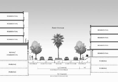
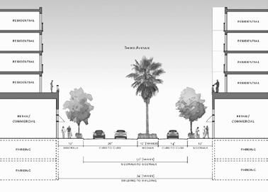
90 Source: Firesafe Planning Solutions, 2011 I:\ArcGIS\K\KIL-03 SDCorporateCenter\Map\ENV\EIR\Fig5_2-9_FireAccess.indd -KF Fire Access Plan Figure 5.2-9
Table Existing Traffic Conditions for Arterial Segments along Construction Access Route. Daily
 5.8 TRAFFIC, ACCESS, AND CIRCULATION This section describes existing traffic conditions in the project area; summarizes applicable regulations; and analyzes the potential traffic, access, and circulation
Escondido Marriott Hotel and Mixed-Use Condominium Project TRAFFIC IMPACT ANALYSIS REPORT
 Escondido Marriott Hotel and Mixed-Use Condominium Project TRAFFIC IMPACT ANALYSIS REPORT Prepared for Phelps Program Management 420 Sixth Avenue, Greeley, CO 80632 Prepared by 5050 Avenida Encinas, Suite
Traffic Impact Analysis 5742 BEACH BOULEVARD MIXED USE PROJECT
 Traffic Impact Analysis 5742 BEACH BOULEVARD MIXED USE PROJECT CITY OF BUENA PARK Prepared by Project No. 14139 000 April 17 th, 2015 DKS Associates Jeffrey Heald, P.E. Rohit Itadkar, T.E. 2677 North Main
MADERAS HOTEL TRANSPORTATION IMPACT ANALYSIS. LLG Ref Transportation Planner III & Jorge Cuyuch Transportation Engineer I
 TRANSPORTATION IMPACT ANALYSIS MADERAS HOTEL Poway, California June 21, 2016 LLG Ref. 3-16-2602 Prepared by: Amelia Giacalone Transportation Planner III & Jorge Cuyuch Transportation Engineer I Under the
APPENDIX B Traffic Analysis
 APPENDIX B Traffic Analysis Rim of the World Unified School District Reconfiguration Prepared for: Rim of the World School District 27315 North Bay Road, Blue Jay, CA 92317 Prepared by: 400 Oceangate,
APPENDIX H. Transportation Impact Study
 APPENDIX H Transportation Impact Study BUENA VISTA LAGOON ENHANCEMENT PROJECT TRANSPORTATION IMPACT STUDY Prepared for: San Diego Association of Governments Prepared by: VRPA Technologies, Inc. 9520 Padgett
The major roadways in the study area are State Route 166 and State Route 33, which are shown on Figure 1-1 and described below:
 3.5 TRAFFIC AND CIRCULATION 3.5.1 Existing Conditions 3.5.1.1 Street Network DRAFT ENVIRONMENTAL IMPACT REPORT The major roadways in the study area are State Route 166 and State Route 33, which are shown
TRAFFIC IMPACT ANALYSIS SAFARI HIGHLANDS RANCH
 TRAFFIC IMPACT ANALYSIS SAFARI HIGHLANDS RANCH, California November 11, 2016 LLG Ref. 3-14-2334 EXECUTIVE SUMMARY The Project proposes the development of 550 luxury residential dwelling units, public trails,
2. Valley Circle Boulevard/Andora Avenue/Baden Avenue and Lassen Street
 IV.J TRANSPORTATION 1. INTRODUCTION This section presents an overview of the existing traffic and circulation system in and surrounding the project site. This section also discusses the potential impacts
4.14 TRANSPORTATION AND CIRCULATION
 4.14 TRANSPORTATION AND CIRCULATION 4.14.1 Summary Table 4.14-1 summarizes the identified environmental impacts, proposed mitigation measures, and residual impacts of the proposed project with regard to
Appendix Q Traffic Study
 Appendices Appendix Q Traffic Study Crummer Site Subdivision Draft EIR City of Malibu Appendices This page intentionally left blank. The Planning Center April 2013 TRAFFIC IMPACT ANALYSIS Photo z here
TABLE OF CONTENTS SECTION PAGE. Executive Summary... xii
 TABLE OF CONTENTS SECTION PAGE Executive Summary... xii 1.0 Introduction... 1 1.1 Study Area... 2 1.2 Traffic Impact Analysis Scenarios... 4 1.3 Study Area - City of Orange... 4 2.0 Project Description
Section 5.8 Transportation and Traffic
 Section 5.8 Transportation and Traffic 5.8 TRANSPORTATION AND TRAFFIC Generous This Section is based on the Topgolf Specific Plan Traffic Impact Analysis (RK Engineering Group, Inc., October 31, 2016);
Quantitative analyses of weekday a.m. and p.m. commuter hour conditions have been conducted for the following five scenarios:
 6.1 TRANSPORTATION AND CIRCULATION 6.1.1 INTRODUCTION This section of the EIR presents the results of TJKM s traffic impact analysis of the proposed Greenbriar Development. The analysis includes consideration
TIMBERVINE TRANSPORTATION IMPACT STUDY FORT COLLINS, COLORADO JANUARY Prepared for:
 TIMBERVINE TRANSPORTATION IMPACT STUDY FORT COLLINS, COLORADO JANUARY 2014 Prepared for: Hartford Companies 1218 W. Ash Street Suite A Windsor, Co 80550 Prepared by: DELICH ASSOCIATES 2272 Glen Haven Drive
TALMONT TOWNHOMES MADISON KENNETH SPA TRAFFIC IMPACT STUDY. Sacramento, CA. Prepared For: MBK Homes. Prepared By:
 TALMONT TOWNHOMES MADISON KENNETH SPA TRAFFIC IMPACT STUDY Sacramento, CA Prepared For: MBK Homes Prepared By: KD Anderson & Associates 3853 Taylor Road, Suite G Loomis, California 95650 (916) 660-1555
Proposed location of Camp Parkway Commerce Center. Vicinity map of Camp Parkway Commerce Center Southampton County, VA
 Proposed location of Camp Parkway Commerce Center Vicinity map of Camp Parkway Commerce Center Southampton County, VA Camp Parkway Commerce Center is a proposed distribution and industrial center to be
Traffic Impact Statement (TIS)
") Traffic Impact Statement (TIS) Vincentian PUDA Collier County, FL 10/18/2013 Prepared for: Global Properties of Naples Prepared by: Trebilcock Consulting Solutions, PA 2614 Tamiami Trail N, Suite 615 1205
Traffic Impact Statement (TIS) Vincentian PUDA Collier County, FL 10/18/2013 Prepared for: Global Properties of Naples Prepared by: Trebilcock Consulting Solutions, PA 2614 Tamiami Trail N, Suite 615 1205
MEMORANDUM. Figure 1. Roundabout Interchange under Alternative D
 MEMORANDUM Date: To: Liz Diamond, Dokken Engineering From: Subject: Dave Stanek, Fehr & Peers Western Placerville Interchanges 2045 Analysis RS08-2639 Fehr & Peers has completed a transportation analysis
The key roadways in the project vicinity are described below. Exhibit displays the existing number of lanes on the study roadways.
 4.2 TRAFFIC AND CIRCULATION This section presents the key assumptions, methods, and results of analysis for the transportation and circulation impacts of the proposed project. This section is based on
ZINFANDEL LANE / SILVERADO TRAIL INTERSECTION TRAFFIC ANALYSIS
 ZINFANDEL LANE / SILVERADO TRAIL INTERSECTION TRAFFIC ANALYSIS UPDATED TRAFFIC STUDY FOR THE PROPOSED RAYMOND VINEYARDS WINERY USE PERMIT MODIFICATION #P11-00156 AUGUST 5, 2014 PREPARED BY: OMNI-MEANS,
TRANSPORTATION STUDY FOR THE 8899 BEVERLY BOULEVARD PROJECT
 DRAFT TRANSPORTATION STUDY FOR THE 8899 BEVERLY BOULEVARD PROJECT WEST HOLLYWOOD, CALIFORNIA NOVEMBER 2013 PREPARED FOR BEVERLY BOULEVARD ASSOCIATION PREPARED BY DRAFT TRANSPORTATION STUDY FOR THE 8899
LAWRENCE TRANSIT CENTER LOCATION ANALYSIS 9 TH STREET & ROCKLEDGE ROAD / 21 ST STREET & IOWA STREET LAWRENCE, KANSAS
 LAWRENCE TRANSIT CENTER LOCATION ANALYSIS 9 TH STREET & ROCKLEDGE ROAD / 21 ST STREET & IOWA STREET LAWRENCE, KANSAS TRAFFIC IMPACT STUDY FEBRUARY 214 OA Project No. 213-542 TABLE OF CONTENTS 1. INTRODUCTION...
Date: February 7, 2017 John Doyle, Z-Best Products Robert Del Rio. T.E. Z-Best Traffic Operations and Site Access Analysis
 Memorandum Date: February 7, 07 To: From: Subject: John Doyle, Z-Best Products Robert Del Rio. T.E. Z-Best Traffic Operations and Site Access Analysis Introduction Hexagon Transportation Consultants, Inc.
EXECUTIVE SUMMARY. The following is an outline of the traffic analysis performed by Hales Engineering for the traffic conditions of this project.
 EXECUTIVE SUMMARY This study addresses the traffic impacts associated with the proposed Shopko redevelopment located in Sugarhouse, Utah. The Shopko redevelopment project is located between 1300 East and
Alpine Highway to North County Boulevard Connector Study
 Alpine Highway to North County Boulevard Connector Study prepared by Avenue Consultants March 16, 2017 North County Boulevard Connector Study March 16, 2017 Table of Contents 1 Summary of Findings... 1
INTERCHANGE OPERTIONS STUDY Interstate 77 / Wallings Road Interchange
 INTERCHANGE OPERTIONS STUDY Interstate 77 / Wallings Road Interchange City of Broadview Heights, Cuyahoga County, Ohio Prepared For: City of Broadview Heights Department of Engineering 9543 Broadview Road
TRAFFIC IMPACT ANALYSIS 661 BEAR VALLEY. Escondido, California September 1, LLG Ref
 TRAFFIC IMPACT ANALYSIS 661 BEAR VALLEY Escondido, California September 1, 2015 LLG Ref. 3-13-2299 EXECUTIVE SUMMARY The Project (Project) proposes the development of 55 residential dwelling units on 40.88
V. DEVELOPMENT OF CONCEPTS
 Martin Luther King, Jr. Drive Extension FINAL Feasibility Study Page 9 V. DEVELOPMENT OF CONCEPTS Throughout the study process several alternative alignments were developed and eliminated. Initial discussion
APPENDIX J LAKE WOHLFORD DAM REPLACEMENT PROJECT TRAFFIC IMPACT ANALYSIS (DAM REPLACEMENT) Lake Wohlford Dam Replacement Project EIR
 Lake Wohlford Dam Replacement Project EIR") APPENDIX J LAKE WOHLFORD DAM REPLACEMENT PROJECT TRAFFIC IMPACT ANALYSIS (DAM REPLACEMENT) Replacement Project EIR Appendices TRAFFIC IMPACT ANALYSIS LAKE WOHLFORD DAM Escondido, California December 19,
APPENDIX J LAKE WOHLFORD DAM REPLACEMENT PROJECT TRAFFIC IMPACT ANALYSIS (DAM REPLACEMENT) Replacement Project EIR Appendices TRAFFIC IMPACT ANALYSIS LAKE WOHLFORD DAM Escondido, California December 19,
PROJECT: Wilkinson Road Corridor Improvement Traffic Management Planning Project SUBJECT: Traffic Analysis
 TECHNICAL MEMORANDUM DATE: September 10, 2014 PROJECT 5861.03 NO: PROJECT: Wilkinson Road Corridor Improvement Traffic Management Planning Project SUBJECT: Traffic Analysis TO: Steve Holroyd - District
4.12 TRAFFIC AND CIRCULATION Introduction
 4.12 TRAFFIC AND CIRCULATION 4.12.1 Introduction This section of the EIR describes the existing transportation and traffic conditions on roadways surrounding the project area, and analyzes the potential
TRAFFIC IMPACT STUDY FOR SONIC DRIVE-IN RESTAURANT. Vallejo, CA. Prepared For:
 TRAFFIC IMPACT STUDY FOR SONIC DRIVE-IN RESTAURANT Vallejo, CA Prepared For: ELITE DRIVE-INS, INC. 2190 Meridian Park Blvd, Suite G Concord, CA 94520 Prepared By: KD Anderson & Associates 3853 Taylor Road,
Oakbrook Village Plaza City of Laguna Hills
 Oakbrook Village Plaza City of Laguna Hills Traffic Impact Analysis Prepared by: HDR Engineering 3230 El Camino Real, Suite 200 Irvine, CA 92602 October 2012 Revision 3 D-1 Oakbrook Village Plaza Laguna
APPENDIX E. Traffic Analysis Report
 APPENDIX E Traffic Analysis Report THIS PAGE INTENTIONALLY BLANK EAGLE RIVER TRAFFIC MITIGATION PHASE I OLD GLENN HIGHWAY/EAGLE RIVER ROAD INTERSECTION IMPROVEMENTS TRAFFIC ANALYSIS Eagle River, Alaska
IV. ENVIRONMENTAL IMPACT ANALYSIS N. TRANSPORTATION AND TRAFFIC
 IV. ENVIRONMENTAL IMPACT ANALYSIS N. TRANSPORTATION AND TRAFFIC The following section summarizes the information provided in the traffic report entitled Traffic Impact Analysis for a Proposed Residential
TRAFFIC IMPACT ANALYSIS FOR. McDONALD S RESTAURANT IN CARMICAEL Sacramento County, CA. Prepared For:
 TRAFFIC IMPACT ANALYSIS FOR McDONALD S RESTAURANT IN CARMICAEL Sacramento County, CA Prepared For: McDonald s USA, LLC Pacific Sierra Region 2999 Oak Road, Suite 900 Walnut Creek, CA 94597 Prepared By:
APPENDICES. Appendix R Traffic Impact Analysis (January 2017)
") APPENDICES Appendix R Traffic Impact Analysis (January 2017) 661 Bear Valley Parkway EIR March 2017 APPENDICES This page intentionally left blank 661 Bear Valley Parkway EIR March 2017 TRAFFIC IMPACT ANALYSIS
APPENDICES Appendix R Traffic Impact Analysis (January 2017) 661 Bear Valley Parkway EIR March 2017 APPENDICES This page intentionally left blank 661 Bear Valley Parkway EIR March 2017 TRAFFIC IMPACT ANALYSIS
MONTEREY BAY AQUARIUM RESEARCH INSTITUTE (MBARI) MASTER PLAN UPDATE MOSS LANDING, CALIFORNIA
 MASTER PLAN UPDATE MOSS LANDING, CALIFORNIA") MONTEREY BAY AQUARIUM RESEARCH INSTITUTE (MBARI) MASTER PLAN UPDATE MOSS LANDING, CALIFORNIA TRAFFIC IMPACT ANALYSIS Administrative Draft Report Prepared For Monterey Bay Aquarium Research Institute Moss
MONTEREY BAY AQUARIUM RESEARCH INSTITUTE (MBARI) MASTER PLAN UPDATE MOSS LANDING, CALIFORNIA TRAFFIC IMPACT ANALYSIS Administrative Draft Report Prepared For Monterey Bay Aquarium Research Institute Moss
IV. ENVIRONMENTAL IMPACT ANALYSIS J. TRANSPORTATION AND TRAFFIC
 IV. ENVIRONMENTAL IMPACT ANALYSIS J. TRANSPORTATION AND TRAFFIC This Section summarizes the information provided in the Traffic Study for the Santa Monica College Bundy Campus Master Plan (Traffic Study),
IV. ENVIRONMENTAL IMPACT ANALYSIS B. TRAFFIC AND CIRCULATION
 IV. ENVIRONMENTAL IMPACT ANALYSIS B. TRAFFIC AND CIRCULATION 1. INTRODUCTION This section is based on the technical report, Traffic Study for 10131 Constellation Boulevard Residential Project, prepared
Impacts to street segments were analyzed based on procedures detailed in the Highway Capacity Manual for levels of service related to roadways.
 4.7 Transportation and Circulation This report documents the results of a study of the potential traffic impacts created by the Whittier Main Oil Field Development Project. The study is included as Appendix
Los Angeles Mission College Facilities Master Plan Draft Program Environmental Impact Report 3.13 TRANSPORTATION / TRAFFIC
 3.13 TRANSPORTATION / TRAFFIC As a result of the analysis undertaken in the Initial Study for the Los Angeles Mission College Facilities Master Plan, the (LACCD) determined that the proposed project may
Technical Feasibility Report
 Prepared For: Bow Concord I-93 Improvements Project Bow and Concord, NH Prepared By: 53 Regional Drive Concord, NH 03301 NHDOT Project # 13742 Federal Project #T-A000(018) September 2018 TABLE OF CONTENTS
Section 5.0 Traffic Information
 Section 5.0 Traffic Information 10.0 TRANSPORTATION MDM Transportation Consultants, Inc. (MDM) has prepared an evaluation of transportation impacts for the proposed evaluation for the expansion of the
MONTEREY BAY OPERATIONS AND MAINTENANCE FACILITY PROJECT TRAFFIC IMPACT ANALYSIS DRAFT REPORT
 MONTEREY BAY OPERATIONS AND MAINTENANCE FACILITY PROJECT TRAFFIC IMPACT ANALYSIS DRAFT REPORT MONTEREY, CALIFORNIA Prepared for Denise Duffy & Associates 947 Cass St. Suite 5 Monterey, CA 93940 April 16,
Traffic Impact Analysis. Alliance Cole Avenue Residential Site Dallas, Texas. Kimley-Horn and Associates, Inc. Dallas, Texas.
 Traffic Impact Analysis Alliance Cole Avenue Residential Site Dallas, Texas February 15, 2018 Kimley-Horn and Associates, Inc. Dallas, Texas Project #064524900 Registered Firm F-928 Traffic Impact Analysis
TRAFFIC IMPACT ANALYSIS WESTMINSTER SEMINARY. Escondido, California June 25, LLG Ref Transportation Engineer II
 TRAFFIC IMPACT ANALYSIS WESTMINSTER SEMINARY Escondido, California June 25, 2015 LLG Ref. 3-15-2420 Prepared by: Pedram Massoudi Transportation Engineer II Under the Supervision of: John Boarman, P.E.
APPENDIX D- TRAFFIC STUDY
 APPENDIX D- TRAFFIC STUDY TRANSPORTATION IMPACT ANALYSIS IMPERIAL COUNTY OFFICE OF EDUCATION County of Imperial, California March 06, 2018 LLG Ref. 3-17-2831 Prepared by: Jose R. Nunez Transportation Planner
4.7 Construction Surface Transportation
 4.7.1 Introduction The traffic analysis presented in this section addresses the construction traffic impacts specific to the proposed Project. The construction traffic impacts were analyzed for both the
APPENDIX C1 TRAFFIC ANALYSIS DESIGN YEAR TRAFFIC ANALYSIS
 APPENDIX C1 TRAFFIC ANALYSIS DESIGN YEAR TRAFFIC ANALYSIS DESIGN YEAR TRAFFIC ANALYSIS February 2018 Highway & Bridge Project PIN 6754.12 Route 13 Connector Road Chemung County February 2018 Appendix
Tijuana River Valley Regional Park Campground and Education Center
 Tijuana River Valley Regional Park Campground and Education Center Draft Report September 2018 Prepared for: County of San Diego 5500 Overland Avenue, Suite 410 San Diego, CA 92123 Prepared by: 3900 Fifth
4.7 Construction Surface Transportation
 4.7 Construction Surface Transportation 4.7.1 Introduction The traffic analysis presented in this section addresses the construction traffic impacts specific to the proposed Project. The construction traffic
D R A F T TRAFFIC IMPACT ANALYSIS FOR. DARK HORSE GOLF RESORT EXPANSION Nevada County, CA. Prepared For:
 D R A F T TRAFFIC IMPACT ANALYSIS FOR DARK HORSE GOLF RESORT EXPANSION Nevada County, CA Prepared For: ASIAN PACIFIC GROUP 18000 Van Karman Avenue, Suite 500 Irvine, CA 92612 Prepared By: KD Anderson &
Table of Contents. Traffic Impact Analysis Capital One Building at Schilling Place
 Traffic Impact Analysis Capital One Building at Schilling Place Table of Contents Executive Summary... 1 1. Introduction... 4 2. Project Description... 4 3. Background Information... 4 4. Study Scope...
Traffic Engineering Study
 Traffic Engineering Study Bellaire Boulevard Prepared For: International Management District Technical Services, Inc. Texas Registered Engineering Firm F-3580 November 2009 Executive Summary has been requested
TRAFFIC IMPACT ANALYSIS
 TRAFFIC IMPACT ANALYSIS Emerald Isle Commercial Development Prepared by SEPI Engineering & Construction Prepared for Ark Consulting Group, PLLC March 2016 I. Executive Summary A. Site Location The Emerald
Traffic Impact Study Speedway Gas Station Redevelopment
 Traffic Impact Study Speedway Gas Station Redevelopment Warrenville, Illinois Prepared For: Prepared By: April 11, 2018 Table of Contents 1. Introduction... 1 2. Existing Conditions... 4 Site Location...
To: File From: Adrian Soo, P. Eng. Markham, ON File: Date: August 18, 2015
 Memo To: From: Adrian Soo, P. Eng. Markham, ON : 165620021 Date: Reference: E.C. Row Expressway, Dominion Boulevard Interchange, Dougall Avenue Interchange, and Howard 1. Review of Interchange Geometry
Traffic Study for Barstow 2014 General Plan Amendment. Prepared for: The City of Barstow. Prepared by: ADVANTEC Consulting Engineers
 Traffic Study for Barstow 2014 General Plan Amendment Prepared for: The City of Barstow Prepared by: June 20, 2014 TABLE OF CONTENTS 1. Executive Summary... 1 2. Project Background & Description... 3 2.1
3.4 TRANSPORTATION. Introduction. Existing Conditions. Existing Roadway Network
 3.4 TRANSPORTATION Introduction This section of the EIR summarizes the effects on existing and future (2035) transportation and circulation system resulting from vehicle trips associated with the Project.
LOTUS RANCH TRAFFIC IMPACT ANALYSIS. LLG Ref Senior Transportation Engineer & Charlene Sadiarin Transportation Engineer II
 TRAFFIC IMPACT ANALYSIS LOTUS RANCH El Centro, California July 31, 2015February 12, 2016 LLG Ref. 3-14-2392 Prepared by: KC Yellapu, P.E Senior Transportation Engineer & Charlene Sadiarin Transportation
Volume 1 Traffic Impact Analysis Turtle Creek Boulevard Dallas, Texas. Kimley-Horn and Associates, Inc. Dallas, Texas.
 Volume 1 Traffic Impact Analysis 2727 Dallas, Texas June 18, 2018 Kimley-Horn and Associates, Inc. Dallas, Texas Project #064523000 Registered Firm F-928 Traffic Impact Analysis 2727 Dallas, Texas Prepared
2.0 Development Driveways. Movin Out June 2017
 Movin Out June 2017 1.0 Introduction The proposed Movin Out development is a mixed use development in the northeast quadrant of the intersection of West Broadway and Fayette Avenue in the City of Madison.
Interstate Operations Study: Fargo-Moorhead Metropolitan Area Simulation Results
 NDSU Dept #2880 PO Box 6050 Fargo, ND 58108-6050 Tel 701-231-8058 Fax 701-231-6265 www.ugpti.org www.atacenter.org Interstate Operations Study: Fargo-Moorhead Metropolitan Area 2025 Simulation Results
IV. ENVIRONMENTAL IMPACT ANALYSIS M. TRANSPORTATION AND TRAFFIC
 IV. ENVIRONMENTAL IMPACT ANALYSIS M. TRANSPORTATION AND TRAFFIC INTRODUCTION This section of the (Draft EIR) addresses the subject of traffic and transportation with respect to the proposed (Project or
2.1.5 Traffic and Circulation. Table Level of Service Criteria for Highway Segment Regulatory Setting Affected Environment
 2.1.5 Traffic and Circulation This section addresses the potential impacts to traffic and circulation associated with construction and long-term operation of the proposed project. The traffic and circulation
Appendix E TRAFFIC IMPACT ANALYSIS
 Appendix E TRAFFIC IMPACT ANALYSIS HENRY MAYO NEWHALL MEMORIAL HOSPITAL MASTER PLAN Traffic Impact Analysis MAY 2008 HENRY MAYO NEWHALL MEMORIAL HOSPITAL MASTER PLAN TRAFFIC IMPACT ANALYSIS Prepared by:
APPENDIX G Traffic Assessment of EIR Alternatives Traffic Impact Analysis
 APPENDIX G Traffic Assessment of EIR Alternatives Traffic Impact Analysis MEMORANDUM To: From: Subject: Paul Garcia Chris Moore Atkins Date: March 24, 2016 John Boarman LLG Ref: 3-15-2464 Cara Hilgesen
Craig Scheffler, P.E., PTOE HNTB North Carolina, P.C. HNTB Project File: Subject
 TECHNICAL MEMORANDUM To Kumar Neppalli Traffic Engineering Manager Town of Chapel Hill From Craig Scheffler, P.E., PTOE HNTB North Carolina, P.C. Cc HNTB Project File: 38435 Subject Obey Creek TIS 2022
TRAFFIC IMPACT ANALYSIS FOR THE. PANORAMA PD Shasta County, California. Prepared For: Enplan 3179 Bechelli Lane, Suite 100 Redding, CA 96002
 TRAFFIC IMPACT ANALYSIS FOR THE PANORAMA PD Shasta County, California Prepared For: Enplan 3179 Bechelli Lane, Suite 100 Redding, CA 96002 Prepared By: KD Anderson & Associates, Inc. 3853 Taylor Road,
BERKELEY DOWNTOWN AREA PLAN PROGRAM ENVIRONMENTAL IMPACT REPORT TRAFFIC IMPACT ANALYSIS
 BERKELEY DOWNTOWN AREA PLAN PROGRAM ENVIRONMENTAL IMPACT REPORT TRAFFIC IMPACT ANALYSIS Prepared for: City of Berkeley Prepared by: REVISED JANUARY 9, 2009 Berkeley Downtown Area Plan Program EIR Traffic
L1TILE BEARS DAY CARE TRANSPORTATION IMPACT STUDY FORT COLLINS, COLORADO MAY Prepared for:
 L1TILE BEARS DAY CARE TRANSPORTATION IMPACT STUDY FORT COLLINS, COLORADO MAY 2012 Prepared for: Hillside Construction, Inc. 216 Hemlock Street, Suite B Fort Collins, CO 80534 Prepared by: DELICH ASSOCIATES
5.9 TRANSPORTATION AND TRAFFIC
 5.9 TRANSPORTATION AND TRAFFIC This section evaluates transportation- and traffic-related impacts that have the potential to result from the construction and operation of the Project. Information and analysis
King Soopers #116 Thornton, Colorado
 Traffic Impact Study King Soopers #116 Thornton, Colorado Prepared for: Galloway & Company, Inc. T R A F F I C I M P A C T S T U D Y King Soopers #116 Thornton, Colorado Prepared for Galloway & Company
TRAFFIC IMPACT STUDY DERRY GREEN CORPORATE BUSINESS PARK MILTON SECONDARY PLAN MODIFICATION
 TRAFFIC IMPACT STUDY DERRY GREEN CORPORATE BUSINESS PARK MILTON SECONDARY PLAN MODIFICATION TRAFFIC IMPACT STUDY DERRY GREEN CORPORATE BUSINESS PARK MILTON SECONDARY PLAN MODIFICATION DECEMBER 24 UPDATED
TRAFFIC SIGNAL DESIGN REPORT KING OF PRUSSIA ROAD & RAIDER ROAD RADNOR TOWNSHIP PENNSYLVANIA
 TRAFFIC SIGNAL DESIGN REPORT KING OF PRUSSIA ROAD & RAIDER ROAD RADNOR TOWNSHIP PENNSYLVANIA PREPARED FOR: UNIVERSITY OF PENNSYLVANIA HEALTH SYSTEM 34 CIVIC CENTER BOULEVARD PHILADELPHIA, PA 1987 (61)
14 TRAFFIC AND CIRCULATION
 14 TRAFFIC AND CIRCULATION INTRODUCTION This chapter summarizes the traffic impact analysis (TIA) performed for the preferred project as well as the Commercial Project Alternative. The TIA for the preferred
Traffic Impact Analysis Update
 Willow Bend Traffic Impact Analysis Update TABLE OF CONTENTS Page I. INTRODUCTION -------------------------------------------------------------------------------------------- 1 II. EXISTING CONDITIONS
DRAFT ADDITIONAL ANALYSIS TO THE SDSU 2007 CAMPUS MASTER PLAN REVISION FINAL EIR
 DRAFT ADDITIONAL ANALYSIS TO THE SDSU 2007 CAMPUS MASTER PLAN REVISION FINAL EIR State Clearinghouse No. 2007021020 Prepared for: The Board of Trustees of The California State University 401 Golden Shore
Section 3.12 Traffic and Transportation
 Section. Traffic and Transportation SECTION SUMMARY This section describes existing ground transportation within the Port and surrounding area associated with implementation of the proposed Project. An
Draft US Corridor Study Traffic Analysis Report
 Draft US 15-501 Corridor Study Traffic Analysis Report US 15-501 from NC 54 to US 64 Year 2013-2040 Prepared for: North Carolina Department of Transportation Prepared by: Stantec Consulting Services, Inc.
Interstate Operations Study: Fargo-Moorhead Metropolitan Area Simulation Output
 NDSU Dept #2880 PO Box 6050 Fargo, ND 58108-6050 Tel 701-231-8058 Fax 701-231-6265 www.ugpti.org www.atacenter.org Interstate Operations Study: Fargo-Moorhead Metropolitan Area 2015 Simulation Output Technical
TRAFFIC IMPACT STUDY FOR
 TRAFFIC IMPACT STUDY FOR YUBA CROSSINGS MIXED USE DEVELOPMENT Yuba City, CA Prepared For: Yuba Crossings LLC 1825 Del Paso Blvd Sacramento, CA 95815 Prepared By: KDAnderson & Associates, Inc. 3853 Taylor
Table of Contents INTRODUCTION... 3 PROJECT STUDY AREA Figure 1 Vicinity Map Study Area... 4 EXISTING CONDITIONS... 5 TRAFFIC OPERATIONS...
 Crosshaven Drive Corridor Study City of Vestavia Hills, Alabama Table of Contents INTRODUCTION... 3 PROJECT STUDY AREA... 3 Figure 1 Vicinity Map Study Area... 4 EXISTING CONDITIONS... 5 TRAFFIC OPERATIONS...
IV. ENVIRONMENTAL IMPACT ANALYSIS C. TRAFFIC CIRCULATION AND PARKING
 IV. ENVIRONMENTAL IMPACT ANALYSIS C. TRAFFIC CIRCULATION AND PARKING 1. INTRODUCTION This section is based on the technical report Traffic Impact Study Health Sciences Campus Project, City of Los Angeles,
Existing Traffic Conditions
 May 14, 2014 Ms. Lorraine Weiss City of San Mateo 330 West 20 th Avenue San Mateo, CA 94403 Subject: Traffic Operational Study for the Proposed Tilton Avenue Residential Development in San Mateo, California
I-405 Corridor Master Plan
 Southern California Association of Governments I-405 Corridor Master Plan Presentation to Streets and Freeways Subcommittee October 13, 2015 1 Presentation Overview Expectations and Approach Corridor Performance
1.1 Purpose of This Environmental Impact Report EIR Process Use of This Report Report Organization...
 Table of Contents SUMMARY PAGE S.1 Project Location and Project Characteristics... S-1 S.2 Project Objectives... S-9 S.3 Project Approvals... S-11 S.4 Impacts and Mitigation Measures... S-12 S.5 Alternatives...
ENVIRONMENTAL IMPACT ANALYSIS D. TRANSPORTATION AND CIRCULATION 1. INTRODUCTION
 IV. ENVIRONMENTAL IMPACT ANALYSIS 1. INTRODUCTION This section is based on a traffic and parking impact study that was prepared for the proposed CSMC West Tower Project by Linscott, Law & Greenspan, Engineers,
TRAFFIC IMPACT STUDY. USD #497 Warehouse and Bus Site
 TRAFFIC IMPACT STUDY for USD #497 Warehouse and Bus Site Prepared by: Jason Hoskinson, PE, PTOE BG Project No. 16-12L July 8, 216 145 Wakarusa Drive Lawrence, Kansas 6649 T: 785.749.4474 F: 785.749.734
King County Metro. Columbia Street Transit Priority Improvements Alternative Analysis. Downtown Southend Transit Study. May 2014.
 King County Metro Columbia Street Transit Priority Improvements Alternative Analysis Downtown Southend Transit Study May 2014 Parametrix Table of Contents Introduction... 1 Methodology... 1 Study Area...
DRAFT WATERMAN GARDENS MASTER PLAN TRAFFIC IMPACT STUDY
 DRAFT WATERMAN GARDENS MASTER PLAN TRAFFIC IMPACT STUDY PREPARED FOR: Housing Authority of the County of San Bernardino Pyatok Architects The Planning Center/DCE PREPARED BY: 3850 Vine Street, Suite 140
State Route 1/State Route 41/ Main Street Intersection Control Evaluation (Step 2) Report. City of Morro Bay. Prepared for: Prepared by:
 Report. City of Morro Bay. Prepared for: Prepared by:") State Route 1/State Route 41/ Main Street Intersection Control Evaluation (Step 2) Report Prepared for: City of Morro Bay Prepared by: (Caltrans Project No. 0515000104, EA 0F670) State Route 1/State Route
State Route 1/State Route 41/ Main Street Intersection Control Evaluation (Step 2) Report Prepared for: City of Morro Bay Prepared by: (Caltrans Project No. 0515000104, EA 0F670) State Route 1/State Route
Bennett Pit. Traffic Impact Study. J&T Consulting, Inc. Weld County, Colorado. March 3, 2017
 Bennett Pit Traffic Impact Study J&T Consulting, Inc. Weld County, Colorado March 3, 217 Prepared By: Sustainable Traffic Solutions, Inc. http://www.sustainabletrafficsolutions.com/ Joseph L. Henderson,
Lacey Gateway Residential Phase 1
 Lacey Gateway Residential Phase Transportation Impact Study April 23, 203 Prepared for: Gateway 850 LLC 5 Lake Bellevue Drive Suite 02 Bellevue, WA 98005 Prepared by: TENW Transportation Engineering West
4.4 Transportation and Circulation
 4.4.1 Introduction This section evaluates the potential for construction traffic and operational impacts to result from implementation of the proposed project. This includes the potential for the project
MILLERSVILLE PARK TRAFFIC IMPACT ANALYSIS ANNE ARUNDEL COUNTY, MARYLAND
 MILLERSVILLE PARK TRAFFIC IMPACT ANALYSIS ANNE ARUNDEL COUNTY, MARYLAND Prepared for: Department of Public Works Anne Arundel County Prepared by: URS Corporation 4 North Park Drive, Suite 3 Hunt Valley,
Introduction and Background Study Purpose
 Introduction and Background The Brent Spence Bridge on I-71/75 across the Ohio River is arguably the single most important piece of transportation infrastructure the Ohio-Kentucky-Indiana (OKI) region.
TRAFFIC IMPACT ANALYSIS FOR. STERLING FIFTH STREET APARTMENTS PROJECT Davis, CA. Prepared For:
 TRAFFIC IMPACT ANALYSIS FOR STERLING FIFTH STREET APARTMENTS PROJECT Davis, CA Prepared For: Din/Cal 3, Inc. 3411 Richmond Avenue, Suite 200 Houston, Texas 77046 Prepared By: KD Anderson & Associates,