Intersection Analysis for US 92/International Speedway Blvd. at Garfield Ave.
|
|
|
- Brett Goodman
- 6 years ago
- Views:
Transcription


1

2 FinalReport IntersectionAnalysisfor US92/InternationalSpeedwayBlvd. atgarfieldave. April2017 Preparedfor: RivertoSeaTransportationPlanningOrganization (R2CTPO) 2570W.InternationalSpeedwayBlvd.,Suite100 DaytonaBeach,FL Preparedby: VHB,Inc. 225E.RobinsonStreet, Orlando,FL ProfessionalEngineer: KathrynL.Lee P.E.#62420 April07,2017 VHB, Inc. 0

3 Intersection Analysis For US 92/International Speedway Blvd. at Garfield Ave. Task Work Order #1 VOLUSIA COUNTY Prepared for: Prepared by: Vanasse Hangen Brustlin, Inc. Orlando, FL April 2017 VHB, Inc. 1
4 Intersection Analysis US 92/International Speedway Blvd. at Garfield Ave. R2CTPO EXECUTIVESUMMARY ThisreportpresentstheresultsofanIntersectionAnalysiscompletedforUS92/International SpeedwayBoulevardatGarfieldAvenue,whichislocatedintheCityofDeLandinVolusiaCounty, Florida.ThisreportwaspromptedbyanapplicationbyVolusiaCountytoconstructarightturn lanealongeastboundus92/internationalspeedwayboulevardandtoextendtheexistingleft turnlanealongwestboundus92/internationalspeedwayboulevardatgarfieldavenue. The existing westbound left turn lane on US 92/International Speedway Boulevard is approximately400feetlongwithataperof50feet.theproposedextensionoftheleftturnwill enablevehiclestomoveoutofthethroughlaneandmoveintothedesignatedturnlane,and improve the overall intersection operations. Constructing an eastbound right turn lane will enablevehiclestomoveoutofthewayofthroughtrafficanddecelerateinaseparateturnlane, thusdecreasingdelaytothroughvehiclesandreducingtheriskofrearendcrashes.inaddition to this improvement, this study recommends installing a northbound right turn lane and pedestriansafetyimprovementsasmentionedbelow. Baseduponthecrashanalyses,qualitativeassessment,fieldobservations,intersectionanalysis, Benefit/Cost (B/C) analysis and engineering judgment, the following modifications are recommendedtoimprovethesafetyandoperationoftheintersection: 1:ExtendtheexistingleftturnlanealongwestboundUS92/InternationalSpeedwayBoulevard atgarfieldavenue.therewerenophysicalconstraintsobservedthatwouldimpedethe200 extensionofthewestboundleftturnlaneattheintersectionofus92/internationalspeedway Boulevard and Garfield Avenue. Therefore, the extension of the westbound left turn lane is consideredfeasibleatthislocation.theleftturnlaneextensionwillhaveabeneficialeffectto theoperationofthewestboundmovementaswellastotheintersectionasawhole.theabove modificationcanbeimplementedatanapproximatecostof$13, :ConstructarightturnlanealongeastboundUS92/InternationalSpeedwayBoulevardat Garfield Avenue.The right of way is sufficient to install a separate right turn lane on the VHB, Inc. i
5 eastboundapproach;however,theexistingdrainageswalewouldneedtobereworkedandthe crossdrainwouldneedtobeextendedalongthesouthwestquadrantoftheintersection.the existingpedestriansignal,pullboxandpedestrianlanding,equippedwithahandrail,wouldneed toberelocated.aseparaterightturnlanewillhaveabeneficialeffecttotheoperationofthe eastboundmovementaswellastotheintersectionasawhole.theabovemodificationcanbe implementedatanapproximatecostof$72, : Construct a right turn lane along northbound Garfield Avenue at US 92/International SpeedwayBoulevard.TypeFcurbandgutterwouldbeneededalongtheeastsideofGarfield Avenue to fit a separate northbound right turn lane within the limited rightofway.as the improvementsareconceptual,surveywasnotprovided,andtherightofwaylinesshownonthe ImprovementDiagramarebasedonlotandparcellinespulledfromtheVolusiaCountyProperty Appraiserswebpage.Itisnotanticipatedthattheexistingtrafficsignalpoleswillneedtobe relocated;however,thereareoverheadutilitiesalongtheeastsideofgarfieldavenuethatwould requirerelocation.thenorthboundrightturnlanewillreducedelayandqueueingongarfield Avenue.Theabovemodificationcanbeimplementedatanapproximatecostof$49,357.65(not includinganyadditionalrightofwayorutilityrelocationthatmightberequired). Modifications13canbeimplementedatanapproximatecostof$135,473.65andyieldsaB/C ratioof5.39,whichindicatesthattheanticipatedbenefitsoutweightheestimatedcostsforthe proposedmodifications 4:ExtendtheexistingsidewalksalongtheeastandwestsidesofGarfieldAvenueonthesouth approach all the way to the intersection of US 92/International Speedway Boulevard and GarfieldAvenue.Theseconnectionswillprovideasafepassageforpedestriansbyeliminating theneedforthemtowalkonthepavementorinthegrass.providecrosswalksalongtheeast and south legs of the US 92/International Speedway Boulevard and Garfield Avenue intersection.thecostfortheserecommendations(providedasaseparateitem)isestimatedat $15, VHB, Inc. ii
6 Intersection Analysis US 92/International Speedway Blvd. at Garfield Ave. R2CTPO Contents EXECUTIVESUMMARY...i INTRODUCTION...3 EXISTINGCONDITIONS...5 FieldInventory...5 TrafficVolumeData...13 CrashData...14 QUALITATIVEASSESSMENT...16 FEASIBILITYANALYSIS...18 Background...18 Methodology...18 AssessmentofProposedSite...18 OperationalAnalysis...19 Benefit/CostAnalysis...20 RECOMMENDATIONS...23 APPENDICES...27 ListofTables Table1:8HourTurningMovementPercentages...13 Table2:CrashSummary(Jan2013Dec2015)...15 Table3:BeforeandAfterOperationalAnalysisResults...20 Table4:UnitValueofMOEs...21 Table5:Benefit/CostAnalysisResults...22 ListofFigures Figure1:LocationMap...4 Figure2:ConditionDiagram...12 Figure3:CrashDiagram...15 Figure4:ConceptualImprovementDiagram...25 ListofExhibits Exhibit1:LookingwesttowardstheintersectiononWBUS Exhibit2:LookingeastawayfromtheintersectiononWBUS Exhibit3:LookingeasttowardstheintersectiononEBUS Exhibit4:LookingwestawayfromtheintersectiononEBUS VHB, Inc. 1
7 Exhibit5:LookingnorthtowardstheintersectiononNBGarfieldAvenue...9 Exhibit6:LookingsouthawayfromtheintersectiononNBGarfieldAvenue...9 Exhibit7:LookingsouthtowardstheintersectiononSBGarfieldAvenue...10 Exhibit8:LookingnorthtowardstheintersectiononSBGarfieldAvenue...10 Exhibit9:TrackingonshoulderLookingeasttowardstheintersectiononEBUS VHB, Inc. 2
8 INTRODUCTION VHB,Inc.wasretainedtoperformanIntersectionAnalysisforUS92/InternationalSpeedway BoulevardattheintersectionofGarfieldAvenue,whichislocatedintheCityofDeLandinVolusia County,Florida,asillustratedinFigure1.ThisreportwaspromptedbyanapplicationbyVolusia Countytoconstructaneastboundrightturnlaneandtoextendtheexistingwestboundleftturn lane at the US 92/International Speedway Boulevard and Garfield Avenue intersection.the purpose of the analysis is to identify cost feasible intersection improvements that may be appropriatetoreduceintersectioncongestionanddelay.inadditiontotheseimprovements, thisstudyrecommendsinstallinganorthboundrightturnlane(basedoninformation/comments providedbyfdot)andsidewalkimprovementstopromotepedestriansafety.thisfinalreport wasrevisedbasedonthecommentsreceivedfromvolusiacountyandfloridadepartmentof Transportation(FDOT)onthedraftreport.ThecommentsprovidedbytheCountyandFDOT, along with comment responses, are provided in Appendix A. The analysis will particularly considerthebenefitsandfeasibilityofaddingadedicatedeastboundrightturnlane,northbound right turn lane and extending the westbound left turn lane at the intersection of US 92/InternationalSpeedwayBoulevardandGarfieldAvenue. TheanalysismethodsusedincompletingthisstudyareconsistentwiththeManualonUniform Traffic Control Devices (MUTCD), the Manual on Uniform Traffic Studies (MUTS), the Traffic EngineeringManual(TEM)andengineeringjudgment.Theremainderofthisreportdocuments existing conditions, vehicle and pedestrian counts, qualitative assessments, crash analyses, intersectionanalysis,b/canalysisandrecommendations. VHB, Inc. 3
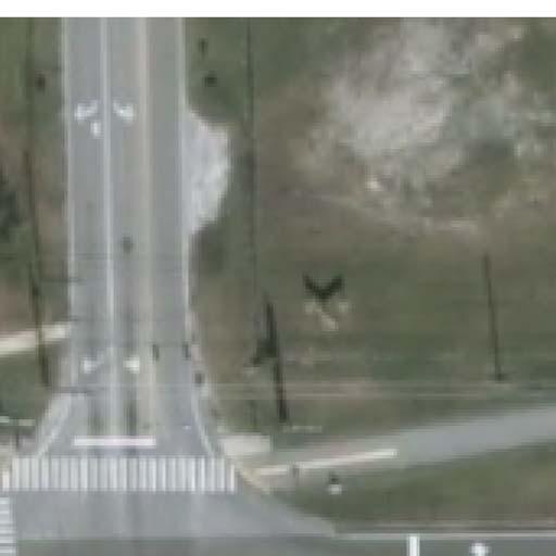
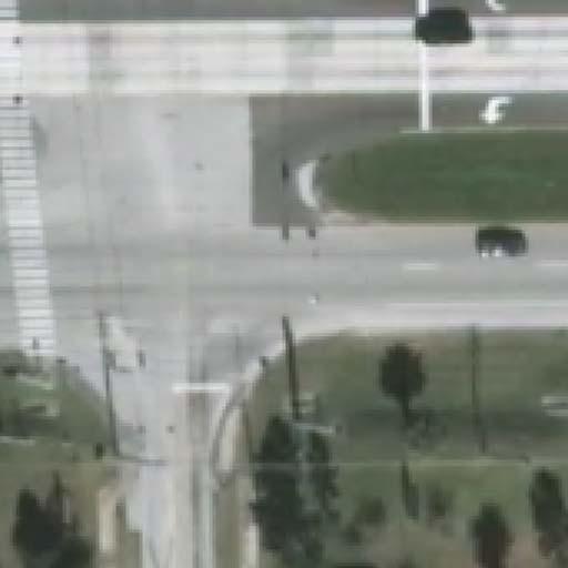
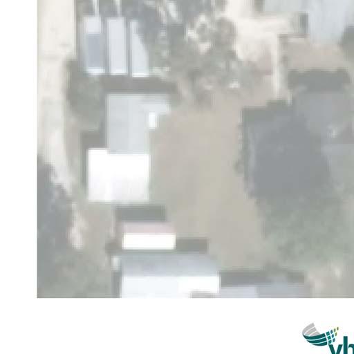
9 N. Spring Garden Ave. \\vhb\proj\orlando\ US 92 at Garfield R2CTPO\graphics\FIGURES\AI Source: Perkins Hwy. N. Spring Garden Ave. Grand Ave. Glenwood Reserve Carter Rd. Clark Bay Conservation Area N Not To Scale Pineland Heights Glenwood Rd. 92 DeLand Municipal Airport E. International Speedway Blvd. N. Woodland Blvd. Glenwood DeLand Fams Grand Ave. North DeLand E. Plymouth Ave. W. Plymouth Ave. E. Plymouth Ave. Garfield Ave. 17 W. Minnesota Ave. E. New York Ave DeLand W. New York Ave. Figure 1 Site Location Map
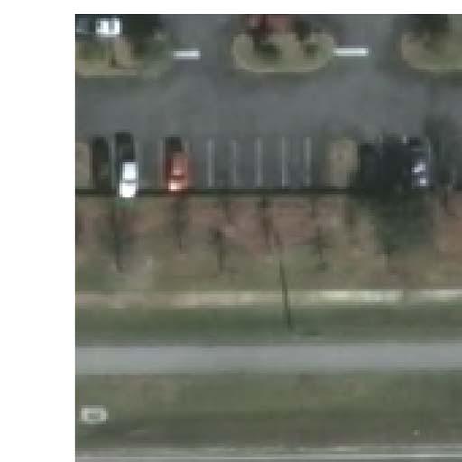
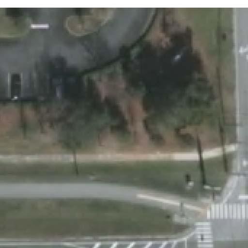
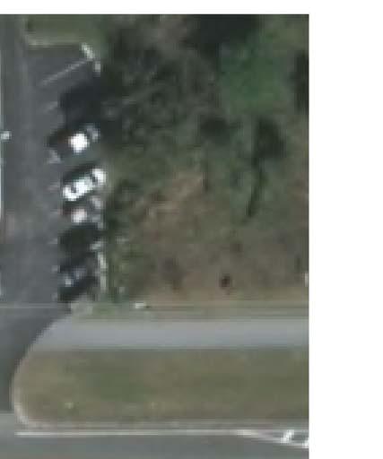
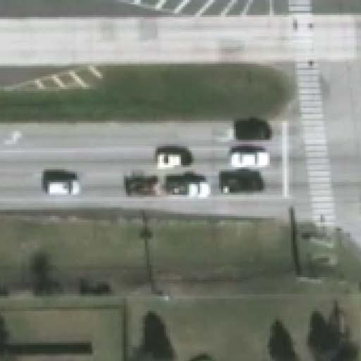
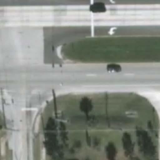
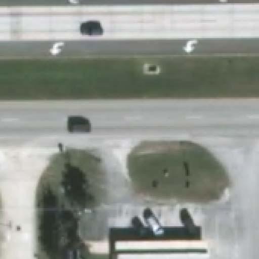
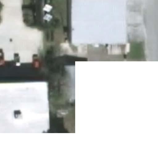
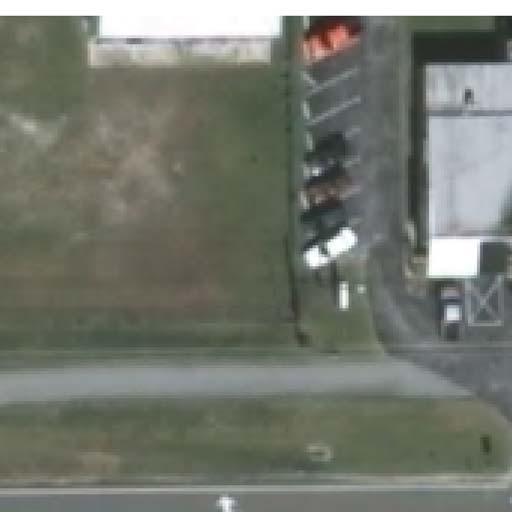
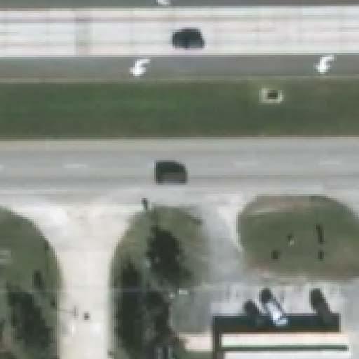
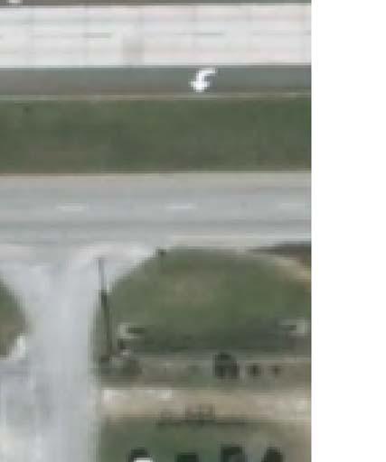
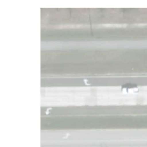
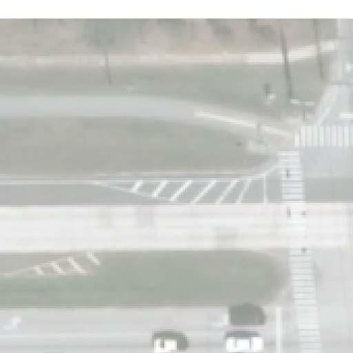
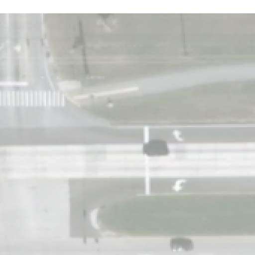
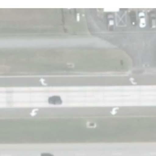
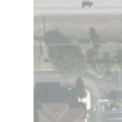
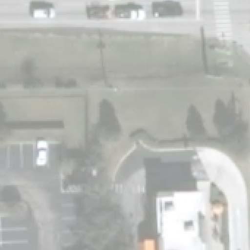
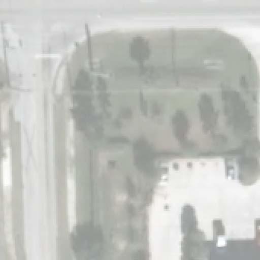
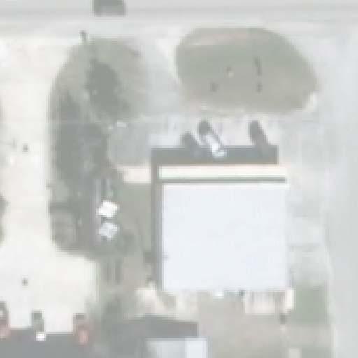
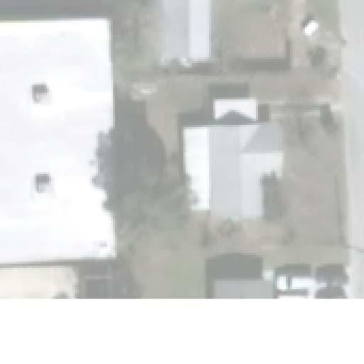
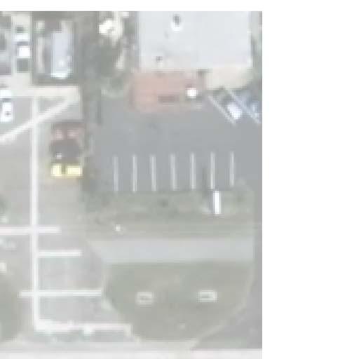
10 Intersection Analysis US 92/International Speedway Blvd. at Garfield Ave. R2CTPO EXISTINGCONDITIONS FieldInventory TheintersectionofUS92/InternationalSpeedwayBoulevardandGarfieldAvenueislocatedin thecityofdelandinvolusiacounty,florida.theexistingconditiondiagram,figure2,depicts the existing conditions at the study intersection including the general roadway geometry, pavementmarkings,landuse,andintersectiontrafficcontrol.inaddition,photographsofthe existingconditionsaroundtheintersectionareprovidedattheendofthissection.theconditions statedinthisreportreflectconditionsasobservedonthedateofthequalitativeassessment. The intersection of US 92/International Speedway Boulevard and Garfield Avenue is a plus shaped intersection with US 92/International Speedway Boulevard running eastwest and GarfieldAvenuerunningnorthsouth.Theintersectionisundersignalcontrol. US92/InternationalSpeedwayBoulevardisa4lanedividedroadwayandGarfieldAvenueisa2 lane undivided roadway. At the intersection, there is a separate left turn lane for all approaches,exceptthenorthboundwhichhasasharedleftthroughandrightturnlane.thereis aseparaterightturnlaneinwestbounddirectiononly.thepostedspeedlimitsare45mphalong US92/InternationalSpeedwayBoulevardand25mphand30mphalongGarfieldAvenuenorth andsouthoftheintersection,respectively. Thetrafficsignalisaboxspanstrainpoledesignwithconcretepoleslocatedinallfourquadrants of the intersection. The signal phasing provides protected/permissive left turns from US 92/InternationalSpeedwayBoulevardandpermissiveleftturnsfromGarfieldAvenue.Thereare signalized special emphasis pedestrian crosswalks across the north and west legs of the intersection.sidewalksrunalongthenorthsideofus92/internationalspeedwayboulevard (westofintersection)andtheeastsideofgarfieldavenue(northofintersection),andbotheast &westsidesofgarfieldavenue(southoftheintersection).thesidewalksalonggarfieldavenue do not extend to the intersection. A shareduse trail runs along the north side of US 92/InternationalSpeedwayBoulevardbetweenthesidewalkandtheroadway.Thereisnostreet lightingalongus92/internationalspeedwayboulevardoralonggarfieldavenue. VHB, Inc. 5
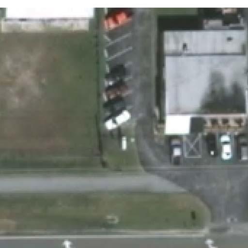
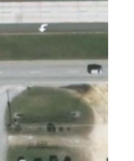
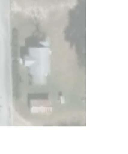
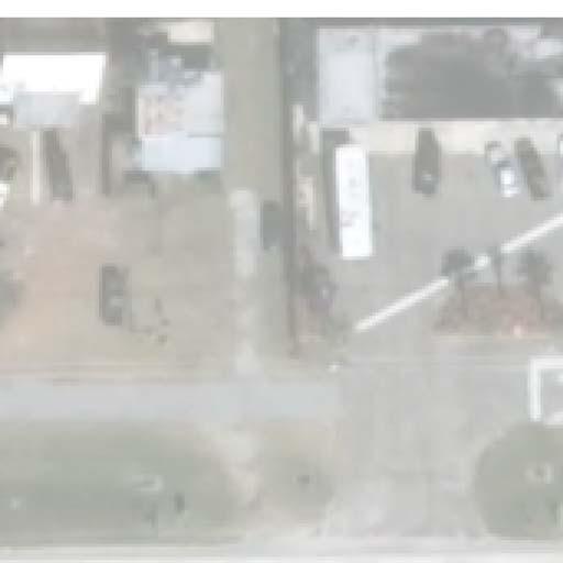
11 ThelandusewithinthevicinityoftheintersectionconsistsofaLowe shomeimprovementin thenorthwestquadrant,adqgrill&chillrestaurantinthenortheastquadrant,adunkindonuts andcomfortinninthesouthwestquadrantandanautozoneinthesoutheastquadrant.us 92/InternationalSpeedwayBoulevardisamajorarterialconnectingtheCityofDeLandtoI95 and the City of Daytona Beach.Garfield Avenue is largely developed; it provides access to commercialandorresidentialdevelopment. VHB, Inc. 6


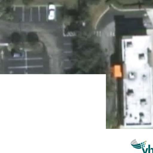
12 Intersection Analysis US 92/International Speedway Blvd. at Garfield Ave. R2CTPO US92/InternationalSpeedwayBoulevardatGarfieldAvenue Exhibit1:LookingwesttowardstheintersectiononWBUS92 Exhibit2:LookingeastawayfromtheintersectiononWBUS92 VHB, Inc. 7


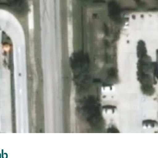
13 Intersection Analysis US 92/International Speedway Blvd. at Garfield Ave. R2CTPO US92/InternationalSpeedwayBoulevardatGarfieldAvenue Exhibit3:LookingeasttowardstheintersectiononEBUS92 Exhibit4:LookingwestawayfromtheintersectiononEBUS92 VHB, Inc. 8


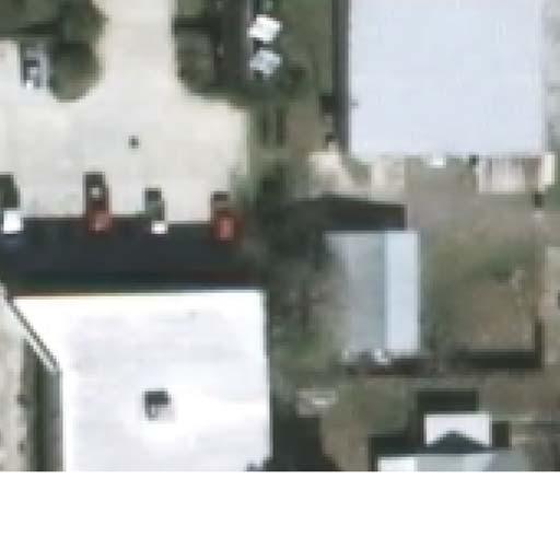
14 Intersection Analysis US 92/International Speedway Blvd. at Garfield Ave. R2CTPO US92/InternationalSpeedwayBoulevardatGarfieldAvenue Exhibit5:LookingnorthtowardstheintersectiononNBGarfieldAvenue Exhibit6:LookingsouthawayfromtheintersectiononNBGarfieldAvenue VHB, Inc. 9


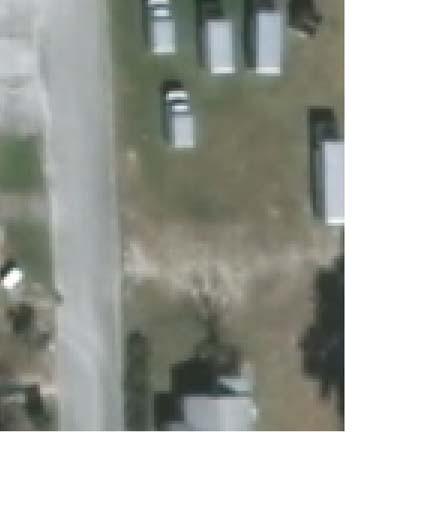
15 Intersection Analysis US 92/International Speedway Blvd. at Garfield Ave. R2CTPO US92/InternationalSpeedwayBoulevardatGarfieldAvenue Exhibit7:LookingsouthtowardstheintersectiononSBGarfieldAvenue Exhibit8:LookingnorthtowardstheintersectiononSBGarfieldAvenue VHB, Inc. 10

16 Intersection Analysis US 92/International Speedway Blvd. at Garfield Ave. R2CTPO US92/InternationalSpeedwayBoulevardatGarfieldAvenue Exhibit9:TrackingonshoulderLookingeasttowardstheintersectiononEBUS92 VHB, Inc. 11

17
18 Intersection Analysis US 92/International Speedway Blvd. at Garfield Ave. R2CTPO TrafficVolumeData The8hourintersectionturningmovementcountswerecollectedonDecember6,2016between 7:00 AM 9:00 AM, 11:00 AM 1:00 PM and 2:00 PM 6:00 PM along US 92/International SpeedwayBoulevardatLowe sentranceandgarfieldavenueintersections.fromthisdata,the AM,middayandPMpeaktraffichourswerefoundtooccurfrom7:15AMto8:15AM,11:30AM to12:30pmand4:45pmto5:45pm,respectively.theoverallpeakhourfortheintersection wasfoundtooccurduringthepmpeakhour. TheturningmovementcountsonUS92/InternationalSpeedwayBoulevardrevealthatthetraffic in eastbound direction peaks during AM conditions and traffic in westbound direction peaks duringpmconditions.duringmiddayconditions,thetrafficseemstobeequallydistributedin both the directions. The 8hour turning movement counts and pedestrian/bicycle counts are provided in greater detail in Appendix B. The following table summarizes the distribution of turningmovementsthroughthestudyintersection: Table1:8HourTurningMovementPercentages (AllVehicles) Movement Northbound Southbound Eastbound Westbound Leftturn/Uturn 32.3% 51.1% 3.7% 6.9% Through 31.4% 21.1% 90.2% 85.3% Rightturn 36.2% 27.8% 6.1% 7.8% Theexistingfieldcollectedturningmovementcountswerebalanced(basedonthepresenceof additionalaccesslocationsbetweenstudyintersections)andusedintheoperationalanalysis. VHB, Inc. 13
19 Intersection Analysis US 92/International Speedway Blvd. at Garfield Ave. R2CTPO CrashData Crash reports compiled by Florida Signal Four Analytics were provided by River to Sea Transportation Planning Organization (R2CTPO).Based on this data, there were 16 crashes reportedwithintheinfluenceareaoftheintersectionduringthelatest36monthperiodcovering January1,2013toDecember31,2015.Thecrashesconsistedof11rearendcrashes,1leftturn crash,2sideswipecrashesand2anglecrashes.thecrashescaused7injuries,andtotalproperty damageamountedtoapproximately$115, therewerenofatalities.threeofthecrashes occurredatnightand10crashesoccurredeitherduringthedayoratduskandunknownforthe remaining3.pavementconditionsweredryfor13ofthecrashesandunknownfortheremaining 3. Basedonthisinformation,itisapparentthatrearendcrashesaccountforthemajorityofthe crashes at the intersection, with most of them occurring on US 92/International Speedway Boulevard rather than on the side streets.rear end crashes are inherent with signalized intersections,andtherewerenogeometricconstraintssuchasverticalorhorizontalcurvesor treesthatwouldpromoterearendcrashesorobstructthevisibilityofthetrafficsignal. Ofthe11rearendcrashes,4crashesoccurredontheoutsidethroughlanealongeastboundUS 92/InternationalSpeedwayBoulevard.Althoughthecrashreportsdidnotspecifywhetherthe eastboundvehiclesweretravelingthroughorturningrightatgarfieldavenue,3outofthese4 crashesoccurredduetoslowingdownorstoppingfortheredlightatthetrafficsignal. ACrashSummaryandCrashDiagramareprovidedinthefollowingpages. VHB, Inc. 14
20 Intersection Analysis US 92/International Speedway Blvd. at Garfield Ave. R2CTPO Table2:CrashSummary(Jan2013Dec2015) # CrashID Date Time Crash Type Fatalities Injuries Property Damage Day/Night Wet/Dry C /19/2013 8:10PM RearEnd 0 0 $4,000 DarkLighted Dry C /19/2013 4:05PM Angle 0 1 $8,000 Daylight Dry C /9/2013 4:45PM RearEnd 0 1 $4,100 Dusk Dry C /1/ :23PM RearEnd 0 0 $4,000 Daylight Dry C /18/2014 6:20AM RearEnd 0 0 $8,000 Unknown Unknown C /23/2014 1:10PM RearEnd 0 0 $6,000 Daylight Dry C /3/2013 4:25PM RearEnd 0 2 $46,100 Daylight Dry C /20/2013 7:17PM Sideswipe 0 3 $2,000 DarkLighted Dry C /15/2013 7:40AM RearEnd 0 0 $0 Daylight Dry C /21/2014 4:00PM RearEnd 0 0 $1 Unknown Unknown C /31/2014 2:25PM RearEnd 0 0 $0 Unknown Unknown C /15/ :32AM RearEnd 0 0 $2,000 Daylight Dry C /31/2015 7:24PM Sideswipe 0 1 $4,000 Daylight Dry C /1/2015 2:58PM LeftTurn 0 4 $20,000 Daylight Dry C /23/2015 7:18PM RearEnd 0 0 $1,500 DarkLighted Dry C /30/2015 5:54PM Angle 0 3 $6,000 Daylight Dry CrashSummarybyCrashTypes(Jan2013Dec2015) CrashType Percent Angle % RearEnd % HeadOn % LeftTurn % Sideswipe % Pedestrian % RightTurn % Bicycle % Other % Total % VHB, Inc. 15

21 3
22 Intersection Analysis US 92/International Speedway Blvd. at Garfield Ave. R2CTPO QUALITATIVEASSESSMENT A qualitative assessment (QA) was conducted in the field in order to evaluate the existing operatingconditionsoccurringonatypicalweekday,andtoidentifyareaswhereimprovements wouldbepotentiallybeneficialtotheoverallsafetyandefficiencyofthelocation.aregistered professionalengineerperformedtheqafrom4:30pm 5:30PMduringtheeveningpeakhour period. 1. During the QA, the intersection, as a whole, appeared to operate smoothly and with minimaldelay.thevolumeoftrafficobservedonus92/internationalspeedwayboulevard wassignificantlyhigherthanthevolumesobservedongarfieldavenue.theflowoftraffic onus92/internationalspeedwayboulevardwasheavierinthewestbounddirectionthanin theeastbounddirection.foracoupleofcyclesbetween5:00pmand5:20pm,queueson westbound US 92/International Speedway Boulevard were observed to back up approximately 800 feet, thus blocking the left turning vehicles and causing cycle failures (queuesclearedupinthenextcycle).duringthesameperiod(5:00 5:20PM),thequeues onwestboundus92/internationalspeedwayboulevardfrequentlybackedupapproximately 600feet.DuringtheremainderofthePMpeakhourtimeperiod,theintersectionoperated withoutsignificantqueuesorcyclefailures.itwasobservedthattheoutsidethroughlaneon eastbound US 92/International Speedway Boulevard was utilized more than the inside throughlane.inafewinstances,thequeuesoneastboundus92/internationalspeedway BoulevardwerebackeduptotheLowe sentrance;however,allqueuedvehicleswereable tocleartheintersectioninonecycle. 2.Thegeometryoftheintersectionis,ingeneral,straightandflat,sothesightdistanceto thesignalisnotimpededandwasnotobservedtopresentanyoperationalorsafetyconcerns. 3.Therearetrackingmarksontheshouldersoftheeastboundapproachwhichbearevidence thatvehiclesaretravelingontheshoulderstogetaroundstoppedthroughtraffictoproceed withtheirrightturn. VHB, Inc. 17
23 4. There are crosswalks with pedestrian signals across the north andwest legs of the US 92/InternationalSpeedwayBoulevardandGarfieldAvenueintersection.Thecrosswalksare markedwithspecialemphasispavementmarkings,whichareappropriateforacrossingata signalizedintersection.thewalktimesprovidedappearedadequateforpedestrianstocross atanormalpaceandwithintheallottedtime. 5.Crosswalksarenotprovidedonthesouthandeastlegsoftheintersection.Thesidewalks alongtheeastandwestsideofgarfieldavenue(southleg)areterminatedjustbeforethe intersection. VHB, Inc. 18
24 Intersection Analysis US 92/International Speedway Blvd. at Garfield Ave. R2CTPO FEASIBILITYANALYSIS Background AnapplicationwasreceivedfromVolusiaCountytoperformafeasibilitystudytoconstructan eastbound right turn lane and to extend the existing westbound left turn lane along US 92/InternationalSpeedwayBoulevardatGarfieldAvenue.Thepurposeoftheeastboundright turnlaneistoenabletraffictomoveoutofthewayofthroughtrafficanddecelerateinthe separateturnlane,thusreducingdelayforvehiclesturningrightontogarfieldavenue.addinga neweastboundrightturnlanewillreducethelikelihoodofrearendcrashesassociatedwith trafficslowingdowntomaketheturnontogarfieldavenue.thetrafficmakingthewestbound left turn (sometimes) cannot reach the turn lane due to the westbound through queues. Therefore,extendingthewestboundleftturnwillenabletraffictomoveoutofthethroughlane andmoveintothedesignatedturnlane.anorthboundrightturnlaneisalsorecommendedat the intersection since the northbound right turn traffic consistently drives on the shoulder aroundnorthboundthroughtraffictoturnrightonred(basedoninformationprovidedbyfdot). Methodology Themethodologyfordeterminingthefeasibilityofconstructinganeastboundrightturnlane,a northbound right turn lane and extending the existing westbound left turn lane along US 92/InternationalSpeedwayBoulevardatGarfieldAvenueincludesperforminganassessmentof theproposedsite,acomparisonofbeforeandafteroperatingconditionsattheintersection utilizingtrafficoperationanalysissoftware,andpreparingabenefit/cost(b/c)analysisforany proposedimprovements. AssessmentofProposedSite US 92/International Speedway Boulevard is a fourlane divided roadway with a wide grass median.at its intersection with Garfield Avenue, US 92/International Speedway Boulevard widenstoincludeseparaterightandleftturnlanesonthewestboundapproachandaseparate leftturnlaneontheeastboundapproach.thedrainagesystemconsistsofopenswalesalong VHB, Inc. 19
25 thenorthandsouthsidesoftheroad,andacrossdrainwithmiteredendsectionsrunningunder thesouthlegofgarfieldavenue. Toinstallaseparaterightturnlaneontheeastboundapproach,theswalealongthesouthwest quadrantwouldneedtobereworkedandthecrossdrainextendedtonotconflictwiththe additionallane.theeastboundapproachcurrentlydrainsintotheswalealongus17,andthe additionofcurbandgutterandassociatedflumeswouldnotchangethat;althoughthevolume ofwaterwillincreasewiththeincreasedimpervioussurfaceareaofthenewlane.theswales shouldbeanalyzedtodetermineiftheycanaccommodatetheadditionalwater.thesouthwest quadrantoftheintersectionalsocontainsapedestriansignal,pullboxandapedestrianlanding equippedwithahandrailthatwouldneedtoberelocatedtoaccommodatetheadditionallane. Inordertoconstructanorthboundrightturnlane,curbandgutterwillberequiredtomaintain theclearzonealongtheeastsideofgarfieldavenue.thenorthboundapproachcurrentlydrains northtowardstheintersectionandintotheswalesalongus17,andtheadditionofcurband gutterwouldnotchangethat;althoughthevolumeofwaterwillincreasewiththeincreased impervioussurfaceareaofthenewlane.theswalesshouldbeanalyzedtodetermineiftheycan accommodatetheadditionalwater.surveywasnotprovidedfortheimprovementdiagrams; however,fromlotandparcellinespulledfromthevolusiacountypropertyappraiserswebpage, itappearsthattheturnlanecouldfitwithintheexistingrightofway.theoverheadutilitylines thatrunalongtheeastsideofgarfieldavenuewouldneedtoberelocated.itisnotanticipated thattheexistingtrafficsignalpoleinthesoutheastquadrantwillneedtobereplacedsincethe curbandgutterwillprovidetheappropriateclearzone. Therewerenophysicalconstraintsobservedthatwouldimpedetheextensionofthewestbound leftturnlane. OperationalAnalysis Anintersectionoperationanalysiswasperformedforbeforeandafterconditions.Thebefore conditionsassumethatthereisnochangeinintersectiongeometryandsignaltimings,whereas, the after conditions assume that the lane configuration on US 92/International Speedway Boulevard will be modified to include a separate eastbound right turn lane, a separate VHB, Inc. 20
26 northboundrightturnlaneandextensionofthewestboundleftturnlane.theexistingoperating conditionsofus92/internationalspeedwayboulevardandgarfieldavenueweredetermined usingsynchro9/simtrafficsimulationsoftware.thesignaltiminginformationwasobtainedfrom VolusiaCounty.Table2summarizestheintersectiondelayandlevelsofservice(LOS)forbefore andafterconditionsduringthethreepeakperiods.asshowninthetable,theintersectionofus 92/InternationalSpeedwayBoulevardandGarfieldAvenueisoverallexpectedtooperatebetter withtheproposedimprovements.thesimtrafficsimulationresultswereprovidedinappendix C. Intersection Delay (Sec.) Table3:BeforeandAfterOperationalAnalysisResults AMPeakHour MidDay PMPeakHour Before After Before After Before After LOS Delay (Sec.) LOS Delay (Sec.) LOS Delay (Sec.) LOS Delay (Sec.) LOS Delay (Sec.) Overall 10.9 B 9.4 A 12.9 B 9.1 A 19.0 B 17.5 B Note:Theresultsarebasedonaverageof10randomseedSimTrafficSimulationruns LOS Benefit/CostAnalysis Abenefitcostanalysiswasperformedforthestudyintersectiontoestimatetheeffectivenessof thepotentialintersectionimprovementsusingsimtrafficsimulation.thebenefitsaredefinedin termsofannualizedcostsavingsassociatedwithreductionsinthefollowingthreemeasuresof effectiveness(moes): o o o TotalDelay(VehicleHours) Stops FuelConsumption(Gallons) Thebenefitswerecalculatedfor300daysinayearaccountingforreducedbenefitsanticipated duetolowertrafficvolumesduringtheweekend.thevalueofdelaytimeperhour($17.67)and fuelcost($3.27)wereobtainedfrom TheMobilityDataforOrlando publishedbytexasa&m University.Stopswereestimatedtocost$0.014each.Table4summarizestheunitvalueofeach MOEinatabularformatalongwithitssource. VHB, Inc. 21
27 Table4:UnitValueofMOEs MOEValues UnitValue Source Stops($) Transyt7F Delay($) UrbanMobilityReportpublishedby TexasA&MTransportationInstitute(TTI) Fuel($/gal.) UrbanMobilityReportpublishedby TTI DaysperYear 300 Averagedayswithobservablepeaking characteristics Theestimatedcostfortheproposedmodificationis$135,474(presentdayvalue)andithasa correspondingannualizedcostamountingto$9, thecostestimatedoesnotincludethe potentialcostofrightofwayortherelocationofexistingutilitiesforthenorthboundrightturn laneimprovement.theservicelifeforthemodificationisassumed20yearsandtheinterestrate usedinthecalculationofannualizedcostsisassumed4%,whichisavaluefrequentlyusedbythe Florida Department of Transportation (FDOT) in their benefit cost computations.the Cost EstimatefortheproposedlaneadditionscanbefoundinAppendixD. Table5summarizesthebenefitcostanalysisfortheproposedimprovements.Theanalysisyields ab/cratioof5.39.thecalculatedb/cratioindicatesthattheanticipatedbenefitsoutweighthe estimatedcostsfortheproposedmodifications,withbenefitsderivedthroughreducedcosts associatedwithlowerdelay,stopsandfuelconsumption. VHB, Inc. 22
28 Table5:Benefit/CostAnalysisResults MeasuresofEffectiveness BenefitPeriod TotalDelay FuelConsumption TotalStops (vehhrs) (gal) AMPeakHour Existing Proposed MidDay Existing Proposed PMPeakHour Existing 1, Proposed 1, EstimatedDaily(AM+ Existing 2, Mid+PM) Proposed 2, EstimatedDailySavings EstimatedUnitCost $0.014 $ $3.270 DailyUserBenefitbyMOE $1.92 $ $4.578 DailyUserBenefitTotal $ AnnualUserBenefit $53, TotalAnnualCost $9, BenefitCostRatio 5.39 Notes: 1) Theservicelifeoftheimprovementswaskeptat20years 2) Interestrateof4%wasusedtodeterminetheannualcostofimprovements 3) Annualuserbenefitwascalculatedfor300dayswith2hourseachofAM,MiddayandPMpeakperiods VHB, Inc. 23
29 Intersection Analysis US 92/International Speedway Blvd. at Garfield Ave. R2CTPO RECOMMENDATIONS Baseduponthecrashandspeedanalyses,qualitativeassessment,fieldobservations,intersection analysis,b/canalysisandengineeringjudgment,thefollowingmodificationsarerecommended toimprovethesafetyandoperationoftheintersection: 1:Extendtheexistingwestboundleftturnlane,constructaneastboundrightturnlaneand constructanorthboundrightturnlaneattheintersectionofus92/internationalspeedway BoulevardandGarfieldAvenue.Therewerenophysicalconstraintsfoundthatwouldimpede the extension of the westbound left turn lane at the intersection of US 92/International SpeedwayBoulevardandGarfieldAvenue.Therightofwayissufficienttoinstallaseparateright turnlaneontheeastboundapproach;however,theexistingdrainageswalewouldneedtobe reworkedandthecrossdrainwouldneedtobeextendedalongthesouthwestquadrantofthe intersection.theexistingpedestriansignal,pullboxandpedestrianlanding,equippedwitha handrail,wouldneedtoberelocated.inordertoconstructanorthboundrightturnlane,curb andgutterwouldberequiredtomaintaintheclearzonealongtheeastsideofgarfieldavenue. Survey was not provided for the Improvement Diagrams; however, from lot and parcel lines pulledfromthevolusiacountypropertyappraiserswebpage,itappearsthatthenorthbound turnlanecouldfitwithintheexistingrightofway;however,theoverheadutilitylinesthatrun alongtheeastsideofgarfieldavenuewouldneedtoberelocated.itisnotanticipatedthatthe existingtrafficsignalpoleinthesoutheastquadrantwillneedtobereplacedsincethecurband gutterwillprovidetheappropriateclearzone.withboththeeastboundandnorthboundright turnlanes,theswalesalongus17shouldbeanalyzedtodetermineiftheycanaccommodatethe additional water. These modifications can be implemented at an approximate cost of $135,473.65(doesnotincludethepotentialcostofrightofwayorrelocationoftheoverhead utilitiesforthenorthboundrightturn)andyieldsab/cratioof5.39,whichindicatesthatthe anticipatedbenefitsoutweightheestimatedcostsfortheproposedmodification. TheproposedimprovementsareillustratedintheFigure4shownonthefollowingpage. VHB, Inc. 24
30 2:ExtendtheexistingsidewalksalongtheeastandwestsidesofGarfieldAvenueonthesouth approach all the way to the intersection of US 92/International Speedway Boulevard and GarfieldAvenue.Theseconnectionswillprovideasafepassageforpedestriansbyeliminating theneedforthemtowalkonthepavementorinthegrass.providecrosswalksalongtheeast and south legs of the US 92/International Speedway Boulevard and Garfield Avenue intersection.thecostfortheserecommendations(providedasaseparateitem)isestimatedat $15, VHB, Inc. 25

31
32
33 APPENDICES VHB, Inc. 28
34 APPENDIXA:ResponsestoComments VHB, Inc. 1
35 Comments from Amir Asgarinik(FDOT) US 92 at Garfield Report Comments 1. Shouldn t we use Optional Base Group 9 instead of 13? Response: Base Group has been revised from 13 to Does the existing concrete signal assembly need to be upgraded based on the proposed improvements? Response: It is anticipated that the existing span wire traffic signal can be maintained since no new signal heads will be required, and Type F curb and gutter is being proposed along the east side of the NB right turn lane since there is not enough right of way to maintain an 18 CZ. 3. Need 36 concrete pipes to accommodate the proposed turning movements and sidewalks. Response: 36 round concrete pipe has been added to the estimate. 4. Most of the proposed sidewalks should be 6 thick due to its proximity to the EOP and traffic movement. Response: The cost estimate considers that the ramps and sidewalk within the immediate vicinity of the curb radius will be 6 concrete % Contingency may be excessive. Response: The contingency has been reduced to 15%. Comments from Keith Riger (City of Deland) 1. I would like to point out that we have a proposed project in the hopper called the DeLand Greenway Trail North Extension, FIN , Federal Aid Number A to build a trail to the SW corner of the intersection. Pertinent plans are attached. Let s coordinate. Response: Comment Noted. Comments from Jon Cheney (Volusia County) 1. No comments on justification for new turn lanes, but always a support new lanes. 2. Why is this separate from the other turn lane study in the same area? This project should be combined with other turn lane project on US92 and administered by FDOT since work is on a State Roadway. Response: Two different reports were created based on the two different feasibility study applications from Volusia county. However, the US 92 & Garfield report was included in the appendix of the US 92 from Woodland Boulevard to Garfield Avenue report. 3. Did they look at need for turn lanes on Garfield itself? Response: As per the information provided by FDOT, additional northbound right turn lane is proposed at Garfield Avenue.
36 4. Not enough information to perform a constructability review, however most construction appears to be in FDOT ROW. Comments from Christopher Cairns (FDOT) 1. Please clarify the input volumes utilized for the eastbound and westbound approaches in the Synchro analysis for AM, Midday, and PM. Response: The turning movement counts, provided in Appendix A, were taken and adjusted (balanced) for reasonableness considering the presence or absence of additional access points between study intersections. 2. There is visible wear on the northbound approach leg from right turns. An exclusive right turn lane would appear to reduce peak hour delay and queuing on Garfield Avenue. Response: Comment noted. Analysis is revised with the exclusive northbound right turn lane improvement. 3. Concur with need for sidewalk to extend to pedestrian signal on SW corner and for pedestrian features and crosswalk for the east and south approaches. Please show these improvements on the improvement diagram. Note that additional work may be required to make well designed sidewalk connectivity on these corners, which may cost more than estimated. Response: Comment noted. All the proposed improvements are shown in the improvements diagram (figure 4). 4. Concur with need for an eastbound right turn lane as recommended. However, some form of bulb out should be considered to break up the right turn lane. We should avoid creating a new continuous EB auxiliary lane between Amelia and Garfield Avenue (that crosses a median opening). Response: Comment noted. The proposed eastbound right turn lane will not create a continuous eastbound auxiliary lane between Amelia Avenue and Garfield Avenue 5. There does not appear to be any operational benefit to extending the existing 450 westbound left turn lane. We are not aware of any wear or queue storage issues to suggest a problem. Response: Comment noted. During field observations, for a couple of cycles between 5:00 PM and 5:20 PM, queues on westbound US 92/International Speedway Boulevard were observed to back up approximately 800 feet, thus blocking the left turning vehicles and causing cycle failures (queues cleared up in the next cycle). During the same period (5:00 5:20 PM), the queues on westbound US 92/International Speedway Boulevard frequently backed up approximately 600 feet. 6. Can the existing signal structure support retroreflective back plates to enhance signal conspicuity and/or 4section heads for FYA indications? Response: Comment noted. The report provides conceptual improvements and there is insufficient information regarding the soil conditions, foundation design and capacity of the existing signal system to provide accurate structural analysis for the proposed modifications.
37 APPENDIXB:TrafficData
38 Roadway Count Summary Vanasse Hangen Brustlin, Inc. County Volusia City DeLand Intersection Lowes Driveway & US 92 Intn'l Speedway Blvd Date December 6, 2016 All Vehicles AM Peak Hour VHB Project #: Time Period Northbound Southbound Eastbound Westbound Left Through Right Left Through Right Left Through Right Left Through Right 7:00 AM 7:15 AM :15 AM 7:30 AM :30 AM 7:45 AM :45 AM 8:00 AM :00 AM 8:15 AM :15 AM 8:30 AM :30 AM 8:45 AM :45 AM 9:00 AM TOTAL , , Peak Hour 7:15 AM 8:15 AM , Midday Time Period Northbound Southbound Eastbound Westbound Left Through Right Left Through Right Left Through Right Left Through Right 11:00 AM 11:15 AM :15 AM 11:30 AM :30 AM 11:45 AM :45 AM 12:00 PM :00 PM 12:15 PM :15 PM 12:30 PM :30 PM 12:45 PM :45 PM 1:00 PM TOTAL , , Peak Hour 11:30 AM 12:30 PM PM Peak Hour Time Period Northbound Southbound Eastbound Westbound Left Through Right Left Through Right Left Through Right Left Through Right 2:00 PM 2:15 PM :15 PM 2:30 PM :30 PM 2:45 PM :45 PM 3:00 PM :00 PM 3:15 PM :15 PM 3:30 PM :30 PM 3:45 PM :45 PM 4:00 PM :00 PM 4:15 PM :15 PM 4:30 PM :30 PM 4:45 PM :45 PM 5:00 PM :00 PM 5:15 PM :15 PM 5:30 PM :30 PM 5:45 PM :45 PM 6:00 PM TOTAL , , Peak Hour 4:45 PM 5:45 PM ,282 30
39 Roadway Count Summary Vanasse Hangen Brustlin, Inc. County Volusia City DeLand Intersection Lowes Driveway & US 92 Intn'l Speedway Blvd Date December 6, 2016 Trucks AM Peak Hour VHB Project #: Time Period Northbound Southbound Eastbound Westbound Left Through Right Left Through Right Left Through Right Left Through Right 7:00 AM 7:15 AM :15 AM 7:30 AM :30 AM 7:45 AM :45 AM 8:00 AM :00 AM 8:15 AM :15 AM 8:30 AM :30 AM 8:45 AM :45 AM 9:00 AM TOTAL Peak Hour 7:15 AM 8:15 AM % 4% 2% 3% 0% 4% 0% Midday Time Period Northbound Southbound Eastbound Westbound Left Through Right Left Through Right Left Through Right Left Through Right 11:00 AM 11:15 AM :15 AM 11:30 AM :30 AM 11:45 AM :45 AM 12:00 PM :00 PM 12:15 PM :15 PM 12:30 PM :30 PM 12:45 PM :45 PM 1:00 PM TOTAL Peak Hour 11:30 AM 12:30 PM % 1% 1% 5% 25% 5% 5% PM Peak Hour Time Period Northbound Southbound Eastbound Westbound Left Through Right Left Through Right Left Through Right Left Through Right 2:00 PM 2:15 PM :15 PM 2:30 PM :30 PM 2:45 PM :45 PM 3:00 PM :00 PM 3:15 PM :15 PM 3:30 PM :30 PM 3:45 PM :45 PM 4:00 PM :00 PM 4:15 PM :15 PM 4:30 PM :30 PM 4:45 PM :45 PM 5:00 PM :00 PM 5:15 PM :15 PM 5:30 PM :30 PM 5:45 PM :45 PM 6:00 PM TOTAL Peak Hour 4:45 PM 5:45 PM
40 Roadway Count Summary Vanasse Hangen Brustlin, Inc. County Volusia City DeLand Intersection Lowes Driveway & US 92 Intn'l Speedway Blvd Date December 6, 2016 UTurns & RTOR AM Peak Hour VHB Project #: Time Period Northbound Southbound Eastbound Westbound Left Through Right Left Through Right Left Through Right Left Through Right 7:00 AM 7:15 AM :15 AM 7:30 AM :30 AM 7:45 AM :45 AM 8:00 AM :00 AM 8:15 AM :15 AM 8:30 AM :30 AM 8:45 AM :45 AM 9:00 AM TOTAL Peak Hour 8:00 AM 9:00 AM Midday Time Period Northbound Southbound Eastbound Westbound Left Through Right Left Through Right Left Through Right Left Through Right 11:00 AM 11:15 AM :15 AM 11:30 AM :30 AM 11:45 AM :45 AM 12:00 PM :00 PM 12:15 PM :15 PM 12:30 PM :30 PM 12:45 PM :45 PM 1:00 PM TOTAL Peak Hour 11:00 AM 12:00 PM PM Peak Hour Time Period Northbound Southbound Eastbound Westbound Left Through Right Left Through Right Left Through Right Left Through Right 2:00 PM 2:15 PM :15 PM 2:30 PM :30 PM 2:45 PM :45 PM 3:00 PM :00 PM 3:15 PM :15 PM 3:30 PM :30 PM 3:45 PM :45 PM 4:00 PM :00 PM 4:15 PM :15 PM 4:30 PM :30 PM 4:45 PM :45 PM 5:00 PM :00 PM 5:15 PM :15 PM 5:30 PM :30 PM 5:45 PM :45 PM 6:00 PM TOTAL Peak Hour 2:15 PM 3:15 PM
41 Pedestrian&BicycleSummary Project#: Date: 12/6/2016 NB/SB: LowesDriveway EB/WB: US92Intn'lSpeedwayBlvd Eastbound Hour 7:00 8:00 11:00 12:00 14:00 15:00 16:00 17: Bike Ped Westbound Bike Ped Southbound Northbound Hour PedBike PedBike LowesDriveway 7: :00 8: US92Intn'lSpeedwayBlvd :00 11: :00 12: :00 14: :00 US92Intn'lSpeedwayBlvd 15: :00 16: :00 17: : LowesDriveway Southbound Northbound PedBike PedBike Hour Eastbound Bike Ped Westbound Bike Ped Hour 7:00 8:00 11:00 12:00 14:00 15:00 16:00 17:
42 Roadway Count Summary Vanasse Hangen Brustlin, Inc. County Volusia City DeLand Intersection Garfield Ave & US 92Intn'l Speedway Blvd Date December 6, 2016 All Vehicles AM Peak Hour VHB Project #: Time Period Northbound Southbound Eastbound Westbound Left Through Right Left Through Right Left Through Right Left Through Right 7:00 AM 7:15 AM :15 AM 7:30 AM :30 AM 7:45 AM :45 AM 8:00 AM :00 AM 8:15 AM :15 AM 8:30 AM :30 AM 8:45 AM :45 AM 9:00 AM TOTAL , , Peak Hour 7:15 AM 8:15 AM , Midday Time Period Northbound Southbound Eastbound Westbound Left Through Right Left Through Right Left Through Right Left Through Right 11:00 AM 11:15 AM :15 AM 11:30 AM :30 AM 11:45 AM :45 AM 12:00 PM :00 PM 12:15 PM :15 PM 12:30 PM :30 PM 12:45 PM :45 PM 1:00 PM TOTAL , , Peak Hour 11:30 AM 12:30 PM PM Peak Hour Time Period Northbound Southbound Eastbound Westbound Left Through Right Left Through Right Left Through Right Left Through Right 2:00 PM 2:15 PM :15 PM 2:30 PM :30 PM 2:45 PM :45 PM 3:00 PM :00 PM 3:15 PM :15 PM 3:30 PM :30 PM 3:45 PM :45 PM 4:00 PM :00 PM 4:15 PM :15 PM 4:30 PM :30 PM 4:45 PM :45 PM 5:00 PM :00 PM 5:15 PM :15 PM 5:30 PM :30 PM 5:45 PM :45 PM 6:00 PM TOTAL , , Peak Hour 4:45 PM 5:45 PM ,201 66
43 Roadway Count Summary Vanasse Hangen Brustlin, Inc. County Volusia City DeLand Intersection Garfield Ave & US 92Intn'l Speedway Blvd Date December 6, 2016 Trucks AM Peak Hour VHB Project #: Time Period Northbound Southbound Eastbound Westbound Left Through Right Left Through Right Left Through Right Left Through Right 7:00 AM 7:15 AM :15 AM 7:30 AM :30 AM 7:45 AM :45 AM 8:00 AM :00 AM 8:15 AM :15 AM 8:30 AM :30 AM 8:45 AM :45 AM 9:00 AM TOTAL Peak Hour 8:00 AM 9:00 AM Midday Time Period Northbound Southbound Eastbound Westbound Left Through Right Left Through Right Left Through Right Left Through Right 11:00 AM 11:15 AM :15 AM 11:30 AM :30 AM 11:45 AM :45 AM 12:00 PM :00 PM 12:15 PM :15 PM 12:30 PM :30 PM 12:45 PM :45 PM 1:00 PM TOTAL Peak Hour 11:15 AM 12:15 PM PM Peak Hour Time Period Northbound Southbound Eastbound Westbound Left Through Right Left Through Right Left Through Right Left Through Right 2:00 PM 2:15 PM :15 PM 2:30 PM :30 PM 2:45 PM :45 PM 3:00 PM :00 PM 3:15 PM :15 PM 3:30 PM :30 PM 3:45 PM :45 PM 4:00 PM :00 PM 4:15 PM :15 PM 4:30 PM :30 PM 4:45 PM :45 PM 5:00 PM :00 PM 5:15 PM :15 PM 5:30 PM :30 PM 5:45 PM :45 PM 6:00 PM TOTAL Peak Hour 2:00 PM 3:00 PM
44 Roadway Count Summary Vanasse Hangen Brustlin, Inc. County Volusia City DeLand Intersection Garfield Ave & US 92Intn'l Speedway Blvd Date December 6, 2016 UTurns & RTOR AM Peak Hour VHB Project #: Time Period Northbound Southbound Eastbound Westbound Left Through Right Left Through Right Left Through Right Left Through Right 7:00 AM 7:15 AM :15 AM 7:30 AM :30 AM 7:45 AM :45 AM 8:00 AM :00 AM 8:15 AM :15 AM 8:30 AM :30 AM 8:45 AM :45 AM 9:00 AM TOTAL Peak Hour 7:00 AM 8:00 AM Midday Time Period Northbound Southbound Eastbound Westbound Left Through Right Left Through Right Left Through Right Left Through Right 11:00 AM 11:15 AM :15 AM 11:30 AM :30 AM 11:45 AM :45 AM 12:00 PM :00 PM 12:15 PM :15 PM 12:30 PM :30 PM 12:45 PM :45 PM 1:00 PM TOTAL Peak Hour 11:15 AM 12:15 PM PM Peak Hour Time Period Northbound Southbound Eastbound Westbound Left Through Right Left Through Right Left Through Right Left Through Right 2:00 PM 2:15 PM :15 PM 2:30 PM :30 PM 2:45 PM :45 PM 3:00 PM :00 PM 3:15 PM :15 PM 3:30 PM :30 PM 3:45 PM :45 PM 4:00 PM :00 PM 4:15 PM :15 PM 4:30 PM :30 PM 4:45 PM :45 PM 5:00 PM :00 PM 5:15 PM :15 PM 5:30 PM :30 PM 5:45 PM :45 PM 6:00 PM TOTAL Peak Hour 2:45 PM 3:45 PM
45 Pedestrian&BicycleSummary Project#: Date: 12/6/2016 NB/SB: GarfieldAve EB/WB: US92Intn'lSpeedwayBlvd Eastbound Hour 7:00 8:00 11:00 12:00 14:00 15:00 16:00 17: Bike Ped Westbound Bike Ped Southbound Northbound Hour PedBike PedBike GarfieldAve 1 7: :00 2 8: US92Intn'lSpeedwayBlvd : : : : : : :00 US92Intn'lSpeedwayBlvd Southbound Northbound PedBike PedBike Hour 6 15: : : : : : GarfieldAve Eastbound Bike Ped Westbound Bike Ped :00 8:00 11:00 12:00 14:00 15:00 16:00 17: Hour
46 APPENDIXC:TrafficOperationAnalysis(SimTrafficResults)
47 COUNTY OF VOLUSIA TRAFFIC SIGNAL TIMING SHEET LOCATION: US 92 & Garfield Avenue DeLand ISOLATED: DATE: 11/30/2015 SIGNAL #: 395 COORD: X Design By: M Tobin System #: 4 PHASE DIRECTION TURN TYPE MIN GREEN EXTENSION CLEARANCE ALL RED WALK FDW MAX 1 MAX 2 MAX 3 ADJUST RECALL DETECTOR FLASH SET CLEAR PHASES: EBL WB NB WBL EB SB PERM/PROT PERM/PROT NONLOCK 8 Controller Timing Chart MIN MIN LOCK NONLOCK NONLOCK LOCK NONLOCK BASE DAY MON #1 TUES#1 WED #1 THU #1 FRI #1 SAT #2 SUN #3 TIME PLAN TIME PLAN TIME PLAN TIME PLAN TIME PLAN TIME PLAN TIME PLAN 05:3010:00 C1O1S1 05:3010:00 C1O1S1 05:3010:00 C1O1S1 05:3010:00 C1O1S1 05:3010:00 C1O1S1 08:0018:00 C2O1S1 09:3017:00 C1O1S1 10:0014:30 C2O1S1 10:0014:30 C2O1S1 10:0014:30 C2O1S1 10:0014:30 C2O1S1 10:0014:30 C2O1S1 18:0000:00 Free 17:0000:00 Free 14:3019:00 C301S1 14:3019:00 C301S1 14:3019:00 C301S1 14:3019:00 C301S1 14:3019:00 C301S1 19:0000:00 Free 19:0000:00 Free 19:0000:00 Free 19:0000:00 Free 19:0000:00 Free CONTROLLER TYPE CONDITION OF OVERHEAD Fair PROM NUMBER OVERHEAD STREET NAMES NO Econolite ASC/3 CABINET TYPE CABINET DATE V 03/2005 ILLUMINATED STREET NAMES PREEMPTION PREEMPTION TYPE YES YES INFRARED IP ADDRESS Crosswalk Length LED P2 75 Feet P4 P6 P8 130 Feet SIGNAL OWNER FDOT YES REMARKS: Max 2 for Coordination Opticom not in Use

48 DATE: VOLUSIA COUNTY TRAFFIC ENGINEERING Switch IP.# SYSTEM INVENTORY Controller IP.# Camera IP # 5/16/2016 DESIGNED BY: M Tobin LOCATION: US 92 & Garfield Avenue CITY: SIGNAL ID NO: 395 SYSTEM ID: 4 DeLand CONTROLLER TIME CHART TP# 1 MVMNT MIN EXT CLR A.R. WALK FDW MAX1 MAX2 MAX3 ADJST REC DET FL SET CLR COORDINATION NL PLAN C1/S1 C2/S1 C3/S1 C4/S1 C5/S1 C6/S MIN L CYCLE OFF NL OFF NL OFF MIN L OFF 4 7 OFF NL PERM 10% 10% 10% 10% 10% 10% 10% 10% PHASE SPLITS (seconds) CY/SP PH 1 PH 2 PH 3 C1/S C2/S C3/S C4/S1 C5/S1 C6/S PH PH 5 PH 6 PH 7 PH BASE DAY MON #1 TUES#1 WED #1 THU #1 FRI #1 SAT #2 SUN #3 TIME PLAN TIME PLAN TIME PLAN TIME PLAN TIME PLAN TIME PLAN TIME PLAN 05:3010:00 C1O1S1 05:3010:00 C1O1S1 05:3010:00 C1O1S1 05:3010:00 C1O1S1 05:3010:00 C1O1S1 08:0018:00 C2O1S1 09:3017:00 C1O1S1 10:0014:30 C2O1S1 10:0014:30 C2O1S1 10:0014:30 C2O1S1 10:0014:30 C2O1S1 10:0014:30 C2O1S1 18:0000:00 Free 17:0000:00 Free 14:3019:00 C301S1 14:3019:00 C301S1 14:3019:00 C301S1 14:3019:00 C301S1 14:3019:00 C301S1 19:0000:00 Free 19:0000:00 Free 19:0000:00 Free 19:0000:00 Free 19:0000:00 Free
Corridor Analysis for US 92/International Speedway Blvd From US 17/Woodland Blvd to Garfield Ave
 FinalReport CorridorAnalysisforUS92/International SpeedwayBlvd FromUS17/WoodlandBlvdtoGarfieldAve April2017 Preparedfor: RivertoSeaTransportationPlanningOrganization (R2CTPO) 2570W.InternationalSpeedwayBlvd.,Suite100
LAWRENCE TRANSIT CENTER LOCATION ANALYSIS 9 TH STREET & ROCKLEDGE ROAD / 21 ST STREET & IOWA STREET LAWRENCE, KANSAS
 LAWRENCE TRANSIT CENTER LOCATION ANALYSIS 9 TH STREET & ROCKLEDGE ROAD / 21 ST STREET & IOWA STREET LAWRENCE, KANSAS TRAFFIC IMPACT STUDY FEBRUARY 214 OA Project No. 213-542 TABLE OF CONTENTS 1. INTRODUCTION...
Lacey Gateway Residential Phase 1
 Lacey Gateway Residential Phase Transportation Impact Study April 23, 203 Prepared for: Gateway 850 LLC 5 Lake Bellevue Drive Suite 02 Bellevue, WA 98005 Prepared by: TENW Transportation Engineering West
Proposed CVS/pharmacy
 Traffic Impact and Access Study Proposed CVS/pharmacy West Main Street (Route 1) at Hull Street Clinton, Connecticut PREPARED FOR Arista Development LLC 520 Providence Highway, Suite 9 Norwood, Massachusetts
INTERSECTION ANALYSIS PARK AVENUE AND BRADDOCK ROAD (FROSTBURG, MD) FOR LENHART TRAFFIC CONSULTING, INC.
 FOR LENHART TRAFFIC CONSULTING, INC.") INTERSECTION ANALYSIS FOR PARK AVENUE AND BRADDOCK ROAD (FROSTBURG, MD) Prepared for: City of Frostburg, Maryland & Allegany County Commissioners Prepared by: LENHART TRAFFIC CONSULTING, INC. TRAFFIC ENGINEERING
INTERSECTION ANALYSIS FOR PARK AVENUE AND BRADDOCK ROAD (FROSTBURG, MD) Prepared for: City of Frostburg, Maryland & Allegany County Commissioners Prepared by: LENHART TRAFFIC CONSULTING, INC. TRAFFIC ENGINEERING
TRAFFIC SIGNAL DESIGN REPORT KING OF PRUSSIA ROAD & RAIDER ROAD RADNOR TOWNSHIP PENNSYLVANIA
 TRAFFIC SIGNAL DESIGN REPORT KING OF PRUSSIA ROAD & RAIDER ROAD RADNOR TOWNSHIP PENNSYLVANIA PREPARED FOR: UNIVERSITY OF PENNSYLVANIA HEALTH SYSTEM 34 CIVIC CENTER BOULEVARD PHILADELPHIA, PA 1987 (61)
Traffic Engineering Study
 Traffic Engineering Study Bellaire Boulevard Prepared For: International Management District Technical Services, Inc. Texas Registered Engineering Firm F-3580 November 2009 Executive Summary has been requested
 Traffic Analysis For Approved Uses within the St. Lucie West DRI Aldi Port St. Lucie, FL Prepared for: Bohler Engineering, LLC 1000 Corporate Drive Suite 250 Fort Lauderdale, FL 33334 Prepared by: 10795
Bennett Pit. Traffic Impact Study. J&T Consulting, Inc. Weld County, Colorado. March 3, 2017
 Bennett Pit Traffic Impact Study J&T Consulting, Inc. Weld County, Colorado March 3, 217 Prepared By: Sustainable Traffic Solutions, Inc. http://www.sustainabletrafficsolutions.com/ Joseph L. Henderson,
MEMO VIA . Ms. Amy Roth DPS Director, City of Three Rivers. To:
 MEMO To: Ms. Amy Roth DPS Director, City of Three Rivers VIA EMAIL From: Michael J. Labadie, PE Julie M. Kroll, PE, PTOE Brandon Hayes, PE, P.Eng. Fleis & VandenBrink Date: January 5, 2017 Re: Proposed
MILLERSVILLE PARK TRAFFIC IMPACT ANALYSIS ANNE ARUNDEL COUNTY, MARYLAND
 MILLERSVILLE PARK TRAFFIC IMPACT ANALYSIS ANNE ARUNDEL COUNTY, MARYLAND Prepared for: Department of Public Works Anne Arundel County Prepared by: URS Corporation 4 North Park Drive, Suite 3 Hunt Valley,
County State Aid Highway 30 (Diffley Road) and Dodd Road Intersection Study
 and Dodd Road Intersection Study") County State Aid Highway 30 (Diffley Road) and Dodd Road Intersection Study City of Eagan, Dakota County, Minnesota Date: March 2012 Project No. 14957.000 444 Cedar Street, Suite 1500 Saint Paul, MN 55101
County State Aid Highway 30 (Diffley Road) and Dodd Road Intersection Study City of Eagan, Dakota County, Minnesota Date: March 2012 Project No. 14957.000 444 Cedar Street, Suite 1500 Saint Paul, MN 55101
Clearlake Road (State Road 501) Project Development & Environment (PD&E) Study
 Project Development & Environment (PD&E) Study") Clearlake Road (State Road 501) Project Development & Environment (PD&E) Study FROM MICHIGAN AVENUE TO INDUSTRY ROAD BREVARD COUNTY, FLORIDA Financial Project ID No: 433605-1-22-01 Federal Aid Project
Clearlake Road (State Road 501) Project Development & Environment (PD&E) Study FROM MICHIGAN AVENUE TO INDUSTRY ROAD BREVARD COUNTY, FLORIDA Financial Project ID No: 433605-1-22-01 Federal Aid Project
Proposed Inn at Bellefield Traffic Impact Assessment
 Proposed Inn at Bellefield Traffic Impact Assessment Town of Hyde Park Dutchess County, New York Prepared for: T-Rex Hyde Park Owner LLC 500 Mamroneck Avenue, Suite 300 Harrison, NY 10528 June 21, 2017
Roundabout Feasibility Study SR 44 at Grand Avenue TABLE OF CONTENTS
 Roundabout Feasibility Study SR 44 at Grand Avenue TABLE OF CONTENTS Introduction and Executive Summary... 1 Existing Conditions... 3 Intersection Volume Conditions... 5 Intersection Operations... 9 Safety
Traffic Impact Analysis Update
 Willow Bend Traffic Impact Analysis Update TABLE OF CONTENTS Page I. INTRODUCTION -------------------------------------------------------------------------------------------- 1 II. EXISTING CONDITIONS
V. DEVELOPMENT OF CONCEPTS
 Martin Luther King, Jr. Drive Extension FINAL Feasibility Study Page 9 V. DEVELOPMENT OF CONCEPTS Throughout the study process several alternative alignments were developed and eliminated. Initial discussion
RTE. 1 at RTE. 637 & RTE. 639
 INTERSECTION SAFETY STUDY Prepared for: Virginia Department of Transportation Central Region Operations Traffic Engineering (UPC #81378, TO 12-092) DAVENPORT Project Number: 13-368 / /2014 RTE. 1 at RTE.
Appendix C-5: Proposed Refinements Rail Operations and Maintenance Facility (ROMF) Traffic Impact Analysis. Durham-Orange Light Rail Transit Project
 Traffic Impact Analysis. Durham-Orange Light Rail Transit Project") Appendix C-5: Proposed Refinements Rail Operations and Maintenance Facility (ROMF) Traffic Impact Analysis Durham-Orange Light Rail Transit Project July 25, 218 ROMF Transportation Impact Analysis Version
Appendix C-5: Proposed Refinements Rail Operations and Maintenance Facility (ROMF) Traffic Impact Analysis Durham-Orange Light Rail Transit Project July 25, 218 ROMF Transportation Impact Analysis Version
LATSON INTERCHANGE DEVELOPMENT TRAFFIC STUDIES. Genoa Township, Livingston County, MI
 LATSON INTERCHANGE DEVELOPMENT TRAFFIC STUDIES Genoa Township, Livingston County, MI DRAFT TRAFFIC STUDY FOR I-96 AT LATSON RD INTERCHANGE Livingston County CS 47065 JN 101622C Submitted to: Michigan Department
TIMBERVINE TRANSPORTATION IMPACT STUDY FORT COLLINS, COLORADO JANUARY Prepared for:
 TIMBERVINE TRANSPORTATION IMPACT STUDY FORT COLLINS, COLORADO JANUARY 2014 Prepared for: Hartford Companies 1218 W. Ash Street Suite A Windsor, Co 80550 Prepared by: DELICH ASSOCIATES 2272 Glen Haven Drive
Traffic Feasibility Study
 Traffic Feasibility Study Town Center South Robbinsville Township, Mercer County, New Jersey December 19, 2017 Prepared For Robbinsville Township Department of Community Development 2298 Route 33 Robbinsville,
886 March Road McDonald's Transportation Study
 McDonald's Restaurants of Canada Limited March 2013 886 March Road McDonald's Transportation Study Submitted by: HDR Corporation 100 York Boulevard, Suite 300 Richmond Hill, ON L4B 1J8 (905) 882-4100 www.hdrinc.com
Traffic Impact Analysis West Street Garden Plots Improvements and DuPage River Park Garden Plots Development Naperville, Illinois
 Traffic Impact Analysis West Street Garden Plots Improvements and DuPage River Park Garden Plots Development Naperville, Illinois Submitted by April 9, 2009 Introduction Kenig, Lindgren, O Hara, Aboona,
BROWARD BOULEVARD CORRIDOR TRANSIT STUDY
 BROWARD BOULEVARD CORRIDOR TRANSIT STUDY FM # 42802411201 EXECUTIVE SUMMARY July 2012 GOBROWARD Broward Boulevard Corridor Transit Study FM # 42802411201 Executive Summary Prepared For: Ms. Khalilah Ffrench,
Traffic Impact Study Speedway Gas Station Redevelopment
 Traffic Impact Study Speedway Gas Station Redevelopment Warrenville, Illinois Prepared For: Prepared By: April 11, 2018 Table of Contents 1. Introduction... 1 2. Existing Conditions... 4 Site Location...
L1TILE BEARS DAY CARE TRANSPORTATION IMPACT STUDY FORT COLLINS, COLORADO MAY Prepared for:
 L1TILE BEARS DAY CARE TRANSPORTATION IMPACT STUDY FORT COLLINS, COLORADO MAY 2012 Prepared for: Hillside Construction, Inc. 216 Hemlock Street, Suite B Fort Collins, CO 80534 Prepared by: DELICH ASSOCIATES
TRAFFIC IMPACT ANALYSIS
 TRAFFIC IMPACT ANALYSIS Emerald Isle Commercial Development Prepared by SEPI Engineering & Construction Prepared for Ark Consulting Group, PLLC March 2016 I. Executive Summary A. Site Location The Emerald
Traffic Analysis for Bon Air Bridge Mitigation Magnolia Storm Water Quality Project
 Memo To: Paul DiDonato, ATI Architects and Engineers From: David Parisi, PE and Ashley Tam, EIT Date: February 23, 216 Subject: Traffic Analysis for Bon Air Bridge Mitigation Magnolia Storm Water Quality
APPENDIX E. Traffic Analysis Report
 APPENDIX E Traffic Analysis Report THIS PAGE INTENTIONALLY BLANK EAGLE RIVER TRAFFIC MITIGATION PHASE I OLD GLENN HIGHWAY/EAGLE RIVER ROAD INTERSECTION IMPROVEMENTS TRAFFIC ANALYSIS Eagle River, Alaska
Proposed Hotel and Restaurant Development
 Traffic Impact Study Proposed Hotel and Restaurant Development Marbledale Road Tuckahoe, NY PREPARED FOR BILLWIN DEVELOPMENT AFFILIATES, LLC 365 WHITE PLAINS ROAD EASTCHESTER, NY. 10709 PREPARED BY Engineering
County State Aid Highway 32 (Cliff Road) and Dodd Road Intersection Study
 and Dodd Road Intersection Study") County State Aid Highway 32 (Cliff Road) and Dodd Road Intersection Study City of Eagan, Dakota County, Minnesota Date: March 2012 Project No. 14957.000 444 Cedar Street, Suite 1500 Saint Paul, MN 55101
County State Aid Highway 32 (Cliff Road) and Dodd Road Intersection Study City of Eagan, Dakota County, Minnesota Date: March 2012 Project No. 14957.000 444 Cedar Street, Suite 1500 Saint Paul, MN 55101
Traffic Impact Analysis. Alliance Cole Avenue Residential Site Dallas, Texas. Kimley-Horn and Associates, Inc. Dallas, Texas.
 Traffic Impact Analysis Alliance Cole Avenue Residential Site Dallas, Texas February 15, 2018 Kimley-Horn and Associates, Inc. Dallas, Texas Project #064524900 Registered Firm F-928 Traffic Impact Analysis
Traffic Impact Statement (TIS)
") Traffic Impact Statement (TIS) Vincentian PUDA Collier County, FL 10/18/2013 Prepared for: Global Properties of Naples Prepared by: Trebilcock Consulting Solutions, PA 2614 Tamiami Trail N, Suite 615 1205
Traffic Impact Statement (TIS) Vincentian PUDA Collier County, FL 10/18/2013 Prepared for: Global Properties of Naples Prepared by: Trebilcock Consulting Solutions, PA 2614 Tamiami Trail N, Suite 615 1205
APPENDIX C1 TRAFFIC ANALYSIS DESIGN YEAR TRAFFIC ANALYSIS
 APPENDIX C1 TRAFFIC ANALYSIS DESIGN YEAR TRAFFIC ANALYSIS DESIGN YEAR TRAFFIC ANALYSIS February 2018 Highway & Bridge Project PIN 6754.12 Route 13 Connector Road Chemung County February 2018 Appendix
King Soopers #116 Thornton, Colorado
 Traffic Impact Study King Soopers #116 Thornton, Colorado Prepared for: Galloway & Company, Inc. T R A F F I C I M P A C T S T U D Y King Soopers #116 Thornton, Colorado Prepared for Galloway & Company
Study Area and Location District PSA Ward ANC Phase Description C Planned Suitland Parkway Westbound at Stanton Road Southeast
 Speed Limit and Safety Nexus Studies for Automated Enforcement Locations in the District of Columbia Suitland Parkway at Stanton Road SE Study Area and Location District PSA Ward ANC Phase Description
Existing Traffic Conditions
 May 14, 2014 Ms. Lorraine Weiss City of San Mateo 330 West 20 th Avenue San Mateo, CA 94403 Subject: Traffic Operational Study for the Proposed Tilton Avenue Residential Development in San Mateo, California
IV. REVISIONS TO THE DRAFT IS/MND
 IV. REVISIONS TO THE DRAFT IS/MND 1. REVISIONS TO THE DRAFT IS/MND This section presents corrections and clarifications that have been made to the text of the Draft IS/MND. These changes include revisions
Shoppes at Pine Meadow BPUD DeBary, Florida. Traffic Impact Analysis
 Shoppes at Pine Meadow BPUD DeBary, Florida Traffic Impact Analysis Prepared for: CPH, Inc. By: Lassiter Transportation Group, Inc. Revised October 2015 Table of Contents Introduction... 1 Study Procedures...
One Harbor Point Residential
 Residential Gig Harbor, WA Transportation Impact Analysis January 23, 2017 Prepared for: Neil Walter Company PO Box 2181 Tacoma, WA 98401 Prepared by: TENW Transportation Engineering NorthWest 11400 SE
Figure 1 Map of intersection of SR 44 (Ravenna Rd) and Butternut Rd
 and Butternut Rd") Abbreviated Study District: 12 County: Geauga Route: SR 44 Section: 1.58 GEA 44 1.58 213 HSP # 47 (Rural Intersection) Prepared April 23, 215 By Bryan Emery Existing Conditions This study contains the
Abbreviated Study District: 12 County: Geauga Route: SR 44 Section: 1.58 GEA 44 1.58 213 HSP # 47 (Rural Intersection) Prepared April 23, 215 By Bryan Emery Existing Conditions This study contains the
INTERCHANGE OPERTIONS STUDY Interstate 77 / Wallings Road Interchange
 INTERCHANGE OPERTIONS STUDY Interstate 77 / Wallings Road Interchange City of Broadview Heights, Cuyahoga County, Ohio Prepared For: City of Broadview Heights Department of Engineering 9543 Broadview Road
December 5, Red Bank Planning Board Municipal Building 90 Monmouth Street Red Bank, NJ 07701
 Dynamic Traffic, LLC www.dynamic-traffic.com 1904 Main Street Lake Como, NJ 07719 T. 732.681.0760 December 5, 2016 Red Bank Planning Board Municipal Building 90 Monmouth Street Red Bank, NJ 07701 Re: Traffic
King County Metro. Columbia Street Transit Priority Improvements Alternative Analysis. Downtown Southend Transit Study. May 2014.
 King County Metro Columbia Street Transit Priority Improvements Alternative Analysis Downtown Southend Transit Study May 2014 Parametrix Table of Contents Introduction... 1 Methodology... 1 Study Area...
City of Marina. Regional Roundabout Study Utilizing Caltrans Intersection Control Evaluation Section 4: Transportation Agency for Monterey County
 Regional Roundabout Study Utilizing Caltrans Intersection Control Evaluation Section 4: City of Marina Study Intersections: RESERVATION ROAD AT BEACH ROAD RESERVATION ROAD AT DEFOREST ROAD CARDOZA AVENUE
Safety Assessment. Intersection of Route 29 (Seminole Trail) and Ashwood Blvd (Route 1670). Albemarle County
 and Ashwood Blvd (Route 1670). Albemarle County") Safety Assessment for Intersection of Route 29 (Seminole Trail) and Ashwood Blvd (Route 1670). Albemarle County Prepared by: VIRGINIA DEPARTMENT OF TRANSPORTATION Northwestern Regional Operations - Traffic
Safety Assessment for Intersection of Route 29 (Seminole Trail) and Ashwood Blvd (Route 1670). Albemarle County Prepared by: VIRGINIA DEPARTMENT OF TRANSPORTATION Northwestern Regional Operations - Traffic
Transit City Etobicoke - Finch West LRT
 Delcan Corporation Transit City Etobicoke - Finch West LRT APPENDIX D Microsimulation Traffic Modeling Report March 2010 March 2010 Appendix D CONTENTS 1.0 STUDY CONTEXT... 2 Figure 1 Study Limits... 2
Table of Contents INTRODUCTION... 3 PROJECT STUDY AREA Figure 1 Vicinity Map Study Area... 4 EXISTING CONDITIONS... 5 TRAFFIC OPERATIONS...
 Crosshaven Drive Corridor Study City of Vestavia Hills, Alabama Table of Contents INTRODUCTION... 3 PROJECT STUDY AREA... 3 Figure 1 Vicinity Map Study Area... 4 EXISTING CONDITIONS... 5 TRAFFIC OPERATIONS...
Vanier Parkway and Presland Road Residential Development Transportation Impact Study
 Vanier Parkway and Presland Road Residential Development Transportation Impact Study Final Report (Revised) March 2011 Submitted to: Groupe Lépine Ottawa Project No. 09-1613 Submitted by: Groupe Lépine
RESPONSE TO TRAFFIC IMPACT STUDY COMMENTS
 RESPONSE TO TRAFFIC IMPACT STUDY COMMENTS Proposed Gas Station 40 Arthur Street (Highway 26), Town of the Blue Mountains (Thornbury), County of Grey, Ontario AUGUST 2013 August 27, 2013 MR. REG RUSSWURM
105 Toronto Street South, Markdale Transportation Impact Study. Paradigm Transportation Solutions Limited
 105 Toronto Street South, Markdale Transportation Impact Study Paradigm Transportation Solutions Limited December 2016 Project Summary Project Number 162060 December 2016 Client Zelinka Priamo Ltd 318
MERIVALE PRIORITY SQUARE 2852 MERIVALE ROAD CITY OF OTTAWA TRANSPORTATION BRIEF. Prepared for: ONT Inc. 25 Winding Way Nepean, Ontario K2C 3H1
 MERIVALE PRIORITY SQUARE 2852 MERIVALE ROAD CITY OF OTTAWA TRANSPORTATION BRIEF Prepared for: 2190986ONT Inc. 25 Winding Way Nepean, Ontario K2C 3H1 October 6, 2010 110-502 Report_1.doc D. J. Halpenny
Corridor Analysis. For COUNTY LINE ROAD (S.R. 1001) CORRIDOR. located in. File No March 2019
 CORRIDOR. located in. File No March 2019") Corridor Analysis For COUNTY LINE ROAD (S.R. 1001) CORRIDOR located in Radnor Township Delaware County Lower Merion Township Montgomery County File No. 16-11060-02 March 2019 Prepared For: Radnor Township
Corridor Analysis For COUNTY LINE ROAD (S.R. 1001) CORRIDOR located in Radnor Township Delaware County Lower Merion Township Montgomery County File No. 16-11060-02 March 2019 Prepared For: Radnor Township
EXECUTIVE SUMMARY. The following is an outline of the traffic analysis performed by Hales Engineering for the traffic conditions of this project.
 EXECUTIVE SUMMARY This study addresses the traffic impacts associated with the proposed Shopko redevelopment located in Sugarhouse, Utah. The Shopko redevelopment project is located between 1300 East and
TABLE OF CONTENTS. P a g e i
 P a g e i TABLE OF CONTENTS EXECUTIVE SUMMARY... 1 1 INTRODUCTION... 2 2 EXISTING CONDITIONS... 3 3 QUALITATIVE ASSESSMENT... 18 4 IMPROVEMENT CONCEPT... 23 5 CONCLUSION... 27 APPENDIX... 28 Section 79230:
Speed Limit and Safety Nexus Studies for Automated Enforcement Locations in the District of Columbia 3rd Street Tunnel at Massachusetts Avenue Exit
 Speed Limit and Safety Nexus Studies for Automated Enforcement Locations in the District of Columbia 3rd Street Tunnel at Massachusetts Avenue Exit Study Area and Location District PSA Ward ANC Phase Description
IMPROVEMENT CONCEPTS
 IMPROVEMENT CONCEPTS for the South Novato Transit Hub Study Prepared by: January 11, 2010 DKS Associates With Wilbur Smith Associates IMPROVEMENT CONCEPTS Chapter 1: Introduction 1. INTRODUCTION The strategic
Provide an overview of the development proposal including projected site traffic volumes;
 December 19, 2013 File: 163600935 Attention: Troy Elliott Carl Elliott Limited 15-1831 Robertson Road PO Box 11117 Nepean, Ontario K1H 7T8 Dear Mr. Elliott, Reference: 2235 and 2265 Robertson Road Transportation
Proposed Lowe s Home Improvement Center
 Traffic Impact and Access Study Proposed Lowe s Home Improvement Center Dennis, Massachusetts Prepared for Prepared by Lowe s Home Centers, Inc. 1605 Curtis Bridge Road Wilkesboro, North Carolina 28697
TRAFFIC DATA. Existing Derousse Ave./River Rd. AM LOS Analysis Existing Derousse Ave./River Rd. PM LOS Analysis
 Appendix E NJ TRANSIT Pennsauken Junction Transit Center and Park & Ride RiverLINE and Atlantic City Line Pennsauken Township, Camden County, New Jersey TRAFFIC DATA Background Traffic Information for
Speed Limit and Safety Nexus Studies for Automated Enforcement Locations in the District of Columbia 400 Block 14th Street SW
 Speed Limit and Safety Nexus Studies for Automated Enforcement Locations in the District of Columbia 4 Block 4th Street SW Study Area and Location District PSA Ward ANC Phase Description 27 6 6D Existing
ZINFANDEL LANE / SILVERADO TRAIL INTERSECTION TRAFFIC ANALYSIS
 ZINFANDEL LANE / SILVERADO TRAIL INTERSECTION TRAFFIC ANALYSIS UPDATED TRAFFIC STUDY FOR THE PROPOSED RAYMOND VINEYARDS WINERY USE PERMIT MODIFICATION #P11-00156 AUGUST 5, 2014 PREPARED BY: OMNI-MEANS,
Qualitative Assessment US 1 at Old Dixie Highway 1
 Qualitative Assessment US 1 at Old Dixie Highway 1 Project Location Map NOT TO SCALE US 1 at Old Dixie Highway LEGEND STUDY INTERSECTION Feature Summary of Existing Conditions Description Main Street US
Traffic Impact Study Morgan Road Commerce Park Pasco County, Florida
 Traffic Impact Study Morgan Road Commerce Park Pasco County, Florida Summary Report June 2008 Prepared by: 12909 N 56 th Street # 201 Tampa, FL 33617 Ph: (813) 988-3180 Fax: (813) 343-6854 Morgan Road
2.0 Development Driveways. Movin Out June 2017
 Movin Out June 2017 1.0 Introduction The proposed Movin Out development is a mixed use development in the northeast quadrant of the intersection of West Broadway and Fayette Avenue in the City of Madison.
PROJECT: Wilkinson Road Corridor Improvement Traffic Management Planning Project SUBJECT: Traffic Analysis
 TECHNICAL MEMORANDUM DATE: September 10, 2014 PROJECT 5861.03 NO: PROJECT: Wilkinson Road Corridor Improvement Traffic Management Planning Project SUBJECT: Traffic Analysis TO: Steve Holroyd - District
TRAFFIC IMPACT ANALYSIS FOR. McDONALD S RESTAURANT IN CARMICAEL Sacramento County, CA. Prepared For:
 TRAFFIC IMPACT ANALYSIS FOR McDONALD S RESTAURANT IN CARMICAEL Sacramento County, CA Prepared For: McDonald s USA, LLC Pacific Sierra Region 2999 Oak Road, Suite 900 Walnut Creek, CA 94597 Prepared By:
INTERSECTION CONTROL EVALUATION
 INTERSECTION CONTROL EVALUATION Trunk Highway 22 and CSAH 21 (E Hill Street/Shanaska Creek Road) Kasota, Le Sueur County, Minnesota November 2018 Trunk Highway 22 and Le Sueur CSAH 21 (E Hill Street/Shanaska
APPENDIX A. OC Transpo Maps & Route Information
 APPENDIX A OC Transpo Maps & Route Information OC Transpo Route 99 APPENDIX B Traffic Count Information & Collision Data VEHICULAR TURNING MOVEMENTS (15 Min. Volumes) Limebank Road & Spratt Road
Proposed location of Camp Parkway Commerce Center. Vicinity map of Camp Parkway Commerce Center Southampton County, VA
 Proposed location of Camp Parkway Commerce Center Vicinity map of Camp Parkway Commerce Center Southampton County, VA Camp Parkway Commerce Center is a proposed distribution and industrial center to be
Re: Cyrville Road Car Dealership
 1223 Michael Street, Suite 100, Ottawa, ON K1J 7T2 Tel: 613.738.4160 Fax: 613.739.7105 www.delcan.com February 25, 2013 OUR REF: TO3098TOE Mark Motors of Ottawa 611 Montreal Road Ottawa, ON K1K 0T8 Attention:
Downtown One Way Street Conversion Technical Feasibility Report
 Downtown One Way Street Conversion Technical Feasibility Report As part of the City s Transportation Master Plan, this report reviews the technical feasibility of the proposed conversion of the current
TRAFFIC IMPACT STUDY DERRY GREEN CORPORATE BUSINESS PARK MILTON SECONDARY PLAN MODIFICATION
 TRAFFIC IMPACT STUDY DERRY GREEN CORPORATE BUSINESS PARK MILTON SECONDARY PLAN MODIFICATION TRAFFIC IMPACT STUDY DERRY GREEN CORPORATE BUSINESS PARK MILTON SECONDARY PLAN MODIFICATION DECEMBER 24 UPDATED
Volume 2 Appendix Turtle Creek Boulevard Dallas, Texas. Kimley-Horn and Associates, Inc. Dallas, Texas. June 18, 2018
 Volume 2 Appendix 2727 Turtle Creek Boulevard Dallas, Texas June 18, 2018 Kimley-Horn and Associates, Inc. Dallas, Texas Project #064523000 Registered Firm F-928 Maple Avenue Drive 1 Fairmount Street Gillespie
Winnetka Avenue Bike Lanes Traffic Impact Analysis
 Winnetka Avenue Bike Lanes Traffic Impact Analysis January 4, 2019 Prepared by City of Los Angeles Department of Transportation Active Transportation Division Winnetka Ave Bike Lanes Traffic Impact Analysis
Final Technical Report US 17 Corridor Study Update (Market Street Road Diet)
") Market Street Road Diet Wilmington, NC 2016 Final Technical Report US 17 Corridor Study Update (Market Street Road Diet) Wilmington, NC Parsons Brinckerhoff January 2016 FINAL TECHNICAL REPORT US 17 Corridor
Market Street Road Diet Wilmington, NC 2016 Final Technical Report US 17 Corridor Study Update (Market Street Road Diet) Wilmington, NC Parsons Brinckerhoff January 2016 FINAL TECHNICAL REPORT US 17 Corridor
BARRHAVEN FELLOWSHIP CRC 3058 JOCKVALE ROAD OTTAWA, ONTARIO TRANSPORTATION BRIEF. Prepared for:
 BARRHAVEN FELLOWSHIP CRC 3058 JOCKVALE ROAD OTTAWA, ONTARIO TRANSPORTATION BRIEF Prepared for: Barrhaven Fellowship CRC 3058 Jockvale Road Ottawa, ON K2J 2W7 December 7, 2016 116-649 Report_1.doc D. J.
City of Pacific Grove
 Regional Study Utilizing Caltrans Intersection Evaluation Section 7: City of Pacific Grove s: FIRST STREET AT CENTRAL AVENUE Transportation Agency for Monterey County Prepared by Transportation Agency
Table of Contents. Traffic Impact Analysis Capital One Building at Schilling Place
 Traffic Impact Analysis Capital One Building at Schilling Place Table of Contents Executive Summary... 1 1. Introduction... 4 2. Project Description... 4 3. Background Information... 4 4. Study Scope...
TRAFFIC AND TRANSPORTATION TECHNICAL MEMORANDUM
 TRAFFIC AND TRANSPORTATION TECHNICAL MEMORANDUM for ENVIRONMENTAL ASSESSMENT US 460 Bypass Interchange and Southgate Drive Relocation State Project No.: 0460-150-204, P101, R201, C501, B601; UPC 99425
Salvini Consulting Inc. 459 Deer Ridge Drive Kitchener, ON N2P 0A November 8, 2017 Revised December 20, 2017
 Salvini Consulting Inc. 459 Deer Ridge Drive Kitchener, ON N2P 0A7 519-591-0426 November 8, 2017 Revised December 20, 2017 Laurie Wills, PEng Deputy Director of Public Works Town of Cobourg 740 Division
Study Area and Location District PSA Ward ANC Phase Description A Proposed Monroe Street Northeast Eastbound at Rhode Island Avenue
 Speed Limit and Safety Nexus Studies for Automated Enforcement Locations in the District of Columbia Monroe Street NE and Rhode Island Avenue NE Study Area and Location District PSA Ward ANC Phase Description
To: File From: Adrian Soo, P. Eng. Markham, ON File: Date: August 18, 2015
 Memo To: From: Adrian Soo, P. Eng. Markham, ON : 165620021 Date: Reference: E.C. Row Expressway, Dominion Boulevard Interchange, Dougall Avenue Interchange, and Howard 1. Review of Interchange Geometry
Traffic Impact Analysis for 2171 Rosecrans Avenue
 Traffic Impact Analysis for 2171 Rosecrans Avenue Prepared for: Continental Development Corporation Revised May 2016 LA16-2831 Prepared by: Fehr & Peers 600 Wilshire Blvd, Suite 1050 Los Angeles, CA 90017
ARVADA TRIANGLE REDEVELOPMENT TRAFFIC IMPACT ANALYSIS
 ARVADA TRIANGLE REDEVELOPMENT TRAFFIC IMPACT ANALYSIS Prepared for: Arvada Urban Renewal Authority 5601 Olde Wadsworth Boulevard, Suite 210 Arvada, Colorado 80002 (720) 898-7062 Prepared by: Felsburg Holt
Memorandum. 1 Short List Analysis Background. James Hinkamp and Tony Coe, City of Lafayette Steering Committee
 To Copies James Hinkamp and Tony Coe, City of Lafayette Steering Committee Date August 26, 2016 Reference number 243381 From Mike Iswalt, Vanessa Peers, Will Baumgardner File reference 4-05 Subject Lafayette
Mineola Village Green
 Traffic Impact Analysis Report Mineola Village Green 199 2 nd Street Mineola, New York Prepared for Mineola Metro LLC c/o Lalezarian Properties 1999 Marcus Avenue, Suite 310 Lake Success, NY 11042 Prepared
DLZ OHIO, US 322 #10 ODOT SAFETY ANALYST 2010 REPORT OCTOBER 2012
 DLZ OHIO, INC. CUY-322-13.60-14.20 SAFETY STUDY US 322 #10 ODOT SAFETY ANALYST 2010 REPORT OCTOBER 2012 Cuyahoga Study Location Prepared for: The Ohio Department of Transportation District 12 5500 Transportation
CUY SAFETY STUDY KINSMAN RD (US 422) AT E. 93 RD ST CLEVELAND, OHIO - ODOT DISTRICT 12. October 13, LJB Inc.
 AT E. 93 RD ST CLEVELAND, OHIO - ODOT DISTRICT 12. October 13, LJB Inc.") CUY-422-4.34 SAFETY STUDY KINSMAN RD (US 422) AT E. 93 RD ST CLEVELAND, OHIO - ODOT DISTRICT 12 October 13, 2014 PREPARED BY: LJB Inc. 2500 Newmark Drive Miamisburg, OH 45342 (937) 259-5000 Elizabeth L.
CUY-422-4.34 SAFETY STUDY KINSMAN RD (US 422) AT E. 93 RD ST CLEVELAND, OHIO - ODOT DISTRICT 12 October 13, 2014 PREPARED BY: LJB Inc. 2500 Newmark Drive Miamisburg, OH 45342 (937) 259-5000 Elizabeth L.
EXECUTIVE SUMMARY. The valet operation, service area, and drop-off lanes provided will be adequate Page i
 EXECUTIVE SUMMARY MacKenzie Engineering and Planning, Inc. performed an analysis of the traffic impacts resulting from the proposed project site located at 25 SE 4th Avenue, Delray Beach, Florida (PCN
RICHMOND OAKS HEALTH CENTRE 6265 PERTH STREET OTTAWA, ONTARIO TRANSPORTATION BRIEF. Prepared for: Guycoki (Eastern) Limited.
 Limited.") RICHMOND OAKS HEALTH CENTRE 6265 PERTH STREET OTTAWA, ONTARIO TRANSPORTATION BRIEF Prepared for: Guycoki (Eastern) Limited June 16, 2016 116-638 Brief_1.doc D. J. Halpenny & Associates Ltd. Consulting
RICHMOND OAKS HEALTH CENTRE 6265 PERTH STREET OTTAWA, ONTARIO TRANSPORTATION BRIEF Prepared for: Guycoki (Eastern) Limited June 16, 2016 116-638 Brief_1.doc D. J. Halpenny & Associates Ltd. Consulting
April Salvation Army Barrhaven Church 102 Bill Leathem Drive Transportation Brief
 April 26 Salvation Army Barrhaven Church 2 Bill Leathem Drive Transportation Brief Salvation Army Barrhaven Church 2 Bill Leathem Drive Transportation Brief prepared for: The Salvation Army 2 Overlea Blvd.
June 21, Mr. Jeff Mark The Landhuis Company 212 North Wahsatch Avenue, Suite 301. Colorado Springs, CO 80903
 LSC TRANSPORTATION CONSULTANTS, INC. 545 East Pikes Peak Avenue, Suite 210 Colorado Springs, CO 80903 (719) 633-2868 FAX (719) 633-5430 E-mail: lsc@lsctrans.com Website: http://www.lsctrans.com June 21,
SR 104/Paradise Bay-Shine Road Intersection Safety Improvements Intersection Control Evaluation
 SR 104/Paradise Bay-Shine Road Intersection Safety Improvements Intersection Control Evaluation Background and Project Needs SR 104 is functionally classified as a rural-principal arterial. It is a limited
TRAFFIC IMPACT STUDY DERRY GREEN CORPORATE BUSINESS PARK MILTON SECONDARY PLAN MODIFICATION
 TRAFFIC IMPACT STUDY DERRY GREEN CORPORATE BUSINESS PARK MILTON SECONDARY PLAN MODIFICATION TRAFFIC IMPACT STUDY DERRY GREEN CORPORATE BUSINESS PARK MILTON SECONDARY PLAN MODIFICATION DECEMBER 2014 UPDATED
Study Area and Location District PSA Ward ANC Phase Description C Proposed 2600 Block Lincoln Road Northeast Northbound
 Speed Limit and Safety Nexus Studies for Automated Enforcement Locations in the District of Columbia 2600 Block Lincoln Road NE Study Area and Location District PSA Ward ANC Phase Description 5 502 5 5C
Table 1 - Land Use Comparisons - Proposed King s Wharf Development. Retail (SF) Office (SF) 354 6,000 10, Land Uses 1
 Office (SF) 354 6,000 10, Land Uses 1") Ref. No. 171-6694 Phase 2 November 23, 217 Mr. David Quilichini, Vice President Fares & Co. Developments Inc. 31 Place Keelson Sales Centre DARTMOUTH NS B2Y C1 Sent Via Email to David@faresinc.com RE:
Ref. No. 171-6694 Phase 2 November 23, 217 Mr. David Quilichini, Vice President Fares & Co. Developments Inc. 31 Place Keelson Sales Centre DARTMOUTH NS B2Y C1 Sent Via Email to David@faresinc.com RE:
AVERAGE DELAY PER VEHICLE EXISTING CONDITIONS AND NO BUILD ALTERNATIVE
 AVERAGE DELAY PER VEHICLE EXISTING CONDITIONS AND NO BUILD ALTERNATIVE EXISTING CONDITIONS (1) NO BUILD ALTERNATIVE () Compared to existing conditions Peak Hour/Train Scenario No Train 1 With Train No
Clean Harbors Canada, Inc.
 Clean Harbors Canada, Inc. Proposed Lambton Landfill Expansion Environmental Assessment Terms of Reference Transportation Assessment St. Clair Township, Ontario September 2009 itrans Consulting Inc. 260