INDUSTRIAL DEVELOPMENT
|
|
|
- Gilbert Randall
- 5 years ago
- Views:
Transcription


1 INDUSTRIAL DEVELOPMENT Traffic Impact Study Plainfield, Illinois August 2018 Prepared for: Seefried Industrial Properties, Inc.
2 TABLE OF CONTENTS Executive Summary 2 Introduction 3 Existing Conditions 5 Future Conditions 14 Recommendations & Conclusions 30 LIST OF TABLES Table 2.1. Level of Service Grading Descriptions 10 Table 2.2. Level of Service Grading Criteria 11 Table 2.3. Existing (Year 2018) Levels of Service 12 Table 3.1. Employee Shift Data 15 Table 3.2. Employee Shift Timeline 15 Table 3.3. Truck Traffic Projections 16 Table 3.4. Site-Generated Traffic Projections 17 Table 3.5. Estimated Trip Distribution 17 Table 3.6. Future (Year 2024) Build Levels of Service 27 Table 3.6. Future (Year 2024) Build Levels of Service (continued) 28 LIST OF EXHIBITS Exhibit 1. SIte Location Map 4 Exhibit 2. Existing (2018) Traffic Volumes 9 Exhibit 3. Site Traffic Assignment - Cars 18 Exhibit 4. Site Traffic Assignment Transport Trucks 19 Exhibit 5. Site Traffic Assignment Shuttle Trucks 20 Exhibit 6. Site Traffic Assignment - Total 21 Exhibit 7. Future (2024) Background Traffic Projections 24 Exhibit 8. Future (2024) Build Traffic Projections 26 Industrial Development Plainfield, Illinois Page 1 August 2018
3 EXECUTIVE SUMMARY Kimley-Horn and Associates, Inc., (Kimley-Horn) was retained by Seefried Properties to prepare a traffic impact study for an industrial warehouse/distribution development proposed on the north side of 143rd Street west of Steiner Road in Plainfield, Illinois. The proposed development includes two warehouse/distribution buildings totaling approximately 2,383,280 square feet. The proposed development would support an existing manufacturing facility located approximately one and onehalf miles to the east, on the north side of 143rd Street between Coil Plus Drive and Van Dyke Road. Truck access to the site is proposed via one inbound access driveway (Access A) from Steiner Street and one outbound access driveway (Access C) to 143rd Street. Passenger vehicle access would be provided via a full-access driveway (Access B) to 143rd Street. As part of this traffic impact study, existing and future traffic conditions were evaluated for the intersections of 143rd Street/Lincoln Highway/Wallin Drive, 143rd Street/Meadow Lane, 143rd Street/Steiner Road, IL 126/Steiner Road, IL 126/Ridge Road and Ridge Road/Johnson Road. Future traffic conditions were also evaluated for the proposed site access driveways. Planned area roadway and traffic control improvements were considered in the evaluation of future traffic conditions. 143rd Street is planned to be extended from west of Steiner Road to Ridge Road at Johnson Road. Additionally, a traffic signal is planned at the intersection of 143rd Street/Meadow Lane. Based on a review of future traffic conditions, it is anticipated that background traffic growth and sitegenerated traffic would be accommodated at the study intersections. The intersections are expected to operate similar to existing conditions under the future scenario. At the future intersection of Ridge Road/Johnson Road/143rd Street, a dedicated right-turn lane is recommended on the south leg and dedicated left-turn lanes are recommended on both the north and south legs. On the south leg, a 265-foot storage lane with a 265-foot taper is recommended for the left- and right-turn lanes. On the north leg, a 265-foot storage lane with a 265-foot taper is recommended for the left-turn lane. The access driveways are expected to operate with acceptable delay and limited 95 th percentile queues. At Access B, a single inbound lane and two outbound lanes are recommended. Two outbound lanes are recommended for Access C. Minor-leg stop-control is recommended for Access B and Access C. Access A would be an inbound-only driveway; and therefore, does not require minor-leg stop-control. Additional details related to the improvements identified above are provided in the Recommendations & Conclusion section of this report. Industrial Development Plainfield, Illinois Page 2 August 2018
4 1. INTRODUCTION Kimley-Horn was retained by Seefried Properties to perform a traffic impact study for an industrial warehouse development proposed on the north side of 143rd Street west of Steiner Road in Plainfield, Illinois. The site is currently undeveloped agricultural land and is adjacent to an existing commercial site. The proposed development plan includes two warehouse/distribution buildings, totaling 2,383,280 square feet. Truck access to the site is proposed via an inbound driveway (Access A) from Steiner Street and an outbound driveway (Access C) to 143rd Street. Passenger vehicle access would be provided via a full-access driveway (Access B) to 143rd Street. An aerial view of the study location and the surrounding roadway network is presented in Exhibit 1. As a part of this study, the existing network was analyzed to determine current operation at the study intersections. Trip generation characteristics were then established for the proposed development. These trips were added to existing and future background traffic volumes to evaluate the impact of the proposed development on area study intersections under the design horizon. Future traffic conditions were evaluated for a Year 2024 design horizon (build-plus-five conditions). This report presents and documents Kimley-Horn s data collection, summarizes the evaluation of traffic conditions on the surrounding roadways, and identifies recommendations to address the potential impact of site-generated traffic on the adjacent roadway network. Industrial Development Plainfield, Illinois Page 3 August 2018


5 SITE 143RD STREET MEADOW LANE RIDGE ROAD STEINER ROAD WALLIN DRIVE LINCOLN HIGHWAY N NOT TO SCALE KENDALL 22 COUNTY KENDALL 11 COUNTY 126 EXHIBIT 1 SITE LOCATION MAP JOHNSON ROAD
6 2. EXISTING CONDITIONS Kimley-Horn conducted a field visit to collect relevant information pertaining to existing land uses in the surrounding area, the adjacent street system, current traffic volumes and operating conditions, lane configurations and traffic controls at nearby intersections, and other key roadway characteristics. The findings of this field investigation are detailed as follows Area Connectivity & Land Uses The subject site is currently undeveloped agricultural land. The area immediately surrounding the property is primarily agricultural in nature. The site located on the northwest quadrant of 143rd Street/Steiner Road is currently developed with a landscape maintenance facility. East of the subject site, the north and south sides of 143rd Street are developed with single-family residential uses. Institutional, commercial, and industrial uses are located further east near the intersection of 143rd Street/Lincoln Highway/Wallin Drive. The frontage along Ridge Road is largely undeveloped agricultural land. Two major arterials are within the vicinity of the subject site. IL 126, located south of the property, provides access to Interstate 55 (I-55) approximately four miles to the east. Access to Interstate 80 (I-80) is provided via Ridge Road about ten miles south of the subject site Existing Roadway Characteristics A field investigation was conducted within the study area. As a result of this visit, the following information was obtained about the existing roadway network. 143rd Street is an east-west roadway which would extend across the southern boundary of the subject property under the future condition. Currently, 143rd Street terminates at the southeast corner of the subject property. East of its intersection with Lincoln Highway/Wallin Drive, 143rd Street is designated a U.S. Highway (US 30). Throughout the study area, 143rd Street generally provides one travel lane per direction with a striped center median. Near its intersection with Steiner Road, a landscape center median is provided on 143rd Street. Dedicated left-turn lanes are provided at key intersections along the corridor. At its signalized intersection with Lincoln Highway/Wallin Drive, 143rd Street provides a dedicated left-turn lane and a shared through/right-turn lane on both legs. At its unsignalized intersection with Meadow Lane, 143rd Street provides a dedicated left-turn lane and a shared through/right-turn lane on both legs. Crosswalks are provided on both legs of 143rd Street at Meadow Lane. At its unsignalized intersection with Steiner Road, 143rd Street provides a dedicated left-turn lane and a shared through/right-turn lane on the east leg; the west leg provides a single shared lane. The posted speed limit on 143rd Street is 45 miles per hour (MPH). West of Steiner Road, a 25 MPH speed limit was assumed for the analysis of existing conditions. Classified by the Illinois Department of Transportation (IDOT) as a Major Collector, 143rd Street is under the jurisdiction of the Village of Plainfield west of Lincoln Highway and under IDOT jurisdiction east of Lincoln Highway. Industrial Development Plainfield, Illinois Page 5 August 2018
7 The Village of Plainfield s Comprehensive Plan Update identifies the 143rd Street corridor as a significant east-west connector roadway with extensions on both the east and west ends. The alignment is ultimately intended to be redesignated as Illinois Route 126 and accommodate regional car and truck volume that would otherwise travel through the downtown area. Steiner Road is a north-south roadway which extends south of 143rd Street. Steiner Road provides one travel lane in each direction and a landscape center median through the study area. At its unsignalized intersection with 143rd Street, separate left- and right-turn lanes are provided on the south leg. The north leg is a private gravel driveway with a single shared lane. During field investigations, a stop-sign was not present at this approach but is assumed for this analysis. At its signalized intersection with IL 126, a dedicated left-turn lane, one through lane, and a dedicated rightturn lane are provided on the north and south legs. North of IL 126, the posted speed limit on Steiner Road is 45 MPH; south of IL 126, the posted speed limit is 40 MPH. Steiner Road is classified by IDOT as a Major Collector and is under the jurisdiction of Plainfield Township. Illinois Route 126 (IL 126) is an east-west State Route located to the south of the subject property. IDOT classifies IL 126 as a Minor Arterial. Through the study area IL 126 provides one travel lane in each direction. At its signalized intersection with Steiner Road, IL 126 provides a dedicated left-turn lane and a shared through/right-turn lane on each leg. At its signalized intersection with Ridge Road, IL 126 provides a dedicated left-turn lane, one through lane, and a dedicated right-turn lane on both the east and west legs. The posted speed limit is 50 MPH east of Steiner Road and 55 MPH west of Steiner Road. IL 126 is under IDOT jurisdiction. Ridge Road is a north-south roadway located to the west of the subject property. Ridge Road is classified as a Strategic Regional Arterial (SRA) by IDOT. IDOT s SRA system is designed to promote mobility on key routes throughout Chicagoland with the use of such strategies as access control and limited signalization. The WIKADUKE SRA Study outlines Ridge Road s role as a key arterial in the region and is the origin of its SRA classification as a segment on the WIKADUKE Trail. Ridge Road provides one travel lane in each direction through the study area. At its signalized intersection with IL 126, Ridge Road provides a dedicated left-turn lane, one through lane, and a dedicated right-turn lane on the north and south legs. At its unsignalized intersection with Johnson Road, a single shared lane is provided on each leg. The posted speed limit on Ridge Road is 45 MPH in the southbound direction. In the northbound direction, the posted speed limit is 45 MPH north of Johnson Road and south of IL 126. Between IL 126 and Johnson Road, the posted speed limit on Ridge Road is 55 MPH in the northbound direction. North of IL 126, IDOT classifies Ridge Road as a Minor Arterial and south of IL 126, it is classified as a Major Collector. Ridge Road is under the jurisdiction of Kendall County. Lincoln Highway/US Route 30 (US 30) is a north-south U.S. Route located to the east of the subject property and is classified by IDOT as a Principal Arterial. In the study area, Lincoln Highway extends north of 143rd Street; south of 143rd Street, the roadway transitions to Wallin Drive. Lincoln Highway generally provides one travel lane per direction with a striped center median and left-turn channelization provided at key intersections. At its signalized intersection with 143rd Street, Lincoln Highway provides a dedicated left-turn lane and a shared through/right-turn lane on the north leg. The posted speed limit on Lincoln Highway is 50 MPH. Lincoln Highway is under IDOT jurisdiction. Industrial Development Plainfield, Illinois Page 6 August 2018
8 Wallin Drive extends south of 143rd Street; north of 143rd Street, the roadway transitions to Lincoln Highway. Wallin Drive is a north-south roadway classified by IDOT as a Principal Arterial. Wallin Drive provides one travel lane in each direction with a striped center median and left-turn channelization provided at key intersections. At its signalized intersection with 143rd Street, Wallin Drive provides a dedicated left-turn lane and a shared through/right-turn lane on the south leg. The north leg of this intersection is Lincoln Highway/US 30. The posted speed limit on Wallin Drive is 45 MPH. Wallin Drive is under the jurisdiction of the Village of Plainfield. Meadow Lane is a north-south local roadway located to the east of the subject property. Meadow Lane serves as the primary access for residential subdivisions north and south of 143rd Street. At its intersection with 143rd Street, Meadow Lane provides a dedicated left-turn lane and a shared through/right-turn lane on the north leg and a single shared lane on the south leg. At its intersection with 143rd Street, Meadow Lane operates under minor-leg stop-control. Meadow Lane is under the jurisdiction of the Village of Plainfield. Johnson Road is an east-west local roadway which extends west of Ridge Road. At its T-intersection with Ridge Road, Johnson Road provides a single shared lane and operates under minor-leg stopcontrol. No speed limit is posted on Johnson Road, so 25 MPH was assumed for the purposes of this analysis. Johnson Road is under the jurisdiction of the Village of Plainfield Traffic Count Data Weekday turning movement count data was collected in July 2018 at the following study intersections: 143rd Street / Lincoln Highway / Wallin Drive 143rd Street / Meadow Lane, 143rd Street / Steiner Road IL 126 / Steiner Road Additional weekday turning movement count data was collected in August 2018 at the following study intersections: IL 126 / Ridge Road Ridge Road / Johnson Road Counts were performed during the weekday morning and evening peak periods (6:00-9:00AM and 3:00-6:00PM, respectively), revealing that peak traffic conditions take place within the study area from 7:00-8:00AM and 4:45-5:45PM. Traffic volumes were rounded to the nearest multiple of five and balanced between intersections. Peak hour traffic volumes are summarized on Exhibit 2. A summary of the count data is provided in the appendix. Existing traffic volumes reveal commuter patterns within the study area. Both 143rd Street and IL 126 experience a higher volume of traffic in the eastbound direction during the morning peak hour as compared to the westbound direction. During the evening peak hour, 143rd Street and IL 126 experience a higher volume of traffic in the westbound direction as compared to the eastbound Industrial Development Plainfield, Illinois Page 7 August 2018
9 direction, reflecting local commuter patterns. In the study area, traffic volumes on Lincoln Highway are generally evenly distributed during the morning peak hour. During the evening peak hour, traffic volumes on Lincoln Highway are generally higher in the southbound direction. Along Steiner Road and Ridge Road, traffic volumes are generally higher in the northbound direction during the morning peak hour. During the evening peak hour, traffic volumes on both Steiner Road and Ridge Road are higher in the southbound direction. Industrial Development Plainfield, Illinois Page 8 August 2018
10 - (-) - (5) - (-) - (-) 10 (5) 60 (305) (5) 5 (-) - (170) (185) 175 (350) 185 (165) (-) - (10) 15 (10) (165) 30 (280) 20 (55) (45) 15 (240) 290 (30) (10) 10 (30) 25 (30) (20) 15 (155) 265 (5) - 10 (30) 45 (295) 30 (185) (120) 170 (170) 235 (25) (100) 40 (215) - (5) (5) 5 (15) 10 (130) (5) 290 (465) 90 (245) (140) 180 (115) 200 (170) (35) 200 (400) 240 (335) - (5) 455 (770) (5) - (-) (240) 155 (340) 60 (125) (55) 70 (470) 490 (140) 85 (30) 10 (295) 410 (75) 130 (5) - (550) 710 (20) 25 (255) 275 (30) 15 N NOT TO SCALE STEINER ROAD JOHNSON ROAD 143RD STREET RIDGE ROAD MEADOW LANE WALLIN DRIVE LINCOLN HIGHWAY KENDALL 22 COUNTY KENDALL 11 COUNTY 126 xx (xx) LEGEND Weekday AM Peak (7:00 8:00am) Weekday PM Peak (4:45 5:45pm) Existing Signalized Intersection Existing Stop Sign Assumed Stop Sign Less than Five Vehicles EXHIBIT 2 EXISTING (2018) TRAFFIC VOLUMES
11 2.4. Existing Capacity Analysis Capacity analyses were conducted to assess existing and future build operating conditions at the study intersections during the weekday peak hours. The capacity of an intersection quantifies its ability to accommodate traffic volumes and is expressed in terms of level of service (LOS), measured in average delay per vehicle. LOS grades range from A to F, with LOS A as the highest (best traffic flow and least delay), LOS E as saturated or at-capacity conditions, and LOS F as the lowest (oversaturated conditions). The lowest LOS grade typically accepted by jurisdictional transportation agencies in Northeastern Illinois is LOS D. The IDOT requirement for through movements along SRA routes is LOS C. The LOS grades shown below, which are provided in the Transportation Research Board s Highway Capacity Manual (HCM), quantify and categorize the driver s discomfort, frustration, fuel consumption, and travel times experienced as a result of intersection control and the resulting traffic queuing. A detailed description of each LOS rating can be found in Table 2.1. Table 2.1. Level of Service Grading Descriptions 1 Level of Service A B C D E Description Minimal control delay; traffic operates at primarily free-flow conditions; unimpeded movement within traffic stream. Minor control delay at signalized intersections; traffic operates at a fairly unimpeded level with slightly restricted movement within traffic stream. Moderate control delay; movement within traffic stream more restricted than at LOS B; formation of queues contributes to lower average travel speeds. Considerable control delay that may be substantially increased by small increases in flow; average travel speeds continue to decrease. High control delay; average travel speed no more than 33 percent of free flow speed. F Extremely high control delay; extensive queuing and high volumes create exceedingly restricted traffic flow. 1 Highway Capacity Manual 2010 The range of control delay for each rating (as detailed in the HCM) is shown in Table 2.2. Because signalized intersections are expected to carry a larger volume of vehicles and stopping is required during red time, higher delays are tolerated for the corresponding LOS ratings. Industrial Development Plainfield, Illinois Page 10 August 2018
12 Table 2.2. Level of Service Grading Criteria 1 Level of Service Unsignalized Intersections Average Control Delay (s/veh) at: Signalized Intersections A B > > C > > D > > E > > F 2 > 50 > 80 1 Highway Capacity Manual All movements with a Volume to Capacity (v/c) ratio greater than 1 receive a rating of LOS F. Existing capacity results were identified for the study intersections based on the HCM standards, as summarized in Table 2.3. In this table, operation on each approach is quantified according to the average delay per vehicle and the corresponding level of service. In order to evaluate existing traffic operation, signal timings for the intersections of 143rd Street/Lincoln Highway/Wallin Drive, IL 126/Steiner Road, and IL 126/Ridge Road were obtained during field observations. The signal splits were manually adjusted to better reflect existing operational characteristics. It should be noted that right-turn on red (RTOR) movements were excluded from the capacity analysis, per IDOT requirements. Industrial Development Plainfield, Illinois Page 11 August 2018
13 Table 2.3. Existing (Year 2018) Levels of Service Intersection Weekday AM Peak Weekday PM Peak Delay (s/veh) LOS Delay (s/veh) LOS 143rd Street / Steiner Road Eastbound 8 A 8 A Westbound 9 A 14 B Northbound 9 A 9 A Southbound 8 A 9 A Intersection 9 A 12 B 143rd Street / Meadow Lane r Eastbound (Left) 7 A 8 A Westbound (Left) 8 A 8 A Northbound 11 B 13 B Southbound 13 B 27 D 143rd Street / Lincoln Highway (US 30) / Wallin Road Ø Eastbound 22 C 25 C Westbound 31 C 39 D Northbound 25 C 29 C Southbound 15 B 35- C Intersection 22 C 33 C IL 126 / Steiner Road Ø Eastbound 18 B 26 C Westbound 13 B 17 B Northbound 34 C 35- C Southbound 34 C 42 D Intersection 23 C 27 C IL 126 / Ridge Road Ø Eastbound 27 C 28 C Westbound 19 B 21 C Northbound 25 C 27 C Southbound 17 B 22 C Intersection 22 C 23 C Ridge Road / Johnson Road r Eastbound 16 C 27 D Northbound (Left) 8 A 10- A Ø Signalized Intersection r Minor-Leg Stop-Controlled Intersection All-Way Stop-Controlled Intersection Industrial Development Plainfield, Illinois Page 12 August 2018
14 The study intersections currently operate at an overall LOS D or better during the peak hours. The northbound and southbound approaches for Ridge Road, an SRA route, currently operate at LOS C or better, consistent with minimum standards. At the all-way stop-controlled intersection of 143rd Street/Steiner Road, the 95 th percentile queues are approximately three vehicles or less for all movements. At the minor-leg stop-controlled intersections of 143rd Street/Meadow Lane and Ridge Road/Johnson Road, the 95 th percentile queues are approximately one vehicle during the peak hours. At the signalized intersections, the 95 th percentile queues are estimated to be contained within the existing storage lanes. Industrial Development Plainfield, Illinois Page 13 August 2018
15 3. FUTURE CONDITIONS This section of the report outlines the proposed site plan, summarizes site-specific traffic characteristics, defines future roadway improvements, and develops future traffic projections for analysis Development Characteristics & Site Access The proposed development would provide a total of approximately 2,383,280 square feet of industrial warehouse/distribution space within two buildings. Steiner Road and 143rd Street would be extended across the property frontage in order to facilitate access to the subject site. Truck access to the site is proposed via one inbound driveway (Access A) from Steiner Road and one outbound driveway (Access C) to 143rd Street. Passenger vehicle access would be provided via a full-access driveway to 143rd Street (Access B). The proposed development would support the existing manufacturing facility located approximately one and one-half miles to the east, on the north side of 143rd Street between Coil Plus Drive and Van Dyke Road Site Trip Generation Because of the unique nature of this facility and its support of a nearby existing manufacturing facility, site-generated traffic projections are based on data provided by the facility s management. The sitegenerated traffic falls into three categories: passenger vehicles for employees, truck traffic for longdistance transport (i.e., transport truck traffic), and shuttle truck traffic traveling between the existing manufacturing facility to the east and the subject site. Site-Generated Passenger Vehicles The passenger vehicle data, summarized in Table 3.1, is based on employee shift schedules and number of employees during each shift. The facility has three shift groups between the two buildings, (referred to as Group A, Group B, and Group C for the purposes of this study) and each group s shifts operate on differing schedules. Detailed information regarding employee shift schedules is shown in Table 3.2. Industrial Development Plainfield, Illinois Page 14 August 2018
16 Table 3.1. Employee Shift Data Shift Day of Week Time of Day Number of Employees Group A: First Shift Monday Friday 6:00 AM 2:00 PM 50 Group A: Second Shift Monday Friday 2:00 PM 10:00 PM 25 Group A: Third Shift Monday Friday 10:00 PM 6:00 AM 25 Group B: First Shift Monday Sunday 6:00 AM 6:00 PM 47 Group B: Second Shift Monday - Sunday 6:00 PM 6:00 AM 47 Group C: First Shift Monday Friday 7:30 AM 3:30 PM 125 Group C: Second Shift Monday - Friday 3:30 PM 11:30 PM 125 Table 3.2. Employee Shift Timeline AM PM AM Shifts 6:00 AM 7:00 AM 8:00 AM 9:00 AM 10:00 AM 11:00 AM 12:00 PM 1:00 PM 2:00 PM 3:00 PM 4:00 PM 5:00 PM 6:00 PM 7:00 PM 8:00 PM 9:00 PM 10:00 PM 11:00 PM 12:00 AM Group C Group B Group A 1:00 AM 2:00 AM 3:00 AM 4:00 AM 5:00 AM Arrive Depart 50 employees 25 employees 25 employees 47 employees 47 employees 125 employees 125 employees Shift change (see arrive and depart totals). To provide a conservative estimate of vehicle trip generation, it was assumed that each employee drives alone to and from the subject site. Therefore, each employee represents an inbound sitegenerated trip at the start of a shift and an outbound site-generated trip at the end of a shift. Based on the peak hours of the study area intersections, the arrival and departure of employees only overlaps with the beginning of Group C s First Shift during the morning peak hour. However, the shift change for Group B employees is near enough to the evening peak hour that trips associated with employees arriving and departing this shift were also included in the analysis. During the morning peak hour, 125 employees arrive for their shift. During the evening peak hour, 47 employees arrive and 47 employees depart. Industrial Development Plainfield, Illinois Page 15 August 2018
17 In addition to the arrival and departure of employees during shift changes, an estimate of the number of trips entering and exiting the subject site mid-shift was also calculated. It is assumed that 10 percent of the employees mid-shift would depart the site and return within the peak hour, representing a total of two trips (one inbound trip, one outbound trip). During the morning peak hour, 97 employees are mid-shift. During the evening peak hour, 150 employees are mid-shift. Combined with the employees arriving and departing during shift changes and rounded to the nearest multiple of five, a total of approximately 135 employees are estimated to arrive during the morning peak hour and approximately 10 employees are estimated to depart. In the evening peak hour, a total of approximately 60 employees are estimated to arrive and approximately 60 employees are estimated to depart (Table 3.4). The daily trip generation for passenger vehicles is based on the total number of employees who work during a given weekday or 444 employees. For each employee, a minimum of two daily trips (one inbound, one outbound) were assumed each day. For purposes of this analysis, it was assumed that each employee will leave the facility once during their shift, thereby adding two daily trips (one inbound, one outbound). Therefore, each employee represents a total of four daily trips or 1,780 trips (rounded to the nearest multiple of ten). This estimate of car trip generation is likely conservative (all employees driving + all leaving the facility once during the shift) and the associated daily volumes may never be realized. However, reviewing the impacts associated with higher than expected car traffic demonstrates the roadway network s capacity to handle background traffic volumes that may vary from day to day. Site-Generated Truck Trips (Transport + Shuttle) The transport truck traffic projections and the shuttle truck traffic projections are based on total daily truck traffic and hourly operational data provided by the facility s supply chain management. The truck traffic projections are summarized in Table 3.3. Inbound and outbound truck trips were assumed to be evenly distributed, representing a truck arrival and departure within the same peak hour. For the transport trucks, this represents an empty truck s arrival to the proposed development and the same truck s departure with cargo. For the shuttle trucks, this represents the inbound trip from the nearby manufacturing facility to the proposed development, and the outbound return trip from the proposed development to the nearby manufacturing facility. The shuttle trucks will be stored at the nearby manufacturing facility when not in use. Table 3.3. Truck Traffic Projections Truck Type Daily Total Percentage of Daily Truck Traffic AM Peak PM Peak Transport 125 7% 8% Shuttle 65 7% 8% The site-generated trips generated during the peak hours were rounded to the nearest multiple of five for the purposes of this analysis, and daily trips were rounded to the nearest multiple of ten. Projected site traffic volumes are summarized in Table 3.4. Industrial Development Plainfield, Illinois Page 16 August 2018
18 Table 3.4. Site-Generated Traffic Projections Weekday Trip Type AM Peak PM Peak Daily In Out Total In Out Total Passenger Vehicles 1, Long-Distance Trucks Shuttle Trucks Total 2, Directional Distribution The estimated distribution of site-generated traffic on the surrounding roadway network as it approaches and departs the site is a function of several variables, such as the nature of surrounding land uses, prevailing traffic volumes/patterns, characteristics of the street system, and the ease with which motorists can travel over various sections of that system. The distributions for the transport trucks are based on destination data provided by the proposed facility s supply chain management. The anticipated directional distributions for both passenger vehicles and transport trucks are outlined in Table 3.5. For the shuttle trucks, it is assumed that 100 percent of the shuttle trucks would utilize 143rd Street to travel between the proposed development and the existing manufacturing facility. Table 3.5. Estimated Trip Distribution Percentage of Site Trips Traveling to/from: Passenger Vehicles Transport Trucks North via Ridge Road 20% 5% North via Lincoln Highway 10% - East via 143rd Street 30% 15% South via Steiner Road 20% - South via Ridge Road 10% 80% West via IL % - Total 100% 100% Using the traffic volume projections and estimated trip distributions presented in Tables 3.4 and 3.5, the site traffic assignment for passenger vehicles, transport trucks, and shuttle trucks were prepared, as shown in Exhibit 3, Exhibit 4, and Exhibit 5, respectively. The total site traffic assignment is shown in Exhibit 6. Industrial Development Plainfield, Illinois Page 17 August 2018
19 SITE 55 (30) (10) 30 (10) (10) (30) 5 (10) - (30) 5 55 (30) (20) 5 (10) - 40 (20) (10) 25 (5) 15 - (10) - (5) - (5) 25 (10) 5 (20) 5 (40) (5) 15 5 (10) - (10) 5 (20) (20) 55 (20) (40) N NOT TO SCALE STEINER ROAD JOHNSON ROAD 143RD STREET RIDGE ROAD MEADOW LANE WALLIN DRIVE LINCOLN HIGHWAY KENDALL 22 COUNTY KENDALL 11 COUNTY ACCESS A 126 xx (xx) LEGEND Weekday AM Peak (7:00 8:00am) Weekday PM Peak (4:45 5:45pm) Existing Signalized Intersection Existing Stop Sign Proposed Stop Sign Less than Five Vehicles EXHIBIT 3 SITE TRAFFIC ASSIGNMENT - CARS ACCESS C ACCESS B
20 SITE (20) 20 (15) 15 (5) 5 5 (5) (5) 5 5 (5) (5) 5 5 (5) (15) (15) (15) (15) 5 (5) 15 (15) N NOT TO SCALE STEINER ROAD JOHNSON ROAD 143RD STREET RIDGE ROAD MEADOW LANE WALLIN DRIVE LINCOLN HIGHWAY KENDALL 22 COUNTY KENDALL 11 COUNTY ACCESS A 126 xx (xx) LEGEND Weekday AM Peak (7:00 8:00am) Weekday PM Peak (4:45 5:45pm) Existing Signalized Intersection Existing Stop Sign Proposed Stop Sign Less than Five Vehicles EXHIBIT 4 SITE TRAFFIC ASSIGNMENT - TRANSPORT TRUCKS ACCESS C ACCESS B (15) 15 (20) 20
21 SITE 10 (10) (10) 10 (10) 10 (10) (10) N NOT TO SCALE STEINER ROAD JOHNSON ROAD 143RD STREET RIDGE ROAD MEADOW LANE WALLIN DRIVE LINCOLN HIGHWAY 10 (10) 10 (10) (10) 10 (10) 10 KENDALL 22 COUNTY KENDALL 11 COUNTY ACCESS A 126 xx (xx) LEGEND Weekday AM Peak (7:00 8:00am) Weekday PM Peak (4:45 5:45pm) Existing Signalized Intersection Existing Stop Sign Proposed Stop Sign Less than Five Vehicles EXHIBIT 5 SITE TRAFFIC ASSIGNMENT - SHUTTLE TRUCKS ACCESS C ACCESS B
22 SITE (30) (40) (15) 15 (45) 20 (10) - 55 (30) 15 (15) (45) (45) (10) - (35) (35) (20) (20) (10) 25 (25) 45 5 (20) 5 (40) 15 (15) 15 (15) (5) (25) 5 (10) 5 (20) (30) 30 (20) 55 - (5) 25 (10) 15 (10) (35) 70 (10) 25 - (10) N NOT TO SCALE STEINER ROAD JOHNSON ROAD 143RD STREET RIDGE ROAD MEADOW LANE WALLIN DRIVE LINCOLN HIGHWAY KENDALL 22 COUNTY KENDALL 11 COUNTY ACCESS A 126 xx (xx) LEGEND Weekday AM Peak (7:00 8:00am) Weekday PM Peak (4:45 5:45pm) Existing Signalized Intersection Existing Stop Sign Proposed Stop Sign Less than Five Vehicles EXHIBIT 6 SITE TRAFFIC ASSIGNMENT - TOTAL ACCESS C ACCESS B
23 3.4. Future Capacity Analysis The proposed development is expected to be constructed by Year 2019; Kimley-Horn therefore evaluated future traffic conditions for a Year 2024 design horizon (build-plus-five conditions, per typical IDOT requirements). Background Traffic Growth and Area Improvements Based on information received from the Chicago Metropolitan Agency for Planning (CMAP), traffic growth on 143rd Street between Steiner Road and Lincoln Highway is projected at a compounded rate of 3.92 percent through Year Growth on Steiner Road between 143rd Street and IL 126 is projected at a compounded rate of 4.12 percent per year. Growth on Lincoln Highway north of 143rd Street is projected at a compounded rate of 1.71 percent per year; south of 143rd Street on Wallin Drive, the compounded growth rate is 2.37 percent. Traffic growth on IL 126 west of Wallin Drive is projected at a compounded rate of 1.99 percent per year. For purposes of this analysis, Ridge Road was assumed to have the same growth rate as IL 126 west of Wallin Drive. The resulting background traffic projections are presented in Exhibit 7. An official letter from CMAP documenting the projected Year 2040 traffic volume on the study roadways is included in the appendix. Planned area roadway and traffic control improvements are anticipated to be completed prior to the Year 2024 design horizon; and therefore, were included in the analysis of future traffic conditions. As previously mentioned, 143rd Street is planned to be extended from west of Steiner Road to Ridge Road at Johnson Road. For purposes of this study, it was assumed the 143rd Street extension would provide one travel lane in each direction with a striped center median based on the cross section described in the Village of Plainfield Comprehensive Plan Update. The existing all-way stop control at 143rd Street at Steiner Road should be reevaluated based on future traffic projections along the corridor. Even with growth in existing traffic volumes and the additional volumes from the proposed site, the intersection is unlikely to meet warrants for an all-way stop-control intersection. 2-way stop control, with stop signs on the north and south legs is currently in place at other similar intersections along the 143rd Street corridor. Based on this, minor-leg stop-control was assumed for this intersection for the purposes of this study. The west leg of 143rd Street at Steiner Road is assumed to be improved as part of the extension and provide a dedicated left-turn lane and a shared through/right-turn lane. Based on the proposed site plan and existing right-of-way restrictions, the north leg of 143rd Street at Steiner Road would provide a single shared lane with minor-leg stopcontrol installed. The 45 MPH speed limit posted east of Steiner Road was assumed for the west roadway extension. At its intersection with Ridge Road, a dedicated left-turn lane and a shared through/right-turn lane were assumed on the east leg of 143rd Street. No changes were assumed for the west leg (Johnson Road) of this intersection, however, when the east leg of the intersection is designed, modifications to the geometry of Johnson Road should be considered in order to minimize the lane offset for through vehicles. Based on final geometrics, it may be necessary to provide an eastbound left-turn lane to mitigate this offset. In addition to the 143rd Street extension, a traffic signal is planned for the intersection of 143rd Street/Meadow Lane. For the purposes of this study, the cycle length and splits were optimized based on future traffic volumes. The extension of 143rd Street east of IL 59 and redistribution of traffic associated with the extension of 143rd Street both to the west of Steiner Road and to the east of IL Industrial Development Plainfield, Illinois Page 22 August 2018
24 59 are not included in this analysis. Future studies associated with the improved 143rd Street corridor should reference the development traffic assumptions made within this study. Industrial Development Plainfield, Illinois Page 23 August 2018
25 - (-) - (5) - (-) - (-) 10 (5) 65 (350) (5) 5 (-) - (195) (215) 195 (390) 205 (185) (-) - (10) 15 (10) (165) 35 (320) 20 (55) (55) 15 (275) 335 (35) (10) 10 (30) 25 (30) (25) 20 (175) 305 (5) 5 15 (35) 50 (340) 35 (215) (125) 185 (190) 260 (30) (115) 45 (245) - (5) (5) 5 (15) 10 (140) (5) 325 (525) 100 (275) (140) 180 (130) 230 (170) (40) 225 (450) 275 (375) - (5) 520 (865) (5) - (-) (265) 165 (375) 65 (140) (65) 90 (520) 550 (160) 95 (35) 10 (330) 460 (85) 145 (5) - (615) 785 (25) 30 (285) 315 (35) 15 N NOT TO SCALE STEINER ROAD JOHNSON ROAD 143RD STREET RIDGE ROAD MEADOW LANE WALLIN DRIVE LINCOLN HIGHWAY KENDALL 22 COUNTY KENDALL 11 COUNTY 126 xx (xx) LEGEND Weekday AM Peak (7:00 8:00am) Weekday PM Peak (4:45 5:45pm) Existing Signalized Intersection Existing Stop Sign Assumed Stop Sign Less than Five Vehicles EXHIBIT 7 FUTURE (2024) BACKGROUND TRAFFIC PROJECTIONS
26 Future Build Traffic Projections Total traffic projections for Year 2024 were calculated by adding site trips (Exhibit 6) to the background traffic volumes (Exhibit 7). Traffic projections for the Year 2024 future build scenario are illustrated in Exhibit 8. For the analysis of future traffic conditions, turn lane warrants were evaluated at the proposed site access driveways and study intersections using guidelines in the IDOT Bureau of Design and Environment (BDE) Manual. Left-turn lanes were evaluated for Steiner Road at Access A, and leftturns and right-turns were evaluated for 143rd Street at Access B. Based on the relatively low volume of turning vehicles at each of the site access driveways, turn lanes are not warranted. However, based on the assumed cross-section of 143rd Street, a dedicated left-turn lane was assumed for the eastbound approach at Access B and included in the analysis of future conditions. Turn lane warrants were also evaluated at the study intersections per the BDE Manual. At the intersection of 143rd Street/Lincoln Highway/Wallin Road, right-turn lanes are warranted on the east leg and north leg based on existing traffic volumes. As there are no known improvements plans for this intersection, the right-turn lanes were excluded from the analysis of future traffic conditions. With the addition of background growth at the signalized intersection of IL 126/Steiner Road, a right-turn lane is warranted for the west leg. Again, because no known improvement projects are planned, the right-turn lane was excluded from the analysis. At the new intersection of 143rd Street/ Ridge Road/Johnson Road, a right-turn lane is warranted on the south leg and a left-turn lane is warranted on the north leg. Based on anticipated intersection geometry, a left-turn lane should also be provided on the south leg. These turn lanes are included in the analysis of future traffic conditions. According to the BDE Manual, the recommended storage length is 265 feet with a 265-foot taper for the northbound left- and right-turn lanes. The recommended storage length for the southbound left-turn lane per the BDE Manual is 215 feet with a 220-foot taper; however, with the improvements associated with the extension of 143rd Street, the speed limit on southbound Ridge Road may be adjusted to match the northbound speed limit. With this consideration, the southbound left-turn lane should be designed with a posted speed limit of 55 MPH and therefore the recommended storage length would be 265 feet with a 265-foot taper. At Access B, a single inbound lane and two outbound lanes are recommended. Two outbound lanes are also recommended for Access C. Minor-leg stop-control is recommended for Access B and Access C. Access A would be an inbound-only driveway; and therefore, does not require minor-leg stop-control. Based on these assumptions, future capacity results for the build condition are provided in Table 3.6. Industrial Development Plainfield, Illinois Page 25 August 2018
27 SITE 5 (20) 5 (40) - (-) - (5) - (-) - (-) - (-) 5 (20) 80 (40) - (-) 15 (15) 65 (35) 65 (350) (15) 30 (-) - (195) (225) 195 (390) 205 (185) 15 (15) 15 (15) (30) 30 (-) - (30) 30 (35) 70 (20) 55 (55) 35 (15) (165) 90 (355) 20 (55) (55) 15 (275) 335 (35) (10) 10 (30) 25 (30) (20) - (25) 20 (220) 325 (5) 5 15 (35) 120 (385) 35 (215) (135) 185 (225) 280 (30) (115) 45 (255) - (5) (5) 5 (15) 10 (140) (5) 325 (525) 100 (275) (140) 180 (140) 255 (170) (45) 240 (470) 275 (375) 295 (265) 165 (375) 65 (140) (65) 90 (520) 550 (160) 95 (35) 10 (350) 490 (85) (5) 520 (865) 25 (10) (-) - (-) 5 (5) - (30) 45 (285) 315 (35) 15 5 (10) - (-) 15 (25) (5) - (615) 785 (25) 45 N NOT TO SCALE STEINER ROAD JOHNSON ROAD 143RD STREET RIDGE ROAD MEADOW LANE WALLIN DRIVE LINCOLN HIGHWAY KENDALL 22 COUNTY KENDALL 11 COUNTY ACCESS A 126 xx (xx) LEGEND Weekday AM Peak (7:00 8:00am) Weekday PM Peak (4:45 5:45pm) Existing Signalized Intersection Existing Stop Sign Proposed Stop Sign Less than Five Vehicles EXHIBIT 8 FUTURE (2024) BUILD TRAFFIC PROJECTIONS ACCESS C ACCESS B
28 Table 3.6. Future (Year 2024) Build Levels of Service Intersection Weekday AM Peak Weekday PM Peak Delay (s/veh) LOS Delay (s/veh) LOS 143rd Street / Steiner Road r Eastbound (Left) 8 A 8 A Westbound (Left) 8 A 8 A Northbound 10+ B 11 B Southbound 12 B 22 C 143rd Street / Meadow Lane Ø Eastbound 10+ B 11 B Westbound 8 A 9 A Northbound 17 B 21 C Southbound 15 B 18 B Intersection 11 B 12 B 143rd Street / Lincoln Highway / Wallin Road Ø Eastbound 26 C 29 C Westbound 36 D 52 D Northbound 31 C 34 C Southbound 18 B 55- D 1 Intersection 26 C 46 D IL 126 / Steiner Road Ø Eastbound 20- B 33 C Westbound 14 B 23 C Northbound 38 D 37 D Southbound 36 D 47 D Intersection 26 C 32 C IL 126 / Ridge Road Ø Eastbound 31 C 32 C Westbound 23 C 24 C Northbound 30 C 29 C Southbound 25 C 31 C Intersection 27 C 28 C Ridge Road / Johnson Road / 143rd Street Extension r Eastbound 23 C 46 E Westbound 59 F 76 F Northbound (Left) 9 A 10+ B Southbound (Left) 10- A 9 A Ø Signalized Intersection r Minor-Leg Stop-Controlled Intersection All-Way Stop-Controlled Intersection 1 Right-turn movement operates at LOS E. Industrial Development Plainfield, Illinois Page 27 August 2018
29 Table 3.6. Future (Year 2024) Build Levels of Service (continued) Intersection 143rd Street / Access B r Weekday AM Peak Weekday PM Peak Delay (s/veh) LOS Delay (s/veh) LOS Eastbound (Left) 8 A 7 A Southbound 9 A 9 A 143rd Street / Access C r Southbound 10- A 10- A r Minor-Leg Stop-Controlled Intersection As shown above, the roadway network is projected to perform similarly to the existing scenario with relatively minor increases in delay projected for some approaches. Overall, the existing intersections are expected to continue to operate at LOS D or better during the peak hours. Through movements on Ridge Road are projected to continue to operate at LOS C or better, consistent with minimum standards for an SRA route. At the signalized intersection of 143rd Street and Lincoln Highway/US 30/Wallin Road, the combination of background growth and site-generated traffic is expected to result in a LOS E for the southbound shared through/right-turn lane in the evening peak hour. Due to the exclusion of rightturn on red, this delay is likely conservative. The proposed development is projected to contribute approximately ten vehicles to the southbound right-turn movement which represents less than five percent of the total projected traffic volume for this movement. Similar to existing conditions, the 95 th percentile queues for the left-turn movements are anticipated to be contained within the existing storage lanes. At the intersection of 143rd Street/Steiner Road, the 95 th percentile queues are anticipated to be approximately two vehicles or less during the morning and evening peak hours, consistent with existing conditions. Delay for the minor-legs is anticipated to increase from existing conditions, however, all approaches are anticipated to operate acceptably. At IL 126/Ridge Road, the 95 th percentile queues are projected to be contained within the existing storage lanes. During the morning peak hour, the 95 th percentile queues for the westbound right-turn movement are expected to be ten vehicles (250 feet), which approaches the length of the storage lane. This analysis excludes RTOR movements; and therefore, the results of this analysis are considered conservative. At the planned new intersection of Ridge Road/Johnson Road/143rd Street Extension, the northbound and southbound left-turn movements are projected to operate at LOS B or better. During the morning peak hour, the westbound approach is projected to operate at LOS F. In the evening peak hour, the eastbound approach is projected to operate at LOS E and the westbound approach is projected to operate at LOS F. The projected delay is not uncommon for the minor-leg approach on an arterial roadway such as Ridge Road. Furthermore, the existing signal at Plainfield Road/Ridge Road, less than three-quarters of a mile to the north was not included in this analysis. Therefore, platooning vehicles from the signalized intersection could provide for gaps in traffic on Ridge Road. Industrial Development Plainfield, Illinois Page 28 August 2018
30 Despite the delay, the 95 th percentile queues for both Johnson Road and 143rd Street is anticipated to be two vehicles or less during the peak hours. With the introduction of a signal at 143rd Street/Meadow Lane, delay is anticipated to be reduced for the northbound and southbound approaches; 143rd Street is expected to continue to operate with acceptable delay. The 95 th percentile queues are anticipated to be contained within the existing storage lanes. The proposed site access driveways are anticipated to operate at LOS A. Because Access A is an inbound driveway only with no opposing traffic for the left-turning vehicles into the site, delay is not reported for this intersection. The 95 th percentile queues are anticipated to be one vehicle (25 feet) or less for the outbound lanes at Access B and Access C. Industrial Development Plainfield, Illinois Page 29 August 2018
31 RECOMMENDATIONS & CONCLUSIONS Based on an evaluation of existing and future traffic conditions, the proposed development is conservatively expected to generate approximately 205 trips during the morning peak hour and 180 trips during the evening peak hour. The projected site-generated traffic is not expected to materially impact operations at the study intersections and projected queues at the site access driveways are expected to be approximately one vehicle or less during the peak hours. Several recommendations are identified to facilitate site access upon construction and occupancy of the subject site: A single inbound lane and two outbound lanes should be provided at the proposed site Access B. A single inbound lane should be provided at the proposed Access A. Two outbound lanes should be provided at the proposed Access C. Access A and Access C should be designed to accommodate truck turning movements. Minor-leg stop-control should be posted for outbound traffic at the proposed site Access B and Access C. Minor-leg stop-control should be posted for the north leg of 143rd Street and Steiner Road. In conjunction with the extension of 143rd Street to Ridge Road, the following dedicated turn lanes should be provided: South Leg: Install left- and right-turn lanes with 265-feet of storage and a 265-foot taper North Leg: Install a left-turn lane with 265 feet of storage and a 265-foot taper Regardless of the final configuration of the intersection geometrics, several additional items should be taken into consideration when preparing roadway improvement plans for the subject development. As the design of the extension of 143rd Street and the site progresses, care should be taken with landscaping, signage, and monumentation at the site access locations to ensure that adequate horizontal and vertical sight distance is provided from the new stop bars. If alterations to the site plan or land use should occur, changes to the analysis provided within this traffic impact study may be needed. Industrial Development Plainfield, Illinois Page 30 August 2018
32 APPENDIX Conceptual Site Plan Existing (Year 2018) Capacity Reports Future (Year 2024) Build Capacity Reports Traffic Count Data Industrial Development Plainfield, Illinois Page 31 August 2018
33 Industrial Development Plainfield, Illinois August 2018 CONCEPTUAL SITE PLAN

 DOCKS 793' SPRINK/ ELEC DISTRIBUTION CENTER 491,660 SF FLEET OFF.")

 ±5,986,791 S.F. DRIVE IN OVERHEAD DOORS 4 DOORS DETENTION (±18.51 AC.")
34 40' DRIVE AISLE 620' 620' FUTURE ACCESS DETENTION FENCE (150) TRAILER STALLS 195' 195' (35) DOCKS (55) DOCKS DISTRIBUTION CENTER 1,050,280 SF D.I.D. OPS. MGR./ SUPPLY OFFICE 5,000 SF SPRINK/ ELEC (35) DOCKS 1694' (35) DOCKS (104) TRAILER STALLS (104) TRAILER STALLS (26) FLEET TRACTORS 195' BUILDING EXPANSION 50' 458,180 SF 325' CONNECTOR 24,750 SF (32) DOCKS 793' SPRINK/ ELEC DISTRIBUTION CENTER 491,660 SF FLEET OFF. 2,000 SF REPACK 40,000 SF SHIPPING/ 5,000 SF D.I.D. (30) DOCKS 195' D.I.D. (142) TRAILER STALLS DETENTION GUARD SHACK QUEUING 14 INBOUND 14 OUTBOUND D.I.D. GEN. PAD OUTBOUND ACCESS W/ GUARD SHACK AND GATE MAIN OFFICE 20,000 SF BUILDING EXPANSION 383,160 SF 618' MONUMENT SIGN/ FLAGS (504) CAR PARKING W. 143RD STREET FUT. DRIVE S. STEINER STREET SITE AREA (± AC.) ±5,986,791 S.F. DRIVE IN OVERHEAD DOORS 4 DOORS DETENTION (±18.51 AC.) ±806,513 SF TOTAL EXTERIOR DOCKS 222 DOCKS BUILDING AREA (INC. CONN.) 1,566,690 SF TRAILER PARKING 500 STALLS PARKING 504 CARS FLEET TRACTOR PARKING 26 STALLS CLEAR HEIGHT 36'-0" CONCEPTUAL NEW FACILITY FOR: PROJECT JUPITER PLAINFIELD, ILLINOIS SITE PLAN KPH ' 50' 150' 300' 600'
35 EXISTING (YEAR 2018) CAPACITY REPORTS Weekday Morning Peak Hour Weekday Evening Peak Hour Industrial Development Plainfield, Illinois August 2018
36 HCM 2010 AWSC 100: Steiner Road & 143rd Street 08/15/2018 Intersection Intersection Delay, s/veh 8.8 Intersection LOS A Movement EBL EBT EBR WBL WBT WBR NBL NBT NBR SBL SBT SBR Lane Configurations Traffic Vol, veh/h Future Vol, veh/h Peak Hour Factor Heavy Vehicles, % Mvmt Flow Number of Lanes Approach EB WB NB SB Opposing Approach WB EB SB NB Opposing Lanes Conflicting Approach Left SB NB EB WB Conflicting Lanes Left Conflicting Approach Right NB SB WB EB Conflicting Lanes Right HCM Control Delay HCM LOS A A A A Lane NBLn1 NBLn2 EBLn1 WBLn1 WBLn2 SBLn1 Vol Left, % 100% 0% 6% 100% 0% 33% Vol Thru, % 0% 0% 83% 0% 91% 33% Vol Right, % 0% 100% 11% 0% 9% 33% Sign Control Stop Stop Stop Stop Stop Stop Traffic Vol by Lane LT Vol Through Vol RT Vol Lane Flow Rate Geometry Grp Degree of Util (X) Departure Headway (Hd) Convergence, Y/N Yes Yes Yes Yes Yes Yes Cap Service Time HCM Lane V/C Ratio HCM Control Delay HCM Lane LOS A A A A A A HCM 95th-tile Q Existing (2018) Traffic Volumes 7:00 am 07/30/2018 AM Peak Hour Synchro 9 Report JAB Page 1
37 HCM 2010 TWSC 200: Meadow Lane & 143rd Street 08/15/2018 Intersection Int Delay, s/veh 4.7 Movement EBL EBT EBR WBL WBT WBR NBL NBT NBR SBL SBT SBR Lane Configurations Traffic Vol, veh/h Future Vol, veh/h Conflicting Peds, #/hr Sign Control Free Free Free Free Free Free Stop Stop Stop Stop Stop Stop RT Channelized - - None - - None - - None - - None Storage Length Veh in Median Storage, # Grade, % Peak Hour Factor Heavy Vehicles, % Mvmt Flow Major/Minor Major1 Major2 Minor1 Minor2 Conflicting Flow All Stage Stage Critical Hdwy Critical Hdwy Stg Critical Hdwy Stg Follow-up Hdwy Pot Cap-1 Maneuver Stage Stage Platoon blocked, % Mov Cap-1 Maneuver Mov Cap-2 Maneuver Stage Stage Approach EB WB NB SB HCM Control Delay, s HCM LOS B B Minor Lane/Major Mvmt NBLn1 EBL EBT EBR WBL WBT WBR SBLn1 SBLn2 Capacity (veh/h) HCM Lane V/C Ratio HCM Control Delay (s) HCM Lane LOS B A - - A - - C B HCM 95th %tile Q(veh) Existing (2018) Traffic Volumes 7:00 am 07/30/2018 AM Peak Hour Synchro 9 Report JAB Page 2
38 HCM 2010 Signalized Intersection Summary 300: Wallin Drive/Lincoln Highway & 143rd Street 08/15/2018 Movement EBL EBT EBR WBL WBT WBR NBL NBT NBR SBL SBT SBR Lane Configurations Traffic Volume (veh/h) Future Volume (veh/h) Number Initial Q (Qb), veh Ped-Bike Adj(A_pbT) Parking Bus, Adj Adj Sat Flow, veh/h/ln Adj Flow Rate, veh/h Adj No. of Lanes Peak Hour Factor Percent Heavy Veh, % Cap, veh/h Arrive On Green Sat Flow, veh/h Grp Volume(v), veh/h Grp Sat Flow(s),veh/h/ln Q Serve(g_s), s Cycle Q Clear(g_c), s Prop In Lane Lane Grp Cap(c), veh/h V/C Ratio(X) Avail Cap(c_a), veh/h HCM Platoon Ratio Upstream Filter(I) Uniform Delay (d), s/veh Incr Delay (d2), s/veh Initial Q Delay(d3),s/veh %ile BackOfQ(95%),veh/ln LnGrp Delay(d),s/veh LnGrp LOS C C C C B C B B Approach Vol, veh/h Approach Delay, s/veh Approach LOS C C C B Timer Assigned Phs Phs Duration (G+Y+Rc), s Change Period (Y+Rc), s Max Green Setting (Gmax), s Max Q Clear Time (g_c+i1), s Green Ext Time (p_c), s Intersection Summary HCM 2010 Ctrl Delay 21.5 HCM 2010 LOS C Existing (2018) Traffic Volumes 7:00 am 07/30/2018 AM Peak Hour Synchro 9 Report JAB Page 3
39 HCM 2010 Signalized Intersection Summary 400: Steiner Road & IL Route /15/2018 Movement EBL EBT EBR WBL WBT WBR NBL NBT NBR SBL SBT SBR Lane Configurations Traffic Volume (veh/h) Future Volume (veh/h) Number Initial Q (Qb), veh Ped-Bike Adj(A_pbT) Parking Bus, Adj Adj Sat Flow, veh/h/ln Adj Flow Rate, veh/h Adj No. of Lanes Peak Hour Factor Percent Heavy Veh, % Cap, veh/h Arrive On Green Sat Flow, veh/h Grp Volume(v), veh/h Grp Sat Flow(s),veh/h/ln Q Serve(g_s), s Cycle Q Clear(g_c), s Prop In Lane Lane Grp Cap(c), veh/h V/C Ratio(X) Avail Cap(c_a), veh/h HCM Platoon Ratio Upstream Filter(I) Uniform Delay (d), s/veh Incr Delay (d2), s/veh Initial Q Delay(d3),s/veh %ile BackOfQ(95%),veh/ln LnGrp Delay(d),s/veh LnGrp LOS A B B B C C D C C C Approach Vol, veh/h Approach Delay, s/veh Approach LOS B B C C Timer Assigned Phs Phs Duration (G+Y+Rc), s Change Period (Y+Rc), s Max Green Setting (Gmax), 8.5s Max Q Clear Time (g_c+i1), 2.0s Green Ext Time (p_c), s Intersection Summary HCM 2010 Ctrl Delay 23.4 HCM 2010 LOS C Existing (2018) Traffic Volumes 7:00 am 07/30/2018 AM Peak Hour Synchro 9 Report JAB Page 4
40 HCM 2010 Signalized Intersection Summary 500: Ridge Road & IL Route /15/2018 Movement EBL EBT EBR WBL WBT WBR NBL NBT NBR SBL SBT SBR Lane Configurations Traffic Volume (veh/h) Future Volume (veh/h) Number Initial Q (Qb), veh Ped-Bike Adj(A_pbT) Parking Bus, Adj Adj Sat Flow, veh/h/ln Adj Flow Rate, veh/h Adj No. of Lanes Peak Hour Factor Percent Heavy Veh, % Cap, veh/h Arrive On Green Sat Flow, veh/h Grp Volume(v), veh/h Grp Sat Flow(s),veh/h/ln Q Serve(g_s), s Cycle Q Clear(g_c), s Prop In Lane Lane Grp Cap(c), veh/h V/C Ratio(X) Avail Cap(c_a), veh/h HCM Platoon Ratio Upstream Filter(I) Uniform Delay (d), s/veh Incr Delay (d2), s/veh Initial Q Delay(d3),s/veh %ile BackOfQ(95%),veh/ln LnGrp Delay(d),s/veh LnGrp LOS B C C B C B B C B B B B Approach Vol, veh/h Approach Delay, s/veh Approach LOS C B C B Timer Assigned Phs Phs Duration (G+Y+Rc), s Change Period (Y+Rc), s Max Green Setting (Gmax), 9.5s Max Q Clear Time (g_c+i1), 4.3s Green Ext Time (p_c), s Intersection Summary HCM 2010 Ctrl Delay 21.8 HCM 2010 LOS C Existing (2018) Traffic Volumes 7:00 am 07/30/2018 AM Peak Hour Synchro 9 Report JAB Page 5
41 HCM 2010 TWSC 600: Ridge Road & Johnson Road 08/15/2018 Intersection Int Delay, s/veh 0.1 Movement EBL EBR NBL NBT SBT SBR Lane Configurations Traffic Vol, veh/h Future Vol, veh/h Conflicting Peds, #/hr Sign Control Stop Stop Free Free Free Free RT Channelized - None - None - None Storage Length Veh in Median Storage, # Grade, % Peak Hour Factor Heavy Vehicles, % Mvmt Flow Major/Minor Minor2 Major1 Major2 Conflicting Flow All Stage Stage Critical Hdwy Critical Hdwy Stg Critical Hdwy Stg Follow-up Hdwy Pot Cap-1 Maneuver Stage Stage Platoon blocked, % Mov Cap-1 Maneuver Mov Cap-2 Maneuver Stage Stage Approach EB NB SB HCM Control Delay, s HCM LOS C Minor Lane/Major Mvmt NBL NBT EBLn1 SBT SBR Capacity (veh/h) HCM Lane V/C Ratio HCM Control Delay (s) HCM Lane LOS A A C - - HCM 95th %tile Q(veh) Existing (2018) Traffic Volumes 7:00 am 07/30/2018 AM Peak Hour Synchro 9 Report JAB Page 6
42 HCM 2010 AWSC 100: Steiner Road & 143rd Street 08/15/2018 Intersection Intersection Delay, s/veh 11.7 Intersection LOS B Movement EBL EBT EBR WBL WBT WBR NBL NBT NBR SBL SBT SBR Lane Configurations Traffic Vol, veh/h Future Vol, veh/h Peak Hour Factor Heavy Vehicles, % Mvmt Flow Number of Lanes Approach EB WB NB SB Opposing Approach WB EB SB NB Opposing Lanes Conflicting Approach Left SB NB EB WB Conflicting Lanes Left Conflicting Approach Right NB SB WB EB Conflicting Lanes Right HCM Control Delay HCM LOS A B A A Lane NBLn1 NBLn2 EBLn1 WBLn1 WBLn2 SBLn1 Vol Left, % 100% 0% 5% 100% 0% 14% Vol Thru, % 0% 1% 48% 0% 83% 71% Vol Right, % 0% 99% 48% 0% 17% 14% Sign Control Stop Stop Stop Stop Stop Stop Traffic Vol by Lane LT Vol Through Vol RT Vol Lane Flow Rate Geometry Grp Degree of Util (X) Departure Headway (Hd) Convergence, Y/N Yes Yes Yes Yes Yes Yes Cap Service Time HCM Lane V/C Ratio HCM Control Delay HCM Lane LOS A A A B A A HCM 95th-tile Q Existing (2018) Traffic Volumes 4:45 pm 07/30/2018 PM Peak Hour Synchro 9 Report JAB Page 1
43 HCM 2010 TWSC 200: Meadow Lane & 143rd Street 08/15/2018 Intersection Int Delay, s/veh 6 Movement EBL EBT EBR WBL WBT WBR NBL NBT NBR SBL SBT SBR Lane Configurations Traffic Vol, veh/h Future Vol, veh/h Conflicting Peds, #/hr Sign Control Free Free Free Free Free Free Stop Stop Stop Stop Stop Stop RT Channelized - - None - - None - - None - - None Storage Length Veh in Median Storage, # Grade, % Peak Hour Factor Heavy Vehicles, % Mvmt Flow Major/Minor Major1 Major2 Minor1 Minor2 Conflicting Flow All Stage Stage Critical Hdwy Critical Hdwy Stg Critical Hdwy Stg Follow-up Hdwy Pot Cap-1 Maneuver Stage Stage Platoon blocked, % Mov Cap-1 Maneuver Mov Cap-2 Maneuver Stage Stage Approach EB WB NB SB HCM Control Delay, s HCM LOS B D Minor Lane/Major Mvmt NBLn1 EBL EBT EBR WBL WBT WBR SBLn1 SBLn2 Capacity (veh/h) HCM Lane V/C Ratio HCM Control Delay (s) HCM Lane LOS B A - - A - - D C HCM 95th %tile Q(veh) Existing (2018) Traffic Volumes 4:45 pm 07/30/2018 PM Peak Hour Synchro 9 Report JAB Page 2
44 HCM 2010 Signalized Intersection Summary 300: Wallin Drive/Lincoln Highway & 143rd Street 08/15/2018 Movement EBL EBT EBR WBL WBT WBR NBL NBT NBR SBL SBT SBR Lane Configurations Traffic Volume (veh/h) Future Volume (veh/h) Number Initial Q (Qb), veh Ped-Bike Adj(A_pbT) Parking Bus, Adj Adj Sat Flow, veh/h/ln Adj Flow Rate, veh/h Adj No. of Lanes Peak Hour Factor Percent Heavy Veh, % Cap, veh/h Arrive On Green Sat Flow, veh/h Grp Volume(v), veh/h Grp Sat Flow(s),veh/h/ln Q Serve(g_s), s Cycle Q Clear(g_c), s Prop In Lane Lane Grp Cap(c), veh/h V/C Ratio(X) Avail Cap(c_a), veh/h HCM Platoon Ratio Upstream Filter(I) Uniform Delay (d), s/veh Incr Delay (d2), s/veh Initial Q Delay(d3),s/veh %ile BackOfQ(95%),veh/ln LnGrp Delay(d),s/veh LnGrp LOS C C C D C C C D Approach Vol, veh/h Approach Delay, s/veh Approach LOS C D C C Timer Assigned Phs Phs Duration (G+Y+Rc), s Change Period (Y+Rc), s Max Green Setting (Gmax), s Max Q Clear Time (g_c+i1), s Green Ext Time (p_c), s Intersection Summary HCM 2010 Ctrl Delay 33.3 HCM 2010 LOS C Existing (2018) Traffic Volumes 4:45 pm 07/30/2018 PM Peak Hour Synchro 9 Report JAB Page 3
45 HCM 2010 Signalized Intersection Summary 400: Steiner Road & IL Route /15/2018 Movement EBL EBT EBR WBL WBT WBR NBL NBT NBR SBL SBT SBR Lane Configurations Traffic Volume (veh/h) Future Volume (veh/h) Number Initial Q (Qb), veh Ped-Bike Adj(A_pbT) Parking Bus, Adj Adj Sat Flow, veh/h/ln Adj Flow Rate, veh/h Adj No. of Lanes Peak Hour Factor Percent Heavy Veh, % Cap, veh/h Arrive On Green Sat Flow, veh/h Grp Volume(v), veh/h Grp Sat Flow(s),veh/h/ln Q Serve(g_s), s Cycle Q Clear(g_c), s Prop In Lane Lane Grp Cap(c), veh/h V/C Ratio(X) Avail Cap(c_a), veh/h HCM Platoon Ratio Upstream Filter(I) Uniform Delay (d), s/veh Incr Delay (d2), s/veh Initial Q Delay(d3),s/veh %ile BackOfQ(95%),veh/ln LnGrp Delay(d),s/veh LnGrp LOS B C B B D C D C D D Approach Vol, veh/h Approach Delay, s/veh Approach LOS C B C D Timer Assigned Phs Phs Duration (G+Y+Rc), s Change Period (Y+Rc), s Max Green Setting (Gmax), 6.5s Max Q Clear Time (g_c+i1), 2.3s Green Ext Time (p_c), s Intersection Summary HCM 2010 Ctrl Delay 26.9 HCM 2010 LOS C Existing (2018) Traffic Volumes 4:45 pm 07/30/2018 PM Peak Hour Synchro 9 Report JAB Page 4
46 HCM 2010 Signalized Intersection Summary 500: Ridge Road & IL Route /15/2018 Movement EBL EBT EBR WBL WBT WBR NBL NBT NBR SBL SBT SBR Lane Configurations Traffic Volume (veh/h) Future Volume (veh/h) Number Initial Q (Qb), veh Ped-Bike Adj(A_pbT) Parking Bus, Adj Adj Sat Flow, veh/h/ln Adj Flow Rate, veh/h Adj No. of Lanes Peak Hour Factor Percent Heavy Veh, % Cap, veh/h Arrive On Green Sat Flow, veh/h Grp Volume(v), veh/h Grp Sat Flow(s),veh/h/ln Q Serve(g_s), s Cycle Q Clear(g_c), s Prop In Lane Lane Grp Cap(c), veh/h V/C Ratio(X) Avail Cap(c_a), veh/h HCM Platoon Ratio Upstream Filter(I) Uniform Delay (d), s/veh Incr Delay (d2), s/veh Initial Q Delay(d3),s/veh %ile BackOfQ(95%),veh/ln LnGrp Delay(d),s/veh LnGrp LOS C C C B C B C C C C C B Approach Vol, veh/h Approach Delay, s/veh Approach LOS C C C C Timer Assigned Phs Phs Duration (G+Y+Rc), s Change Period (Y+Rc), s Max Green Setting (Gmax), 11.5s Max Q Clear Time (g_c+i1), 6.5s Green Ext Time (p_c), s Intersection Summary HCM 2010 Ctrl Delay 23.4 HCM 2010 LOS C Existing (2018) Traffic Volumes 4:45 pm 07/30/2018 PM Peak Hour Synchro 9 Report JAB Page 5
47 HCM 2010 TWSC 600: Ridge Road & Johnson Road 08/15/2018 Intersection Int Delay, s/veh 0.2 Movement EBL EBR NBL NBT SBT SBR Lane Configurations Traffic Vol, veh/h Future Vol, veh/h Conflicting Peds, #/hr Sign Control Stop Stop Free Free Free Free RT Channelized - None - None - None Storage Length Veh in Median Storage, # Grade, % Peak Hour Factor Heavy Vehicles, % Mvmt Flow Major/Minor Minor2 Major1 Major2 Conflicting Flow All Stage Stage Critical Hdwy Critical Hdwy Stg Critical Hdwy Stg Follow-up Hdwy Pot Cap-1 Maneuver Stage Stage Platoon blocked, % Mov Cap-1 Maneuver Mov Cap-2 Maneuver Stage Stage Approach EB NB SB HCM Control Delay, s HCM LOS D Minor Lane/Major Mvmt NBL NBT EBLn1 SBT SBR Capacity (veh/h) HCM Lane V/C Ratio HCM Control Delay (s) HCM Lane LOS A A D - - HCM 95th %tile Q(veh) Existing (2018) Traffic Volumes 4:45 pm 07/30/2018 PM Peak Hour Synchro 9 Report JAB Page 6
48 FUTURE (YEAR 2024) BUILD CAPACITY REPORTS Weekday Morning Peak Hour Weekday Evening Peak Hour Industrial Development Plainfield, Illinois August 2018
49 HCM 2010 TWSC 100: Steiner Road & 143rd Street 08/16/2018 Intersection Int Delay, s/veh 7.7 Movement EBL EBT EBR WBL WBT WBR NBL NBT NBR SBL SBT SBR Lane Configurations Traffic Vol, veh/h Future Vol, veh/h Conflicting Peds, #/hr Sign Control Free Free Free Free Free Free Stop Stop Stop Stop Stop Stop RT Channelized - - None - - None - - None - - None Storage Length Veh in Median Storage, # Grade, % Peak Hour Factor Heavy Vehicles, % Mvmt Flow Major/Minor Major1 Major2 Minor1 Minor2 Conflicting Flow All Stage Stage Critical Hdwy Critical Hdwy Stg Critical Hdwy Stg Follow-up Hdwy Pot Cap-1 Maneuver Stage Stage Platoon blocked, % Mov Cap-1 Maneuver Mov Cap-2 Maneuver Stage Stage Approach EB WB NB SB HCM Control Delay, s HCM LOS B B Minor Lane/Major Mvmt NBLn1 NBLn2 EBL EBT EBR WBL WBT WBR SBLn1 Capacity (veh/h) HCM Lane V/C Ratio HCM Control Delay (s) HCM Lane LOS B B A - - A - - B HCM 95th %tile Q(veh) Build (2024) Traffic Volumes 7:00 am 07/30/2018 AM Peak Hour Synchro 9 Report JAB Page 1
50 HCM 2010 TWSC 120: 143rd Street & Access B 08/16/2018 Intersection Int Delay, s/veh 2.8 Movement EBL EBT WBT WBR SBL SBR Lane Configurations Traffic Vol, veh/h Future Vol, veh/h Conflicting Peds, #/hr Sign Control Free Free Free Free Stop Stop RT Channelized - None - None - None Storage Length Veh in Median Storage, # Grade, % Peak Hour Factor Heavy Vehicles, % Mvmt Flow Major/Minor Major1 Major2 Minor2 Conflicting Flow All Stage Stage Critical Hdwy Critical Hdwy Stg Critical Hdwy Stg Follow-up Hdwy Pot Cap-1 Maneuver Stage Stage Platoon blocked, % Mov Cap-1 Maneuver Mov Cap-2 Maneuver Stage Stage Approach EB WB SB HCM Control Delay, s HCM LOS A Minor Lane/Major Mvmt EBL EBT WBT WBR SBLn1 SBLn2 Capacity (veh/h) HCM Lane V/C Ratio HCM Control Delay (s) HCM Lane LOS A A A HCM 95th %tile Q(veh) Build (2024) Traffic Volumes 7:00 am 07/30/2018 AM Peak Hour Synchro 9 Report JAB Page 2
51 HCM 2010 TWSC 130: 143rd Street & Access C 08/16/2018 Intersection Int Delay, s/veh 2.8 Movement EBL EBT WBT WBR SBL SBR Lane Configurations Traffic Vol, veh/h Future Vol, veh/h Conflicting Peds, #/hr Sign Control Free Free Free Free Stop Stop RT Channelized - None - None - None Storage Length Veh in Median Storage, # Grade, % Peak Hour Factor Heavy Vehicles, % Mvmt Flow Major/Minor Major1 Major2 Minor2 Conflicting Flow All Stage Stage Critical Hdwy Critical Hdwy Stg Critical Hdwy Stg Follow-up Hdwy Pot Cap-1 Maneuver Stage Stage Platoon blocked, % - - Mov Cap-1 Maneuver Mov Cap-2 Maneuver Stage Stage Approach EB WB SB HCM Control Delay, s HCM LOS A Minor Lane/Major Mvmt EBT WBT SBLn1 SBLn2 Capacity (veh/h) HCM Lane V/C Ratio HCM Control Delay (s) HCM Lane LOS - - B A HCM 95th %tile Q(veh) Build (2024) Traffic Volumes 7:00 am 07/30/2018 AM Peak Hour Synchro 9 Report JAB Page 3
52 HCM 2010 Signalized Intersection Summary 200: Meadow Lane & 143rd Street 08/16/2018 Movement EBL EBT EBR WBL WBT WBR NBL NBT NBR SBL SBT SBR Lane Configurations Traffic Volume (veh/h) Future Volume (veh/h) Number Initial Q (Qb), veh Ped-Bike Adj(A_pbT) Parking Bus, Adj Adj Sat Flow, veh/h/ln Adj Flow Rate, veh/h Adj No. of Lanes Peak Hour Factor Percent Heavy Veh, % Cap, veh/h Arrive On Green Sat Flow, veh/h Grp Volume(v), veh/h Grp Sat Flow(s),veh/h/ln Q Serve(g_s), s Cycle Q Clear(g_c), s Prop In Lane Lane Grp Cap(c), veh/h V/C Ratio(X) Avail Cap(c_a), veh/h HCM Platoon Ratio Upstream Filter(I) Uniform Delay (d), s/veh Incr Delay (d2), s/veh Initial Q Delay(d3),s/veh %ile BackOfQ(95%),veh/ln LnGrp Delay(d),s/veh LnGrp LOS A B A A B B B Approach Vol, veh/h Approach Delay, s/veh Approach LOS B A B B Timer Assigned Phs Phs Duration (G+Y+Rc), s Change Period (Y+Rc), s Max Green Setting (Gmax), s Max Q Clear Time (g_c+i1), s Green Ext Time (p_c), s Intersection Summary HCM 2010 Ctrl Delay 11.4 HCM 2010 LOS B Build (2024) Traffic Volumes 7:00 am 07/30/2018 AM Peak Hour Synchro 9 Report JAB Page 4
53 HCM 2010 Signalized Intersection Summary 300: Wallin Drive/Lincoln Highway & 143rd Street 08/16/2018 Movement EBL EBT EBR WBL WBT WBR NBL NBT NBR SBL SBT SBR Lane Configurations Traffic Volume (veh/h) Future Volume (veh/h) Number Initial Q (Qb), veh Ped-Bike Adj(A_pbT) Parking Bus, Adj Adj Sat Flow, veh/h/ln Adj Flow Rate, veh/h Adj No. of Lanes Peak Hour Factor Percent Heavy Veh, % Cap, veh/h Arrive On Green Sat Flow, veh/h Grp Volume(v), veh/h Grp Sat Flow(s),veh/h/ln Q Serve(g_s), s Cycle Q Clear(g_c), s Prop In Lane Lane Grp Cap(c), veh/h V/C Ratio(X) Avail Cap(c_a), veh/h HCM Platoon Ratio Upstream Filter(I) Uniform Delay (d), s/veh Incr Delay (d2), s/veh Initial Q Delay(d3),s/veh %ile BackOfQ(95%),veh/ln LnGrp Delay(d),s/veh LnGrp LOS C C C D B C B B Approach Vol, veh/h Approach Delay, s/veh Approach LOS C D C B Timer Assigned Phs Phs Duration (G+Y+Rc), s Change Period (Y+Rc), s Max Green Setting (Gmax), 16.5s Max Q Clear Time (g_c+i1), 9.9s Green Ext Time (p_c), s Intersection Summary HCM 2010 Ctrl Delay 26.4 HCM 2010 LOS C Build (2024) Traffic Volumes 7:00 am 07/30/2018 AM Peak Hour Synchro 9 Report JAB Page 5
54 HCM 2010 Signalized Intersection Summary 400: Steiner Road & IL Route /16/2018 Movement EBL EBT EBR WBL WBT WBR NBL NBT NBR SBL SBT SBR Lane Configurations Traffic Volume (veh/h) Future Volume (veh/h) Number Initial Q (Qb), veh Ped-Bike Adj(A_pbT) Parking Bus, Adj Adj Sat Flow, veh/h/ln Adj Flow Rate, veh/h Adj No. of Lanes Peak Hour Factor Percent Heavy Veh, % Cap, veh/h Arrive On Green Sat Flow, veh/h Grp Volume(v), veh/h Grp Sat Flow(s),veh/h/ln Q Serve(g_s), s Cycle Q Clear(g_c), s Prop In Lane Lane Grp Cap(c), veh/h V/C Ratio(X) Avail Cap(c_a), veh/h HCM Platoon Ratio Upstream Filter(I) Uniform Delay (d), s/veh Incr Delay (d2), s/veh Initial Q Delay(d3),s/veh %ile BackOfQ(95%),veh/ln LnGrp Delay(d),s/veh LnGrp LOS A C B B C D D C D D Approach Vol, veh/h Approach Delay, s/veh Approach LOS B B D D Timer Assigned Phs Phs Duration (G+Y+Rc), s Change Period (Y+Rc), s Max Green Setting (Gmax), 8.5s Max Q Clear Time (g_c+i1), 2.0s Green Ext Time (p_c), s Intersection Summary HCM 2010 Ctrl Delay 25.6 HCM 2010 LOS C Build (2024) Traffic Volumes 7:00 am 07/30/2018 AM Peak Hour Synchro 9 Report JAB Page 6
55 HCM 2010 Signalized Intersection Summary 500: Ridge Road & IL Route /16/2018 Movement EBL EBT EBR WBL WBT WBR NBL NBT NBR SBL SBT SBR Lane Configurations Traffic Volume (veh/h) Future Volume (veh/h) Number Initial Q (Qb), veh Ped-Bike Adj(A_pbT) Parking Bus, Adj Adj Sat Flow, veh/h/ln Adj Flow Rate, veh/h Adj No. of Lanes Peak Hour Factor Percent Heavy Veh, % Cap, veh/h Arrive On Green Sat Flow, veh/h Grp Volume(v), veh/h Grp Sat Flow(s),veh/h/ln Q Serve(g_s), s Cycle Q Clear(g_c), s Prop In Lane Lane Grp Cap(c), veh/h V/C Ratio(X) Avail Cap(c_a), veh/h HCM Platoon Ratio Upstream Filter(I) Uniform Delay (d), s/veh Incr Delay (d2), s/veh Initial Q Delay(d3),s/veh %ile BackOfQ(95%),veh/ln LnGrp Delay(d),s/veh LnGrp LOS C C C C C C B C B C B B Approach Vol, veh/h Approach Delay, s/veh Approach LOS C C C C Timer Assigned Phs Phs Duration (G+Y+Rc), s Change Period (Y+Rc), s Max Green Setting (Gmax), 9.5s Max Q Clear Time (g_c+i1), 4.9s Green Ext Time (p_c), s Intersection Summary HCM 2010 Ctrl Delay 27.1 HCM 2010 LOS C Build (2024) Traffic Volumes 7:00 am 07/30/2018 AM Peak Hour Synchro 9 Report JAB Page 7
56 HCM 2010 TWSC 600: Ridge Road & Johnson Road/143rd Street 08/16/2018 Intersection Int Delay, s/veh 1.2 Movement EBL EBT EBR WBL WBT WBR NBL NBT NBR SBL SBT SBR Lane Configurations Traffic Vol, veh/h Future Vol, veh/h Conflicting Peds, #/hr Sign Control Stop Stop Stop Stop Stop Stop Free Free Free Free Free Free RT Channelized - - None - - None - - None - - None Storage Length Veh in Median Storage, # Grade, % Peak Hour Factor Heavy Vehicles, % Mvmt Flow Major/Minor Minor2 Minor1 Major1 Major2 Conflicting Flow All Stage Stage Critical Hdwy Critical Hdwy Stg Critical Hdwy Stg Follow-up Hdwy Pot Cap-1 Maneuver Stage Stage Platoon blocked, % Mov Cap-1 Maneuver Mov Cap-2 Maneuver Stage Stage Approach EB WB NB SB HCM Control Delay, s HCM LOS C F Minor Lane/Major Mvmt NBL NBT NBR EBLn1WBLn1WBLn2 SBL SBT SBR Capacity (veh/h) HCM Lane V/C Ratio HCM Control Delay (s) HCM Lane LOS A - - C F C A - - HCM 95th %tile Q(veh) Build (2024) Traffic Volumes 7:00 am 07/30/2018 AM Peak Hour Synchro 9 Report JAB Page 8
57 HCM 2010 TWSC 100: Steiner Road & 143rd Street 08/16/2018 Intersection Int Delay, s/veh 7.6 Movement EBL EBT EBR WBL WBT WBR NBL NBT NBR SBL SBT SBR Lane Configurations Traffic Vol, veh/h Future Vol, veh/h Conflicting Peds, #/hr Sign Control Free Free Free Free Free Free Stop Stop Stop Stop Stop Stop RT Channelized - - None - - None - - None - - None Storage Length Veh in Median Storage, # Grade, % Peak Hour Factor Heavy Vehicles, % Mvmt Flow Major/Minor Major1 Major2 Minor1 Minor2 Conflicting Flow All Stage Stage Critical Hdwy Critical Hdwy Stg Critical Hdwy Stg Follow-up Hdwy Pot Cap-1 Maneuver Stage Stage Platoon blocked, % Mov Cap-1 Maneuver Mov Cap-2 Maneuver Stage Stage Approach EB WB NB SB HCM Control Delay, s HCM LOS B C Minor Lane/Major Mvmt NBLn1 NBLn2 EBL EBT EBR WBL WBT WBR SBLn1 Capacity (veh/h) HCM Lane V/C Ratio HCM Control Delay (s) HCM Lane LOS C A A - - A - - C HCM 95th %tile Q(veh) Build (2024) Traffic Volumes 4:45 pm 07/30/2018 PM Peak Hour Synchro 9 Report JAB Page 1
58 HCM 2010 TWSC 120: 143rd Street & Access B 08/16/2018 Intersection Int Delay, s/veh 4.5 Movement EBL EBT WBT WBR SBL SBR Lane Configurations Traffic Vol, veh/h Future Vol, veh/h Conflicting Peds, #/hr Sign Control Free Free Free Free Stop Stop RT Channelized - None - None - None Storage Length Veh in Median Storage, # Grade, % Peak Hour Factor Heavy Vehicles, % Mvmt Flow Major/Minor Major1 Major2 Minor2 Conflicting Flow All Stage Stage Critical Hdwy Critical Hdwy Stg Critical Hdwy Stg Follow-up Hdwy Pot Cap-1 Maneuver Stage Stage Platoon blocked, % Mov Cap-1 Maneuver Mov Cap-2 Maneuver Stage Stage Approach EB WB SB HCM Control Delay, s HCM LOS A Minor Lane/Major Mvmt EBL EBT WBT WBR SBLn1 SBLn2 Capacity (veh/h) HCM Lane V/C Ratio HCM Control Delay (s) HCM Lane LOS A A A HCM 95th %tile Q(veh) Build (2024) Traffic Volumes 4:45 pm 07/30/2018 PM Peak Hour Synchro 9 Report JAB Page 2
59 HCM 2010 TWSC 130: 143rd Street & Access C 08/16/2018 Intersection Int Delay, s/veh 3.4 Movement EBL EBT WBT WBR SBL SBR Lane Configurations Traffic Vol, veh/h Future Vol, veh/h Conflicting Peds, #/hr Sign Control Free Free Free Free Stop Stop RT Channelized - None - None - None Storage Length Veh in Median Storage, # Grade, % Peak Hour Factor Heavy Vehicles, % Mvmt Flow Major/Minor Major1 Major2 Minor2 Conflicting Flow All Stage Stage Critical Hdwy Critical Hdwy Stg Critical Hdwy Stg Follow-up Hdwy Pot Cap-1 Maneuver Stage Stage Platoon blocked, % - - Mov Cap-1 Maneuver Mov Cap-2 Maneuver Stage Stage Approach EB WB SB HCM Control Delay, s HCM LOS A Minor Lane/Major Mvmt EBT WBT SBLn1 SBLn2 Capacity (veh/h) HCM Lane V/C Ratio HCM Control Delay (s) HCM Lane LOS - - A A HCM 95th %tile Q(veh) Build (2024) Traffic Volumes 4:45 pm 07/30/2018 PM Peak Hour Synchro 9 Report JAB Page 3
60 HCM 2010 Signalized Intersection Summary 200: Meadow Lane & 143rd Street 08/16/2018 Movement EBL EBT EBR WBL WBT WBR NBL NBT NBR SBL SBT SBR Lane Configurations Traffic Volume (veh/h) Future Volume (veh/h) Number Initial Q (Qb), veh Ped-Bike Adj(A_pbT) Parking Bus, Adj Adj Sat Flow, veh/h/ln Adj Flow Rate, veh/h Adj No. of Lanes Peak Hour Factor Percent Heavy Veh, % Cap, veh/h Arrive On Green Sat Flow, veh/h Grp Volume(v), veh/h Grp Sat Flow(s),veh/h/ln Q Serve(g_s), s Cycle Q Clear(g_c), s Prop In Lane Lane Grp Cap(c), veh/h V/C Ratio(X) Avail Cap(c_a), veh/h HCM Platoon Ratio Upstream Filter(I) Uniform Delay (d), s/veh Incr Delay (d2), s/veh Initial Q Delay(d3),s/veh %ile BackOfQ(95%),veh/ln LnGrp Delay(d),s/veh LnGrp LOS A B A B C B B Approach Vol, veh/h Approach Delay, s/veh Approach LOS B A C B Timer Assigned Phs Phs Duration (G+Y+Rc), s Change Period (Y+Rc), s Max Green Setting (Gmax), s Max Q Clear Time (g_c+i1), s Green Ext Time (p_c), s Intersection Summary HCM 2010 Ctrl Delay 11.8 HCM 2010 LOS B Build (2024) Traffic Volumes 4:45 pm 07/30/2018 PM Peak Hour Synchro 9 Report JAB Page 4
61 HCM 2010 Signalized Intersection Summary 300: Wallin Drive/Lincoln Highway & 143rd Street 08/16/2018 Movement EBL EBT EBR WBL WBT WBR NBL NBT NBR SBL SBT SBR Lane Configurations Traffic Volume (veh/h) Future Volume (veh/h) Number Initial Q (Qb), veh Ped-Bike Adj(A_pbT) Parking Bus, Adj Adj Sat Flow, veh/h/ln Adj Flow Rate, veh/h Adj No. of Lanes Peak Hour Factor Percent Heavy Veh, % Cap, veh/h Arrive On Green Sat Flow, veh/h Grp Volume(v), veh/h Grp Sat Flow(s),veh/h/ln Q Serve(g_s), s Cycle Q Clear(g_c), s Prop In Lane Lane Grp Cap(c), veh/h V/C Ratio(X) Avail Cap(c_a), veh/h HCM Platoon Ratio Upstream Filter(I) Uniform Delay (d), s/veh Incr Delay (d2), s/veh Initial Q Delay(d3),s/veh %ile BackOfQ(95%),veh/ln LnGrp Delay(d),s/veh LnGrp LOS C C C E C C C E Approach Vol, veh/h Approach Delay, s/veh Approach LOS C D C D Timer Assigned Phs Phs Duration (G+Y+Rc), s Change Period (Y+Rc), s Max Green Setting (Gmax), 8.5s Max Q Clear Time (g_c+i1), 10.5s Green Ext Time (p_c), s Intersection Summary HCM 2010 Ctrl Delay 45.8 HCM 2010 LOS D Build (2024) Traffic Volumes 4:45 pm 07/30/2018 PM Peak Hour Synchro 9 Report JAB Page 5
62 HCM 2010 Signalized Intersection Summary 400: Steiner Road & IL Route /16/2018 Movement EBL EBT EBR WBL WBT WBR NBL NBT NBR SBL SBT SBR Lane Configurations Traffic Volume (veh/h) Future Volume (veh/h) Number Initial Q (Qb), veh Ped-Bike Adj(A_pbT) Parking Bus, Adj Adj Sat Flow, veh/h/ln Adj Flow Rate, veh/h Adj No. of Lanes Peak Hour Factor Percent Heavy Veh, % Cap, veh/h Arrive On Green Sat Flow, veh/h Grp Volume(v), veh/h Grp Sat Flow(s),veh/h/ln Q Serve(g_s), s Cycle Q Clear(g_c), s Prop In Lane Lane Grp Cap(c), veh/h V/C Ratio(X) Avail Cap(c_a), veh/h HCM Platoon Ratio Upstream Filter(I) Uniform Delay (d), s/veh Incr Delay (d2), s/veh Initial Q Delay(d3),s/veh %ile BackOfQ(95%),veh/ln LnGrp Delay(d),s/veh LnGrp LOS B C C B D C D D D D Approach Vol, veh/h Approach Delay, s/veh Approach LOS C C D D Timer Assigned Phs Phs Duration (G+Y+Rc), s Change Period (Y+Rc), s Max Green Setting (Gmax), 6.5s Max Q Clear Time (g_c+i1), 2.3s Green Ext Time (p_c), s Intersection Summary HCM 2010 Ctrl Delay 32.3 HCM 2010 LOS C Build (2024) Traffic Volumes 4:45 pm 07/30/2018 PM Peak Hour Synchro 9 Report JAB Page 6
63 HCM 2010 Signalized Intersection Summary 500: Ridge Road & IL Route /16/2018 Movement EBL EBT EBR WBL WBT WBR NBL NBT NBR SBL SBT SBR Lane Configurations Traffic Volume (veh/h) Future Volume (veh/h) Number Initial Q (Qb), veh Ped-Bike Adj(A_pbT) Parking Bus, Adj Adj Sat Flow, veh/h/ln Adj Flow Rate, veh/h Adj No. of Lanes Peak Hour Factor Percent Heavy Veh, % Cap, veh/h Arrive On Green Sat Flow, veh/h Grp Volume(v), veh/h Grp Sat Flow(s),veh/h/ln Q Serve(g_s), s Cycle Q Clear(g_c), s Prop In Lane Lane Grp Cap(c), veh/h V/C Ratio(X) Avail Cap(c_a), veh/h HCM Platoon Ratio Upstream Filter(I) Uniform Delay (d), s/veh Incr Delay (d2), s/veh Initial Q Delay(d3),s/veh %ile BackOfQ(95%),veh/ln LnGrp Delay(d),s/veh LnGrp LOS C C C C C B C C B D C B Approach Vol, veh/h Approach Delay, s/veh Approach LOS C C C C Timer Assigned Phs Phs Duration (G+Y+Rc), s Change Period (Y+Rc), s Max Green Setting (Gmax), 11.5s Max Q Clear Time (g_c+i1), 7.6s Green Ext Time (p_c), s Intersection Summary HCM 2010 Ctrl Delay 28.4 HCM 2010 LOS C Build (2024) Traffic Volumes 4:45 pm 07/30/2018 PM Peak Hour Synchro 9 Report JAB Page 7
64 HCM 2010 TWSC 600: Ridge Road & Johnson Road/143rd Street 08/16/2018 Intersection Int Delay, s/veh 2.1 Movement EBL EBT EBR WBL WBT WBR NBL NBT NBR SBL SBT SBR Lane Configurations Traffic Vol, veh/h Future Vol, veh/h Conflicting Peds, #/hr Sign Control Stop Stop Stop Stop Stop Stop Free Free Free Free Free Free RT Channelized - - None - - None - - None - - None Storage Length Veh in Median Storage, # Grade, % Peak Hour Factor Heavy Vehicles, % Mvmt Flow Major/Minor Minor2 Minor1 Major1 Major2 Conflicting Flow All Stage Stage Critical Hdwy Critical Hdwy Stg Critical Hdwy Stg Follow-up Hdwy Pot Cap-1 Maneuver Stage Stage Platoon blocked, % Mov Cap-1 Maneuver Mov Cap-2 Maneuver Stage Stage Approach EB WB NB SB HCM Control Delay, s HCM LOS E F Minor Lane/Major Mvmt NBL NBT NBR EBLn1WBLn1WBLn2 SBL SBT SBR Capacity (veh/h) HCM Lane V/C Ratio HCM Control Delay (s) HCM Lane LOS B - - E F C A - - HCM 95th %tile Q(veh) Build (2024) Traffic Volumes 4:45 pm 07/30/2018 PM Peak Hour Synchro 9 Report JAB Page 8
65 Industrial Development Plainfield, Illinois August 2018 TRAFFIC COUNT DATA
66 Study Name rd & Steiner Date Thursday, July 19, 2018 Report Summary Eastbound Westbound Northbound Southbound Crosswalk Time Period Class. U L T R I O U L T R I O U L T R I O U L T R I O Total s on CroedestrianTotal Weekday Lights W AM Peak Hour % 0% 0% 62% 50% 60% 80% 0% 91% 73% 0% 88% 98% 0% 100% 0% 100% 100% 89% 0% 0% 0% 0% 0% 0% 96% 0% 0% 6:00 AM - 9:00 AM Mediums E One Hour Peak % 0% 0% 0% 0% 0% 0% 0% 9% 0% 0% 8% 0% 0% 0% 0% 0% 0% 9% 0% 0% 0% 0% 0% 0% 2% 0% 0% 7:00 AM - 8:00 AM rticulated Truc S % 0% 0% 38% 50% 40% 20% 0% 0% 27% 0% 5% 2% 0% 0% 0% 0% 0% 2% 0% 0% 0% 0% 0% 0% 3% 0% 0% Total N PHF % 0% HV % 0% 0% 38% 50% 40% 20% 0% 9% 27% 0% 12% 2% 0% 0% 0% 0% 0% 11% 0% 0% 0% 0% 0% 0% 4% icycles on Roa Weekday Lights W PM Peak Hour % 0% 0% 55% 91% 73% 50% 0% 100% 0% 0% 99% 97% 0% 75% 0% 99% 99% 100% 0% 0% 100% 100% 100% 0% 98% 0% 0% 3:00 PM - 6:00 PM Mediums E One Hour Peak % 0% 0% 9% 0% 5% 25% 0% 0% 67% 0% 1% 1% 0% 0% 0% 1% 1% 0% 0% 0% 0% 0% 0% 0% 1% 0% 0% 4:45 PM - 5:45 PM rticulated Truc S % 0% 0% 36% 9% 23% 25% 0% 0% 33% 0% 0% 2% 0% 25% 0% 0% 1% 0% 0% 0% 0% 0% 0% 0% 1% 0% 0% Total N PHF % 0% HV % 0% 0% 45% 9% 27% 50% 0% 0% 100% 0% 1% 3% 0% 25% 0% 1% 1% 0% 0% 0% 0% 0% 0% 0% 2% icycles on Roa
67 Study Name rd & Meadow Date Thursday, July 19, 2018 Report Summary Eastbound Westbound Northbound Southbound Crosswalk Time Period Class. U L T R I O U L T R I O U L T R I O U L T R I O Total s on CroedestrianTotal Weekday Lights W AM Peak Hour % 0% 94% 98% 100% 97% 87% 0% 96% 84% 89% 89% 98% 0% 100% 82% 98% 97% 92% 0% 100% 78% 89% 92% 89% 96% 33% 67% 6:00 AM - 9:00 AM Mediums E One Hour Peak % 0% 6% 1% 0% 1% 9% 0% 4% 9% 11% 7% 1% 0% 0% 18% 2% 3% 8% 0% 0% 22% 11% 8% 11% 3% 0% 0% 7:00 AM - 8:00 AM rticulated Truc S % 0% 0% 2% 0% 1% 4% 0% 0% 7% 0% 4% 1% 0% 0% 0% 0% 0% 0% 0% 0% 0% 0% 0% 0% 1% 0% 0% Total N PHF % 100% HV % 0% 6% 2% 0% 3% 13% 0% 4% 16% 11% 11% 2% 0% 0% 18% 2% 3% 8% 0% 0% 22% 11% 8% 11% 4% icycles on Roa Weekday Lights W PM Peak Hour % 0% 100% 97% 100% 97% 99% 0% 100% 99% 97% 99% 97% 0% 100% 100% 98% 99% 100% 0% 93% 100% 100% 97% 99% 99% 0% 100% 3:00 PM - 6:00 PM Mediums E One Hour Peak % 0% 0% 3% 0% 2% 1% 0% 0% 1% 3% 1% 3% 0% 0% 0% 2% 1% 0% 0% 7% 0% 0% 3% 1% 1% 50% 50% 4:45 PM - 5:45 PM rticulated Truc S % 0% 0% 1% 0% 1% 0% 0% 0% 0% 0% 0% 0% 0% 0% 0% 0% 0% 0% 0% 0% 0% 0% 0% 0% 0% 100% 0% Total N PHF % 0% HV % 0% 0% 3% 0% 3% 1% 0% 0% 1% 3% 1% 3% 0% 0% 0% 2% 1% 0% 0% 7% 0% 0% 3% 1% 1% icycles on Roa
68 Study Name rd & Wallin Date Thursday, July 19, 2018 Report Summary Eastbound Westbound Northbound Southbound Crosswalk Time Period Class. U L T R I O U L T R I O U L T R I O U L T R I O Total s on CroedestrianTotal Weekday Lights W AM Peak Hour % 0% 98% 97% 100% 98% 89% 0% 84% 81% 54% 64% 89% 0% 94% 98% 91% 97% 95% 0% 79% 96% 93% 88% 90% 91% 0% 0% 6:00 AM - 9:00 AM Mediums E One Hour Peak % 0% 1% 1% 0% 1% 9% 0% 11% 19% 8% 11% 3% 0% 0% 1% 2% 1% 3% 0% 5% 2% 5% 4% 2% 3% 0% 0% 7:00 AM - 8:00 AM rticulated Truc S % 0% 1% 1% 0% 1% 2% 0% 5% 0% 38% 26% 8% 0% 6% 1% 7% 2% 2% 0% 16% 2% 3% 8% 8% 6% 0% 0% Total N PHF % 0% HV % 0% 2% 3% 0% 2% 11% 0% 16% 19% 46% 36% 11% 0% 6% 2% 9% 3% 5% 0% 21% 4% 8% 12% 10% 9% icycles on Roa Weekday Lights W PM Peak Hour % 0% 99% 96% 96% 97% 99% 0% 98% 99% 85% 94% 92% 0% 98% 99% 100% 99% 98% 0% 86% 98% 98% 95% 95% 96% 0% 0% 3:00 PM - 6:00 PM Mediums E One Hour Peak % 0% 1% 2% 4% 2% 1% 0% 0% 1% 4% 2% 2% 0% 2% 0% 0% 0% 1% 0% 3% 1% 1% 1% 2% 1% 0% 0% 4:45 PM - 5:45 PM rticulated Truc S % 0% 0% 2% 0% 1% 0% 0% 2% 0% 11% 4% 6% 0% 0% 1% 0% 1% 1% 0% 11% 1% 1% 3% 4% 3% 0% 0% Total N PHF % 0% HV % 0% 1% 4% 4% 3% 1% 0% 2% 1% 15% 6% 8% 0% 2% 1% 0% 1% 2% 0% 14% 2% 2% 5% 5% 4% icycles on Roa
69 Study Name 07 IL 126 & Steiner/Drauden Date Thursday, July 19, 2018 Report Summary Eastbound Westbound Northbound Southbound Crosswalk Time Period Class. U L T R I O U L T R I O U L T R I O U L T R I O Total s on CroedestrianTotal Weekday Lights W AM Peak Hour % 0% 100% 95% 100% 96% 91% 0% 96% 88% 100% 90% 96% 0% 96% 99% 99% 98% 96% 0% 100% 88% 90% 89% 99% 95% 0% 0% 6:00 AM - 9:00 AM Mediums E One Hour Peak % 0% 0% 3% 0% 2% 6% 0% 4% 8% 0% 7% 2% 0% 4% 1% 1% 2% 4% 0% 0% 12% 5% 9% 1% 3% 0% 0% 7:00 AM - 8:00 AM rticulated Truc S % 0% 0% 2% 0% 2% 2% 0% 0% 4% 0% 3% 2% 0% 0% 0% 0% 0% 0% 0% 0% 0% 5% 2% 0% 1% 0% 0% Total N PHF % 0% HV % 0% 0% 5% 0% 4% 9% 0% 4% 12% 0% 10% 4% 0% 4% 1% 1% 2% 4% 0% 0% 12% 10% 11% 1% 5% icycles on Roa Weekday Lights W PM Peak Hour % 0% 98% 97% 98% 97% 99% 0% 99% 99% 100% 99% 98% 0% 99% 99% 99% 99% 99% 0% 86% 100% 99% 99% 99% 99% 0% 0% 3:00 PM - 6:00 PM Mediums E One Hour Peak % 0% 0% 2% 2% 2% 1% 0% 1% 1% 0% 1% 2% 0% 0% 1% 1% 0% 1% 0% 0% 0% 1% 0% 1% 1% 0% 0% 4:45 PM - 5:45 PM rticulated Truc S % 0% 2% 0% 0% 1% 1% 0% 0% 1% 0% 1% 1% 0% 1% 0% 0% 0% 0% 0% 14% 0% 0% 0% 1% 0% 0% 0% Total N PHF % 0% HV % 0% 2% 3% 2% 3% 1% 0% 1% 1% 0% 1% 2% 0% 1% 1% 1% 1% 1% 0% 14% 0% 1% 1% 1% 1% icycles on Roa
70 Study Name 10 IL 126 & Ridge Date Thursday, August 09, 2018 Report Summary Eastbound Westbound Northbound Southbound Crosswalk Time Period Class. U L T R I O U L T R I O U L T R I O U L T R I O Total s on CroedestrianTotal Weekday Lights W AM Peak Hour % 0% 96% 93% 79% 93% 90% 0% 79% 91% 98% 93% 93% 0% 83% 98% 88% 95% 86% 0% 97% 89% 85% 93% 98% 94% 0% 0% 6:00 AM - 9:00 AM Mediums E One Hour Peak % 0% 4% 3% 14% 4% 6% 0% 3% 5% 2% 3% 2% 0% 8% 1% 1% 1% 5% 0% 2% 6% 10% 4% 2% 3% 0% 0% 7:00 AM - 8:00 AM rticulated Truc S % 0% 0% 4% 7% 4% 5% 0% 18% 4% 0% 4% 5% 0% 8% 1% 11% 4% 9% 0% 1% 6% 5% 3% 1% 4% 0% 0% Total N PHF % 0% HV % 0% 4% 7% 21% 7% 10% 0% 21% 9% 2% 7% 7% 0% 17% 2% 12% 5% 14% 0% 3% 11% 15% 7% 2% 6% icycles on Roa Weekday Lights W PM Peak Hour % 0% 95% 97% 100% 97% 97% 0% 95% 98% 98% 97% 98% 0% 93% 99% 96% 98% 97% 0% 99% 97% 97% 98% 98% 98% 0% 0% 3:00 PM - 6:00 PM Mediums E One Hour Peak % 0% 5% 2% 0% 2% 1% 0% 2% 1% 1% 1% 1% 0% 7% 0% 0% 1% 1% 0% 1% 1% 3% 1% 1% 1% 0% 0% 4:45 PM - 5:45 PM rticulated Truc S % 0% 0% 1% 0% 1% 1% 0% 3% 2% 1% 2% 1% 0% 0% 1% 4% 1% 2% 0% 0% 2% 0% 1% 1% 1% 0% 0% Total N PHF % 0% HV % 0% 5% 3% 0% 3% 3% 0% 5% 2% 2% 3% 2% 0% 7% 1% 4% 2% 3% 0% 1% 3% 3% 2% 2% 2% icycles on Roa
71 Study Name 11 Ridge & Johnson Date Thursday, August 09, 2018 Report Summary Eastbound Northbound Southbound Crosswalk Time Period Class. U L R I O U L T I O U T R I O Total s on Croedestria Total Weekday Lights W AM Peak Hour % 0% 0% 33% 25% 100% 0% 100% 98% 98% 93% 0% 93% 100% 93% 98% 96% 0% 0% 6:00 AM - 9:00 AM Mediums S One Hour Peak % 0% 100% 67% 75% 0% 0% 0% 1% 1% 4% 0% 3% 0% 3% 2% 2% 0% 0% 7:00 AM - 8:00 AM ticulated Truc N % 0% 0% 0% 0% 0% 0% 0% 1% 1% 4% 0% 4% 0% 4% 1% 2% 0% 0% Total PHF HV % 0% 100% 67% 75% 0% 0% 0% 2% 2% 7% 0% 7% 0% 7% 2% 4% icycles on Roa Weekday Lights W PM Peak Hour % 0% 100% 100% 100% 90% 0% 80% 99% 99% 98% 0% 98% 100% 98% 99% 98% 0% 0% 3:00 PM - 6:00 PM Mediums S One Hour Peak % 0% 0% 0% 0% 10% 0% 20% 0% 1% 1% 0% 1% 0% 1% 0% 1% 0% 0% 4:45 PM - 5:45 PM ticulated Truc N % 0% 0% 0% 0% 0% 0% 0% 1% 1% 1% 0% 1% 0% 1% 1% 1% 0% 0% Total PHF HV % 0% 0% 0% 0% 10% 0% 20% 1% 1% 2% 0% 2% 0% 2% 1% 2% icycles on Roa
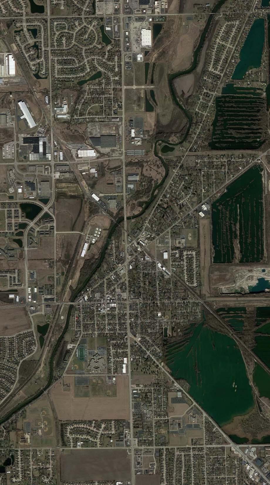
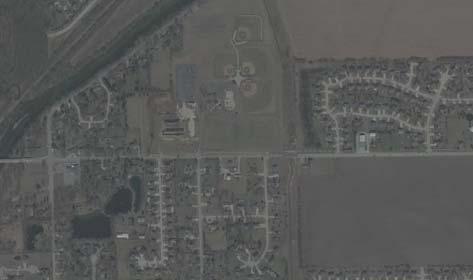

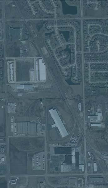

72 1001 Warrenville Road I Suite 350 I Lisle, IL I
Traffic Impact Study Speedway Gas Station Redevelopment
 Traffic Impact Study Speedway Gas Station Redevelopment Warrenville, Illinois Prepared For: Prepared By: April 11, 2018 Table of Contents 1. Introduction... 1 2. Existing Conditions... 4 Site Location...
King Soopers #116 Thornton, Colorado
 Traffic Impact Study King Soopers #116 Thornton, Colorado Prepared for: Galloway & Company, Inc. T R A F F I C I M P A C T S T U D Y King Soopers #116 Thornton, Colorado Prepared for Galloway & Company
Traffic Impact Analysis West Street Garden Plots Improvements and DuPage River Park Garden Plots Development Naperville, Illinois
 Traffic Impact Analysis West Street Garden Plots Improvements and DuPage River Park Garden Plots Development Naperville, Illinois Submitted by April 9, 2009 Introduction Kenig, Lindgren, O Hara, Aboona,
APPENDIX C1 TRAFFIC ANALYSIS DESIGN YEAR TRAFFIC ANALYSIS
 APPENDIX C1 TRAFFIC ANALYSIS DESIGN YEAR TRAFFIC ANALYSIS DESIGN YEAR TRAFFIC ANALYSIS February 2018 Highway & Bridge Project PIN 6754.12 Route 13 Connector Road Chemung County February 2018 Appendix
TRAFFIC IMPACT ANALYSIS
 TRAFFIC IMPACT ANALYSIS Emerald Isle Commercial Development Prepared by SEPI Engineering & Construction Prepared for Ark Consulting Group, PLLC March 2016 I. Executive Summary A. Site Location The Emerald
Section 5.0 Traffic Information
 Section 5.0 Traffic Information 10.0 TRANSPORTATION MDM Transportation Consultants, Inc. (MDM) has prepared an evaluation of transportation impacts for the proposed evaluation for the expansion of the
Date: February 7, 2017 John Doyle, Z-Best Products Robert Del Rio. T.E. Z-Best Traffic Operations and Site Access Analysis
 Memorandum Date: February 7, 07 To: From: Subject: John Doyle, Z-Best Products Robert Del Rio. T.E. Z-Best Traffic Operations and Site Access Analysis Introduction Hexagon Transportation Consultants, Inc.
LAWRENCE TRANSIT CENTER LOCATION ANALYSIS 9 TH STREET & ROCKLEDGE ROAD / 21 ST STREET & IOWA STREET LAWRENCE, KANSAS
 LAWRENCE TRANSIT CENTER LOCATION ANALYSIS 9 TH STREET & ROCKLEDGE ROAD / 21 ST STREET & IOWA STREET LAWRENCE, KANSAS TRAFFIC IMPACT STUDY FEBRUARY 214 OA Project No. 213-542 TABLE OF CONTENTS 1. INTRODUCTION...
Traffic Impact Analysis. Alliance Cole Avenue Residential Site Dallas, Texas. Kimley-Horn and Associates, Inc. Dallas, Texas.
 Traffic Impact Analysis Alliance Cole Avenue Residential Site Dallas, Texas February 15, 2018 Kimley-Horn and Associates, Inc. Dallas, Texas Project #064524900 Registered Firm F-928 Traffic Impact Analysis
West Hills Shopping Centre Lowe s Expansion Traffic Impact Study
 West Hills Shopping Centre Lowe s Expansion Traffic Impact Study Prepared for: Armel Corporation January 2015 Paradigm Transportation Solutions Ltd. 22 King Street South, Suite 300 Waterloo ON N2J 1N8
TRAFFIC IMPACT STUDY. USD #497 Warehouse and Bus Site
 TRAFFIC IMPACT STUDY for USD #497 Warehouse and Bus Site Prepared by: Jason Hoskinson, PE, PTOE BG Project No. 16-12L July 8, 216 145 Wakarusa Drive Lawrence, Kansas 6649 T: 785.749.4474 F: 785.749.734
EXECUTIVE SUMMARY. The following is an outline of the traffic analysis performed by Hales Engineering for the traffic conditions of this project.
 EXECUTIVE SUMMARY This study addresses the traffic impacts associated with the proposed Shopko redevelopment located in Sugarhouse, Utah. The Shopko redevelopment project is located between 1300 East and
APPENDIX E. Traffic Analysis Report
 APPENDIX E Traffic Analysis Report THIS PAGE INTENTIONALLY BLANK EAGLE RIVER TRAFFIC MITIGATION PHASE I OLD GLENN HIGHWAY/EAGLE RIVER ROAD INTERSECTION IMPROVEMENTS TRAFFIC ANALYSIS Eagle River, Alaska
MINERVA PARK SITE TRAFFIC IMPACT STUDY M/I HOMES. September 2, 2015
 5500 New Albany Road Columbus, Ohio 43054 Phone: 614.775.4500 Fax: 614.775.4800 Toll Free: 1-888-775-EMHT emht.com 2015-1008 MINERVA PARK SITE TRAFFIC IMPACT STUDY M/I HOMES September 2, 2015 Engineers
Bennett Pit. Traffic Impact Study. J&T Consulting, Inc. Weld County, Colorado. March 3, 2017
 Bennett Pit Traffic Impact Study J&T Consulting, Inc. Weld County, Colorado March 3, 217 Prepared By: Sustainable Traffic Solutions, Inc. http://www.sustainabletrafficsolutions.com/ Joseph L. Henderson,
Traffic Engineering Study
 Traffic Engineering Study Bellaire Boulevard Prepared For: International Management District Technical Services, Inc. Texas Registered Engineering Firm F-3580 November 2009 Executive Summary has been requested
Clean Harbors Canada, Inc.
 Clean Harbors Canada, Inc. Proposed Lambton Landfill Expansion Environmental Assessment Terms of Reference Transportation Assessment St. Clair Township, Ontario September 2009 itrans Consulting Inc. 260
Craig Scheffler, P.E., PTOE HNTB North Carolina, P.C. HNTB Project File: Subject
 TECHNICAL MEMORANDUM To Kumar Neppalli Traffic Engineering Manager Town of Chapel Hill From Craig Scheffler, P.E., PTOE HNTB North Carolina, P.C. Cc HNTB Project File: 38435 Subject Obey Creek TIS 2022
Volume 1 Traffic Impact Analysis Turtle Creek Boulevard Dallas, Texas. Kimley-Horn and Associates, Inc. Dallas, Texas.
 Volume 1 Traffic Impact Analysis 2727 Dallas, Texas June 18, 2018 Kimley-Horn and Associates, Inc. Dallas, Texas Project #064523000 Registered Firm F-928 Traffic Impact Analysis 2727 Dallas, Texas Prepared
Proposed location of Camp Parkway Commerce Center. Vicinity map of Camp Parkway Commerce Center Southampton County, VA
 Proposed location of Camp Parkway Commerce Center Vicinity map of Camp Parkway Commerce Center Southampton County, VA Camp Parkway Commerce Center is a proposed distribution and industrial center to be
King County Metro. Columbia Street Transit Priority Improvements Alternative Analysis. Downtown Southend Transit Study. May 2014.
 King County Metro Columbia Street Transit Priority Improvements Alternative Analysis Downtown Southend Transit Study May 2014 Parametrix Table of Contents Introduction... 1 Methodology... 1 Study Area...
CHAPTER 9: VEHICULAR ACCESS CONTROL Introduction and Goals Administration Standards
 9.00 Introduction and Goals 9.01 Administration 9.02 Standards 9.1 9.00 INTRODUCTION AND GOALS City streets serve two purposes that are often in conflict moving traffic and accessing property. The higher
2.0 Development Driveways. Movin Out June 2017
 Movin Out June 2017 1.0 Introduction The proposed Movin Out development is a mixed use development in the northeast quadrant of the intersection of West Broadway and Fayette Avenue in the City of Madison.
TIMBERVINE TRANSPORTATION IMPACT STUDY FORT COLLINS, COLORADO JANUARY Prepared for:
 TIMBERVINE TRANSPORTATION IMPACT STUDY FORT COLLINS, COLORADO JANUARY 2014 Prepared for: Hartford Companies 1218 W. Ash Street Suite A Windsor, Co 80550 Prepared by: DELICH ASSOCIATES 2272 Glen Haven Drive
Traffic Impact Study for Proposed Olive Boulevard Development
 Traffic Impact Study for Proposed 11330 Olive Boulevard Development Creve Coeur, Missouri July 7, 2017 Prepared For: 11330 Olive Boulevard Development 11330 Olive Boulevard Creve Coeur, Missouri 63141
Appendix H TRAFFIC IMPACT ANALYSIS
 Appendix H TRAFFIC IMPACT ANALYSIS Teichert Boca Quarry Expansion Traffic Impact Analysis Prepared for Teichert Aggregates Prepared by TRANSPORTATION CONSULTANTS, INC. LSC Transportation Consultants, Inc.
Transportation & Traffic Engineering
 Transportation & Traffic Engineering 1) Project Description This report presents a summary of findings for a Traffic Impact Analysis (TIA) performed by A+ Engineering, Inc. for the Hill Country Family
Table of Contents INTRODUCTION... 3 PROJECT STUDY AREA Figure 1 Vicinity Map Study Area... 4 EXISTING CONDITIONS... 5 TRAFFIC OPERATIONS...
 Crosshaven Drive Corridor Study City of Vestavia Hills, Alabama Table of Contents INTRODUCTION... 3 PROJECT STUDY AREA... 3 Figure 1 Vicinity Map Study Area... 4 EXISTING CONDITIONS... 5 TRAFFIC OPERATIONS...
BARRHAVEN FELLOWSHIP CRC 3058 JOCKVALE ROAD OTTAWA, ONTARIO TRANSPORTATION BRIEF. Prepared for:
 BARRHAVEN FELLOWSHIP CRC 3058 JOCKVALE ROAD OTTAWA, ONTARIO TRANSPORTATION BRIEF Prepared for: Barrhaven Fellowship CRC 3058 Jockvale Road Ottawa, ON K2J 2W7 December 7, 2016 116-649 Report_1.doc D. J.
Alpine Highway to North County Boulevard Connector Study
 Alpine Highway to North County Boulevard Connector Study prepared by Avenue Consultants March 16, 2017 North County Boulevard Connector Study March 16, 2017 Table of Contents 1 Summary of Findings... 1
TRAFFIC IMPACT STUDY DERRY GREEN CORPORATE BUSINESS PARK MILTON SECONDARY PLAN MODIFICATION
 TRAFFIC IMPACT STUDY DERRY GREEN CORPORATE BUSINESS PARK MILTON SECONDARY PLAN MODIFICATION TRAFFIC IMPACT STUDY DERRY GREEN CORPORATE BUSINESS PARK MILTON SECONDARY PLAN MODIFICATION DECEMBER 24 UPDATED
MILLERSVILLE PARK TRAFFIC IMPACT ANALYSIS ANNE ARUNDEL COUNTY, MARYLAND
 MILLERSVILLE PARK TRAFFIC IMPACT ANALYSIS ANNE ARUNDEL COUNTY, MARYLAND Prepared for: Department of Public Works Anne Arundel County Prepared by: URS Corporation 4 North Park Drive, Suite 3 Hunt Valley,
The major roadways in the study area are State Route 166 and State Route 33, which are shown on Figure 1-1 and described below:
 3.5 TRAFFIC AND CIRCULATION 3.5.1 Existing Conditions 3.5.1.1 Street Network DRAFT ENVIRONMENTAL IMPACT REPORT The major roadways in the study area are State Route 166 and State Route 33, which are shown
TRAFFIC IMPACT STUDY FOR SONIC DRIVE-IN RESTAURANT. Vallejo, CA. Prepared For:
 TRAFFIC IMPACT STUDY FOR SONIC DRIVE-IN RESTAURANT Vallejo, CA Prepared For: ELITE DRIVE-INS, INC. 2190 Meridian Park Blvd, Suite G Concord, CA 94520 Prepared By: KD Anderson & Associates 3853 Taylor Road,
Traffic Feasibility Study
 Traffic Feasibility Study Town Center South Robbinsville Township, Mercer County, New Jersey December 19, 2017 Prepared For Robbinsville Township Department of Community Development 2298 Route 33 Robbinsville,
HUMC/Mountainside Hospital Redevelopment Plan
 Traffic and Parking Analysis HUMC/Mountainside Hospital Redevelopment Plan in Glen Ridge Borough and Montclair Township PREPARED FOR H2M 119 Cherry Hill Road, Suite 110 Parsippany, NJ 07054 862.207.5900
Proposed CVS/pharmacy
 Traffic Impact and Access Study Proposed CVS/pharmacy West Main Street (Route 1) at Hull Street Clinton, Connecticut PREPARED FOR Arista Development LLC 520 Providence Highway, Suite 9 Norwood, Massachusetts
Trafalgar Road & Lower Base Line Transportation Study Ontario Inc.
 Trafalgar Road & Lower Base Line Transportation Study 1255723 Ontario Inc. Trafalgar Road & Lower Base Line Transportation Study 1255723 Ontario Inc. 1465 Pickering Parkway Suite 200 Pickering ON L1V 7G7
L1TILE BEARS DAY CARE TRANSPORTATION IMPACT STUDY FORT COLLINS, COLORADO MAY Prepared for:
 L1TILE BEARS DAY CARE TRANSPORTATION IMPACT STUDY FORT COLLINS, COLORADO MAY 2012 Prepared for: Hillside Construction, Inc. 216 Hemlock Street, Suite B Fort Collins, CO 80534 Prepared by: DELICH ASSOCIATES
Submittal Document II.G. D-bar-A Project, Traffic Impact Study, prepared by Bergmman Associates, dated November 3, 2015 ( Traffic Study )
") Submittal Document II.G. D-bar-A Project, Traffic Impact Study, prepared by Bergmman Associates, dated November 3, 2015 ( Traffic Study ) D-bar-A Project Traffic Impact Study November 3 rd, 2015 1427
Submittal Document II.G. D-bar-A Project, Traffic Impact Study, prepared by Bergmman Associates, dated November 3, 2015 ( Traffic Study ) D-bar-A Project Traffic Impact Study November 3 rd, 2015 1427
THE CORNERSTONE APARTMENTS TRAFFIC IMPACT STUDY R&M PROJECT NO
 THE CORNERSTONE APARTMENTS SITUATED AT N/E/C OF STAUDERMAN AVENUE AND FOREST AVENUE VILLAGE OF LYNBROOK NASSAU COUNTY, NEW YORK TRAFFIC IMPACT STUDY R&M PROJECT NO. 2018-089 September 2018 50 Elm Street,
TRAFFIC DATA. Existing Derousse Ave./River Rd. AM LOS Analysis Existing Derousse Ave./River Rd. PM LOS Analysis
 Appendix E NJ TRANSIT Pennsauken Junction Transit Center and Park & Ride RiverLINE and Atlantic City Line Pennsauken Township, Camden County, New Jersey TRAFFIC DATA Background Traffic Information for
RICHMOND OAKS HEALTH CENTRE 6265 PERTH STREET OTTAWA, ONTARIO TRANSPORTATION BRIEF. Prepared for: Guycoki (Eastern) Limited.
 Limited.") RICHMOND OAKS HEALTH CENTRE 6265 PERTH STREET OTTAWA, ONTARIO TRANSPORTATION BRIEF Prepared for: Guycoki (Eastern) Limited June 16, 2016 116-638 Brief_1.doc D. J. Halpenny & Associates Ltd. Consulting
RICHMOND OAKS HEALTH CENTRE 6265 PERTH STREET OTTAWA, ONTARIO TRANSPORTATION BRIEF Prepared for: Guycoki (Eastern) Limited June 16, 2016 116-638 Brief_1.doc D. J. Halpenny & Associates Ltd. Consulting
DEVELOPMENT PROPERTY 1627 MAXIME STREET CITY OF OTTAWA TRANSPORTATION OVERVIEW. Prepared for: Subhas Bhargava. July 9, Overview_1.
 DEVELOPMENT PROPERTY 1627 MAXIME STREET CITY OF OTTAWA TRANSPORTATION OVERVIEW Prepared for: Subhas Bhargava July 9, 2015 115-620 Overview_1.doc D. J. Halpenny & Associates Ltd. Consulting Transportation
TALMONT TOWNHOMES MADISON KENNETH SPA TRAFFIC IMPACT STUDY. Sacramento, CA. Prepared For: MBK Homes. Prepared By:
 TALMONT TOWNHOMES MADISON KENNETH SPA TRAFFIC IMPACT STUDY Sacramento, CA Prepared For: MBK Homes Prepared By: KD Anderson & Associates 3853 Taylor Road, Suite G Loomis, California 95650 (916) 660-1555
Traffic Impact Analysis Update
 Willow Bend Traffic Impact Analysis Update TABLE OF CONTENTS Page I. INTRODUCTION -------------------------------------------------------------------------------------------- 1 II. EXISTING CONDITIONS
MERIVALE PRIORITY SQUARE 2852 MERIVALE ROAD CITY OF OTTAWA TRANSPORTATION BRIEF. Prepared for: ONT Inc. 25 Winding Way Nepean, Ontario K2C 3H1
 MERIVALE PRIORITY SQUARE 2852 MERIVALE ROAD CITY OF OTTAWA TRANSPORTATION BRIEF Prepared for: 2190986ONT Inc. 25 Winding Way Nepean, Ontario K2C 3H1 October 6, 2010 110-502 Report_1.doc D. J. Halpenny
TABLE OF CONTENTS 1.0 INTRODUCTION AND SUMMARY Purpose of Report and Study Objectives... 2
 TABLE OF CONTENTS 1.0 INTRODUCTION AND SUMMARY 1 1.1 Purpose of Report and Study Objectives... 2 1.2 Executive Summary... 3 1.2.1 Site Location and Study Area... 3 1.2.2 Development Description... 3 1.2.3
105 Toronto Street South, Markdale Transportation Impact Study. Paradigm Transportation Solutions Limited
 105 Toronto Street South, Markdale Transportation Impact Study Paradigm Transportation Solutions Limited December 2016 Project Summary Project Number 162060 December 2016 Client Zelinka Priamo Ltd 318
Traffic Impact Study for the proposed. Town of Allegany, New York. August Project No Prepared For:
 Appendix B SRF Traffic Study (Revised November 2005) Draft Environmental Impact Statement University Commons Town of Allegany, Cattaraugus County, NY December 2005 Traffic Impact Study for the proposed
The key roadways in the project vicinity are described below. Exhibit displays the existing number of lanes on the study roadways.
 4.2 TRAFFIC AND CIRCULATION This section presents the key assumptions, methods, and results of analysis for the transportation and circulation impacts of the proposed project. This section is based on
Appendix J Traffic Impact Study
 MRI May 2012 Appendix J Traffic Impact Study Level 2 Traffic Assessment Limited Impact Review Appendix J [This page was left blank intentionally.] www.sgm-inc.com Figure 1. Site Driveway and Trail Crossing
Appendix C-5: Proposed Refinements Rail Operations and Maintenance Facility (ROMF) Traffic Impact Analysis. Durham-Orange Light Rail Transit Project
 Traffic Impact Analysis. Durham-Orange Light Rail Transit Project") Appendix C-5: Proposed Refinements Rail Operations and Maintenance Facility (ROMF) Traffic Impact Analysis Durham-Orange Light Rail Transit Project July 25, 218 ROMF Transportation Impact Analysis Version
Appendix C-5: Proposed Refinements Rail Operations and Maintenance Facility (ROMF) Traffic Impact Analysis Durham-Orange Light Rail Transit Project July 25, 218 ROMF Transportation Impact Analysis Version
830 Main Street Halifax Regional Municipality
 830 Main Street Halifax Regional Municipality Traffic Impact Statement Final Report Prepared by: GRIFFIN transportation group inc. 30 Bonny View Drive Fall River, NS B2T 1R2 www.griffininc.ca Prepared
V. DEVELOPMENT OF CONCEPTS
 Martin Luther King, Jr. Drive Extension FINAL Feasibility Study Page 9 V. DEVELOPMENT OF CONCEPTS Throughout the study process several alternative alignments were developed and eliminated. Initial discussion
Oakbrook Village Plaza City of Laguna Hills
 Oakbrook Village Plaza City of Laguna Hills Traffic Impact Analysis Prepared by: HDR Engineering 3230 El Camino Real, Suite 200 Irvine, CA 92602 October 2012 Revision 3 D-1 Oakbrook Village Plaza Laguna
GASOLINE SERVICE STATION 1618, 1622 ROGER STEVENS DRIVE OTTAWA, ONTARIO TRANSPORTATION IMPACT ASSESSMENT. Prepared for:
 GASOLINE SERVICE STATION 1618, 1622 ROGER STEVENS DRIVE OTTAWA, ONTARIO TRANSPORTATION IMPACT ASSESSMENT Prepared for: Invecta Development (Ottawa) Corporation 758 Shanks Height Milton, ON L9T 7P7 May
Appendix Q Traffic Study
 Appendices Appendix Q Traffic Study Crummer Site Subdivision Draft EIR City of Malibu Appendices This page intentionally left blank. The Planning Center April 2013 TRAFFIC IMPACT ANALYSIS Photo z here
Escondido Marriott Hotel and Mixed-Use Condominium Project TRAFFIC IMPACT ANALYSIS REPORT
 Escondido Marriott Hotel and Mixed-Use Condominium Project TRAFFIC IMPACT ANALYSIS REPORT Prepared for Phelps Program Management 420 Sixth Avenue, Greeley, CO 80632 Prepared by 5050 Avenida Encinas, Suite
APPENDIX B Traffic Analysis
 APPENDIX B Traffic Analysis Rim of the World Unified School District Reconfiguration Prepared for: Rim of the World School District 27315 North Bay Road, Blue Jay, CA 92317 Prepared by: 400 Oceangate,
TRAFFIC IMPACT ANALYSIS RIZZO CONFERENCE CENTER EXPANSION FINAL REPORT
 TRAFFIC IMPACT ANALYSIS RIZZO CONFERENCE CENTER EXPANSION Chapel Hill, North Carolina FINAL REPORT Prepared for: The Town of Chapel Hill, NC Prepared by: Architects-Engineers-Planners, Inc. December 2010
MONTEREY BAY AQUARIUM RESEARCH INSTITUTE (MBARI) MASTER PLAN UPDATE MOSS LANDING, CALIFORNIA
 MASTER PLAN UPDATE MOSS LANDING, CALIFORNIA") MONTEREY BAY AQUARIUM RESEARCH INSTITUTE (MBARI) MASTER PLAN UPDATE MOSS LANDING, CALIFORNIA TRAFFIC IMPACT ANALYSIS Administrative Draft Report Prepared For Monterey Bay Aquarium Research Institute Moss
MONTEREY BAY AQUARIUM RESEARCH INSTITUTE (MBARI) MASTER PLAN UPDATE MOSS LANDING, CALIFORNIA TRAFFIC IMPACT ANALYSIS Administrative Draft Report Prepared For Monterey Bay Aquarium Research Institute Moss
MEMO VIA . Ms. Amy Roth DPS Director, City of Three Rivers. To:
 MEMO To: Ms. Amy Roth DPS Director, City of Three Rivers VIA EMAIL From: Michael J. Labadie, PE Julie M. Kroll, PE, PTOE Brandon Hayes, PE, P.Eng. Fleis & VandenBrink Date: January 5, 2017 Re: Proposed
Traffic Impact Analysis 5742 BEACH BOULEVARD MIXED USE PROJECT
 Traffic Impact Analysis 5742 BEACH BOULEVARD MIXED USE PROJECT CITY OF BUENA PARK Prepared by Project No. 14139 000 April 17 th, 2015 DKS Associates Jeffrey Heald, P.E. Rohit Itadkar, T.E. 2677 North Main
Proposed Inn at Bellefield Traffic Impact Assessment
 Proposed Inn at Bellefield Traffic Impact Assessment Town of Hyde Park Dutchess County, New York Prepared for: T-Rex Hyde Park Owner LLC 500 Mamroneck Avenue, Suite 300 Harrison, NY 10528 June 21, 2017
Prepared For: Toronto Transit Commission 1138 Bathurst Street Toronto, Ontario M5R 3H2. Prepared By:
 TRAFFIC IMPACT STUDY FOR THE TTC MCNICOLL BUS GARAGE CITY OF TORONTO Prepared For: Toronto Transit Commission 1138 Bathurst Street Toronto, Ontario M5R 3H2 Prepared By: Canada Inc. 4th Floor, 3 Leek Crescent
Proposed Commercial Service at Paine Field Traffic Impact Analysis
 Gibson Traffic Consultants 80 Wetmore Avenue Suite 0 Everett, WA 980.9.86 Prepared for: Federal Aviation Administration July 0 GTC #09-07 TABLE OF CONTENTS. EXECUTIVE SUMMARY.... PROJECT IDENTIFICATION....
Traffic Impact Study Proposed Residential Development (Watson Parkway North - Starwood Drive Node, City of Guelph)
") Traffic Impact Study Proposed Residential Development (Watson Parkway North - Starwood Drive Node, City of Guelph) Prepared By: 332 Lorne Avenue East Stratford ON N5A 6S4 Prepared for: Paul Kemper, President
Traffic Impact Study Proposed Residential Development (Watson Parkway North - Starwood Drive Node, City of Guelph) Prepared By: 332 Lorne Avenue East Stratford ON N5A 6S4 Prepared for: Paul Kemper, President
1354 Carling Avenue. Community Transportation Study/ Transportation Impact Study
 354 Carling Avenue Community Transportation Study/ Transportation Impact Study prepared for: Holloway Lodging Corporation 69 Quinpool Road, th Floor Halifax, NS B3K 5J7 prepared by: 223 Michael Street
Traffic Impact Statement (TIS)
") Traffic Impact Statement (TIS) Vincentian PUDA Collier County, FL 10/18/2013 Prepared for: Global Properties of Naples Prepared by: Trebilcock Consulting Solutions, PA 2614 Tamiami Trail N, Suite 615 1205
Traffic Impact Statement (TIS) Vincentian PUDA Collier County, FL 10/18/2013 Prepared for: Global Properties of Naples Prepared by: Trebilcock Consulting Solutions, PA 2614 Tamiami Trail N, Suite 615 1205
D & B COMMERCIAL TRAFFIC IMPACT ANALYSIS
 D & B COMMERCIAL TRAFFIC IMPACT ANALYSIS TABLE OF CONTENTS I. Introduction...3 II. Project Description...3 III. Existing Conditions...3 IV. Future Traffic Conditions...8 V. Conclusions and Mitigation...14
TRAFFIC PARKING ANALYSIS
 TRAFFIC PARKING ANALYSIS NAPA FLEA MARKET COUNTY OF NAPA Prepared for: Tom Harding Napa-Vallejo Flea Market 33 Kelly Road American Canyon, CA 9453 Prepared by: 166 Olympic Boulevard, Suite 21 Walnut Creek,
April 7, Mr. Blake Shutler Compass Homes Development LLC Summit Homes Construction, LLC PO Box 6539 Dillon, CO 80435
 Compass Homes Development LLC Summit Homes Construction, LLC PO Box 6539 Dillon, CO 80435 Re: Trip Generation Comparison West Hills Townhomes Keystone, Colorado FHU Reference No. 116388-01 Dear Mr. Shutler:
Subarea Study. Manning Avenue (CSAH 15) Corridor Management and Safety Improvement Project. Final Version 1. Washington County.
 Corridor Management and Safety Improvement Project. Final Version 1. Washington County.") Subarea Study Manning Avenue (CSAH 15) Corridor Management and Safety Improvement Project Final Version 1 Washington County June 12, 214 SRF No. 138141 Table of Contents Introduction... 1 Forecast Methodology
Subarea Study Manning Avenue (CSAH 15) Corridor Management and Safety Improvement Project Final Version 1 Washington County June 12, 214 SRF No. 138141 Table of Contents Introduction... 1 Forecast Methodology
Quantitative analyses of weekday a.m. and p.m. commuter hour conditions have been conducted for the following five scenarios:
 6.1 TRANSPORTATION AND CIRCULATION 6.1.1 INTRODUCTION This section of the EIR presents the results of TJKM s traffic impact analysis of the proposed Greenbriar Development. The analysis includes consideration
TRANSPORTATION STUDY FOR THE 8899 BEVERLY BOULEVARD PROJECT
 DRAFT TRANSPORTATION STUDY FOR THE 8899 BEVERLY BOULEVARD PROJECT WEST HOLLYWOOD, CALIFORNIA NOVEMBER 2013 PREPARED FOR BEVERLY BOULEVARD ASSOCIATION PREPARED BY DRAFT TRANSPORTATION STUDY FOR THE 8899
TRAFFIC IMPACT ANALYSIS FOR. McDONALD S RESTAURANT IN CARMICAEL Sacramento County, CA. Prepared For:
 TRAFFIC IMPACT ANALYSIS FOR McDONALD S RESTAURANT IN CARMICAEL Sacramento County, CA Prepared For: McDonald s USA, LLC Pacific Sierra Region 2999 Oak Road, Suite 900 Walnut Creek, CA 94597 Prepared By:
ENGINE COMPANY 42. Traffic Study. Chicago, Illinois. March 2018 FRIEDMAN PROPERTIES. Prepared for:
 ENGINE COMPANY 42 Traffic Study Chicago, Illinois March 2018 Prepared for: FRIEDMAN PROPERTIES INTRODUCTION Kimley-Horn and Associates, Inc. (Kimley-Horn) was retained by Friedman Properties to perform
Construction Realty Co.
 MEMORANDUM TO: FROM : Jeff Pickus Construction Realty Co. Luay R. Aboona, PE Principal 9575 West Higgins Road, Suite 400 Rosemont, Illinois 60018 p: 847-518-9990 f: 847-518-9987 DATE: May 22, 2014 SUBJECT:
Planned Development Application 1450 Sherman Avenue Evanston, IL TRAFFIC CIRCULATION IMPACT STUDY
 Planned Development Application 1450 Sherman Avenue Evanston, IL 60201 14 TRAFFIC CIRCULATION IMPACT STUDY Traffic Impact Study 1454 Sherman Mixed-Use Development Evanston, Illinois Prepared for Prepared
BERKELEY DOWNTOWN AREA PLAN PROGRAM ENVIRONMENTAL IMPACT REPORT TRAFFIC IMPACT ANALYSIS
 BERKELEY DOWNTOWN AREA PLAN PROGRAM ENVIRONMENTAL IMPACT REPORT TRAFFIC IMPACT ANALYSIS Prepared for: City of Berkeley Prepared by: REVISED JANUARY 9, 2009 Berkeley Downtown Area Plan Program EIR Traffic
County State Aid Highway 32 (Cliff Road) and Dodd Road Intersection Study
 and Dodd Road Intersection Study") County State Aid Highway 32 (Cliff Road) and Dodd Road Intersection Study City of Eagan, Dakota County, Minnesota Date: March 2012 Project No. 14957.000 444 Cedar Street, Suite 1500 Saint Paul, MN 55101
County State Aid Highway 32 (Cliff Road) and Dodd Road Intersection Study City of Eagan, Dakota County, Minnesota Date: March 2012 Project No. 14957.000 444 Cedar Street, Suite 1500 Saint Paul, MN 55101
2. Valley Circle Boulevard/Andora Avenue/Baden Avenue and Lassen Street
 IV.J TRANSPORTATION 1. INTRODUCTION This section presents an overview of the existing traffic and circulation system in and surrounding the project site. This section also discusses the potential impacts
TRAFFIC SIGNAL DESIGN REPORT KING OF PRUSSIA ROAD & RAIDER ROAD RADNOR TOWNSHIP PENNSYLVANIA
 TRAFFIC SIGNAL DESIGN REPORT KING OF PRUSSIA ROAD & RAIDER ROAD RADNOR TOWNSHIP PENNSYLVANIA PREPARED FOR: UNIVERSITY OF PENNSYLVANIA HEALTH SYSTEM 34 CIVIC CENTER BOULEVARD PHILADELPHIA, PA 1987 (61)
Proposed Hotel and Restaurant Development
 Traffic Impact Study Proposed Hotel and Restaurant Development Marbledale Road Tuckahoe, NY PREPARED FOR BILLWIN DEVELOPMENT AFFILIATES, LLC 365 WHITE PLAINS ROAD EASTCHESTER, NY. 10709 PREPARED BY Engineering
Appendix 5. Haymeadow Interim Traffic Analysis
 Appendix 5 Haymeadow Interim Traffic Analysis 20 MEMORANDUM To: From: Rick Pylman Gary Brooks Bill Fox Date: September 15, 2016 Project: Subject: Haymeadow Evaluation of interim access configuration Currently
Table of Contents. Traffic Impact Analysis Capital One Building at Schilling Place
 Traffic Impact Analysis Capital One Building at Schilling Place Table of Contents Executive Summary... 1 1. Introduction... 4 2. Project Description... 4 3. Background Information... 4 4. Study Scope...
TRAFFIC IMPACT ANALYSIS SHORTBREAD LOFTS 2009 MODIFICATION Chapel Hill, North Carolina
 TRAFFIC IMPACT ANALYSIS SHORTBREAD LOFTS 2009 MODIFICATION Chapel Hill, North Carolina Prepared for: The Town of Chapel Hill, NC Prepared by: Architects-Engineers-Planners, Inc. November 2009 Traffic Impact
Traffic Impact Study. Chicago, Illinois. May 2017 RETAIL UPPER N COLUMBUS US DRIVE. Parcel O, LLC. Prepared for: EXISTING SIDEWALK EXISTING PLA
 0F 0E LAKESHORE EAST PARCEL O Traffic Impact Study EXISTING SIDEWALK EXISTING PLA Chicago, Illinois May 2017 NEW PLANTER NEW PLANTERS Prepared for: Parcel O, LLC UPPER N COLUMBUS US DRIVE RETAIL NEW PLANTERS
LCPS Valley Service Center
 Traffic Impact Study LCPS Valley Service Center Loudoun County, Virginia November 4, 2015 Prepared For: Loudoun County Public Schools 21000 Education Court Ashburn, VA 20148 Prepared by: 1140 Connecticut
Shirk Road at State Route 198 Interchange Analysis Tulare County, California
 Shirk Road at State Route 198 Interchange Analysis Tulare County, California DRAFT REPORT Prepared By Tulare County Association of Governments (TCAG) April 2013 Table of Contents Introduction:... 3 Project
Craigieburn Employment Precinct North and English Street
 Craigieburn Employment Precinct North and English Street METROPOLITAN PLANNING AUTHORITY Intersection Analyses 7 February 2014 Intersection Analyses Craigieburn Employment Precinct North and English Street
Vanier Parkway and Presland Road Residential Development Transportation Impact Study
 Vanier Parkway and Presland Road Residential Development Transportation Impact Study Final Report (Revised) March 2011 Submitted to: Groupe Lépine Ottawa Project No. 09-1613 Submitted by: Groupe Lépine
Re: Addendum No. 4 Transportation Overview 146 Mountshannon Drive Ottawa, Ontario
 April 18 th, 2017 Mr. Kevin Yemm Vice President, Land Development Richraft Group of Companies 2280 St. Laurent Boulevard, Suite 201 Ottawa, Ontario (Tel: 613.739.7111 / e-mail: keviny@richcraft.com) Re:
One Harbor Point Residential
 Residential Gig Harbor, WA Transportation Impact Analysis January 23, 2017 Prepared for: Neil Walter Company PO Box 2181 Tacoma, WA 98401 Prepared by: TENW Transportation Engineering NorthWest 11400 SE
RE: A Traffic Impact Statement for a proposed development on Quinpool Road
 James J. Copeland, P.Eng. GRIFFIN transportation group inc. 30 Bonny View Drive Fall River, NS B2T 1R2 May 31, 2018 Ellen O Hara, P.Eng. Project Engineer DesignPoint Engineering & Surveying Ltd. 200 Waterfront
MEMORANDUM. Figure 1. Roundabout Interchange under Alternative D
 MEMORANDUM Date: To: Liz Diamond, Dokken Engineering From: Subject: Dave Stanek, Fehr & Peers Western Placerville Interchanges 2045 Analysis RS08-2639 Fehr & Peers has completed a transportation analysis
TRANSPORTATION TECHNICAL REPORT
 TRANSPORTATION TECHNICAL REPORT for Sunrise Elementary School Replacement PREPARED FOR: Puyallup School District PREPARED BY: 6544 NE 61 st Street, Seattle, WA 98115 ph: (26) 523-3939 fx: (26) 523-4949
Interstate Operations Study: Fargo-Moorhead Metropolitan Area Simulation Output
 NDSU Dept #2880 PO Box 6050 Fargo, ND 58108-6050 Tel 701-231-8058 Fax 701-231-6265 www.ugpti.org www.atacenter.org Interstate Operations Study: Fargo-Moorhead Metropolitan Area 2015 Simulation Output Technical
County State Aid Highway 30 (Diffley Road) and Dodd Road Intersection Study
 and Dodd Road Intersection Study") County State Aid Highway 30 (Diffley Road) and Dodd Road Intersection Study City of Eagan, Dakota County, Minnesota Date: March 2012 Project No. 14957.000 444 Cedar Street, Suite 1500 Saint Paul, MN 55101
County State Aid Highway 30 (Diffley Road) and Dodd Road Intersection Study City of Eagan, Dakota County, Minnesota Date: March 2012 Project No. 14957.000 444 Cedar Street, Suite 1500 Saint Paul, MN 55101