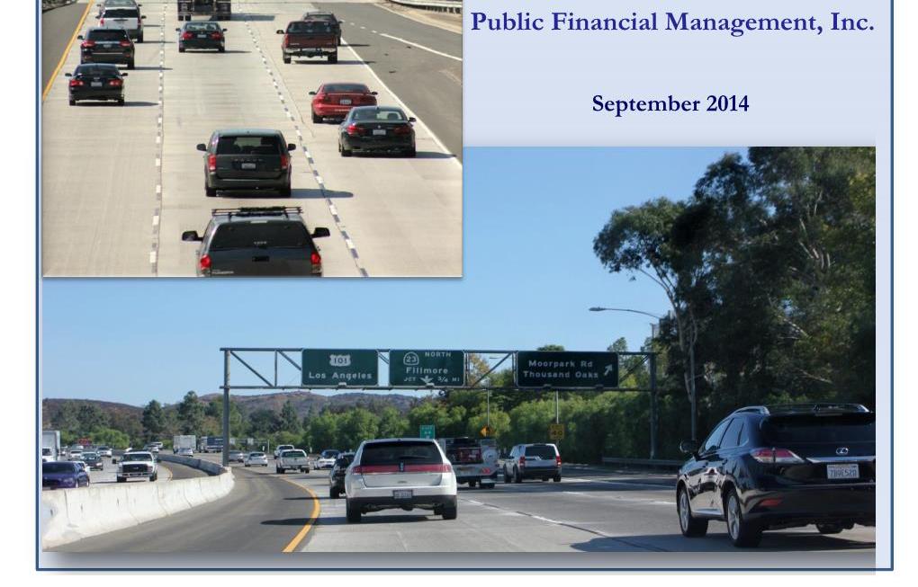
Summary Report, Ventura County US-101 HOT Lanes Preliminary Feasibility Study. Table of Contents
|
|
|
- Hector Curtis
- 5 years ago
- Views:
Transcription

1 i
2 Table of Contents Section 1 Introduction Background and Objectives Study Area Description... 2 Section 2 Proposed US-101 HOT Lanes Project Configuration General Operations Concept... 7 Section Sketch-Level Traffic and Toll Revenue Analysis Analysis Approach Forecast Methodology Revenue Estimation Assumptions Estimated Annual Gross Toll Revenue Annual Revenue by Segment for Composite Scenario Section 4 Preliminary Financial Feasibility Analysis Assumptions Findings List of Figures Figure 1.1 Project Location and Proposed HOT Lanes Limits... 2 Figure 1.2 Estimated 2012 Weekday Traffic Levels... Figure 2.1 Existing and Future Number of Lanes and Proposed Access Areas... 4,5,6 Figure 2.2 Typical Cross-Section with HOT Lanes... 7 Figure 2. Proposed Pricing Segments... 9 Figure.1 Illustration of Distribution of Value of Time and HOT Lanes Usage Figure.2 Estimated Annual Gross Toll Revenue by Segment, Composite Scenario List of Tables Table -1. Scenarios Analyzed... 1 Table -2 Comparison of Estimated Annual Tolled and Gross Toll Revenue, Toll Policy to Maximize Traffic Table - Comparison of Estimated Annual Tolled and Gross Toll Revenue, Toll Policy to Optimize Revenue Table -4 Estimated Annual Tolled and Gross Toll Revenue by Segment, Composite Scenario Table 4-1 Financing Plan for Entire US-101 HOT Lanes Project Table 4-2 Alternatives Financing Plan (Prioritized by Potential Revenue)... 22
3 Summary Report - US-101 HOT Lanes Feasibility Study 1 Introduction The Ventura County Transportation Commission (VCTC) completed its Comprehensive Transportation Plan (CTP) in August 201. Through this planning process, the US-101 Freeway was identified as a priority for improvements due to its present and forecasted congestion as well as its key role in the economic development of the County. Based on the financial evaluation in the Comprehensive Transportation Plan, with current revenues it will likely take 0 years to complete the improvements on US-101. VCTC considered the possibility of implementation of high-occupancy/toll (HOT) lanes for its potential to provide an additional mobility option for auto drivers, maximize the utility of any additional capacity, and provide an additional funding source that could help expedite the freeway improvements. As proposed, the US-101 HOT lanes would consist of one added lane in each direction, from approximately SR-2 in Thousand Oaks to the junction of the SR- Freeway in Ventura. This report summarizes the work completed under a sketch-level analysis to further develop the HOT lanes concept for the corridor and to evaluate the potential financial feasibility of the project. 1.1 Background and Objectives Due to anticipated future growth in Ventura County, increase in required automobile-based travel demand to destination in Ventura County and beyond, and to remedy current congestion along the U.S. 101 freeway corridor, VCTC, Caltrans, and Corridor Cities have collectively worked on capacity and operational improvement along this major transportation corridor. In 201, Caltrans and VCTC adopted a Project Study Report Project Development Support (PSR-PDS) that proposed one High-Occupancy Toll (HOT) lane in each direction on US-101 between Moorpark Road and SR-. This consideration was to create a revenue stream that would assist in acceleration of implementation of the project and provide funds to pay for the costs of future maintenance and operation of the facility. VCTC commissioned CDM Smith to perform a financial feasibility study for the proposed HOT lanes and identify the estimated revenues under all probable and practical scenarios/assumptions. The study was structured in two phases. Phase 1 included a sketch-level traffic and revenue analysis based on the available records from Caltrans District 7, the Southern California Association of Governments (SCAG) and other study partners and stakeholder agencies to conceptually identify potential HOT lanes alternatives, evaluate HOT lanes Concept of Operations, and develop a preliminary Concept of Operations document. Phase 2 included modeling and refinement of traffic and revenue forecast developed at sketch-level in phase 1, preliminary determination of HOT lanes concept cost and revenue, and preparation of a final report. Phase 2 was to be authorized after determination of viability of the proposed project by VCTC staff and the Board. 1
, spanning a total distance of approximately 28 miles with 25 interchanges. Within the limits of the project, the freeway passes through the cities of Thousand Oaks, Camarillo, Oxnard, and Ventura.")
4 1.2 Study Area Description The proposed HOT lanes would extend along US-101 in Ventura County between its interchanges with the SR- 2 and SR- freeways (Figure 1.1), spanning a total distance of approximately 28 miles with 25 interchanges. Within the limits of the project, the freeway passes through the cities of Thousand Oaks, Camarillo, Oxnard, and Ventura. As a major regional east-west freeway corridor, US-101 is the primary link between these cities in Ventura County to neighboring Los Angeles County and Santa Barbara County. Between SR-2 and SR-, US-101 is primarily a six-lane freeway, with auxiliary lanes between most interchanges in Thousand Oaks and selected interchanges in the other communities. Figure 1.1 Project Location and Proposed HOT Lanes Limits Traffic volumes are highest on the eastern end of the corridor, near Los Angeles County. Average daily traffic volumes in 2012 on US-101 are in the range of approximately 177,000 vehicles per day near SR- 2; 125, ,000 vehicles per day through Camarillo and Oxnard; and 75, ,000 vehicles per day through Ventura. Heavy truck traffic accounts for to 5 percent of the total traffic, indicating that this route is not a primary commercial traffic corridor but serves the communities along the freeway. Figure 1.2 shows estimated weekday traffic volumes in different segments of the study corridor along with estimated a.m. and p.m. peak hour traffic volumes. 1 1 Sources include 2012 Traffic Volumes on the California State Highway System, State of California Department of Transportation, Division of Traffic Operations, 2012 Ramp Volumes on the California State Freeway System, and the Caltrans Performance Measurement System (PeMS). 2
5 Figure 1.2 Estimated 2012 Weekday Traffic Levels Match Line A Match Line B Ojai Fwy. Exit 70B Oxnard Blvd. Exit 62B Flynn Rd. Exit 5A California St. Exit 70A E. Vineyard Ave. Exit 62A Santa Rosa Rd. Exit Vista Del Mar Dr. Exit E. Rose Ave. Exit Monmouth Way Exit Camarillo Springs Rd. Exit S. Seaward Ave Exit Rice Ave. Exit Del Norte Blvd. Exit Camarillo Thousand Oaks LEGEND XX.X Weekday Traffic Flow XX.X AM Peak Period Traffic Flow (7:00-9:00 a.m.) XX.X PM Peak Period Traffic Flow (4:00-6:00 p.m.) Bus E. Main St. Exit 66B Oxnard Wendy Dr. Exit 47B Camarillo 16.9 Central Ave. Exit Santa Paula Fwy. Telephone Rd. Exit 66A 52.4 Exit Borchard Rd. Exit 47A Springville Dr. Exit Victoria Ave. Exit Ventu Park Rd. Exit Northbank Dr. Exit Las PosasRd. Exit Lynn Rd. Exit S. Moorpark Rd. Exit Johnson Dr. Exit Carmen Dr. Exit Ventura E. Daily Dr. Exit 5B Moorpark Fwy. Exit 4B S. Rancho Rd. Exit 4A Oxnard Ventura Rd. Exit 6A Match Line A Match Line B Summary Report, Ventura County US-101 HOT Lanes Preliminary Feasibility Study
6 The main areas of traffic congestion on weekdays are primarily during the peak periods. In the morning peak period, the major direction of travel is eastbound, with congestion focused in Camarillo and Thousand Oaks. In the afternoon peak period, the major direction of travel is westbound, with congestion extending between Thousand Oaks and Oxnard. However, within Camarillo, both directions of travel experience delays during both a.m. and p.m. peak periods. 2 2 Proposed US-101 HOT Lanes 2.1 Project Configuration The US-101 HOT lanes would involve the construction of two high-occupancy/toll lanes (one per direction) in the median of US-101 between SR-2 and SR-. The typical cross-section of the freeway in this study area is currently three general purpose lanes in each direction plus a fourth auxiliary lane in several locations (primarily in Thousand Oaks). As part of project study work performed for this corridor, Caltrans recommended auxiliary lane improvements between almost every interchange in Camarillo, Oxnard, and Ventura. The existing and proposed number of lanes on US-101 within the study area is shown in Figure 2.1. Figure 2.1 Existing and Future Number of Lanes and Proposed Access Areas Ojai Fwy. Exit 70B 0.77 Mi Mi Mi. Bus S. Oak St. S. Chestnut St. Vista Del Mar Dr. Exit Thompson Blvd. 2+1 Harbor Blvd Match Line A California St. Exit 70A Monmouth Way 1.67 Mi. Bus 0.5 Mi Mi. S. Seaward Ave. Exit 68 E. Main St. Exit 66B Santa Paula Fwy. Exit 66A LEGEND Match Line A Exit Match Line B 0 0 Current Number of General Lanes + Auxiliary Lane Proposed Number of General Lanes + Auxiliary Lane HOT Lanes HOT Lane Access Zone 2 Based on observations using maps.google.com for typical weekday and specific weekdays during study period. 4
7 Figure 2.1 (continued) Existing and Future Number of Lanes and Proposed Access Areas 1.2 Mi. 1.00Mi. 0.46Mi. Telephone Rd. Exit 65 Victoria Ave. Exit 64 Northbank Dr. Johnson Dr. Exit 6B Ventura Rd. Exit 6A Match Line B Wagon Wheel Rd. Match Line C Valentine Rd. Exit 64 Ventura Oxnard 0.9 Mi Mi Mi. Oxnard Blvd. Exit 62B E. Vineyard Ave. Exit 62A Match Line C Match Line D Pacific Coast Hwy. Exit 62B 0.94 Mi Mi Mi. E. Rose Ave. Exit 61 Rice Ave. Exit 60 Del Norte Blvd. Exit 59 Central Ave. Exit 57 Match Line D Match Line E Camarillo Oxnard 0.95 Mi Mi Mi. Springville Dr. Exit 56 Las Posas Rd. Exit 55 LEGEND Match Line E Match Line F 0 0 Current Number of General Lanes + Auxiliary Lane Proposed Number of General Lanes + Auxiliary Lane HOT Lanes HOT Lane Access Zone 5
8 Figure 2.1 (continued) Existing and Future Number of Lanes and Proposed Access Areas 0.84 Mi Mi Mi. Carmen Dr. Exit 54 E. Daily Dr. Exit 5B Lewis Rd. Flynn Rd. Exit 5A Mission Oaks Blvd. Santa Rosa Rd. Exit 52 Match Line F Match Line G Ventura Blvd. Exit 54 E. Ventura Blvd. Exit 5B Village At The Park Dr. Exit 5A 1.47 Mi. 2.9 Mi Mi. Wendy Dr. Camino Dos Rios Match Line G Match Line H Old Conejo Rd. Camarillo Springs Rd. Exit 50 Camarillo Thousand Oaks Wendy Dr. Exit 47B 0.8 Mi Mi Mi. Borchard Rd. Exit 47A Ventu Park Rd. Exit 46 Lynn Rd. Exit 45 S. Moorpark Rd. Exit 44 Exit 47B Match Line G Match Line H Mi Newbury Rd. Moorpark Fwy. Exit 4B 0.12 Mi. +1 S. Rancho Rd. Exit 4A LEGEND Current Number of General Lanes + Auxiliary Lane Proposed Number of General Lanes + Auxiliary Lane Match Line G HOT Lanes HOT Lane Access Zone 6

9 The overall length of the US-101 HOT lanes project would be 28 miles. The US-101 HOT lanes would be separated from the adjacent general purpose lanes using double solid-striped pavement markings. Access to and from the HOT lanes would be provided at fixed locations, designated by a change from solid to dashed striping. A detailed design of intermediate access points will be part of later studies should VCTC decide to proceed with planning for HOT lanes. A typical cross-section of the proposed facility is shown in Figure 2.2. Figure 2.2 Typical Cross Section with HOT Lanes (Source: Modified from Caltrans Freeway Project Studies for VCTC Presentation File, presented by Caltrans, October 4, 201) For the purposes of this study, initial locations of intermediate access points to the HOT lanes were developed based on the following criteria: provide access close to major interchanges, provide access to and from each community, provide access before or after areas of congestion, and locate access points a minimum of 0.5 miles before an exit ramp or after an entrance ramp to be served by the access point. As shown in Figure 1., the study assumed a total of 10 intermediate access points in addition to the termini in Thousand Oaks and Ventura. 2.2 General Operations Concept In coordination with the Project Technical Advisory Committee, which consisted of Caltrans operations personnel; representatives from the cities of Camarillo, Ventura, Oxnard, and Thousand Oaks; and County of Ventura Public Works Agency, a general operations concept was developed for this project. The operations concept was designed to be consistent with state legislation regarding electronic toll collection equipment, operating policies on other existing projects (including the I-10 and I-110 Express Lanes projects in Los Angeles), and specific needs of this corridor. The HOT lanes feasibility analysis assumed the following operating parameters: 1. The HOT lanes would operate 24 hours per day, 7 days per week in both directions. 2. Vehicles that meet minimum eligibility requirements will be allowed toll-free use of the HOT lanes (two scenarios of minimum eligibility were tested: two occupants and three occupants).. Low-occupancy vehicles (LOV), which would include single-occupant vehicles (SOV) and other vehicles not meeting the minimum eligibility requirements (depending on the scenario), will be allowed to use the HOT lanes for a fee. 7
10 4. Demand for the HOT lanes will be managed by varying tolls at about 5-minute intervals. The tolling algorithm will be designed to increase tolls and restrict LOV access to the HOT lanes to maintain average travel speeds of 45 mph or higher (usually associated with traffic volumes of about 1,650 vehicles per hour. 5. Pricing signs will be placed in advance of each access point to inform drivers of the current price to use the HOT lanes. Signs will be placed sufficient distance away from the access point to allow drivers time and distance to make the necessary lane changes to enter the HOT lanes. The pricing signs will be variable message signs that will be updated at 5-minute intervals to show the current toll rate. The system will be designed to that the price the driver sees is the price that they will be charged, no matter how many times the prices change while the vehicle is in the HOT lanes. For goodwill purposes, should prices decrease while a vehicle is in the HOT lane, the toll system can be designed to charge the lower of the two rates. 6. A dynamic pricing sign typically shows two or three tolls, depending on the location of the entry point. The first toll shown will be the lowest toll that a trip will pay if they entered the system at that location, and the farthest destination the vehicle can travel before incurring an additional toll cost. The last toll shown is the highest toll a driver will be charged within the system, which is typically the farthest exit. The toll shown in the middle is the charge to a major intermediate destination. 7. To simplify the messaging on the sign, a segment-based toll scheme is recommended. Under this type of scheme, a vehicle will be charged based on their point of entry into a segment, which will cover their travel to the end of the segment. that enter a segment midway will pay proportionally for the distance traveled to the end of that segment. If a trip enters a second segment, it will pay for the full length trip to the end of the second segment. Due to its length, the US-101 HOT lanes project was divided into three segments for the purposes of phasing, pricing and signing. Figure 2. shows the three segments and the access points within each segment. 8. It is suggested that a minimum toll policy be set for this project. Minimum tolls are a minimum toll amount that will be charged to low-occupancy vehicles, regardless of time of day, operating condition, or distance traveled. Minimum tolls are recommended practice to ensure that operating costs and costs of collection are covered by the amount of toll collected, and help ensure maintain smooth traffic flow on the HOT lanes by discouraging very short trips on the project. 9. The tolling operation will be fully electronic, with tolls collected via electronic transponder. 10. All vehicles, regardless of free or toll status, will be required to have a transponder. Eligible highoccupancy vehicles will declare their occupancy status using switch on the transponder that indicates the number of occupants in the vehicle. 11. Enforcement will be performed manually by California Highway Patrol officers and electronically by video-capture of license plates. Although there is no technology that is currently available to accurately detect the number of people in a moving vehicle, research is being conducted in this area and other resources may be likely to be available by the time the US-101 HOT lanes are implemented. More detailed description of proposed toll operations is provided in a separate technical memorandum, Concept of Operations, US-101 HOT Lanes Sketch-Level Feasibility Study. 8
11 9 Figure 2. Proposed Pricing Segments Match Line A Match Line B Ojai Fwy. Exit 70B Oxnard Blvd. Exit 62B Flynn Rd. Exit 5A California St. Exit 70A E. Vineyard Ave. Exit 62A Santa Rosa Rd. Exit 52 LEGEND Pricing Segment A Pricing Segment B Pricing Segment C Vista Del Mar Dr. Exit 69 E. Rose Ave. Exit 61 Monmouth Way Exit 68 Camarillo Springs Rd. Exit 50 S. Seaward Ave. Exit 68 Rice Ave. Exit 60 Del Norte Blvd. Exit 59 Wendy Dr. Exit 47B Bus E. Main St. Exit 66B Central Ave. Exit 57 Borchard Rd. Exit 47A Santa Paula Fwy. Exit 66A Telephone Rd. Exit 65 Springville Dr. Exit 56 Ventu Park Rd. Exit 46 Las PosasRd. Exit 55 Lynn Rd. Exit 45 Victoria Ave. Exit 64 S. Moorpark Rd. Exit 44 Northbank Dr. Exit 6 Carmen Dr. Exit 54 Moorpark Fwy. Exit 4B Johnson Dr. Exit 6 E. Daily Dr. Exit 5B S. Rancho Rd. Exit 4A Ventura Rd. Exit 6A Match Line A Match Line B Summary Report, Ventura County US-101 HOT Lanes Preliminary Feasibility Study
12 Sketch-Level Traffic and Toll Revenue Analysis This study scope called for a sketch-level traffic and toll revenue forecast to be conducted for the US- 101 HOT lanes project. Commensurate with its sketch-level nature, the analysis relied exclusively on previously collected data and reports; no new data collection was performed. Primary sources of information include reports and tables published by the California Department of Transportation, including traffic data from Traffic Volumes on California Highways, Ramp Volumes on the California State Freeway System, and the Performance Monitoring System (PeMS)..1 Analysis Approach CDM Smith used the following approach to develop the inputs to the sketch-level model. 1. Obtain average daily traffic volumes for freeway mainline links from Caltrans report, 2012 Traffic Volumes on California Highways. 2. Obtain average daily traffic volumes for freeway ramps from Caltrans report, 2012 Ramp Volumes on the California State Freeway System.. Obtain truck percentage share for US-101 from Caltrans report, 2012 Annual Average Daily Truck Traffic on the California State Highway System. Assumed 5 percent for initial modeling based on data from this report. 4. Obtain assumptions on auxiliary lane improvements to US-101 based on Caltrans report, Minor Operational Analysis Level of Service (LOS) Analysis Report, Northbound and Southbound Route 101 HOV Lanes and Auxiliary Lanes, March 17, Obtain from Caltrans and review historical traffic count information for US-101. Assumed 18 percent of total traffic in the corridor is two-or-more-occupants (HOV-2+). 6. Collect and use data from the PeMS system to identify hourly peaking patterns in the freeway corridor. Only the interchange ramps in Thousand Oaks area were available on PeMS; one or two other mainline locations were available in Ventura. The hourly variation patterns were applied to other interchanges based on location, nearby land uses, and orientation to/from employment centers to develop estimates of hourly and peak period traffic volumes by segment. 7. Develop an estimate of 2012-level hourly traffic demand for each mainline and ramp on US-101 from SR to SR 2 for using the data collected in the list above. 8. Collect travel speed information for an average weekday from the maps.google.com website and for selected locations from the PeMS website. This served to provide an indication of areas of congestion and potential bottleneck locations within the corridor. 9. Review aerials from Google Maps to identify the number of existing general purpose lanes on US Assume all auxiliary lanes recommended in Caltrans Operational Analysis Report will be implemented by
13 10. Gather county-level and municipal-level income information from American Community Survey, and the Consumers Price Index from the Bureau of Labor Statistics. 11. Review growth forecasts from the Southern California Association of Governments (SCAG) regional travel demand model and from the Caltrans TCR and PSR for the corridor. 12. Forecast future traffic using 1.0 percent per year from 2012 to 2028, 1.0 percent from 2028 to 208, and 0.5 percent per year from 208 to 2048, resulting in a net annualized growth rate of 0.86 percent over 6 years, which was similar to the assumptions used in the Caltrans studies..2 Forecast Methodology Demand for HOT lanes is very sensitive to small changes in total traffic demand and travel time savings since HOT lanes tend to attract toll-paying traffic only when the adjacent free lanes are congested. When traffic shifts into the HOT lanes, travel time in the general purpose lanes may improve. As a result, the travel time savings offered by the HOT lanes is reduced and the number of users willing to pay a toll would be lower. At the same time, when time savings are lower, the toll that needs to be charged to manage demand for the HOT lanes would be lower. The sketch-level model was developed to attempt to recognize this equilibrium effect. The data listed in the previous section were incorporated into the sketch-level spreadsheet model. The model includes hourly traffic volumes by direction for every mainline link on the freeway before and after every ramp. The model calculates the travel time in the general purpose and HOT lanes based on the ratio of traffic volume to mainline capacity (v/c) ratio on those links. For the distance between each pair of HOT lanes access points, the model compares the travel time in the general purpose lanes to the travel times in the HOT lanes to estimate the travel time savings offered by the HOT lanes. In addition, the model recognizes that value of time (expressed in units of dollars per minute), while usually expressed in an average form, varies among drivers and differs depending on the urgency of a driver s situation and user perception. For example, all else being equal, drivers typically value time savings while on a commute to work trip more highly than while on a shopping trip. Drivers who are late for an appointment tend to have a higher value of time at that moment than others. Figure.1 illustrates the concept of a distribution of value of time. In the chart, the X-axis represents a range of values of time. The Y-axis represents the percent share of drivers with that value of time. The model compares the amount of toll paid against the amount of time savings (dollars paid per minute saved) and estimates the share of drivers with a value of time equal to or higher than the dollars per minutes saved. Drivers who have a value of time higher than the value of the toll cost per minute of times savings will tend to choose to pay a toll. 11

14 Typical Toll Facility Pricing Percent of Drivers Express Lanes Pricing Portion of drivers with a Value of Time higher than level indicated => Willing to Pay Value of Time ($ per minute) Figure.1 Illustration of Distribution of Value of Time and HOT Lanes Usage Traditional toll facilities that price all drivers and have two, three, or more lanes per direction charge tolls to attract the largest number of users. HOT lanes typically include only one or two lanes per direction, and represent only 25 to percent of the total capacity of the freeway. As such, the toll rates charged on HOT lanes are set to manage demand for the HOT lanes and tend to be higher than the median value of time. If they were set to the median value of drivers, the lanes would attract 50 percent of users, and would not meet its operational goals. Based on the time savings, an assumed distribution of value of time, and the share of total traffic that is in the HOT lanes, the sketch-level model calculates the estimated toll value of the time savings. In periods where the general purpose lanes are free flow, very little traffic is expected to pay a toll to use the HOT lanes. A range of traffic and toll levels are tested to identify toll rates that would maximize traffic utilization of the lanes as well as toll rates that would optimize revenues by time of day and direction.. Revenue Estimation Assumptions In addition to the operating parameters outlined in Section 2, and the traffic inputs outlined above, the toll revenue forecast assumed the following factors: The project is assumed to open to tolled traffic on January 1, The project will be in operations 24 hours per day, 65 days per year. An annualization factor of effective weekdays was used to annualize the weekday revenue to annual revenue. This was developed assuming 240 normal/non-holiday weekdays, 115 holiday weekdays and weekend days, and 10 atypical Fridays. Holidays and weekends were assumed to generate daily revenues about 10 percent of a typical weekday and atypical Fridays were assumed to generate revenues 10 percent higher than a typical weekday. No deductions from the toll revenue have been taken for violations, leakage, or non-collectible revenue (assumes violations processing fees will offset losses in uncollectible tolls). Traffic and revenue for the period beyond 2048 was extrapolated to include inflation and real increases in toll rates needed to manage demand. 12
15 While the sketch-level spreadsheet model is not designed to model the effects of minimum tolls, manual adjustments were applied to reflect the effects of minimum tolls. A minimum toll of the lower of $0.09 per mile or $0.0 per transaction (in 2014 dollars) was assumed to be charged in order to cover transaction costs. While the sketch-level spreadsheet model is not designed to model the effects of segment-based pricing based on point-of-entry as outlined in Section 2, the evaluation of tolls by segment presents an appropriate order-of-magnitude estimate of toll revenue potential for this project based on relative congestion levels and forecasted traffic growth..4 Estimated Annual Gross Toll Revenue A total of six scenarios were evaluated for the US-101 HOT lanes with parameters as outlined in Table -1. The scenarios used variations on the minimum occupancy requirements needed for toll free travel; whether the proposed auxiliary lanes in the corridor are constructed; and two types of toll policy, one to use the lowest tolls needed to maximize traffic usage of the HOT lanes while maintaining minimum speeds of 45 mph (or maximum of 1,650 vehicles per hour) or one using tolls that would optimize revenues in the HOT lanes based on congestion in the general purpose lanes. Table -1 Scenarios Analyzed Mininum Scenario Occupancy for Free Travel Planned Auxiliary Lanes Toll Policy Set to: 1 HOV-2+ Yes Maximize Traffic 2 HOV-+ Yes Maximize Traffic HOV-2+ No Maximize Traffic 4 HOV-+ No Maximize Traffic 5 HOV-2+ Yes Optimize Revenue 6 HOV-+ Yes Optimize Revenue Table -2 shows the traffic and toll revenue forecast at annualized levels for the forecast period for Scenarios 1 through 4 while Table - shows the annual revenues for Scenarios 5 and 6 as compared to Scenario 1. The scenarios assuming construction of the auxiliary lanes in the central (Segment B) and western (Segment A) portions of the US-101 corridor (Scenarios 1 and 2) yields lower gross toll revenue since the additional capacity will alleviate congestion and improve traffic weaving maneuvers in these section. The scenarios assuming a definition of HOV-+ for free use of the HOT lanes (Scenarios 2, 4, and 6) are anticipated to yield higher revenues than the corresponding scenarios with HOV-2+ free, since a greater share of the traffic in the HOT lanes will be tolled; under the HOV-2+ free scenario, certain parts of the HOT lanes may be full with free traffic, resulting in the need to close the facility to toll-paying traffic during the peak hours. The revenues are highest under Scenarios 5 and 6, which assume toll rates are raised to optimize revenues. These higher toll rates are in effect only during peak hours, when traffic congestion in the general purpose lanes would encourage use of the proposed HOT lanes. The average tolls per trip (revenue divided by number of transactions) for Scenarios 1 through 4 are between $0.40 and $0.50 per trip ($2014) in the opening year, During most hours of the day, 1
16 the minimum toll of $0.0 per trip was charged; higher tolls were charged in the peak direction during the peak hours only. Average tolls for an entire day for Scenarios 1 through 4 increases to the range of $0.55 to $0.75 cents per trip ($2014) by 208, and $0.70 to $0.95 ($2014) by Peak hour tolls in Scenarios 1 through 4 were about $0.45 in 2028, increasing to $0.80-$1.00 in 208 and $1.20-$1.50 in 2048 (in 2014 dollars). Average daily tolls for Scenarios 5 and 6 are higher ($0.55 and $0.77, respectively, in 2028) due to higher toll rates used in the peak hours. For Scenarios 5 and 6, peak hour tolls would be in the range of $0.60-$1.20 in 2028, $ in 208, and $1.50-$2.75 in 2048 (in 2014 dollars). The lower end of these ranges would apply to Scenario 5, where HOV-2+ traffic is allowed to use the HOT lanes for free and the higher end would apply to Scenario 6, where HOV-2 traffic is assumed to pay a toll. On this facility, if HOV-2 traffic were assumed to be charged to use the HOT lanes, there would be more traffic congestion in the general purpose lanes, resulting in more time savings offered by the HOT lanes, resulting in higher toll rates and willingness to pay. The forecasted toll rates are significantly lower than the tolls currently charged on existing facilities in Los Angeles and Orange Counties. This is due to the differences in congestion characteristics between US-101 and I-10, I-110, and SR-91. The peak period of congestion on US-101 is shorter than on the other corridors and the congestion is highly directional, meaning there is congestion in one direction of travel only, limiting the revenue-generating potential of the HOT lanes project to a few hours each weekday. The existing congestion that exists in Camarillo in both directions during peak hours will be mitigated by the construction of new auxiliary lanes. Congestion on US-101 is normally high on weekends and during holidays and summer. The social/recreational nature of weekend and summer traffic on US-101 results in a higher share of traffic with two-or-more occupants during these times, which would help increase utilization of the HOT lanes. If the toll policy is set to allow HOV-2+ traffic to use the lanes for free, there may be little excess capacity for tolled single occupant vehicles. 14
17 Table -2 Comparison of Estimated Annual Tolled and Gross Toll Revenue, Toll Policy to Maximize Traffic Scenario 1: HOV-2+ Traffic Free, With New Auxiliary Lanes Pricing Set to Maximize Traffic Usage of Toll Lanes Scenario 2: HOV-+ Traffic Free, Scenario : HOV-2+ Traffic Free, With New Auxiliary Lanes No New Auxiliary Lanes Percent Difference Percent Difference from Base from Base Scenario 4: HOV-+ Traffic Free, No New Auxiliary Lanes Percent Difference from Base Year Annual Tolled Annual Gross Toll Revenue(1) Annual Tolled Annual Gross Toll Revenue(1) Tolled Annual Gross Toll Revenue Annual Tolled Annual Gross Toll Revenue(1) Tolled Annual Gross Toll Revenue Annual Tolled Annual Gross Toll Revenue(1) Tolled Annual Gross Toll Revenue (2) 1,418,000 $576,000 2,489,000 $971,000 76% 69% 1,976,000 $91,000 9% 62%,74,000 $1,472,000 18% 156% 2029 (2) 2,09,000 1,056,000 4,0,000 1,72,000 75% 64%,200,000 1,697,000 9% 61% 5,417,000 $2,629,000 15% 149% 200 (2) 2,855,000 1,421,000 4,96,000 2,287,000 74% 61%,96,000 2,275,000 8% 60% 6,611,000 $,477,000 12% 145% 201,110,000 1,649,000 5,85,000 2,617,000 7% 59% 4,269,000 2,62,000 7% 60% 7,121,000 $,982, % 141% 202,292,000 1,80,000 5,680,000 2,87,000 7% 57% 4,501,000 2,914,000 7% 59% 7,461,000 $4,74, % 19% 20,474,000 2,000,000 5,975,000,114,000 72% 56% 4,74,000,180,000 6% 59% 7,801,000 $4,74, % 17% 204,656,000 2,161,000 6,269,000,42,000 71% 55% 4,966,000,41,000 6% 59% 8,141,000 $5,091,000 12% 16% 205,88,000 2,11,000 6,564,000,556,000 71% 54% 5,198,000,667,000 5% 59% 8,481,000 $5,419, % 14% 206 4,020,000 2,45,000 6,859,000,756,000 71% 5% 5,40,000,889,000 5% 59% 8,821,000 $5,726, % 1% 207 4,202,000 2,587,000 7,154,000,945,000 70% 52% 5,662,000 4,097,000 5% 58% 9,161,000 $6,015, % 1% 208 4,84,000 2,712,000 7,449,000 4,121,000 70% 52% 5,894,000 4,292,000 4% 58% 9,501,000 $6,285, % 12% 209 4,50,000 2,916,000 7,626,000 4,40,000 69% 51% 6,08,000 4,601,000 4% 58% 9,698,000 $6,79, % 11% ,62,000,109,000 7,802,000 4,668,000 69% 50% 6,182,000 4,89,000 4% 57% 9,879,000 $7,166, % 10% ,742,000,289,000 7,979,000 4,917,000 68% 49% 6,26,000 5,166,000 % 57% 10,041,000 $7,566, % 10% ,861,000,458,000 8,156,000 5,151,000 68% 49% 6,470,000 5,422,000 % 57% 10,188,000 $7,942, % 10% 204 4,981,000,617,000 8,,000 5,69,000 67% 48% 6,615,000 5,662,000 % 57% 10,19,000 $8,295, % 129% ,100,000,766,000 8,509,000 5,57,000 67% 48% 6,759,000 5,887,000 % 56% 10,48,000 $8,624, % 129% ,219,000,905,000 8,686,000 5,76,000 66% 48% 6,90,000 6,096,000 2% 56% 10,545,000 $8,91, % 129% ,8,000 4,04,000 8,86,000 5,940,000 66% 47% 7,047,000 6,291,000 2% 56% 10,641,000 $9,217,000 99% 128% ,458,000 4,154,000 9,09,000 6,104,000 66% 47% 7,191,000 6,472,000 2% 56% 10,727,000 $9,482,000 97% 128% ,577,000 4,266,000 9,216,000 6,256,000 65% 47% 7,5,000 6,640,000 2% 56% 11,471,000 $9,729, % 128% ,666,000 4,24,000 9,49,000 6,41,000 65% 47% 7,44,000 6,71,000 1% 56% 11,505,000 $9,862,000 10% 128% ,756,000 4,8,000 9,481,000 6,428,000 65% 47% 7,551,000 6,82,000 1% 56% 11,505,000 $9,996, % 128% ,845,000 4,44,000 9,614,000 6,516,000 64% 47% 7,659,000 6,916,000 1% 56% 11,505,000 $10,12,000 97% 128% ,95,000 4,482,000 9,746,000 6,57,000 64% 47% 7,767,000 6,977,000 1% 56% 11,505,000 $10,221,000 94% 128% 205 6,024,000 4,521,000 9,879,000 6,61,000 64% 47% 7,875,000 7,08,000 1% 56% 11,505,000 $10,11,000 91% 128% ,114,000 4,561,000 10,011,000 6,689,000 64% 47% 7,98,000 7,099,000 1% 56% 11,505,000 $10,402,000 88% 128% ,20,000 4,601,000 10,144,000 6,748,000 64% 47% 8,092,000 7,162,000 0% 56% 11,505,000 $10,49,000 85% 128% ,29,000 4,641,000 10,276,000 6,807,000 6% 47% 8,200,000 7,224,000 0% 56% 11,505,000 $10,585,000 8% 128% ,82,000 4,682,000 10,409,000 6,867,000 6% 47% 8,08,000 7,288,000 0% 56% 11,505,000 $10,678,000 80% 128% ,472,000 4,72,000 10,541,000 6,927,000 6% 47% 8,416,000 7,52,000 0% 56% 11,505,000 $10,771,000 78% 128% Assumptions: US 101 has one toll lane in each direction from SR to SR 2. Toll lanes operation begins on January 1, Toll lanes in operation 24 hours per day. New auxiliary lanes between interchanges are as recommended by Caltrans in the Operational Analysis/Level of Service Analysis Report dated March 17, (1) Annual revenues expressed in 2014 dollars. (2) Adjustment factors (.55,.841,.975) have been applied to modeled traffic and revenues for first three years of operation for recognize ramp-up in demand for new toll lanes. Summary Report, Ventura County US-101 HOT Lanes Preliminary Feasibility Study
18 Table - Comparison of Estimated Annual Tolled and Gross Toll Revenue, Toll Policy to Optimize Revenue Pricing Set to Maximize Traffic Usage of Toll Lanes Scenario 1: HOV-2+ Traffic Free, With New Auxiliary Lanes Pricing Set to Optimize Revenues of Toll Lanes Scenario 5: HOV-2+ Traffic Free, Scenario 6: HOV-+ Traffic Free, With New Auxiliary Lanes With New Auxiliary Lanes Percent Difference Percent Difference from Base from Base Year Annual Tolled Annual Gross Toll Revenue(1) Annual Tolled Annual Gross Toll Revenue(1) Tolled Annual Gross Toll Revenue Annual Tolled Annual Gross Toll Revenue(1) Tolled Annual Gross Toll Revenue 2028 (2) 1,418,000 $576,000 1,222,000 $677,000-14% 18% 1,87,000 $1,414,000 0% 145% 2029 (2) 2,09,000 1,056,000 1,990,000 1,25,000-14% 17% 2,96,000 2,541,000 28% 141% 200 (2) 2,855,000 1,421,000 2,460,000 1,656,000-14% 17%,62,000,7,000 27% 17% 201,110,000 1,649,000 2,681,000 1,916,000-14% 16%,927,000,87,000 26% 15% 202,292,000 1,80,000 2,88,000 2,121,000-14% 16% 4,129,000 4,265,000 25% 1% 20,474,000 2,000,000 2,995,000 2,14,000-14% 16% 4,2,000 4,6,000 25% 12% 204,656,000 2,161,000,152,000 2,497,000-14% 16% 4,54,000 4,980,000 24% 10% 205,88,000 2,11,000,09,000 2,669,000-14% 15% 4,76,000 5,06,000 2% 10% 206 4,020,000 2,45,000,467,000 2,80,000-14% 15% 4,98,000 5,614,000 2% 129% 207 4,202,000 2,587,000,624,000 2,982,000-14% 15% 5,140,000 5,901,000 22% 128% 208 4,84,000 2,712,000,781,000,124,000-14% 15% 5,42,000 6,171,000 22% 128% 209 4,50,000 2,916,000,886,000,25,000-14% 14% 5,486,000 6,579,000 22% 126% ,62,000,109,000,991,000,514,000-14% 1% 5,629,000 6,962,000 22% 124% ,742,000,289,000 4,097,000,692,000-14% 12% 5,77,000 7,21,000 22% 12% ,861,000,458,000 4,202,000,858,000-14% 12% 5,916,000 7,658,000 22% 121% 204 4,981,000,617,000 4,07,000 4,014,000-14% 11% 6,060,000 7,97,000 22% 120% ,100,000,766,000 4,412,000 4,159,000-1% 10% 6,204,000 8,268,000 22% 120% ,219,000,905,000 4,517,000 4,294,000-1% 10% 6,47,000 8,542,000 22% 119% ,8,000 4,04,000 4,62,000 4,420,000-1% 10% 6,491,000 8,797,000 22% 118% ,458,000 4,154,000 4,728,000 4,56,000-1% 9% 6,64,000 9,0,000 22% 117% ,577,000 4,266,000 4,8,000 4,644,000-1% 9% 6,778,000 9,252,000 22% 117% ,666,000 4,24,000 4,912,000 4,708,000-1% 9% 6,886,000 9,79,000 22% 117% ,756,000 4,8,000 4,991,000 4,772,000-1% 9% 6,99,000 9,506,000 21% 117% ,845,000 4,44,000 5,070,000 4,87,000-1% 9% 7,101,000 9,66,000 21% 117% ,95,000 4,482,000 5,149,000 4,879,000-1% 9% 7,209,000 9,721,000 21% 117% 205 6,024,000 4,521,000 5,228,000 4,922,000-1% 9% 7,17,000 9,806,000 21% 117% ,114,000 4,561,000 5,06,000 4,965,000-1% 9% 7,424,000 9,892,000 21% 117% ,20,000 4,601,000 5,85,000 5,009,000-1% 9% 7,52,000 9,979,000 21% 117% ,29,000 4,641,000 5,464,000 5,05,000-1% 9% 7,640,000 10,066,000 21% 117% ,82,000 4,682,000 5,54,000 5,097,000-1% 9% 7,747,000 10,154,000 21% 117% ,472,000 4,72,000 5,622,000 5,142,000-1% 9% 7,855,000 10,244,000 21% 117% Assumptions: US 101 has one toll lane in each direction from SR to SR 2. Toll lanes operation begins on January 1, Toll lanes in operation 24 hours per day. New auxiliary lanes between interchanges as recommended by Caltrans in the Operational Analysis/Level of Service Analysis Report dated March 17, 2014, are constructed. (1) Annual revenues expressed in 2014 dollars. (2) Adjustment factors (.55,.841,.975) have been applied to modeled traffic and revenues for first three years of operation for recognize ramp-up in demand for new toll lanes. 16
19 .5 Annual Revenue by Segment for Composite Scenario A final composite scenario was developed for use in the financial feasibility analysis. The composite scenario was based on the scenarios assuming a minimum of three occupants for free travel in the HOT lane, along with construction of the auxiliary lanes. Since the HOT lanes revenues would be used to help offset the cost of the lanes, the composite scenario used the average of the traffic maximizing and revenue optimizing toll rate policies. In effect, it was assumed that the toll algorithm would be set to try to achieve more revenue during the peak periods when the HOT lanes offer greater value, but remain at low levels during other times of the day. Table -4 and Figure.2 show the revenues by segment for the composite scenario. 17
20 Table -4 Estimated Annual Tolled and Gross Toll Revenue by Segment, Composite Scenario Year Annual Tolled HOV-+ Traffic Free, With New Auxiliary Lanes Segment B: Oxnard Blvd. to West of Camarillo Springs Rd. Segment A: SR- to Oxnard Blvd. Segment C: West of Camarillo Springs Rd. to SR- Annual Gross Toll 2 Revenue(1) 2028 (2) 2,16,000 $155, ,000 58,000 $1,19, (2),498, ,000 1,218, ,000 2,17, (2) 4,297,500 68,000 1,61, ,000 2,80, ,656, ,000 1,849, ,000,245, ,904, ,000 2,04,000 1,071,000,569, ,15, ,000 2,208,000 1,162,000,874, ,401, ,000 2,72,000 1,248,000 4,161, ,650, ,000 2,526,000 1,29,000 4,41, ,898, ,000 2,670,000 1,406,000 4,685, ,147, ,000 2,806,000 1,477,000 4,92, ,95, ,000 2,9,000 1,544,000 5,146, ,556, ,000,10,000 1,647,000 5,491, ,715, ,000,14,000 1,745,000 5,815, ,876, ,000,488,000 1,86,000 6,119, ,06,000 8,000,650,000 1,922,000 6,405, ,196, ,000,80,000 2,001,000 6,671, ,56, ,000,945,000 2,076,000 6,921, ,516,500 90,000 4,077,000 2,146,000 7,15, ,677, ,000 4,200,000 2,211,000 7,69, ,86, ,000 4,14,000 2,271,000 7,569, ,997,000 1,008,000 4,420,000 2,26,000 7,754, ,117,500 1,022,000 4,480,000 2,58,000 7,860, ,27,000 1,06,000 4,541,000 2,90,000 7,967, ,57,500 1,050,000 4,60,000 2,42,000 8,076, ,477,500 1,059,000 4,644,000 2,444,000 8,147, ,598,000 1,068,000 4,685,000 2,466,000 8,219, ,717,500 1,078,000 4,726,000 2,487,000 8,291, ,88,000 1,087,000 4,768,000 2,509,000 8,64, ,958,000 1,097,000 4,809,000 2,51,000 8,47, ,078,000 1,106,000 4,852,000 2,55,000 8,511, ,198,000 1,116,000 4,894,000 2,576,000 8,586, ,294,000 1,120,000 4,91,000 2,586,000 8,619, ,90,000 1,125,000 4,92,000 2,596,000 8,65, ,486,000 1,129,000 4,951,000 2,606,000 8,686, ,582,500 1,14,000 4,970,000 2,616,000 8,720, ,678,500 1,18,000 4,990,000 2,626,000 8,754, ,774,500 1,142,000 5,010,000 2,66,000 8,788, ,870,500 1,147,000 5,028,000 2,647,000 8,822, ,966,500 1,151,000 5,049,000 2,657,000 8,857, ,062,500 1,156,000 5,068,000 2,667,000 8,891, ,159,000 1,160,000 5,088,000 2,678,000 8,926,000 Assumptions: US 101 has one toll lane in each direction from SR to SR 2. Toll lanes operation begins on January 1, Toll lanes in operation 24 hours per day. New auxiliary lanes between interchanges as recommended by Caltrans in the Operational Analysis/Level of Service Analysis Report dated March 17, 2014, are constructed. (1) Annual revenues expressed in 2014 dollars. (2) Adjustment factors (.55,.841,.975) have been applied to modeled traffic and revenues for first three years of operation to recognize ramp-up in demand for new toll lanes. 18
21 10,000 9,000 8,000 Seg. A: SR- to Oxnard Boulevard Seg. B: Oxnard Boulevard to Camarillo Springs Road Seg. C: Camarillo Springs Road to SR-2 Annual Gross Toll Revenue ($thousand) 7,000 6,000 5,000 4,000,000 2,000 1, Figure.2 Estimated Annual Gross Toll Revenue by Segment, Composite Scenario 19
22 4 Preliminary Financial Feasibility Analysis The PFM Group conducted a preliminary feasibility analysis of the US-101 HOT lanes to identify the preliminary bonding capacity of the project revenue stream, considering toll revenue bonds, TIFIA loans, and other sources of state and federal funding. PFM was also asked to evaluate phasing or segmenting strategies that may improve operations, reduce initial costs, and generate revenues to support implementation of subsequent segments. 4.1 Assumptions The financial feasibility analysis is based on the following assumptions regarding revenues and costs: 1. Used the lower limit of capital cost of the most reasonable and probable alternative from the Project Study Report, Alternative, one standard HOV lane in each direction ($1.4 billion in $201) 2. Assume toll revenue (composite scenario) are used first to pay ordinary maintenance and major capital maintenance/replacement costs, then to service the toll revenue debt. Assume revenues from fines and fees add 10 percent to the toll revenues 4. Added inflation to the operating and capital costs, and tolls, based on the annual inflation rates used in the CTP, which ranged from 1.8% to.% 5. Annualized the capital costs using a cost curve that spread the costs over a 1-year period, and estimated annual soft versus hard costs 6. Used debt interest rates equal to a 10-year historical average 7. A debt service reserve is funded incrementally from toll revenues for both toll revenue bonds and TIFIA loan, equal to maximum annual debt service over the next five years, and initially funded at 10% of the principal amount, or the first year s interest, from proceeds of the debt 8. Costs of issuance for debt is equal to 0.0% of the principal amount 9. Debt service and major capital maintenance reserves earn interest at 2.5% 10. Maintained average debt service coverage (i.e., net revenues divided by debt service) over the life of the debt of 1.75 times for a TIFIA loan and 2.00 times for toll revenue bonds 11. Allocated state and federal funding to the HOT lanes based on the maximum amounts available in the CTP, including the use of advance construction that allocates future year funding to reimburse prior year expenditures Caltrans Project Study Report-Project Development Support (PSR-PDS) to Request Programming for Capital Support (Project Approval and Environmental Document Phase) in the 2014 STIP On Route US-101 Between Near S. Moorpark Road (PM 4.1) and Near State Route (PM 0.9), November
23 12. Remainder of gross toll and other operating revenues after payment of operating and maintenance costs toll revenue bond debt service, TIFIA debt service, toll revenue bond and TIFIA debt service reserve fund deposits, and major capital maintenance deposits, are available to VCTC for eligible expenditures within the corridor 1. Estimated segment operating and major capital maintenance costs based on the proportional length of the segment 4.2 Findings The financing plan sources and uses of funds for the 28-mile length US-101 HOT lanes is shown in Table 4-1, which shows the anticipated toll revenue bond proceeds, a federal TIFIA loan, and state STIP and federal STP funds, to total approximately $41 million. The total capital costs of the project, including inflation-adjusted construction and financing costs, are $1.9 billion, leaving an unfunded amount of almost $1.5 billion. The project toll and other revenues can fund approximately 22 percent of the overall project; the project is not considered to be financially feasible based on current funding sources. Table 4-1 Financing Plan for Entire US-101 HOT Lanes Project Total (Inflated$) Sources Toll Revenue Bonds CIBS Par Amount $25,595,000 CABS Par Amount 16,042,45 CCABS Par Amount +Premium/-Discount 700,55 Bond Proceeds $42,7,970 TIFIA Proceeds 49,964,922 STIP 178,506,044 STP 142,044,66 Total Sources $412,85,599 Uses Capital Costs $1,896,221,989 Financing Costs 9,764,750 Total Uses $1,905,986,79 Unfunded Amount $1,49,1,140 21
24 Following this initial conclusion, PFM was asked to develop a preliminary bonding capacity analysis assuming the project is separated into three segments (labelled A, B, and C) that would be constructed over time. Segment A includes SR- to Oxnard Boulevard and is 8 miles in length, Segment B includes Oxnard Boulevard to West of Camarillo Springs Road and is 12 miles, and Segment C includes West of Camarillo Springs Road to SR-2 and is 8 miles. The preliminary bonding capacity analyses for each segment of the project was performed by developing separate cash flow models and running alternative scenarios to determine the timing of constructing and financing each segment and allocating available state and federal funding to each segment to identify the optimum years for project phasing, and assuming a toll system financing, whereby the revenues of each segment are jointly pledged to the toll revenue debt of each segment. Table 4-2 shows the sources and uses of funding and possible implementation year of each of the segments based on available revenues. The funding capacity is the maximum amount of construction costs that can be funded from the toll revenue debt and available state and federal funding. The cost to construct each segment has not been estimated. Table 4-2 Alternatives Financing Plan (Prioritized by Potential Revenue) Sources Toll Revenue Bonds CIBS Par Amount CABS Par Amount CCABS Par Amount +Premium/-Discount Bond Proceeds Segment B Segment A Segment C Total (Inflated$) TIFIA Proceeds $67,500,000 $45,500,000 $15,000,000 $128,000,000 STIP 154,1,551 1,848,112 89,628,128 77,789,791 STP 11,660,2 76,051,888 42,771,872 22,48,99 Total Sources $5,47,784 $255,400,000 $147,400,000 $78,27,784 Uses Funding Capacity $2,492,67 $25,90,486 $146,77,52 $72,620,646 TIFIA Reserve 2,778,647 1,87, ,477 5,269,18 Cost of Issuance 202,500 16,500 45,000 84,000 Total Uses $5,47,784 $255,400,000 $147,400,000 $78,27,784 Year of Operation Segment B is assumed constructed first, as this segment has the most congestion and highest amount of gross toll revenue, and can support the construction of $2 million of capital costs. Segment A is assumed constructed second, and can support $25 million of capital costs, and is completed seven years later in 205. Segment C is constructed last in 2042, and supports $147 million of capital costs. 22
Traffic and Toll Revenue Estimates
 The results of WSA s assessment of traffic and toll revenue characteristics of the proposed LBJ (MLs) are presented in this chapter. As discussed in Chapter 1, Alternatives 2 and 6 were selected as the
Task Force Meeting January 15, 2009
 Task Force Meeting January 15, 2009 Study Update August 14 th Task Force Meeting Update on Traffic Projections and Financial Feasibility Study presented by Kane County and WSA staff The presentation summarized
Expansion Projects Description
 Expansion Projects Description The Turnpike expansion program was authorized by the Florida Legislature in 1990 to meet the State s backlog of needed highway facilities. The Legislature set environmental
Executive Summary. Draft Environmental Impact Statement/Environmental Impact Report ES-1
 Executive Summary Introduction The Eastside Transit Corridor Phase 2 Project is a vital public transit infrastructure investment that would provide a transit connection to the existing Metro Gold Line
Comprehensive Regional Goods Movement Plan and Implementation Strategy Goods Movement in the 2012 RTP/SCS
 Comprehensive Regional Goods Movement Plan and Implementation Strategy Goods Movement in the 2012 RTP/SCS Annie Nam Southern California Association of Governments September 24, 2012 The Goods Movement
4 COSTS AND OPERATIONS
 4 COSTS AND OPERATIONS 4.1 INTRODUCTION This chapter summarizes the estimated capital and operations and maintenance (O&M) costs for the Modal and High-Speed Train (HST) Alternatives evaluated in this
CITY OF LOS ANGELES INTER-DEPARTMENTAL MEMORANDUM
 CITY OF LOS ANGELES INTER-DEPARTMENTAL MEMORANDUM Date: April 11, 2018 To: The Honorable City Council c/o City Clerk, Room 395, City Hall Attention: Honorable Mike Bonin, Chair, Transportation Committee
The major roadways in the study area are State Route 166 and State Route 33, which are shown on Figure 1-1 and described below:
 3.5 TRAFFIC AND CIRCULATION 3.5.1 Existing Conditions 3.5.1.1 Street Network DRAFT ENVIRONMENTAL IMPACT REPORT The major roadways in the study area are State Route 166 and State Route 33, which are shown
Evaluation of Renton Ramp Meters on I-405
 Evaluation of Renton Ramp Meters on I-405 From the SE 8 th St. Interchange in Bellevue to the SR 167 Interchange in Renton January 2000 By Hien Trinh Edited by Jason Gibbens Northwest Region Traffic Systems
2016 Congestion Report
 2016 Congestion Report Metropolitan Freeway System May 2017 2016 Congestion Report 1 Table of Contents Purpose and Need...3 Introduction...3 Methodology...4 2016 Results...5 Explanation of Percentage Miles
Parks and Transportation System Development Charge Methodology
 City of Sandy Parks and Transportation System Development Charge Methodology March, 2016 Background In order to implement a City Council goal the City of Sandy engaged FCS Group in January of 2015 to update
Funding Scenario Descriptions & Performance
 Funding Scenario Descriptions & Performance These scenarios were developed based on direction set by the Task Force at previous meetings. They represent approaches for funding to further Task Force discussion
COMMUNITY REPORT FISCAL YEAR We are making progress, are you on board? GOLD COAST TRANSIT DISTRICT
 FISCAL YEAR 178 GOLD COAST TRANSIT DISTRICT COMMUNITY REPORT We are making progress, are you on board? OJAI OXNARD PORT HUENEME VENTURA COUNTY OF VENTURA GENERAL MANAGER S MESSAGE STEVEN P. BROWN DEAR
6/6/2018. June 7, Item #1 CITIZENS PARTICIPATION
 June 7, 2018 Item #1 CITIZENS PARTICIPATION 1 Item #2 APPROVAL OF MINUTES Item #3 TRAC GOALS, FRAMEWORK & AGENDA REVIEW 2 COMMITTEE GOALS Learn about Southern Nevada s mobility challenges, new developments
STH 60 Northern Reliever Route Feasibility Study Report
 #233087 v3 STH 60 Northern Reliever Route Feasibility Study Report Washington County Public Works Committee Meeting September 28, 2016 1 STH 60 Northern Reliever Route Feasibility Study Hartford Area Development
US 81 Bypass of Chickasha Environmental Assessment Public Meeting
 US 81 Bypass of Chickasha Environmental Assessment Public Meeting March 14, 2013 Introductions ODOT FHWA SAIC Meeting Purpose Present need for bypass Provide responses to 10/04/11 public meeting comments
Clean Harbors Canada, Inc.
 Clean Harbors Canada, Inc. Proposed Lambton Landfill Expansion Environmental Assessment Terms of Reference Transportation Assessment St. Clair Township, Ontario September 2009 itrans Consulting Inc. 260
Traffic Engineering Study
 Traffic Engineering Study Bellaire Boulevard Prepared For: International Management District Technical Services, Inc. Texas Registered Engineering Firm F-3580 November 2009 Executive Summary has been requested
Subarea Study. Manning Avenue (CSAH 15) Corridor Management and Safety Improvement Project. Final Version 1. Washington County.
 Corridor Management and Safety Improvement Project. Final Version 1. Washington County.") Subarea Study Manning Avenue (CSAH 15) Corridor Management and Safety Improvement Project Final Version 1 Washington County June 12, 214 SRF No. 138141 Table of Contents Introduction... 1 Forecast Methodology
Subarea Study Manning Avenue (CSAH 15) Corridor Management and Safety Improvement Project Final Version 1 Washington County June 12, 214 SRF No. 138141 Table of Contents Introduction... 1 Forecast Methodology
Metropolitan Freeway System 2013 Congestion Report
 Metropolitan Freeway System 2013 Congestion Report Metro District Office of Operations and Maintenance Regional Transportation Management Center May 2014 Table of Contents PURPOSE AND NEED... 1 INTRODUCTION...
5. OPPORTUNITIES AND NEXT STEPS
 5. OPPORTUNITIES AND NEXT STEPS When the METRO Green Line LRT begins operating in mid-2014, a strong emphasis will be placed on providing frequent connecting bus service with Green Line trains. Bus hours
Broward County Intermodal Center And People Mover. AASHTO Value Engineering Conference Presentation. September 1, 2009 San Diego, CA
 Project Development & Environment Study Broward County Intermodal Center And People Mover AASHTO Value Engineering Conference Presentation September 1, 2009 San Diego, CA Background P D & E Study Regional
Benefit Cost Analysis
 Benefit Cost Analysis The Benefit Cost Analysis (BCA) was performed in accordance with the ARRA guidance provided in the Federal Register. These benefits and costs were quantified in accordance with the
Alternatives Analysis Findings Report
 6.0 This chapter presents estimates of the potential capital, operations and maintenance costs associated with the alternatives carried forward for detailed evaluation. The methodology used to develop
Appendix SAN San Diego, California 2003 Annual Report on Freeway Mobility and Reliability
 (http://mobility.tamu.edu/mmp) Office of Operations, Federal Highway Administration Appendix SAN San Diego, California 2003 Annual Report on Freeway Mobility and Reliability This report is a supplement
Pacific Electric Right-of-Way / West Santa Ana Branch Corridor Alternatives Analysis
 Pacific Electric Right-of-Way / West Santa Ana Branch Corridor Alternatives Analysis Transit Coalition September 26, 2012 2 Study Area Pacific Electric Rightof-Way/West Santa Ana Branch (PEROW/ WSAB) extends
Date: February 7, 2017 John Doyle, Z-Best Products Robert Del Rio. T.E. Z-Best Traffic Operations and Site Access Analysis
 Memorandum Date: February 7, 07 To: From: Subject: John Doyle, Z-Best Products Robert Del Rio. T.E. Z-Best Traffic Operations and Site Access Analysis Introduction Hexagon Transportation Consultants, Inc.
City of Pacific Grove
 Regional Study Utilizing Caltrans Intersection Evaluation Section 7: City of Pacific Grove s: FIRST STREET AT CENTRAL AVENUE Transportation Agency for Monterey County Prepared by Transportation Agency
Sepulveda Pass Corridor Systems Planning Study
 Los Angeles County Metropolitan Transportation Authority Sepulveda Pass Corridor Systems Planning Study Streets and Freeways Subcommittee January 17, 2013 1 Sepulveda Pass Study Corridor Extends for 30
Introduction and Background Study Purpose
 Introduction and Background The Brent Spence Bridge on I-71/75 across the Ohio River is arguably the single most important piece of transportation infrastructure the Ohio-Kentucky-Indiana (OKI) region.
Town of Londonderry, New Hampshire NH Route 28 Western Segment Traffic Impact Fee Methodology
 Town of Londonderry, New Hampshire NH Route 28 Western Segment Traffic Impact Fee Methodology Prepared by the Londonderry Community Development Department Planning & Economic Development Division Based
Road Tolls and Road Pricing Innovative Methods to Charge for the Use of Road Systems
 Road Tolls and Road Pricing Innovative Methods to Charge for the Use of Road Systems by Daphnée Benayoun & René P. Cousin The Louis Berger Group, Inc. Introduction Major challenges facing now the road
INDUSTRIAL DEVELOPMENT
 INDUSTRIAL DEVELOPMENT Traffic Impact Study Plainfield, Illinois August 2018 Prepared for: Seefried Industrial Properties, Inc. TABLE OF CONTENTS Executive Summary 2 Introduction 3 Existing Conditions
Interstate Operations Study: Fargo-Moorhead Metropolitan Area Simulation Output
 NDSU Dept #2880 PO Box 6050 Fargo, ND 58108-6050 Tel 701-231-8058 Fax 701-231-6265 www.ugpti.org www.atacenter.org Interstate Operations Study: Fargo-Moorhead Metropolitan Area 2015 Simulation Output Technical
Point A Point B Point C Point D. Fulton County Board of Commissioners and Mayors Meeting December 14, 2017
 Fulton County Board of Commissioners and Mayors Meeting December 14, 2017 Master Plan Overview Phase 1 Community Vision and Existing Transit Conditions Phase 2 Scenario Development Phase 3 Transit Master
King County Metro. Columbia Street Transit Priority Improvements Alternative Analysis. Downtown Southend Transit Study. May 2014.
 King County Metro Columbia Street Transit Priority Improvements Alternative Analysis Downtown Southend Transit Study May 2014 Parametrix Table of Contents Introduction... 1 Methodology... 1 Study Area...
SOUTHERN GATEWAY. Transportation and Trinity River Project Committee 11 May 2015
 SOUTHERN GATEWAY Transportation and Trinity River Project Committee 11 May 2015 Southern Gateway Project History Began in 2001 as a Major Investment Study [ MIS ], Schematic, and Environmental Assessment
Table of Contents INTRODUCTION... 3 PROJECT STUDY AREA Figure 1 Vicinity Map Study Area... 4 EXISTING CONDITIONS... 5 TRAFFIC OPERATIONS...
 Crosshaven Drive Corridor Study City of Vestavia Hills, Alabama Table of Contents INTRODUCTION... 3 PROJECT STUDY AREA... 3 Figure 1 Vicinity Map Study Area... 4 EXISTING CONDITIONS... 5 TRAFFIC OPERATIONS...
BROWARD BOULEVARD CORRIDOR TRANSIT STUDY
 BROWARD BOULEVARD CORRIDOR TRANSIT STUDY FM # 42802411201 EXECUTIVE SUMMARY July 2012 GOBROWARD Broward Boulevard Corridor Transit Study FM # 42802411201 Executive Summary Prepared For: Ms. Khalilah Ffrench,
Table Existing Traffic Conditions for Arterial Segments along Construction Access Route. Daily
 5.8 TRAFFIC, ACCESS, AND CIRCULATION This section describes existing traffic conditions in the project area; summarizes applicable regulations; and analyzes the potential traffic, access, and circulation
TRAFFIC PARKING ANALYSIS
 TRAFFIC PARKING ANALYSIS NAPA FLEA MARKET COUNTY OF NAPA Prepared for: Tom Harding Napa-Vallejo Flea Market 33 Kelly Road American Canyon, CA 9453 Prepared by: 166 Olympic Boulevard, Suite 21 Walnut Creek,
Bella Vista Bypass Benefit Cost Analysis
 Bella Vista Benefit Cost Analysis The Benefit Cost Analysis (BCA) was performed in accordance with the ARRA guidance provided in the Federal Register. These benefits and costs were quantified in accordance
4.0 TIER 2 ALTERNATIVES
 4.0 TIER 2 ALTERNATIVES The Tier 2 Alternatives represent the highest performing Tier 1 Alternatives. The purpose of the Tier 2 Screening was to identify the LPA utilizing a more robust list of evaluation
TRAFFIC IMPACT ANALYSIS
 TRAFFIC IMPACT ANALYSIS Emerald Isle Commercial Development Prepared by SEPI Engineering & Construction Prepared for Ark Consulting Group, PLLC March 2016 I. Executive Summary A. Site Location The Emerald
Transportation & Traffic Engineering
 Transportation & Traffic Engineering 1) Project Description This report presents a summary of findings for a Traffic Impact Analysis (TIA) performed by A+ Engineering, Inc. for the Hill Country Family
To: File From: Adrian Soo, P. Eng. Markham, ON File: Date: August 18, 2015
 Memo To: From: Adrian Soo, P. Eng. Markham, ON : 165620021 Date: Reference: E.C. Row Expressway, Dominion Boulevard Interchange, Dougall Avenue Interchange, and Howard 1. Review of Interchange Geometry
SEPULVEDA PASS CORRIDOR
 SEPULVEDA PASS CORRIDOR PUBLIC PRIVATE PARTNERSHIP DELIVERY PRE-DEVELOPMENT AGREEMENT PDA Sepulveda Pass Mobility Issues Most congested highway segment in the U.S. 295,000 vehicles per day (2010) 430,000
Unified Corridor Investment Study DRAFT Step 2 Scenario Analysis Report
 Unified Corridor Investment Study DRAFT Step 2 Scenario Analysis Report REVISIONS 1. Table 39: New Public Investments for Operation and Maintenance Costs 2. Appendix A-10: Passenger Rail Service - Operations
Metropolitan Freeway System 2007 Congestion Report
 Metropolitan Freeway System 2007 Congestion Report Minnesota Department of Transportation Office of Traffic, Safety and Operations Freeway Operations Section Regional Transportation Management Center March
Technical Memorandum Analysis Procedures and Mobility Performance Measures 100 Most Congested Texas Road Sections What s New for 2015
 Technical Memorandum Analysis Procedures and Mobility Performance Measures 100 Most Congested Texas Road Sections Prepared by Texas A&M Transportation Institute August 2015 This memo documents the analysis
Waco Rapid Transit Corridor (RTC) Feasibility Study
 Feasibility Study") Waco Rapid Transit Corridor (RTC) Feasibility Study Chris Evilia, Director of Waco Metropolitan Planning Organization Allen Hunter, General Manager Waco Transit System Jimi Mitchell, Project Manager AECOM
Waco Rapid Transit Corridor (RTC) Feasibility Study Chris Evilia, Director of Waco Metropolitan Planning Organization Allen Hunter, General Manager Waco Transit System Jimi Mitchell, Project Manager AECOM
Proposed location of Camp Parkway Commerce Center. Vicinity map of Camp Parkway Commerce Center Southampton County, VA
 Proposed location of Camp Parkway Commerce Center Vicinity map of Camp Parkway Commerce Center Southampton County, VA Camp Parkway Commerce Center is a proposed distribution and industrial center to be
Madison BRT Transit Corridor Study Proposed BRT Operations Plans
 Madison BRT Transit Corridor Study Proposed BRT Operations Plans This paper presents a description of the proposed BRT operations plan for use in the Madison BRT Transit Corridor Study. The objective is
U.S. System Summary: ARIZONA/SOUTHWEST
 U.S. System Summary: ARIZONA/SOUTHWEST Arizona/Southwest High-Speed Rail System (Source: Texas A&M Transportation Institute) The Arizona/Southwest high-speed rail system described in this summary groups
Office of Transportation Bureau of Traffic Management Downtown Parking Meter District Rate Report
 Office of Transportation Bureau of Traffic Management 1997 Downtown Parking Meter District Rate Report Introduction The City operates approximately 5,600 parking meters in the core area of downtown. 1
FINAL. Sound Transit Long-Range Plan Update. Issue Paper S.1: Tacoma Link Integration with Central Link. Prepared for: Sound Transit
 Sound Transit Long-Range Plan Update Issue Paper S.1: Tacoma Link Integration with Central Link Prepared for: Sound Transit Prepared by: Quade & Douglas, Inc. FINAL March 2005 Foreword This issue paper
METRO Orange Line BRT American Boulevard Station Options
 METRO Orange Line BRT American Boulevard Station Options Bloomington City Council Work Session November 18, 2013 Christina Morrison BRT/Small Starts Project Office Coordinating Planning and Design AMERICAN
Attachment C: Benefit-Cost Analysis Spreadsheet
 Attachment C: Benefit-Cost Analysis Spreadsheet TIGER VII Application Collier Blvd. Corridor Improvements June 5 th, 2015 Collier Blvd BCA Summary The Collier Boulevard Benefit Cost Analysis (BCA) has
Highway 18 BNSF Railroad Overpass Feasibility Study Craighead County. Executive Summary
 Highway 18 BNSF Railroad Overpass Feasibility Study Craighead County Executive Summary October 2014 Highway 18 BNSF Railroad Overpass Feasibility Study Craighead County Executive Summary October 2014 Prepared
MILLERSVILLE PARK TRAFFIC IMPACT ANALYSIS ANNE ARUNDEL COUNTY, MARYLAND
 MILLERSVILLE PARK TRAFFIC IMPACT ANALYSIS ANNE ARUNDEL COUNTY, MARYLAND Prepared for: Department of Public Works Anne Arundel County Prepared by: URS Corporation 4 North Park Drive, Suite 3 Hunt Valley,
V. DEVELOPMENT OF CONCEPTS
 Martin Luther King, Jr. Drive Extension FINAL Feasibility Study Page 9 V. DEVELOPMENT OF CONCEPTS Throughout the study process several alternative alignments were developed and eliminated. Initial discussion
MEMORANDUM. Figure 1. Roundabout Interchange under Alternative D
 MEMORANDUM Date: To: Liz Diamond, Dokken Engineering From: Subject: Dave Stanek, Fehr & Peers Western Placerville Interchanges 2045 Analysis RS08-2639 Fehr & Peers has completed a transportation analysis
APPENDIX C1 TRAFFIC ANALYSIS DESIGN YEAR TRAFFIC ANALYSIS
 APPENDIX C1 TRAFFIC ANALYSIS DESIGN YEAR TRAFFIC ANALYSIS DESIGN YEAR TRAFFIC ANALYSIS February 2018 Highway & Bridge Project PIN 6754.12 Route 13 Connector Road Chemung County February 2018 Appendix
King Soopers #116 Thornton, Colorado
 Traffic Impact Study King Soopers #116 Thornton, Colorado Prepared for: Galloway & Company, Inc. T R A F F I C I M P A C T S T U D Y King Soopers #116 Thornton, Colorado Prepared for Galloway & Company
Interstate Operations Study: Fargo-Moorhead Metropolitan Area Simulation Results
 NDSU Dept #2880 PO Box 6050 Fargo, ND 58108-6050 Tel 701-231-8058 Fax 701-231-6265 www.ugpti.org www.atacenter.org Interstate Operations Study: Fargo-Moorhead Metropolitan Area 2025 Simulation Results
Alpine Highway to North County Boulevard Connector Study
 Alpine Highway to North County Boulevard Connector Study prepared by Avenue Consultants March 16, 2017 North County Boulevard Connector Study March 16, 2017 Table of Contents 1 Summary of Findings... 1
The Boston South Station HSIPR Expansion Project Cost-Benefit Analysis. High Speed Intercity Passenger Rail Technical Appendix
 The Boston South Station HSIPR Expansion Project Cost-Benefit Analysis High Speed Intercity Passenger Rail Technical Appendix Prepared by HDR August 5, 2010 The Boston South Station HSIPR Expansion Project
IMPROVEMENT CONCEPTS
 IMPROVEMENT CONCEPTS for the South Novato Transit Hub Study Prepared by: January 11, 2010 DKS Associates With Wilbur Smith Associates IMPROVEMENT CONCEPTS Chapter 1: Introduction 1. INTRODUCTION The strategic
Table 8-1: Service Frequencies for All Short-List Alternatives by Day of Week and Time of Day Frequency Day of Week Time of Day Time Period
 8. Operating Plans The following Section presents the operating plans for the Short-List Alternatives. The modern streetcar operating plans are presented for Alternatives 2 and 3, followed by bus rapid
Stakeholders Advisory Working Groups (SAWGs) Traffic and Transit SAWG Meeting #7
 Traffic and Transit SAWG Meeting #7") Presentation Tappan Zee Bridge/I-287 Corridor Environmental Review December 4, 2008 Slide 1 Title Slide Slide 2 This presentation discusses the contents of the Transit Mode Selection Report. Slide 3 The
Presentation Tappan Zee Bridge/I-287 Corridor Environmental Review December 4, 2008 Slide 1 Title Slide Slide 2 This presentation discusses the contents of the Transit Mode Selection Report. Slide 3 The
EUGENE-SPRINGFIELD, OREGON EAST WEST PILOT BRT LANE TRANSIT DISTRICT
 EUGENE-SPRINGFIELD, OREGON EAST WEST PILOT BRT LANE TRANSIT DISTRICT (BRIEF) Table of Contents EUGENE-SPRINGFIELD, OREGON (USA)... 1 COUNTY CONTEXT AND SYSTEM DESCRIPTION... 1 SYSTEM OVERVIEW... 1 PLANNING
City of Marina. Regional Roundabout Study Utilizing Caltrans Intersection Control Evaluation Section 4: Transportation Agency for Monterey County
 Regional Roundabout Study Utilizing Caltrans Intersection Control Evaluation Section 4: City of Marina Study Intersections: RESERVATION ROAD AT BEACH ROAD RESERVATION ROAD AT DEFOREST ROAD CARDOZA AVENUE
Costco Gasoline Fuel Station Transportation Characteristics
 Exhibit A MEMORANDUM Date: May 23, 2013 Project #: I-10 To: Jennifer Murillo, Costco Wholesale Terry Odle, Mulvanny G2 Architecture From: Sonia Hennum, PTOE Project: Subject: Signal Hill Costco Gasoline
I-820 (East) Project Description. Fort Worth District. Reconstruct Southern I-820/SH 121 Interchange
 Project Description. Fort Worth District. Reconstruct Southern I-820/SH 121 Interchange") I-820 (East) Project Description Fort Worth District Reconstruct Southern I-820/SH 121 Interchange I-820 from approximately 2,000 feet north of Pipeline Road/Glenview Drive to approximately 3,200 feet
I-820 (East) Project Description Fort Worth District Reconstruct Southern I-820/SH 121 Interchange I-820 from approximately 2,000 feet north of Pipeline Road/Glenview Drive to approximately 3,200 feet
2. Valley Circle Boulevard/Andora Avenue/Baden Avenue and Lassen Street
 IV.J TRANSPORTATION 1. INTRODUCTION This section presents an overview of the existing traffic and circulation system in and surrounding the project site. This section also discusses the potential impacts
Chapter 9 Recommended Locally Preferred Alternative and Alternatives for Evaluation in Draft SEIS/SEIR
 Chapter 9 Recommended Locally Preferred Alternative and Alternatives for Evaluation in Draft SEIS/SEIR 9.0 RECOMMENDED LOCALLY PREFERRED ALTERNATIVE AND ALTERNATIVES FOR EVALUATION IN DRAFT SEIS/SEIR
Traffic Impact Analysis 5742 BEACH BOULEVARD MIXED USE PROJECT
 Traffic Impact Analysis 5742 BEACH BOULEVARD MIXED USE PROJECT CITY OF BUENA PARK Prepared by Project No. 14139 000 April 17 th, 2015 DKS Associates Jeffrey Heald, P.E. Rohit Itadkar, T.E. 2677 North Main
May 23, 2011 APTA Bus & Paratransit Conference. Metro ExpressLanes
 May 23, 2011 APTA Bus & Paratransit Conference Metro ExpressLanes Program Overview > Conversion of HOV lanes to HOT lanes on I-10 and I-110 > Multi-modal Integrated Corridor Emphasis > 1 of 6 Nationwide
US 59 (SOUTHWEST FWY) IH 610 (West Loop) to SH 288 (South Fwy)
 IH 610 (West Loop) to SH 288 (South Fwy)") Mobility Investment Priorities Project Houston US 59 US 59 (SOUTHWEST FWY) IH 610 (West Loop) to SH 288 (South Fwy) Current Conditions From IH 610 West to SH 288, US 59 operates with four or five lanes
Mobility Investment Priorities Project Houston US 59 US 59 (SOUTHWEST FWY) IH 610 (West Loop) to SH 288 (South Fwy) Current Conditions From IH 610 West to SH 288, US 59 operates with four or five lanes
Action 6A: HRTAC FY2018 FY2023 Funding Plan
 Action 6A: HRTAC 2018 2023 Funding Plan Presentation to: HRTAC Finance Committee Kevin Page, HRTAC Liang Shan, PFM June 5, 2017 PFM Financial Advisors LLC 300 S. Orange Avenue Ste 1170 Orlando, Florida
Automated Occupancy Detection October 2015 (Phase I) Demonstration Results Presented by Kathy McCune
 Demonstration Results Presented by Kathy McCune") Automated Occupancy Detection October 2015 (Phase I) Demonstration Results Presented by Kathy McCune 2016 TRB Managed Lanes Conference May 5th, Session 6 Presentation Background Outline Metro ExpressLanes
Automated Occupancy Detection October 2015 (Phase I) Demonstration Results Presented by Kathy McCune 2016 TRB Managed Lanes Conference May 5th, Session 6 Presentation Background Outline Metro ExpressLanes
L. A. Metro s Parking Management Program Principles Applied. October 17, 2011 Rail-Volution, Washington D.C.
 Los Angeles County Metropolitan Transportation Authority L. A. Metro s Parking Management Program Principles Applied October 17, 2011 Rail-Volution, Washington D.C. What is Parking Management? Various
MONTEREY BAY AQUARIUM RESEARCH INSTITUTE (MBARI) MASTER PLAN UPDATE MOSS LANDING, CALIFORNIA
 MASTER PLAN UPDATE MOSS LANDING, CALIFORNIA") MONTEREY BAY AQUARIUM RESEARCH INSTITUTE (MBARI) MASTER PLAN UPDATE MOSS LANDING, CALIFORNIA TRAFFIC IMPACT ANALYSIS Administrative Draft Report Prepared For Monterey Bay Aquarium Research Institute Moss
MONTEREY BAY AQUARIUM RESEARCH INSTITUTE (MBARI) MASTER PLAN UPDATE MOSS LANDING, CALIFORNIA TRAFFIC IMPACT ANALYSIS Administrative Draft Report Prepared For Monterey Bay Aquarium Research Institute Moss
TABLE OF CONTENTS SECTION PAGE. Executive Summary... xii
 TABLE OF CONTENTS SECTION PAGE Executive Summary... xii 1.0 Introduction... 1 1.1 Study Area... 2 1.2 Traffic Impact Analysis Scenarios... 4 1.3 Study Area - City of Orange... 4 2.0 Project Description
Treasure Island Mobility Management Program
 Treasure Island Mobility Management Program Preliminary Toll Policy Recommendations For Buildout Year (2030) Draft TIDA CAB June 2, 2015 About the Treasure Island Mobility Management Program 2003 2008
State Route 1 Auxiliary Lane Bus-on-Shoulder Concept of Operations DRAFT. Santa Cruz County Regional Transportation Commission
 State Route 1 Auxiliary Lane Bus-on-Shoulder Concept of Operations Santa Cruz County Regional Transportation Commission March 14, 2019 Table of Contents Section 1 Introduction... 1-1 1.1 Purpose of this
CHAPTER 5 ESTIMATED TRAFFIC AND TOLL REVENUE
 CHAPTER 5 ESTIMATED TRAFFIC AND TOLL REVENUE Estimated traffic and toll revenue for the proposed ICC is based on the volume of traffic that would be diverted from existing routes in the travel corridor,
PROJECT: Wilkinson Road Corridor Improvement Traffic Management Planning Project SUBJECT: Traffic Analysis
 TECHNICAL MEMORANDUM DATE: September 10, 2014 PROJECT 5861.03 NO: PROJECT: Wilkinson Road Corridor Improvement Traffic Management Planning Project SUBJECT: Traffic Analysis TO: Steve Holroyd - District
4.14 TRANSPORTATION AND CIRCULATION
 4.14 TRANSPORTATION AND CIRCULATION 4.14.1 Summary Table 4.14-1 summarizes the identified environmental impacts, proposed mitigation measures, and residual impacts of the proposed project with regard to
Operating & Maintenance Cost Results Report
 Operating & Maintenance Cost Results Report Prepared for: Hennepin County Regional Railroad Authority Prepared by: Connetics Transportation Group Under Contract To: Kimley-Horn and Associates FINAL June
State Highway 32 East TIGER Discretionary Grant Application APPENDIX C - BENEFIT COST ANALYSIS REPORT
 State Highway 32 East TIGER Discretionary Grant Application APPENDIX C - BENEFIT COST ANALYSIS REPORT April 2016 I. COST-EFFECTIVENESS ANALYSIS A Benefit-Cost Analysis (BCA) was conducted in conformance
City of Palo Alto (ID # 6416) City Council Staff Report
 City Council Staff Report") City of Palo Alto (ID # 6416) City Council Staff Report Report Type: Informational Report Meeting Date: 1/25/2016 Summary Title: Update on Second Transmission Line Title: Update on Progress Towards Building
City of Palo Alto (ID # 6416) City Council Staff Report Report Type: Informational Report Meeting Date: 1/25/2016 Summary Title: Update on Second Transmission Line Title: Update on Progress Towards Building
CEDAR AVENUE TRANSITWAY Implementation Plan Update
 CEDAR AVENUE TRANSITWAY Implementation Plan Update EECUTIVE SUMMARY DECEMBER 2015 Executive Summary In 2013, the Twin Cities metropolitan area s first bus rapid transit (BRT) line, the METRO Red Line,
Table of Contents SR-91 IMPLEMENTATION PLAN i
 Table of Contents TABLE OF CONTENTS...I SECTION 1: 2009 STATUS REPORT AND UPDATE...1 SECTION 2: IMPLEMENTATION PLAN...7 BY YEAR 2011...8 BY YEAR 2015...13 BY YEAR 2022...19 BY YEAR POST-2025/2030...23
IRSCH REEN Hirsch/Green Transportation Consulting, Inc.
 IRSCH REEN Hirsch/Green Transportation Consulting, Inc. February 6, 2013 Mr. David Weil Director of Finance St. Matthew s Parish School 1031 Bienveneda Avenue Pacific Palisades, California 90272 RE: Trip
6/11/2018. June 7, Item #1 CITIZENS PARTICIPATION
 June 7, 2018 Item #1 CITIZENS PARTICIPATION 1 Item #2 APPROVAL OF MINUTES Item #3 TRAC GOALS, FRAMEWORK & AGENDA REVIEW 2 COMMITTEE GOALS Learn about Southern Nevada s mobility challenges, new developments
Transit Access to the National Harbor
 Transit Access to the National Harbor December 2014 Table of Contents Executive Summary... 3 Introduction and Project Purpose... 6 Methodology.. 9 Definition of Alternatives..... 9 Similar Project Implementation
Section 3.12 Traffic and Transportation
 Section. Traffic and Transportation SECTION SUMMARY This section describes existing ground transportation within the Port and surrounding area associated with implementation of the proposed Project. An
Travel Time Savings Memorandum
 04-05-2018 TABLE OF CONTENTS 1 Background 3 Methodology 3 Inputs and Calculation 3 Assumptions 4 Light Rail Transit (LRT) Travel Times 5 Auto Travel Times 5 Bus Travel Times 6 Findings 7 Generalized Cost
WASHINGTON STATE ROAD USAGE CHARGE ASSESSMENT
 1 WASHINGTON STATE ROAD USAGE CHARGE ASSESSMENT Anthony L. Buckley Director, Office of Innovative Partnerships Washington State Department of Transportation Overview: Washington State Infrastructure 2