Table of Contents SR-91 IMPLEMENTATION PLAN i
|
|
|
- Daniella Rice
- 5 years ago
- Views:
Transcription
1
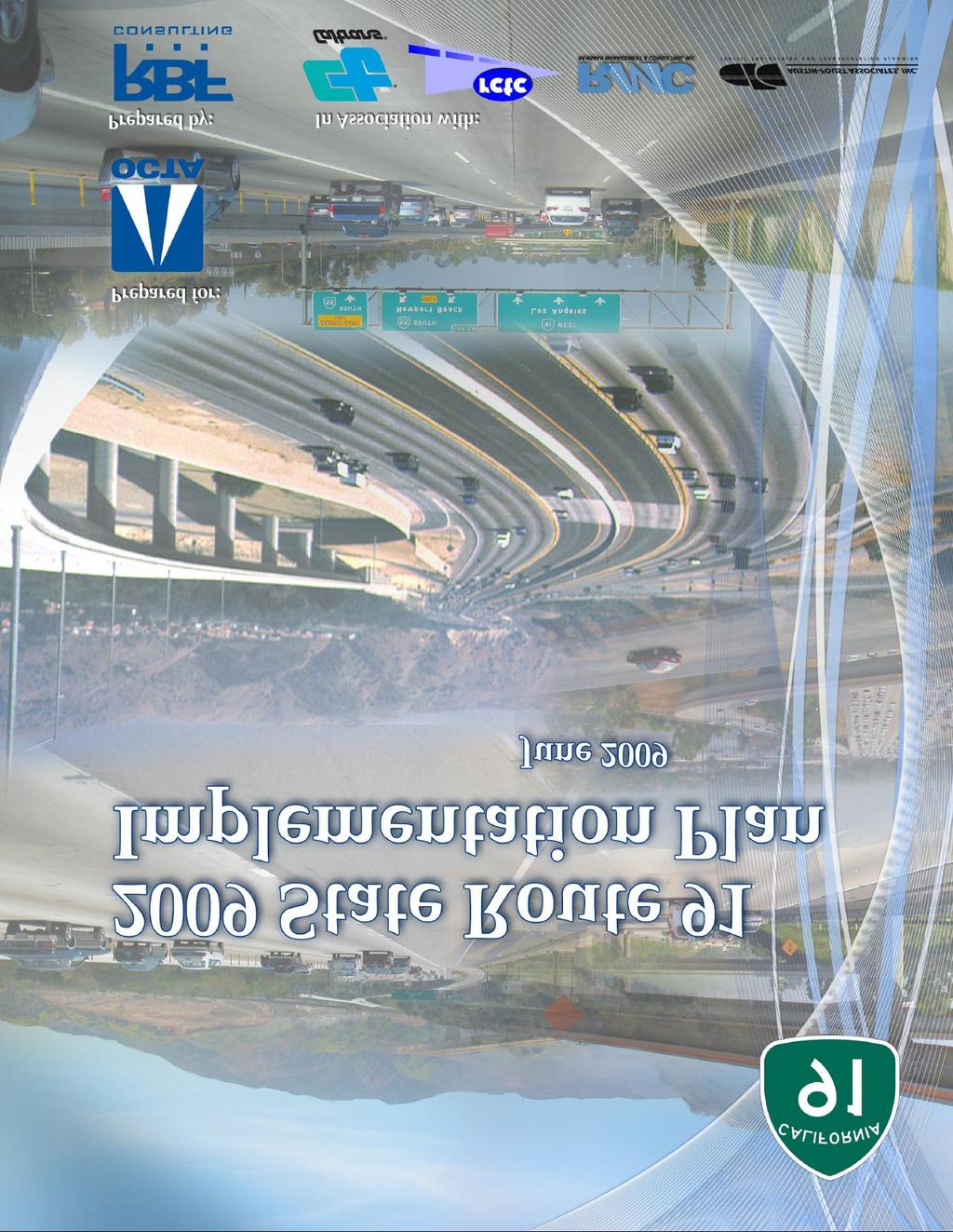
2 Table of Contents TABLE OF CONTENTS...I SECTION 1: 2009 STATUS REPORT AND UPDATE...1 SECTION 2: IMPLEMENTATION PLAN...7 BY YEAR BY YEAR BY YEAR BY YEAR POST-2025/ SECTION 3: REFERENCES SR-91 IMPLEMENTATION PLAN i
3 SECTION 1: 2009 Status Report and Update INTRODUCTION Previous law authorized the California Department of Transportation (Caltrans) to enter into franchise agreements with private companies to construct and operate four demonstration toll road projects in California. This resulted in the development of the 91 Express Lanes facility in Orange County. The four-lane, 10-mile toll road runs along the median of the Riverside Freeway (State Route 91) in northeast Orange County between the Orange/Riverside County Line and the Costa Mesa Freeway (State Route 55). Since the 91 Express Lanes carried its first vehicle on December 27, 1995, the facility has saved users over 32 million hours of commuting time. While the 91 Express Lanes facility has improved travel time along the State Route 91 (SR-91) corridor, provisions in the franchise agreement between Caltrans and the private franchisee, the California Private Transportation Company (CPTC), prohibited Caltrans and county transportation agencies from adding transportation capacity or operational improvements to the SR-91 corridor from the Ontario Freeway (Interstate 15) in Riverside County to the Orange/Los Angeles Counties border through the year Consequently, the public agencies were barred from adding new lanes, improving interchanges, and adding other improvements to decrease congestion on the SR-91 freeway. Recognizing the need to eliminate the non-compete provision of the franchise agreement, Governor Gray Davis signed Assembly Bill 1010 (Lou Correa) into law in September 2002, paving the way for much-needed congestion relief for thousands of drivers who use SR-91 to travel between Riverside and Orange Counties each day. The bill allowed the Orange County Transportation Authority (OCTA) to purchase the 91 Express Lanes franchise and eliminate the existing clause that prohibited any capacity-enhancing improvements from being made to SR-91 until the year The purchase agreement for the 91 Express Lanes was completed in January 2003, placing the road in public hands at a cost of $207.5 million. With the elimination of the non-compete provision through AB 1010 and the subsequent 91 Express Lanes purchase by the OCTA, Orange County and Riverside County public officials and Caltrans Districts 8 and 12 have been coordinating improvement plans for SR-91. Senate Bill 1316 (Lou Correa) was signed into law in August 2008 as an update to the provisions of AB SB 1316 authorizes OCTA to transfer its rights and interests in the Riverside County portion of SR-91 toll lanes by assigning them to the Riverside County Transportation Commission (RCTC), and authorizes RCTC to impose tolls for 50 years. SB 1316 also requires OCTA, in consultation with Caltrans and RCTC, to annually issue a plan and a proposed completion schedule for SR-91 improvements from State Route 57 (SR-57) to Interstate 15 (I-15). The previous SR-91 Implementation Plan included a westerly project limit of State Route 55 (SR-55). This plan establishes a program of projects eligible for funding by the use of potential excess toll revenue and other funds. This 2009 SR-91 Implementation Plan (Plan) is the result of the requirement to provide the State Legislature with an annual Implementation Plan for SR-91 improvements and builds on the 2008 report, which was a major update of the previous annual Implementation Plans. This year s update includes projects identified in the Riverside County Orange County Major Investment Study (MIS) as well as other project development efforts and funding programs such as the RCTC 10-Year Western County Highway Delivery Plan that outlines a number of projects such as the extension of High Occupancy Toll (HOT) Lanes from the Orange/Riverside County Line to I-15, the California Transportation Commission (CTC) Corridor Mobility Improvement Account (CMIA) that provides a funding source for transportation projects, the extension of the Measure A program that provides funding for transportation projects in Riverside County, and the Renewed Measure M program that provides funding for transportation projects in Orange County. The 2009 Plan includes an overview, identification of issues and needs, time frames for project packages to improve mobility on SR-91, and are listed based on a logical sequence for implementation. Project descriptions include conceptual 2009 SR-91 IMPLEMENTATION PLAN 1
4 lane diagrams (as appropriate), cost estimates (in 2009 dollars, or as noted), and discussion of key considerations that need to be addressed in the planning and development of each project. This plan will provide OCTA, RCTC, and Caltrans with a framework to implement SR-91 and other related improvements. Future annual plan updates will continue to refine the scope, cost, and schedule of each project included in this version of the plan. SR-91 CORRIDOR CONDITIONS Project Limits The project study limits encompass the segment of SR-91 from west of the junction of SR-57 and SR-91 in the City of Anaheim in Orange County, to east of the junction of SR-91 and I-15 in the City of Corona in Riverside County. The freeway segment is approximately 20.3 miles long, and includes approximately 12.7 miles within Orange County and approximately 7.6 miles within Riverside County. Traffic Conditions Summary A review of traffic conditions in the Corridor indicates that the existing carrying capacity of the facility is inadequate to accommodate current and future peak demand volumes, and that Level of Service (LOS) F prevails in the peak direction during the entire peak period, where LOS F is defined as the worst freeway operating condition and is defined as a density of more than 45 passenger cars/lane/mile. The results also indicate that there are several physical constraints that generate unacceptable traffic queues. The following list summarizes the deficiencies identified along the SR-91 Corridor: Heavy traffic volumes from I-15 (North and South) converge with SR-91. The weaving and merging condition is complicated by the close proximity of the Westbound (WB) Main Street off-ramp. High demand from several on-ramps within the eastern segment exacerbates traffic conditions during rush hours. An eastbound (EB) general purpose (GP) lane is dropped just east of the Corona Expressway (State Route 71). The second EB High Occupancy Vehicle (HOV) lane becomes a GP lane. Heavy downstream congestion forces traffic to exit at the Green River off-ramp. The backup caused by the off-ramp blocks the right lane of the mainline freeway. High traffic volumes from Gypsum Canyon Road and Santa Ana Canyon Road contribute to congestion on the mainline. The Foothill Transportation Corridor (State Route 241) merges with SR-91 causing additional congestion in the EB direction. Both EB lanes from State Route 241 (SR-241) are dropped prior to State Route 71 (SR-71). Heavy traffic reentering the freeway merges at slow speeds from existing WB and EB truck scales, impacting the general-purpose lanes. SR-55 merges with SR-91. An EB lane on SR-91 is dropped at Lakeview Avenue and a second EB lane is dropped at Imperial Highway creating a severe merge condition. WB SR-91 drops a GP lane and a 91 Express Lane to SB SR-55, which contributes to mainline congestion. High demand from Weir Canyon Road, Imperial Highway and Lakeview Avenue. WB traffic entering SR-91 at Lakeview Avenue weaving through three lanes from WB SR-91 to southbound (SB) SR-55 contributes to mainline congestion. PROJECT SUMMARY Many of the projects identified in this 2009 Plan are based on the MIS that was completed in January The projects are presented based on potential implementation schedules and priorities established in the MIS as well as through subsequent project development. Table 1 summarizes the various projects in the 2009 Plan, and they are outlined below by implementation schedule (see Section 2 for detailed project summaries): The first set of projects is anticipated to be completed by 2011 and includes four improvements at a total cost of approximately $145 million. The projects include construction of a Metrolink parking structure at the North Main Street Corona Metrolink Station, Metrolink service improvements, Express Bus improvements, and the EB SR-91 lane addition from SR-241 to SR-71. These projects are in the process of preliminary engineering, final design, construction, 2009 SR-91 IMPLEMENTATION PLAN 2
5 or procurement and implementation, as noted in the project summaries. The 2015 improvements include five projects, with a total cost up to approximately $1.9 billion. The projects include new travel lanes between SR-55 and SR-241; interchange improvements at SR- 71/SR-91; the SR-91 Corridor Improvement Project (CIP) from SR-241 to Pierce Street that will widen SR-91 by one GP lane in each direction east of SR-241, add collector-distributor (CD) roads and direct connectors at I-15/SR-91, extend the 91 Express Lanes to I-15, and add system interchange improvements; a new WB lane at Tustin Avenue; and a potential new interchange or overcrossing at Fairmont Boulevard. Three projects for implementation by 2022 include the SR-241/SR-91 HOV/HOT direct connector, a significant expansion of Metrolink service and station improvements, and SR-91 improvements between SR-57 and SR-55. OCTA, RCTC, and Caltrans will be initiating preliminary planning activities for these projects to ensure readiness when local, state, or federal funding becomes available. Consequently, there may be opportunities to advance these projects if additional funding is made available. Projects for implementation by 2022 would cost approximately $900 million to $1.2 billion. Some of these projects may become components of post-2025/2030 projects. Projects for post-2025/2030 implementation focus on longer-lead time projects and include: SR- 55/SR-91 Interchange Improvements, an Elevated 4-Lane Facility (MIS Corridor A) from SR-241 to I-15, a 4-Lane Facility (MIS Corridor B) from SR-241/Laguna Freeway (State Route 133) to I-15/Cajalco Road, and the Anaheim to Ontario International Airport High Speed Rail. The $200 million dollar interchange project and the other three, multi-billion dollar potential projects require a significant amount of planning, design, and future policy and public input. In some cases, these projects may include previous projects as project components, Project No. Table 1 SR-91 Implementation Plan Projects Project Summary By Year 2011 such that all projects may not be implemented within this project summary. Traffic Analysis Cost ($M) 1 North Main Street Corona Metrolink Station Parking 25.0 Structure 2 Metrolink Short-Term Expansion Plan Express Bus Improvements Orange County to Riverside 9.5 County 4 Eastbound Lane Addition from SR-241 to SR SUBTOTAL By Year Widen SR-91 between SR-55 and SR-241 by Adding a 5 th GP lane in Each Direction 6 SR-71/SR-91 Interchange Improvements Widen SR-91 by One GP Lane in Each Direction East of 1,542 SR-241, CD Roads and Direct Connectors at I-15/SR-91, Extension of Express Lanes to I-15, and System Interchange Improvements 8 SR-91 WB Lane at Tustin Avenue Fairmont Boulevard Improvements SUBTOTAL 1,903-1,935 By Year SR-241/SR-91 HOV/HOT Connector Metrolink Service and Station Improvements SR-91 between SR-57 and SR SUBTOTAL 902 1,192 By Post-2025/ SR-55/SR-91 Interchange Improvements Elevated 4-Lane Facility (MIS Corridor A) from SR-241 to 2,720 I Lane Facility (MIS Corridor B) from SR-241/SR-133 to 5,960 I-15/Cajalco Road 16 Anaheim to Ontario International Airport High Speed Rail TBD SUBTOTAL 8,880+ For the 2009 Plan, the traffic analysis for major SR-91 capacity projects has been updated from the 2008 Plan and the westerly project study limit has been revised to include SR-57. This analysis used the latest freeway operations software model available from UC Berkeley and 2008 traffic data. This freeway operations model 2009 SR-91 IMPLEMENTATION PLAN 3
6 provides a better depiction of actual travel delays experienced by motorists compared to traditional travel demand models. The model can be used to analyze freeway bottlenecks sometimes neglected in traditional travel demand models. This approach is especially important given high SR-91 traffic volumes and the potential for relatively few vehicles to significantly slow down traffic. For example, a minor freeway merging area can cause many vehicles to slow, cascading delay through the traffic stream, and suddenly both speed and volume rapidly decrease for major segments of the freeway. The operations analysis quantified travel time savings for WB morning and EB afternoon conditions for the following major capacity enhancing projects: Eastbound lane addition from SR-241 to SR-71 by 2011 (Project 4). New lanes in both directions from SR-55 to SR-241 by 2014 (Project 5). New lanes in both directions from SR-241 to I-15 by 2015 (Project 7). Eastbound lane between SR-57 and SR-55 by 2022 (Project 12). New capacity provided by Corridor A and Corridor B by post-2025/2030 as recommended by the 2006 MIS (Projects 14 and 15). The results indicate that the WB morning travel times increase for 2011 as there are no planned WB improvements, but by 2015 and 2022 there are significant travel time improvements compared with the 2011 results. Results for 2030 illustrate travel time increases without Corridors A and B, whereas the inclusion of Corridors A and B results in greatly reduced travel times. The afternoon travel times are slightly decreased for the EB SR-91 project planned for 2011, whereas 2015 and 2022 improvements will significantly decrease EB travel speeds. These improvements will help manage the future growth for the SR-91 corridor. The current design of the SR-55/SR-91 interchange limits the ability to move traffic into north and central Orange County via SR-55, and significant future vehicle delays may result without major interchange improvements and downstream capacity increases or diversion to other corridors. The introduction of Corridors A and B by post-2025/2030 offers the potential capacity to manage future SR-91 traffic demand in both directions. While both of these corridors are still concepts, they provide substantial relief to EB and WB traffic congestion in the future. Further feasibility studies will determine if one or both concepts move forward in the project development process. The charts below describe the travel time benefits by year including these various project concepts. The 2030 scenario shows travel time without the Corridor A and B improvements. Figure 1-1 Mainline Westbound SR-91 from I-15 to SR-57 A.M. Peak Hour Average Travel Time Mainline Westbound SR-91 From I-15 to SR-57 AM Peak Hour Average Travel Time (in Minutes) Existing (2009) A&B Orange County Riverside County 2009 SR-91 IMPLEMENTATION PLAN 4
7 Figure 1-2 Mainline Eastbound SR-91 from SR-57 to I-15 P.M. Peak Hour Average Travel Time Mainline Eastbound SR-91 from SR-57 to I-15 PM Peak Hour Average Travel Time (in Minutes) Existing (2009) A&B Orange County Riverside County PROJECT ACCOMPLISHMENTS Much progress has been made since the initial 2003 SR-91 Implementation Plan was approved. Recently Completed Construction/Improvement Projects As of May 2009, the following physical improvements have been constructed/implemented: Repaved and sealed pavement surfaces, replaced raised channelizers, and restriped lanes on the 91 Express Lanes. EB SR-91 restripe and median barrier reconstruction project that removed the CHP enforcement area and extended the EB auxiliary lane from SR-71 to the Serfas Club Drive off-ramp. Express Bus improvements are implemented for the Galleria at Tyler to South Coast Metro route. WB auxiliary lane extension between the County Line and SR-241. This project eliminated the lane drop at the 91 Express Lanes and extended the existing auxiliary lane from the County Line to SR-241 in the westbound direction. This improvement minimized the traffic delays at the lane drop area, resulting in improved vehicle progression. WB restripe project extended the auxiliary lane between SR-71 and the County Line resulting in a new continuous auxiliary lane between SR-71 & SR-241. Safety Improvements at the Truck Scales. Existing shoulders were improved, lanes were re-striped, illumination improved, and signage was modified into and out of the EB facilities. Green River Road overcrossing replacement. These projects provided enhanced freeway capacity and improved mobility for one of the most congested segments of the freeway. In addition, there are two projects that are currently in the project development phase that have a direct impact upon SR-91 widening projects. The first is the $2 billion U.S. Army Corps of Engineers (Corps) Santa Ana River Mainstem (SARM) improvement project that provides flood protection from the recently improved Prado Dam (near SR-71) to the Pacific Ocean. As part of the Corps project, existing riverbanks have been improved due to the increased capacity of the Prado Dam outlet works, which can now release up to 30,000 cfs compared to the previous facility capacity of 10,000 cfs. The only remaining segment of the Santa Ana River to be improved is Reach 9, which includes areas along SR-91 from the Coal Canyon Wildlife Corridor Crossing to SR-71. SR-91 project teams have coordinated with the Corps; Caltrans; and other federal, regional, and local agencies in order to accommodate future SR-91 improvements by the Corps bank protection project within Reach 9 by relocating the Santa Ana River while it would have been otherwise disturbed by the original Corps project to protect-in-place the riverbank protection for SR-91. This will greatly enhance the ability of Caltrans and other regional transportation agencies to implement many of the SR-91 improvement projects listed herein. The Corps currently has 95% design plans completed for the improvements and are awaiting federal stimulus package funding allocation and disbursement prior to construction SR-91 IMPLEMENTATION PLAN 5
8 The other project with a direct impact to SR-91 is the $100 million Santa Ana Regional Interceptor (SARI) sewer trunk line relocation. The existing SARI line is within the Santa Ana River floodplain and is in jeopardy of failure due to scour from the potential increased flood releases by the aforementioned Corps project. In order to relocate the proposed 48-inch diameter SARI line outside of the floodplain, which is immediately adjacent to SR-91, highway R/W needs to be relinquished to the Orange County Flood Control District (OCFCD) for location of the SARI line. SR-91 project teams have coordinated with the OCFCD; Caltrans; and other federal, regional, and local agencies in order to accommodate planned SR-91 improvements within the R/W subsequent to relinquishment. This project initiated the preliminary engineering phase in early 2009 and is scheduled to complete construction by summer Recently Completed PSR s and other Reports In addition to the physical improvements in the corridor, there are several reports and PSR s that are completed, in draft form, or anticipated to be approved that identify improvements that will provide improved mobility. The reports and PSR s include: Project Study Report On State Route 91 Between the SR-91/SR-55 Interchange and the SR-91/SR-241 Interchange in Orange County (April 2004). MIS Final Project Report: Locally Preferred Strategy Report (January 2006). Project Study Report On Route 91 from State Route 241 in Orange County to Pierce Street in the City of Riverside in Riverside County (October 2006). Renewed Measure M Transportation Investment Plan (November 2006). Project Study Report for SR-71/SR-91 Interchange (December 2006). RCTC 10-Year Western County Highway Delivery Plan (December 2006). Renewed Measure M Early Action Plan, approved August SR-91 from SR-57 to SR-55 Feasibility Study (anticipated by May 2009). 91 Express Lanes Extension and State Route 241 Connector Feasibility Study (March 2009). SR-91/Fairmont Boulevard Feasibility Study (anticipated by June 2009). Plans, Specifications and Estimates (PS&E) for Eastbound SR-91 lane addition from SR-241 to SR-71 (2009). Renewed Measure M Strategic Plan (anticipated by June 2009). Updates from the 2008 SR-91 Implementation Plan In addition, to the improvements and progress noted above, the following projects that were included in the 2008 SR-91 Implementation Plan have been modified or dropped for the 2009 Plan: The Green River Road interchange improvements have been completed and the project is deleted from the 2009 Plan. The Fairmont Boulevard improvements (Project 9) alternative for drop ramps into the 91 Express Lanes has been deleted. A traditional interchange or overcrossing alternative are still included as viable options. An eastbound SR-91 widening project from SR-57 to SR-55 (Project 12) has been added for The SR-55/SR-91 interchange improvements (Project 13) schedule has been changed from 2020 completion to post-2025/2030. The 2020 horizon year has been updated to 2022 to capture projects that will be implemented before Various project costs and schedules have been updated from the 2008 Plan based on continued project development SR-91 IMPLEMENTATION PLAN 6
9 SECTION 2: OVERVIEW The 2009 Plan describes projects, implementation schedules, key consideration, benefits, and costs (in 2009 dollars, or as noted) for major projects through post- 2025/2030. Most of the projects identified in this Implementation Plan are based on the MIS that was completed in January The projects are presented based on potential implementation schedules and priorities established in the MIS. The schedules for implementation of the packages of projects include 2011, 2015, 2022, and post-2025/2030. The 2011 and 2015 projects are capable of being implemented through the project development process with minimal to moderate environmental constraints. Some of the longer-range projects for 2022 and post-2025/2030 require more significant planning and environmental assessment prior to design. Each of the project improvements includes an estimate of project schedules. It is important to note that implementing various time saving measures, such as design-build or contractor incentives for early completion, may potentially reduce project schedules. The implementation phases are defined as follows: Implementation Plan Conceptual Engineering = Pre-Project Study Report (Pre-PSR) Conceptual planning and engineering for project scoping and feasibility prior to initiating the PSR phase. Preliminary Engineering = Project Study Report (PSR) Conceptual planning and engineering phase that allows for programming of funds. Environmental = Project Report/Environmental Documentation (PR/ED) The detailed concept design that provides environmental clearance for the project and programs for final design and right of way acquisition. The duration for this phase is typically 2-3 years. Design = Plans, Specifications and Estimates (PS&E) Provide detailed design to contractors for construction bidding and implementation. Construction = The project has completed construction and will provide congestion relief to motorists. The intent of these implementation plan project packages is to provide an action list for OCTA, RCTC and Caltrans to pursue in the project development process or for initiating further studies. Figure 2-1 SR-91 Project Study Area from SR-57 to I SR-91 IMPLEMENTATION PLAN 7

10 By Year 2011 The first set of projects will be completed by 2011 and includes four improvements at a total cost of approximately $144 million (in 2009 dollars). The projects include a new parking structure at the North Main Street Corona Metrolink Station, Metrolink service improvements, Express Bus improvements, and the EB SR-91 lane addition from near SR-241 to SR-71. Most of these projects are in the process of preliminary engineering, final design, construction, or procurement and implementation. These projects are recommended for the first few years of the Plan and will provide mobility improvements to the corridor when implemented. Most of these near term projects provide immediate operational benefits with a minimum of effort required relative to environmental documentation and Right-of-Way constraints. Project No. Project Summary Cost ($M) 1 North Main Street Corona Metrolink Station Parking Structure Metrolink Short-Term Expansion Plan Express Bus Improvements Orange County to Riverside County Eastbound Lane Addition from SR-241 to SR SUBTOTAL Figure 2-2 Summary of Projects for Implementation By SR-91 IMPLEMENTATION PLAN 8

11 2009 SR-91 IMPLEMENTATION PLAN 9

12 2009 SR-91 IMPLEMENTATION PLAN 10

13 2009 SR-91 IMPLEMENTATION PLAN 11

14 2009 SR-91 IMPLEMENTATION PLAN 12
 lane in each direction between SR-55 and SR-241. Another project is the interchange improvements at SR-71/SR-91.")
15 By Year 2015 The next set of improvements includes five projects, which would be implemented by 2015 at a total cost of approximately $1.9 billion (in 2009 dollars, or as noted). One of the projects includes SR-91 widening by one general purpose (GP) lane in each direction between SR-55 and SR-241. Another project is the interchange improvements at SR-71/SR-91. The third project is the SR-91 Corridor Improvement Project (CIP) from SR-241 to Pierce Street that will widen SR-91 by one GP lane in each direction east of SR-241, add CD Roads and Direct Connectors at I-15/SR-91, extend 91 Express Lanes to I-15, and add system interchange improvements. The other two projects that will be completed in this time frame include the WB lane at Tustin Avenue, and a potential new interchange at Fairmont Boulevard. Project No. Project Summary Cost ($M) 5 Widen SR-91 between SR-55 and SR-241 by Adding a 5 th GP lane in Each Direction SR-71/SR-91 Interchange Improvements Widen SR-91 by One GP Lane in Each Direction East of SR-241, CD Roads and Direct Connectors at I-15/SR- 1,542 91, Extension of Express Lanes to I-15, and System Interchange Improvements 8 SR-91 WB Lane at Tustin Avenue Fairmont Boulevard Improvements SUBTOTAL 1,903-1,935 Figure 2-3 Summary of Projects for Implementation By SR-91 IMPLEMENTATION PLAN 13

16 2009 SR-91 IMPLEMENTATION PLAN 14

17 2009 SR-91 IMPLEMENTATION PLAN 15

18 2009 SR-91 IMPLEMENTATION PLAN 16

19 2009 SR-91 IMPLEMENTATION PLAN 17

20 2009 SR-91 IMPLEMENTATION PLAN 18

21 By Year 2022 Projects for implementation by 2022 include the SR-241/SR-91 HOV/HOT connector improvements, a significant expansion of Metrolink service and station improvements, and SR-91 improvements between SR-57 and SR-55. OCTA, RCTC, and Caltrans will be initiating preliminary planning activities for these projects to ensure readiness when local, state, or federal funding becomes available. Consequently, there may be opportunities to advance these projects if additional funding is made available. Projects for implementation by 2022 are expected to cost approximately $900 million to $1.2 billion (in 2009 dollars, or as noted). Some of these projects may become components of post-2025/2030 projects. Project No. Project Summary Cost ($M) 10 SR-241/SR-91 HOV/HOT Connector Metrolink Service and Station Improvements SR-91 between SR-57 and SR SUBTOTAL 902 1,192 Figure 2-4 Summary of Projects for Implementation By SR-91 IMPLEMENTATION PLAN 19

22 2009 SR-91 IMPLEMENTATION PLAN 20

23 2009 SR-91 IMPLEMENTATION PLAN 21
24 2009 SR-91 IMPLEMENTATION PLAN 22
 from SR-241 to I-15, a 4-Lane Facility (MIS Corridor B) from")
25 By Year Post-2025/2030 Projects for implementation by post-2025/2030 focus on longer-lead time projects. This multi-billion dollar program includes: SR-55/SR-91 Interchange Improvements, an Elevated 4-Lane Facility (MIS Corridor A) from SR-241 to I-15, a 4-Lane Facility (MIS Corridor B) from SR-241/SR-133 to I-15/Cajalco Road, and the Anaheim to Ontario International Airport High Speed Rail. The $200 million dollar SR-55/SR-91 interchange project and the other three, multi-billion dollar potential projects include significant environmental constraints and right of way requirements in addition to requiring a significant amount of planning, design, and future policy and public input. The Corridor A project may incorporate projects being developed in the earlier programs as project components, such that all projects may not be implemented within this project summary in addition to Corridor A. Project No. Project Summary Cost ($M) 13 SR-55/SR-91 Interchange Improvements Elevated 4-Lane Facility (MIS Corridor A) from SR-241 to I-15 2, Lane Facility (MIS Corridor B) from SR-241/SR-133 to I-15/Cajalco Road 5, Anaheim to Ontario International Airport High Speed Rail TBD SUBTOTAL 8,880+ Figure 2-5 Summary of Projects for Implementation by Post-2025/ SR-91 IMPLEMENTATION PLAN 23

26 2009 SR-91 IMPLEMENTATION PLAN 24

27 2009 SR-91 IMPLEMENTATION PLAN 25

28 2009 SR-91 IMPLEMENTATION PLAN 26

29 2009 SR-91 IMPLEMENTATION PLAN 27
30 SECTION 3: REFERENCES The following documents and resources were used in the development of the 2009 Plan. Data was provided by OCTA, RCTC, Caltrans Districts 8 and 12, Transportation Corridor Agencies (TCA), and other agencies. Draft Project Study Report/Project Report Adjacent to Route 91 Between Weir Canyon Road and the Coal Canyon Wildlife Corridor Crossing, SARI line R/W relinquishment, April Express Lanes Extension and State Route 241 Connector Feasibility Study, March 2009 Project Study Report/Project Report On Gypsum Canyon Road Between the Gypsum Canyon Road/SR-91 Westbound Off- Ramp (PM 16.4) and the Gypsum Canyon Road/SR-91 Eastbound Direct On-Ramp (PM 16.4), June 2008 California Transportation Commission, Corridor Mobility Improvement Account (CMIA), February 2007 Final Plans, Specifications and Estimates for Green River Road Overcrossing, 2006 Project Study Report On Route 91 from Green River Road to Serfas Club Drive in the City of Corona in Riverside County, December 2006 Orange County Transportation Authority Renewed Measure M Transportation Investment Plan, November 2006 Project Study Report On Route 91 from State Route 241 in Orange County to Pierce Street in the City of Riverside in Riverside County, October 2006 Riverside County-Orange County Major Investment Study (MIS) Final Project Report: Locally Preferred Strategy Report, January 2006 Preliminary design plans for Eastbound Lane Addition from SR-241 to SR-71, 2006 SR-91 Choke Point Elimination - City of Corona, Prepared by Parsons, November 19, 2005 Project Study Report Westbound State Route 91 Auxiliary Lane from the NB SR-55/WB SR-91 Connector to the Tustin Avenue Interchange, July 2004 Project Study Report On State Route 91 Between the SR-91/SR-55 Interchange and the SR-91/SR-241 Interchange in Orange County, April 2004 California Nevada Interstate Maglev Project Report, Anaheim-Ontario Segment; California-Nevada Super Speed Train Commission, American Magline Group, August 2003 SR-91 Congestion Relief Alternatives Analysis, Caltrans, January 2003 Route Concept Reports for SR-91, Caltrans Districts 8 and 12 Various Preliminary Drawings and Cross Sections, Caltrans Districts 8 and SR-91 Implementation Plan 28
SOUTHERN GATEWAY. Transportation and Trinity River Project Committee 11 May 2015
 SOUTHERN GATEWAY Transportation and Trinity River Project Committee 11 May 2015 Southern Gateway Project History Began in 2001 as a Major Investment Study [ MIS ], Schematic, and Environmental Assessment
The major roadways in the study area are State Route 166 and State Route 33, which are shown on Figure 1-1 and described below:
 3.5 TRAFFIC AND CIRCULATION 3.5.1 Existing Conditions 3.5.1.1 Street Network DRAFT ENVIRONMENTAL IMPACT REPORT The major roadways in the study area are State Route 166 and State Route 33, which are shown
Traffic and Toll Revenue Estimates
 The results of WSA s assessment of traffic and toll revenue characteristics of the proposed LBJ (MLs) are presented in this chapter. As discussed in Chapter 1, Alternatives 2 and 6 were selected as the
To: File From: Adrian Soo, P. Eng. Markham, ON File: Date: August 18, 2015
 Memo To: From: Adrian Soo, P. Eng. Markham, ON : 165620021 Date: Reference: E.C. Row Expressway, Dominion Boulevard Interchange, Dougall Avenue Interchange, and Howard 1. Review of Interchange Geometry
Metro Highway Program
 Metro Highway Program ACEC November 2018 I-5 North HOV and Truck Lanes 14 miles of HOV lanes in both directions 2 miles of truck climbing lanes at the south end 7 bridge modifications at: Gavin Canyon
MEMORANDUM. Figure 1. Roundabout Interchange under Alternative D
 MEMORANDUM Date: To: Liz Diamond, Dokken Engineering From: Subject: Dave Stanek, Fehr & Peers Western Placerville Interchanges 2045 Analysis RS08-2639 Fehr & Peers has completed a transportation analysis
Comprehensive Regional Goods Movement Plan and Implementation Strategy Goods Movement in the 2012 RTP/SCS
 Comprehensive Regional Goods Movement Plan and Implementation Strategy Goods Movement in the 2012 RTP/SCS Annie Nam Southern California Association of Governments September 24, 2012 The Goods Movement
Mobility Corridor Updates. Transit & Active Transportation Projects
 Mobility Corridor Updates Transit & Active Transportation Projects Manjeet Ranu, SEO East San Fernando Valley Transit Corridor Metro Board LPA selection: June 2018 Recently awarded $200 million in Senate
Technical Feasibility Report
 Prepared For: Bow Concord I-93 Improvements Project Bow and Concord, NH Prepared By: 53 Regional Drive Concord, NH 03301 NHDOT Project # 13742 Federal Project #T-A000(018) September 2018 TABLE OF CONTENTS
I-820 (East) Project Description. Fort Worth District. Reconstruct Southern I-820/SH 121 Interchange
 Project Description. Fort Worth District. Reconstruct Southern I-820/SH 121 Interchange") I-820 (East) Project Description Fort Worth District Reconstruct Southern I-820/SH 121 Interchange I-820 from approximately 2,000 feet north of Pipeline Road/Glenview Drive to approximately 3,200 feet
I-820 (East) Project Description Fort Worth District Reconstruct Southern I-820/SH 121 Interchange I-820 from approximately 2,000 feet north of Pipeline Road/Glenview Drive to approximately 3,200 feet
Mobility Corridor Updates. Transit & Active Transportation Projects
 Mobility Corridor Updates Transit & Active Transportation Projects Laura Cornejo, DEO Regional Planner Regional Operator Metro is LA County s Regional Builder/Funder Rail Bus Service (Metro/Muni/Local)
Executive Summary. Draft Environmental Impact Statement/Environmental Impact Report ES-1
 Executive Summary Introduction The Eastside Transit Corridor Phase 2 Project is a vital public transit infrastructure investment that would provide a transit connection to the existing Metro Gold Line
I-405 Corridor Master Plan
 Southern California Association of Governments I-405 Corridor Master Plan Presentation to Streets and Freeways Subcommittee October 13, 2015 1 Presentation Overview Expectations and Approach Corridor Performance
I-4 Beyond the Ultimate. Florida Transportation Builders Association January 18, 2019
 I-4 Beyond the Ultimate Florida Transportation Builders Association January 18, 2019 FDOT District 5 Improving Mobility & Safety in Central Florida FDOT District 5 is: Designing and building a better Interstate
4 COSTS AND OPERATIONS
 4 COSTS AND OPERATIONS 4.1 INTRODUCTION This chapter summarizes the estimated capital and operations and maintenance (O&M) costs for the Modal and High-Speed Train (HST) Alternatives evaluated in this
IMPROVEMENT CONCEPTS
 IMPROVEMENT CONCEPTS for the South Novato Transit Hub Study Prepared by: January 11, 2010 DKS Associates With Wilbur Smith Associates IMPROVEMENT CONCEPTS Chapter 1: Introduction 1. INTRODUCTION The strategic
Project Application. General Information ODOT PID. Primary County (3 char abrv) ODOT District
 ODOT District") Current Status (Tier 1, Tier 2 or New) Proposed Status (Tier 1 or Tier 2) Project Application General Information ODOT PID ODOT District Primary County (3 char abrv) Facility Name (i.e. route, rail, terminal,
Current Status (Tier 1, Tier 2 or New) Proposed Status (Tier 1 or Tier 2) Project Application General Information ODOT PID ODOT District Primary County (3 char abrv) Facility Name (i.e. route, rail, terminal,
Expansion Projects Description
 Expansion Projects Description The Turnpike expansion program was authorized by the Florida Legislature in 1990 to meet the State s backlog of needed highway facilities. The Legislature set environmental
Metropolitan Freeway System 2007 Congestion Report
 Metropolitan Freeway System 2007 Congestion Report Minnesota Department of Transportation Office of Traffic, Safety and Operations Freeway Operations Section Regional Transportation Management Center March
U.S. System Summary: ARIZONA/SOUTHWEST
 U.S. System Summary: ARIZONA/SOUTHWEST Arizona/Southwest High-Speed Rail System (Source: Texas A&M Transportation Institute) The Arizona/Southwest high-speed rail system described in this summary groups
RTID Travel Demand Modeling: Assumptions and Method of Analysis
 RTID Travel Demand Modeling: Assumptions and Method of Analysis Overall Model and Scenario Assumptions The Puget Sound Regional Council s (PSRC) regional travel demand model was used to forecast travel
Traffic Engineering Study
 Traffic Engineering Study Bellaire Boulevard Prepared For: International Management District Technical Services, Inc. Texas Registered Engineering Firm F-3580 November 2009 Executive Summary has been requested
Open House. Highway212. Meetings. Corridor Access Management, Safety & Phasing Plan. 5:30 to 6:30 p.m. - Southwest Corridor Transportation Coalition
 Welcome Meetings 5:30 to 6:30 p.m. - Southwest Corridor Transportation Coalition 6:30 to 8:00 p.m. - Open House Why is Highway 212 Project Important? Important Arterial Route Local Support Highway 212
NORTH HOUSTON HIGHWAY IMPROVEMENT PROJECT (NHHIP): SEGMENT 3. April 19, 2018 NHHIP April 19, 2018
: SEGMENT 3. April 19, 2018 NHHIP April 19, 2018") NORTH HOUSTON HIGHWAY IMPROVEMENT PROJECT (NHHIP): SEGMENT 3 April 19, 2018 NHHIP OVERVIEW NHHIP divided into 3 Segments: Segment 1: I-45: Beltway 8 to I-610 (9 mi) 45 Segment 2: I-45: I-610 to I-10 (3
NORTH HOUSTON HIGHWAY IMPROVEMENT PROJECT (NHHIP): SEGMENT 3 April 19, 2018 NHHIP OVERVIEW NHHIP divided into 3 Segments: Segment 1: I-45: Beltway 8 to I-610 (9 mi) 45 Segment 2: I-45: I-610 to I-10 (3
Agenda. Utility Undergrounding Strategies & Laguna Canyon Road Master Plan
 Utility Undergrounding Strategies & Laguna Canyon Road Master Plan January 17, 2017 City Council Meeting 2 Agenda Progress since March 2016 Status of undergrounding and road widening between El Toro Rd.
Chapter 7. Transportation Capital Improvement Projects. Chapter 7
 Chapter 7 Transportation Capital Improvement Projects Chapter 7 81 Chapter 7 Transportation Capital Improvement Projects Local Transportation Sales Tax Programs For over three decades, Santa Clara County
State Route 1 Auxiliary Lane Bus-on-Shoulder Concept of Operations DRAFT. Santa Cruz County Regional Transportation Commission
 State Route 1 Auxiliary Lane Bus-on-Shoulder Concept of Operations Santa Cruz County Regional Transportation Commission March 14, 2019 Table of Contents Section 1 Introduction... 1-1 1.1 Purpose of this
V. DEVELOPMENT OF CONCEPTS
 Martin Luther King, Jr. Drive Extension FINAL Feasibility Study Page 9 V. DEVELOPMENT OF CONCEPTS Throughout the study process several alternative alignments were developed and eliminated. Initial discussion
Project Working Group Meeting #5
 September 17, 2013 Project Working Group Meeting #5 1 September 17, 2013 www.i-80will.com Meeting Purpose Project update Discuss Range of Alternatives Discuss next steps 2 September 17, 2013 www.i-80will.com
City of Pacific Grove
 Regional Study Utilizing Caltrans Intersection Evaluation Section 7: City of Pacific Grove s: FIRST STREET AT CENTRAL AVENUE Transportation Agency for Monterey County Prepared by Transportation Agency
Sepulveda Pass Corridor Systems Planning Study Update
 Los Angeles County Metropolitan Transportation Authority Sepulveda Pass Corridor Systems Planning Study Update June 20, 2012 Measure R Transit Corridors One of 12 Measure R Transit Corridors approved by
Sepulveda Pass Corridor Systems Planning Study
 Los Angeles County Metropolitan Transportation Authority Sepulveda Pass Corridor Systems Planning Study Streets and Freeways Subcommittee January 17, 2013 1 Sepulveda Pass Study Corridor Extends for 30
Interstate Operations Study: Fargo-Moorhead Metropolitan Area Simulation Results
 NDSU Dept #2880 PO Box 6050 Fargo, ND 58108-6050 Tel 701-231-8058 Fax 701-231-6265 www.ugpti.org www.atacenter.org Interstate Operations Study: Fargo-Moorhead Metropolitan Area 2025 Simulation Results
METRO Orange Line BRT American Boulevard Station Options
 METRO Orange Line BRT American Boulevard Station Options Bloomington City Council Work Session November 18, 2013 Christina Morrison BRT/Small Starts Project Office Coordinating Planning and Design AMERICAN
TABLE OF CONTENTS SECTION PAGE. Executive Summary... xii
 TABLE OF CONTENTS SECTION PAGE Executive Summary... xii 1.0 Introduction... 1 1.1 Study Area... 2 1.2 Traffic Impact Analysis Scenarios... 4 1.3 Study Area - City of Orange... 4 2.0 Project Description
TRAFFIC IMPACT STUDY. USD #497 Warehouse and Bus Site
 TRAFFIC IMPACT STUDY for USD #497 Warehouse and Bus Site Prepared by: Jason Hoskinson, PE, PTOE BG Project No. 16-12L July 8, 216 145 Wakarusa Drive Lawrence, Kansas 6649 T: 785.749.4474 F: 785.749.734
2016 Congestion Report
 2016 Congestion Report Metropolitan Freeway System May 2017 2016 Congestion Report 1 Table of Contents Purpose and Need...3 Introduction...3 Methodology...4 2016 Results...5 Explanation of Percentage Miles
Interstate Operations Study: Fargo-Moorhead Metropolitan Area Simulation Output
 NDSU Dept #2880 PO Box 6050 Fargo, ND 58108-6050 Tel 701-231-8058 Fax 701-231-6265 www.ugpti.org www.atacenter.org Interstate Operations Study: Fargo-Moorhead Metropolitan Area 2015 Simulation Output Technical
IH 45 (GULF FWY) IH 10 (Katy Fwy) to IH 610 S (South Loop) 2010 Rank: Rank: 12
 IH 10 (Katy Fwy) to IH 610 S (South Loop) 2010 Rank: Rank: 12") Mobility Investment Priorities Project Houston IH 45 IH 45 (GULF FWY) IH 10 (Katy Fwy) to IH 610 S (South Loop) Current Conditions From IH 10 to IH 610 south, IH 45 is a 6- to 9-lane facility with three
Mobility Investment Priorities Project Houston IH 45 IH 45 (GULF FWY) IH 10 (Katy Fwy) to IH 610 S (South Loop) Current Conditions From IH 10 to IH 610 south, IH 45 is a 6- to 9-lane facility with three
Clean Harbors Canada, Inc.
 Clean Harbors Canada, Inc. Proposed Lambton Landfill Expansion Environmental Assessment Terms of Reference Transportation Assessment St. Clair Township, Ontario September 2009 itrans Consulting Inc. 260
2. Valley Circle Boulevard/Andora Avenue/Baden Avenue and Lassen Street
 IV.J TRANSPORTATION 1. INTRODUCTION This section presents an overview of the existing traffic and circulation system in and surrounding the project site. This section also discusses the potential impacts
Pacific Electric Right-of-Way / West Santa Ana Branch Corridor Alternatives Analysis
 Pacific Electric Right-of-Way / West Santa Ana Branch Corridor Alternatives Analysis Transit Coalition September 26, 2012 2 Study Area Pacific Electric Rightof-Way/West Santa Ana Branch (PEROW/ WSAB) extends
CITY OF LONDON STRATEGIC MULTI-YEAR BUDGET ADDITIONAL INVESTMENTS BUSINESS CASE # 6
 2016 2019 CITY OF LONDON STRATEGIC MULTI-YEAR BUDGET ADDITIONAL INVESTMENTS BUSINESS CASE # 6 STRATEGIC AREA OF FOCUS: SUB-PRIORITY: STRATEGY: INITIATIVE: INITIATIVE LEAD(S): BUILDING A SUSTAINABLE CITY
STH 60 Northern Reliever Route Feasibility Study Report
 #233087 v3 STH 60 Northern Reliever Route Feasibility Study Report Washington County Public Works Committee Meeting September 28, 2016 1 STH 60 Northern Reliever Route Feasibility Study Hartford Area Development
BERKELEY DOWNTOWN AREA PLAN PROGRAM ENVIRONMENTAL IMPACT REPORT TRAFFIC IMPACT ANALYSIS
 BERKELEY DOWNTOWN AREA PLAN PROGRAM ENVIRONMENTAL IMPACT REPORT TRAFFIC IMPACT ANALYSIS Prepared for: City of Berkeley Prepared by: REVISED JANUARY 9, 2009 Berkeley Downtown Area Plan Program EIR Traffic
Metropolitan Freeway System 2013 Congestion Report
 Metropolitan Freeway System 2013 Congestion Report Metro District Office of Operations and Maintenance Regional Transportation Management Center May 2014 Table of Contents PURPOSE AND NEED... 1 INTRODUCTION...
Transit Project Delivery Status Report. Significant Issues
 Item 1 Transit Project Delivery Status Report Significant Issues Presented By K.N. Murthy Executive Director Construction Committee 1 I-405 Sepulveda Pass Closure Construction Committee I-405 Sepulveda
Transit City Etobicoke - Finch West LRT
 Delcan Corporation Transit City Etobicoke - Finch West LRT APPENDIX D Microsimulation Traffic Modeling Report March 2010 March 2010 Appendix D CONTENTS 1.0 STUDY CONTEXT... 2 Figure 1 Study Limits... 2
Table of Contents INTRODUCTION... 3 PROJECT STUDY AREA Figure 1 Vicinity Map Study Area... 4 EXISTING CONDITIONS... 5 TRAFFIC OPERATIONS...
 Crosshaven Drive Corridor Study City of Vestavia Hills, Alabama Table of Contents INTRODUCTION... 3 PROJECT STUDY AREA... 3 Figure 1 Vicinity Map Study Area... 4 EXISTING CONDITIONS... 5 TRAFFIC OPERATIONS...
FREQUENTLY ASKED QUESTIONS
 THE PROJECT Last updated on 9/8/16 FREQUENTLY ASKED QUESTIONS What s happening on Highway 169? The Minnesota Department of Transportation (MnDOT) is planning to rebuild and repair the infrastructure on
Countdown to the Closure Extended 53-Hour Closure of I-405 Freeway Between U.S. 101 and I-10 Planned in Mid-July for Mulholland Bridge Demolition
 Countdown to the Closure Extended 3-Hour Closure of I-40 Freeway Between U.S. 0 and I-0 Planned in Mid-July for Mulholland Bridge Demolition Work Los Angeles, Calif. Plan Ahead, Avoid The Area, Or Stay
Chapter 9 Recommended Locally Preferred Alternative and Alternatives for Evaluation in Draft SEIS/SEIR
 Chapter 9 Recommended Locally Preferred Alternative and Alternatives for Evaluation in Draft SEIS/SEIR 9.0 RECOMMENDED LOCALLY PREFERRED ALTERNATIVE AND ALTERNATIVES FOR EVALUATION IN DRAFT SEIS/SEIR
City of Marina. Regional Roundabout Study Utilizing Caltrans Intersection Control Evaluation Section 4: Transportation Agency for Monterey County
 Regional Roundabout Study Utilizing Caltrans Intersection Control Evaluation Section 4: City of Marina Study Intersections: RESERVATION ROAD AT BEACH ROAD RESERVATION ROAD AT DEFOREST ROAD CARDOZA AVENUE
SH 249 IN GRIMES COUNTY. Open House April 3, 2014
 SH 249 IN GRIMES COUNTY Open House April 3, 2014 Meeting Agenda Purpose of Meeting Today: Review the purpose and need for the SH 249 Grimes County project Review the proposed project and alternatives Discuss
Doran Street and Broadway/Brazil Grade Separation Project
 Doran Street and Broadway/Brazil Grade Separation Project Public Outreach Meeting October 4, 2017 Agenda Introductions Project Overview Grade Separation Alternative Traffic Report Update Interim Condition
US 81 Bypass of Chickasha Environmental Assessment Public Meeting
 US 81 Bypass of Chickasha Environmental Assessment Public Meeting March 14, 2013 Introductions ODOT FHWA SAIC Meeting Purpose Present need for bypass Provide responses to 10/04/11 public meeting comments
Challenges in a Post-Katrina Environment East-West Corridor Project Overview February, 2007
 EAST-WEST CORRIDOR Challenges in a Post-Katrina Environment East-West Corridor Project Overview February, 2007 Presentation Agenda Project Overview / Purpose and Need Highway Component Transit Component
Date: February 7, 2017 John Doyle, Z-Best Products Robert Del Rio. T.E. Z-Best Traffic Operations and Site Access Analysis
 Memorandum Date: February 7, 07 To: From: Subject: John Doyle, Z-Best Products Robert Del Rio. T.E. Z-Best Traffic Operations and Site Access Analysis Introduction Hexagon Transportation Consultants, Inc.
SANTA BARBARA COUNTY ASSOCIATION OF GOVERNMENTS GOLETA RAMP METERING STUDY MAY 8, 2018 FINAL REPORT
 SANTA BARBARA COUNTY ASSOCIATION OF GOVERNMENTS GOLETA RAMP METERING STUDY MAY 8, 2018 FINAL REPORT May 8, 2018 Page i TABLE OF CONTENTS Table of Contents... i 1. Introduction... 1 1.1 Summary... 1 2.
Kendall Drive Premium Transit PD&E Study Project Kick-Off Meeting SR 94/Kendall Drive/SW 88 Street Project Development and Environment (PD&E) Study
 Study") Florida Department of Transportation District Six Kendall Drive Premium Transit PD&E Study Project Kick-Off Meeting SR 94/Kendall Drive/SW 88 Street Project Development and Environment (PD&E) Study What
Florida Department of Transportation District Six Kendall Drive Premium Transit PD&E Study Project Kick-Off Meeting SR 94/Kendall Drive/SW 88 Street Project Development and Environment (PD&E) Study What
TRAFFIC IMPACT STUDY DERRY GREEN CORPORATE BUSINESS PARK MILTON SECONDARY PLAN MODIFICATION
 TRAFFIC IMPACT STUDY DERRY GREEN CORPORATE BUSINESS PARK MILTON SECONDARY PLAN MODIFICATION TRAFFIC IMPACT STUDY DERRY GREEN CORPORATE BUSINESS PARK MILTON SECONDARY PLAN MODIFICATION DECEMBER 24 UPDATED
Table Existing Traffic Conditions for Arterial Segments along Construction Access Route. Daily
 5.8 TRAFFIC, ACCESS, AND CIRCULATION This section describes existing traffic conditions in the project area; summarizes applicable regulations; and analyzes the potential traffic, access, and circulation
REPORT CARD FOR CALIFORNIA S INFRASTRUCTURE WHAT YOU SHOULD KNOW ABOUT CALIFORNIA S TRANSIT FACILITIES
 TRANSIT GRADE: C- WHAT YOU SHOULD KNOW ABOUT TRANSIT FACILITIES California needs robust, flexible and reliable transit systems to reduce peak congestion on our highways, provide options for citizens who
Southern California Association of Governments ADOPTED APRIL 2012
 highways and arterials appendix Southern California Association of Governments ADOPTED APRIL 2012 Highways and Arterials Programmed Commitments 1 Additional County Commitments 3 System Preservation 9 Aging
New Jersey Turnpike Authority Interchange 6 to 9 Widening Program
 New Jersey Turnpike Authority Interchange 6 to 9 Widening Program Tuesday, September 18, 2007 Public Hearings: Time: 5:00 PM - 8:00 PM Wednesday, September 19, 2007 Senior Center 3 Municipal Drive Bordentown,
Construction Management Association of America (CMAA) Thursday, August 18, 2011 Frank Quon, PE Lan Saadatnejadi, PE
 Thursday, August 18, 2011 Frank Quon, PE Lan Saadatnejadi, PE") Metro s Highway Program Construction Management Association of America (CMAA) Thursday, August 18, 2011 Frank Quon, PE Lan Saadatnejadi, PE Los Angeles County Sources: Metro 2009 Long Range Transportation
Metro s Highway Program Construction Management Association of America (CMAA) Thursday, August 18, 2011 Frank Quon, PE Lan Saadatnejadi, PE Los Angeles County Sources: Metro 2009 Long Range Transportation
FREQUENTLY ASKED QUESTIONS
 THE PROJECT Last updated on 2/19/16 FREQUENTLY ASKED QUESTIONS What s happening on Highway 169? The Minnesota Department of Transportation (MnDOT) is planning to rebuild and repair the infrastructure on
INTERCHANGE OPERTIONS STUDY Interstate 77 / Wallings Road Interchange
 INTERCHANGE OPERTIONS STUDY Interstate 77 / Wallings Road Interchange City of Broadview Heights, Cuyahoga County, Ohio Prepared For: City of Broadview Heights Department of Engineering 9543 Broadview Road
NEWS RELEASE November 8, 2017
 NEWS RELEASE November 8, 2017 Contact: Marsha Roa Public Information Manager 909.839.7055 mroa@diamondbarca.gov GRAND AVENUE INTERCHANGE AT SR-57 (ORANGE) AND SR-60 (POMONA) MULTIPLE ROADWAY, RAMP AND
PROJECT: Wilkinson Road Corridor Improvement Traffic Management Planning Project SUBJECT: Traffic Analysis
 TECHNICAL MEMORANDUM DATE: September 10, 2014 PROJECT 5861.03 NO: PROJECT: Wilkinson Road Corridor Improvement Traffic Management Planning Project SUBJECT: Traffic Analysis TO: Steve Holroyd - District
Develop ground transportation improvements to make the Airport a multi-modal regional
 Project Overview TRANSPORTATION IMPROVEMENTS WHAT ARE THE PROJECT GOALS? Transportation transportation hub. Develop ground transportation improvements to make the Airport a multi-modal regional Land Use
Mountainland Association of Governments SPRINGVILLE-SPANISH FORK AREA TRANSPORTATION STUDY APRIL 2012
 Mountainland Association of Governments SPRINGVILLE-SPANISH FORK AREA TRANSPORTATION STUDY APRIL 2012 PLANNING FOR OUR FUTURE Planners with the Mountainland Association of Governments (MAG) have evaluated
Key Project Elements Status Report
 Los Angeles County Metropolitan Transportation Authority Key Project Elements Status Report presented to the Corridor Advisory Committee August 18, 2016 Background Motion 22.1 elements are grouped into
Proposed Project I 35 Improvements from SH 195 to I 10
 I 35 ROADWAY Proposed Project I 35 Improvements from SH 195 to I 10 The existing I 35 facility from State Highway 195 (SH 195) north of Georgetown to Interstate 10 (I 10) in San Antonio varies from four
Proposed FY Capital Improvement Program (CIP) March 5, 2018 Capital Planning Committee 1
 March 5, 2018 Capital Planning Committee 1") Proposed FY 2019-2023 Capital Improvement Program (CIP) March 5, 2018 Capital Planning Committee 1 The Capital Improvement Program is: A fiscally constrained, 5-year program of capital projects An implementation
Proposed FY 2019-2023 Capital Improvement Program (CIP) March 5, 2018 Capital Planning Committee 1 The Capital Improvement Program is: A fiscally constrained, 5-year program of capital projects An implementation
City of Palo Alto (ID # 6416) City Council Staff Report
 City Council Staff Report") City of Palo Alto (ID # 6416) City Council Staff Report Report Type: Informational Report Meeting Date: 1/25/2016 Summary Title: Update on Second Transmission Line Title: Update on Progress Towards Building
City of Palo Alto (ID # 6416) City Council Staff Report Report Type: Informational Report Meeting Date: 1/25/2016 Summary Title: Update on Second Transmission Line Title: Update on Progress Towards Building
W&OD TRAIL BRIDGE OVER LEE HIGHWAY I-66 EASTBOUND WIDENING INSIDE THE BELTWAY FROM THE DULLES CONNECTOR ROAD (ROUTE 267) TO FAIRFAX DRIVE (ROUTE 237)
 TO FAIRFAX DRIVE (ROUTE 237)") W&OD TRAIL BRIDGE OVER LEE HIGHWAY A COMPONENT OF THE I-66 EASTBOUND WIDENING INSIDE THE BELTWAY FROM THE DULLES CONNECTOR ROAD (ROUTE 267) TO FAIRFAX DRIVE (ROUTE 237) October 11, 2018 Bill Cuttler, PE
W&OD TRAIL BRIDGE OVER LEE HIGHWAY A COMPONENT OF THE I-66 EASTBOUND WIDENING INSIDE THE BELTWAY FROM THE DULLES CONNECTOR ROAD (ROUTE 267) TO FAIRFAX DRIVE (ROUTE 237) October 11, 2018 Bill Cuttler, PE
Southern California - CHSRA
 CALIFORNIA HIGH-SPEED RAIL Michael Gillam, Deputy Program Director Southern California - CHSRA CMAA - Construction Management Association of America July 19, 2012 CALIFORNIA S HIGH-SPEED TRAIN SYSTEM Largest
Traffic Impact Analysis 5742 BEACH BOULEVARD MIXED USE PROJECT
 Traffic Impact Analysis 5742 BEACH BOULEVARD MIXED USE PROJECT CITY OF BUENA PARK Prepared by Project No. 14139 000 April 17 th, 2015 DKS Associates Jeffrey Heald, P.E. Rohit Itadkar, T.E. 2677 North Main
FIELD APPLICATIONS OF CORSIM: I-40 FREEWAY DESIGN EVALUATION, OKLAHOMA CITY, OK. Michelle Thomas
 Proceedings of the 1998 Winter Simulation Conference D.J. Medeiros, E.F. Watson, J.S. Carson and M.S. Manivannan, eds. FIELD APPLICATIONS OF CORSIM: I-40 FREEWAY DESIGN EVALUATION, OKLAHOMA CITY, OK Gene
Merger of the generator interconnection processes of Valley Electric and the ISO;
 California Independent System Operator Corporation Memorandum To: ISO Board of Governors From: Karen Edson Vice President, Policy & Client Services Date: August 18, 2011 Re: Decision on Valley Electric
ANDERSON PROPERTY SITE ANALYSIS
 ANDERSON PROPERTY SITE ANALYSIS Introduction The Montgomery County Department of Transportation (MCDOT) initiated a feasibility study in the fall of 2012 to evaluate the need for transit service expansion
Unified Corridor Investment Study DRAFT Step 2 Scenario Analysis Report
 Unified Corridor Investment Study DRAFT Step 2 Scenario Analysis Report REVISIONS 1. Table 39: New Public Investments for Operation and Maintenance Costs 2. Appendix A-10: Passenger Rail Service - Operations
West Santa Ana Branch Transit Corridor. Informational Briefing Gateway Cities Service Council April 13, 2017
 West Santa Ana Branch Transit Corridor Informational Briefing Gateway Cities Service Council April 13, 2017 Project Study Area 98 square miles 20 individual cities plus unincorporated LA County 1.2 million
Town of Londonderry, New Hampshire NH Route 28 Western Segment Traffic Impact Fee Methodology
 Town of Londonderry, New Hampshire NH Route 28 Western Segment Traffic Impact Fee Methodology Prepared by the Londonderry Community Development Department Planning & Economic Development Division Based
FINAL. Sound Transit Long-Range Plan Update. Issue Paper S.1: Tacoma Link Integration with Central Link. Prepared for: Sound Transit
 Sound Transit Long-Range Plan Update Issue Paper S.1: Tacoma Link Integration with Central Link Prepared for: Sound Transit Prepared by: Quade & Douglas, Inc. FINAL March 2005 Foreword This issue paper
Note: The October 2007 version of this report has been updated in this December 2008 report to present costs in year 2007 dollars.
 Sound Transit Phase 2 South Corridor LRT Design Report: SR 99 and I-5 Alignment Scenarios (S 200 th Street to Tacoma Dome Station) Tacoma Link Extension to West Tacoma Prepared for: Sound Transit Prepared
The Jack A. Markell Trail Delaware s Bicycle Highway New England Bike- Walk Summit
 The Jack A. Markell Trail Delaware s Bicycle Highway 2018 New England Bike- Walk Summit The Jack A. Markell Trail Sometimes a very difficult project, including significant investment and perseverance,
EXECUTIVE SUMMARY. The following is an outline of the traffic analysis performed by Hales Engineering for the traffic conditions of this project.
 EXECUTIVE SUMMARY This study addresses the traffic impacts associated with the proposed Shopko redevelopment located in Sugarhouse, Utah. The Shopko redevelopment project is located between 1300 East and
Sepulveda Pass Corridor Systems Planning Study Final Compendium Report. Connecting the San Fernando Valley and the Westside
 Los Angeles County Metropolitan Transportation Authority November 2012 Connecting the San Fernando Valley and the Westside Interstate 405 Sepulveda Pass THIS PAGE INTENTIONALLY LEFT BLANK Sepulveda Pass
APPENDIX E. Traffic Analysis Report
 APPENDIX E Traffic Analysis Report THIS PAGE INTENTIONALLY BLANK EAGLE RIVER TRAFFIC MITIGATION PHASE I OLD GLENN HIGHWAY/EAGLE RIVER ROAD INTERSECTION IMPROVEMENTS TRAFFIC ANALYSIS Eagle River, Alaska
US 59 (SOUTHWEST FWY) IH 610 (West Loop) to SH 288 (South Fwy)
 IH 610 (West Loop) to SH 288 (South Fwy)") Mobility Investment Priorities Project Houston US 59 US 59 (SOUTHWEST FWY) IH 610 (West Loop) to SH 288 (South Fwy) Current Conditions From IH 610 West to SH 288, US 59 operates with four or five lanes
Mobility Investment Priorities Project Houston US 59 US 59 (SOUTHWEST FWY) IH 610 (West Loop) to SH 288 (South Fwy) Current Conditions From IH 610 West to SH 288, US 59 operates with four or five lanes
I-405 Sepulveda Pass Improvements Project
 I-405 Sepulveda Pass Improvements Project Community Meeting November 15, 2012 1 Wilshire Segment Overview of Wilshire Segment There are a total of 23 bridges being constructed on this project; almost half
Road Tolls and Road Pricing Innovative Methods to Charge for the Use of Road Systems
 Road Tolls and Road Pricing Innovative Methods to Charge for the Use of Road Systems by Daphnée Benayoun & René P. Cousin The Louis Berger Group, Inc. Introduction Major challenges facing now the road
The Eastern Connector Study November, 2007 planning for the future
 The Eastern Connector Study November, 2007 planning for the future In late 2006, Albemarle County and the City of Charlottesville jointly initiated the Eastern Connector Corridor Study. The Project Team
Sound Transit East Link: Bus/LRT System Integration Study
 Sound Transit East Link: Bus/LRT System Integration Study Prepared For: Sound Transit King County Metro Mercer Island WSDOT Prepared By: CH2M HILL July, 2014 1 SOUND TRANSIT EAST LINK: BUS/LRT SYSTEMES
6/6/2018. June 7, Item #1 CITIZENS PARTICIPATION
 June 7, 2018 Item #1 CITIZENS PARTICIPATION 1 Item #2 APPROVAL OF MINUTES Item #3 TRAC GOALS, FRAMEWORK & AGENDA REVIEW 2 COMMITTEE GOALS Learn about Southern Nevada s mobility challenges, new developments
Executive Summary. Treasure Valley High Capacity Transit Study Priority Corridor Phase 1 Alternatives Analysis October 13, 2009.
 Treasure Valley High Capacity Transit Study Priority Corridor Phase 1 Alternatives Analysis October 13, 2009 Background As the Treasure Valley continues to grow, high-quality transportation connections
LAWRENCE TRANSIT CENTER LOCATION ANALYSIS 9 TH STREET & ROCKLEDGE ROAD / 21 ST STREET & IOWA STREET LAWRENCE, KANSAS
 LAWRENCE TRANSIT CENTER LOCATION ANALYSIS 9 TH STREET & ROCKLEDGE ROAD / 21 ST STREET & IOWA STREET LAWRENCE, KANSAS TRAFFIC IMPACT STUDY FEBRUARY 214 OA Project No. 213-542 TABLE OF CONTENTS 1. INTRODUCTION...
Needs and Community Characteristics
 Needs and Community Characteristics Anticipate Population and Job Growth in the City Strongest density of population and jobs in Ann Arbor are within the Study Area Population expected to grow 8.4% by