US 81 Bypass of Chickasha Environmental Assessment Public Meeting
|
|
|
- Loraine Wheeler
- 6 years ago
- Views:
Transcription


1 US 81 Bypass of Chickasha Environmental Assessment Public Meeting March 14, 2013

2 Introductions ODOT FHWA SAIC
3 Meeting Purpose Present need for bypass Provide responses to 10/04/11 public meeting comments Present socioeconomic study results Introduce 3 alignments developed in response to public comments Obtain input and feedback
4 Purpose and Need Provide Improved Route for North/South US 81 Travel through Chickasha Reduce Travel Time and Delays for Traffic Traveling through Chickasha Reduce Congestion along US 81 through Chickasha Central Business District Improve Safety for Motorists and Pedestrians along Existing US 81 through Chickasha
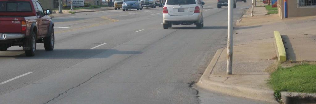
5 Traffic Data & Analysis Highlights Video of Existing Truck Traffic & Critical Turning Maneuvers Traffic Data & Level of Service Crash Data & Safety Analysis


6 Purpose and Need
7 Traffic Data & Analysis Highlights Video of Existing Truck Traffic & Critical Turning Maneuvers Traffic Data & Level of Service Crash Data & Safety Analysis
8 Daily Traffic Along US 81 - Without/With Bypass (2012,2040) Annual Average Daily Traffic Location 2012 w/o Bypass 2012 w/ Bypass 2040 w/o Bypass 2040 w/ Bypass 1 11,280 8,770 17,600 13, ,900 11,410 23,300 17, ,680 14,080 27,580 21,950 4 n/a 5,360 n/a 8,400 5 n/a 4,430 n/a 6,
9 Trucks Along US 81 - Without/With Bypass (2012, 2040) Daily Truck Traffic Location 2012 w/o Bypass 2012 w/ Bypass 2040 w/o Bypass 2040 w/ Bypass 1 1,900 1,200 3,000 1, ,000 1,100 3,120 1, ,600 1,670 4,060 2,600 4 n/a 1,230 n/a 1,920 5 n/a 1,020 n/a 1, Excessive truck traffic through Downtown Chickasha Affects Traffic Operations & Safety Restricts Sight Distance
 2040 Without Bypass")


10 Future Level of Service (LOS) Along US 81 Without Bypass (2040) 2040 Without Bypass LOS Legend: B C D Heavy Left Turns at US 81/Grand Avenue Intersection E F Long Queues & Excessive Delay Will Occur Along US 81 Extending South From US 81/ US 62 Intersection
11 Future Level of Service (LOS) Along US 81 With Bypass (2040) 2040 With Bypass LOS Legend: B C D E F Improved Traffic Flow & Operations


12 Five-Year Crash Data Along Existing US 81 (Years ) Total Crashes = 738 Injury Crashes = 218 Fatalities = 4 SEGMENT 4 SEGMENT 2 SEGMENT 3 SEGMENT 1
13 Five-Year Crash Data Along Existing US 81 (Years ) Five-Year Crash Data ( ) Crash Type Number of Crashes Crash Rate Along US 81 (per 100 million vehicle miles) Segment 1 - US 81 from SH 19, north to US 62 Statewide Average Crash Rate for Similar Facility (per 100 million vehicle miles) Fatality Injury Total Segment 2 US 62 from US 81, west to 11th Street Fatality Injury Total Segment 3 US 62 from 11th Street, west to US 81 North Fatality Injury Total Segment 4 US 81 north 1.5 miles from US 62 Fatality Injury Total


14 Five-Year Crash Data Along Existing US 81 (Years ) High Crash Intersections with Injury and Property Damage Injury = 8 PD = 42 Injury = 18 PD = 54 Injury = 3 PD = 19 Injury = 16 PD = 29 Injury = 9 PD = 21
15 Travel Time From To Travel Time Data Northern Terminus: North of the US 81/ US 62 intersection Southern Terminus: South of the US 81/ SH 19 East intersection Free Flow Speed Conditions along Existing US No-Build Peak Conditions 10 minutes minutes No-Build Peak Conditions minutes Build Peak Conditions along the Bypass 8 10 minutes 2040 Build Peak Conditions along Existing US minutes 1. Travel time subject to increase when over length and/or over width trucks are present
16 Improvement of Existing US 81 Improvement of Existing US 81 to LOS C Widen to 6-Lane and Continuous Left-Turn Lane: US 81/US 62 (Choctaw) to Minnesota; 5 Blocks Widen to 8-Lane and Continuous Left-Turn Lane: Minnesota to Grand; 16 Blocks Significant Right-of-Way Acquisition Required Impacts: Loss of Buildings, Businesses, and Parking throughout Corridor Loss of All Structures Adjacent to US 81, Choctaw to Kansas Downtown Historic District and Structures
17 US 81 Bypass Environmental Assessment Improvement of Existing US 81 Improvement of Existing US 81 Likely Not Feasible Funding likely unavailable due to impacts to historic resources Extensive right-of-way impacts
18 Proposed Project Controlled-Access 4-Lane Divided Western Bypass of Chickasha From Curve North of the US 81/SH 19 West Junction North to US 81/US 62

19 Alignment Presented at October 2011 Meeting (from 2007 Corridor Study)
20 Public Comments from First Meeting Public Comments from First Meeting: Suggested I-44 as US 81 truck bypass route Concerns regarding proximity to: Large church Residential neighborhood Concerns over socioeconomic impacts

21 Public Comments: I-44 as US 81 Truck Bypass Route Public Comments: I-44 as US 81 Truck Bypass Route Good Idea, but Some Significant Complications: Would require payment of H. E. Bailey Turnpike toll Turnpike toll gate restrictions 15 3 maximum height 9 6 maximum cash width 11 6 maximum pikepass width 80,000 lbs maximum weight
22 Public Comments: I-44 as US 81 Truck Bypass Route Public Comments: I-44 as US 81 Truck Bypass Route Cannot require all truck traffic to use I-44, as some truck traffic has local destination in Chickasha Longer route than going through town National Highway System routes need to provide access to truck traffic Based upon ODOT s understanding of state statutes, no authority to restrict truck traffic
23 Public Comments: I-44 as US 81 Truck Bypass Route Public Comments: I-44 as US 81 Truck Bypass Route Remove state highway designation from downtown route Dual designation for I-44/US 81 Approximate cost of improvements = $184M Limited options for capacity expansions beyond year 2040 Will not relieve congestion along US 62 west of US 81 (Choctaw) Increase congestion on US 62 east of US 81 Conclusion: Not the most feasible alignment
24 Public Comments from First Meeting Public Comments from First Meeting: Suggested I-44 as US 81 truck bypass route Concerns regarding proximity to: Large church Residential neighborhood Concerns over socioeconomic impacts
25 Public Comments: Proximity to Church and Neighborhood
26 Public Comments from First Meeting Public Comments from First Meeting: Suggested I-44 as US 81 truck bypass route Concerns regarding proximity to: Large church Residential neighborhood Concerns over socioeconomic impacts
27 Public Comment: Concerns over Socioeconomic Impacts Concerns over Socioeconomic Impacts Andy Atlas, AICP Vice-President, CP&Y Inc.
28 Purpose of the Socioeconomic Assessment Purpose of the Study To describe the social and economic conditions of the existing US 81 corridor and evaluate the socioeconomic impacts of a proposed bypass on the existing corridor


29 Aerial of the Study Area Industrial Facilities Historic District, Downtown Existing Business District (along S. 4 th St / US 81) I-44 Interchange
30 Socioeconomic Assessment Study Methodology Literature Review Data Analysis o o o o U.S. Census American Community Survey Floodplain Map Traffic Data Interviews with local residents Field Investigations Review of previous public involvement documentation
31 US 81 Bypass Environmental Assessment Existing Conditions / Environmental Consequences Land Use 290 businesses on existing corridor 16 percent vacancy rate 23 percent of businesses provide travel-related services Automotive Dining Accommodation Convenience stores

32 Existing Conditions / Environ mental Consequences Demographic Study Area Census blocks within 500 feet of the existing US 81 corridor
33 Existing Conditions / Environmental Consequences Population and Demographic Characteristics Study Area population declined between by 4.9 percent between 2000 and 2010 Chickasha s population is expected to grow to approximately 19,260 residents by 2030 The ethnicity in the study area and the City is predominantly White (non-hispanic) Population Change Year State of Grady City of Study Oklahoma County Chickasha Area* Percent Change % 15.2% 1.2% 4.9% ,751,351 52,431 16,036 2,737

34 Existing Conditions / Environmental Consequences
35 Existing Conditions / Environmental Consequences Transportation Systems and Mobility Patterns Truck traffic on existing US 81 would be reduced from under the Build scenario compared to the No-Build scenario Four traffic fatalities in corridor from , including one pedestrian Traffic projections show that 2040 traffic on existing US 81 between US 62 and I-44 would exceed 2012 traffic by between 19 and 24 percent Overall traffic on US 81 (bypass and existing combined) would be more than 1,000 vehicles per day higher than No Build
36 Existing Conditions / Environmental Consequences Economic Conditions Annual average unemployment of 5.8 percent in Grady County was lower than the statewide rate of 6.2 percent in 2011 Primary employment industries in Chickasha are: social services, manufacturing, and retail trade Almost half of Grady County labor force (48.5 percent) commutes outside of Grady County Chickasha poverty rate of 21.6 percent is higher than County and State Sales tax revenues grew by two percent from 2009 to 2012 to $862,000
37 Conclusions Competing Goals: General economic revitalization of the community Maintaining vitality of individual businesses
38 Conclusions Potential costs to the community of a bypass Potential closure of some travel-related businesses Cost will tend to be short-term as travel increases on existing US 81
39 Conclusions Potential opportunities to the community of a bypass Increased traffic and business through Chickasha Revitalization of existing US 81 corridor Improved Safety Trucks will be able to move through town more quickly Economic development opportunities along bypass route at interchanges
40 Bypass Alignments under Consideration
41 Updated Environmental Assessment Study Area

42 Updated Constraints Map
43 Comparison of Bypass Alignments Alternative 100-Year Floodplains (linear feet) NWI Wetlands (linear feet) Prime Farmlands (acres) Potential Noise Impacts Potential for Hazardous Waste Impacts Local Access Estimated # of Relocations Level of Service Estimated Construction Cost ($M) No-Build NA None No Change 0 D* 0 Alignment 1 6, None Best nearest to town (US-62, Idaho Avenue, Grand Avenue, Norge Road, I-44) 2 Commercial 7 Residential B Alignment 2 4, Slight Potential from O&G sites Good further west than #1 (US-62, Idaho Avenue, Grand Avenue, Norge Road, I-44) 1 Commercial 5 Residential B Alignment 3 5, Slight Potential from O&G and industrial sites Fair further west than #1 and #2 (US-62, Idaho Avenue, Grand Avenue, Norge Road, I-44) 2 Commercial 6 Residential B *: Level of Service along existing US 81 improves to C upon construction of bypass.
44 What Happens Next? Consider Comments from this Public Meeting Select a Preferred Alignment Conduct Field Studies Prepare Draft EA Document Public Hearing (Mid-2014); Comment Period Finalize EA Request FONSI from FHWA (Late 2014)
45 What Happens Next? Begin ROW Acquisition and Utility Relocation Process (2014) Begin Bypass Construction, as Funding Allows
46 Information Sources Web Address: Greg Worrell ODOT Phone: NE 21st Street Oklahoma City, OK Diane Abernathy SAIC Phone: W. Robinson, Suite 200 Norman, OK
47 Thank you!
48 Question and Answer Session
STH 60 Northern Reliever Route Feasibility Study Report
 #233087 v3 STH 60 Northern Reliever Route Feasibility Study Report Washington County Public Works Committee Meeting September 28, 2016 1 STH 60 Northern Reliever Route Feasibility Study Hartford Area Development
SH 249 IN GRIMES COUNTY. Open House April 3, 2014
 SH 249 IN GRIMES COUNTY Open House April 3, 2014 Meeting Agenda Purpose of Meeting Today: Review the purpose and need for the SH 249 Grimes County project Review the proposed project and alternatives Discuss
Highway 18 BNSF Railroad Overpass Feasibility Study Craighead County. Executive Summary
 Highway 18 BNSF Railroad Overpass Feasibility Study Craighead County Executive Summary October 2014 Highway 18 BNSF Railroad Overpass Feasibility Study Craighead County Executive Summary October 2014 Prepared
Public Information Workshop
 Public Information Workshop Charlotte County-Punta Gorda MPO - Meeting Rooms A and B March 29, 2018 Welcome to the Public Information Workshop for Harborview Road Project Development and Environment (PD&E)
I-820 (East) Project Description. Fort Worth District. Reconstruct Southern I-820/SH 121 Interchange
 Project Description. Fort Worth District. Reconstruct Southern I-820/SH 121 Interchange") I-820 (East) Project Description Fort Worth District Reconstruct Southern I-820/SH 121 Interchange I-820 from approximately 2,000 feet north of Pipeline Road/Glenview Drive to approximately 3,200 feet
I-820 (East) Project Description Fort Worth District Reconstruct Southern I-820/SH 121 Interchange I-820 from approximately 2,000 feet north of Pipeline Road/Glenview Drive to approximately 3,200 feet
Challenges in a Post-Katrina Environment East-West Corridor Project Overview February, 2007
 EAST-WEST CORRIDOR Challenges in a Post-Katrina Environment East-West Corridor Project Overview February, 2007 Presentation Agenda Project Overview / Purpose and Need Highway Component Transit Component
Mountainland Association of Governments SPRINGVILLE-SPANISH FORK AREA TRANSPORTATION STUDY APRIL 2012
 Mountainland Association of Governments SPRINGVILLE-SPANISH FORK AREA TRANSPORTATION STUDY APRIL 2012 PLANNING FOR OUR FUTURE Planners with the Mountainland Association of Governments (MAG) have evaluated
Attachment D Environmental Justice and Outreach
 Attachment D Environmental Justice and Outreach ATTACHMENT D Environmental Justice and Outreach Indicate whether the project will have disproportionately high and adverse impacts on minority or low income
Subarea Study. Manning Avenue (CSAH 15) Corridor Management and Safety Improvement Project. Final Version 1. Washington County.
 Corridor Management and Safety Improvement Project. Final Version 1. Washington County.") Subarea Study Manning Avenue (CSAH 15) Corridor Management and Safety Improvement Project Final Version 1 Washington County June 12, 214 SRF No. 138141 Table of Contents Introduction... 1 Forecast Methodology
Subarea Study Manning Avenue (CSAH 15) Corridor Management and Safety Improvement Project Final Version 1 Washington County June 12, 214 SRF No. 138141 Table of Contents Introduction... 1 Forecast Methodology
Purpose and Need Report
 Purpose and Need Report State Highway (SH) 29 From Southwestern Boulevard to SH 95 Williamson County, Texas (CSJ: 0337-02-045) Prepared by Blanton & Associates, Inc. Date: November, 2015 The environmental
MAP OR PHOTO. Public Meeting & Open House July 23, Project Roadway Limits From: FM 1957 To: FM 471. Counties Bexar & Medina
 Public Meeting & Open House July 23, 2013 Project Roadway Limits From: FM 1957 To: FM 471 MAP OR PHOTO Counties Bexar & Medina 1 I. Project History II. III. IV. Project Overview Project Alternatives Response
Open House. Highway212. Meetings. Corridor Access Management, Safety & Phasing Plan. 5:30 to 6:30 p.m. - Southwest Corridor Transportation Coalition
 Welcome Meetings 5:30 to 6:30 p.m. - Southwest Corridor Transportation Coalition 6:30 to 8:00 p.m. - Open House Why is Highway 212 Project Important? Important Arterial Route Local Support Highway 212
SH 249 PUBLIC MEETING DESIGN CHANGES FROM FM 2920 TO HARDIN STORE ROAD
 SH 249 PUBLIC MEETING DESIGN CHANGES FROM FM 2920 TO HARDIN STORE ROAD Lone Star College, Tomball Campus December 8, 2015 Open House 5:30-7:30 pm National Environmental Policy Act The environmental review,
Task Force Meeting January 15, 2009
 Task Force Meeting January 15, 2009 Study Update August 14 th Task Force Meeting Update on Traffic Projections and Financial Feasibility Study presented by Kane County and WSA staff The presentation summarized
U.S. 81 Realignment Around Chickasha, Oklahoma Benefit-Cost Analysis Narrative
 U.S. 81 Realignment Around Chickasha, Oklahoma Benefit-Cost Analysis Narrative Introduction U.S. 81 is part of the National Highway System. It runs north-south, from Texas to the Canadian border and passes
METRO Orange Line BRT American Boulevard Station Options
 METRO Orange Line BRT American Boulevard Station Options Bloomington City Council Work Session November 18, 2013 Christina Morrison BRT/Small Starts Project Office Coordinating Planning and Design AMERICAN
PUBLIC MEETING. Bear Creek Park Community Center. January 24, :30 pm to 7:30 pm
 PUBLIC MEETING Bear Creek Park Community Center January 24, 2017 5:30 pm to 7:30 pm PURPOSE OF THE MEETING This is an open House No formal presentation Introduce the project to the public Present existing
New Jersey Turnpike Authority Interchange 6 to 9 Widening Program
 New Jersey Turnpike Authority Interchange 6 to 9 Widening Program Tuesday, September 18, 2007 Public Hearings: Time: 5:00 PM - 8:00 PM Wednesday, September 19, 2007 Senior Center 3 Municipal Drive Bordentown,
FREQUENTLY ASKED QUESTIONS
 THE PROJECT Last updated on 2/19/16 FREQUENTLY ASKED QUESTIONS What s happening on Highway 169? The Minnesota Department of Transportation (MnDOT) is planning to rebuild and repair the infrastructure on
IH 35 FEASIBILITY STUDY
 IH 35 FEASIBILITY STUDY COOKE COUNTY, TEXAS February 1, 2007 Prepared by: Carter & Burgess, Inc. For: The Wichita Falls District of the Texas Department of Transportation INDEX I. INTRODUCTION. 3 II. PURPOSE
FREQUENTLY ASKED QUESTIONS
 THE PROJECT Last updated on 9/8/16 FREQUENTLY ASKED QUESTIONS What s happening on Highway 169? The Minnesota Department of Transportation (MnDOT) is planning to rebuild and repair the infrastructure on
WELCOME PUBLIC OPEN HOUSE FOR US-64 FROM THE SH-18 INTERSECTION EAST 6.5 MILES JANUARY 10TH, 2017 PAWNEE CITY HALL, 5:30 PM
 WELCOME PUBLIC OPEN HOUSE FOR US-64 FROM THE SH-18 INTERSECTION EAST 6.5 MILES JANUARY 10TH, 2017 PAWNEE CITY HALL, 5:30 PM 1 PURPOSE OF THIS OPEN HOUSE Present information about the proposed improvements
The Jack A. Markell Trail Delaware s Bicycle Highway New England Bike- Walk Summit
 The Jack A. Markell Trail Delaware s Bicycle Highway 2018 New England Bike- Walk Summit The Jack A. Markell Trail Sometimes a very difficult project, including significant investment and perseverance,
Needs and Community Characteristics
 Needs and Community Characteristics Anticipate Population and Job Growth in the City Strongest density of population and jobs in Ann Arbor are within the Study Area Population expected to grow 8.4% by
Executive Summary. Draft Environmental Impact Statement/Environmental Impact Report ES-1
 Executive Summary Introduction The Eastside Transit Corridor Phase 2 Project is a vital public transit infrastructure investment that would provide a transit connection to the existing Metro Gold Line
Alpine Highway to North County Boulevard Connector Study
 Alpine Highway to North County Boulevard Connector Study prepared by Avenue Consultants March 16, 2017 North County Boulevard Connector Study March 16, 2017 Table of Contents 1 Summary of Findings... 1
FRESNO COUNTY SUBSECTION OF THE CALIFORNIA HIGH- SPEED TRAIN (HST)
") FRESNO COUNTY SUBSECTION OF THE CALIFORNIA HIGH- SPEED TRAIN (HST) The Fresno County subsection of the California High- Speed Train System (HST) is analyzed in two separate EIR/EISs the Merced-Fresno EIR/EIS
FRESNO COUNTY SUBSECTION OF THE CALIFORNIA HIGH- SPEED TRAIN (HST) The Fresno County subsection of the California High- Speed Train System (HST) is analyzed in two separate EIR/EISs the Merced-Fresno EIR/EIS
VIADUCT LOCATION STUDY. October 19, 2009
 VIADUCT LOCATION STUDY October 19, 2009 Background Information Traffic Study Alternative Evaluation Public Involvement Preferred Concept Next Steps Evaluate alternatives for the location of a viaduct to
PUBLIC INFRASTRUCTURE PROJECTS
 PUBLIC INFRASTRUCTURE PROJECTS FM 664 / OVILLA ROAD WIDENING & IMPROVEMENTS FM 664 / OVILLA ROAD CONNECTS US 287 WITH I-45 (SOURCE: TEXAS DEPARTMENT OF TRANSPORTATION. 2016 FM 664 / OVILLA ROAD WIDENING
TXDOT PLANNING CONFERENCE. Quincy D. Allen, P.E. Houston District Engineer June 16, 2016
 TXDOT PLANNING CONFERENCE Quincy D. Allen, P.E. Houston District Engineer June 16, 2016 Welcome to Houston Show video...http://youtu.be/knchpl8sdfu Population Growth in Texas Texas added 1.3 million people
Madison BRT Transit Corridor Study Proposed BRT Operations Plans
 Madison BRT Transit Corridor Study Proposed BRT Operations Plans This paper presents a description of the proposed BRT operations plan for use in the Madison BRT Transit Corridor Study. The objective is
The Eastern Connector Study November, 2007 planning for the future
 The Eastern Connector Study November, 2007 planning for the future In late 2006, Albemarle County and the City of Charlottesville jointly initiated the Eastern Connector Corridor Study. The Project Team
Fresno County. Sustainable Communities Strategy (SCS) Public Workshop
 Public Workshop") Fresno County Sustainable Communities Strategy (SCS) Public Workshop Project Background Senate Bill 375 Regional Transportation Plan (RTP) Greenhouse gas emission reduction through integrated transportation
Fresno County Sustainable Communities Strategy (SCS) Public Workshop Project Background Senate Bill 375 Regional Transportation Plan (RTP) Greenhouse gas emission reduction through integrated transportation
Traffic Engineering Study
 Traffic Engineering Study Bellaire Boulevard Prepared For: International Management District Technical Services, Inc. Texas Registered Engineering Firm F-3580 November 2009 Executive Summary has been requested
Introduction and Background Study Purpose
 Introduction and Background The Brent Spence Bridge on I-71/75 across the Ohio River is arguably the single most important piece of transportation infrastructure the Ohio-Kentucky-Indiana (OKI) region.
Kendall Drive Premium Transit PD&E Study Project Kick-Off Meeting SR 94/Kendall Drive/SW 88 Street Project Development and Environment (PD&E) Study
 Study") Florida Department of Transportation District Six Kendall Drive Premium Transit PD&E Study Project Kick-Off Meeting SR 94/Kendall Drive/SW 88 Street Project Development and Environment (PD&E) Study What
Florida Department of Transportation District Six Kendall Drive Premium Transit PD&E Study Project Kick-Off Meeting SR 94/Kendall Drive/SW 88 Street Project Development and Environment (PD&E) Study What
Harlem Avenue between 63 rd and 65 th
 Harlem Avenue between 63 rd and 65 th Public Meeting #2 March 13, 2018 Summit Park District Welcome to the second Public Meeting for the preliminary engineering and environmental studies of Illinois 43
EXCEPTION TO STANDARDS REPORT
 EXCEPTION TO STANDARDS REPORT PROJECT DESCRIPTION AND NEED The project is located in Section 6, Township 23 North, Range 9 East and Section 31 Township 24 North, Range 9 East, in the Town of Stockton,
Rocky Mount. Transportation Plan. Transportation Planning Division. Virginia Department of Transportation
 2020 Transportation Plan Developed by the Transportation Planning Division of the Virginia Department of Transportation in cooperation with the U.S. Department of Transportation, Federal Highway Administration
Table of Contents INTRODUCTION... 3 PROJECT STUDY AREA Figure 1 Vicinity Map Study Area... 4 EXISTING CONDITIONS... 5 TRAFFIC OPERATIONS...
 Crosshaven Drive Corridor Study City of Vestavia Hills, Alabama Table of Contents INTRODUCTION... 3 PROJECT STUDY AREA... 3 Figure 1 Vicinity Map Study Area... 4 EXISTING CONDITIONS... 5 TRAFFIC OPERATIONS...
Location Concept Plan Amendment Recommendation Approved 2011 Concept Plan
 Valley Line West LRT Concept Plan Recommended Amendments Lewis Farms LRT Terminus Site Location Concept Plan Amendment Recommendation Approved 2011 Concept Plan Lewis Farms LRT terminus site, 87 Avenue/West
Pedestrians, Cars, Buses and Trains? Considerations for Rapid Transit Service at Western University
 Pedestrians, Cars, Buses and Trains? Considerations for Rapid Transit Service at Western University Shift: The City of London s Rapid Transit Proposal Shift: The City of London s Rapid Transit Proposal
US 69/75 Controlled Access Highway and Grade Separations Benefit-Cost Analysis Narrative
 US 69/75 Controlled Access Highway and Grade Separations Introduction The Oklahoma Department of Transportation (ODOT) proposes to improve safety and efficiency of high volume freight traffic along the
Alternatives Analysis Findings Report
 6.0 This chapter presents estimates of the potential capital, operations and maintenance costs associated with the alternatives carried forward for detailed evaluation. The methodology used to develop
Parks and Transportation System Development Charge Methodology
 City of Sandy Parks and Transportation System Development Charge Methodology March, 2016 Background In order to implement a City Council goal the City of Sandy engaged FCS Group in January of 2015 to update
PROJECT BACKGROUND 3
 AGENDA 1. Welcome & Introductions 2. Project Background 3. Project Approach & Schedule 4. Draft Long List of Options 5. Evaluation Process 6. Next Steps 2 PROJECT BACKGROUND 3 OUR RAPID TRANSIT NETWORK
MPO Staff Report Technical Advisory Committee: July 12, 2017
 MPO Staff Report Technical Advisory Committee: July 12, 2017 RECOMMENDED ACTION: 2 nd TAC Meeting with Kimley-Horn/WSB in Updating the Street/Highway Element of 2045 Metropolitan Transportation Plan. Matter
San Rafael Transit Center. Update. Golden Gate Bridge, Highway & Transportation District Transportation Committee of the Board of Directors
 Transportation Committee November 17, 2016 Agenda Item No. 5, Update on the San Rafael Transit Center Relocation San Rafael Transit Center Relocation Study Update 11/17/16 Golden Gate Bridge, Highway &
PUBLIC MEETINGS. Winter TOPRS Winter 2014 Public Meeting Presentation
 PUBLIC MEETINGS Winter 2014 BACKGROUND 2 Why study rail between Oklahoma and South Texas? IH-35 is congested and will continue to get more congested as Texas population and economy grow. Passenger rail
Rail~Volution 2005 Hal Ryan Johnson, AICP, Bus Rapid Transit Project Manager Utah Transit Authority September 7, 2005
 Rail~Volution 2005 Hal Ryan Johnson, AICP, Bus Rapid Transit Project Manager Utah Transit Authority September 7, 2005 Public Transit District Utah Transit Authority Linear Geographic Area - 130 miles by
Landside Access Modernization Program (LAMP)
") Landside Access Modernization Program (LAMP) LAX Los Angeles International Airport is the 2 nd busiest airport in the United States and is the largest airport in California. Since the start of the economic
Landside Access Modernization Program (LAMP) LAX Los Angeles International Airport is the 2 nd busiest airport in the United States and is the largest airport in California. Since the start of the economic
Project Description: Georgia Department of Transportation Public Information Open House Handout PI#(s): , County: Muscogee
: , County: Muscogee") Why We Are Here: GDOT s Transportation Improvement Act (TIA) Office, the City of Columbus, and the project delivery team are here this evening to display and answer questions concerning the proposed roadway
Why We Are Here: GDOT s Transportation Improvement Act (TIA) Office, the City of Columbus, and the project delivery team are here this evening to display and answer questions concerning the proposed roadway
Public Meeting. SD Highway 28 From US81 W 11 miles through Lake Norden Hamlin County PH 0028(37)329 PCN 04JY
329 PCN 04JY") Public Meeting SD Highway 28 From US81 W 11 miles through Lake Norden Hamlin County PH 0028(37)329 PCN 04JY Neil Schochenmaier, PE Road Design Engineering Supervisor March 16, 2017 Purpose of the Meeting
Public Meeting SD Highway 28 From US81 W 11 miles through Lake Norden Hamlin County PH 0028(37)329 PCN 04JY Neil Schochenmaier, PE Road Design Engineering Supervisor March 16, 2017 Purpose of the Meeting
Goods Movement Plans. Summary of Needs Assessments. January 21, 2015 GOODS MOVEMENT COLLABORATIVE AND GOODS MOVEMENT PLAN 6
 Goods Movement Plans Summary of Needs Assessments January 21, 2015 GOODS MOVEMENT COLLABORATIVE AND GOODS MOVEMENT PLAN 6 Goods Movement Vision and Goals GOODS MOVEMENT COLLABORATIVE AND GOODS MOVEMENT
Restoration of Historic Streetcar Services in Downtown Los Angeles
 Restoration of Historic Streetcar Services in Downtown Los Angeles Early Scoping Meeting for Alternatives Analysis (AA) May 17, 2011 Introduction Key players Local lead agency: Metro Federal lead agency:
NORTH HOUSTON HIGHWAY IMPROVEMENT PROJECT (NHHIP)
") NORTH HOUSTON HIGHWAY IMPROVEMENT PROJECT (NHHIP) Project Overview Briefing Packet March 2017 PROJECT OVERVIEW Environmental Impact Statement (EIS) Project divided into 3 Segments Segment 1: Beltway 8
NORTH HOUSTON HIGHWAY IMPROVEMENT PROJECT (NHHIP) Project Overview Briefing Packet March 2017 PROJECT OVERVIEW Environmental Impact Statement (EIS) Project divided into 3 Segments Segment 1: Beltway 8
Clearlake Road (State Road 501) Project Development & Environment (PD&E) Study
 Project Development & Environment (PD&E) Study") Clearlake Road (State Road 501) Project Development & Environment (PD&E) Study FROM MICHIGAN AVENUE TO INDUSTRY ROAD BREVARD COUNTY, FLORIDA Financial Project ID No: 433605-1-22-01 Federal Aid Project
Clearlake Road (State Road 501) Project Development & Environment (PD&E) Study FROM MICHIGAN AVENUE TO INDUSTRY ROAD BREVARD COUNTY, FLORIDA Financial Project ID No: 433605-1-22-01 Federal Aid Project
Major Widening/New Roadway
 Revised Evaluation s Major Widening/New Roadway This page provides a summary of any revisions made to the draft scores presented at the October th Attributable Funds Committee meeting. The information
To: File From: Adrian Soo, P. Eng. Markham, ON File: Date: August 18, 2015
 Memo To: From: Adrian Soo, P. Eng. Markham, ON : 165620021 Date: Reference: E.C. Row Expressway, Dominion Boulevard Interchange, Dougall Avenue Interchange, and Howard 1. Review of Interchange Geometry
Federal Way Link Extension
 Federal Way Link Extension Draft EIS Summary Route & station alternatives and impacts Link Light Rail System Map Lynnwood Mountlake Terrace Lynnwood Link Extension Shoreline 14th Northgate 40 Northgate
Utilizing GIS Models in Prioritizing and Selecting Transportation Projects
 Utilizing GIS Models in Prioritizing and Selecting Transportation Projects GIS-T Conference Raleigh, NC April 7, 2016 Tyler Meyer, AICP Tram Truong, GISP Outline Case Studies: 1. MPO project selection
Turnpike Mitigation Program Application
 Ohio Department of Transportation & Ohio Turnpike and Infrastructure Commission Turnpike Mitigation Program Application Please note the following eligibility criteria: 1) Projects must be sponsored by
APPENDIX C1 TRAFFIC ANALYSIS DESIGN YEAR TRAFFIC ANALYSIS
 APPENDIX C1 TRAFFIC ANALYSIS DESIGN YEAR TRAFFIC ANALYSIS DESIGN YEAR TRAFFIC ANALYSIS February 2018 Highway & Bridge Project PIN 6754.12 Route 13 Connector Road Chemung County February 2018 Appendix
Maryland Gets to Work
 I-695/Leeds Avenue Interchange Reconstruction Baltimore County Reconstruction of the I-695/Leeds Avenue interchange including replacing the I-695 Inner Loop bridges over Benson Avenue, Amtrak s Northeast
Broward County Intermodal Center And People Mover. AASHTO Value Engineering Conference Presentation. September 1, 2009 San Diego, CA
 Project Development & Environment Study Broward County Intermodal Center And People Mover AASHTO Value Engineering Conference Presentation September 1, 2009 San Diego, CA Background P D & E Study Regional
TRAFFIC IMPACT STUDY. USD #497 Warehouse and Bus Site
 TRAFFIC IMPACT STUDY for USD #497 Warehouse and Bus Site Prepared by: Jason Hoskinson, PE, PTOE BG Project No. 16-12L July 8, 216 145 Wakarusa Drive Lawrence, Kansas 6649 T: 785.749.4474 F: 785.749.734
SOUTHERN GATEWAY. Transportation and Trinity River Project Committee 11 May 2015
 SOUTHERN GATEWAY Transportation and Trinity River Project Committee 11 May 2015 Southern Gateway Project History Began in 2001 as a Major Investment Study [ MIS ], Schematic, and Environmental Assessment
ANDERSON PROPERTY SITE ANALYSIS
 ANDERSON PROPERTY SITE ANALYSIS Introduction The Montgomery County Department of Transportation (MCDOT) initiated a feasibility study in the fall of 2012 to evaluate the need for transit service expansion
Public Meeting. City of Chicago Department of Transportation & Department of Housing and Economic Development
 Public Meeting City of Chicago Department of Transportation & Department of Housing and Economic Development Funded by Regional Transportation Authority September 12, 2011 In partnership with Presentation
TRAFFIC PARKING ANALYSIS
 TRAFFIC PARKING ANALYSIS NAPA FLEA MARKET COUNTY OF NAPA Prepared for: Tom Harding Napa-Vallejo Flea Market 33 Kelly Road American Canyon, CA 9453 Prepared by: 166 Olympic Boulevard, Suite 21 Walnut Creek,
Mississauga Bus Rapid Transit Preliminary Design Project
 Mississauga Bus Rapid Transit Preliminary Design Project PUBLIC INFORMATION CENTRE OCTOBER 2008 WELCOME The Mississauga Bus Rapid Transit (BRT) Project Thank you for attending this Public Information Centre.
Northeast Corridor Alternatives Analysis. Public Involvement Round 2 Input on Alternatives for Further Study
 Northeast Corridor Alternatives Analysis Public Involvement Round 2 Input on Alternatives for Further Study Feb. 7-9, 2012 Agenda Review project background Progress summary Recommended alternatives for
Prime Commercial Land in Developing Area
 W North Grand Avenue Access Road Prime Commercial Land in Developing Area Retail/Fuel Station Site off Great Access & Exposure On one of Porterville s Major East/West Corridor (North Grand) In High Traffic
TRANSPORTATION PLANNING PERFORMANCE MEASUREMENT USING GIS
 TRANSPORTATION PLANNING PERFORMANCE MEASUREMENT USING GIS TYLER MEYER, AICP 2015 AMPO Conference Clark County, NV October 2015 Overview Transportation Alternatives Program (TAP) overview MPO TAP Scoring
I-405 and SR 522/NE 145th Bus Rapid Transit. Elected Leadership Groups Meeting November 30, 2018
 I-405 and SR 522/NE 145th Bus Rapid Transit Elected Leadership Groups Meeting November 30, 2018 Agenda Welcome and Introductions Public Comment BRT Connection in Bothell Common Elements: Bus base, Station
WOODVILLE HIGHWAY (SR 363) PD&E STUDY From Capital Circle Southeast To Paul Russell Road FPID NUMBER: Public Hearing
 PD&E STUDY From Capital Circle Southeast To Paul Russell Road FPID NUMBER: Public Hearing") WOODVILLE HIGHWAY (SR 363) PD&E STUDY From Capital Circle Southeast To Paul Russell Road FPID NUMBER: 424009-3 Public Hearing May 9, 2013 This Public Hearing is being held in accordance with the Federal-aid
WOODVILLE HIGHWAY (SR 363) PD&E STUDY From Capital Circle Southeast To Paul Russell Road FPID NUMBER: 424009-3 Public Hearing May 9, 2013 This Public Hearing is being held in accordance with the Federal-aid
Car Sharing at a. with great results.
 Car Sharing at a Denver tweaks its parking system with great results. By Robert Ferrin L aunched earlier this year, Denver s car sharing program is a fee-based service that provides a shared vehicle fleet
Technical Feasibility Report
 Prepared For: Bow Concord I-93 Improvements Project Bow and Concord, NH Prepared By: 53 Regional Drive Concord, NH 03301 NHDOT Project # 13742 Federal Project #T-A000(018) September 2018 TABLE OF CONTENTS
Energy Technical Memorandum
 Southeast Extension Project Lincoln Station to RidgeGate Parkway Prepared for: Federal Transit Administration Prepared by: Denver Regional Transportation District May 2014 Table of Contents Page No. Chapter
Sound Transit East Link: Bus/LRT System Integration Study
 Sound Transit East Link: Bus/LRT System Integration Study Prepared For: Sound Transit King County Metro Mercer Island WSDOT Prepared By: CH2M HILL July, 2014 1 SOUND TRANSIT EAST LINK: BUS/LRT SYSTEMES
2.0 Development Driveways. Movin Out June 2017
 Movin Out June 2017 1.0 Introduction The proposed Movin Out development is a mixed use development in the northeast quadrant of the intersection of West Broadway and Fayette Avenue in the City of Madison.
Evaluation Considerations and Geometric Nuances of Reduced Conflict U-Turn Intersections (RCUTs)
") Evaluation Considerations and Geometric Nuances of Reduced Conflict U-Turn Intersections (RCUTs) 26 th Annual Transportation Research Conference Saint Paul RiverCentre May 20, 2015 Presentation Outline
Evaluation Considerations and Geometric Nuances of Reduced Conflict U-Turn Intersections (RCUTs) 26 th Annual Transportation Research Conference Saint Paul RiverCentre May 20, 2015 Presentation Outline
Metropolitan Freeway System 2007 Congestion Report
 Metropolitan Freeway System 2007 Congestion Report Minnesota Department of Transportation Office of Traffic, Safety and Operations Freeway Operations Section Regional Transportation Management Center March
City of Pacific Grove
 Regional Study Utilizing Caltrans Intersection Evaluation Section 7: City of Pacific Grove s: FIRST STREET AT CENTRAL AVENUE Transportation Agency for Monterey County Prepared by Transportation Agency
Restoration of Historic Streetcar Services in Downtown Los Angeles
 Restoration of Historic Streetcar Services in Downtown Los Angeles Alternatives Analysis Community Update Meeting August 2, 2011 Introduction Key players Local lead agency: Metro Federal lead agency: Federal
NORTH HOUSTON HIGHWAY IMPROVEMENT PROJECT (NHHIP): SEGMENT 3. April 19, 2018 NHHIP April 19, 2018
: SEGMENT 3. April 19, 2018 NHHIP April 19, 2018") NORTH HOUSTON HIGHWAY IMPROVEMENT PROJECT (NHHIP): SEGMENT 3 April 19, 2018 NHHIP OVERVIEW NHHIP divided into 3 Segments: Segment 1: I-45: Beltway 8 to I-610 (9 mi) 45 Segment 2: I-45: I-610 to I-10 (3
NORTH HOUSTON HIGHWAY IMPROVEMENT PROJECT (NHHIP): SEGMENT 3 April 19, 2018 NHHIP OVERVIEW NHHIP divided into 3 Segments: Segment 1: I-45: Beltway 8 to I-610 (9 mi) 45 Segment 2: I-45: I-610 to I-10 (3
Traffic Impact Analysis West Street Garden Plots Improvements and DuPage River Park Garden Plots Development Naperville, Illinois
 Traffic Impact Analysis West Street Garden Plots Improvements and DuPage River Park Garden Plots Development Naperville, Illinois Submitted by April 9, 2009 Introduction Kenig, Lindgren, O Hara, Aboona,
PORTS-TO-PLAINS. Corridor Planning. Ports-to-Plains Stakeholder Meeting
 PORTS-TO-PLAINS Corridor Planning Stakeholder Workshop - Agenda 1 Purpose of Stakeholder Workshops 3 2 Rural Transportation System Overview 4 3 Ports-to-Plains 8 4 5 6 7 I-27 Expansion Key Considerations
LAWRENCE TRANSIT CENTER LOCATION ANALYSIS 9 TH STREET & ROCKLEDGE ROAD / 21 ST STREET & IOWA STREET LAWRENCE, KANSAS
 LAWRENCE TRANSIT CENTER LOCATION ANALYSIS 9 TH STREET & ROCKLEDGE ROAD / 21 ST STREET & IOWA STREET LAWRENCE, KANSAS TRAFFIC IMPACT STUDY FEBRUARY 214 OA Project No. 213-542 TABLE OF CONTENTS 1. INTRODUCTION...
I-10 West AA/EIS Pre-Screening and Tier 1 Analysis Results. Public Meeting. Wulf Grote, Director Project Development Rick Pilgrim, Project Manager
 I-10 West AA/EIS Pre-Screening and Tier 1 Analysis Results Public Meeting Wulf Grote, Director Project Development Rick Pilgrim, Project Manager March 4 & 5, 2008 Today s Agenda Overview of Alternatives
6/6/2018. June 7, Item #1 CITIZENS PARTICIPATION
 June 7, 2018 Item #1 CITIZENS PARTICIPATION 1 Item #2 APPROVAL OF MINUTES Item #3 TRAC GOALS, FRAMEWORK & AGENDA REVIEW 2 COMMITTEE GOALS Learn about Southern Nevada s mobility challenges, new developments
Submission to Greater Cambridge City Deal
 What Transport for Cambridge? 2 1 Submission to Greater Cambridge City Deal By Professor Marcial Echenique OBE ScD RIBA RTPI and Jonathan Barker Introduction Cambridge Futures was founded in 1997 as a
Point A Point B Point C Point D. Fulton County Board of Commissioners and Mayors Meeting December 14, 2017
 Fulton County Board of Commissioners and Mayors Meeting December 14, 2017 Master Plan Overview Phase 1 Community Vision and Existing Transit Conditions Phase 2 Scenario Development Phase 3 Transit Master
Comprehensive Regional Goods Movement Plan and Implementation Strategy Goods Movement in the 2012 RTP/SCS
 Comprehensive Regional Goods Movement Plan and Implementation Strategy Goods Movement in the 2012 RTP/SCS Annie Nam Southern California Association of Governments September 24, 2012 The Goods Movement
APPENDIX E. Traffic Analysis Report
 APPENDIX E Traffic Analysis Report THIS PAGE INTENTIONALLY BLANK EAGLE RIVER TRAFFIC MITIGATION PHASE I OLD GLENN HIGHWAY/EAGLE RIVER ROAD INTERSECTION IMPROVEMENTS TRAFFIC ANALYSIS Eagle River, Alaska
Corridor Sketch Summary
 Corridor Sketch Summary SR 241: I-82 Jct (Sunnyside) to SR 24 Jct Corridor Highway No. 241 Mileposts: 7.53 to 25.21 Length: 17.65 miles Corridor Description The seventeen and one-half mile corridor begins
Railyard Alternatives & I-280 Boulevard Feasibility Study 1 RAILYARD ALTERNATIVES & I-280 BOULEVARD (RAB) FEASIBILITY STUDY
 FEASIBILITY STUDY") Railyard Alternatives & I-280 Boulevard Feasibility Study 1 RAILYARD ALTERNATIVES & I-280 BOULEVARD (RAB) FEASIBILITY STUDY RAB Citizen Working Group Meeting, August 1 st 2016 CITIZEN WORKING GROUP (CWG)
Railyard Alternatives & I-280 Boulevard Feasibility Study 1 RAILYARD ALTERNATIVES & I-280 BOULEVARD (RAB) FEASIBILITY STUDY RAB Citizen Working Group Meeting, August 1 st 2016 CITIZEN WORKING GROUP (CWG)
CROSSING RAIL PROJECT (P4) RAIL
 RAIL") GRAND CROSSING RAIL PROJECT (P4) Community Advisory Group October 10, 2012 1:30 pm Grand Crossing Park Field House 7655 S. Ingleside Avenue, Chicago GRAND CROSSING RAIL PROJECT (P4) Community Advisory
GRAND CROSSING RAIL PROJECT (P4) Community Advisory Group October 10, 2012 1:30 pm Grand Crossing Park Field House 7655 S. Ingleside Avenue, Chicago GRAND CROSSING RAIL PROJECT (P4) Community Advisory
Background Information about the Metrobus 29 Lines Study
 Background Information about the Metrobus 29 Lines Study Questions Overview of Existing Service Q. Why is the study being conducted? A. The 29 Lines provide an important connection between Annandale and
Expansion Projects Description
 Expansion Projects Description The Turnpike expansion program was authorized by the Florida Legislature in 1990 to meet the State s backlog of needed highway facilities. The Legislature set environmental