Goods Movement Plans. Summary of Needs Assessments. January 21, 2015 GOODS MOVEMENT COLLABORATIVE AND GOODS MOVEMENT PLAN 6
|
|
|
- Emma Knight
- 5 years ago
- Views:
Transcription


1 Goods Movement Plans Summary of Needs Assessments January 21, 2015 GOODS MOVEMENT COLLABORATIVE AND GOODS MOVEMENT PLAN 6


2 Goods Movement Vision and Goals GOODS MOVEMENT COLLABORATIVE AND GOODS MOVEMENT PLAN 7
3 Purpose of Needs Assessment Evaluate the existing and future conditions of freight assets against goals and performance measures (established in prior tasks) Identify gaps, issues and opportunities for each functional element based on performance measure ratings Help develop strategies to meet performance goals Strategies will be evaluated against all performance measures and all goals should be met through balanced portfolio of strategies GOODS MOVEMENT COLLABORATIVE AND GOODS MOVEMENT PLAN 8


4 Needs Assessment Overview Global Gateways Issues Global gateways handle international trade, and cover entry and exits points that are essential to moving imports/exports. These Issues are associated with Ports, Airports and other intermodal assets. Interregional and Intraregional Corridors Issues Interregional corridors link Alameda County and the Bay Area with the rest of the U.S. Issues along major highway and rail corridors. Local Streets and Roads Issues Local streets and roads link global gateways and the interregional and intraregional corridors. These issues include issues on city truck routes and local streets, and last-mile connectors. Cross-Cutting Issues Air quality and public health Industrial land supply Crude by rail Sea level l rise Higher level regional analysis coordinated with detailed Alameda County Analysis GOODS MOVEMENT COLLABORATIVE AND GOODS MOVEMENT PLAN 9
5 Needs Assessment Summary Local Streets t and Roads Issues GOODS MOVEMENT COLLABORATIVE AND GOODS MOVEMENT PLAN 10


6 Role of Local Streets and Roads in Goods Movement Economic driver Almost 50% of goods in the Bay Area are entirely local Local delivery and pick up Critical last-mile connectivity needed to/from freight hubs Source: FAF 3.5 Provisional Data and Forecasts. GOODS MOVEMENT COLLABORATIVE AND GOODS MOVEMENT PLAN 11
7 Summary of Local Street and Roads Needs Truck routes connectivity it Access, land use and modal conflicts Truck route performance Congestion, safety Truck Parking Pavement Conditions GOODS MOVEMENT COLLABORATIVE AND GOODS MOVEMENT PLAN 12


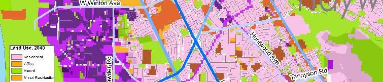


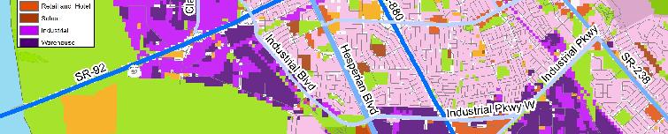
8 Connectivity and Land Use Conflicts Residential Area Industrial Users Residential Area Industrial Users Source: MTC Land Use Data; Cambridge Systematics GOODS MOVEMENT COLLABORATIVE AND GOODS MOVEMENT PLAN 13
9 Focus on Alameda County Congestion and Delay AM Peak Source: INRIX 2014, Cambridge Systematics analysis. GOODS MOVEMENT COLLABORATIVE AND GOODS MOVEMENT PLAN 14
10 Focus on Alameda County Congestion and Delay PM Peak Source: INRIX 2014, Cambridge Systematics analysis. GOODS MOVEMENT COLLABORATIVE AND GOODS MOVEMENT PLAN 15


11 Truck Parking Issues Port-related Corridor parking for Urban delivery parking in West long haul parking Oakland Corridor parking photo: Urban Delivery photo: NACTO Webinar, Freight Considerations in World Class Street Design, Stacey Hodge, March 13, 2014 GOODS MOVEMENT COLLABORATIVE AND GOODS MOVEMENT PLAN 16
12 Needs Assessment Summary Interregional and Intraregional Corridor Issues - Highways GOODS MOVEMENT COLLABORATIVE AND GOODS MOVEMENT PLAN 17
13 Importance of Highway Corridors Regional View Total = 454,146 KTons Freight Flows by Tonnage Other and unknown 7,651; 2% No domestic mode 15,456; 3% Total = $643,836 Million Freight Flows by Value Pipeline 30,613; 5% Other and unknown 9,920; 1% No domestic mode 6,238; 1% Multiple modes & mail 27,606; 6% Air (include truck-air) 688; 0% Water 12,740; 3% Pipeline 49,174; 11% Truck 326,198; 72% Air (include truck-air) 68,177; 11% Multiple modes & mail 121,015; 19% Truck 390,975; 61% Rail 14,634; 3% Water 3,283; 0% Rail 13,616; 2% Source: Cambridge Systematics FAF Disaggregated Database. GOODS MOVEMENT COLLABORATIVE AND GOODS MOVEMENT PLAN 18
14 Summary of Inter-Regional and Intra-Regional Highway Needs Congestion and Mobility Highest levels of truck delay on I-880, I-80 (Oakland to Berkeley), U.S.101 in San Jose, SR 4 at Port Chicago Freeway Travel Time Reliability Worst truck reliability on I-80, I-580, and I-880 East-West Connectivity SR12/SR37 needs, SR 4 connectivity it to SJV, SR 152 future potential ti I-80/I-680/SR 12 Interchange and WB Truck Scales Truck-Involved Crashes Pavement and Bridge Conditions GOODS MOVEMENT COLLABORATIVE AND GOODS MOVEMENT PLAN 19
15 Focus on Alameda County - Top 10 Truck Delay Locations in AM Source: INRIX 2014 Speed Data; Alameda County Truck Travel Demand Model; PeMS time of day distribution, Cambridge Systematics analysis. GOODS MOVEMENT COLLABORATIVE AND GOODS MOVEMENT PLAN 20
16 Focus on Alameda County - Top 10 Truck Delay Locations in PM Source: INRIX 2014 Speed Data ; Alameda County Truck Travel Demand Model; PeMS time of day distribution, Cambridge Systematics analysis. GOODS MOVEMENT COLLABORATIVE AND GOODS MOVEMENT PLAN 21
17 Needs Assessment Summary Interregional and Intraregional Corridor Issues - Rail GOODS MOVEMENT COLLABORATIVE AND GOODS MOVEMENT PLAN 22
18 Summary of Inter-regional Rail Corridor Issues Congestion and capacity Changing nature and use of Northern CA Rail System Bulk unit trains and manifest traffic to ports Growth in domestic and international container traffic Passenger and Freight Conflicts Industrial Rail Spur Funding Needs Grade Crossing Improvements Grade separations, signal improvements Quiet zones to reduce community impacts GOODS MOVEMENT COLLABORATIVE AND GOODS MOVEMENT PLAN 23


19 Focus on Alameda County Train Volumes Trains/Day Source: AECOM and Cambridge Systematics GOODS MOVEMENT COLLABORATIVE AND GOODS MOVEMENT PLAN 24
20 Congestion/Capacity Needs V/C Ratio on Bay Area Rail Lines Parallel Highway Corridor Subdivision From: To: Freight Daily Trains Existing 2020 Total Daily Freight LOS Trains Daily Trains Total Daily Trains LOS I-880 UP Coast San Jose Newark 8 30 F F UP Coast Newark Oakland 6 8 C 8 10 C UP Niles Niles Oakland 2 18 C 2 26 E UP Oakland Niles Melrose 1 1 A N/A N/A N/A Sacramento Martinez C D I-80 UP Martinez Martinez Richmond C E Richmond Emeryville D E Emeryville Oakland D E I-580 UP Oakland Niles Stockton 4 12 B D US 101 UP Coast Gilroy San Jose 2 10 A 4 12 C Caltrain Peninsula San Jose San Francisco 6 93 E F BNSF Port Stockton C D Stockton Chicago Port SR 4 UP Tracy Martinez 4 4 A N/A N/A N/A Chicago GOODS MOVEMENT Port COLLABORATIVE AND GOODS MOVEMENT PLAN 25 UP Tracy Lathrop 0 0 A N/A N/A N/A Chicago
21 Needs Assessment Summary Global l Gateway Issues GOODS MOVEMENT COLLABORATIVE AND GOODS MOVEMENT PLAN 26
22 Importance of Global Gateways in the Bay Area Freight Flows by Tonnage, 2012 Freight Flows by Value, 2012 Total = 454,146 KTons Total = $643,836 Million Exports 25,154; 6% Imports 40,658; 9% Exports 58,304; 9% Imports 98,454 15% Domestic 388,334; 85% Domestic 487,078; 76% Source: Cambridge Systematics FAF Disaggregated Database. GOODS MOVEMENT COLLABORATIVE AND GOODS MOVEMENT PLAN 27
23 Summary of Global Gateway Needs Seaports Operations issues at Port of Oakland Gate queueing issues, handling big ships Rail operations and access Bulk export opportunities Land use and access constraints Airports Sufficient capacity for growth SFO may experience constraints if international markets come back stronger in the future Highway congestion GOODS MOVEMENT COLLABORATIVE AND GOODS MOVEMENT PLAN 28


24 Focus on Alameda County Port of Oakland Needs Terminal Capacity Neighborhood Impacts Gate Queues 7 th Street Grade Crossing Bike and Pedestrian Access GOODS MOVEMENT COLLABORATIVE AND GOODS MOVEMENT PLAN 29
25 Needs Assessment Summary Cross-Cutting Issues GOODS MOVEMENT COLLABORATIVE AND GOODS MOVEMENT PLAN 30
26 Summary of Cross-Cutting Cutting Needs Regional Air Quality Impacts and Localized Public Health Effects Sea-level Rise Vulnerability and Risk Industrial Land Supply Crude by Rail GOODS MOVEMENT COLLABORATIVE AND GOODS MOVEMENT PLAN 31


27 Air Quality and Environmental Impacts - Emissions i from Freight Significant reductions but still major public health issue Source: Improving Air Quality and Health in Bay Area Communities, Community Air Risk Evaluation Program Retrospective and Path Forward ( ), BAAQMD, April GOODS MOVEMENT COLLABORATIVE AND GOODS MOVEMENT PLAN 32
28 Air Quality and Environmental Impacts Localized Health Effects Source: Bay Area Air Quality Management District. GOODS MOVEMENT COLLABORATIVE AND GOODS MOVEMENT PLAN 33
29 Opportunities and Strategiest GOODS MOVEMENT COLLABORATIVE AND GOODS MOVEMENT PLAN 34
30 Context- Setting Opportunities Goods Movement to Support Emerging Industries (biotech, artisanal foods, clean energy & transportation, advanced manufacturing, recycled materials) E-Commerce and Advanced Retail Distribution capture valueadded economic activity; neighborhood & commercial center impacts Goods Movement Workforce Development key source of job diversity; need to focus on access to jobs for impacted communities Bulk Exports and Expanded Rail Services growth in bulk exports at seaports; increased demand on rail corridors New Technologies ITS, equipment technology Integrated Planning coordinated land use, transportation and economic development; integration of complete streets concepts GOODS MOVEMENT COLLABORATIVE AND GOODS MOVEMENT PLAN 35
31 Examples of Strategies Projects Programs Policies/ Partnerships - Whipple Road widening and truck route designation from Central to Mission Boulevard in Union City - Construct I-580 eastbound truck climbing lane at the Altamont Summit - Port of Oakland Rail Access Improvements - Cross-jurisdictional Truck Route management program - Countywide Grade Separation program - Hour-peak delivery policy guidance and demonstration ti program - Policy guidance on insulating residential areas from health impacts of goods movement - Incorporation of sea level rise considerations during infrastructure rehab GOODS MOVEMENT COLLABORATIVE AND GOODS MOVEMENT PLAN 36
GTA West Corridor Planning and EA Study Stage 1
 GTA West Corridor Planning and EA Study Stage 1 Draft Development Strategy Presentation to Peel Goods Movement Task Force April 8 2011 Study Areas 2 Unique Approach Unprecedented two-stage EA process:
Rail alignment and benefits (rab) study
 study") Rail alignment and benefits (rab) study previously known as railyard alternatives & i-280 boulevard study June 5, 2018 CONNECTING CALIFORNIA 4,300 lane miles + 115 Airport gates would be needed to create
Rail alignment and benefits (rab) study previously known as railyard alternatives & i-280 boulevard study June 5, 2018 CONNECTING CALIFORNIA 4,300 lane miles + 115 Airport gates would be needed to create
Transit in Bay Area Blueprint
 Rail~Volution 2010 Click to edit Master title style Transit in Bay Area Blueprint October 21, 2010 0 Bottom Line State-of-Good Repair essential for reliable transit service large funding shortfalls BART
Comprehensive Regional Goods Movement Plan and Implementation Strategy Goods Movement in the 2012 RTP/SCS
 Comprehensive Regional Goods Movement Plan and Implementation Strategy Goods Movement in the 2012 RTP/SCS Annie Nam Southern California Association of Governments September 24, 2012 The Goods Movement
UCLA Lake Arrowhead Conference. October 18, 2010
 BART Click to Capacity edit Master Overview title style for UCLA Lake Arrowhead Conference October 18, 2010 0 BART Basics 360,000 daily riders 104 miles 43 stations 1.3 billion annual passenger miles 1
UCLA Lake Arrowhead Conference. October 18, 2010
 BART Click to Capacity edit Master Overview title style for UCLA Lake Arrowhead Conference October 18, 2010 0 BART Basics 360,000 daily riders 104 miles 43 stations 1.3 billion annual passenger miles 1
UCLA Lake Arrowhead Conference. October 18, 2010
 BART Click to Capacity edit Master Overview title style for UCLA Lake Arrowhead Conference October 18, 2010 0 BART Basics 360,000 daily riders 104 miles 43 stations 1.3 billion annual passenger miles 1
REGIONAL RAIL RIGHT OF WAY ACTION PLAN TECHNICAL MEMORANDUM #1 RIGHT OF WAY INVENTORY
 REGIONAL RAIL RIGHT OF WAY ACTION PLAN TECHNICAL MEMORANDUM #1 RIGHT OF WAY INVENTORY This memorandum provides an update to the description of corridor planning contained in the 2007 MTC Regional Rail
Rail alignment and benefits (rab) study
 study") Rail alignment and benefits (rab) study previously known as railyard alternatives & i-280 boulevard study May 22, 2018 CONNECTING CALIFORNIA 4,300 lane miles + 115 Airport gates would be needed to create
Rail alignment and benefits (rab) study previously known as railyard alternatives & i-280 boulevard study May 22, 2018 CONNECTING CALIFORNIA 4,300 lane miles + 115 Airport gates would be needed to create
ALAMEDA CORRIDOR. A A Project of National Significance. TRB Summer Conference MTS as a Component of the Nation s Transportation System June 25, 2002
 ALAMEDA CORRIDOR A A Project of National Significance TRB Summer Conference MTS as a Component of the Nation s Transportation System June 25, 2002 Top U.S. Container Ports (2001) LOS ANGELES 5.18 LONG
CONNECTING AND TRANSFORMING CALIFORNIA
 CONNECTING AND TRANSFORMING CALIFORNIA High-Speed Rail Local Policy Maker Group (LPMG) San Carlos, CA January 28, 2016 INTRODUCTIONS 1 STATEWIDE OVERVIEW CONNECTING CALIFORNIA Phase I:» 520 Miles» San
BROWARD BOULEVARD CORRIDOR TRANSIT STUDY
 BROWARD BOULEVARD CORRIDOR TRANSIT STUDY FM # 42802411201 EXECUTIVE SUMMARY July 2012 GOBROWARD Broward Boulevard Corridor Transit Study FM # 42802411201 Executive Summary Prepared For: Ms. Khalilah Ffrench,
City of Pacific Grove
 Regional Study Utilizing Caltrans Intersection Evaluation Section 7: City of Pacific Grove s: FIRST STREET AT CENTRAL AVENUE Transportation Agency for Monterey County Prepared by Transportation Agency
San Rafael Transit Center. Update. Golden Gate Bridge, Highway & Transportation District Transportation Committee of the Board of Directors
 Transportation Committee November 17, 2016 Agenda Item No. 5, Update on the San Rafael Transit Center Relocation San Rafael Transit Center Relocation Study Update 11/17/16 Golden Gate Bridge, Highway &
San Francisco Mobility, Access & Pricing Study
 San Francisco Mobility, Access & Pricing Study SAN FRANCISCO COUNTY TRANSPORTATION AUTHORITY Summer Workshops 2010 Downtown Growth Projections + 24,000 hsg units + 107,000 jobs +184,000 auto trips +88,000
Broward County Intermodal Center And People Mover. AASHTO Value Engineering Conference Presentation. September 1, 2009 San Diego, CA
 Project Development & Environment Study Broward County Intermodal Center And People Mover AASHTO Value Engineering Conference Presentation September 1, 2009 San Diego, CA Background P D & E Study Regional
US 81 Bypass of Chickasha Environmental Assessment Public Meeting
 US 81 Bypass of Chickasha Environmental Assessment Public Meeting March 14, 2013 Introductions ODOT FHWA SAIC Meeting Purpose Present need for bypass Provide responses to 10/04/11 public meeting comments
Railyard Alternatives & I-280 Boulevard Feasibility Study 1 RAILYARD ALTERNATIVES & I-280 BOULEVARD (RAB) FEASIBILITY STUDY
 FEASIBILITY STUDY") Railyard Alternatives & I-280 Boulevard Feasibility Study 1 RAILYARD ALTERNATIVES & I-280 BOULEVARD (RAB) FEASIBILITY STUDY RAB Citizen Working Group Meeting, August 1 st 2016 CITIZEN WORKING GROUP (CWG)
Railyard Alternatives & I-280 Boulevard Feasibility Study 1 RAILYARD ALTERNATIVES & I-280 BOULEVARD (RAB) FEASIBILITY STUDY RAB Citizen Working Group Meeting, August 1 st 2016 CITIZEN WORKING GROUP (CWG)
Caltrain Downtown Extension Study Ridership Forecast Summary
 Caltrain Downtown Extension Study Ridership Forecast Summary presented to Transbay Joint Powers Authority presented by Cambridge Systematics date: March 12, 2009 Transportation leadership you can trust.
Redefining Mobility Ready or not: Autonomous and connected vehicle planning and policy, now and in the future
 Redefining Mobility Ready or not: Autonomous and connected vehicle planning and policy, now and in the future Randy Iwasaki November 30, 2017 WHO WE ARE The Contra Costa Transportation Authority (CCTA)
CITY COUNCIL STUDY SESSION UPDATE ON SMART. January 19, 2017 CITY OF SAN RAFAEL
 CITY COUNCIL STUDY SESSION UPDATE ON SMART January 19, 2017 CITY OF SAN RAFAEL SONOMA MARIN AREA RAIL TRANSIT UPDATE OUTLINE BACKGROUND INITIAL OPERATION SYSTEM (IOS1) CIVIC CENTER AREA LARKSPUR EXTENSION
This Evening s Agenda. Open House 7:00 7:30 Presentation 7:30 8:00 Community Feedback8:00 9:00 Adjourn
 This Evening s Agenda Open House 7:00 7:30 Presentation 7:30 8:00 Community Feedback8:00 9:00 Adjourn Preliminary Station Footprint Potential Mid-Peninsula High Speed Train Station Palo Alto Dominic Spaethling,
Redefining Mobility. Randy Iwasaki. Executive Director Contra Costa Transportation Authority January 18, 2018
 Redefining Mobility Randy Iwasaki Executive Director Contra Costa Transportation Authority January 18, 2018 Who We Are CCTA is a public agency formed by voters in 1988 to manage the county s transportation
The Jack A. Markell Trail Delaware s Bicycle Highway New England Bike- Walk Summit
 The Jack A. Markell Trail Delaware s Bicycle Highway 2018 New England Bike- Walk Summit The Jack A. Markell Trail Sometimes a very difficult project, including significant investment and perseverance,
TransNet Dollars Keep San Diego Moving
 TransNet Dollars Keep San Diego Moving In 1987, San Diego region voters approved the TransNet program a half-cent sales tax to fund a variety of important transportation projects throughout the region.
Develop ground transportation improvements to make the Airport a multi-modal regional
 Project Overview TRANSPORTATION IMPROVEMENTS WHAT ARE THE PROJECT GOALS? Transportation transportation hub. Develop ground transportation improvements to make the Airport a multi-modal regional Land Use
Agenda. Preliminary Station Footprint High Speed Train Station in the City of Millbrae
 Agenda Preliminary Station Footprint High Speed Train Station in the City of Millbrae Open House 7:00 7:30 Presentation 7:30 8:00 Community Question/Answer 8:00 9:00 Adjourn 2 Preliminary Station Footprint
Harlem Avenue between 63 rd and 65 th
 Harlem Avenue between 63 rd and 65 th Public Meeting #2 March 13, 2018 Summit Park District Welcome to the second Public Meeting for the preliminary engineering and environmental studies of Illinois 43
IMPROVEMENT CONCEPTS
 IMPROVEMENT CONCEPTS for the South Novato Transit Hub Study Prepared by: January 11, 2010 DKS Associates With Wilbur Smith Associates IMPROVEMENT CONCEPTS Chapter 1: Introduction 1. INTRODUCTION The strategic
Major Widening/New Roadway
 Revised Evaluation s Major Widening/New Roadway This page provides a summary of any revisions made to the draft scores presented at the October th Attributable Funds Committee meeting. The information
Caltrain Business Plan. Project Update July 2018 through January 2019
 Caltrain Business Plan JANUARY 2019 Project Update July 2018 through January 2019 2 Business Plan Overview Business Plan Overview A Vision for Growth Crafting Scenarios Looking Beyond the Tracks Outreach
Connected Vehicle and Autonomous Vehicle (CV/AV) Mobility and Technology
 Mobility and Technology") Connected Vehicle and Autonomous Vehicle (CV/AV) Mobility and Technology Randy Iwasaki Executive Director Contra Costa Transportation Authority May13, 2016 WHO WE ARE The Contra Costa Transportation Authority
Connected Vehicle and Autonomous Vehicle (CV/AV) Mobility and Technology Randy Iwasaki Executive Director Contra Costa Transportation Authority May13, 2016 WHO WE ARE The Contra Costa Transportation Authority
I-405 Corridor Master Plan
 Southern California Association of Governments I-405 Corridor Master Plan Presentation to Streets and Freeways Subcommittee October 13, 2015 1 Presentation Overview Expectations and Approach Corridor Performance
Transportation Sustainability Program
 Transportation Sustainability Program Photo: Sergio Ruiz San Francisco 2016 Roads and public transit nearing capacity Increase in cycling and walking despite less than ideal conditions 2 San Francisco
Speaker Information Tweet about this presentation #TransitGIS
 Making the Case for Transit: the Transit Competitiveness Index Title William E. Walter, GISP Speaker Information Tweet about this presentation #TransitGIS Understanding Conditions in Each Travel Market
City of Marina. Regional Roundabout Study Utilizing Caltrans Intersection Control Evaluation Section 4: Transportation Agency for Monterey County
 Regional Roundabout Study Utilizing Caltrans Intersection Control Evaluation Section 4: City of Marina Study Intersections: RESERVATION ROAD AT BEACH ROAD RESERVATION ROAD AT DEFOREST ROAD CARDOZA AVENUE
Harlem Avenue between 63 rd and 65 th
 Harlem Avenue between 63 rd and 65 th Community Advisory Group Meeting #3 December 1, 2017 Bedford Park Public Library 1 Meeting Agenda 1. Welcome/Introductions (3 mins) 2. Project Overview and Re-Cap
Executive Summary. Treasure Valley High Capacity Transit Study Priority Corridor Phase 1 Alternatives Analysis October 13, 2009.
 Treasure Valley High Capacity Transit Study Priority Corridor Phase 1 Alternatives Analysis October 13, 2009 Background As the Treasure Valley continues to grow, high-quality transportation connections
Brigham City 1200 West Box Elder Creek Bridge - Widening Project Type Reconstruction
 Brigham City 1200 West Box Elder Creek Bridge - Widening Project Type Reconstruction 550 North to 650 North $ 1,750,000 $ 1,582,113 To widen an existing bridge on 1200 West over Box Elder Creek that will
Overview of Regional Commuter Rail Webinar: Phoenix, Arizona December 18, 2013
 Overview of Regional Commuter Rail Webinar: Phoenix, Arizona December 18, 2013 2013, All Rights Reserved. 1 The Maricopa Association of Governments (MAG) is the designated metropolitan planning organization
Caltrain Business Plan
 Caltrain Business Plan FEBRUARY 2019 LPMG February 28, 2019 Caltrain Business Plan Project Update 2 3 What is the Caltrain Business Plan? What Why Addresses the future potential of the railroad over the
Southern California - CHSRA
 CALIFORNIA HIGH-SPEED RAIL Michael Gillam, Deputy Program Director Southern California - CHSRA CMAA - Construction Management Association of America July 19, 2012 CALIFORNIA S HIGH-SPEED TRAIN SYSTEM Largest
Chapter 7. Transportation Capital Improvement Projects. Chapter 7
 Chapter 7 Transportation Capital Improvement Projects Chapter 7 81 Chapter 7 Transportation Capital Improvement Projects Local Transportation Sales Tax Programs For over three decades, Santa Clara County
STH 60 Northern Reliever Route Feasibility Study Report
 #233087 v3 STH 60 Northern Reliever Route Feasibility Study Report Washington County Public Works Committee Meeting September 28, 2016 1 STH 60 Northern Reliever Route Feasibility Study Hartford Area Development
Sustainability SFMTA Path to Platinum
 Sustainability SFMTA Path to Platinum Ed Reiskin San Francisco Municipal Transportation Agency, Director of Transportation San Francisco, CA Timothy Papandreou Deputy Director Strategic Planning & Policy
Emerging Technologies & Autonomous Vehicle Readiness Planning. Georgia Planning Association Conference Jekyll Island, GA September 5, 2018
 Emerging Technologies & Autonomous Vehicle Readiness Planning Georgia Planning Association Conference Jekyll Island, GA September 5, 2018 Agenda 1 U.S. Context 2 U.S. Survey on Emerging Technologies &
Open House. Highway212. Meetings. Corridor Access Management, Safety & Phasing Plan. 5:30 to 6:30 p.m. - Southwest Corridor Transportation Coalition
 Welcome Meetings 5:30 to 6:30 p.m. - Southwest Corridor Transportation Coalition 6:30 to 8:00 p.m. - Open House Why is Highway 212 Project Important? Important Arterial Route Local Support Highway 212
METRO Orange Line BRT American Boulevard Station Options
 METRO Orange Line BRT American Boulevard Station Options Bloomington City Council Work Session November 18, 2013 Christina Morrison BRT/Small Starts Project Office Coordinating Planning and Design AMERICAN
Preliminary Alternatives Analysis Caltrain Modernization & High Speed Train Projects City of Millbrae
 Preliminary Alternatives Analysis Caltrain Modernization & High Speed Train Projects City of Millbrae Dominic Spaethling Regional Program Manager Bethany Williams Public Involvement Manager, HNTB April
Corridor Sketch Summary
 Corridor Sketch Summary SR 241: I-82 Jct (Sunnyside) to SR 24 Jct Corridor Highway No. 241 Mileposts: 7.53 to 25.21 Length: 17.65 miles Corridor Description The seventeen and one-half mile corridor begins
ACEforward. Livermore Valley Chamber of Commerce Business Alliance Meeting. September 6, 2017
 ACEforward Livermore Valley Chamber of Commerce Business Alliance Meeting September 6, 2017 Current ACE Connectivity Map WESTBOUND TRAINS ACE 1 ACE 3 ACE 5 ACE 7 Stockton 4:20AM 5:35AM 6:40AM 7:05AM Tracy
SAN FRANCISCO TO SAN JOSE PROJECT UPDATE
 SAN FRANCISCO TO SAN JOSE PROJECT UPDATE San Francisco County Transportation Authority Tuesday, April 25, 2017 Ben Tripousis, Northern California Regional Director HIGH-SPEED RAIL: Connecting California
Smart City/Smart Mobility Strategy. Hans Larsen, Fremont Public Works Director May 2, 2018
 Smart City/Smart Mobility Strategy Hans Larsen, Fremont Public Works Director May 2, 2018 About Fremont 230,000 Population; 4 th Largest City in Bay Area About Fremont #1 Happiest Place to Live in America
Unified Corridor Investment Study DRAFT Step 2 Scenario Analysis Report
 Unified Corridor Investment Study DRAFT Step 2 Scenario Analysis Report REVISIONS 1. Table 39: New Public Investments for Operation and Maintenance Costs 2. Appendix A-10: Passenger Rail Service - Operations
San Francisco Transportation Plan Update
 San Francisco Transportation Plan Update SPUR August 1, 2011 www.sfcta.org/movesmartsf twitter.com/sanfranciscota www.facebook.com/movesmartsf How does the RTP relate to the SFTP? Regional Transportation
Executive Summary. Draft Environmental Impact Statement/Environmental Impact Report ES-1
 Executive Summary Introduction The Eastside Transit Corridor Phase 2 Project is a vital public transit infrastructure investment that would provide a transit connection to the existing Metro Gold Line
Table of Contents INTRODUCTION... 3 PROJECT STUDY AREA Figure 1 Vicinity Map Study Area... 4 EXISTING CONDITIONS... 5 TRAFFIC OPERATIONS...
 Crosshaven Drive Corridor Study City of Vestavia Hills, Alabama Table of Contents INTRODUCTION... 3 PROJECT STUDY AREA... 3 Figure 1 Vicinity Map Study Area... 4 EXISTING CONDITIONS... 5 TRAFFIC OPERATIONS...
4.1 Land Use. SECTION CONTENTS Land Use Transit Transportation Technology
 4 FUTURE CHANGES IN THE CORRIDOR Over the next 30 years, Santa Clara County will grow by roughly 637,000 residents and 303,500 jobs increases of 31 percent and 43 percent, respectively. 1 Changes in land
Transportation 2040: Plan Performance. Transportation Policy Board September 14, 2017
 Transportation 2040: Plan Performance Transportation Policy Board September 14, 2017 Today Background Plan Performance Today s Meeting Background Board and Committee Direction 2016-2017 Transportation
Transportation. Background. Transportation Planning Goals. Level of Service Analysis 5-1
 Transportation portion of the city s stormwater utility, and state road and fuel taxes. Background The transportation needs of the City of Lacey and its planning areas are met by a growing multimodal network
GROWTH & DEVELOPMENT. Residents enjoying the newly opened Brickell City Centre on Nov. 3, 2016.
 GROWTH & DEVELOPMENT Residents enjoying the newly opened Brickell City Centre on Nov. 3, 2016. 20 Growth & Development Overview With over 450,000 residents, the City of Miami is at the heart of one of
PROJECT: Wilkinson Road Corridor Improvement Traffic Management Planning Project SUBJECT: Traffic Analysis
 TECHNICAL MEMORANDUM DATE: September 10, 2014 PROJECT 5861.03 NO: PROJECT: Wilkinson Road Corridor Improvement Traffic Management Planning Project SUBJECT: Traffic Analysis TO: Steve Holroyd - District
PUBLIC INFRASTRUCTURE PROJECTS
 PUBLIC INFRASTRUCTURE PROJECTS FM 664 / OVILLA ROAD WIDENING & IMPROVEMENTS FM 664 / OVILLA ROAD CONNECTS US 287 WITH I-45 (SOURCE: TEXAS DEPARTMENT OF TRANSPORTATION. 2016 FM 664 / OVILLA ROAD WIDENING
RTID Travel Demand Modeling: Assumptions and Method of Analysis
 RTID Travel Demand Modeling: Assumptions and Method of Analysis Overall Model and Scenario Assumptions The Puget Sound Regional Council s (PSRC) regional travel demand model was used to forecast travel
I-4 Beyond the Ultimate. Florida Transportation Builders Association January 18, 2019
 I-4 Beyond the Ultimate Florida Transportation Builders Association January 18, 2019 FDOT District 5 Improving Mobility & Safety in Central Florida FDOT District 5 is: Designing and building a better Interstate
State Route 1/State Route 41/ Main Street Intersection Control Evaluation (Step 2) Report. City of Morro Bay. Prepared for: Prepared by:
 Report. City of Morro Bay. Prepared for: Prepared by:") State Route 1/State Route 41/ Main Street Intersection Control Evaluation (Step 2) Report Prepared for: City of Morro Bay Prepared by: (Caltrans Project No. 0515000104, EA 0F670) State Route 1/State Route
State Route 1/State Route 41/ Main Street Intersection Control Evaluation (Step 2) Report Prepared for: City of Morro Bay Prepared by: (Caltrans Project No. 0515000104, EA 0F670) State Route 1/State Route
Status of Plans March Presented by CAPITOL REGION COUNCIL OF GOVERNMENTS
 Status of Plans March 2011 Presented by CAPITOL REGION COUNCIL OF GOVERNMENTS Transit project update Project rationale The system New Britain Hartford Busway New Haven/Hartford/ Springfield Passenger Rail
THE PORT OF LOS ANGELES OCCUPIES 4,300 ACRES OF LAND ALONG 43 MILES OF WATERFRONT. THE PORT OF LOS ANGELES IS THE LARGEST PORT IN THE
 THE PORT OF LOS ANGELES OCCUPIES 4,300 ACRES OF LAND ALONG 43 MILES OF WATERFRONT. THE PORT OF LOS ANGELES IS THE LARGEST PORT IN THE U.S. AND 13TH LARGEST WORLDWIDE. THE PORT OF LONG BEACH IS THE SECOND
JTA S MOBILITY CORRIDORS. Improving System Performance Through Urban Design
 JTA S MOBILITY CORRIDORS Improving System Performance Through Urban Design Overview Agenda Overview of Jacksonville & JTA Catalysts for a Transit Driven Complete Streets Program Process Countermeasures
The major roadways in the study area are State Route 166 and State Route 33, which are shown on Figure 1-1 and described below:
 3.5 TRAFFIC AND CIRCULATION 3.5.1 Existing Conditions 3.5.1.1 Street Network DRAFT ENVIRONMENTAL IMPACT REPORT The major roadways in the study area are State Route 166 and State Route 33, which are shown
What is the Peninsula Corridor Electrification Project (PCEP)?
?") What is the Peninsula Corridor Electrification Project (PCEP)? Project Purpose and Need Improve Train Performance Increase Service and Ridership Increase Revenue and Reduce Cost Reduce Environmental Impacts
What is the Peninsula Corridor Electrification Project (PCEP)? Project Purpose and Need Improve Train Performance Increase Service and Ridership Increase Revenue and Reduce Cost Reduce Environmental Impacts
Brainstormed Solutions - Passenger
 1-1a Air / Exand: Expand capacity (runway lengths) at BG airport (LOW) find solution! 1-1b Air / fuel: Improve fuel availabilty and reduce cost (LOW) Sound Walls X X X Reduce scatter lighting - more focused
The Screening and Selection of Regionally Significant Projects
 The Screening and Selection of Regionally Significant Projects UTC 2018 Seminar Series March 15, 2018 Claire Bozic Martin Menninger ON TO 2050 CMAP is the Region s MPO, seven county region Land use and
Metro Transit Update. Christina Morrison, Senior Planner Metro Transit BRT/Small Starts Project Office. John Dillery, Senior Transit Planner
 Metro Transit Update Christina Morrison, Senior Planner Metro Transit BRT/Small Starts Project Office John Dillery, Senior Transit Planner Metro Transit Service Development May 16, 2013 1 Transit Planning
San Francisco Transportation Plan
 San Francisco Transportation Plan Overview and Findings to Date November 13, 2012 www.sfcta.org/movesmartsf twitter.com/sanfranciscota www.facebook.com/movesmartsf Purpose of the SFTP San Francisco s long-range
DRAFT TREASURE ISLAND TRAVEL DEMAND MODELING & ANALYSIS DOCUMENTATION MEMORANDUM
 DRAFT TREASURE ISLAND TRAVEL DEMAND MODELING & ANALYSIS DOCUMENTATION MEMORANDUM PREPARED FOR: PREPARED B Y: JULY 21, 2016 1 Table of Contents Table of Contents... 2 Table of Figures... 3 Table of Tables...
RAILYARDS SUPPORT A VARIETY OF OPERATIONS INCLUDING: LOCOMOTIVES, ON-ROAD AND OFF-ROAD TRUCKS, CARGO-HANDLING EQUIPMENT, TRANSPORTATION
 RAILYARDS SUPPORT A VARIETY OF OPERATIONS INCLUDING: LOCOMOTIVES, ON-ROAD AND OFF-ROAD TRUCKS, CARGO-HANDLING EQUIPMENT, TRANSPORTATION REFRIGERATION UNITS AND MAINTENANCE SHOPS. CHAPTER FIVE railyards
EUGENE-SPRINGFIELD, OREGON EAST WEST PILOT BRT LANE TRANSIT DISTRICT
 EUGENE-SPRINGFIELD, OREGON EAST WEST PILOT BRT LANE TRANSIT DISTRICT (BRIEF) Table of Contents EUGENE-SPRINGFIELD, OREGON (USA)... 1 COUNTY CONTEXT AND SYSTEM DESCRIPTION... 1 SYSTEM OVERVIEW... 1 PLANNING
Transportation Demand Management Element
 Transportation Demand Management Element Over the years, our reliance on the private automobile as our primary mode of transportation has grown substantially. Our dependence on the automobile is evidenced
THE CITY OF CHATTANOOGA SMART TRANSPORTATION SYSTEMS
 THE CITY OF CHATTANOOGA SMART TRANSPORTATION SYSTEMS SMART TRANSPORTATION SYSTEMS What comes to mind when we mention the term Smart Transportation? or its more generic term ITS. (Intelligent Transportation
Per Revised Concept Plan Residential Condo/Townhouse. Proposed Land Use per TIS
 January 2, 2018 Mr. Paul DeBotton Marple Associates, L.P. 1604 Walnut Street, 4 th Floor Philadelphia, PA 19103 RE: Langford Run Road Traffic Analysis Proposed Mid County Shopping Center Marple Township,
TIMBERVINE TRANSPORTATION IMPACT STUDY FORT COLLINS, COLORADO JANUARY Prepared for:
 TIMBERVINE TRANSPORTATION IMPACT STUDY FORT COLLINS, COLORADO JANUARY 2014 Prepared for: Hartford Companies 1218 W. Ash Street Suite A Windsor, Co 80550 Prepared by: DELICH ASSOCIATES 2272 Glen Haven Drive
RE: A Traffic Impact Statement for a proposed development on Quinpool Road
 James J. Copeland, P.Eng. GRIFFIN transportation group inc. 30 Bonny View Drive Fall River, NS B2T 1R2 May 31, 2018 Ellen O Hara, P.Eng. Project Engineer DesignPoint Engineering & Surveying Ltd. 200 Waterfront
Leveraging Land Use Changes through Transportation Funding
 Leveraging Land Use Changes through Transportation Funding Railvolution 2005 September 10, 2005 James Corless Senior Planner What is the MTC region? 9 7 101 26 San Francisco Bay Area counties Million people;
Transit Access Study
 West of Hudson Regional Transit Access Study Open House presentation July 20, 2010 1 Agenda Progress To date Summary of Level 2 Alternatives and Screening Service Plans Bus and Rail Operating and Capital
Making Mobility Better, Together
 Making Mobility Better, Together Austin Transportation Department Gordon Derr, P.E., for Robert J. Spillar, P.E Director, Austin Transportation Department 1 AUSTIN TRANSPORTATION DEPARTMENT Our Mission
Public Meeting. City of Chicago Department of Transportation & Department of Housing and Economic Development
 Public Meeting City of Chicago Department of Transportation & Department of Housing and Economic Development Funded by Regional Transportation Authority September 12, 2011 In partnership with Presentation
Clean Harbors Canada, Inc.
 Clean Harbors Canada, Inc. Proposed Lambton Landfill Expansion Environmental Assessment Terms of Reference Transportation Assessment St. Clair Township, Ontario September 2009 itrans Consulting Inc. 260
Rail~Volution 2005 Hal Ryan Johnson, AICP, Bus Rapid Transit Project Manager Utah Transit Authority September 7, 2005
 Rail~Volution 2005 Hal Ryan Johnson, AICP, Bus Rapid Transit Project Manager Utah Transit Authority September 7, 2005 Public Transit District Utah Transit Authority Linear Geographic Area - 130 miles by
SH 249 IN GRIMES COUNTY. Open House April 3, 2014
 SH 249 IN GRIMES COUNTY Open House April 3, 2014 Meeting Agenda Purpose of Meeting Today: Review the purpose and need for the SH 249 Grimes County project Review the proposed project and alternatives Discuss
The key roadways in the project vicinity are described below. Exhibit displays the existing number of lanes on the study roadways.
 4.2 TRAFFIC AND CIRCULATION This section presents the key assumptions, methods, and results of analysis for the transportation and circulation impacts of the proposed project. This section is based on
Lacey Gateway Residential Phase 1
 Lacey Gateway Residential Phase Transportation Impact Study April 23, 203 Prepared for: Gateway 850 LLC 5 Lake Bellevue Drive Suite 02 Bellevue, WA 98005 Prepared by: TENW Transportation Engineering West
BART Silicon Valley. Berryessa Extension Project Community Update. October 27, 2010
 BART Silicon Valley Berryessa Extension Project Community Update October 27, 2010 1 Agenda Welcome and Introductions Program and Project Background Project Status Project and Station Details Current and
Base Information. 1. Project Title Dry Creek Road Eastbound Lane (I-25 to Inverness Drive East)
") Part 1 Base Information 1. Project Title Dry Creek Road Eastbound Lane (I-25 to Inverness Drive East) 2. Project Start/End points or Geographic Area Provide a map with submittal, as appropriate Dry Creek
Part 1 Base Information 1. Project Title Dry Creek Road Eastbound Lane (I-25 to Inverness Drive East) 2. Project Start/End points or Geographic Area Provide a map with submittal, as appropriate Dry Creek
Congestion Management. SFMTA Board Annual Workshop January 29, 2019
 Congestion Management SFMTA Board Annual Workshop January 29, 2019 CONGESTION CONSEQUENCES We want economic growth and more housing, but that mean more trips of all types. Per Transit First, vehicular
Partial Automation for Truck Platooning
 Partial Automation for Truck Platooning Observations and Lessons Learned to Date from California's Experience with Truck Platooning Matt Hanson 2017 ITS CA Conference September 18, 2017 Burlingame, CA
San Francisco to San Jose Preliminary Alternatives Analysis
 San Francisco to San Jose High-Speed Train Project EIR/EIS San Francisco to San Jose Preliminary Alternatives Analysis April 15, 2010 Page 1 Largest Public Transportation Project in U.S. History 800 miles
Pacific Electric Right-of-Way / West Santa Ana Branch Corridor Alternatives Analysis
 Pacific Electric Right-of-Way / West Santa Ana Branch Corridor Alternatives Analysis Transit Coalition September 26, 2012 2 Study Area Pacific Electric Rightof-Way/West Santa Ana Branch (PEROW/ WSAB) extends
To: File From: Adrian Soo, P. Eng. Markham, ON File: Date: August 18, 2015
 Memo To: From: Adrian Soo, P. Eng. Markham, ON : 165620021 Date: Reference: E.C. Row Expressway, Dominion Boulevard Interchange, Dougall Avenue Interchange, and Howard 1. Review of Interchange Geometry
CTA Blue Line Study Area
 CTA Blue Line Study Area HISTORY OF THE CTA BLUE LINE / I-290 SYSTEM Blue Line / I-290 infrastructure is 55 years old First integrated transit / highway facility in the U.S. PROJECT STUDY AREA EXISTING