MPO Staff Report Technical Advisory Committee: July 12, 2017
|
|
|
- Irene Rebecca Floyd
- 5 years ago
- Views:
Transcription

1 MPO Staff Report Technical Advisory Committee: July 12, 2017 RECOMMENDED ACTION: 2 nd TAC Meeting with Kimley-Horn/WSB in Updating the Street/Highway Element of 2045 Metropolitan Transportation Plan. Matter of Kick-off for 2045 Street/Highway Element. Background: The UPWP identifies that the major undertaking of the MPO for the next two years is to update the Street/Highway Element of our Metropolitan Transportation Plan to the horizon year of Kimley-Horn, with WSB as subconsultant, were retained to assist us in this update. The final contracts were signed during the first week of May. The consultant team will be present at the July TAC meeting to present existing conditions of the Street/Highway system. The presentation is attached. Findings and Analysis: This activity is identified in UPWP. The regular 5 year update cycle ends December 2018 This update is required to be FAST compliant This update will need to incorporate require performance measures and targets. The consulting team of Kimley-Horm and WSB are under contract and working. One of the first activities is to analyze the existing conditions. Support Materials: Presentation.

2 Streets + Highways Plan Update TAC Meeting #2 July 12, 2017
3 Agenda Existing Conditions Report Goals, Objectives, and Performance Measures Schedule & Public Participation Process Overall Schedule Online Engagement In Person Engagement Open House #1 Wrap-Up Next Steps Questions
4 Existing Conditions Report
5 Existing Conditions: Overview Existing Demographics and Forecasted 2045 Land Use Update on 2015/2045 Travel Demand Modeling (ATAC) Existing Street/Highway System Characteristics NHS & Other Federal-Aid Eligible Roadways Network Lane Miles Roadway Jurisdiction Pavement Conditions Traffic Volumes Intersection Level of Service (LOS) Auto and Truck Crash History Truck Routes and Truck Traffic Volumes BNSF Trackage and Railroad Crossings
6 Existing Conditions: MPO Study Area Source: GF-EGF MPO
7 Existing Conditions: Population Forecasts City US Census ACS Estimate Grand Forks 52,838 54,944 60,247 67,879 76,479 East Grand Forks 8,601 8,611 9,841 10,764 11,773 Total 61,439 63,555 70,088 78,643 88, percent growth rate assumed per 2045 Grand Forks Land Use Plan 0.9 percent growth rate assumed per 2045 East Grand Forks Land Use Plan Source: 2045 Grand Forks Land Use Plan, East Grand Forks 2045 Land Use Plan
8 Existing Conditions: Age Groups 12,000 10,000 8,000 6,000 4,000 2,000 0 Under 5 5 to 9 10 to to to to to to to to and over Grand Forks 2015 East Grand Forks 2015 Source: 2015 American Community Survey
9 Existing Conditions: Race Composition City White Black or African American American Indian and Alaska Native Asian Native Hawaiian and Other Pacific Some other race Grand Forks 90.7% 3.7% 4.7% 3.2% 0.2% 1.1% East Grand Forks 94.9% 3.7% 3.3% 1.4% 0.1% 0.6% Source: 2015 American Community Survey
10 Existing Conditions: Workplace Location and Travel Patterns City Percent of People that Live and Work in Same City Percent of People that Live and Work in Same County Travel to Work via Automobile Drive Alone Mean Travel Time to Work Grand Forks 84.4% 89.7% 90.1% 82.1% 12.9 minutes East Grand Forks 22.3% 27.5% 94.6% 86.7% 14.5 minutes Source: 2015 American Community Survey Note: MPO data indicates approximately 4,000 EGF residents commute to GF for work and approximately 4,000 GF residents commute to EGF for work.

11 Existing Conditions: Link Level of Service (LOS) ATAC UPDATING NETWORK TO 2015 CALIBRATED BASE YEAR


12 Existing Conditions: 2045 Land Use Plans Source: GF-EGF MPO

 Source:")
13 Existing Conditions: 2045 Growth Allocation MPO STAFF/ATAC ALLOCATING FORECASTED GROWTH BY TAZ (POPULATION, EMPLOYMENT & HOUSEHOLDS) Source: GF-EGF MPO
14 Existing Conditions: National Highway System (NHS) & Other Federal-Aid Roads Source: GF-EGF MPO
15 Existing Conditions: Lane Miles Roadway Type 4 Lanes All Others Total North Dakota Minnesota MPO Study Area Source: GF-EGF MPO
16 Existing Conditions: Roadway Jurisdiction Source: GF-EGF MPO
17 Existing Conditions: Roadway Jurisdiction Mileage Jurisdiction State County Township City Total North Dakota Minnesota MPO Study Area Source: GF-EGF MPO

18 Existing Conditions: Functional Classification Note: Functional Classification recently updated for East Grand Forks Needs to be updated for Grand Forks Source: GF-EGF MPO
19 Existing Conditions: Functional Classification Mileage Totals by State Interstate Principal Arterial Minor Arterial Collector Major Collector Local All Roads North Dakota Minnesota MPO Study Area Source: GF-EGF MPO
20 Existing Conditions: Functional Classification Summary Compared to FHWA Guidelines Facility Type MPO Study Area FHWA Urban Guidance Principal Arterials (including interstates) 10% 5 to 10% Principal Arterials plus Minor Arterials 21% 15 to 25% Collectors 17% 5 to 10% Local Streets 62% 65 to 80% Source: GF-EGF MPO
21 Existing Conditions: Pavement Conditions Note: GF 2013 EGF 2015 NDOT and MnDOT missing data. Source: GF-EGF MPO
22 Existing Conditions: Pavement Trends by Pavement Condition Index Year Grand Forks Average PCI East Grand Forks Average PCI Grand Forks Weighted Average PCI East Grand Forks Weighted Average PCI n/a n/a Current 72.7 (2013) (2015) 69.9 (2013) 82.0 (2015) Note: NDDOT and MnDOT roads missing data. Source: GF-EGF MPO
23 Existing Conditions: Pavement Conditions Comparison Pavement Condition GF/EGF MPO Area MN-Side ND-Side Local Roads State Roads Local Roads State Roads Local Roads State Roads Good 35% 7% 24% 9% 40% 1% Satisfactory 21% 7% 7% 4% 27% 13% Fair 17% 21% 2% 0% 24% 72% Poor 7% 0% 2% 0% 9% 0% Very Poor 0% 0% 0% 0% 0% 0% No Data 21% 66% 64% 87% 0% 14% Source: GF-EGF MPO
24 Existing Conditions: Traffic Volumes Source: GF-EGF MPO
 80 55 35 20 10 LOS E LOS D LOS C LOS B LOS A Not Congested Congested Control Delay per Vehicle (sec.")
25 Existing Conditions: Intersection LOS LOS F Control Delay per Vehicle (sec.) LOS E LOS D LOS C LOS B LOS A Not Congested Congested Control Delay per Vehicle (sec.) LOS F LOS E LOS D LOS C LOS B LOS A Not Congested Congested Source: Highway Capacity Manual Signalized Intersection Un-signalized Intersection

26 Existing Conditions: Intersection Level of Service (LOS)
 Source: NDDOT and")
27 Existing Conditions: Crash Rates ( ) Source: NDDOT and MnDOT
28 Existing Conditions: Crash Type ( ) Key Locations* Intersection Angle/Turn Head On Rear End Side Swipe Other 31st St. S. & 32nd Ave. S th Ave. S. & Columbia Rd th Ave. N. & Columbia Rd Columbia Rd. & 32nd Ave. S th Ave. S. & 17th St. S th Ave. S. & 20th St. S th Ave. S. & Washington St th Ave. S. & Columbia Rd th St. S. & 24th Ave. S th St. S. & 32nd Ave. S th Ave. S. & Columbia Rd Interstate 29 & US Highway 2/Gateway Dr Interstate 29 & 32nd Av. S US Highway 297/Demers Ave. & 42nd St. N US Highway 297/Demers Ave. & Columbia Rd US Highway 2/Gateway Dr. & Mill Rd US Highway 2/Gateway Dr. & Columbia Rd th Ave. S. & 34th St. S nd Ave. S. & Washington St th St. S. & 32nd Ave. S th St. S. & 32nd Ave. S nd St. N. & University Ave th Ave. S. & Belmont Rd th Ave. N. & Columbia Rd Washington St. & University Ave US Highway 2/Gateway Dr. & Central Ave./TH Source: NDDOT and MnDOT * Above expected crash rate
29 Existing Conditions: Crash Rate/Severity ( ) Key Locations* Intersection Actual Crash Rate Expected Crash Rate Total Crashes Fatal Crashes Injury Crashes 31st St. S. & 32nd Ave. S th Ave. S. & Columbia Rd th Ave. N. & Columbia Rd Columbia Rd. & 32nd Ave. S th Ave. S. & 17th St. S th Ave. S. & 20th St. S th Ave. S. & Washington St th Ave. S. & Columbia Rd th St. S. & 24th Ave. S th St. S. & 32nd Ave. S th Ave. S. & Columbia Rd Interstate 29 & US Highway 2/Gateway Dr Interstate 29 & 32nd Av. S US Highway 297/Demers Ave. & 42nd St. N US Highway 297/Demers Ave. & Columbia Rd US Highway 2/Gateway Dr. & Mill Rd US Highway 2/Gateway Dr. & Columbia Rd th Ave. S. & 34th St. S nd Ave. S. & Washington St th St. S. & 32nd Ave. S th St. S. & 32nd Ave. S nd St. N. & University Ave th Ave. S. & Belmont Rd th Ave. N. & Columbia Rd Washington St. & University Ave US Highway 2/Gateway Dr. & Central Ave./TH Source: NDDOT and MnDOT * Above expected crash rate

30 Existing Conditions: Truck Routes Source: GF-EGF MPO
31 Existing Conditions: Truck Traffic Volumes Source: GF-EGF MPO

32 Existing Conditions: Truck Crashes Source: NDDOT and MnDOT
33 Existing Conditions: Truck Crashes Truck Type Total Double Axle Triple Axle or greater Truck Tractor with 0-3 Trailers Unknown Heavy Truck Total Death Injury Property Damage Only Source: NDDOT and MnDOT
34 Existing Conditions: BNSF Trackage Source: GF-EGF MPO

35 Existing Conditions: Railroad Crossings Source: GF-EGF MPO
36 Goals, Objectives, and Performance Measures
37 Goals, Objectives, and Performance Measures: Process Review 2040 MTP performance measures Update goals and performance measures per updated FAST Act guidelines and requirements, drawn from: TAC feedback New priorities within the area New perspectives Effectiveness of old performance measures Best practices from other MPOs Ease of adoption by NDDOT and MnDOT Others
38 Performance Measurement: Goals 2040 Plan Goals FAST Act: Required Goals Goal 1: Economic Vitality Goal 2: Security Goal 3: Accessibility and Mobility Goal 4: Environmental/Energy/ Quality of Life Goal 5: Integration and Connectivity Goal 6: Efficient System Management Goal 7: System Preservation Goal 8: Safety Goal 1: Safety Goal 2: Infrastructure Condition Goal 3: Congestion Reduction Goal 4: System Reliability Goal 5: Freight Movement and Economic Vitality Goal 6: Environmental Sustainability Goal 7: Project Delivery
39 MPO 2045 Draft Vision Statement The Grand Forks-East Grand Forks Long Range Transportation Plan envisions a community that provides a variety of complementary transportation choices for people and goods that is fiscally constrained.
40 MPO 2045 Draft Goals Goal 1: Economic Vitality Goal 2: Security Goal 3: Accessibility and Mobility Goal 4: Environmental/Energy/ Quality of Life Goal 5: Integration and Connectivity Goal 6: Efficient System Management Goal 7: System Preservation Goal 8: Safety Goal 9: Resiliency Goal 10: Tourism
41 Goals, Objectives, and Performance Measures Matrix Existing/ Proposed Goal Objective Performance Measure Data Source Federal Req t? State Req t? Local Issue Addressed Existing Safety Reduce the number, severity, and rate of crashes compared to previous years by type of vehicle and transportation facility. Number of traffic fatalities and serious crashes. NDDOT/ MnDOT Yes ND/MN
42 Schedule & Public Participation Process
43 Project Overview: Schedule

44 Wrap Up: Next Steps Actively working on Task 2: Goals/Objectives/Performance Measures Report Task 3: Existing Conditions Report Task 4: Existing Plus Future Conditions Report Followed by Task 5: Identification of Issues Report Task 9: Prep for TAC #2 and Open House #2

45 Online Engagement: WikiMapping
46 In Person Engagement Open House Date Purpose Open House 1 August 10, 2017 Present existing conditions Introduce performance based planning including goals, objectives, and performance measures Open House 2 November 2017 Present existing plus future conditions Present issues identified Present goals, objectives, performance measures Open House 3 April 2018 Present issues identified Present range of alternatives Present financial plan Open House 4 July 2018 Present recommended future network and implementation report Present Street and Highway Plan
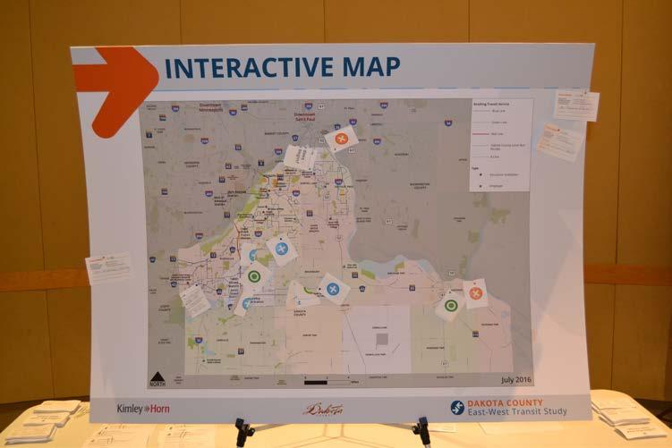
47 Open House #1: August 10, 2017 Details Time: TBD Location: TBD Outline Sign-In Station Formal Presentation & Open House Format Major Topics Addressed Existing conditions Public engagement process Planning process Display Boards Existing Conditions Vision, Goals, and Performance Objectives Schedule and participation process Activity interactive map to identify issue areas Website and WikiMapping Overview Comment box
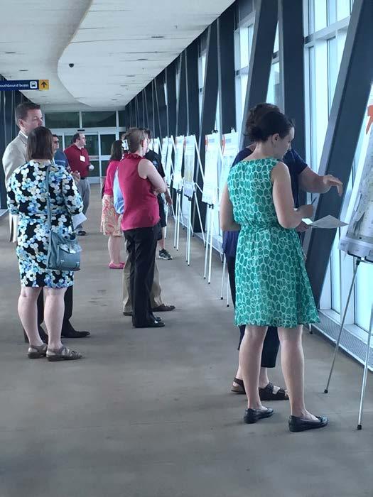
48 In-Person Engagement
49 Wrap Up Questions? Next TAC Meeting: November 8, 2017 Kimley-Horn Brandon Bourdon, P.E WSB Scott Mareck, AICP
City of Grand Forks Staff Report
 City of Grand Forks Staff Report Service/Safety Committee December 15, 2015 City Council December 21, 2015 Agenda Item: Amendment No. 1 to Engineering Services Agreement with CPS for City Project No. 7143,
Subarea Study. Manning Avenue (CSAH 15) Corridor Management and Safety Improvement Project. Final Version 1. Washington County.
 Corridor Management and Safety Improvement Project. Final Version 1. Washington County.") Subarea Study Manning Avenue (CSAH 15) Corridor Management and Safety Improvement Project Final Version 1 Washington County June 12, 214 SRF No. 138141 Table of Contents Introduction... 1 Forecast Methodology
Subarea Study Manning Avenue (CSAH 15) Corridor Management and Safety Improvement Project Final Version 1 Washington County June 12, 214 SRF No. 138141 Table of Contents Introduction... 1 Forecast Methodology
Open House. Highway212. Meetings. Corridor Access Management, Safety & Phasing Plan. 5:30 to 6:30 p.m. - Southwest Corridor Transportation Coalition
 Welcome Meetings 5:30 to 6:30 p.m. - Southwest Corridor Transportation Coalition 6:30 to 8:00 p.m. - Open House Why is Highway 212 Project Important? Important Arterial Route Local Support Highway 212
Alpine Highway to North County Boulevard Connector Study
 Alpine Highway to North County Boulevard Connector Study prepared by Avenue Consultants March 16, 2017 North County Boulevard Connector Study March 16, 2017 Table of Contents 1 Summary of Findings... 1
Executive Summary. Draft Environmental Impact Statement/Environmental Impact Report ES-1
 Executive Summary Introduction The Eastside Transit Corridor Phase 2 Project is a vital public transit infrastructure investment that would provide a transit connection to the existing Metro Gold Line
Kendall Drive Premium Transit PD&E Study Project Kick-Off Meeting SR 94/Kendall Drive/SW 88 Street Project Development and Environment (PD&E) Study
 Study") Florida Department of Transportation District Six Kendall Drive Premium Transit PD&E Study Project Kick-Off Meeting SR 94/Kendall Drive/SW 88 Street Project Development and Environment (PD&E) Study What
Florida Department of Transportation District Six Kendall Drive Premium Transit PD&E Study Project Kick-Off Meeting SR 94/Kendall Drive/SW 88 Street Project Development and Environment (PD&E) Study What
Transportation. Background. Transportation Planning Goals. Level of Service Analysis 5-1
 Transportation portion of the city s stormwater utility, and state road and fuel taxes. Background The transportation needs of the City of Lacey and its planning areas are met by a growing multimodal network
US 81 Bypass of Chickasha Environmental Assessment Public Meeting
 US 81 Bypass of Chickasha Environmental Assessment Public Meeting March 14, 2013 Introductions ODOT FHWA SAIC Meeting Purpose Present need for bypass Provide responses to 10/04/11 public meeting comments
Northeast Pavement Preservation Partnership Burlington, Vermont. Rhode Island DOT
 Northeast Pavement Preservation Partnership Burlington, Vermont Rhode Island DOT April 8, 2014 SHRP2 R26 (Preservation of High-Traffic Volume Roadways) and MAP-21 Impacts to RIDOT Pavement Management David
Highway 18 BNSF Railroad Overpass Feasibility Study Craighead County. Executive Summary
 Highway 18 BNSF Railroad Overpass Feasibility Study Craighead County Executive Summary October 2014 Highway 18 BNSF Railroad Overpass Feasibility Study Craighead County Executive Summary October 2014 Prepared
Waco Rapid Transit Corridor (RTC) Feasibility Study
 Feasibility Study") Waco Rapid Transit Corridor (RTC) Feasibility Study Chris Evilia, Director of Waco Metropolitan Planning Organization Allen Hunter, General Manager Waco Transit System Jimi Mitchell, Project Manager AECOM
Waco Rapid Transit Corridor (RTC) Feasibility Study Chris Evilia, Director of Waco Metropolitan Planning Organization Allen Hunter, General Manager Waco Transit System Jimi Mitchell, Project Manager AECOM
STH 60 Northern Reliever Route Feasibility Study Report
 #233087 v3 STH 60 Northern Reliever Route Feasibility Study Report Washington County Public Works Committee Meeting September 28, 2016 1 STH 60 Northern Reliever Route Feasibility Study Hartford Area Development
Corridor Sketch Summary
 Corridor Sketch Summary SR 241: I-82 Jct (Sunnyside) to SR 24 Jct Corridor Highway No. 241 Mileposts: 7.53 to 25.21 Length: 17.65 miles Corridor Description The seventeen and one-half mile corridor begins
Current Corridor Characteristics. MN 62 Corridor Performance
 Corridor Context The corridor runs 12 miles between I-494 and MN 55 south of Minneapolis. The corridor serves as an important East-West connection for the Metro area. A portion of the corridor has been
Highway 23 New London Access & Safety Assessment. Public Open House #2 October 3, :00 to 7:00 PM
 Public Open House #2 October 3, 2017 5:00 to 7:00 PM Highway 9 OVERVIEW OF ASSESSMENT Assessment Limits Highway 23 from County Road 40 to North Shore Dr Purpose: Identify opportunities to reduce serious
MPO Transit Study. Transit Concept for 2050 November 5, Transit Technologies
 Hillsborough County MPO Transit Study Transit Concept for 2050 November 5, 2007 Transit Technologies 1 Technologies Considered Bus Light Rail Commuter Rail Bus Standard or articulated high-capacity vehicles
US 10 Corridor Performance
 Corridor Context The corridor runs northwest 18 miles from I-35W to the edge of Anoka County. The corridor connects the cities of Ramsey, Anoka,, Mounds View, and Blaine. Current Corridor Characteristics
Harlem Avenue between 63 rd and 65 th
 Harlem Avenue between 63 rd and 65 th Public Meeting #2 March 13, 2018 Summit Park District Welcome to the second Public Meeting for the preliminary engineering and environmental studies of Illinois 43
Parking Management Element
 Parking Management Element The State Transportation Planning Rule, adopted in 1991, requires that the Metropolitan Planning Organization (MPO) area implement, through its member jurisdictions, a parking
Purpose and Need Report
 Purpose and Need Report State Highway (SH) 29 From Southwestern Boulevard to SH 95 Williamson County, Texas (CSJ: 0337-02-045) Prepared by Blanton & Associates, Inc. Date: November, 2015 The environmental
March 2, 2017 Integrating Transportation Planning, Project Development, and Project Programming
 COORDINATION WITH VDOT DISTRICTS TO DELIVER IMPLEMENTABLE IMPROVEMENT PROJECTS March 2, 2017 Integrating Transportation Planning, Project Development, and Project Programming PRESENTATION OUTLINE What
A Vision for Highway Automation
 A Vision for Highway Automation R y a n D. R i c e D i r e c t o r o f M o b i l i t y O p e r a t i o n s C o l o r a d o D e p a r t m e n t o f T r a n s p o r t a t i o n Problem Statement Higher
Sales and Use Transportation Tax Implementation Plan
 Sales and Use Transportation Tax Implementation Plan Transportation is more than just a way of getting from here to there. Reliable, safe transportation is necessary for commerce, economic development,
F:\PROJ\ \dwg\Alt-bridge-alignments.dwg, 17-2, 11/12/ :22:17 PM, saamhu, Acrobat PDFWriter
 F:\PROJ\55211014\dwg\Alt-bridge-alignments.dwg, 17-2, 11/12/2002 03:22:17 PM, saamhu, Acrobat PDFWriter MERRIFIELD RIVER CROSSING METHOD OF CHANGE FROM ID# ISSUES MEASUREMENT UNITS VALUE BASE CONDITIONS
Transportation Performance Management Overview. Laura Toole 2018 Ohio Planning Conference
 Transportation Performance Management Overview Laura Toole 2018 Ohio Planning Conference What is Transportation Performance Management (TPM)? Strategic approach Uses system information to make decisions
Western ND Meeting. February 19, 2014 Grant Levi, NDDOT Director
 Western ND Meeting February 19, 2014 Grant Levi, NDDOT Director 1 Traffic Trends in North Dakota 2 Truck Traffic 2008 3 Truck Traffic 2012 4 Average Daily Traffic 5 ND Vehicle Miles Traveled Statewide
City of Grand Forks Staff Report
 City of Grand Forks Staff Report Committee of the Whole December 1, 016 City Council December 19, 016 Agenda Item: Bids for City Project No. 7551 Lift Station No. 17 & 17A Rehabilitation Submitted by:
Dulles Corridor Air Rights Study Investigation
 Dulles Corridor Air Rights Study Investigation Fairfax County Board of Supervisors Transportation Committee September 17, 2013 1 On March 19, 2013 the Fairfax County Board of Supervisors asked FCDOT staff
Recommended Transportation. Capital Improvement Program
 Recommended 2018-2022 Transportation Capital Improvement Program 1 Overview 2017 Review 2018-2022 Considerations 2018-2022 Recommended CIP 2 Limited Resources are Directed to the Highest Priority Number
I-394 Corridor Performance
 Population Trends Corridor Context The corridor runs from edge of Hennepin County to downtown Minneapolis and serves the cities of Delano, Independence, Medina, and Wayzata. City Population 2000 2010 2,088
The Eastern Connector Study November, 2007 planning for the future
 The Eastern Connector Study November, 2007 planning for the future In late 2006, Albemarle County and the City of Charlottesville jointly initiated the Eastern Connector Corridor Study. The Project Team
Welcome. Highway 23 Gap New London to Paynesville. Open House. - Please Sign In -
 Highway Gap New London to Paynesville Welcome Highway Gap New London to Paynesville Open House - Please Sign In - There is no formal presentation, but representatives are available to answer your questions.
Population Trends. US 12 Corridor Performance
 Corridor Context The corridor runs over 81 miles from Willmar to the Twins Cities metropolitan area. It connects the Twin Cities and the cities of Montrose, Howard Lake, Cokato, Dassel, Litchfield, Atwater,
CHARACTERIZATION AND DEVELOPMENT OF TRUCK LOAD SPECTRA FOR CURRENT AND FUTURE PAVEMENT DESIGN PRACTICES IN LOUISIANA
 CHARACTERIZATION AND DEVELOPMENT OF TRUCK LOAD SPECTRA FOR CURRENT AND FUTURE PAVEMENT DESIGN PRACTICES IN LOUISIANA LSU Research Team Sherif Ishak Hak-Chul Shin Bharath K Sridhar OUTLINE BACKGROUND AND
Planning for Future Mobility In a Performance-Based World Steven Gayle, PTP
 Planning for Future Mobility In a Performance-Based World Steven Gayle, PTP September 26, 2018 MPOs at the Intersection 2 Performance-Based Planning New planning paradigm introduced in MAP-21 MPOs and
Transportation 2040: Plan Performance. Transportation Policy Board September 14, 2017
 Transportation 2040: Plan Performance Transportation Policy Board September 14, 2017 Today Background Plan Performance Today s Meeting Background Board and Committee Direction 2016-2017 Transportation
Metro Transit Update. Christina Morrison, Senior Planner Metro Transit BRT/Small Starts Project Office. John Dillery, Senior Transit Planner
 Metro Transit Update Christina Morrison, Senior Planner Metro Transit BRT/Small Starts Project Office John Dillery, Senior Transit Planner Metro Transit Service Development May 16, 2013 1 Transit Planning
Missouri Seat Belt Usage Survey for 2017
 Missouri Seat Belt Usage Survey for 2017 Conducted for the Highway Safety & Traffic Division of the Missouri Department of Transportation by The Missouri Safety Center University of Central Missouri Final
Overview. Prioritization of Safety Strategies Development of the Minnesota Sinusoidal Rumble Strip Implementation and Public Relations Considerations
 Victor Lund, PE, Traffic Engineer St. Louis County, Minnesota October 11, 2018 Overview Prioritization of Safety Strategies Development of the Minnesota Sinusoidal Rumble Strip Implementation and Public
Slow Down! Why speed is important in realizing your Vision Zero goals and how to achieve the speeds you need
 Slow Down! Why speed is important in realizing your Vision Zero goals and how to achieve the speeds you need Lake McTighe, METRO Joel McCarroll, ODOT Jenna Marmon, ODOT Matt Ferris-Smith, PBOT Oregon Active
ITEM 13 - NOTICE May 20, 2009
 ITEM 13 - NOTICE May 20, 2009 Notice of Proposed Amendment to the 2009 CLRP and FY 2010-2015 TIP to include the Closure of the I-395 Southbound Exit Ramp to 3rd Street NW, the Reconfiguration of the Southbound
10/4/2016. October 6, Item #1 CITIZENS PARTICIPATION
 October 6, 2016 Item #1 CITIZENS PARTICIPATION 1 Item #2 APPROVAL OF MINUTES Item #3 WELCOME 2 Item #4 TRAC ROADWAY RECOMMENDATIONS UPDATE Item #4 Completed Jurisdiction Presentations Boulder City August
Transportation Statistical Data Development Report BAY COUNTY 2035 LONG RANGE TRANSPORTATION PLAN
 Transportation Statistical Data Development Report BAY COUNTY 2035 LONG RANGE TRANSPORTATION PLAN Prepared for Bay County Transportation Planning Organization and The Florida Department of Transportation,
Harlem Avenue between 63 rd and 65 th
 Harlem Avenue between 63 rd and 65 th Community Advisory Group Meeting #3 December 1, 2017 Bedford Park Public Library 1 Meeting Agenda 1. Welcome/Introductions (3 mins) 2. Project Overview and Re-Cap
Rocky Mount. Transportation Plan. Transportation Planning Division. Virginia Department of Transportation
 2020 Transportation Plan Developed by the Transportation Planning Division of the Virginia Department of Transportation in cooperation with the U.S. Department of Transportation, Federal Highway Administration
2030 Multimodal Transportation Study
 2030 Multimodal Transportation Study City of Jacksonville Planning and Development Department Prepared by Ghyabi & Associates April 29,2010 Introduction Presentation Components 1. Study Basis 2. Study
ALAMEDA CORRIDOR. A A Project of National Significance. TRB Summer Conference MTS as a Component of the Nation s Transportation System June 25, 2002
 ALAMEDA CORRIDOR A A Project of National Significance TRB Summer Conference MTS as a Component of the Nation s Transportation System June 25, 2002 Top U.S. Container Ports (2001) LOS ANGELES 5.18 LONG
Utilizing GIS Models in Prioritizing and Selecting Transportation Projects
 Utilizing GIS Models in Prioritizing and Selecting Transportation Projects GIS-T Conference Raleigh, NC April 7, 2016 Tyler Meyer, AICP Tram Truong, GISP Outline Case Studies: 1. MPO project selection
ACTION TRANSMITTAL No
 Transportation Advisory Board of the Metropolitan Council of the Twin Cities DATE: January 4, 2016 TO: ACTION TRANSMITTAL No. 2016-19 TAC Funding and Programming Committee PREPARED BY: Joe Barbeau, Senior
BROWARD BOULEVARD CORRIDOR TRANSIT STUDY
 BROWARD BOULEVARD CORRIDOR TRANSIT STUDY FM # 42802411201 EXECUTIVE SUMMARY July 2012 GOBROWARD Broward Boulevard Corridor Transit Study FM # 42802411201 Executive Summary Prepared For: Ms. Khalilah Ffrench,
Interstate Operations Study: Fargo-Moorhead Metropolitan Area Simulation Output
 NDSU Dept #2880 PO Box 6050 Fargo, ND 58108-6050 Tel 701-231-8058 Fax 701-231-6265 www.ugpti.org www.atacenter.org Interstate Operations Study: Fargo-Moorhead Metropolitan Area 2015 Simulation Output Technical
Introduction. Assumptions. Jeff Holstein, P.E., City of Brooklyn Park Steve Wilson, Principal Tim Babich, Associate Krista Anderson, Engineer
 SRF No. 10482 To: From: Jeff Holstein, P.E., City of Brooklyn Park Steve Wilson, Principal Tim Babich, Associate Krista Anderson, Engineer Date: May 16, 2018 Subject: City of Brooklyn Park Year 2040 Forecasts
PROPOSED LAND USE ORDINANCE NO. 834 Individual and General Notice June 15, 2018
 PROPOSED LAND USE ORDINANCE NO. 834 Individual and General Notice 2018-05 June 15, 2018 The Washington County Planning Commission and Board of Commissioners (Board) will soon consider proposed. Listed
Transportation accomplishments
 1 1 Welcome Transportation accomplishments Federal Funding State Funding Challenges Future Projects 2 Transportation Project: The NDDOT had a record construction season in 2011. Completed $595.6 million
METRO Orange Line BRT American Boulevard Station Options
 METRO Orange Line BRT American Boulevard Station Options Bloomington City Council Work Session November 18, 2013 Christina Morrison BRT/Small Starts Project Office Coordinating Planning and Design AMERICAN
Understanding and Identifying Crashes on Curves for Safety Improvement Potential in Illinois
 Understanding and Identifying Crashes on Curves for Safety Improvement Potential in Illinois Priscilla Tobias, P.E. Mouyid Islam, Ph.D. Kim Kolody, P.E. Optional Agenda Image Title Background Workflow
Improving Accessibility of Regional Bus Stops and Pathways
 Customer Service and Operations Committee Board Information Item III-A March 13, 2014 Improving Accessibility of Regional Bus Stops and Pathways Page 3 of 17 Washington Metropolitan Area Transit Authority
The Engineering Department recommends Council receive this report for information.
 CORPORATE REPORT NO: R161 COUNCIL DATE: July 23, 2018 REGULAR COUNCIL TO: Mayor & Council DATE: July 19, 2018 FROM: General Manager, Engineering FILE: 8740-01 SUBJECT: Surrey Long-Range Rapid Transit Vision
Point A Point B Point C Point D. Fulton County Board of Commissioners and Mayors Meeting December 14, 2017
 Fulton County Board of Commissioners and Mayors Meeting December 14, 2017 Master Plan Overview Phase 1 Community Vision and Existing Transit Conditions Phase 2 Scenario Development Phase 3 Transit Master
Business Advisory Committee. July 7, 2015
 Business Advisory Committee July 7, 2015 1 Today s Topics Outreach Update TI #1 and 2: Target Field Station Connection to I-94: Recommendation 85 th Station Configuration 93 rd Station Configuration DEIS
TRAFFIC CALMING PROGRAM
 TRAFFIC CALMING PROGRAM PROGRAM BASICS Mount Pleasant Transportation Department 100 Ann Edwards Lane Mt. Pleasant, SC 29465 Tel: 843-856-3080 www.tompsc.com The Town of Mount Pleasant has adopted a traffic
TRAFFIC AND TRANSPORTATION TECHNICAL REPORT
 TRAFFIC AND TRANSPORTATION TECHNICAL REPORT for ENVIRONMENTAL ASSESSMENT Route 29 Bypass State Project No.: 0029-002-844, P101; UPC 102419 Federal Project Number: TBD From: Route 250 Bypass To: U.S. Route
I-820 (East) Project Description. Fort Worth District. Reconstruct Southern I-820/SH 121 Interchange
 Project Description. Fort Worth District. Reconstruct Southern I-820/SH 121 Interchange") I-820 (East) Project Description Fort Worth District Reconstruct Southern I-820/SH 121 Interchange I-820 from approximately 2,000 feet north of Pipeline Road/Glenview Drive to approximately 3,200 feet
I-820 (East) Project Description Fort Worth District Reconstruct Southern I-820/SH 121 Interchange I-820 from approximately 2,000 feet north of Pipeline Road/Glenview Drive to approximately 3,200 feet
Regional Transit Extension Studies. Hampton Roads Transportation Planning Organization Passenger Rail Task Force Meeting December 17, 2013
 Regional Transit Extension Studies Hampton Roads Transportation Planning Organization Passenger Rail Task Force Meeting December 17, 2013 Topics Virginia Beach Transit Extension Study (VBTES) Naval Station
Citizens Committee for Facilities
 Citizens Committee for Facilities AGENDA Thursday, December 11, 2014 City Council Chambers 305 3 rd Avenue East -Twin Falls, Idaho 11:30 A.M. AGENDA ITEMS Purpose By 1. Discussion and possible action on
Business Advisory Committee. November 3, 2015
 Business Advisory Committee November 3, 2015 1 Today s Topics DEIS Cost Estimate 2 Assumptions Revised Cost Estimate Revised Project Scope Cost Estimate Overview Position Statement Discussion Municipal
Signal System Timing and Phasing Program SAMPLE. Figure 1: General Location Map. Second St.
 I. Overview Consultant A was retained by the Ohio Department of Transportation to conduct traffic signal timing analyses on approximately one mile of roadway on between the Main Street and the Fourth Street
Bennett Pit. Traffic Impact Study. J&T Consulting, Inc. Weld County, Colorado. March 3, 2017
 Bennett Pit Traffic Impact Study J&T Consulting, Inc. Weld County, Colorado March 3, 217 Prepared By: Sustainable Traffic Solutions, Inc. http://www.sustainabletrafficsolutions.com/ Joseph L. Henderson,
Naval Station Norfolk Transit Extension Study. October 2014
 Naval Station Norfolk Transit Extension Study October 2014 1 Employment by Transportation Analysis Zone (TAZ) Naval Station Legend Norfolk is Hampton Roads Region s largest employer C or with better PM
Parks and Transportation System Development Charge Methodology
 City of Sandy Parks and Transportation System Development Charge Methodology March, 2016 Background In order to implement a City Council goal the City of Sandy engaged FCS Group in January of 2015 to update
2016 Congestion Report
 2016 Congestion Report Metropolitan Freeway System May 2017 2016 Congestion Report 1 Table of Contents Purpose and Need...3 Introduction...3 Methodology...4 2016 Results...5 Explanation of Percentage Miles
Plainfield, Indiana Speed Limit Study
 March 21 st, 2017 Prepared on behalf of: Town of Plainfield Building and Engineering Department 206 W. Main Street Plainfield, IN 46168 (317) 839-2561 Prepared by: Thomas S. Vandenberg, PE, PTOE Matthew
The Georgia CMAQ Program. Practice Makes Perfect
 The Georgia CMAQ Program Practice Makes Perfect Outline Georgia s Air Quality Georgia s CMAQ Process Prioritized Projects Project Mix Georgia and Air Quality Out of the 6 pollutants measured by EPA, Georgia
Metropolitan Freeway System 2013 Congestion Report
 Metropolitan Freeway System 2013 Congestion Report Metro District Office of Operations and Maintenance Regional Transportation Management Center May 2014 Table of Contents PURPOSE AND NEED... 1 INTRODUCTION...
WIM #37 was operational for the entire month of September Volume was computed using all monthly data.
 SEPTEMBER 2016 WIM Site Location WIM #37 is located on I-94 near Otsego in Wright county. The WIM is located only on the westbound (WB) side of I-94, meaning that all data mentioned in this report pertains
MEMO VIA . Ms. Amy Roth DPS Director, City of Three Rivers. To:
 MEMO To: Ms. Amy Roth DPS Director, City of Three Rivers VIA EMAIL From: Michael J. Labadie, PE Julie M. Kroll, PE, PTOE Brandon Hayes, PE, P.Eng. Fleis & VandenBrink Date: January 5, 2017 Re: Proposed
Clearlake Road (State Road 501) Project Development & Environment (PD&E) Study
 Project Development & Environment (PD&E) Study") Clearlake Road (State Road 501) Project Development & Environment (PD&E) Study FROM MICHIGAN AVENUE TO INDUSTRY ROAD BREVARD COUNTY, FLORIDA Financial Project ID No: 433605-1-22-01 Federal Aid Project
Clearlake Road (State Road 501) Project Development & Environment (PD&E) Study FROM MICHIGAN AVENUE TO INDUSTRY ROAD BREVARD COUNTY, FLORIDA Financial Project ID No: 433605-1-22-01 Federal Aid Project
Task Force Meeting January 15, 2009
 Task Force Meeting January 15, 2009 Study Update August 14 th Task Force Meeting Update on Traffic Projections and Financial Feasibility Study presented by Kane County and WSA staff The presentation summarized
Executive Summary. Treasure Valley High Capacity Transit Study Priority Corridor Phase 1 Alternatives Analysis October 13, 2009.
 Treasure Valley High Capacity Transit Study Priority Corridor Phase 1 Alternatives Analysis October 13, 2009 Background As the Treasure Valley continues to grow, high-quality transportation connections
Only video reveals the hidden dangers of speeding.
 Only video reveals the hidden dangers of speeding. SNAPSHOT FOR TRUCKING April 2018 SmartDrive Smart IQ Beat Snapshots provide in-depth analysis and metrics of top fleet performance trends based on the
Southeastern Wisconsin Regional Freeway System Reconstruction Study
 Southeastern Wisconsin Regional Freeway System Reconstruction Study July 26, 2001 1 Agenda Item 3 Presentation of Projected Traffic Impacts of the Possible New Freeway Segment Connecting IH 43 and USH
INTERSECTION CONTROL EVALUATION
 INTERSECTION CONTROL EVALUATION Trunk Highway 22 and CSAH 21 (E Hill Street/Shanaska Creek Road) Kasota, Le Sueur County, Minnesota November 2018 Trunk Highway 22 and Le Sueur CSAH 21 (E Hill Street/Shanaska
WIM #40 is located on US 52 near South St. Paul in Dakota county.
 WIM Site Location WIM #40 is located on US 52 near South St. Paul in Dakota county. System Operation WIM #40 was operational for the entire month of November 2017. Volume was computed using all monthly
Community Advisory Committee. October 5, 2015
 Community Advisory Committee October 5, 2015 1 Today s Topics Hennepin County Community Works Update Project Ridership Estimates Technical Issue #4:Golden Valley Rd and Plymouth Ave Stations Technical
Florida Strategic Highway Safety Planning Florida Strategic Highway Safety Plan (SHSP) Update and Performance Overview
 Update and Performance Overview") Session 1 Florida Strategic Highway Safety Planning Florida Strategic Highway Safety Plan (SHSP) Update and Performance Overview Joe Santos, PE, FDOT, State Safety Office October, 23, 2013 Florida Statistics
Session 1 Florida Strategic Highway Safety Planning Florida Strategic Highway Safety Plan (SHSP) Update and Performance Overview Joe Santos, PE, FDOT, State Safety Office October, 23, 2013 Florida Statistics
Table of Contents INTRODUCTION... 3 PROJECT STUDY AREA Figure 1 Vicinity Map Study Area... 4 EXISTING CONDITIONS... 5 TRAFFIC OPERATIONS...
 Crosshaven Drive Corridor Study City of Vestavia Hills, Alabama Table of Contents INTRODUCTION... 3 PROJECT STUDY AREA... 3 Figure 1 Vicinity Map Study Area... 4 EXISTING CONDITIONS... 5 TRAFFIC OPERATIONS...
CEDAR AVENUE TRANSITWAY Implementation Plan Update
 CEDAR AVENUE TRANSITWAY Implementation Plan Update EECUTIVE SUMMARY DECEMBER 2015 Executive Summary In 2013, the Twin Cities metropolitan area s first bus rapid transit (BRT) line, the METRO Red Line,
Request for Qualification for Comprehensive Plan Services RFQ#
 Request for Qualification for Comprehensive Plan Services RFQ#16-2001-05 City of Texarkana, Texas Planning and Community Development 220 Texas Boulevard Texarkana, TX 75501 Page 2 of 10 RFQ COMPREHENSIVE
Call for Projects Congestion Mitigation and Air Quality (CMAQ) Emissions Formulas Technical Advisory Committee
 Emissions Formulas Technical Advisory Committee") Call for Projects Congestion Mitigation and Air Quality (CMAQ) Emissions Formulas Technical Advisory Committee July 18, 2018 Formula Coordination DRCOG under review, considering FHWA toolkit RAQC Argonne
Call for Projects Congestion Mitigation and Air Quality (CMAQ) Emissions Formulas Technical Advisory Committee July 18, 2018 Formula Coordination DRCOG under review, considering FHWA toolkit RAQC Argonne
DEVELOPMENT OF RIDERSHIP FORECASTS FOR THE SAN BERNARDINO INFRASTRUCTURE IMPROVEMENT STUDY
 APPENDIX 1 DEVELOPMENT OF RIDERSHIP FORECASTS FOR THE SAN BERNARDINO INFRASTRUCTURE IMPROVEMENT STUDY INTRODUCTION: This Appendix presents a general description of the analysis method used in forecasting
Trunk Highway 13 Corridor Study Update Existing and No-Build Conditions Technical Memo #2B: Traffic Forecasts and Operations Analysis SEH No.
 TECHNICAL MEMORANDUM TO: FROM: Molly McCartney MnDOT Project Manager Haifeng Xiao, PE Tom Sohrweide, PE, PTOE DATE: November 27, 2012 RE: Trunk Highway 13 Corridor Study Update Existing and No-Build Conditions
Tulsa Transportation Management Area. Urbanized Area Surface Transportation Program
 Tulsa Transportation Management Area Urbanized Area Surface Transportation Program FFY 2022 Application Information Sponsor Location Description STP Request Other Funds Broken Arrow Elm Place: Kenosha
Lacey Gateway Residential Phase 1
 Lacey Gateway Residential Phase Transportation Impact Study April 23, 203 Prepared for: Gateway 850 LLC 5 Lake Bellevue Drive Suite 02 Bellevue, WA 98005 Prepared by: TENW Transportation Engineering West
RESIDENTIAL WASTE HAULING ASSESSMENT SERVICES. January 10, 2011 Presentation to Arvada City Council
 RESIDENTIAL WASTE HAULING ASSESSMENT SERVICES January 10, 2011 Presentation to Arvada City Council CONSULTANT TEAM LBA Associates MSW Consultants Denver based recycling and waste management consultant
Mountainland Association of Governments SPRINGVILLE-SPANISH FORK AREA TRANSPORTATION STUDY APRIL 2012
 Mountainland Association of Governments SPRINGVILLE-SPANISH FORK AREA TRANSPORTATION STUDY APRIL 2012 PLANNING FOR OUR FUTURE Planners with the Mountainland Association of Governments (MAG) have evaluated
Interchange Modification Justification Study. I-90/Timberline Road Interchange, Exit 402 SIOUX FALLS MPO
 Interchange Modification Justification Study I-90/Timberline Road Interchange, Exit 402 SIOUX FALLS MPO Technical analysis to accompany companion Environmental Assessment Interchange Modification Justification
Exhibit A Sound Transit Board Resolution R Selecting the bicycle, pedestrian, and parking access improvements to be built for the Puyallup
 Exhibit A Sound Transit Board Resolution R2016-07 Selecting the bicycle, pedestrian, and parking access improvements to be built for the Puyallup Access Improvement Project. RESOLUTION NO. R2016-07 Selecting
House Committee on Transportation Policy Public Hearing HB April 5, 2017
 REPRESENTATIVE RICH VIAL OREGON HOUSE OF REPRESENTATIVES HOUSE DISTRICT 26 House Committee on Transportation Policy Public Hearing HB 3231 April 5, 2017 Background House District 26 Wilsonville Sherwood
MILLERSVILLE PARK TRAFFIC IMPACT ANALYSIS ANNE ARUNDEL COUNTY, MARYLAND
 MILLERSVILLE PARK TRAFFIC IMPACT ANALYSIS ANNE ARUNDEL COUNTY, MARYLAND Prepared for: Department of Public Works Anne Arundel County Prepared by: URS Corporation 4 North Park Drive, Suite 3 Hunt Valley,
Additional $200 Speeding Fine Signs
 CITY OF CHARLOTTESVILLE, VIRGINIA CITY COUNCIL AGENDA Agenda Date: June 18, 2007 Action Required: Presenter: Staff Contacts: Title: Adopt Ordinance Jeanie Alexander, P.E. Jeanie Alexander Additional $200