Stemmer Ridge Road Street & Utility Improvement Project
|
|
|
- Shauna Dickerson
- 5 years ago
- Views:
Transcription

1 City of Prior Lake 4646 Dakota Street SE Prior Lake, MN June 9, 2014 Stemmer Ridge Road Street & Utility Improvement Project City of Prior Lake Scott County, Minnesota WSB Project No
2 FEASIBILITY REPORT STEMMER RIDGE ROAD STREET & UTILITY IMPROVEMENT PROJECT FOR THE CITY OF PRIOR LAKE, MINNESOTA June 9, 2014 Prepared By: WSB & Associates, Inc. 701 Xenia Avenue South, Suite 300 Minneapolis, MN (Fax) Feasibility Report Stemmer Ridge Road Street & Utility Improvement Project WSB Project No

3 engineering planning environmental construction 701 Xenia Avenue South Suite 300 Minneapolis, MN Tel: Fax: June 9, 2014 Honorable Mayor and City Council City of Prior Lake 4646 Dakota Street SE Prior Lake, MN Re: Feasibility Report Stemmer Ridge Road Street & Utility Improvement Project WSB Project No Dear Mayor and City Council Members: Transmitted herein is the feasibility report for the proposed Stemmer Road Street and Utility Improvements, which is located in the northwest portion of the City. The proposed project consists of the extension of Stemmer Ridge Road from its current northerly terminus to CSAH 82. The project, as prepared herein, includes the construction of trunk sanitary sewer and watermain, storm sewer, and street and trail improvements. The report contained herein presents costs for the project as well as proposed funding, including assessments. We are available at your convenience to discuss this report. Please feel free to contact me at or if you have any questions. Sincerely, WSB & Associates, Inc. Jason C. Wedel, PE Associate Enclosure cc: Larry Poppler, PE, City Engineer St. Cloud Minneapolis St. Paul Equal Opportunity Employer wsbeng.com
4 CERTIFICATION I hereby certify that this plan, specification or report was prepared by me or under my direct supervision and that I am a duly Licensed Professional Engineer under the laws of the State of Minnesota. Jason C. Wedel, PE Date: June 9, 2014 Lic. No Feasibility Report Stemmer Ridge Road Street & Utility Improvement Project WSB Project No
5 TABLE OF CONTENTS TITLE SHEET LETTER OF TRANSMITTAL CERTIFICATION SHEET TABLE OF CONTENTS 1. EXECUTIVE SUMMARY INTRODUCTION Authorization Project Overview Scope EXISTING CONDITIONS Existing Conditions Existing Sanitary Sewer and Watermain Conditions Existing Storm Sewer Conditions Right-of-Way PROPOSED IMPROVEMENTS Street Improvements Storm Sewer Improvements Sanitary Sewer and Watermain Improvements Right-of-Way/Easements Permits Phasing Environmental Assessment Worksheet FINANCING Opinion of Cost Funding PROJECT SCHEDULE CONCLUSIONS AND RECOMMENDATIONS Appendix A Figure 1 Location Map Figure 2 Typical Section Figure 3 Stemmer Ridge Road Storm Sewer Improvements Figure 4 Stemmer Ridge Road Sanitary Sewer and Watermain Improvements Appendix B Figure 5 Stemmer Ridge Road Alignment A Figure 6 Stemmer Ridge Road Alignment B Figure 7 Stemmer Ridge Road Development Concept Plan Feasibility Report Stemmer Ridge Road Street & Utility Improvement Project WSB Project No
6 Appendix C Opinion of Probable Cost Proposed Assessment Roll Figure 8 Parcel Assessment Map Feasibility Report Stemmer Ridge Road Street & Utility Improvement Project WSB Project No
7 1. EXECUTIVE SUMMARY The Stemmer Ridge Road Street and Utility Project is a City Council initiated project that includes the construction of approximately 3,800 lineal feet of utilities and streets. The project includes extending Stemmer Ridge Road from its current terminus within the Spring Lake Estates development north to CSAH 82 and will align with the existing intersection of Mystic Lake Boulevard. The purpose of this project is to connect the City s trunk sanitary sewer and watermain in this location and to complete the street connection between Shoreline Boulevard (County Road 12) and CSAH 82. Stemmer Ridge Road is designated a Municipal State Aid Street and is classified as a Minor Collector in the City s 2030 Comprehensive Plan. In 2030, the anticipated Annual Average Daily Trips (AADT) is 6,000 trips per day. The City has previously constructed trunk utilities to the north and to the south of this project through a combination of City initiated and developer initiated projects. In 2007, as part of the CSAH 82 improvement project, 30-inch trunk sanitary sewer and 16-inch trunk watermain were extended west from CSAH 21 along CSAH 82 and stubbed to the future connection of Stemmer Ridge Road. In 2008, Arcon Development received City plat approval and constructed the Stemmer Ridge development, later known as Spring Lake Estates. This development included the construction of the existing section of Stemmer Ridge Road. Stemmer Ridge Road was designed and constructed with 80 feet of right-of-way, a 44-foot wide street from back of curb to back of curb, 16-inch trunk watermain, and dual 12-inch and 16-inch sanitary sewer force mains. In 2013, Scott County initiated the reconstruction of Shoreline Boulevard (County Road 12). As part of that project, the City installed 36-inch trunk sanitary sewer from County Road 17 to Sunset Avenue, the structural components for the lift station that will ultimately be installed at the intersection of Shoreline Boulevard and Sunset Avenue, and extended 12-inch and 16-inch force mains from the future lift station and extended them east to the existing force mains that were installed with the previous County Road 12 improvements and the Spring Lake Estates development. Ultimately, the trunk sanitary sewer and watermain that have been installed to date are intended to service the properties in the immediate area, as well as the southwest corner of the City including approximately 3,200 acres of future annexation area. This project represents the last section of the required improvements to complete the connection between the trunk utilities to the south within Shoreline Boulevard and the trunk utilities to the north within CSAH 82. The proposed schedule for the project allows for construction of the utilities, curb, aggregate base, and bituminous base course improvements in The bituminous wear course and final project restoration would be completed in However, the City may wish to phase the construction of the improvements. Alternative phasing plans are included in Section 4 of this report. The total project costs for the street and utility improvements as proposed herein are estimated between $1,674,000 and $4,181,000, depending on the alternative selected. Proposed funding for the project will come from General Obligation Improvement Bonds (G.O. Bonds) to cover Feasibility Report Stemmer Ridge Road Street & Utility Improvement Project WSB Project No Page 1
8 the assessed portions of the improvements. The City s past practice has been to assess 100% of the project cost to the benefitting property owners, except for any trunk over sizing costs. Over sizing is considered for watermain over eight inches in diameter, sanitary sewer over eight inches in diameter, streets wider than 36 feet from back of curb to back of curb, and right-of-way wider than 66 feet. Over sizing costs would be paid for with the City s trunk sanitary sewer, water, and street oversize funds. The project as described herein is necessary, feasible, and cost-effective from an engineering standpoint. It is the recommendation of WSB & Associates, Inc. that the City Council select a preferred alternative and call for the public hearing to order the improvements as proposed. Feasibility Report Stemmer Ridge Road Street & Utility Improvement Project WSB Project No Page 2
9 2. INTRODUCTION 2.1 Authorization This feasibility report was authorized by the City Council of Prior Lake at its January 27, 2014 meeting. 2.2 Project Overview The following report represents Stemmer Ridge Road from its current terminus north to CSAH 82. Figure 1 in Appendix A illustrates the proposed project area. The proposed project consists of street, sanitary sewer, watermain, and storm sewer improvements. 2.3 Scope The scope of this feasibility report includes the construction of utilities and street for the following: Stemmer Ridge Road northerly terminus to CSAH 82 The proposed improvements include the construction of the pavement and curb and gutter, sanitary sewer, watermain, and storm sewer. The feasibility report as presented herein addresses the estimated costs along with the potential funding for the work to be completed. Feasibility Report Stemmer Ridge Road Street & Utility Improvement Project WSB Project No Page 3
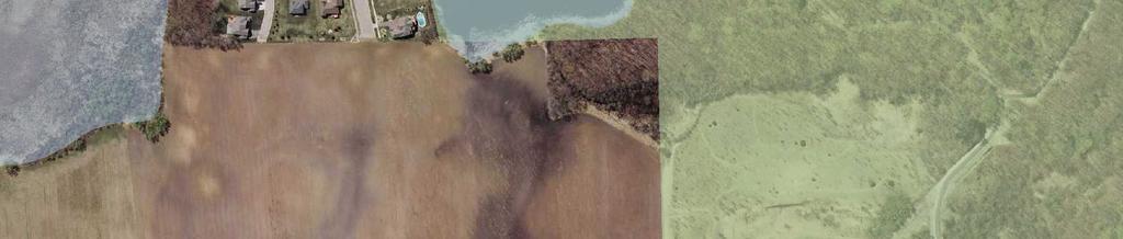
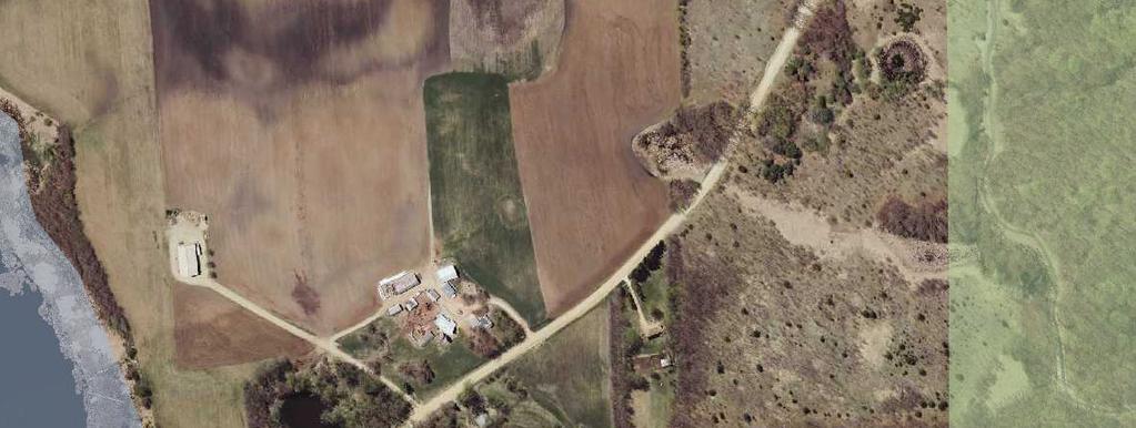
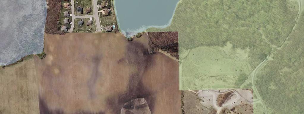
10 3. EXISTING CONDITIONS 3.1 Existing Conditions The existing property along the proposed alignment of Stemmer Ridge Road is primarily undeveloped land and is either being utilized for agricultural purposes or has been left in a natural state. Starting at the north end of the project, the Shakopee Mdewakanton Sioux Community (SMSC) owns in fee the majority of the property from CSAH 82 south to Howard Lake Road. The SMSC is not actively using this property currently and it consists of a combination of wooded areas and wetlands. There are a few old buildings on site that are no longer being used. The property is guided for medium density residential housing per the City s 2030 Comprehensive Plan. Adjacent to the southeast corner of the SMSC property is a 2.7 acre parcel that is owned by Jeffrey Micko. This property consists of a single family home with access coming from Howard Lake Road. The home is being served by a private on site well and septic system. The remaining property from Howard Lake Road south to the current terminus of Stemmer Ridge Road is broken up into a number of separate parcels that are owned by various members of the Menden family. This includes property owned by Francis Menden, Robert and Roxanne Menden, and Tom Menden. The property contains an existing farm house and a number of out buildings. The farm house is being served by a private on site well and septic system. The remaining portion of the property is being actively farmed. There is a large area in the middle of the property that has been identified as wetland per the National Wetland Inventory (NWI) map. Immediately to the east is park property that is owned by a combination of the City of Prior Lake and Scott County and is known as Spring Lake Regional Park. The City purchased approximately 40 acres from Scott County as part of the long term planning for an active use park in this location. In 2006, Scott County had a master plan prepared for this site. The planned improvements included active uses; such as baseball fields on the City property and a dog park and trails on the Scott County property. A significant portion of the site was shown to be left in its natural condition. To date, only the dog park has been constructed. 3.2 Existing Sanitary Sewer and Watermain Conditions This area is undeveloped and does not currently have sanitary sewer or watermain available to serve the parcels included in this report. All of the required utility improvements will be new construction. 3.3 Existing Storm Sewer Conditions The project area is currently rural in nature and does not currently have any storm sewer or storm water treatment in place. The natural drainage pattern is either from the southeast corner of the Menden property to the low area/wetland in the middle of the property, which ultimately overflows to the west toward Howard Lake, or it drains from the north end of the project south toward the low area/wetland on the Menden property, which overflows to the west toward Howard Lake. Since this area does not drain to Prior Lake it is not under Prior Lake/Spring Lake Watershed jurisdiction. There are several large wetlands identified for the project area on the Feasibility Report Stemmer Ridge Road Street & Utility Improvement Project WSB Project No Page 4
11 National Wetland Inventory map. These wetlands will be delineated this summer to confirm their exact size and location. 3.4 Right-of-Way There isn t any existing right-of-way or easements in place for the proposed improvements. The portion of Stemmer Ridge Road that was constructed as part of the Stemmer Ridge development to the south of this project included the dedication of 80 feet of right-of- way by the developer as part of their plat. It is anticipated that all of necessary right-of-way and temporary construction easements will be acquired prior to the construction of this project. The cost for acquiring the right-of-way and easements is included in the overall project cost. Feasibility Report Stemmer Ridge Road Street & Utility Improvement Project WSB Project No Page 5
12 4. PROPOSED IMPROVEMENTS 4.1 Street Improvements The proposed street improvements are proposed to match the existing section of Stemmer Ridge Road to the south. The street width is 44 feet from back of curb to back of curb. The street section consists of 1-1/2 inches of wear course, 2-1/2 inches of base course, 12 inches of Class 5, and 24 inches of granular base. The street section also includes an eight foot bituminous trail running parallel to the street on the west side of the roadway and a five foot concrete sidewalk running parallel to the east side. Figure 2 in Appendix A identifies the proposed typical section. Soil borings for the proposed alignment are scheduled to be completed in the summer of Depending on the results of the soil borings, the street section may be adjusted accordingly. Discussion with Scott County confirmed the need to make modifications to Mystic Lake Boulevard on the north side of CSAH 82 where it will align with Stemmer Ridge Road to the south. These improvements will be needed so that the street sections will match one another. As part of the future project design, Scott County will require the completion of an Intersection Control Evaluation. It is not anticipated that a traffic signal will be needed initially; however, as development occurs in the City s annexation area and additional traffic is generated, it is possible that this intersection will meet the warrants for signalization in the future. 4.2 Storm Sewer Improvements The proposed storm sewer improvements include the construction of storm water ponds. The existing pond located along the south side of CSAH 82 is proposed to be expanded to accommodate the additional storm water runoff that will be directed to that pond. In addition, a new pond will need to be constructed along the east side of Stemmer Ridge Road immediately adjacent to the existing wetland area. To facilitate the storm water runoff from Stemmer Ridge Road, catch basins and storm sewer will be installed to direct the water to the storm water ponds. Figure 3 in Appendix A identifies the proposed storm sewer system improvements for Stemmer Ridge Road. 4.3 Sanitary Sewer and Watermain Improvements The existing 30-inch PVC sanitary sewer located within CSAH 82 is proposed to be extended south to the current terminus of Stemmer Ridge Road. The existing 12-inch and 16-inch force mains will connect into this pipe. This connection will complete the final link between the lift station located at the intersection of Shoreline Boulevard and Sunset Avenue and the existing trunk gravity sewer located within CSAH 82. In addition to providing a connection for the two force mains, the 30-inch trunk sanitary sewer will also serve any future homes with direct frontage along Stemmer Ridge Road, as well as provide lateral connections to the developable property to the east and west. The proposed watermain improvement consists of extending 20-inch DIP trunk watermain from CSAH 82 south to the current terminus of Stemmer Ridge Road. The new watermain will complete the trunk watermain loop as shown in the City s 2030 Comprehensive Plan for this area. The 20-inch trunk watermain will also serve any future homes with direct frontage on Feasibility Report Stemmer Ridge Road Street & Utility Improvement Project WSB Project No Page 6
13 Stemmer Ridge Road as well as provide lateral connections to the developable property to the east and west. Figure 4 in Appendix A identifies the proposed sanitary sewer and watermain improvement for Stemmer Ridge Road. 4.4 Right-of-Way/Easements The project is proposed to be constructed within a new 80-foot right-of-way. The alignment for the right-of-way will be based on the alignment of the streets and utilities identified in this report. As part of the preparation of this report, meetings with the various land owners impacted by this project were held to review the proposed alignment. At those meetings two alternatives were presented for their consideration. The two alternatives, Alignment A and Alignment B, are shown in Figures 5 and 6 in Appendix B. The property owners contacted were as follows: 1. Stanley Ellison representative for the Shakopee Mdewakanton Sioux Community 2. Fritz Menden representative for the Menden family 3. Mark Themig Three Rivers Park District 4. Scott Jensen Scott County Public Works Alignment A is centrally located within the project area and Alignment B is located primarily along the east side of the project area. The benefits that were discussed for Alignment A included the minimization of wetland impacts and its central location making it more accessible to the surrounding property. The sole negative response to the alignment was that it did not provide direct access to the regional park located along the east side of the project area. The benefit for Alignment B was that it provided direct access to the park property. The negative responses for this alignment included more wetland impact, creation of a parcel of property in the southeast corner of the project area that would be difficult to develop, and it was not as accessible to the project area to the west. The consensus of the representatives listed above was to utilize Alignment A. Using this alignment, a development concept was prepared to illustrate how the adjacent property might develop in the future and is shown in Figure 7 in Appendix B. The concept demonstrates that the proposed alignment for Stemmer Ridge Road will accommodate future development of the vacant property to the east and west of the roadway. If the City Council moves forward with ordering this project. it is anticipated that right-of-way acquisition would begin in 2014 following the alignment shown in Alignment A. It should be noted that Scott County mentioned that Howard Lake Road was previously agreed to be turned back from Scott County to the City of Prior Lake, but the final paper work has never been recorded. As part of this project, the County will require the completion of that turn back. Feasibility Report Stemmer Ridge Road Street & Utility Improvement Project WSB Project No Page 7
14 4.5 Permits Permits required as part of the proposed improvements are anticipated as follows: Minnesota Pollution Control (MPCA) NPDES Construction Activity Permit Sanitary Sewer Minnesota Department of Health (MDH) Watermain Scott County Right-of-Way Permit Water Management Organization 4.6 Phasing The proposed project as shown will benefit the project area in the following ways: It will facilitate development of the Menden property. It completes a minor arterial roadway connection between CSAH 82 and County Road 12. It provides sanitary sewer and watermain service to the annexation area. Depending on which of these benefits is a priority for the City, the project could be completed in phases. The following alternatives address each of these three priorities. Alternative No. 1 This alternative includes completion of the utilities and streets for the entire project length. This alternative is the largest of the three and addresses all of the priorities listed above. Pros: Facilitates the development of the City s annexation area. Facilitates development of the Menden property. Completes the Stemmer Ridge Road connection between and CSAH 82 and County Road 12. Eliminates the need to maintain the gravel portion of Howard Lake Road west of Stemmer Ridge Road. Cons: Most expensive of the three alternatives at $4,181,000. Removes flexibility on the location of Stemmer Ridge Road for future development design for the Menden property. The cost associated with each of these alternatives is outlined in more detail in Section 5 of this report. Feasibility Report Stemmer Ridge Road Street & Utility Improvement Project WSB Project No Page 8
15 Alternative No. 2 If it is a priority to facilitate private development of the Menden property, an alternative would be to complete the sanitary sewer and watermain improvements for the entire project length as described in Alternative No. 1 and add the street and storm sewer from CSAH 82 south to Howard Lake Road. Pros: Would accommodate access to the Menden property from CSAH 82. Facilitates the development of the City s annexation area. In the future as development occurs on the Menden property, a developer could complete the street and storm sewer improvements at that time and at their expense. Eliminates the need to maintain the gravel portion of Howard Lake Road west of Stemmer Ridge Road. Cons: Project cost of $2,928,000. Completion of Stemmer Ridge Road is dependent on Menden development. Alternative No. 3 If providing sanitary sewer and watermain service to the annexation area is a priority, an alternative would be to construct only the sanitary sewer and watermain along the entire project length initially and complete the street and storm sewer at a later date. The street and storm sewer could be completed in the future as a City project or potentially as a private development. Pros: Minimizes project costs and allows the property to continue to be used for agricultural purposes. Facilitates the development of the City s annexation area. In the future as development occurs on the Menden property, a developer could complete the street and storm sewer improvements at that time and at their expense. Provides for the maximum amount of flexibility with how the project area might develop in the future.. Cons: Development of the Menden property would be restricted to access from the south until the SMSC decides to develop their property. Completion of Stemmer Ridge Road is dependent on Menden and SMSC development. 4.7 Environmental Assessment Worksheet An Environment Assessment Worksheet (EAW) is required for this project due to the connection of the trunk sanitary sewer. The completion of the sanitary sewer between CSAH 82 and the current terminus of Stemmer Ridge Road will facilitate the potential service of the City s proposed 3,200 acre annexation area with municipal services. Facilitating the development of this much area triggers the need for an EAW. The City Council approved the preparation of the EAW at the January 27, 2014 City Council meeting. Preparation of the EAW will be completed in Feasibility Report Stemmer Ridge Road Street & Utility Improvement Project WSB Project No Page 9
16 5. FINANCING 5.1 Opinion of Cost A detailed Engineer s Opinion of Probable Cost for the proposed improvements can be found in Appendix C of this report. These opinions of probable cost incorporate 2014 construction costs and include a 10% construction contingency and 25% project support costs. The project support costs include legal, engineering, administrative, and financing items. A summary of the project costs is shown below: SUMMARY OF COSTS Alternate No. 1 Alternate No. 2 Alternate No. 3 Street Improvements $1,736,000 $950,000 $155,000 Sanitary Improvements $331,000 $331,000 $331,000 Watermain Improvements $579,000 $579,000 $579,000 Storm Sewer Improvements $242,000 $117,000 $0 Subtotal $2,888,000 $1,977,000 $1,065,000 Contingency (10%) $289,000 $197,500 $106,000 Total Construction Cost $3,177,000 $2,174,500 $1,171,000 Project Support Costs (25%) $794,000 $543,500 $293,000 Right-of-Way Acquisition $210,000 $210,000 $210,000 Total Project Cost $4,181,000 $2,928,000 $1,674, Funding The proposed funding for the project will include G.O. Improvement Bonds and City Trunk Funds. The G.O. Improvement Bonds will cover the costs associated with constructing a standard utility and street project. Payment of the bonds will come from assessments to be levied against the benefiting properties in the project area. City Trunk Funds will be used to cover the over sizing costs for the sanitary sewer, watermain, and street. A number of assessment methodologies for this project were reviewed by the City s Assessment Committee on April 9, 2014 and April 15, The recommended method for levying assessments for this project is using a combination of area and per lot assessments. Utilizing the proposed development concept plan shown in Figure 7 Appendix B, there are a total of 16 lots that will have direct frontage along the proposed Stemmer Ridge Road extension. These lots will be immediately buildable and therefore receive a higher benefit than the rest of the surrounding property. These lots will be assessed on a per unit basis. The remaining property located south of CSAH 82, north of the current Stemmer Ridge Road, west of the Three Rivers Park property, and east of Howard Lake will be assessed on a net acreage basis. These properties receive a benefit of having access to the collector roadway and trunk utilities which makes their properties developable. Wetlands will be deducted from the gross acreage. The calculation of the assessment rates for each alternative is as follows: Feasibility Report Stemmer Ridge Road Street & Utility Improvement Project WSB Project No Page 10
17 Alternative No. 1 The total number of units = 16 The total assessable area = acres (excludes area for unit assessment) It is estimated that the per unit benefit for utilities and streets is as follows: Street $18,000 Water Service $ 6,000 Sanitary Sewer Service $ 6,000 Total $30,000 The area assessment rates were calculated as follows: Total Street Cost $2,720,000 Oversizing ($277,460) Unit Cost ($360,000) 20 units x $18,000 Balance $2,082,540 Street Area Assessment Rate = $2,082, acres = $14,898 per acre Total Watermain Cost $796,000 Oversizing ($263,120) Unit Cost ($120,000) 20 units x $6,000 Balance $412,880 Watermain Area Assessment Rate = $412, acres = $2,954 per acre Total Sewer Cost $665,000 Oversizing ($216,233) Unit Cost ($120,000) 20 units x $6,000 Balance $328,767 Sewer Area Assessment Rate = $328, acres = $2,352 per acre Alternative No. 2 The total number of units = 4 (streets) and 20 (water & sewer) The total street assessable area = acres (full street for SMSC property) The total street assessable area = acres (misc. street for Menden) The total sewer and water assessable area = (excludes area for unit assessment) It is estimated that the per unit benefit for utilities and streets is as follows: Street $18,000 Sanitary Sewer Service $ 6,000 Water Service $ 6,000 Total $30,000 Feasibility Report Stemmer Ridge Road Street & Utility Improvement Project WSB Project No Page 11
18 The area assessment rates were calculated as follows: Total Street Cost $1,467,000 Misc. street costs ($ 127,600) Oversizing ($105,500) Unit Cost ($ 72,000) 4 units x $18,000 Balance $1,161,900 Street Area Assessment Rate = $1,161, acres = $19,690 per acre (SMSC/Micko) Street Area Assessment Rate = $127, acres = $1,491 per acre (Menden) Total Watermain Cost $796,000 Oversizing ($263,120) Unit Cost ($120,000) 20 units x $6,000 Balance $412,880 Watermain Area Assessment Rate = $412, acres = $2,954 per acre Total Sewer Cost $665,000 Oversizing ($216,233) Unit Cost ($120,000) 20 units x $6,000 Balance $328,767 Sewer Area Assessment Rate = $328, acres = $2,352 per acre Alternative No. 3 The total number of units = 20 The total street assessable area = (no units deducted) The total sewer and water assessable area = (excludes area for unit assessment) It is estimated that the per unit benefit for utilities and streets is as follows: Sanitary Sewer Service $ 6,000 Water Service $ 6,000 Total $12,000 The area assessment rates were calculated as follows: Total Street Cost $213,000 Oversizing ($000,000) Balance $213,000 Street Area Assessment Rate = $213, acres = $1,447 per acre Feasibility Report Stemmer Ridge Road Street & Utility Improvement Project WSB Project No Page 12
19 Total Watermain Cost $796,000 Oversizing ($263,120) Unit Cost ($120,000) 20 units x $6,000 Balance $412,880 Watermain Area Assessment Rate = $412, acres = $2,954 per acre Total Sewer Cost $665,000 Oversizing ($216,233) Unit Cost ($120,000) 20 units x $6,000 Balance $328,767 Sewer Area Assessment Rate = $328, acres = $2,352 per acre Ultimately, the levied assessments cannot be greater than the value increase presented by the improvements. The preliminary assessment roll for each of the three project alternatives is included in Appendix C. Consistent with the City s Special Assessment Policy, the assessments for the utilities are proposed to be levied over a 20-year period and the assessments for the streets are proposed to be levied over a 10-year period, at an interest rate that is 2% over the rate at which the City sells G.O. Bonds. It should be noted that the property owned by the Menden s is currently in Green Acres and any assessments to those parcels will be deferred accordingly. Below is a table that breaks down the proposed funding sources for each alternative. Alternative No. 1 Alternative No. 2 Alternative No. 3 Assessments $3,424,187 $2,343,147 $1,197,647 Trunk Sewer Fund $216,233 $216,233 $216,233 Trunk Water Fund $263,120 $263,120 $263,120 Trunk Storm Fund $0 $0 $0 Street Oversize Fund $277,460 $105,500 $0 Total $4,181,000 $2,928,000 $1,674,000 Feasibility Report Stemmer Ridge Road Street & Utility Improvement Project WSB Project No Page 13
20 6. PROJECT SCHEDULE In consideration of the effort required to complete the project as presented, the following preliminary schedule is proposed. This schedule may be revised as the project progresses: EAW Initiated... March 24, 2014 Receive Feasibility Report... June 9, 2014 Right-of-Way/Easement Acquisition... June - December 2014 EAW Complete... June 2014 Publish Notice of Public Hearing... August 23 & August 30, 2014 Mail Notice of Public Hearing... August 25, 2014 Hold Public Hearing/Order the Improvements... September 8, 2014 Preparation of Plans and Specifications... October December 2014 Approve Plans and Specifications/Authorize Bids... January 12, 2015 Receive Bids... February 3, 2015 Mail Notice of Assessment Hearing... February 18, 2015 Publish Notice of Assessment Hearing... February 21, 2015 Assessment Hearing... March 9, 2015 Award Contract (Within one year of Ordering Improvements)... April 13, 2015 Begin Construction... May 2015 Street and Utility Construction Substantially Complete... September 2015 Construction Complete... June 2016 Feasibility Report Stemmer Ridge Road Street & Utility Improvement Project WSB Project No Page 14
21 7. CONCLUSIONS AND RECOMMENDATIONS Based on the preceding discussions, we offer the following conclusions: 1. It is necessary to construct the sanitary sewer and watermain to facilitate development within the City s annexation area. 2. Each of the three project alternatives are feasible to construct and cost effective through resident assessments and City trunk funds from an engineering standpoint. 3. The City will need to decide which alternative to proceed with and order the public hearing by the end of July to ensure construction in Based on the preceding discussion, we offer the following recommendations: 1. It is the recommendation of WSB & Associates and City staff to construct improvements as proposed herein. 2. The City Council accepts this feasibility report and call for the public hearing. This is necessary to order the improvements consistent with Minnesota State Statute No. 429 governing public improvements. 3. The project should be partially funded by assessments to the benefiting property owners. Feasibility Report Stemmer Ridge Road Street & Utility Improvement Project WSB Project No Page 15
22 APPENDIX A Figure 1 Location Map Figure 2 Typical Section Figure 3 Storm Sewer Improvements Figure 4 Sanitary Sewer and Watermain Improvements Feasibility Report Stemmer Ridge Road Street & Utility Improvement Project WSB Project No
23 Mystic Lake Blvd GÜWX 154th St Trail of Dreams Document Path: K:\ \GIS\Maps\Figure1_LocationMap.mxd Date Saved: 5/6/2014 2:26:29 PM Howard Lake Rd Berens Ct Edgewood Dr Stemmer Ridge Rd Legend Project Location Figure 1 - Location Map Stemmer Ridge Road Street & Utility Improvement Project ± Feet May 27, 2014 WSB Project No

24
 \") Howard Lake Rd \") \") #* \") \") #* \") \") \") \") \") \") \") \") \") \") Edgewood Dr Berens Ct \") \") \") Stemmer Ridge Rd \") \") Legend Proposed Storm Sewer Existing")
25 Mystic Lake Blvd GÜWX 154th St Trail of Dreams ") ") #* ") ") ") ") ") ") ") Document Path: K:\ \GIS\Maps\Figure3_Storm.mxd Date Saved: 5/9/ :36:34 AM ") ") Howard Lake Rd ") ") #* ") ") #* ") ") ") ") ") ") ") ") ") ") Edgewood Dr Berens Ct ") ") ") Stemmer Ridge Rd ") ") Legend Proposed Storm Sewer Existing Storm Sewer Figure 3 - Storm Sewer Improvements Stemmer Ridge Road Street & Utility Improvement Project Feet ± May 27, 2014 WSB Project No


26 Mystic Lake Blvd GÜWX 154th St Trail of Dreams G!. Document Path: K:\ \GIS\Maps\Figure4_Sanitary and Water.mxd Date Saved: 5/9/2014 7:54:30 AM Howard Lake Rd G!. G!. G!. G!. Edgewood Dr Berens Ct Stemmer Ridge Rd G!. G!. Legend ProposedWatermainPipe Proposed Sanitary Sewer Existing Watermain Existing Sanitary Sewer Figure 4 - Sanitary Sewer & Watermain Improvements Stemmer Ridge Road Street & Utility Improvement Project Feet ± May 27, 2014 WSB Project No
27 APPENDIX B Figure 5 Stemmer Ridge Road Alignment A Figure 6 Stemmer Ridge Road Alignment B Figure 7 Stemmer Ridge Road Development Concept Plan Feasibility Report Stemmer Ridge Road Street & Utility Improvement Project WSB Project No


28 Mystic Lake Blvd GÜWX 154th St Trail of Dreams Document Path: K:\ \GIS\Maps\Figure5_AlignmentA.mxd Date Saved: 5/9/2014 8:00:29 AM Howard Lake Rd Berens Ct Edgewood Dr Stemmer Ridge Rd Figure 5 - Stemmer Ridge Road - Alignment A Stemmer Ridge Road Street & Utility Improvement Project Feet ± May 27, 2014 WSB Project No


29 Mystic Lake Blvd GÜWX 154th St Trail of Dreams Document Path: K:\ \GIS\Maps\Figure6_AlignmentB.mxd Date Saved: 5/9/2014 8:11:28 AM Howard Lake Rd Berens Ct Edgewood Dr Stemmer Ridge Rd Figure 6 - Stemmer Ridge Road - Alignment B Stemmer Ridge Road Street & Utility Improvement Project Feet ± May 27, 2014 WSB Project No


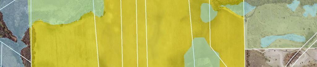
30 Mystic Lake Blvd GÜWX 154th St Trail of Dreams Document Path: K:\ \GIS\Maps\Figure7_DevelopmentPlan.mxd Date Saved: 6/2/2014 8:22:40 AM Howard Lake Rd Berens Ct Edgewood Dr Stemmer Ridge Rd Figure 7 - Stemmer Ridge Road - Development Plan Stemmer Ridge Road Street & Utility Improvement Project Feet ± May 27, 2014 WSB Project No
31 APPENDIX C Opinion of Probable Cost Preliminary Assessment Roll Figure 8 Parcel Assessment Map Feasibility Report Stemmer Ridge Road Street & Utility Improvement Project WSB Project No
32 Project Number: Project: PRIOR LAKE - Stemmer Ridge Road Improvements (Alternative No. 1 - Complete Utilities & Streets) Opinion of Probable Cost Date: Item No. Description Units Quantity Unit Price Total Price SCHEDULE A - STREET IMPROVEMENTS 1 MOBILIZATION LUMP SUM 1 $125, $125, CLEARING ACRE 3.60 $4, $14, GRUBBING ACRE 3.00 $4, $12, TREE TRIMMING HOUR 8 $ $1, REMOVE CURB AND GUTTER LIN FT 1490 $3.00 $4, REMOVE BITUMINOUS PAVEMENT SQ YD 1245 $5.75 $7, REMOVE BITUMINOUS WALK SQ YD 20 $3.25 $ REMOVE CONCRETE WALK SQ YD 980 $2.85 $2, REMOVE SIGN TYPE C EACH 2 $50.00 $ SAWING CONCRETE PAVEMENT (FULL DEPTH) LIN FT 30 $7.00 $ SAWING BIT PAVEMENT (FULL DEPTH) LIN FT 1694 $4.00 $6, COMMON EXCAVATION CU YD $8.00 $240, COMMON EXCAVATION (POND) CU YD 4650 $10.00 $46, POND RESTORATION CU YD 1 $7, $7, FILL SPECIAL - CLAY CU YD 320 $20.00 $6, SUBGRADE EXCAVATION CU YD $8.00 $83, GRANULAR BORROW (CV) CU YD $12.50 $167, /2" CLEAR ROCK CU YD 1214 $12.00 $14, STREET SWEEPER (WITH PICKUP BROOM) HOUR 84 $ $15, AGGREGATE BASE CLASS 5 TON 200 $15.00 $3, AGGREGATE BASE (CV) CLASS 5 CU YD 7619 $28.00 $213, TYPE SP 12.5 WEARING COURSE MIXTURE (4,E) (Base) TON 3258 $68.00 $221, TYPE SP 12.5 WEARING COURSE MIXTURE (4,C) (Wear) TON 1955 $65.00 $127, " CONCRETE WALK SQ FT $4.50 $87, " BITUMINOUS WALK SQ FT $2.00 $62, CONCRETE CURB & GUTTER DESIGN B618 LIN FT 8600 $11.00 $94, CONCRETE CURB & GUTTER DESIGN B424 LIN FT 1380 $16.00 $22, TRUNCATED DOMES SQ FT 78 $55.00 $4, GUIDE POST TYPE B EACH 10 $50.00 $ TRAFFIC CONTROL LUMP SUM 1 $7, $7, F&I SIGN PANELS TYPE SPECIAL EACH 85 $50.00 $4, INSTALL SIGN TYPE SPECIAL (STREET SIGNS) EACH 2 $ $1, TEMPORARY FENCE LIN FT 1600 $2.50 $4, SILT FENCE, TYPE MACHINE SLICED LIN FT 8200 $2.50 $20, STORM DRAIN INLET PROTECTION EACH 32 $ $3, FILTER LOG TYPE STRAW BIOROLL LIN FT 200 $2.50 $ TEMPORARY DITCH CHECK TYPE 2 LIN FT 200 $6.85 $1, CULVERT PROTECTION EACH 8 $ $1, TEMPORARY ROCK CONSTRUCTION ENTRANCE EACH 4 $1, $4, SEEDING ACRE 6 $ $ SEED MIXTURE 250 POUND 570 $2.60 $1, SODDING TYPE SALT RESISTANT SQ YD 9650 $4.10 $39, MULCH MATERIAL TYPE 1 TON 6 $ $1, K:\ \Admin\Docs\Feasibility Report\Opinion of Probable Cost (Alternative No. 1)6/2/2014
33 Project Number: Project: PRIOR LAKE - Stemmer Ridge Road Improvements (Alternative No. 1 - Complete Utilities & Streets) Opinion of Probable Cost Date: EROSION CONTROL BLANKETS CATEGORY 3 SQ YD 2000 $1.00 $2, RAPID STABILIZATION METHOD 3 MGALLON 30 $ $5, STREET LIGHTS EACH 9 $3, $27, PAVT MSSG (LT ARROW) EPOXY EACH 3 $ $ PAVT MSSG (RT ARROW) EPOXY EACH 5 $ $1, PAVT MSSG (THRU ARROW) EPOXY EACH 3 $ $ " SOLID LINE WHITE-EPOXY LIN FT 8810 $0.40 $3, " DOUBLE SOLID LINE YELLOW-EPOXY LIN FT 4200 $0.80 $3, " STOP LINE WHITE-EPOXY LIN FT 80 $7.35 $ CROSSWALK MARKING - POLY PERFORM (GR IN) SQ FT 432 $18.25 $7, Subtotal SCHEDULE A - STREET IMPROVEMENTS + 10% CONTINGENCY Subtotal 25% PROJECT SUPPORT COSTS Total SCHEDULE A - STREET IMPROVEMENTS $1,736, $173, $1,909, $477, $2,387, K:\ \Admin\Docs\Feasibility Report\Opinion of Probable Cost (Alternative No. 1)6/2/2014
34 Project Number: Project: PRIOR LAKE - Stemmer Ridge Road Improvements (Alternative No. 1 - Complete Utilities & Streets) Opinion of Probable Cost Date: SCHEDULE B - SANITARY SEWER 54 30" PVC SANITARY SEWER PIPE LIN FT 3,759 $75.00 $281, " PVC PIPE SEWER - SDR 26 LIN FT 200 $35.00 $7, CASTING ASSEMBLY SANITARY SEWER EACH 18 $ $13, CONNECT TO EXISTING SANITARY SEWER EACH 1 $2, $2, CONNECT TO EXISTING FORCE MAIN EACH 2 $2, $4, CONSTRUCT SANITARY MANHOLE SPECIAL EACH 22 $ $13, CONSTRUCT SANITARY MANHOLES LIN FT 250 $25.00 $6, " FORCE MAIN - PVC C900 LIN FT 20 $55.00 $1, " FORCE MAIN - PVC C900 LIN FT 20 $65.00 $1, Subtotal SCHEDULE B - SANITARY SEWER + 10% CONTINGENCY Subtotal 25% PROJECT SUPPORT COSTS Total SCHEDULE B - SANITARY SEWER $331, $33, $364, $91, $455, SCHEDULE C - WATER MAIN 63 HYDRANT EACH 9 $3, $32, " GATE VALVE AND BOX EACH 9 $1, $13, " GATE VALVE AND BOX EACH 5 $1, $9, " CORPORATION STOP EACH 35 $ $13, " CURB STOP & BOX EACH 35 $ $13, CONNECT TO EXISTING WATER MAIN EACH 2 $1, $2, " TYPE K COPPER PIPE LIN FT 1,350 $27.75 $37, " WATERMAIN DUCTILE IRON CL 52 LIN FT 160 $40.00 $6, " WATERMAIN DUCTILE IRON CL 52 LIN FT 1,013 $45.00 $45, " WATER MAIN - DUCT IRON CL 51 LIN FT 3,784 $85.00 $321, DUCTILE IRON FITTINGS POUND 16,625 $5.00 $83, Subtotal SCHEDULE C - WATER MAIN + 10% CONTINGENCY Subtotal 25% PROJECT SUPPORT COSTS Total SCHEDULE C - WATER MAIN $579, $57, $636, $159, $796, K:\ \Admin\Docs\Feasibility Report\Opinion of Probable Cost (Alternative No. 1)6/2/2014
35 Project Number: Project: PRIOR LAKE - Stemmer Ridge Road Improvements (Alternative No. 1 - Complete Utilities & Streets) Opinion of Probable Cost Date: SCHEDULE D - STORM SEWER 74 PIPE BEDDING MATERIAL CU YD 1100 $7.75 $8, " RC PIPE APRON EACH 2 $ $ " RC PIPE APRON EACH 2 $ $ " RC PIPE APRON EACH 2 $ $1, TRASH GUARD FOR 15" PIPE APRON EACH 2 $ $ TRASH GUARD FOR 18" PIPE APRON EACH 2 $ $ TRASH GUARD FOR 24" PIPE APRON EACH 2 $ $1, " PERF TP PIPE DRAIN LIN FT 780 $24.00 $18, " DRAINTILE CLEANOUT EACH 16 $ $4, " RC PIPE SEWER DESIGN 3006 CL V LIN FT 1509 $34.00 $51, " RC PIPE SEWER DESIGN 3006 CL III LIN FT 1157 $38.00 $43, " RC PIPE SEWER DESIGN 3006 CL III LIN FT 307 $48.00 $14, CONNECT TO EXISTING STORM SEWER EACH 1 $ $ CONST DRAINAGE STRUCTURE DES LIN FT 61 $ $14, CONST DRAINAGE STRUCTURE DES LIN FT 9 $ $4, CONST DRAINAGE STRUCTURE DES SPECIAL 1-2'X3' BOX EACH 16 $ $5, CONST DRAINAGE STRUCTURE DES SPECIAL 2 - OCS EACH 3 $4, $13, CASTING ASSEMBLY EACH 25 $1, $27, ADJUST FRAME & RING CASTING EACH 30 $ $10, GEOTEXTILE FILTER TYPE IV SQ YD 3840 $3.75 $14, RIPRAP CL III CU YD 53 $65.00 $3, SCHEDULE E - RIGHT OF WAY Subtotal SCHEDULE D - STORM SEWER + 10% CONTINGENCY Subtotal 25% PROJECT SUPPORT COSTS Total SCHEDULE D - STORM SEWER $242, $24, $266, $66, $333, ACQUISITION ACRE $210, Total SCHEDULE E - RIGHT OF WAY $210, TOTAL PROJECT COST SUBTOTAL SCHEDULE A - STREET IMPROVEMENTS $2,387, SUBTOTAL SCHEDULE B - SANITARY SEWER $455, SUBTOTAL SCHEDULE C - WATERMAIN $796, SUBTOTAL SCHEDULE D - STORM SEWER $333, SUBTOTAL SCHEDULE E - RIGHT OF WAY $210, PROJECT GRAND TOTAL $4,181, K:\ \Admin\Docs\Feasibility Report\Opinion of Probable Cost (Alternative No. 1)6/2/2014
36 Project Number: Project: PRIOR LAKE - Stemmer Ridge Road Improvements (Alternative No. 2 - Utilities & SMSC Streets) Opinion of Probable Cost Date: Item No. Description Units Quantity Unit Price Total Price SCHEDULE A - STREET IMPROVEMENTS 1 MOBILIZATION LUMP SUM 1 $75, $75, CLEARING ACRE 3.60 $4, $14, GRUBBING ACRE 3.00 $4, $12, TREE TRIMMING HOUR 8 $ $1, REMOVE CURB AND GUTTER LIN FT 1490 $3.00 $4, REMOVE BITUMINOUS PAVEMENT SQ YD 1200 $5.75 $6, REMOVE BITUMINOUS WALK SQ YD 20 $3.25 $ REMOVE CONCRETE WALK SQ YD 980 $2.85 $2, REMOVE SIGN TYPE C EACH 2 $50.00 $ SAWING CONCRETE PAVEMENT (FULL DEPTH) LIN FT 24 $7.00 $ SAWING BIT PAVEMENT (FULL DEPTH) LIN FT 1650 $4.00 $6, COMMON EXCAVATION CU YD $8.00 $180, COMMON EXCAVATION (POND) CU YD 2500 $10.00 $25, POND RESTORATION CU YD 1 $7, $7, FILL SPECIAL - CLAY CU YD 320 $20.00 $6, SUBGRADE EXCAVATION CU YD 6450 $8.00 $51, GRANULAR BORROW (CV) CU YD 5210 $12.50 $65, /2" CLEAR ROCK CU YD 64 $12.00 $ STREET SWEEPER (WITH PICKUP BROOM) HOUR 60 $ $10, AGGREGATE BASE CLASS 5 TON 100 $15.00 $1, AGGREGATE BASE (CV) CLASS 5 CU YD 2858 $28.00 $80, TYPE SP 12.5 WEARING COURSE MIXTURE (4,E) (Base) TON 1477 $68.00 $100, TYPE SP 12.5 WEARING COURSE MIXTURE (4,C) (Wear) TON 886 $65.00 $57, " CONCRETE WALK SQ FT 7335 $4.50 $33, " BITUMINOUS WALK SQ FT $2.00 $23, CONCRETE CURB & GUTTER DESIGN B618 LIN FT 3614 $11.00 $39, CONCRETE CURB & GUTTER DESIGN B424 LIN FT 1380 $16.00 $22, TRUNCATED DOMES SQ FT 78 $55.00 $4, GUIDE POST TYPE B EACH 6 $50.00 $ TRAFFIC CONTROL LUMP SUM 1 $5, $5, F&I SIGN PANELS TYPE SPECIAL EACH 50 $50.00 $2, INSTALL SIGN TYPE SPECIAL (STREET SIGNS) EACH 2 $ $1, TEMPORARY FENCE LIN FT 1600 $2.50 $4, SILT FENCE, TYPE MACHINE SLICED LIN FT 8200 $2.50 $20, STORM DRAIN INLET PROTECTION EACH 12 $ $1, FILTER LOG TYPE STRAW BIOROLL LIN FT 200 $2.50 $ TEMPORARY DITCH CHECK TYPE 2 LIN FT 200 $6.85 $1, CULVERT PROTECTION EACH 4 $ $ TEMPORARY ROCK CONSTRUCTION ENTRANCE EACH 4 $1, $4, SEEDING ACRE 6 $ $ SEED MIXTURE 250 POUND 570 $2.60 $1, SODDING TYPE SALT RESISTANT SQ YD 9650 $4.10 $39, MULCH MATERIAL TYPE 1 TON 6 $ $1, K:\ \Admin\Docs\Feasibility Report\Opinion of Probable Cost (Alternative No. 2)6/2/2014
37 Project Number: Project: PRIOR LAKE - Stemmer Ridge Road Improvements (Alternative No. 2 - Utilities & SMSC Streets) Opinion of Probable Cost Date: EROSION CONTROL BLANKETS CATEGORY 3 SQ YD 2000 $1.00 $2, RAPID STABILIZATION METHOD 3 MGALLON 30 $ $5, STREET LIGHTS EACH 4 $3, $12, PAVT MSSG (LT ARROW) EPOXY EACH 3 $ $ PAVT MSSG (RT ARROW) EPOXY EACH 5 $ $1, PAVT MSSG (THRU ARROW) EPOXY EACH 3 $ $ " SOLID LINE WHITE-EPOXY LIN FT 4010 $0.40 $1, " DOUBLE SOLID LINE YELLOW-EPOXY LIN FT 1400 $0.80 $1, " STOP LINE WHITE-EPOXY LIN FT 80 $7.35 $ CROSSWALK MARKING - POLY PERFORM (GR IN) SQ FT 432 $18.25 $7, Subtotal SCHEDULE A - STREET IMPROVEMENTS + 10% CONTINGENCY Subtotal 25% PROJECT SUPPORT COSTS Total SCHEDULE A - STREET IMPROVEMENTS $950, $95, $1,045, $261, $1,306, K:\ \Admin\Docs\Feasibility Report\Opinion of Probable Cost (Alternative No. 2)6/2/2014
38 Project Number: Project: PRIOR LAKE - Stemmer Ridge Road Improvements (Alternative No. 2 - Utilities & SMSC Streets) Opinion of Probable Cost Date: SCHEDULE B - SANITARY SEWER 54 30" PVC SANITARY SEWER PIPE LIN FT 3,759 $75.00 $281, " PVC PIPE SEWER - SDR 26 LIN FT 200 $35.00 $7, CASTING ASSEMBLY SANITARY SEWER EACH 18 $ $13, CONNECT TO EXISTING SANITARY SEWER EACH 1 $2, $2, CONNECT TO EXISTING FORCE MAIN EACH 2 $2, $4, CONSTRUCT SANITARY MANHOLE SPECIAL EACH 22 $ $13, CONSTRUCT SANITARY MANHOLES LIN FT 250 $25.00 $6, " FORCE MAIN - PVC C900 LIN FT 20 $55.00 $1, " FORCE MAIN - PVC C900 LIN FT 20 $65.00 $1, Subtotal SCHEDULE B - SANITARY SEWER + 10% CONTINGENCY Subtotal 25% PROJECT SUPPORT COSTS Total SCHEDULE B - SANITARY SEWER $331, $33, $364, $91, $455, SCHEDULE C - WATER MAIN 63 HYDRANT EACH 9 $3, $32, " GATE VALVE AND BOX EACH 9 $1, $13, " GATE VALVE AND BOX EACH 5 $1, $9, " CORPORATION STOP EACH 35 $ $13, " CURB STOP & BOX EACH 35 $ $13, CONNECT TO EXISTING WATER MAIN EACH 2 $1, $2, " TYPE K COPPER PIPE LIN FT 1,350 $27.75 $37, " WATERMAIN DUCTILE IRON CL 52 LIN FT 160 $40.00 $6, " WATERMAIN DUCTILE IRON CL 52 LIN FT 1,013 $45.00 $45, " WATER MAIN - DUCT IRON CL 51 LIN FT 3,784 $85.00 $321, DUCTILE IRON FITTINGS POUND 16,625 $5.00 $83, Subtotal SCHEDULE C - WATER MAIN + 10% CONTINGENCY Subtotal 25% PROJECT SUPPORT COSTS Total SCHEDULE C - WATER MAIN $579, $57, $636, $159, $796, K:\ \Admin\Docs\Feasibility Report\Opinion of Probable Cost (Alternative No. 2)6/2/2014
39 Project Number: Project: PRIOR LAKE - Stemmer Ridge Road Improvements (Alternative No. 2 - Utilities & SMSC Streets) Opinion of Probable Cost Date: SCHEDULE D - STORM SEWER 74 PIPE BEDDING MATERIAL CU YD 550 $7.75 $4, " RC PIPE APRON EACH 1 $ $ " RC PIPE APRON EACH 1 $ $ TRASH GUARD FOR 15" PIPE APRON EACH 1 $ $ TRASH GUARD FOR 24" PIPE APRON EACH 1 $ $ " PERF TP PIPE DRAIN LIN FT 300 $24.00 $7, " DRAINTILE CLEANOUT EACH 8 $ $2, " RC PIPE SEWER DESIGN 3006 CL V LIN FT 260 $34.00 $8, " RC PIPE SEWER DESIGN 3006 CL III LIN FT 1067 $38.00 $40, " RC PIPE SEWER DESIGN 3006 CL III LIN FT 175 $48.00 $8, CONNECT TO EXISTING STORM SEWER EACH 1 $ $ CONST DRAINAGE STRUCTURE DES LIN FT 57 $ $14, CONST DRAINAGE STRUCTURE DES LIN FT 0 $ $ CONST DRAINAGE STRUCTURE DES SPECIAL 1-2'X3' BOX EACH 5 $ $1, CONST DRAINAGE STRUCTURE DES SPECIAL 2 - OCS EACH 1 $4, $4, CASTING ASSEMBLY EACH 11 $1, $12, ADJUST FRAME & RING CASTING EACH 14 $ $5, GEOTEXTILE FILTER TYPE IV SQ YD 1320 $3.75 $4, RIPRAP CL III CU YD 20 $65.00 $1, SCHEDULE E - RIGHT OF WAY Subtotal SCHEDULE D - STORM SEWER + 10% CONTINGENCY Subtotal 25% PROJECT SUPPORT COSTS Total SCHEDULE D - STORM SEWER $117, $11, $129, $32, $161, ACQUISITION ACRE $210, Total SCHEDULE E - RIGHT OF WAY $210, TOTAL PROJECT COST SUBTOTAL SCHEDULE A - STREET IMPROVEMENTS $1,306, SUBTOTAL SCHEDULE B - SANITARY SEWER $455, SUBTOTAL SCHEDULE C - WATERMAIN $796, SUBTOTAL SCHEDULE D - STORM SEWER $161, SUBTOTAL SCHEDULE E - RIGHT OF WAY $210, PROJECT GRAND TOTAL $2,928, K:\ \Admin\Docs\Feasibility Report\Opinion of Probable Cost (Alternative No. 2)6/2/2014
40 Project Number: Project: PRIOR LAKE - Stemmer Ridge Road Improvements (Alternative No. 3 - Utilities Only) Opinion of Probable Cost Date: Item No. Description Units Quantity Unit Price Total Price SCHEDULE A - STREET IMPROVEMENTS 1 MOBILIZATION LUMP SUM 1 $44, $44, CLEARING ACRE 3.60 $4, $14, GRUBBING ACRE 3.00 $4, $12, TREE TRIMMING HOUR 8 $ $1, TRAFFIC CONTROL LUMP SUM 1.00 $2, $2, TEMPORARY FENCE LIN FT 1, $2.50 $4, SILT FENCE, TYPE MACHINE SLICED LIN FT 8200 $2.50 $20, FILTER LOG TYPE STRAW BIOROLL LIN FT 200 $2.50 $ TEMPORARY DITCH CHECK TYPE 2 LIN FT $6.85 $1, TEMPORARY ROCK CONSTRUCTION ENTRANCE EACH 4.00 $1, $4, SEEDING ACRE 5.7 $ $ SEED MIXTURE 250 POUND 570 $2.60 $1, SODDING TYPE SALT RESISTANT SQ YD 9650 $4.10 $39, MULCH MATERIAL TYPE 1 TON 5.7 $ $1, EROSION CONTROL BLANKETS CATEGORY 3 SQ YD 2000 $1.00 $2, RAPID STABILIZATION METHOD 3 MGALLON 30 $ $5, Subtotal SCHEDULE A - STREET IMPROVEMENTS + 10% CONTINGENCY Subtotal 25% PROJECT SUPPORT COSTS Total SCHEDULE A - STREET IMPROVEMENTS $155, $15, $170, $42, $213, SCHEDULE B - SANITARY SEWER 17 30" PVC SANITARY SEWER PIPE LIN FT 3,759 $75.00 $281, " PVC PIPE SEWER - SDR 26 LIN FT 200 $35.00 $7, CASTING ASSEMBLY SANITARY SEWER EACH 18 $ $13, CONNECT TO EXISTING SANITARY SEWER EACH 1 $2, $2, CONNECT TO EXISTING FORCE MAIN EACH 2 $2, $4, CONSTRUCT SANITARY MANHOLE SPECIAL EACH 22 $ $13, CONSTRUCT SANITARY MANHOLES LIN FT 250 $25.00 $6, " FORCE MAIN - PVC C900 LIN FT 20 $55.00 $1, " FORCE MAIN - PVC C900 LIN FT 20 $65.00 $1, Subtotal SCHEDULE B - SANITARY SEWER + 10% CONTINGENCY Subtotal 25% PROJECT SUPPORT COSTS Total SCHEDULE B - SANITARY SEWER $331, $33, $364, $91, $455, K:\ \Admin\Docs\Feasibility Report\Opinion of Probable Cost (Alternative No. 3)6/2/2014
41 Project Number: Project: PRIOR LAKE - Stemmer Ridge Road Improvements (Alternative No. 3 - Utilities Only) Opinion of Probable Cost Date: SCHEDULE C - WATER MAIN 26 HYDRANT EACH 9 $3, $32, " GATE VALVE AND BOX EACH 9 $1, $13, " GATE VALVE AND BOX EACH 5 $1, $9, " CORPORATION STOP EACH 35 $ $13, " CURB STOP & BOX EACH 35 $ $13, CONNECT TO EXISTING WATER MAIN EACH 2 $1, $2, " TYPE K COPPER PIPE LIN FT 1,350 $27.75 $37, " WATERMAIN DUCTILE IRON CL 52 LIN FT 160 $40.00 $6, " WATERMAIN DUCTILE IRON CL 52 LIN FT 1,013 $45.00 $45, " WATER MAIN - DUCT IRON CL 51 LIN FT 3,784 $85.00 $321, DUCTILE IRON FITTINGS POUND 16,625 $5.00 $83, Subtotal SCHEDULE C - WATER MAIN + 10% CONTINGENCY Subtotal 25% PROJECT SUPPORT COSTS Total SCHEDULE C - WATER MAIN $579, $57, $636, $159, $796, SCHEDULE D - RIGHT OF WAY 37 ACQUISITION ACRE $210, Total SCHEDULE D - ACQUISITION $210, TOTAL PROJECT COST SUBTOTAL SCHEDULE A - STREET IMPROVEMENTS $213, SUBTOTAL SCHEDULE B - SANITARY SEWER $455, SUBTOTAL SCHEDULE C - WATER MAIN $796, SUBTOTAL SCHEDULE D - RIGHT OF WAY $210, PROJECT GRAND TOTAL $1,674, K:\ \Admin\Docs\Feasibility Report\Opinion of Probable Cost (Alternative No. 3)6/2/2014
42 PRELIMINARY ROLL - ALTERNATE NO. 1 DESCRIPTION: # STEMMER RIDGE ROAD UNIT RATE (100%): STREET AND STORM SEWER UNIT RATE (100%): UTILITIES CODE: Street Unit Rate $18,000 Unit INTEREST RATE: Water Unit Rate $6,000 Unit TERM: 10 YEAR STREETS 20 YEARS UTILITIES Sewer Unit Rate $6,000 Unit INITIAL YEAR: Street Area Rate $14,898 Acre ADDITIONAL INTEREST: Water Area Rate $2,954 Acre TOTAL AREA STREETS UTILITIES Sewer Area Rate $2,352 Acre TOTAL UNITS 20 STREETS 20 UTILITIES PAYMENT METHOD: EQUAL PRINCIPAL NO. LEGAL DESCRIPTION PARCEL ADDRESS PARCEL NUMBER PROPERTY OWNER & ADDRESS ASSESSABLE AREA ASSESSABLE UNITS STREET WATERMAIN SEWER TOTAL AMOUNT Section 32 Township 115 Range 022 P/O E 49A OF GOV LOT 3 LYING S OF RD #19, & 15A IN GOVT LOT HOWARD LAKE RD NW SubdivisionName RLS 153 Lot TCT Block 00C SubdivisionCd Section 33 Township 115 Range A IN N1/2 SW1/ Section 33 Township 115 Range 022 N1/2 SW1/4 EX 1.67A & EX N 440' & EX E 1287' & EX 1.23A HWY HOWARD LAKE RD NW Section 33 Township 115 Range 022 N1/2 SW1/4 EX 1.67A & EX N 440' & EX E 1287' & EX 1.23A HWY HOWARD LAKE RD NW Section 32 Township 115 Range A LOT # 4 EX 11.6A EX 1.50A EX 1.37A Section 32 Township 115 Range ' STRIP IN GOVT LOT 4 IN WHICH THE N & W LINE COM 198' W OF SE COR, N ', N E ' Section 32 Township 115 Range ' STRIP IN GOVT LOT 4, THE W & N LINE DESCRIBED AS COM 132' W OF SE COR, N ', N E ' Section 32 Township 115 Range 022 P/O GOVT LOT 4 LYING 66' SE OF LINE COM 132' W OF SE COR, N ', N E ' & THERE TERMINATING SHAKOPEE MDEWAKANTON SIOUX 2330 Sioux Trail NW, Prior Lake, MN $ 296, $ 58, $ 46, $ 402, SHAKOPEE MDEWAKANTON SIOUX 2330 Sioux Trail NW, Prior Lake, MN $ 1, $ $ $ 2, SCOTT COUNTY HIGHWAY ENGINEER 600 Country Trail N. Jordan, MN $ 4, $ $ $ 6, SHAKOPEE MDEWAKANTON SIOUX 2330 Sioux Trail NW, Prior Lake, MN $ 249, $ 49, $ 39, $ 338, SHAKOPEE MDEWAKANTON SIOUX 2330 Sioux Trail NW, Prior Lake, MN $ 11, $ 2, $ 1, $ 15, Shakopee, MN $ 83, $ 16, $ 13, $ 113, Shakopee, MN $ 22, $ 4, $ 3, $ 30, Shakopee, MN $ 19, $ 3, $ 3, $ 26, MENDEN TOM 919 Market Street S., Shakopee, MN $ 17, $ 3, $ 2, $ 23, Section 33 Township 115 Range 022 SW1/4 SW1/4 LYING SW OF CO RD 81 & LYING NW OF LINE COM NW COR, S ' TO POB, N E TO N LINE SW1/4 SW1/4 & THERE TERMINATING & COM SW COR SW1/4, E ' TO W LINE OF E 133', N ' TO CL CO RD 81, NW AL MENDEN TOM 919 Market Street S., Shakopee, MN $ 2, $ $ $ 3, Section 33 Township 115 Range 022 P/O SW1/4 SW1/4 LYING 66' NW OF LINE COM 132' W OF SE COR GOVT LOT , N N ' TO CL CO RD 81 & THERE TERMINATING Shakopee, MN $ 9, $ 1, $ 1, $ 12, Page 1
43 NO. LEGAL DESCRIPTION PARCEL ADDRESS PARCEL NUMBER PROPERTY OWNER & ADDRESS 12 Section 33 Township 115 Range ' STRIP IN SW1/4 SW1/4 COM ' S OF NW COR, N E TO CL CO RD 81, NW ALONG CL 66', S W TO W LINE SW1/4, S 66' TO POB ASSESSABLE AREA ASSESSABLE UNITS STREET WATERMAIN SEWER TOTAL AMOUNT Shakopee, MN $ 12, $ 2, $ 1, $ 16, Section 33 Township 115 Range 022 SW1/4 SW1/4 LYING SW OF CO RD 81 & LYING NW OF LINE COM NW COR, S ' TO POB, N E TO N LINE SW1/4 SW1/4 & THERE TERMINATING & COM SW COR SW1/4, E ' TO W LINE OF E 133', N ' TO CL CO RD 81, NW AL Section 33 Township 115 Range 022 COM SW COR OF SW1/4 SW1/4, N W ALONG W LINE SW1/4 SW1/ ' TO CL OF CO RD 81, S W ' TO POB HOWARD LAKE RD NW Section 33 Township 115 Range 022 SW1/4 SW1/4 LYING NORTH OF CO RD #14 EX E 180' Section 33 Township 115 Range 022 SW1/4 SW1/4 LYING SW OF CO RD 81 & LYING NW OF LINE COM NW COR, S ' TO POB, N E TO N LINE SW1/4 SW1/4 & THERE TERMINATING & COM SW COR SW1/4, E ' TO W LINE OF E 133', N ' TO CL CO RD 81, NW AL Section 33 Township 115 Range 022 E 180' OF SW1/4 SW1/4 LYING N OF CO RD HOWARD LAKE RD NW Section 33 Township 115 Range 022 W 66' OF E 132' OF SW1/4 SW1/4 LYING S OF CL OF CO RD Section 33 Township 115 Range 022 E 66' OF SW1/4 SW1/4 LYING S OF CL OF HWY Section 05 Township 114 Range A IN GOV'T LOT Section 05 Township 114 Range 022 GOVT LOT 1 LYING E OF A LINE COM ' S OF NE COR OF LOT 4, SW ', SW ' TO S LINE OF LOT 1 AT PT ' W OF SE COR & THERE TERM. & LYING W OF A LINE COM ' W OF SE COR OF LOT 1, NE ', E Section 05 Township 114 Range 022 P/O GOVT LOT 1 COM SE COR, W ', NE ', E 49.34' N 66', E 66', S 66', E 66' TO E LINE, S TO POB Section 05 Township 114 Range 022 N 66' OF E 66' OF GOVT LOT Section 04 Township 114 Range 022 P/O NW1/4 NW1/4 COM SW COR, E ', N ', W ' TO W LINE, S TO POB MENDEN TOM 919 Market Street S., Shakopee, MN $ 13, $ 2, $ 2, $ 18, MENDEN ROBERT L & ROXANN L Howard Lake Road NW, Shakopee, MN $ 190, $ 37, $ 30, $ 258, SHAKOPEE MDEWAKANTON SIOUX 2330 Sioux Trail NW, Prior Lake, MN $ 65, $ 13, $ 10, $ 88, MENDEN TOM 919 Market Street S., Shakopee, MN $ 181, $ 36, $ 28, $ 246, MICKO JEFFREY J Howard Lake Road NW, Shakopee, MN $ 72, $ 24, $ 24, $ 120, Shakopee, MN $ 11, $ 2, $ 1, $ 16, Shakopee, MN $ 10, $ 1, $ 1, $ 13, SHAKOPEE MDEWAKANTON SIOUX 2330 Sioux Trail NW, Prior Lake, MN $ 253, $ 50, $ 40, $ 344, Shakopee, MN $ 126, $ 25, $ 20, $ 171, Shakopee, MN $ 81, $ 16, $ 12, $ 110, MENDEN TOM 919 Market Street S., Shakopee, MN $ 1, $ $ $ 2, Shakopee, MN $ 50, $ 10, $ 7, $ 68, Page 2
44 NO. LEGAL DESCRIPTION PARCEL ADDRESS PARCEL NUMBER PROPERTY OWNER & ADDRESS ASSESSABLE AREA ASSESSABLE UNITS STREET WATERMAIN SEWER TOTAL AMOUNT Section 04 Township 114 Range 022 P/O NW1/4 NW1/4 COM 132' W OF NE COR, S 66', W ', S 320', S W ' TO S LINE NW1/4 NW1/4, W ', N ', W ', N 66' TO N LINE NW1/4 NW1/4, E TO POB Section 04 Township 114 Range 022 P/O NW1/4 NW1/4 COM ' W OF SE COR, W ', NE ', N 320', E ', N 66', E 66', S ', SW ', S ' TO POB Section 04 Township 114 Range 022 P/O NW1/4 NW1/4 COM NE COR, S TO SE COR, W ', N NE ', NE ', N ' TO N LINE, E 66' TO POB UPDATED 5/8/14 MENDEN TOM 919 Market Street S., Shakopee, MN $ 457, $ 129, $ 122, $ 709, Shakopee, MN $ 60, $ 12, $ 9, $ 82, Shakopee, MN $ 133, $ 26, $ 21, $ 181, $ 2,442, $ 532, $ 448, $ 3,424, Page 3
45 PRELIMINARY ROLL - ALTERNATE NO. 2 DESCRIPTION: # STEMMER RIDGE ROAD UNIT RATE (100%): STREET AND STORM SEWER UNIT RATE (100%): UTILITIES CODE: Street Unit Rate $18,000 Unit Micko Property INTEREST RATE: Water Unit Rate $6,000 Unit TERM: 10 YEAR STREETS 20 YEARS UTILITIES Sewer Unit Rate $6,000 Unit INITIAL YEAR: Street Area Rate $19,690 Acre SMSC Property ADDITIONAL INTEREST: Street Area Rate $1,491 Acre Menden Property TOTAL AREA STREETS UTILITIES Water Area Rate $2,954 Acre TOTAL UNITS 4 STREETS 20 UTILITIES Sewer Area Rate $2,352 Acre PAYMENT METHOD: EQUAL PRINCIPAL NO. LEGAL DESCRIPTION PARCEL ADDRESS PARCEL NUMBER PROPERTY OWNER & ADDRESS ASSESSABLE AREA ASSESSABLE UNITS STREET WATERMAIN SEWER TOTAL AMOUNT Section 32 Township 115 Range 022 P/O E 49A OF GOV LOT 3 LYING S OF RD #19, & 15A IN GOVT LOT HOWARD LAKE RD NW SubdivisionName RLS 153 Lot TCT Block 00C SubdivisionCd Section 33 Township 115 Range A IN N1/2 SW1/ Section 33 Township 115 Range 022 N1/2 SW1/4 EX 1.67A & EX N 440' & EX E 1287' & EX 1.23A HWY HOWARD LAKE RD NW Section 33 Township 115 Range 022 N1/2 SW1/4 EX 1.67A & EX N 440' & EX E 1287' & EX 1.23A HWY HOWARD LAKE RD NW Section 32 Township 115 Range A LOT # 4 EX 11.6A EX 1.50A EX 1.37A Section 32 Township 115 Range ' STRIP IN GOVT LOT 4 IN WHICH THE N & W LINE COM 198' W OF SE COR, N ', N E ' Section 32 Township 115 Range ' STRIP IN GOVT LOT 4, THE W & N LINE DESCRIBED AS COM 132' W OF SE COR, N ', N E ' Section 32 Township 115 Range 022 P/O GOVT LOT 4 LYING 66' SE OF LINE COM 132' W OF SE COR, N ', N E ' & THERE TERMINATING SHAKOPEE MDEWAKANTON SIOUX 2330 Sioux Trail NW, Prior Lake, MN $ 392, $ 58, $ 46, $ 497, SHAKOPEE MDEWAKANTON SIOUX 2330 Sioux Trail NW, Prior Lake, MN $ 2, $ $ $ 2, SCOTT COUNTY HIGHWAY ENGINEER 600 Country Trail N. Jordan, MN $ $ $ $ 2, SHAKOPEE MDEWAKANTON SIOUX 2330 Sioux Trail NW, Prior Lake, MN $ 330, $ 49, $ 39, $ 419, SHAKOPEE MDEWAKANTON SIOUX 2330 Sioux Trail NW, Prior Lake, MN $ 15, $ 2, $ 1, $ 19, Shakopee, MN $ 8, $ 16, $ 13, $ 38, Shakopee, MN $ 2, $ 4, $ 3, $ 10, Shakopee, MN $ 1, $ 3, $ 3, $ 8, MENDEN TOM 919 Market Street S., Shakopee, MN $ 1, $ 3, $ 2, $ 7, Section 33 Township 115 Range 022 SW1/4 SW1/4 LYING SW OF CO RD 81 & LYING NW OF LINE COM NW COR, S ' TO POB, N E TO N LINE SW1/4 SW1/4 & THERE TERMINATING & COM SW COR SW1/4, E ' TO W LINE OF E 133', N ' TO CL CO RD 81, NW AL MENDEN TOM 919 Market Street S., Shakopee, MN $ $ $ $ 1, Section 33 Township 115 Range 022 P/O SW1/4 SW1/4 LYING 66' NW OF LINE COM 132' W OF SE COR GOVT LOT , N N ' TO CL CO RD 81 & THERE TERMINATING Shakopee, MN $ $ 1, $ 1, $ 4, Page 1
46 NO. LEGAL DESCRIPTION PARCEL ADDRESS PARCEL NUMBER PROPERTY OWNER & ADDRESS 12 Section 33 Township 115 Range ' STRIP IN SW1/4 SW1/4 COM ' S OF NW COR, N E TO CL CO RD 81, NW ALONG CL 66', S W TO W LINE SW1/4, S 66' TO POB ASSESSABLE AREA ASSESSABLE UNITS STREET WATERMAIN SEWER TOTAL AMOUNT Shakopee, MN $ 1, $ 2, $ 1, $ 5, Section 33 Township 115 Range 022 SW1/4 SW1/4 LYING SW OF CO RD 81 & LYING NW OF LINE COM NW COR, S ' TO POB, N E TO N LINE SW1/4 SW1/4 & THERE TERMINATING & COM SW COR SW1/4, E ' TO W LINE OF E 133', N ' TO CL CO RD 81, NW AL Section 33 Township 115 Range 022 COM SW COR OF SW1/4 SW1/4, N W ALONG W LINE SW1/4 SW1/ ' TO CL OF CO RD 81, S W ' TO POB HOWARD LAKE RD NW Section 33 Township 115 Range 022 SW1/4 SW1/4 LYING NORTH OF CO RD #14 EX E 180' Section 33 Township 115 Range 022 SW1/4 SW1/4 LYING SW OF CO RD 81 & LYING NW OF LINE COM NW COR, S ' TO POB, N E TO N LINE SW1/4 SW1/4 & THERE TERMINATING & COM SW COR SW1/4, E ' TO W LINE OF E 133', N ' TO CL CO RD 81, NW AL Section 33 Township 115 Range 022 E 180' OF SW1/4 SW1/4 LYING N OF CO RD HOWARD LAKE RD NW Section 33 Township 115 Range 022 W 66' OF E 132' OF SW1/4 SW1/4 LYING S OF CL OF CO RD Section 33 Township 115 Range 022 E 66' OF SW1/4 SW1/4 LYING S OF CL OF HWY Section 05 Township 114 Range A IN GOV'T LOT Section 05 Township 114 Range 022 GOVT LOT 1 LYING E OF A LINE COM ' S OF NE COR OF LOT 4, SW ', SW ' TO S LINE OF LOT 1 AT PT ' W OF SE COR & THERE TERM. & LYING W OF A LINE COM ' W OF SE COR OF LOT 1, NE ', E Section 05 Township 114 Range 022 P/O GOVT LOT 1 COM SE COR, W ', NE ', E 49.34' N 66', E 66', S 66', E 66' TO E LINE, S TO POB Section 05 Township 114 Range 022 N 66' OF E 66' OF GOVT LOT Section 04 Township 114 Range 022 P/O NW1/4 NW1/4 COM SW COR, E ', N ', W ' TO W LINE, S TO POB MENDEN TOM 919 Market Street S., Shakopee, MN $ 1, $ 2, $ 2, $ 6, MENDEN ROBERT L & ROXANN L Howard Lake Road NW, Shakopee, MN $ 19, $ 37, $ 30, $ 87, SHAKOPEE MDEWAKANTON SIOUX 2330 Sioux Trail NW, Prior Lake, MN $ 86, $ 13, $ 10, $ 110, MENDEN TOM 919 Market Street S., Shakopee, MN $ 18, $ 36, $ 28, $ 82, MICKO JEFFREY J Howard Lake Road NW, Shakopee, MN $ 72, $ 24, $ 24, $ 120, Shakopee, MN $ 1, $ 2, $ 1, $ 5, Shakopee, MN $ 1, $ 1, $ 1, $ 4, SHAKOPEE MDEWAKANTON SIOUX 2330 Sioux Trail NW, Prior Lake, MN $ 335, $ 50, $ 40, $ 426, Shakopee, MN $ 12, $ 25, $ 20, $ 57, Shakopee, MN $ 8, $ 16, $ 12, $ 37, MENDEN TOM 919 Market Street S., Shakopee, MN $ $ $ $ Shakopee, MN $ 5, $ 10, $ 7, $ 23, Page 2
47 NO. LEGAL DESCRIPTION PARCEL ADDRESS PARCEL NUMBER PROPERTY OWNER & ADDRESS ASSESSABLE AREA ASSESSABLE UNITS STREET WATERMAIN SEWER TOTAL AMOUNT Section 04 Township 114 Range 022 P/O NW1/4 NW1/4 COM 132' W OF NE COR, S 66', W ', S 320', S W ' TO S LINE NW1/4 NW1/4, W ', N ', W ', N 66' TO N LINE NW1/4 NW1/4, E TO POB Section 04 Township 114 Range 022 P/O NW1/4 NW1/4 COM ' W OF SE COR, W ', NE ', N 320', E ', N 66', E 66', S ', SW ', S ' TO POB Section 04 Township 114 Range 022 P/O NW1/4 NW1/4 COM NE COR, S TO SE COR, W ', N NE ', NE ', N ' TO N LINE, E 66' TO POB UPDATED 5/8/14 MENDEN TOM 919 Market Street S., Shakopee, MN $ 24, $ 129, $ 122, $ 276, Shakopee, MN $ 6, $ 12, $ 9, $ 27, Shakopee, MN $ 13, $ 26, $ 21, $ 61, $ 1,361, $ 532, $ 448, $ 2,343, Page 3
48 PRELIMINARY ROLL - ALTERNATE NO. 3 DESCRIPTION: # STEMMER RIDGE ROAD UNIT RATE (100%): STREET AND STORM SEWER UNIT RATE (100%): UTILITIES CODE: Street Unit Rate $0 Unit INTEREST RATE: Water Unit Rate $6,000 Unit TERM: 10 YEAR STREETS 20 YEARS UTILITIES Sewer Unit Rate $6,000 Unit INITIAL YEAR: Street Area Rate $1,447 Acre ADDITIONAL INTEREST: Water Area Rate $2,954 Acre TOTAL AREA STREETS UTILITIES Sewer Area Rate $2,352 Acre TOTAL UNITS 0 STREETS 20 UTILITIES PAYMENT METHOD: EQUAL PRINCIPAL NO. LEGAL DESCRIPTION PARCEL ADDRESS PARCEL NUMBER PROPERTY OWNER & ADDRESS ASSESSABLE AREA ASSESSABLE UNITS STREET WATERMAIN SEWER TOTAL AMOUNT Section 32 Township 115 Range 022 P/O E 49A OF GOV LOT 3 LYING S OF RD #19, & 15A IN GOVT LOT HOWARD LAKE RD NW SubdivisionName RLS 153 Lot TCT Block 00C SubdivisionCd Section 33 Township 115 Range A IN N1/2 SW1/ Section 33 Township 115 Range 022 N1/2 SW1/4 EX 1.67A & EX N 440' & EX E 1287' & EX 1.23A HWY HOWARD LAKE RD NW Section 33 Township 115 Range 022 N1/2 SW1/4 EX 1.67A & EX N 440' & EX E 1287' & EX 1.23A HWY HOWARD LAKE RD NW Section 32 Township 115 Range A LOT # 4 EX 11.6A EX 1.50A EX 1.37A Section 32 Township 115 Range ' STRIP IN GOVT LOT 4 IN WHICH THE N & W LINE COM 198' W OF SE COR, N ', N E ' Section 32 Township 115 Range ' STRIP IN GOVT LOT 4, THE W & N LINE DESCRIBED AS COM 132' W OF SE COR, N ', N E ' Section 32 Township 115 Range 022 P/O GOVT LOT 4 LYING 66' SE OF LINE COM 132' W OF SE COR, N ', N E ' & THERE TERMINATING SHAKOPEE MDEWAKANTON SIOUX 2330 Sioux Trail NW, Prior Lake, MN $ 28, $ 58, $ 46, $ 134, SHAKOPEE MDEWAKANTON SIOUX 2330 Sioux Trail NW, Prior Lake, MN $ $ $ $ SCOTT COUNTY HIGHWAY ENGINEER 600 Country Trail N. Jordan, MN $ $ $ $ 2, SHAKOPEE MDEWAKANTON SIOUX 2330 Sioux Trail NW, Prior Lake, MN $ 24, $ 49, $ 39, $ 113, SHAKOPEE MDEWAKANTON SIOUX 2330 Sioux Trail NW, Prior Lake, MN $ 1, $ 2, $ 1, $ 5, Shakopee, MN $ 8, $ 16, $ 13, $ 37, Shakopee, MN $ 2, $ 4, $ 3, $ 10, Shakopee, MN $ 1, $ 3, $ 3, $ 8, MENDEN TOM 919 Market Street S., Shakopee, MN $ 1, $ 3, $ 2, $ 7, Section 33 Township 115 Range 022 SW1/4 SW1/4 LYING SW OF CO RD 81 & LYING NW OF LINE COM NW COR, S ' TO POB, N E TO N LINE SW1/4 SW1/4 & THERE TERMINATING & COM SW COR SW1/4, E ' TO W LINE OF E 133', N ' TO CL CO RD 81, NW AL MENDEN TOM 919 Market Street S., Shakopee, MN $ $ $ $ 1, Section 33 Township 115 Range 022 P/O SW1/4 SW1/4 LYING 66' NW OF LINE COM 132' W OF SE COR GOVT LOT , N N ' TO CL CO RD 81 & THERE TERMINATING Shakopee, MN $ $ 1, $ 1, $ 4, Page 1
49 NO. LEGAL DESCRIPTION PARCEL ADDRESS PARCEL NUMBER PROPERTY OWNER & ADDRESS 12 Section 33 Township 115 Range ' STRIP IN SW1/4 SW1/4 COM ' S OF NW COR, N E TO CL CO RD 81, NW ALONG CL 66', S W TO W LINE SW1/4, S 66' TO POB ASSESSABLE AREA ASSESSABLE UNITS STREET WATERMAIN SEWER TOTAL AMOUNT Shakopee, MN $ 1, $ 2, $ 1, $ 5, Section 33 Township 115 Range 022 SW1/4 SW1/4 LYING SW OF CO RD 81 & LYING NW OF LINE COM NW COR, S ' TO POB, N E TO N LINE SW1/4 SW1/4 & THERE TERMINATING & COM SW COR SW1/4, E ' TO W LINE OF E 133', N ' TO CL CO RD 81, NW AL Section 33 Township 115 Range 022 COM SW COR OF SW1/4 SW1/4, N W ALONG W LINE SW1/4 SW1/ ' TO CL OF CO RD 81, S W ' TO POB HOWARD LAKE RD NW Section 33 Township 115 Range 022 SW1/4 SW1/4 LYING NORTH OF CO RD #14 EX E 180' Section 33 Township 115 Range 022 SW1/4 SW1/4 LYING SW OF CO RD 81 & LYING NW OF LINE COM NW COR, S ' TO POB, N E TO N LINE SW1/4 SW1/4 & THERE TERMINATING & COM SW COR SW1/4, E ' TO W LINE OF E 133', N ' TO CL CO RD 81, NW AL Section 33 Township 115 Range 022 E 180' OF SW1/4 SW1/4 LYING N OF CO RD HOWARD LAKE RD NW Section 33 Township 115 Range 022 W 66' OF E 132' OF SW1/4 SW1/4 LYING S OF CL OF CO RD Section 33 Township 115 Range 022 E 66' OF SW1/4 SW1/4 LYING S OF CL OF HWY Section 05 Township 114 Range A IN GOV'T LOT Section 05 Township 114 Range 022 GOVT LOT 1 LYING E OF A LINE COM ' S OF NE COR OF LOT 4, SW ', SW ' TO S LINE OF LOT 1 AT PT ' W OF SE COR & THERE TERM. & LYING W OF A LINE COM ' W OF SE COR OF LOT 1, NE ', E Section 05 Township 114 Range 022 P/O GOVT LOT 1 COM SE COR, W ', NE ', E 49.34' N 66', E 66', S 66', E 66' TO E LINE, S TO POB Section 05 Township 114 Range 022 N 66' OF E 66' OF GOVT LOT Section 04 Township 114 Range 022 P/O NW1/4 NW1/4 COM SW COR, E ', N ', W ' TO W LINE, S TO POB MENDEN TOM 919 Market Street S., Shakopee, MN $ 1, $ 2, $ 2, $ 6, MENDEN ROBERT L & ROXANN L Howard Lake Road NW, Shakopee, MN $ 18, $ 37, $ 30, $ 86, SHAKOPEE MDEWAKANTON SIOUX 2330 Sioux Trail NW, Prior Lake, MN $ 6, $ 13, $ 10, $ 29, MENDEN TOM 919 Market Street S., Shakopee, MN $ 17, $ 36, $ 28, $ 82, MICKO JEFFREY J Howard Lake Road NW, Shakopee, MN $ 3, $ 24, $ 24, $ 51, Shakopee, MN $ 1, $ 2, $ 1, $ 5, Shakopee, MN $ $ 1, $ 1, $ 4, SHAKOPEE MDEWAKANTON SIOUX 2330 Sioux Trail NW, Prior Lake, MN $ 24, $ 50, $ 40, $ 115, Shakopee, MN $ 12, $ 25, $ 20, $ 57, Shakopee, MN $ 7, $ 16, $ 12, $ 36, MENDEN TOM 919 Market Street S., Shakopee, MN $ $ $ $ Shakopee, MN $ 4, $ 10, $ 7, $ 22, Page 2
50 NO. LEGAL DESCRIPTION PARCEL ADDRESS PARCEL NUMBER PROPERTY OWNER & ADDRESS ASSESSABLE AREA ASSESSABLE UNITS STREET WATERMAIN SEWER TOTAL AMOUNT Section 04 Township 114 Range 022 P/O NW1/4 NW1/4 COM 132' W OF NE COR, S 66', W ', S 320', S W ' TO S LINE NW1/4 NW1/4, W ', N ', W ', N 66' TO N LINE NW1/4 NW1/4, E TO POB Section 04 Township 114 Range 022 P/O NW1/4 NW1/4 COM ' W OF SE COR, W ', NE ', N 320', E ', N 66', E 66', S ', SW ', S ' TO POB Section 04 Township 114 Range 022 P/O NW1/4 NW1/4 COM NE COR, S TO SE COR, W ', N NE ', NE ', N ' TO N LINE, E 66' TO POB UPDATED 5/8/14 MENDEN TOM 919 Market Street S., Shakopee, MN $ 23, $ 129, $ 122, $ 275, Shakopee, MN $ 5, $ 12, $ 9, $ 27, Shakopee, MN $ 12, $ 26, $ 21, $ 60, $ 212, $ 532, $ 448, $ 1,194, Page 3


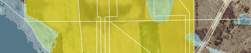

51 Mystic Lake Blvd 1 2 GÜWX 154th St Trail of Dreams Document Path: K:\ \GIS\Maps\Figure8_ParcelAssessmentMap.mxd Date Saved: 5/9/2014 9:20:34 AM Howard Lake Rd Edgewood Dr Berens Ct Legend Assessed Parcels Wetlands Figure 8 - Parcel Assessment Map Stemmer Ridge Road Street & Utility Improvement Project Feet ± May 27, 2014 WSB Project No
FEASIBILITY REPORT. 65 th STREET TRUNK WATER MAIN IMPROVEMENTS INVER GROVE HEIGHTS MINNESOTA DAKOTA COUNTY. October 2, 2017
 FEASIBILITY REPORT 65 th STREET TRUNK WATER MAIN IMPROVEMENTS INVER GROVE HEIGHTS MINNESOTA DAKOTA COUNTY October 2, 2017 Prepared for: City of Inver Grove Heights 8150 Barbara Avenue Inver Grove Heights,
STATE OF MINNESOTA DEPARTMENT OF TRANSPORTATION - TABULATION OF BIDS. Start Dt: 05/15/17 Comp. Dt: 08/04/17. Contract Time: Min: Max:
 Letting: 17012700 Letting Dt: January 27, 2017 9:30 A.M. State Proj.: 1401-171 Contract ID: Contract Description: Contract Location: Recommendation: 170002 STATE OF MINNESOTA DEPARTMENT OF TRANSPORTATION
Feasibility Report. Olson Lake Trail Improvements. City of Lake Elmo, Minnesota. City Project No SEH No
 Feasibility Report Olson Lake Trail Improvements City of Lake Elmo, Minnesota City Project No. 2015.125 SEH No. 139299 April 4, 2017 April 4, 2017 RE: Olson Lake Trail Improvements Feasibility Report City
S T A T E O F M I N N E S O T A D E P A R T M E N T O F T R A N S P O R T A T I O N DATE : 05/01/00 PAGE : 1 TABULATION OF BIDS
 PAGE : 1 CONTRACT DESCRIPTION : MILL & OVERLAY, GRADING, BIT SURFACING, BR NO 02038 ETC CONTRACT LOCATION: LOCATED ON TH 47 FROM 153RD AVE NW IN RAMSEY TO 180TH LANE NW AND AT FORD BROOK IN BURNS TOWNSHIP
STATE OF MINNESOTA DEPARTMENT OF TRANSPORTATION - TABULATION OF BIDS. District(s): 8 30=047 Start Dt: 05/01/17 Comp. Dt:
: 8 30=047 Start Dt: 05/01/17 Comp. Dt:") Letting: 17030200 Letting Dt: March 02, 2017 9:30 A.M. State Proj.: 5101-14 Contract ID: Contract Description: Contract Location: Recommendation: 170020 STATE OF MINNESOTA DEPARTMENT OF TRANSPORTATION
Letting: 17030200 Letting Dt: March 02, 2017 9:30 A.M. State Proj.: 5101-14 Contract ID: Contract Description: Contract Location: Recommendation: 170020 STATE OF MINNESOTA DEPARTMENT OF TRANSPORTATION
STATE OF MINNESOTA DEPARTMENT OF TRANSPORTATION - TABULATION OF BIDS. Start Dt: 05/08/17 Comp. Dt:
 Letting: 17012700 Letting Dt: January 27, 2017 9:30 A.M. State Proj.: 4308-34 Contract ID: Contract Description: Contract Location: Recommendation: 170004 STATE OF MINNESOTA DEPARTMENT OF TRANSPORTATION
TABLE OF CONTENTS EXECUTIVE SUMMARY...1 INTRODUCTION...3 PROJECTED FUTURE GROWTH...3 ROADWAY IMPROVEMENT PROJECTS...4 POTENTIAL FUNDING SOURCES...
 Transportation Impact Fee Study September 2014 TABLE OF CONTENTS EXECUTIVE SUMMARY...1 INTRODUCTION...3 PROJECTED FUTURE GROWTH...3 ROADWAY IMPROVEMENT PROJECTS......4 POTENTIAL FUNDING SOURCES...7 PROPOSED
CITY OF DELANO. City Council Date. January 5, 2016
 CITY OF DELANO REQUEST FOR ACTION Department Head Vince Vander Top, City Engineer City Council Date January 5, 2016 Agenda Item 2016 Infrastructure Improvements Feasibility Report ACTION REQUESTED Accept
2014 Street and Utility Improvement Project
 City of Circle Pines 200 Civic Heights Circle Circle Pines, MN 55014 January 28, 2014 2014 Street and Utility Improvement Project City of Circle Pines Anoka County, Minnesota WSB Project No. 1507-57 FEASIBILITY
2017 Industrial Rail and Transportation Study. Becker, Minnesota
 2017 Industrial Rail and Transportation Study Becker, Minnesota BECKR 140932 August 2, 2017 2017 Industrial Rail and Transportation Study Becker, Minnesota SEH No. BECKR 140932 August 2, 2017 I hereby
CONTRACTOR'S REQUEST FOR PAYMENT CHASKA VETERANS PARK IMPROVEMENTS STANTEC PROJECT NO
 Owner: City of Chaska, 1 City Hall Plz., Chaska, mn 55318 Date: December 12, 2017 For Period: 12/1/2017 to 1/31/2018 Request No: 1 Contractor: Blackstone Contractors, LLC, 9520 County Rd. 19, Ste. D, Loretto,
City Hall 539 Phoenix Street South Haven, Michigan Telephone (269) Fax (269)
 Fax (269)") City of South Haven City Hall 539 Phoenix Street South Haven, Michigan 49090-1499 Telephone (269) 637-0700 Fax (269) 637-5319 Dunkley and Black River Infrastructure Improvements Dunkley - Dyckman Avenue
City of South Haven City Hall 539 Phoenix Street South Haven, Michigan 49090-1499 Telephone (269) 637-0700 Fax (269) 637-5319 Dunkley and Black River Infrastructure Improvements Dunkley - Dyckman Avenue
FOCUS ENGINEERING, inc STREET, DRAINAGE, AND UTILITY IMPROVEMENTS 10TH STREET N. CITY OF LAKE ELMO, MN. Project No
 2016 STREET, DRAINAGE, AND UTILITY IMPROVEMENTS 30TH STREET N 20TH STREET 10TH STREET N SEPTEMBER, 2015 CITY OF LAKE ELMO, MN. Project No. 2015.129 www.focusengineeringinc.com FOCUS ENGINEERING, inc. 2016
CROW WING COUNTY HIGHWAY DEPARTMENT APPLICATION FOR PERMIT TO CONSTRUCT DRIVEWAY ACCESS TO ROADS UNDER COUNTY JURISDICTION CONSTRUCTION INFORMATION
 CROW WING COUNTY HIGHWAY DEPARTMENT APPLICATION FOR PERMIT TO CONSTRUCT DRIVEWAY ACCESS TO ROADS UNDER COUNTY JURISDICTION Crow Wing County Highway Department 16589 CR 142 Brainerd, MN 56401 Crow Wing
ACTION TRANSMITTAL No
 Transportation Advisory Board of the Metropolitan Council of the Twin Cities DATE: January 4, 2016 TO: ACTION TRANSMITTAL No. 2016-19 TAC Funding and Programming Committee PREPARED BY: Joe Barbeau, Senior
Wentzville Parkway South Phase 2 & 2A
 Wentzville Parkway South Phase 2 & 2A Sponsor Wentzville Project No. RB18-000034 Project Type New Road TOTAL FUNDING Phase 2 Total County Sponsor Federal $10,000,000 $8,000,000 $2,000,000 $0 Phase 2A Total
/ Planning and Zoning Staff Report Lonestar Land, LLC. - Rezone, RZ
 / Planning and Zoning Staff Report Lonestar Land, LLC. - Rezone, RZ2018-0019 Hearing Date: October 18, 2018 Development Services Department Applicant: Lonestar Land, LLC. Representative: Lance Warnick
S T A T E O F M I N N E S O T A D E P A R T M E N T O F T R A N S P O R T A T I O N DATE : 02/26/00 PAGE : 1 TABULATION OF BIDS
 PAGE : 1 CONTRACT DESCRIPTION : LEFT & RIGHT TURN LANES AND FLASHING BEACON SYSTEM CONTRACT LOCATION: LOCATED ON TH 7 FROM 327 M WEST OF JCT TH 25 TO 445 M EAST OF JCT TH 25 RECOMMENDATION: AWARD TO LOW
City of Grand Forks Staff Report
 City of Grand Forks Staff Report Service/Safety Committee December 15, 2015 City Council December 21, 2015 Agenda Item: Amendment No. 1 to Engineering Services Agreement with CPS for City Project No. 7143,
2015 PAVEMENT MAINTENANCE SECTION 15-PVMTC-05-GM
 ADDENDUM NO. 1 March 17, 2015 2015 PAVEMENT MAINTENANCE SECTION 15-PVMTC-05-GM SCHEDULE OF PRICES (BLR 12000a) Replace the schedule of prices with the attached pages. SUMMARY OF QUANTITIES Replace the
McCRORY & WILLIAMS, INC. HILLCREST ROAD CONNECTOR MCR ROADWAY ITEMS
 BID TABULATION Hillcrest Road Connector John G. Walton Construction M. C. Williams Contracting Hosea. Weaver & Sons, Inc. BID OPENING: March 25, 29 Company, Inc. Company, Inc. QTY DESCRIPTION DOLLARSjCTS
Project Book Worksheet for Cost Estimation
 001.01 MOBILIZATION LS $34,716.18 007 3/17/2039 001.02 INCIDENTAL LS $23,929.43 019 3/17/2039 001.03 CONSTRUCTION STAKING LS $10,504.39 201 5/9/2013 001.04 REESTABLISH PROPERTY CORNERS EA $496.08 201 5/9/2013
Items Unit Quantity Unit Price Total Unit Price Total
 Engineer's Plote Construction, Inc. Estimate 1100 Brandt Drive Hoffman Estates, IL 60192 s Unit Quantity 1 SUPPLEMENTAL WATERING UNIT 4 $100.00 400.00 $40.00 160.00 2 TOP SOIL FURNISH AND PLACE, 6 INCH
(1 ) Active Construction Inc River Road East Tacoma, WA AMOUNT , , ,
 Active Construction Inc River Road East Tacoma, WA AMOUNT , , ,") 78th Avenue Eastl184th Street EastlCRP 5661 I hereby certify this to be a true copy of the tabulation of the bids as received and opened. BID OPENING: FRIDAY, March 3, 2017 County Engine (1 ) Active Construction
78th Avenue Eastl184th Street EastlCRP 5661 I hereby certify this to be a true copy of the tabulation of the bids as received and opened. BID OPENING: FRIDAY, March 3, 2017 County Engine (1 ) Active Construction
ORDINANCE NO
 ORDINANCE NO. 07-5424 AN ORDINANCE OF THE CITY OF BILLINGS, PROVIDING THAT THE BILLINGS, MONTANA CITY CODE BE AMENDED BY REVISING SECTION 6-1208; PROVIDING CHANGES TO CERTAIN CURB CUT LENGTHS AND REGULATIONS.
800 Access Control, R/W Use Permits and Drive Design
 Table of Contents 801 Access Control... 8-1 801.1 Access Control Directives... 8-1 801.2 Access Control Policies... 8-1 801.2.1 Interstate Limited Access... 8-1 801.2.2 Limited Access... 8-1 801.2.3 Controlled
Steese Rd - Curb & Sidewalk Improvement
 REF. NO. ITEM NO. Steese Rd - Curb & Sidewalk Improvement DESCRIPTION QTY UNITS UNIT COST SUB-TOTAL 1 103.05 Requirement of Contract Bid 1 LS 24,048.00 24,048.00 2 201 Clearing and Grubbing 1 LS 11,077.00
STANDARD DRAWING INDEX
 ATTACHMENT B STANDARD DRAWING INDEX DESCRIPTION EXISTING DRAWING NO. GENERAL Typical Layout for Improvement Plans City of Stockton Standard Border and Title Block for 8 1/2 x11 Sheet City of Stockton Standard
3. Application Fees, Certificate Of Insurance & Performance Bond
 SUBSECTION 13.10 CONSTRUCTION OF DRIVEWAYS 13.10A PERMIT REQUIREMENTS 1. General A driveway or access road serving private property and intersecting with a town road shall be constructed in such a manner
Feasibility Report nd Avenue South Improvements. Sauk Rapids, Minnesota. SEH No. SAUKR
 Feasibility Report 2017 2 nd Avenue South Improvements Sauk Rapids, Minnesota SEH No. SAUKR 138208 September 12, 2016 This Page Left Blank Intentionally September 12, 2016 RE: Sauk Rapids, Minnesota 2017
STREET IMPROVEMENTS PROPOSAL BID ITEMS
 STREET IMPROVEMENTS 1 Excavation 3,525 CY $ $ 2 A.C. Planing (2" to 4" Depth) 20,586 SY $ $ 3 Furnish & Install Asphalt Concrete 4,270 TON $ $ 4 Furnish & Install Aggregate Base 2,955 TON $ $ 5 Remove
DR SE WAY SOMERSIDE. C-N Neighborhood Commercial Site. R-LD - Development in accordance. Fully Landscaped Park/ Playground.
 LAND & BUSINESS SUPPORT DEPT Southlands Phase 6A Plan 01231 City of Medicine Hat Land & Business Support Ph (03) 52-1 Fax (03) 502-055 land_properties@medicinehat.ca updated August 20, 201 SOMERSET BAY
Ohio Department of Transportation Official Bid Tabulation James G. Beasley, P.E., P.S., Director
 Ohio Department of Transportation Official Bid Tabulation James G. Beasley, P.E., P.S., Director Project No. 080598 PID 21272 CUY-SR-237-4.93 - PART I (FRONT STREET); CUY-237-4.55 - P Federal Type: RAILROAD
Ohio Department of Transportation Official Bid Tabulation Jolene M. Molitoris, Director
 Ohio Department of Transportation Official Bid Tabulation Jolene M. Molitoris, Director Project No. 100281 PID 77255 LUC-IR-475-14.18 Federal Type: MAJOR RECONSTRUCTION Letting Date: 6/3/2010 Completion
City of Grand Island Tuesday, October 10, 2017 Council Session
 City of Grand Island Tuesday, October 10, 2017 Council Session Item G-12 #2017-276 - Approving Change Order No. 1 for Lift Station No. 20 Upgrade and Force Main Rehabilitation & Lift Station No. 14 Abandonment;
FINAL UTILITY REPORT Eastcreek Farm Thornton, CO
 FINAL UTILITY REPORT Eastcreek Farm Thornton, CO October 14, 2016 JN: 13049 Prepared for: York 80, LLC 12460 1 st Street Eastelake, CO 80614 P: 303.457.2966 Prepared by: Jansen Strawn Consulting Engineers
ANDERSON PROPERTY SITE ANALYSIS
 ANDERSON PROPERTY SITE ANALYSIS Introduction The Montgomery County Department of Transportation (MCDOT) initiated a feasibility study in the fall of 2012 to evaluate the need for transit service expansion
Right-of-Way Obstruction Permit Fee Structure Minneapolis Department of Public Works May 10, 2001
 Right-of-Way Obstruction Permit Fee Structure Minneapolis Department of Public Works May 10, 2001 Revised April 5, 2005 Revised January 27, 2006 Prepared by: Steve Collin, Engineer 2.5 Revised by Douglas
City of Grand Island Tuesday, June 26, 2018 Council Session
 City of Grand Island Tuesday, June 26, 2018 Council Session Item G-21 #2018-188 - Approving Change Order No. 3 for Sanitary Sewer Collection System Rehabilitation Various Locations; Project No. 2017-S-2A
CITY of NOVI CITY COUNCIL
 CITY of NOVI CITY COUNCIL Agenda Item 3 July 9, 2018 ci tyofnovi.org SUBJECT: Approval to award design engineering services to AECOM Great Lakes, Inc., for the Flint Street Realignment and Reconstruction
Big Easy RV & Boat Storage A Green Energy Project Jana Lane Wildomar, California
 Big Easy RV & Boat Storage A Green Energy Project 36215 Jana Lane Wildomar, California 1 PROJECT OVERVIEW Project Description The construction and operation of a solar generation facility consisting of
Lake County Building Department
 Lake County Building Department P.O. Box 513 505 Harrison Avenue Leadville, CO 80461 (719) 486-2875 Fax (719) 486-4179 Driveway Permit (Resolutions 98-15 and 98-35) PERMIT: To connect a driveway or parking
BARRETT ROAD (C.R. 178) ROADWAY RESURFACING FROM LEWIS ROAD TO SPAFFORD ROAD IN OLMSTED TOWNSHIP, OHIO ITEMIZED UNIT PRICE BID ROADWAY
 ROADWAY RESURFACING FROM LEWIS ROAD TO SPAFFORD ROAD IN OLMSTED TOWNSHIP, OHIO ITEMIZED UNIT PRICE BID ROADWAY") IZED PRICE BID DESCRIPTION PRICE BID ROADWAY 1 201 11000 CLEARING AND GRUBBING 1 - - LUMP 2 202 23000 PAVEMENT REMOVED NR SQ YD 20 3 202 35100 PIPE REMOVED, 24" AND UNDER NR FT 134 4 202 58000 MANHOLE
IZED PRICE BID DESCRIPTION PRICE BID ROADWAY 1 201 11000 CLEARING AND GRUBBING 1 - - LUMP 2 202 23000 PAVEMENT REMOVED NR SQ YD 20 3 202 35100 PIPE REMOVED, 24" AND UNDER NR FT 134 4 202 58000 MANHOLE
BID TABULATION REPORT McKINNEY STREET DRAINAGE IMPROVEMENTS PROJECT No. PWDR10012 BID OPENED : TUESDAY, AUGUST 13, :00 P.M.
 PAVING IMPROVEMENTS McKINNEY 101 Rightofway Preparation LS 1 75,000.00 75,000.00 200,000.00 200,000.00 67,000.00 67,000.00 110,000.00 110,000.00 102 12inch HMAC Street Pulvermix SY 11,650 3.00 34,950.00
Subarea Study. Manning Avenue (CSAH 15) Corridor Management and Safety Improvement Project. Final Version 1. Washington County.
 Corridor Management and Safety Improvement Project. Final Version 1. Washington County.") Subarea Study Manning Avenue (CSAH 15) Corridor Management and Safety Improvement Project Final Version 1 Washington County June 12, 214 SRF No. 138141 Table of Contents Introduction... 1 Forecast Methodology
Subarea Study Manning Avenue (CSAH 15) Corridor Management and Safety Improvement Project Final Version 1 Washington County June 12, 214 SRF No. 138141 Table of Contents Introduction... 1 Forecast Methodology
S T A T E O F M I N N E S O T A D E P A R T M E N T O F T R A N S P O R T A T I O N DATE : 02/27/06 PAGE : 1 TABULATION OF BIDS
 PAGE : 1 NUMBER OF DAYS: 63 BRIDGE COUNT : 9 CONTRACT DESCRIPTION : BITUMINOUS OVERLAY & BRIDGE APPROACH PANEL REPLACEMENT CONTRACT LOCATION: LOCATED ON TH 90 FROM 0.8 MILE WEST OF THE BLUE EARTH RIVER
Purpose: General Provisions:
 10-19-1 Purpose: The purpose of off-street parking requirements is to promote traffic/pedestrian safety and efficiency and to minimize hard surfaced areas to reduce storm water run-off and visual impacts
BOARD OF SUPERVISORS BUSINESS MEETING ACTION ITEM. Design Endorsement for Sterling Boulevard Extension
 Date of Meeting: July 20, 2017 # 6 BOARD OF SUPERVISORS BUSINESS MEETING ACTION ITEM SUBJECT: ELECTION DISTRICT: CRITICAL ACTION DATE: STAFF CONTACTS: Design Endorsement for Sterling Boulevard Extension
HILLS MATERIALS COMPANY UNIT COST TOTAL COST UNIT COST TOTAL COST UNIT COST $294, $294, $74, $74, $35, $35,000.
 PROJECT NAME: Anamosa Street Reconstruction - Midway Street to Miiwuakee Street PROJECT NUMBER: PROJECT NO. 07-1473 / CIP NO. 50559 LET DATE: April 11, 2017 LOW BID AMOUNT: $3,941,397.20 ENGINEER'S ESTIMATE
Public Information Workshop
 Public Information Workshop Charlotte County-Punta Gorda MPO - Meeting Rooms A and B March 29, 2018 Welcome to the Public Information Workshop for Harborview Road Project Development and Environment (PD&E)
City of Grand Forks Staff Report
 City of Grand Forks Staff Report Service/Safety Committee May 27, 2014 City Council June 2, 2014 Agenda Item: Consideration of Bids for City Project Nos. 7152 Dist. No. 501; 7153 Dist. No. 317 and 7154
2.0 Development Driveways. Movin Out June 2017
 Movin Out June 2017 1.0 Introduction The proposed Movin Out development is a mixed use development in the northeast quadrant of the intersection of West Broadway and Fayette Avenue in the City of Madison.
CAPITAL FUND 9510 STREET & SIDEWALK IMPROVEMENTS FIVE-YEAR CAPITAL IMPROVEMENT PROGRAM FISCAL YEARS
 9510 STREET & SIDEWALK IMPROVEMENTS FIVE-YEAR CAPITAL IMPROVEMENT PROGRAM FISCAL YEARS 2019-2023 9510 STREET & SIDEWALK IMPROVEMENTS - 01 STREET AND SIDEWALK MAINTENANCE PROGRAM $1,250,000 $0 $1,250,000
DESCRIPTION QUANTITY PRICE TOTAL
 GENERAL 1 TRAFFIC CONTROL LS 1 $40,000 $40,000 $8,500.00 $8,500.00 $5,000.00 $5,000.00 $5,000.00 $5,000.00 $15,000.00 $15,000.00 2 MOBILIZATION LS 1 $557,000 $557,000 $629,500.00 $629,500.00 $350,000.00
THORNTON ROAD WIDENING PROJECT NO. PW1428 B I D D I N G S C H E D U L E
 THORNTON ROAD WIDENING PROJECT NO. PW1428 B I D D I N G S C H E D U L E Each bidder shall bid each item of the Base Bid Schedule and Alternate A Bid Schedule. Failure to bid an item shall be just cause
SOUTH COVE PARK MULTI-COURT IMPROVEMENTS FOR OCONEE COUNTY PARKS, RECREATION AND TOURISM SENECA, SOUTH CAROLINA FEBRUARY 2018
 Pursuant to agreement between, Inc. (HMW) and the party for which these documents have been prepared, these documents and all data, plans, specifications and other information contained herein are the
CITY OF LOS ANGELES INTER-DEPARTMENTAL MEMORANDUM
 Date: March 26, 2013 CITY OF LOS ANGELES INTER-DEPARTMENTAL MEMORANDUM To: From: The Honorable City Council c/o City Clerk, Room 395 Attention: Honorable Mitchell Englander, Chair, Public Safety Committee
DRAFT. Feasibility Report for 2016 Infrastructure Project. City of Delano. WENCK File # November Prepared for:
 WENCK File #0564-0180 November 2015 Feasibility Report for 2016 Infrastructure Project Prepared for: City of Delano 234 2 nd Street North Delano, MN 55328 Prepared by: WENCK Associates, Inc. 1800 Pioneer
FREQUENTLY ASKED QUESTIONS
 THE PROJECT Last updated on 9/8/16 FREQUENTLY ASKED QUESTIONS What s happening on Highway 169? The Minnesota Department of Transportation (MnDOT) is planning to rebuild and repair the infrastructure on
City of Grand Island Tuesday, February 13, 2018 Council Session
 City of Grand Island Tuesday, February 13, 2018 Council Session Item G-7 #2018-34 - Approving Certificate of Final Completion for the Construction of North Interceptor Phase I; Project No. 2012-S-6 Staff
I-820 (East) Project Description. Fort Worth District. Reconstruct Southern I-820/SH 121 Interchange
 Project Description. Fort Worth District. Reconstruct Southern I-820/SH 121 Interchange") I-820 (East) Project Description Fort Worth District Reconstruct Southern I-820/SH 121 Interchange I-820 from approximately 2,000 feet north of Pipeline Road/Glenview Drive to approximately 3,200 feet
I-820 (East) Project Description Fort Worth District Reconstruct Southern I-820/SH 121 Interchange I-820 from approximately 2,000 feet north of Pipeline Road/Glenview Drive to approximately 3,200 feet
DRAFT Design Study Report February 2015 Eagle River Traffic Mitigation Phase 1 MOA Project No Appendix D Utilities
 Appendix D Utilities This page intentionally left blank. Utilities There are numerous utilities present within the project area, including natural gas, sewer, water, electric, communications, and street
TENDER FOR COUNTY ROAD 44 MULTI-USE PATHWAY PHASE 1A & 1B. Tender No.: NG16-19 ADDENDUM #1. October 31, 2016
 TENDER FOR COUNTY ROAD 44 MULTI-USE PATHWAY PHASE 1A & 1B Tender No.: NG16-19 ADDENDUM #1 October 31, 2016 A copy of this addendum must be enclosed with your tender. Failure to comply with this requirement
MSRC CLEAN TRANSPORTATION FUNDING LOCAL GOVERNMENT PARTNERSHIP
 MSRC CLEAN TRANSPORTATION FUNDING LOCAL GOVERNMENT PARTNERSHIP PROGRAM DUE: AUGUST 2, 2018 CITY OF "Agency Name" LOCAL GOVERNMENT PARTNERSHIP PROGRAM PROPOSAL SUBMITTED: "Month XX, 2018" TABLE OF CONTENTS
CITY AND COUNTY OF DENVER DEPARTMENT OF PUBLIC WORKS Engineering Division PROJECT NO INCA STREET MULTI-USE PATH 38 TH AVE. TO 43 RD AVE.
 201-00000 Clearing and Grubbing 1 LS 202-00010 Removal of Tree 9 EA 202-00019 Removal of Inlet 8 EA 202-00034 Removal of Pipe (6 Inch) 196 LF 202-00035 Removal of Pipe (18 Inch) 10 LF 202-00036 Removal
Operations Center FAQs
 RICHARDSON INDEPENDENT SCHOOL DISTRICT Where all students learn, grow and succeed Operations Center FAQs Richardson ISD is constructing an operations center on vacant district land between Greenville Avenue
Appendix C Preferred Solution
 Appendix C Preferred Solution C.1 Conceptual Design Drawings C.2 Preferred Option Ideas and Inspiration C.3 Concept Renderings C.4 Cost Estimate Appendix C.1 Conceptual Design Drawings Plan View Brock
FREQUENTLY ASKED QUESTIONS
 THE PROJECT Last updated on 2/19/16 FREQUENTLY ASKED QUESTIONS What s happening on Highway 169? The Minnesota Department of Transportation (MnDOT) is planning to rebuild and repair the infrastructure on
Welcome. Highway 23 Gap New London to Paynesville. Open House. - Please Sign In -
 Highway Gap New London to Paynesville Welcome Highway Gap New London to Paynesville Open House - Please Sign In - There is no formal presentation, but representatives are available to answer your questions.
TIMBERVINE TRANSPORTATION IMPACT STUDY FORT COLLINS, COLORADO JANUARY Prepared for:
 TIMBERVINE TRANSPORTATION IMPACT STUDY FORT COLLINS, COLORADO JANUARY 2014 Prepared for: Hartford Companies 1218 W. Ash Street Suite A Windsor, Co 80550 Prepared by: DELICH ASSOCIATES 2272 Glen Haven Drive
 NOTICE OF PUBLIC HEARING ANAHEIM PUBLIC UTILITES BOARD IS HOLDING A PUBLIC HEARING ON THE FORMATION OF UNDERGROUND DISTRICT No. 66 (BEACH) TO UNDERGROUND OVERHEAD FACILTIIES, INCLUDING POWER AND COMMUNICATION
5. HORIZON YEAR TRANSPORTATION MASTER PLAN-COST ESTIMATES
 5. HORIZON YEAR TRANSPORTATION MASTER PLAN-COST ESTIMATES 5.1 INTRODUCTION This chapter of the TMP presents an opinion of probable cost estimates for the proposed Horizon Year roadway network improvements
Town of Londonderry, New Hampshire NH Route 28 Western Segment Traffic Impact Fee Methodology
 Town of Londonderry, New Hampshire NH Route 28 Western Segment Traffic Impact Fee Methodology Prepared by the Londonderry Community Development Department Planning & Economic Development Division Based
CITY OF STEVENS POINT AGENDA
 CITY OF STEVENS POINT BOARD OF PUBLIC WORKS MEETING Monday, September 11, 2017 6:00 p.m. (or immediately following previously scheduled meeting) Lincoln Center 1519 Water Street Stevens Point, WI 54481
Decision D ATCO Electric Ltd. Decommissioning of Transmission Line 6L82
 Decision 21447-D01-2016 August 23, 2016 Decision 21447-D01-2016 Proceeding 21447 Application 21447-A001 August 23, 2016 Published by the: Fifth Avenue Place, Fourth Floor, 425 First Street S.W. Calgary,
Transportation Analysis. Pedestrian Pathways. Sterling District. County Project Manager: Suheili Pérez-Jiménez. Prepared by: J2 Engineers, Inc.
 Transportation Analysis Pedestrian Pathways Prepared for: Loudoun County Department of Transportation and Capital Infrastructure County Project Manager: Suheili Pérez-Jiménez Prepared by: J2 Engineers,
ARTICLE 8 OFF-STREET PARKING AND PRIVATE DRIVEWAY STANDARDS
 ARTICLE 8 OFF-STREET PARKING AND PRIVATE DRIVEWAY STANDARDS TABLE OF CONTENTS SECTION PAGE 8.1 GENERAL STANDARDS...8-2 8.2 PRIVATE DRIVEWAY PROVISIONS...8-4 8.3 OFF-STREET PARKING STANDARDS...8-5 8.4 OFF-STREET
FOCUS ENGINEERING, inc. FEASIBILITY REPORT INWOOD BOOSTER STATION AND TRUNK WATERMAIN IMPROVEMENTS 26TH STREET N INWOOD AVENUE 10TH STREET N
 INWOOD BOOSTER STATION AND TRUNK WATERMAIN IMPROVEMENTS FEASIBILITY REPORT 26TH STREET N INWOOD AVENUE 15TH STREET N 10TH STREET N NOVEMBER, 2013 CITY OF LAKE ELMO, MN. Project No. 2012.126 www.focusengineeringinc.com
Town of Medley Office of Capital Projects & Development Services 7777 NW 72 Avenue, Medley, Florida 33166
 Town of Medley Office of Capital Projects & Development Services 7777 NW 72 Avenue, Medley, Florida 33166 Date: August 10, 2016 Subject: Bid for Construction of NW 89 th Avenue, NW 93 rd Street and NW
Committee Report. Transportation Committee. Business Item No
 Committee Report Business Item No. 2015-280 Transportation Committee For the Metropolitan Council meeting of December 9, 2015 Subject: METRO Blue Line Extension (Bottineau Light Rail Transit) Revised Scope
McCRORY & WILIJAMS, INC. PROJECT NO. MCR-2008-OO1
 McCRORY & WILIJAMS, INC. THEODORE DAWES ROADISCHILLINGER ROAD SOUTH BID TABULATION: Theodore DaweslSchillingor Road PROJECT NO.: M5700-2033 BIDDER #1 BIDDER #2 BIDDER #3 Hosea 0. Weaver & Sons, Inc. John
DRIVEWAY/APPROACH PERMIT APPLICATION Applicant Type: Architect/Engineer Contractor Owner
 DRIVEWAY/APPROACH PERMIT APPLICATION Applicant Type: Architect/Engineer Contractor Owner Lake Elmo City Hall 651-747-3900 3880 Laverne Avenue North Lake Elmo, MN 55042 Project Address: Property Owner:
CITY OF PORTSMOUTH DEPARTMENT OF PUBLIC WORKS (DPW) DRIVEWAY RULES AND PROCEDURES
 DRIVEWAY RULES AND PROCEDURES") CITY OF PORTSMOUTH DEPARTMENT OF PUBLIC WORKS (DPW) DRIVEWAY RULES AND PROCEDURES The purpose of a driveway permit is to secure access from a private property to the public right-of-way. It is required
CITY OF PORTSMOUTH DEPARTMENT OF PUBLIC WORKS (DPW) DRIVEWAY RULES AND PROCEDURES The purpose of a driveway permit is to secure access from a private property to the public right-of-way. It is required
Comprehensive Lift Station Evaluation Buffalo, Minnesota
 City of Buffalo Comprehensive Lift Station Evaluation Buffalo, Minnesota W3.088 Submitted by: Bolton & Menk, Inc. 040 Hwy East Willmar, MN 560 P: 30-3-3956 F: 30-3-970 Certification Comprehensive Lift
Table of Contents INTRODUCTION... 3 PROJECT STUDY AREA Figure 1 Vicinity Map Study Area... 4 EXISTING CONDITIONS... 5 TRAFFIC OPERATIONS...
 Crosshaven Drive Corridor Study City of Vestavia Hills, Alabama Table of Contents INTRODUCTION... 3 PROJECT STUDY AREA... 3 Figure 1 Vicinity Map Study Area... 4 EXISTING CONDITIONS... 5 TRAFFIC OPERATIONS...
LAWRENCE TRANSIT CENTER LOCATION ANALYSIS 9 TH STREET & ROCKLEDGE ROAD / 21 ST STREET & IOWA STREET LAWRENCE, KANSAS
 LAWRENCE TRANSIT CENTER LOCATION ANALYSIS 9 TH STREET & ROCKLEDGE ROAD / 21 ST STREET & IOWA STREET LAWRENCE, KANSAS TRAFFIC IMPACT STUDY FEBRUARY 214 OA Project No. 213-542 TABLE OF CONTENTS 1. INTRODUCTION...
SECTION 9 STORM SEWER INLETS
 SECTION 9 STORM SEWER INLETS CITY OF WESTMINSTER STORM DRAINAGE DESIGN AND TECHNICAL CRITERIA SECTION 9 STORM SEWER INLETS 9.1 INTRODUCTION There are three types of inlets: curb opening, grated, and combination
REQUEST FOR COUNCIL ACTION. List of Exhibits A. Project Plan Set B. Bolton & Menk Proposal for Engineering / Inspection Services
 Item #08 - CC Agenda - 05/2/2016 [Page 1 of 5] REQUEST FOR COUNCIL ACTION : May 2, 2016 ITEM NO: 8 Department Approval: Administrator Reviewed: Agenda Section: Name Adam Edwards JML Public Works Director/
City of Houston Fondren Road Paving and Drainage
 City of Houston Fondren Road Paving and Drainage From Braeswood Boulevard to Creekbend Drive TRC Meeting March 2016 Location and Vicinity Maps City Council District K Key Map 530 Z, 530 Y Land Use Commercial
SOUTHERN GATEWAY. Transportation and Trinity River Project Committee 11 May 2015
 SOUTHERN GATEWAY Transportation and Trinity River Project Committee 11 May 2015 Southern Gateway Project History Began in 2001 as a Major Investment Study [ MIS ], Schematic, and Environmental Assessment
Recommended Transportation. Capital Improvement Program
 Recommended 2018-2022 Transportation Capital Improvement Program 1 Overview 2017 Review 2018-2022 Considerations 2018-2022 Recommended CIP 2 Limited Resources are Directed to the Highest Priority Number
PERMIT FOR INSTALLATION ON COUNTY RIGHTS-OF-WAY: ACCESS DRIVEWAYS RESIDENTIAL
 PERMIT FOR INSTALLATION ON COUNTY RIGHTS-OF-WAY: ACCESS DRIVEWAYS RESIDENTIAL Submit To Martin County Judge s Office P.O. Box 1330 Stanton Texas 79782-1330 mhernandez@co.martin.tx.us APPLICATION: Permittee
Grays Ferry Cost Estimate Breakdown Budgetary Numbers for Machinery Drive Options 10 Nov 14
 Grays Ferry Cost Estimate Breakdown Budgetary Numbers for Machinery Drive Options 10 Nov 14 Hardesty & Hanover, LLC Alternative 1 Bogie Support System Alternative Based on AW Sketch of New Bridge Component
Taylor s Falls Business Park
 Site Information Taylor s Falls Business Park County Road 37, Taylors Falls, MN Chisago County HRA-EDA 12/23/2014 Taylors Falls Business Park County Road 37 Taylors Falls, MN 55084 PROPERTY FEATURES: Zoned
Received June 2, 2017 PLN-PUDC
 MASTER LAND USE PLAN for: a prestigious community presented by: Breeden Investment Properties and Davenport Management Company Virginia Beach, Virginia 23452(757) 468-6800 Received PLN-PUDC-2016-008 page
ANN ARBOR CITY NOTICE ORDINANCE NO. ORD OFF STREET PARKING CHAPTER 59
 ANN ARBOR CITY NOTICE ORDINANCE NO. ORD-12-04 OFF STREET PARKING CHAPTER 59 AN ORDINANCE TO AMEND SECTIONS 5:168 AND 5:169 OF CHAPTER 59 (OFF- STREET PARKING) OF TITLE V OF THE CODE OF THE CITY OF ANN
City of Newaygo RESOLUTION Council Member Walerczyk, supported by Council Member Palmiter, moved to adopt the following resolution:
 City of Newaygo RESOLUTION 14-05 Council Member Walerczyk, supported by Council Member Palmiter, moved to adopt the following resolution: RESOLUTION ESTABLISHING WATER AND SEWER CHARGES: WHEREAS, the City
Street Lighting Policy. Revision
 Street Lighting Policy Revision 5-2017 Grand Chute Street Lighting Policy - 1 - May 2, 2017 Intent: The intent of this policy is to outline the Town of Grand Chute s standards for the installation and
TYPICAL DRIVEWAY CONSTRUCTION PER DOUGLAS COUNTY REGULATIONS AND POLICIES
 TYPICAL DRIVEWAY CONSTRUCTION PER DOUGLAS COUNTY REGULATIONS AND POLICIES This document is a summary of the Douglas County regulations and policies for constructing residential driveways. It is intended
ELMORE COUNTY HIGHWAY DEPARTMENT
 Adopted 11/27/06 Effective 2/1/07 Amended 4/10/08 ELMORE COUNTY HIGHWAY DEPARTMENT 155 County Shop Road Wetumpka, Alabama 36092 Phone (334) 567-1162 Fax (334) 567-1100 Access Management Policy The Elmore