Motorways Route in Thailand. Sustainable Highway Design
|
|
|
- Ada Clarke
- 5 years ago
- Views:
Transcription


1

2 Motorways Route in Thailand 2 2
3 Development of Highway Community Speed decreased Open Highway At Grade Median Opening Settlements along the highway (Ribbon Development) Non Control Access or Partial Control Access cause : - Speed decreasing - Longer Travel Time - Lower Level of Service - Reduce Safety of Through Traffic - Accidents 3 3
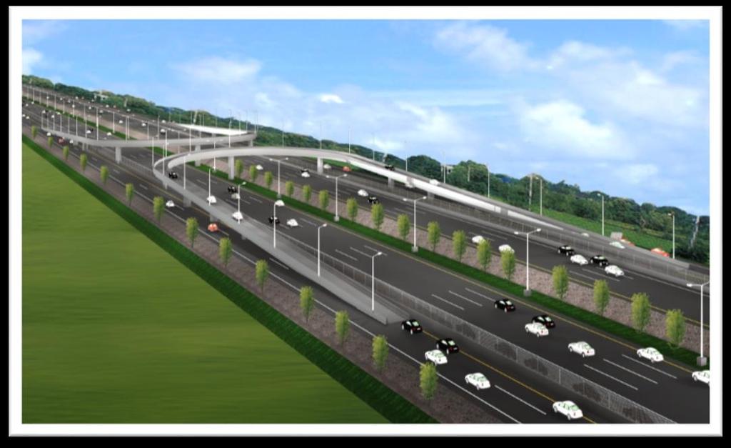
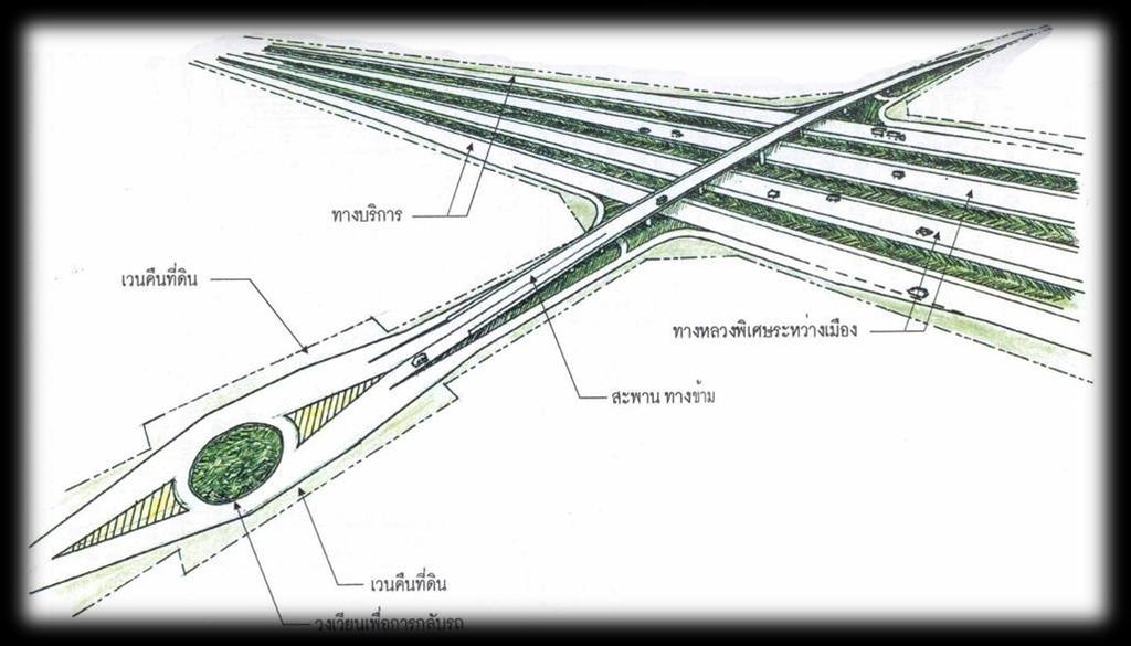
4 Development of Motorway Grade Seperate Intersection Motorway (Fully Control of Access) Open Highway Collector Distributor Road 4 4


5 Motorway in Rolling Terrain Motorway in Flat Terrain 5 5
6 Geometric Design Standards For main motorway DOH 1996 Parameter Desirable Standard Absolute Lowest Standard A. MAIN SECTIONS OF MOTORWAY Lane Width 3.60 m 3.60 m Outer Shoulder Width 3.00 m 3.00 m Inner Shoulder Width 1.00 m 1.00 m Ultimate Median Width 6.30 m 3.60 m Outer Verge Width 0.50 m 0.50 m Inner Verge Width 0.50 m 0.50 m Minimum Vertical Clearance 5.25 m 5.00 m Maximum Gradient 3% 5% Maximum Superelevation 4% 7% R.O.W 70 m 50 m B. DESIGN SPEED RELATED STANDARDS FOR MAIN MOTORWAY Design Speed 120 kph 100 kph Min Stopping Sight Distance 290 m 210 m Min Horizontal Radius with 4% superelevation 1500 m Min Horizontal Radius with 7% superelevation 720 m Vertical Curvature K Value (crest) Vertical Curvature K Value (sag)
 % 4 6 MaximumGradient (down) % 5 7 Minimum Stopping Sight Distance m 90 50 Semi-directional Ramps Design Speed kph 70 50 Minimum Horizontal Radius m")
7 Geometric Design Standards Interchange on motorway DOH 1996 Design Element Unit Desirable Standard Absolute Minimum Standard Loop Ramps Design Speed kph Minimum Horizontal Radius m MaximumSuperelevation % 6 10 MaximumGradient (up) % 4 6 MaximumGradient (down) % 5 7 Minimum Stopping Sight Distance m Semi-directional Ramps Design Speed kph Minimum Horizontal Radius m MaximumSuperelevation % 6 10 MaximumGradient (up) % 4 5 MaximumGradient (down) % 4 6 Minimum Stopping Sight Distance m Directional Ramps Design Speed kph Minimum Horizontal Radius m MaximumSuperelevation % 6 10 MaximumGradient (up) % 4 5 MaximumGradient (down) % Minimum Stopping Sight Distance m


8 General Motorway Section Without service road With service road 8 8


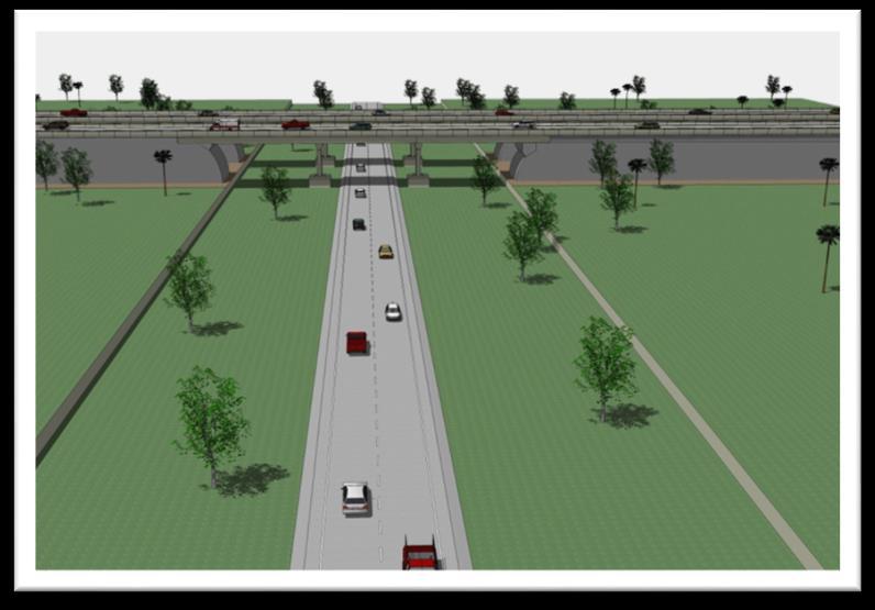
9 Viaduct Section 9 9


10 Component of Motorway 10 10
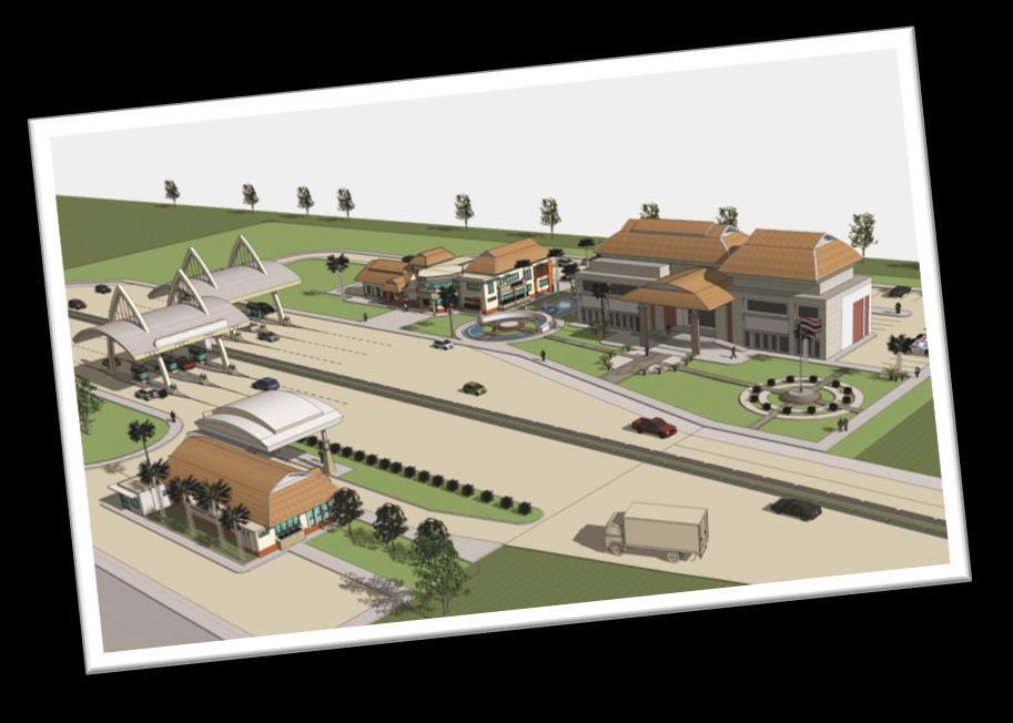
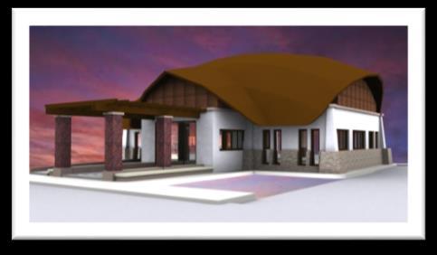
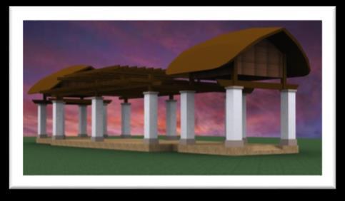
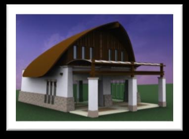
11 Design of Service Area Rest Area Service Area Distance 30 km. Max. 50 km. Parkinglot Public Toilet Park Beverages Restaurant Information center Shops Pavilion Emergency Services Gas station The parking area allocated for the MSA based upon the projected traffic after fifteen years 50% of Traffic Volume for Car 35% of Traffic Volume for Trucks 10% of Traffic Volume for Buses 11 11


12 Rest Area Bus Personal Car Truck 12 12


13 Service Area Bus Personal Car Truck 13 13

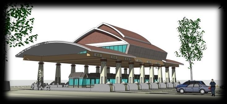


14 TOLL PLAZA 14

15 Toll Collection System (Closed System) No. of Entry Toll Booths : No. of Entry lanes 3 : 1 No. of Exit Toll Booths : No. of Exit lanes 4 : 1 Rate of allowance from entry Toll Plaza Vehicle/Hr./Lane Rate of allowance from exit Toll Plaza Manual System Vehicle/Hr./Lane Automatic System(with divider) 800 Vehicle/Hr./Lane Automatic System(without divider) 1800 Vehicle/Hr./Lane 15 15


16 Design of Weighing System Dynamic Weighing System Located before approaching the static Weighing system. Static Weighing System Overweight trucks will be forced to weigh on the static weighing station for more accuracy
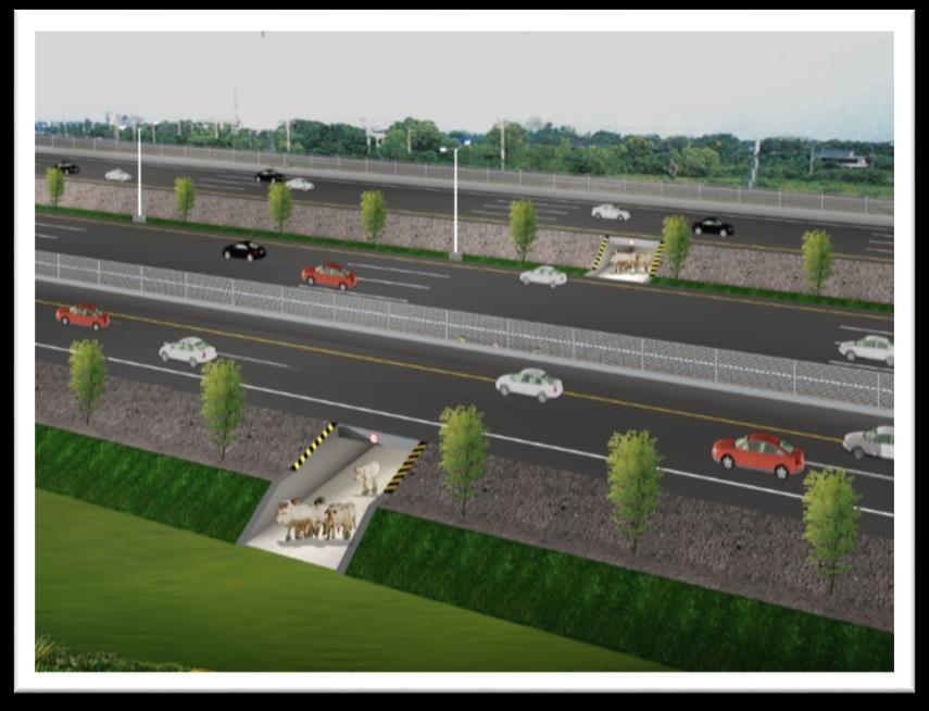

17 Undercrossings, Overcrossings, Service Road for Local Communication (Land Seperated by Motorway) 17 Overcrossings with Service Road and 17

18 Design of Street Lighting Design of density of Light. Average of Light density 15 Lux for main Line 20 Lux for intersection and interchange 20 Lux for toll plaza and station 25 Lux for tunnel Low Pressure Sodium High Pressure Sodium Example of Lighting Use standard of The Provincial Electricity Authority and other International Standard 18 18


19 Design of Sign and Marking Use Standard of DOH and Office of Transport and Traffic Policy And Planning 19 19


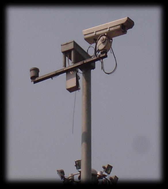
20 Traffic Control & Surveillance System Emergency Telephone CCTV 20 20


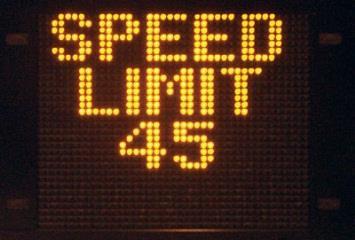
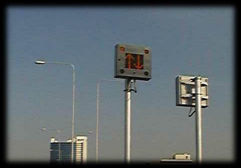
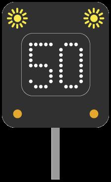
21 Traffic Control & Surveillance System Matrix Sign (MS) Variable Message Sign (VMS) 21 21
22 Noise Barrier 22 22
AASHTO Policy on Geometric Design of Highways and Streets
 AASHTO Policy on Geometric Design of Highways and Streets 2001 Highlights and Major Changes Since the 1994 Edition Jim Mills, P.E. Roadway Design Office 605 Suwannee Street MS-32 Tallahassee, FL 32399-0450
Page
 Page Page Page 3 Page 4 Page 5 Page 6 Page 7 Page 9 3-6 I A Policy on Geometric of Highways and Streets A strict application of the maximum relative gradient criterion provides runofflengths for four-lane
INTERURBAN ROADS. Scope of Interurban Roads. Scope of Interurban Roads. Scope of Interurban Roads
 INTERURBAN ROADS Scope of Interurban Roads Interurban Road Segments without continuous development on either side, such as restaurants, factories, or villages. Urban/Suburban Road Segments continuous permanent
DIRECTIONAL DRIVEWAYS AT HIGHWAYS WITHOUT CURB
 DIRECTIONAL DRIVEWAYS AT HIGHWAYS WITHOUT CURB 20 (6m) 25 (7.5m) Desirable outline of parking area 10 (3m) 16 (4.8m) 50 (15 m) R 75 (23m) R Taper Alternate outline of 20 (6m) R parking area Pave shoulders
Horizontal Sight Distance Considerations Freeway and Interchange Reconstruction
 80 TRANSPORTATION RESEARCH RECORD 1208 Horizontal Sight Distance Considerations Freeway and Interchange Reconstruction In JOEL p. LEISCH With improvements being made to freeways and expressways, the problem
Chapter 6. CEE 320 Anne Goodchild. Spring 2008 CEE 320
 Chapter 6 Freeway Level of Service Anne Goodchild Definitions Level of Service (LOS) Chief measure of quality of service Describes operational conditions within a traffic stream. Does not include safety
Mobile Barrier Trailer
 Mobile Barrier Trailer Protecting our employees History Born out of the need to protect employees working on highways (June 2004) 4 years of research and development Manufacture and deployment of the Mobile
CHANGE LIST for MDOT Traffic and Safety Geometric Design Guides. May 23, 2017: The following update was made to the web site.
 CHANGE LIST for MDOT Traffic and Safety Geometric Design Guides Note: Located at https://mdotjboss.state.mi.us/tssd/tssdhome.htm May 23, 2017: The following update was made to the web site. GEO-650-D Flares
Dynamic Hard Shoulder Running
 Dynamic Hard Shoulder Running Lessons Learned from the US and UK Experience Ryan Gulick, PE David Kamnitzer 1 Overview What is Hard Shoulder Running? HSR in the US Washington State DOT Experience HSR in
Alberta Infrastructure HIGHWAY GEOMETRIC DESIGN GUIDE AUGUST 1999
 &+$37(5Ã)Ã Alberta Infrastructure HIGHWAY GEOMETRIC DESIGN GUIDE AUGUST 1999 &+$37(5) 52$'6,'()$&,/,7,(6 7$%/(2)&217(176 Section Subject Page Number Page Date F.1 VEHICLE INSPECTION STATIONS... F-3 April
IMPROVEMENT CONCEPTS
 IMPROVEMENT CONCEPTS for the South Novato Transit Hub Study Prepared by: January 11, 2010 DKS Associates With Wilbur Smith Associates IMPROVEMENT CONCEPTS Chapter 1: Introduction 1. INTRODUCTION The strategic
GEOMETRIC ALIGNMENT AND DESIGN
 GEOMETRIC ALIGNMENT AND DESIGN Geometric parameters dependent on design speed For given design speeds, designers aim to achieve at least the desirable minimum values for stopping sight distance, horizontal
APPENDIX A Basis of Design and Design Criteria Memorandum
 APPENDIX A Basis of Design and Design Criteria Memorandum Job No: Y01-500 Files are stored in: Engineering / Client / Yolo/Y01500 Buckeye and Rumsey/Rumsey CR 41 over Cache Creek, CAD files stored in:
JCE 4600 Basic Freeway Segments
 JCE 4600 Basic Freeway Segments HCM Applications What is a Freeway? divided highway with full control of access two or more lanes for the exclusive use of traffic in each direction no signalized or stop-controlled
Swedish road signs, signals, road markings and signals by policemen
 Swedish road signs, signals, road markings and signals by policemen 2006-09 Warning signs Dangerous bend, bend to right Dangerous bends, the first to right Steep hill downwards Road narrows on both sides
American Association of State Highway and Transportation Officials. June Dear Customer:
 American Association of State Highway and Transportation Officials John R. Njord, President Executive Director Utah Department of Transportation John Horsley Executive Director June 2004 Dear Customer:
1400 MISCELLANEOUS Traffic Engineering Manual
 TABLE OF CONTENTS Part 14 - MISCELLANEOUS 1400 GENERAL... 14-3 1415 RUMBLE STRIPS (INCLUDING STRIPES) IN THE ROADWAY... 14-4 1415-1 General... 14-4 1415-2 Transverse Rumble Strips... 14-4 1415-2.1 General...
DELINEATOR REFERENCE POINT 200' TYPICAL SPACING (YELLOW DELINEATORS) END OF MERGE LANE TAPER DELINEATOR REFERENCE POINT
 END OF MERGE LANE TAPER DELINEATOR REFERENCE POINT") 200' TYP. 0' < EACH SIDE BOTH ROADWAYS END OF MERGE LANE TAPER TYPICAL FOR ALL 2-LANE MERGES EXCEPT WHERE THERE IS A MERGE FROM THE RIGHT AND NO OFFSET IN THE THROUGH LANES END OF MERGE LANE TAPER 200'
200' TYP. 0' < EACH SIDE BOTH ROADWAYS END OF MERGE LANE TAPER TYPICAL FOR ALL 2-LANE MERGES EXCEPT WHERE THERE IS A MERGE FROM THE RIGHT AND NO OFFSET IN THE THROUGH LANES END OF MERGE LANE TAPER 200'
Interchange Ramp Characteristics (Selection and Design)
") Interchange Ramp Characteristics (Selection and Design) by David L. Heavey, P.E. CONTENTS INTRODUCTION...4 MAINLINE RAMP TERMINAL TYPES...5 Tapered Entrance Terminal...5 Parallel Entrance Terminal...6
Interchange Ramp Characteristics (Selection and Design) by David L. Heavey, P.E. CONTENTS INTRODUCTION...4 MAINLINE RAMP TERMINAL TYPES...5 Tapered Entrance Terminal...5 Parallel Entrance Terminal...6
Lecture 4: Capacity and Level of Service (LoS) of Freeways Basic Segments. Prof. Responsável: Filipe Moura
 of Freeways Basic Segments. Prof. Responsável: Filipe Moura") Lecture 4: Capacity and Level of Service (LoS) of Freeways Basic Segments Prof. Responsável: Filipe Moura Engenharia de Tráfego Rodoviário Lecture 4 - Basic Freeway segments 1 CAPACITY AND LEVEL OF SERVICE
Lecture 4: Capacity and Level of Service (LoS) of Freeways Basic Segments Prof. Responsável: Filipe Moura Engenharia de Tráfego Rodoviário Lecture 4 - Basic Freeway segments 1 CAPACITY AND LEVEL OF SERVICE
Safer travel - faster arrival
 Safer travel - faster arrival Karolina Joanna Korth Page 1 Siemens AG 2013. All rights reserved Siemens Centrals to manage traffic on the highway and tunnel Highway Control Center - CONDUCT+ International
2 Min. Min. Edge of. Edgeline See Note 3 PLAN VIEW. See Note 3. This distance may vary
 8" Physical gore ( ) ( ) 250 Varies 250 TYPICAL RUMBLE STRIP PLACEMENT AT EXIT AND ENTRANCE RAMPS This distance may vary This distance may vary ( ) 2 16" edge of R=12" Max ( ) Physical gore Texturing 1.
GEOMETRIC ALIGNMENT AND DESIGN
 GEOMETRIC ALIGNMENT AND DESIGN Geometric parameters dependent on design speed For given design speeds, designers aim to achieve at least the desirable minimum values for stopping sight distance, horizontal
Chapter III Geometric design of Highways. Tewodros N.
 Chapter III Geometric design of Highways Tewodros N. www.tnigatu.wordpress.com tedynihe@gmail.com Introduction Appropriate Geometric Standards Design Controls and Criteria Design Class Sight Distance Design
IH 35 FEASIBILITY STUDY
 IH 35 FEASIBILITY STUDY COOKE COUNTY, TEXAS February 1, 2007 Prepared by: Carter & Burgess, Inc. For: The Wichita Falls District of the Texas Department of Transportation INDEX I. INTRODUCTION. 3 II. PURPOSE
Sight Distance. A fundamental principle of good design is that
 Session 9 Jack Broz, PE, HR Green May 5-7, 2010 Sight Distance A fundamental principle of good design is that the alignment and cross section should provide adequate sight lines for drivers operating their
JCE4600 Fundamentals of Traffic Engineering
 JCE4600 Fundamentals of Traffic Engineering Introduction to Geometric Design Agenda Kinematics Human Factors Stopping Sight Distance Cornering Intersection Design Cross Sections 1 AASHTO Green Book Kinematics
CEE 320. Fall Horizontal Alignment
 Horizontal Alignment Horizontal Alignment Objective: Geometry of directional transition to ensure: Safety Comfort Primary challenge Transition between two directions Fundamentals Circular curves Superelevation
 اجزا ء سیست م اهی ح م ل و نق ل http://mnooriamiri.professora.ir Road users-drivers, pedestrians, bicyclists, passengers Vehicles- private and commercial Streets and highways Traffic control devices The
DESIGN STANDARDS SECTION DS 3 STREETS
 DESIGN STANDARDS SECTION DS 3 STREETS DS 3-01 GENERAL: A. INTENT: The intent of these Design Standards is to provide minimum standards for the design of public streets. These standards are intended to
The Design-Builder shall meet local road criteria provided by the local governing agencies.
 11 ROADWAYS 11.1 General The -Builder shall conduct all Work necessary to meet the requirements of roadways. Roadway classifications include mainline, acceleration lanes, deceleration lanes, auxiliary
French - Russian Chamber of Commerce and Industry
 French - Russian Chamber of Commerce and Industry PPP & Innovation Christian Heurtebis Paris, VINCI Concessions - Six areas of activity 2 Locations in Europe 3 Locations around the world 4 The A19: An
2016 Congestion Report
 2016 Congestion Report Metropolitan Freeway System May 2017 2016 Congestion Report 1 Table of Contents Purpose and Need...3 Introduction...3 Methodology...4 2016 Results...5 Explanation of Percentage Miles
Transportation Highway Engineering Conference February 24, 2015
 Transportation Highway Engineering Conference February 24, 2015 Today s Agenda Move Illinois status Jane Addams Memorial (I-90) Rebuilding and Widening Project Building a 21 st century corridor Incorporating
Geometric Design Elements to Reduce Wrong-Way (WW) Entry at Freeway Interchanges Hugo Zhou, Ph.D., P.E.
 Entry at Freeway Interchanges Hugo Zhou, Ph.D., P.E.") Geometric Design Elements to Reduce Wrong-Way (WW) Entry at Freeway Interchanges Hugo Zhou, Ph.D., P.E. Department of Civil Engineering Auburn University March, 2017 Why People Drive Wrong-way? WW Entry:
Geometric Design Elements to Reduce Wrong-Way (WW) Entry at Freeway Interchanges Hugo Zhou, Ph.D., P.E. Department of Civil Engineering Auburn University March, 2017 Why People Drive Wrong-way? WW Entry:
PERFORMANCE ACTIVITY 603 SIGNS
 PERFORMANCE ACTIVITY 603 SIGNS WORK DESCRIPTION 3 WORK DESCRIPTION 4 WORK DESCRIPTION 6 New Install Maintenance / Replace Temporary 603 SIGNS ACTIVITY DESCRIPTION Install new signs and maintain and replace
Regulatory Signs in Nomenclature Order
 Regulatory Signs in Nomenclature Order Nomenclature Description Sizes (mm x mm) R 1-1 STOP 600x600 750x750 900x900 1200x1200 R 1-1A RIGHT LANE KEEP MOVING 600x750 750x900 R 1-1B OPPOSING TRAFFIC DOES NOT
CHAPTER 9: VEHICULAR ACCESS CONTROL Introduction and Goals Administration Standards
 9.00 Introduction and Goals 9.01 Administration 9.02 Standards 9.1 9.00 INTRODUCTION AND GOALS City streets serve two purposes that are often in conflict moving traffic and accessing property. The higher
800 Access Control, R/W Use Permits and Drive Design
 Table of Contents 801 Access Control... 8-1 801.1 Access Control Directives... 8-1 801.2 Access Control Policies... 8-1 801.2.1 Interstate Limited Access... 8-1 801.2.2 Limited Access... 8-1 801.2.3 Controlled
Corridor Sketch Summary
 Corridor Sketch Summary SR 241: I-82 Jct (Sunnyside) to SR 24 Jct Corridor Highway No. 241 Mileposts: 7.53 to 25.21 Length: 17.65 miles Corridor Description The seventeen and one-half mile corridor begins
EXCEPTION TO STANDARDS REPORT
 EXCEPTION TO STANDARDS REPORT PROJECT DESCRIPTION AND NEED The project is located in Section 6, Township 23 North, Range 9 East and Section 31 Township 24 North, Range 9 East, in the Town of Stockton,
Access Management Standards
 Access Management Standards This section replaces Access Control Standards on Page number 300-4 of the Engineering Standards passed February 11, 2002 and is an abridged version of the Access Management
SECTION 602 PORTLAND CEMENT CONCRETE PAVEMENT SMOOTHNESS
 SECTION 602 PORTLAND CEMENT CONCRETE PAVEMENT SMOOTHNESS 602.01 General 1. This specification establishes a standard for Portland cement concrete pavement smoothness, and defines defective pavement smoothness.
Conventional Approach
 Session 6 Jack Broz, PE, HR Green May 5-7, 2010 Conventional Approach Classification required by Federal law General Categories: Arterial Collector Local 6-1 Functional Classifications Changing Road Classification
Smart mobility for sustainable development - ITS measures in Japan - Kinji Hasegawa
 Executive Session 8 Environmental Sustainability How Does it Deliver? Smart mobility for sustainable development - ITS measures in Japan - Kinji Hasegawa ITS Policy and Program Office Road Bureau Ministry
Metropolitan Freeway System 2013 Congestion Report
 Metropolitan Freeway System 2013 Congestion Report Metro District Office of Operations and Maintenance Regional Transportation Management Center May 2014 Table of Contents PURPOSE AND NEED... 1 INTRODUCTION...
Identification of safety hazards on existing road network regarding road Geometric Design: Implementation in Greece
 4 th International Conference on Road Safety and Simulation RSS 2013 23 rd -25 th October 2013 Rome, Italy Identification of safety hazards on existing road network regarding road Geometric Design: Implementation
Fire Apparatus Access Roads in Marysville
 Fire Apparatus Access Roads in Marysville 1094 Cedar Avenue, Marysville, Washington 98270 Phone (360) 363-8500 Fax (360) 659-1382 These documents all address various requirements for Fire Apparatus Access
Smart Green Transportation of LG CNS. Seoul Case
 Smart Green Transportation of LG CNS Seoul Case about Seoul Seoul Was about Seoul about Seoul - 1/22 Economic Growth of Korea Item 1970 2004 Differences Population 5,433,198 10,297,004 2 times Vehicles
3.15 SAFETY AND SECURITY
 3.15 SAFETY AND SECURITY Introduction This section describes the environmental setting and potential effects of the alternatives analyzed in this EIR with regard to safety and security in the SantaClara-Alum
Use of WIM in Overload Detection, Enforcement and Toll Collection Applications
 Use of WIM in Overload Detection, Enforcement and Toll Collection Applications Nick Wilks General Manager, Kistler Americas (Presenting on behalf of David Cornu, Head of Business Field, Road & Traffic,
I-90 ALLSTON INTERCHANGE A MULTIMODAL TRANSPORTATION PROJECT PUBLIC INFORMATION MEETING
 I-90 ALLSTON INTERCHANGE A MULTIMODAL TRANSPORTATION PROJECT PUBLIC INFORMATION MEETING DECEMBER 8, 2015 JACKSON MANN COMMUNITY CENTER Meeting Agenda Welcome & Introductions Introduce Concept 3K West Station
Lecture 4 - Road Transport II
 Lecture 4 - Road Transport II ROAD TRANSPORT II LECTURE STRUCTURE Section 1 Section 2 Infrastructure Operations CONSTRUCTION Network of road types (local to expressway) Construction (surface, gradients,
Section 6H.01 Typical Applications
 December 27, 2010 Draft Page 6H-1 Section 6H.01 Typical Applications Support: 01 Whenever the acronym TTC is used in this Chapter, it refers to temporary traffic control. 02 The needs and control of all
Importance of ITS Preventive Maintenance and Transitioning to an Accelerated ITS design Approach for Illinois Tollway September 14th, 2018
 Importance of ITS Preventive Maintenance and Transitioning to an Accelerated ITS design Approach for Illinois Tollway September 14th, 2018 Amarpal Matharu, PE, MBA Traffic Operation Manager, Illinois Tollway
R00DV. May 25, Dear Blue Bird Owner:
 R00DV May 25, 2000 Dear Blue Bird Owner: This notice is sent to you in accordance with the requirements of the National Traffic and Motor Vehicle Safety Act. Blue Bird Body Company has determined that
June WASHINGTON STATE DEPARTMENT OF TRANSPORTATION Alaskan Way Viaduct and Seawall Replacement Program Seattle, Washington
 DESIGN DEVIATION NOs. 1 & 2 Horizontal Stopping Sight Distance and Shoulder Width Reduction SR 99 S. Holgate St to S. King St. Viaduct Replacement Stage 2 MP 29.89 TO MP 30.78 XL-3237 PIN-809936D June
Two Lane Highways Procedures from 2000 Highway Capacity Manual
 Two Lane Highways Procedures from 2000 Highway Capacity Manual Two lane-1 Maximum flow rates on two-way streets: 1700 cars/hour in one direction and 3200 in both directions Level of Service is based on:
Lake County Building Department
 Lake County Building Department P.O. Box 513 505 Harrison Avenue Leadville, CO 80461 (719) 486-2875 Fax (719) 486-4179 Driveway Permit (Resolutions 98-15 and 98-35) PERMIT: To connect a driveway or parking
on Motorways and on Main Roads The German GNSS Toll System Hanns-Karsten Kirchmann CEO, Toll Collect GmbH
 Skatteudvalget SAU alm. del - Bilag 199 Offentligt The German GNSS Toll System on Motorways and on Main Roads Hanns-Karsten Kirchmann CEO, Toll Collect GmbH 20th of June 2007 The German Motorway Toll Act
M60/M62 smart motorways
 Public information exhibition Highways England creative N150128 Welcome We re improving the M60 between junction 8 (Carrington Spur) and M62 junction 20 (Rochdale and Oldham). The M60 and M62 are vital
ANNEX B SPECIFICATIONS FOR THE PROTECTION OF LEVEL CROSSINGS
 ANNEX B SPECIFICATIONS FOR THE PROTECTION OF LEVEL CROSSINGS ) INTRODUCTION Definition: A level crossing arises from the intersection of a road with the railway. It then creates a problem, since the level
GEOMETRIC PARAMETERS Affecting Capacity ICD 2
 Single Lane Roundabouts Geometric Design in Context -Urban versus Rural 1 GEOMETRIC PARAMETERS Affecting Capacity ICD 2 Effective Geometry V = Approach Road half width 3 E = Entry Width L = Effective Flare
Sepulveda Pass Corridor Systems Planning Study
 Los Angeles County Metropolitan Transportation Authority Sepulveda Pass Corridor Systems Planning Study Streets and Freeways Subcommittee January 17, 2013 1 Sepulveda Pass Study Corridor Extends for 30
Technical Feasibility Report
 Prepared For: Bow Concord I-93 Improvements Project Bow and Concord, NH Prepared By: 53 Regional Drive Concord, NH 03301 NHDOT Project # 13742 Federal Project #T-A000(018) September 2018 TABLE OF CONTENTS
Airplane wing test stand for simulating the airstream. Airbus Deutschland GmbH
 Airplane wing test stand for simulating the airstream Airbus Deutschland GmbH 2 1 Airplane wing test stand for simulating the airstream Hänchen ist standard In test stands at Airbus in Bremen, Hänchen
Crash Prediction Models for Rural Motorways
 Crash Prediction Models for Rural Motorways Alfonso Montella, Lucio Colantuoni, and Renato Lamberti In this paper, crash prediction models for estimating the safety of rural motorways are presented. Separate
FE Review-Transportation-II. D e p a r t m e n t o f C i v i l E n g i n e e r i n g U n i v e r s i t y O f M e m p h i s
 FE Review-Transportation-II D e p a r t m e n t o f C i v i l E n g i n e e r i n g U n i v e r s i t y O f M e m p h i s Learning Objectives Design, compute, and solve FE problems on Freeway level of
REGULATIONS for Placement of Multifunctional Road Service Zones on Highways of the State Enterprise Russian Highways
 _APPROVED by the order of the State Enterprise Russian Highways on the 19 th of July 2010, No.93 REGULATIONS for Placement of Multifunctional Road Service Zones on Highways of the State Enterprise Russian
SOUTHERN GATEWAY. Transportation and Trinity River Project Committee 11 May 2015
 SOUTHERN GATEWAY Transportation and Trinity River Project Committee 11 May 2015 Southern Gateway Project History Began in 2001 as a Major Investment Study [ MIS ], Schematic, and Environmental Assessment
WEIGH IN MOTION AND DIRECT ENFORCEMENT
 WEIGH IN MOTION AND DIRECT ENFORCEMENT CrossWIM PRE-SELECTION AND ENFORCEMENT WEIGH-IN-MOTION CERTIFIED FOR DIRECT ENFORCEMENT Weigh-in-Motion and Direct Enforcement CrossWIM SIZE MEASUREMENT SENSOR LPR
Prevention and Management of Ghost drivers Incidents on Motorways
 Prevention and Management of Ghost drivers Incidents on Motorways The French Experience The contribution of ITS to Immediate Detection and Optimum Management of Ghost drivers Incidents Pierre VICEDO, Director
SECTION STREETS CITY OF LEE S SUMMIT, MISSOURI DESIGN CRITERIA
 SECTION 5200 - STREETS CITY OF LEE S SUMMIT, MISSOURI DESIGN CRITERIA These criteria shall be adhered to for the design of all streets within the City of Lee s Summit, Missouri and shall supersede KC Metro
US 70 Corridor Planning for the Future
 New Bern/James City Area - Work Session US 70 Corridor Planning for the Future Brinson Elementary School Thursday, January 31, 2008 Agenda Sign-in, in, View Maps, Talk to Project Team Public Q & A Session
Project Information. Highway 2 /Gaetz Avenue Interchange. Highway 2, Gaetz Avenue and Taylor Drive Interchange Improvements
 Project Information During the summer of 2016, construction will begin on a three year project to reconstruct the interchanges on Highway 2 at Gaetz Avenue and Taylor Drive near the City of Red Deer. The
TxDOT Guidelines for Acknowledgment Signing
 TxDOT Guidelines for Acknowledgment Signing Section 1. General Description Acknowledgment signs are a way of recognizing an individual, company, business, volunteer group or other jurisdictions that provide
New Jersey Turnpike Authority Interchange 6 to 9 Widening Program
 New Jersey Turnpike Authority Interchange 6 to 9 Widening Program Tuesday, September 18, 2007 Public Hearings: Time: 5:00 PM - 8:00 PM Wednesday, September 19, 2007 Senior Center 3 Municipal Drive Bordentown,
You have received information on the most technologically advanced mirror in the world.
 Quarry Marine Ltd. 12-292 Gower Point Rd., PO Box 961, Gibsons, BC V0N 1V0 Toll Free: 1-888-802-4448 Mobile: (604) 740-7214 Phone: (604) 885-5466 Fax: (604) 648-8818 You have received information on the
Road User Cost Analysis
 Road User Cost Analysis I-45 Gulf Freeway at Beltway 8 Interchange CSJ #500-03-382 1994 Texas Transportation Institute ROAD USER COST ANALYSIS CSJ #500-03-382 The Texas Department of Transportation (TxDOT)
HUNGARY GENERAL REPORT 2017 ASECAP STUDY AND INFORMATION DAYS LJUBLJANA, 6-8 JUNE 2018
 HUNGARY GENERAL REPORT 2017 ASECAP STUDY AND INFORMATION DAYS LJUBLJANA, 6-8 JUNE 2018 Network length The length of the tolled motorway network in Hungary as of 31 December 2016 is: 1.191 km, as of 31
Understanding road traffic crashes in India through a data-driven approach.
 1 November 22-23, 2017 New Delhi Understanding road traffic crashes in India through a data-driven approach. Ravishankar Rajaraman, JP Research India Pvt. Ltd. Road Accident Sampling System - India 2 On-site
Roundabout Modeling in CORSIM. Aaron Elias August 18 th, 2009
 Roundabout Modeling in CORSIM Aaron Elias August 18 th, 2009 Objective To determine the best method of roundabout implementation in CORSIM and make recommendations for its improvement based on comparisons
LOCAL. Legend. Le Roux Road which provides a link across the N1 will be extended westwards to link with the planned K73.
 N LOCAL K71 Kyalami Main Road (R55) K58 Olifantsfontein Road (R562) K73 New Road M71) Le Roux Lever Road R101 N1 Highway Old Pretoria Main Road K56 Dale Road Olifantsfontein Road (R562) PWV 5 Allan Road
Road Safety and the Italian Tolled Motorway Network: where we are and what we are doing?
 Italian Association of Toll Motorways and Tunnels Operators Road Safety and the Italian Tolled Motorway Network: where we are and what we are doing? WORKSHOP ON MANAGING OPERATIONAL RISK IN ROAD OPERATIONS
Massachusetts Private Passenger Automobile Statistical Plan Appendix C Traffic Law Violations
 The following abbreviations are used in Appendix C: M.G.L. c., Chapter and Section of the Massachusetts General Laws CMR " Code of Massachusetts Regulations The following out-of-state incidents are to
Introduction of Electronic Tolling Collection system in Japan
 Introduction of Electronic Tolling Collection system in Japan November 2014 ICT SOLUTION HEADQUARTERS 2013 MITSUBISHI HEAVY INDUSTRIES, LTD. All Rights Reserved. 2014 MITSUBISHI HEAVY INDUSTRIES, LTD.
Ara Tūhono Pūhoi to Wellsford Road of National Significance: Pūhoi to Warkworth Section
 Ara Tūhono Pūhoi to Wellsford Road of National Significance: Pūhoi to Warkworth Section Adding the Perspective of the Heavy Haulage Industry PRESENTATION OVERVIEW *General support for the RoNS project
To: File From: Adrian Soo, P. Eng. Markham, ON File: Date: August 18, 2015
 Memo To: From: Adrian Soo, P. Eng. Markham, ON : 165620021 Date: Reference: E.C. Row Expressway, Dominion Boulevard Interchange, Dougall Avenue Interchange, and Howard 1. Review of Interchange Geometry
INNOVATIVE APPROACH IN ROAD INFRASTRUCTURE SAFETY MANAGEMENT AND ROAD SAFETY IMPACT ASSESSMENT
 INNOVATIVE APPROACH IN ROAD INFRASTRUCTURE SAFETY MANAGEMENT AND ROAD SAFETY IMPACT ASSESSMENT www.ptvgroup.com Timo Hoffmann, PTV Group TSTS Road Safety Seminar, Bangkok, 2014-10-17 CRASH PREDICTION Tomorrow
PUBLIC INFRASTRUCTURE PROJECTS
 PUBLIC INFRASTRUCTURE PROJECTS FM 664 / OVILLA ROAD WIDENING & IMPROVEMENTS FM 664 / OVILLA ROAD CONNECTS US 287 WITH I-45 (SOURCE: TEXAS DEPARTMENT OF TRANSPORTATION. 2016 FM 664 / OVILLA ROAD WIDENING
A REVIEW OF THE EFFECT OF INCREASES IN VEHICLE SIZE ON AUSTRALIAN GEOMETRIC ROAD DESIGN STANDARDS
 Pages 252-277 A REVIEW OF THE EFFECT OF INCREASES IN VEHICLE SIZE ON AUSTRALIAN GEOMETRIC ROAD DESIGN STANDARDS Ricky Cox Transport Technology Division Queensland Department of Main Roads GPO Box 1412
Yonge-Eglinton. Mobility Hub Profile. September 19, 2012 YONGE- EGLINTON
 September 19, 2012 PEEL YORK HALTON DURHAM HAMILTON TORONTO YONGE- EGLINTON MOBILITY HUBS: places of connectivity between regional and rapid transit services, where different modes of transportation come
Commercial general knowledge
 1. CDL medical certificates must be renewed every: Two years 2. Merging onto a road is safest if you: Wait for a large enough gap in traffic to enter the road. 3. You are checking your steering and the
FIRE DEPARTMENT ACCESS Based on the 2012 edition of the International Fire Code
 FIRE DEPARTMENT ACCESS Based on the 2012 edition of the International Fire Code The Fire Department is required to respond to a multitude of emergencies in various types of buildings and occupancies. These
Below is the master set of questions. Of these, 60 will be chosen at random and used at regional competitions and the championship.
 The theory component of the competition (including the championship) has been changed to be more educative and less intimidating to contestants. There is no reason any person wishing to update their knowledge
SMART ROAD. The innovative road that runs with progress
 SMART ROAD The innovative road that runs with progress What is a Smart Road? SAFETY COMFORT CONNECTIVITY INFORMATION 2 Smart Road ANAS Anas has launched the Smart Road programme ~ 3000 km The project concerns
TripTik Overview Directions. TripTik Overview Map. Directions
 TripTik Overview TripTik Overview 50 mi 100 km Legend Trip Origin Trip Destination Stopover Controlled Access Toll Primary Secondary Local Unpaved Tunnel Ferry, Auto Ferry, Passenger Interstate TransCanadian
Tongaat Hullette Developments - Cornubia Phase 2. Technical Note 02 - N2/M41 AIMSUN Micro-simulation Analysis
 Technical Note 02 - N2/M41 AIMSUN Micro-simulation Tongaat Hullette Developments Cornubia Phase 2 Technical Note 02 - N2/M41 AIMSUN Micro-simulation Analysis Prepared by: 18/11/14 Justin Janki Date Approvals
ELEVATED STRUCTURE. Solving the Traffic Problem in Jakarta. City. The 5 th REAAA Business Forum Manila, 21 st July 2017
 ELEVATED Solving the Traffic Problem in Jakarta STRUCTURE City The 5 th REAAA Business Forum Manila, 21 st July 2017 Speaker Profile Mr. Destiawan Chairman of International Market, IRDA Soewardjono Joined
[Insert name] newsletter CALCULATING SAFETY OUTCOMES FOR ROAD PROJECTS. User Manual MONTH YEAR
![[Insert name] newsletter CALCULATING SAFETY OUTCOMES FOR ROAD PROJECTS. User Manual MONTH YEAR](/thumbs/75/72619921.jpg "[Insert name] newsletter CALCULATING SAFETY OUTCOMES FOR ROAD PROJECTS. User Manual MONTH YEAR") [Insert name] newsletter MONTH YEAR CALCULATING SAFETY OUTCOMES FOR ROAD PROJECTS User Manual MAY 2012 Page 2 of 20 Contents 1 Introduction... 4 1.1 Background... 4 1.2 Overview... 4 1.3 When is the Worksheet
[Insert name] newsletter MONTH YEAR CALCULATING SAFETY OUTCOMES FOR ROAD PROJECTS User Manual MAY 2012 Page 2 of 20 Contents 1 Introduction... 4 1.1 Background... 4 1.2 Overview... 4 1.3 When is the Worksheet