Eastcreek Farm Thornton, CO
|
|
|
- Shanon Reed
- 5 years ago
- Views:
Transcription

1 FINAL UTILITY REPORT Eastcreek Farm Tornton, CO November 27, 27 JN: 349 Prepared for: York, LLC 246 First Street Eastelake, CO 64 P: Prepared by: Ware Malcomb Engineering and Surveying 99 S. Broadway Suite 23 Denver, CO 29 P: Tomas C. Jansen, PE No Principal 99 S. Broadway 23, Denver, CO 29 P PAGE
2 Eastcreek Farm November 27, 27 Page 2 City of Tornton Development Engineering Division 95 Civic Center Drive Tornton, CO 229 Attn: Tim Semones Dear Mr. Semones: Te purpose of tis letter in to present te final design for te proposed water and sanitary utilities witin te Eastcreek Farm Subdivision development. Te attaced report defines and analyzes te impact on te existing public water and sanitary systems and te size of te facilities included in te Eastcreek Farm Subdivision development. Water and sanitary demands were calculated for te proposed Single-Family Detaced Residential areas. Upon analyzing te sanitary sewer demands for te total development, te flow witin te proposed sanitary sewer never surpasses te 5% design capacity of.3 cfs per City of Tornton Criteria (See report and Appendix to follow). Similarly, te water system for te total development as been analyzed for te scenarios required by City of Tornton Criteria including: Average Day Demand, Maximum Day Demand, Maximum Hour Demand and Maximum Day Demand plus Fire Demand. In all cases, te pipe pressures and velocities were all witin te guidelines set by te City of Tornton. Sould you ave any questions or comments, please feel free to contact me at (33) Sincerely, Ware Malcomb Engineering and Surveying Tom Jansen, PE Principal 99 S. Broadway 23, Denver, CO 29 P
3 Eastcreek Farm November 27, 27 Page 3 CERTIFICATIONS York, LLC ereby certifies tat te utilities (water and sanitary sewer) for te Eastcreek Farm Subdivision will be constructed to te design presented in tis report. I understand tat te City of Tornton does not and sall not assume liability for te utilities designed and/or certified by my engineer. I understand tat te City of Tornton reviews utility plans but cannot, on bealf of te Eastcreek Farm Subdivision guarantee tat final utility design review will absolve York, LLC and/or teir successors and/or assigns of future liability for improper design. I furter understand tat approval of te Final Plan and/or Final Development Plan does not imply approval of my engineer s utility design. Attest: Name of Responsible Party Notary Public Autorized Signature I ereby certify tat tis report (plan) for te Final Utility design of te Eastcreek Farm Subdivision was prepared by me (or under my direct supervision) in accordance wit te provisions of te City of Tornton Standards and Specifications for te Responsible Parties tereof. I understand tat te City of Tornton does not and will not assume liability for utilities designed by oters. Tomas C. Jansen, PE State of Colorado Registration No For and on bealf of Ware Malcomb Engineering and Surveying Date 99 S. Broadway 23, Denver, CO 29 P
4 Eastcreek Farm November 27, 27 Page 4 T A B L E O F C O N T E N T S INTRODUCTION... 4 I. GENERAL LOCATION AND DESCRIPTION... 4 II. EXISTING UTILITIES... 5 III. PROPOSED UTILITIES... 5 IV. REFERENCES... 7 APPENDIX A Vicinity Map APPENDIX B WaterCAD Map Water Calculations Sanitary Sewer Calculations APPENDIX C Overall Utility Map APPENDIX D Existing Utility Coordination Map Existing Sanitary Pipe Capacity Calculations A P P E N D I C E S APPENDIX E Exibit VII- City of Tornton: Existing Water System Exibit XI- City of Tornton: Existing Sewer System 99 S. Broadway 23, Denver, CO 29 P
5 Eastcreek Farm November 27, 27 Page 5 I. GENERAL LOCATION AND DESCRIPTION A. Location Te proposed Eastcreek Farm Subdivision (site) is located in te soutwest quarter section of Section 2, Townsip Sout, Range 67 West of te 6 t Principal Meridian, City of Tornton, County of Adams, Colorado. Te overall development area currently includes approximately 96.9 acres of property, including 43. acres of single-family detaced residential and 29.4 acres of open space/parks. Te site lies to te sout of E- 47 Rigt-of-Way, to te east of York Street and is sligtly split by East 52 nd Avenue. Te site is bordered to te east by RTD railroad tracks. Adjacent developments include Te Haven at York Street to te sout, Fairfield to te west, and Silver Creek Elementary Scool to te soutwest. Tere are no oter adjacent developments. Te site is currently zoned as and will remain zoned as single-family detaced (SFD). See Appendix A for te Vicinity Map and Appendix C for an Overall Utility Map. B. Description of Property Te Eastcreek Farm Subdivision is being platted wit te City of Tornton. Te entire Eastcreek Farm Subdivision is approximately 97 acres, wic includes open space and 275 residential lots. Te site is largely broken into two individual residential areas, wic are divided nort-sout by East 52 nd Avenue. Te existing site is undeveloped land covered by sort native grasses. Te German irrigation ditc traverses te site entering approximately,467 feet east of te intersection of York St and 52 nd Ave and flows in a norteasterly direction existing at te norteast property corner. Wadley Nort Creek also enters te site via an existing 7 x 3 RCBC at te nortwest intersection of 52 nd Ave and Elizabet Street and flows nortwest to te existing culvert crossing under York Street. (See Utility Map) Existing slopes run generally to te norteast between and 4%, draining to Sort Run, wic lies just to te norteast of te site. 99 S. Broadway 23, Denver, CO 29 P
6 Eastcreek Farm November 27, 27 Page 6 II. EXISTING UTILITIES A. Potable Water System Information regarding existing water facilities ave been gatered from te City of Tornton. According to teir records, te subject property is located witin Pressure Zone. Tis zone as a Hydraulic Grade Line (HGL) of 534. Te site elevations range from 546 to 5 tat correspond to a static pressure of 3 psi and 6 psi. An existing 6-inc water main currently runs witin York Street from te intersection of York St and 52 nd Ave sout along te property frontage. An -inc tap is proposed at te intersection of York St and E. 5 st Avenue into te soutern portion of te project. Additionally tere is an existing 2 water main witin East 52 nd Avenue from te intersection of York St and E 52 nd Ave. Tis project proposes to connect te existing 6- inc water main at te intersection of 52 nd Ave and York St wit a 2-inc water main and extend tat east to te existing 2-inc water main location. Tree new -inc taps are proposed, two at Elizabet St off te new 2-inc water main section and one at Fillmore Street off of te Existing 2-inc water main. All of tese connections are off of Zone Waterlines. (See Appendices B & C) B. Sanitary Sewer Te Eastcreek Farm Subdivision is located in Basin H of te Water and Wastewater Master Plan for te City of Tornton, May 2. Te existing site as no sanitary demand. Te norteast portion of te site will be serviced from an existing 5-inc sanitary main to te norteast of te proposed site. Per an from te City, te 5-inc sanitary main is a dry line (See Appendix D). Te line tat will be tied into tis line from te proposed site is an -inc. Terefore, te existing line as capacity to take on sanitary flow from te proposed site. Te soutwest portion of te site will be serviced by an existing -inc sanitary main in East 52 nd Avenue west of York Street. Te capacity in te existing -inc is.43 cfs and calcuations from te approved 5 t and York Subdivision Utility Report as been included in Appendix D of tis report for reference. Currently it is taking in.6 cfs at its peak, te peak flow tat will enter tis pipe from te proposed site is.2 cfs at peak conditions. Te combined.2 cfs will fill te existing pipe to 65.% of te pipe s capacity at peak conditions. Tis proves tat te existing pipe tat te proposed sanitary section PA-2 as capacity and will function appropriately. Te surrounding land uses ave been described above, and te proposed sanitary system will be designed in accordance wit all City of Tornton Criteria. All proposed land uses comply wit wat is sown on te City of Tornton Future Land Use Map provided in te Wastewater Masterplan. 99 S. Broadway 23, Denver, CO 29 P
7 Eastcreek Farm November 27, 27 Page 7 III. PROPOSED UTILITIES A. Potable Water System Te existing water stubs from te Fairfield Development (York and East 52 nd Avenue) will ave -inc waterlines constructed off of tem. Te waterlines will be interconnected running troug te entire site. Tere are proposed connections between te existing stubbed water main at te intersection of 52 nd Avenue and York St, at te intersection of 5 st Ave and York St, at te intersection of 52 nd Avenue and Silver Creek Elementary Scool Drive, and at te intersection of 52 nd Avenue and Street F. Te connection at te 52 nd Avenue and York St Intersection extends east troug Street A wit a 4-way 2 x cross, at wic point te lines will run bot nort and sout from tat location. Continuing east from te cross te proposed 2 water main extends east and ties into te existing 2 water main at te intersection of 52 nd Avenue and Silver Creek Elementary Scool Drive. All proposed fire ydrants and water service connections will be made off of te proposed looped water mains. All fire ydrants connections will be 6 ductile iron pipe. Sleeving will be provided per te City of Tornton standards for all irrigation ditc and drainageway crossing locations, wit approved variances in sleeving lengt were appropriate. A WaterCAD model was prepared for tis development utilizing City of Tornton criteria and te following scenarios witin Zone. Altoug tis water system tecnically connects different zones, it as been analyzed based upon te immediate zone it as been located in. Zone delineations sould not be affected based on te results of tis report and were included witin te City of Tornton Masterplan. Demand nodes ave been placed trougout te site; eac node as been assigned a demand based on te number of adjacent units and te criteria referenced earlier in tis report. On te Utility Map included wit tis report, eac node as a dased line around its respected lots being serviced by tat node as sown witin te WaterCAD model. Te WaterCAD model accounts for te tree different proposed development types. Te single-family detaced residential as less tan 5 DU/acre and a residential low density of 3.45 persons per units. Average Day: Max Pressure= psi, Min Pressure=5 psi Max Daily + Fire Flow: Min Pressure=2 psi, Max Velocity (for pipes)=.2 fps Max Velocity (all pipes greater tan )= fps Peak Hour: Min Pressure = 4 psi, Max Velocity=5 fps Fire Flow Rate =,5 gpm Design criteria used is as follows: 3.45 persons per dwelling Average Day = 5 gallons per person per day 99 S. Broadway 23, Denver, CO 29 P
8 Eastcreek Farm November 27, 27 Page Maximum Daily = 3.2 x Average Day (Residential) Maximum Hourly = 5.76 x Average Day (Residential) WaterCAD scenarios ave been prepared in accordance wit City of Tornton Criteria. Te scenarios run for te project include Static HGL wit No Demand, Static HGL wit Peak Hour Demands, and Maximum Day Demands plus Fire Demand. Spreadseets ave been provided witin te appendix detailing te pipe flows, velocities and pressures at junctions called out witin te WaterCAD plan seet. Pipe sizes and materials ave all been provided witin te WaterCAD pipe spreadseets. Te pressures and pipe velocities are all witin te City of Tornton Criteria. No revisions are required based on te findings of te WaterCAD model provided. B. Sanitary Sewer Te Eastcreek Farm Subdivision proposed -inc gravity sanitary sewer systems running trougout bot sides of te proposed single-family detaced residential areas. Te soutwestern portion of te site will be serviced by a proposed sanitary main running nort to East 52 nd Ave, and west, connecting into te existing -inc sanitary sewer witin East 52 nd Ave at te intersection wit York St. Te entire norteastern portion of te site will flow troug a proposed sanitary system wic is looped troug te site, ultimately tying into te existing sanitary sewer to te norteast of te site. Te land uses and associated internal -inc pipe network conforms to te City of Tornton Master Plan. Sleeving will be provided per te City of Tornton standards for all irrigation ditc and drainageway crossing locations, wit approved variances in sleeving lengt were appropriate. Te sanitary sewer design as been broken into te two planning areas described above, wit te norteast portion of te site being referred to as PA in te calculations, wit te soutwest section to te sout of East 52 nd Ave being referred to as PA2. Te sanitary sewer as been designed to meet City of Tornton Standards and Specifications. Criteria used is as follows: 3.45 persons per dwelling Average Day (F) = gallons per person per day Peaking factor =.72 / (F.295 ) [3.5 max, 2.6 min] Design Slope for pipe between.4% and 5.% Velocity between 2 and feet per second Design capacity for pipes smaller tan 5 = 5% maximum capacity Demand results are as follows: Average Day Demand: 99 S. Broadway 23, Denver, CO 29 P
9 Eastcreek Farm November 27, 27 Page 9 o PA = 63,756 GPD o PA2 = 2,44 GPD Peak Demand from Development o PA = 223,46 GPD (.35cfs) o PA2 = 42,54 GPD (7cfs) Assuming a minimum pipe slope of.% for an main and a maximum of 5% dept, te allowable capacity as been calculated to be.6cfs. Meanwile te maximum capacity of an main at a maximum dept of 5% and a slope of.4% is.3cfs. Te calculated peak maximum demand for te single-family detaced residential development is.35cfs. Tis demand is less tan te maximum per City of Tornton Criteria. IV. REFERENCES. City of Tornton Standards and Specifications for te Design and Construction of Public and Private Improvements, City of Tornton, October t and York Subdivision Final Utility Report, Jansen Strawn Consulting Engineers, June 2, Volume : Water and Wastewater Systems Master Plan, City of Tornton, May S. Broadway 23, Denver, CO 29 P
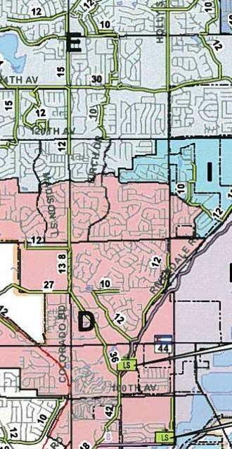
10 APPENDIX A Vicinity Map 99 S. Broadway 23, Denver, CO 29 P
11 VICINITY MAP
12 APPENDIX B WaterCAD Map Water Calculations Sanitary Sewer Calculations 99 S. Broadway 23, Denver, CO 29 P
13 WaterCAD Map H-4 H-3 H-5 J-9 J- J-7 J- P-25 P-2 J-4 J-2 P- J-6 P- J-2 P-23 J-7 P-2 J-5 P- J-3 J-2 J- J- J-5 P7 6 P- P- 5 4 P - J-4 J-9 P-2 P-6 J-6 P-2 J-22 R-2 R-3 P-3 P-32 R-4 J-2 P-3 J-3 H- H-2 P-33 P- J- R- 349-Water Map.wtg /29/27 Bentley Systems, Inc. Haestad Metods Solution Center 27 Siemon Company Drive Suite 2 W Watertown, CT 6795 USA Bentley WaterCAD Vi (SELECTseries 6) [..6.3] Page of
14 Scenario: Max Day Plus Fire Active Scenario: Max Day Plus Fire H-3 H-4 J-6 P- J-7 P- J- P-2 J-7 P-23 J- P-25 J-2 J-9 P-2 J-2 J-4 P-7 P- J-5 P-37 H-5 P-7 J-5 P-6 J-4 P-2 J-9 P-3 J- P-4 J- J-2 P-5 P-6 J-3 P-2 J-6 R-2 P-3 J-22 P-32 R-4 R-3 J-2 P-3 J-3 H- P- J- P-33 H-2 R- 349-Water Map.wtg /29/27 Bentley Systems, Inc. Haestad Metods Solution Center 27 Siemon Company Drive Suite 2 W Watertown, CT 6795 USA Bentley WaterCAD Vi (SELECTseries 6) [..6.3] Page of
15 ID J- J-2 J-3 J-4 J-5 J-6 J-7 J- J-9 J- J- J-2 J-3 J-4 J-5 J-6 J-7 J- J-9 J-2 J-2 J-22 Label Elevation 5,3.2 5,29.4 5,24. 5,22.9 5,22.6 5,24.5 5,24.3 5,22. 5,25.6 5,23. 5,22.4 5,2. 5,9.3 5,.5 5,3.4 5,3. 5,2 5,7.75 5,7. 5,.75 5,6.6 5,2 FlexTable: Junction Table Active Scenario: Max Day Plus Fire Zone Demand (gpm) Hydraulic Grade 5, ,33.5 5, ,3.52 5,3.2 5,39 5,37 5, , , , , , , , , , , , , , ,33.75 Unit Demand Collection <Count> Unit Demand Collection <Collection: <Collection: <Collection: <Collection: <Collection: <Collection: <Collection: <Collection: <Collection: <Collection: <Collection: <Collection: <Collection: <Collection: <Collection: <Collection: <Collection: <Collection: <Collection: <Collection: <Collection: <Collection: Pressure (psi) Water Map.wtg /29/27 Bentley Systems, Inc. Haestad Metods Solution Center 27 Siemon Company Drive Suite 2 W Watertown, CT 6795 USA Bentley WaterCAD Vi (SELECTseries 6) [..6.3] Page of
16 Active Scenario: Max Day Plus Fire FlexTable: Pipe Table Lengt Headloss Gradient (ft/ft) Velocity (ft/s) Flow (gpm) Minor Loss Coefficient (Local) Zone Hazen-Williams C Material Diameter (in) Stop Node Start Node Lengt (Scaled) Label ID J- R- 26 P J-2 J- 355 P J-3 J-2 69 P J-3 J P J-4 J P J-5 J P J-6 J P J-7 J P J-5 J-7 47 P J- J P J-4 J- 637 P J-9 J-4 26 P J- J P J- J- 44 P J-2 J- 47 P J-3 J-2 23 P J-4 J P J-5 J P J-6 J P J-2 J-6 42 P J-7 J- 27 P J-9 J P J- J-7 25 P J- J- 62 P J-9 J- 25 P J-2 J-9 26 P J- J P J-2 J P J-3 J P J- R-3 43 P Ductile Iron 2. J-22 R P Ductile Iron 2. J-22 R-4 35 P H- J- 436 P H-2 J P , H-3 J-2 37 P H-4 J P H-5 J P-37 3 Page of 27 Siemon Company Drive Suite 2 W Watertown, CT 6795 USA /29/27 Bentley WaterCAD Vi (SELECTseries 6) [..6.3] Bentley Systems, Inc. Haestad Metods Solution Center 349-Water Map.wtg
17 FlexTable: Hydrant Table ID Label H- H-2 H-3 H-4 H-5 Hydrant Status Closed Closed Open Closed Closed Emitter Coefficient (gpm/psi^n) Lateral Lengt Active Scenario: Max Day Plus Fire Elevation 5,26.2 5,25.4 5,3.5 5,4.2 5,34.2 Zone Demand Collection <Collection: <Collection: <Collection: <Collection: <Collection: Demand (gpm),5 Hydraulic Grade 5, , ,22.3 5, ,295.6 Pressure (psi) Water Map.wtg /29/27 Bentley Systems, Inc. Haestad Metods Solution Center 27 Siemon Company Drive Suite 2 W Watertown, CT 6795 USA Bentley WaterCAD Vi (SELECTseries 6) [..6.3] Page of
18 Scenario: Static HGL & No Demands Active Scenario: Static HGL & No Demands H-4 H-3 J-6 P- J-7 P- J- P-2 J-7 P-23 J- P-25 J-2 J-9 P-2 J-2 J-4 P- J-5 H-5 P-7 J-5 P-6 J-4 P-2 J-9 J- P-4 J- J-2 P-5 P-6 J-3 P-2 J-6 R-2 P-3 J-22 P-32 R-4 R-3 J-2 P-3 J-3 H- P- J- P-33 H-2 R- 349-Water Map.wtg /29/27 Bentley Systems, Inc. Haestad Metods Solution Center 27 Siemon Company Drive Suite 2 W Watertown, CT 6795 USA Bentley WaterCAD Vi (SELECTseries 6) [..6.3] Page of
19 ID Label J- J-2 J-3 J-4 J-5 J-6 J-7 J- J-9 J- J- J-2 J-3 J-4 J-5 J-6 J-7 J- J-9 J-2 J-2 J-22 Elevation 5,3.2 5,29.4 5,24. 5,22.9 5,22.6 5,24.5 5,24.3 5,22. 5,25.6 5,23. 5,22.4 5,2. 5,9.3 5,.5 5,3.4 5,3. 5,2 5,7.75 5,7. 5,.75 5,6.6 5,2 Zone FlexTable: Junction Table Active Scenario: Static HGL & No Demands Demand (gpm) Hydraulic Grade 5,34. 5,34. 5,34. 5,34. 5,34. 5,34. 5,34. 5,34. 5,34. 5,34. 5,34. 5,34. 5,34. 5,34. 5,34. 5,34. 5,34. 5,34. 5,34. 5,34. 5,34. 5,34. Unit Demand Collection <Count> Unit Demand Collection <Collection: <Collection: <Collection: <Collection: <Collection: <Collection: <Collection: <Collection: <Collection: <Collection: <Collection: <Collection: <Collection: <Collection: <Collection: <Collection: <Collection: <Collection: <Collection: <Collection: <Collection: <Collection: Pressure (psi) Water Map.wtg /29/27 Bentley Systems, Inc. Haestad Metods Solution Center 27 Siemon Company Drive Suite 2 W Watertown, CT 6795 USA Bentley WaterCAD Vi (SELECTseries 6) [..6.3] Page of
20 Active Scenario: Static HGL & No Demands FlexTable: Pipe Table Lengt Headloss Gradient (ft/ft) Velocity (ft/s) Flow (gpm) Minor Loss Coefficient (Local) Zone Hazen-Williams C Material Diameter (in) Stop Node Start Node Lengt (Scaled) Label ID J- R- 26 P J-2 J- 355 P J-3 J-2 69 P J-3 J P J-4 J P J-5 J P J-6 J P J-7 J P J-5 J-7 47 P J- J P J-4 J- 637 P J-9 J-4 26 P J- J P J- J- 44 P J-2 J- 47 P J-3 J-2 23 P J-4 J P J-5 J P J-6 J P J-2 J-6 42 P J-7 J- 27 P J-9 J P J- J-7 25 P J- J- 62 P J-9 J- 25 P J-2 J-9 26 P J- J P J-2 J P J-3 J P J- R-3 43 P Ductile Iron 2. J-22 R P Ductile Iron 2. J-22 R-4 35 P H- J- 436 P H-2 J P H-3 J-2 37 P H-4 J P H-5 J P-37 3 Page of 27 Siemon Company Drive Suite 2 W Watertown, CT 6795 USA /29/27 Bentley WaterCAD Vi (SELECTseries 6) [..6.3] Bentley Systems, Inc. Haestad Metods Solution Center 349-Water Map.wtg
21 FlexTable: Hydrant Table ID Label H- H-2 H-3 H-4 H-5 Hydrant Status Closed Closed Closed Closed Closed Emitter Coefficient (gpm/psi^n) Active Scenario: Static HGL & No Demands Lateral Lengt Elevation 5,26.2 5,25.4 5,3.5 5,4.2 5,34.2 Zone Demand Collection <Collection: <Collection: <Collection: <Collection: <Collection: Demand (gpm) Hydraulic Grade 5,34. 5,34. 5,34. 5,34. 5,34. Pressure (psi) Water Map.wtg /29/27 Bentley Systems, Inc. Haestad Metods Solution Center 27 Siemon Company Drive Suite 2 W Watertown, CT 6795 USA Bentley WaterCAD Vi (SELECTseries 6) [..6.3] Page of
22 Scenario: Static HGL & Peak Hour Active Scenario: Static HGL & Peak Hour H-3 H-4 J-6 P- J-7 P- J- P-2 J-7 P-23 J- P-25 J-2 J-9 P-2 J-2 J-4 P-7 P- J-5 P-37 H-5 P-7 J-5 P-6 J-4 P-2 J-9 P-3 J- P-4 J- J-2 P-5 P-6 J-3 P-2 J-6 R-2 P-3 J-22 P-32 R-4 R-3 J-2 P-3 J-3 H- P- J- P-33 H-2 R- 349-Water Map.wtg /29/27 Bentley Systems, Inc. Haestad Metods Solution Center 27 Siemon Company Drive Suite 2 W Watertown, CT 6795 USA Bentley WaterCAD Vi (SELECTseries 6) [..6.3] Page of
23 FlexTable: Junction Table ID Label J- J-2 J-3 J-4 J-5 J-6 J-7 J- J-9 J- J- J-2 J-3 J-4 J-5 J-6 J-7 J- J-9 J-2 J-2 J-22 Elevation 5,3.2 5,29.4 5,24. 5,22.9 5,22.6 5,24.5 5,24.3 5,22. 5,25.6 5,23. 5,22.4 5,2. 5,9.3 5,.5 5,3.4 5,3. 5,2 5,7.75 5,7. 5,.75 5,6.6 5,2 Zone Active Scenario: Static HGL & Peak Hour Demand (gpm) Hydraulic Grade 5, , , ,33.6 5, , , , , , , , ,33.5 5, , , , , , , ,33.5 5,33.96 Unit Demand Collection <Count> Unit Demand Collection <Collection: <Collection: <Collection: <Collection: <Collection: <Collection: <Collection: <Collection: <Collection: <Collection: <Collection: <Collection: <Collection: <Collection: <Collection: <Collection: <Collection: <Collection: <Collection: <Collection: <Collection: <Collection: Pressure (psi) Water Map.wtg /29/27 Bentley Systems, Inc. Haestad Metods Solution Center 27 Siemon Company Drive Suite 2 W Watertown, CT 6795 USA Bentley WaterCAD Vi (SELECTseries 6) [..6.3] Page of
24 Active Scenario: Static HGL & Peak Hour FlexTable: Pipe Table Lengt Headloss Gradient (ft/ft) Velocity (ft/s) Flow (gpm) Minor Loss Coefficient (Local) Zone Hazen-Williams C Material Diameter (in) Stop Node Start Node Lengt (Scaled) Label ID J- R- 26 P J-2 J- 355 P J-3 J-2 69 P J-3 J P J-4 J P J-5 J P J-6 J P J-7 J P J-5 J-7 47 P J- J P J-4 J- 637 P J-9 J-4 26 P J- J P J- J- 44 P J-2 J- 47 P J-3 J-2 23 P J-4 J P J-5 J P J-6 J P J-2 J-6 42 P J-7 J- 27 P J-9 J P J- J-7 25 P J- J- 62 P J-9 J- 25 P J-2 J-9 26 P J- J P J-2 J P J-3 J P J- R-3 43 P Ductile Iron 2. J-22 R P Ductile Iron 2. J-22 R-4 35 P H- J- 436 P H-2 J P H-3 J-2 37 P H-4 J P H-5 J P-37 3 Page of 27 Siemon Company Drive Suite 2 W Watertown, CT 6795 USA /29/27 Bentley WaterCAD Vi (SELECTseries 6) [..6.3] Bentley Systems, Inc. Haestad Metods Solution Center 349-Water Map.wtg
25 FlexTable: Hydrant Table ID Label H- H-2 H-3 H-4 H-5 Hydrant Status Closed Closed Closed Closed Closed Emitter Coefficient (gpm/psi^n) Active Scenario: Static HGL & Peak Hour Lateral Lengt Elevation 5,26.2 5,25.4 5,3.5 5,4.2 5,34.2 Zone Demand Collection <Collection: <Collection: <Collection: <Collection: <Collection: Demand (gpm) Hydraulic Grade 5, , ,33.5 5, ,33.46 Pressure (psi) Water Map.wtg /29/27 Bentley Systems, Inc. Haestad Metods Solution Center 27 Siemon Company Drive Suite 2 W Watertown, CT 6795 USA Bentley WaterCAD Vi (SELECTseries 6) [..6.3] Page of
26 /3/27 Sanitary Calculations for Eastcreek City of Tornton Standards low density (less tan 5 DU/acre) 3.45 people / unit mid density (5 to 2 DU/ acre) 2.45 people / unit ig density (more tan 2 DU/acre) 2.2 people / unit Residential average demand: gal / person / day Commercial average demand: 6 gal / acre DU = dwelling units Planning Area Land Use: DU (ac) People / Unit No. of People Average Demand (gal/person/day) Average Flow (gpd) Average Flow (gpm) Average Flow (cfs) Used Peaking Factor PA- SFA , ,37.29 PA-2 SFA , ,2.2 Peak Flow (gpd) Peak Flow (cfs) Total: 275 Total= 75, ,65.4 Design Average flow (gpd) Used Peaking Factor Peak Flow (gpd) Peak flow (q) (cfs) Minimum Full Flow Pipe Size (in) Pipe Slope Q full (cfs) Capacity Q cap. (cfs) q/q full (%) (%) (%) PA- 53,2 3.5, %.76 5%.3 3.% PA-2 22, ,2.2.4%.76 5%.3 5.6%. Pipes smaller tan 5" are designed wit no more tan 5% maximum flow (q/q) per 22 City of Tornton Standards and Specs. Page of 596-Sewer Demands.xlsx
27 " sewer capacity Project Description Friction Metod Solve For Manning Formula Discarge Input Data Rougness Coefficient Cannel Slope Normal Dept Diameter 4 ft/ft.33 ft. in Results Discarge.5 ft³/s Flow Area.7 ft² Wetted Perimeter.5 ft Hydraulic Radius.7 ft Top Widt.67 ft Critical Dept.33 ft Percent Full 5 % Critical Slope 44 ft/ft Velocity 2.4 ft/s Velocity Head.3 ft Specific Energy.46 ft Froude Number.9 Maximum Discarge.7 ft³/s Discarge Full.99 ft³/s Slope Full ft/ft Flow Type SubCritical GVF Input Data Downstream Dept ft Lengt ft Number Of Steps GVF Output Data Upstream Dept ft Profile Description Profile Headloss ft Average End Dept Over Rise % Normal Dept Over Rise % Downstream Velocity Infinity ft/s 6/2/27 :7:3 AM Bentley Systems, Inc. Haestad Metods Solution Bentley Center FlowMaster Vi (SELECTseries ) [...3] 27 Siemons Company Drive Suite 2 W Watertown, CT 6795 USA Page of 2
28 " sewer capacity GVF Output Data Upstream Velocity Normal Dept Critical Dept Cannel Slope Critical Slope Infinity ft/s.33 ft.33 ft 4 ft/ft 44 ft/ft 6/2/27 :7:3 AM Bentley Systems, Inc. Haestad Metods Solution Bentley Center FlowMaster Vi (SELECTseries ) [...3] 27 Siemons Company Drive Suite 2 W Watertown, CT 6795 USA Page 2 of 2
29 PA- Max Velocity Project Description Friction Metod Solve For Manning Formula Normal Dept Input Data Rougness Coefficient Cannel Slope Diameter Discarge 5 ft/ft. in.29 ft³/s Results Normal Dept.3 ft Flow Area 5 ft² Wetted Perimeter.6 ft Hydraulic Radius ft Top Widt.53 ft Critical Dept.25 ft Percent Full 9.4 % Critical Slope 35 ft/ft Velocity 6. ft/s Velocity Head.57 ft Specific Energy.7 ft Froude Number 3.56 Maximum Discarge 3.7 ft³/s Discarge Full 3.5 ft³/s Slope Full 34 ft/ft Flow Type SuperCritical GVF Input Data Downstream Dept ft Lengt ft Number Of Steps GVF Output Data Upstream Dept ft Profile Description Profile Headloss ft Average End Dept Over Rise % Normal Dept Over Rise 9.44 % Downstream Velocity Infinity ft/s 6/22/27 :6:5 AM Bentley Systems, Inc. Haestad Metods Solution Bentley Center FlowMaster Vi (SELECTseries ) [...3] 27 Siemons Company Drive Suite 2 W Watertown, CT 6795 USA Page of 2
30 PA- Max Velocity GVF Output Data Upstream Velocity Normal Dept Critical Dept Cannel Slope Critical Slope Infinity ft/s.3 ft.25 ft 5 ft/ft 35 ft/ft 6/22/27 :6:5 AM Bentley Systems, Inc. Haestad Metods Solution Bentley Center FlowMaster Vi (SELECTseries ) [...3] 27 Siemons Company Drive Suite 2 W Watertown, CT 6795 USA Page 2 of 2
31 PA-2 Max Velocity Project Description Friction Metod Solve For Manning Formula Normal Dept Input Data Rougness Coefficient Cannel Slope Diameter Discarge 5 ft/ft. in.2 ft³/s Results Normal Dept ft Flow Area 3 ft² Wetted Perimeter.4 ft Hydraulic Radius 5 ft Top Widt.44 ft Critical Dept.6 ft Percent Full 2.6 % Critical Slope 33 ft/ft Velocity 4.69 ft/s Velocity Head.34 ft Specific Energy.43 ft Froude Number 3.44 Maximum Discarge 3.7 ft³/s Discarge Full 3.5 ft³/s Slope Full 6 ft/ft Flow Type SuperCritical GVF Input Data Downstream Dept ft Lengt ft Number Of Steps GVF Output Data Upstream Dept ft Profile Description Profile Headloss ft Average End Dept Over Rise % Normal Dept Over Rise 2.64 % Downstream Velocity Infinity ft/s 6/22/27 :6:5 AM Bentley Systems, Inc. Haestad Metods Solution Bentley Center FlowMaster Vi (SELECTseries ) [...3] 27 Siemons Company Drive Suite 2 W Watertown, CT 6795 USA Page of 2
32 PA-2 Max Velocity GVF Output Data Upstream Velocity Normal Dept Critical Dept Cannel Slope Critical Slope Infinity ft/s ft.6 ft 5 ft/ft 33 ft/ft 6/22/27 :6:5 AM Bentley Systems, Inc. Haestad Metods Solution Bentley Center FlowMaster Vi (SELECTseries ) [...3] 27 Siemons Company Drive Suite 2 W Watertown, CT 6795 USA Page 2 of 2
33 APPENDIX C Overall Utility Map 99 S. Broadway 23, Denver, CO 29 P
34
35 APPENDIX D Existing Utility Coordination Map Existing Sanitary Pipe Capacity Calculations 99 S. Broadway 23, Denver, CO 29 P
36 !!!!!!!!! m m!!! 2 2 t ) 2 36 RCP t )!!!!! 3 RCP!!! ee d t )! t )!!! 3 RCP 5 t ) t ) AB t ) 24!! map name - Te COT Master Plan as te Haven Lift Station abandoned and a main sewer line carrying flows from Quail Valley and te Haven across your site. Te sewer main would need to be sized to carry tose flows. 2 24!! CITY OF THORNTON, COLORADO 95 CIVIC CENTER DRIVE THORNTON, COLORADO (33) FM eee 5!!! M!!!! 24 H m 7 PROPRIETARY INFORMATION -- NOT FOR RESALE Digital Data Produced by te City of Tornton GIS Project. Tis map is representational only, and does not determine exact locations or boundaries of any districts or properties. It is not intended to be relied upon for any legal descriptions or oter land use documents x eee 2 AB CONC AB t AB t ) 2 AB AB PROJECT SITE 2 3 mm m m m m ' µ eee 2 U P P P eeeeee t 2 2 eee eee 36 RCP 36 RCP t 6 (2) - 44'' x 72'' BOX () - '' BOX t ) d d eee eee You would need an easement from E-47 to put te sewer line in te E-47 ROW H d d eee d d d mm m d d m m Hm m d d 3 RCP ' e 29x45 d GT± PROJECT SITE 36 RCP RCP 36 RCP 3 36 eee t t eee eee 5 2 inc = 599 feet eee eee eee H H d d d d d d d d H H m Pm m H m H t 24 RCP 24 ELRCP 5 3 t ) 2 eeeeee RCP 3 RCP 5 24 RCP RCP eee RCP 5 eee ' 42 RCP 2 eee 42 RCP U eee 5 PROJECT SITE 5'' x 6'' BOX eee eee eee 5 eee eee eee t t 5 Tis line is dry FM 5!!!!!!!!!!!!!!!!!!!!!!!!! 5 t ' eee!!!!!! 5, 2, 3, 4, Feet eee ' ' <Map name and pat>
37 5/3/25 Sanitary Sewer Demands for 5t and York City of Tornton Standards low density (less tan 5 DU/acre) 3.45 people / unit mid density (5 to 2 DU/ acre) 2.45 people / unit ig density (more tan 2 DU/acre) 2.2 people / unit Residential average demand: gal / person / day Commercial average demand: 6 gal / acre DU = dwelling units Planning Area Land Use: DU People / Unit No. of People Average Demand (gal/person/day) Average Flow (gpd) Average Flow (gpm) Average Flow (cfs) Used Peaking Factor A SFD , ,44.3 A- SFD , ,5 4 B SFD , ,4 4 C , ,232.6 Total= 36, ,47.2 Peak Flow (gpd) Peak Flow (cfs) Design Average flow (cfs) Used Peaking Factor Peak Flow (gpd) Peak flow (q) (cfs) Minimum Full Flow Pipe Size (in) Pipe Slope Q full (cfs) Capacity Q cap. (cfs) q/q full (%) (%) (%) 236, , %.95 5% % 2 3, , %.5 5%.43 9.% 3 26, ,2. 2.3%.95 5% % 4 6, ,4 4.5%.5 5% % 5 2, , % % %. Pipes smaller tan 5" are designed wit no more tan 5% maximum flow (q/q) per 22 City of Tornton Standards and Specs. Te igligted section sown above depicts te capacity of te existing pipe tat will act as te western tie-in point west of te intersection of 52nd Ave and York St. Page of 45-Sewer Demands.xlsx
38 APPENDIX E Exibit VII- City of Tornton: Existing Water System Exibit XI- City of Tornton: Existing Sewer System 99 S. Broadway 23, Denver, CO 29 P


39


40
FINAL UTILITY REPORT Eastcreek Farm Thornton, CO
 FINAL UTILITY REPORT Eastcreek Farm Thornton, CO October 14, 2016 JN: 13049 Prepared for: York 80, LLC 12460 1 st Street Eastelake, CO 80614 P: 303.457.2966 Prepared by: Jansen Strawn Consulting Engineers
CONCEPTUAL UTILITY REPORT FOR THE CANYONS PHASE 1 CITY OF CASTLE PINES, CO
 CONCEPTUAL UTILITY REPORT FOR THE CANYONS PHASE 1 CITY OF CASTLE PINES, CO PREPARED FOR: SHEA HOMES 9380 STATION ST., SUITE 600 LONE TREE, CO 80124 PHONE: 303-791-8180 CONTACT: RYAN MCDERMED PREPARED BY:
FINAL UTILITY REPORT
 RIVER VALLEY VILLAGE SUBDIVISION, AMD NO. 3 CORNERSTONE TOWNHOMES II NEC THORNTON PARKWAY & COLORADO BOULEVARD CITY OF THORNTON, STATE OF COLORADO SITUATED IN THE SOUTHWEST ¼ OF SECTION 18, TOWNSHIP 2
City of St. Pete Beach Model Capacity Report Addendum
 Model Capacity Report - Addendum City of St. Pete Beach Model Capacity Report Addendum Prepared for: City of St. Pete Beach 155 Corey Avenue St. Pete Beach, FL 33706 Prepared By: Kimley-Horn and Associates,
PRELIMINARY UTILITY REPORT FOR TOPGOLF INTERNATIONAL, INC.
 PRELIMINARY UTILITY REPORT FOR TOPGOLF INTERNATIONAL, INC. THORNTON, COLORADO Prepared for: ARCO Murray Contact: Rachel Bohac Phone: 331.251.2726 Prepared by: 1225 17 th Street, Suite 514 Denver, CO 80202
Kent Breeze Corporation. Noise Assessment Report. Kent Breeze Wind Farm and MacLeod Windmill Project H
 Kent Breeze Corporation Kent Breeze Wind Farm and MacLeod Windmill Project H335112-0000-00-124-0001 0 May 14, 2010 Project Report Kent Breeze Corporation Kent Breeze Wind Farm and MacLeod Windmill Project
Swale Storage/ Length Between Ditch Blocks
 Swale Storage/ Length Between Ditch Blocks Input: Roadway Grade 1.00 % Front Slope 4 :1 Bottom Width 0 ft Back Slope 3 :1 Swale Depth 1.50 ft Calculations: Cross-Sectional Swale Area = 7.88 ft 2 DITCH
/ Planning and Zoning Staff Report Lonestar Land, LLC. - Rezone, RZ
 / Planning and Zoning Staff Report Lonestar Land, LLC. - Rezone, RZ2018-0019 Hearing Date: October 18, 2018 Development Services Department Applicant: Lonestar Land, LLC. Representative: Lance Warnick
STAFF REPORT # CHANGE OF ZONING
 STAFF REPORT #17-2000-0007 CHANGE OF ZONING PLANNING COMMISSION MEETING DATE: November 16, 2017 (Applicant Provided Materials / Traffic Study = Blue) 1. APPLICATION: A public hearing for an application
2005 City of Santa Paula Potable Water System Master Plan Amendment
 2005 City of Santa Paula Potable Water System Master Plan Amendment City of Santa Paula Project Engineer Randy Toedter, PE Brian Yanez June, 2012 970 Ventura Street Santa Paula, CA 93060 PURPOSE OF THE
Traffic Impact Statement (TIS)
") Traffic Impact Statement (TIS) Vincentian PUDA Collier County, FL 10/18/2013 Prepared for: Global Properties of Naples Prepared by: Trebilcock Consulting Solutions, PA 2614 Tamiami Trail N, Suite 615 1205
Traffic Impact Statement (TIS) Vincentian PUDA Collier County, FL 10/18/2013 Prepared for: Global Properties of Naples Prepared by: Trebilcock Consulting Solutions, PA 2614 Tamiami Trail N, Suite 615 1205
BERMAD Irrigation. Technical Specifications. WW-700 & 800 Series Metric. 800 Metric
 Tecnical Specifications -700 & 0 Series SI 700 Metric SI 0 Metric Available Sizes & Patterns DN - DN 0 - Y Pattern DN - DN 4 - Angle DN 600 - DN 0 - Globe Connection Standard Flanged: ISO 7005-2 (ISO,
DRIVEWAY/APPROACH PERMIT APPLICATION Applicant Type: Architect/Engineer Contractor Owner
 DRIVEWAY/APPROACH PERMIT APPLICATION Applicant Type: Architect/Engineer Contractor Owner Lake Elmo City Hall 651-747-3900 3880 Laverne Avenue North Lake Elmo, MN 55042 Project Address: Property Owner:
This letter summarizes our observations, anticipated traffic changes, and conclusions.
 Mr. David Jorschumb Project Manager Boulder Valley School District Re: Review of proposed school access improvements at the Foothills Elementary School in Boulder Dear Mr. Jorschumb, At your request, the
CENTENNIAL PARK EXPANSION
 2 working days CITY ELKO EXISTING LEGEND PROPOSED CENTENNIAL PARK EXPANSION SEET LIGHT POWER POLE ELECICAL BOX 1-800-227-2600 AVOID CUTTING UNDERGROUND UTILITIES WATER VALVE GAS VALVE FIRE HYDRANT OWNER/DEVELOPER:
Marion County Board of County Commissioners
 Marion County Board of County Commissioners Office of the County Engineer 412 SE 25th Ave. Ocala, FL 34471 Phone: 352-671-8686 Fax: 352-671-8687 DEVELOPMENT REVIEW COMMITTEE WAIVER REQUEST FORM Date: 08/04/2016
PUBLIC INFRASTRUCTURE PROJECTS
 PUBLIC INFRASTRUCTURE PROJECTS FM 664 / OVILLA ROAD WIDENING & IMPROVEMENTS FM 664 / OVILLA ROAD CONNECTS US 287 WITH I-45 (SOURCE: TEXAS DEPARTMENT OF TRANSPORTATION. 2016 FM 664 / OVILLA ROAD WIDENING
Hydraulic Modeling: Pipe Network Analysis
 Utah State University DigitalCommons@USU All Graduate Plan B and other Reports Graduate Studies 12-2012 Hydraulic Modeling: Pipe Network Analysis Trevor T. Datwyler Utah State University Follow this and
April 18, Mr. David Schmit, County Manager Arapahoe County 5334 S. Prince Street Littleton, CO Conoco Phillips Section 6 Swan Well
 April 18, 2018 Mr. David Schmit, County Manager Arapahoe County 5334 S. Prince Street Littleton, CO 80120 Re: Conoco Phillips Section 6 Swan Well Dear David, It is our understanding that Conoco Phillips
GATTIS SCHOOL RD / SH 130 SUBDIVISION
 AMISTAD DR MEADOWILD DR NO. DESCRIPTION INDEX ROYAL BURGESS DR. E NAKOMA SITE SH 130 CITY LIMITS LITTLE LAKE RD KAATZ LN ESTATE DR DANA DR MARJORIE DR 1 COVER 2 PRELIMINARY PLAT 3 EXISTING CONDITIONS 4
TIMBERVINE TRANSPORTATION IMPACT STUDY FORT COLLINS, COLORADO JANUARY Prepared for:
 TIMBERVINE TRANSPORTATION IMPACT STUDY FORT COLLINS, COLORADO JANUARY 2014 Prepared for: Hartford Companies 1218 W. Ash Street Suite A Windsor, Co 80550 Prepared by: DELICH ASSOCIATES 2272 Glen Haven Drive
2.21 School Bus Safety Program. Introduction
 2.21 Scool Bus Safety Program Introduction Te Motor Registration Division (MRD) of te Department of Government Services is responsible for administering all activities and legislation respecting veicles
PRELIMINARY SEWER SERVICE REPORT TREES RESORT AT DARKHORSE. Nevada County, CA
 PRLIMINARY SWR SRVIC RPORT Prepared for: T ORT AT Nevada County, CA April 5, 2 3/31/ Prepared By: runswick Road, Suite 11 Grass Valley, CA 95945 Phone (53) 272-8328 CONTNTS NARRATIV - (Section A) Page
Draft Zoning and Land Use Regulations. Presentation to the Montclair Township Planning Board
 Draft Zoning and Land Use Regulations Presentation to the Montclair Township Planning Board November 27, 2017 Consolidation of Chapters Five separate chapters involving land use have been consolidated:
Evaluation of Turnability of Tracked Vehicle
 JARQ 3, 249-253 1996) Evaluation of Turnability of Tracked Veicle Nobutaka ITO Department of Bioproduction and Macinery, Faculty of Bioresources, Mie University Tsu, Mie, 514 Japan) Abstract Rice combine
Speed measurements were taken at the following three locations on October 13 and 14, 2016 (See Location Map in Exhibit 1):
:") 2709 McGraw Drive Bloomington, Illinois 61704 p 309.663.8435 f 309.663.1571 www.f-w.com www.greennavigation.com November 4, 2016 Mr. Kevin Kothe, PE City Engineer City of Bloomington Public Works Department
2709 McGraw Drive Bloomington, Illinois 61704 p 309.663.8435 f 309.663.1571 www.f-w.com www.greennavigation.com November 4, 2016 Mr. Kevin Kothe, PE City Engineer City of Bloomington Public Works Department
A SH Series. SH Series. 2. Ball slide shape
 S Series -5-1.2 S Series 1. eatures (1) ower noise and gentler tone Incorporating a retaining piece and optimizing te circulation pat enables steel ball circulation stability and te prevention of ball
TYPICAL DRIVEWAY CONSTRUCTION PER DOUGLAS COUNTY REGULATIONS AND POLICIES
 TYPICAL DRIVEWAY CONSTRUCTION PER DOUGLAS COUNTY REGULATIONS AND POLICIES This document is a summary of the Douglas County regulations and policies for constructing residential driveways. It is intended
Assisted Living / Memory Care - South Forsyth
 ! Assisted Living / Memory Care - South Forsyth LOCATION: 6388 Post Road, Cumming, GA 30040 - Forsyth County Parcel ID - 037-012 2 nd District, 1 st Section, Land Lot 317 SIZE: 5.4723 acres +/- ZONING:
PRESSURE UTILITIES. Pipe flow occurs due to contents of the pipe being pressurized System cannot have a free connection to the atmosphere
 PRESSURE UTILITIES Pipe flow occurs due to contents of the pipe being pressurized System cannot have a free connection to the atmosphere Types of Pressure Utilities Domestic Water: Clean/drinkable water
April 7, Mr. Blake Shutler Compass Homes Development LLC Summit Homes Construction, LLC PO Box 6539 Dillon, CO 80435
 Compass Homes Development LLC Summit Homes Construction, LLC PO Box 6539 Dillon, CO 80435 Re: Trip Generation Comparison West Hills Townhomes Keystone, Colorado FHU Reference No. 116388-01 Dear Mr. Shutler:
STAFF REPORT. To: Planning Commission Meeting date: April 12, 2017 Item: UN Prepared by: Robert Eastman
 # 5 ) UN-15-17 LA SIERRA AUTO SALES SPECIAL USE PERMIT VEHICLE SALES PUBLIC HEARING STAFF REPORT To: Planning Commission Meeting date: April 12, 2017 Item: UN-15-17 Prepared by: Robert Eastman GENERAL
3. Site Information: Address: TBD Location: Southeast corner of Meridian Rd and Old Meridian Rd Size: 2.48 acres Zoning: CR Commercial Regional
 Address Address Re: Les Schwab Tire Center New Construction Meridian Crossing Lots 3 & 4 Phantom II Partners LLC, 1. This letter is being sent to you because Galloway & Company, Inc. is proposing a land
A LH Series. LH Series. 2. Ball slide shape
 Series -5-1.1 Series are also available in randam matcing. (Special ig-carbon steel products for 15 to 45) 2. all slide sape all slide Model Sape/installation metod ype (Upper row, Rating: ower row, all
Optimized Radius of Roller Large End Face in Tapered Roller Bearings
 NTN TECHNICAL REVIEW No.77 29 Tecnical Paper Optimized Radius of Roller Large End Face in Tapered Roller Bearings Hiroki FUJIWARA Takasi TSUJIMOTO Kazuto YAMAUCHI Tapered roller bearings can support eavy
2.0 Development Driveways. Movin Out June 2017
 Movin Out June 2017 1.0 Introduction The proposed Movin Out development is a mixed use development in the northeast quadrant of the intersection of West Broadway and Fayette Avenue in the City of Madison.
Traffic, Transportation & Civil Engineering Ali R. Khorasani, P.E. P.O. Box 804, Spencer, MA 01562, Tel: (508)
") Associates Traffic, Transportation & Civil Engineering Ali R. Khorasani, P.E. P.O. Box 804, Spencer, MA 01562, Tel: (508) 885-5121 Ms. Teri Ford, Associate 800 Boylston Street, Suite 1570 Boston, MA July
Associates Traffic, Transportation & Civil Engineering Ali R. Khorasani, P.E. P.O. Box 804, Spencer, MA 01562, Tel: (508) 885-5121 Ms. Teri Ford, Associate 800 Boylston Street, Suite 1570 Boston, MA July
Temporary Sales Trailer Application
 Development Services Department Building Division 311 Vernon Street Roseville, California 95678-2649 Temporary Sales Trailer Application General: Requests for temporary sales trailers, which comply with
Crossed Roller Slides
 Crossed Roller Slides ov-crossed-slides-divider - Updated - 18-09-2017 165 Linear Linear Rail Sets Overview Standard cross roller rail sets L1000 & L1001 Seven rail profiles (Sizes 1-12) Lengts: 20mm to
DRAFT REPORT TXDOT SH 183 MASTER DRAINAGE STUDY HYDRAULIC ANALYSIS OF ELM FORK OF TRINITY RIVER CROSSING AT SH 183 WITHIN THE ELM FORK WATERSHED
 DRAFT REPORT TXDOT SH 183 MASTER DRAINAGE STUDY HYDRAULIC ANALYSIS OF ELM FORK OF TRINITY RIVER CROSSING AT SH 183 WITHIN THE ELM FORK WATERSHED FOR TEXAS DEPARTMENT OF TRANSPORTATION DALLAS DISTRICT CONTRACT
FIRE DEPARTMENT ACCESS Based on the 2012 edition of the International Fire Code
 FIRE DEPARTMENT ACCESS Based on the 2012 edition of the International Fire Code The Fire Department is required to respond to a multitude of emergencies in various types of buildings and occupancies. These
MILLERSVILLE PARK TRAFFIC IMPACT ANALYSIS ANNE ARUNDEL COUNTY, MARYLAND
 MILLERSVILLE PARK TRAFFIC IMPACT ANALYSIS ANNE ARUNDEL COUNTY, MARYLAND Prepared for: Department of Public Works Anne Arundel County Prepared by: URS Corporation 4 North Park Drive, Suite 3 Hunt Valley,
Attachment F: Transport assessment report on implications if Capell Avenue never formed
 Attachment F: Transport assessment report on implications if never formed CCL Ref: 14447-181118-williams.docx 18 November 2018 Tim Williams Williams and Co Limited By e-mail only: tim@williamsandco.nz
ANDERSON PROPERTY SITE ANALYSIS
 ANDERSON PROPERTY SITE ANALYSIS Introduction The Montgomery County Department of Transportation (MCDOT) initiated a feasibility study in the fall of 2012 to evaluate the need for transit service expansion
Cedar View Subdivision No. 2 Hillcrest Dr. Montrose, Colorado 81401
 Cedar View Subdivision No. 2 Hillcrest Dr. 81401 Property Information Packet John Renfrow * Jim Renfrow M b f Renfrow Realty Member of: Rocky Mountain Commercial Brokers www.rmcbrokers.com Page 1 Executive
Parks and Transportation System Development Charge Methodology
 City of Sandy Parks and Transportation System Development Charge Methodology March, 2016 Background In order to implement a City Council goal the City of Sandy engaged FCS Group in January of 2015 to update
Escondido Marriott Hotel and Mixed-Use Condominium Project TRAFFIC IMPACT ANALYSIS REPORT
 Escondido Marriott Hotel and Mixed-Use Condominium Project TRAFFIC IMPACT ANALYSIS REPORT Prepared for Phelps Program Management 420 Sixth Avenue, Greeley, CO 80632 Prepared by 5050 Avenida Encinas, Suite
MAP OR PHOTO. Public Meeting & Open House July 23, Project Roadway Limits From: FM 1957 To: FM 471. Counties Bexar & Medina
 Public Meeting & Open House July 23, 2013 Project Roadway Limits From: FM 1957 To: FM 471 MAP OR PHOTO Counties Bexar & Medina 1 I. Project History II. III. IV. Project Overview Project Alternatives Response
TRAFFIC IMPACT STUDY. USD #497 Warehouse and Bus Site
 TRAFFIC IMPACT STUDY for USD #497 Warehouse and Bus Site Prepared by: Jason Hoskinson, PE, PTOE BG Project No. 16-12L July 8, 216 145 Wakarusa Drive Lawrence, Kansas 6649 T: 785.749.4474 F: 785.749.734
Downtown Lee s Summit Parking Study
 Downtown Lee s Summit Parking Study As part of the Downtown Lee s Summit Master Plan, a downtown parking and traffic study was completed by TranSystems Corporation in November 2003. The parking analysis
Appendix 5. Haymeadow Interim Traffic Analysis
 Appendix 5 Haymeadow Interim Traffic Analysis 20 MEMORANDUM To: From: Rick Pylman Gary Brooks Bill Fox Date: September 15, 2016 Project: Subject: Haymeadow Evaluation of interim access configuration Currently
Hydraulic Report. County Road 595 Bridge over Second River. Prepared By AECOM Brian A. Hintsala, P.E
 Prepared for: Prepared by: Marquette County Road Commission AECOM Ishpeming, MI Marquette, MI 60240279 December 9, 2011 Hydraulic Report County Road 595 Bridge over Second River Prepared By AECOM Brian
Plan Check Policies and Guidelines
 Plan Check Policies and Guidelines VII. A. INTRODUCTION Traffic signing and striping plans are required for all General Plan Roads and any roadway that is 56-foot wide curb-to-curb (78 R/W) or wider. Transportation
HARDEE COUNTY ROAD AND BRIDGE DEPARTMENT Driveway-Culvert Installation Permit
 1 HARDEE COUNTY ROAD AND BRIDGE DEPARTMENT Driveway-Culvert Installation Permit The word Applicant shall mean Person or Persons as defined per Hardee County Ordinance No. 2010-09, as individuals, firms,
PASCO COUNTY UTILITIES SERVICE CONNECTION APPLICATION Single Residential or Commercial
 X IX V IVII XI XI I VI I IV V II III Pasco County Utilities Depart. Administration Building 1942 Central Boulevard Land O Lakes, Fl. 34637 PASCO COUNTY UTILITIES SERVICE CONNECTION APPLICATION Single Residential
Fire Department Access & Water Supply
 ROSEBURG FIRE DEPARTMENT FIRE PREVENTION DIVISION fireprevention@cityofroseburg.org 700 SE Douglas Avenue Roseburg, OR 97470 Phone (541) 492-6770 Fire Department Access & Water Supply This brochure is
appendix 4: Parking Management Study, Phase II
 appendix 4: Parking Management Study, Phase II A4-1 A4-2 Eastlake Parking Management Study Final Phase 2 Report Future Parking Demand & Supply January 6, 2017 Submitted by Denver Corp Center III 7900 E.
RESOLUTION NO. Date Passed: November 14, 2016 ESTABLISHING CITY OF ROCHELLE WATER RATES, EFFECTIVE JULY 1, 2017
 RESOLUTION NO. Date Passed: November 14, 2016 ESTABLISHING CITY OF ROCHELLE WATER RATES, EFFECTIVE JULY 1, 2017 WHEREAS, the City of Rochelle is a body politic and corporate, organized and existing pursuant
Plumas County Record of Surveys
 Plumas County Record of Surveys Guidelines & Submittal Requirements 1 Office of the County Engineer Guide to processing a Record of Survey When Required 1) When a material evidence or physical change,
King Soopers #116 Thornton, Colorado
 Traffic Impact Study King Soopers #116 Thornton, Colorado Prepared for: Galloway & Company, Inc. T R A F F I C I M P A C T S T U D Y King Soopers #116 Thornton, Colorado Prepared for Galloway & Company
The minimum number of accessory off-street parking spaces. shall conform to the requirements of the Table of General
 ARTICLE VII Parking and Loading 1. Conformity with Use Table; exceptions. The minimum number of accessory off-street parking spaces shall conform to the requirements of the Table of General Use Regulations,
Traffic Impact Analysis Update
 Willow Bend Traffic Impact Analysis Update TABLE OF CONTENTS Page I. INTRODUCTION -------------------------------------------------------------------------------------------- 1 II. EXISTING CONDITIONS
City of Houston Fondren Road Paving and Drainage
 City of Houston Fondren Road Paving and Drainage From Braeswood Boulevard to Creekbend Drive TRC Meeting March 2016 Location and Vicinity Maps City Council District K Key Map 530 Z, 530 Y Land Use Commercial
FEASIBILITY REPORT. 65 th STREET TRUNK WATER MAIN IMPROVEMENTS INVER GROVE HEIGHTS MINNESOTA DAKOTA COUNTY. October 2, 2017
 FEASIBILITY REPORT 65 th STREET TRUNK WATER MAIN IMPROVEMENTS INVER GROVE HEIGHTS MINNESOTA DAKOTA COUNTY October 2, 2017 Prepared for: City of Inver Grove Heights 8150 Barbara Avenue Inver Grove Heights,
TRAFFIC MANAGEMENT STANDARDS CITY OF GARLAND TRANSPORTATION DEPARTMENT
 TRAFFIC MANAGEMENT STANDARDS CITY OF GARLAND TRANSPORTATION DEPARTMENT JUNE 1996 TABLE OF CONTENTS 1.0 Street Design Standards 1.1 Right-of-Way Requirements 1.2 Median Openings 1.3 Sidewalks 1.4 Traffic
Craig Scheffler, P.E., PTOE HNTB North Carolina, P.C. HNTB Project File: Subject
 TECHNICAL MEMORANDUM To Kumar Neppalli Traffic Engineering Manager Town of Chapel Hill From Craig Scheffler, P.E., PTOE HNTB North Carolina, P.C. Cc HNTB Project File: 38435 Subject Obey Creek TIS 2022
EXECUTIVE SUMMARY. The following is an outline of the traffic analysis performed by Hales Engineering for the traffic conditions of this project.
 EXECUTIVE SUMMARY This study addresses the traffic impacts associated with the proposed Shopko redevelopment located in Sugarhouse, Utah. The Shopko redevelopment project is located between 1300 East and
Access Management Standards
 Access Management Standards This section replaces Access Control Standards on Page number 300-4 of the Engineering Standards passed February 11, 2002 and is an abridged version of the Access Management
Water Supply & Fire Apparatus Access Requirements
 Moses Lake Fire Department rd 701 E 3 AVE Moses Lake WA 98837 www.cityofml.com Water Supply & Fire Apparatus Access Requirements This brochure is provided as a resource only. The items listed are the requirements
supertorc Actuators and Controls
 supertorc Actuators and Controls Contents supertorc Actuators 4 5 6 7 7 7 8 8 8 Basic actuator Module system Scotc-Yoke principle Manual actuator Electric actuator Cylinder actuator Sub-sea actuator Spring
Taylor s Falls Business Park
 Site Information Taylor s Falls Business Park County Road 37, Taylors Falls, MN Chisago County HRA-EDA 12/23/2014 Taylors Falls Business Park County Road 37 Taylors Falls, MN 55084 PROPERTY FEATURES: Zoned
RED OAK ESTATES II. Offered Exclusively By:
 ATHENS NEWEST AND FINEST RESIDENTIAL SUBDIVISION Offered Exclusively By: STEVE GRANT REAL ESTATE Steve Grant, Listing Broker 406 East Corsicana St. / PO Box 350 Athens, TX 75751 (903) 675-3503 - Office
STANDARD DRAWING INDEX
 ATTACHMENT B STANDARD DRAWING INDEX DESCRIPTION EXISTING DRAWING NO. GENERAL Typical Layout for Improvement Plans City of Stockton Standard Border and Title Block for 8 1/2 x11 Sheet City of Stockton Standard
Lake County Building Department
 Lake County Building Department P.O. Box 513 505 Harrison Avenue Leadville, CO 80461 (719) 486-2875 Fax (719) 486-4179 Driveway Permit (Resolutions 98-15 and 98-35) PERMIT: To connect a driveway or parking
City Hall 539 Phoenix Street South Haven, Michigan Telephone (269) Fax (269)
 Fax (269)") City of South Haven City Hall 539 Phoenix Street South Haven, Michigan 49090-1499 Telephone (269) 637-0700 Fax (269) 637-5319 Dunkley and Black River Infrastructure Improvements Dunkley - Dyckman Avenue
City of South Haven City Hall 539 Phoenix Street South Haven, Michigan 49090-1499 Telephone (269) 637-0700 Fax (269) 637-5319 Dunkley and Black River Infrastructure Improvements Dunkley - Dyckman Avenue
Re: Sainte-Geneviève Elementary School (2198 Arch Street) Transportation Overview
 Transportation Overview") 2 March 2015 OUR REF: TO3205TOB00 Conseil des écoles catholiques du Centre-Est (CECCE) 4000 rue Labelle Ottawa, Ontario K1J 1A1 Attention: Maguy Eustache Dear Maguy: Re: Sainte-Geneviève Elementary School
2 March 2015 OUR REF: TO3205TOB00 Conseil des écoles catholiques du Centre-Est (CECCE) 4000 rue Labelle Ottawa, Ontario K1J 1A1 Attention: Maguy Eustache Dear Maguy: Re: Sainte-Geneviève Elementary School
CROW WING COUNTY HIGHWAY DEPARTMENT APPLICATION FOR PERMIT TO CONSTRUCT DRIVEWAY ACCESS TO ROADS UNDER COUNTY JURISDICTION CONSTRUCTION INFORMATION
 CROW WING COUNTY HIGHWAY DEPARTMENT APPLICATION FOR PERMIT TO CONSTRUCT DRIVEWAY ACCESS TO ROADS UNDER COUNTY JURISDICTION Crow Wing County Highway Department 16589 CR 142 Brainerd, MN 56401 Crow Wing
Technical Memorandum. To: From: Date: October 14 th, 2018 Project #: 1302 Project Name: Subject: Distribution:
 Technical Memorandum To: Tom Hanrahan Jeff Sharp From: Date: October 14 th, 2018 Project #: 1302 Project Name: Subject: Distribution: Barrie Lockhart Road LP Conformity Review Scott Young Sorbara Group
POLICY AND PROCEDURE FOR SPEED HUMP INSTALLATION. Effective Date: July 10, 2013
 CITY OF MORENO VALLEY DEPARTMENT OF PUBLIC WORKS TRANSPORTATION ENGINEERING DIVISION Administration Policy #A-14A POLICY AND PROCEDURE FOR SPEED HUMP INSTALLATION Effective Date: July 10, 2013 Approved
Plan Check Policies and Guidelines
 VIII. TRAFFIC SIGNING AND STRIPING PLANS A. INTRODUCTION Traffic signing and striping plans are required for all General Plan Roads and any roadway that is 56-foot wide curb-to-curb (78 R/W) or wider.
THE CORNERSTONE APARTMENTS TRAFFIC IMPACT STUDY R&M PROJECT NO
 THE CORNERSTONE APARTMENTS SITUATED AT N/E/C OF STAUDERMAN AVENUE AND FOREST AVENUE VILLAGE OF LYNBROOK NASSAU COUNTY, NEW YORK TRAFFIC IMPACT STUDY R&M PROJECT NO. 2018-089 September 2018 50 Elm Street,
Director of Building and Deputy Chief Building Official. 1. North York Community Council approve the request for sign variance at 515 Drewry Avenue.
 STAFF REPORT ACTION REQUIRED Sign Variance 515 Drewry Avenue (New Application & Report) Date: October 19, 2009 To: From: Wards: Reference Number: North York Community Council Director of Building and Deputy
Director of Building and Deputy Chief Building Official
 STAFF REPORT ACTION REQUIRED Sign Variance 515 Drewry Avenue Date: September 22, 2009 To: From: Wards: Reference Number: North York Community Council Director of Building and Deputy Chief Building Official
DRIVEWAY DESIGN AND CONSTRUCTION GUIDELINES
 DRIVEWAY DESIGN AND CONSTRUCTION GUIDELINES These guidelines are provided to assist you in the construction of your driveway to help you determine: The best location on your property. What you need to
PARISH OF ASCENSION OFFICE OF PLANNING AND DEVELOPMENT PLANNING DEPARTMENT
 1. Call To Order 2. Roll Call of Members 3. Introduction of Staff 4. Chairman's Comments PARISH OF ASCENSION OFFICE OF PLANNING AND DEVELOPMENT PLANNING DEPARTMENT Joint Planning and Zoning Meeting March
DRIVEWAY ENTRANCES GENERAL. 1. Description
 GENERAL 1. Description This standard identifies the minimum requirements that shall be met for all driveway entrances in the design and construction of elements for Arlington County Horizontal Design Standards.
Flood Dosed System Worksheet
 Number of bedrooms Flood Dosed System Worksheet Septic tank size Minimum 1000 gallons Dosing tank size Minimum 800 gallons or 1 bedroom smaller than septic tank size whichever is larger Filter: gravity(in
LOTUS RANCH TRAFFIC IMPACT ANALYSIS. LLG Ref Senior Transportation Engineer & Charlene Sadiarin Transportation Engineer II
 TRAFFIC IMPACT ANALYSIS LOTUS RANCH El Centro, California July 31, 2015February 12, 2016 LLG Ref. 3-14-2392 Prepared by: KC Yellapu, P.E Senior Transportation Engineer & Charlene Sadiarin Transportation
NR/NRS. LM Guide B-93. A Technical Descriptions of the Products (Separate) B Product Specifications
 B Product Specifications") R/RS Guide Product Specifications Dimensional Drawing, Dimensional Table s R-R and R-R... s RS-R and RS-R... s R-A and R-A... s RS-A and RS-A... s R- and R-... s RS- and RS-... Standard engt and aximum
R/RS Guide Product Specifications Dimensional Drawing, Dimensional Table s R-R and R-R... s RS-R and RS-R... s R-A and R-A... s RS-A and RS-A... s R- and R-... s RS- and RS-... Standard engt and aximum
TECHNICAL MEMORANDUM. Part A: Introduction
 TECHNICAL MEMORANDUM To: David J. Decker Decker Properties, Inc. 5950 Seminole Centre Ct. Suite 200 Madison, Wisconsin 53711 608-663-1218 Fax: 608-663-1226 www.klengineering.com From: Mike Scarmon, P.E.,
AMENDED CULVERT POLICY WITH MAIL BOX POLICY
 AMENDED CULVERT POLICY WITH MAIL BOX POLICY REVISED MARCH 28, 2017 COMMISSIONERS COURT ORDER NO. 17-03-168 POLICY ACCEPTANCE AGREEMENT This page is to be signed by the Requesting Party and returned in
11 October 12, 2011 Public Hearing APPLICANT:
 11 October 12, 2011 Public Hearing APPLICANT: CARING TRANSITIONS PROPERTY OWNER: HARDEE REALTY CORPORATION REQUEST: Conditional Use Permit (motor vehicle rental) STAFF PLANNER: Leslie Bonilla ADDRESS /
Citizens Committee for Facilities
 Citizens Committee for Facilities AGENDA Thursday, December 11, 2014 City Council Chambers 305 3 rd Avenue East -Twin Falls, Idaho 11:30 A.M. AGENDA ITEMS Purpose By 1. Discussion and possible action on
Driveway Entrance Policy for Residential Properties - District 3 - All Wards
 Driveway Entrance Policy for Residential Properties - District 3 - All Wards (City Council on August 1, 2, 3 and 4, 2000, adopted this Clause, without amendment.) The North York Community Council recommends
Form UST FP-290 Notification for Underground Storage Tanks Regulated Under 527 CMR 9.00
 Massachusetts Department of Environmental Protection Underground Storage Tank Program Form UST FP-290 Notification for Underground Storage Tanks Regulated Under 527 CMR 9.00 Forward completed form to:
Volume of a Cuboid. Brain-Cells: E.Resources Ltd. All Rights Reserved 24/11/09
 Volume of a Cuboid Objectives: Have an understanding of te way in wic volume is measured Be able to calculate te volume of a cuboid Be able to calculate an unknown dimension from two known dimensions and
November 1, Mr. Jafar Tabrizi President, Tabrizi Rugs 180 Bedford Highway. Traffic Impact Statement BH-1 and BH-2, Southgate Drive, Bedford, NS
 161-12598 Mr. Jafar Tabrizi President, Tabrizi Rugs 180 Bedford Highway Bedford, NS B4A 1C1 [Via Email: tabrizi@tabrizi.com] RE: Traffic Impact Statement Dear Mr. Tabrizi: Plans are being prepared for
Per Revised Concept Plan Residential Condo/Townhouse. Proposed Land Use per TIS
 January 2, 2018 Mr. Paul DeBotton Marple Associates, L.P. 1604 Walnut Street, 4 th Floor Philadelphia, PA 19103 RE: Langford Run Road Traffic Analysis Proposed Mid County Shopping Center Marple Township,
NOTICE OF TOTALIZING FLOW METER RE-VERIFICATION, INSTALLATION OR REPLACEMENT
 Form 3.1 06/15/2014 www.water.state.co.us S. Platte River Division 1 970-352-8712 Fax 970-392-1816 810 9 th Street, 2 nd Floor, Greeley, CO 80631 dnr_div1spgwm@state.co.us Republican River Division 1 970-352-8712
DRAFT Design Study Report February 2015 Eagle River Traffic Mitigation Phase 1 MOA Project No Appendix D Utilities
 Appendix D Utilities This page intentionally left blank. Utilities There are numerous utilities present within the project area, including natural gas, sewer, water, electric, communications, and street