Chapter 3 Identification and Screening of Initial Alternatives
|
|
|
- Melanie Dickerson
- 5 years ago
- Views:
Transcription

1 Chapter 3 Identification and Screening of Initial Alternatives
2
3 3.0 IDENTIFICATION AND SCREENING OF INITIAL ALTERNATIVES A full range of alternatives were identified and considered for the improvement of transit services in the Mid-Coast Corridor. During the consideration of alternatives, previously eliminated alternatives were reviewed to determine if the reasons for elimination continued to be valid based on the analysis of changed conditions. Alternatives that had not been previously evaluated were also reviewed for possible inclusion in the range of alternatives. In addition to a No-Build Alternative and a Transportation System Management (TSM) Alternative, the alternatives considered included the previously adopted Locally Preferred Alternative (LPA) and alternatives to the LPA based on evaluation of changed conditions in the corridor since the 1995 adoption of the LPA and the San Diego Association of Governments (SANDAG) 2003 LPA update. The alternatives included variations to the LPA alignment, station locations, and operating plan as well as other modal alternatives, such as commuter rail, bus rapid transit (BRT), and rapid bus alternatives. This chapter describes the alternatives development process consisting of the background and planning context and the identification and screening of the initial alternatives for consideration in the Mid-Coast Corridor. 3.1 Background and Planning Context Brief descriptions of corridor background studies, including alternatives previously considered, are included below. The current planning context for the corridor is also summarized Background Studies Since the Mid-Coast Corridor Transit Project was included as a priority transit project in the initial 1987 TransNet sales tax measure, various studies have been undertaken to analyze potential transit projects and services in the corridor Mid-Coast Corridor AA/DEIS/DEIR In February 1995, the Mid-Coast Corridor Alternatives Analysis/Draft Environmental Impact Statement/Draft Environmental Impact Report (AA/DEIS/DEIR) (Metropolitan Transit Development Board [MTDB] 1995a) evaluated the following six build alternatives, resulting in the selection of the original LPA. TSM Alternative Low- to moderate-cost transit service and facility improvements, including route modifications, more frequent service on existing bus routes, and new park-and-ride lots. TSM/Commuter Rail Alternative Improvements from the TSM Alternative, plus new COASTER commuter rail stations at Balboa Avenue and Nobel Drive and a parking facility at the Sorrento Valley COASTER Station. Commuter Rail Tunnel Alternative Improvements from the TSM Alternative, plus a Balboa Avenue COASTER Station, a parking facility at the Sorrento Valley 3-1
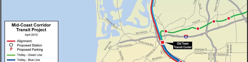
4 COASTER Station, and a double-tracked tunnel between Sorrento Valley and Rose Canyon, with an underground station at the University Towne Centre (UTC) Transit Center. High Occupancy Vehicle (HOV) Lanes Alternative TSM Alternative service and capital improvements, plus 11.6 miles of HOV lanes along Interstate 5 (I-5) between Carmel Mountain Road and Pacific Highway, direct access ramps (DARs), and a rebuilt Pacific Highway overpass for an I-5 drop ramp connection. Light Rail Transit (LRT) I-5 Alternative TSM Alternative capital improvements, plus a LRT extension between the Old Town Transit Center (OTTC) and University City. Between Old Town and Gilman Drive/I-5, the alignment would follow the railroad corridor. It would then leave the railroad right-of-way continuing north along the east side of I-5, crossing to the west side of I-5 south of Nobel Drive to the University of California, San Diego (UCSD). At Gilman Drive, the alignment would cross back to the east side of I-5, cross Regents Road at Executive Drive, and continue east on Executive Drive to Miramar Road east of Judicial Drive. The ten alternative stations included: OTTC, Tecolote Road, Clairemont Drive, Balboa Avenue, Jutland Drive, Gilman Drive (south of Gilman Drive/La Jolla Colony Drive), Nobel Drive (northeast corner of La Jolla Village Square), UCSD (northeast corner of the Veterans Administration or VA Medical Center), Genesee Avenue/Executive Drive, and Towne Centre Drive (east of Judicial Drive). LRT Genesee Alternative TSM Alternative capital improvements, plus a LRT extension between OTTC and University City. Between Old Town and Genesee Avenue, the alignment would follow the railroad corridor, veering east of I-5 north of Rose Canyon. It would leave the railroad right-of-way by turning north into a tunnel under Genesee Avenue, rising to grade and turning east at Executive Drive, terminating east of Judicial Drive. The nine alternative stations included: OTTC, Tecolote Road, Clairemont Drive, Balboa Avenue, Jutland Drive, Gilman Drive (south of Gilman Drive/La Jolla Colony Drive), UTC (southwest corner of mall), Genesee Avenue/Executive Drive, and Towne Centre Drive (east of Judicial Drive) Mid-Coast Corridor Locally Preferred Alternative Report In November 1995, the Mid-Coast Corridor Locally Preferred Alternative Report (MTDB 1995b) described the adopted LPA, which resulted from the AA/DEIS/DEIR. The adopted LPA combined the LRT I-5 Alternative with a new Nobel Drive COASTER Station, additional parking at the Sorrento Valley COASTER Station and I-5 HOV lanes between Carmel Valley Road and I-8. The LRT I-5 Alternative was selected over the LRT Genesee Alternative because it was projected to generate the highest transit ridership, provide direct service to UCSD, and connect major activity centers in the corridor. It was also projected to be cost effective, provide the best travel time savings for transit users, and result in the largest shift from autos to transit. The Nobel Drive COASTER Station was included because it was deemed, at the time, to improve COASTER service at a low cost, in a short period of time. The HOV lanes were included because they were considered to be cost effective, provide the biggest reduction in congestion, and have limited community and environmental impacts. 3-2
5 Mid-Coast Corridor Project Balboa Extension and Nobel Drive Coaster Station Final Environmental Impact Statement After the AA/DEIS/DEIR was completed, the MTDB split the LRT project into two segments based on funding constraints. The Final Environmental Impact Statement (FEIS) for the Balboa Segment, within the Metropolitan Transit System (MTS)/San Diego Northern Railway (SDNR) right-of-way from OTTC to past Balboa Avenue, was completed in 2001 (MTDB 2001). The FEIS also included the Nobel Drive COASTER Station, which would be located along the existing MTS/SDNR right-of-way just east of Genesee Avenue. The Nobel Drive COASTER Station would have vertical access to Genesee Avenue and would include parking and feeder bus service UCSD Alternatives and UTC Terminals In 1999, opportunities and implications of LRT service to UCSD garnered active interest from the community and UCSD officials. Changes in the corridor also affected the ability to build the second phase of the LPA. As a result, new analyses of the LPA, and potential alternatives in the UCSD and UTC areas, took place to address increased development adjacent to UCSD, changes on the campus, a renewed interest in directly serving the UCSD West Campus, and direct access to UTC. In particular, the sale of La Jolla Village Square significantly increased the cost to provide a station and parking onsite. UCSD was also updating its campus master plan to create a stronger campus center near the Price Center. UCSD had plans to build a landmark cable-stayed bridge across I-5 at Gilman Drive and was concerned about anticipated aesthetic conflicts between the LRT bridge and the UCSD bridge. MTDB and UCSD jointly developed 11 potential alignment alternatives for the second phase of the LPA specifically, the corridor alignment between the LPA I-5 overcrossing south of Nobel Drive and UCSD/UTC. Of the following alternatives, MTDB ultimately selected Alternative E-1 for the 2003 LPA update. Alignment A: 1995-Adopted LPA This alignment approached UCSD from La Jolla Village Square (along the west side of I-5), to the VA Medical Center. At Gilman Drive, it crossed back to the east side of I-5, continuing along internal campus roads to Regents Road, Executive Drive, and Judicial Drive. Stations included La Jolla Village Square, the VA Medical Center, and Towne Centre Drive (east of Judicial Drive). Alignment B: East Side of I-5 This alignment stayed on the east side of I-5, continuing north to Thornton Hospital, turning east to cross Regents Road along Executive Drive, and turning south at Genesee Avenue to an elevated UTC terminal. Stations included Nobel Drive (north of Nobel Drive), Thornton Hospital, and UTC. Although this alignment had the lowest capital costs, it had the lowest ridership and did not meet project goals of directly serving UCSD and increasing transit ridership. Alignments C-1 and C-2: VA Medical Center Station These alignments crossed I-5 from east to west at La Jolla Village Drive, looping around the VA Medical Center and crossing back to the east side of I-5 at Gilman Drive on or near the proposed UCSD cable-stayed bridge. Stations included Nobel Drive (east side of I-5), Gilman Drive/Villa La Jolla Drive, and Thornton Hospital. These alignments did not serve the UCSD West Campus, and UCSD had concerns about aesthetic conflicts with their bridge. 3-3
6 Alignments D-1, D-2, D-3, and D-4: Price Center Station All alignments to Price Center incorporated extensive tunneling or elevated structures due to right-of-way constraints on the campus. Stations included the UCSD West Campus and the UCSD East Campus. All alternatives were difficult and expensive to construct and had longer routings and trip times for through passengers. Alternative E-1 proved to serve the campus center as effectively. Alignments E-1, E-2, and E-3: Pepper Canyon All alignments crossed to the west side of I-5 north of Nobel Drive, continuing north past the VA Medical Center, under Gilman Drive, to a UCSD West Station in Pepper Canyon. The alternatives would continue east in a tunnel, emerging along the south side of Voigt Drive, crossing back to the east side of I-5. Option E-1 would follow Voigt Drive, Regents Road, Executive Drive, and Genesee Avenue to an elevated UTC terminal. Options E-2 and E-3 would follow Voigt Drive east of I-5 but would turn south and then east through the UCSD East Campus to connect to Executive Drive and Genesee Avenue. Although all alternatives were found to generate relatively high ridership and be relatively cost effective, Alignment E-1 (later renamed the UCSD West Alignment) was selected in the 2003 LPA update because it addressed constraints at La Jolla Village Square, more efficiently and effectively served the center of the UCSD campus, had the fewest campus and environmental impacts, best served activity centers east of I-5, and was less costly. Alignment F: Gilman Drive This alignment crossed to the west side of I-5 at Gilman Drive, continuing west on Gilman Drive to a station at Myers Drive. The alignment continued east along Gilman Drive, crossing to the east side of I-5 on a new LRT bridge. This alternative was not pursued due to concerns of UCSD about impacts to the UCSD campus, the elimination of a station near Nobel Drive (east or west of I-5), and the preference for Alternative E Mid-Coast LRT/BRT Comparison In October 2000, MTDB adopted the Transit First planning strategy, which led MTDB to ask if there were more appropriate transit options for the corridor based on a new knowledge of market segments, changing land use and employment patterns, funding potential, and implementation schedules. The Mid-Coast Strategic Transportation Study Light Rail and Bus Rapid Transit Comparative Assessment Report (URS 2003b) included a comparative analysis of the plan to extend LRT service from OTTC north to UTC and a BRT alternative that would provide equivalent service between the two points. MTDB required the BRT analysis to assume the same quality and reliability of service as the LRT alternative. It was assumed that LRT would run on the UCSD West Alignment (Alignment E-1). BRT would ingress and egress in mixed traffic at OTTC but would otherwise use dedicated bus guideway facilities following the LRT alignment. The same stations were included for both alignments. Operating conditions for both systems were also the same. Analysis of the two modes considered performance effectiveness, costs, impacts, and feasibility. MTDB concluded that the I-5 corridor justifies an exclusive transit facility providing full transit priority to address the travel and market demands along the corridor 3-4
7 between Downtown San Diego and University City. MTDB confirmed that, given the choice between a bus-based service along an exclusive busway or an extension of LRT, both at a substantial capital investment, LRT was a more appropriate option for the corridor because it would: Result in higher predicted ridership Provide better connections with the existing high-capacity transit system Integrate better with existing LRT line at Old Town for direct downtown service Accommodate projected demand with available capacity Better accommodate special events Result in similar net operating costs to BRT Have a more positive impact on traffic SANDAG used this analysis as input to the subsequent 2003 updated LPA Locally Preferred Alternative Update In December 2003, the SANDAG Board of Directors adopted an update to the LPA that replaced the 1995 LRT alignment between I-5/Gilman Drive and University City with the UCSD West Alignment (Alignment E-1). SANDAG also agreed with MTDB s conclusions regarding the comparison of LRT and BRT. The SANDAG Board determined the updated LRT LPA to be the most promising alignment for ridership, access, land use integration, biological impact, and community acceptance. The updated LPA included alignment options east of I-5 along either Regents Road/Executive Drive or Genesee Avenue. The updated LPA would serve both the west and east sides of the UCSD campus and would integrate the LRT with other existing and planned transit at the UTC Transit Center, including providing an opportunity to incorporate LRT into the planned expansion of the Westfield UTC shopping center. In addition, SANDAG recombined the two segments in anticipation of available funding from an extension of the TransNet sales tax measure. This Draft Comparative Evaluation of Alternatives Report refers to this recombination of segments, as modified in 2003 and documented in the Mid-Coast Light Rail Transit Extension LPA Update Summary (SANDAG 2004b), as the updated LPA. As shown in Figure 3-1, the updated LPA extends the existing Trolley LRT system from Old Town north to University City. The LRT extension begins at OTTC and travels within the MTS/SDNR right-of-way, which is owned by MTS, to Gilman Drive. Stations in this segment include Tecolote Road, Clairemont Drive, and Balboa Avenue. At Gilman Drive, the LPA diverges from the railroad right-of-way and continues north along the east side of I-5 to a station near University Center Lane (north of Nobel Drive). The alignment continues north to La Jolla Village Drive, where it crosses the freeway from east to west on its own elevated structure, touching down on the UCSD West Campus just south of the VA Medical Center. Traveling north, the alignment enters a short tunnel under Gilman Drive to access a below-grade UCSD West Station near Lyman Avenue. From the station, the LPA veers east in a tunnel under Voigt Drive, emerging at grade along the south side of Voigt Drive to cross to the east side of I-5. On the UCSD East Campus, the alignment continues along Voigt Drive to Campus Point Drive, either 3-5


8 Figure 3-1. Adopted Locally Preferred Alternative 3-6
9 remaining at grade or becoming elevated. Potential station options are located on Voigt Drive near Scripps Memorial Hospital and the Preuss School or at Campus Point Drive. The elevated option transitions to Genesee Avenue, continuing south to elevated stations at Executive Drive and UTC. From Voigt Drive, the at-grade option turns south on Regents Road, east on Executive Drive (where it becomes elevated), and south on Genesee Avenue to the UTC Transit Center Station terminus Planning Context While the background studies identify specific transit alignment and service alternatives previously evaluated for the Mid-Coast Corridor, several regional policies, strategies, and plans provide the context in which transit projects are planned in the region. Together, the background studies and regional plans/policies provide input for identifying the initial set of alternatives and the context for screening the alternatives. Regional plans and policies that affect planning for the Mid-Coast Corridor Transit Project are discussed below Mid-Coast Strategic Transportation Study Action Plan To define the Transit First planning strategy in the Mid-Coast Corridor, the Mid-Coast Strategic Transportation Study Action Plan (URS 2003a) identified a series of implementation actions, or transit improvements, for the corridor. A goal of the plan was to develop a transit service network that would complement and support near- and longer-term transit improvements, including enhanced BRT/LRT services along partially or fully dedicated transit guideways. The plan adopted a multi-tiered approach to transit service in the corridor, allowing for a range of transit speeds and levels of accessibility. The four tiers of service included: High-speed regional services on major corridors with infrequent stops (every 4 to 5 miles) catering to long distance trips (10 to 50 miles) Moderate- to high-speed services with stops every 1 to 2 miles serving moderatedistance trips (generally 5 to 15 miles) Slower-speed local services focused on short-distance urban trip-making and access with stops averaging every 0.25 to 0.50 miles Community circulators providing local access and distribution from other services While the Mid-Coast Strategic Transportation Study Action Plan identified BRT/LRT as the preferred mode to address the longer-term transit needs of the Mid-Coast Corridor, it also identified several regional routes that could be enhanced to further support the corridor, including: I-805 between South Bay and both the Golden Triangle and Sorrento Mesa areas Arterial corridors into the UCSD and Golden Triangle areas through Mission Beach/Pacific Beach/La Jolla and along Genesee Avenue and Miramar Road The COASTER commuter rail In addition to regional routes, the plan also identified community circulator services within the UCSD, Golden Triangle, and Sorrento Mesa areas that would provide local circulation, 3-7
10 access, and distribution to and from these regional areas. Although not specifically funded in the 2030 San Diego Regional Transportation Plan: Pathways for the Future (RTP) (SANDAG 2007), elements of the plan, including the Mid-Coast LRT, the SuperLoop, and BRT service from Escondido and Otay Mesa along the I-15/Mira Mesa and I-15/State Route 52 (SR 52)/Interstate 805 (I-805) corridors, respectively, are included in the RTP Revenue Constrained Scenario. Using Mid-Coast Corridor arterial streets, rapid bus elements are also included in the RTP Reasonably Expected Revenue Scenario. By evaluating a range of regional transit plans within the Mid-Coast Corridor, the plan helped MTDB and SANDAG reaffirm an LRT LPA for the project Independent Transit Planning Review The 2004 passage of the TransNet sales tax extension included a commitment to conduct an Independent Transit Planning Review (ITPR) of the proposed transit system in the RTP. An external, expert panel provided guidance to SANDAG on the coordination of smart growth initiatives and transit elements of the RTP. Among other issues, the panel members commented on plans for the Mid-Coast Corridor and supported reinvestigation of alternatives. It is important to note that the Independent Transit Planning Review Services Report (SANDAG 2006) did not analyze any specific alignments in the Mid-Coast Corridor or provide any alignment or mode recommendations. However, it did introduce multiple alternative concepts for further study depending on travel market and demand analysis in the corridor, including express bus, enhanced COASTER services (such as a COASTER shuttle), and an automated people mover Regional Transportation Plan SANDAG adopted the RTP in 2003 and updated it in November The 2007 RTP serves as a blueprint for the San Diego region to address mobility challenges created by regional growth. The plan contains an integrated set of public policies, strategies, and investments to maintain, manage, and improve the regional transportation system through the year The plan also includes the definition of specific projects and services for highways, transit, and major arterials. The transit component calls for a network of fast, flexible, reliable, safe, and convenient transit services to connect residents to regional employment and activity centers. The RTP emphasizes the integration of transit and land use to improve mobility and accommodate growth. The conclusions of the Independent Transit Planning Review Services Report were considered in the preparation of the RTP. SANDAG developed three funding scenarios in the RTP: The Revenue Constrained Scenario, which is based on current sources of federal, state, and local transportation revenue projected through 2030 The Reasonably Expected Revenue Scenario, which includes all sources in the Revenue Constrained Scenario plus additional sources that may be reasonably expected to become available The Unconstrained Scenario, which identifies the level of investment required to meet projected travel demand without the consideration of funding constraints 3-8
11 Federal planning regulations generally require using the Revenue Constrained Scenario to conduct alternatives analyses. In, and adjacent to, the Mid-Coast Corridor, the RTP Revenue Constrained Scenario includes the following transit projects: Mid-Coast Corridor LRT Project COASTER commuter rail double tracking and other improvements BRT from South Bay to Sorrento Mesa along I-805, I-15, and SR 52 Arterial rapid bus (the SuperLoop) within the UCSD/Golden Triangle area Arterial rapid bus from the north I-15 corridor into Sorrento Mesa and University City Excluding the Mid-Coast Corridor LRT Project, the Revenue Constrained Scenario becomes the basis for the No-Build Alternative in the Mid-Coast Corridor. The Reasonably Expected Revenue Scenario adds arterial rapid bus projects between downtown and University City through Mission Beach/Pacific Beach/La Jolla, through Uptown, and along Genesee Avenue. It also includes a COASTER tunnel under Genesee Avenue. Excluding the COASTER tunnel project, the Reasonably Expected Scenario is the basis for the TSM Alternative Regional Comprehensive Plan The Regional Comprehensive Plan (RCP) (SANDAG 2004a) is SANDAG s strategic framework for growth in the San Diego region. The RCP calls for increased coordination between land use, development, and transportation infrastructure. To implement this goal, the SANDAG Smart Growth Concept Map was developed to identify areas that could efficiently support smart growth and public transit. The map helps SANDAG prioritize investments, by identifying a hierarchy of existing/planned and potential smart growth centers to be served, or that could be served, by high-frequency transit. The Mid-Coast Corridor includes five of the seven designated smart growth opportunity areas, including an urban center, town centers, community centers, mixed-use transit corridors, and a special-use center TransNet Local Transportation Sales Tax Measure In 1987, San Diego County voters passed Proposition A, a local one-half-cent sales tax for transportation projects in the county. This ballot measure, called TransNet, collected revenues for 20 years and divided them evenly among highways, transit, and local streets. TransNet specifically identified projects to be funded through the local sales tax, including several extensions to the Trolley LRT system, including an extension in the Mid-Coast Corridor. As the 20-year sunset approached, the Mid-Coast Corridor LRT Project was the only transit project specified in the 1987 TransNet measure that had not been completed. In 2004, voters extended TransNet another 40 years and again included a LRT extension in the Mid-Coast Corridor as part of the measure. The ballot language stated that BRT could be implemented if federal funding could not be secured for LRT. SANDAG identified the completion of a major transit investment in the Mid-Coast Corridor as its highest priority transit project and included the project in its TransNet Early Action Plan. 3-9
12 3.1.3 Changed Conditions In a March 15, 2006 letter, SANDAG requested concurrence from the Federal Transit Administration (FTA) of its intent to proceed with the federal environmental review of the 2003 updated LPA. SANDAG outlined an approach specifying that a BRT alternative would be evaluated in the Draft Supplemental Environmental Impact Statement (SEIS) and that the LRT LPA would consider alignment and station variations in response to changed conditions since the 1995 LPA and 2003 update. In a July 24, 2006 letter, the FTA responded to SANDAG that it concurred with the approach. The California Environmental Quality Act (CEQA) also requires that a Subsequent Environmental Impact Report (SEIR) consider changed conditions and new information. Since the 1995 AA/DEIS/DEIR, 2001 FEIS, and 2003 updated LPA, significant changes have occurred in the Mid-Coast Corridor, including the following: Changes in Existing and Planned Land Use Bay View Plaza Redevelopment Project (Morena Boulevard and Clairemont Drive) In May 2008, the San Diego City Council approved a proposal to redevelop the plaza. Although it does not conflict with the LPA alignment, the property could be used to support parking for a proposed adjacent station. La Jolla Village Square The 1995 LPA included a transit center at La Jolla Village Square. After La Jolla Village Square expanded, creating land constraints and increasing right-of-way costs, the updated LPA relocated the station north of Nobel Drive on the opposite side of I-5 (the east side). Subsequent plans to expand I-5 now place constraints on the east side. Further review of development proposals will be necessary to assess the feasibility of the LPA in this area. UCSD In 2004, UCSD completed the Long-Range Development Plan (LRDP) (UCSD 2004a) where it identified the university s commitment to encouraging the use of mass transit to serve the campus. In support of mass transit development, the LRDP noted that the campus shuttle will be deployed. Westfield UTC In July 2008, the San Diego City Council approved expansion plans for Westfield UTC. A proposed pedestrian bridge over Genesee Avenue could conflict with the LPA elevated alignment along Genesee Avenue. Ongoing planning and coordination with the city will need to be considered. Changes in Existing and Planned Transit Service and Facilities Coastal Rail Tunnels The 2003 and 2007 versions of the 2030 RTP Reasonably Expected Revenue Scenario include a rail tunnel under Genesee Avenue. As the tunnel, which would route the COASTER under UTC, is not included in the Revenue Constrained Scenario, the COASTER may offer a new transit option in the area, which LRT tunnel design would have to consider. SuperLoop The SuperLoop is a two-way circulator and distributor transit system serving the University City area. LRT LPA alignment and station designs should reassess connections between modes and the value of the SuperLoop distributor function to facilitate transfers and expand the service area. Trolley Blue and Orange Line Improvements Vehicle and station upgrades to allow low-floor vehicle operations were included in the 2004 TransNet Extension 3-10
13 Ordinance and 2030 RTP Revenue Constrained Scenario. Low-floor vehicles were not introduced to the LRT system until the 2005 Mission Valley East extension. These improvements should be evaluated to assess any physical and operational design implication for the LPA. Increased Trolley Blue, Orange, and Green Line and COASTER Services The 2030 RTP Revenue Constrained Scenario includes increased service frequencies for all fixed-route transit, which could lead to infrastructure and facility capacity constraints. The operation of the LPA could be affected. Mission Valley East Corridor Although this corridor was included in previous No-Build evaluations, its completion in 2005 leads to information about actual ridership impacts and potential changes to the travel model, which could influence anticipated travel in the Mid-Coast Corridor. ITPR The review suggested a broad review of the Mid-Coast Corridor to include the consideration of BRT busways, BRT on I-5 shoulders, BRT in I-5 HOV lanes, COASTER service opportunities, and an I-805 alignment, as well as an I-5 alignment, for LRT. Although TransNet specifies that priority be given to LRT if federal funding can be secured, consideration was given to options identified by the ITPR. Nobel Drive COASTER Station The 1995 LPA included a new COASTER station along the existing COASTER rail corridor in University City. In October 2003, SANDAG completed a study that evaluated adding the Nobel Drive COASTER Station. The station has not advanced due to cost constraints and potential operating impacts to COASTER services. Changes in Existing and Planned Highways I-5 HOV Lanes From I-805 to I-8, with funding identified in the 2030 RTP Revenue Constrained Scenario. The I-5 North Coast HOV Lane Project identifies DARs at Voigt Drive, which would constrain the LPA alignment. I-5, J Street to Sea World Drive Funding for planned access improvements identified in the 2030 RTP Revenue Constrained Scenario, which may impact the LPA alignment. I-5/I-8 Connector On I-5, from the I-5/I-8 separator to Morena Boulevard, proposed construction of auxiliary lanes and widening of connectors. Widening of the freeway could affect the LPA alignment. Changes in Existing and Planned Arterial Streets Genesee Avenue, I-5 to Campus Point Drive Planned widening from four to six lanes. Regents Road, Executive Drive to Genesee Avenue Planned widening to four-lane major street and relocation of Regents Road/Genesee Avenue intersection. Regents Road Planned construction of two separate, parallel two-lane bridge structures across Rose Canyon connecting the existing ends of Regents Road. Executive Drive, Regents Road to Genesee Avenue Completed widening to fourlane collector. Executive Drive, Genesee Avenue to Executive Way Completed widening to four lanes and alignment of Executive Drive to intersect with Towne Centre Drive. 3-11
14 I-5/Nobel Drive Completed widening of Nobel Drive over-crossing to four throughlanes, dual left-turn lanes, bike lanes, and sidewalks; a half diamond interchange with ramps to and from the south at Nobel Drive and I-5; and signals. Genesee Avenue Planned widening of I-5/Genesee Avenue overcrossing to five lanes plus dual turn lanes with 26-foot median; replacement of I-5/Genesee Avenue and I-5/Voigt Drive overcrossings; modification of ramps and auxiliary lanes; and I-5 corridor improvements. La Jolla Colony Drive, I-5 to Palmilla Drive/Charmant Drive Completed construction of a four-lane collector. La Jolla Village Drive and Regents Road Planned addition of a right-turn lane. I-5/La Jolla Village Drive Completed widening of overcrossing to seven throughlanes, two auxiliary lanes and sidewalk; widened off-ramps to three lanes; street improvements to ease transitions. La Jolla Village Drive Completed widening to six or eight lanes, widened bridge, turn lanes, drainage improvements from Torrey Pines Road to I-805. Genesee Avenue/Eastgate Mall Planned median closure, new double left-turn lanes on Eastgate Mall, and signal upgrades. Nobel Drive, Lebon Drive to Regents Road and Genesee Avenue to Towne Centre Drive Planned improvement to six-lane major street/primary arterial and turn lanes. Balboa Avenue, Clairemont Drive to 1-5 Planned widening from four to a six-lane major street. Knoxville Street Planned extension to West Morena Boulevard. Changes to Existing and Planned Bicycle/Pedestrian Facilities Class I Bike Trail North of Rose Canyon The bike trail was extended from Rose Creek to the westerly end of Pacific Beach in This extension could affect the LPA alignment. Genesee Avenue Pedestrian Overcrossing A new pedestrian bridge over Genesee Avenue planned on the southwest corner of Genesee Avenue and La Jolla Village Drive. This bridge may conflict with the LPA alignment. 3.2 Identification of Initial Alternatives Based on previous studies and the analysis of changed conditions in the Mid-Coast Corridor, as described above, an initial set of alternatives has been developed for consideration. The initial set of alternatives includes LRT, commuter rail, BRT, and rapid bus transit mode options, as well as a variety of alignment, termini, and station location alternatives. These modes and alignment alternatives will be screened and analyzed to identify the alternatives that best address the changed conditions and meet the project purpose and need Transit Modal Alternatives A brief description of LRT, commuter rail, BRT, and rapid bus transit modes considered in the initial set of alternatives for the Mid-Coast Corridor Transit Project is provided below. 3-12

15 Light Rail Transit LRT is the mode proposed under the adopted LPA for the Mid-Coast Corridor. The type of LRT proposed would be the same as operated by the existing Trolley light rail system. Figure 3-2. Light Rail Transit Vehicle LRT operates on fixed rails, generally within a dedicated right-of-way, although it can operate within city streets in exclusive lanes. LRT operates at grade, on elevated structures, and in tunnels. At-grade intersection crossings are controlled by either the deployment of gates providing first priority to LRT (typical on exclusive right-of-way sections) or via traffic signals (typical on in-street operations). As shown in Figure 3-2, light rail vehicles are electrically propelled via overhead lines powered by substations along the route. Newer light rail vehicles offer low-floors, lowplatform boarding for easy passenger access and generally carry 64 seated passengers and up to 163 passengers with standees. Vehicles can be linked together in up to fourcar trains to accommodate high-volume passenger demand. LRT operates at moderate speeds of up to 55 miles per hour and can accommodate grades of up to 6 percent and moderate to tight turning radii. LRT best serves short distance trips with passenger access provided at stations generally spaced 1 to 2 miles apart (station spacing is much closer in dense urban areas, such as Downtown San Diego). Station facilities range from simple on-street platforms (of up to 400 feet long) to more elaborate stations and transit Figure 3-3. Commuter Rail Transit Vehicle centers with connecting bus facilities and park-and-ride lots Commuter Rail Transit The commuter rail mode would be similar to the existing COASTER commuter rail facilities and service in the Mid-Coast Corridor. The COASTER, shown in Figure 3-3, operates diesel propelled locomotives on the MTS/SDNR right-of-way shared with intercity and freight trains. Trains generally consist of up to five doubledeck passenger cars that carry 135 seated passengers in each car. The COASTER operates at moderate to high speeds (traveling its 41-mile route in under one hour), primarily serving mid- to long-distance trips. Passenger access is provided at stations located approximately 4 to 5 miles apart, on average. Most stations provide parking and include 3-13

16 facilities for feeder bus access. Shelters, benches, and ticket vending machines for prepaid fare payment are also included. COASTER service generally operates at grade with bridges spanning canyons, lagoons, and undercrossings. The ability to accommodate steep grades and tight curves is limited. COASTER service currently provides 30- to 45-minute peak period service Bus Rapid Transit BRT is rubber-tired, bus-based transit intended to emulate rail transit through dedicated transit guideways and other transit priority treatments. Dedicated BRT right-of-way can be provided through dedicated arterial street lanes, exclusive bus guideways, or freeway HOV or Managed Lanes. BRT vehicles, similar to the one shown in Figure 3-4, can also operate in general traffic. Where BRT operates in dedicated lanes, the lanes are next to the curb and right-turning vehicles are usually allowed. Figure 3-4. Bus Rapid Transit Vehicle Like LRT, BRT facilities can be at grade, elevated, or below grade. Unlike LRT, at-grade intersection crossings are not controlled by gates (first priority), but transit priority can be provided at signalized street intersections. BRT vehicles are generally diesel or natural gas powered with low floors for easy passenger access. BRT vehicles generally carry 45 to 65 seated passengers and up to 100 passengers with standees. BRT operates at moderate speeds up to 55 to 65 miles per hour and can accommodate steeper grades and tighter turning radii than LRT. BRT best accommodates mid- to long-distance trips with passenger access provided at stations generally spaced 1 to 5 miles apart (station spacing can be much closer in dense urban areas, such as Downtown San Diego). Stations range from enhanced shelters to large transit centers, some with park-and-ride lots, and are generally at grade but could be grade separated. Stations can be integrated into adjacent land uses, placed in freeway medians, or located adjacent to freeways, connected to HOV lanes or transit guideways via DARs. BRT service frequency can vary greatly but can be as often as every few minutes to accommodate passenger demand. BRT has the flexibility to travel off the exclusive transitway or dedicated lanes to provide local collector/distributor service (in lieu of feeder bus service to stations). Because of the range in types of BRT, SANDAG developed several BRT alternatives with varying degrees of capital investments and transit priority treatments for evaluation in the Mid-Coast Corridor Rapid Bus Rapid bus is a scaled-down version of BRT in which limited transit priority along arterial streets is provided for bus-based transit service to improve travel times and reliability. Rapid bus could use standard or BRT vehicles as shown in Figure 3-5. Rapid bus could 3-14
17 be operated under the TSM Alternative, since it would likely have less than the 50-percent dedicated guideway required for New Starts funding. Figure 3-5. Rapid Bus Vehicle Rapid bus includes some or all of the following features: Frequent service Bus signal priority at intersections Queue jump lanes at intersections Less frequent stops than local bus service Low-floor vehicles to provide level boarding and easy passenger access Higher-capacity vehicles to accommodate passenger demand Service branding of vehicles and stations Simple curbside stations with passenger amenities, such as shelters, benches, and next vehicle arrival displays Prepaid fare system Limited sections of dedicated transit lanes Transit Alignment Alternatives The alternatives considered in the initial screening follow a variety of alignments along major arterials, I-5, the railroad right-of-way, and routings independent of any existing transportation facility. They also ranged in profile from at-grade to grade-separated alignment configurations, including both elevated and tunnel or below-grade alignments in open cuts or cut-and-cover configurations. The initial set of alternatives includes alignments that: Are variations to the LPA intended to respond to changed conditions Were considered in previous Mid-Coast Corridor studies and not pursued but may now be appropriate to consider under changed conditions Reflect transit projects or services in SANDAG s 2007 RTP that may address both changed conditions and the Mid-Coast Corridor Transit Project purpose and need Are new alignments for consideration available given the changed conditions The Mid-Coast Corridor is defined as extending from Downtown San Diego in the south to University City in the north. Logical northern project termini would be UCSD or UTC in University City, both of which provide anchors of activity and connections to regional transit. Downtown San Diego and OTTC are both logical southern termini for physical or service improvements since both termini offer seamless integration with the regional rail transit network and connections to a large part of the regional bus transit system. 3-15
18 The corridor between Downtown San Diego and University City has been divided into three segments that allow for consideration of all potential alignments. The three segments are shown in Figure 3-6 and defined below: South segment extending from Downtown San Diego to I-8 in Mission Valley (OTTC) Middle segment extending from I-8 in Mission Valley (OTTC) to SR 52 North segment extending SR 52 to University City (UCSD/UTC) 3.3 Screening of Initial Alternatives This section describes the screening results of initial alignment segment alternatives, including the alignment segments selected to carry forward and those considered and eliminated. The alternatives were screened by mode (i.e., LRT, commuter rail, and BRT) using the criteria described in Chapter 2, Screening and Selection Process, of this report Screening of LRT Alternatives The LRT alternatives under consideration include the adopted LPA and the alternatives to the LPA that have been identified based on the results of the evaluation of changed conditions in the Mid-Coast Corridor since the 1995 adoption of the LPA and the SANDAG 2003 LPA update. The alternatives include variations to the LPA alignment and changes in station locations LRT Alternatives Considered and Carried Forward This section discusses the LRT alignment segment alternatives selected to carry forward to conceptual corridor definition in each of the three segments of the Mid-Coast Corridor from Downtown San Diego to University City. South Segment from Downtown to Old Town Transit Center LRT S-1 Alignment Within the south segment from Downtown San Diego to OTTC, the only LRT alignment segment alternative under consideration is LRT S-1, which would use the existing MTS LRT trackway within the MTS/SDNR right-of-way. Figure 3-7 shows the LRT alignment alternative in this segment. The LPA would operate via the existing double-track alignment from the Santa Fe Depot north to OTTC with stops at the County Center/Little Italy, Middletown, Washington Street, and OTTC. No major improvements would be required along the alignment. Any improvements needed would be limited to special trackway, such as pocket tracks, crossovers, signaling, communications equipment, and station platforms. Middle Segment from Old Town to SR 52 LRT M-1 Alignment As with the south segment, only one LRT alignment alternative was identified for consideration in the middle segment (Figure 3-7). This alignment alternative would be located next to the existing SDNR tracks, predominately within the existing MTS/SDNR right-of-way. 3-16


19 Figure 3-6. Mid-Coast Corridor Segments 3-17


20 Figure 3-7. LRT Alignment Alternatives S-1 and M-I in South and Middle Segments 3-18


21 The LRT M-1 Alignment would proceed north from OTTC along the existing Trolley Green Line tracks and then diverge on a new double-track alignment and cross under I-8 and over the San Diego River on a new bridge. After crossing the river, the alignment would continue north at grade, generally within the MTS/SDNR right-of-way to SR 52. The location of the LRT alignment within the MTS/SDNR right-of-way would not preclude future double tracking of the existing SDNR track. It is assumed that the double tracking will occur to the west of the existing SDNR track. The proposed LRT tracks would be located along the east side of the existing SDNR track. After crossing over the San Diego River and Friars Road, the LRT M-1 alignment would continue north parallel to the east side of the SDNR track and under Tecolote Road, under Clairemont Drive, and over Balboa Avenue on a new bridge. After the alignment passes Jutland Drive, it would cross Rose Creek on a new bridge and then rise over the existing tracks near the end of Santa Fe Street to run on the west side of the railroad. As it continues north, the alignment would cross under SR 52. Potential stations include Tecolote Road, Ashton Street, Clairemont Drive, and Balboa Avenue. Potential impacts to wetlands could occur as a result of the new bridge crossings over the San Diego River, Tecolote Creek, and Rose Creek. Construction of two Figure 3-8. Elvira Curve South of SR 52 LRT tracks and double tracking of a portion of the SDNR track south of Elvira control point, located at SR 52, would also have the potential to impact wetlands. Presently, there is a single SDNR track between Balboa Avenue and SR 52. The partial double tracking of the SDNR track is required in order to move the existing Elvira control point further south, where maintenance access to the SDNR track can be obtained without having to cross the LRT tracks. Permits for the bridge crossings would be required from the US Army Corps of Engineers (USACE). In addition to the new bridges and partial double tracking, future improvements to the SDNR track geometry at Elvira Curve, located south of SR 52, and double tracking of the SDNR facility in this segment, from Balboa Avenue to the new control point, as identified in the RTP, would have to be accommodated. Figure 3-8 shows the Elvira Curve south of SR 52. The existing right-of-way is 100 feet and could accommodate the doubletracking of the SDNR track as well as 3-19
22 two LRT tracks. This arrangement would maintain the current SDNR operating speeds and would have minor right-of-way impacts. Geometric improvements to the existing curves at Elvira in order to increase the operation speed would require additional rightof-way acquisitions and is not part of this alternative. North Segment from SR 52 to University City After crossing under SR 52, seven alignments were identified to be carried forward to conceptual definition. These included variations of both the LPA alignments (Genesee Avenue and Regents Road) together with the SDNR/Genesee Avenue tunnel alignment. LRT N-1 Alignment This alignment alternative is a variation of the Genesee LPA alignment. As shown in Figure 3-9, the LRT N-1 Alignment would continue north parallel to the SDNR track within the MTS/SDNR right-of-way to Gilman Drive. At this point, the at-grade alignment would leave the MTS/SDNR right-of-way, crossing under Gilman Drive, and follow I-5 north. South of Nobel Drive, the alignment would ascend to aerial structure and cross to the west side of I-5, south of La Jolla Village Square. The aerial structure would continue along the west side of I-5 and into the shopping center property. An aerial station would be located in the existing parking lot at La Jolla Village Square, with opportunities for a joint-use parking structure. The aerial structure would continue north across Nobel Drive and La Jolla Village Drive and descend to grade along the east side of the VA Medical Center. It would then travel in a northwesterly direction, cross under Gilman Drive, and arrive at Pepper Canyon, where the UCSD West Station would be located. North of the station, the alignment would enter a short cut-and-cover tunnel, turn east, and ascend to grade along the center of Voigt Drive. It would cross the Gilman Drive/Voigt Drive intersection at grade, continuing along Voigt Drive overcrossing towards the UCSD East Campus. The UCSD East Station would be located in the median of Voigt Drive, just west of Campus Point Drive. It should be noted that the I-5 North Coast Project is proposing to realign Voigt Drive to connect directly with Genesee Avenue, widen Voigt Drive to four lanes plus turn lanes, lower the profile of Voigt Drive across I-5, construct DARs from the I-5 HOV lanes to the Voigt Drive overcrossing, and realign Campus Point Drive to connect to the realigned Voigt Drive. East of the UCSD East Station, the at-grade alignment would follow the median of Voigt Drive, cross the Voigt Drive/Campus Point Drive intersection, and enter the median of Genesee Avenue. Once in the median of Genesee Avenue, the alignment would ascend to aerial structure just west of the Genesee Avenue/Regents Road intersection. The aerial alignment would proceed south to a terminal station south of Esplanade Court, adjacent to the planned transit center being developed as part of the Westfield UTC shopping center expansion. A potential additional station could be located near the Genesee Avenue/Executive Drive intersection prior to reaching the terminal station. At the intersection with the north and south facing DARs on Voigt Drive and along Gilman Drive, Campus Point Drive, and Genesee Avenue, the LRT at-grade crossings would be controlled by traffic signals. Two existing pedestrian bridges on Genesee Avenue may be in conflict with the proposed LRT structure. One is located south and the other north of La Jolla Village Drive. These pedestrian crossings may have to be relocated and reconfigured to provide access to the proposed station locations. 3-20

23 Figure 3-9. LRT Alignment Alternatives N-1 through N-4 in North Segment LRT N-2 Alignment This alignment alternative is intended to lower the cost of the project by reducing the length of the aerial structure along Genesee Avenue. This alignment would follow the LRT N-1 Alignment to the center of Voigt Drive just east of I-5 (Figure 3-9). At this point, the alignment would enter a tunnel segment and cross the eastbound lanes of Voigt Drive, traveling in a trench along the south side of Voigt Drive. At driveways and at Campus Point Drive, the trench design would become a cut-and-cover section. The alignment would ascend to grade east of Campus Point Drive, where the UCSD East Station would be located. Most of the grade crossings noted above for the LRT N-1 Alignment would be avoided under this alignment. From the UCSD East Campus parking lot, the alignment would proceed south in the median of Regents Road. Railroad crossing protection would be required where the alignment crosses to and from the median of Regents Road. The alignment would then turn east on Executive Drive and ascend to aerial structure just west of Genesee Avenue, turning south on Genesee Avenue and continuing in an above-grade configuration to UTC. LRT N-3 Alignment This alignment alternative would begin at the Elvira Curve, south of SR 52, and follow the MTS/SDNR right-of-way east to Genesee Avenue (Figure 3-9). At this point, the alignment would exit the MTS/SDNR right-of-way and turn north, entering a tunnel portal at the southwest quadrant of the Genesee Avenue/Decoro Street intersection. The alignment would continue in a tunnel generally under Genesee Avenue north to an underground station at UTC and then to Executive Drive. Turning west on Executive Drive, the alignment would ascend to grade just west of Regents Road and would proceed along Medical Center Drive and the edge of Miramar Canyon to a station on the UCSD East Campus near Thornton Hospital. From there, the alignment would continue across I-5 to a terminal station on the UCSD West Campus at Pepper Canyon. 3-21
24 Between SR 52 and Genesee Avenue, the existing railroad right-of-way width ranges from 65 to 125 feet. The LRT tracks would be separated from the SDNR tracks by 25 feet from center line to center line. Some additional right-of-way acquisition from private open space and the Rose Canyon Open Space Park to the north of the MTS/SDNR right-of-way would be required. It is estimated that approximately 5 acres of additional right-of-way would be required to accommodate the LRT double-track alignment. The alignment considers the planned Coastal Rail Trail bike path to be located north of the proposed LRT tracks. LRT N-4 Alignment This alignment alternative would avoid the at-grade crossings along Voigt Drive at the Voigt Drive DAR, Gilman Drive, Campus Point Drive, and Genesee Avenue. It would follow the LRT N-1 Alignment to the UCSD West Station (Figure 3-9). From there, it would enter a short tunnel and exit along the south side of Voigt Drive, turn east and ascend to aerial structure west of the intersection of Voigt Drive with Gilman Drive. It would continue in an aerial configuration along the south side of Voigt Drive. Immediately east of the freeway, access to an existing surface parking lot would have to be maintained. East of this parking facility would be a proposed aerial station near Scripps Memorial Hospital. The aerial structure would continue through the existing surface parking lot east of Campus Point Drive to Genesee Avenue. It would then cross the southbound lanes of Genesee Avenue and into the median of Genesee Avenue, following the LRT N-1 Alignment to UTC. Although this alternative is more costly than the LRT N-1 Alignment and would require an additional 3,000 feet of aerial guideway, it would avoid some of the constraints of the LRT N-1 Alignment. The aerial alignment on Voigt Drive would minimize potential impacts to access points along Voigt Drive. It would also avoid an at-grade crossing of Campus Point Drive, eliminating the need for crossing gates and concerns with emergency vehicular access to the hospital. LRT N-5 Alignment As an alternative to a location in the median of, or adjacent to, Voigt Drive, the LRT N-5 Alignment would cross I-5 on a separate bridge south of both Voigt Drive and the existing UCSD ball fields on the east and west sides of I-5 (Figure 3-10). This alignment alternative would follow the LRT N-1 Alignment to the UCSD West Station. Immediately north of the UCSD West Station, this alignment would enter a cutand-cover tunnel to turn east, travel at grade along the south side of the UCSD ball fields, and then ascend to aerial structure and cross over Gilman Drive and I-5. On the east side of I-5, the at-grade alignment would follow the south side of the existing UCSD ball fields and then descend to a cut-and-cover section in order to cross both the planned UCSD soccer fields, located west of Campus Point Drive, and Campus Point Drive. An at-grade station would be located east of Campus Point Drive, after which the alignment would ascend to an aerial structure, crossing the southbound lanes of Genesee Avenue and following the median of Genesee Avenue to UTC, similar to the LRT N-1 Alignment. 3-22
25 Figure LRT Alignment Alternatives N-5 through N-7 in North Segment This alignment would require limited lengths of 6 percent grades and extensive cut-andcover tunnels. Although the potential property access impacts to Voigt Drive would be avoided, there would be the additional cost of the cut-and-cover tunnel under the planned soccer fields. Because of the aerial structures, this alternative would have the same potential visual impact along Genesee Avenue as the LRT N-1 Alignment. LRT N-6 Alignment Similar to the LRT N-5 Alignment, this alignment alternative avoids potential impacts to Voigt Drive but also eliminates the cut-and-cover sections under the planned UCSD soccer fields (Figure 3-10). Like the LRT N-3 Alignment, this alignment also would have a UCSD East Station located south of Thornton Hospital instead of on Voigt Drive. The alignment would follow the LRT N-1 Alignment to the UCSD West Station. Like the LRT N-5 Alignment, this alignment would turn east immediately north of the UCSD West Station. The alignment would ascend to aerial structure and cross over Gilman Drive and I-5 to south of the existing UCSD ball field, located on the west side of I-5. When crossing I-5, the alignment would curve to the south and travel in a southerly direction along the east side of I-5. Tall retaining walls would be required along the east side of I-5 for the alignment to stay within the California Department of Transportation (Caltrans) right-of-way. Descending to grade, the alignment would then turn east along the north side of Miramar Canyon. It would follow the alignment of Medical Center Drive to Regents Road. Prior to reaching Regents Road, the alignment would transition to aerial, crossing Regents Road into Executive Drive, and following the median of Executive Drive to Genesee Avenue. From there, the alignment would follow the LRT N-1 Alignment to a terminal station at UTC. The UCSD East Station would be located near Thornton Hospital. A potential aerial station could be located on Genesee Avenue near Executive Drive. 3-23
26 Although the potential impact to Voigt Drive would be avoided, the circuitous route of the alignment would result in a low operating speed through the west and east campuses of UCSD. In addition, tall retaining walls would be required along I-5 and Miramar Canyon. An at-grade crossing of a parking lot driveway would also be required. The columns of the viaduct along Executive Drive may prohibit left-turn movements in and out of the driveways because of limited sight distance. LRT N-7 Alignment From SR 52, this alignment alternative would follow the MTS/SDNR right-of-way to Gilman Drive. It would then exit the MTS/SDNR right-of-way and follow the east side of the I-5 corridor. South of Nobel Drive, the alignment would transition to tunnel and then ascend to an at-grade station located immediately north of Nobel Drive, east of I-5 and west of University Center Lane (the Nobel Drive Station at University Center Lane). North of the station, the alignment would ascend to aerial structure, crossing over La Jolla Village Drive and continuing through Miramar Canyon and proceeding east to the UCSD East Station, located near Thornton Hospital (Figure 3-10). East of the UCSD East Station, the alignment would follow the LRT N-6 Alignment, heading toward UTC. Although the alternative would avoid crossing I-5 twice, it would require an extensive cutand-cover tunnel near the San Diego California Temple. Additionally, as the Nobel Drive Station at University Center Lane would be located below street grade, elevators, ramps, and stairs would be required to access the station and station visibility would have to meet all safety requirements. This alternative does not provide a station on the UCSD West Campus and, as a result, may not effectively serve UCSD as well as the other alternatives under consideration. To attract additional ridership, the extension of Gilman Drive across I-5 to Medical Center Drive was considered. This improvement to internal circulation within UCSD would provide improved circulation for UCSD shuttle buses accessing a transit station at Thornton Hospital LRT Alternatives Considered and Eliminated from Consideration The initial screening of alternatives resulted in the elimination of some alignment segments and alignment configurations. The LRT alignment alternatives considered and eliminated are described in this section along with reasons for their elimination. South Segment from Downtown San Diego to Old Town Transit Center Use of an alternative route for an LRT connection from Downtown San Diego to OTTC was not considered necessary or practical because of increased impacts, duplication of facilities, and cost effectiveness. Middle Segment from Old Town Transit Center to SR 52 Within the middle segment from the OTTC to SR 52, three other LRT alignments were considered. Two are variations of the LRT M-1 Alignment and the other uses the existing Trolley Green Line bridge across San Diego River. LRT M-1a Alignment This alignment alternative follows the same route as the LRT M-1 Alignment (Figure 3-7). Under this alternative, the existing SDNR bridge across San Diego River 3-24
27 and Friars Road would be demolished and a new bridge for both the LRT and SDNR tracks would be constructed. The proposed SDNR track would be shifted by approximately 9 feet from the westerly boundary of the MTS/SDNR right-of-way. Assuming that a retaining wall and/or fencing would be required for the right-of-way, the minimum clearance would be less than North County Transit District (NCTD) standards and less than required for proper inspection of tracks or railroad cars. Depending on the exact clearance to the fence or the wall, the clearance may not meet the minimum California Public Utilities Commission (CPUC) requirements. Hence, this alternative may require additional right-of-way along the west side, where existing buildings at zero set back currently exist. Although the overall cost of this alternative would be similar to that of the LRT M-1 Alignment, it does not address some of the concerns identified for that alternative. In particular, this alternative does not address concerns related to potential wetland impacts at San Diego River. LRT M-1b Alignment The LRT M-1b Alignment follows the same route as the LRT M-1 Alignment (Figure 3-7) but would extend the bridge over San Diego River and Friars Road further north, descending to grade prior to reaching the Tecolote Road Station. Compared to the LRT M-1 Alignment, this alignment would have a significantly higher capital cost. The bridge over San Diego River would have to be at a higher elevation than under the LRT M-1 Alignment so that north of Friars Road the soffit of the bridge would have adequate clearance to the at-grade railroad tracks. The higher bridge could have greater potential visual impacts at San Diego River. Additionally, the alternative would not avoid potential impacts to wetlands at the San Diego River crossings. LRT M-2 Alignment This alignment alternative was developed as an avoidance alternative to the wetland impacts of a new San Diego River bridge and impacts to SDNR railroad operations under the above alternatives. This alternative may also be lower in cost than a new San Diego River LRT bridge. The LRT M-2 Alignment would use the existing Trolley Green Line LRT bridge across the San Diego River and run at grade along the center of Morena Boulevard and West Morena Boulevard north to the Tecolote Road Station (Figure 3-11). As proposed, the alignment would not connect to the existing Morena/Linda Vista Station; however, a junction with a westbound to northbound connection to the Trolley Green Line could be constructed to provide additional operational flexibility for MTS. Morena Boulevard is currently a four-lane major street. To accommodate street-running LRT in a semi-exclusive configuration, Morena Boulevard would be reconfigured into a two-lane roadway with a median and left-turn lane. This reconfiguration could impact access to existing businesses on Morena Boulevard as it runs through the congested intersection of Morena Boulevard and Linda Vista Road. The LRT alignment would 3-25


28 Figure LRT M-2 Alignment Alternative leave West Morena Boulevard through the Vega Street intersection and the parcel bound by West Morena Boulevard on the east, Tecolote Road on the north, and the MTS/SDNR right-of-way on the west, which is partially occupied by a garden nursery and may require additional right-of-way and relocation of the business. The LRT alignment would continue north to the Tecolote Road Station and into the MTS/SDNR right-of-way. From this point north to SR 52, the alignment would continue on the railroad right-of-way identical to the LRT M-1 Alignment. The reduced construction cost of this alternative may be offset by potential impacts to the businesses along Morena Boulevard. In addition, the elimination of travel lanes on Morena Boulevard would require the approval of the City of San Diego. Together with the lower operating speed of a center-running LRT alignment, it was determined that this alternative would not be as practical as the other alternatives under consideration. North Segment from SR 52 to University City Several LRT alternatives were considered and eliminated in the north segment from SR 52 to University City. Many are variations of those considered and carried forward to conceptual definition. Refer to Figure 3-7 through Figure 3-10 for the locations of these alignments. 3-26
29 LRT N-1a Alignment This alignment alternative is similar to the LRT N-1 Alignment but would cross I-5 north of Nobel Drive. Although this crossing location may result in a marginally greater potential visual impact to the San Diego California Temple, it would require a Nobel Drive Station at University Center Lane rather than at La Jolla Village Square. The long cut-and-cover section near the temple would also require long-term maintenance. Because of safety, security, and accessibility issues, it was determined that the preferred station location should be at La Jolla Village Square. LRT N-1b Alignment This alignment alternative is similar to the LRT N-1 Alignment but crosses I-5 north of the I-5/La Jolla Village Drive interchange. Although this crossing location would reduce the potential visual impacts to the San Diego California Temple and would provide a better skew angle while crossing I-5, it would require the Nobel Drive Station to be located at University Center Lane rather than at La Jolla Village Square. Because of safety, security, and accessibility issues, it was determined that the preferred station location should be at La Jolla Village Square. LRT N-1c Alignment This alignment alternative crosses I-5 at about the same location as the LRT N-1 Alignment, but it tunnels under I-5 rather than using an aerial structure. In doing so, there would not be adequate distance for the profile to ascend to grade, which would allow for a level station platform south of Nobel Drive at La Jolla Village Square, or to cross Nobel Drive on an aerial structure with adequate vertical clearance. Because of the at-grade crossing of Nobel Drive so close to I-5 on ramps and the existing traffic volumes on Nobel Drive, this alternative was not considered practical. LRT N-1d Alignment This alignment alternative is similar to the LRT N-1a Alignment but would locate the Nobel Drive Station at University Center Lane directly below the Nobel Drive overcrossing. It would require complete reconstruction of the Nobel Drive overcrossing but would provide better access and visibility to the station. The station would be accessed by elevators, ramps, and stairs from both sides of Nobel Drive. The original site of the station near University Center Lane could then be dedicated to a parking structure. Although the visibility and access issues of the Nobel Drive Station at University Center Lane would be partially resolved, the additional cost and staging of reconstructing the Nobel Drive overcrossing would not be cost effective. LRT N-1e Alignment Genesee Avenue has a wide median and could accommodate a median-running LRT alignment. This alignment alternative would follow the LRT N-1 Alignment, but once in the median of Genesee Avenue, the alignment would continue at grade to UTC. The existing wide median is used at intersections for dual left-turn lanes. With an at-grade median-running LRT alignment, the left-turn lanes would have to be eliminated. Genesee Avenue is fully built out on both sides and significant widening would not be practical. Potential alternatives to mitigate for the loss of the left-turn lanes would be shared through and left-turn lanes or two through lanes in each direction with a dedicated third through lane to left-turn movements. Both of these alternatives would 3-27
30 limit the left-turn movements to only one lane and would significantly reduce the level of service (LOS) at the intersections. LRT N-2a Alignment This alignment alternative is similar to the LRT N-4 Alignment but, after crossing over to the east side of I-5 on an aerial structure, would descend to grade and continue toward Regents Road, traveling at grade along the median of Regents Road and Executive Drive, similar to the LRT N-2 Alignment. It would travel at grade along the south side of Voigt Drive and would cross Campus Point Drive at grade. Railroad grade-crossing protection would be required at Campus Point Drive and would potentially interfere with Thornton Hospital emergency vehicle access. LRT N-2b Alignment This alignment alternative is similar to the LRT N-2 and LRT N-2a Alignments, but instead of traveling in the median, the alignment would be located along the west side of Regents Road. This alignment would require grade-crossing protection at all driveway entrances to UCSD East Campus. It would not provide any advantage over the other alignments. LRT N-3a Alignment This alignment alternative would be south of the existing SDNR tracks (immediately north of Rose Canyon). To connect to the tunnel portal at Genesee Avenue, a bridge would have to be constructed over the existing SDNR tracks. Although the alternative would avoid the LRT/SDNR grade separation near Rose Creek, it would introduce a new aerial structure west of Genesee Avenue within the MTS/SDNR right-of-way. The structure would be in close proximity to nearby residences and would potentially be visible from the canyon. LRT N-3b Alignment This alignment alternative would follow the existing MTS/SDNR right-of-way to Genesee Avenue and then elevate the LRT alignment above Genesee Avenue, continuing north on Genesee Avenue and east on aerial structure on Executive Drive before returning to grade on the UCSD East Campus. It would require raising the LRT tracks within the MTS/SDNR right-of-way; the LRT bridge structure would be approximately 25 feet above the elevation of Genesee Avenue. This alternative would reduce the capital cost of the project by avoiding a tunnel along Genesee Avenue and Executive Drive, but would have a greater potential for environmental impacts than the LRT N-3 alignment. LRT N-8 Alignment This alignment alternative would follow the MTS/SDNR right-of-way from SR 52 to Gilman Drive interchange. It would then cross over the interchange and travel in the median of Gilman Drive to the UCSD West Campus (Figure 3-12). The existing park-and-ride facility at this interchange would be expanded to provide parking for a transit station. This alignment would travel at grade along Gilman Drive under the La Jolla Village Drive overcrossing. La Jolla Village Drive connects to Gilman Drive via a diamond interchange. Modification to this interchange could include widening Gilman Drive. The segment of Gilman Drive immediately north of the La Jolla Village Drive interchange provides primary access to UCSD. Location of the LRT alignment at grade along this 3-28
31 Figure LRT N-8 and 8a Alignment Alternative section of Gilman Drive would require reconstruction of the entrance to UCSD. North of the UCSD Medical School, the LRT alignment would transition to an aerial structure and proceed east on the aerial structure in the median of Gilman Drive past the VA Medical Center. The UCSD West Station would be an aerial station located in the median of Gilman Drive near the VA Medical Center. The aerial structure would then cross I-5 to the UCSD East Campus, with a station near Thornton Hospital. From here, the alignment would follow that of the LRT N-6 Alignment and continue to UTC. Although the Gilman Drive alignment would provide an opportunity to avoid the right-ofway constraints and difficult construction in the vicinity of the I-5 corridor north of the Gilman Drive interchange under the LPA, avoid impacts to La Jolla Village Square, and incorporate a park-and-ride facility, it would have potentially significant impacts along Gilman Drive and on the UCSD campus. To accommodate the at-grade alignment in the median of Gilman Drive from I-5 to La Jolla Village Drive, the existing number of through lanes would be reduced from two to one lane in each direction. The projected average daily traffic in 2030 is estimated to be approximately 20,000 vehicles. Mitigation for the proposed lane reduction would include street widening at some of the intersections and station locations which would eliminate existing on-street parking. Elimination of on-street parking would have detrimental impacts on the community as both students and residents use the on-street parking. North of La Jolla Village Drive on the UCSD campus, both an aerial and tunnel alignment were considered. This alignment was eliminated because of its proximity to the UCSD Medical School and the VA Medical Center, and the potential electromagnetic field (EMF) interference with sensitive equipment at these facilities. Additionally, this alternative has a greater potential for visual impacts from the aerial structure, traffic impacts on Gilman Drive, and noise and vibration impacts than the LRT N-1 alignment. LRT N-8a Alignment This alignment alternative would follow the LRT N-8 Alignment to La Jolla Village Drive. At the intersection of Gilman Drive and westbound La Jolla Village Drive on and off ramps, this 3-29
32 alternative would curve to the east and enter a tunnel south of the existing parking lot for the UCSD Medical School (Figure 3-12). The alignment would then curve below some of the low-rise buildings within the UCSD Medical School Campus before arriving at the proposed station in Pepper Canyon. The corner of the UCSD Medical School Campus currently appears to provide adequate room to stage the tunneling operation. UCSD plans to construct a four-story building with a basement near the medical school, which would conflict with the Gilman Drive tunnel alternative. Potential impacts of the tunnel alignment also include EMF and vibration impacts on the campus. LRT N-9 Alignment Under this alignment alternative, an at-grade LRT alignment would be located in the median of I-5 following the planned I-5 HOV lane alignment. This alternative was eliminated from consideration in favor of alignments running along the west or east sides of I-5, which would minimize or eliminate the extent of freeway reconstruction. An LRT structure the length of the HOV lanes was determined to be more costly than the east or west side-running LRT and would not provide significant advantages over those alternatives. LRT N-10 Alignment Alignments that would run on Torrey Pines Road, Regents Road, and Genesee Avenue were eliminated from consideration because they would all require extensive LRT operation on arterial streets. These primary route arterial streets are circuitous and have multiple intersections and access points that would slow LRT operations. In addition, there would be significant right-of-way impacts to provide exclusive travel ways for the LRT. These alternatives were not considered feasible for LRT. They are better suited for rapid bus alternatives. LRT N-11 Alignment Alignments that would utilize the planned I-805 HOV lanes were eliminated from consideration because they are not consistent with the project purpose and need to increase capacity and provide transit alternatives and direct service in the Mid-Coast/I-5 corridor. In addition, SANDAG s Revenue Constrained RTP Scenario includes plans to provide Managed Lanes on I-805 that would provide facilities for BRT along this alignment segment, increasing transit capacity in the segment and constraining right-ofway in the freeway corridor for additional transportation infrastructure Screening of Commuter Rail Alternatives The commuter rail alternatives provide for implementing a shuttle that would operate from the Santa Fe Depot in Downtown San Diego to University City. The alternatives under consideration include an alternative that would operate along an improved double-track SDNR alignment to a new station at Nobel Drive in University City and an alternative with a new tunnel extension under Genesee Avenue with a station at UTC. This section discusses the screening of the commuter rail alternatives, including those alternatives recommended to carry forward for further study and those recommended for elimination. 3-30
33 Commuter Rail Alternatives Considered and Carried Forward This section discusses the commuter rail alignment alternatives selected to carry forward to conceptual corridor alternatives definition in each of the three segments of the Mid- Coast Corridor from Downtown San Diego to University City. Figure 3-13 shows the location of the Commuter Rail Alternative selected for further consideration. South Segment from Downtown San Diego to Old Town Transit Center Commuter Rail S-1 Alignment Within the south segment from Downtown San Diego to OTTC, the only commuter rail alignment alternative considered was the existing MTS/SDNR right-of-way. The commuter rail alternative would operate via the existing double-tracked alignment from the Santa Fe Depot north to OTTC. No major improvements would be required. Improvements would be made to block signaling that would allow the addition of commuter shuttle trains at up to 15-minute frequencies. Middle Segment from Old Town Transit Center to SR 52 Commuter Rail M-1 Alignment The commuter rail alignment alternative in the middle segment from OTTC to SR 52 would travel within the MTS/SDNR right-of-way. Double tracking would be required from north of Taylor Street to south of Tecolote Road and from south of Balboa Avenue to SR 52. Improvements would also be required to the block signaling to operate the commuter shuttle on the same tracks as Amtrak, COASTER, and freight services. New bridges would be constructed over the San Diego River, Balboa Avenue, and Rose Creek. Wetlands would be potentially impacted and permits would be required from the U.S. Coast Guard and USACE. To increase operating speeds, this alternative would include realignment and curve straightening improvements south of SR 52 at Elvira curves. The improvements to the current alignment could increase the operational speed through the curves from 35 miles per hour (mph) to 70 mph. The realignment and improvements to the curves would require right-of-way acquisitions and would result in potential impacts to the wetlands and the adjacent Marian Bear Memorial Park. North Segment from SR 52 to University City Commuter Rail N-1 Alignment After crossing under SR 52, the proposed double tracking would join the existing doubletracked SDNR facility. The existing tracks are located along the east side of I-5 up to Gilman Drive interchange. They then turn east and follow the north side of Rose Canyon. Rose Canyon is located within University City and generally runs in an eastwest direction. It begins at I-5, north of SR 52, and continues east to I-805. The existing right-of-way along this segment of the MTS/SDNR right-of-way varies from 65 to 175 feet. The Rose Canyon Open Space Park owned by the City of San Diego is located primarily to the south of the MTS/SDNR right-of-way. There are some smaller designated open space areas to the north of the MTS/SDNR right-of-way. No right-ofway would be required from the Rose Canyon Open Space Park. Improvements to block signaling may be required to accommodate commuter rail trains at a 15-minute frequency of service. 3-31


34 Figure Commuter Rail Alignment Alternative 3-32
35 Prior to passing under the Genesee Avenue bridge, the alignment would branch off the existing tracks and turn north into a tunnel which would generally follow the alignment of Genesee Avenue to a deep underground station at UTC. The approach to the tunnel portal, as well as the portal itself, would impact the privately owned open space north of the MTS/SDNR right-of-way. The proposed tunnel alignment is also consistent with the planned commuter rail tunnel in the 2030 RTP Reasonably Expected Revenue Scenario. A terminal station at UTC Transit Center could provide for transfers to the SuperLoop, which would provide connections to UCSD and other locations within University City Commuter Rail Alternatives Considered and Eliminated The initial screening of the commuter rail alternatives resulted in the elimination of some alignment segments and alignment configurations. The commuter rail alternatives considered and eliminated are described in this section along with reasons for their elimination. South Segment from Downtown San Diego to Old Town Transit Center Within the south segment from Downtown San Diego to OTTC, the only commuter rail alignment segment considered was the commuter rail tracks within the existing MTS/SDNR right-of-way. Use of an alternative route for a commuter rail connection from Downtown San Diego to OTTC was not considered necessary or practical because of increased impacts, duplication of facilities, and cost effectiveness. Construction of separate double track for the commuter rail shuttle along the existing MTS/SDNR right-of-way was considered but eliminated because of right-of-way constraints in the south segment. Construction of two additional tracks in the south segment would require the elimination of access to many of the businesses that front California Street. In addition, existing grade-crossing equipment would have to be relocated, and the profile of some steep roadway grades that approach the track crossings would have to be revised. Middle Segment from Old Town Transit Center to SR 52 As with the south segment, within the middle segment from the OTTC to SR 52, the only commuter rail alignment segment considered was the existing MTS/SDNR right-of-way and commuter rail tracks, or the Commuter Rail M-1 Alignment. Use of an alternative route is not considered necessary or practical because it would increase impacts, duplicate an existing rail corridor, and not be cost effective. North Segment from SR 52 to University City Alignments and variations outside the existing commuter rail corridor were not evaluated because the commuter rail mode already exists in this segment. In addition to not being a compatible mode for streets and freeways, commuter rail is more cost effective with use of existing MTS/SDNR right-of-way. The alternatives not considered or evaluated include the LRT LPA, Torrey Pines Road, Gilman Drive, Regents Road Reverse LPA, Genesee Avenue Reverse LPA, I-5, and I-805 Reverse LPA Alignments. The following alternatives were evaluated and eliminated from further consideration. 3-33
36 Commuter Rail N-2 Alignment Extension of commuter rail tunnels to UCSD campuses was eliminated from further consideration. Such an alignment would be similar to that of the LRT N-3 Alignment (Figure 3-9). Besides the steep grades required for the elevation of stations and required clearance over I-5, the alignment alternative was not considered compatible with the existing land uses in the UCSD Research Science Park. Commuter rail is a technology considered more appropriate for regional service with longer station spacing, unlike what would be required with stops at UTC, Thornton Hospital, and UCSD West Campus. The proposed alignment would also result in potential noise impacts and was considered inconsistent with the planned commuter rail tunnel in the 2030 RTP Reasonably Expected Revenue Scenario to Sorrento Valley. Commuter Rail N-3 Alignment An alignment alternative to the Commuter Rail N-1 Alignment and the deep underground UTC Transit Center Station would be for the commuter rail shuttle to continue east along the MTS/SDNR right-of-way to a new station south and adjacent to Nobel Drive (Figure 3-14). The route passes under the Genesee Avenue Bridge and terminates where Nobel Drive and the SuperLoop alignment approach the MTS/SDNR right-of-way. A proposed station would be located near Nobel Drive. The station could potentially impact the Rose Canyon Open Space Park owned by the City of San Diego to the north of the MTS/SDNR right-of-way. A new stop would be required on the SuperLoop for transfers at the station. This alignment would not effectively serve UTC (in accordance with the project purpose and need) Screening of BRT Alternatives These alternatives proposed introduction of BRT services operating in exclusive lanes in grade-separated rights-of-way from Downtown San Diego north to University City or in a combination of shared and semi-exclusive lanes on arterial streets and HOV lanes on I-5. This section discusses the screening of the BRT alternatives, including those alternatives recommended to carry forward for further study and those recommended for elimination BRT Alternatives Considered and Carried Forward This section discusses the BRT alignment segment alternatives selected to carry forward to conceptual definition in each of the three segments of the Mid-Coast Corridor from Downtown San Diego to University City. South Segment from Downtown San Diego to Old Town Transit Center Within the south segment from Downtown San Diego to OTTC or Mission Valley (I-8), the only BRT alignment segments considered and carried forward would travel on Broadway and Pacific Highway. On Pacific Highway, two alignment alternatives have been selected to carry forward. Figure 3-15 shows the alignment alternatives carried forward for consideration in the south segment of the Mid-Coast Corridor. 3-34


37 Figure Commuter Rail N-3 Alignment Alternative Figure BRT Alignment Alternatives in South Segment 3-35
38 BRT S-1 Alignment The alignment would begin on Broadway in Downtown San Diego and operate in mixedtraffic in a shared curb lane to Pacific Highway. Stations/stops would be located on Broadway at 5th Street, State Street, and Kettner Boulevard. Pacific Highway from downtown to Taylor Street in Old Town is generally two to three lanes in each direction with posted speeds of 35 to 55 mph. The BRT S-1 Alignment would provide a semi-exclusive BRT lane in the curb lane in each direction from Broadway to I-5 on and off ramps to Pacific Highway. From there, the BRT would operate in shared lanes to OTTC. Right turns would be allowed from the curb lane for access to driveways and at cross streets. Local buses would also share the semiexclusive lane. Stations would be located at Cedar Street, Palm Street, and Enterprise Street. At Taylor Street in Old Town, the BRT would operate in shared lanes with mixed traffic for access to OTTC. BRT S-2 Alignment A higher-speed, fixed-guideway alternative would provide two exclusive BRT lanes on an elevated structure in the median of Pacific Highway, beginning at Palm Street and continuing north to OTTC. South of Palm Street, the alternative would operate in shared lanes on Broadway and semi-exclusive lanes on Pacific Highway. From Pacific Highway, the aerial alignment would cross over I-5 to an aerial station at OTTC. Middle Segment from Old Town Transit Center to University City Within this segment, four alignments for the BRT alternatives were identified for consideration and are being carried forward to conceptual definition. BRT M-1 Alignment This alignment alternative would provide for an aerial BRT alignment continuing north from OTTC and across I-8 and the San Diego River (Figure 3-16). After crossing the river, the alignment would continue north on an aerial structure within the MTS/SDNR right-of-way to north of Clairemont Drive, with aerial stations at Tecolote Road and Clairemont Drive. The aerial alignment would then descend to grade and travel next to the SDNR tracks north to the Balboa Avenue Station. From the Balboa Avenue Station to SR 52, the BRT M-1 Alignment would travel largely at grade, with a new Balboa Avenue overcrossing and three Rose Creek crossings. The alignment would be located along the east side of the existing tracks with barrier separation. After the alignment passes Jutland Drive, it would ascend over the existing SDNR tracks near the end of Santa Fe Street to run on the west side of the railroad. As it continues north, the alignment would cross under SR 52. Similar to the LRT alignment, future improvements to the SDNR track geometry at the Elvira Curve, located south of SR 52, would have to be accommodated with the BRT alignment. Because of the wide footprint of the BRT alignment and the required separation from the existing SDNR tracks, retaining walls would be required along the east side of the alignment. The retaining walls and portions of the guideway would be located outside of the existing MTS/SDNR right-of-way. 3-36
39 Figure BRT M-1 Alignment Alternative BRT M-2 Alignment From OTTC, the BRT buses would travel east in shared lanes on Taylor Street and then turn north on Morena Boulevard (Figure 3-17). The BRT buses would follow Morena Boulevard as it turns into West Morena Boulevard and back to Morena Boulevard. Shared lanes would be provided between Taylor Street and Tecolote Road because removing a travel lane in each direction for transit use only would cause adverse impact to the existing LOS. Semi-exclusive lanes would be provided on Morena Boulevard north of Tecolote Road. Potential station locations include Tecolote Road and Clairemont Drive. 3-37

40 Figure BRT M-2 Alignment Alternative North of Clairemont Drive, the alignment would then enter the MTS/SDNR right-of-way and travel at grade next to the SDNR tracks north to SR 52, following the BRT M-1 Alignment. BRT M-3 Alignment Upon departing from the OTTC, the BRT alignment would proceed north in shared lanes on Pacific Highway and transition to an aerial structure and cross over the San Diego River to the east side of the SDNR track (Figure 3-18). The alignment would continue north and descend to grade just south of Vega Street, with an at-grade station at Vega Street (Tecolote Road Station). From Vega Street, the alignment would turn north to Morena Boulevard. 3-38
41 Figure BRT M-3 Alignment Alternative Semi-exclusive lanes would be provided on Morena Boulevard from Vega Street north to Balboa Avenue. Potential station locations include Tecolote Road, Clairemont Drive, and Balboa Avenue. The Balboa Avenue Station would be located just south of Balboa Avenue between Morena Boulevard and the SDNR tracks. The station would have parking and bus transfer facilities. Access to the station would be from Morena Boulevard. The buses would access the I-5 HOV lanes via a bus-only DAR. BRT buses accessing the I-5 HOV lanes at this location would stop at the station for passenger loading prior to entering the DAR to the HOV lanes. The BRT would operate with HOV traffic in the HOV lanes on I-5. HOV lanes in the region are currently restricted to passenger vehicles with two or more occupants. By 2030, the HOV lanes may become congested unless the vehicle occupancy requirements are increased. An LOS C or better in the HOV lanes would be needed to 3-39
42 provide improved BRT operating times over arterial lanes. Buses would operate in the HOV lanes north to Nobel Drive. BRT M-4 Alignment From OTTC, the BRT buses would travel east in shared lanes on Taylor Street and then turn north on Morena Boulevard, following the BRT M-2 Alignment to Clairemont Drive (Figure 3-19). At Clairemont Drive, the BRT buses would continue north in semi-exclusive lanes to Balboa Avenue and then enter the at-grade transit center at Balboa Avenue. North of Balboa Avenue, the buses would enter the I-5 HOV lanes via a bus-only DAR and operate in the HOV lanes, similar to the BRT M-3 Alignment. Figure BRT M-4 Alignment Alternative 3-40
.")
43 North Segment from University City to UCSD and UTC Transit Center Within this segment, three alignments for the BRT alternatives have been identified for consideration, and all are being carried forward to conceptual definition and evaluation. BRT N-1 Alignment This alignment alternative would follow the HOV lanes north on I-5 to Nobel Drive (Figure 3-20). The BRT buses would exit the HOV lanes and merge over in the generalpurpose lanes on I-5 to exit the freeway at the existing Nobel Drive interchange. After exiting the freeway, buses would operate in shared lanes on Nobel Drive west to Villa La Jolla Drive and travel north in shared lanes to the UCSD West Campus. The alignment would operate in shared lanes on Gilman Drive and in exclusive lanes through Pepper Canyon to Voigt Drive. An at-grade BRT station is proposed in Pepper Canyon. The alignment would then follow the LRT N-1 Alignment and turn into the median of Voigt Drive. The at-grade alignment would cross over I-5 and possible future DARs at Voigt Drive and continue east along the median of realigned Voigt Drive, past Campus Point Drive, and enter the median of Genesee Avenue. It would then transition to an aerial structure just west of Regents Road. The at-grade BRT alignment in the median of Voigt Drive would be signal controlled at its intersection with Gilman Drive, the I-5 DARs, Campus Point Drive, and Genesee Avenue. An at-grade BRT station would be located on the UCSD East Campus in the median of Voigt Drive, just west of Campus Point Drive. The aerial alignment would continue in the median of Genesee Avenue to an aerial station at Executive Drive and UTC Transit Center. Stations would be located on Nobel Drive at La Jolla Village Square west of I-5, UCSD West Campus at Pepper Canyon, Voigt Drive in the UCSD East Campus, Genesee Avenue at Executive Drive, and Genesee Avenue at the UTC Transit Center. Figure BRT N-1 and BRT N-2 Alignment Alternatives 3-41
Chapter 9 Recommended Locally Preferred Alternative and Alternatives for Evaluation in Draft SEIS/SEIR
 Chapter 9 Recommended Locally Preferred Alternative and Alternatives for Evaluation in Draft SEIS/SEIR 9.0 RECOMMENDED LOCALLY PREFERRED ALTERNATIVE AND ALTERNATIVES FOR EVALUATION IN DRAFT SEIS/SEIR
4.0 TIER 2 ALTERNATIVES
 4.0 TIER 2 ALTERNATIVES The Tier 2 Alternatives represent the highest performing Tier 1 Alternatives. The purpose of the Tier 2 Screening was to identify the LPA utilizing a more robust list of evaluation
EUGENE-SPRINGFIELD, OREGON EAST WEST PILOT BRT LANE TRANSIT DISTRICT
 EUGENE-SPRINGFIELD, OREGON EAST WEST PILOT BRT LANE TRANSIT DISTRICT (BRIEF) Table of Contents EUGENE-SPRINGFIELD, OREGON (USA)... 1 COUNTY CONTEXT AND SYSTEM DESCRIPTION... 1 SYSTEM OVERVIEW... 1 PLANNING
TransNet Dollars Keep San Diego Moving
 TransNet Dollars Keep San Diego Moving In 1987, San Diego region voters approved the TransNet program a half-cent sales tax to fund a variety of important transportation projects throughout the region.
Preliminary Definition of Alternatives. 3.0 Preliminary Definition of Alternatives
 3.0 What preliminary alternatives are being evaluated? The alternatives for the East San Fernando Valley Transit Corridor project that were considered for screening include the No Build Alternative, Transportation
FINAL. Sound Transit Long-Range Plan Update. Issue Paper S.1: Tacoma Link Integration with Central Link. Prepared for: Sound Transit
 Sound Transit Long-Range Plan Update Issue Paper S.1: Tacoma Link Integration with Central Link Prepared for: Sound Transit Prepared by: Quade & Douglas, Inc. FINAL March 2005 Foreword This issue paper
5. OPPORTUNITIES AND NEXT STEPS
 5. OPPORTUNITIES AND NEXT STEPS When the METRO Green Line LRT begins operating in mid-2014, a strong emphasis will be placed on providing frequent connecting bus service with Green Line trains. Bus hours
Mid-Coast Corridor Transit Project
 San Diego Transportation Development Association Mid Coast Construction Update June 11, 2018 Mid-Coast Corridor Transit Project Mid-Coast Project 11-mile extension of Trolley Blue Line New LRT Infrastructure:
CEDAR AVENUE TRANSITWAY Implementation Plan Update
 CEDAR AVENUE TRANSITWAY Implementation Plan Update EECUTIVE SUMMARY DECEMBER 2015 Executive Summary In 2013, the Twin Cities metropolitan area s first bus rapid transit (BRT) line, the METRO Red Line,
Executive Summary. Draft Environmental Impact Statement/Environmental Impact Report ES-1
 Executive Summary Introduction The Eastside Transit Corridor Phase 2 Project is a vital public transit infrastructure investment that would provide a transit connection to the existing Metro Gold Line
Executive Summary. Treasure Valley High Capacity Transit Study Priority Corridor Phase 1 Alternatives Analysis October 13, 2009.
 Treasure Valley High Capacity Transit Study Priority Corridor Phase 1 Alternatives Analysis October 13, 2009 Background As the Treasure Valley continues to grow, high-quality transportation connections
Waco Rapid Transit Corridor (RTC) Feasibility Study
 Feasibility Study") Waco Rapid Transit Corridor (RTC) Feasibility Study Chris Evilia, Director of Waco Metropolitan Planning Organization Allen Hunter, General Manager Waco Transit System Jimi Mitchell, Project Manager AECOM
Waco Rapid Transit Corridor (RTC) Feasibility Study Chris Evilia, Director of Waco Metropolitan Planning Organization Allen Hunter, General Manager Waco Transit System Jimi Mitchell, Project Manager AECOM
Location Concept Plan Amendment Recommendation Approved 2011 Concept Plan
 Valley Line West LRT Concept Plan Recommended Amendments Lewis Farms LRT Terminus Site Location Concept Plan Amendment Recommendation Approved 2011 Concept Plan Lewis Farms LRT terminus site, 87 Avenue/West
RECOMMENDED ALTERNATIVE REPORT
 DRAFT METROCENTER CORRIDOR STUDY RECOMMENDED ALTERNATIVE REPORT JULY 12, 2005 TABLE OF CONTENTS SECTION PAGE 1.0 INTRODUCTION... 1 2.0 TIER 1 ALTERNATIVES EVALUATION... 1 3.0 TIER 2 ALTERNATIVES EVALUATION...
Note: The October 2007 version of this report has been updated in this December 2008 report to present costs in year 2007 dollars.
 Sound Transit Phase 2 South Corridor LRT Design Report: SR 99 and I-5 Alignment Scenarios (S 200 th Street to Tacoma Dome Station) Tacoma Link Extension to West Tacoma Prepared for: Sound Transit Prepared
Energy Technical Memorandum
 Southeast Extension Project Lincoln Station to RidgeGate Parkway Prepared for: Federal Transit Administration Prepared by: Denver Regional Transportation District May 2014 Table of Contents Page No. Chapter
Bi-County Transitway/ Bethesda Station Access Demand Analysis
 Bi-County Transitway/ Bethesda Station Access Demand Analysis Prepared for: Washington Metropolitan Area Transit Authority Office of Planning and Project Development May 2005 Prepared by: in conjunction
Develop ground transportation improvements to make the Airport a multi-modal regional
 Project Overview TRANSPORTATION IMPROVEMENTS WHAT ARE THE PROJECT GOALS? Transportation transportation hub. Develop ground transportation improvements to make the Airport a multi-modal regional Land Use
Kendall Drive Premium Transit PD&E Study Project Kick-Off Meeting SR 94/Kendall Drive/SW 88 Street Project Development and Environment (PD&E) Study
 Study") Florida Department of Transportation District Six Kendall Drive Premium Transit PD&E Study Project Kick-Off Meeting SR 94/Kendall Drive/SW 88 Street Project Development and Environment (PD&E) Study What
Florida Department of Transportation District Six Kendall Drive Premium Transit PD&E Study Project Kick-Off Meeting SR 94/Kendall Drive/SW 88 Street Project Development and Environment (PD&E) Study What
FREQUENTLY ASKED QUESTIONS
 FREQUENTLY ASKED QUESTIONS 2018 What is the More MARTA Atlanta program? The More MARTA Atlanta program is a collaborative partnership between MARTA and the City of Atlanta to develop and implement a program
6/6/2018. June 7, Item #1 CITIZENS PARTICIPATION
 June 7, 2018 Item #1 CITIZENS PARTICIPATION 1 Item #2 APPROVAL OF MINUTES Item #3 TRAC GOALS, FRAMEWORK & AGENDA REVIEW 2 COMMITTEE GOALS Learn about Southern Nevada s mobility challenges, new developments
Table Existing Traffic Conditions for Arterial Segments along Construction Access Route. Daily
 5.8 TRAFFIC, ACCESS, AND CIRCULATION This section describes existing traffic conditions in the project area; summarizes applicable regulations; and analyzes the potential traffic, access, and circulation
The $600 Million Rebirth of San Diego Trolley
 The $600 Million Rebirth of San Diego Trolley E. Wayne Terry Chief Operating Officer MTS Rail APTA Rail Conference - 2010 1919 San Diego and Arizona Eastern Railroad The Bones of the Original South and
APPENDIX I: [FIXED-GUIDEWAY TRANSIT FEASIBILITY]
![APPENDIX I: [FIXED-GUIDEWAY TRANSIT FEASIBILITY]](/thumbs/83/87090921.jpg "APPENDIX I: [FIXED-GUIDEWAY TRANSIT FEASIBILITY]") APPENDIX I: [FIXED-GUIDEWAY TRANSIT FEASIBILITY] Jackson/Teton Integrated Transportation Plan 2015 Appendix I. Fixed-Guideway Transit Feasibility Jackson/Teton County Integrated Transportation Plan v2
APPENDIX I: [FIXED-GUIDEWAY TRANSIT FEASIBILITY] Jackson/Teton Integrated Transportation Plan 2015 Appendix I. Fixed-Guideway Transit Feasibility Jackson/Teton County Integrated Transportation Plan v2
Chapter 4 : THEME 2. Transportation
 Chapter 4 : THEME 2 Strengthen connections to keep the Central Area easy to reach and get around 55 Figure 4.2.1 Promote region-wide transit investments. Metra commuter rail provides service to the east,
CITY OF LONDON STRATEGIC MULTI-YEAR BUDGET ADDITIONAL INVESTMENTS BUSINESS CASE # 6
 2016 2019 CITY OF LONDON STRATEGIC MULTI-YEAR BUDGET ADDITIONAL INVESTMENTS BUSINESS CASE # 6 STRATEGIC AREA OF FOCUS: SUB-PRIORITY: STRATEGY: INITIATIVE: INITIATIVE LEAD(S): BUILDING A SUSTAINABLE CITY
V03. APTA Multimodal Operations Planning Workshop August Green Line LRT
 V03 APTA Multimodal Operations Planning Workshop August 2016 Green Line LRT 2 Presentation Outline Past Present Future 3 16/03/2016 RouteAhead Update 4 4 16/03/2016 RouteAhead Update 5 5 16/03/2016 6 6
BROWARD BOULEVARD CORRIDOR TRANSIT STUDY
 BROWARD BOULEVARD CORRIDOR TRANSIT STUDY FM # 42802411201 EXECUTIVE SUMMARY July 2012 GOBROWARD Broward Boulevard Corridor Transit Study FM # 42802411201 Executive Summary Prepared For: Ms. Khalilah Ffrench,
IMPROVEMENT CONCEPTS
 IMPROVEMENT CONCEPTS for the South Novato Transit Hub Study Prepared by: January 11, 2010 DKS Associates With Wilbur Smith Associates IMPROVEMENT CONCEPTS Chapter 1: Introduction 1. INTRODUCTION The strategic
Project Scoping Report Appendix B Project Web Site. APPENDIX B Project Web Site
 Project Scoping Report Appendix B Project Web Site APPENDIX B Project Web Site WESTSIDE EXTENSION TRANSIT CORRIDOR STUDY February 4, 2008 News and Info of 1 http://metro.net/projects_programs/westside/news_info.htm#topofpage
Leadership NC. November 8, 2018
 v Leadership NC November 8, 2018 Planning for our region s growth The Triangle is one of the fastestgrowing regions in the nation. More than 2 million people are already part of the equation, and the
Tempe Streetcar. March 2, 2016
 Tempe Streetcar March 2, 2016 Tempe Profile 40 sq. miles, highest density in state University Town, center of region Imposed growth boundaries (density increase) Mixed use growth/intensifying land use
The range of alternatives has been reviewed with the RTAC Subgroup and the preliminary analysis is proceeding on the following HCT alternatives:
 Attachment 2 Boise Treasure Valley Phase 1 Alternatives Analysis August 14, 2009 Introduction The Treasure Valley High Capacity Transit Priority Corridor Phase 1 Alternatives Analysis is being prepared
SERVICE DESIGN GUIDELINES
 VTA TRANSIT SUSTAINABILITY POLICY: APPENDIX A SERVICE DESIGN GUIDELINES Adopted February 2007 COMMUNITYBUS LOCALBUS EXPRESSBUS BUSRAPIDTRANSIT LIGHTRAILTRANSIT STATIONAREAS S A N T A C L A R A Valley Transportation
Public Meeting. City of Chicago Department of Transportation & Department of Housing and Economic Development
 Public Meeting City of Chicago Department of Transportation & Department of Housing and Economic Development Funded by Regional Transportation Authority September 12, 2011 In partnership with Presentation
Chapter 7: Travel Demand Analysis. Chapter 8. Plan Scenarios. LaSalle Community Center. Image Credit: Town of LaSalle
 Chapter 7: Travel Demand Analysis Chapter 8 Plan Scenarios LaSalle Community Center. Image Credit: Town of LaSalle 164 Chapter 8: Plan Scenarios Moving Ahead for Progress in the 21 st Century Act (MAP
I-26 Fixed Guideway Alternatives Analysis
 I-26 Fixed Guideway Alternatives Analysis Public Meetings: North Charleston, January 25, 2016 Charleston: January 26, 2016 Summerville: January 28, 2016 Agenda I. Project Update II. III. IV. Screen Two
Pacific Electric Right-of-Way / West Santa Ana Branch Corridor Alternatives Analysis
 Pacific Electric Right-of-Way / West Santa Ana Branch Corridor Alternatives Analysis Transit Coalition September 26, 2012 2 Study Area Pacific Electric Rightof-Way/West Santa Ana Branch (PEROW/ WSAB) extends
Welcome. Please Sign In
 Welcome South Bay Bus Rapid Transit (BRT) Draft Environmental Impact Report (DEIR) Public Meeting Please Sign In Please comment in any of the following manners: 1. Submit a comment form 2. Provide verbal
Midtown Corridor Alternatives Analysis Key Issues Memo
 Midtown Corridor Alternatives Analysis Key Issues Memo 1/4/2013 Prepared by the SRF Consulting Group Team for Table of Contents Introduction... 1 1. Markets... 1 External Markets... 1 Intra-Corridor Travel...
I-820 (East) Project Description. Fort Worth District. Reconstruct Southern I-820/SH 121 Interchange
 Project Description. Fort Worth District. Reconstruct Southern I-820/SH 121 Interchange") I-820 (East) Project Description Fort Worth District Reconstruct Southern I-820/SH 121 Interchange I-820 from approximately 2,000 feet north of Pipeline Road/Glenview Drive to approximately 3,200 feet
I-820 (East) Project Description Fort Worth District Reconstruct Southern I-820/SH 121 Interchange I-820 from approximately 2,000 feet north of Pipeline Road/Glenview Drive to approximately 3,200 feet
East San Fernando Valley Transit Corridor. TAC Briefing December 4, 2013
 East San Fernando Valley Transit Corridor TAC Briefing December 4, 2013 Overview Measure R Project Long Range Transportation Plan Reserves $170.1 Million 2018 Revenue Operations Date Coordination with
Attachment 5. High Speed Transit Planning Study REPORT SUMMARY. Prepared by: City of Edmonton Transportation Planning Branch. Stantec Consulting Ltd.
 Attachment 5 High Speed Transit Planning Study Prepared by: City of Edmonton Transportation Planning Branch Stantec Consulting Ltd. Transportation Management & Design, Inc. with Lea Consulting Ltd. [135-35130]
Point A Point B Point C Point D. Fulton County Board of Commissioners and Mayors Meeting December 14, 2017
 Fulton County Board of Commissioners and Mayors Meeting December 14, 2017 Master Plan Overview Phase 1 Community Vision and Existing Transit Conditions Phase 2 Scenario Development Phase 3 Transit Master
I-10 West AA/EIS Pre-Screening and Tier 1 Analysis Results. Public Meeting. Wulf Grote, Director Project Development Rick Pilgrim, Project Manager
 I-10 West AA/EIS Pre-Screening and Tier 1 Analysis Results Public Meeting Wulf Grote, Director Project Development Rick Pilgrim, Project Manager March 4 & 5, 2008 Today s Agenda Overview of Alternatives
West LRT. Alignment Update and Costing Report May Calgary Transit Transportation Planning Clifton ND Lea Consultants
 West LRT Alignment Update and Costing Report 2006 May Calgary Transit Transportation Planning Clifton ND Lea Consultants West LRT Update Background The service area for West LRT is generally described
VAN NESS AVENUE BUS RAPID TRANSIT
 VAN NESS AVENUE BUS RAPID TRANSIT Commission of the Environment Policy Committee May 22, 2014 Peter Gabancho Project Manager III Capital Programs & Construction SFMTA 1 Conceptual Visual Simulation Center-Running
Alternatives Analysis Findings Report
 6.0 This chapter presents estimates of the potential capital, operations and maintenance costs associated with the alternatives carried forward for detailed evaluation. The methodology used to develop
Click to edit Master title style
 Nelson/Nygaard Consulting Associates SERVICE IMPROVEMENT STRATEGIES September 22, 2015 1 PROJECT OVERVIEW & WORK TO DATE 1. Extensive stakeholder involvement Throughout 2. System and market assessment
Green Line LRT: Beltline Recommendation Frequently Asked Questions
 Green Line LRT: Beltline Recommendation Frequently Asked Questions June 2017 Quick Facts Administration has evaluated several alignment options that would connect the Green Line in the Beltline to Victoria
Mobility Corridor Updates. Transit & Active Transportation Projects
 Mobility Corridor Updates Transit & Active Transportation Projects Manjeet Ranu, SEO East San Fernando Valley Transit Corridor Metro Board LPA selection: June 2018 Recently awarded $200 million in Senate
US 29 Bus Rapid Transit Planning Board Briefing. February 16, 2017
 US 29 Bus Rapid Transit Planning Board Briefing February 16, 2017 Project Goals Improve the quality of transit service Improve mobility opportunities and choices Enhance quality of life Support master
I-20 EAST TRANSIT INITIATIVE Tier 1 and Tier 2 Alternatives Screening Report EXECUTIVE SUMMARY
 EXECUTIVE SUMMARY The purpose of this report is to document the results of the Tier 1 and Tier 2 Screening of alternatives for the I-20 East Transit Initiative. The two-tier screening process presented
Mississauga Bus Rapid Transit Preliminary Design Project
 Mississauga Bus Rapid Transit Preliminary Design Project PUBLIC INFORMATION CENTRE OCTOBER 2008 WELCOME The Mississauga Bus Rapid Transit (BRT) Project Thank you for attending this Public Information Centre.
2018 Long Range Development Plan Update Community Advisory Group- February 21, 2018
 Transportation @ UC San Diego 2018 Long Range Development Plan Update Community Advisory Group- February 21, 2018 Agenda UC San Diego Transportation Services Organizational Overview Current State Parking,
Crenshaw-Prairie Transit Corridor Study Public Meetings
 Crenshaw-Prairie Transit Corridor Study Public Meetings Darby Park: Wednesday, February 20, 2008 6:30 8:00 PM US Bank Community Room: Thursday, February 21, 2008 6:30 8:00 PM Nate Holden Performing Arts
APPENDIX H. Transportation Impact Study
 APPENDIX H Transportation Impact Study BUENA VISTA LAGOON ENHANCEMENT PROJECT TRANSPORTATION IMPACT STUDY Prepared for: San Diego Association of Governments Prepared by: VRPA Technologies, Inc. 9520 Padgett
STH 60 Northern Reliever Route Feasibility Study Report
 #233087 v3 STH 60 Northern Reliever Route Feasibility Study Report Washington County Public Works Committee Meeting September 28, 2016 1 STH 60 Northern Reliever Route Feasibility Study Hartford Area Development
4 COSTS AND OPERATIONS
 4 COSTS AND OPERATIONS 4.1 INTRODUCTION This chapter summarizes the estimated capital and operations and maintenance (O&M) costs for the Modal and High-Speed Train (HST) Alternatives evaluated in this
Feasibility Study. Community Meeting March, North-South Commuter Rail Feasibility Study
 Feasibility Study Community Meeting March, 2017 1 Agenda 1. Welcome / Introductions 2. Background / Meeting Purpose 3. Progress to Date Options Evaluated Capital/Operating Costs Ridership 4. Financial
WAKE TRANSIT PLAN Summer 2018
 WAKE TRANSIT PLAN Summer 2018 Planning for growth WAKE COUNTY s population already exceeds ONE MILLION and grows by more than 60 people a day. That s 23,000 people a year or basically another Morrisville.
Service Quality: Higher Ridership: Very Affordable: Image:
 Over the past decade, much attention has been placed on the development of Bus Rapid Transit (BRT) systems. These systems provide rail-like service, but with buses, and are typically less expensive to
STRATEGIC PRIORITIES AND POLICY COMMITTEE MAY 5, 2016
 STRATEGIC PRIORITIES AND POLICY COMMITTEE MAY 5, 2016 Shift Rapid Transit Initiative Largest infrastructure project in the city s history. Rapid Transit initiative will transform London s public transit
FOR SALE OR FOR LEASE SALE PRICE: $2,000, & 2950 Garnet Avenue
 FOR SALE OR FOR LEASE SALE PRICE: $2,000,000 2946 & 2950 Garnet Avenue 6165 GREENWICH DRIVE, SUITE 110 SAN DIEGO, CA 92122 619.280.2600 FLOCKEAVOYER.COM *DISCLAIMERS The Opportunity 2946 & 2950 Garnet
TORONTO TRANSIT COMMISSION REPORT NO.
 Form Revised: February 2005 TORONTO TRANSIT COMMISSION REPORT NO. MEETING DATE: October 24, 2012 SUBJECT: DOWNTOWN RAPID TRANSIT EXPANSION STUDY (DRTES) PHASE 1 STRATEGIC PLAN ACTION ITEM RECOMMENDATIONS
What is the Connector?
 What is the Connector? The Connector is a plan for a high-capacity transit system from northeast to south Ann Arbor, connecting major destinations including downtown, commercial, and residential areas,
WELCOME. Transit Options Amherst - Buffalo Public Workshops
 WELCOME Transit Options Amherst - Buffalo Public Workshops Sponsored by Niagara Frontier Transportation Authority Greater Buffalo Niagara Regional Transportation Council Where do you live? Where do you
Northeast Corridor Alternatives Analysis. Public Involvement Round 2 Input on Alternatives for Further Study
 Northeast Corridor Alternatives Analysis Public Involvement Round 2 Input on Alternatives for Further Study Feb. 7-9, 2012 Agenda Review project background Progress summary Recommended alternatives for
Mobility Corridor Updates. Transit & Active Transportation Projects
 Mobility Corridor Updates Transit & Active Transportation Projects Laura Cornejo, DEO Regional Planner Regional Operator Metro is LA County s Regional Builder/Funder Rail Bus Service (Metro/Muni/Local)
Dixie Transportation Planning Office
 A project must be given a yes rating on items 1 & 2 in order to be prioritized. Sponsor: St. George City Project: Pioneer Parkway Type: Road Widening and Reconstruction Rev. 9/17/2010 Dixie Transportation
1.0 Detailed Definition of Alternatives
 1.0 Detailed Definition of Alternatives 1.1 Introduction This chapter provides supplemental information on the four alternatives, including both physical and operational characteristics (e.g. service plans)
King County Metro. Columbia Street Transit Priority Improvements Alternative Analysis. Downtown Southend Transit Study. May 2014.
 King County Metro Columbia Street Transit Priority Improvements Alternative Analysis Downtown Southend Transit Study May 2014 Parametrix Table of Contents Introduction... 1 Methodology... 1 Study Area...
Operating & Maintenance Cost Results Report
 Operating & Maintenance Cost Results Report Prepared for: Hennepin County Regional Railroad Authority Prepared by: Connetics Transportation Group Under Contract To: Kimley-Horn and Associates FINAL June
DRAFT METROCENTER CORRIDOR STUDY
 DRAFT METROCENTER CORRIDOR STUDY TIER 2 EVALUATION OF ALTERNATIVES JUNE 20, 2005 TABLE OF CONTENTS SECTION PAGE 1.0 INTRODUCTION... 1 1.1 Overview... 1 1.2 Project Description... 1 2.0 EVALUATION PROCESS...
Transit on the New NY Bridge
 Transit on the New NY Bridge TZB Cross Section North bridge incorporating 12ft shared use path and space for future bus lane South bridge with space for a future bus lane Gap between the two decks for
Welcome The City has undertaken a naming exercise for the existing and future LRT lines. The SE to West LRT, as the project has been called to date,
 Welcome The City has undertaken a naming exercise for the existing and future LRT lines. The SE to West LRT, as the project has been called to date, is now called the Valley Line. We are here to present
THE WAY WE MOVE LRT FOR EVERYONE
 THE WAY WE MOVE LRT FOR EVERYONE 2 LRT for Everyone LRT FOR EVERYONE Light rail is about more than transit; it s about transforming Edmonton. As the city grows, so do its transportation needs. LRT is an
Restoration of Historic Streetcar Services in Downtown Los Angeles
 Restoration of Historic Streetcar Services in Downtown Los Angeles Early Scoping Meeting for Alternatives Analysis (AA) May 17, 2011 Introduction Key players Local lead agency: Metro Federal lead agency:
The Engineering Department recommends Council receive this report for information.
 CORPORATE REPORT NO: R161 COUNCIL DATE: July 23, 2018 REGULAR COUNCIL TO: Mayor & Council DATE: July 19, 2018 FROM: General Manager, Engineering FILE: 8740-01 SUBJECT: Surrey Long-Range Rapid Transit Vision
Unified Corridor Investment Study DRAFT Step 2 Scenario Analysis Report
 Unified Corridor Investment Study DRAFT Step 2 Scenario Analysis Report REVISIONS 1. Table 39: New Public Investments for Operation and Maintenance Costs 2. Appendix A-10: Passenger Rail Service - Operations
Chapter 7. Transportation Capital Improvement Projects. Chapter 7
 Chapter 7 Transportation Capital Improvement Projects Chapter 7 81 Chapter 7 Transportation Capital Improvement Projects Local Transportation Sales Tax Programs For over three decades, Santa Clara County
ANDERSON PROPERTY SITE ANALYSIS
 ANDERSON PROPERTY SITE ANALYSIS Introduction The Montgomery County Department of Transportation (MCDOT) initiated a feasibility study in the fall of 2012 to evaluate the need for transit service expansion
Table of Contents INTRODUCTION... 3 PROJECT STUDY AREA Figure 1 Vicinity Map Study Area... 4 EXISTING CONDITIONS... 5 TRAFFIC OPERATIONS...
 Crosshaven Drive Corridor Study City of Vestavia Hills, Alabama Table of Contents INTRODUCTION... 3 PROJECT STUDY AREA... 3 Figure 1 Vicinity Map Study Area... 4 EXISTING CONDITIONS... 5 TRAFFIC OPERATIONS...
Draft Results and Open House
 Waco Rapid Transit Corridor (RTC) Feasibility Study Draft Results and Open House Chris Evilia, Director of Waco Metropolitan Planning Organization Allen Hunter, General Manager Waco Transit System Jimi
Sepulveda Pass Corridor Systems Planning Study Update
 Los Angeles County Metropolitan Transportation Authority Sepulveda Pass Corridor Systems Planning Study Update June 20, 2012 Measure R Transit Corridors One of 12 Measure R Transit Corridors approved by
Funding Scenario Descriptions & Performance
 Funding Scenario Descriptions & Performance These scenarios were developed based on direction set by the Task Force at previous meetings. They represent approaches for funding to further Task Force discussion
Valley Metro: Past, Present and Future. September 11, 2014
 Valley Metro: Past, Present and Future September 11, 2014 Valley Metro Who are We? Two Boards of Directors Regional Public Transportation Authority Fund and operate regional transit services Valley Metro
3.15 SAFETY AND SECURITY
 3.15 SAFETY AND SECURITY Introduction This section describes the environmental setting and potential effects of the alternatives analyzed in this EIR with regard to safety and security in the SantaClara-Alum
Green Line LRT: Beltline Segment Update April 19, 2017
 Green Line LRT: Beltline Segment Update April 19, 2017 Quick Facts On April 11, 2017, City Council approved Administration s recommendation for the Green Line to be underground in the Beltline from 2 Street
METRO Orange Line BRT American Boulevard Station Options
 METRO Orange Line BRT American Boulevard Station Options Bloomington City Council Work Session November 18, 2013 Christina Morrison BRT/Small Starts Project Office Coordinating Planning and Design AMERICAN
LOS ANGELES COUNTY METROPOLITAN TRANSPORTATION AUTHORITY (LACMTA) AND FEDERAL TRANSIT ADMINISTRATION (FTA)
 AND FEDERAL TRANSIT ADMINISTRATION (FTA)") LOS ANGELES COUNTY METROPOLITAN TRANSPORTATION AUTHORITY (LACMTA) AND FEDERAL TRANSIT ADMINISTRATION (FTA) NOTICE OF PREPARATION (NOP)/NOTICE OF INTENT (NOI) OF AN ENVIRONMENTAL IMPACT STATEMENT (EIS)/ENVIRONMENTAL
LOS ANGELES COUNTY METROPOLITAN TRANSPORTATION AUTHORITY (LACMTA) AND FEDERAL TRANSIT ADMINISTRATION (FTA) NOTICE OF PREPARATION (NOP)/NOTICE OF INTENT (NOI) OF AN ENVIRONMENTAL IMPACT STATEMENT (EIS)/ENVIRONMENTAL
6/11/2018. June 7, Item #1 CITIZENS PARTICIPATION
 June 7, 2018 Item #1 CITIZENS PARTICIPATION 1 Item #2 APPROVAL OF MINUTES Item #3 TRAC GOALS, FRAMEWORK & AGENDA REVIEW 2 COMMITTEE GOALS Learn about Southern Nevada s mobility challenges, new developments
GTA West Corridor Planning and EA Study Stage 1
 GTA West Corridor Planning and EA Study Stage 1 Draft Development Strategy Presentation to Peel Goods Movement Task Force April 8 2011 Study Areas 2 Unique Approach Unprecedented two-stage EA process:
Calgary Transit and the Calgary Transportation Plan Chris Jordan, M.Sc., P.Eng. Coordinator, Strategic Transit Planning, Calgary Transit
 Calgary Transit and the Calgary Transportation Plan Chris Jordan, M.Sc., P.Eng. Coordinator, Strategic Transit Planning, Calgary Transit 1. Plan It Calgary the new Municipal Development Plan and Calgary
MOTION NO. M Preferred Alternative for the Puyallup Station Access Improvement Project
 MOTION NO. M2014 64 Preferred Alternative for the Puyallup Station Access Improvement Project MEETING: DATE: TYPE OF ACTION: STAFF CONTACT: Capital Committee Board PROPOSED ACTION 8/14/14 8/28/14 Recommendation
FACT SHEET. US 192 Alternatives Analysis Modal Technologies. Alternative Description/Overview
 FACT SHEET US 192 Alternatives Analysis Modal Technologies Bus Alternative Description/Overview Bus systems typically operate in mixed traffic and have minimal station infrastructure. Bus service typically
Midtown Corridor Alternatives Analysis Initial Screening Analysis
 Midtown Corridor Alternatives Analysis Initial Screening Analysis 7/24/2013 Prepared by the SRF Consulting Group Team for Table of Contents Purpose... 1 Initial Screening Analysis Methodology... 1 Screening...
Corridor Sketch Summary
 Corridor Sketch Summary SR 241: I-82 Jct (Sunnyside) to SR 24 Jct Corridor Highway No. 241 Mileposts: 7.53 to 25.21 Length: 17.65 miles Corridor Description The seventeen and one-half mile corridor begins
REPORT CARD FOR CALIFORNIA S INFRASTRUCTURE WHAT YOU SHOULD KNOW ABOUT CALIFORNIA S TRANSIT FACILITIES
 TRANSIT GRADE: C- WHAT YOU SHOULD KNOW ABOUT TRANSIT FACILITIES California needs robust, flexible and reliable transit systems to reduce peak congestion on our highways, provide options for citizens who
Proposed Program of Interrelated Projects
 DALLAS AREA RAPID TRANSIT Proposed Program of Interrelated Projects Federal Transit Administration Capital Investment Program Summer 204 INTRODUCTION The current federal transportation bill, Moving Ahead