DRAFT METROCENTER CORRIDOR STUDY
|
|
|
- Abner Harrell
- 5 years ago
- Views:
Transcription


1 DRAFT METROCENTER CORRIDOR STUDY TIER 2 EVALUATION OF ALTERNATIVES JUNE 20, 2005
2
3 TABLE OF CONTENTS SECTION PAGE 1.0 INTRODUCTION Overview Project Description EVALUATION PROCESS Process Findings of the Tier 1 and Subsequent Evaluations Alternatives Carried Forward for Tier 2 Evaluation DEFINITION OF TIER 2 ALTERNATIVES No-Build Baseline LRT Alternative LRT Alternative BRT Alternative TIER 2 EVALUATION CRITERIA Introduction Criteria Considered TIER 2 EVALUATION TIER 2 FINDINGS Introduction Findings TABLES 2-1 LRT Alternatives Considered in the Tier 1 Evaluation 2-2 BRT Alternatives Considered in the Tier 1 Evaluation 2-3 Tier 1 Evaluation Recommendations Alternatives to be Retained 2-4 Tier 1 Evaluation Recommendations Alternatives to be Eliminated 2-5 New Rail/BRT Riders (% Increase over LRT Starter Line) 2-6 Comparison of At-Grade and Aerial Alignments Along 19 th Avenue 3-1 MAG Regional Transportation Plan Highway Projects 3-2 MAG FY Special TIP Highway Projects 3-3 No-Build Alternative (2025) Transit Service Comparison 3-4 No-Build Alternative Transit Centers 3-5 No-Build Alternative Park-and-Rides 3-6 Baseline Alternative Transit Service Comparison 3-7 Baseline Alternative Peak Transit Service Comparison 3-8 LRT Alternative 1 Stations and Park-and-Ride Facilities Tier 2 Evaluation of Alternatives Page i
4 3-9 LRT Operating Plans 3-10 LRT Alternative 4-Option 4-A/4-C Stations and Park-and-Ride Facilities 3-11 LRT Alternative 4-Option 4-A/4-D Stations and Park-and-Ride Facilities 3-12 LRT Alternative 4-Option 4-B/4-C Stations and Park-and-Ride Facilities 3-13 LRT Alternative 4-Option 4-B/4-D Stations and Park-and-Ride Facilities 3-14 BRT Operating Plans 3-15 BRT Alternative 4-Option 4-A/4-C Stations and Park-and-Ride Facilities 3-16 BRT Alternative 4-Option 4-A/4-D Stations and Park-and-Ride Facilities 3-17 BRT Alternative 4-Option 4-B/4-C Stations and Park-and-Ride Facilities 3-18 BRT Alternative 4-Option 4-B/4-D Stations and Park-and-Ride Facilities 4-1 Tier 2 Alternatives Screening Criteria 4-2 Noise and Vibration Screening Distances 5-1 Tier 2 Alternative Evaluation Summary (No-Build, Baseline, LRT Alternative 1, LRT Alternative 4 [Option 4-A/4-C]) 5-2 Tier 2 Alternative Evaluation Summary (LRT Alternative 4 [Options 4-A/4-D, 4-B/4-C, 4- B/4-D]) 5-3 Tier 2 Alternative Evaluation Summary (BRT Alternative 4) 6-1 Tier 2 Alternatives Rating Comparisons 6-2 Major Advantages of the Tier 2 Build Alternatives 6-3 Major Disadvantages of the Tier 2 Build Alternatives 6-4 Comparison of the Baseline Alternative to the Build Alternatives 6-5 Comparison of the Baseline Alternative Ratings to the Build Alternatives FIGURES 1-1 Metrocenter Corridor Study Area 2-1 Alternatives Evaluation Process 2-2 Tier 1 Alternatives LRT Alternatives 1 and Tier 1 Alternatives LRT Alternatives 3 and Tier 1 Alternatives BRT Alternatives 1 and Tier 1 Alternatives BRT Alternatives 3 and LRT Alternative LRT Alternative 4-A/4-C 3-3 LRT Alternative 4-A/4-D 3-4 LRT Alternative 4-B/4-C 3-5 LRT Alternative 4-B/4-D 3-6 BRT Alternative 4-A/4-C 3-7 BRT Alternative 4-A/4-D 3-8 BRT Alternative 4-B/4-C 3-9 BRT Alternative 4-B/4-D 4-1 BRT Connection to CP/EV LRT Concept A 4-2 BRT Connection to CP/EV LRT Concept B 4-3 BRT Connection to CP/EV LRT Concept C Tier 2 Evaluation of Alternatives Page ii
5 APPENDICES A B C D E F Traffic Issues Supporting Documentation Activity Centers Served Supporting Documentation Populations Served Supporting Documentation Historic Architectural Resources Supporting Documentation Design and Constructability Issues Supporting Documentation Capital and O&M Costs Supporting Documentation Tier 2 Evaluation of Alternatives Page iii
6 1.0 INTRODUCTION 1.1 OVERVIEW The purpose of this report is to present the evaluation of the Tier 2 alternatives that are being considered for high capacity transit improvements in the Metrocenter Corridor. The Tier 2 alternatives include those that were retained following completion of the analysis of the initial, or Tier 1, set of alternatives (see Section 2.2 of this report and the separate Tier 1 Evaluation of Alternatives Report for more information). In addition, the Baseline Alternative is evaluated and compared to the Tier 2 alternatives for performance criteria (e.g., ridership and costs). The Baseline Alternative is used in the FTA s Section 5309 New Starts process to compare the New Starts Build Alternative and is intended to isolate the costs and benefits of the proposed major transit investment, and must include in the project corridor all reasonable cost-effective transit improvements short of investment in the new start project. Section 1.2 of this report provides additional information about the overall study, its purpose, and the project development process. Chapter 2 describes the comprehensive process for evaluating and narrowing down the range of alternatives considered with the goal of achieving one Locally Preferred Alternative (LPA) that will be studied in greater detail in an Environmental Impact Statement (EIS). The definitions of the Tier 2 alternatives are presented in Chapter 3. Chapters 4 and 5 present the Tier 2 evaluation criteria and the results of the evaluation. The report concludes with Chapter 6 which summarizes the findings for each alternative. 1.2 PROJECT DESCRIPTION Introduction Valley Metro Rail, Inc. and the cities of Phoenix and Glendale are undertaking an Alternatives Analysis (AA) and an Environmental Impact Statement (EIS) to evaluate high-capacity transit service improvements in the Metrocenter Corridor in the northwest portion of the City of Phoenix. Capital improvements under consideration include light rail transit (LRT) and bus rapid transit (BRT). In addition, a local bus network will be integrated into the selected higher capacity rapid transit system. The purpose of this study is to develop project information in sufficient detail so that citizen groups, local and federal agencies, elected officials, and other study participants can make informed decisions on the appropriate transit technology and alignment to address travel needs in the Metrocenter Corridor. This information includes, but is not limited to, the following: Develop technology modes and potential alignment options; Evaluate modes and alignments using a variety of criteria (as discussed in Chapter 4) to narrow down the range of alternatives; Define an enhanced bus system that integrates with the build alternative(s); Select a preferred mode and route or alignment. For the selected alternative provide detailed information about the following: - Operating plans; - Environmental impacts and appropriate mitigation; Tier 2 Evaluation of Alternatives Page 1
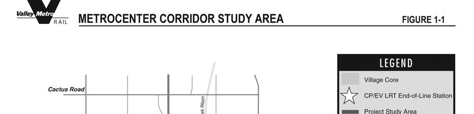
7 - Cost estimates and financial plan; - Cost effectiveness and efficiency; - Forecasted ridership; - Land use and economic development implications; and - Location and configuration of stations, park-and-ride lots, and the maintenance facility Study Area Definition The study area (Figure 1-1) is bounded by Missouri Avenue to the south; 15 th Avenue to the east; Cholla Street to the north; and 31 st Avenue to the west. Although not a part of the formal AA/EIS process for the Metrocenter Corridor Study, secondary study areas in Phoenix north of the Metrocenter Corridor and west to Glendale are also being considered to identify opportunities for future transportation connections to those areas should Valley Metro Rail, Inc. later decide to move forward with those potential projects. Any further detailed planning and design for a future connection to either area would be prepared in accordance with stipulations of the National Environmental Policy Act (NEPA) Project Background The Phoenix/Glendale Major Investment Study (MIS) was initiated in 1998 to identify highcapacity transportation improvements that would improve mobility and provide transit options in the corridors linking Metrocenter and downtown Glendale with central Phoenix. A secondary purpose was to answer the question on whether LRT planned in the Central Phoenix/East Valley Corridor should be extended into the Phoenix/Glendale study area. The MIS encompassed a study area which included the Metrocenter Corridor Study area. Nine transit technologies traversing various alignments were considered: Busways; Express bus; Light rail transit; Commuter rail; Automated guideway transit; Monorail; Magnetically levitated railway (Mag Lev); Heavy rail; and Personal rapid transit. Using a variety of evaluation criteria, a locally preferred alternative (LPA) was recommended that included LRT as the selected transit mode. The alignment within the Metrocenter Corridor included a connection with the Central Phoenix/East Valley LRT (the LRT starter line that began construction in mid-2004) at Spectrum Mall on 19th Avenue near Bethany Home Road and continued north on 19th Avenue to Northern Avenue with various sub-option alignments to the Metrocenter Shopping Center. Since completion of the MIS in 1999, the Federal Transit Administration (FTA) has revised its planning process with new requirements for Alternatives Analysis (AA). AA requires a more detailed analysis of modal options, alignments, and travel demand forecasting. Therefore, the Tier 2 Evaluation of Alternatives Page 2
8 AA for the Metrocenter Corridor Study re-evaluates reasonable technology modes as well as alignment options within the study area. The Metrocenter Corridor Project was included in the City of Phoenix s Transit 2000 ballot initiative that was passed by voters in 2000 and provides a 0.4% sales tax to help fund the City s transit program. The project also is included in the currently approved Maricopa Association of Governments (MAG) financially constrained Long Range Transportation Plan (LRTP) Project Development Process The Metrocenter Corridor Study is being advanced in accordance with the project development process outlined by FTA for major transit capital investments and in accordance with the rules and regulations specified under the National Environmental Policy Act (NEPA). The steps from Alternatives Analysis (AA) through Final Environmental Impact Statement (FEIS) are considered to be the project planning phases. During this time, an analysis of various alternatives is conducted considering a variety of criteria. Based on the results of the evaluation and the public input received, the Phoenix City Council and the Valley Metro Rail, Inc., Board of Directors will identify a Locally Preferred Alternative (LPA). The goal is to conduct a detailed analysis of the LPA and No-Build Alternative during the Draft Environmental Impact Statement (DEIS) and to propose mitigation measures for adverse impacts. Upon completion of the DEIS, it will be circulated for public review and comment, and public hearings will be held at that time. Based on the findings of the DEIS and public comments received, FTA, the Phoenix City Council, and the Valley Metro Rail, Board of Directors will then adopt a refined LPA. Preliminary Engineering (PE) will then be conducted concurrently with preparation of the Final Environmental Impact Statement (FEIS) that responds to public comments and commits to specific mitigation measures for adverse impacts. Upon completion of the FEIS, it will be submitted to FTA for consideration, and FTA will then issue a Record of Decision (ROD) that provides environmental clearance. Following issuance of a favorable ROD, final design would be conducted, and the financing plan would be finalized. Construction would then begin, and the project is expected to be operational by Tier 2 Evaluation of Alternatives Page 3
9
10 2.0 EVALUATION PROCESS 2.1 PROCESS A two-tiered process is being implemented to evaluate the Metrocenter Corridor alternatives (Figure 2-1). The first phase (Tier 1), which has already been completed, included a conceptual level evaluation that analyzed the advantages and disadvantages of a long list of potential alternatives to address the transportation needs of the corridor (see separate Tier 1 Evaluation of Alternatives Report for more information). The purpose of the Tier 1 evaluation was to determine which of the alternatives included on the long list were the most feasible, thus narrowing down the range of options to be considered for more detailed analysis. The Tier 1 evaluation criteria are mostly qualitative in nature and sought to eliminate alignment and, possibly, technology options that had fatal flaws, clearly did not meet project goals, or had other undesirable qualities. Section 2.2 summarizes the findings of the Tier 1 evaluation and supplemental analysis that occurred prior to Tier 2. The Metrocenter Corridor alternatives remaining after the Tier 1 evaluation are being subjected to a more detailed evaluation (Tier 2), and that is the subject of this report. The Tier 2 evaluation criteria begin to quantify ridership potential, capital costs, land use and economic development impacts, traffic issues, environmental factors, conceptual engineering, and public preferences. The Tier 2 build alternatives have been advanced to a schematic design evaluation level and their definitions include plans and cross-sections, right-of-way requirements, station locations, park-and-ride locations, intermodal transfer stations, end-of-line station location, future downtown Glendale connection options, future connections to the Deer Valley Core, feeder bus service, and operating plans (see Chapter 3 of this report and the separate Tier 2 Definition of Alternatives Report for more information). Capital cost estimates are also provided for each alternative. The evaluation of the Tier 2 alternatives is intended to eliminate all but a Locally Preferred Alternative (LPA) with possible design options. However, if the Tier 2 evaluation results in more than one optimal alternative with no clear choice, then those alternatives will be modeled and assessed against the Section 5309 New Starts criteria and community acceptance to help achieve the best possible project as identified by the FTA criteria. The alternative that most satisfies the criteria would then be the one recommended as the preferred alternative for further detailed evaluation in the Environmental Impact Statement. An essential component throughout the evaluation process is the Public Involvement Program (PIP). The PIP identifies the public, interested groups and stakeholders and will solicit their input and participation at key points in the process. Tier 2 Evaluation of Alternatives Page 5
11
12 2.2 FINDINGS OF THE TIER 1 AND SUBSEQUENT EVALUATIONS Tier 1 Evaluation Results A total of four Light Rail Transit (LRT) and four BRT alternatives were developed and analyzed (Figures 2-2 through 2-5 and Tables 2-1 and 2-2) in the Tier 1 evaluation. All alternatives begin at the northern terminus of the CP/EV LRT starter line near 19 th Avenue/Bethany Home Road and follow various routes, as described in the tables and figures, to Cholla Street, which is at the northern boundary of the Metrocenter Corridor study area. The recommendations of the Tier 1 evaluation were that LRT Alternatives 1 and 4 (Figures 2-2 and 2-3) best met the goals and objectives for the project and should be retained for additional evaluation during a more rigorous Tier 2 analysis. Table 2-3 summarizes the benefits of these alternatives. It was also recommended that LRT Alternatives 2 and 3 and BRT Alternatives 2 and 3 be eliminated from further consideration for reasons summarized in Table 2-4. In addition, through conversations with FTA, BRT Alternatives 1 and 4 (with similar alignments to their LRT counterparts) should be subjected to additional ridership analysis from that conducted during Tier Additional Findings After the Tier 1 Evaluation Subsequent to the Tier 1 evaluation, it was decided that additional modeling would be conducted for the retained BRT alternatives that would give consideration to a more optimal BRT operating scenario to determine if more new riders would be attracted. The Tier 1 patronage evaluation for all of the BRT alternatives assumed that BRT operated only in the Metrocenter Corridor and would require a transfer to the Central Phoenix/East Valley LRT (CP/EV LRT) at its northern terminus at Spectrum Mall (19 th Avenue near Bethany Home Road) to continue south. This forced transfer resulted in limited new riders being attracted to the transit system. New riders attracted is a critical measure of the alternative s success given the FTA Section 5309 New Starts evaluation criteria and the Purpose and Need Report developed for the Metrocenter Corridor Study. The Purpose and Need for the Metrocenter Corridor Study identifies the necessity to attract new riders to the transit system as a mechanism to create additional passenger throughput in a highly congested corridor. The scenario used in the supplemental modeling considered the possibility that passengers on the BRT would have the choice of either transferring to the CP/EV LRT at Spectrum Mall or continuing south on the bus (without transfer) to the State Capitol and then to downtown Phoenix. Although the modeling focused on the retained BRT Alternatives 1 and 4, all of the LRT and BRT alternatives considered in the Tier 1 analysis were re-evaluated in order to determine how the retained BRT alternatives compared to the other alternatives in their ability to attract new riders. The results of the additional modeling are summarized in Table 2-5. In all cases, the LRT alternatives performed significantly better than their BRT counterparts in their ability to attract new riders. The best performing BRT operating scenario was the one that assumed rail operating speeds. However, it is unrealistic to assume that the operating speeds could be consistently achieved since the alternatives would operate in the existing I-17 HOV lanes. These lanes already experience congestion during some times of the day. Tier 2 Evaluation of Alternatives Page 7
13 Figure 2-2 Tier 1 Alternatives LRT Alternatives 1 and 2 Tier 2 Evaluation of Alternatives Page 8
14 Figure 2-3 Tier 1 Alternatives LRT Alternatives 3 and 4 Tier 2 Evaluation of Alternatives Page 9
15 Figure 2-4 Tier 1 Alternatives BRT Alternatives 1 and 2 Tier 2 Evaluation of Alternatives Page 10
16 Figure 2-5 Tier 1 Alternatives BRT Alternatives 3 and 4 Tier 2 Evaluation of Alternatives Page 11
17 The BRT scenario that best reflects the type of operation that would be implemented for the project is the one that was coded as rail, but assumes express bus operating speeds in the I-17 Corridor. Under this scenario, the best performing alternative, BRT Alternative 4-A/4-D is only expected to attract about 10% new rail/brt riders. This compares to its counterpart, LRT Alternative 4-A/4-D, which is expected to attract about 39% new rail riders. TABLE 2-1 LRT ALTERNATIVES CONSIDERED IN THE TIER 1 EVALUATION 1 No. Location 1 19 th Avenue 2 19 th Avenue/Bethany Home Road/I th Avenue/Orangewood Avenue/31 st Avenue/Metrocenter West/28 th Drive 4 Four major options: Options 4-A and 4-B serve the area between Spectrum Mall and Dunlap Avenue/25 th Avenue. Options 4-C and 4-D serve the area between Dunlap Avenue/25 th Avenue and Cholla Street. Option 4-A can be combined with either Option 4-C or 4-D to traverse the entire study area. Likewise, Option 4-B can be combined with either Option 4-C or 4-D. Option 4-A - 19 th Avenue/Dunlap Avenue to 25 th Avenue Option 4-B - 19 th Avenue/Northern Avenue/23 rd Avenue/Dunlap Avenue to 25 th Avenue Option 4-C - Dunlap Avenue at 25 th Avenue north to Cholla Street Option 4-D - Dunlap Avenue at 25 th Avenue north to about Mountain View Road/New crossing of I- 17/Metrocenter East/28 th Drive 1 All alternatives begin at the northern terminus of the CP/EV LRT starter line near 19 th Avenue/Bethany Home Road and end at Cholla Street, which at the northern end of the Metrocenter Corridor study area. The locations above indicate the specific routing between the two points. TABLE 2-2 BRT ALTERNATIVES CONSIDERED IN THE TIER 1 EVALUATION 1 No. Location 1 19 th Avenue (Same alignment as LRT Alternative 1.) 2 19 th Avenue/Bethany Home Road/I-17 (Same alignment as LRT Alternative 2.) 3 19 th Avenue/Glendale Avenue/31 st Avenue/Metrocenter West/28 th Drive 4 Four major options: Options 4-A and 4-B serve the area between Spectrum Mall and Dunlap Avenue/25 th Avenue. Options 4-C and 4-D serve the area between Dunlap Avenue/25 th Avenue and Cholla Street. Option 4-A can be combined with either Option 4-C or 4-D to traverse the entire study area. Likewise, Option 4-B can be combined with either Option 4-C or 4-D Option 4-A - 19 th Avenue/Dunlap Avenue to 25 th Avenue (Same alignment as LRT Option 4-A.) Option 4-B - 19 th Avenue/Northern Avenue/23 rd Avenue/Dunlap Avenue to 25 th Avenue (Same alignment as LRT Option 4-B.) Option 4-C - Dunlap Avenue at 25 th Avenue north to Peoria Avenue/Peoria Avenue/I-17 Option 4-D - Dunlap Avenue at 25 th Avenue north to about Mountain View Road/New crossing of I- 17/Metrocenter East/28 th Drive/Peoria Avenue/I-17 1 All alternatives begin at the northern terminus of the CP/EV LRT starter line near 19 th Avenue/Bethany Home Road and end at Cholla Street, which at the northern end of the Metrocenter Corridor study area. The locations above indicate the specific routing between the two points. Tier 2 Evaluation of Alternatives Page 12
18 Alternative LRT Alternative 1 TABLE 2-3 TIER 1 EVALUATION RECOMMENDATIONS ALTERNATIVES TO BE RETAINED 1 Reasons for Retention Competitive travel times Direct travel through Corridor Opportunities for transit-oriented and economic development LRT Alternative 4 and all 4 options In addition: Option 4-A/4-C High mobility due to serving major activity centers along 19 th Avenue and near I- 17 High potential for attracting new riders Transit-oriented development opportunity Previously recommended in 1999 Phoenix/Glendale Major Investment Study Best proximity and ease of access to activity centers Ranked #2 in ability to attract new riders Option 4-A/4-D Best proximity and ease of access to activity centers Ranked #1 in ability to attract new riders (39%) 1 Subsequent to the Tier 1 evaluation of alternatives, it was decided that BRT Alternative 4 (and all of its options) would also be retained for the Tier 2 analysis because it had the best ability to attract new riders of any of the BRT alternatives. See Section for more information. Tier 2 Evaluation of Alternatives Page 13
19 Alternative LRT Alternative 2 BRT Alternative 2 LRT Alternative 3 BRT Alternative 3 TABLE 2-4 TIER 1 EVALUATION RECOMMENDATIONS ALTERNATIVES TO BE ELIMINATED Major Reasons for Elimination Least potential of LRT alternatives for attracting new riders Major I-17 traffic disruption during construction Extensive utility relocation Limited transit-oriented development opportunity Poor access to LRT stations Low potential for attracting new riders Possible double-deck of I-17 by ADOT may make HOV direct access ramps infeasible resulting in reduced transit service levels Limited transit-oriented development opportunity Poor access to LRT stations Does not serve Corporate Center or other activity areas east of I-17 Slow travel time due to circuitous routing through Corridor Far from activity centers Major impacts on residential driveways and on-street parking Major impacts on existing right-of-way Lack of community acceptance Extensive utility relocation and impacts on water treatment plant Limited transit-oriented development opportunity Low potential for attracting new riders Does not serve Corporate Center or other activity areas east of I-17 Slow travel time due to circuitous routing through Corridor Far from activity centers Major impacts on residential driveways and on-street parking Major impacts on existing right-of-way Lack of community acceptance Extensive utility relocation and impacts on water treatment plant Limited transit-oriented development opportunity Tier 2 Evaluation of Alternatives Page 14
20 Alternative TABLE 2-5 NEW RAIL/BRT RIDERS (% INCREASE OVER LRT STARTER LINE) 1 Operating Scenario LRT BRT (Metrocenter Only) 2 BRT (Using Rail Operating Speeds) 3 BRT (Using Express Bus Operating Speeds) % -4% 14% 3% 2 24% -4% 12% 3% 3 36% 1% 18% 8% 4-A/4-C 37% -1% 19% 8% 4-A/4-D 39% 2% 23% 10% 4-B/4-C 35% 0% 18% 7% 4-B/4-D 33% -1% 17% 6% 1 New rail/brt riders also includes new riders over the CP/EV LRT starter line at the 19 th Avenue/Montebello (Spectrum Mall) Station that is the northern terminus of the LRT starter line. 2 This is the operating scenario assumed in the Tier 1 analysis of alternatives. 3 The BRT travel speeds assumed in this scenario are unlikely to be consistently achieved since the I-17 HOV lanes already experience congestion at certain times of the day. 4 This is the BRT operating scenario that would most likely be implemented for the project. Source: MAG model, April 2004 as reported in Metrocenter Corridor Study BRT Evaluation Report, April 13, An aerial alignment was also evaluated to determine if an LRT fixed guideway should be constructed at grade or on elevated structure. A test case was analyzed for a 3.4-mile segment of 19 th Avenue from Spectrum Mall to just north of Dunlap Avenue. The pertinent findings are presented in Table 2-6. Although right-of-way requirements and costs would be less for an aerial alignment than one that is at grade, the total costs of elevated (capital plus real estate costs) would be more than twice as much as an at-grade alignment ($40.5 million per mile for at grade; $92.9 million per mile for aerial [side-running] alignment; and $105.6 million per mile for aerial [median-running] alignment). In addition, the higher speed of an LRT aerial alignment (almost 6 miles per hour faster) as compared to an at-grade alignment would attract only a negligible difference in additional new riders. The considerably higher costs with no real difference in the ability to attract new riders, coupled with the introduction of an obtrusive elevated structure adjacent to numerous residences along the route, made it difficult to recommend implementation of an aerial alignment. The 4-D option for LRT Alternative 4 was designed to reach Metrocenter Mall by building a new bridge over I-17 north of the Arizona Canal. The possibility of tunneling underneath I-17 to access the mall was also considered. The most economical tunneling option would involve a 700-foot tunnel section with a 750-foot open-cut tunnel approach on each end to allow for the 4% maximum grade to the tunnel. The west tunnel approach would require realignment of Cheryl Drive and the east entrance to the mall to the south about 200 feet at a new intersection with Metro Parkway East. A bridge would need to be constructed for Metro Parkway East over the LRT tunnel approach. The cost of the tunnel option would be about twice as high as building a bridge over I-17 ($63 million for tunnel vs. $32 million for bridge). The Metrocenter Mall Station would also need to be moved further north along 28 th Drive to accommodate the design approach grades, thus making pedestrian access between the mall and station less Tier 2 Evaluation of Alternatives Page 15
21 convenient. For these reasons, the tunnel option for LRT Alternative Option 4-D was eliminated from further consideration. TABLE 2-6 COMPARISON OF AT-GRADE AND AERIAL ALIGNMENTS ALONG 19 TH AVENUE Factor Aerial Aerial (Median- (Side-Running) Running) At Grade Total capital cost 2010 (millions) 1 Capital cost/mile (millions) $347 $102.1 $316 $92.9 $138 $40.5 Right-of-way costs (millions) 2,3 $12 $12 $4 $30 Total costs (millions) 3 Total cost/mile (millions) $359 $105.6 $328 $96.5 $320 $94.1 $168 $49.4 Right-of-way requirements 3 Full parcel acquisitions Partial parcel acquisitions Total Full parcel acquisitions/mile Partial parcel acquisitions/mile LRT average travel speed (mph) % increase rail riders for aerial as a result of the higher speed 4 % increase new rail riders for aerial as a result of the higher speed 4 Number left-turn restrictions 5 Total Restrictions/mile Number new traffic signals required Total Signals/mile % 0.44% % 0.44% Capital costs do not include light rail vehicles, maintenance and storage facility, or additional right-of-way. 2 Right-of-way costs include relocations but do not include contingencies. 3 Two values are given for right-of-way requirements for the elevated side-running alignment. The first value represents the minimum necessary. The second higher value considers what is more likely needed to achieve community acceptance due to purchase of those buildings most affected by visual impacts. 4 The margin of error for sketch planning is +/- 10%. Source=MAG model, June Aerial (median-running alignment) was estimated. To determine the actual number of restricted left turns, further more detailed sight distance studies would be needed at the time that more refined design of actual pier locations were completed. Source: Comparison of At-Grade and Aerial Alignments Along 19 th Avenue, Valley Metro Rail, Inc. July 19, N/A N/A ALTERNATIVES CARRIED FORWARD FOR TIER 2 EVALUATION Although BRT s ability to attract new ridership would be significantly less than LRT, it was decided that the best performing BRT alternative (BRT Alternative 4 and all of its options) would be carried into the Tier 2 evaluation to allow for a more detailed analysis of the BRT mode. Therefore, the Tier 2 evaluation considers the following build alternatives: LRT Alternative 1, LRT Alternative 4 (and all of its options), and BRT Alternative 4 (and all of its options). The No- Build and Baseline Alternatives are also compared to the build alternatives for performance criteria only. The LRT and BRT alternatives being considered in the Tier 2 analysis have been refined since Tier 1 with regard to end-of-line locations, and station locations have been defined. Definitions of the Tier 2 alternatives are presented in Chapter 3. Tier 2 Evaluation of Alternatives Page 16
22 3.0 DEFINITION OF TIER 2 ALTERNATIVES 3.1 NO-BUILD The highway and roadway and transit network improvements included in the No-Build Alternative are discussed in this section Highway and Roadway Network The No-Build Alternative consists of the existing highway system as well as planned and programmed improvements identified in the 2025 Regional Transportation Plan (RTP) and the MAG FY Special Transportation Improvement Program (TIP). Tables 3-1 and 3-2 summarize the planned improvements. TABLE 3-1 MAG REGIONAL TRANSPORTATION PLAN HIGHWAY PROJECTS Segment Project Length Cost (2002$) I-17: Loop 101 to Arizona Canal (between Peoria and Dunlap) Add one general purpose lane in each direction 6 miles $53 million I-17: McDowell Road to Arizona Canal (between Peoria and Dunlap) Long term capacity improvements (target addition of one HOV lane and two general purpose lanes in each direction) 7 miles $1 billion Total $1.053 billion Total (as percentage for transit) $105.3 million 1 1 The total capacity improvement on I-17 is 8 lanes (6 general purpose and 2 HOV). The total cost of the 2 HOV lanes is $ million (25% of $1.053 billion). According to the Traveler Response to Transportation System Changes Interim Handbook (TCRP Project B-12, March 2000), the utilization of a standard HOV lane by transit is 40%. Therefore, the total cost of the improvements allocated to transit is $105.3 million (40% of $ million). Source: MAG Regional Transportation Plan, November 25, TABLE 3-2 MAG FY SPECIAL TIP HIGHWAY PROJECTS Segment Project Length Cost (2004$) I-17: Peoria to Greenway Construct auxiliary lanes and walls 3 miles $14 million (2005) I-17: At Peoria and at Cactus Reconstruct pump station/retention n/a $5 million (2007) Total $19 million Source: MAG FY Special TIP, November 25, In addition, the City of Phoenix is planning to widen Camelback Road from five to six lanes between Central Avenue and 17th Avenue in conjunction with the construction of the CP/EV LRT project. This project is in close proximity to but technically outside the Metrocenter Corridor study area. Tier 2 Evaluation of Alternatives Page 17
23 3.1.2 Transit Network The No-Build Alternative includes funded transit improvements from the CP/EV LRT Project Bus/Rail Plan rather than those outlined in the RTP. The Bus/Rail Plan includes a higher level of bus service than identified in the RTP and provides consistency with the 2020 Phoenix Transit Plan. In addition, the transit improvements listed in the Bus/Rail Plan are programmed with a dedicated funding source whereas some of the transit improvements listed in the RTP require an additional local funding match by partner jurisdictions. The No-Build Alternative includes bus service between 5 a.m. and midnight, Monday to Saturday, and service 6 a.m. to 10 p.m. on Sundays and holidays. Targeted frequencies by route are 15-minute service during the peak and 30-minute service during the off-peak. On some streets, such as 19th Avenue south of Dunlap Avenue, multiple routes will operate along the roadway and provide a combined peak hour frequency of 5 to 10 minutes. The CP/EV LRT segment within the Metrocenter Corridor, which terminates at 19th Avenue and Montebello Avenue, is scheduled to open in 2008 and by 2020 will provide service every six minutes during the peak and 12 minutes during the off-peak. A park-and-ride lot and transit center will also be constructed at this location as part of the CP/EV LRT Project. Table 3-3 compares existing transit service in the Metrocenter Corridor to the No-Build Alternative. TABLE 3-3 NO-BUILD ALTERNATIVE (2025) TRANSIT SERVICE COMPARISON Element Estimate 1 Transit Service Weekday Hours of Service Frequency 11 Local Bus 4 Express 4 RAPID Source: Valley Metro Rail (2004). Local Bus: 5am to 8:30pm (some routes provide service to midnight) Express: 6am to 8am, 4pm to 6pm RAPID: 5am to 9am, 3pm to 7pm Local Bus: 30 minute peak, 60 minute offpeak Express: 30 minute peak RAPID: 15 minute peak 10 Local Bus 1 Limited Stop 2 Express 6 RAPID 1 LRT Local Bus: 5am to midnight Limited: 5am to 9am, 3pm to 7pm Express: 5am to 9am, 3pm to 7pm RAPID: 5am to 9am, 3pm to 7pm LRT: 5am to 1am Local Bus: 15 minute peak, 30 minute offpeak (combined headway on some streets will be 5-10 minutes) Limited: 15 minute peak Express: 30 minute peak RAPID: 15 minute peak (combined headway as low as 3 minutes) Transit capital projects are included in the No-Build Alternative and will be constructed with programmed revenues. The No-Build Alternative includes two transit centers and four regional park-and-ride facilities (Tables 3-4 and 3-5). Tier 2 Evaluation of Alternatives Page 18
24 TABLE 3-4 NO-BUILD ALTERNATIVE TRANSIT CENTERS Transit Center Transit Service Comment Metrocenter Transit Center 5 Local Bus, 2 Express Renovated in th Avenue/Montebello LRT Station Transit Center 3 RAPID 3 Local Bus 2 RAPID CP/EV LRT Source: MAG FY Special TIP; Valley Metro (2004). Opens 2008 TABLE 3-5 NO-BUILD ALTERNATIVE PARK-AND-RIDES Park-and-Ride Transit Service Parking Spaces Comment I-17/Bell Park-and-Ride 2 Local Bus 350 Existing park-and-ride 5 RAPID Metrocenter Park-and-Ride 6 Local Bus, 2 Express 185 Existing park-and-ride 19th Avenue/Montebello LRT Station Park-and-Ride I-17/Peoria Park-and-Ride 3 RAPID 3 Local Bus 2 RAPID CP/EV LRT 6 Local Bus, 2 Express 3 RAPID 795 Opens Programmed (Structured parking facility at Metrocenter) Source: MAG FY Special TIP; MAG Park-and-Ride Study (2001); Valley Metro (2004). 3.2 BASELINE ALTERNATIVE FTA Final Rule 49 CFR Part 611 requires grantees to request FTA approval of the Baseline Alternative to be used in the FY 2006 Section 5309 New Starts Report as a comparison to the New Start Build Alternative. The Baseline Alternative is intended to isolate the costs and benefits of the proposed major transit investment, and must include in the project corridor all reasonable cost-effective transit improvements short of investment in the new start project. FTA guidance also states that the Baseline Alternative is best described as transit improvements lower in cost than the proposed new start, which result in a better ratio of measures of transit mobility compared to cost than the no-build alternative; but that it also may be defined as [the alternative] where the adopted financially constrained regional transportation plan includes within the corridor all reasonable cost-effective transit improvements short of the new start project. The Baseline Alternative presented in this report is still in the process of being refined as Valley Metro Rail, Inc. and the Maricopa Association of Governments (MAG) continue to test the new MAG travel demand model and the performance of the Baseline Alternative. The Baseline Alternative provides an incremental expansion of transit services over the existing service levels in the Metrocenter Corridor. It includes all the elements of the fiscally-constrained No-Build Alternative, plus unfunded transit improvements normally considered as transportation system management (TSM) improvements. The Baseline Alternative includes funded transit improvements from the CP/EV LRT Project Bus/Rail Plan rather than those outlined in the RTP. The Bus/Rail Plan includes a higher level of bus service than identified in the RTP and provides consistency with the 2020 Phoenix Transit Plan. In addition, the transit improvements listed in the Bus/Rail Plan are programmed Tier 2 Evaluation of Alternatives Page 19
25 with a dedicated funding source whereas some of the transit improvements listed in the RTP require a currently unfunded local match by partner jurisdictions. The Baseline Alternative also includes some unfunded transit operating and capital improvements that were not identified in the Bus/Rail Plan or the RTP. The Baseline Alternative includes bus service between 5 a.m. and midnight, Monday through Saturday, and service 6 a.m. to 10 p.m. on Sundays and holidays. Targeted frequencies by route are 15-minute service during the peak and 30-minute service during the off-peak. On some streets in the corridor, such as 19th Avenue, multiple routes will operate along the roadway and provide a combined peak hour frequency of 3 to 5 minutes. The LRT segment within the Metrocenter Corridor, which terminates at 19 th /Montebello Avenues, is scheduled to open in 2008 and by 2020 will provide service every 6 minutes during the peak and 12 minutes during the off-peak. A park-and-ride lot and transit center will also be constructed at this location as part of the CP/EV LRT Project. Table 3-6 compares existing transit service in the Metrocenter Corridor to the Baseline Alternative. TABLE 3-6 BASELINE ALTERNATIVE TRANSIT SERVICE COMPARISON Element Existing 2004 Baseline 2025 Estimate Transit Service 11 Local Bus 4 Express 4 RAPID 10 Local Bus 2 Limited Stop 2 Express 6 RAPID Weekday Hours of Service Local Bus: 5am to 8:30pm (some routes provide service to midnight) Express: 6am to 8am, 4pm to 6pm RAPID: 5am to 9am, 3pm to 7pm Frequency Local Bus: 30 minute peak, 60 minute off-peak Express: 30 minute peak RAPID: 15 minute peak Source: Valley Metro Rail (2004). 1 LRT Local Bus: 5am to midnight Limited: 6am to 8am, 4pm to 6pm Express: 6am to 8am, 4pm to 6pm RAPID: 5am to 9am, 3pm to 7pm LRT: 5am to 1am Local Bus: 15 minute peak, 30 minute off-peak (combined headway on some streets will be as low as 3 minutes) Limited: 15 minute peak Express: 30 minute peak RAPID: 15 minute peak (combined headway on I-17 will be 3 minutes) The Baseline Alternative provides a substantial increase in headways throughout the Metrocenter Corridor. Transit service coverage, including combined headways in particular corridors, is presented in Table 3-7. Transit capital projects included in the Baseline Alternative include the same two transit centers and four regional park-and-ride facilities associated with the No-Build Alternative (see Tables 3-4 and 3-5). The only difference is the increase in local bus routes (from 3 to 5) serving the 19 th Avenue/Montebello LRT Station Transit Center and Park-and-Ride facilities. Tier 2 Evaluation of Alternatives Page 20
26 TABLE 3-7 BASELINE ALTERNATIVE PEAK TRANSIT SERVICE COVERAGE Corridor Roadways Routes Buses per Hour Combined Headways 19th Ave (Dunlap to Montebello) 15, 19, 19 Limited th Ave (Northern to Montebello) 15, 19, 19 Limited*, th Ave (Glendale to Montebello) 15, 19, 19 Limited 1, 24B 1, 80B th Ave (Dunlap to Camelback) Camelback (35th Ave to 19th Ave) 50, 50 Limited Bethany Home (35th Ave to 19th Ave) Glendale (35th Ave to 19th Ave) 24A, 24B Northern (35th Ave to I-17) 80A, 80B, Dunlap (29th Ave to 19th Ave) 15, Peoria (28th Dr to 19th Ave) 106, I-17 (Bell to Bethany Home) I-17A, I-17B, I-17C, I-17E, I-17F 20 3 I-17 (Dunlap to Bethany Home) I-17A, I-17B, I-17C, I-17D, Routes currently unfunded. Source: Valley Metro Rail (2005). I-17E, I-17F, 570, 581 The Baseline Alternative would also include new HOV direct access connections to I-17 within the Metrocenter Corridor study area. These connections would function similar to the HOV direct access ramps in downtown Phoenix that allow express buses to access the center HOV lane without having to weave through general purpose traffic. The Baseline Alternative would also add a series of unfunded transit priority treatments on 19th Avenue between Dunlap Avenue and Camelback Road. These improvements would increase the speed and reliability of bus service, including Routes 15, 19, 19 Limited, 24, and 80. Two forms of transit priority treatments would be included: queue jumps and traffic signal priority (TSP). Queue jumps allow buses to bypass known congestion points by giving the bus exclusive right-of-way. It can be combined with TSP to give green light time to the bus prior to general purpose traffic. The Baseline Alternative would include queue jumps and TSP at the one-mile arterial intersections between Dunlap Avenue and Camelback Road. 3.3 LRT ALTERNATIVE 1 LRT Alternative 1 is portrayed in Figure 3-1. It begins at Spectrum Mall and continues north on 19 th Avenue to Peoria Avenue. Stations and park-and-ride facilities would be at the locations shown in Table 3-8. TABLE 3-8 LRT ALTERNATIVE 1 STATIONS AND PARK-AND-RIDE FACILITIES Station/Park-and-Ride Location 19th/Glendale North of intersection 19th/Northern North of intersection 19th/Dunlap North of intersection Tier 2 Evaluation of Alternatives Page 21
RECOMMENDED ALTERNATIVE REPORT
 DRAFT METROCENTER CORRIDOR STUDY RECOMMENDED ALTERNATIVE REPORT JULY 12, 2005 TABLE OF CONTENTS SECTION PAGE 1.0 INTRODUCTION... 1 2.0 TIER 1 ALTERNATIVES EVALUATION... 1 3.0 TIER 2 ALTERNATIVES EVALUATION...
I-10 West AA/EIS Pre-Screening and Tier 1 Analysis Results. Public Meeting. Wulf Grote, Director Project Development Rick Pilgrim, Project Manager
 I-10 West AA/EIS Pre-Screening and Tier 1 Analysis Results Public Meeting Wulf Grote, Director Project Development Rick Pilgrim, Project Manager March 4 & 5, 2008 Today s Agenda Overview of Alternatives
SCOPING SUMMARY REPORT
 DRAFT METROCENTER CORRIDOR STUDY SCOPING SUMMARY REPORT February 12, 2004 TABLE OF CONTENTS SECTION PAGE 1.0 INTRODUCTION...1 1.1 Overview...1 1.2 Purpose...1 1.3 Process...2 2.0 PROJECT BACKGROUND...2
FINAL. Sound Transit Long-Range Plan Update. Issue Paper S.1: Tacoma Link Integration with Central Link. Prepared for: Sound Transit
 Sound Transit Long-Range Plan Update Issue Paper S.1: Tacoma Link Integration with Central Link Prepared for: Sound Transit Prepared by: Quade & Douglas, Inc. FINAL March 2005 Foreword This issue paper
Waco Rapid Transit Corridor (RTC) Feasibility Study
 Feasibility Study") Waco Rapid Transit Corridor (RTC) Feasibility Study Chris Evilia, Director of Waco Metropolitan Planning Organization Allen Hunter, General Manager Waco Transit System Jimi Mitchell, Project Manager AECOM
Waco Rapid Transit Corridor (RTC) Feasibility Study Chris Evilia, Director of Waco Metropolitan Planning Organization Allen Hunter, General Manager Waco Transit System Jimi Mitchell, Project Manager AECOM
4.0 TIER 2 ALTERNATIVES
 4.0 TIER 2 ALTERNATIVES The Tier 2 Alternatives represent the highest performing Tier 1 Alternatives. The purpose of the Tier 2 Screening was to identify the LPA utilizing a more robust list of evaluation
Chapter 9 Recommended Locally Preferred Alternative and Alternatives for Evaluation in Draft SEIS/SEIR
 Chapter 9 Recommended Locally Preferred Alternative and Alternatives for Evaluation in Draft SEIS/SEIR 9.0 RECOMMENDED LOCALLY PREFERRED ALTERNATIVE AND ALTERNATIVES FOR EVALUATION IN DRAFT SEIS/SEIR
Valley Metro Overview. ITE/IMSA Spring Conference March 6, 2014
 Valley Metro Overview ITE/IMSA Spring Conference March 6, 2014 Valley Metro Who Are We? Operate Regional Transit Services Valley Metro and Phoenix are region s primary service providers Light Rail and
Draft Results and Recommendations
 Waco Rapid Transit Corridor (RTC) Feasibility Study Draft Results and Recommendations Chris Evilia, Director of Waco Metropolitan Planning Organization Allen Hunter, General Manager Waco Transit System
Draft Results and Open House
 Waco Rapid Transit Corridor (RTC) Feasibility Study Draft Results and Open House Chris Evilia, Director of Waco Metropolitan Planning Organization Allen Hunter, General Manager Waco Transit System Jimi
Energy Technical Memorandum
 Southeast Extension Project Lincoln Station to RidgeGate Parkway Prepared for: Federal Transit Administration Prepared by: Denver Regional Transportation District May 2014 Table of Contents Page No. Chapter
EUGENE-SPRINGFIELD, OREGON EAST WEST PILOT BRT LANE TRANSIT DISTRICT
 EUGENE-SPRINGFIELD, OREGON EAST WEST PILOT BRT LANE TRANSIT DISTRICT (BRIEF) Table of Contents EUGENE-SPRINGFIELD, OREGON (USA)... 1 COUNTY CONTEXT AND SYSTEM DESCRIPTION... 1 SYSTEM OVERVIEW... 1 PLANNING
Alternatives Analysis Findings Report
 6.0 This chapter presents estimates of the potential capital, operations and maintenance costs associated with the alternatives carried forward for detailed evaluation. The methodology used to develop
METRO Light Rail Update
 American Society of Highway Engineers METRO Light Rail Update Brian Buchanan Director, Design and Construction October 13, 2009 1 High Capacity Transit System 2 20-Mile Light Rail Line 3 Operations Operations
Executive Summary. Draft Environmental Impact Statement/Environmental Impact Report ES-1
 Executive Summary Introduction The Eastside Transit Corridor Phase 2 Project is a vital public transit infrastructure investment that would provide a transit connection to the existing Metro Gold Line
Operating & Maintenance Cost Results Report
 Operating & Maintenance Cost Results Report Prepared for: Hennepin County Regional Railroad Authority Prepared by: Connetics Transportation Group Under Contract To: Kimley-Horn and Associates FINAL June
Chapter 7: Travel Demand Analysis. Chapter 8. Plan Scenarios. LaSalle Community Center. Image Credit: Town of LaSalle
 Chapter 7: Travel Demand Analysis Chapter 8 Plan Scenarios LaSalle Community Center. Image Credit: Town of LaSalle 164 Chapter 8: Plan Scenarios Moving Ahead for Progress in the 21 st Century Act (MAP
5. OPPORTUNITIES AND NEXT STEPS
 5. OPPORTUNITIES AND NEXT STEPS When the METRO Green Line LRT begins operating in mid-2014, a strong emphasis will be placed on providing frequent connecting bus service with Green Line trains. Bus hours
CEDAR AVENUE TRANSITWAY Implementation Plan Update
 CEDAR AVENUE TRANSITWAY Implementation Plan Update EECUTIVE SUMMARY DECEMBER 2015 Executive Summary In 2013, the Twin Cities metropolitan area s first bus rapid transit (BRT) line, the METRO Red Line,
ALTERNATIVES ANALYSIS/ ENVIRONMENTAL IMPACT STATEMENT SCOPING BROCHURE
 I-10 WEST ALTERNATIVES ANALYSIS/ ENVIRONMENTAL IMPACT STATEMENT SCOPING BROCHURE INTRODUCTION Cricket Pavilion Study Description, Project Background The Federal Transit Administration (FTA) and METRO are
Executive Summary. Treasure Valley High Capacity Transit Study Priority Corridor Phase 1 Alternatives Analysis October 13, 2009.
 Treasure Valley High Capacity Transit Study Priority Corridor Phase 1 Alternatives Analysis October 13, 2009 Background As the Treasure Valley continues to grow, high-quality transportation connections
BROWARD BOULEVARD CORRIDOR TRANSIT STUDY
 BROWARD BOULEVARD CORRIDOR TRANSIT STUDY FM # 42802411201 EXECUTIVE SUMMARY July 2012 GOBROWARD Broward Boulevard Corridor Transit Study FM # 42802411201 Executive Summary Prepared For: Ms. Khalilah Ffrench,
I-20 EAST TRANSIT INITIATIVE Tier 1 and Tier 2 Alternatives Screening Report EXECUTIVE SUMMARY
 EXECUTIVE SUMMARY The purpose of this report is to document the results of the Tier 1 and Tier 2 Screening of alternatives for the I-20 East Transit Initiative. The two-tier screening process presented
Preliminary Definition of Alternatives. 3.0 Preliminary Definition of Alternatives
 3.0 What preliminary alternatives are being evaluated? The alternatives for the East San Fernando Valley Transit Corridor project that were considered for screening include the No Build Alternative, Transportation
CITY OF LONDON STRATEGIC MULTI-YEAR BUDGET ADDITIONAL INVESTMENTS BUSINESS CASE # 6
 2016 2019 CITY OF LONDON STRATEGIC MULTI-YEAR BUDGET ADDITIONAL INVESTMENTS BUSINESS CASE # 6 STRATEGIC AREA OF FOCUS: SUB-PRIORITY: STRATEGY: INITIATIVE: INITIATIVE LEAD(S): BUILDING A SUSTAINABLE CITY
Pacific Electric Right-of-Way / West Santa Ana Branch Corridor Alternatives Analysis
 Pacific Electric Right-of-Way / West Santa Ana Branch Corridor Alternatives Analysis Transit Coalition September 26, 2012 2 Study Area Pacific Electric Rightof-Way/West Santa Ana Branch (PEROW/ WSAB) extends
Green Line LRT: Beltline Segment Update April 19, 2017
 Green Line LRT: Beltline Segment Update April 19, 2017 Quick Facts On April 11, 2017, City Council approved Administration s recommendation for the Green Line to be underground in the Beltline from 2 Street
Broward County Intermodal Center And People Mover. AASHTO Value Engineering Conference Presentation. September 1, 2009 San Diego, CA
 Project Development & Environment Study Broward County Intermodal Center And People Mover AASHTO Value Engineering Conference Presentation September 1, 2009 San Diego, CA Background P D & E Study Regional
Restoration of Historic Streetcar Services in Downtown Los Angeles
 Restoration of Historic Streetcar Services in Downtown Los Angeles Early Scoping Meeting for Alternatives Analysis (AA) May 17, 2011 Introduction Key players Local lead agency: Metro Federal lead agency:
SEPULVEDA PASS CORRIDOR
 SEPULVEDA PASS CORRIDOR PUBLIC PRIVATE PARTNERSHIP DELIVERY PRE-DEVELOPMENT AGREEMENT PDA Sepulveda Pass Mobility Issues Most congested highway segment in the U.S. 295,000 vehicles per day (2010) 430,000
Sound Transit East Link: Bus/LRT System Integration Study
 Sound Transit East Link: Bus/LRT System Integration Study Prepared For: Sound Transit King County Metro Mercer Island WSDOT Prepared By: CH2M HILL July, 2014 1 SOUND TRANSIT EAST LINK: BUS/LRT SYSTEMES
6/6/2018. June 7, Item #1 CITIZENS PARTICIPATION
 June 7, 2018 Item #1 CITIZENS PARTICIPATION 1 Item #2 APPROVAL OF MINUTES Item #3 TRAC GOALS, FRAMEWORK & AGENDA REVIEW 2 COMMITTEE GOALS Learn about Southern Nevada s mobility challenges, new developments
METRO Orange Line BRT American Boulevard Station Options
 METRO Orange Line BRT American Boulevard Station Options Bloomington City Council Work Session November 18, 2013 Christina Morrison BRT/Small Starts Project Office Coordinating Planning and Design AMERICAN
Crenshaw-Prairie Transit Corridor Study Public Meetings
 Crenshaw-Prairie Transit Corridor Study Public Meetings Darby Park: Wednesday, February 20, 2008 6:30 8:00 PM US Bank Community Room: Thursday, February 21, 2008 6:30 8:00 PM Nate Holden Performing Arts
Tier 2 Screening and Selection522. of the Short List Alternatives KISSIMMEE CORRIDOR. Downtown CRA. US 192 Alternatives Analysis
 LAKE COUNTY ORANGE COUNTY Ticket and Transportation Center Walt Disney / Reedy Creek Improvement District CR 535 John Young Parkway 441 17 92 Florida s Turnpike VE 92 mee Hall JOHN YOUNG PKY 192 OAK ST
Needs and Community Characteristics
 Needs and Community Characteristics Anticipate Population and Job Growth in the City Strongest density of population and jobs in Ann Arbor are within the Study Area Population expected to grow 8.4% by
Bi-County Transitway/ Bethesda Station Access Demand Analysis
 Bi-County Transitway/ Bethesda Station Access Demand Analysis Prepared for: Washington Metropolitan Area Transit Authority Office of Planning and Project Development May 2005 Prepared by: in conjunction
KANSAS CITY STREETCAR
 KANSAS CITY STREETCAR KAREN CLAWSON MID-AMERICA REGIONAL COUNCIL KANSAS CITY STREETCAR Regional Context Alternatives Analysis Kansas City Streetcar Project KANSAS CITY REGION KANSAS CITY REGION KANSAS
Recommended Vision for the Downtown Rapid Transit Network
 Recommended Vision for the Downtown Rapid Transit Network April 2008 Presentation Overview Context Transit options Assessment of options Recommended network Building the network 2 1 Rapid Our Vision Reliable
Restoration of Historic Streetcar Services in Downtown Los Angeles
 Restoration of Historic Streetcar Services in Downtown Los Angeles Alternatives Analysis Community Update Meeting August 2, 2011 Introduction Key players Local lead agency: Metro Federal lead agency: Federal
7 COMPARATIVE EVALUATION OF ALTERNATIVES
 7 COMPARATIVE EVALUATION OF ALTERNATIVES 7.1 INTRODUCTION This chapter presents the comparative analysis of the four Level 2 build alternatives along with a discussion of the relative performance of the
STRATEGIC PRIORITIES AND POLICY COMMITTEE MAY 5, 2016
 STRATEGIC PRIORITIES AND POLICY COMMITTEE MAY 5, 2016 Shift Rapid Transit Initiative Largest infrastructure project in the city s history. Rapid Transit initiative will transform London s public transit
Public Meeting. City of Chicago Department of Transportation & Department of Housing and Economic Development
 Public Meeting City of Chicago Department of Transportation & Department of Housing and Economic Development Funded by Regional Transportation Authority September 12, 2011 In partnership with Presentation
West Broadway Reconstruction/LRT Design. March 19, 2015
 West Broadway Reconstruction/LRT Design March 19, 2015 1 Meeting Agenda 6:05 6:30 PM Brief presentation What we heard Project overview 6:30 8:00 PM Visit Six Topic Areas Road and LRT design elements Pedestrian
Develop ground transportation improvements to make the Airport a multi-modal regional
 Project Overview TRANSPORTATION IMPROVEMENTS WHAT ARE THE PROJECT GOALS? Transportation transportation hub. Develop ground transportation improvements to make the Airport a multi-modal regional Land Use
Challenges in a Post-Katrina Environment East-West Corridor Project Overview February, 2007
 EAST-WEST CORRIDOR Challenges in a Post-Katrina Environment East-West Corridor Project Overview February, 2007 Presentation Agenda Project Overview / Purpose and Need Highway Component Transit Component
Central City Line Locally Preferred Alternative (LPA) Amendment Public Hearing. July 24, 2014
 Amendment Public Hearing. July 24, 2014") Central City Line Locally Preferred Alternative (LPA) Amendment Public Hearing July 24, 2014 Project Description The Central City Line is a High Performance Transit project that will extend from Browne
Central City Line Locally Preferred Alternative (LPA) Amendment Public Hearing July 24, 2014 Project Description The Central City Line is a High Performance Transit project that will extend from Browne
Federal Way Link Extension
 Federal Way Link Extension Draft EIS Summary Route & station alternatives and impacts Link Light Rail System Map Lynnwood Mountlake Terrace Lynnwood Link Extension Shoreline 14th Northgate 40 Northgate
North Shore Alternatives Analysis. May 2012
 North Shore Alternatives Analysis May 2012 Agenda Study Process and Progress to Date Short List Alternatives Screening Traffic Analysis Conceptual Engineering Ridership Forecasts Refinement of Service
PEACHTREE CORRIDOR PARTNERSHIP. Current Status & Next Steps
 PEACHTREE CORRIDOR PARTNERSHIP Current Status & Next Steps PEACHTREE CORRIDOR PARTNERSHIP Why Peachtree? Why Now? I. THE CONTEXT High Level View of Phasing Discussion Potential Ridership Segment 3 Ease
Valley Metro: Past, Present and Future. September 11, 2014
 Valley Metro: Past, Present and Future September 11, 2014 Valley Metro Who are We? Two Boards of Directors Regional Public Transportation Authority Fund and operate regional transit services Valley Metro
CENTRAL MESA HIGH C CENTRAL MESA HIGH CAPACIT CIT Y TRANSIT C TRANSIT CORRIDOR ORRIDOR
 CENTRAL MESA HIGH CAPACITY TRANSIT CORRIDOR study SCOPING BROCHURE INTRODUCTION Study Description, Project Background METRO and the City of Mesa are conducting a 24-month study to analyze potential high
TORONTO TRANSIT COMMISSION REPORT NO.
 Form Revised: February 2005 TORONTO TRANSIT COMMISSION REPORT NO. MEETING DATE: October 24, 2012 SUBJECT: DOWNTOWN RAPID TRANSIT EXPANSION STUDY (DRTES) PHASE 1 STRATEGIC PLAN ACTION ITEM RECOMMENDATIONS
East San Fernando Valley Transit Corridor. Information Session, October 10, 2017
 East San Fernando Valley Transit Corridor Information Session, October 10, 2017 1 Welcome and Meeting Purpose Introductions Metro Transit Corridors Planning Metro Real Estate Metro Community Relations
ANDERSON PROPERTY SITE ANALYSIS
 ANDERSON PROPERTY SITE ANALYSIS Introduction The Montgomery County Department of Transportation (MCDOT) initiated a feasibility study in the fall of 2012 to evaluate the need for transit service expansion
SERVICE DESIGN GUIDELINES
 VTA TRANSIT SUSTAINABILITY POLICY: APPENDIX A SERVICE DESIGN GUIDELINES Adopted February 2007 COMMUNITYBUS LOCALBUS EXPRESSBUS BUSRAPIDTRANSIT LIGHTRAILTRANSIT STATIONAREAS S A N T A C L A R A Valley Transportation
Green Line LRT: Beltline Recommendation Frequently Asked Questions
 Green Line LRT: Beltline Recommendation Frequently Asked Questions June 2017 Quick Facts Administration has evaluated several alignment options that would connect the Green Line in the Beltline to Victoria
STH 60 Northern Reliever Route Feasibility Study Report
 #233087 v3 STH 60 Northern Reliever Route Feasibility Study Report Washington County Public Works Committee Meeting September 28, 2016 1 STH 60 Northern Reliever Route Feasibility Study Hartford Area Development
Feasibility Study. Community Meeting March, North-South Commuter Rail Feasibility Study
 Feasibility Study Community Meeting March, 2017 1 Agenda 1. Welcome / Introductions 2. Background / Meeting Purpose 3. Progress to Date Options Evaluated Capital/Operating Costs Ridership 4. Financial
FREQUENTLY ASKED QUESTIONS
 FREQUENTLY ASKED QUESTIONS 2018 What is the More MARTA Atlanta program? The More MARTA Atlanta program is a collaborative partnership between MARTA and the City of Atlanta to develop and implement a program
Clifton Corridor Transit Initiative. Briefing to Medlock Area Neighborhood Association (MANA) February 15, 2016
 February 15, 2016") Clifton Corridor Transit Initiative Briefing to Medlock Area Neighborhood Association (MANA) February 15, 2016 Neighborhood Concerns and Requests Provide a general overview and background of the project
Clifton Corridor Transit Initiative Briefing to Medlock Area Neighborhood Association (MANA) February 15, 2016 Neighborhood Concerns and Requests Provide a general overview and background of the project
Tempe Streetcar. March 2, 2016
 Tempe Streetcar March 2, 2016 Tempe Profile 40 sq. miles, highest density in state University Town, center of region Imposed growth boundaries (density increase) Mixed use growth/intensifying land use
NEW HAVEN HARTFORD SPRINGFIELD RAIL PROGRAM
 NEW HAVEN HARTFORD SPRINGFIELD RAIL PROGRAM Hartford Rail Alternatives Analysis www.nhhsrail.com What Is This Study About? The Connecticut Department of Transportation (CTDOT) conducted an Alternatives
Mississauga Bus Rapid Transit Preliminary Design Project
 Mississauga Bus Rapid Transit Preliminary Design Project PUBLIC INFORMATION CENTRE OCTOBER 2008 WELCOME The Mississauga Bus Rapid Transit (BRT) Project Thank you for attending this Public Information Centre.
Clifton Corridor Transit Initiative. Briefing to Great Lakes Community February 11, 2016
 Clifton Corridor Transit Initiative Briefing to Great Lakes Community February 11, 2016 Neighborhood Concerns and Requests Provide a general overview and background of the project What are the different
Regional Transit Extension Studies. Hampton Roads Transportation Planning Organization Passenger Rail Task Force Meeting December 17, 2013
 Regional Transit Extension Studies Hampton Roads Transportation Planning Organization Passenger Rail Task Force Meeting December 17, 2013 Topics Virginia Beach Transit Extension Study (VBTES) Naval Station
Chapter 7. Transportation Capital Improvement Projects. Chapter 7
 Chapter 7 Transportation Capital Improvement Projects Chapter 7 81 Chapter 7 Transportation Capital Improvement Projects Local Transportation Sales Tax Programs For over three decades, Santa Clara County
Dixie Transportation Planning Office
 A project must be given a yes rating on items 1 & 2 in order to be prioritized. Sponsor: St. George City Project: Pioneer Parkway Type: Road Widening and Reconstruction Rev. 9/17/2010 Dixie Transportation
LOS ANGELES COUNTY METROPOLITAN TRANSPORTATION AUTHORITY (LACMTA) AND FEDERAL TRANSIT ADMINISTRATION (FTA)
 AND FEDERAL TRANSIT ADMINISTRATION (FTA)") LOS ANGELES COUNTY METROPOLITAN TRANSPORTATION AUTHORITY (LACMTA) AND FEDERAL TRANSIT ADMINISTRATION (FTA) NOTICE OF PREPARATION (NOP)/NOTICE OF INTENT (NOI) OF AN ENVIRONMENTAL IMPACT STATEMENT (EIS)/ENVIRONMENTAL
LOS ANGELES COUNTY METROPOLITAN TRANSPORTATION AUTHORITY (LACMTA) AND FEDERAL TRANSIT ADMINISTRATION (FTA) NOTICE OF PREPARATION (NOP)/NOTICE OF INTENT (NOI) OF AN ENVIRONMENTAL IMPACT STATEMENT (EIS)/ENVIRONMENTAL
US 81 Bypass of Chickasha Environmental Assessment Public Meeting
 US 81 Bypass of Chickasha Environmental Assessment Public Meeting March 14, 2013 Introductions ODOT FHWA SAIC Meeting Purpose Present need for bypass Provide responses to 10/04/11 public meeting comments
Tier 3 Screening and Selection. of the Recommended Alternative KISSIMMEE CORRIDOR. June Downtown CRA. US 192 Alternatives Analysis
 LAKE COUNTY ORANGE COUNTY Ticket and Transportation Center Walt Disney / Reedy Creek Improvement District CR 535 John Young Parkway 441 17 92 Florida s Turnpike VE 92 mee Hall JOHN YOUNG PKY 192 OAK ST
3.15 SAFETY AND SECURITY
 3.15 SAFETY AND SECURITY Introduction This section describes the environmental setting and potential effects of the alternatives analyzed in this EIR with regard to safety and security in the SantaClara-Alum
Letter EL652 City of Mercer Island. Page 1. No comments n/a
 Letter EL652 City of Mercer Island Page 1 No comments n/a Page 2 Response to comment EL652 1 Section 4.5.3 of the Final EIS presents the range of potential impacts of the project. This project also lists
East San Fernando Valley Transit Corridor. TAC Briefing December 4, 2013
 East San Fernando Valley Transit Corridor TAC Briefing December 4, 2013 Overview Measure R Project Long Range Transportation Plan Reserves $170.1 Million 2018 Revenue Operations Date Coordination with
Proposed Program of Interrelated Projects
 DALLAS AREA RAPID TRANSIT Proposed Program of Interrelated Projects Federal Transit Administration Capital Investment Program Summer 204 INTRODUCTION The current federal transportation bill, Moving Ahead
The range of alternatives has been reviewed with the RTAC Subgroup and the preliminary analysis is proceeding on the following HCT alternatives:
 Attachment 2 Boise Treasure Valley Phase 1 Alternatives Analysis August 14, 2009 Introduction The Treasure Valley High Capacity Transit Priority Corridor Phase 1 Alternatives Analysis is being prepared
Business Advisory Committee. July 7, 2015
 Business Advisory Committee July 7, 2015 1 Today s Topics Outreach Update TI #1 and 2: Target Field Station Connection to I-94: Recommendation 85 th Station Configuration 93 rd Station Configuration DEIS
I-26 Fixed Guideway Alternatives Analysis
 I-26 Fixed Guideway Alternatives Analysis Public Meetings: North Charleston, January 25, 2016 Charleston: January 26, 2016 Summerville: January 28, 2016 Agenda I. Project Update II. III. IV. Screen Two
Attachment 5. High Speed Transit Planning Study REPORT SUMMARY. Prepared by: City of Edmonton Transportation Planning Branch. Stantec Consulting Ltd.
 Attachment 5 High Speed Transit Planning Study Prepared by: City of Edmonton Transportation Planning Branch Stantec Consulting Ltd. Transportation Management & Design, Inc. with Lea Consulting Ltd. [135-35130]
Committee Report. Transportation Committee. Business Item No
 Committee Report Business Item No. 2015-280 Transportation Committee For the Metropolitan Council meeting of December 9, 2015 Subject: METRO Blue Line Extension (Bottineau Light Rail Transit) Revised Scope
I-26 Fixed Guideway Alternatives Analysis
 I-26 Fixed Guideway Alternatives Analysis Steering & Technical Advisory Committees Joint Meeting January 15, 2016 @ 10:00 AM SC/TAC Meeting Winter 2016 Agenda I. Welcome & Introductions II. III. Project
West Broadway Transit Study. Community Advisory Committee September 17, 2015
 West Broadway Transit Study Community Advisory Committee September 17, 2015 Introductions Community Engagement Summer Outreach Fall Outreach Technical Analysis Process Update Alternatives Review Economic
Unified Corridor Investment Study DRAFT Step 2 Scenario Analysis Report
 Unified Corridor Investment Study DRAFT Step 2 Scenario Analysis Report REVISIONS 1. Table 39: New Public Investments for Operation and Maintenance Costs 2. Appendix A-10: Passenger Rail Service - Operations
METRONext. Vision & Moving Forward Plans. Board Workshop. December 11, DRAFT For Preliminary Discussion Only
 METRONext Vision & Moving Forward Plans Board Workshop December 11, 2018 Disclaimer This presentation is being provided solely for discussion purposes by the Board of Directors of the Metropolitan Transit
EGLINTON CROSSTOWN LIGHT RAIL TRANSIT (LRT)
") WELCOME TO OUR PUBLIC OPEN HOUSE EGLINTON CROSSTOWN LIGHT RAIL TRANSIT (LRT) Preliminary Planning for a Transit Project Assessment Open House Martin Grove Road to Pearson International Airport September
WELCOME TO OUR PUBLIC OPEN HOUSE EGLINTON CROSSTOWN LIGHT RAIL TRANSIT (LRT) Preliminary Planning for a Transit Project Assessment Open House Martin Grove Road to Pearson International Airport September
APPENDIX I: [FIXED-GUIDEWAY TRANSIT FEASIBILITY]
![APPENDIX I: [FIXED-GUIDEWAY TRANSIT FEASIBILITY]](/thumbs/83/87090921.jpg "APPENDIX I: [FIXED-GUIDEWAY TRANSIT FEASIBILITY]") APPENDIX I: [FIXED-GUIDEWAY TRANSIT FEASIBILITY] Jackson/Teton Integrated Transportation Plan 2015 Appendix I. Fixed-Guideway Transit Feasibility Jackson/Teton County Integrated Transportation Plan v2
APPENDIX I: [FIXED-GUIDEWAY TRANSIT FEASIBILITY] Jackson/Teton Integrated Transportation Plan 2015 Appendix I. Fixed-Guideway Transit Feasibility Jackson/Teton County Integrated Transportation Plan v2
Transportation Committee Revised Project Scope and Cost Estimate. November 23, 2015
 Transportation Committee Revised Project Scope and Cost Estimate November 23, 2015 1 Today s Topics Revised Project Scope Revised Cost Estimate Municipal Approval Action 2 3 Revised Project Scope Project
Business Advisory Committee. November 3, 2015
 Business Advisory Committee November 3, 2015 1 Today s Topics DEIS Cost Estimate 2 Assumptions Revised Cost Estimate Revised Project Scope Cost Estimate Overview Position Statement Discussion Municipal
Midtown Corridor Alternatives Analysis Initial Screening Analysis
 Midtown Corridor Alternatives Analysis Initial Screening Analysis 7/24/2013 Prepared by the SRF Consulting Group Team for Table of Contents Purpose... 1 Initial Screening Analysis Methodology... 1 Screening...
August 2, 2010 Public Meeting
 Public Meeting LYMMO Expansion Alternatives Analysis Study Purpose of study is to provide a fresh look at potential LYMMO expansion, following Federal Transit Administration (FTA) Alternatives Analysis
Transit Access Study
 West of Hudson Regional Transit Access Study Open House presentation July 20, 2010 1 Agenda Progress To date Summary of Level 2 Alternatives and Screening Service Plans Bus and Rail Operating and Capital
Service Quality: Higher Ridership: Very Affordable: Image:
 Over the past decade, much attention has been placed on the development of Bus Rapid Transit (BRT) systems. These systems provide rail-like service, but with buses, and are typically less expensive to
TBARTA USF to Wesley Chapel Express Bus Service Operating Plan. Draft 3/25/2014
 TBARTA USF to Wesley Chapel Express Bus Service Operating Plan Draft 3/25/2014 March 2014 Table of Contents 1.0 Introduction... 1 2.0 Study Area... 1 3.0 Existing Available Service... 3 4.0 Proposed Service...
State Avenue Corridor Bus Rapid Transit (BRT)
") State Avenue Corridor Bus Rapid Transit (BRT) Moving Forward Incrementally April 2010 State Ave. BRT Update Bus Rapid Transit Overview State Ave. Alternatives Analysis Results What s Coming Up Right Away!
State Avenue Corridor Bus Rapid Transit (BRT) Moving Forward Incrementally April 2010 State Ave. BRT Update Bus Rapid Transit Overview State Ave. Alternatives Analysis Results What s Coming Up Right Away!
Kendall Drive Premium Transit PD&E Study Project Kick-Off Meeting SR 94/Kendall Drive/SW 88 Street Project Development and Environment (PD&E) Study
 Study") Florida Department of Transportation District Six Kendall Drive Premium Transit PD&E Study Project Kick-Off Meeting SR 94/Kendall Drive/SW 88 Street Project Development and Environment (PD&E) Study What
Florida Department of Transportation District Six Kendall Drive Premium Transit PD&E Study Project Kick-Off Meeting SR 94/Kendall Drive/SW 88 Street Project Development and Environment (PD&E) Study What
Location Concept Plan Amendment Recommendation Approved 2011 Concept Plan
 Valley Line West LRT Concept Plan Recommended Amendments Lewis Farms LRT Terminus Site Location Concept Plan Amendment Recommendation Approved 2011 Concept Plan Lewis Farms LRT terminus site, 87 Avenue/West
US 29 Bus Rapid Transit Planning Board Briefing. February 16, 2017
 US 29 Bus Rapid Transit Planning Board Briefing February 16, 2017 Project Goals Improve the quality of transit service Improve mobility opportunities and choices Enhance quality of life Support master
FINAL TECHNICAL MEMORANDUM
 Metro Amherst-Buffalo Corridor TIER 3 SCREENING RESULTS FINAL TECHNICAL MEMORANDUM Prepared for: Niagara Frontier Transportation Authority (NFTA) Prepared by: AECOM USA, Inc. In Association with Wendel
3. PRELIMINARY DEFINITION OF ALTERNATIVES
 3. PRELIMINARY DEFINITION OF ALTERNATIVES The purpose of the Preliminary Definition of Alternatives is to introduce the alternatives, including modes and off- and on-airport routes that will be carried
Snelling Bus Rapid Transit. May 13, 2013 Technical Advisory Committee Meeting #1
 Snelling Bus Rapid Transit May 13, 2013 Technical Advisory Committee Meeting #1 1 Today s meeting TAC Introductions Project Overview Arterial BRT Concept Background Snelling Corridor Plan, Funding & Schedule