Utilization of Unmanned Aerial Systems (UAS) for Vegetation Mapping and Restoration
|
|
|
- Cynthia Dennis
- 6 years ago
- Views:
Transcription
 for Vegetation Mapping")


1 Utilization of Unmanned Aerial Systems (UAS) for Vegetation Mapping and Restoration Jon Morton Biologist Invasive Species Management Branch West Palm Beach, Florida Jacksonville District UAS team US Army Corps of Engineers
2 UAV THE NEED High resolution imagery for invasive species management and environmental restoration High temporal resolution (ability to quickly reacquire) Waterproof landing Responsive to users Sufficient payload capacity for future development


3 Safety USACE Program Mission Provide a Reliable Data Collection Tool to Support Aerial Mapping and Environmental Reconnaissance Missions


4
5 UAV - History 2005: Starts with ERDC, USGS, University of Florida (UF) and Jacksonville District (SAJ) : Airframe/Payload Development 2010: Transition to operations 2011: SAJ designated UAV Southeast Division (SAD) Regional Center of Expertise. 2012: New Payload. Mosaic Solution : Turn-Key Production Environment 2014: Metric Payload. Gimbaled EO/TIR Video 2015+: Increase Support for Military Customers


6 GCS Evolution A lot of parts/wires etc. Getting there...

7 GCS Current Version Stand is helpful Everything in one case Panasonic TB, Combox, RC Controller,etc. Power Redundancy ~50 lbs


8 Airframe Evolution Airframe development Truck for geospatial payload : Polaris : Shoe/NOVA : NOVA/NOVA Block II
9 NOVA System

10 NOVA System Components

11 NOVA BLOCK III Commercialized version of the Block II 6 cell lithium battery Connection improvements Established safety record with AED Procerus Kestrel Autopilot
12 NOVA Specifications Fully Autonomous 2.7 m Wingspan 15 lbs. w/ Payload ~750 acres per 300m altitude ~50 kilometers per 300m altitude 300m altitude Absolute spatial accuracy typically 2-4 meters (no ground control) Block II = 60 minute duration Block III = 90 minute duration


13 Standard Mapping Payload Details (MP21) Camera Body: Rebel EOS T2i Sensor: APS-C CMOS 5184x3456 Single Board Micro PC Lens: Voigtlander Ultron 40mm F2 SL Aspherical Positioning: Xsens Mti-G (L1 with WAAS)


14 Standard Mapping Payload Details (MP22) Camera Body: Rebel SL1 Sensor: APS-C CMOS 5184x3456 Single Board Micro PC Lens: Voigtlander Ultron 20mm F2 SL Aspherical Positioning: Novatel OEMStar (L1 with WAAS)


15 NOVA Airboat Launch


16 Image Capture

17 High Resolution Mosaic 250 images


18 Mosaic Enlargement

19 Constraints
20 Constraints We only fly in approved airspace, typically: Below nm outside of airports 30 nm for large airports (MIA, TPA). Flight in this airspace possible, requires COA AR requires AWR: Airworthiness Qualification Level (AQL) 3 Not undergone rigorous airworthiness qualification Avoid flying over people, roads, homes, etc. Limited to Line Of Sight operation (LOS) Depends on conditions, typically 1.5km


21 Airspace Class G Airspace = GOOD for the most part.
22 NOVA: Applications APPLICATIONS
23 NOVA: Applications Pre/active/post construction monitoring Asset/infrastructure management Invasive species surveillance and monitoring Vegetation mapping Environmental restoration/engineering

24 NOVA: Applications Pre/active/post construction monitoring Asset/infrastructure management Invasive species surveillance and monitoring Vegetation mapping Environmental restoration
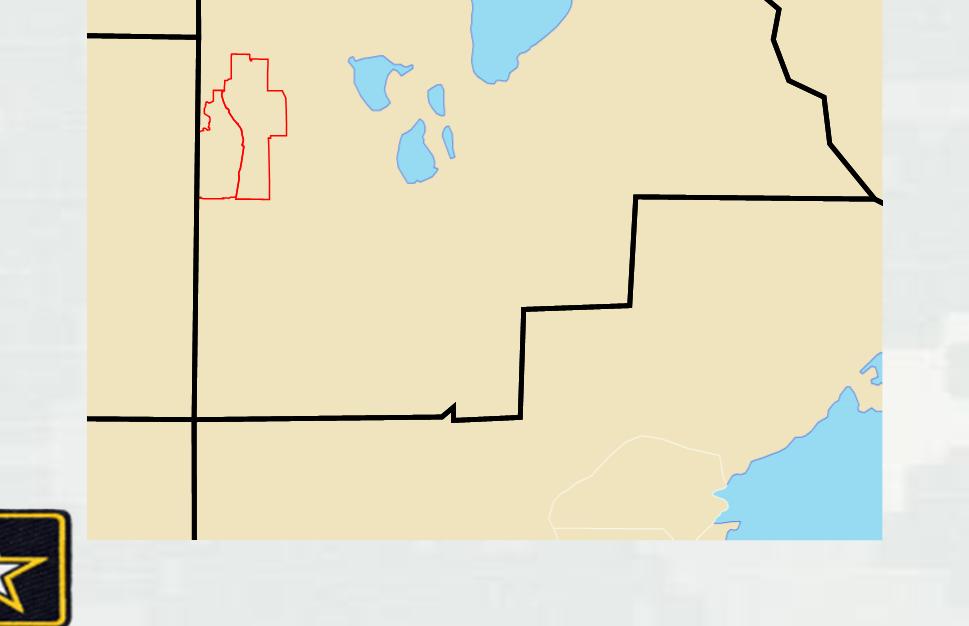
25 Fisheating Bay Lake Okeechobee

26 Fisheating Bay

27 Target Area

28 Luziola subintegra

29 Luziola subintegra

30 Mixed Emergent/Floating
 19,712 8% 28% Vegetation 180,007 72% Frog's")

31 Analysis Processed Data Species Delineation Class Subclass Area (m²) % Total % Class Water 69,993 28% Open Water 50,281 20% 72% Decomposing (Submerged) 19,712 8% 28% Vegetation 180,007 72% Frog's Bit, Water Hyacinth, & Cupscale 46,944 19% 26% Decomposing (Emergent) 45,889 18% 25% Water Lettuce 29,599 12% 16% Luziola 26,386 11% 15% Lotus 22,433 9% 12% Shadow/Unclassified 8,757 4% 5% Total 250,000

32 Analysis Species Matrix Classification (ENVI)
33 Eagle Bay Lake Okeechobee


34

35

36

37
38 March acres 17 active nests
39 July acres 29 active nests

40 September acres 1 active nest
41 Ground Truthing Ourselves Area of Lake Average % FWC SFWMD AAM USACE 1. Torrey & Kreamer % Ritta % East Wall - Coot Bay % West Wall - Whidden % Fisheating Bay % Harney - Indian Prairie % Indian P. - Kissimmee % King's Bar % March IA Group Estimate 168 acres Actual acres 9. Kissimmee - Taylor Cr % Taylor Cr. - Chancey % TOTALS %
42 Ground Truthing Ourselves Area of Lake Average % FWC 1 FWC 2 SFWMD AAM USACE 1. Torrey & Kreamer % Ritta % East Wall - Coot Bay % West Wall - Whidden % Fisheating Bay % Harney - Indian Prairie % Indian P. - Kissimmee % King's Bar % Kissimmee - Taylor Cr % Taylor Cr. - Chancey % July IA Group Estimate 1310 acres Actual 537 acres TOTALS %
43 Object-based Classification Dr Amr Abd-Elrahman, PhD Geomatics Lead University of Florida Gulf Coast Research & Education Center Roshan Pande, Post-Doc Tao Liu, Post-Doc
 Test different machine learning")
44 Object-based Classification Goal: Map Invasive plants using spectral, textural and contextual object-based classification Objectives: Identify best spectral and textural features and segmentation scale(s) Test different machine learning classifiers e.g. Regression Tree (CART), Support Vector Machine (SVM), and Artificial Neural Network (ANN) Develop spectral, textural and contextual rules based on multi-scale segmentation


45 Examples of Segmentation at different scales Segmentation : course (300) scale Segmentation: medium (75 )scale


46 Original scale 40 scale 15 scale 10
47 Results of Preliminary Study Scale level 75 was better in separating most classes, while level 40 was found good at further separating small patches. Scale level 110 was too coarse and combined vegetation classes. Scale level 15 was found too fine to separate textured classes (e.g. Willow, Cattail, etc.). However it provided valuable textural input for higher scale level. Scale level 300 didn t separate individual vegetation species but it can broadly separate water and roads from wetlands. Input of spectral values as well as textural information from Haralick indices and sub-object related textures provided better classification results. In preliminary study, SVM and ANN yielded better results than Maximum Likelihood method. Pixel based classification produced low overall accuracy (51% for Maximum Likelihood 54% for ANN ). Visual results will be shown later.
48 Results of Preliminary Study, cont We considered 4 segmentation scales in further analysis: Very fine scale (L15): Initial classification is run in this level. Result is used for input for further classification. Fine scale (L40): It separates small patches of plant species in mixed class area. Final classification is performed on L40 and L75 levels. Medium scale (L75): It is expected to separate most major classes with some mixed classes (e.g. lotus mixed with other species). Coarse scale (L300): to be used for course delineation of invasive plants.

49

50

51

52
53 Accuracy Assessment Classified maps were matched against assessment data set and error matrices were developed. Accuracy values (overall accuracy and Kappa coefficients) were computed and used for assessment and comparison. Classifier Overall Kappa SVM 70.32% ANN 69.44% M L 58.18% Pixel based SVM (downsized) 57.37% Pixel based ML 50.94% Pixel based ANN 53.62% 0.476

54

55

56

57
58 Future Analysis Experimenting on other study areas and different acquisition dates. More contextual refinement after consulting biologist Lily s existence among lotus? small shade/water objects? Long Term: Using highly adaptable fuzzy statistical models based on machine learning algorithms Using infrared imagery with visible bands for classification

59 Blue Head Ranch NRCS Wetland Restoration Project (WRP)
60


61

62

63


64

65 Classifying Training Data Species delineation to identify cogon grass (neon green)
66 Classifying Training Data, cont Vegetation Classification System for South Florida Natural Areas, 2009
67 Classifying Training Data, cont


68 Species Identification/Classification Species delineation to identify cogon grass (neon green)


69 RESTORATION NEED DSMs? SJ1 Upland Disposal Area, St. Augustine, Florida Sometimes the vertical relief is not readily apparent in imagery


70 GOT DSMS? Repair volume and debris removal estimation


71 Watch Your Step SJ1 Upland Disposal Area, St. Augustine, Florida ~1.2 meter washout Rapid assessment of road/levee conditions


72 Point Clouds with RGB values We can create dense RGB point clouds from imagery Point clouds can be filtered for bare earth surfaces

73 Future


74 Future: Payloads

75 Metric Payload True purpose built geospatial/remote sensing imaging payload

76 Metric Payload 16MP CCD (presently 29MP CCD) Increased Radiometric Resolution: 8 and 12 bit Multispectral Stable optics High precision L1/L2 GPS Omnistar and RTK
 Minimal flight crew one operator one observer Think biologists, park ranges, engineers, etc.")
77 Future: Multi Rotor VTOL for Everyone ~20 minute flight time 300 gram capacity Live video feedback Water quality sampling Turn Key : No assembly and minimal flight planning COTS Optional HUD via smartphone app Minimal cost ~$3K per kit Minimal training (2-3 days) Minimal flight crew one operator one observer Think biologists, park ranges, engineers, etc.

78 Multi Rotor VTOL Access to previously difficult/impractical mission sites where landing approach not sufficient Carries fixed wing NOVA payloads Identical avionics to fixed wing

79
DRONE & UAV.
 www.erapkorea.co.kr DRONE & UAV Extended flight time Proven to be reliable, safe and easy to use Various fields of operation Completely autonomous, and manually controlled ERAP DRONE & UAV WHY ERAP s MAPPING
In 2003, A-Level Aerosystems (ZALA AERO) was founded by current company President Alexander Zakharov, since then he has led
 was founded by current company President Alexander Zakharov, since then he has led") A-Level Aerosystems In 2003, A-Level Aerosystems (ZALA AERO) was founded by current company President Alexander Zakharov, since then he has led the company to be a leader in the micro UAV market in Russian
A-Level Aerosystems In 2003, A-Level Aerosystems (ZALA AERO) was founded by current company President Alexander Zakharov, since then he has led the company to be a leader in the micro UAV market in Russian
FLYEYE Unmanned Aerial System
 FLYEYE Unmanned Aerial System FLYEYE Unmanned Aerial System About Flytronic FLYTRONIC is a dynamic modern engineering company focussed on developing Unmanned Aerial Systems to provide observation and reconnaissance
PENGUIN C UAS OPERATIONS & MAINTENANCE TRAINING 20 HOURS FLIGHT ENDURANCE 100KM RANGE ITAR - FREE CREW OF TWO
 PENGUIN C UAS LONG ENDURANCE UNMANNED AERIAL SYSTEM 20 HOURS FLIGHT ENDURANCE OPERATIONS & MAINTENANCE TRAINING 100KM RANGE ITAR - FREE CREW OF TWO U AV FAC T O RY LT D., E U R O P E U AV FAC T O RY U
Perspectivas y avances del uso de UAV en AP. Bruno Basso
 Perspectivas y avances del uso de UAV en AP Bruno Basso Outline of the presentation Remote and proximal sensing Pro and Cons of UAV Available UAVs Technologies Applications of UAVs in Precision Agriculture
Aeronautical Systems Center
 Aeronautical Systems Center Global Hawk Program Overview Michael Johnston 303 AESG/LG DSN: 787-4047 Comm: 937-255-4047 michael.johnston@wpafb.af.mil RQ-4A Global Hawk System Global Hawk: High-altitude,
Table of Contents. Abstract... Pg. (2) Project Description... Pg. (2) Design and Performance... Pg. (3) OOM Block Diagram Figure 1... Pg.
 Project Description... Pg. (2) Design and Performance... Pg. (3) OOM Block Diagram Figure 1... Pg.") March 5, 2015 0 P a g e Table of Contents Abstract... Pg. (2) Project Description... Pg. (2) Design and Performance... Pg. (3) OOM Block Diagram Figure 1... Pg. (4) OOM Payload Concept Model Figure 2...
March 5, 2015 0 P a g e Table of Contents Abstract... Pg. (2) Project Description... Pg. (2) Design and Performance... Pg. (3) OOM Block Diagram Figure 1... Pg. (4) OOM Payload Concept Model Figure 2...
Small UAV A French MoD perspective and planning
 Small UAV A French MoD perspective and planning French ISTAR segmentation portable transportable infrastructure System volume Tactical Small UAV Contact Combat Helicopters (MTI) Fighter Aircrafts Land
AT-10 Electric/HF Hybrid VTOL UAS
 AT-10 Electric/HF Hybrid VTOL UAS Acuity Technologies Robert Clark bob@acuitytx.com Summary The AT-10 is a tactical size hybrid propulsion VTOL UAS with a nose camera mount and a large payload bay. Propulsion
A complete hybrid VTOL autopilot solution. Start anywhere, fly everywhere.
 Key Features A complete hybrid VTOL autopilot solution. Start anywhere, fly everywhere. Supported Vehicle Types s Multirotors Fixed-wings Bi-, tri- and quadcopter tailsitters, quadplanes and tiltrotors.
UAS ISR Sensors Roadmap Update to 26 th Annual AUVSI Pathfinder Symposium 19 March 2015
 UAS ISR Sensors Roadmap Update to 26 th Annual AUVSI Pathfinder Symposium 19 March 2015 COL Casimir (Casey) Carey Director, U.S. Army Training & Doctrine Command Capability Manager for Intelligence Sensors
THE ULTIMATE DRONE SOLUTION
 THE ULTIMATE DRONE SOLUTION LX-1 ECHELON LiDAR MULTIROTOR Brochure & Technical Specifications OVERVIEW The LX-1 Echelon is a professional-grade hexacopter equipped with a LiDAR sensing payload, and designed
THE FALCON REDUNDANCY HIGH WIND TOLERANCE BEST USED FOR SURVEILLANCE & SECURITY DELIVERY & TRANSPORT
 THE FALCON REDUNDANCY HIGH WIND TOLERANCE The Falcon's new air frame and motor configuration is the new best in its class of light payloads with flight times of up to 50 minutes. This makes the Falcon
Monitoring Bank Erosion On the Missouri River, Lower Brule Reservation
 Monitoring Bank Erosion On the Missouri River, Lower Brule Reservation A cooperative study between the Lower Brule Sioux Tribe s Environmental Protection Office and the U.S. Geological Survey, with assistance
UAV KF-1 helicopter. CopterCam UAV KF-1 helicopter specification
 UAV KF-1 helicopter The provided helicopter is a self-stabilizing unmanned mini-helicopter that can be used as an aerial platform for several applications, such as aerial filming, photography, surveillance,
Fire Fighting Equipment Development - Unmanned Aerial Vehicle Trials. Ripley Valley Rural Fire Brigade - August 2010
 Fire Fighting Equipment Development - Unmanned Aerial Vehicle Trials Ripley Valley Rural Fire Brigade - August 2010 The Brigade offered to help evaluate the capabilities of an Unmanned Aerial Vehicle (UAV)
수직이착륙형고속비행무인기로임무효율성및운용편의성증대 자동수직이착륙으로높은운용성 ( 고정익대비 ) 고도 / 속도 / 체공성능우월로임무효율성제고 ( 회전익대비 ) EO/IR, LRF 탑재및임무장비교체가능한다목적용무인기
 고도 / 속도 / 체공성능우월로임무효율성제고 ( 회전익대비 ) EO/IR, LRF 탑재및임무장비교체가능한다목적용무인기") 헬기처럼뜨고비행기처럼나는수직이착륙형고속무인항공기 KUS-TR 수직이착륙틸트로터무인항공기 천이비행 순항비행 천이비행 수직이륙 수직착륙 틸트로터천이비행 개요 제원 / 성능 수직이착륙형고속비행무인기로임무효율성및운용편의성증대 전장 3.5 m 최대속도 250 km/h 특징 전폭 5.2 m 순항속도 200 km/h 자동수직이착륙으로높은운용성 ( 고정익대비 ) 고도 /
헬기처럼뜨고비행기처럼나는수직이착륙형고속무인항공기 KUS-TR 수직이착륙틸트로터무인항공기 천이비행 순항비행 천이비행 수직이륙 수직착륙 틸트로터천이비행 개요 제원 / 성능 수직이착륙형고속비행무인기로임무효율성및운용편의성증대 전장 3.5 m 최대속도 250 km/h 특징 전폭 5.2 m 순항속도 200 km/h 자동수직이착륙으로높은운용성 ( 고정익대비 ) 고도 /
Autonomous Unmanned Aerial Systems 1. ABSTRACT
 1. ABSTRACT Zeppelin FC 26, a team formed in 2014, has undergone exponential growth. We have delved into diverse and challenging endeavors, ranging from systems integration to design and development of
UAV Systems Comparison. Planes, Frames and Autopilots
 UAV Systems Comparison Planes, Frames and Autopilots Presenter: Robert Lefebvre BASc Mechanical Engineering, University of Ottawa Managing Director NOVAerial Robotics Inc. Ardupilot Developer 6 Years UAV
Investigative Technologies and Techniques
 Investigative Technologies and Techniques Using Drones In Accident Investigation (Aerial Photography) Drone used in accident investigation Technical specifications and performance Flat 8 motor configuration
Oil Palm Ripeness Detector (OPRID) and Non-Destructive Thermal Method of Palm Oil Quality Estimation
 and Non-Destructive Thermal Method of Palm Oil Quality Estimation") Oil Palm Ripeness Detector (OPRID) and Non-Destructive Thermal Method of Palm Oil Quality Estimation Abdul Rashid Mohamed Shariff, Shahrzad Zolfagharnassab, Alhadi Aiad H. Ben Dayaf, Goh Jia Quan, Adel
Oil Palm Ripeness Detector (OPRID) and Non-Destructive Thermal Method of Palm Oil Quality Estimation Abdul Rashid Mohamed Shariff, Shahrzad Zolfagharnassab, Alhadi Aiad H. Ben Dayaf, Goh Jia Quan, Adel
Integrated Airborne Surveillance Systems. November 2014
 Integrated Airborne Surveillance Systems November 2014 Integrated Airborne Surveillance Systems ATOS Mission System for Manned Platforms Unmanned Aerial Systems (UAS) 2 ATOS Mission System ATOS (Airborne
suas in CAP Delaware Wing HQ, Civil Air Patrol Development of small Unmanned Aerial Systems
 Delaware Wing HQ, Civil Air Patrol suas in CAP Development of small Unmanned Aerial Systems Advent of the suas Small Unmanned Aerial Systems have become very common recently Sophisticated microprocessors
Palos Verdes High School 1
 Abstract: The Palos Verdes High School Institute of Technology (PVIT) Unmanned Aerial Vehicle team is proud to present Condor. Condor is a hexacopter weighing in at 1664g including the 4 cell 11.1 volt,
Analysts/Fund Managers Visit 19 April Autonomous Systems and Future Capability Mark Kane
 Analysts/Fund Managers Visit 19 April 2007 Autonomous Systems and Future Capability Mark Kane The Rationale for UAVs The Rationale for UAVs UAVs generally seen to carry out the dull, dirty, and dangerous
Eye In The Sky: The Future of Risk Assessment From Above
 Eye In The Sky: The Future of Risk Assessment From Above Property Insurance Report National Conference 15 November 2010 Timothy E. Carone, Ph.D. Director, Global Climate Monitoring Systems Advanced Programs
for Unmanned Aircraft
 Damage age Tolerant Flight Control o Systems s for Unmanned Aircraft September 17, 28 Vlad Gavrilets, Ph.D. Approved for public release, distribution unlimited Rockwell Collins Control Technologies - Formerly
WingtraOne Technical Specifications
 WingtraOne Technical Specifications wingtra.com The all-in-one drone: large coverage, high resolution and accuracy WingtraOne Resolution Accuracy Coverage down to 0.7 cm/px (0.3 in/px) GSD down to 1 cm
Electric Penguin s philosophy:
 UNMANNED PLATFORMS AND SUBSYSTEMS Datasheet v 1.1 Penguin BE Electric Unmanned Platform Up to 110 minutes of endurance 2 with 2.8 kg payload 23 liters of payload volume Quick replaceable battery cartridge
2012 AUVSI SUAS Student Competition Journal Paper. Kansas State University Salina UAS Club. Prepared By: Mark Wilson Coby Tenpenny Colby Walter
 2012 AUVSI SUAS Student Competition Journal Paper Kansas State University Salina UAS Club Prepared By: Mark Wilson Coby Tenpenny Colby Walter May 14, 2012 Willie Abstract The Willie Unmanned Aerial System
SURVEYOR-H. Technical Data. Max speed 120 km/h. Engine power 7.2 hp. Powerplant Modified Zenoah G29E. Fuel tank volume 3.6 l
 rev. 28.10.14 * features & specifications are subject to change without notice. Technical Data Max speed 120 km/h Engine power 7.2 hp Powerplant Modified Zenoah G29E Fuel tank volume 3.6 l Payload with
Content. Introduction. Technology. Type of unmanned vehicle. Past, Present, Future. Conclusion
 Introduction Content Technology Type of unmanned vehicle Past, Present, Future Conclusion What is unmanned vehicles? l Without a person on board l Remote controlled l Remote guided vehicles Reduce casualty
2015 AUVSI UAS Competition Journal Paper
 2015 AUVSI UAS Competition Journal Paper Abstract We are the Unmanned Aerial Systems (UAS) team from the South Dakota School of Mines and Technology (SDSM&T). We have built an unmanned aerial vehicle (UAV)
CENTAUR OPTIONALLY-PILOTED AIRCRAFT ULTIMATE FLEXIBILITY FOR AIRBORNE SENSING
 CENTAUR OPTIONALLY-PILOTED AIRCRAFT ULTIMATE FLEXIBILITY FOR AIRBORNE SENSING CENTAUR A NEW LEVEL OF OPERATIONAL FLEXIBILITY Aurora Flight Sciences Centaur combines the best of manned and unmanned surveillance
Press release. Maiden flight pushes boundaries in surveying
 Press release Date: 31/7/1 Maiden flight pushes boundaries in surveying The Routescene proposition to transform the approach to surveys across the world is taking hold. Collaborating with Hanseatic Aviation
Design and Navigation of Flying Robots
 Design and Navigation of Flying Robots Roland Siegwart, ETH Zurich www.asl.ethz.ch Drones: From Technology to Policy, Security to Ethics 30 January 2015, ETH Zurich Roland Siegwart 06.11.2014 1 ASL ETH
THE KARANTANIA UNMANNED AERIAL SYSTEM
 THE KARANTANIA UNMANNED AERIAL SYSTEM ABSTRACT Tomaž Meze, Bogo Štempihar, Mihael Grom MIBO MODLI d.o.o. Čevica 6, SI 1370 Logatec, Slovenia tomi.meze@siol.net, info@mibojets.com Tone Magister University
Prototyping Collision Avoidance for suas
 Prototyping Collision Avoidance for Michael P. Owen 5 December 2017 Sponsor: Neal Suchy, FAA AJM-233 DISTRIBUTION STATEMENT A: Approved for public release; distribution is unlimited. Trends in Unmanned
MAV and UAV Research at Rochester Institute of Technology. Rochester Institute of Technology
 MAV and UAV Research at Andrew Streett 5 th year BS/MS Student 2005-2006 MAV Team Lead Jason Grow BS/MS Graduate of RIT 2003-2004 MAV Team Lead Boeing Phantom Works, HB 714-372-9026 jason.a.grow@boeing.com
A VERY UNIQUE UAV FLAMINGO MK1 UAV Silvertone Electronics Australia
 A VERY UNIQUE UAV FLAMINGO MK1 UAV 01 DESIGN BACKGROUND The design was born out of a perceived need for a low capital cost, surveillance tool for large Farm/ Property owners. 02 SIZE AND WEIGHT The size,
DSSI UAV. Unmanned Aerial Vehicle. Research & Development Project
 UAV Unmanned Aerial Vehicle HISTORY AND SKILLS of Small UAV with electrically powered propeller Description of the solution: Airframe,electronics, 2 battery sets 1 spare Airframe, battery charger Transport
TABLE OF CONTENTS. Thank you for your interest in CUAir
 SPONSORSHIP INFORMATION 2018-2019 TABLE OF CONTENTS The Team Subteams The Competition Theia II Accomplishments 2019 Air System Outreach Why Contribute Sponsorship Levels 2017-2018 Sponsors Contact Us 3
Super Squadron technical paper for. International Aerial Robotics Competition Team Reconnaissance. C. Aasish (M.
 Super Squadron technical paper for International Aerial Robotics Competition 2017 Team Reconnaissance C. Aasish (M.Tech Avionics) S. Jayadeep (B.Tech Avionics) N. Gowri (B.Tech Aerospace) ABSTRACT The
INSTYTUT TECHNICZNY WOJSK LOTNICZYCH Air Force Institute of Technology
 1953-2014 INSTYTUT TECHNICZNY WOJSK LOTNICZYCH Air Force Institute of Technology 01 Aircraft Engines Division Airworthiness Division IT Logistics Support Systems Division Aeroplanes & Helicopters Division
PENGUIN B UAV PLATFORM
 UNMANNED PLATFORMS AND SUBSYSTEMS Datasheet v.0 PENGUIN B UAV PLATFORM Penguin B platform ready for payload and autopilot integration 0+ hour endurance Fuel injected engine option Up to 10 kg payload capacity
Predator Program Office
 Predator Program Office Developing, Fielding, and Sustaining America s Aerospace Force Predator Program Overview 14 June 02 Lt Col Stephen DeCou ASC/RABP DSN:785-4504 Stephen.DeCou@wpafb.af.mil Report
GRC Aircraft Operations Office
 GRC Aircraft Operations Office Glenn Research Center Aircraft Operations 1 Mission Provide safety, operational, and engineering oversight to all GRC research experiments involving flight, including non-nasa
Innovating the future of disaster relief
 Innovating the future of disaster relief American Helicopter Society International 33rd Annual Student Design Competition Graduate Student Team Submission VEHICLE OVERVIEW FOUR VIEW DRAWING INTERNAL COMPONENTS
Massachusetts Institute of Technology Unmanned Aerial Vehicle Team. Jonathan Downey, Derrick Tan. June 16, Abstract
 Entry for the 3 rd Annual AUVSI Student UAV Competition Massachusetts Institute of Technology Unmanned Aerial Vehicle Team Jonathan Downey, Derrick Tan June 16, 2005 Abstract This year, the MIT Unmanned
Predator B: The Multi-Role UAV
 Predator B: The Multi-Role UAV June 2002 Report Documentation Page Form Approved OMB No. 0704-0188 Public reporting burden for the collection of information is estimated to average 1 hour per response,
SeaRobotics Facility. Integrated Facility for the Design and Build and Test. Location. Facility. Test Capability
 1 SeaRobotics Facility Location Located in Stuart, Florida 26 miles north of Riviera Beach ¼ mile from I-95 Facility 1400 square meters in Treasure Coast Commerce Park 400 m2, Engineering, Integration
BY HOEYCOMB AEROSPACE TECHNOLOGIES. HC-330 HYBRID-POWERED ALL- ELECTRICITY DRIVEN four-rotor UAV
 BY HOEYCOMB AEROSPACE TECHNOLOGIES HC-330 HYBRID-POWERED ALL- ELECTRICITY DRIVEN four-rotor UAV Content SYSTEM SPECIFICATI- ON TYPICAL USING PROCESS OVERVIEW SUBSYSTEM SPECIFICATI- ON 1 OVERVIEW System
Ejemplos de aeronaves existentes similares a las propuestas en los RFP 2007
 Ejemplos de aeronaves existentes similares a las propuestas en los RFP 2007 UAV Sergio Esteban sesteban@us.es 1 Advanced Technologies and Engineering Co (Pty) Ltd (ATE). Vulture Production: Production
Design and Development of the UTSA Unmanned Aerial System ACE 1
 Design and Development of the UTSA Unmanned Aerial System ACE 1 For use in the 2010 AUVSI Student UAS Competition Ilhan Yilmaz Department of Mechanical Engineering (Team Lead) Christopher Weldon Department
Predator ACTD. Presentation To NDIA IOT&E
 Predator ACTD Presentation To NDIA IOT&E Tier 2 ACTD Highlights Program run by Joint Program Office (JPO) GOAL: rapid deployment of long endurance medium unmanned ISR platform Performance objectives: Over
4.5 HOURS ENDURANCE 21 KG MAX. TAKE-OFF WEIGHT IP-56 WATER/DUST RESISTANT FULLY AUTOMATIC 5 KG PAYLOAD IMC-SHIELDED +50 KM RANGE WITH HD VIDEO
 HEF32 UAV System 4.5 HOURS ENDURANCE 21 KG MAX. TAKE-OFF WEIGHT IP-56 WATER/DUST RESISTANT FULLY AUTOMATIC 5 KG PAYLOAD IMC-SHIELDED +50 KM RANGE WITH HD VIDEO CERTIFIED OPERATIONS MANUAL PART 145 MAINTENANCE
Exhibit R-2, RDT&E Budget Item Justification
 PE NUMBER: 0305219F PE TITLE: PREDATOR Exhibit R-2, RDT&E Budget Item Justification BUDGET ACTIVITY PE NUMBER AND TITLE Cost ($ in Millions) FY 2008 FY 2009 FY 2010 FY 2011 FY 2012 FY 2013 FY 2014 FY 2015
UAV Fuel Cell Module. Fly. Longer. Fly. Further. Achieve More
 UAV Fuel Cell Module Fly Longer Fly Further Achieve More The use of professional Unmanned Aerial Vehicles (UAVs) has grown significantly in recent years. Owing to the constraints of traditional battery
Training Course Catalog
 Geospatial exploitation Products (GXP ) Training Course Catalog Revised: June 15, 2016 www.baesystems.com/gxp All scheduled training courses held in our regional training centers are free for current GXP
Intelligent Fault Analysis in Electrical Power Grids
 Intelligent Fault Analysis in Electrical Power Grids Biswarup Bhattacharya (University of Southern California) & Abhishek Sinha (Adobe Systems Incorporated) 2017 11 08 Overview Introduction Dataset Forecasting
UAV Fuel Cell Module. Fly. Longer. Fly. Further. Achieve More
 UAV Fuel Cell Module Fly Longer Fly Further Achieve More The use of professional Unmanned Aerial Vehicles (UAVs) has grown significantly in recent years. Owing to the constraints of traditional battery
Jay Gundlach AIAA EDUCATION SERIES. Manassas, Virginia. Joseph A. Schetz, Editor-in-Chief. Blacksburg, Virginia. Aurora Flight Sciences
 Jay Gundlach Aurora Flight Sciences Manassas, Virginia AIAA EDUCATION SERIES Joseph A. Schetz, Editor-in-Chief Virginia Polytechnic Institute and State University Blacksburg, Virginia Published by the
9/11/2018. UAS110 Intro to UAV Systems. UAS110 Intro to Unmanned Aerial Systems. Overview. Impetus. 3: UAV Classification
 UAS110 Intro to Unmanned Aerial Systems 2018 J. Sumey California University of PA rev. 9/11/18 Overview UAVs may be classified according to various metrics scale (size) method of lift generation range/endurance
Development of a Low Cost DIY UAV Mapping Platform
 Development of a Low Cost DIY UAV Mapping Platform James Parkes Tritan Survey CC, Engineering and Hydrographic Surveyors, Cape Town, South Africa +27 21 797 2081 - jamesp@tritan.co.za Abstract In the past
Length Height Rotor Diameter Tail Rotor Diameter..12. Tail Boom Length Width
 2.1 Air Vehicle 2.1.1 Vehicle General Description The PA-01 Vapor S-UAV is a rotary wing small unmanned aerial vehicle. The AV is powered by an outrunner 8.5hp class brushless electric motor. The airframe
Unmanned Aircraft in Border Patrol Activities
 Annual UAS Conference Operational and Technology Readiness 25 th 26 th September 2011 Conference Unmanned Aircraft in Border Patrol Activities Dr Joseph Barnard joseph.barnard@barnardmicrosystems.com Barnard
Development, Certification, and Flight Testing of an OPA for UAS FTT Development and Training at NTPS
 Development, Certification, and Flight Testing of an OPA for UAS FTT Development and Training at NTPS 2013 SFTE/SETP Flight Test Symposium Evolution of Flight Testing from Manned Vehicles to UAVs 1 Overview
Joint Unmanned Aircraft System Mission Environment (JUAS-ME)
") Joint Unmanned Aircraft System Mission Environment (JUAS-ME) A Ground Test Architecture for Army Manned/Unmanned Teaming (MUM-T) Robert E. Stone JUAS-ME Army Program Manager (PM) Advanced Technology Office
Joint Unmanned Aircraft System Mission Environment (JUAS-ME) A Ground Test Architecture for Army Manned/Unmanned Teaming (MUM-T) Robert E. Stone JUAS-ME Army Program Manager (PM) Advanced Technology Office
In recent years, multirotor helicopter type autonomous UAVs are being used for aerial photography and aerial survey. In addition, various
 25 6 18 In recent years, multirotor helicopter type autonomous UAVs are being used for aerial photography and aerial survey. In addition, various applications such as buildings maintenance, security and
A Risk-Based Approach for Small Unmanned Aircraft System (suas) Airworthiness and Safety Certification Risk Model Review National Academies of Science
 Airworthiness and Safety Certification Risk Model Review National Academies of Science") A Risk-Based Approach for Small Unmanned Aircraft System (suas) Airworthiness and Safety Certification Risk Model Review National Academies of Science Jeff Breunig Project Lead September 26th, 2017 MITRE
A Risk-Based Approach for Small Unmanned Aircraft System (suas) Airworthiness and Safety Certification Risk Model Review National Academies of Science Jeff Breunig Project Lead September 26th, 2017 MITRE
Sand and Dust Monitoring in RA II
 Sand and Dust Monitoring in RA II Xiang Fang National Satellite Meteorological Center,CMA Outline Major progresses in 2015 Plan for Next Two Years on Dust monitoring Major progress in 2015 AODretrievalfromHimawari-8(H8)
The requirements for unmanned aircraft operating in oil, gas and mineral exploration and production
 AUVSI Unmanned Systems North America 2013 Conference August 14, 2013 The requirements for unmanned aircraft operating in oil, gas and mineral exploration and production Dr Joseph Barnard joseph.barnard@barnardmicrosystems.com
Exploratory Use of Raster Images for Freight Modeling
 Exploratory Use of Raster Images for Freight Modeling Pedro Camargo PhD Student University of California, Irvine TRB SHRP2 SYMPOSIUM Innovations in Freight Demand Modeling and Data Improvement October
UAV Fuel Cell Power Module. Fly. Longer. Fly. Further. Achieve More
 UAV Fuel Cell Power Module Fly Longer Fly Further Achieve More The use of professional Unmanned Aerial Vehicles (UAVs) has grown significantly in recent years. Owing to the constraints of traditional battery
BAYLOR UNIVERSITY DEPARTMENT OF ENGINEERING. EGR 4347 Analysis and Design of Propulsion Systems Fall 2002 ASSIGNMENT GUIDELINES
 BAYLOR UNIVERSITY DEPARTMENT OF ENGINEERING EGR 4347 Analysis and Design of Propulsion Systems Fall 2002 Design Project I Dr Van Treuren 100 points ASSIGNMENT GUIDELINES For this assignment, you may work
Latest technology in specialty crop production. Good coverage + ~ 0 drift
 Latest technology in specialty crop production Good coverage + ~ 0 drift Unmanned Aircraft for Agricultural Spraying of Specialty Crops Ken Giles Ryan Billing UC-Davis Biological & Agricultural Engineering
Austrian Show Case Disaster Relief. Diamond Aircraft, Hanoi February DAI-Marketing/Mandl
 Austrian Show Case Disaster Relief Diamond Aircraft, Hanoi 20 21 February 2012 Multiple requirements Multi Purpose Platform 1. Company Movie 2. Company presentation 3. Disaster relief 4. Security 5. One-stop
Palamede, more than a microsatellite. Workshop on University Micro Satellites in Italy Rome, July 27, 2005
 Palamede, more than a microsatellite The Palamede Team (represented by Franco Bernelli and Roberto Armellin) Workshop on University Micro Satellites in Italy Rome, July 27, 2005 Outline Mission and educational
University Student Launch Initiative
 University Student Launch Initiative HARDING UNIVERSITY Critical Design Review February 4, 2008 The Team Dr. Edmond Wilson Brett Keller Team Official Project Leader, Safety Officer Professor of Chemistry
DRONE PRODUCTS LINEUP
 DATA S H E E T DRONE PRODUCTS LINEUP COMPANY OVERVIEW Ainstein is the cutting-edge UAV/UAS radar sensor and advanced flight controller provider for autonomous and beyond visual line of sight (BVLOS) flight
Automatic image processing for agriculture through specific ENVI modules (add-on)
") Automatic image processing for agriculture through specific ENVI modules (add-on) L. García-Torres, J. J. Caballero-Novella, D. Gómez-Candón, F. López-Granados Institute for Sustainable Agriculture, CSIC,
Automatic image processing for agriculture through specific ENVI modules (add-on) L. García-Torres, J. J. Caballero-Novella, D. Gómez-Candón, F. López-Granados Institute for Sustainable Agriculture, CSIC,
LUNAR INDUSTRIAL RESEARCH BASE. Yuzhnoye SDO proprietary
 LUNAR INDUSTRIAL RESEARCH BASE DESCRIPTION Lunar Industrial Research Base is one of global, expensive, scientific and labor intensive projects which is to be implemented by the humanity to meet the needs
Skycar Flight Control System Overview By Bruce Calkins August 14, 2012
 Skycar Flight Control System Overview By Bruce Calkins August 14, 2012 Introduction The Skycar is a new type of personal aircraft that will rely on directed thrust produced by its engines to enable various
Autopilot and Ground Control Station for UAV
 Autopilot and Ground Control Station for UAV Duarte Lopes Figueiredo duarte.figueiredo@ist.utl.pt Instituto Superior Técnico, Lisboa, Portugal November 2014 Abstract The Unmanned Air Vehicle sector has
Powertrain Design for Hand- Launchable Long Endurance Unmanned Aerial Vehicles
 Powertrain Design for Hand- Launchable Long Endurance Unmanned Aerial Vehicles Stuart Boland Derek Keen 1 Justin Nelson Brian Taylor Nick Wagner Dr. Thomas Bradley 47 th AIAA/ASME/SAE/ASEE JPC Outline
UAVs UK - factsheet. The Variants. Desert Hawk
 FS 70 UAVs UK - factsheet The Variants Desert Hawk Battery powered and hand launched. Can fly for around one hour at 200-800 feet within a 15km radius of its ground control system. Used for battlefield
Uninhabited Air Vehicle (UAV) Costing Considerations PSI Team. SCAF Workshop 22 November 2010
 Costing Considerations PSI Team. SCAF Workshop 22 November 2010") Uninhabited Air Vehicle (UAV) Costing Considerations PSI Team SCAF Workshop 22 November 2010 UAV Design Considerations 1. Role 2. Design quality military / commercial? 3. Performance altitude, speed, endurance
Uninhabited Air Vehicle (UAV) Costing Considerations PSI Team SCAF Workshop 22 November 2010 UAV Design Considerations 1. Role 2. Design quality military / commercial? 3. Performance altitude, speed, endurance
Development of an Autonomous Aerial Reconnaissance Platform at Virginia Tech
 Development of an Autonomous Aerial Reconnaissance Platform at Virginia Tech Gregg Vonder Reith, Ken Meidenbauer, Imraan Faruque, Chris Sharkey Jared Cooper, Shane Barnett, Dr. Charles Reinholtz Department
D. Trochkine, V. Pavlov, I. Sutorikhin, A. Romanov, N. Bezuglova, G. Zinchenko
 Seasonal change of water content in the atmosphere over the West Siberia on the basis of remote sensing using ENVISAT (ESA) D. Trochkine, V. Pavlov, I. Sutorikhin, A. Romanov, N. Bezuglova, G. Zinchenko
3 MODES FLIGHT YOUR EASY-TO-USE AERIAL PHOTO AND VIDEO ASSISTANT AERIAL IMAGES * CAPTURE STUNNING. shown
 shown YOUR EASY-TO-USE AERIAL PHOTO AND VIDEO ASSISTANT Āton makes it easy for everyone to enjoy capturing stunning aerial footage. With built-in features such as Auto-Take off and Return To Home, Āton
HEF 32 UNMANNED HELICOPTER SYSTEM
 HEF 32 UNMANNED HELICOPTER SYSTEM > 4 HOURS ENDURANCE 50 KM LINE OF SIGHT RANGE IP-67 WATER/DUST RESISTANT 5 KG PAYLOAD 21.5 KG MAX. TAKE-OFF WEIGHT EMI-SHIELDED ITAR FREE FULLY AUTOMATIC OPERATION ENCRYPTED
Production of Scientific and Production Center Unmanned Aircraft Systems and Technologies
 State Scientific Institution PHYSICAL-TECHNICAL INSTITUTE OF NATIONAL ACADEMY OF SCIENCES OF BELARUS Production of Scientific and Production Center Unmanned Aircraft Systems and Technologies Physical-Technical
FANG Shouen Tongji University
 Introduction to Dr. Fang Shou en Communist Party secretary of Tongji University; Doctoral supervisor in Tongji University; Executive director of China Intelligent Transportation Systems Association (CITSA)
'Prototype' Commission Regulation on Unmanned Aircraft Operations. FAI proposal for model flying activities
 Lausanne, 17 January 2017 'Prototype' Commission Regulation on Unmanned Aircraft Operations FAI proposal for model flying activities Annexes: 1- Article 15 - Provisions for model aircraft operations 2-
Cooperative EVA/Telerobotic Surface Operations in Support of Exploration Science
 Cooperative EVA/Telerobotic Surface Operations in Support of Exploration Science David L. Akin http://www.ssl.umd.edu Planetary Surface Robotics EVA support and autonomous operations at all physical scales
GOCI Yonsei aerosol retrievals during 2012 DRAGON-NE Asia and 2015 MAPS-Seoul campaigns
 The Sixth Asia/Oceania Meteorological Satellite Users' Conference 09 13 November 2015, Tokyo/Japan GOCI Yonsei aerosol retrievals during 2012 DRAGON-NE Asia and 2015 MAPS-Seoul campaigns Myungje Choi (1),
Unmanned Aerial Vehicle Design, Development, and Implementation
 Unmanned Aerial Vehicle Design, Development, and Implementation Faculty Advisor Dr. David Schmidt Team Members Patrick Herklotz, Shane Kirkbride, Mike Kopps, Mark Kraska, John Ordeman, Erica Rygg, Matt
ARCHIVED REPORT. For data and forecasts on current programs please visit or call
 Radar Forecast ARCHIVED REPORT For data and forecasts on current programs please visit www.forecastinternational.com or call +1 203.426.0800 Outlook ZPQ-1 is being replaced on newer UAVs with more modern
Republic of Korea Airworthiness Certification of Unmanned Aerial System
 Republic of Korea Airworthiness Certification of Unmanned Aerial System Name : Maj. Na, Kyeong-min(ROK), Hwang, Ki-Lyong(KAL) E-mail : kminn@korea.kr, klhwang@koreanair.com Contents PART I Introduction
UAVs Conquer The Skies April 07, :00 AM 1211 Electronic Design William Wong
 UAVs Conquer The Skies April 07, 2010 12:00 AM 1211 Electronic Design William Wong Unmanned aerial vehicles (UAVs) come in all shapes and sizes. They range from tiny microbots to high-flying drones like