Contents NORTHWEST CORRIDOR PHASE II ALTERNATIVES ANALYSIS. Overview. Market Targets. Transit Operating Schedules & Speeds
|
|
|
- Bruno Wright
- 5 years ago
- Views:
Transcription


1
2 NORTHWEST CORRIDOR PHASE II Contents Overview Market Targets Transit Operating Schedules & Speeds Line, Grade & Cross-Section Data Station Definition, Feeder Bus & Station Access Assumptions CTA Planning & Development April 18, 2003 Blue Line Extension to Schaumburg Description of Alternatives

3 NORTHWEST CORRIDOR PHASE II Overview This plan takes advantage of the unique opportunities afforded by the speed, capacity and level of frequent service afforded by heavy rail rapid transit. Furthermore, it leverages the O Hare expansion plan to provide direct service between Chicago, the growing economic opportunities north and west of the airport, and, of course, the airport itself. Finally, it provides two options for traveling between Schaumburg and the western access point of O Hare. One follows the I-90 corridor and mix of land uses that have arisen along this important artery. The other seizes upon the new development opportunities that will be afforded by a completed western access roadway to O Hare, linking this corridor with the Woodfield and Schaumburg areas. Project Background In April 2000 a study by the Regional Transportation Authority concluded that extension of the Chicago Transit Authority s Blue Line into the Northwest Corridor would move more people out of their cars over 46,000 each day and onto transit than any other investment. The alignments tested in the Feasibility Study generally used the median of the I-90 Northwest Tollway, connecting with CTA s Blue Line rapid transit service at the Rosemont station. The ridership projections found that extension of the CTA s Blue Line into the Northwest Corridor was the most successful for moving people out of their cars and onto transit, with the highest number of total transit trips of any option. It was estimated that 46,600 new daily transit trips would be generated by the Blue Line extension. In June 2002, the RTA requested the participation of the three service boards CTA, Pace and Metra along with the Illinois State Toll Highway Authority and the Northwest Municipal Conference of Mayors, in the Northwest Corridor Phase II Alternatives Analysis. Each service board was asked to develop a proposal. In September 2002 first presentations were made by CTA and Pace at a Public Agency Scoping Meeting, followed by public presentations by CTA and Pace during November The CTA Blue Line extension proposals described in this document are a result of this process and discussions with the other service providers and community representatives. North Option The extended Blue Line could proceed along a northerly alignment, within the proposed O Hare Western Bypass corridor and within or near the existing Northwest Tollway corridor. South Option The extended Blue Line could proceed along a southerly alignment, within the proposed Elgin-O Hare Expressway corridor and within or near the existing I-290 corridor. Both alignments serve Woodfield Mall and terminate adjacent to the proposed Schaumburg Convention Center with a shared transit terminal designed to accommodate Pace Bus Rapid Transit feeder services along I-90 and I-290/Route 53. The capital costs and ridership potential for both the North Option and the South Option are expected to be comparable. The primary differences between the proposed alignments are the potential for future transitfriendly development adjacent to the new stations and the ability to effectively accommodate transit feeder service. b. Service and Operating Plans The introduction of CTA heavy rail service in the Northwest Corridor will present a significant opportunity to develop an intensive local intermodal transit system comprising feeder bus connections and frequent rail service that can be readily tailored to meet travel demand. The Blue Line extension offers an unparalleled ability to accommodate ridership growth with high frequency, high capacity service. Service levels can be adjusted to meet demand with a total capacity of up to 600 trains per day. The proposed CTA extension will be designed to accommodate trains of up to 10 cars in length. The CTA Blue Line operating plan in the Northwest Corridor is flexible enough to accommodate traffic levels ranging from a minimum of 5,400 customers per hour per direction up to a maximum of 21,600 customers per hour per direction. Service and operating issues are detailed in the Operating Plan section of this report. Peak Hour Capacity Comparison What is in this Document a. Proposed Alignments Since the Phase I Alternatives Analysis (Feasibility Study) was completed, Chicago s O Hare Modernization Program has created new opportunities to better serve the Northwest Corridor from the Western Terminal of O Hare airfield, allowing for a through (transfer-free) trip. The relationship between CTA s proposal and the O Hare Modernization Program is described in detail on the following page. From the western edge of the Airport property, CTA proposes two alternative alignments for the Blue Line to serve the Northwest Corridor: CTA Planning & Development April 18, 2003 Blue Line Extension to Schaumburg Description of Alternatives

4 New Opportunities for Transit: Relationship to the O Hare Modernization Program CTA s current proposal for extending rapid transit service to the Northwest Corridor overcomes several shortcomings in the conceptual plan of the Northwest Corridor Transit Feasibility Study of April Most notably, the April 2000 plan called for the creation of a new CTA Blue Line branch that would diverge from the existing Blue Line at Rosemont. This would have ultimately required a complex train routing pattern with some Blue Line trains serving O Hare, and others serving the Northwest Corridor. Furthermore, under the April 2000 proposal, transit trips from the Northwest Corridor to O Hare would have required changing trains at Rosemont to reach the airport terminal station. The O Hare Modernization Program solved these problems by creating the opportunity to directly link O Hare Airport with the Northwest Corridor via the CTA Blue Line. The O Hare Airport Layout Plan submitted for approval to the Federal Aviation Administration in December 2002 allows for CTA s Blue Line tracks to be extended westward from the current O Hare terminus to the western edge of the airport property, as shown to the right. This extension is possible because the O Hare Modernization Program includes the relocation of the existing northwest-southeast runway to an east-west orientation. Below-ground construction of the Blue Line extension through the Airport property would be scheduled to coincide with corresponding runway and taxiway improvements at the ground level. O Hare Modernization Plan courtesy of City of Chicago Department of Aviation, 2003 This modification to the Feasibility Study s heavy rail alignment will provide a fast, convenient, one-seat connection between the Northwest Corridor, O Hare Airport, and Chicago. In addition, the Airport Layout Plan makes provision for the O Hare Western Bypass corridor to be developed as a multi-modal facility, with accommodation for existing freight railway tracks as well as future Metra tracks, highway lanes, and CTA tracks (if the North Option is chosen). The proposed confluence of CTA and Metra tracks at the western approach to O Hare would also allow for convenient and efficient transfer connections between CTA s Blue Line extension, serving the Northwest Corridor and Chicago, and several Metra lines, serving suburbs to the north and west. In addition, CTA s proposal allows for the Blue Line to serve the new western terminal that is part of the O Hare Modernization Program with the potential for a station with direct access to the new terminal. Relationship to the Federal Transit Administration s New Starts Program This report responds to RTA s request to provide information on certain product requirements to advance the local decision-making process. It should be noted that this information does not supplant the Federal Transit Administration s New Starts requirements, including specific steps necessary to complete Alternatives Analysis requirements. CTA Planning & Development April 18, 2003 Blue Line Extension to Schaumburg Description of Alternatives
5 NORTHWEST CORRIDOR PHASE II Market Targets Market Segments CTA Rapid Transit in the Northwest Corridor is targeted at several markets. These include, broadly, the work commute market; the entertainment/shopping market; and convention/travel market. The commute market is expected to be the primary draw for CTA's Blue line extension, by providing a new option for these trips into Chicago and by connecting high-density neighborhoods of Chicago particularly the city s northwest side with the employment rich areas of Elk Grove Village, Rosemont, Des Plaines, Arlington Heights, Rolling Meadows and Schaumburg. Employers likely to be well-served include airlines and aviation-logistics and support businesses neighboring O'Hare; SRDS; Pepsi; Sears; and Motorola; as well as Woodfield Mall, IKEA and surrounding retail. By delivering 24-hour service, the commute market will include 8:00am-5:00pm office building commuters, first-shift (day) line and support employees, second-shift (evening) retail and industrial employees, and third-shift (overnight) industrial, maintenance, security and janitorial employees. Similarly, some NW Corridor residents working at these same employment sites will also be drawn to the frequent rapid transit proposed. c. Transit Nodes Station location and design will develop a series of transit nodes along the corridor that will help with both bus-to-bus and bus-to-rail transfers at key locations. This will facilitate many more travel options for people in this area. Station development in conjunction with land use planning initiatives in the corridor will create new transit-friendly development adjacent to the stations. The terminal station at the Schaumburg Convention Center provides a unique opportunity to integrate CTA rail service with Pace BRT service operating from the west in the I-90 corridor, and in the north-south I-290 corridor. In addition to this, the retail stores at and around Woodfield Mall are expected to draw shoppers onto transit west from Chicago, Park Ridge, DesPlaines and other near-in municipalities. Adding moviegoers to this group, travel demand is expected to span from 1000h to 2200h. Finally, CTA expects to capture a portion of the O'Hare originating or destined traffic to and from the northwest communities; the employment, shopping and entertainment attractions listed above; and proposed convention center in Schaumburg. The Blue Line extension would link the existing Rosemont Convention Center and concentration of hotels with the Woodfield and Schaumburg destinations. Hours of demand would span early-morning to late-evening. Design Approach a. Alignment The alignment alternatives for CTA rapid transit consider proximity to major traffic generators and are configured to provide the fastest possible service. Extension of the existing Blue Line provides direct service to and east of O Hare without the need to transfer. b. Station Character Station plans will be coordinated with major traffic generators and the arterial street system, providing links to other parts of the corridor and region. Station design will maximize intermodal connectivity by providing off-street bus facilities with direct and easy bus-rail transfer paths, appropriate supply of park and ride to match demand, pick-up and drop-off areas for taxi and autos, and development of pedestrian/bicycle connections to the nearby community. CTA Planning & Development April 18, 2003 Blue Line Extension to Schaumburg Description of Alternatives

6 NORTHWEST CORRIDOR PHASE II Transit Operating Schedules & Speeds Operating Schedules Operating schedules can readily be tailored to meet demand. The base assumption is that during peak periods every other Blue Line train would continue west of O Hare to Schaumburg-Convention Center. During off-peak periods, all trains would operate through O Hare. a. Peak service minute headways b. Off-peak service minute headways c. Span of Service - 24-hours/day - 7 days/week Feeder Bus Network It is assumed that Pace s Vision 2020 network of local, express and BRT routes would be coordinated as feeder services to the Blue Line extension. Station plans incorporate bus transfer facilities and include information on assumptions for local circulation and arterial feeder route service at each station. The Schaumburg Convention Center terminal station includes facilities to intercept BRT service from the west on I-90 and north-south BRT service on I-290. Operating Speeds & Travel Times Maximum operating speed on the Blue Line extension will be 70 mph. a. North Alignment Travel time and distance Schaumburg - Convention Center Schaumburg Woodfield Mall Rolling Meadows Arlington Heights Mount Prospect Des Plaines Elk Grove Village O Hare West TIME [15.5 minutes] DISTANCE [10.56 miles] b. South Alignment Travel time and distance Schaumburg - Convention Center Schaumburg Woodfield Mall Higgins Road Elk Grove Village Itasca Bensenvile Wood Dale O Hare West TIME [15 minutes] DISTANCE [10.31 miles] CTA Planning & Development April 18, 2003 Blue Line Extension to Schaumburg Description of Alternatives
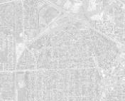
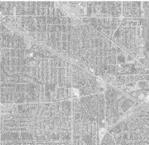
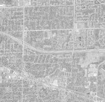
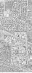
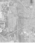
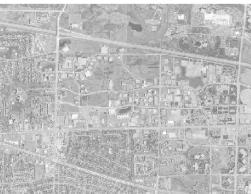
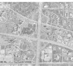
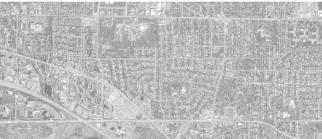
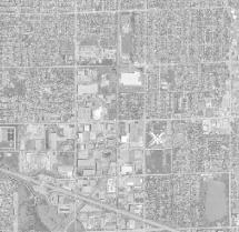
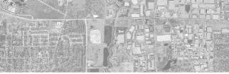
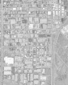
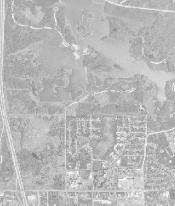
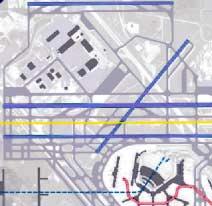
7 N O RTHW E ST C O RRID O R PH A S E II A LT E RN A TIV E S A N A LYSIS Line, Grade & Cross-Section Data Conceptual alignment and station plans are shown on the following pages, utilizing base aerial photomaps provided by the RTA. The aerials are only as accurate as the land uses patterns in place at the time the aerial photographs were taken. Major land use changes that have been constructed since the photographing of these aerials have been noted. The alignment and station plans should not be considered final; they are provided for an understanding of how a Blue Line extension could be achieved and operated, and for preliminary cost estimation. As discussed in the Overview section, the Schaumburg Blue Line extension has been planned with the O Hare Modernization Program. The final alignments near the airport will change from what is shown, as plans for access improvements are developed; they are shown for cost estimation purposes only. Station locations have considered site conditions, local development, arterial access, and the work performed in the Land Use Study by the Northwest Municipal Conference. Two alternate alignments are provided: North Alignment, generally along I-90. South Alignment, generally along Thorndale Avenue and Rohlwing Road. Key Assumptions The project start point is the west side of O Hare Airport. The right-of-way along I-90 is assumed to be available for the project. Locations where the proposed alignment requires land acquisition outside of public rights-of-way can be identified on the plans. Utility, survey and engineering data, beyond what can be seen on the aerial photomaps, was not made available during this phase of the study. The western terminal is adjacent to the proposed Schaumburg Convention Center. The station facility and tracks are proposed on aerial structure over the center of I-90. Major rail car maintenance and storage is assumed to occur at existing Blue Line yard facilities. A light maintenance facility could be constructed as part of the Schaumburg Convention Center terminal. The plans have not been developed to the level to site traction power substations. Standard CTA automatic cab signal system should be assumed, with bi-directional operation. Emergency crossovers should be located every mile, and include one 1,400-foot emergency center track for temporary storage of defective and work equipment. The Schaumburg Convention Center station includes two, 10-car train turnback tracks, extending to the west of the station platform. Typical cross sections representing CTA design criteria are provided at the end of this section. Maximum vertical grade is 4%. CTA Planning & Development April 18, 2003 Blue Line Extension to Schaumburg Description of Alternatives


8

9 ALIGNMENT IS PROVIDED FOR COST ESTIMATION PURPOSES ONLY. FINAL ALIGNMENT WILL BE INCORPORATED INTO O'HARE MODERNIZATION PROGRAM AND WEST BY-PASS CORRIDOR IMPROVEMENTS. 570 FT. RADIUS ML-A (N) ML-B (N) ML-A (N) N. YORK RD. 5256' (AT-GRADE) NORTH ALIGNMENT 1" = 400' MATCHLINE A-A (ML A-A)
 ML-B (N) ML-A (N) N. YORK RD.")
10 ML-C (N) ML-B (N) 4505 FT. RADIUS ALIGNMENT IS PROVIDED FOR COST ESTIMATION PURPOSES ONLY. FINAL ALIGNMENT WILL BE INCORPORATED INTO O'HARE MODERNIZATION PROGRAM AND WEST BY-PASS CORRIDOR IMPROVEMENTS FT. RADIUS ELK GROVE VILLAGE STATION (AT-GRADE) ML-B (N) ML-A (N) N. YORK RD. 400' (TRANSITION) 4505' (AT-GRADE) PACE BUS ROUTES ELK GROVE VILLAGE CIRCULATOR 1" = 400' NORTH ALIGNMENT MATCHLINE B-B (ML B-B)
 ML-B (N) 4844' (STRUCTURE) NORTH ALIGNMENT 1\" =")
11 I-90 ML-C (N) ML-D (N) 2000 FT. RADIUS 1600 FT. RADIUS TOUHY ML-C (N) ML-B (N) 4844' (STRUCTURE) NORTH ALIGNMENT 1" = 400' MATCHLINE C-C (ML C-C)

12 PACE BUS DES PLAINES STATION (STRUCTURE) 3 PACE BUS ROUTES ML-E (N) ML-D (N) ML-D (N) N. YORK RD FT. RADIUS 2000 FT. RADIUS ML-C (N) 5049' (STRUCTURE) 1" = 400' NORTH ALIGNMENT NORTHWEST CORRIDOR PHASE II MATCHLINE D-D (ML D-D)
 ML-D (N) 1700 FT.")
13 ML-F (N) NEW PEDESTRIAN ACCESS IMPROVEMENTS ML-E (N) 2040 FT. RADIUS BUSSE RD FT. RADIUS PACE BUS LANDFILL 1200 FT. RADIUS ML-E (N) ML-D (N) 1700 FT. RADIUS 3534' (AT-GRADE) 400' (TRANSITION) NORTH ALIGNMENT 1" = 400' MATCHLINE E-E (ML E-E)
 ML-F (N) ML-E (N) 3-4 PACE BUS ROUTES 2040 FT. RADIUS 1200 FT. RADIUS NEW PEDESTRIAN ACCESS IMPROVEMENTS BUSSE RD.")
14 PACE BUS HIGH VOLTAGE TRANSMISSION LINES MOUNT PROSPECT STATION (STRUCTURE) 1771' (AT-GRADE) 400' 2163' (STRUCTURE) 400' (TRANSITION) (TRANSITION) ML-G (N) ML-F (N) ML-F (N) ML-E (N) 3-4 PACE BUS ROUTES 2040 FT. RADIUS 1200 FT. RADIUS NEW PEDESTRIAN ACCESS IMPROVEMENTS BUSSE RD. NORTH ALIGNMENT 1" = 400' MATCHLINE F-F (ML F-F)
 ML-G (N) ML-G (N) ML-F (N) 3755 FT.")
15 PACE BUS HIGH VOLTAGE TRANSMISSION LINES ARLINGTON HEIGHTS STATION (STRUCTURE) 2940' (AT-GRADE) ML-H (N) ML-G (N) ML-G (N) ML-F (N) 3755 FT. RADIUS 1" = 400' NORTH ALIGNMENT MATCHLINE G-G (ML G-G)

16 PACE BUS-ARLINGTON HEIGHTS ARLINGTON HEIGHTS STATION(STRUCTURE) 3 PACE BUS ROUTES 1110' (AT-GRADE) 400' 3612' (STRUCTURE) 400' (TRANSITION) (TRANSITION) ML-J (N) ML-H (N) I-90 ML-H (N) ML-G (N) CEMETERY 2-3 PACE BUS ROUTES 2450 FT. RADIUS PACE BUS-ITASCA & ELK GROVE VILLAGE 3755 FT. RADIUS ARLINGTON HEIGHTS RD. 1" = 400' NORTH ALIGNMENT NORTHWEST CORRIDOR PHASE II MATCHLINE H-H (ML H-H)
 4123' (AT-GRADE) ML-K (N) ML-J (N) I-90 ML-J (N) ML-H")
17 GOLF RD. OFFICE & HOTEL PLANS PACE BUS 400' (TRANSITION) 4123' (AT-GRADE) ML-K (N) ML-J (N) I-90 ML-J (N) ML-H (N) 2450 FT. RADIUS NORTH ALIGNMENT 1" = 400' NORTHWEST CORRIDOR PHASE II MATCHLINE J-J (ML J-J)
 ML-J (N) ML-L (N) ML-K (N) 1290 FT. RADIUS 1590 FT.")
18 NEW PEDESTRIAN CONNECTION ROLLING MEADOWS STATION (STRUCTURE) I FT. RADIUS GOLF RD. ML-K (N) ML-J (N) ML-L (N) ML-K (N) 1290 FT. RADIUS 1590 FT. RADIUS 6054' (STRUCTURE) NORTH ALIGNMENT 1" = 400' NORTHWEST CORRIDOR PHASE II MATCHLINE K-K (ML K-K)
 ML-K (N) SCHAUMBURG-WOODFIELD STATION (STRUCTURE) 1\" = 400' NORTH ALIGNMENT MATCHLINE L-L (ML")
19 ML-M (N) ML-L (N) 450 FT. RADIUS 4853' (STRUCTURE) I FT. RADIUS BRT 480 FT. RADIUS GOLF RD. ML-L (N) ML-K (N) SCHAUMBURG-WOODFIELD STATION (STRUCTURE) 1" = 400' NORTH ALIGNMENT MATCHLINE L-L (ML L-L)
20 2 LOCAL ROUTES BUS DECK (10-12 ROUTES) SCHAUMBURG CONVENTION CENTER STATION (STRUCTURE) ML-M (N) BRT BRT I-90 MEACHAM RD. EXISTING DEVELOPMENT WETLANDS 775 FT. RADIUS 550 FT. RADIUS ML-L (N) ML-M (N) 825 FT. RADIUS 4246' (STRUCTURE) 1" = 400' NORTH ALIGNMENT MATCHLINE M-M (ML M-M)
21 NORTHWEST CORRIDOR PHASE II Line, Grade & Cross-Section Data South Alignment CTA Planning & Development April 18, 2003 Blue Line Extension to Schaumburg Description of Alternatives
 5142' (STRUCTURE) 1\" = 400' S OUTH ALIG NMENT MATCHLINE")
22 THORNDALE N. YORK RD. ML-B (S) ML-A (S) 2160 FT. RADIUS 1605 FT. RADIUS ML-A (S) 5142' (STRUCTURE) 1" = 400' S OUTH ALIG NMENT MATCHLINE A-A (ML A-A)
 ML-B (S) 3465 FT.")
23 PACE BUS ROUTES BENSENVILLE-WOOD DALE STATION (STRUCTURE) ML-B (S) ML-A (S) THORNDALE BUSSE RD. ML-C (S) ML-B (S) 3465 FT. RADIUS 6026' (STRUCTURE) SOUTH ALIGNMENT 1" = 400' MATCHLINE B-B (ML B-B)
 SOUTH ALIGNMENT 1\" = 400' MATCHLINE C-C")
24 ML-D (S) ML-C (S) THORNDALE ML-C (S) ML-B (S) FT. RADIUS 4335' (STRUCTURE) SOUTH ALIGNMENT 1" = 400' MATCHLINE C-C (ML C-C)
 PACE BUS PACE BUS ROUTES ML-E (S) ML-D (S) THORNDALE ML-D (S) ML-C (S) PACE BUS ITASCA STATION")
25 HOTEL OFFICE ARLINGTON HEIGHTS RD. ROAD (EXISTING) PACE BUS PACE BUS ROUTES ML-E (S) ML-D (S) THORNDALE ML-D (S) ML-C (S) PACE BUS ITASCA STATION (STRUCTURE) 4244' (STRUCTURE) 1" = 400' S OUTH ALIG NMENT MATCHLINE D-D (ML D-D)
 THORNDALE ML-E (S) ML-E (S) ML-D (S) 3791' (STRUCTURE) 1\" = 400'")
26 I-290 ITASCA STATION (STRUCTURE) 1870 FT. RADIUS ML-F (S) THORNDALE ML-E (S) ML-E (S) ML-D (S) 3791' (STRUCTURE) 1" = 400' S OUTH ALIG NMENT MATCHLINE E-E (ML E-E)
 ML-F (S) ROHLWING RD.")
27 14000 FT. RADIUS ML-E (S) I-290 ML-F (S) 3817' (STRUCTURE) DEVON AVE FT. RADIUS THORNDALE ML-G (S) ML-F (S) ROHLWING RD. SOUTH ALIGNMENT 1" = 400' MATCHLINE F-F (ML F-F)
 ML-F (S) 3281' (STRUCTURE) 1\" = 400' S OUTH ALIG NMENT")
28 DEVON AVE FT. RADIUS ML-H (S) ML-G (S) ROHLWING RD. ML-G (S) ML-F (S) 3281' (STRUCTURE) 1" = 400' S OUTH ALIG NMENT MATCHLINE G-G (ML G-G)
 784' (AT-GRADE) 400' (TRANSITION) 2497' (STRUCTURE) 1\" = 400' S OUTH ALIG NMENT")
29 I-290 BIESTERFIELD RD. 885 FT. RADIUS PACE BUS ROUTES ML-J (S) ML-H (S) ROHLWING RD. ML-H (S) ML-G (S) 1400 FT. RADIUS ELK GROVE VILLAGE STATION (STRUCTURE) 784' (AT-GRADE) 400' (TRANSITION) 2497' (STRUCTURE) 1" = 400' S OUTH ALIG NMENT MATCHLINE H-H (ML H-H)
 OFFICE (EXISTING) SOUTH ALIGNMENT 1\" = 400' MATCHLINE J-J")
30 5725 FT. RADIUS ML-K (S) ML-J (S) I-290 ROHLWING RD. ML-J (S) ML-H (S) 1400 FT. RADIUS 4893' (AT-GRADE) OFFICE (EXISTING) SOUTH ALIGNMENT 1" = 400' MATCHLINE J-J (ML J-J)
 ML-J (S) 2762' (STRUCTURE) 400' (TRANSITION) 1801' (AT-GRADE) HIGGINS RD.")
31 HIGGINS RD. PACE BUS ROUTES ML-L (S) ML-K (S) ROHLWING RD. ML-K (S) ML-J (S) 2762' (STRUCTURE) 400' (TRANSITION) 1801' (AT-GRADE) HIGGINS RD. STATION (STRUCTURE) OFFICE (EXISTING) 1" = 400' S OUTH ALIG NMENT MATCHLINE K-K (ML K-K)

32 GOLF RD. SCHAUMBURG-WOODFIELD STATION (STRUCTURE) I FT. RADIUS ML-L (S) ML-K (S) 2600 FT. RADIUS 1200 FT. RADIUS 600 FT. RADIUS 2340 FT. RADIUS ML-L (S) 4212' (STRUCTURE) 1" = 400' S OUTH ALIG NMENT MATCHLINE L-L (ML L-L)

33 BRT I-290 SCHAUMBURG-WOODFIELD STATION (STRUCTURE) ML-N (S) ML-M (S) 450 FT. RADIUS 480 FT. RADIUS GOLF RD. ML-L (S) ML-M (S) 2175' (STRUCTURE) 1" = 400' S OUTH ALIG NMENT MATCHLINE M-M (ML M-M)
 550 FT. RADIUS 825 FT.")
34 2 LOCAL ROUTES BUS DECK (10-12 ROUTES) SCHAUMBURG CONVENTION CENTER STATION (STRUCTURE) ML-M (N) BRT BRT I-90 MEACHAM RD. EXISTING DEVELOPMENT WETLANDS 775 FT. RADIUS ML-N (S) 550 FT. RADIUS 825 FT. RADIUS ML-M (S) 4246' (STRUCTURE) 1" = 400' S OUTH ALIG NMENT MATCHLINE N-N (ML N-N)
35 3/32"=1'-0" SCHAMBURG C ONVENTION CENTER AERIAL STRUCTURE SE CTIO N
36 3/32"=1'-0" AERIAL STRUCTURE AERIAL STRUCTURE SE CTIO N
37 3/32"=1'-0" AT-GRADE AT-GRADE SE CTIO N
38 3/32"=1'-0" O PEN-C UT OPEN CUT SECTION
39 N O RTHW E ST C O RRID O R PH A S E II A LT E RN A TIV E S A N A LYSIS Station Definition, F eeder B us & Station A ccess A ssumptions A narrative and photographic description of each station includes an outline of Pace bus feeder service developed in cooperation with Pace, extent of park & ride facilities, intermodal facilities, pedestrian/roadway links to adjacent development, and estimated travel times within the line extension. Station Design Criteria Center Island, 520-foot tangent platform (10-car trains). 24-foot wide minimum platform width. Vertical access includes escalator, stair and elevator. Automatic Fare Collection system of turnstiles and transit card vending machines, compatible with existing CTA equipment. CTA Planning & Development April 18, 2003 Blue Line Extension to Schaumburg Description of Alternatives
")

40 Station Program o At-grade station o Bus transfer facility Recommended Feeder Bus Service o Pace circulator service to adjacent industrial/commercial areas west of station o Pace arterial service on York/Elmhurst Road (serving Bensenville) Estimated Travel Times o minutes to Schaumburg-Convention Center o 1.75 minutes to O'Hare West 125 Proposed alignment on railroad right-of-way f West of station location on Devon Ave NORTH ALIGNMENT ELK GROVE VILLAGE STATION (NORTH ALIGNMENT) D1


41 Station Program o Elevated station o Center platform o Bus transfer facility o Park & Ride for 1,000 vehicles Recommended Feeder Bus Service o Pace circulator service to Des Plaines o Pace arterial service on Oakton and Elmhurst Roads Estimated Travel Times o 11 minutes to Schaumburg-Convention Center o 4.5 minutes to O'Hare West 94 Proposed station location / trailer park 91 Proposed alignment / waste management facility NORTH ALIGNMENT DES PLAINES STATION (NORTH ALIGNMENT) D2


42 Station Program o Elevated station o Center platform o Bus transfer facility o Improved pedestrian connection at intersection of Busse Road and Higgins Road Recommended Feeder Bus Service o Pace circulator service to adjacent employment centers and residential areas o Pace arterial service on Busse, Higgins, and Oakton Roads Estimated Travel Times o 4.75 minutes to Schaumburg-Convention Center o minutes to O'Hare West 82 Proposed station location adjacent to tollway 2 Busse Road and Tollway intersection NORTH ALIGNMENT MOUNT PROSPECT STATION (NORTH ALIGNMENT) D3


43 66 Proposed station location Station Program o Elevated station o Center platform o Bus transfer facility o Park & Ride for 1,000 vehicles o Pedestrian connection to bus facility north of Tollway Recommended Feeder Bus Service o Pace circulator service to adjacent employment centers and residential areas o Pace arterial service south from Arlington Heights community (utilizing bus facility north of Tollway) o Pace arterial service north from Elk Grove Village and Itasca (utilizing bus facility south of Tollway) Estimated Travel Times o 6 minutes to Schaumburg-Convention Center o 9.5 minutes to O'Hare West 63 Proposed alignment at Arlington Heights Road/ Tollway interchange NORTH ALIGNMENT ARLINGTON HEIGHTS STATION (NORTH ALIGNMENT) D4


44 Station Program o Elevated station o Center platform o Bus transfer facility o Pedestrian connection to north side of Tollway Recommended Feeder Bus Service o Pace circulator service to adjacent employment centers o Pace arterial service connecting areas north of Tollway in Rolling Meadows and Golf Road Estimated Travel Times o 7.5 minutes to Schaumburg-Convention Center o 8 minutes to O'Hare West 59 Proposed station location and adjacent office complex 56 Golf Road alignment NORTH ALIGNMENT ROLLING MEADOWS STATION (NORTH ALIGNMENT) D5


45 Station Program o Elevated station o Center platform o Bus transfer facility Recommended Feeder Bus Service o Pace circulator service to Roosevelt University, Streets of Woodfield and adjacent employment centers o Pace arterial bus service between Woodfield Mall and surrounding communities Estimated Travel Times o 2.75 minute to Schaumburg-Convention Center o minutes to O'Hare West 38 Across street from station location at Woodfield Mall 45 Alignment intersection with I-290 NORTH ALIGNMENT SCHAUMBURG - WO ODFIELD MALL (NORTH ALIGNMENT) D6
46 Station Program o Elevated station o Two platforms o Intermodal BRT - HRT facility Recommended Feeder Bus Service o Pace circulator service to adjacent employment and retail centers o Two Pace BRT routes: one west to Elgin on I-90, one north-south on I-53/290/355 Estimated Travel Times o 15.5 minutes to O'Hare West 22 Proposed station location and convention center site Note: Assuming reconfiguration of Meacham Road and Tollway occur as part of programmed Meacham Road widening and planned new Tollway interchange. 33 Nearby development and proposed alignment NORTH ALIGNMENT SCHAUMBURG C ONVENTION/TRANSIT CENTER (NORTH ALIGNMENT) D7
47 N O RTHW E ST C O RRID O R PH A S E II A LT E RN A TIV E S A N A LYSIS Station Definition, F eeder B us & Station A ccess A ssumptions South Alignment CTA Planning & Development April 18, 2003 Blue Line Extension to Schaumburg Description of Alternatives


48 Station Program o Elevated station o Bus transfer facility o Park & Ride for 1,000 vehicles Recommended Feeder Bus Service o Pace circulator service to adjacent commercial/industrial and residential areas o Pace local bus service on Busse Road Estimated Travel Times o 13 minutes to Schaumburg-Convention Center o 2 minutes to O'Hare West k Proposed station location on Thorndale Road g Local street north of station location SOUTH ALIGNMENT BENSENVILLE - WO OD DALE STATION (SOUTH ALIGNMENT) D1s


49 Station Program o Elevated station o Bus transfer facility o Park & Ride for 1,000 vehicles Recommended Feeder Bus Service o Pace circulator service to commercial/industrial area north and residential area south of station o Pace arterial bus service on Arlington Heights Road Estimated Travel Times o 10.5 minutes to Schaumburg-Convention Center o 4.5 minutes to O'Hare West 113 Proposed station location with nearby hotel and office in distance 109 Proposed alignment on Thorndale Road SOUTH ALIGNMENT ITASCA STATION (SOUTH ALIGNMENT) D2s

")
50 Station Program o Elevated station o Bus transfer facility o Park & Ride for 1,000 vehicles Recommended Feeder Bus Service o Pace circulator service from residential area west of station o Pace arterial bus service on Rohlwing Road to Itasca and Spring Lake Industrial Parks Estimated Travel Times o 7.5 minutes to Schaumburg-Convention Center o 7.5 minutes to O'Hare West 124 Proposed station location north of Biesterfield Road 125 Proposed Rohlwing Road alignment (northbound) SOUTH ALIGNMENT ELK GROVE VILLAGE STATION (SOUTH ALIGNMENT) D3s

 SOUTH ALIGNMENT HIGGINS")
51 Station Program o Elevated station o Bus transfer facility Recommended Feeder Bus Service o Pace circulator service from residential area west of station o Pace circulator service from Streets of Woodfield and commercial complexes north of station o Pace arterial service on Higgins Road Estimated Travel Times o minutes to Schaumburg-Convention Center o 4.75 minutes to O'Hare West 128 Propsoed station location 125 Proposed Rohlwing Road alignment (northbound) SOUTH ALIGNMENT HIGGINS ROAD STATION (SOUTH ALIGNMENT) D4s


52 41 Proposed station location and grade change Station Program o Elevated station o Center platform o Bus transfer facility Recommended Feeder Bus Service o Pace circulator service to Roosevelt University, Streets of Woodfield and adjacent employment centers o Pace arterial bus service between Woodfield Mall and surrounding communities Market Targets o Woodfield Mall and surrounding retail employees and customers o Roosevelt University employees and students Estimated Travel Times o 2.75 minute to Schaumburg-Convention Center o minutes to O'Hare West 131 Alignment through Woodfield Mall surface parking SOUTH ALIGNMENT SCHAUMBURG - WO ODFIELD MALL (SOUTH ALIGNMENT) D5s


53 Station Program o Elevated station o Two platforms o Intermodal BRT - HRT facility Recommended Feeder Bus Service o Pace circulator service to adjacent employment and retail centers o Two Pace BRT routes: one west to Elgin on I-90, one north-south on I-53/290/355 Estimated Travel Times o 15 minutes to O'Hare West 22 Proposed station location and convention center site Note: Assuming reconfiguration of Meacham Road and Tollway occur as part of programmed Meacham Road widening and planned new Tollway interchange. 33 Nearby development and proposed alignment NORTH ALIGNMENT SCHAUMBURG C ONVENTION / TRANSIT CENTER (SOUTH ALIGNMENT) D6s
CHICAGO TRANSIT AUTHORITY
 CHICAGO TRANSIT AUTHORITY Blue Line Extension to Schaumburg RTA Northwest Corridor Phase II Alternatives Analysis May 8, 2003 Project Overview In June 2002 RTA requested that CTA, Pace, Metra and ISTHA,
Bi-County Transitway/ Bethesda Station Access Demand Analysis
 Bi-County Transitway/ Bethesda Station Access Demand Analysis Prepared for: Washington Metropolitan Area Transit Authority Office of Planning and Project Development May 2005 Prepared by: in conjunction
METRO Orange Line BRT American Boulevard Station Options
 METRO Orange Line BRT American Boulevard Station Options Bloomington City Council Work Session November 18, 2013 Christina Morrison BRT/Small Starts Project Office Coordinating Planning and Design AMERICAN
Public Meeting. City of Chicago Department of Transportation & Department of Housing and Economic Development
 Public Meeting City of Chicago Department of Transportation & Department of Housing and Economic Development Funded by Regional Transportation Authority September 12, 2011 In partnership with Presentation
TORONTO TRANSIT COMMISSION REPORT NO.
 Form Revised: February 2005 TORONTO TRANSIT COMMISSION REPORT NO. MEETING DATE: October 24, 2012 SUBJECT: DOWNTOWN RAPID TRANSIT EXPANSION STUDY (DRTES) PHASE 1 STRATEGIC PLAN ACTION ITEM RECOMMENDATIONS
FINAL. Sound Transit Long-Range Plan Update. Issue Paper S.1: Tacoma Link Integration with Central Link. Prepared for: Sound Transit
 Sound Transit Long-Range Plan Update Issue Paper S.1: Tacoma Link Integration with Central Link Prepared for: Sound Transit Prepared by: Quade & Douglas, Inc. FINAL March 2005 Foreword This issue paper
4.0 TIER 2 ALTERNATIVES
 4.0 TIER 2 ALTERNATIVES The Tier 2 Alternatives represent the highest performing Tier 1 Alternatives. The purpose of the Tier 2 Screening was to identify the LPA utilizing a more robust list of evaluation
Chapter 4 : THEME 2. Transportation
 Chapter 4 : THEME 2 Strengthen connections to keep the Central Area easy to reach and get around 55 Figure 4.2.1 Promote region-wide transit investments. Metra commuter rail provides service to the east,
NICTI Alternatives Analysis
 EXECUTIVE SUMMARY Development of Detailed Alternatives Report Prepared for: Northern Illinois Commuter Transportation Initiative City of Rockford, Illinois Prepared by: 222 South Riverside Plaza, Suite
Valley Metro Overview. ITE/IMSA Spring Conference March 6, 2014
 Valley Metro Overview ITE/IMSA Spring Conference March 6, 2014 Valley Metro Who Are We? Operate Regional Transit Services Valley Metro and Phoenix are region s primary service providers Light Rail and
Location Concept Plan Amendment Recommendation Approved 2011 Concept Plan
 Valley Line West LRT Concept Plan Recommended Amendments Lewis Farms LRT Terminus Site Location Concept Plan Amendment Recommendation Approved 2011 Concept Plan Lewis Farms LRT terminus site, 87 Avenue/West
Chicago Transit Authority Service Standards and Policies
 Chicago Transit Authority Service Standards and Policies Overview and Objectives The Chicago Transit Authority (CTA) has revised its Service Standards and Policies in accordance with Federal Transit Administration
Mississauga Bus Rapid Transit Preliminary Design Project
 Mississauga Bus Rapid Transit Preliminary Design Project PUBLIC INFORMATION CENTRE OCTOBER 2008 WELCOME The Mississauga Bus Rapid Transit (BRT) Project Thank you for attending this Public Information Centre.
Letter EL652 City of Mercer Island. Page 1. No comments n/a
 Letter EL652 City of Mercer Island Page 1 No comments n/a Page 2 Response to comment EL652 1 Section 4.5.3 of the Final EIS presents the range of potential impacts of the project. This project also lists
6/6/2018. June 7, Item #1 CITIZENS PARTICIPATION
 June 7, 2018 Item #1 CITIZENS PARTICIPATION 1 Item #2 APPROVAL OF MINUTES Item #3 TRAC GOALS, FRAMEWORK & AGENDA REVIEW 2 COMMITTEE GOALS Learn about Southern Nevada s mobility challenges, new developments
5. OPPORTUNITIES AND NEXT STEPS
 5. OPPORTUNITIES AND NEXT STEPS When the METRO Green Line LRT begins operating in mid-2014, a strong emphasis will be placed on providing frequent connecting bus service with Green Line trains. Bus hours
EUGENE-SPRINGFIELD, OREGON EAST WEST PILOT BRT LANE TRANSIT DISTRICT
 EUGENE-SPRINGFIELD, OREGON EAST WEST PILOT BRT LANE TRANSIT DISTRICT (BRIEF) Table of Contents EUGENE-SPRINGFIELD, OREGON (USA)... 1 COUNTY CONTEXT AND SYSTEM DESCRIPTION... 1 SYSTEM OVERVIEW... 1 PLANNING
Executive Summary. Draft Environmental Impact Statement/Environmental Impact Report ES-1
 Executive Summary Introduction The Eastside Transit Corridor Phase 2 Project is a vital public transit infrastructure investment that would provide a transit connection to the existing Metro Gold Line
Challenges in a Post-Katrina Environment East-West Corridor Project Overview February, 2007
 EAST-WEST CORRIDOR Challenges in a Post-Katrina Environment East-West Corridor Project Overview February, 2007 Presentation Agenda Project Overview / Purpose and Need Highway Component Transit Component
Station Evaluation. Durham-Orange Light Rail Transit Project Spring 2012
 Station Evaluation Durham-Orange Light Rail Transit Project Spring 2012 Key Ingredients for Station Development Platform Designs UNC Hospitals Station The UNC Hospitals Station Option D would be the westerly
Business Advisory Committee. July 7, 2015
 Business Advisory Committee July 7, 2015 1 Today s Topics Outreach Update TI #1 and 2: Target Field Station Connection to I-94: Recommendation 85 th Station Configuration 93 rd Station Configuration DEIS
The Engineering Department recommends Council receive this report for information.
 CORPORATE REPORT NO: R161 COUNCIL DATE: July 23, 2018 REGULAR COUNCIL TO: Mayor & Council DATE: July 19, 2018 FROM: General Manager, Engineering FILE: 8740-01 SUBJECT: Surrey Long-Range Rapid Transit Vision
2 EXISTING ROUTE STRUCTURE AND SERVICE LEVELS
 2 EXISTING ROUTE STRUCTURE AND SERVICE LEVELS In the Study Area, as in most of the Metro Transit network, there are two distinct route structures. The base service structure operates all day and the peak
STH 60 Northern Reliever Route Feasibility Study Report
 #233087 v3 STH 60 Northern Reliever Route Feasibility Study Report Washington County Public Works Committee Meeting September 28, 2016 1 STH 60 Northern Reliever Route Feasibility Study Hartford Area Development
Shuttle Bug: Linking Workers to Public Transportation in Northern Cook and Southern Lake Counties University of Illinois- Chicago Urban
 Shuttle Bug: Linking Workers to Public Transportation in Northern Cook and Southern Lake Counties University of Illinois- Chicago Urban Transportation Center- 2016 Seminar Series November 17,2016 About
Point A Point B Point C Point D. Fulton County Board of Commissioners and Mayors Meeting December 14, 2017
 Fulton County Board of Commissioners and Mayors Meeting December 14, 2017 Master Plan Overview Phase 1 Community Vision and Existing Transit Conditions Phase 2 Scenario Development Phase 3 Transit Master
Note: The October 2007 version of this report has been updated in this December 2008 report to present costs in year 2007 dollars.
 Sound Transit Phase 2 South Corridor LRT Design Report: SR 99 and I-5 Alignment Scenarios (S 200 th Street to Tacoma Dome Station) Tacoma Link Extension to West Tacoma Prepared for: Sound Transit Prepared
Mannheim/Higgins. Lee/Touhy. Municipal. Alternate 1), Village of Rosemont (Eastbound. Major Considerations:
, Village of Rosemont (Eastbound. Major Considerations:") Mannheim/Higgins Municipality: Municipality: City of Village Des Plaines of Skokie (Eastbound Alternate 1), Village of Rosemont (Eastbound Alternate Major 2 and Considerations: Westbound Alternate 1),
Mannheim/Higgins Municipality: Municipality: City of Village Des Plaines of Skokie (Eastbound Alternate 1), Village of Rosemont (Eastbound Alternate Major 2 and Considerations: Westbound Alternate 1),
SUPPORTING TOD IN METRO CHICAGO
 www.rtachicago.org SUPPORTING TOD IN METRO CHICAGO Tuesdays at APA November 18, 2014 OVERVIEW OF RTA 2 11/18/2014 Tuesdays at APA: Supporting TOD in Metro Chicago RTA Region 8.5 million people 3,700 square
Develop ground transportation improvements to make the Airport a multi-modal regional
 Project Overview TRANSPORTATION IMPROVEMENTS WHAT ARE THE PROJECT GOALS? Transportation transportation hub. Develop ground transportation improvements to make the Airport a multi-modal regional Land Use
Community Advisory Committee. October 5, 2015
 Community Advisory Committee October 5, 2015 1 Today s Topics Hennepin County Community Works Update Project Ridership Estimates Technical Issue #4:Golden Valley Rd and Plymouth Ave Stations Technical
Executive Summary. Treasure Valley High Capacity Transit Study Priority Corridor Phase 1 Alternatives Analysis October 13, 2009.
 Treasure Valley High Capacity Transit Study Priority Corridor Phase 1 Alternatives Analysis October 13, 2009 Background As the Treasure Valley continues to grow, high-quality transportation connections
Development of 220 mph High Speed Rail Service for Illinois. Mark C. Walbrun, PE TranSystems Corporation
 Development of 220 mph High Speed Rail Service for Illinois Mark C. Walbrun, PE TranSystems Corporation 1 Study Purpose Worldwide Use of High Speed Rail Technology Japan, France, Italy, Germany, Spain,
MetroExpress Improvements
 Improvements Enhancements Short-term improvements to keep Austin moving. Investments Long-term projects to support our future. Mobility Hubs MetroRapid MetroRail Commuters Connectors Circulators Project
SERVICE DESIGN GUIDELINES
 VTA TRANSIT SUSTAINABILITY POLICY: APPENDIX A SERVICE DESIGN GUIDELINES Adopted February 2007 COMMUNITYBUS LOCALBUS EXPRESSBUS BUSRAPIDTRANSIT LIGHTRAILTRANSIT STATIONAREAS S A N T A C L A R A Valley Transportation
TRANSIT FEASIBILITY STUDY Town of Bradford West Gwillimbury
 TRANSIT FEASIBILITY STUDY Town of Bradford West Gwillimbury Open House Presentation January 19, 2012 Study Objectives Quantify the need for transit service in BWG Determine transit service priorities based
CTA Blue Line Study Area
 CTA Blue Line Study Area HISTORY OF THE CTA BLUE LINE / I-290 SYSTEM Blue Line / I-290 infrastructure is 55 years old First integrated transit / highway facility in the U.S. PROJECT STUDY AREA EXISTING
2.0 Development Driveways. Movin Out June 2017
 Movin Out June 2017 1.0 Introduction The proposed Movin Out development is a mixed use development in the northeast quadrant of the intersection of West Broadway and Fayette Avenue in the City of Madison.
Transportation Highway Engineering Conference February 24, 2015
 Transportation Highway Engineering Conference February 24, 2015 Today s Agenda Move Illinois status Jane Addams Memorial (I-90) Rebuilding and Widening Project Building a 21 st century corridor Incorporating
I-20 EAST TRANSIT INITIATIVE Tier 1 and Tier 2 Alternatives Screening Report EXECUTIVE SUMMARY
 EXECUTIVE SUMMARY The purpose of this report is to document the results of the Tier 1 and Tier 2 Screening of alternatives for the I-20 East Transit Initiative. The two-tier screening process presented
METRO Light Rail Update
 American Society of Highway Engineers METRO Light Rail Update Brian Buchanan Director, Design and Construction October 13, 2009 1 High Capacity Transit System 2 20-Mile Light Rail Line 3 Operations Operations
US 81 Bypass of Chickasha Environmental Assessment Public Meeting
 US 81 Bypass of Chickasha Environmental Assessment Public Meeting March 14, 2013 Introductions ODOT FHWA SAIC Meeting Purpose Present need for bypass Provide responses to 10/04/11 public meeting comments
Traffic Impact Study Speedway Gas Station Redevelopment
 Traffic Impact Study Speedway Gas Station Redevelopment Warrenville, Illinois Prepared For: Prepared By: April 11, 2018 Table of Contents 1. Introduction... 1 2. Existing Conditions... 4 Site Location...
V03. APTA Multimodal Operations Planning Workshop August Green Line LRT
 V03 APTA Multimodal Operations Planning Workshop August 2016 Green Line LRT 2 Presentation Outline Past Present Future 3 16/03/2016 RouteAhead Update 4 4 16/03/2016 RouteAhead Update 5 5 16/03/2016 6 6
The Latest on Joint Development Policy Guidance
 Panelists The Latest on Joint Development Policy Guidance Moderator: Jonathan Davis Deputy General Manager and Chief Financial Officer Massachusetts Bay Transportation Authority James Blakesley, Attorney-Advisor,
US 29 Bus Rapid Transit Planning Board Briefing. February 16, 2017
 US 29 Bus Rapid Transit Planning Board Briefing February 16, 2017 Project Goals Improve the quality of transit service Improve mobility opportunities and choices Enhance quality of life Support master
Calgary Transit and the Calgary Transportation Plan Chris Jordan, M.Sc., P.Eng. Coordinator, Strategic Transit Planning, Calgary Transit
 Calgary Transit and the Calgary Transportation Plan Chris Jordan, M.Sc., P.Eng. Coordinator, Strategic Transit Planning, Calgary Transit 1. Plan It Calgary the new Municipal Development Plan and Calgary
Table 8-1: Service Frequencies for All Short-List Alternatives by Day of Week and Time of Day Frequency Day of Week Time of Day Time Period
 8. Operating Plans The following Section presents the operating plans for the Short-List Alternatives. The modern streetcar operating plans are presented for Alternatives 2 and 3, followed by bus rapid
GO Transit s deliverable: the 2020 Service Plan
 GO Transit s deliverable: the 2020 Service Plan GO Transit s 2020 Service Plan describes GO s commitment to customers, existing and new, to provide a dramatically expanded interregional transit option
BROWARD BOULEVARD CORRIDOR TRANSIT STUDY
 BROWARD BOULEVARD CORRIDOR TRANSIT STUDY FM # 42802411201 EXECUTIVE SUMMARY July 2012 GOBROWARD Broward Boulevard Corridor Transit Study FM # 42802411201 Executive Summary Prepared For: Ms. Khalilah Ffrench,
Maryland Gets to Work
 I-695/Leeds Avenue Interchange Reconstruction Baltimore County Reconstruction of the I-695/Leeds Avenue interchange including replacing the I-695 Inner Loop bridges over Benson Avenue, Amtrak s Northeast
6/11/2018. June 7, Item #1 CITIZENS PARTICIPATION
 June 7, 2018 Item #1 CITIZENS PARTICIPATION 1 Item #2 APPROVAL OF MINUTES Item #3 TRAC GOALS, FRAMEWORK & AGENDA REVIEW 2 COMMITTEE GOALS Learn about Southern Nevada s mobility challenges, new developments
4 COSTS AND OPERATIONS
 4 COSTS AND OPERATIONS 4.1 INTRODUCTION This chapter summarizes the estimated capital and operations and maintenance (O&M) costs for the Modal and High-Speed Train (HST) Alternatives evaluated in this
Waco Rapid Transit Corridor (RTC) Feasibility Study
 Feasibility Study") Waco Rapid Transit Corridor (RTC) Feasibility Study Chris Evilia, Director of Waco Metropolitan Planning Organization Allen Hunter, General Manager Waco Transit System Jimi Mitchell, Project Manager AECOM
Waco Rapid Transit Corridor (RTC) Feasibility Study Chris Evilia, Director of Waco Metropolitan Planning Organization Allen Hunter, General Manager Waco Transit System Jimi Mitchell, Project Manager AECOM
PEACHTREE CORRIDOR PARTNERSHIP. Current Status & Next Steps
 PEACHTREE CORRIDOR PARTNERSHIP Current Status & Next Steps PEACHTREE CORRIDOR PARTNERSHIP Why Peachtree? Why Now? I. THE CONTEXT High Level View of Phasing Discussion Potential Ridership Segment 3 Ease
Analysis of Radial and Trunk Feeder Transit System Configurations in Downtown Charlottesville
 Analysis of Radial and Trunk Feeder Transit System Configurations in Downtown Charlottesville 1. Introduction During the stakeholder input sessions of Charlottesville Area Transit s (CAT) Transit Development
Public Meeting. June 15, :30 7:30 p.m.
 Public Meeting June 15, 2017 5:30 7:30 p.m. Welcome 2015 Naval Station Norfolk Transit Extension Study 2015 Naval Station Norfolk Transit Extension Study 2017 Norfolk Westside Transit Study HRT and the
August 2, 2010 Public Meeting
 Public Meeting LYMMO Expansion Alternatives Analysis Study Purpose of study is to provide a fresh look at potential LYMMO expansion, following Federal Transit Administration (FTA) Alternatives Analysis
Green Line LRT: Beltline Segment Update April 19, 2017
 Green Line LRT: Beltline Segment Update April 19, 2017 Quick Facts On April 11, 2017, City Council approved Administration s recommendation for the Green Line to be underground in the Beltline from 2 Street
Madison BRT Transit Corridor Study Proposed BRT Operations Plans
 Madison BRT Transit Corridor Study Proposed BRT Operations Plans This paper presents a description of the proposed BRT operations plan for use in the Madison BRT Transit Corridor Study. The objective is
Town of Londonderry, New Hampshire NH Route 28 Western Segment Traffic Impact Fee Methodology
 Town of Londonderry, New Hampshire NH Route 28 Western Segment Traffic Impact Fee Methodology Prepared by the Londonderry Community Development Department Planning & Economic Development Division Based
Green Line Long-Term Investments
 Enhancements Short-term improvements to keep Austin moving. Investments Long-term projects to support our future. Mobility Hubs MetroRapid MetroRail MetroExpress Connectors Circulators Project Connect
Metra Milwaukee District West Line Transit-Friendly Development Plan
 Metra Milwaukee District West Line Transit-Friendly Development Plan Community Input Workshop April 6, 2011 Overview of Presentation Workshop Goals Study Context Existing Conditions Market Overview Employment
Harlem Avenue between 63 rd and 65 th
 Harlem Avenue between 63 rd and 65 th Public Meeting #2 March 13, 2018 Summit Park District Welcome to the second Public Meeting for the preliminary engineering and environmental studies of Illinois 43
CEDAR AVENUE TRANSITWAY Implementation Plan Update
 CEDAR AVENUE TRANSITWAY Implementation Plan Update EECUTIVE SUMMARY DECEMBER 2015 Executive Summary In 2013, the Twin Cities metropolitan area s first bus rapid transit (BRT) line, the METRO Red Line,
FREQUENTLY ASKED QUESTIONS
 FREQUENTLY ASKED QUESTIONS 2018 What is the More MARTA Atlanta program? The More MARTA Atlanta program is a collaborative partnership between MARTA and the City of Atlanta to develop and implement a program
Preliminary Definition of Alternatives. 3.0 Preliminary Definition of Alternatives
 3.0 What preliminary alternatives are being evaluated? The alternatives for the East San Fernando Valley Transit Corridor project that were considered for screening include the No Build Alternative, Transportation
Locally Preferred Alternative Report
 METRA UP-NW LINE Cook, Lake, and McHenry Counties Illinois s Analysis Study Locally Preferred Report Document #9 Final Report October 12, 2007 Prepared by DMJM Harris Documents submitted in association
Technology Evaluation Scorecard Suitability
 Technology Evaluation Scorecard Suitability Does the mode meet the MOE? Measure of Effectiveness Length of Typical Station Operating Technology Commute Spacing Speed Automated Guideway Bus Rapid Commuter
STAR Line Alternatives Analysis
 STAR Line Final Study Report Document 9 Prepared for: Metra Prepared by: Parsons Brinckerhoff Quade & Douglas, Inc. June 2012 LIST OF STAR LINE ALTERNATIVES ANALYSIS DOCUMENTS 1. Detailed Workscope 2.
I-405 and SR 522/NE 145th Bus Rapid Transit. Elected Leadership Groups Meeting November 30, 2018
 I-405 and SR 522/NE 145th Bus Rapid Transit Elected Leadership Groups Meeting November 30, 2018 Agenda Welcome and Introductions Public Comment BRT Connection in Bothell Common Elements: Bus base, Station
Yonge-Eglinton. Mobility Hub Profile. September 19, 2012 YONGE- EGLINTON
 September 19, 2012 PEEL YORK HALTON DURHAM HAMILTON TORONTO YONGE- EGLINTON MOBILITY HUBS: places of connectivity between regional and rapid transit services, where different modes of transportation come
SERVICE IMPROVEMENT GUIDE
 SOUTH COOK COUNTY / WILL COUNTY RESTRUCTURING INITIATIVE SERVICE IMPROVEMENT GUIDE Working to Improve Your Commute Change has arrived for residents of south and southwest Cook County, in the form of improved
Needs and Community Characteristics
 Needs and Community Characteristics Anticipate Population and Job Growth in the City Strongest density of population and jobs in Ann Arbor are within the Study Area Population expected to grow 8.4% by
Central Loop Bus Rapid Transit
 Central Loop Bus Rapid Transit Transportation Goals of the Chicago Central Area ACTION Plan, page 2-6 Central Area Plan Improve Transit in Central Area Improve Pedestrian Environment Manage Traffic Circulation
Green Line LRT: Beltline Recommendation Frequently Asked Questions
 Green Line LRT: Beltline Recommendation Frequently Asked Questions June 2017 Quick Facts Administration has evaluated several alignment options that would connect the Green Line in the Beltline to Victoria
FOR IMMEDIATE RELEASE January 17, CONTACT: Mayor s Press Office
 FOR IMMEDIATE RELEASE January 17, 2012 CONTACT: Mayor s Press Office 312.744.3334 press@cityofchicago.org MAYOR EMANUEL OPENS NEWLY-RENOVATED GRAND AVENUE RED LINE STATION Announces New Green Line Station
STRATEGIC PRIORITIES AND POLICY COMMITTEE MAY 5, 2016
 STRATEGIC PRIORITIES AND POLICY COMMITTEE MAY 5, 2016 Shift Rapid Transit Initiative Largest infrastructure project in the city s history. Rapid Transit initiative will transform London s public transit
Transit Access Study
 West of Hudson Regional Transit Access Study Open House presentation July 20, 2010 1 Agenda Progress To date Summary of Level 2 Alternatives and Screening Service Plans Bus and Rail Operating and Capital
Mercer Island Center for the Arts Parking Management Plan
 Parking Stalls Mercer Island Center for the Arts Parking Management Plan June 15, 2016 This Parking Management Plan (P) covers all tenants at the Mercer Island Center for the Arts (MICA) campus, including
ROCHESTER, MINNESOTA
 ROCHESTER, MINNESOTA Rochester Public Works TRANSIT AND PARKING DIVISION Transit and Parking Manager Tony Knauer tknauer@rochestermn.gov SERVICE ATTITUDE CONSISTENCY - TEAMWORK ROCHESTER TRANSIT & PARKING
Proposed Program of Interrelated Projects
 DALLAS AREA RAPID TRANSIT Proposed Program of Interrelated Projects Federal Transit Administration Capital Investment Program Summer 204 INTRODUCTION The current federal transportation bill, Moving Ahead
ANDERSON PROPERTY SITE ANALYSIS
 ANDERSON PROPERTY SITE ANALYSIS Introduction The Montgomery County Department of Transportation (MCDOT) initiated a feasibility study in the fall of 2012 to evaluate the need for transit service expansion
NAVY YARD BALLPARK STATION ACCESS IMPROVEMENTS STUDY. Final Report. Washington Metropolitan Area Transit Authority
 NAVY YARD BALLPARK STATION ACCESS IMPROVEMENTS STUDY Final Report Washington Metropolitan Area Transit Authority Office of Real Estate and Station Planning April 2016 [This page intentionally left blank]
Transit on the New NY Bridge
 Transit on the New NY Bridge TZB Cross Section North bridge incorporating 12ft shared use path and space for future bus lane South bridge with space for a future bus lane Gap between the two decks for
Background Information about the Metrobus 29 Lines Study
 Background Information about the Metrobus 29 Lines Study Questions Overview of Existing Service Q. Why is the study being conducted? A. The 29 Lines provide an important connection between Annandale and
EGLINTON CROSSTOWN LIGHT RAIL TRANSIT (LRT)
") WELCOME TO OUR PUBLIC OPEN HOUSE EGLINTON CROSSTOWN LIGHT RAIL TRANSIT (LRT) Preliminary Planning for a Transit Project Assessment Open House Martin Grove Road to Pearson International Airport September
WELCOME TO OUR PUBLIC OPEN HOUSE EGLINTON CROSSTOWN LIGHT RAIL TRANSIT (LRT) Preliminary Planning for a Transit Project Assessment Open House Martin Grove Road to Pearson International Airport September
The Screening and Selection of Regionally Significant Projects
 The Screening and Selection of Regionally Significant Projects UTC 2018 Seminar Series March 15, 2018 Claire Bozic Martin Menninger ON TO 2050 CMAP is the Region s MPO, seven county region Land use and
Pulse Overview. Future Pulse Lines
 Pulse Overview Pace s new rapid transit network, Pulse, will provide enhanced express bus service to commuters using the latest technology and streamlined route design. Pulse is designed to provide fast,
West Broadway Transit Study. Community Advisory Committee September 17, 2015
 West Broadway Transit Study Community Advisory Committee September 17, 2015 Introductions Community Engagement Summer Outreach Fall Outreach Technical Analysis Process Update Alternatives Review Economic
EXECUTIVE SUMMARY. Introduction
 EXECUTIVE SUMMARY Introduction The purpose of this study is to ensure that the Village, in cooperation and coordination with the Downtown Management Corporation (DMC), is using best practices as they plan
THE WAY WE MOVE LRT FOR EVERYONE
 THE WAY WE MOVE LRT FOR EVERYONE 2 LRT for Everyone LRT FOR EVERYONE Light rail is about more than transit; it s about transforming Edmonton. As the city grows, so do its transportation needs. LRT is an
PROJECT BACKGROUND 3
 AGENDA 1. Welcome & Introductions 2. Project Background 3. Project Approach & Schedule 4. Draft Long List of Options 5. Evaluation Process 6. Next Steps 2 PROJECT BACKGROUND 3 OUR RAPID TRANSIT NETWORK
TRANSPORTATION REVIEW
 TRANSPORTATION REVIEW - PROPOSED MIX OF LAND USES IS CONSISTENT WITH THE CITY S UNDER THE GRANVILLE BRIDGE POLICIES THAT AIM TO MEET NEIGHBOURING RESIDENTS SHOPPING NEEDS AND REDUCE RELIANCE ON AUTOMOBILE
Traffic Impact Analysis West Street Garden Plots Improvements and DuPage River Park Garden Plots Development Naperville, Illinois
 Traffic Impact Analysis West Street Garden Plots Improvements and DuPage River Park Garden Plots Development Naperville, Illinois Submitted by April 9, 2009 Introduction Kenig, Lindgren, O Hara, Aboona,
Kendall Drive Premium Transit PD&E Study Project Kick-Off Meeting SR 94/Kendall Drive/SW 88 Street Project Development and Environment (PD&E) Study
 Study") Florida Department of Transportation District Six Kendall Drive Premium Transit PD&E Study Project Kick-Off Meeting SR 94/Kendall Drive/SW 88 Street Project Development and Environment (PD&E) Study What
Florida Department of Transportation District Six Kendall Drive Premium Transit PD&E Study Project Kick-Off Meeting SR 94/Kendall Drive/SW 88 Street Project Development and Environment (PD&E) Study What
West Santa Ana Branch Transit Corridor. Informational Briefing Gateway Cities Service Council April 13, 2017
 West Santa Ana Branch Transit Corridor Informational Briefing Gateway Cities Service Council April 13, 2017 Project Study Area 98 square miles 20 individual cities plus unincorporated LA County 1.2 million
Attachment 5. High Speed Transit Planning Study REPORT SUMMARY. Prepared by: City of Edmonton Transportation Planning Branch. Stantec Consulting Ltd.
 Attachment 5 High Speed Transit Planning Study Prepared by: City of Edmonton Transportation Planning Branch Stantec Consulting Ltd. Transportation Management & Design, Inc. with Lea Consulting Ltd. [135-35130]
RIDERSHIP TRENDS. March 2017
 RIDERSHIP TRENDS March 2017 Prepared by the Division of Strategic Capital Planning May 2017 Table of Contents Executive Summary...1 Ridership...3 Estimated Passenger Trips by Line...3 Estimated Passenger
Station Evaluation Summary
 Station Evaluation Summary Preferred Site Location 10/1/00 Loop 1 Station Points 70 Key Issues: Potential Master Plan Development suggests a strong economic development potential for the larger property