CHAMPLAIN PARKWAY GRADE CROSSING DIAGNOSTIC MATRIX
|
|
|
- Magdalen Caldwell
- 5 years ago
- Views:
Transcription
1 CHAMPLAIN PARKWAY GRADE CROSSING DIAGNOSTIC MATRIX USDOT. ROADWAY NAME ROADWAY POSTED SPEED (M.P.H.) TRACK 2008 ADT'S TRACK NAME SPEED MILE POST PUBLIC / PASS / FRT PRIVATE (M.P.H.) EXISTING / PROPOSED EXISTING WARNING SYSTEM PROPOSED WARNING SYSTEM TRAFFIC SIGNAL INTERCONNECT B King Street Mainline Public Existing Flashing Lights / Gates Change Existing U Maple Street 25 2,600 Mainline Public Existing Flashing Lights / Gates Flashing Lights / Gates Existing W Battery Street Extension 30 16,600 Horn Track Public Existing ne Flashing Lights XXX-XXXX Southern Connector 30 16,600 Pine Street Lead 10 Public Proposed Flashing Lights Proposed ** XXX-XXXX Rail Yard Access Road (Marble Street Extension) 30 Anticipated 300 (est.) Pine Street Lead ` 10 Public Proposed Flashing Lights (w/ Extra Lights) T.B.D. Citizens Oil Access Drive N/A N/A Pine Street Lead 20 Private Existing ne ne Maltex / Farrell Access Drive N/A N/A Pine Street Lead 20 Private Existing ne ne Maltex Access Drive/Howard Street N/A N/A Pine Street Lead 20 Private Existing ne ne Proposed C Southern Connector (Whiting's) 30 18,400 Pine Street Lead 10 Public Existing ne Flashing Lights Proposed Whiting's Access Drive N/A N/A Pine Street Lead 10 Private Existing ne ne Whiting's Access Drive N/A N/A Pine Street Lead 10 Private Existing ne ne XXX-XXXX Southern Connector 35 15,900 Grocery Spur 10 Public Proposed Flashing Lights / Gates Proposed ** V Sears Lane (Pedestrian Crossing) N/A N/A Mainline Public Existing J Flynn Avenue 25 5,454 Mainline Public Existing R Barrett's Salt Access Drive N/A N/A Mainline Private Existing C Home Avenue 25 3,400 Mainline Public Existing Flashing Lights / Gates Flashing Lights / Gates / Raised median Flashing Lights / Gates Flashing Lights / Gates / Raised median Change Change ** Change Change Proposed ** U:\8659\ Rail Issues\GRADE CROSSING DIAGNOSTIC SUMMARY\Railroad Diagnostic _ 2014\GRADE CROSSING DIAGNOSTICS - FINAL 5/5/2014 2:17 PM
2 N VT STATE PLANE GRID MAINLINE TRACK SPEED (PASSENGER/FREIGHT) /40 20/20 FLYNN AVENUE AAR DOT # J (MP ) 15/10 SEARS LANE PEDESTRIAN CROSSING AAR DOT # V (MP ) BARRETT S SALT AAR DOT # R (MP ) P. T.S TA T E N STRE AI AMPL SOUTH CH 9 P. T.STA T E NE STRE PI 7 SEARS LANE N ST. M AI 7 NG ST. KI 7 CHAMPLAIN PARKWAY SECTION C-2 (GROCERY LEAD) PROPOSED TO BE REMOVED NE PL. PI 7 4 E HOWARD ST " MARBLE AVE MAPLE ST N LBURN ST. KI NE ST. PI LOCUST ST. FLYNN AV E. PL. 170 FERGUSON AVE P. C.S TA LYMAN AV E. MORSE HOME AVE. PI NE ST LAKESI DE AVE C.STA.21 P. 00 POB STA RY BATTE T E STRE A 9 4 BATCH E L DE R ST KING STREET ARR DOT # B (MP ) PINE STREET SPUR (WHITING S XING) AAR DOT # C (TRACK REMOVED) BRI GGS ST. T EN KM AN EMB 1 VE MO TE RE NO E SE MAPLE STREET AAR DOT # U (MP ) EXISTING DRIVEWAY AT CITIZENS OIL PROPOSED RELOCATED DRIVEWAY TO MALTEX HOWARD STREET 7 HOME AVENUE AAR DOT # C (MP ) EXISTNG DRIVEWAY SHARED BY MALTEX AND FARRELL TWO EXISTING DRIVEWAYS INTO DEALER.COM (FORMER WHITING) FROM PINE STREET (TRACK REMOVED) SH E L BURNE S T. PROJECT CURRENT AND LOCATION 2008 HOME AVENUE FLYNN AVENUE CHAMPLAIN PARKWAY PINE STREET MAPLE STREET USER = 2676 KING STREET DATE/TIM E = 2/27/2014 FILE NAM E = U: \8659\M STN\03\COLOR\RAIL\ M eeting. dgn PROJECTED ADT S 2028 CHAMPLAIN PARKWAY SCALE: 1"=400 III Winners Circle, PO Box 5269 Main: (518) Albany, NY
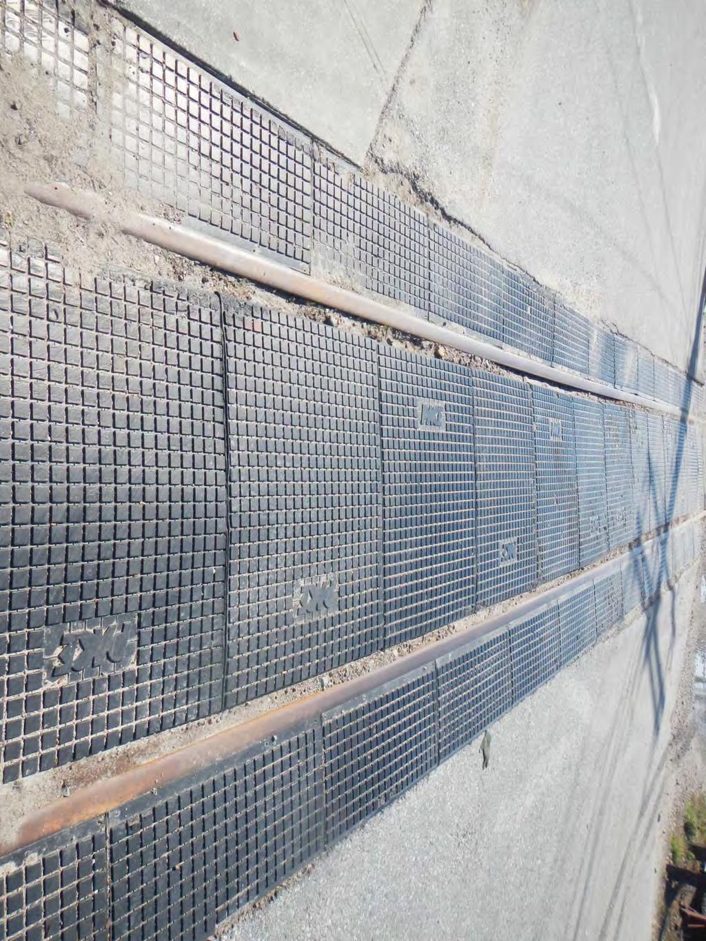
3 U.S. DOT - CROSSING INVENTORY INFORMATION AS OF 12/19/2013 Crossing.: C Update Reason: Changed Crossing Effective Begin-Date of Record: Railroad: VTR Vermont Rwy, Inc. [VTR ] End-Date of Record: Initiating Agency State Type and Positiion: Public At Grade 11/01/10 Part I Location and Classification of Crossing Division: Subdivision: Branch or Line Name: Railroad Milepost: RailRoad I.D..: Nearest RR Timetable Stn: Parent Railroad: Crossing Owner: ENS Sign Installed: Passenger Service: Avg Passenger Train Count: 2 Adjacent Crossing with Separate Number: NORTHERN MAIN BURLINGTON Other State: County: VT CHITTENDEN City: Street or Road Name: In BURLINGTON HOME AVENUE Highway Type &.: TH HSR Corridor ID: County Map Ref..: Latitude: Longitude: Lat/Long Source: Actual Quiet Zone: 24 hr Private Crossing Information: Category: Specify Signs: Public Access: Specify Signals: Unknown Railroad Use: ST/RR A ST/RR B ST/RR C ST/RR D State Use: NOE 12/4/2006 Narrative: Emergency Contact: (888) Railroad Contact: (802) State Contact: (802) Part II Railroad Information Number of Daily Train Movements: Less Than One Movement Per Day: Total Trains: 3 Total Switching: 0 Day Thru: 3 Typical Speed Range Over Crossing: From 25 to 45 mph Type and Number of Tracks: Main: 1 Other : 0 Does Another RR Operate a Separate Track at Crossing? Does Another RR Operate Over Your Track at Crossing? Maximum Time Table Speed: 50 Specify:
4 Crossing C U.S. DOT - CROSSING INVENTORY INFORMATION Continued Effective Begin-Date of Record: 11/01/10 End-Date of Record: Part III: Traffic Control Device Information Signs: Crossbucks: Advanced Warning: Yes Hump Crossing Sign: Pavement Markings: Train Activated Devices: Gates: 4 Mast Mounted FL: 4 Track Equipped with Train Signals? 4 Highway Stop Signs: 0 Markings Other Signs: Special Warning Devices t Train Activated: 6 3 Type of Train Detection: Specify: Cantilevered FL (Over): 0 Cantilevered FL (t over): 0 Other Flashing Lights: Highway Traffic Signals: 0 Wigwags: 0 Bells: 1 Other Train Activated Warning Devices: Channelization: 0 All R4-7 4 Quad or Full Barrier: Yes Total Number FL Pairs: 6 Specify Other Flashing Lights: Traffic Light Interconnection/Preemption: NO WHISTLE Constant Warning Time N/A Part IV: Physical Characteristics Type of Development: Number of Traffic Lanes Crossing Railroad: Is Highway Paved? Crossing Surface: Industrial 2 Yes Asphalt Smallest Crossing Angle: Are Truck Pullout Lanes Present? If Other: 60 to 90 Degrees Nearby Intersecting Highway? Less than 75 feet Is it Signalized? Does Track Run Down a Street? Is Crossing Illuminated? Yes Is Commercial Power Available? Yes Part V: Highway Information Highway System: Is Crossing on State Highway System: Annual Average Daily Traffic (AADT): Estimated Percent Trucks: Posted Highway Speed: 0 Other FA Highway - t NHS Functional Classification of Road at Crossing: AADT Year: 2008 Avg. of School Buses per Day: 12 Urban Local
5

6
7
8
9

10
11
12 VTrans Rail - Highway Crossing Suffiency Rating Rail Line VTR This rating is based on principal elements related to rail highway crossing Dot Crossing # C It is based on a ranking score of points with the greater score Suffiency Rating 82 indicating a safer crossing. Date of Evaluation Mar-10 1 Hazard Index Maximum Points = 25 Calculated Point Select one Points For Hazard Points Points Warning Devices Value Enter "y" Index X Bucks 25 < Stop Sign w/ X Bucks < Bell only w/ X Bucks < Flashing Lights w/wo Bell < Gates & Flng Lts w/wo Bell 800 y < < < Total < AADT Train/Day 3 Total Section 1 25 Hazard Index Accidents Maximum Points = 10 4 Alignment and Grades Maximum points = 10 Accident History since last major improvement if unknown use history from last 5 years Select only one Enter "y" in either column A One Occurance More Than One Skew of Crossing in Degrees - angle between CL road way and CL track Select one "y" Fatal 2 0 Degres Points Injury P.D.O none 10 y n/a y 7 Total A 7 Total Section Sight Distance Maximum Points = 40 B Grades - Approach to Crossing Select one A Select one Any approach to crosing? Points Enter "y" Quadrant Sites Distances: Points enter "y" 10% or Greater or humped 0 All Quads Clear 25 5 to 10% 1 One Quad restricted 18 3 to 5% 2 Two Quadrants restricted 12 Both Approaches< 3% 3 y 3 Three Quadrants restricted 6 Total B 3 Four Quadrants restricted 0 y 0 Total A 0 Total Section 4 10 B Stop Line Site Distances For the Max Rail Speed Below: Is site distance from either stop line: Points Select one Enter "y" 5 Special Categories Maximum Points = mph < Select one 60 mph < y 0 A Bus Factor Points Enter "y" 50 mph < Potential Bus Route 0 y 0 40 mph < n Bus Route 5 30 mph < mph < mph < Total A 0 Is sight distance > minimum? 10 B Select one Total B 0 Amtrak Route Points Enter "y" Amtrak Route? 0 C Select one n Amtrak Route? 5 y 5 Existing Active Devices? Points enter "y" Gates and Flashers 30 y 30 Flashing Lights 10 Total B 5 Total C 30 C Select one Hazardous Materials Points Enter "y" Heavy Industrial/Commerci 0 General Highway Activity 2 y 2 Minor or Occasional 4 Insignificant 5 Total C 2 Enter Total Section 3 30 Total Section 5 7
13 U.S. DOT - CROSSING INVENTORY INFORMATION AS OF 12/19/2013 Crossing.: J Update Reason: Changed Crossing Effective Begin-Date of Record: Railroad: VTR Vermont Rwy, Inc. [VTR ] End-Date of Record: Initiating Agency State Type and Positiion: Public At Grade 11/01/10 Part I Location and Classification of Crossing Division: Subdivision: Branch or Line Name: Railroad Milepost: RailRoad I.D..: Nearest RR Timetable Stn: Parent Railroad: Crossing Owner: ENS Sign Installed: Passenger Service: Avg Passenger Train Count: 2 Adjacent Crossing with Separate Number: NORTHERN MAIN BURLINGTON Other State: County: VT CHITTENDEN City: Street or Road Name: In BURLINGTON FLYNN AVENUE Highway Type &.: TH HSR Corridor ID: County Map Ref..: Latitude: Longitude: Lat/Long Source: Actual Quiet Zone: 24 hr Private Crossing Information: Category: Specify Signs: Public Access: Specify Signals: Unknown Railroad Use: ST/RR A ST/RR B ST/RR C ST/RR D State Use: NOE 12/4/2006 Narrative: Emergency Contact: (888) Railroad Contact: (802) State Contact: (802) Part II Railroad Information Number of Daily Train Movements: Less Than One Movement Per Day: Total Trains: 3 Total Switching: 0 Day Thru: 3 Typical Speed Range Over Crossing: From 20 to 40 mph Type and Number of Tracks: Main: 1 Other : 1 Does Another RR Operate a Separate Track at Crossing? Does Another RR Operate Over Your Track at Crossing? Maximum Time Table Speed: 40 Specify: SIDING
14 Crossing J U.S. DOT - CROSSING INVENTORY INFORMATION Continued Effective Begin-Date of Record: 11/01/10 End-Date of Record: Part III: Traffic Control Device Information Signs: Crossbucks: Advanced Warning: Yes Hump Crossing Sign: Pavement Markings: Train Activated Devices: Gates: 4 Mast Mounted FL: 4 Track Equipped with Train Signals? 4 Highway Stop Signs: 0 Markings Other Signs: Special Warning Devices t Train Activated: 2 2 Type of Train Detection: Specify: Cantilevered FL (Over): 0 Cantilevered FL (t over): 0 Other Flashing Lights: Highway Traffic Signals: 0 Wigwags: 0 Bells: 1 Other Train Activated Warning Devices: Channelization: 0 R8-8 4 Quad or Full Barrier: Yes Total Number FL Pairs: 6 Specify Other Flashing Lights: Traffic Light Interconnection/Preemption: NO WHISTLE Constant Warning Time N/A Part IV: Physical Characteristics Type of Development: Number of Traffic Lanes Crossing Railroad: Is Highway Paved? Crossing Surface: Industrial 2 Yes Asphalt Smallest Crossing Angle: Are Truck Pullout Lanes Present? If Other: 60 to 90 Degrees Nearby Intersecting Highway? 201 to 500 feet Is it Signalized? Does Track Run Down a Street? Is Crossing Illuminated? Yes Is Commercial Power Available? Yes Part V: Highway Information Highway System: Is Crossing on State Highway System: Annual Average Daily Traffic (AADT): Estimated Percent Trucks: Posted Highway Speed: 0 n-federal-aid Functional Classification of Road at Crossing: AADT Year: 2008 Avg. of School Buses per Day: 0 Urban Local
15
16
17
18
19
20
21
22 VTrans Rail - Highway Crossing Suffiency Rating Rail Line VTR This rating is based on principal elements related to rail highway crossing Dot Crossing # J It is based on a ranking score of points with the greater score Suffiency Rating 87 indicating a safer crossing. Date of Evaluation Mar-10 1 Hazard Index Maximum Points = 25 Calculated Point Select one Points For Hazard Points Points Warning Devices Value Enter "y" Index X Bucks 25 < Stop Sign w/ X Bucks < Bell only w/ X Bucks < Flashing Lights w/wo Bell < Gates & Flng Lts w/wo Bell 800 y < < < Total < AADT Train/Day 3 Total Section 1 25 Hazard Index Accidents Maximum Points = 10 4 Alignment and Grades Maximum points = 10 Accident History since last major improvement if unknown use history from last 5 years Select only one Enter "y" in either column A One Occurance More Than One Skew of Crossing in Degrees - angle between CL road way and CL track Select one "y" Fatal 2 0 Degres Points Injury P.D.O none 10 y n/a y 7 Total A 7 Total Section Sight Distance Maximum Points = 40 B Grades - Approach to Crossing Select one A Select one Any approach to crosing? Points Enter "y" Quadrant Sites Distances: Points enter "y" 10% or Greater or humped 0 All Quads Clear 25 5 to 10% 1 One Quad restricted 18 3 to 5% 2 Two Quadrants restricted 12 Both Approaches< 3% 3 y 3 Three Quadrants restricted 6 y 6 Total B 3 Four Quadrants restricted 0 Total A 6 Total Section 4 10 B Stop Line Site Distances For the Max Rail Speed Below: Is site distance from either stop line: Points Select one Enter "y" 5 Special Categories Maximum Points = mph < Select one 60 mph < A Bus Factor Points Enter "y" 50 mph < Potential Bus Route 0 y 0 40 mph < n Bus Route 5 30 mph < mph < mph < Total A 0 Is sight distance > minimum? 10 y 10 B Select one Total B 10 Amtrak Route Points Enter "y" Amtrak Route? 0 y 0 C Select one n Amtrak Route? 5 Existing Active Devices? Points enter "y" Gates and Flashers 30 y 30 Flashing Lights 10 Total B 0 Total C 30 C Select one Hazardous Materials Points Enter "y" Heavy Industrial/Commerci 0 General Highway Activity 2 y 2 Minor or Occasional 4 Insignificant 5 Total C 2 Enter Total Section 3 40 Total Section 5 2
23 U.S. DOT - CROSSING INVENTORY INFORMATION AS OF 12/19/2013 Crossing.: V Update Reason: Changed Crossing Effective Begin-Date of Record: Railroad: VTR Vermont Rwy, Inc. [VTR ] End-Date of Record: Initiating Agency Railroad Type and Positiion: Private At Grade 10/01/09 Part I Location and Classification of Crossing Division: Subdivision: Branch or Line Name: Railroad Milepost: RailRoad I.D..: Nearest RR Timetable Stn: Parent Railroad: Crossing Owner: ENS Sign Installed: Passenger Service: Avg Passenger Train Count: 0 Adjacent Crossing with Separate Number: NORTHERN MAIN BURLINGTON Other State: VT County: CHITTENDEN City: In BURLINGTON Street or Road Name: SEARS LN PED XING Highway Type &.: PED XNG HSR Corridor ID: County Map Ref..: Latitude: Longitude: Lat/Long Source: Quiet Zone: 24 hr Private Crossing Information: Category: Residential Public Access: Signals Specify Signs: Specify Signals: SEE NARRATIVE Railroad Use: ST/RR A ST/RR B ST/RR C ST/RR D State Use: NOE 12/4/2006 Narrative: XBKS, LTS, BELL, MKGS, WARN, & NO WHISTLE SGNS Emergency Contact: (888) Railroad Contact: (802) State Contact: (802) Part II Railroad Information Number of Daily Train Movements: Less Than One Movement Per Day: Total Trains: 4 Total Switching: 2 Day Thru: 0 Typical Speed Range Over Crossing: From 5 to 15 mph Type and Number of Tracks: Main: 1 Other : 2 Does Another RR Operate a Separate Track at Crossing? Does Another RR Operate Over Your Track at Crossing? Maximum Time Table Speed: 15 Specify: SIDINGS
24 Crossing V U.S. DOT - CROSSING INVENTORY INFORMATION Continued Effective Begin-Date of Record: 10/01/09 End-Date of Record: Part III: Traffic Control Device Information Signs: Crossbucks: Advanced Warning: Pavement Markings: 0 Highway Stop Signs: 0 Hump Crossing Sign: Markings Other Signs: 0 Specify: 0 Train Activated Devices: Gates: 0 Mast Mounted FL: 0 Cantilevered FL (Over): 0 Cantilevered FL (t over): 0 Other Flashing Lights: Highway Traffic Signals: 0 Wigwags: 0 Bells: 0 Other Train Activated Warning Devices: Channelization: Track Equipped with Train Signals? 0 4 Quad or Full Barrier: Total Number FL Pairs: 0 Specify Other Flashing Lights: Special Warning Devices t Train Activated: Type of Train Detection: Traffic Light Interconnection/Preemption: CHAIN-EMERG XING ONL ne Part IV: Physical Characteristics Type of Development: Number of Traffic Lanes Crossing Railroad: Is Highway Paved? Crossing Surface: Residential 1 Yes Asphalt Smallest Crossing Angle: Are Truck Pullout Lanes Present? If Other: 60 to 90 Degrees Nearby Intersecting Highway? Does Track Run Down a Street? N/A Is it Signalized? Is Crossing Illuminated? Is Commercial Power Available? Yes Part V: Highway Information Highway System: Is Crossing on State Highway System: Annual Average Daily Traffic (AADT): Estimated Percent Trucks: Posted Highway Speed: 0 n-federal-aid Functional Classification of Road at Crossing: AADT Year: 1987 Avg. of School Buses per Day: 0 Urban Local
25


26


27


28
29 U.S. DOT - CROSSING INVENTORY INFORMATION AS OF 12/19/2013 Crossing.: U Update Reason: Changed Crossing Effective Begin-Date of Record: Railroad: VTR Vermont Rwy, Inc. [VTR ] End-Date of Record: Initiating Agency State Type and Positiion: Public At Grade 11/01/10 Part I Location and Classification of Crossing Division: Subdivision: Branch or Line Name: Railroad Milepost: RailRoad I.D..: Nearest RR Timetable Stn: Parent Railroad: Crossing Owner: ENS Sign Installed: Passenger Service: Avg Passenger Train Count: 2 Adjacent Crossing with Separate Number: NORTHERN MAIN BURLINGTON Other State: County: VT CHITTENDEN City: Street or Road Name: In BURLINGTON MAPLE STREET Highway Type &.: TH HSR Corridor ID: County Map Ref..: Latitude: Longitude: Lat/Long Source: Actual Quiet Zone: Private Crossing Information: Category: Specify Signs: Public Access: Specify Signals: Unknown Railroad Use: ST/RR A ST/RR B ST/RR C ST/RR D State Use: Narrative: Emergency Contact: (888) Railroad Contact: (802) State Contact: (802) Part II Railroad Information Number of Daily Train Movements: Less Than One Movement Per Day: Total Trains: 10 Total Switching: 0 Day Thru: 0 Typical Speed Range Over Crossing: From 10 to 15 mph Type and Number of Tracks: Main: 1 Other : 2 Does Another RR Operate a Separate Track at Crossing? Does Another RR Operate Over Your Track at Crossing? Maximum Time Table Speed: 15 Yes: NECR Specify: SIDINGS
30 Crossing U U.S. DOT - CROSSING INVENTORY INFORMATION Continued Effective Begin-Date of Record: 11/01/10 End-Date of Record: Part III: Traffic Control Device Information Signs: Crossbucks: Advanced Warning: Yes Hump Crossing Sign: Pavement Markings: Train Activated Devices: Gates: 2 Mast Mounted FL: 3 Track Equipped with Train Signals? 3 Highway Stop Signs: 0 Markings Other Signs: Special Warning Devices t Train Activated: 2 2 Type of Train Detection: Specify: Cantilevered FL (Over): 0 Cantilevered FL (t over): 0 Other Flashing Lights: Highway Traffic Signals: 0 Wigwags: 0 Bells: 1 Other Train Activated Warning Devices: Channelization: 0 ne R8-8 4 Quad or Full Barrier: Total Number FL Pairs: 7 Specify Other Flashing Lights: Traffic Light Interconnection/Preemption: R15-2 DC/AFO N/A Part IV: Physical Characteristics Type of Development: Number of Traffic Lanes Crossing Railroad: Is Highway Paved? Crossing Surface: Industrial 2 Yes Rubber Smallest Crossing Angle: Are Truck Pullout Lanes Present? If Other: 60 to 90 Degrees Nearby Intersecting Highway? Less than 75 feet Is it Signalized? Yes Does Track Run Down a Street? Is Crossing Illuminated? Yes Is Commercial Power Available? Yes Part V: Highway Information Highway System: Is Crossing on State Highway System: Annual Average Daily Traffic (AADT): Estimated Percent Trucks: Posted Highway Speed: 0 n-federal-aid Functional Classification of Road at Crossing: AADT Year: 2008 Avg. of School Buses per Day: 0 Urban Local
31
32
33
34
35
36
37
38
39
40
41
42 VTrans Rail - Highway Crossing Suffiency Rating Rail Line VTR This rating is based on principal elements related to rail highway crossing Dot Crossing # U It is based on a ranking score of points with the greater score Suffiency Rating 79 indicating a safer crossing. Date of Evaluation Dec-12 1 Hazard Index Maximum Points = 25 Calculated Point Select one Points For Hazard Points Points Warning Devices Value Enter "y" Index X Bucks 25 < Stop Sign w/ X Bucks < Bell only w/ X Bucks < Flashing Lights w/wo Bell < Gates & Flng Lts w/wo Bell 800 y < < < Total < AADT Train/Day 10 Total Section 1 21 Hazard Index Accidents Maximum Points = 10 4 Alignment and Grades Maximum points = 10 Accident History since last major improvement if unknown use history from last 5 years Select only one Enter "y" in either column A One Occurance More Than One Skew of Crossing in Degrees - angle between CL road way and CL track Select one "y" Fatal 2 0 Degres Points Injury y 0 P.D.O none 10 y n/a Total A 0 Total Section Sight Distance Maximum Points = 40 B Grades - Approach to Crossing Select one A Select one Any approach to crosing? Points Enter "y" Quadrant Sites Distances: Points enter "y" 10% or Greater or humped 0 All Quads Clear 25 y 25 5 to 10% 1 One Quad restricted 18 3 to 5% 2 Two Quadrants restricted 12 Both Approaches< 3% 3 y 3 Three Quadrants restricted 6 Total B 3 Four Quadrants restricted 0 Total A 25 Total Section 4 3 B Stop Line Site Distances For the Max Rail Speed Below: Is site distance from either stop line: Points Select one Enter "y" 5 Special Categories Maximum Points = mph < Select one 60 mph < A Bus Factor Points Enter "y" 50 mph < Potential Bus Route 0 y 0 40 mph < n Bus Route 5 30 mph < mph < mph < y 8 Total A 0 Is sight distance > minimum? 10 B Select one Total B 8 Amtrak Route Points Enter "y" Amtrak Route? 0 C Select one n Amtrak Route? 5 y 5 Existing Active Devices? Points enter "y" Gates and Flashers 30 y 30 Flashing Lights 10 Total B 5 Total C 30 C Select one Hazardous Materials Points Enter "y" Heavy Industrial/Commerci 0 y 0 General Highway Activity 2 Minor or Occasional 4 Insignificant 5 Total C 0 Enter Total Section 3 40 Total Section 5 5
43 U.S. DOT - CROSSING INVENTORY INFORMATION AS OF 12/19/2013 Crossing.: B Update Reason: Changed Crossing Effective Begin-Date of Record: Railroad: VTR Vermont Rwy, Inc. [VTR ] End-Date of Record: Initiating Agency State Type and Positiion: Public At Grade 11/01/10 Part I Location and Classification of Crossing Division: Subdivision: Branch or Line Name: Railroad Milepost: RailRoad I.D..: Nearest RR Timetable Stn: Parent Railroad: Crossing Owner: ENS Sign Installed: Passenger Service: Avg Passenger Train Count: 2 Adjacent Crossing with Separate Number: NORTHERN MAIN BURLINGTON Other State: County: VT CHITTENDEN City: Street or Road Name: In BURLINGTON KING STREET Highway Type &.: TH HSR Corridor ID: County Map Ref..: Latitude: Longitude: Lat/Long Source: Actual Quiet Zone: Private Crossing Information: Category: Specify Signs: Public Access: Specify Signals: Unknown Railroad Use: ST/RR A ST/RR B ST/RR C ST/RR D State Use: Narrative: Emergency Contact: (888) Railroad Contact: (802) State Contact: (802) Part II Railroad Information Number of Daily Train Movements: Less Than One Movement Per Day: Total Trains: 8 Total Switching: 4 Day Thru: 0 Typical Speed Range Over Crossing: From 10 to 15 mph Type and Number of Tracks: Main: 1 Other : 0 Does Another RR Operate a Separate Track at Crossing? Does Another RR Operate Over Your Track at Crossing? Maximum Time Table Speed: 15 Yes: NECR Specify:
44 Crossing B U.S. DOT - CROSSING INVENTORY INFORMATION Continued Effective Begin-Date of Record: 11/01/10 End-Date of Record: Part III: Traffic Control Device Information Signs: Crossbucks: Advanced Warning: Yes Hump Crossing Sign: Pavement Markings: Train Activated Devices: Gates: 2 Mast Mounted FL: 2 Track Equipped with Train Signals? 5 Highway Stop Signs: 0 Markings Other Signs: Special Warning Devices t Train Activated: 1 1 Type of Train Detection: Specify: Cantilevered FL (Over): 0 Cantilevered FL (t over): 0 Other Flashing Lights: Highway Traffic Signals: 0 Wigwags: 0 Bells: 1 Other Train Activated Warning Devices: Channelization: 0 ne R8-8 4 Quad or Full Barrier: Total Number FL Pairs: 4 Specify Other Flashing Lights: Traffic Light Interconnection/Preemption: BIKE XING DC/AFO Advance Preemption Part IV: Physical Characteristics Type of Development: Number of Traffic Lanes Crossing Railroad: Is Highway Paved? Crossing Surface: Commercial 2 Yes Rubber Smallest Crossing Angle: Are Truck Pullout Lanes Present? If Other: 60 to 90 Degrees Nearby Intersecting Highway? Less than 75 feet Is it Signalized? Does Track Run Down a Street? Is Crossing Illuminated? Yes Is Commercial Power Available? Yes Part V: Highway Information Highway System: Is Crossing on State Highway System: Annual Average Daily Traffic (AADT): Estimated Percent Trucks: Posted Highway Speed: 0 n-federal-aid Functional Classification of Road at Crossing: AADT Year: 2008 Avg. of School Buses per Day: 0 Urban Local
45
46
47
48
49
50
51
52 VTrans Rail - Highway Crossing Suffiency Rating Rail Line VTR This rating is based on principal elements related to rail highway crossing Dot Crossing # B It is based on a ranking score of points with the greater score Suffiency Rating 80 indicating a safer crossing. Date of Evaluation Dec-12 1 Hazard Index Maximum Points = 25 Calculated Point Select one Points For Hazard Points Points Warning Devices Value Enter "y" Index X Bucks 25 < Stop Sign w/ X Bucks < Bell only w/ X Bucks < Flashing Lights w/wo Bell < Gates & Flng Lts w/wo Bell 800 y < < < Total < AADT Train/Day 8 Total Section 1 25 Hazard Index Accidents Maximum Points = 10 4 Alignment and Grades Maximum points = 10 Accident History since last major improvement if unknown use history from last 5 years Select only one Enter "y" in either column A One Occurance More Than One Skew of Crossing in Degrees - angle between CL road way and CL track Select one "y" Fatal 2 0 Degres Points Injury P.D.O 8 y none 10 n/a y 7 Total A 7 Total Section Sight Distance Maximum Points = 40 B Grades - Approach to Crossing Select one A Select one Any approach to crosing? Points Enter "y" Quadrant Sites Distances: Points enter "y" 10% or Greater or humped 0 All Quads Clear 25 5 to 10% 1 One Quad restricted 18 3 to 5% 2 y 2 Two Quadrants restricted 12 Both Approaches< 3% 3 Three Quadrants restricted 6 Total B 2 Four Quadrants restricted 0 y 0 Total A 0 Total Section 4 9 B Stop Line Site Distances For the Max Rail Speed Below: Is site distance from either stop line: Points Select one Enter "y" 5 Special Categories Maximum Points = mph < Select one 60 mph < A Bus Factor Points Enter "y" 50 mph < Potential Bus Route 0 y 0 40 mph < n Bus Route 5 30 mph < mph < y 6 10 mph < Total A 0 Is sight distance > minimum? 10 B Select one Total B 6 Amtrak Route Points Enter "y" Amtrak Route? 0 y 0 C Select one n Amtrak Route? 5 Existing Active Devices? Points enter "y" Gates and Flashers 30 y 30 Flashing Lights 10 Total B 0 Total C 30 C Select one Hazardous Materials Points Enter "y" Heavy Industrial/Commerci 0 General Highway Activity 2 y 2 Minor or Occasional 4 Insignificant 5 Total C 2 Enter Total Section 3 36 Total Section 5 2
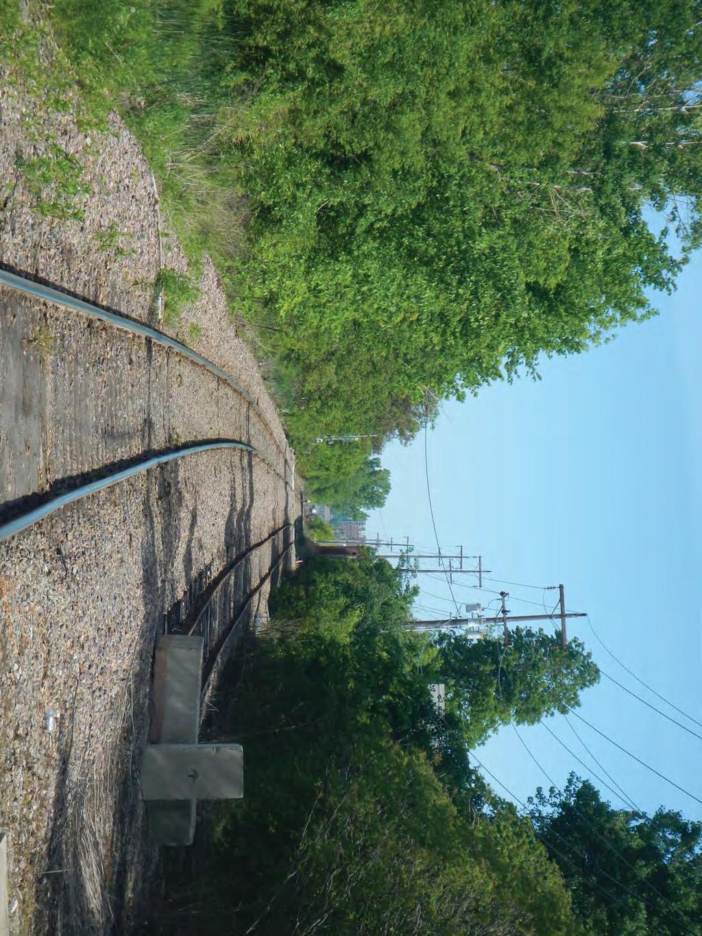
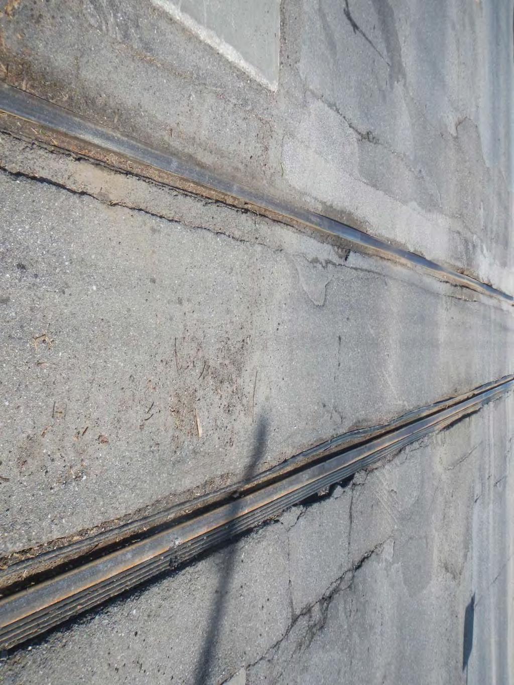
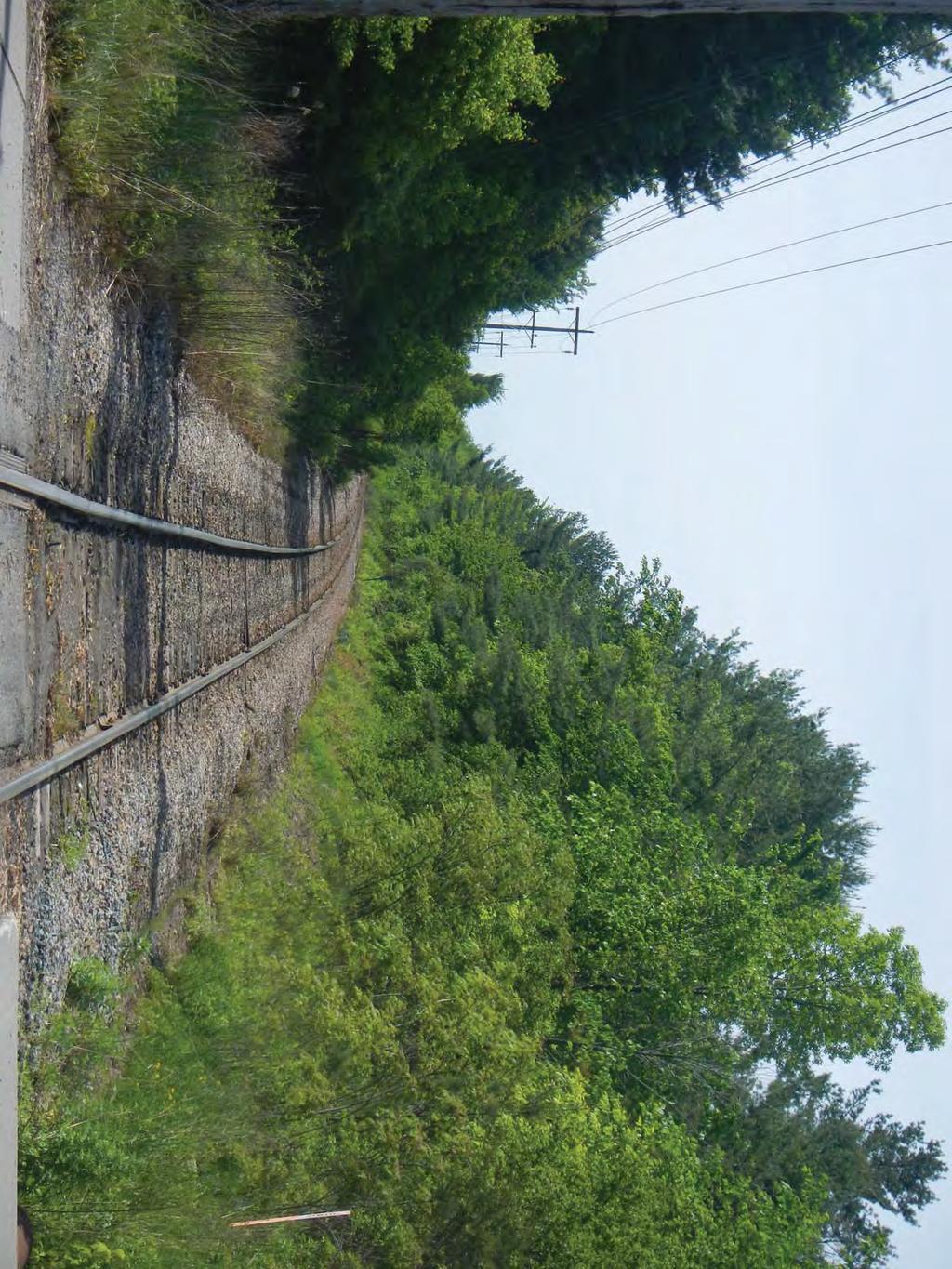
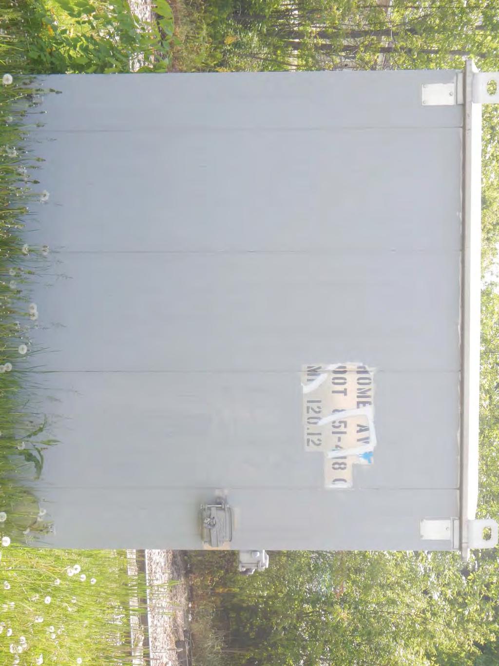
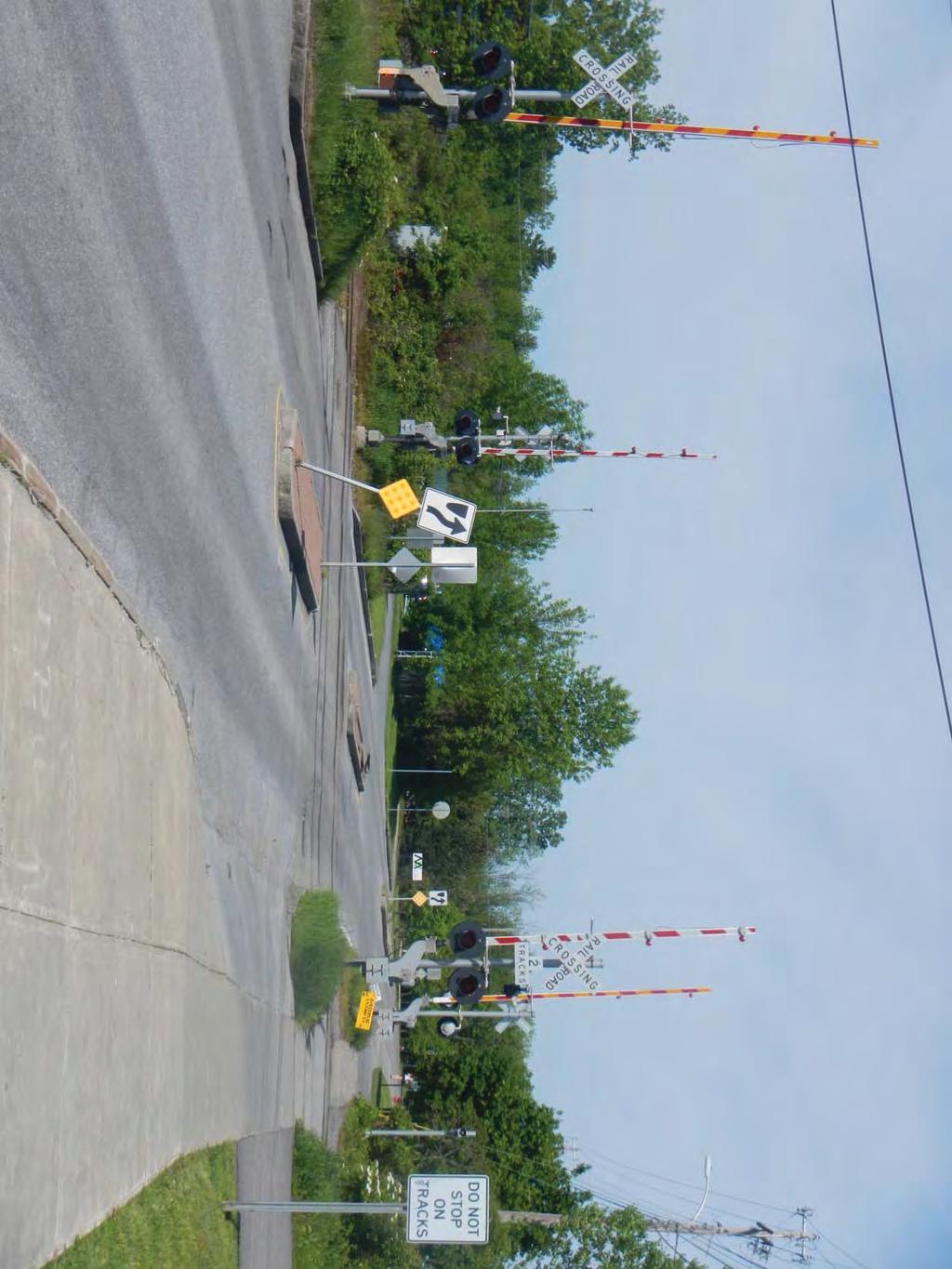
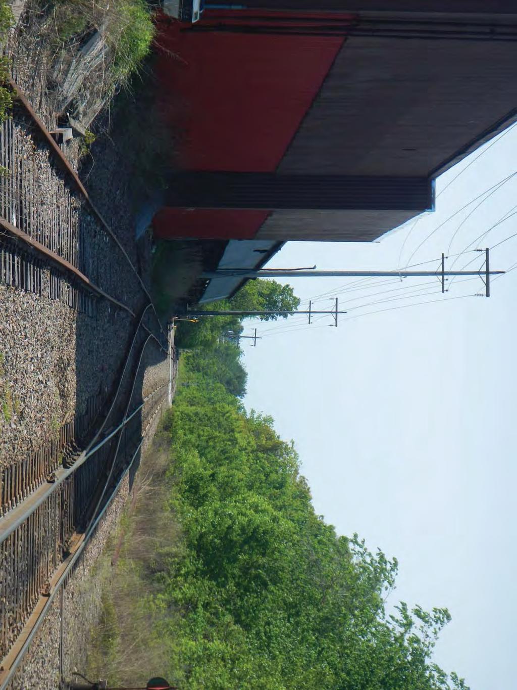
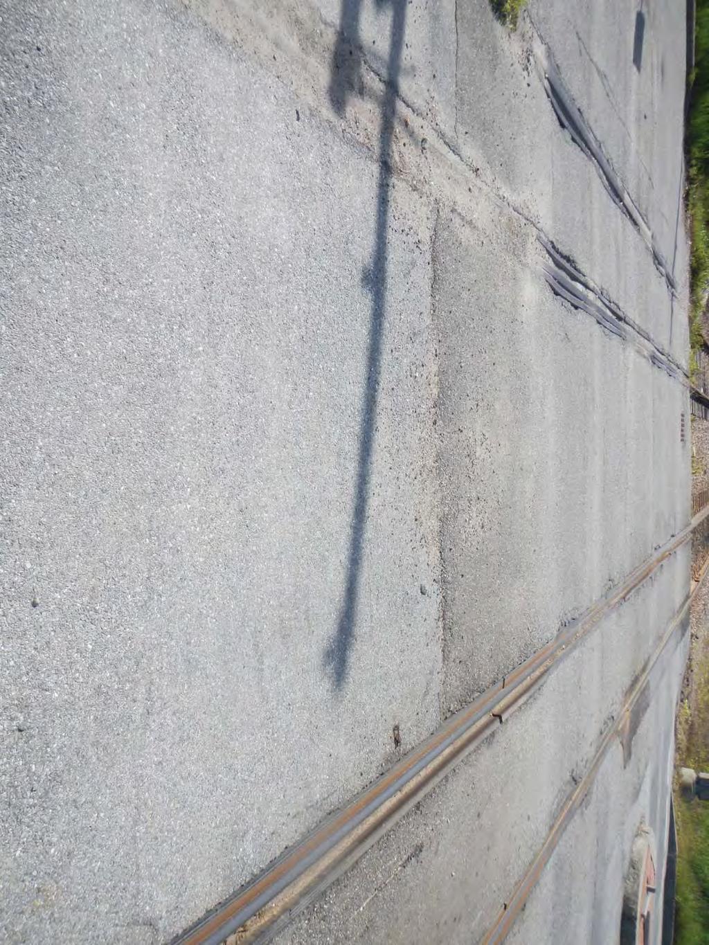
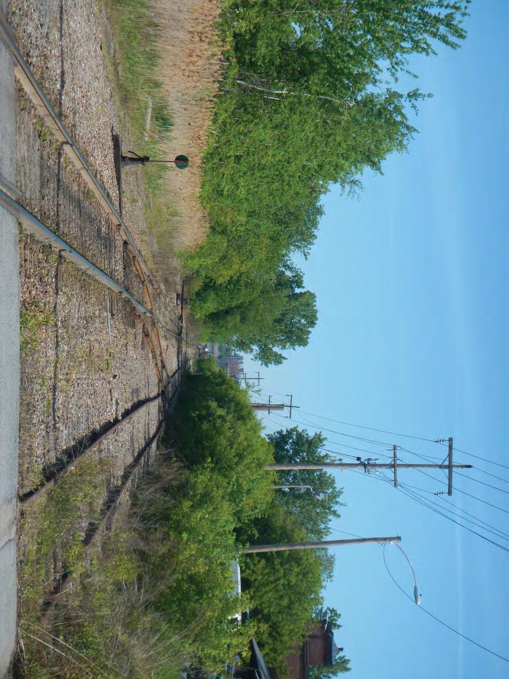
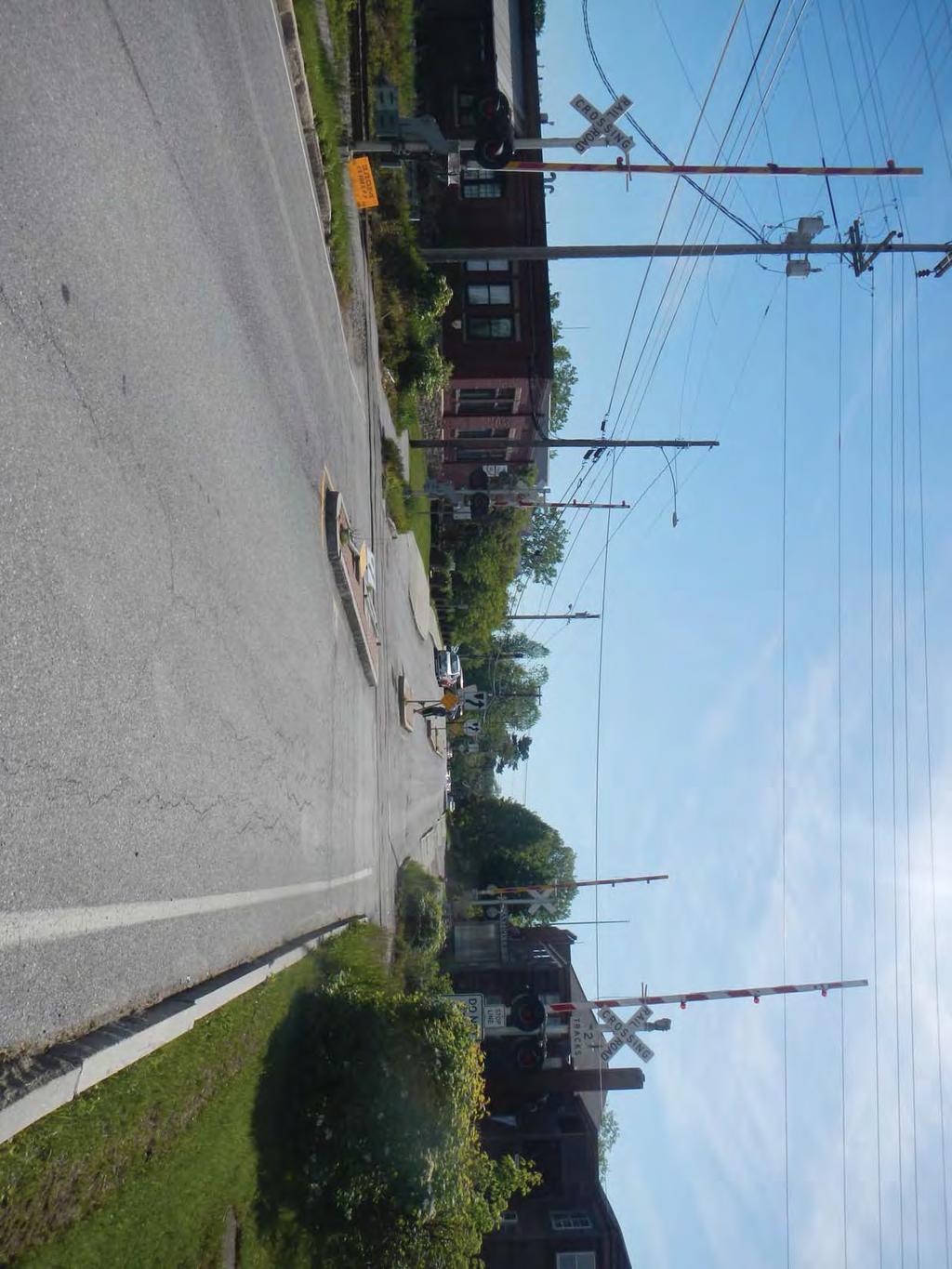
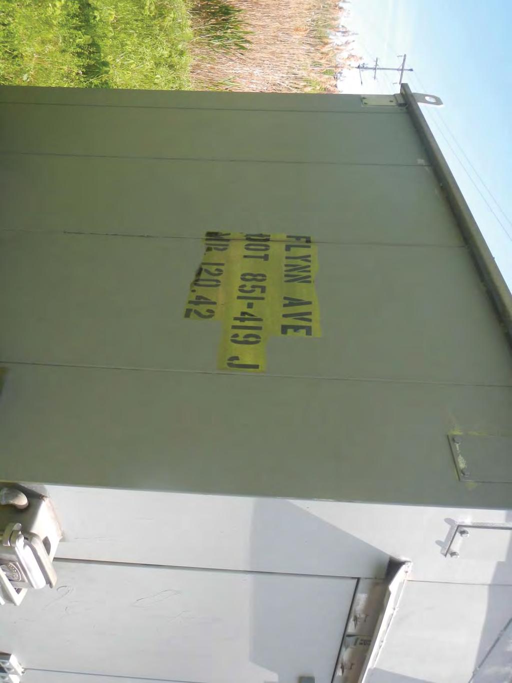
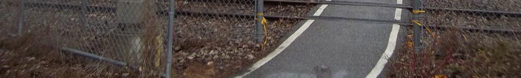
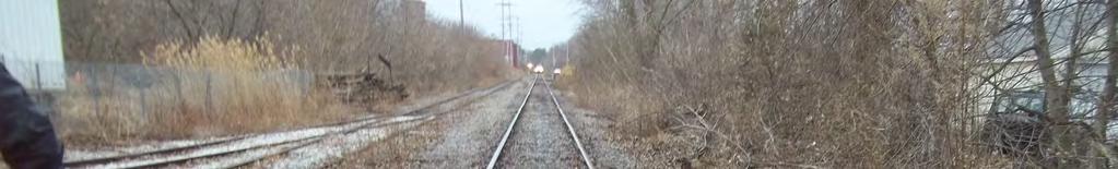
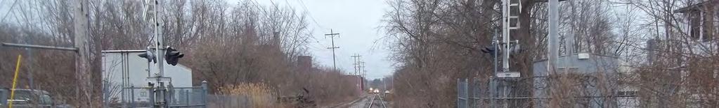
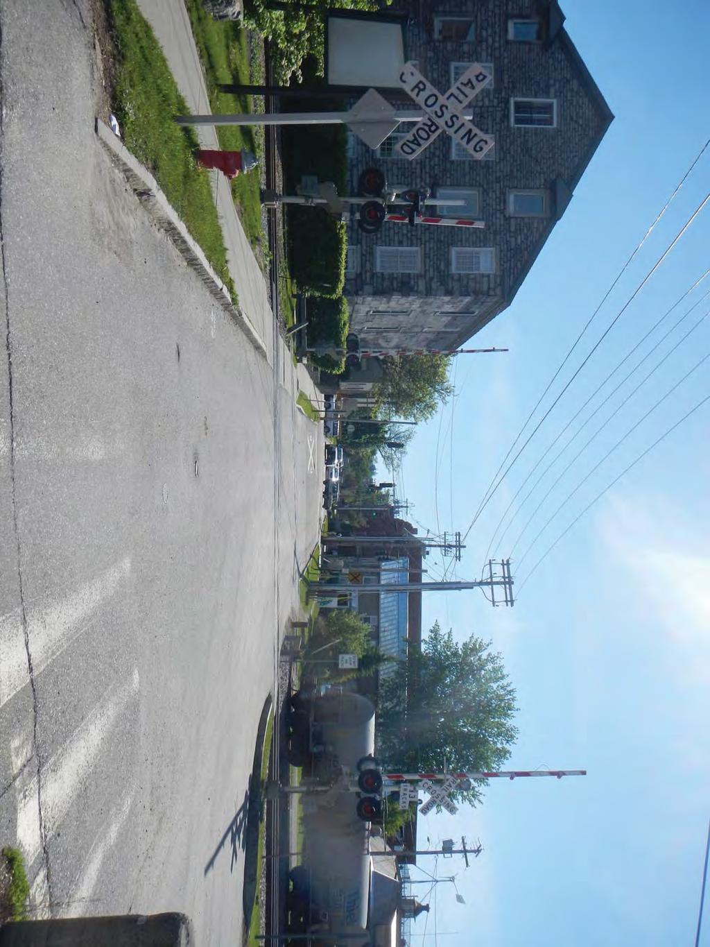
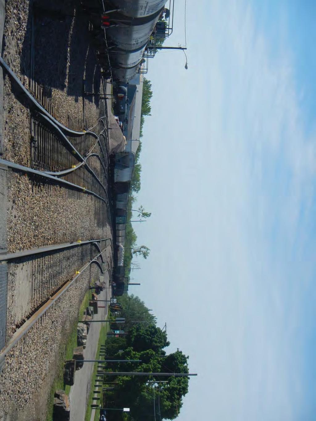
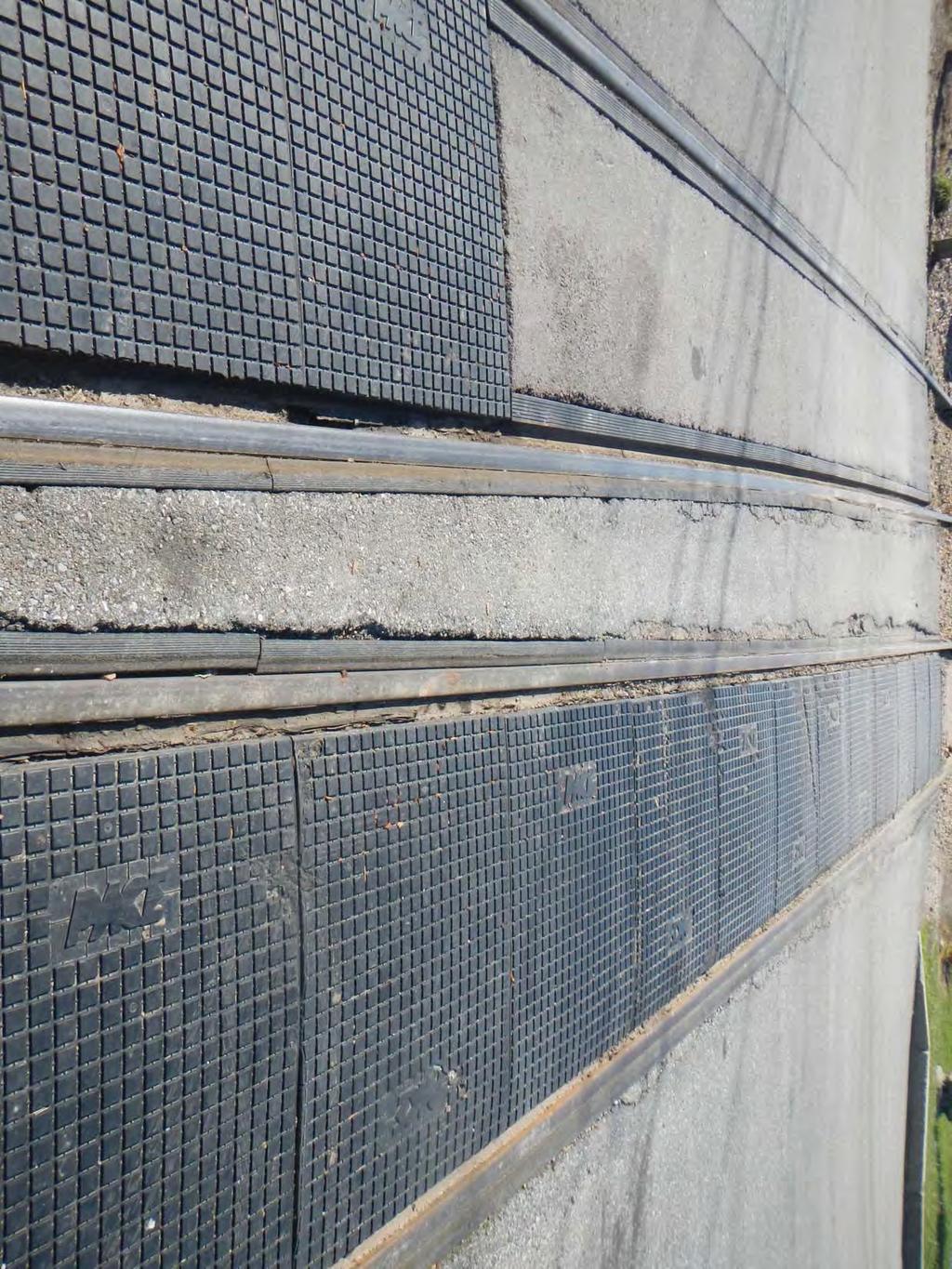
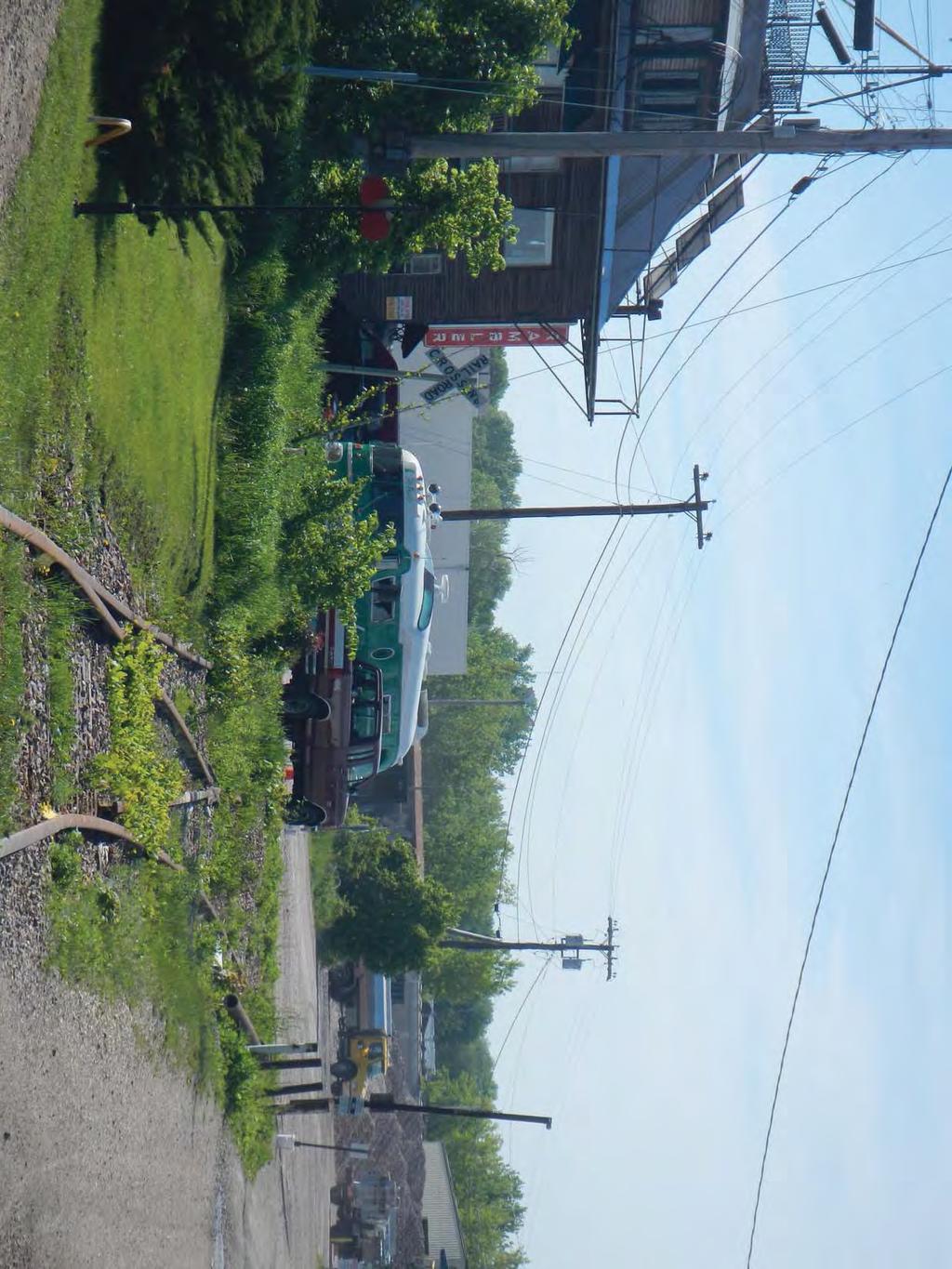
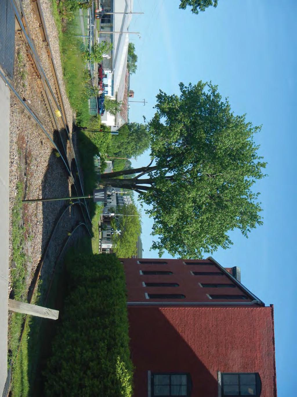
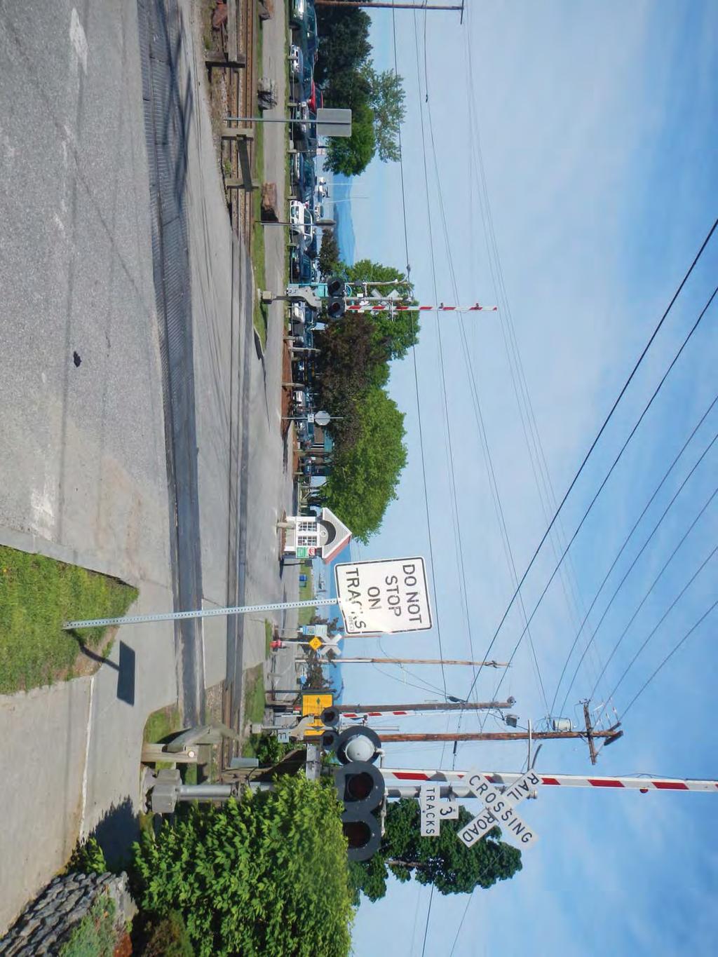
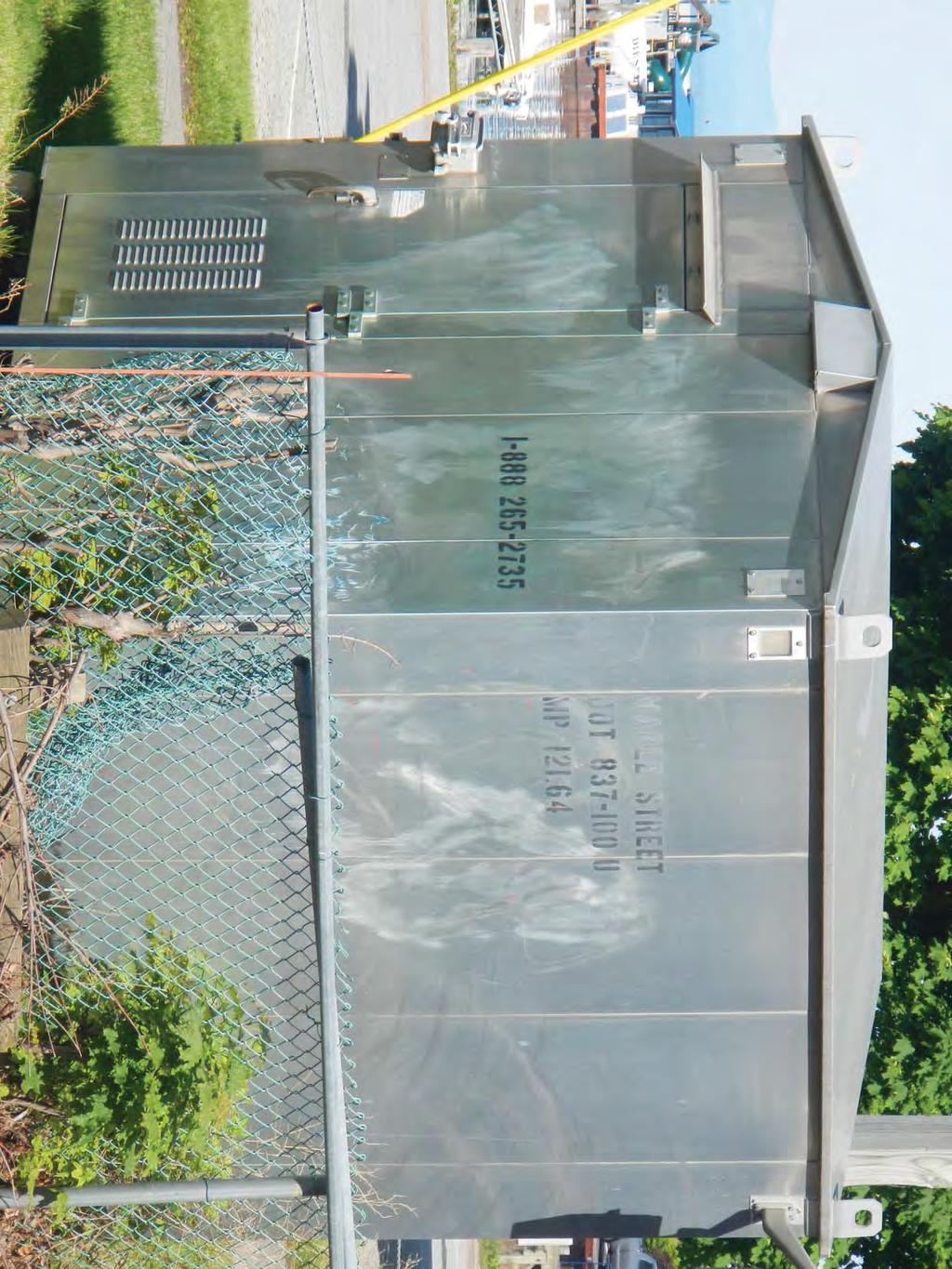
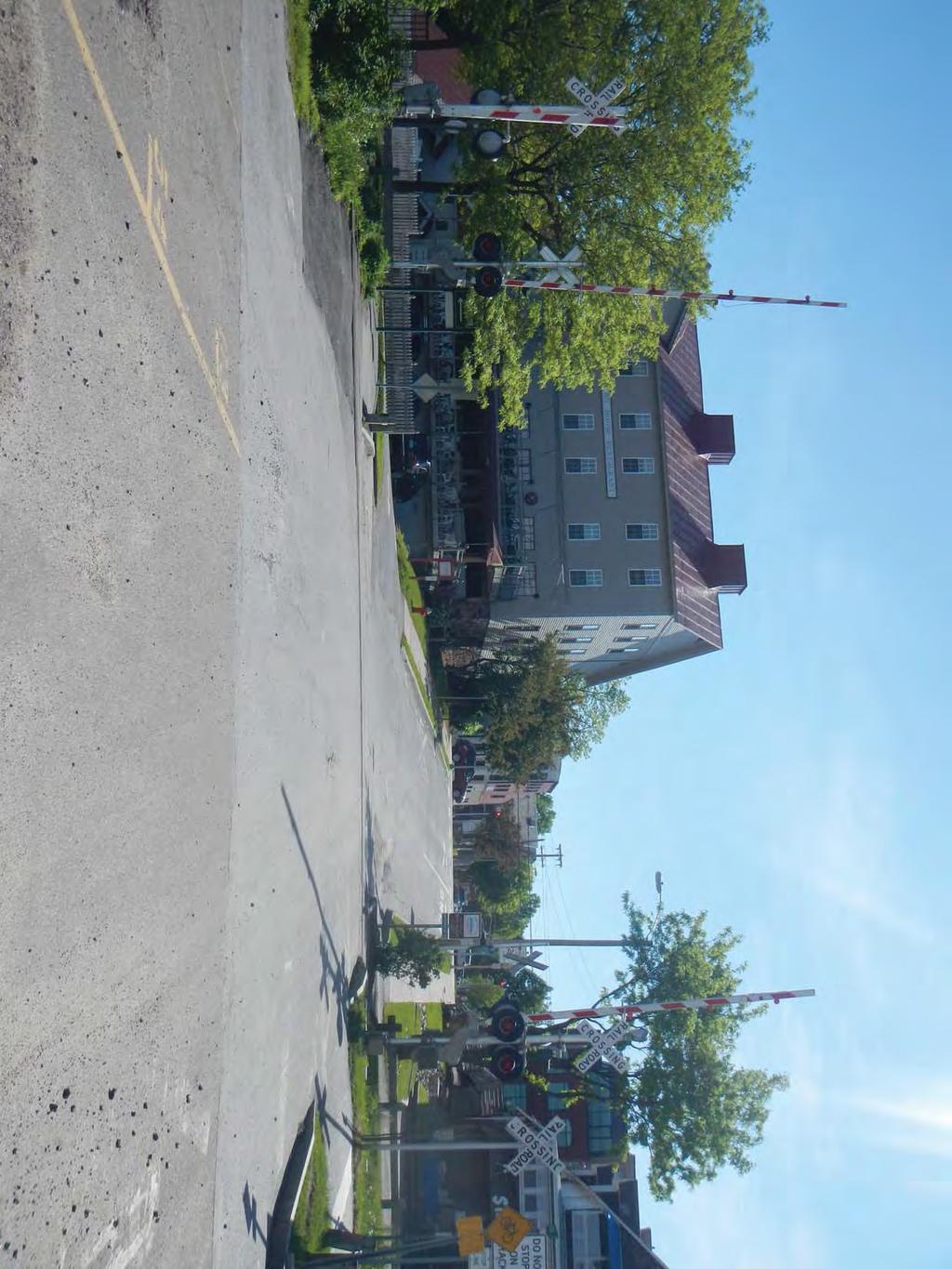
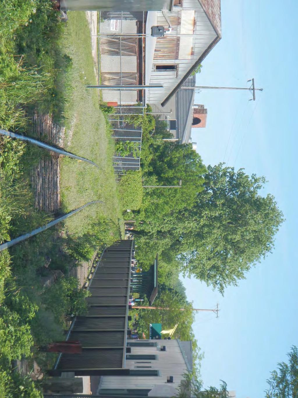
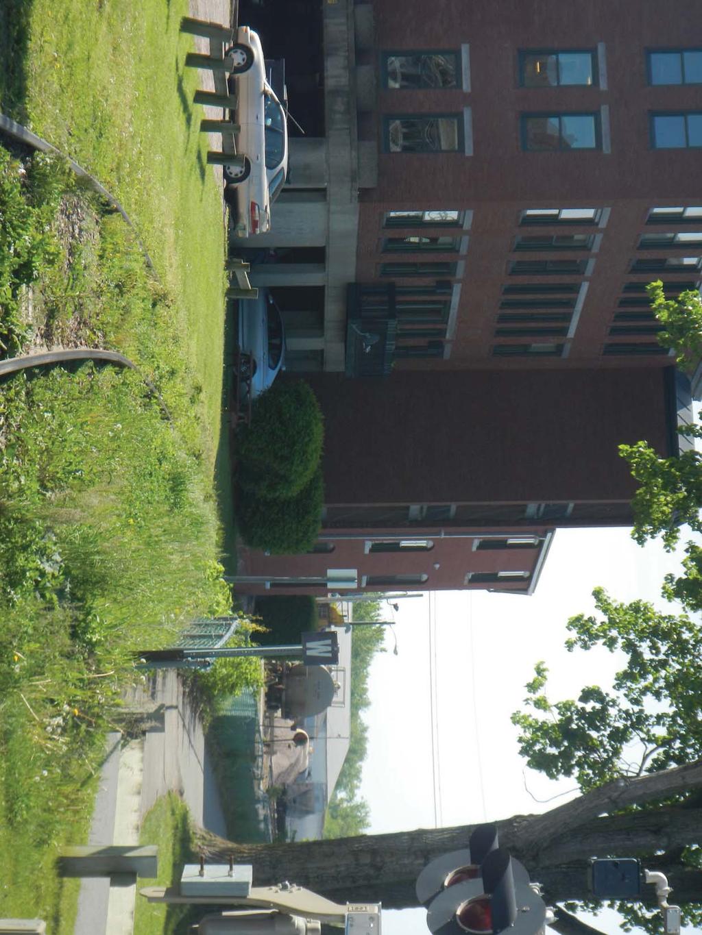
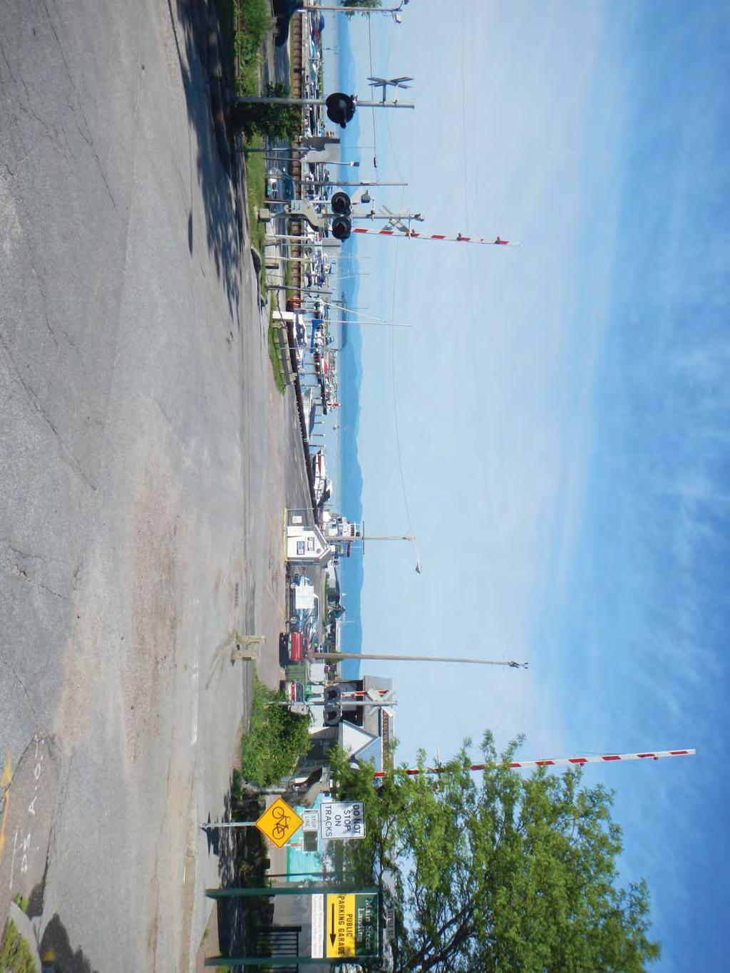
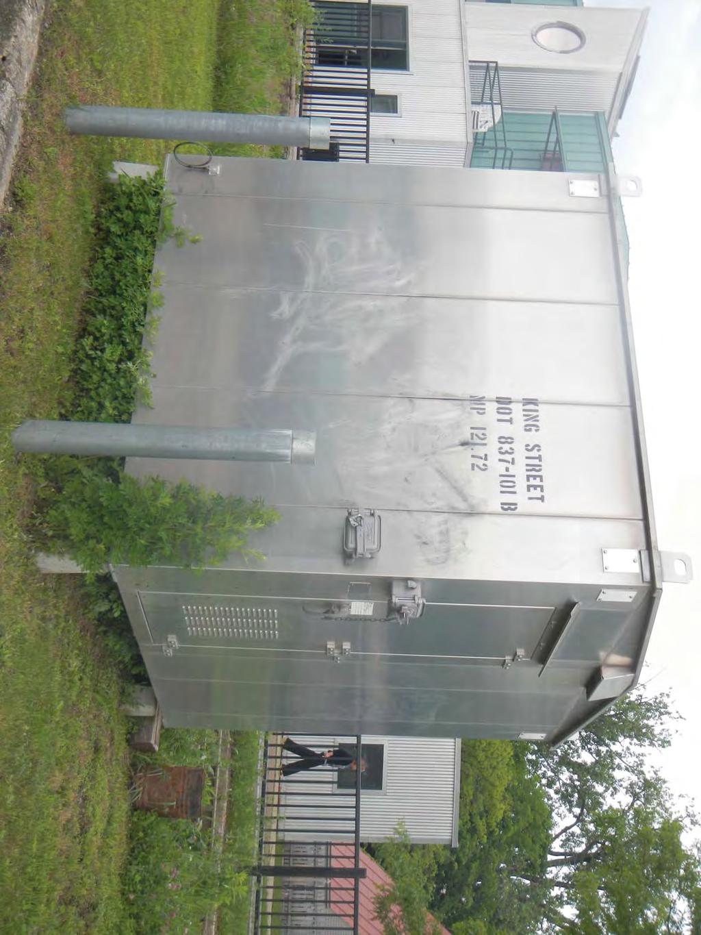
53 AGENDA RAILROAD DIAGNOSTIC MEETING CHAMPLAIN PARKWAY/SOUTHERN CONNECTOR MEGC M5000 (1) DATE: May 29, 2014 CHA File: 8659 PLACE: Burlington DPW TIME: 9:00 a.m. 645 Pine Street Burlington, VT PURPOSE: The purpose of this meeting is to conduct a railroad diagnostic for the Champlain Parkway project. TOPICS: 1. Introductions 2. Champlain Parkway Project Overview General Overview Diagnostic History o October 2003 Diagnostic o Design modifications 3. Diagnostic Team Process 4. Grade Crossing Field Review Home Avenue (AAR DOT# C) Barrett s Salt Access Driveway (AAR DOT# R) Flynn Avenue (AAR DOT# J) Sears Lane Pedestrian Crossing (AAR DOT# V) Grocery Lead Proposed to be Removed Dealer.com Driveways (Former Whiting) Track Removed Pine Street Spur (AAR DOT# C) Track Removed Proposed Relocated Maltex Driveway Existing Maltex/Farrell Driveway Existing Citizens Oil Driveway Maple Street (AAR DOT# U) King Street (AAR DOT# B) U:\8659\MTGS\8659agenda125.doc
Site DNL Calculator. Guidelines:
 http://portal.hud.gov/hudportal/hud?src=/program_offices/comm_planning/environment/... Page 1 of 3 1/9/214 HUD > Program Offices > Community Planning and Development > Environment > Site For more information
EXCEPTION TO STANDARDS REPORT
 EXCEPTION TO STANDARDS REPORT PROJECT DESCRIPTION AND NEED The project is located in Section 6, Township 23 North, Range 9 East and Section 31 Township 24 North, Range 9 East, in the Town of Stockton,
Highway 18 BNSF Railroad Overpass Feasibility Study Craighead County. Executive Summary
 Highway 18 BNSF Railroad Overpass Feasibility Study Craighead County Executive Summary October 2014 Highway 18 BNSF Railroad Overpass Feasibility Study Craighead County Executive Summary October 2014 Prepared
Speed Limit Study: Traffic Engineering Report
 Speed Limit Study: Traffic Engineering Report This report documents the engineering and traffic investigation required by Vermont Statutes Annotated Title 23, Chapter 13 1007 for a municipal legislative
Southern Windsor County 2016 Traffic Count Program Summary April 2017
 Southern Windsor County 2016 Traffic Count Program Summary April 2017 The Southern Windsor County Regional Planning Commission (the RPC ) has been monitoring traffic at 19 locations throughout the southern
1 TO 2 2 TO 3 12 TO 1 10 TO TO 12
 STATION: New York State Department of Transportation Traffic Count Hourly Report Page of ROUTE #: NY ROAD NAME: FROM: RT CENTRAL SQUARE : ACC RT I COUNTY: Oswego : Northbound FACR GROUP: REC. SERIAL #:
LAWRENCE TRANSIT CENTER LOCATION ANALYSIS 9 TH STREET & ROCKLEDGE ROAD / 21 ST STREET & IOWA STREET LAWRENCE, KANSAS
 LAWRENCE TRANSIT CENTER LOCATION ANALYSIS 9 TH STREET & ROCKLEDGE ROAD / 21 ST STREET & IOWA STREET LAWRENCE, KANSAS TRAFFIC IMPACT STUDY FEBRUARY 214 OA Project No. 213-542 TABLE OF CONTENTS 1. INTRODUCTION...
2.0 Development Driveways. Movin Out June 2017
 Movin Out June 2017 1.0 Introduction The proposed Movin Out development is a mixed use development in the northeast quadrant of the intersection of West Broadway and Fayette Avenue in the City of Madison.
1 TO 2 2 TO 3 3 TO 4 11 TO TO 1
 STATION: New York State Department of Transportation Traffic Count Hourly Report Page of ROUTE #: NY ROAD NAME: FROM: RT : END / OLAP COUNTY: Onondaga : Eastbound FACR GROUP: REC. SERIAL #: AP FUNC. CLASS:
VIADUCT LOCATION STUDY. October 19, 2009
 VIADUCT LOCATION STUDY October 19, 2009 Background Information Traffic Study Alternative Evaluation Public Involvement Preferred Concept Next Steps Evaluate alternatives for the location of a viaduct to
APPENDIX A Basis of Design and Design Criteria Memorandum
 APPENDIX A Basis of Design and Design Criteria Memorandum Job No: Y01-500 Files are stored in: Engineering / Client / Yolo/Y01500 Buckeye and Rumsey/Rumsey CR 41 over Cache Creek, CAD files stored in:
3.15 SAFETY AND SECURITY
 3.15 SAFETY AND SECURITY Introduction This section describes the environmental setting and potential effects of the alternatives analyzed in this EIR with regard to safety and security in the SantaClara-Alum
Speed measurements were taken at the following three locations on October 13 and 14, 2016 (See Location Map in Exhibit 1):
:") 2709 McGraw Drive Bloomington, Illinois 61704 p 309.663.8435 f 309.663.1571 www.f-w.com www.greennavigation.com November 4, 2016 Mr. Kevin Kothe, PE City Engineer City of Bloomington Public Works Department
2709 McGraw Drive Bloomington, Illinois 61704 p 309.663.8435 f 309.663.1571 www.f-w.com www.greennavigation.com November 4, 2016 Mr. Kevin Kothe, PE City Engineer City of Bloomington Public Works Department
TRAFFIC IMPACT STUDY. USD #497 Warehouse and Bus Site
 TRAFFIC IMPACT STUDY for USD #497 Warehouse and Bus Site Prepared by: Jason Hoskinson, PE, PTOE BG Project No. 16-12L July 8, 216 145 Wakarusa Drive Lawrence, Kansas 6649 T: 785.749.4474 F: 785.749.734
Memorandum. To: Sue Polka, City Engineer, City of Arden Hills. From: Sean Delmore, PE, PTOE. Date: June 21, 2017
 Memorandum engineering planning environmental construction 701 Xenia Avenue South Suite 300 Minneapolis, MN 55416 Tel: 763-541-4800 Fax: 763-541-1700 To: Sue Polka, City Engineer, City of Arden Hills From:
Harlem Avenue between 63 rd and 65 th
 Harlem Avenue between 63 rd and 65 th Public Meeting #2 March 13, 2018 Summit Park District Welcome to the second Public Meeting for the preliminary engineering and environmental studies of Illinois 43
STAFF REPORT. MEETING DATE: September 23, City Council. Michael Frank, City Manager Russ Thompson, Public Works Director
 STAFF REPORT MEETING DATE: September 23, 2014 TO: City Council 922 Machin Avenue Novato, CA 94945 415/ 899-8900 FAX 415/ 899-8213 www.novato.org FROM: Michael Frank, City Manager Russ Thompson, Public
1 TO 2 2 TO 12 TO 1 10 TO TO 12
 STATION: New York State Department of Transportation Traffic Count Hourly Report Page of ROAD #: CR CR ROAD NAME: KINNE ST FROM: JCT JAMES/KINNE : KIRKVILLE RD COUNTY: Onondaga : Northbound FACR GROUP:
Clearlake Road (State Road 501) Project Development & Environment (PD&E) Study
 Project Development & Environment (PD&E) Study") Clearlake Road (State Road 501) Project Development & Environment (PD&E) Study FROM MICHIGAN AVENUE TO INDUSTRY ROAD BREVARD COUNTY, FLORIDA Financial Project ID No: 433605-1-22-01 Federal Aid Project
Clearlake Road (State Road 501) Project Development & Environment (PD&E) Study FROM MICHIGAN AVENUE TO INDUSTRY ROAD BREVARD COUNTY, FLORIDA Financial Project ID No: 433605-1-22-01 Federal Aid Project
Citizens Committee for Facilities
 Citizens Committee for Facilities AGENDA Thursday, December 11, 2014 City Council Chambers 305 3 rd Avenue East -Twin Falls, Idaho 11:30 A.M. AGENDA ITEMS Purpose By 1. Discussion and possible action on
CAR 10-1 TRAFFIC CALMING CAR 10-1 OPR: Engineering 06/06
 CAR 10-1 TRAFFIC CALMING CAR 10-1 OPR: Engineering 06/06 Purpose Section I Policy II I. Purpose The purpose of this Ordinance is to outline the City s response to the traffic complaints arising as a result
IH 35 FEASIBILITY STUDY
 IH 35 FEASIBILITY STUDY COOKE COUNTY, TEXAS February 1, 2007 Prepared by: Carter & Burgess, Inc. For: The Wichita Falls District of the Texas Department of Transportation INDEX I. INTRODUCTION. 3 II. PURPOSE
PART 8. TRAFFIC CONTROLS FOR HIGHWAY-RAIL GRADE CROSSINGS TABLE OF CONTENTS
 PART 8. TRAFFIC CONTROLS FOR HIGHWAY-RAIL GRADE CROSSINGS TABLE OF CONTENTS CHAPTER 8A. GENERAL Section 8A.01 Introduction... 8A-1 Section 8A.02 Use of Standard Devices, Systems, and Practices... 8A-4
Preliminary Analysis of LED Enhanced Signs at a Passive Rural Level Crossing
 Preliminary Analysis of LED Enhanced Signs at a Passive Rural Level Crossing Adrian Hellman Systems Safety and Engineering Division August 6, 2014 Volpe The National Transportation Systems Center Advancing
Technical Training Workshop: Quiet Zones
 Technical Training Workshop: Quiet Zones August 27 & 28, 2013 For Handouts: Please email admin@tcrpc.org Subject: FRA handouts How Will We Move? Passenger Rail Update for Southeast Florida TREASURE COAST
POLICY AND PROCEDURE FOR SPEED HUMP INSTALLATION. Effective Date: July 10, 2013
 CITY OF MORENO VALLEY DEPARTMENT OF PUBLIC WORKS TRANSPORTATION ENGINEERING DIVISION Administration Policy #A-14A POLICY AND PROCEDURE FOR SPEED HUMP INSTALLATION Effective Date: July 10, 2013 Approved
Support: The Crossbuck (R15-1) sign assigns right-of-way to rail traffic at a highway-rail grade crossing.
 sign assigns right-of-way to rail traffic at a highway-rail grade crossing.") TECHNICAL COMMITTEE: Railroad and Light Rail Transit Technical Committee DATE OF ACTION: June 25, 2004 TOPIC: Crossbuck with Yield or Stop Signs and Advance Signs. STATUS: Accepted by the National Committee
TECHNICAL COMMITTEE: Railroad and Light Rail Transit Technical Committee DATE OF ACTION: June 25, 2004 TOPIC: Crossbuck with Yield or Stop Signs and Advance Signs. STATUS: Accepted by the National Committee
East Kings Highway and Roberts Avenue Speed Hump Analysis
 East Kings Highway and Roberts Avenue Speed Hump Analysis BOROUGH OF HADDONFIELD, CAMDEN COUNTY, NEW JERSEY 5/18/2018 Prepared By: Remington & Vernick Engineers 232 EAST KINGS HIGHWAY, HADDONFIELD, NEW
Safety Evaluation of Restricted Crossing U-Turn (RCUT or J-Turn) Projects in Louisiana
 Projects in Louisiana") Safety Evaluation of Restricted Crossing U-Turn (RCUT or J-Turn) Projects in Louisiana Xiaoduan Sun University of Louisiana at Lafayette 2018 Louisiana Transportation Engineering Conference Outline Project
Safety Evaluation of Restricted Crossing U-Turn (RCUT or J-Turn) Projects in Louisiana Xiaoduan Sun University of Louisiana at Lafayette 2018 Louisiana Transportation Engineering Conference Outline Project
STAFF REPORT # CHANGE OF ZONING
 STAFF REPORT #17-2000-0007 CHANGE OF ZONING PLANNING COMMISSION MEETING DATE: November 16, 2017 (Applicant Provided Materials / Traffic Study = Blue) 1. APPLICATION: A public hearing for an application
SPEED HUMP POLICY and PROCEDURES for RESIDENTIAL AREAS
 SPEED HUMP POLICY and PROCEDURES for RESIDENTIAL AREAS City of Panama City, Florida Public Works Department 9 Harrison Avenue Panama City, Florida 32401 Phone: (850) 872-3015 Effective 1/22/08 Table of
Dixie Transportation Planning Office
 A project must be given a yes rating on items 1 & 2 in order to be prioritized. Sponsor: St. George City Project: Pioneer Parkway Type: Road Widening and Reconstruction Rev. 9/17/2010 Dixie Transportation
TRAFFIC IMPACT ANALYSIS. for MILTON SQUARE
 TRAFFIC IMPACT ANALYSIS for MILTON SQUARE US Route 7 Milton, Vermont March 5, 2008 LAMOUREUX & DICKINSON 14 Morse Drive Essex Junction, Vermont 05452 (802) 878-4450 Traffic Impact Assessment EXECUTIVE
traversing them. Speed dips may be installed in lieu of speed humps where the 85 th percentile speed on a street is at least 36 mph.
 County of San Mateo Department of Public Works Residential Speed Control Device Program PURPOSE The purpose of the Residential Speed Control Devices 1 Program is to provide a consistent, fair and cost-effective
Construction Realty Co.
 MEMORANDUM TO: FROM : Jeff Pickus Construction Realty Co. Luay R. Aboona, PE Principal 9575 West Higgins Road, Suite 400 Rosemont, Illinois 60018 p: 847-518-9990 f: 847-518-9987 DATE: May 22, 2014 SUBJECT:
Alpine Highway to North County Boulevard Connector Study
 Alpine Highway to North County Boulevard Connector Study prepared by Avenue Consultants March 16, 2017 North County Boulevard Connector Study March 16, 2017 Table of Contents 1 Summary of Findings... 1
US 81 Bypass of Chickasha Environmental Assessment Public Meeting
 US 81 Bypass of Chickasha Environmental Assessment Public Meeting March 14, 2013 Introductions ODOT FHWA SAIC Meeting Purpose Present need for bypass Provide responses to 10/04/11 public meeting comments
TRAFFIC PARKING ANALYSIS
 TRAFFIC PARKING ANALYSIS NAPA FLEA MARKET COUNTY OF NAPA Prepared for: Tom Harding Napa-Vallejo Flea Market 33 Kelly Road American Canyon, CA 9453 Prepared by: 166 Olympic Boulevard, Suite 21 Walnut Creek,
COUNTY ROAD SPEED LIMITS. Policy 817 i
 Table of Contents COUNTY ROAD SPEED LIMITS Policy 817.1 PURPOSE... 1.2 APPLICABILITY... 1.3 DEFINITIONS... 1.4 STATE ENABLING LEGISLATION... 2.5 SPEED LIMITS ON COUNTY ROADS (CCC 11.04)... 2.6 ESTABLISHING
Railroad Impact Study
 Railroad Impact Study Ryan Huebschman, PE, PTOE Jason O Neill November 21, 2016 Study Impetus CSXT to lease and improve rail line between Louisville and Indianapolis Rail improvements will allow CSXT to
SPEED HUMP POLICY. It is the policy of Hamilton Township to consider requests for speed humps as outlined below:
 SPEED HUMP POLICY It is the policy of Hamilton Township to consider requests for speed humps as outlined below: 1. Residents who desire the installation of speed humps may request the Township to initiate
WOODVILLE HIGHWAY (SR 363) PD&E STUDY From Capital Circle Southeast To Paul Russell Road FPID NUMBER: Public Hearing
 PD&E STUDY From Capital Circle Southeast To Paul Russell Road FPID NUMBER: Public Hearing") WOODVILLE HIGHWAY (SR 363) PD&E STUDY From Capital Circle Southeast To Paul Russell Road FPID NUMBER: 424009-3 Public Hearing May 9, 2013 This Public Hearing is being held in accordance with the Federal-aid
WOODVILLE HIGHWAY (SR 363) PD&E STUDY From Capital Circle Southeast To Paul Russell Road FPID NUMBER: 424009-3 Public Hearing May 9, 2013 This Public Hearing is being held in accordance with the Federal-aid
Characterization of Combined Use of County Road Segment
 Department of Public Works Inyo County, California Characterization of Combined Use of County Road Segment Segment Name: _Lone Pine No. 1_ Purpose: Which of the following does the combined-use segment
Railyard Alternatives & I-280 Boulevard Feasibility Study 1 RAILYARD ALTERNATIVES & I-280 BOULEVARD (RAB) FEASIBILITY STUDY
 FEASIBILITY STUDY") Railyard Alternatives & I-280 Boulevard Feasibility Study 1 RAILYARD ALTERNATIVES & I-280 BOULEVARD (RAB) FEASIBILITY STUDY RAB Citizen Working Group Meeting, August 1 st 2016 CITIZEN WORKING GROUP (CWG)
Railyard Alternatives & I-280 Boulevard Feasibility Study 1 RAILYARD ALTERNATIVES & I-280 BOULEVARD (RAB) FEASIBILITY STUDY RAB Citizen Working Group Meeting, August 1 st 2016 CITIZEN WORKING GROUP (CWG)
Workshop Agenda. Bransford Roundabout. Bedford Intersection/Roundabout. Section 3 Revisions (Left turn lanes) Roadway Section/Curb Type Discussion
 Roadway Section/Curb Type Discussion") Workshop Agenda Bransford Roundabout Bedford Intersection/Roundabout Section 3 Revisions (Left turn lanes) Roadway Section/Curb Type Discussion Project Phasing Summary of Recommendation Purpose: Provide
Workshop Agenda Bransford Roundabout Bedford Intersection/Roundabout Section 3 Revisions (Left turn lanes) Roadway Section/Curb Type Discussion Project Phasing Summary of Recommendation Purpose: Provide
Purpose and Need Report
 Purpose and Need Report State Highway (SH) 29 From Southwestern Boulevard to SH 95 Williamson County, Texas (CSJ: 0337-02-045) Prepared by Blanton & Associates, Inc. Date: November, 2015 The environmental
Traffic Engineering Study
 Traffic Engineering Study Bellaire Boulevard Prepared For: International Management District Technical Services, Inc. Texas Registered Engineering Firm F-3580 November 2009 Executive Summary has been requested
85th. HB 87 vs 85 Percentile Speed
 House Bill 87 25 mph Speed Voluntary Technical Workshop 85th HB 87 vs 85 Percentile Speed Cissy Sylo, P.E. Director of Engineering Services City of Frisco January 20, 2006 Background Prima Facie Speed
March 2, 2017 Integrating Transportation Planning, Project Development, and Project Programming
 COORDINATION WITH VDOT DISTRICTS TO DELIVER IMPLEMENTABLE IMPROVEMENT PROJECTS March 2, 2017 Integrating Transportation Planning, Project Development, and Project Programming PRESENTATION OUTLINE What
The Eastern Connector Study November, 2007 planning for the future
 The Eastern Connector Study November, 2007 planning for the future In late 2006, Albemarle County and the City of Charlottesville jointly initiated the Eastern Connector Corridor Study. The Project Team
Figure 1 Map of intersection of SR 44 (Ravenna Rd) and Butternut Rd
 and Butternut Rd") Abbreviated Study District: 12 County: Geauga Route: SR 44 Section: 1.58 GEA 44 1.58 213 HSP # 47 (Rural Intersection) Prepared April 23, 215 By Bryan Emery Existing Conditions This study contains the
Abbreviated Study District: 12 County: Geauga Route: SR 44 Section: 1.58 GEA 44 1.58 213 HSP # 47 (Rural Intersection) Prepared April 23, 215 By Bryan Emery Existing Conditions This study contains the
Plan Check Policies and Guidelines
 Plan Check Policies and Guidelines VII. A. INTRODUCTION Traffic signing and striping plans are required for all General Plan Roads and any roadway that is 56-foot wide curb-to-curb (78 R/W) or wider. Transportation
Develop ground transportation improvements to make the Airport a multi-modal regional
 Project Overview TRANSPORTATION IMPROVEMENTS WHAT ARE THE PROJECT GOALS? Transportation transportation hub. Develop ground transportation improvements to make the Airport a multi-modal regional Land Use
City of Pacific Grove
 Regional Study Utilizing Caltrans Intersection Evaluation Section 7: City of Pacific Grove s: FIRST STREET AT CENTRAL AVENUE Transportation Agency for Monterey County Prepared by Transportation Agency
June WASHINGTON STATE DEPARTMENT OF TRANSPORTATION Alaskan Way Viaduct and Seawall Replacement Program Seattle, Washington
 DESIGN DEVIATION NOs. 1 & 2 Horizontal Stopping Sight Distance and Shoulder Width Reduction SR 99 S. Holgate St to S. King St. Viaduct Replacement Stage 2 MP 29.89 TO MP 30.78 XL-3237 PIN-809936D June
MEMORANDUM FPN: State Road: 91 County: Osceola (92)
") Traffic and Revenue Consultant Florida s Turnpike Enterprise Florida Department of Transportation MEMORANDUM Date: October 14, 2013 To: From: Copies: Subject: Tom Neyer, Production Project Manager Emam
Traffic and Revenue Consultant Florida s Turnpike Enterprise Florida Department of Transportation MEMORANDUM Date: October 14, 2013 To: From: Copies: Subject: Tom Neyer, Production Project Manager Emam
MPO Staff Report Technical Advisory Committee: July 12, 2017
 MPO Staff Report Technical Advisory Committee: July 12, 2017 RECOMMENDED ACTION: 2 nd TAC Meeting with Kimley-Horn/WSB in Updating the Street/Highway Element of 2045 Metropolitan Transportation Plan. Matter
LATSON INTERCHANGE DEVELOPMENT TRAFFIC STUDIES. Genoa Township, Livingston County, MI
 LATSON INTERCHANGE DEVELOPMENT TRAFFIC STUDIES Genoa Township, Livingston County, MI DRAFT TRAFFIC STUDY FOR I-96 AT LATSON RD INTERCHANGE Livingston County CS 47065 JN 101622C Submitted to: Michigan Department
CHAPTER 9: VEHICULAR ACCESS CONTROL Introduction and Goals Administration Standards
 9.00 Introduction and Goals 9.01 Administration 9.02 Standards 9.1 9.00 INTRODUCTION AND GOALS City streets serve two purposes that are often in conflict moving traffic and accessing property. The higher
Traffic Impact Analysis West Street Garden Plots Improvements and DuPage River Park Garden Plots Development Naperville, Illinois
 Traffic Impact Analysis West Street Garden Plots Improvements and DuPage River Park Garden Plots Development Naperville, Illinois Submitted by April 9, 2009 Introduction Kenig, Lindgren, O Hara, Aboona,
Plan Check Policies and Guidelines
 VIII. TRAFFIC SIGNING AND STRIPING PLANS A. INTRODUCTION Traffic signing and striping plans are required for all General Plan Roads and any roadway that is 56-foot wide curb-to-curb (78 R/W) or wider.
Effectiveness of Median Cable Barriers and Rumble Strips
 Effectiveness of Median Cable Barriers and Rumble Strips Chris Poole, Iowa Department of Transportation Peter Savolainen, Iowa State University Mid-Continent Transportation Research Symposium August 16,
ELMORE COUNTY HIGHWAY DEPARTMENT
 Adopted 11/27/06 Effective 2/1/07 Amended 4/10/08 ELMORE COUNTY HIGHWAY DEPARTMENT 155 County Shop Road Wetumpka, Alabama 36092 Phone (334) 567-1162 Fax (334) 567-1100 Access Management Policy The Elmore
Lacey Gateway Residential Phase 1
 Lacey Gateway Residential Phase Transportation Impact Study April 23, 203 Prepared for: Gateway 850 LLC 5 Lake Bellevue Drive Suite 02 Bellevue, WA 98005 Prepared by: TENW Transportation Engineering West
TRAFFIC CALMING PROGRAM
 TRAFFIC CALMING PROGRAM PROGRAM BASICS Mount Pleasant Transportation Department 100 Ann Edwards Lane Mt. Pleasant, SC 29465 Tel: 843-856-3080 www.tompsc.com The Town of Mount Pleasant has adopted a traffic
Bennett Pit. Traffic Impact Study. J&T Consulting, Inc. Weld County, Colorado. March 3, 2017
 Bennett Pit Traffic Impact Study J&T Consulting, Inc. Weld County, Colorado March 3, 217 Prepared By: Sustainable Traffic Solutions, Inc. http://www.sustainabletrafficsolutions.com/ Joseph L. Henderson,
Appendix J Traffic Impact Study
 MRI May 2012 Appendix J Traffic Impact Study Level 2 Traffic Assessment Limited Impact Review Appendix J [This page was left blank intentionally.] www.sgm-inc.com Figure 1. Site Driveway and Trail Crossing
BROWARD BOULEVARD CORRIDOR TRANSIT STUDY
 BROWARD BOULEVARD CORRIDOR TRANSIT STUDY FM # 42802411201 EXECUTIVE SUMMARY July 2012 GOBROWARD Broward Boulevard Corridor Transit Study FM # 42802411201 Executive Summary Prepared For: Ms. Khalilah Ffrench,
Study Area and Location District PSA Ward ANC Phase Description C Existing 100 Block Michigan Avenue Northeast Westbound
 Speed Limit and Safety Nexus Studies for Automated Enforcement Locations in the District of Columbia 1 Block Michigan Avenue NE W/B Study Area and Location District PSA Ward ANC Phase Description 5 45
Speed Limit and Safety Nexus Studies for Automated Enforcement Locations in the District of Columbia 3rd Street Tunnel at Massachusetts Avenue Exit
 Speed Limit and Safety Nexus Studies for Automated Enforcement Locations in the District of Columbia 3rd Street Tunnel at Massachusetts Avenue Exit Study Area and Location District PSA Ward ANC Phase Description
Re: Sainte-Geneviève Elementary School (2198 Arch Street) Transportation Overview
 Transportation Overview") 2 March 2015 OUR REF: TO3205TOB00 Conseil des écoles catholiques du Centre-Est (CECCE) 4000 rue Labelle Ottawa, Ontario K1J 1A1 Attention: Maguy Eustache Dear Maguy: Re: Sainte-Geneviève Elementary School
2 March 2015 OUR REF: TO3205TOB00 Conseil des écoles catholiques du Centre-Est (CECCE) 4000 rue Labelle Ottawa, Ontario K1J 1A1 Attention: Maguy Eustache Dear Maguy: Re: Sainte-Geneviève Elementary School
Study Area and Location District PSA Ward ANC Phase Description B Existing 600 Block New York Avenue Northeast Westbound
 Speed Limit and Safety Nexus Studies for Automated Enforcement Locations in the District of Columbia 6 Block New York Avenue NE Study Area and Location District PSA Ward ANC Phase Description 5 55 5 5B
Safety Assessment. Intersection of Route 29 (Seminole Trail) and Ashwood Blvd (Route 1670). Albemarle County
 and Ashwood Blvd (Route 1670). Albemarle County") Safety Assessment for Intersection of Route 29 (Seminole Trail) and Ashwood Blvd (Route 1670). Albemarle County Prepared by: VIRGINIA DEPARTMENT OF TRANSPORTATION Northwestern Regional Operations - Traffic
Safety Assessment for Intersection of Route 29 (Seminole Trail) and Ashwood Blvd (Route 1670). Albemarle County Prepared by: VIRGINIA DEPARTMENT OF TRANSPORTATION Northwestern Regional Operations - Traffic
Date: February 7, 2017 John Doyle, Z-Best Products Robert Del Rio. T.E. Z-Best Traffic Operations and Site Access Analysis
 Memorandum Date: February 7, 07 To: From: Subject: John Doyle, Z-Best Products Robert Del Rio. T.E. Z-Best Traffic Operations and Site Access Analysis Introduction Hexagon Transportation Consultants, Inc.
Study Area and Location District PSA Ward ANC Phase Description B Existing 3700 Block Massachusetts Avenue Southeast Southeast-bound
 Speed Limit and Safety Nexus Studies for Automated Enforcement Locations in the District of Columbia 37 Block Massachusetts Avenue SE Study Area and Location District PSA Ward ANC Phase Description 6 65
LADOT Railroad Preemption Form Instructions
 LADOT Railroad Preemption Form Instructions The LADOT Railroad Preemption Form is entirely contained on one worksheet within an Excel workbook. If Additional approaches to the crossing are analyzed, the
W District Department of Transportation 55 M Street, SE, Suite 400 Washington, DC 20003
 Speed Limit and Safety Nexus Studies for Automated Enforcement Locations in the District of Columbia 35 Block Martin Luther King, Jr. Avenue SE SW/B Study Area and Location District PSA Ward ANC Phase
Corridor Sketch Summary
 Corridor Sketch Summary SR 241: I-82 Jct (Sunnyside) to SR 24 Jct Corridor Highway No. 241 Mileposts: 7.53 to 25.21 Length: 17.65 miles Corridor Description The seventeen and one-half mile corridor begins
December 5, Red Bank Planning Board Municipal Building 90 Monmouth Street Red Bank, NJ 07701
 Dynamic Traffic, LLC www.dynamic-traffic.com 1904 Main Street Lake Como, NJ 07719 T. 732.681.0760 December 5, 2016 Red Bank Planning Board Municipal Building 90 Monmouth Street Red Bank, NJ 07701 Re: Traffic
Speed Limit and Safety Nexus Studies for Automated Enforcement Locations in the District of Columbia 3600 Block Martin Luther King, Jr.
 Speed Limit and Safety Nexus Studies for Automated Enforcement Locations in the District of Columbia 36 Block Martin Luther King, Jr. Avenue SE Study Area and Location District PSA Ward ANC Phase Description
City of Marina. Regional Roundabout Study Utilizing Caltrans Intersection Control Evaluation Section 4: Transportation Agency for Monterey County
 Regional Roundabout Study Utilizing Caltrans Intersection Control Evaluation Section 4: City of Marina Study Intersections: RESERVATION ROAD AT BEACH ROAD RESERVATION ROAD AT DEFOREST ROAD CARDOZA AVENUE
Study Area and Location District PSA Ward ANC Phase Description B Existing 2200 Block South Dakota Avenue Northeast Southeast bound
 Speed Limit and Safety Nexus Studies for Automated Enforcement Locations in the District of Columbia 22 Block South Dakota Avenue NE Study Area and Location District PSA Ward ANC Phase Description 5 53
Study Area and Location District PSA Ward ANC Phase Description A Proposed Monroe Street Northeast Eastbound at Rhode Island Avenue
 Speed Limit and Safety Nexus Studies for Automated Enforcement Locations in the District of Columbia Monroe Street NE and Rhode Island Avenue NE Study Area and Location District PSA Ward ANC Phase Description
Engineering Dept. Highways & Transportation Engineering
 The University College of Applied Sciences UCAS Engineering Dept. Highways & Transportation Engineering (BENG 4326) Instructors: Dr. Y. R. Sarraj Chapter 4 Traffic Engineering Studies Reference: Traffic
Project Advisory Committee
 Meredith US 3/NH 25 Improvements Transportation Planning Study Project Advisory Committee March 18, 2008 Meredith US 3/NH 25 Improvements Transportation Planning Study Meeting Agenda Welcome Traffic Model
Study Area and Location District PSA Ward ANC Phase Description C Planned Suitland Parkway Westbound at Stanton Road Southeast
 Speed Limit and Safety Nexus Studies for Automated Enforcement Locations in the District of Columbia Suitland Parkway at Stanton Road SE Study Area and Location District PSA Ward ANC Phase Description
Restricted Crossing U-Turn (RCUT) Intersection Concept, Case Studies, and Design Guide ITE Midwest Annual Meeting June 30, 2015 Branson, MO
 Intersection Concept, Case Studies, and Design Guide ITE Midwest Annual Meeting June 30, 2015 Branson, MO") Restricted Crossing U-Turn (RCUT) Intersection Concept, Case Studies, and Design Guide 2015 ITE Midwest Annual Meeting June 30, 2015 Branson, MO Wei Zhang, Ph.D., P.E. Program Manager, Intersection Safety
Restricted Crossing U-Turn (RCUT) Intersection Concept, Case Studies, and Design Guide 2015 ITE Midwest Annual Meeting June 30, 2015 Branson, MO Wei Zhang, Ph.D., P.E. Program Manager, Intersection Safety
Public Information Workshop
 Public Information Workshop Charlotte County-Punta Gorda MPO - Meeting Rooms A and B March 29, 2018 Welcome to the Public Information Workshop for Harborview Road Project Development and Environment (PD&E)
Revised Evaluation Scores. System Preservation
 Revised Evaluation s System Preservation This page provides a summary of any revisions made to the draft scores presented at the October th Attributable Funds mmittee meeting. The information below highlights
Access Management: An R-CUT Above the Rest
 Access Management: An R-CUT Above the Rest Presented by Cristine Gowland LADOTD District 62 www.dotd.la.gov What is an R-CUT? Restricted Crossing U-Turn Non-traditional intersection design: Side street
Geometric Design Elements to Reduce Wrong-Way (WW) Entry at Freeway Interchanges Hugo Zhou, Ph.D., P.E.
 Entry at Freeway Interchanges Hugo Zhou, Ph.D., P.E.") Geometric Design Elements to Reduce Wrong-Way (WW) Entry at Freeway Interchanges Hugo Zhou, Ph.D., P.E. Department of Civil Engineering Auburn University March, 2017 Why People Drive Wrong-way? WW Entry:
Geometric Design Elements to Reduce Wrong-Way (WW) Entry at Freeway Interchanges Hugo Zhou, Ph.D., P.E. Department of Civil Engineering Auburn University March, 2017 Why People Drive Wrong-way? WW Entry:
POLICY FOR THE ESTABLISHMENT AND POSTING OF SPEED LIMITS ON COUNTY AND TOWNSHIP HIGHWAYS WITHIN MCHENRY COUNTY, ILLINOIS
 POLICY FOR THE ESTABLISHMENT AND POSTING OF SPEED LIMITS ON COUNTY AND TOWNSHIP HIGHWAYS WITHIN MCHENRY COUNTY, ILLINOIS MCHENRY COUNTY DIVISION OF TRANSPORTATION 16111 NELSON ROAD WOODSTOCK, IL 60098
INDUSTRIAL DEVELOPMENT
 INDUSTRIAL DEVELOPMENT Traffic Impact Study Plainfield, Illinois August 2018 Prepared for: Seefried Industrial Properties, Inc. TABLE OF CONTENTS Executive Summary 2 Introduction 3 Existing Conditions
TIMBERVINE TRANSPORTATION IMPACT STUDY FORT COLLINS, COLORADO JANUARY Prepared for:
 TIMBERVINE TRANSPORTATION IMPACT STUDY FORT COLLINS, COLORADO JANUARY 2014 Prepared for: Hartford Companies 1218 W. Ash Street Suite A Windsor, Co 80550 Prepared by: DELICH ASSOCIATES 2272 Glen Haven Drive
US 70 Corridor Planning for the Future
 New Bern/James City Area - Work Session US 70 Corridor Planning for the Future Brinson Elementary School Thursday, January 31, 2008 Agenda Sign-in, in, View Maps, Talk to Project Team Public Q & A Session
Speed Limit and Safety Nexus Studies for Automated Enforcement Locations in the District of Columbia 400 Block 14th Street SW
 Speed Limit and Safety Nexus Studies for Automated Enforcement Locations in the District of Columbia 4 Block 4th Street SW Study Area and Location District PSA Ward ANC Phase Description 27 6 6D Existing
Smoothness Specification Update
 Florida Department of TRANSPORTATION Smoothness Specification Update 38 th Annual Asphalt Conference September 9, 2014 Intents Separate Rolling Straightedge from Laser Profiler Create Ride Quality (Smoothness)
ORANGE COUNTY TRAFFIC COMMITTEE. Speed Limit. Sellas Road North/Sellas Road South; Ladera Ranch; TB 952-F1. Traffic Engineering.
 ORANGE COUNTY TRAFFIC COMMITTEE SUPERVISORIAL DISTRICT: 5 SUBJECT: LOCATION: INITIATED BY: INVESTIGATOR: REQUEST: Speed Limit Sellas Road North/Sellas Road South; Ladera Ranch; TB 952-F1 Traffic Engineering
Vehicle/Obstacle Detection
 2014 Global Level Crossing Safety & Trespass Prevention Symposium Urbana, IL University of Illinois Vehicle/Obstacle Detection History of Four Quadrant Gates in Illinois Brian Vercruysse, Illinois Commerce
Call for Projects Congestion Mitigation and Air Quality (CMAQ) Emissions Formulas Technical Advisory Committee
 Emissions Formulas Technical Advisory Committee") Call for Projects Congestion Mitigation and Air Quality (CMAQ) Emissions Formulas Technical Advisory Committee July 18, 2018 Formula Coordination DRCOG under review, considering FHWA toolkit RAQC Argonne
Call for Projects Congestion Mitigation and Air Quality (CMAQ) Emissions Formulas Technical Advisory Committee July 18, 2018 Formula Coordination DRCOG under review, considering FHWA toolkit RAQC Argonne