March 2, 2017 Integrating Transportation Planning, Project Development, and Project Programming
|
|
|
- Deirdre Hamilton
- 5 years ago
- Views:
Transcription

1 COORDINATION WITH VDOT DISTRICTS TO DELIVER IMPLEMENTABLE IMPROVEMENT PROJECTS March 2, 2017 Integrating Transportation Planning, Project Development, and Project Programming

2 PRESENTATION OUTLINE What is the STARS Program? How can STARS Help Districts Deliver Transportation Projects? Example STARS Project Next steps Strategically Targeted and Affordable Roadway Solutions 2

 View Read-Me File for methodology for considering multiple CMFs PROJECT")


")
 Cross median 0 0 0 0 0 0 Yes Fixed")
3 Applicable Crash Type and Severity (Include Name) (RNS Node-Offset If Applicable) SUMMARY Data Corridors Studies/Design Applications Six-Year Program RSTP/ CMAQ SMART SCALE Revenue Sharing HSIP FOR OFFICE USE ONLY Project #: xxxxxxxxxxxx Receive #:xxxxxxxx HSIP File:xxxxxxxxx Date Received: Month x, 2015 Safety Improvement Proposal (FY16-17) View Read-Me File for methodology for considering multiple CMFs PROJECT INFORMATION Agency Project Sponsor Address City State Zip VDOT VDOT CO 1401 E Broad Street Richmond VA Address Phone Priority Number State Milepoint VDOT District VDOT Region HSIProgram@VirginiaDOT.org CO Central Program Type Project Type Functional Class Code Area Location Code Fed. Sys. Code Study Period Begins Study Period Ends Regular Intersection Urban Minor Arterial Small Urban (5,000-49,999) NHS 1/1/ /31/2014 County Safety Proposal Location / Route System Traffic Control From / Major Road To / Cross Street Chesterfield W Hundred Rd and Old Bermuda Hund Rd/ SR00010 & Primary Traffic Signal TAP STEP 1 :: CRASH HISTORY (Define crashes by type and severity) APPLICABLE CRASH TYPE AND SEVERITY Crash Severity Automated Check Link to SHSP Crash Type Categories All Fatal (K) Incapacitating Injury (A) Minor Injury (B+C) Property Damage (O) Not specified Total Crashes All Yes Primary Crash Categories (sum of all 3 must equal total crashes) Cross median Yes Fixed object Yes Run off road Yes 3


4 WHAT IS THE STARS PROGRAM? Program to develop solutions to reduce crashes and congestion bottlenecks using a data-driven approach Crash hotspots Speed data AADT data Use this information together to identify corridors with safety and congestion challenges Overall goal of STARS is to develop solutions that can be programmed in the VDOT Six-Year Improvement Program (SYIP) 4


5 STARS BRIDGING THE GAP Planning linked to operations/its, safety and design Designers engaged early in the planning process Project risks identified Readiness improved for project implementation Estimates Schedules 5

6 PROJECT GIS DATA ARCMAP MAP PACKAGES 6
7 WHAT CRITERIA IS USED? Safety PSI Rating - Intersection PSI Rating - Segment Historic Crash Pattern Operations District Coordination Planning Designations Potential for Safety Improvement HSM predictive methods Indication of high historical crash rate Top 100 intersections per district Top 100 miles of segments per district 7
8 WHAT CRITERIA IS USED? Safety PSI Rating - Intersection PSI Rating - Segment Historic Crash Pattern Operations V/C Ratio Travel Planning Buffer District Coordination Planning Designations Volume to Capacity (V/C) Ratio Statewide Planning System (SPS) Current year (2015) Forecast year (2030) 8
9 WHAT CRITERIA IS USED? Safety PSI Rating - Intersection PSI Rating - Segment Historic Crash Pattern Operations V/C Ratio Travel Planning Buffer District Coordination Planning Designations Travel (TTI) INRIX Travel time / travel time at FFS Used to calculate duration of congestion Peak Hour Expansion Factor 9
10 WHAT CRITERIA IS USED? Safety PSI Rating - Intersection PSI Rating - Segment Historic Crash Pattern Operations V/C Ratio Travel Planning Buffer District Coordination Corridor Already Studied Economic Development Impact Funding Identified District and Local Support Planning Designations 10
11 WHAT CRITERIA IS USED? Safety PSI Rating - Intersection PSI Rating - Segment Historic Crash Pattern Operations V/C Ratio Travel Planning Buffer District Coordination Corridor Already Studied Economic Development Impact Funding Identified District and Local Support Planning Designations Corridor Location Located on CoSS Future Improvements Identified Corridor Length PLUS OTHERS 11


12 IDENTIFY PROJECT DEVELOPMENT CORRIDORS PSI Segments and Intersections Proposed Corridor Proposed corridor contains the 1 st, 3 rd, 6 th, 7 th, and 12 th highest ranking segments for PSI within the district 12

13 IDENTIFY PROJECT DEVELOPMENT CORRIDORS V/C Ratio Forecasted 2030 V/C Ratio =
 PM Peak Period (4 PM 6PM) District")
14 IDENTIFY PROJECT DEVELOPMENT CORRIDORS Travel (Percentiles) PM Peak Period (4 PM 6PM) District Percentile = 99.2% 14

15 LYNCHBURG PROJECT DEVELOPMENT CORRIDOR P 15

16 WHY IS STARS IMPORTANT TO PROJECT DELIVERY? Prepares a source of current data Develops solutions that can be funded in the SYIP SMART SCALE, HSIP, CMAQ, RSTP, Revenue Sharing Improves accuracy of cost estimates and schedules 17


17 THE STARS TEAM Cities, Towns, and Counties VDOT Districts and Residencies Metropolitan Planning Organizations Planning District Commissions Universities and/or Colleges VDOT Central Office Consultants 18

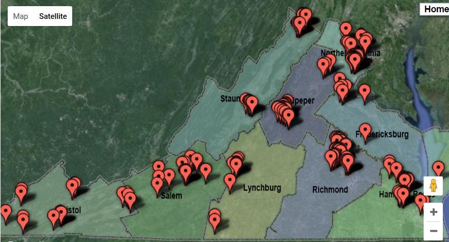
18 STARS PROJECTS 19


19 PREVIOUS EXAMPLE LYNCHBURG EXPRESSWAY (US 29 BUS) 4.5 miles of limited access highway 10 interchanges / 41 ramps / 23 intersections Built in phases between 1950s and 1970s City of Lynchburg Liberty University Traffic analysis tools used CORSIM Synchro
20 STARS PROJECT SUMMARIES 21

21 STARS PROJECT DEVELOPMENT CYCLE 22
22 NEXT STEPS STARS applications due annually Coordinate with VDOT District Planner Contact Samuel W. Hayes, PE Transportation and Mobility Planning Division (804) office (804) mobile 23

23 QUESTIONS? 24
Effectiveness of Median Cable Barriers and Rumble Strips
 Effectiveness of Median Cable Barriers and Rumble Strips Chris Poole, Iowa Department of Transportation Peter Savolainen, Iowa State University Mid-Continent Transportation Research Symposium August 16,
Richmond Area MPO Regional Priority Transportation Projects
 Regional Priority Transportation Projects September 27, 2007 HANOVER GOOCHLAND ASHLAND POWHATAN RICHMOND HENRICO NEW KENT CHESTERFIELD CHARLES CITY 9211 Forest Hill Avenue, Suite 200 Richmond, Virginia
Metropolitan Freeway System 2013 Congestion Report
 Metropolitan Freeway System 2013 Congestion Report Metro District Office of Operations and Maintenance Regional Transportation Management Center May 2014 Table of Contents PURPOSE AND NEED... 1 INTRODUCTION...
5. OPPORTUNITIES AND NEXT STEPS
 5. OPPORTUNITIES AND NEXT STEPS When the METRO Green Line LRT begins operating in mid-2014, a strong emphasis will be placed on providing frequent connecting bus service with Green Line trains. Bus hours
Rocky Mount. Transportation Plan. Transportation Planning Division. Virginia Department of Transportation
 2020 Transportation Plan Developed by the Transportation Planning Division of the Virginia Department of Transportation in cooperation with the U.S. Department of Transportation, Federal Highway Administration
US 70 Corridor Planning for the Future
 New Bern/James City Area - Work Session US 70 Corridor Planning for the Future Brinson Elementary School Thursday, January 31, 2008 Agenda Sign-in, in, View Maps, Talk to Project Team Public Q & A Session
Open House. Highway212. Meetings. Corridor Access Management, Safety & Phasing Plan. 5:30 to 6:30 p.m. - Southwest Corridor Transportation Coalition
 Welcome Meetings 5:30 to 6:30 p.m. - Southwest Corridor Transportation Coalition 6:30 to 8:00 p.m. - Open House Why is Highway 212 Project Important? Important Arterial Route Local Support Highway 212
2016 Congestion Report
 2016 Congestion Report Metropolitan Freeway System May 2017 2016 Congestion Report 1 Table of Contents Purpose and Need...3 Introduction...3 Methodology...4 2016 Results...5 Explanation of Percentage Miles
EXCEPTION TO STANDARDS REPORT
 EXCEPTION TO STANDARDS REPORT PROJECT DESCRIPTION AND NEED The project is located in Section 6, Township 23 North, Range 9 East and Section 31 Township 24 North, Range 9 East, in the Town of Stockton,
High Risk Rural Roads Program Guideline
 High Risk Rural Roads Program Guideline 3.1 High Risk Rural Roads Program (HRRRP) SFETE-LU introduced a new set-aside provision known as the High Risk Rural Roads Program (HRRRP), codified as 23 U.S.C.
Subarea Study. Manning Avenue (CSAH 15) Corridor Management and Safety Improvement Project. Final Version 1. Washington County.
 Corridor Management and Safety Improvement Project. Final Version 1. Washington County.") Subarea Study Manning Avenue (CSAH 15) Corridor Management and Safety Improvement Project Final Version 1 Washington County June 12, 214 SRF No. 138141 Table of Contents Introduction... 1 Forecast Methodology
Subarea Study Manning Avenue (CSAH 15) Corridor Management and Safety Improvement Project Final Version 1 Washington County June 12, 214 SRF No. 138141 Table of Contents Introduction... 1 Forecast Methodology
Travel Demand Modeling at NCTCOG
 Travel Demand Modeling at NCTCOG Arash Mirzaei North Central Texas Council Of Governments for Southern Methodist University The ASCE Student Chapter October 24, 2005 Contents NCTCOG DFW Regional Model
BROWARD BOULEVARD CORRIDOR TRANSIT STUDY
 BROWARD BOULEVARD CORRIDOR TRANSIT STUDY FM # 42802411201 EXECUTIVE SUMMARY July 2012 GOBROWARD Broward Boulevard Corridor Transit Study FM # 42802411201 Executive Summary Prepared For: Ms. Khalilah Ffrench,
TxDOT TRAFFIC INCIDENT MANAGEMENT UPDATE. ITS Texas 2016
 TxDOT TRAFFIC INCIDENT MANAGEMENT UPDATE ITS Texas 2016 November 10, 2016 TxDOT- Traffic Operations Division November 10, 2016 Performance Measures (Lonestar ATMS) Lonestar ATMS Upgraded to Support Incident
Chapter 7: Travel Demand Analysis. Chapter 8. Plan Scenarios. LaSalle Community Center. Image Credit: Town of LaSalle
 Chapter 7: Travel Demand Analysis Chapter 8 Plan Scenarios LaSalle Community Center. Image Credit: Town of LaSalle 164 Chapter 8: Plan Scenarios Moving Ahead for Progress in the 21 st Century Act (MAP
To: File From: Adrian Soo, P. Eng. Markham, ON File: Date: August 18, 2015
 Memo To: From: Adrian Soo, P. Eng. Markham, ON : 165620021 Date: Reference: E.C. Row Expressway, Dominion Boulevard Interchange, Dougall Avenue Interchange, and Howard 1. Review of Interchange Geometry
City of Pacific Grove
 Regional Study Utilizing Caltrans Intersection Evaluation Section 7: City of Pacific Grove s: FIRST STREET AT CENTRAL AVENUE Transportation Agency for Monterey County Prepared by Transportation Agency
Transportation Performance Management Overview. Laura Toole 2018 Ohio Planning Conference
 Transportation Performance Management Overview Laura Toole 2018 Ohio Planning Conference What is Transportation Performance Management (TPM)? Strategic approach Uses system information to make decisions
STH 60 Northern Reliever Route Feasibility Study Report
 #233087 v3 STH 60 Northern Reliever Route Feasibility Study Report Washington County Public Works Committee Meeting September 28, 2016 1 STH 60 Northern Reliever Route Feasibility Study Hartford Area Development
Signal System Timing and Phasing Program SAMPLE. Figure 1: General Location Map. Second St.
 I. Overview Consultant A was retained by the Ohio Department of Transportation to conduct traffic signal timing analyses on approximately one mile of roadway on between the Main Street and the Fourth Street
Alpine Highway to North County Boulevard Connector Study
 Alpine Highway to North County Boulevard Connector Study prepared by Avenue Consultants March 16, 2017 North County Boulevard Connector Study March 16, 2017 Table of Contents 1 Summary of Findings... 1
APPENDIX C1 TRAFFIC ANALYSIS DESIGN YEAR TRAFFIC ANALYSIS
 APPENDIX C1 TRAFFIC ANALYSIS DESIGN YEAR TRAFFIC ANALYSIS DESIGN YEAR TRAFFIC ANALYSIS February 2018 Highway & Bridge Project PIN 6754.12 Route 13 Connector Road Chemung County February 2018 Appendix
Tulsa Transportation Management Area. Urbanized Area Surface Transportation Program
 Tulsa Transportation Management Area Urbanized Area Surface Transportation Program FFY 2022 Application Information Sponsor Location Description STP Request Other Funds Broken Arrow Elm Place: Kenosha
Restricted Crossing U-Turn (RCUT) Intersection Concept, Case Studies, and Design Guide ITE Midwest Annual Meeting June 30, 2015 Branson, MO
 Intersection Concept, Case Studies, and Design Guide ITE Midwest Annual Meeting June 30, 2015 Branson, MO") Restricted Crossing U-Turn (RCUT) Intersection Concept, Case Studies, and Design Guide 2015 ITE Midwest Annual Meeting June 30, 2015 Branson, MO Wei Zhang, Ph.D., P.E. Program Manager, Intersection Safety
Restricted Crossing U-Turn (RCUT) Intersection Concept, Case Studies, and Design Guide 2015 ITE Midwest Annual Meeting June 30, 2015 Branson, MO Wei Zhang, Ph.D., P.E. Program Manager, Intersection Safety
FY Regional Surface Transportation Program (RSTP) Allocations *
 Allocations *") FY 2015-2020 Regional Surface Transportation Program (RSTP) Allocations * Cost Previous Actual Other Source Total Allocation Jurisdiction/Project Description UPC Estimate Funding Allocation * Projected
FY 2015-2020 Regional Surface Transportation Program (RSTP) Allocations * Cost Previous Actual Other Source Total Allocation Jurisdiction/Project Description UPC Estimate Funding Allocation * Projected
Kendall Drive Premium Transit PD&E Study Project Kick-Off Meeting SR 94/Kendall Drive/SW 88 Street Project Development and Environment (PD&E) Study
 Study") Florida Department of Transportation District Six Kendall Drive Premium Transit PD&E Study Project Kick-Off Meeting SR 94/Kendall Drive/SW 88 Street Project Development and Environment (PD&E) Study What
Florida Department of Transportation District Six Kendall Drive Premium Transit PD&E Study Project Kick-Off Meeting SR 94/Kendall Drive/SW 88 Street Project Development and Environment (PD&E) Study What
Table of Contents INTRODUCTION... 3 PROJECT STUDY AREA Figure 1 Vicinity Map Study Area... 4 EXISTING CONDITIONS... 5 TRAFFIC OPERATIONS...
 Crosshaven Drive Corridor Study City of Vestavia Hills, Alabama Table of Contents INTRODUCTION... 3 PROJECT STUDY AREA... 3 Figure 1 Vicinity Map Study Area... 4 EXISTING CONDITIONS... 5 TRAFFIC OPERATIONS...
Electric Vehicle Infrastructure Location Tool and Visualization Map. July 17, 2018
 Electric Vehicle Infrastructure Location Tool and Visualization Map Version 2.0 Analysis Summary July 17, 2018 Contents Electric Vehicle Fast Charging Infrastructure Planning Tools Overview & Analysis
Metro Transit Update. Christina Morrison, Senior Planner Metro Transit BRT/Small Starts Project Office. John Dillery, Senior Transit Planner
 Metro Transit Update Christina Morrison, Senior Planner Metro Transit BRT/Small Starts Project Office John Dillery, Senior Transit Planner Metro Transit Service Development May 16, 2013 1 Transit Planning
2030 Multimodal Transportation Study
 2030 Multimodal Transportation Study City of Jacksonville Planning and Development Department Prepared by Ghyabi & Associates April 29,2010 Introduction Presentation Components 1. Study Basis 2. Study
FREQUENTLY ASKED QUESTIONS
 FREQUENTLY ASKED QUESTIONS 2018 What is the More MARTA Atlanta program? The More MARTA Atlanta program is a collaborative partnership between MARTA and the City of Atlanta to develop and implement a program
Richmond Area MPO Regional Priority Transportation Projects
 Regional Priority Transportation Projects October 12, 2006 Town of Ashland Counties of Charles City Chesterfield Goochland Hanover Henrico New Kent Powhatan City of Richmond Richmond Regional Planning
DRAFT Evaluation Scores. Transit
 DRAFT Evaluation s The criteria for evaluating applications for new funding commitments are used to measure how well they advance the six goals identified for the MTP. Through transportation: Reduce per
Predictive Analytics for TDOT HELP. AASHTO STSMO Meeting September 14, 2017 Rapid City, South Dakota
 Predictive Analytics for TDOT HELP AASHTO STSMO Meeting September 14, 2017 Rapid City, South Dakota What is Predictive Analytics? An analysis tool that uses historical and current data to forecast future
TEXAS CITY PARK & RIDE RIDERSHIP ANALYSIS
 TEXAS CITY PARK & RIDE RIDERSHIP ANALYSIS This document reviews the methodologies and tools used to calculate the projected ridership and parking space needs from the proposed Texas City Park & Ride to
The Jack A. Markell Trail Delaware s Bicycle Highway New England Bike- Walk Summit
 The Jack A. Markell Trail Delaware s Bicycle Highway 2018 New England Bike- Walk Summit The Jack A. Markell Trail Sometimes a very difficult project, including significant investment and perseverance,
US 81 Bypass of Chickasha Environmental Assessment Public Meeting
 US 81 Bypass of Chickasha Environmental Assessment Public Meeting March 14, 2013 Introductions ODOT FHWA SAIC Meeting Purpose Present need for bypass Provide responses to 10/04/11 public meeting comments
Reliability Guide for the HCM Concepts & Content
 Reliability Guide for the HCM Concepts & Content SHRP 2 Project L08: Incorporation of Travel Time Reliability into the Highway Capacity Manual July 2012 1 Research Objectives The objectives of Project
MPO Staff Report Technical Advisory Committee: July 12, 2017
 MPO Staff Report Technical Advisory Committee: July 12, 2017 RECOMMENDED ACTION: 2 nd TAC Meeting with Kimley-Horn/WSB in Updating the Street/Highway Element of 2045 Metropolitan Transportation Plan. Matter
ACTION TRANSMITTAL No
 Transportation Advisory Board of the Metropolitan Council of the Twin Cities DATE: January 4, 2016 TO: ACTION TRANSMITTAL No. 2016-19 TAC Funding and Programming Committee PREPARED BY: Joe Barbeau, Senior
Highway 23 New London Access & Safety Assessment. Public Open House #2 October 3, :00 to 7:00 PM
 Public Open House #2 October 3, 2017 5:00 to 7:00 PM Highway 9 OVERVIEW OF ASSESSMENT Assessment Limits Highway 23 from County Road 40 to North Shore Dr Purpose: Identify opportunities to reduce serious
Metropolitan Freeway System 2007 Congestion Report
 Metropolitan Freeway System 2007 Congestion Report Minnesota Department of Transportation Office of Traffic, Safety and Operations Freeway Operations Section Regional Transportation Management Center March
Highway 18 BNSF Railroad Overpass Feasibility Study Craighead County. Executive Summary
 Highway 18 BNSF Railroad Overpass Feasibility Study Craighead County Executive Summary October 2014 Highway 18 BNSF Railroad Overpass Feasibility Study Craighead County Executive Summary October 2014 Prepared
SH 249 IN GRIMES COUNTY. Open House April 3, 2014
 SH 249 IN GRIMES COUNTY Open House April 3, 2014 Meeting Agenda Purpose of Meeting Today: Review the purpose and need for the SH 249 Grimes County project Review the proposed project and alternatives Discuss
2 VALUE PROPOSITION VALUE PROPOSITION DEVELOPMENT
 2 VALUE PROPOSITION The purpose of the Value Proposition is to define a number of metrics or interesting facts that clearly demonstrate the value of the existing Xpress system to external audiences including
Over-Dimensional Vehicle Restriction Study for US 129 in TN
 Over-Dimensional Vehicle Restriction Study for US 129 in TN July 30,2015 TDOT Region 1 US 129 Location Map US 129 Topography and Scenery Operational and Safety Study August 2014, US129 Operational and
Figure 1 Map of intersection of SR 44 (Ravenna Rd) and Butternut Rd
 and Butternut Rd") Abbreviated Study District: 12 County: Geauga Route: SR 44 Section: 1.58 GEA 44 1.58 213 HSP # 47 (Rural Intersection) Prepared April 23, 215 By Bryan Emery Existing Conditions This study contains the
Abbreviated Study District: 12 County: Geauga Route: SR 44 Section: 1.58 GEA 44 1.58 213 HSP # 47 (Rural Intersection) Prepared April 23, 215 By Bryan Emery Existing Conditions This study contains the
Letter EL652 City of Mercer Island. Page 1. No comments n/a
 Letter EL652 City of Mercer Island Page 1 No comments n/a Page 2 Response to comment EL652 1 Section 4.5.3 of the Final EIS presents the range of potential impacts of the project. This project also lists
New Buck O Neil (U. S. 169) Crossing Benefit-Cost Analysis. Kansas City, Missouri
 Crossing Benefit-Cost Analysis. Kansas City, Missouri") New Buck O Neil (U. S. 169) Crossing Benefit-Cost Analysis Kansas City, Missouri New Buck O Neil (U. S. 169) Crossing Benefit-Cost Analysis prepared for Kansas City, Missouri prepared by Burns & McDonnell
New Buck O Neil (U. S. 169) Crossing Benefit-Cost Analysis Kansas City, Missouri New Buck O Neil (U. S. 169) Crossing Benefit-Cost Analysis prepared for Kansas City, Missouri prepared by Burns & McDonnell
Andrew Lee, House Fiscal 1 of 12 4/1/ :36 PM
 FY 2022 FY 2023 7 8 DEPARTMENT OF TRANSPORTATION 9 10 MULTIMODAL SYSTEMS 11 12 Aeronautics: 13 Airport Dev. & Assistance - Base AIR 42,599 30,596 30,596 15,298 15,298 30,596 30,596 15,298 15,298 30,596
HIGHWAY SAFETY RESEARCH GROUP. Safety Analysis Tools Used for Coalitions and Districtwide Safety Investment Plans
 Safety Analysis Tools Used for Coalitions and Districtwide Safety Investment Plans 3 Levels of Analysis SHSP Dashboards LOSS Dashboard GIS Tool SHSP Dashboards Strategic Highway Safety Plan The vision
Parks and Transportation System Development Charge Methodology
 City of Sandy Parks and Transportation System Development Charge Methodology March, 2016 Background In order to implement a City Council goal the City of Sandy engaged FCS Group in January of 2015 to update
HSIP FUNDING APPLICATION
 HSIP FUNDING APPLICATION Lucas County - Sylvania Ave at Centennial Rd DATE 10/6/2011 Project Information: COUNTY Lucas County LOCATION TYPE Intersection PROJECT SERVICE LIFE 20 years SEGMENT INFORMATION
Proposed HRTAC FY2018 FY2023 Plan of Finance Update
 Chair, MICHAEL J. HIPPLE Vice Chair, LINDA T. JOHNSON Executive Director, KEVIN B. PAGE Proposed HRTAC 2018 2023 Plan of Finance Update HRTAC 2018 2023 Six Year Operating and Capital Program of Projects
Technical Memorandum Analysis Procedures and Mobility Performance Measures 100 Most Congested Texas Road Sections What s New for 2015
 Technical Memorandum Analysis Procedures and Mobility Performance Measures 100 Most Congested Texas Road Sections Prepared by Texas A&M Transportation Institute August 2015 This memo documents the analysis
I-10 West AA/EIS Pre-Screening and Tier 1 Analysis Results. Public Meeting. Wulf Grote, Director Project Development Rick Pilgrim, Project Manager
 I-10 West AA/EIS Pre-Screening and Tier 1 Analysis Results Public Meeting Wulf Grote, Director Project Development Rick Pilgrim, Project Manager March 4 & 5, 2008 Today s Agenda Overview of Alternatives
Safety Assessment. Intersection of Route 29 (Seminole Trail) and Ashwood Blvd (Route 1670). Albemarle County
 and Ashwood Blvd (Route 1670). Albemarle County") Safety Assessment for Intersection of Route 29 (Seminole Trail) and Ashwood Blvd (Route 1670). Albemarle County Prepared by: VIRGINIA DEPARTMENT OF TRANSPORTATION Northwestern Regional Operations - Traffic
Safety Assessment for Intersection of Route 29 (Seminole Trail) and Ashwood Blvd (Route 1670). Albemarle County Prepared by: VIRGINIA DEPARTMENT OF TRANSPORTATION Northwestern Regional Operations - Traffic
Basic Project Information
 FY 2015-16 PROJECT DESCRIPTION FORM (7B) Submitting Agency: Fairfax County Basic Project Information Project Title: South Van Dorn Street and Franconia Road Interchange 7B Project Type (check one): Roadway
King County Metro. Columbia Street Transit Priority Improvements Alternative Analysis. Downtown Southend Transit Study. May 2014.
 King County Metro Columbia Street Transit Priority Improvements Alternative Analysis Downtown Southend Transit Study May 2014 Parametrix Table of Contents Introduction... 1 Methodology... 1 Study Area...
RTID Travel Demand Modeling: Assumptions and Method of Analysis
 RTID Travel Demand Modeling: Assumptions and Method of Analysis Overall Model and Scenario Assumptions The Puget Sound Regional Council s (PSRC) regional travel demand model was used to forecast travel
TEXAS RURAL TRANSPORTATION PLAN 2035 (TRTP 2035)
") TEXAS RURAL TRANSPORTATION PLAN 2035 (TRTP 2035) Helping shape the future of rural Texas Texas Rural Transportation Plan 2035 Texas Rural Transportation Plan 2035 What is it? Component of the Statewide
TEXAS RURAL TRANSPORTATION PLAN 2035 (TRTP 2035) Helping shape the future of rural Texas Texas Rural Transportation Plan 2035 Texas Rural Transportation Plan 2035 What is it? Component of the Statewide
6/6/2018. June 7, Item #1 CITIZENS PARTICIPATION
 June 7, 2018 Item #1 CITIZENS PARTICIPATION 1 Item #2 APPROVAL OF MINUTES Item #3 TRAC GOALS, FRAMEWORK & AGENDA REVIEW 2 COMMITTEE GOALS Learn about Southern Nevada s mobility challenges, new developments
RTE. 1 at RTE. 637 & RTE. 639
 INTERSECTION SAFETY STUDY Prepared for: Virginia Department of Transportation Central Region Operations Traffic Engineering (UPC #81378, TO 12-092) DAVENPORT Project Number: 13-368 / /2014 RTE. 1 at RTE.
Turnpike Mitigation Program Application
 Ohio Department of Transportation & Ohio Turnpike and Infrastructure Commission Turnpike Mitigation Program Application Please note the following eligibility criteria: 1) Projects must be sponsored by
Florida Strategic Highway Safety Planning Florida Strategic Highway Safety Plan (SHSP) Update and Performance Overview
 Update and Performance Overview") Session 1 Florida Strategic Highway Safety Planning Florida Strategic Highway Safety Plan (SHSP) Update and Performance Overview Joe Santos, PE, FDOT, State Safety Office October, 23, 2013 Florida Statistics
Session 1 Florida Strategic Highway Safety Planning Florida Strategic Highway Safety Plan (SHSP) Update and Performance Overview Joe Santos, PE, FDOT, State Safety Office October, 23, 2013 Florida Statistics
INTERSECTION CONTROL EVALUATION
 INTERSECTION CONTROL EVALUATION Trunk Highway 22 and CSAH 21 (E Hill Street/Shanaska Creek Road) Kasota, Le Sueur County, Minnesota November 2018 Trunk Highway 22 and Le Sueur CSAH 21 (E Hill Street/Shanaska
VDOT Unused Facilities
 VDOT Unused Facilities Appropriation Act Item 457 K.1 (2010) Report to the Chairmen of House Appropriations and Senate Finance Committees Virginia Department of Transportation 1401 East Broad Street Richmond,
Corridor Sketch Summary
 Corridor Sketch Summary SR 241: I-82 Jct (Sunnyside) to SR 24 Jct Corridor Highway No. 241 Mileposts: 7.53 to 25.21 Length: 17.65 miles Corridor Description The seventeen and one-half mile corridor begins
Point A Point B Point C Point D. Fulton County Board of Commissioners and Mayors Meeting December 14, 2017
 Fulton County Board of Commissioners and Mayors Meeting December 14, 2017 Master Plan Overview Phase 1 Community Vision and Existing Transit Conditions Phase 2 Scenario Development Phase 3 Transit Master
Introduction and Background Study Purpose
 Introduction and Background The Brent Spence Bridge on I-71/75 across the Ohio River is arguably the single most important piece of transportation infrastructure the Ohio-Kentucky-Indiana (OKI) region.
MEMO VIA . Ms. Amy Roth DPS Director, City of Three Rivers. To:
 MEMO To: Ms. Amy Roth DPS Director, City of Three Rivers VIA EMAIL From: Michael J. Labadie, PE Julie M. Kroll, PE, PTOE Brandon Hayes, PE, P.Eng. Fleis & VandenBrink Date: January 5, 2017 Re: Proposed
A Vision for Highway Automation
 A Vision for Highway Automation R y a n D. R i c e D i r e c t o r o f M o b i l i t y O p e r a t i o n s C o l o r a d o D e p a r t m e n t o f T r a n s p o r t a t i o n Problem Statement Higher
Proposed FY Capital Improvement Program (CIP) March 5, 2018 Capital Planning Committee 1
 March 5, 2018 Capital Planning Committee 1") Proposed FY 2019-2023 Capital Improvement Program (CIP) March 5, 2018 Capital Planning Committee 1 The Capital Improvement Program is: A fiscally constrained, 5-year program of capital projects An implementation
Proposed FY 2019-2023 Capital Improvement Program (CIP) March 5, 2018 Capital Planning Committee 1 The Capital Improvement Program is: A fiscally constrained, 5-year program of capital projects An implementation
FFY Transportation Improvement Program (TIP) Development
 Development") FFY 2016-2019 Transportation Improvement Program (TIP) Development MAY 18, 2015 CAPE COD METROPOLITAN PLANNING ORGANIZATION Highway Funding Regional s Year STP HSIP CMAQ FFY 2016 2019 TOTAL Regional with
FFY 2016-2019 Transportation Improvement Program (TIP) Development MAY 18, 2015 CAPE COD METROPOLITAN PLANNING ORGANIZATION Highway Funding Regional s Year STP HSIP CMAQ FFY 2016 2019 TOTAL Regional with
PORTS-TO-PLAINS. Corridor Planning. Ports-to-Plains Stakeholder Meeting
 PORTS-TO-PLAINS Corridor Planning Stakeholder Workshop - Agenda 1 Purpose of Stakeholder Workshops 3 2 Rural Transportation System Overview 4 3 Ports-to-Plains 8 4 5 6 7 I-27 Expansion Key Considerations
Request for Design Exception (#1) S.M. Wright Phase IIB
 S.M. Wright Phase IIB") Request for Design Exception (#1) S.M. Wright Phase IIB County: Dallas CSJ s: 0092-01-059, 0092-14-088 Project Limits: From Pennsylvania Avenue to North of Al Lipscomb Way Date: June 28, 2016 Proposed
Request for Design Exception (#1) S.M. Wright Phase IIB County: Dallas CSJ s: 0092-01-059, 0092-14-088 Project Limits: From Pennsylvania Avenue to North of Al Lipscomb Way Date: June 28, 2016 Proposed
Call for Projects Congestion Mitigation and Air Quality (CMAQ) Emissions Formulas Technical Advisory Committee
 Emissions Formulas Technical Advisory Committee") Call for Projects Congestion Mitigation and Air Quality (CMAQ) Emissions Formulas Technical Advisory Committee July 18, 2018 Formula Coordination DRCOG under review, considering FHWA toolkit RAQC Argonne
Call for Projects Congestion Mitigation and Air Quality (CMAQ) Emissions Formulas Technical Advisory Committee July 18, 2018 Formula Coordination DRCOG under review, considering FHWA toolkit RAQC Argonne
The Highway Safety Manual: Will you use your new safety powers for good or evil? April 4, 2011
 The Highway Safety Manual: Will you use your new safety powers for good or evil? April 4, 2011 Introductions Russell Brownlee, M.A. Sc., FITE, P. Eng. Specialize in road user and rail safety Transportation
Business Leadership on Transportation in the Triangle
 Business Leadership on Transportation in the Triangle Joe Milazzo II, PE Executive Director Regional Transportation Alliance business coalition North Carolina House Select Committee on Strategic Transportation
RE: Comments on Proposed Mitigation Plan for the Volkswagen Environmental Mitigation Trust
 May 24, 2018 Oklahoma Department of Environmental Quality Air Quality Division P.O. Box 1677 Oklahoma City, OK 73101-1677 RE: Comments on Proposed Mitigation Plan for the Volkswagen Environmental Mitigation
SC Highway 41 Existing Conditions
 SC Highway 41 Existing Conditions Existing Typical Cross Section purposes only and does not replace the required NEPA process necessary for alignment The NEPA process is anticipated to begin in the next
Additional $200 Speeding Fine Signs
 CITY OF CHARLOTTESVILLE, VIRGINIA CITY COUNCIL AGENDA Agenda Date: June 18, 2007 Action Required: Presenter: Staff Contacts: Title: Adopt Ordinance Jeanie Alexander, P.E. Jeanie Alexander Additional $200
Performance Measure Summary - Washington DC-VA-MD. Performance Measures and Definition of Terms
 Performance Measure Summary - Washington DC-VA-MD There are several inventory and performance measures listed in the pages of this Urban Area Report for the years from 1982 to 2014. There is no single
TTI TRAFFIC SAFETY CONFERENCE. John A. Barton, P.E.
 TTI TRAFFIC SAFETY CONFERENCE John A. Barton, P.E. Introduction TxDOT Mission Work with others to provide safe and reliable transportation solutions for Texas. 2 Mission Zero Is a Journey toward: Zero
Freight Performance Measures Using Truck GPS Data and the Application of National Performance Measure Research Data Set (NPMRDS)
") Freight Performance Measures Using Truck GPS Data and the Application of National Performance Measure Research Data Set (NPMRDS) Chen-Fu Liao Department of Civil, Environmental, and Geo- Engineering University
Freight Performance Measures Using Truck GPS Data and the Application of National Performance Measure Research Data Set (NPMRDS) Chen-Fu Liao Department of Civil, Environmental, and Geo- Engineering University
Performance Measure Summary - Boston MA-NH-RI. Performance Measures and Definition of Terms
 Performance Measure Summary - Boston MA-NH-RI There are several inventory and performance measures listed in the pages of this Urban Area Report for the years from 1982 to 2014. There is no single performance
The State of SCDOT. Presented: February 1, 2017 Secretary Christy A. Hall, P.E.
 The State of SCDOT Presented: February 1, 2017 Secretary Christy A. Hall, P.E. As we enter our Centennial Year, we have much to do together. 2 Looking # Back # over # the # past # 12 # months Y Y Y Y Y
FIELD APPLICATIONS OF CORSIM: I-40 FREEWAY DESIGN EVALUATION, OKLAHOMA CITY, OK. Michelle Thomas
 Proceedings of the 1998 Winter Simulation Conference D.J. Medeiros, E.F. Watson, J.S. Carson and M.S. Manivannan, eds. FIELD APPLICATIONS OF CORSIM: I-40 FREEWAY DESIGN EVALUATION, OKLAHOMA CITY, OK Gene
Incentives for Green Fleets
 Incentives for Green Fleets 2012 Green Vehicle Funding Workshop East Bay Clean Cities Coalition Karen Schkolnick Air Quality Programs Manager Bay Area Air Quality Management District Overview Introduction
Broward County Intermodal Center And People Mover. AASHTO Value Engineering Conference Presentation. September 1, 2009 San Diego, CA
 Project Development & Environment Study Broward County Intermodal Center And People Mover AASHTO Value Engineering Conference Presentation September 1, 2009 San Diego, CA Background P D & E Study Regional
Performance Measure Summary - Louisville-Jefferson County KY-IN. Performance Measures and Definition of Terms
 Performance Measure Summary - Louisville-Jefferson County KY-IN There are several inventory and performance measures listed in the pages of this Urban Area Report for the years from 1982 to 2014. There
METRO Orange Line BRT American Boulevard Station Options
 METRO Orange Line BRT American Boulevard Station Options Bloomington City Council Work Session November 18, 2013 Christina Morrison BRT/Small Starts Project Office Coordinating Planning and Design AMERICAN
2002 Virginia Department of Transportation Daily Traffic Volume Estimates Including Vehicle Classification Estimates. Special Locality Report 129
 Daily Traffic Volume Estimates Including Vehicle Classification Estimates where available Special Locality Report 129 Prepared By In Cooperation With U.S. Department of Transportation Federal Highway Administration
SUCCESSFUL PERFORMANCE PAVEMENT PROJECTS 2015 TxAPA Annual Meeting September 23, 2015 Austin District Mike Arellano, P.E. Date
 SUCCESSFUL PERFORMANCE PAVEMENT PROJECTS 2015 TxAPA Annual Meeting September 23, 2015 Austin District Mike Arellano, P.E. Date AUSTIN DISTRICT SAFETY PERFORMANCE OF HIGH- FRICTION MIXTURES Mike Arellano,
Executive Summary. Draft Environmental Impact Statement/Environmental Impact Report ES-1
 Executive Summary Introduction The Eastside Transit Corridor Phase 2 Project is a vital public transit infrastructure investment that would provide a transit connection to the existing Metro Gold Line
Snelling Bus Rapid Transit. May 13, 2013 Technical Advisory Committee Meeting #1
 Snelling Bus Rapid Transit May 13, 2013 Technical Advisory Committee Meeting #1 1 Today s meeting TAC Introductions Project Overview Arterial BRT Concept Background Snelling Corridor Plan, Funding & Schedule
I-405 Corridor Master Plan
 Southern California Association of Governments I-405 Corridor Master Plan Presentation to Streets and Freeways Subcommittee October 13, 2015 1 Presentation Overview Expectations and Approach Corridor Performance
Town of Londonderry, New Hampshire NH Route 28 Western Segment Traffic Impact Fee Methodology
 Town of Londonderry, New Hampshire NH Route 28 Western Segment Traffic Impact Fee Methodology Prepared by the Londonderry Community Development Department Planning & Economic Development Division Based
Is Lafayette ready for a traffic loop?
 Page 1 of 5 Jessica Goff, jgoff@theadvertiser.com 8:55 a.m. CDT October 9, 2015 The push to transform U.S. 90 into a 160-mile interstate (/story/news/local/2015/10/06/overpass-throughdowntown-call--49-south-connector/73448276/)
Action 6A: HRTAC FY2018 FY2023 Funding Plan
 Action 6A: HRTAC 2018 2023 Funding Plan Presentation to: HRTAC Finance Committee Kevin Page, HRTAC Liang Shan, PFM June 5, 2017 PFM Financial Advisors LLC 300 S. Orange Avenue Ste 1170 Orlando, Florida