United Therapeutics Phase 3 Silver Spring, MD
|
|
|
- Scott Skinner
- 5 years ago
- Views:
Transcription
1 Traffic Impact Study United Therapeutics Phase 3 Silver Spring, MD Prepared for: United Therapeutics Corporation April 1, 2013 Kimley-Horn & Associates, Inc. 2013
2 This document, together with the concepts and designs presented herein, as an instrument of service, is intended only for the specific purpose and client for which it was prepared. Reuse of and improper reliance on this document without written authorization and adaptation by Kimley-Horn and Associates, Inc. shall be without liability to Kimley-Horn and Associates, Inc.
3 TABLE OF CONTENTS Contents TABLE OF CONTENTS...i LIST OF FIGURES...ii LIST OF TABLES...ii INTRODUCTION... 1 AREA TRANSPORTATION SYSTEM... 3 Existing Area Roadways... 3 Existing Area Transit Service... 6 Metrorail Red Line... 6 Metrobus... 6 MTA Commuter Route... 7 VanGo Downtown Shuttle... 7 Ride-On MARC Train Service Existing Pedestrian and Bicycles Facilities Future Roadway Modifications DESCRIPTION OF PROPOSED DEVELOENT TRAFFIC VOLUMES Existing Traffic Volumes Vehicle Trip Generation and Directions of Approach Background Traffic Volumes Site Generated Traffic Volumes Total Future Traffic Volumes ASSESSMENT OF TRAFFIC CONDITIONS Intersection Capacity Analyses Pedestrian Impact Transportation Policy Area Review (TPAR) CONCLUSIONS APPENDIX Scoping Letter Site Plan (TBD) Traffic and Pedestrian Count Summaries Background Development Trip Generation Figures CLV Worksheets i
4 LIST OF FIGURES Figure 1 - Site Vicinity Map... 2 Figure 2 Study Area... 5 Figure 3 Existing Metrobus Routes... 8 Figure 4 Existing MTA Commuter Bus Routes... 9 Figure 5: VanGo Bus Routes Figure 6 Ride-On Bus Routes Figure 7 Existing Pedestrian and Bicycle Facilities Figure 8 - Existing Lane Designations Figure 9 Existing Peak hour Traffic Volumes Figure 10 Existing Peak Hour Pedestrian and Bicycle Volumes Figure 11 Directional Distribution of Traffic Figure 12 Approved and Unbuilt Developments Figure 13 Approved and Unbuilt Development Peak Hour Traffic Volumes Figure 14 Background Peak Hour Traffic Volumes Figure 15 - Site Generated Peak Hour Traffic Volumes Figure 16 - Total Future Peak Hour Traffic Volumes LIST OF TABLES Table 1: Pedestrian Crossing Distance Analysis Results Table 2: Silver Spring CBD Trip Generation Rates Table 3: Distribution of Site Generated Traffic Table 4: Trip Generation for Approved and Unbuilt Developments Table 5: Site Generated Traffic Volumes Table 6: Intersection Capacity Analysis Results ii
5 INTRODUCTION This report presents the results of a traffic impact study for the proposed Phase 3 of the United Therapeutics Silver Spring Campus. The site vicinity map is shown in Figure 1. The site is located in the southwest corner of the Colesville Road (US 29) and Spring Street intersection. The site currently contains the Montgomery County Garage 21, with current vehicular access located along Spring Street. Previously, vehicle access to Garage 21 had also been provided along Cameron Street. The proposed development includes removing and replacing the existing parking structure with up to approximately 115,000 square feet of office/laboratory and approximately 10,000 square feet of retail. The project will provide one-half of the parking typically required under the Zoning Ordinance. This traffic study was prepared to satisfy the requirements of the Adequate Public Facilities Ordinance (APFO) associated with the Preliminary Plan of Subdivision application for this project. The study was prepared in accordance with the Local Area Transportation Review (LATR) and Transportation Policy Area Review (TPAR) guidelines established by the Montgomery County Planning Board (MCPB), dated February The following sections of this report describe the area transportation system, existing traffic volumes, the calculation of traffic generated by approved and unbuilt developments, and the impact of the proposed development. 1


6 SITE NOT TO SCALE Site Vicinity Map Permitted Use Number Figure 1 United Therapeutics Phase 3, Silver Spring, Maryland Page 2
7 AREA TRANSPORTATION SYSTEM Existing Area Roadways The Silver Spring CBD functions both as a through commuter route for drivers commuting between residential areas in Montgomery County and work locations in the District of Columbia, and as an employment center in its own right. Included in this study are two of the major roadways that traverse the study area: Georgia Avenue (US Route 29/MD Route 97) and Colesville Road (US Route 29/MD Route 384). Also included are additional roadways that provide vehicular access to the project site. A brief description of the area roadway system follows. Georgia Avenue This major northwest-southeast arterial connects the Capital Beltway and Washington, DC, and is designated as US Route 29 and MD Route 97 in the vicinity of the study area. Through this area of Silver Spring, Georgia Avenue is a six-lane divided arterial. The study intersection of Georgia Avenue with Colesville Road is signalized. Colesville Road This major northeast-southwest arterial connects 16 th Street to the southwest with University Boulevard to the northeast, where it becomes Columbia Pike. In this study, Colesville Road is assumed to be oriented north-south. Colesville Road is designated as MD Route 384 south of Georgia Avenue and as US Route 29 north of Georgia Avenue. Colesville Road is a major commuter route that has an interchange with the Capital Beltway (I-495) and connects the northern communities along the Route 29 corridor with Silver Spring and downtown Washington, D.C. via 16 th Street. In the study area, Colesville Road has a six-lane cross-section with the inside through lane in each direction serving as a reversible lane during the morning and afternoon commuter hours. The study intersections of Colesville Road with Georgia Avenue, Fenton Street, and Spring Street are signalized. Spring Street This roadway serves as a collector road through the Silver Spring area, connecting 16 th Street with areas to the east of Colesville Road. In the study area, Spring Street has a four-lane cross-section that consists of four travel lanes east of Cameron Street and two travel lanes and two parking lanes west of Cameron Street. Spring Street transitions to a two-lane roadway to the east of Colesville Road. Further to the east of Colesville Road, Spring Street changes name designation to Cedar Street and continues to its intersection with Wayne Avenue. 3
8 The study intersections of Spring Street with the Cameron Street, Colesville Road, and Ellsworth Drive are all signalized. The proposed site driveway will be located along Spring Street west of the intersection of Spring Street and Colesville Road. Cameron Street This north-south roadway serves as a collector in the Silver Spring area, providing access for local development to Georgia Avenue and Spring Street. In the study area, Cameron Street has two travel lanes and two parking lanes. The study intersection of Cameron Street with Spring Street is signalized. Fenton Street This local east-west roadway extends from Cameron street east to Takoma Avenue in the City of Takoma Park. East of Takoma Avenue, Fenton Street becomes Albany Avenue. Fenton Street runs parallel to Georgia Avenue in the study area. The study intersection of Fenton Street and Colesville Road is signalized. Ellsworth Drive This local north-south roadway connects the residential areas to the north with the Silver Spring CBD. Ellsworth Drive terminates at Bennington Drive to the north and Georgia Avenue to the south. Ellsworth Drive has two travel lanes and two parking lanes in the study area. The study intersection of Ellsworth Drive and Spring Street/Cedar Street is signalized. The study area is shown in Figure 2. 4
9 NOT TO SCALE 1 2 SITE Legend: Study Intersection - Project Location Study Area United Therapeutics Phase 3, Silver Spring, Maryland Figure 2 Page 5
10 Existing Area Transit Service Existing transit service in the study area includes the nearby Silver Spring Metrorail station, the Silver Spring Transit Center (currently under construction), MARC commuter rail station, numerous bus routes, and a bus terminal at the Metrorail station. Metrorail Red Line The Silver Spring Metrorail Station is located along Colesville Road between Wayne Avenue/2 nd Avenue and East-West Highway. The entrances for the station are located at the east side and west side of Colesville Road. The station is on the Metrorail s Red Line which runs between Glenmont and Shady Grove with a loop through downtown Washington DC. Service is provided on weekdays, Saturdays, and Sundays. On weekdays, trains operate between 5:09 and 12:24. On Saturdays and Sundays, the first train leaves at 7:09. On Friday and Saturday nights, the last train leaves at 3:24 the next day. Metrobus The following Metrobus Routes are available in the study area: Metrobus routes F4 and F6, the New Carrollton-Silver Spring lines, travel between the Silver Spring Metrorail Station, through Prince Georges County, and the New Carrolton Metrorail Station. In the study area, routes F4 and F6 run along Fenton Street. Metrobus route J4, the College Park-Bethesda line, travels between the Montgomery Mall transit center, Medical Center Metrorail Station, Bethesda Metrorail Station, and College Park-University of Maryland Metrorail Station. Metrobus route J5, the Twinbrook-Silver Spring line, travels between the Twinbrook Metrorail Station, the Grosvenor-Strathmore Metrorail station, and the Silver Spring Metrorail Station. In the study area, route J5 runs primarily along Georgia Avenue. Metrobus route Q2, the Veirs Mill Road line, travels between Shady Grove, Rockville, Wheaton, Forest Glen, and Silver Spring Metrorail stations. In the study area, it runs primarily along Georgia Avenue. Metrobus routes Y5, Y7, Y8, Y9, the Georgia Avenue-Maryland lines, travel between Montgomery General Hospital in Olney, the Norbeck park-and-ride lots, and the Glenmont, Wheaton, Forest Glen, and Silver Spring Metrorail Stations. In the study area, these routes run primarily along Georgia Avenue. Metrobus routes Z2 and Z6, the Colevsille-Ashton and Calverton-Westfarm lines, respectively, travel primarily along Colesville Road in the study area. Route Z2 travels between Olney, Ashton, Cloverly, Colesville, Four Corners, and the Silver Spring 6
11 Metrorail Station. Route Z6 travels between the Burtonsville Crossing and Briggs Chaney park-and-ride lots, Calverton, Westfarm, White Oak, Four Corners, and the Silver Spring Metrorail Station. Metrobus route Z8, the Fairland line, travels between the Greencastle and Briggs Chaney park-and-ride lots, Fairland, White Oak, Four Corners, and the Silver Spring Metrorail Station. In the study area, route Z8 travels along Colesville Road. Metrobus routes Z9 and Z29, the Laurel-Burtonsville express lines, travel between the South Laurel and Burtonsville park-and-ride lots, Fairland, White Oak, and the Silver Spring Metrorail Station. In the study area, routes Z9 and Z29 travel along Colesville Road. Metrobus routes Z11 and Z13, the Greencastle-Briggs Chaney Express lines, travel between Greencastle and Briggs Chaney park-and-ride lots and the Silver Spring Metrorail station. In the study area, routes Z11 and Z13 travel along Colesville Road. The Metrobus routes in the study are shown on Figure 3. MTA Commuter Route The Maryland Transit Administration (MTA) provides commuter bus service. Route 915, Columbia/Silver Spring/Washington D.C., and Route 929, Columbia to Silver Spring/Washington D.C. express service, travel from Columbia, Maryland, to downtown Washington D.C stopping at the Scaggsville and Burtonsville park-and-ride lots and the Silver Spring Metrorail Station. In the study area, these routes travel along Colesville Road. The service is provided on weekdays. The MTA Commuter Routes in the study are shown on Figure 4. VanGo Downtown Shuttle The VanGo bus service is a free shuttle service in Downtown Silver Spring that operates Monday through Friday from 7:00 a.m. to 7:00 p.m. The shuttle arrives every eight minutes and stops at 25 locations within Silver Spring. Stops within the study area are located on Cameron Street, Fenton Street, Colesville Road, and Georgia Avenue. The VanGo stops and routes in the study area are shown on Figure 5. 7
12 NOT TO SCALE SITE Legend: - Project Location A1 - Bus Route Existing Metrobus Routes United Therapeutics Phase 3, Silver Spring, Maryland Figure 3 Page 8
13 NOT TO SCALE SITE Legend: - Project Location 1 - Bus Route Existing MTA Commuter Bus Routes Figure 4 United Therapeutics Phase 3, Silver Spring, Maryland Page 9
14 NOT TO SCALE SITE Legend: - Project Location - Bus Stops VanGo Bus Routes Figure 5 United Therapeutics Phase 3, Silver Spring, Maryland Page 10
15 Ride-On Montgomery County provides Ride-On local bus service. The following Ride-One routes are available in the study area: Route 4: Kensington to Silver Spring Metrorail Station via Second Avenue. Route 5: Twinbrook Metrorail Station to Kensington to Silver Spring Metrorail Station via Second Avenue and 16 th Street Route 8: Wheaton Metrorail Station to Forest Glen Metrorail Station to Silver Spring Metrorail Station via Colesville Road Route 9: Wheaton Metrorail Station to Silver Spring Metrorail Station via Colesville Road Route 12: Takoma Metrorail Station to Silver Spring Metrorail Station via Georgia Avenue, Wayne Avenue, Cedar Street, and Colesville Road Route 13: Takoma Metrorail Station to Silver Spring Metrorail Station via Colesville Road and Georgia Avenue Route 14: Takoma Metrorail Station to Silver Spring Metrorail Station via Colesville Road and Georgia Avenue Route 15: Langley Park to Silver Spring Metrorail Station via Wayne Avenue Route 16: Langley Park/Takoma Park to Silver Spring Metrorail Station via Fenton Street, Colesville Road, and Georgia Avenue Route 17: Langley Park to Silver Spring Metrorail Station via Fenton Street, Colesville Road, and Georgia Avenue Route 18: Langley Park to Silver Spring Metrorail Station via Spring Street, Colesville Road, and 1 st Avenue Route 19: Northwood to Silver Spring Metrorail Station via Wayne Avenue Route 20: Hillandale to Silver Spring Metrorail Station via Fenton Street Route 21: Briggs-Chaney park-and-ride lot to Silver Spring Metro Rail Station via Colesville Road Route 22: Hillandale to Silver Spring Metrorail Station via Colesville Road Route 28: Georgia Avenue MARC Station to Silver Spring MARC Station via Georgia Avenue The Ride-On routes in the study area are shown in Figure 6. 11
16 NOT TO SCALE SITE Legend: - Project Location 1 - Bus routes Existing Ride-On Bus Routes Figure 6 United Therapeutics Phase 3, Silver Spring, Maryland Page 12
17 MARC Train Service The MTA also provides MARC Train service. The Brunswick line serves Union Station in Washington D.C.; Silver Spring, Kensington, Garrett Park, Rockville, Washington Grove, Gaithersburg, Metropolitan Grove, Germantown, Boyds, Barnesville, Dickerson, Point of Rocks, Brunswick, MD; Harpers Ferry, Duffields & Martinsburg, W.V., with extension service to Monocacy and Frederick, MD. The Brunswick line runs on weekdays. Existing Pedestrian and Bicycles Facilities This pedestrian analysis examines the presence of pedestrian and bicycle facilities along the area streets and the pedestrian and bicycle accommodations at each study intersection. A review of existing conditions confirms that in the study area sidewalks are present along both sides of Colesville Road, Spring Street, Cameron Street, Fenton Street, and Georgia Avenue. Review of existing conditions confirms that crosswalks and pedestrian signal heads are provided wherever pedestrian crossings are permitted at signalized study intersections. Pedestrians are not permitted to cross the north leg of the intersection of Colesville Road and Spring Street because of the potential conflict with the double and sometimes triple eastbound left turn lanes from Spring Street to Colesville Road. Audible pedestrian tones, that indicate to pedestrians that it is safe to cross, are provided at all of the study intersections. The audible pedestrian tones are actuated by pedestrian pushbuttons located near each pedestrian crossing. ADA compliant ramps are provided at all study intersections where pedestrian crossings are permitted. A pedestrian crossing distance analysis was performed at the study intersections to determine the existing crossing conditions and signal timing necessary to meet the required pedestrian and bicycle crossing needs. Field measurements were taken to determine the pedestrian crossing distances, measured curb-to-curb, at each intersection. Using these measurements, the required pedestrian crossing time was calculated by dividing the distance by an average walking speed of 3.5 feet per second. Table 1 summarizes the results of the pedestrian crossing distance analysis. The crossing times provided at each intersection are sufficient for pedestrian movements. If there were locations where pedestrian crossing time criteria were deemed insufficient, the applicant would be required to inform Montgomery County DOT and request that it revise the signal timing in accordance with the LATR and TPAR Guidelines. This is not the case at any of these study intersections. 13
18 Pedestrian Crossing Table 1: Pedestrian Crossing Distance Analysis Results Required Crossing Crossing Distance Time (feet) (seconds) Provided Crossing Time* Peak Hour (seconds) Provided Crossing Time* Peak Hour (seconds) Spring Street and Cameron Street Cameron Street North Leg Cameron Street South Leg Spring Street East Leg Spring Street West Leg Spring Street and Colesville Road Spring Street North Leg Spring Street South Leg Colesville Road East Leg Colesville Road West Leg Spring Street and Ellsworth Drive Ellsworth Drive North Leg Ellsworth Drive South Leg Cedar Street East Leg Spring Street West Leg Colesville Road and Fenton Street Colesville Road North Leg Colesville Road South Leg Fenton Street East Leg Fenton Street West Leg Colesville Road and Georgia Avenue Colesville Road North Leg Colesville Road South Leg Georgia Avenue East Leg Georgia Avenue West Leg *Estimated as the sum of walk time and flashing don t walk time as noted during field observations. Separate, designated bicycle lanes are not provided along any of the study network roadways, including Colesville Road, Spring Street, Cameron Street, Fenton Street, and Georgia Avenue. However, there is signage provided in the southbound direction on Colesville Road indicating that bikes are permitted to use the full travel lane when they are present. Pedestrian and bicycle accommodations are shown in Figure 6. Future Roadway Modifications There are no programmed roadway improvements in the study area that were considered in this study. 14

19 NOT TO SCALE SITE C Legend: - Study Intersection (All Signalized) Pedestrian Crossing Phase on Recall Mode C - Crosswalk not provided due to vehicle-pedestrian conflict Existing Pedestrian and Bicycle Facilities Figure 7 United Therapeutics Phase 3, Silver Spring, Maryland Page 15
20 DESCRIPTION OF PROPOSED DEVELOENT Phase 3 of the United Therapeutics Silver Spring Campus is located at 1000 Spring Street along the south side of Spring Street west of the intersection of Spring Street and Colesville Road. The proposed development includes up to approximately 115,000 square feet of office/laboratory and approximately 10,000 square feet of retail space. The property currently contains the County s Garage 21, which will be removed. The project will provide one-half of the parking typically required under the Zoning Ordinance. The driveway that provides access to the on-site parking will be located along Spring Street approximately 250 feet west of the Colesville Road, measured along the tangent. 16
21 TRAFFIC VOLUMES Traffic volumes used in this study include existing traffic volumes, the addition of traffic generated by approved and unbuilt developments in the area, and traffic generated by the proposed development, to obtain total future traffic volumes. The MCPB transportation staff directed that the weekday and commuter peak hours be studied. Intersections identified for study by MCPB Area 1 transportation staff are as follows: Spring Street and Cameron Street Spring Street and Site access point Spring Street and Colesville Road Spring Street and Ellsworth Drive Colesville Road and Fenton Street Colesville Road and Georgia Avenue Figure 8 shows the lane designations at the study area intersections. The following sections describe the traffic volumes used in this study. Existing Traffic Volumes Traffic, pedestrian, and bicycle counts were conducted at the study area intersections on Thursday, February 28, 2013 between 6:30 and 9:30 and between 4:00 and 7:00. These counts were used to establish current peak hour traffic conditions. The peak hours at each intersection were established by identifying the peak 60 minutes of vehicle traffic during the and peak hours. Based on these traffic counts, the peak study hours were identified for each intersection as follows: Spring Street and Cameron Street 8:15 to 9:15, 5:00 to 6:00 Spring Street and Colesville Road 8:00 to 9:00, 4:45 to 5:45 Spring Street and Ellsworth Drive 8:30 to 9:30, 5:00 to 6:00 Colesville Road and Fenton Street 7:45 to 8:45, 5:00 to 6:00 Colesville Road and Georgia Avenue 7:45 to 8:45, 5:15 to 6:15 The existing peak hour traffic volumes at the study intersections are shown on Figure 9. The existing peak hour pedestrian and bicycle volumes at the study intersections are shown in Figure 10. The appendix of this report contains the traffic count and pedestrian/bicycle count summaries. 17
22 NOT TO SCALE Proposed Site Driveway Fenton Street/Colesville Road Legend: - Lane Designations Existing Lane Designations Figure 8 United Therapeutics Phase 3, Silver Spring, Maryland Page 18
23 NOT TO SCALE Fenton Street/Colesville Road Legend: XX/XX - / Peak Hour Traffic Volumes *Prohibited movements are shown on this figure as they were observed in the field. For the purpose of the traffic analysis, prohibited movements were not considered and these volumes were added to the through movement along that approach. Existing Peak Hour Traffic Volumes Figure 9 United Therapeutics Phase 3, Silver Spring, Maryland Page 19
24 NOT TO SCALE *Pedestrian movements prohibited Fenton Street/Colesville Road Legend: XX/XX YY/YY / Pedestrian Crossings - / Bicycle Crossings Existing Peak Hour Pedestrian and Bicycle Volumes United Therapeutics Phase 3, Silver Spring, Maryland Figure 10 Page 20
25 Vehicle Trip Generation and Directions of Approach The and peak-hour vehicle-trip generation rates for various land uses in the Silver Spring CBD have been established and are contained in the Planning Board s LATR and TPAR guidelines. These trip generation rates were used for approved and unbuilt developments and for the proposed Phase 3 of the United Therapeutics Silver Spring Campus. The resulting and peak-hour trip generation rates for these land uses are shown in Table 2. Land Use Table 2: Silver Spring CBD Trip Generation Rates Traffic Volumes Peak Hour Peak Hour In Out In Out Office per thousand square feet Residential (high rise) per residential unit Retail per thousand square feet Hotel per room Note: United Therapeutics Phase 3 includes office and laboratory space. In order to represent worst case conditions, the traffic analysis assumed all of the space to be office. Regional trip distributions are contained in the Planning Board s LATR guidelines and were used for assigning trips generated by approved and unbuilt developments. These distributions are shown for office and residential land uses. The office distributions were used for the office, retail, and hotel trips. The resulting percent distributions on the key roadways are listed in Table 3 and shown in Figure 11. Table 3: Distribution of Site Generated Traffic Residential Office and Retail To/From North on Colesville Road 17% 36% To/From South on Colesville Road 26% 6% To/From the North on Georgia Avenue 35% 46% To/From the South on Georgia Avenue 16% 4% To/From East on Fenton Street 6% 8% Background Traffic Volumes Background traffic volumes represent future traffic that would travel through the area intersections without the proposed development. The MCPB transportation staff provided a list of approved and unbuilt developments to be included as part of background traffic in this traffic study as shown in Figure
26 P NOT TO SCALE P SITE P P Legend: 10% - 10% - - Office/Retail and Residential Trip Distribution P - Public Parking Directional Distribution of Development Traffic United Therapeutics Phase 3, Silver Spring, Maryland Figure 11 Page 22
27 NOT TO SCALE 8711 Georgia Ave 1 2 SITE Georgia Ave 5 Downtown Silver Spring City Place Legend: The Fillmore Study Intersection - A&U Development Approved and Unbuilt Developments United Therapeutics Phase 3, Silver Spring, Maryland Figure 12 Page 23
28 Trips were generated for these developments using the trip generation rates for the Silver Spring CBD as shown in Table 1. The list of approved and unbuilt developments and the resulting number of trips based upon these trip rates are shown in Table 4. Development Table 4: Trip Generation for Approved and Unbuilt Developments Quantity Weekday Peak Hour Weekday Peak Hour In Out In Out Downtown Silver Spring (High Rise) 221 D.U City Place (Office) 246,857 SF Fillmore Music Hall Hotel D.U. 189 Rooms Retail 5,500 SF Ofiice Office 219,700 SF Georgia Avenue Retail SGF 6,209 SF Office 185,072 SF Georgia Avenue Retail SG 2,400 SF Residential (High Rise) 160 D.U Total The trips generated by these approved developments were assigned to the area street network based on the direction of approach of development generated traffic described in Table 3 above and based upon the locations of the developments The peak hour assignment of these trips on the area roadways is shown on Figure 13. Background traffic volumes were calculated by adding trips generated by approved and unbuilt developments shown on Figure 13, to the existing traffic volumes, shown on Figure 8. The resulting background traffic volumes are shown on Figure
29 NOT TO SCALE Site Driveway Fenton Street/Colesville Road Legend: XX/XX - / Peak Hour Traffic Volumes Approved and Unbuilt Development Peak Hour Traffic Volumes Figure 13 United Therapeutics Phase 3, Silver Spring, Maryland Page 25
30 NOT TO SCALE Site Driveway Fenton Street/Colesville Road Legend: XX/XX - / Peak Hour Traffic Volumes Background Peak Hour Traffic Volumes Figure 14 United Therapeutics Phase 3, Silver Spring, Maryland Page 26
31 Site Generated Traffic Volumes Site generated traffic volumes were calculated for the United Therapeutics Phase 3 development and are shown in Table 5. Development Table 5: Site Generated Traffic Volumes Phase 3 of the United Therapeutics Silver Spring Campus Peak Hour Peak Hour In Out In Out Office: 115,000 SF Retail: 10,000 SF Total Development The project includes office and laboratory space. In order to represent worst case conditions, the trip generation and traffic analysis assumed all of the space to be office. The trips generated by Phase 3 of the United Therapeutics development were assigned to the area street network based on the direction of approach shown in Table 3 and based on the location of parking. On-site parking will be provided at the rate of one-half the Zoning Ordinance requirement. As a result, one-half of the site generated vehicle trips were assigned to the on-site parking garage. The remaining half of site generated trips were added to the existing County Garage 2, located further west of the site along Spring Street. The assignment of site generated trips is shown on Figure 15. Total Future Traffic Volumes Total future traffic volumes represent future traffic volumes with the inclusion of the proposed United Therapeutics development. These volumes were calculated by adding the site generated trips (shown on Figure 15) to the background traffic volumes (shown on Figure 14). The resulting total future peak hour traffic volumes are shown on Figure
32 NOT TO SCALE Site Driveway Legend: XX/XX - / Peak Hour Traffic Volumes Entrance IN OUT Site Driveway 70/17 13/73 Public Garage 70/17 13/74 Total 140/34 26/147 Site Generated Peak Hour Traffic Volumes Figure 15 United Therapeutics Phase 3, Silver Spring, Maryland Page 28
33 NOT TO SCALE Site Driveway Fenton Street/Colesville Road *Through volumes at the site driveway are estimated based on the approach volumes of the upstream and downstream intersections. Legend: XX/XX - / Peak Hour Traffic Volumes Total Future Peak Hour Traffic Volumes Figure 16 United Therapeutics Phase 3, Silver Spring, Maryland Page 29
34 ASSESSMENT OF TRAFFIC CONDITIONS The following is a discussion of the assessment of traffic conditions. Intersection Capacity Analyses Intersection capacity analyses were conducted for existing, background, and total future traffic volumes. The capacity analyses were conducted utilizing the critical lane volume (CLV) method as called for in Montgomery County s LATR Guidelines. The analyses of existing, background, and total future traffic volumes were based on the existing lane uses at the area intersections, since no programmed roadway improvements were assumed in this study. The results of the capacity analyses are summarized in Table 6. The congestion standard for the Silver Spring CBD, which is a Metro Station Policy Area, is Intersection Table 6: Intersection Capacity Analysis Results Existing Traffic Volumes Background Traffic Volumes Total Future Traffic Volumes Spring Street and Cameron Street Spring Street and Site Access Point Spring Street and Colesville Road Spring Street and Ellsworth Drive Colesville Road and Fenton Street Colesville Road and Georgia Avenue The capacity analysis results show that under existing, background, and total future traffic volume conditions, all of the study intersections operate within the congestion standard for the area. As a result, the proposed Phase 3 of the United Therapeutics Silver Spring Campus will have no adverse impact on the area roadway system. Pedestrian Impact The sidewalks within the proposed development will connect to this existing pedestrian network to provide safe access for pedestrians. The development will provide streetscape improvements (including street trees, pavers, and lighting) along the site frontage on Colesville road and Spring Street. Also, a mid-block pedestrian connection between Colesville Road and Cameron Street will be provided as part of the project. 30
35 Transportation Policy Area Review (TPAR) The recently adopted Transportation Policy Area Review (TPAR) assesses the transit and roadway adequacy of the policy area in which development is proposed. These adequacy standards are used to determine any payment required for mitigation of the development s impact on the surrounding network intersections. The proposed Phase 3 of the United Therapeutics Silver Spring Campus is located in the Silver Spring CBD Policy Area. This policy area is exempt from the transit adequacy test and is adequate under the roadway test. As a result, no TPAR payment is required for the proposed Phase 3 of the United Therapeutics Silver Spring Campus. 31
36 CONCLUSIONS The results of this study show that the area intersections will all operate at acceptable conditions with the Phase 3 of the United Therapeutics Silver Spring Campus. The intersections will operate within the acceptable congestion standard for the area. As a result, the LATR requirements of the Adequate Public Facilities Ordinance are satisfied. In addition, the TPAR test for development in the Silver Spring CBD policy area is satisfied. This policy area is exempt from the transit adequacy test and is adequate under the roadway test. The vehicular trips to this site will be distributed to the site entrance driveway and to nearby County parking facilities. Accordingly, the site access and vehicle circulation along the neighborhood streets will operate in a safe and efficient manner with the addition of the United Therapeutics traffic. The area is well served by transit including Metrorail, MARC, and the bus terminal at the Silver Spring Metrorail Station. Direct pedestrian connections to transit are in place via existing sidewalks. Pedestrian crossing facilities (ramps, crosswalks, pedestrian signal heads) are provided in most locations and pedestrian crossing times are sufficient at all locations. This development will provide streetscape improvements along the site frontage on Colesville Road and Spring Street and a mid-block pedestrian connection between Colesville Road and Cameron Street. 32
37 APPENDIX 33
38

39
40
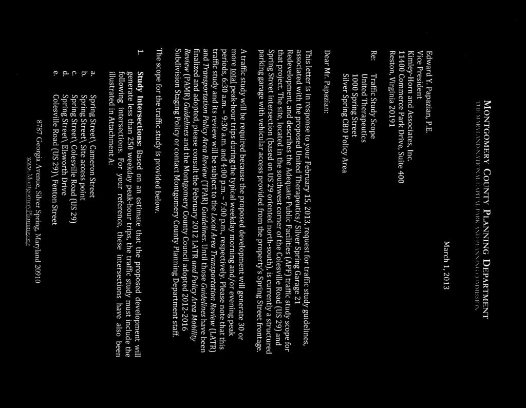
 d. Spring Street\ Elsworth Drive ST PL e.")
41 PL D 2N E AV Montgomery County Planning Area 1 RA EY MS AV E 5 4 ST 1 2 b e SITE Silver Spring CBD Policy Area 3 TO N f FE N a United Therapeutics 1000 Spring Street E AV Transportation AP VE EA FE N ST CA a. Spring Street\ Cameron Street b. Site access point c. Spring Street\ Colesville Road (US 29) d. Spring Street\ Elsworth Drive ST PL e. Colesville Road (US 29)\ Fenton Street G IN IN G N R N A Georgia Avenue (MD 97) f. Colesville Road (US 29)\ SP L P LA K W IC T NS ME RO G c R RI N LE S CO SP RD VIL LE D RR Study Intersections: LA FID LE R O W EL LS RG D G EO IA RT H T Background Developments 1 E AV TH NS Study Intersections NE AY W LO RA T CU TE a R PA NG KI VE d RU PL CU T 300 BO RS PE OE DE R C ED DR E AV N A ST Feet I ST R NT IFA HI NG T 1S Attachment A
42 Fillmore Music Hall On Georgia Ave, 250' west of Colesville Rd 383,082 SF Gross Floor Area on Parcels N217 and N ,700 SF Unbuilt Office; 140,500 Unbuilt Retail (Hotel) Georgia Avenue On Georgia Ave, 75' west of Colesville Rd - Lot 2 191,281 SF Gross Floor Area 185,072 SF Unbuilt Office; 6,209 SF Unbuilt Retail Attachment B Background Developments Traffic Study for the Proposed United Therapeutics Development at 1000 Spring Street 1000 Spring Street, Silver Spring, Maryland # Application No. Project Name Location Number of Units or SF or Other Downtown Silver Spring Bounded by Georgia Ave, Wayne Ave, 221 High-Rise DU's Cedar St, and Ellsworth Dr All Unbuilt City Place SE Quadrant of the Intersection of Colesville Rd 739,269 SF Gross Floor Area and Fenton St 246,857 SF Unbuilt Office Georgia Avenue On Georgia Ave, 250' NE of Cameron St - 2,400 SF Retail; 160 DU Parcels 109 and 107 All Unbuilt SF Square Feet DU Dwelling Units 1 of 1
43 NOTES: 1. THIS PLAN IS NOT FOR CONSTRUCTION PURPOSES. 2. THE BOUNDARY INFORMATION WAS PREPARED FROM PLATS AND DEES OF RECORD. 3. THE TOPOGRAPHY WAS COMMPILED FROM AERIAL SURVEYS, AVAILABLE UTILITY PLANS AND FIELD SURVEY BY MACRIS, HENDRICKS & GLASCOCK, PA 4. THE PROPERTY IS ZONED CBD-1 5. THE WATER & SEWER CATEGORY IS W-1 & S-1 6. THIS SITE IS WITHIN THE SLIGO CREEK WATERSHED, STRE CLASS I. 7. THIS SITE IS WITHIN THE SILVER SPRING CBD SECTOR PLAN. 8. THE ENVIRONMENTAL PLANNING DEPARTMENT OF THE M-NCP&PC HAS APPROVED AN NRI/FSD (REF. # ) 9. A STORMWATER MANAGEMENT CONCEPT HAS BEEN SUBMITTED TO MCDPS FOR REVIEW. 10. A PRELIMINARY FOREST CONSERVATION PLAN HAS BEEN SUMITTED TO THE M-NCP&PC FOR REVIEW. 11. THE LOCATIONS OF EXISTING UNDERGROUND UTILITIES ARE APPROXIMATE LOCATIONS AS PER AVAILABLE 12. UTILITY COMPANY RECORDS. THE EXACT LOCATION OF ALL UNDERGROUND UTILITIES SHOULD BE VERIFED 13. BY MISS UTILITY ( ) PRIOR TO ANY EXCAVATION. MACRIS, HENDRICKS & GLASCOCK DOES NOT EXPRESS OR IMPLY ANY GUARANTEE OR WARRANTY AS TO THE LOCATION OR EXISTENCE OF ANY 14. UNDERGROUND UTILITY. 15. THE MONTGOMERY COUNTY HEALTH DEPARTMENT RECORDS DO NOT INDICATE ANY WELL OR SEPTIC AREAS 16. ON THE SUBJECT SITE. 17. DEVELOENT SHOWN IS SUBJECT TO APPROVAL OF A 59-D-3 SITE DEVELOENT PLAN BY THE M-NCP&PC. 18. DEVELOENT SHOWN IS SUBJECT TO APPROVAL OF A PROJECT PLAN BY THE M-NCP&PC. SITE DATA SUBJECT PROPERTY: L-1963 F-475, L-2407 F-502, L-2424 F-537, L-2446 F-576 PROPOSED LOT 2, UNITED THERAPEUTICS ADDITION TO SILVER SPRING 1000 SPRING STREET PROPERTY AREA: GROSS TRACT AREA 77,822 S.F. or 1.79 AC. PROPOSED PUBLIC R/W DEDICATION 10,239 S.F. or 0.24 AC. NET LOT AREA 67,583 S.F. or 1.55 AC. ZONING CLASSIFICATION: CBD-1 (CENTRAL BUSINESS DISTRICT, FAR 1.0) (OPTIONAL METHOD OF DEVELOENT, FAR 2.0 ALLOWED) PROPOSED USE: OFFICE/LABORATORY = 111,724 G.S.F. RETAIL = 10,000 G.S.F. TOTAL = 121,724 G.S.F. DEVELOENT STANDARDS FOR OPTIONAL METHOD REQUIRED/ALLOWED PROPOSED LOT AREA LOT-2 22,000 S.F. 67,583 S.F./1.55 AC. BUILDING SETBACK REQUIREMENTS NOT REQUIRED, SETBACKS WILL BE ADJACENT TO SPRING ST. (NORTH) ESTABLISHED BY PLANNING 0 ADJACENT TO CERON ST. (WEST) BOARD AT PROJECT PLAN APPROVAL 16 ADJOINING LOTS SOUTH 10 ADJOINING LOTS WEST 0 MAXIMUM BUILDING HEIGHT BUILDING AREA 2.0 FAR 1.56 FAR or 155,644 S.F. or 121,724 S.F. PUBLIC SPACE ON-SITE PUBLIC USE SPACE: 20% OF NET LOT AREA OR 13,517 S.F. 12,950 S.F. or 19.2% ON-SITE PUBLIC USE SPACE CREATED OFF-SITE: 850 S.F. or 1.3% ON-SITE TOTAL 13,800 S.F. or 20.4% OFF-SITE ENITY SPACE: 12,900 S.F. or 19.1% TOTAL 26,700 S.F. or 39.5% OFF STREET PARKING (1) OFFICE/LABORATORY 111,724 S.F. 2.4/1,000 S.F.= 269 RETAIL (AUX) 10,000 S.F. 3.5/1,000 S.F.= 35 TOTAL 304 SPACES 152 SPACES (1) HANDICAP ACCESSIBLE 6 SPACES/2 RESERVED FOR VANS 6 SPACES MOTORCYCLE 2% = 3 SPACES 3 SPACES BICYCLE 1/20 SPACES = 8 8 SPACES AUTOMOBILE PARKING REQUIRED BY MONTGOMERY COUNTY 152 SPACES 152 SPACES (1) THE PROJECT IS LOCATED IN THE SILVER SPRING PARKING LOT DISTRICT AND ON-SITE PARKING SPACES ARE NOT REQUIRED PROVIDED AN APPLICANT PAYS THE PARKING LOT DISTRICT TAX. ADDITIONAL PUBLIC PARKING SPACES ARE PROVIDED IN NEARBY PUBLIC PARKING FACILITIES.
44 VEHICLE TURNING MOVEMENT COUNT - SUMMARY Counted by: VCU Intersection of: Spring St Date: February 28, 2013 Day: Thursday and: Cameron St Weather: Cloudy/Cool Location: Montgomery Co., MD Entered by: RB TRAFFIC FROM NORTH TRAFFIC FROM SOUTH TRAFFIC FROM EAST TRAFFIC FROM WEST TOTAL on: Cameron St on: Cameron St on: Spring St on: Spring St N + S TIME + LEFT THRU RIGHT U-TN TOTAL LEFT THRU RIGHT U-TN TOTAL LEFT THRU RIGHT U-TN TOTAL LEFT THRU RIGHT U-TN TOTAL E + W 6:30-6: :45-7: :00-7: :15-7: :30-7: :45-8: :00-8: :15-8: :30-8: :45-9: :00-9: :15-9: Hr Totals Hr Totals 6:30-7: :45-7: :00-8: :15-8: :30-8: :45-8: :00-9: :15-9: :30-9: PEAK HOUR 8:15-9: :00-4: :15-4: :30-4: :45-5: :00-5: :15-5: :30-5: :45-6: :00-6: :15-6: :30-6: :45-7: Hr Totals Hr Totals 4:00-5: :15-5: :30-5: :45-5: :00-6: :15-6: :30-6: :45-6: :00-7: PEAK HOUR 5:00-6:
45 PEDESTRIAN OBSERVATIONS Counted by: VCU Intersection of: Spring St Date: February 28, 2013 and: Cameron St Weather: Cloudy/Cool Location: Montgomery Co., MD Entered by: RB Day: Thursday Cameron St Cameron St NORTH LEG SOUTH LEG TIME PEDESTRIANS BICYCLES PEDESTRIANS BICYCLES 6:30-6: :45-7: :00-7: :15-7: :30-7: :45-7: :00-8: :15-8: :30-8: :45-9: :00-9: :15-9: TOTALS :00-4: :15-4: :30-4: :45-5: :00-5: :15-5: :30-5: :45-5: :00-6: :15-6: :30-6: :45-7: TOTALS TIME Spring St Spring St EAST LEG WEST LEG PEDESTRIANS BICYCLES PEDESTRIANS BICYCLES 6:30-6: :45-7: :00-7: :15-7: :30-7: :45-7: :00-8: :15-8: :30-8: :45-9: :00-9: :15-9: TOTALS :00-4: :15-4: :30-4: :45-5: :00-5: :15-5: :30-5: :45-5: :00-6: :15-6: :30-6: :45-7: TOTALS
46 VEHICLE TURNING MOVEMENT COUNT - SUMMARY Counted by: VCU Intersection of: Colesville Rd (US 29) Date: February 28, 2013 Day: Thursday and: Spring St Weather: Cloudy/Cool Location: Montgomery Co., MD Entered by: RB TRAFFIC FROM NORTH TRAFFIC FROM SOUTH TRAFFIC FROM EAST TRAFFIC FROM WEST TOTAL on: Colesville Rd on: Colesville Rd on: Spring St on: Spring St N + S TIME + LEFT THRU RIGHT U-TN TOTAL LEFT THRU RIGHT U-TN TOTAL LEFT THRU RIGHT U-TN TOTAL LEFT THRU RIGHT U-TN TOTAL E + W 6:30-6: :45-7: :00-7: :15-7: :30-7: :45-8: :00-8: :15-8: :30-8: :45-9: :00-9: :15-9: Hr Totals Hr Totals 6:30-7: :45-7: :00-8: :15-8: :30-8: :45-8: :00-9: :15-9: :30-9: PEAK HOUR 8:00-9: :00-4: :15-4: :30-4: :45-5: :00-5: :15-5: :30-5: :45-6: :00-6: :15-6: :30-6: :45-7: Hr Totals Hr Totals 4:00-5: :15-5: :30-5: :45-5: :00-6: :15-6: :30-6: :45-6: :00-7: PEAK HOUR 4:45-5:
47 PEDESTRIAN OBSERVATIONS Counted by: VCU Intersection of: Colesville Rd (US 29) Date: February 28, 2013 and: Spring St Weather: Cloudy/Cool Location: Montgomery Co., MD Entered by: RB Day: Thursday Colesville Rd Colesville Rd NORTH LEG SOUTH LEG TIME PEDESTRIANS BICYCLES PEDESTRIANS BICYCLES 6:30-6: :45-7: :00-7: :15-7: :30-7: :45-7: :00-8: :15-8: :30-8: :45-9: :00-9: :15-9: TOTALS :00-4: :15-4: :30-4: :45-5: :00-5: :15-5: :30-5: :45-5: :00-6: :15-6: :30-6: :45-7: TOTALS TIME Spring St Spring St EAST LEG WEST LEG PEDESTRIANS BICYCLES PEDESTRIANS BICYCLES 6:30-6: :45-7: :00-7: :15-7: :30-7: :45-7: :00-8: :15-8: :30-8: :45-9: :00-9: :15-9: TOTALS :00-4: :15-4: :30-4: :45-5: :00-5: :15-5: :30-5: :45-5: :00-6: :15-6: :30-6: :45-7: TOTALS
48 VEHICLE TURNING MOVEMENT COUNT - SUMMARY Counted by: VCU Intersection of: Spring St Date: February 28, 2013 Day: Thursday and: Ellsworth Dr Weather: Cloudy/Cool Location: Montgomery Co., MD Entered by: RB TRAFFIC FROM NORTH TRAFFIC FROM SOUTH TRAFFIC FROM EAST TRAFFIC FROM WEST TOTAL on: Ellsworth Dr on: Ellsworth Dr on: Spring St on: Spring St N + S TIME + LEFT THRU RIGHT U-TN TOTAL LEFT THRU RIGHT U-TN TOTAL LEFT THRU RIGHT U-TN TOTAL LEFT THRU RIGHT U-TN TOTAL E + W 6:30-6: :45-7: :00-7: :15-7: :30-7: :45-8: :00-8: :15-8: :30-8: :45-9: :00-9: :15-9: Hr Totals Hr Totals 6:30-7: :45-7: :00-8: :15-8: :30-8: :45-8: :00-9: :15-9: :30-9: PEAK HOUR 8:30-9: :00-4: :15-4: :30-4: :45-5: :00-5: :15-5: :30-5: :45-6: :00-6: :15-6: :30-6: :45-7: Hr Totals Hr Totals 4:00-5: :15-5: :30-5: :45-5: :00-6: :15-6: :30-6: :45-6: :00-7: PEAK HOUR 5:00-6:
Bi-County Transitway/ Bethesda Station Access Demand Analysis
 Bi-County Transitway/ Bethesda Station Access Demand Analysis Prepared for: Washington Metropolitan Area Transit Authority Office of Planning and Project Development May 2005 Prepared by: in conjunction
Chevy Chase Lake. Preliminary Plan # B TRAFFIC STATEMENT. Prepared for: Chevy Chase Land Company & Bozzuto Development Company
 Chevy Chase Lake Preliminary Plan # 12002020B TRAFFIC STATEMENT Prepared for: Chevy Chase Land Company & Bozzuto Development Company Montgomery County, Maryland Prepared by: SSSTS Consulting (410) 718-8660
ANDERSON PROPERTY SITE ANALYSIS
 ANDERSON PROPERTY SITE ANALYSIS Introduction The Montgomery County Department of Transportation (MCDOT) initiated a feasibility study in the fall of 2012 to evaluate the need for transit service expansion
7359 WISCONSIN AVENUE MONTGOMERY COUNTY, MARYLAND
 7359 WISCONSIN MONTGOMERY COUNTY, MARYLAND September 1, 2017 7359 Wisconsin Avenue September 2017 7359 WISCONSIN Local Area Transportation Review Montgomery County, Maryland September 1, 2017 Prepared
2.0 Development Driveways. Movin Out June 2017
 Movin Out June 2017 1.0 Introduction The proposed Movin Out development is a mixed use development in the northeast quadrant of the intersection of West Broadway and Fayette Avenue in the City of Madison.
Maryland Gets to Work
 I-695/Leeds Avenue Interchange Reconstruction Baltimore County Reconstruction of the I-695/Leeds Avenue interchange including replacing the I-695 Inner Loop bridges over Benson Avenue, Amtrak s Northeast
TIMBERVINE TRANSPORTATION IMPACT STUDY FORT COLLINS, COLORADO JANUARY Prepared for:
 TIMBERVINE TRANSPORTATION IMPACT STUDY FORT COLLINS, COLORADO JANUARY 2014 Prepared for: Hartford Companies 1218 W. Ash Street Suite A Windsor, Co 80550 Prepared by: DELICH ASSOCIATES 2272 Glen Haven Drive
TRAFFIC SIGNAL DESIGN REPORT KING OF PRUSSIA ROAD & RAIDER ROAD RADNOR TOWNSHIP PENNSYLVANIA
 TRAFFIC SIGNAL DESIGN REPORT KING OF PRUSSIA ROAD & RAIDER ROAD RADNOR TOWNSHIP PENNSYLVANIA PREPARED FOR: UNIVERSITY OF PENNSYLVANIA HEALTH SYSTEM 34 CIVIC CENTER BOULEVARD PHILADELPHIA, PA 1987 (61)
Lacey Gateway Residential Phase 1
 Lacey Gateway Residential Phase Transportation Impact Study April 23, 203 Prepared for: Gateway 850 LLC 5 Lake Bellevue Drive Suite 02 Bellevue, WA 98005 Prepared by: TENW Transportation Engineering West
MILLERSVILLE PARK TRAFFIC IMPACT ANALYSIS ANNE ARUNDEL COUNTY, MARYLAND
 MILLERSVILLE PARK TRAFFIC IMPACT ANALYSIS ANNE ARUNDEL COUNTY, MARYLAND Prepared for: Department of Public Works Anne Arundel County Prepared by: URS Corporation 4 North Park Drive, Suite 3 Hunt Valley,
LAWRENCE TRANSIT CENTER LOCATION ANALYSIS 9 TH STREET & ROCKLEDGE ROAD / 21 ST STREET & IOWA STREET LAWRENCE, KANSAS
 LAWRENCE TRANSIT CENTER LOCATION ANALYSIS 9 TH STREET & ROCKLEDGE ROAD / 21 ST STREET & IOWA STREET LAWRENCE, KANSAS TRAFFIC IMPACT STUDY FEBRUARY 214 OA Project No. 213-542 TABLE OF CONTENTS 1. INTRODUCTION...
INDUSTRIAL DEVELOPMENT
 INDUSTRIAL DEVELOPMENT Traffic Impact Study Plainfield, Illinois August 2018 Prepared for: Seefried Industrial Properties, Inc. TABLE OF CONTENTS Executive Summary 2 Introduction 3 Existing Conditions
THE CORNERSTONE APARTMENTS TRAFFIC IMPACT STUDY R&M PROJECT NO
 THE CORNERSTONE APARTMENTS SITUATED AT N/E/C OF STAUDERMAN AVENUE AND FOREST AVENUE VILLAGE OF LYNBROOK NASSAU COUNTY, NEW YORK TRAFFIC IMPACT STUDY R&M PROJECT NO. 2018-089 September 2018 50 Elm Street,
Escondido Marriott Hotel and Mixed-Use Condominium Project TRAFFIC IMPACT ANALYSIS REPORT
 Escondido Marriott Hotel and Mixed-Use Condominium Project TRAFFIC IMPACT ANALYSIS REPORT Prepared for Phelps Program Management 420 Sixth Avenue, Greeley, CO 80632 Prepared by 5050 Avenida Encinas, Suite
Traffic Impact Study Speedway Gas Station Redevelopment
 Traffic Impact Study Speedway Gas Station Redevelopment Warrenville, Illinois Prepared For: Prepared By: April 11, 2018 Table of Contents 1. Introduction... 1 2. Existing Conditions... 4 Site Location...
NEWCASTLE MIDDLE SCHOOL Traffic Impact Analysis
 Gibson Traffic Consultants 2802 Wetmore Avenue Suite 220 Everett, WA 98201 425.339.8266 NEWCASTLE MIDDLE SCHOOL Traffic Impact Analysis Prepared for: Renton School District Jurisdiction: City of Newcastle
Traffic Impact Analysis West Street Garden Plots Improvements and DuPage River Park Garden Plots Development Naperville, Illinois
 Traffic Impact Analysis West Street Garden Plots Improvements and DuPage River Park Garden Plots Development Naperville, Illinois Submitted by April 9, 2009 Introduction Kenig, Lindgren, O Hara, Aboona,
King Soopers #116 Thornton, Colorado
 Traffic Impact Study King Soopers #116 Thornton, Colorado Prepared for: Galloway & Company, Inc. T R A F F I C I M P A C T S T U D Y King Soopers #116 Thornton, Colorado Prepared for Galloway & Company
l White Flint station l Randolph Road l Glenmont station l Colesville l White Oak l Food & Drug Administration/ Federal Research Center
 How to use this timetable Use the map to find the stops closest to where you will get on and off the bus. Select the schedule (Weekday, Saturday, Sunday) for when you will travel. Along the top of the
Craig Scheffler, P.E., PTOE HNTB North Carolina, P.C. HNTB Project File: Subject
 TECHNICAL MEMORANDUM To Kumar Neppalli Traffic Engineering Manager Town of Chapel Hill From Craig Scheffler, P.E., PTOE HNTB North Carolina, P.C. Cc HNTB Project File: 38435 Subject Obey Creek TIS 2022
appendix 4: Parking Management Study, Phase II
 appendix 4: Parking Management Study, Phase II A4-1 A4-2 Eastlake Parking Management Study Final Phase 2 Report Future Parking Demand & Supply January 6, 2017 Submitted by Denver Corp Center III 7900 E.
Volume 1 Traffic Impact Analysis Turtle Creek Boulevard Dallas, Texas. Kimley-Horn and Associates, Inc. Dallas, Texas.
 Volume 1 Traffic Impact Analysis 2727 Dallas, Texas June 18, 2018 Kimley-Horn and Associates, Inc. Dallas, Texas Project #064523000 Registered Firm F-928 Traffic Impact Analysis 2727 Dallas, Texas Prepared
GLEBE 672 TRAFFIC IMPACT ANALYSIS ARLINGTON COUNTY, VIRGINIA. Section 1 INTRODUCTION 1
 GLEBE 672 TRAFFIC IMPACT ANALYSIS ARLINGTON COUNTY, VIRGINIA TABLE OF CONTENTS Page Section 1 INTRODUCTION 1 Section 2 BACKGROUND INFORMATION 6 Public Road Network... 6 Non Auto Facilities and Services...
EXECUTIVE SUMMARY. The following is an outline of the traffic analysis performed by Hales Engineering for the traffic conditions of this project.
 EXECUTIVE SUMMARY This study addresses the traffic impacts associated with the proposed Shopko redevelopment located in Sugarhouse, Utah. The Shopko redevelopment project is located between 1300 East and
RESU ULTS. nt & Delivery
 TRAVEL FORECASTSS RESU ULTS TECHNICAL REPORT August 2013 Transit Developmen nt & Delivery 100 South Charles Street Tower Two, Suite 700 Baltimore, Maryland 21201 August 2013 TABLE OF CONTENTS 1. Introduction...
INTERSECTION ANALYSIS PARK AVENUE AND BRADDOCK ROAD (FROSTBURG, MD) FOR LENHART TRAFFIC CONSULTING, INC.
 FOR LENHART TRAFFIC CONSULTING, INC.") INTERSECTION ANALYSIS FOR PARK AVENUE AND BRADDOCK ROAD (FROSTBURG, MD) Prepared for: City of Frostburg, Maryland & Allegany County Commissioners Prepared by: LENHART TRAFFIC CONSULTING, INC. TRAFFIC ENGINEERING
INTERSECTION ANALYSIS FOR PARK AVENUE AND BRADDOCK ROAD (FROSTBURG, MD) Prepared for: City of Frostburg, Maryland & Allegany County Commissioners Prepared by: LENHART TRAFFIC CONSULTING, INC. TRAFFIC ENGINEERING
Project Status Update January 2017
 Project Status Update January 2017 1 What is the Purple Line? A new 16 mile east-west light rail line Operates mostly on the surface with 21 stations Connects New Carrollton in Prince George s County and
TRANSPORTATION STUDY FOR THE 8899 BEVERLY BOULEVARD PROJECT
 DRAFT TRANSPORTATION STUDY FOR THE 8899 BEVERLY BOULEVARD PROJECT WEST HOLLYWOOD, CALIFORNIA NOVEMBER 2013 PREPARED FOR BEVERLY BOULEVARD ASSOCIATION PREPARED BY DRAFT TRANSPORTATION STUDY FOR THE 8899
MERIVALE PRIORITY SQUARE 2852 MERIVALE ROAD CITY OF OTTAWA TRANSPORTATION BRIEF. Prepared for: ONT Inc. 25 Winding Way Nepean, Ontario K2C 3H1
 MERIVALE PRIORITY SQUARE 2852 MERIVALE ROAD CITY OF OTTAWA TRANSPORTATION BRIEF Prepared for: 2190986ONT Inc. 25 Winding Way Nepean, Ontario K2C 3H1 October 6, 2010 110-502 Report_1.doc D. J. Halpenny
Appendix C. Traffic Study
 Appendix C Traffic Study TABLE OF CONTENTS SECTION Executive Summary PAGE 1.0 Introduction... 1 1.1 Scope of Work... 1 1.2 Study Area... 2 2.0 Project Description... 3 2.1 Site Access... 4 2.2 Pedestrian
RE: A Traffic Impact Statement for a proposed development on Quinpool Road
 James J. Copeland, P.Eng. GRIFFIN transportation group inc. 30 Bonny View Drive Fall River, NS B2T 1R2 May 31, 2018 Ellen O Hara, P.Eng. Project Engineer DesignPoint Engineering & Surveying Ltd. 200 Waterfront
King County Metro. Columbia Street Transit Priority Improvements Alternative Analysis. Downtown Southend Transit Study. May 2014.
 King County Metro Columbia Street Transit Priority Improvements Alternative Analysis Downtown Southend Transit Study May 2014 Parametrix Table of Contents Introduction... 1 Methodology... 1 Study Area...
Construction Realty Co.
 MEMORANDUM TO: FROM : Jeff Pickus Construction Realty Co. Luay R. Aboona, PE Principal 9575 West Higgins Road, Suite 400 Rosemont, Illinois 60018 p: 847-518-9990 f: 847-518-9987 DATE: May 22, 2014 SUBJECT:
TRAFFIC IMPACT ANALYSIS FOR. McDONALD S RESTAURANT IN CARMICAEL Sacramento County, CA. Prepared For:
 TRAFFIC IMPACT ANALYSIS FOR McDONALD S RESTAURANT IN CARMICAEL Sacramento County, CA Prepared For: McDonald s USA, LLC Pacific Sierra Region 2999 Oak Road, Suite 900 Walnut Creek, CA 94597 Prepared By:
RICHMOND OAKS HEALTH CENTRE 6265 PERTH STREET OTTAWA, ONTARIO TRANSPORTATION BRIEF. Prepared for: Guycoki (Eastern) Limited.
 Limited.") RICHMOND OAKS HEALTH CENTRE 6265 PERTH STREET OTTAWA, ONTARIO TRANSPORTATION BRIEF Prepared for: Guycoki (Eastern) Limited June 16, 2016 116-638 Brief_1.doc D. J. Halpenny & Associates Ltd. Consulting
RICHMOND OAKS HEALTH CENTRE 6265 PERTH STREET OTTAWA, ONTARIO TRANSPORTATION BRIEF Prepared for: Guycoki (Eastern) Limited June 16, 2016 116-638 Brief_1.doc D. J. Halpenny & Associates Ltd. Consulting
TRANSPORTATION REVIEW
 TRANSPORTATION REVIEW - PROPOSED MIX OF LAND USES IS CONSISTENT WITH THE CITY S UNDER THE GRANVILLE BRIDGE POLICIES THAT AIM TO MEET NEIGHBOURING RESIDENTS SHOPPING NEEDS AND REDUCE RELIANCE ON AUTOMOBILE
COMPREHENSIVE TRANSPORTATION REVIEW SHEPHERD PARK PUD WASHINGTON, DC
 COMPREHENSIVE TRANSPORTATION REVIEW SHEPHERD PARK PUD WASHINGTON, DC May 31, 2016 Prepared by: 1140 Connecticut Avenue NW Suite 600 Washington, DC 20036 Tel: 202.296.8625 Fax: 202.785.1276 3914 Centreville
4 Circulation & Transportation
 4.1 Mobility Network The mobility network at the new St. Paul s hospital and health campus is comprised of an interconnected system of sidewalks, cycle paths, transit routes and roadways. Figure 4-1: Indicative
This letter summarizes our observations, anticipated traffic changes, and conclusions.
 Mr. David Jorschumb Project Manager Boulder Valley School District Re: Review of proposed school access improvements at the Foothills Elementary School in Boulder Dear Mr. Jorschumb, At your request, the
Traffic Impact Analysis 5742 BEACH BOULEVARD MIXED USE PROJECT
 Traffic Impact Analysis 5742 BEACH BOULEVARD MIXED USE PROJECT CITY OF BUENA PARK Prepared by Project No. 14139 000 April 17 th, 2015 DKS Associates Jeffrey Heald, P.E. Rohit Itadkar, T.E. 2677 North Main
TABLE OF CONTENTS 1.0 INTRODUCTION AND SUMMARY Purpose of Report and Study Objectives... 2
 TABLE OF CONTENTS 1.0 INTRODUCTION AND SUMMARY 1 1.1 Purpose of Report and Study Objectives... 2 1.2 Executive Summary... 3 1.2.1 Site Location and Study Area... 3 1.2.2 Development Description... 3 1.2.3
Transportation & Traffic Engineering
 Transportation & Traffic Engineering 1) Project Description This report presents a summary of findings for a Traffic Impact Analysis (TIA) performed by A+ Engineering, Inc. for the Hill Country Family
2. Valley Circle Boulevard/Andora Avenue/Baden Avenue and Lassen Street
 IV.J TRANSPORTATION 1. INTRODUCTION This section presents an overview of the existing traffic and circulation system in and surrounding the project site. This section also discusses the potential impacts
Countywide Transit Corridors Functional Master Plan. Appendix 9 Travel Demand Forecasting Model Documentation
 Countywide Transit Corridors Functional Master Plan Appendix 9 Travel Demand Forecasting Model Documentation Tower 1, 10 th Floor 100 S. Charles Street Baltimore, MD 21201-2727 (410) 727-5050 Memorandum
Traffic Engineering Study
 Traffic Engineering Study Bellaire Boulevard Prepared For: International Management District Technical Services, Inc. Texas Registered Engineering Firm F-3580 November 2009 Executive Summary has been requested
Planned Development Application 1450 Sherman Avenue Evanston, IL TRAFFIC CIRCULATION IMPACT STUDY
 Planned Development Application 1450 Sherman Avenue Evanston, IL 60201 14 TRAFFIC CIRCULATION IMPACT STUDY Traffic Impact Study 1454 Sherman Mixed-Use Development Evanston, Illinois Prepared for Prepared
11 October 12, 2011 Public Hearing APPLICANT:
 11 October 12, 2011 Public Hearing APPLICANT: CARING TRANSITIONS PROPERTY OWNER: HARDEE REALTY CORPORATION REQUEST: Conditional Use Permit (motor vehicle rental) STAFF PLANNER: Leslie Bonilla ADDRESS /
West Hills Shopping Centre Lowe s Expansion Traffic Impact Study
 West Hills Shopping Centre Lowe s Expansion Traffic Impact Study Prepared for: Armel Corporation January 2015 Paradigm Transportation Solutions Ltd. 22 King Street South, Suite 300 Waterloo ON N2J 1N8
Transportation Land Development Environmental S e r v i c e s
 Transportation Land Development Environmental S e r v i c e s Memorandum To: Ms. Kristin E. Kassner Planning Director Town Hall Annex 25 Center Street Burlington, MA 01803 Date: September 23, 2013 Project
TECHNICAL MEMORANDUM. Part A: Introduction
 TECHNICAL MEMORANDUM To: David J. Decker Decker Properties, Inc. 5950 Seminole Centre Ct. Suite 200 Madison, Wisconsin 53711 608-663-1218 Fax: 608-663-1226 www.klengineering.com From: Mike Scarmon, P.E.,
BROWARD BOULEVARD CORRIDOR TRANSIT STUDY
 BROWARD BOULEVARD CORRIDOR TRANSIT STUDY FM # 42802411201 EXECUTIVE SUMMARY July 2012 GOBROWARD Broward Boulevard Corridor Transit Study FM # 42802411201 Executive Summary Prepared For: Ms. Khalilah Ffrench,
IV. ENVIRONMENTAL IMPACT ANALYSIS N. TRANSPORTATION AND TRAFFIC
 IV. ENVIRONMENTAL IMPACT ANALYSIS N. TRANSPORTATION AND TRAFFIC The following section summarizes the information provided in the traffic report entitled Traffic Impact Analysis for a Proposed Residential
TRAFFIC DATA. Existing Derousse Ave./River Rd. AM LOS Analysis Existing Derousse Ave./River Rd. PM LOS Analysis
 Appendix E NJ TRANSIT Pennsauken Junction Transit Center and Park & Ride RiverLINE and Atlantic City Line Pennsauken Township, Camden County, New Jersey TRAFFIC DATA Background Traffic Information for
Construction Staging Area 4 Avenue Road
 REPORT FOR ACTION Construction Staging Area 4 Avenue Road Date: September 27, 2017 To: Toronto and East York Community Council From: Acting Director, Transportation Services, Toronto and East York District
L1TILE BEARS DAY CARE TRANSPORTATION IMPACT STUDY FORT COLLINS, COLORADO MAY Prepared for:
 L1TILE BEARS DAY CARE TRANSPORTATION IMPACT STUDY FORT COLLINS, COLORADO MAY 2012 Prepared for: Hillside Construction, Inc. 216 Hemlock Street, Suite B Fort Collins, CO 80534 Prepared by: DELICH ASSOCIATES
TRAFFIC IMPACT ANALYSIS SHORTBREAD LOFTS 2009 MODIFICATION Chapel Hill, North Carolina
 TRAFFIC IMPACT ANALYSIS SHORTBREAD LOFTS 2009 MODIFICATION Chapel Hill, North Carolina Prepared for: The Town of Chapel Hill, NC Prepared by: Architects-Engineers-Planners, Inc. November 2009 Traffic Impact
Citizens Committee for Facilities
 Citizens Committee for Facilities AGENDA Thursday, December 11, 2014 City Council Chambers 305 3 rd Avenue East -Twin Falls, Idaho 11:30 A.M. AGENDA ITEMS Purpose By 1. Discussion and possible action on
APPENDIX C-2. Traffic Study Supplemental Analysis Memo
 APPENDIX C-2 Traffic Study Supplemental Analysis Memo The Mobility Group Transportation Strategies & Solutions Memorandum To: From: Subject: Tomas Carranza, LADOT Matthew Simons Traffic Review - Revised
IV. ENVIRONMENTAL IMPACT ANALYSIS K.2. PARKING
 IV. ENVIRONMENTAL IMPACT ANALYSIS K.2. PARKING ENVIRONMENTAL SETTING The following analysis summarizes the findings and conclusions of the Traffic Analysis (Traffic Study), prepared by The Mobility Group,
GASOLINE SERVICE STATION 1618, 1622 ROGER STEVENS DRIVE OTTAWA, ONTARIO TRANSPORTATION IMPACT ASSESSMENT. Prepared for:
 GASOLINE SERVICE STATION 1618, 1622 ROGER STEVENS DRIVE OTTAWA, ONTARIO TRANSPORTATION IMPACT ASSESSMENT Prepared for: Invecta Development (Ottawa) Corporation 758 Shanks Height Milton, ON L9T 7P7 May
Lakeside Terrace Development
 Lakeside Terrace Development City of Barrie, County of Simcoe Traffic Brief for: Type of Document: Final Report Project Number: JDE 1617 Date Submitted: April 29 th, 216 4/29/16 John Northcote, P.Eng.
Countywide Transit Corridors Functional Master Plan. Appendix 13 BRT Station Typology
 Countywide Transit Corridors Functional Master Plan Appendix 13 BRT Station Typology Tower 1, 10 th Floor 100 S. Charles Street Baltimore, MD 21201-2727 (410) 727-5050 Memorandum To: Larry Cole, M-NCPPC
Trip Generation & Parking Occupancy Data Collection: Grocery Stores Student Chapter of Institute of Transportation Engineers at UCLA Spring 2014
 Trip Generation & Parking Occupancy Data Collection: Grocery Stores Student Chapter of Institute of Transportation Engineers at UCLA Spring 2014 Page 1 Introduction The UCLA Institute of Transportation
TRAFFIC PARKING ANALYSIS
 TRAFFIC PARKING ANALYSIS NAPA FLEA MARKET COUNTY OF NAPA Prepared for: Tom Harding Napa-Vallejo Flea Market 33 Kelly Road American Canyon, CA 9453 Prepared by: 166 Olympic Boulevard, Suite 21 Walnut Creek,
Proposed Hotel and Restaurant Development
 Traffic Impact Study Proposed Hotel and Restaurant Development Marbledale Road Tuckahoe, NY PREPARED FOR BILLWIN DEVELOPMENT AFFILIATES, LLC 365 WHITE PLAINS ROAD EASTCHESTER, NY. 10709 PREPARED BY Engineering
West Rosslyn Development
 Traffic Impact Study and Transportation Management Plan West Rosslyn Development Arlington County, VA Revised: January 11, 2017 May 10, 2016 Prepared for: Penzance 2400 N Street, NW, Suite 600 Washington,
4131 Chain Bridge Road
 Traffic Impact Study 4131 Chain Bridge Road City of Fairfax, VA 05/04/16 May 4, 2016 Prepared for: Paradigm 1415 North Taft Street Suite 100 Arlington, VA 22201 This report is printed on environmentally
MONTGOMERY COUNTY PLANNING DEPARTMENT THE MARYLAND-NATIONAL CAPITAL PARK AND PLANNING COMMISSION
 MONTGOMERY COUNTY PLANNING DEPARTMENT THE MARYLAND-NATIONAL CAPITAL PARK AND PLANNING COMMISSION MCPB Item No. 5 Date: 3/2/17 Smart Kids Bilingual Learning Day Care LLC, Conditional Use No. CU 2017-10
CHAPTER 9: VEHICULAR ACCESS CONTROL Introduction and Goals Administration Standards
 9.00 Introduction and Goals 9.01 Administration 9.02 Standards 9.1 9.00 INTRODUCTION AND GOALS City streets serve two purposes that are often in conflict moving traffic and accessing property. The higher
Appendix G Traffic and Parking Report
 Appendix G Traffic and Parking Report TABLE OF CONTENTS SECTION PAGE Executive Summary... v 1.0 Introduction... 1 1.1 Study Area... 3 2.0 Project Description... 4 2.1 Site Location... 4 2.2 Existing Project
APPENDIX B Traffic Analysis
 APPENDIX B Traffic Analysis Rim of the World Unified School District Reconfiguration Prepared for: Rim of the World School District 27315 North Bay Road, Blue Jay, CA 92317 Prepared by: 400 Oceangate,
Traffic Impact Statement (TIS)
") Traffic Impact Statement (TIS) Vincentian PUDA Collier County, FL 10/18/2013 Prepared for: Global Properties of Naples Prepared by: Trebilcock Consulting Solutions, PA 2614 Tamiami Trail N, Suite 615 1205
Traffic Impact Statement (TIS) Vincentian PUDA Collier County, FL 10/18/2013 Prepared for: Global Properties of Naples Prepared by: Trebilcock Consulting Solutions, PA 2614 Tamiami Trail N, Suite 615 1205
886 March Road McDonald's Transportation Study
 McDonald's Restaurants of Canada Limited March 2013 886 March Road McDonald's Transportation Study Submitted by: HDR Corporation 100 York Boulevard, Suite 300 Richmond Hill, ON L4B 1J8 (905) 882-4100 www.hdrinc.com
Re: Residential Development - Ogilvie/Cummings Transportation Overview
 1223 Michael Street, Suite 100, Ottawa, ON K1J 7T2 Tel: 613.738.4160 Fax: 613.739.7105 www.delcan.com March 28, 2012 OUR REF: TO3088TOY Barry J. Hobin & Architects 63 Pamilla Street Ottawa, ON K1S 3K7
Re: Cyrville Road Car Dealership
 1223 Michael Street, Suite 100, Ottawa, ON K1J 7T2 Tel: 613.738.4160 Fax: 613.739.7105 www.delcan.com February 25, 2013 OUR REF: TO3098TOE Mark Motors of Ottawa 611 Montreal Road Ottawa, ON K1K 0T8 Attention:
Capital Metro Downtown Multimodal Station
 Capital Metro Downtown Multimodal Station Stakeholder Briefing December 11, 2015 Agenda 1 2 3 4 5 Project Summary Downtown Station Concept Evaluation 4 th Street Traffic Analysis 5 th Street Traffic Analysis
Clean Harbors Canada, Inc.
 Clean Harbors Canada, Inc. Proposed Lambton Landfill Expansion Environmental Assessment Terms of Reference Transportation Assessment St. Clair Township, Ontario September 2009 itrans Consulting Inc. 260
1. INTRODUCTION 2. PROJECT DESCRIPTION CUBES SELF-STORAGE MILL CREEK TRIP GENERATION COMPARISON
 CUBES SELF-STORAGE MILL CREEK TRIP GENERATION COMPARISON 1. INTRODUCTION This report summarizes traffic impacts of the proposed CUBES Self-Storage Mill Creek project in comparison to the traffic currently
Traffic Impact Analysis for 2171 Rosecrans Avenue
 Traffic Impact Analysis for 2171 Rosecrans Avenue Prepared for: Continental Development Corporation Revised May 2016 LA16-2831 Prepared by: Fehr & Peers 600 Wilshire Blvd, Suite 1050 Los Angeles, CA 90017
DEVELOPMENT PROPERTY 1627 MAXIME STREET CITY OF OTTAWA TRANSPORTATION OVERVIEW. Prepared for: Subhas Bhargava. July 9, Overview_1.
 DEVELOPMENT PROPERTY 1627 MAXIME STREET CITY OF OTTAWA TRANSPORTATION OVERVIEW Prepared for: Subhas Bhargava July 9, 2015 115-620 Overview_1.doc D. J. Halpenny & Associates Ltd. Consulting Transportation
5. OPPORTUNITIES AND NEXT STEPS
 5. OPPORTUNITIES AND NEXT STEPS When the METRO Green Line LRT begins operating in mid-2014, a strong emphasis will be placed on providing frequent connecting bus service with Green Line trains. Bus hours
TALMONT TOWNHOMES MADISON KENNETH SPA TRAFFIC IMPACT STUDY. Sacramento, CA. Prepared For: MBK Homes. Prepared By:
 TALMONT TOWNHOMES MADISON KENNETH SPA TRAFFIC IMPACT STUDY Sacramento, CA Prepared For: MBK Homes Prepared By: KD Anderson & Associates 3853 Taylor Road, Suite G Loomis, California 95650 (916) 660-1555
APPENDIX TR-1 PARKING AND QUEUING ASSESSMENT
 APPENDIX TR-1 PARKING AND QUEUING ASSESSMENT Overland Overland Traffic Consultants, Traffic Consultants, Inc. Inc. Overland Traffic Consultants 952 Manhattan Beach Boulevard, Suite #100 Manhattan Beach,
RE: 67/71 Marquette Avenue Redevelopment Transportation Overview
 1223 Michael Street, Suite 100, Ottawa, Ontario K1J 7T2 Tel: 613.738.4160 Fax: 613.739.7105 www.delcan.com April 23, 2014 OUR REF: TO3157TOA00 BY EMAIL: mark.larose@urbanrisedevelopment.com Urban Rise
IV. ENVIRONMENTAL IMPACT ANALYSIS L. TRANSPORTATION/TRAFFIC
 IV. ENVIRONMENTAL IMPACT ANALYSIS L. TRANSPORTATION/TRAFFIC INTRODUCTION The following section summarizes the information provided in the traffic report entitled Traffic Impact Analysis for a Proposed
The Re:Queen and Sparks Traffic Brief - Addendum #2
 June 11, 2015 Ashcroft Homes 18 Antares Drive Ottawa, ON K2E 1A9 EMAIL: mpham@ashcrofthomes.com Attention: May Pham Development Planner Dear May, Re: The Re:Queen and Sparks Traffic Brief - Addendum #2
The Brick Yard Buildings F & J Mid Atlantic Blvd. Laurel/Beltsville, Maryland. 10,000 to 122,136 SF
 The Brick Yard Buildings F & J Mid Atlantic Blvd. Laurel/Beltsville, Maryland 10,000 to 122,136 SF J I H G F E D A C Mid-Atlantic Blvd. B 200 The Brick Yard Rockville 95 Laurel Van Dusen Rd. Contee Rd.
DEVELOPMENT AGREEMENT APPLICATION MULTI-UNIT RESIDENTIAL DEVELOPMENT FOURTH STREET NEAR BEDFORD HIGHWAY SUBMITTED BY: LYDON LYNCH ARCHITECTS
 DEVELOPMENT AGREEMENT APPLICATION MULTI-UNIT RESIDENTIAL DEVELOPMENT FOURTH STREET NEAR BEDFORD HIGHWAY NOVEMBER 30, 2017 SUBMITTED BY: LYDON LYNCH ARCHITECTS TABLE OF CONTENTS LETTER OF INTRODUCTION PROJECT
Note: The October 2007 version of this report has been updated in this December 2008 report to present costs in year 2007 dollars.
 Sound Transit Phase 2 South Corridor LRT Design Report: SR 99 and I-5 Alignment Scenarios (S 200 th Street to Tacoma Dome Station) Tacoma Link Extension to West Tacoma Prepared for: Sound Transit Prepared
Trip and Parking Generation Data Collection at Grocery Store with Gas Station and Auto Repair
 Trip and Parking Generation Data Collection at Grocery Store with Gas Station and Auto Repair Final Report 2011 ITE District 6 - Data Collection Project Institute of Transportation Engineers Student Chapter
Proposed Inn at Bellefield Traffic Impact Assessment
 Proposed Inn at Bellefield Traffic Impact Assessment Town of Hyde Park Dutchess County, New York Prepared for: T-Rex Hyde Park Owner LLC 500 Mamroneck Avenue, Suite 300 Harrison, NY 10528 June 21, 2017
County Engineers of Maryland. William Parks Michael D. Madden Maryland Transit Administration
 County Engineers of Maryland William Parks Michael D. Madden Maryland Transit Administration May 25, 2017 1 Project Description 16 mile east-west light rail line between Bethesda in Montgomery County and
November 1, Mr. Jafar Tabrizi President, Tabrizi Rugs 180 Bedford Highway. Traffic Impact Statement BH-1 and BH-2, Southgate Drive, Bedford, NS
 161-12598 Mr. Jafar Tabrizi President, Tabrizi Rugs 180 Bedford Highway Bedford, NS B4A 1C1 [Via Email: tabrizi@tabrizi.com] RE: Traffic Impact Statement Dear Mr. Tabrizi: Plans are being prepared for
TRAFFIC IMPACT ANALYSIS
 TRAFFIC IMPACT ANALYSIS Emerald Isle Commercial Development Prepared by SEPI Engineering & Construction Prepared for Ark Consulting Group, PLLC March 2016 I. Executive Summary A. Site Location The Emerald
City of Marina. Regional Roundabout Study Utilizing Caltrans Intersection Control Evaluation Section 4: Transportation Agency for Monterey County
 Regional Roundabout Study Utilizing Caltrans Intersection Control Evaluation Section 4: City of Marina Study Intersections: RESERVATION ROAD AT BEACH ROAD RESERVATION ROAD AT DEFOREST ROAD CARDOZA AVENUE
Traffic Impact Study for Proposed Olive Boulevard Development
 Traffic Impact Study for Proposed 11330 Olive Boulevard Development Creve Coeur, Missouri July 7, 2017 Prepared For: 11330 Olive Boulevard Development 11330 Olive Boulevard Creve Coeur, Missouri 63141
Existing Traffic Conditions
 May 14, 2014 Ms. Lorraine Weiss City of San Mateo 330 West 20 th Avenue San Mateo, CA 94403 Subject: Traffic Operational Study for the Proposed Tilton Avenue Residential Development in San Mateo, California
Madison BRT Transit Corridor Study Proposed BRT Operations Plans
 Madison BRT Transit Corridor Study Proposed BRT Operations Plans This paper presents a description of the proposed BRT operations plan for use in the Madison BRT Transit Corridor Study. The objective is
Mercer Island Center for the Arts Parking Management Plan
 Parking Stalls Mercer Island Center for the Arts Parking Management Plan June 15, 2016 This Parking Management Plan (P) covers all tenants at the Mercer Island Center for the Arts (MICA) campus, including
MEMO VIA . Ms. Amy Roth DPS Director, City of Three Rivers. To:
 MEMO To: Ms. Amy Roth DPS Director, City of Three Rivers VIA EMAIL From: Michael J. Labadie, PE Julie M. Kroll, PE, PTOE Brandon Hayes, PE, P.Eng. Fleis & VandenBrink Date: January 5, 2017 Re: Proposed