PRESENTATION Metro s Streets & Freeways Subcommittee
|
|
|
- Annis Jennings
- 5 years ago
- Views:
Transcription

")

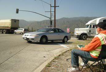
1 PRESENTATION Metro s Streets & Freeways Subcommittee Los Angeles County Metro s 2011 Interstate 210 Truck Origin & Destination (O D) Study Presented by: Fred Minagar MINAGAR & ASSOCIATES, INC. October 20,

2 I-210 Truck Origin Destination Study Corridor Limits I 210 Freeway Study Corridor 2
3 Project Map 3
4 1. Project Overview Study Purpose and Need Interstate 210 Background Study Methodology Key Findings of I-210 Truck O-D Study 4


5 2. Literature Review & Existing Data Collection Literature Review Caltrans 2010 Traffic Data 5

6 Caltrans 2010 Annual ADT Volumes & HDT Volume Percentages on I-210I 6
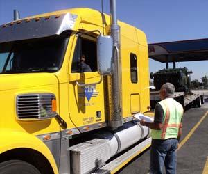
7 3. Field Data Collection Intersection Turning Movement Counts Freeway Ramp Intersection TMCs Freeway Interchange Truck Split Traffic Counts Arterial Vehicle Classification Machine Counts Freeway Vehicle Classification Video Counts Key Findings of Field Data Collection 7


8 Field Data Collection 8

9 PM Peak Inbound/Outbound Truck Volume Splits at I-210 Freeway Interchanges 9
10 2011 Average Daily Traffic (ADT) Volumes on Major Arterials Adjacent to I

11 Weekly Traffic Volume Fluctuations on Major Arterials Adjacent to I-210I 11
12 4. Surveys of Local Freight Operators, Warehouses & Distribution Centers Approach & List of Survey Respondents Type of Facility Type of Trucks Serviced Truck Trip Volumes, O-D Commodities Seasonality % of Truck Trips Entirely Within LA LAC Increasing/Decreasing Truck Use on the I- 210 Fwy Comments on the Operating Conditions of the I-210 Fwy 12

13 Locations of Surveyed Truck Freight Operators, Warehouses & Distribution Centers 13
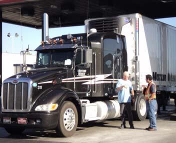
14 5. Truck Driver Intercept Interviews Approach and Methodology Survey Findings Vehicle Type Truck Origin Location Truck Destination Location Truck Route Choice & Truck Flow Patterns Frequency of Chosen Route Reasons for Route Selection Commodity, Gross Vehicle Weight & Additional Comments 14

15 Northern California Sacramento County Bay Area Superior counties Central California Central Coast San Joaquin Valley Central Sierra counties From Other States: NV AZ, TX, FL OH, OK, IL OR/WA Others Ventura County Los Angeles County Orange County San Bernardino County Riverside County Southern Border San Diego County Imperial County Note: O D Regional boundaries based on a combination of major statewide region and SCAG s Southern California Regions. Some regions and sub regions have been consolidated within and outside of the SCAG boundary for the sole purpose of this exhibit. 15
16 Exhibit 5.2.3A Northern California Sacramento County Bay Area Superior counties DESTINATION Regions of Truck Driver Intercept Interview Surveyed Trips on the I 210 Freeway Project Segment Central California Central Coast San Joaquin Valley Central Sierra Counties From Other States: NV AZ, TX, FL OH, OK, IL OR/WA Others Ventura County Los Angeles County Orange County Southern Border San Diego County Imperial County San Bernardino County Riverside County Note: O D Regional boundaries based on a combination of major statewide region and SCAG s Southern California Regions. Some regions and sub regions have been consolidated within and outside of the SCAG boundary for the sole purpose of this exhibit. 16
17 6. Data Management and Analysis Data Management Process Data Quality Control/Quality Assurance Data Expansion/Validation 17

18 Annual Average Daily Traffic (AADT) on the I 210 Fwy Study Segment* All Vehicles: Passenger Vehicles 2 258,769 vehicles per day 242, % of all vehicles Trucks 3 16, % of all vehicles HDTs 4 9, % of all vehicles 55.98% of trucks Other Trucks 5 7, % of all vehicles 44.02% of trucks 1 Average ADT traversing the I 210 Freeway BW the SR 134 (Pasadena) & SR 57 (San Dimas) Fwy Interchanges in LA County 2 Cars, motorcycles, & small vans and pickup trucks 3 Commercial motor vehicles (CMV) with a minimum weight of 1 & 1/2 tons or more, & min. combination of 6 tires & 2 axles 4 Heavy Duty Trucks. Typically, large trucks meeting or exceeding a min. weight/configuration combination of 13 tons (26,000 lbs) & 3 axles, with the primary purpose of hauling a specific commodity(ies) between origin & destination points. 5 CMVs having a lighter weight &/or with lesser axle tire combinations than HDTs. Typically consists of two axle service & delivery trucks & RVs 18
I-405 Corridor Master Plan
 Southern California Association of Governments I-405 Corridor Master Plan Presentation to Streets and Freeways Subcommittee October 13, 2015 1 Presentation Overview Expectations and Approach Corridor Performance
The major roadways in the study area are State Route 166 and State Route 33, which are shown on Figure 1-1 and described below:
 3.5 TRAFFIC AND CIRCULATION 3.5.1 Existing Conditions 3.5.1.1 Street Network DRAFT ENVIRONMENTAL IMPACT REPORT The major roadways in the study area are State Route 166 and State Route 33, which are shown
California Regional Travel & Tourism Outlook. September 2016
 California Regional Travel & Tourism Outlook September 2016 California regional & seasonal travel trends The number of visits to California regions surpasses that of total California visits in a given
Traffic Study for Barstow 2014 General Plan Amendment. Prepared for: The City of Barstow. Prepared by: ADVANTEC Consulting Engineers
 Traffic Study for Barstow 2014 General Plan Amendment Prepared for: The City of Barstow Prepared by: June 20, 2014 TABLE OF CONTENTS 1. Executive Summary... 1 2. Project Background & Description... 3 2.1
Appendix G Traffic Study Methodology
 REVISED DRAFT ENVIRONMENTAL IMPACT REPORT/ Appendix G Traffic Forecasting Model Methodology In addition to the existing/baseline condition (year 2005), a level of service (LOS) analysis was conducted for
Escondido Marriott Hotel and Mixed-Use Condominium Project TRAFFIC IMPACT ANALYSIS REPORT
 Escondido Marriott Hotel and Mixed-Use Condominium Project TRAFFIC IMPACT ANALYSIS REPORT Prepared for Phelps Program Management 420 Sixth Avenue, Greeley, CO 80632 Prepared by 5050 Avenida Encinas, Suite
Develop ground transportation improvements to make the Airport a multi-modal regional
 Project Overview TRANSPORTATION IMPROVEMENTS WHAT ARE THE PROJECT GOALS? Transportation transportation hub. Develop ground transportation improvements to make the Airport a multi-modal regional Land Use
ELECTRIC VEHICLES TODAY AND TOMORROW Delaware Valley Regional Planning Commission
 ELECTRIC VEHICLES TODAY AND TOMORROW Delaware Valley Regional Planning Commission Monday, November 6, 2017 Gil Tal gtal@ucdavis.edu Wei Ji weiji@ucdavis.edu Tom Turrentine tsturrentine@gmail.com Modeling
DEVELOPMENT OF RIDERSHIP FORECASTS FOR THE SAN BERNARDINO INFRASTRUCTURE IMPROVEMENT STUDY
 APPENDIX 1 DEVELOPMENT OF RIDERSHIP FORECASTS FOR THE SAN BERNARDINO INFRASTRUCTURE IMPROVEMENT STUDY INTRODUCTION: This Appendix presents a general description of the analysis method used in forecasting
The key roadways in the project vicinity are described below. Exhibit displays the existing number of lanes on the study roadways.
 4.2 TRAFFIC AND CIRCULATION This section presents the key assumptions, methods, and results of analysis for the transportation and circulation impacts of the proposed project. This section is based on
Comprehensive Regional Goods Movement Plan and Implementation Strategy Goods Movement in the 2012 RTP/SCS
 Comprehensive Regional Goods Movement Plan and Implementation Strategy Goods Movement in the 2012 RTP/SCS Annie Nam Southern California Association of Governments September 24, 2012 The Goods Movement
Table Existing Traffic Conditions for Arterial Segments along Construction Access Route. Daily
 5.8 TRAFFIC, ACCESS, AND CIRCULATION This section describes existing traffic conditions in the project area; summarizes applicable regulations; and analyzes the potential traffic, access, and circulation
Sepulveda Pass Corridor Systems Planning Study
 Los Angeles County Metropolitan Transportation Authority Sepulveda Pass Corridor Systems Planning Study Streets and Freeways Subcommittee January 17, 2013 1 Sepulveda Pass Study Corridor Extends for 30
Southern California Association of Governments ADOPTED APRIL 2012
 highways and arterials appendix Southern California Association of Governments ADOPTED APRIL 2012 Highways and Arterials Programmed Commitments 1 Additional County Commitments 3 System Preservation 9 Aging
1 TO 2 2 TO 3 3 TO 4 11 TO TO 1
 STATION: New York State Department of Transportation Traffic Count Hourly Report Page of ROUTE #: NY ROAD NAME: FROM: RT : END / OLAP COUNTY: Onondaga : Eastbound FACR GROUP: REC. SERIAL #: AP FUNC. CLASS:
Interstate Operations Study: Fargo-Moorhead Metropolitan Area Simulation Output
 NDSU Dept #2880 PO Box 6050 Fargo, ND 58108-6050 Tel 701-231-8058 Fax 701-231-6265 www.ugpti.org www.atacenter.org Interstate Operations Study: Fargo-Moorhead Metropolitan Area 2015 Simulation Output Technical
Countdown to the Closure Extended 53-Hour Closure of I-405 Freeway Between U.S. 101 and I-10 Planned in Mid-July for Mulholland Bridge Demolition
 Countdown to the Closure Extended 3-Hour Closure of I-40 Freeway Between U.S. 0 and I-0 Planned in Mid-July for Mulholland Bridge Demolition Work Los Angeles, Calif. Plan Ahead, Avoid The Area, Or Stay
Policy Research CENTER
 Heavy Haul Access to U.S. Ports Background TRANSPORTATION Policy Research CENTER Texas exporters are increasingly concerned that current overweight regulations do not allow for the full use of the capacity
1 TO 2 2 TO 3 12 TO 1 10 TO TO 12
 STATION: New York State Department of Transportation Traffic Count Hourly Report Page of ROUTE #: NY ROAD NAME: FROM: RT CENTRAL SQUARE : ACC RT I COUNTY: Oswego : Northbound FACR GROUP: REC. SERIAL #:
Expansion Projects Description
 Expansion Projects Description The Turnpike expansion program was authorized by the Florida Legislature in 1990 to meet the State s backlog of needed highway facilities. The Legislature set environmental
Chapter 9 Recommended Locally Preferred Alternative and Alternatives for Evaluation in Draft SEIS/SEIR
 Chapter 9 Recommended Locally Preferred Alternative and Alternatives for Evaluation in Draft SEIS/SEIR 9.0 RECOMMENDED LOCALLY PREFERRED ALTERNATIVE AND ALTERNATIVES FOR EVALUATION IN DRAFT SEIS/SEIR
Section 3.12 Traffic and Transportation
 Section. Traffic and Transportation SECTION SUMMARY This section describes existing ground transportation within the Port and surrounding area associated with implementation of the proposed Project. An
APPENDIX H. Transportation Impact Study
 APPENDIX H Transportation Impact Study BUENA VISTA LAGOON ENHANCEMENT PROJECT TRANSPORTATION IMPACT STUDY Prepared for: San Diego Association of Governments Prepared by: VRPA Technologies, Inc. 9520 Padgett
Traffic Impact Analysis 5742 BEACH BOULEVARD MIXED USE PROJECT
 Traffic Impact Analysis 5742 BEACH BOULEVARD MIXED USE PROJECT CITY OF BUENA PARK Prepared by Project No. 14139 000 April 17 th, 2015 DKS Associates Jeffrey Heald, P.E. Rohit Itadkar, T.E. 2677 North Main
2012 Air Emissions Inventory
 SECTION 6 HEAVY-DUTY VEHICLES This section presents emissions estimates for the heavy-duty vehicles (HDV) source category, including source description (6.1), geographical delineation (6.2), data and information
Introduction and Background Study Purpose
 Introduction and Background The Brent Spence Bridge on I-71/75 across the Ohio River is arguably the single most important piece of transportation infrastructure the Ohio-Kentucky-Indiana (OKI) region.
Appendix H TRAFFIC IMPACT ANALYSIS
 Appendix H TRAFFIC IMPACT ANALYSIS Teichert Boca Quarry Expansion Traffic Impact Analysis Prepared for Teichert Aggregates Prepared by TRANSPORTATION CONSULTANTS, INC. LSC Transportation Consultants, Inc.
Southern Windsor County 2016 Traffic Count Program Summary April 2017
 Southern Windsor County 2016 Traffic Count Program Summary April 2017 The Southern Windsor County Regional Planning Commission (the RPC ) has been monitoring traffic at 19 locations throughout the southern
APPENDIX D HEALTH RISK ASSESSMENT TECHNICAL REPORT
 APPENDIX D HEALTH RISK ASSESSMENT TECHNICAL REPORT PREPARED FOR: SOUTHERN CALIFORNIA ASSOCIATION OF GOVERNMENTS 818 WEST 7TH STREET, 12TH FLOOR LOS ANGELES, CA 90017 PREPARED BY: KLEINFELDER 2 ADA, SUITE
Sepulveda Pass Corridor Systems Planning Study Update
 Los Angeles County Metropolitan Transportation Authority Sepulveda Pass Corridor Systems Planning Study Update June 20, 2012 Measure R Transit Corridors One of 12 Measure R Transit Corridors approved by
TRANSPORTATION STUDY FOR THE 8899 BEVERLY BOULEVARD PROJECT
 DRAFT TRANSPORTATION STUDY FOR THE 8899 BEVERLY BOULEVARD PROJECT WEST HOLLYWOOD, CALIFORNIA NOVEMBER 2013 PREPARED FOR BEVERLY BOULEVARD ASSOCIATION PREPARED BY DRAFT TRANSPORTATION STUDY FOR THE 8899
Overview: Division of Rail & Mass Transportation
 Page 2 Overview: Division of Rail & Mass Transportation Mass Transit Funding Programs Federal Transit Grants & Procurement State Transit Programs Cap & Trade Funding Passenger Rail Program Rail Planning
FRESNO COUNTY SUBSECTION OF THE CALIFORNIA HIGH- SPEED TRAIN (HST)
") FRESNO COUNTY SUBSECTION OF THE CALIFORNIA HIGH- SPEED TRAIN (HST) The Fresno County subsection of the California High- Speed Train System (HST) is analyzed in two separate EIR/EISs the Merced-Fresno EIR/EIS
FRESNO COUNTY SUBSECTION OF THE CALIFORNIA HIGH- SPEED TRAIN (HST) The Fresno County subsection of the California High- Speed Train System (HST) is analyzed in two separate EIR/EISs the Merced-Fresno EIR/EIS
US 81 Bypass of Chickasha Environmental Assessment Public Meeting
 US 81 Bypass of Chickasha Environmental Assessment Public Meeting March 14, 2013 Introductions ODOT FHWA SAIC Meeting Purpose Present need for bypass Provide responses to 10/04/11 public meeting comments
REPORT CARD FOR CALIFORNIA S INFRASTRUCTURE WHAT YOU SHOULD KNOW ABOUT CALIFORNIA S TRANSIT FACILITIES
 TRANSIT GRADE: C- WHAT YOU SHOULD KNOW ABOUT TRANSIT FACILITIES California needs robust, flexible and reliable transit systems to reduce peak congestion on our highways, provide options for citizens who
REALIZING THE AIR QUALITY BENEFITS OF PORT INFRASTRUCTURE PROJECTS. A Case Study of the Alameda Corridor
 REALIZING THE AIR QUALITY BENEFITS OF PORT INFRASTRUCTURE PROJECTS A Case Study of the Alameda Corridor April 29, 25 Dr. Margaret Lobnitz, Weston Solutions, Inc. 1 BACKGROUND In mid-198 s, growing concern
Corridor Sketch Summary
 Corridor Sketch Summary SR 241: I-82 Jct (Sunnyside) to SR 24 Jct Corridor Highway No. 241 Mileposts: 7.53 to 25.21 Length: 17.65 miles Corridor Description The seventeen and one-half mile corridor begins
Project Scoping Report Appendix B Project Web Site. APPENDIX B Project Web Site
 Project Scoping Report Appendix B Project Web Site APPENDIX B Project Web Site WESTSIDE EXTENSION TRANSIT CORRIDOR STUDY February 4, 2008 News and Info of 1 http://metro.net/projects_programs/westside/news_info.htm#topofpage
East San Fernando Valley Transit Corridor. TAC Briefing December 4, 2013
 East San Fernando Valley Transit Corridor TAC Briefing December 4, 2013 Overview Measure R Project Long Range Transportation Plan Reserves $170.1 Million 2018 Revenue Operations Date Coordination with
LOS ANGELES COUNTY METROPOLITAN TRANSPORTATION AUTHORITY (LACMTA) AND FEDERAL TRANSIT ADMINISTRATION (FTA)
 AND FEDERAL TRANSIT ADMINISTRATION (FTA)") LOS ANGELES COUNTY METROPOLITAN TRANSPORTATION AUTHORITY (LACMTA) AND FEDERAL TRANSIT ADMINISTRATION (FTA) NOTICE OF PREPARATION (NOP)/NOTICE OF INTENT (NOI) OF AN ENVIRONMENTAL IMPACT STATEMENT (EIS)/ENVIRONMENTAL
LOS ANGELES COUNTY METROPOLITAN TRANSPORTATION AUTHORITY (LACMTA) AND FEDERAL TRANSIT ADMINISTRATION (FTA) NOTICE OF PREPARATION (NOP)/NOTICE OF INTENT (NOI) OF AN ENVIRONMENTAL IMPACT STATEMENT (EIS)/ENVIRONMENTAL
1 TO 2 2 TO 12 TO 1 10 TO TO 12
 STATION: New York State Department of Transportation Traffic Count Hourly Report Page of ROAD #: CR CR ROAD NAME: KINNE ST FROM: JCT JAMES/KINNE : KIRKVILLE RD COUNTY: Onondaga : Northbound FACR GROUP:
TRAFFIC IMPACT ANALYSIS SAFARI HIGHLANDS RANCH
 TRAFFIC IMPACT ANALYSIS SAFARI HIGHLANDS RANCH, California November 11, 2016 LLG Ref. 3-14-2334 EXECUTIVE SUMMARY The Project proposes the development of 550 luxury residential dwelling units, public trails,
LOTUS RANCH TRAFFIC IMPACT ANALYSIS. LLG Ref Senior Transportation Engineer & Charlene Sadiarin Transportation Engineer II
 TRAFFIC IMPACT ANALYSIS LOTUS RANCH El Centro, California July 31, 2015February 12, 2016 LLG Ref. 3-14-2392 Prepared by: KC Yellapu, P.E Senior Transportation Engineer & Charlene Sadiarin Transportation
ARE DIAMONDS LRT S BEST FRIEND? AT-GRADE LRT CROSSING AT A DIAMOND INTERCHANGE
 ARE DIAMONDS LRT S BEST FRIEND? AT-GRADE LRT CROSSING AT A DIAMOND INTERCHANGE NATE LARSON HDR SEATTLE, WA ABHISHEK DAYAL VALLEY METRO PHOENIX, AZ ITE WESTERN DISTRICT ANNUAL MEETING JULY 16, 2013 Presentation
U.S. System Summary: ARIZONA/SOUTHWEST
 U.S. System Summary: ARIZONA/SOUTHWEST Arizona/Southwest High-Speed Rail System (Source: Texas A&M Transportation Institute) The Arizona/Southwest high-speed rail system described in this summary groups
Community Meetings June 2018
 Community Meetings June 2018 1 Welcome and Agenda Thank you for joining us! 6:00 pm Open House 6:30 pm Welcome & Presentation 7:00 pm Q&A 7:15 pm Open House Resumes 8:00 pm Meeting Concludes 2 Purpose
Welcome and Agenda. Thank you for joining us! 6:00 pm Open House. 6:30 pm Welcome & Presentation. 7:00 pm Q&A. 7:15 pm Open House Resumes
 1 Welcome and Agenda Thank you for joining us! 6:00 pm Open House 6:30 pm Welcome & Presentation 7:00 pm Q&A 7:15 pm Open House Resumes 8:00 pm Meeting Concludes 2 Purpose of this Meeting Introduce project
David Chow, P.E., AICP Director, IBI Group
 David Chow, P.E., AICP Director, IBI Group Existing Conditions get worst ROADWAY CONDITIONS IN 2030 Daily delay goes from 2.2 to up to 5.4 million hours lost in congestion Unreliability of the roadway
Appendix F Model Development Report
 Appendix F Model Development Report This page intentionally left blank. Westside Mobility Plan Model Development Report December 2015 WESTSIDE MOBILITY PLAN MODEL DEVELOPMENT REPORT December 2015 Originally
Truck Movement Characteristics on Selected Truck Routes in Washington State
 Truck Movement Characteristics on Selected Truck Routes in Washington State EWITS Working Paper Number 6 August 1996 by Kathleen M. Painter Post-Doctoral Research Associate and Ken Casavant, EWITS Project
I-26 Fixed Guideway Alternatives Analysis
 I-26 Fixed Guideway Alternatives Analysis Public Meetings: North Charleston, January 25, 2016 Charleston: January 26, 2016 Summerville: January 28, 2016 Agenda I. Project Update II. III. IV. Screen Two
INDUSTRIAL FOR SALE S Chestnut Ave, Fresno, CA FREESTANDING ±11,900 SF WAREHOUSE + LAND + TRUCK REPAIR BUSINESS PROPERTY FEATURES
 SALE PRICE: $1,525,000 (RE + Business) LOT SIZE: 1.64 Acres BUILDING SIZE: 11,900 SF APN: 331-090-15 ZONING: M-3 Zoning (Heavy Industrial) POWER: 800 Amps, 220V, 3-Phase MARKET: Southwest Fresno PROPERTY
TOLL TRUCKWAYS: Increasing Productivity and Safety in Goods Movement. By Robert W. Poole, Jr., and Peter Samuel
 TOLL TRUCKWAYS: Increasing Productivity and Safety in Goods Movement By Robert W. Poole, Jr., and Peter Samuel Trucks Are America s Lifeblood Trucks carry 90% of all freight (by value). Truck shipment
Appendix SAN San Diego, California 2003 Annual Report on Freeway Mobility and Reliability
 (http://mobility.tamu.edu/mmp) Office of Operations, Federal Highway Administration Appendix SAN San Diego, California 2003 Annual Report on Freeway Mobility and Reliability This report is a supplement
2. Valley Circle Boulevard/Andora Avenue/Baden Avenue and Lassen Street
 IV.J TRANSPORTATION 1. INTRODUCTION This section presents an overview of the existing traffic and circulation system in and surrounding the project site. This section also discusses the potential impacts
TABLE OF CONTENTS SECTION PAGE. Executive Summary... xii
 TABLE OF CONTENTS SECTION PAGE Executive Summary... xii 1.0 Introduction... 1 1.1 Study Area... 2 1.2 Traffic Impact Analysis Scenarios... 4 1.3 Study Area - City of Orange... 4 2.0 Project Description
Sepulveda Pass Corridor Systems Planning Study Final Compendium Report. Connecting the San Fernando Valley and the Westside
 Los Angeles County Metropolitan Transportation Authority November 2012 Connecting the San Fernando Valley and the Westside Interstate 405 Sepulveda Pass THIS PAGE INTENTIONALLY LEFT BLANK Sepulveda Pass
Preliminary Definition of Alternatives. 3.0 Preliminary Definition of Alternatives
 3.0 What preliminary alternatives are being evaluated? The alternatives for the East San Fernando Valley Transit Corridor project that were considered for screening include the No Build Alternative, Transportation
4.1 Traffic, Circulation, and Parking
 4.1 Traffic, This section describes the existing transportation and parking conditions within and adjacent to the project area. A traffic report describing the potential impacts of the proposed project
Mobility Corridor Updates. Transit & Active Transportation Projects
 Mobility Corridor Updates Transit & Active Transportation Projects Laura Cornejo, DEO Regional Planner Regional Operator Metro is LA County s Regional Builder/Funder Rail Bus Service (Metro/Muni/Local)
1. Traffic Count Balancing Methodology. 2. Design-Year No-Build & Build Traffic Growth and Balancing D-1
 1. Traffic Count alancing Methodology 1. The raw 3-day data was consolidated and averaged to provide a single 24-hour average weekday daily traffic () count. Heavy vehicle percentages were also tabulated
2016 Congestion Report
 2016 Congestion Report Metropolitan Freeway System May 2017 2016 Congestion Report 1 Table of Contents Purpose and Need...3 Introduction...3 Methodology...4 2016 Results...5 Explanation of Percentage Miles
Presentation to the Senate Committee on Transportation. April 7, Carson City, NV
 Presentation to the Senate Committee on Transportation April 7, 2015 Carson City, NV A Robust Market with a True Need On average, 38 million people visited Las Vegas annually between 2005 and 2013. Over
Southern California - CHSRA
 CALIFORNIA HIGH-SPEED RAIL Michael Gillam, Deputy Program Director Southern California - CHSRA CMAA - Construction Management Association of America July 19, 2012 CALIFORNIA S HIGH-SPEED TRAIN SYSTEM Largest
Chapter 1 Project Description
 Chapter 1 Project Description 1.1 INTRODUCTION The Metro Gold Line light rail transit (LRT) system currently extends from Los Angeles to Pasadena serving cities and communities along the alignment corridor.
Executive Summary. Draft Environmental Impact Statement/Environmental Impact Report ES-1
 Executive Summary Introduction The Eastside Transit Corridor Phase 2 Project is a vital public transit infrastructure investment that would provide a transit connection to the existing Metro Gold Line
ENVIRONMENTAL SETTING
 II. ENVIRONMENTAL SETTING A. OVERVIEW OF ENVIRONMENTAL SETTING This section provides a brief overview of the project site s regional and local setting. Additional descriptions of the environmental setting
final report Northwest Toll Expressway Value Pricing Program Pilot Study Georgia State Road and Tollway Authority Cambridge Systematics, Inc.
 Northwest Toll Expressway Value Pricing Program Pilot Study final report prepared for Georgia State Road and Tollway Authority prepared by Cambridge Systematics, Inc. with Jordan Jones & Goulding GeoStats
Act 229 Evaluation Report
 R22-1 W21-19 W21-20 Act 229 Evaluation Report Prepared for Prepared by Table of Contents 1. Documentation Page 3 2. Executive Summary 4 2.1. Purpose 4 2.2. Evaluation Results 4 3. Background 4 4. Approach
A IR Q UALITY A PPENDIX
 A P P E N D I X B A IR Q UALITY A PPENDIX... CO EWP Petaluma East Washington Place, Petaluma CARBON MONOXIDE ANALYSIS PM Peak Hour Assumes worst case of all intersections based on total volume, LOS and
Quantitative analyses of weekday a.m. and p.m. commuter hour conditions have been conducted for the following five scenarios:
 6.1 TRANSPORTATION AND CIRCULATION 6.1.1 INTRODUCTION This section of the EIR presents the results of TJKM s traffic impact analysis of the proposed Greenbriar Development. The analysis includes consideration
LOTUS RANCH TRAFFIC IMPACT ANALYSIS. LLG Ref Senior Transportation Engineer & Charlene Sadiarin Transportation Engineer II
 TRAFFIC IMPACT ANALYSIS LOTUS RANCH El Centro, California April 26, 2016 LLG Ref. 3-14-2392 Prepared by: KC Yellapu, P.E Senior Transportation Engineer & Charlene Sadiarin Transportation Engineer II Under
Successful Passenger Rail in the State of California
 Successful Passenger Rail in the State of California Texas Transportation Forum Austin, Texas Eugene K. Skoropowski, Managing Director Capitol Corridor Joint Powers Authority (CCJPA) Oakland, California
Technical Advisory Committee Meeting No. 19 July 8, 2015 Stakeholder Outreach Advisory Committee Meeting No. 15 July 9, 2015.
 SR 710 North Study Technical Advisory Committee Meeting No. 19 July 8, 2015 Stakeholder Outreach Advisory Committee Meeting No. 15 July 9, 2015 1 1 1 Agenda Public Outreach Activities Recap of TAC No.
CHAPTER 4 TRANSPORTATION AND INFRASTRUCTURE ELEMENT
 CHAPTER 4 TRANSPORTATION AND INFRASTRUCTURE ELEMENT CHAPTER 4 TRANSPORTATION AND INFRASTRUCTURE GUIDING PRINCIPLE 1.0 INTRODUCTION The City of Carson is committed to providing a safe and efficient circulation
Edmonton Region Commodity Flow Study
 A Joint Alberta Transportation, City of Edmonton and Economic Development Edmonton Venture Supported by: Alberta Motor Transport Association (AMTA) Alberta Capital Region Alliance (ACRA) Page 1 27,748
Mobility Corridor Updates. Transit & Active Transportation Projects
 Mobility Corridor Updates Transit & Active Transportation Projects Manjeet Ranu, SEO East San Fernando Valley Transit Corridor Metro Board LPA selection: June 2018 Recently awarded $200 million in Senate
SANTA BARBARA COUNTY ASSOCIATION OF GOVERNMENTS GOLETA RAMP METERING STUDY MAY 8, 2018 FINAL REPORT
 SANTA BARBARA COUNTY ASSOCIATION OF GOVERNMENTS GOLETA RAMP METERING STUDY MAY 8, 2018 FINAL REPORT May 8, 2018 Page i TABLE OF CONTENTS Table of Contents... i 1. Introduction... 1 1.1 Summary... 1 2.
APPENDIX J LAKE WOHLFORD DAM REPLACEMENT PROJECT TRAFFIC IMPACT ANALYSIS (DAM REPLACEMENT) Lake Wohlford Dam Replacement Project EIR
 Lake Wohlford Dam Replacement Project EIR") APPENDIX J LAKE WOHLFORD DAM REPLACEMENT PROJECT TRAFFIC IMPACT ANALYSIS (DAM REPLACEMENT) Replacement Project EIR Appendices TRAFFIC IMPACT ANALYSIS LAKE WOHLFORD DAM Escondido, California December 19,
APPENDIX J LAKE WOHLFORD DAM REPLACEMENT PROJECT TRAFFIC IMPACT ANALYSIS (DAM REPLACEMENT) Replacement Project EIR Appendices TRAFFIC IMPACT ANALYSIS LAKE WOHLFORD DAM Escondido, California December 19,
Site DNL Calculator. Guidelines:
 http://portal.hud.gov/hudportal/hud?src=/program_offices/comm_planning/environment/... Page 1 of 3 1/9/214 HUD > Program Offices > Community Planning and Development > Environment > Site For more information
APPENDIX B Traffic Analysis
 APPENDIX B Traffic Analysis Rim of the World Unified School District Reconfiguration Prepared for: Rim of the World School District 27315 North Bay Road, Blue Jay, CA 92317 Prepared by: 400 Oceangate,
Traffic Study for the United California, California and Bradley ( UCCB ) Energy Project, Orcutt, CA
 Energy Project, Orcutt, CA") Stantec Consulting Services Inc. 111 East Victoria Street, Santa Barbara CA 93101-2018 June 25, 2015 File: 2064107000 Erik Vasquez PetroRock, LLC 4700 Stockdale Highway, Suite 120 Bakersfield, CA. 93309
Stantec Consulting Services Inc. 111 East Victoria Street, Santa Barbara CA 93101-2018 June 25, 2015 File: 2064107000 Erik Vasquez PetroRock, LLC 4700 Stockdale Highway, Suite 120 Bakersfield, CA. 93309
Appendix M. Traffic Impact Analysis Report
 Appendix M Traffic Impact Analysis Report California Flats Solar Project Traffic Impact Analysis Report August 5, 213 Contents Executive Summary... 1 1. Introduction... 4 2. Existing Conditions... 12 3.
Section 5.8 Transportation and Traffic
 Section 5.8 Transportation and Traffic 5.8 TRANSPORTATION AND TRAFFIC Generous This Section is based on the Topgolf Specific Plan Traffic Impact Analysis (RK Engineering Group, Inc., October 31, 2016);
TRUCK-INVOLVED CRASHES AND TRAFFIC LEVELS ON URBAN FREEWAYS
 TRUCK-INVOLVED CRASHES AND TRAFFIC LEVELS ON URBAN FREEWAYS Thomas F. Golob Institute of Transportation Studies University of California Irvine, CA 92697-3600 tgolob@uci.edu and Amelia C. Regan Department
East San Fernando Valley Transit Corridor. Community Meetings April/May, 2012
 East San Fernando Valley Transit Corridor Community Meetings April/May, 2012 Meeting Format Sign-In/Open-House 6:00 P.M. to 6:30 P.M. Welcome/Presentation 6:30 P.M. to 7 P.M. Open-House 7:00 P.M. to 8:00
Alpine Highway to North County Boulevard Connector Study
 Alpine Highway to North County Boulevard Connector Study prepared by Avenue Consultants March 16, 2017 North County Boulevard Connector Study March 16, 2017 Table of Contents 1 Summary of Findings... 1
Pier B On-Dock Rail Support Facility Project Rail Grade Crossings Analysis
 Pier B On-Dock Rail Support Facility Project Rail Grade Crossings Analysis Prepared for Port of Long Beach Prepared by Cambridge Systematics, Inc. July 2016 www.camsys.com Pier B On-Dock Rail Support Facility
Orange County Transportation Authority
 Orange County Transportation Authority Sales Tax Review Meeting 2 nd Quarter 2011 December 14, 2011 www.muniservices.com 800.800.8181 Transportation Authorities Sales Tax Net Cash Receipts: Three Advances
COLLISION CONSULTANTS AND INVESTIGATIONS
 Curriculum Vitae C. Dean Brewer Traffic Collision Reconstruction And Computer Animation Specialist ACTAR #1225 EDUCATION: Associate of Arts (Admin of Justice) San Bernardino Valley College Bachelor of
4 COSTS AND OPERATIONS
 4 COSTS AND OPERATIONS 4.1 INTRODUCTION This chapter summarizes the estimated capital and operations and maintenance (O&M) costs for the Modal and High-Speed Train (HST) Alternatives evaluated in this
San Fernando Valley Service Changes For December 2015
 Los Angeles County Metropolitan Transportation Authority San Fernando Valley Service Changes For December 2015 Presented by Israel Marin Presented by Israel Marin Bus Stop Optimization Plan Background:
ORANGE COUNTY TRANSPORTATION AUTHORITY. MuniServices - Sales Tax Update. PowerPoint
 ORANGE COUNTY TRANSPORTATION AUTHORITY MuniServices - Sales Tax Update PowerPoint Orange County Transportation Authority Sales Tax Update 3 rd Quarter 2011 February 22, 2012 www.muniservices.com 800.800.8181
Truck Travel in the San Francisco Bay Area
 TRANSPORTATION RESEARCH RECORD 1383 85 Truck Travel in the San Francisco Bay Area M. L. SCHLAPPI, R. G. MARSHALL, AND I. T.!TAMURA In travel demand forecasting, truck travel demand is often combined with
Board of Vocational Nursing and Psychiatric Technicians
 Department of Consumer Affairs Board of Vocational Nursing and Psychiatric Technicians The table below represents the performance of all first - time program graduates who completed the NCLEX/PN during
Metro. Board Report. B. PROGRAM AND AMEND the FY 17 budget to add $900,000 in Measure R Commuter Rail service funds to conduct this study; and
 Metro Board Report Los Angeles County Metropolitan Transportation Authority One Gateway Plaza 3rd Floor Board Room Los Angeles, CA File #:2016-0284, File Type:Motion / Motion Agenda Number:9. REVISED PLANNING
March 2, 2017 Integrating Transportation Planning, Project Development, and Project Programming
 COORDINATION WITH VDOT DISTRICTS TO DELIVER IMPLEMENTABLE IMPROVEMENT PROJECTS March 2, 2017 Integrating Transportation Planning, Project Development, and Project Programming PRESENTATION OUTLINE What
HOT Lanes: Congestion Relief and Better Transit
 HOT Lanes: Congestion Relief and Better Transit Robert W. Poole, Jr. Director of Transportation Studies Reason Foundation www.reason.org/transportation Basic Thesis: Current Transportation Plans Need Rethinking
Monterey County Freeway Service Patrol Annual Report
 Monterey County Freeway Service Patrol Annual Report Fiscal Year 2012 2013 Tow Trucks to the Rescue What is the Freeway Service Patrol Program? The purpose of the Freeway Service Patrol is to provide for
Using Weigh-in-Motion Data to Calibrate Trade-Derived Estimates of Mexican Trade Truck Volumes in Texas
 Transportation Research Record 1719 129 Paper No. 00-1353 Using Weigh-in-Motion Data to Calibrate Trade-Derived Estimates of Mexican Trade Truck Volumes in Texas Miguel A. Figliozzi, Robert Harrison, and