DRAFT. Locations of 2018 Submitted Applications for Regional Solicitation Transit and Travel Demand Management Projects ") 5 ") ") Reference Items
|
|
|
- Nathaniel Daniels
- 5 years ago
- Views:
Transcription
1 Locations of 2018 Submitted Applications for Regional Solicitation Transit and Travel Demand Management Projects Reference Items ") Transit Expansion (1-10) " Transit Modernization (11-20) " Travel Demand Management (21-33) Principle Arterial County Boundaries City Boundaries Lakes and Rivers DRAFT Projects with an asterisk are not displayed on map Miles 20 ") 10 9 ") ") ") ") ") ") ") ") 5 25 ") Transit Expansion 1. Hwy 169 Interim Bus Service (10843) 2. Orange Line Connector Bus Service (10870) 3. Route 4 Transit Service Expansion in Minneapolis (10923) 4. Route 32 Transit Service Expansion in Robbinsdale, Minneapolis, St. Anthony, and Roseville (10928) 5. Route 68 Transit Service Expansion in Saint Paul, West St. Paul, and South St. Paul (10930) 6. Route 724 Transit Service Expansion in Brooklyn Center and Brooklyn Park (10932) 7.* I-494 SW Prime Service Expansion (10994) 8.* Minneapolis and Saint Paul Electric Vehicle Network (11000) 9. SouthWest Transit Mobility Hub at SouthWest Station (11024) 10. Golden Triangle Area Bus Transfer Station (11032) Transit Modernization 11. Route 6 Corridor Bus and Stop Modernization in Minneapolis (10647) 12. Lake St-Marshall Ave Corridor Bus Stop Modernization (10648) 13. Emerson and Fremont Ave Bus Stop Modernization in Minneapolis (10649) 14. Burnsville Bus Garage Modernization (10890) th S Skyway for Red Line in Apple Valley (10918) th S Pedestrian Bridge for Red Line in Apple Valley (10963) 17. Chicago-Portland Ave Corridor Bus Stop Modernization in Minneapolis, Richfield, and Bloomington (10980) 18. Burnsville Transit Station Modernization (10990) 19. Eagan Transit Station Modernization (10991) 20. Solar Array at East Creek Station in Chaska (10999) Travel Demand Management 21.* Closed Network Carshare in Minneapolis and Saint Paul (10804) 22.* Bicycle Access & Safety Education Initiative in Minneapolis and Saint Paul (10834) 23.* Scott County Travel Demand Management (10860) 24.* Transforming Renters' Transportation Choices Along Green Line (10913) 25. East Metro First-Last Mile Job Access Project (10942) 26.* HOURCAR Community Engagement and Outreach Initiative (10961) 27.* TDM Cultural Ambassadors in Minneapolis and Brooklyn Park (10998) 28. Parking FlexPass at ABC Ramps (11022) 29.* eworkplace Phase 4 for Downtown Minneapolis (11029) 30.* Shared Mobility Integration for the Metro Transit Mobile App (11030) 31.* Bike Rack Sensors for Metro Transit Buses (11031) 32.* Bike Share Integration, Inclusion, and Regional Expansion (11046) 33.* Commuter and Community Bicycle Access in Minneapolis (11048)

. One bus stop will be constructed at Viking Drive, Location Map which will include a shelter, light, and heat. Other stops will use existing infrastructure.")

2 One Page Summary Project Name: US Highway 169 Bus Rapid Transit Interim Service Applicant: Scott County Project Location: Marschall Road Transit Station, Shakopee, MN to General Mills Headquarters, Golden Valley, MN Route: miles Requested Award Amount: $6,962,538 Total Project Cost: $8,703,172 Project Description: This new bus service will operate on weekdays from 5am to 11pm in the US Highway 169 Corridor (Principal Arterial). One bus stop will be constructed at Viking Drive, Location Map which will include a shelter, light, and heat. Other stops will use existing infrastructure. This service is intended to begin alongside Southwest Light Rail Transit in Interim bus service will serve four stops; Marschall Road Transit Station in Shakopee, Viking Drive in Bloomington, Downtown Hopkins Station, and General Mills in Golden Valley. Interim bus service will help establish a market for eventual implementation of BRT as described in the Highway 169 Mobility Study Recommended Improvements. Project Benefits: Makes connections to future Southwest Light Rail Transit (Green Line) Extension; Improves reverse commute options to Shakopee, Bloomington and Hopkins; Provides transit service to several employment nodes; Establishes ridership for the develop of permanent BRT implementation. 1


3 2018 Regional Solicitation Orange Line Connector Summary Date: July 10, 2018 ABOUT Minnesota Valley Transit Authority (MVTA) is the second largest public transit agency in Minnesota based on ridership and provides public transportation to fast-growing population and employment centers in Dakota and Scott counties. MVTA operates transit service within its seven cities and provides substantial services extending beyond their borders. MVTA operates service out of 20 transit stations and park and ride lots throughout the Twin Cities Metro Area. PROJECT OVERVIEW The proposed transit expansion project will add new weekday local service to connect Orange Line Phase 1 terminus with anticipated re-development in Burnsville (approximately 6 miles). The service includes local stops, a connection to Burnsville Transit Station, and could serve as a precursor to a future Orange Line extension. The proposed route requires purchase of additional buses, with an anticipated service frequency of 30- minutes approximately 15 hours per day. Heart of the City PROJECTED IMPACTS The project will improve access to jobs and health care by directly connecting an area of concentrated poverty to a high-frequency transit corridor (METRO Orange Line). The proposed route is surrounded by multiple land uses with a variety of single family and multifamily housing options within close proximity to existing stops, with nearly 23,000 residents within a quarter mile of the route. FUNDING REQUEST MVTA requests a total of $3,430,000 ($1,030,000 for two heavy duty buses and $2,400,000 for three years of operations). Burnsville Center Buck Hill 2

4 Route 4 Transit Service Expansion Summary Route 4 is a Core Urban Local Route running from New Brighton to Southtown Shopping Center in Bloomington via Old Highway 8, Johnson Street, Hennepin Avenue, Lyndale Avenue, Bryant Avenue, and Penn Avenue. It operates in one of the most important transit corridors in the region, connecting dense urban and mixed use development to significant commercial centers including Silver Lake Village, Saint Anthony Main, downtown Minneapolis, Lyn Lake, and Southtown Shopping Center. The portion of Route 4 included in this project operates from the north end of downtown Minneapolis to Bryant Avenue and 38th Street in south Minneapolis. This segment has the highest population and job density of the corridor and is the most transit supportive. Currently the project segment of the Route 4 operates every 10 minutes on weekdays in the peak period and every 15 minutes in the off peak. On Saturdays it operates every minutes and it operates every 30 minutes on Sundays. This is below the standard of service that should be available given the transit supportiveness of this segment of the corridor. This project would increase the weekday off peak frequency to every 10 minutes, Saturday frequencies to every 15 minutes, and Sunday frequencies to every 15 minutes. It would also explore the installation and implementation of transit signal priority treatments at 8 to 10 intersections along Lyndale Avenue and Bryant Avenue to improve transit speed and reliability in this corridor. The grant request is for the additional operating funds required to implement the service improvement and install transit signal priority treatments at 8 to 10 intersections in the corridor. No additional vehicles are required to implement this improvement. Total Project Cost: $2,613, Requested Federal Amount: $2,090, Local Match Amount: $522, Local Match Percentage: 20.0% 3
5 Route 32 Transit Service Expansion Summary Route 32 is a Supporting Urban Local route running from Robbinsdale Transit Center to Rosedale Transit Center in Roseville, via West Broadway Avenue, Lowry Avenue, Kenzie Terrace/ New Brighton Blvd, and County Road B2. It operates as an important crosstown route connecting to several major Core Urban Local routes as well as significant commercial, residential, and activity centers in the corridor. These include downtown Robbinsdale, North Memorial Hospital, neighborhood commercial nodes in North and Northeast Minneapolis, and Roseville Shopping Center. Currently, Route 32 operates every 30 minutes on weekdays, Saturdays, and Sundays. This improvement would increase frequency to every 20 minutes all days. Service will operate on weekdays from approximately 5:30am to 9:00pm, on Saturdays from approximately 6:30am to 8:30pm, and on Sundays from approximately 7:00am to 8:00pm. This improvement will build on incremental improvements made over the past several years to the Route 32 that have been very successful. Weekday frequency was increased in 2012, Saturday service was added in 2014, followed by new Sunday service in In 2017 the span of both weekday and Saturday service was widened to better serve evening demand at Rosedale Mall. In all these cases anticipated ridership has met or exceeded our goals. We expect that the proposed frequency improvement will continue the pattern of strong ridership in response to new service. The grant request is for the additional operating funds required to implement the service as well as two additional 40? buses needed. Total Project Cost: $5,390, Requested Federal Amount: $4,312, Local Match Amount: $1,078, Local Match Percentage: 20.0% 4
6 Route 68 Transit Service Expansion Summary Route 68 is a Core Urban Local route running from the north side of Saint Paul to West Saint Paul, South Saint Paul, and Inver Grove Heights via Jackson Street, downtown Saint Paul, Robert Street, Thompson Ave, Marie Ave, and 5th Ave S. It operates on a major transit corridor in Saint Paul and the east metro, connecting downtown Saint Paul with several significant commercial and job centers, mixed use neighborhoods, and residential areas. The portion of Route 68 included in this project operates from 14th Street and Jackson Street north of downtown Saint Paul to 5th Street and South Street in South Saint Paul. This segment of the route has the highest population and job density of the corridor and can support the highest level of transit service. Currently, this portion of the Route 68 runs every minutes during the weekday peak period and every minutes in the midday and evenings. Saturdays and Sundays, it runs every minutes for most of the day. The planned improvement to this route is most significant in the weekday off peak, and Saturdays where the headway will be improved from every 20 or every 30 minutes to every 15 minutes. On Sundays headway frequencies will be improved from about every 30 minutes to every 20 minutes. The grant request is for the additional operating funds required to implement the service improvement. No additional vehicles are required to implement this improvement. Total Project Cost: $4,477, Requested Federal Amount: $3,581, Local Match Amount: $895, Local Match Percentage: 20.0% 5
7 Route 724 Transit Service Expansion Summary Route 724 is a Suburban Local Route serving Brooklyn Park and Brooklyn Center, with peak period service to downtown Minneapolis. It connects the Target North Campus, Starlite Transit Center, Brooklyn Center Transit Center, and downtown Minneapolis, with local pick up in Brooklyn Center, Brooklyn Park, and north Minneapolis. The portion of Route 724 included in this project operates from Starlite Transit Center in Brooklyn Park to Brooklyn Center Transit Center in Brooklyn Center via Brooklyn Blvd, Zane Ave N, 63rd Ave N, and Xerxes Ave N. This segment of the route plays an important role in connecting to other core local and suburban local routes at the two transit centers, significantly expanding the footprint of convenient transit service in this suburban area. This segment of the route also has the highest level of local ridership on the route. Currently this segment of Route 724 runs every 30 minutes on weekdays and every 30 to 60 minutes on Saturdays and Sundays. This improvement would increase frequency on this segment to every 15 minutes from 6am to 8pm on weekdays and 6am to 7pm on Saturdays. Sunday service will be improved to every minutes for most of the day. Total Project Cost: $5,211, Requested Federal Amount: $4,169, Local Match Amount: $1,042, Local Match Percentage: 20.0% 6
8 494 North SW Prime Service Project Summary This I-494 North SW Prime service expansion project is requesting funds for an additional 15 SW Prime vehicles and operating dollars to implement a new SW Prime microtransit service along the I-494 corridor between Eden Prairie and Maple Grove. The service that will be a hybrid of the current SW Prime service that will allow riders both departing or entering SouthWest Transit's service area to be able to book rides to and from on demand zones where rides are provided as needed without reservations, and scheduled zones where riders select the time frame in advance they want to be picked up for their rides. SouthWest Transit will seek to partner with other transit agencies along the corridor (Maple Grove Transit, Metro Transit, and Plymouth Metrolink) so that the service may be utilized by as many riders as possible. Highlights of the proposed service: The service is an expansion of the highly successful SW Prime microtransit service which offers on demand rides to and from anywhere within the city limits of Eden Prairie, Chanhassen, Chaska, Carver, and Victoria. The service is proposing 10 electric passenger vehicles and 5 medium duty lift-equipped transit vehicles (electric if available). The service plan calls for 13 vehicles to operate the service. Service would mirror SW Prime service hours (Monday-Friday, 6am 6:30pm). The service as proposed will only service rides that originate or terminate within the proposed Eden Prairie zone of the service (The Golden Triangle and Town Center Areas of Eden Prairie), but eventually the service could be opened up to allow interzone rides across all proposed service areas. There are proposed service areas in Eden Prairie, Minnetonka, Plymouth, and Maple Grove that primarily consist of retail, industrial, and commercial land uses. The service will stop anywhere within the proposed service zones. The proposed scheduled zones in Maple Grove and Plymouth will allow riders to schedule rides within a 15 or 30-minute timeframe up to 24 hours in advance. The proposed on demand zones will act as SW Prime operates today where riders book rides only at the time a ride is needed. Expected average arrival time per ride: <20 minutes; Expected average trip duration: 20 minutes. Fares for the service will be similar to SW Prime fares. The intent of the service is to eventually have it integrated with the regional fare system so that all fare media will be accepted on the service. Riders will be able to transfer to and from other transit services as part of the service. The proposed service areas provide access to over 150,000 jobs. Rides will be able to be booked for the service through a smartphone app, web app, over the phone, at SW Prime kiosks, and in person at SouthWest Transit Customer Service. The service will ensure vehicle availability for persons with mobility needs and for persons looking to transport bikes. 7

.")
9 DEPARTMENT OF PUBLIC WORKS Kathy Lantry, Director CITY OF SAINT PAUL Melvin W. Carter, Mayor Paul Kurtz, City Engineer Telephone: City Hall Annex Fax: W. Fourth Street Saint Paul, MN TWIN CITIES EV COMMUNITY MOBILITY NETWORK The City of St. Paul ( the City ), working in partnership with HOURCAR, the Twin Cities nonprofit carsharing service, and Xcel Energy, is applying for a Transit Expansion grant to fund a new all-electric community mobility network in the Twin Cities. This new service will be enabled for both one-way and two-way trips. The base fleet for the new service will be 150 battery electric vehicles (BEVs). The fleet will be supported by a network of 70 mobility hubs, structured around a.6 mile grid within a 35 square-mile walkshed (see accompanying maps for proposed service area and approximate mobility hub locations). At most points within this walkshed, users will be within ~.3 miles (~5-minute walk) from a mobility hub with electric vehicles and charging stations. In 2017, the Shared-Use Mobility Center released its Twin Cities Shared-Mobility Action Plan, with the support of numerous regional stakeholders. A key finding is that the lack of flexible, one-way carsharing strengthens incentives for personal vehicle ownership and reduces transit use, biking, and walking. The negative effects fall hardest on people in underserved neighborhoods. The Action Plan recommends using CMAQ funding to strengthen carsharing and to establish a one-way service, emphasizing access for disadvantaged communities. Our plan implements this recommendation. We are submitting in the Transit Expansion category because the new service will provide a new mode of transit. As with other, traditional forms of transit, the proposed service is a one-way or round-trip transportation mode, is shared use, is not human-powered, is a public carrier, and complements existing transit but does not rely on it. Like other transit expansion projects, this project will have independent utility for oneway trips. As with traditional transit, the mobility network will integrate seamlessly with other transit modes, reduce auto ownership, reduce vehicle miles traveled (VMT), and reduce emissions. Like other transit, EV carshare substantially reduces emissions by reducing total VMT. Our fleet will further reduce emissions by using battery electric vehicles (BEVs). Accounting for Xcel's generation mix, these BEVs emit less than half the greenhouse gas emissions of the average regional vehicle, and of course zero local emissions. To the extent possible, we also plan to use smart charging and renewables to power the vehicles. Agencies in other regions fund analogous municipally-sponsored mobility networks to complement and expand existing transit. For example, Los Angeles DOT, which operates the LA DASH bus system, recently contracted for an EV mobility network similar to what we propose. The Capital District Transportation Authority in Albany, New York, provides direct operating support to and serves on the board of the area s non-profit carshare. Together, they created the iride iwalk idrive program, which provides bus passes and carshare memberships to low-income individuals, and promotes using all three modes together. By supporting this project, the Metropolitan Council will be taking a step that is innovative but not unprecedented, enhancing quality of life in the region, and reinforcing the Twin Cities' role as a national leader in transportation. As the accompanying maps illustrate, this project will serve portions of both Saint Paul and Minneapolis. Should the Metropolitan Council elect to fund our proposal, the City plans to negotiate a joint powers agreement with the City of Minneapolis (whose letter of support is included). The joint powers agreement will also facilitate securing permits and rights-of-way for all on-street elements of the project. We appreciate the Council s consideration of our proposal. An Affirmative Action Equal Opportunity Employer Need this translated? Call us at Necesita esta traducción? Comuníquese con nosotros al Ma u baahan tahay tarjamadaan Naga soo wac Xav tau qhov no txhais los? Hu rau peb ntawm


10 Regional Solicitation SouthWest Transit Mobility Hub Description SouthWest Transit's Mobility Hub will be a multimodal approach to facilitate first and last mile travel within the SouthWest Transit service area. Through the expansions of the on-demand service SouthWest Prime and the bike rental program SW Ride, as well as the creation of a car share service, riders will have many options not only to connect to fixed route service for regional travel, but to travel within SouthWest Transit's service area with sustainable and efficient options. The Mobility Hub will be centered at Eden Prairie's SouthWest Station. Through these means, SWT is able to further expand upon the current array of first and last mile options for passengers. This project is also timely considering the incoming SWLRT - Green Line extension. One goal of this project is to expand upon existing services in time to accommodate the increased ridership that will occur at SouthWest Station - providing LRT riders with options to travel to and from their final destinations with ease and comfort. Another goal is to improve these options for riders who are traveling solely within the SWT service area. Through the mentioned expansions and the creation of a car share service, riders within the service area as well as riders traveling to and from the service via express routes or the SWLRT will be provided numerous options to travel in a modern, efficient, and safe manner. Service Area Cost 9
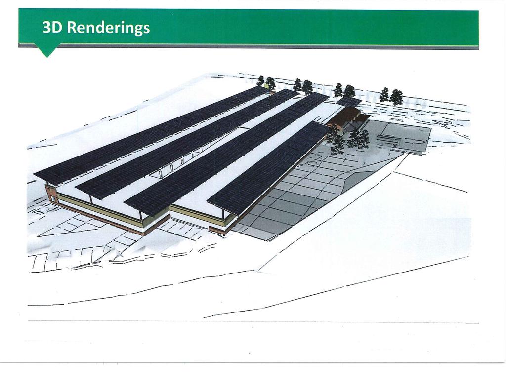
11 Golden Triangle Bus Transfer Station Project Summary The planned Golden Triangle Area (GTA) Bus Transfer Station will provide a much-needed bus transfer location within the GTA in Eden Prairie - the largest suburban business district in the Twin Cities metropolitan area. The facility will include enough loading/layover area to accommodate a minimum of two 45-ft coach buses, an indoor temperature controlled waiting/lobby area, sidewalks, rest areas, restrooms, transit information, proper signage, and landscaping. The site will not include transit park and ride as its primary use will be for reverse commute, suburb-to-suburb service, and potential transitway service connections. The GTA in Eden Prairie is a heavily auto-oriented district with minimal sidewalks, a meandering road network, and predominantly low density commercial land uses. These factors contribute to an environment that is not transit-friendly where transit vehicles take a relatively longer time to service the area compared to a more urban dense environment with grid pattern street networks. Additionally, the road network within the GTA makes it far too inefficient for transit vehicles to quickly and effectively service all areas of the GTA where service is needed. It is for the above reasons that a bus transfer station within the GTA will significantly increase transit efficiency by allowing express/transitway vehicles to connect to GTA circulator services at the proposed GTA Bus Transfer Station. SW Prime microtransit service will also connect at the planned station allowing riders to access the entirety of SouthWest Transit's service area (Eden Prairie, Chanhassen, Chaska, Carver, Victoria). Current and planned services that will connect with/benefit from the proposed station include SouthWest Transit reverse commute express services, SouthWest Transit s SW Prime microtransit service, programmed/funded MVTA express service to the GTA, and programmed/funded SouthWest Transit suburb-to-suburb service along I-494 between Eden Prairie and the Mall of America. Other planned services that could stop at/benefit from the proposed station include planned 169 BRT service, planned American Blvd ABRT service, and the planned SWLRT Green Line Extension connector bus service. 10


12 Applicant: Metro Transit Route 6 Bus and Stop Modernization The Route 6 Corridor Bus and Stop Modernization project will improve transit service by enhancing customers experiences with modern amenities like enhanced shelters, real-time transit information and zero-emission electric buses. This project will modernize much of Route 6 connecting Stadium Village to southwest Minneapolis via University Avenue and Hennepin Avenue. Three buses will be upgraded to fully electric propulsion. Route 6 is a critical component of the existing transit network, averaging over 9,000 daily rides. It is one of Metro Transit's busiest bus routes. Existing transit facilities along the corridor do not meet their communities needs; many locations consist of a sign on a pole without any scheduling information. Narrow sidewalks and right-ofway restrict available space for customer improvements like shelters. This project will expand sidewalk space with bus bumpouts for dedicated transit boarding areas, near-level boarding and enhanced facilities. Bus stops along the corridor will feature enhanced shelters with heat and light. Other improvements include real-time information, phones and/or cameras, benches, bicycle racks and trash receptacles. Accessible High Amenity Equitable/ACP50 The project will also convert three diesel articulated buses planned for the corridor to battery electric articulated buses. The incremental cost difference of purchasing electric buses in lieu of a diesel purchase is included in this project application; the base bus cost is accounted for separately. The project requests $7.25 MM for the construction of bus stop improvements throughout the Route 6 corridor and $1.5 MM for the incremental cost difference of modernizing three vehicles in the planned fleet by purchasing electric buses in lieu of diesel buses. 9,000 daily riders ` 11 Route 6 Stop at Hennepin and Franklin Avenues (northbound)


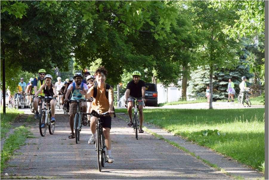
13 Applicant: Accessible Metro Transit Lake Street-Marshall Avenue Bus Stop Modernization The Lake-Marshall Corridor Bus Stop Modernization project will make transit service more attractive along 7.1 miles of Route 21 by enhancing the customer experience with vastly improved amenities like enhanced transit shelters and real-time transit information. High Amenity Equitable/ACP50 12,000 daily riders This project will modernize bus stops along the western portion of the existing Route 21 corridor between the Uptown Transit Center and the METRO Green Line Snelling Avenue Station via Lake Street, Marshall Avenue, and Snelling Avenue. Most of the route segment targeted for improvement with this project is in today s High-Frequency Network, the core of Metro Transit s service. Between the Uptown Transit Center and Snelling Avenue, weekday ridership reaches up to about 10,000 boardings. The service is Metro Transit's second highest ridership bus route, behind only the existing Route 5 service. The limited transit facilities along the corridor do not meet the needs of the communities they serve. Limited sidewalk space and available right-of-way restricts the available space for customer improvements such as shelters. Many locations currently do not have shelters and offer little more information than a bus stop sign on a pole. Other improvements include real-time information, phones and/or cameras, benches, bicycle racks and trash receptacles. Route 21 Stop at Lake St. & Bloomington Ave. (eastbound) The construction project will expand sidewalk space with bus bumpouts to accommodate a dedicated transit ` boarding area for near-level boarding, plus enhanced customer facilities. Bus stops along the corridor will be modernized with a variety of improvements, including enhanced shelters with heat and light. The project includes $8.75MM for the construction of bus stop improvements throughout the Lake Street-Marshall Avenue corridor. 12


14 Emerson-Fremont Avenue Bus Stop Modernization Applicant: Accessible High Amenity Metro Transit The Emerson-Fremont Avenue Corridor Bus Stop Modernization project will make existing transit service more attractive along over seven miles of Route 5 by enhancing the customer experience with amenities like enhanced shelters and real-time transit information. Route 5 connects the City of Brooklyn Center with the Mall of America via downtown Minneapolis. It is the highest ridership bus route within the existing transit network and carries an average of 15,500 passengers per day. However, limited transit facilities along the corridor do not meet the needs of the communities they serve. Scarce sidewalk space and the lack of right-of-way constrict space for improvements such as shelters. Many bus stops along this corridor today do not offer more than a sign affixed to a pole. This project will modernize bus stops along the northern portion of Route 5 connecting the Brooklyn Center Transit Center with downtown Minneapolis via Emerson and Fremont Avenues. Curb bumpouts will be constructed as part of this project to accommodate near level boarding, a dedicated boarding area and enhanced shelters. The enhanced shelters will provide heat and light, as well as real-time bus-tracking information. Security features (emergency phones and/or cameras) and furnishings like benches, bicycle racks, and trash receptacles will also be installed. The curb extensions will provide a better waiting experience for riders. They also remove the need for buses to merge into and out of traffic, improving travel times. The project requests $8.75 million for the construction of bus stop improvements throughout the Emerson-Fremont corridor. Equitable/ACP50 15,500 daily riders Route 5 Stop at Emerson and Lowry Avenues (northbound) 13
15 2018 Regional Solicitation Burnsville Bus Garage (BBG) Modernization Summary Date: July 10, 2018 ABOUT Minnesota Valley Transit Authority (MVTA) is the second largest public transit agency in Minnesota based on ridership and provides public transportation to the fast-growing population and employment centers in Dakota and Scott counties. MVTA operates transit service within its seven cities, but also provides substantial services extending beyond their borders. MVTA operates service out of 20 transit stations and park and ride lots throughout the Twin Cities Metro Area. PROJECT OVERVIEW The Burnsville Bus Garage (BBG), located at Rupp Drive in Burnsville, was constructed in 1977 as a manufacturing facility in an industrial park adjacent to the Minnesota Valley National Wildlife Refuge. The facility was converted to a bus garage in The garage area houses maintenance and a bus-washing system in addition to revenue and non-revenue vehicle storage. The site is tightly constrained and surrounding areas are used by high volumes of heavy trucks. Limitations with facility design have created safety and operational challenges at BBG as revenue and non-revenue vehicle inventories continue to grow. Both bus garages are overcapacity, with 10+ large buses being stored outside at the rear of BBG near the fuel islands and 8+ large buses are parked outside on the north apron. Vehicle parking inside the garage occurs wherever there is space, including the maintenance and wash bays, traffic lanes, and stall parking to maximize space. Careful maneuvering is required throughout the garage, with buses backing up from stalls and bays, increasing the risk of collisions. To further confound the issues with safety and traffic flow inside the garage is the location of the bus-washing system. The bus wash is located near the main office entry, which requires employees and visitors to pass through frequent bus traffic and wet floors, creating a significant safety hazard. Further, the interior ceiling height is too low to allow buses to raise to full height for repairs and inspections and there is a lack of storage for parts, tools, and other maintenance equipment. There is also inadequate parking space for employees in the front lot. The project includes the remodel and augment the existing building footprint, relocate maintenance and the bus wash to the rear of the building, and add storage. A redundant fiber connection that runs from BBG to the Burnsville Transit Station, MVTA s main transit hub. The project scope increases bus storage capacity by 36 to accommodate current and long-term vehicle inventories, resolves congestion and safety issues by relocating maintenance and bus wash, adds muchneeded storage and employee parking space, and provides consistent network connectivity. Additionally, the relocated maintenance area provides a sufficient ceiling height to maintain all bus types in the MVTA fleet. FUNDING REQUEST The total project amount is $6,771,632; the requested federal portion is $5,417,306 and the requested local match (20%) is $1,354,


 without")
16 Red Line BRT 147th Street Station - Skyway APPLE VALLEY APPLE VALLEY RED LINE BRT SKYWAY PROJECT EXTENT EXISTING SIDEWALK BRT RED LINE 77 MULTI-FAMILY RESIDENTIAL PARK OR OPEN SPACE NEARBY RETAIL PROPOSED GRADE SEPARATED CROSSING DAKOTA COUNTY CDA HOUSING APPLE VALLEY VILLA SENIOR APARTMENTS 494 AUGUSTA HEALTH CENTER Project Location: Apple Valley Requested Award Amount: $3,520,000 Total Project Cost: $880, M.O.A. PROJECT DESCRIPTION Cedar Grove 13 PLANNED TRANSIT SUPPORTIVE MIXED-USE DEVELOPMENT G A L A X IE A V E C E D A R A VE BLOOMINGTON BURNSVILLE Cedar Ave 35E APPLE VALLEY Northbound 147th Street Station Phase th St 147 th St 150th St T H ST W 42 Apple Valley Transit Station LAKEVILLE PROJECT CONTEXT PROPOSED SKYWAY IMPROVEMENT EXISTING SKYWAY IMPROVEMENT Miles Project Location The METRO Red Line opened in the summer of 2013 and has been a great connector for the people of Dakota County to the greater metropolitan transit system. At the time of construction, the stations at 147th Street were built to have an indoor waiting area on each side of Cedar Avenue. The stations were designed so that a skyway could be installed, connecting the two stations, and providing transit riders and pedestrians a safe way to cross Cedar Avenue (45,000 49,000 ADT) without interfering with traffic. PROJECT BENEFITS Northbound 147th Street Station Phase 2» The shovel ready 147th Street Station Skyway Project proposes to add not only the skyway, but to upgrade the existing station facilities with larger, indoor waiting areas, staircases, elevators, as well as ambient lighting to enhance the experience for transit users.» The skyway will provide a safe, comfortable alternative to crossing the nine-lane Cedar Avenue corridor, which will be especially helpful in inclement weather. This will complete a connection within the existing and future pedestrian network in the area.» The skyway will help support the Regional Bicycle Transportation Network being planned near the transit station. Renderings/Concepts» The 147th Street Station has direct pedestrian, bicycle, and transit connections to high pedestriantraffic areas, and areas that are targeted for future transit-oriented development. 15
17 Transit System Modernization CSAH 23 (Cedar Avenue) & 140 th Street Pedestrian Bridge METRO Red Line BRT (Application #10963) The project is for the construction of a new, accessible, all ages and abilities pedestrian/bike bridge over CSAH 23 (Cedar Avenue) just north of intersection with 140 th Street (directly south of the 140 th Street Transit Station serving the METRO Red Line) in Dakota County. (Please refer to the CSAH th - LAYOUT in the Attachments.) The project will significantly increase safety for pedestrians/bicyclists crossing CSAH 23 (Cedar Avenue) including riders of the METRO Red Line BRT. The project will improve access to communities, services and opportunities on the east and west sides of CSAH 23 (Cedar Avenue) Principal Arterial roadway. The project will implement a solution to a problem identified in the Dakota County Intersection Study review with updates March 2018 (attached). The project is included in the adopted Dakota County CIP (Capital Improvement Program) for construction in 2022 (attached). The project will construct a Pedestrian Bridge over CSAH 23 (Cedar Avenue) Principal Arterial roadway (where 1,500 feet north of this location CSAH 23 becomes Trunk Highway 77) in the city of Apple Valley. The bridge will span across CSAH 23 (Cedar Ave), the bridge ramps will touch-down along 140 th Street, and will be ADA compliant. Amenities will include pedestrian scale lighting, additional lighting in character with the existing BRT corridor, landscaping, benches, and trash receptacles. Bike racks are available at the nearby 140 th Street METRO Red Line Station. The Pedestrian Bridge will be located to the south of the 140 th Street METRO Red Line Station. The area where Trunk Highway 77 becomes CSAH 23 (Cedar Avenue) is in a downward slope that influences the placement of the Pedestrian Bridge. When the 140 th Street Station was constructed it was not built to accommodate a Skyway connecting between the west/east stations. The CSAH 23 (Cedar Avenue) & 140 th Street intersection is the last northerly full access intersection before the CSAH 23 roadway becomes Trunk Highway 77; as a result of this westbound 140 th Street traffic has double right turn lanes (for northbound CSAH 23 vehicles) that function like a freeway on ramp during morning peak hour. Westbound 140 th Street vehicles turning right on red to access northbound CSAH 23 (Cedar Ave) -Trunk Highway 77 create conflicts with pedestrians crossing the nine lanes of CSAH 23. The project is located near 350 units of senior housing, where in 2018 The Legends a new 163 unit opened on the corner of CSAH 23 (Cedar Avenue) & 140 th Street. This area also includes McKay Manor a Dakota County CDA development of public housing townhomes. Many of these residents rely solely on public transit for employment, shopping and entertainment. The project will make existing transit service in the corridor more attractive to users by constructing a modernized pedestrian bridge to service pedestrians/transit users to the 140 th Street METRO Red Line Station with significantly improving safety by not having to cross nine lanes of Principal Arterial CSAH 23 (Cedar Avenue). In addition to improving safety, the construction of the ADA compliant Pedestrian Bridge will make transit/walkability more attractive to patrons who are less mobile (i.e. elderly, young children, infants in strollers, visually impaired, and disabled). The pedestrian bridge will encourage alternative transportation modes and more importantly expose users to physical activity that leads to better physical and mental health. 16


18 Applicant: Accessible Metro Transit Chicago-Portland Avenue Bus Stop Modernization The Chicago-Portland Avenue Corridor Bus Stop Modernization project will make existing transit service more attractive along seven miles of Route 5 by enhancing the customer experience with vastly improved amenities like enhanced shelters and real-time transit information. Route 5 connects the City of Brooklyn Center with the Mall of America via downtown Minneapolis. It is the most popular bus route within the existing transit network and carries an average of 15,500 passengers per day. However, limited transit facilities along the corridor do not meet the needs of the communities they serve. Many bus stops today do not offer more than a sign affixed to a pole. This project will modernize bus stops linking south Minneapolis, Richfield, and Bloomington to the Mall of America, allowing for better accessibility to connections to the METRO Red Line, METRO Blue Line, and 20 bus routes. Curb bumpouts will be constructed as part of this project to accommodate near level boarding, a dedicated boarding area and enhanced shelters. The enhanced shelters will provide heat and light, as well as real-time bustracking information. Security features (emergency phones and/or cameras) and furnishings like benches, bicycle racks, and trash receptacles will also be installed. The project includes $8.75 million for the construction of bus stop improvements throughout the Chicago-Portland corridor. High Amenity Equitable/ACP50 15,500 daily riders Route 5 Stop at Chicago Ave. & 46th St. (southbound) 17


19 2018 Regional Solicitation Burnsville Transit Station (BTS) Modernization Summary Date: July 10, 2018 ABOUT Minnesota Valley Transit Authority (MVTA) is the second largest public transit agency in Minnesota based on ridership and provides public transportation to fast-growing population and employment centers in Dakota and Scott counties. MVTA operates transit service within its seven cities and provides substantial services extending beyond their borders. MVTA operates service out of 20 transit stations and park and ride lots throughout the Twin Cities Metro Area. PROJECT OVERVIEW BTS was constructed in 1995 with a transit station and surface parking lots. In 1997, a parking deck was built to accommodate this customer needs; and this process was repeated in 2002 when a second deck was added. Today the site has 1300 parking spaces and annual ridership of just over 1 million. This park and ride grew in phases, resulting in a passenger elevator never being included in the construction. Currently all customers parking on the upper levels are required to use stairways for egress. The Metropolitan Councils Thrive MSP 2040 Transportation Policy Plan states we should provide people of all ages and abilities with a transportation system that connects them with jobs, schools and opportunity. An elevator is necessary to assure accessibility for all customers to egress the three level parking structure and is consistent with this plan. The provided project cost is for a multi-passenger elevator installation and enclosure construction. A backup power generator has been included in this project to assure the elevator and facility can remain operational during emergencies. The generator will also assure that transit operations and customer service are able to provide service to our customers. Included in the cost is a utility room that is necessary for custodial and supply storage needs. It is necessary to cross a road to get from the parking ramp to the bus bays. Dollars have been included in this request to improve signage at these pedestrian crossings. FUNDING REQUEST The total project amount is $770,000; the requested federal portion is $616,000 and the requested local match (20%) is $154,

20 2018 Regional Solicitation Eagan Transit Station (ETS) Modernization Summary Date: July 10, 2018 ABOUT Minnesota Valley Transit Authority (MVTA) is the second largest public transit agency in Minnesota based on ridership and provides public transportation to the fast-growing population and employment centers in Dakota and Scott counties. MVTA operates transit service within its seven cities, but also provides substantial services extending beyond their borders. MVTA operates service out of 20 transit stations and park and ride lots throughout the Twin Cities Metro Area. PROJECT OVERVIEW Eagan Transit Station (ETS) is in need of a passenger elevator. The station is bordered by the second busiest intersection in Dakota County, Yankee Doodle Road and Pilot Knob Road. Adjacent to Interstate Highway 35E, it provides transit access to a large retail area, hotels, and multi-family housing. The station also serves commuters to the downtown areas of both Minneapolis and Saint Paul. Development in this area was sparked when MVTA built a Transit Oriented Development (TOD) on the site located at 3470 Pilot Knob Road in Eagan MN. The area is now the City of Eagan s central shopping district. That project included a six-store mall adjacent to the transit station. The original 330 vehicle surface park and ride started serving customers in The park and ride demand at the site increased and in 2002, it was expanded to accommodate 750 vehicles. The expansion included, a two-level parking ramp structure, customer waiting area and restrooms. Annual ridership at this location is just under half a million. The expansion project did not include a passenger elevator. Currently all customers parking on the upper levels are required to use stairways for egress. The Metropolitan Councils Thrive MSP 2040 Transportation Policy Plan states we should provide people of all ages and abilities with a transportation system that connects them with jobs, schools and opportunity. An elevator is necessary to assure accessibility for all customers to egress the three level parking structure and is consistent with this plan. FUNDING REQUEST The total project amount is $515,000; the requested federal portion is $412,000 and the requested local match (20%) is $103,
21 20
22 Summary of Closed Network Carshare Development Project The Problem: Reducing dependence on individually owned cars involves replacing a single source transportation solution (owned car) with a group of services that operate in unique niches, covering different travel occasions. Among these different transportation services, carshare is an important strategy that provides households with a transportation alternative for important and necessary travel occasions not served by other alternatives. The problem is, commercial carshare operations require many users per car to be viable. That limits their operations to the densest populated areas of the metropolitan area, leaving many households unable to access carshare in their area. Solution: The goal of this program is to bring a viable carshare option to areas of the metropolitan area not served by commercial carshare operations. These areas include neighborhoods surrounding the high frequency transit corridors that are outside the dense core of the cities. The program could be summarized as follows: The closed network carshare program allows a group of neighbors to own and operate a car together. The closed network system has several advantages over commercial carshare that allows it to operate in lower density locations than commercial operations. 1. Users of Closed network carshare, make a larger monetary commitment than a typical commercial carshare operation. Where commercial carshare operations typically seek to eliminate fixed costs, the closed network program seeks to limit fixed costs not eliminate them. 2. Because the user group is smaller and more defined, some of the operating systems and technology required can be less robust than commercial operations or performed by members, lowering costs. 3. Lastly, Closed network carshare users are taxed as vehicle owners, not as commercial system users. Program Parameters: the cars, typically late model electric or hybrid vehicles, are purchased by CarFreeLife (Minnesota Non-profit), then they re leased under a specialized long-term lease and joint ownership agreement to neighbors interested in using the car. The specialized lease and joint ownership agreements allows members to get in and out of the lease in a more favorable way than if they were in a long-term lease with a typical car leasing company. CarFreeLife also provides operational support services and technologies that facilitate smooth operations. The CarFreeLife plan includes two variations of closed network carshare, sponsored and non-sponsored. A sponsor is a non-user that benefits from the presence of the carshare vehicle in a particular location. It could be an apartment building owner who wants to have a closed network carshare vehicle for residents of his or her building to join. Or it could be an office building that wants it as an amenity for tenants of the building to use. Sponsors of closed network carshare vehicles contribute by facilitating the vehicle in several ways. These may include a parking spot or garage space for the vehicle, or power for charging in the case of electric vehicles. They may also include economic incentives or guarantees that change the risk factors associated with placing the vehicle in a particular location. Use of Proceeds of this Grant Application: The vehicles and operating costs are paid for by the user/owners of the cars. The proceeds of this application if successful would be used to educate potential neighbor groups and sponsors of the costs and benefits involved in participation. User/Member Profile Scenarios: 1. I commute to work using Metro Transit, or sometimes ride my bike. I also use Uber or Lyft when I m out for the evening. I just don t need a car full time, but it s nice to have Neighbor-Car for the times that I do. I m going to go to Europe with the money I saved by not owning a car. 2. We have two cars in our household. By adding a Neighbor-Car membership we can easily relinquish a car, allowing us to pocket a significant amount of money every month. 3. I like Neighbor-Car because, it allows us to drive a late model environmentally friendly car. By myself it might have taken me a long time before I could afford something like that. Besides Neighbor-Car has helped create a great social network. We find ourselves sharing all kinds of stuff now. 21
23 July 13, 2018 Elaine Koutsoukos Metropolitan Council 390 Robert Street North St. Paul, MN Dear Elaine and Metropolitan Council Review Team, This letter is submitted as confirmation that Cycles for Change has secured funding to match federal dollars allocated through the Transportation Demand Management program. With a requested $319,200 TDM award, C4C will be expected to supply $79,800 in matching funds over the two-year period of the grant. C4C is expected to receive more than $65,000 annually in individual donations in 2018 (with comparable or larger amounts in ); this funding is unrestricted, and C4C is prepared to put as much as needed towards the required TDM match. Additionally, C4C receives $40,000 annually from the McKnight Foundation ( ), and continued funding is expected. Additionally, the Otto Bremer Foundation contributed $20,000 in 2017, with comparable contributions projected in 2018 and beyond that could be used as a match. With an annual budget of more than $700,000 that includes substantial flexible and general operations resources, C4C is unquestionably in a position of allocating $79,800 over two years to match a $319,200 TDM award. Please feel free to call me at with any questions you might have. Sincerely, Tina Cho Executive Director, Cycles for Change 22
24 Scott County TDM Applicant- Scott County(Smartlink) which is a cooperative agreement between Carver and Scott Counties for Dial-A-Ride, non-emergency medical transportation, volunteer drivers, shared vehicle and travel trainer. This project is education and marketing of various transportation modes in Scott and Carver County. Smartlink will be advertising and educating as many residents as we can in order to help people realize the potential of modes like fixed route, commuter, DAR, volunteers, carpool, car share, and even taxi, and Uber/Lyft. Smartlink believes this is a great opportunity for education and outreach as commuters will have 35W headaches for at least 3 years and gas prices are starting to climb again ever so slowly. Smartlink links this project with another we are entrenched in, Mobility Management. Smartlink has done a survey which helped the Scott County Board to enact a DAR week-end service in Scott County because the people responding to the survey said that was important to them. Now Smartlink has to get that service to new heights beyond its 1.5 passengers per hour, and make it a sustainable service for the future. Employment in this region has climbed dramatically and just like we cannot build enough roads to support congestion, there is not enough fixed or commuter route to support all businesses, so we have to come up with alternatives like: walking, biking, carpool, rideshare, car share. Smartlink has already created a vehicle share program in Norwood Young America and wants to mirror this to encourage all citizens to share rides or use existing transportation resources to reduce the number of SOV s on the road. Smartlink will also be teaming with Human services to assist the clients they work with get to jobs, make it to medical appointments, and shopping. This is a project for and has a total cost of $150, which is a 1.0 FTE travel trainer to market, advertise, outreach, and educate all citizens of Scott and Carver County on the who, what, when, why, where, and how to transportation solutions in their communities. An equal part of this effort is the discovery of needs and gaps which hopefully can lead to viable solutions for the discovered needs. Costs include salary, benefits, marketing materials, and advertising. Total cost of the project is $150, which includes a local match of $30,000. The local match of $30, is being funded by a variety of sources like local transit tax, Carver County and Scott County operating budgets, DAR contracted revenue, and volunteer driver fares. 23
25 24
26 First-Last Mile Job Access Project Summary Providing adequate access to low-wage jobs in suburban areas is a significant challenge given the state of the land-use and transportation system. Low residential and employment densities, coupled with a relatively even distribution of low-wage jobs across a wide geographic area, make it difficult to provide fixed-route transit cost-effectively. The burden of the automobile-oriented land-use and transportation paradigm falls disproportionately on those least able to bear the cost of car ownership. To address these problems, at least in part, transit agencies have long relied on alternatives to fixed-route service, including dial-a-ride, variable-route shared service, and private taxicabs. New technologies, including mobile app-based ride hailing, and improved vehicle routing algorithms, have the potential to make these services more effective. This project will implement a demand-responsive, microtransit service based around the SunRay Transit Center in the east side of Saint Paul. Users will be able to hail a ride using a smart phone app or calling the dispatch center. Vehicles will be routed to passengers using a routing algorithm in real time and pick-up and drop-off additional passengers along the way. The service will be available 7 days per week for 14 hours per day. It will include four vehicles available in service and target average passenger wait times of less than 10 minutes from the time of the ride request. The service area will include the east side of Saint Paul, Maplewood, Oakdale, and Woodbury. There are significant opportunities to improve access to jobs in low density suburban job centers in this area. The grant request is to support the additional operating funds needed to implement the service. Total Project Cost: $1,274, Requested Federal Amount: $500, Local Match Amount: $774, Local Match Percentage: 60.76% 25
. HOURCAR already operates carsharing hubs in such communities.")
27 Project Request HOURCAR requests TDM funds to engage low-income communities through a robust outreach strategy and promote multi-modal transportation approaches, particularly in areas of concentrated poverty and communities of color (ACP50 areas). HOURCAR already operates carsharing hubs in such communities. These "Increased Access Hubs, which were implemented in 2017, have lower hourly rates compared to other locations throughout the Twin Cities. Organization Overview HOURCAR is a nonprofit that provides members with hourly access to a fleet of fuel-efficient vehicles. We have 2,300+ members and 60 hubs throughout the Twin Cities. Car-sharing is essential to efficient, convenient multi-modal transit. HOURCAR is committed to increasing transportation and car-sharing access to everyone in the Twin Cities, and seeks to engage low-income, underserved communities that have traditionally be left out of car-sharing opportunities. Project Overview Since becoming an autonomous organization in 2017, HOURCAR has identified engagement and inclusion in disadvantaged communities as a priority. This led to the creation of Increased Access Hubs, located in neighborhoods where the median income is less than $49,200 or 200% of the poverty guideline for a family of four. Currently there are 8 Increased Access Hub locationsin addition, HOURCAR plans to add 6 more Increased Access Hubs in North Minneapolis and East St. Paul. For this project, HOURCAR seeks to build staff and organizational capacity to foster strong partnerships within these neighborhoods, with a goal to identify, mitigate, and/or eliminate barriers to carsharing. Funding Request Funding from this request will support the creation and implementation of a comprehensive outreach strategy that effectively engages communities with an Increased Access Hub. Components of the strategy include: A Stakeholder's Committee made up of local community leaders and advocates; A full-time Community Engagement Manager who will leverage community partnerships, engage residents, and promote the benefits of car-sharing across the region; Customized marketing and communication materials; and Focus groups with residents to determine the opportunities and challenges unique to their communities. Without TDM funds, HOURCAR does not have the organizational capacity to foster relationships in Increased Access Hub communities or determine the barriers to usage. This project allows HOURCAR to increase engagement, mitigate user challenges, understand the needs within Increased Access hub neighborhoods, and create a process for a sustained and thriving multimodal community. 26
28 27
29 Parking FlexPass at ABC Ramps: Integrating Parking and Transit Options for Sustainable Mobility The Parking FlexPass at ABC Ramps project is an innovative way to leverage existing transportation infrastructure and systems to address our region s mobility challenges by changing travel behavior with flexible purchase options for ABC Ramp parking contract holders. To reduce Single Occupancy Vehicle (SOV) travel to downtown Minneapolis, this project will build a program with broad organizational support that allows commuters to have more commute mode flexibility. Currently many employers offer benefits for either parking or transit. Many commuters express a desire to have more flexibility than is currently offered to drive some days and use transit other days. This project will create a product that that employers can include in their benefits packages that allows commuters to have a guaranteed parking space on days they need to drive and use transit on other days. The product could provide other benefits such as access to car share, bike share, carpooling and more. The plan for Parking FlexPass at ABC Ramps was created over several months in 2018 by MnDOT, the City of Minneapolis, the University of Minnesota, Move Minneapolis, and other stakeholders. The funding for the Parking FlexPass at ABC Ramps project will be used to: 1. Complete Systems Integration and Software Development Integrate systems that allows the cost that commuters pay each month to be used for both parking and transit These systems include but are not limited to parking revenue control systems, Metro Transit and pre-tax employer benefits. This project is unique from previous efforts to encourage SOV parkers to use transit in that it will partner with employer benefit administrators (like Wage Works) to offer the program to employees through their employer s pre-tax benefit packages. The project team will also promote the program directly to commuters with parking contracts. 2. Develop product pricing The ABC Ramps Transportation Program will work to find price purchase levels that fall between SOV parking contracts on the high end and a monthly transit pass on the low end. 3. Marketing and outreach The new product will need extensive marketing and outreach effort to reach employers and commuters. Employers will need to learn about it so they can add it their benefits packages. There will likely be a contract with the Downtown Minneapolis TMO, Move Minneapolis, to help support this effort. 4. Conduct performance measures to measure impact on travel behavior The University of Minnesota will be responsible for collecting travel behavior change. This may be done using the Daynamica App or other means. If the app is selected a sub-set of participants would be offered incentives to carry a mobile phone that tracks their travel behavior for a short sample period. 28

30 eworkplace Phase 4 This project promotes telework as a choice to commuters throughout the I-35W corridor and offers free consulting services to Twin Cities employers so they have strong and durable telework policies. Along the I-35W split into downtown Minneapolis, the corridor is one of the most heavily traveled routes in the Twin Cities Metropolitan Area. Highway capacity in this corridor is severely constrained due to 35W@94 Crosstown to Midtown construction expected to last through This project has disrupted already congested conditions on I-35W, causing conditions that push both employers and commuters to rethink their commute options. MnDOT has collaborated closely with eworkplace to share the free services that the program provides. eworkplace will enter its fourth phase (eworkplace Phase 4) with successful award of this grant application, building on a history of successful outreach to employers. eworkplace will continue to maintain the service lines that have made the program successful, including the website, social media presence, webinars and "lunch and learns" with employers, and outreach to previous project participants. However, in this phase eworkplace will add deliberate, direct outreach to employees for referrals to employers and boasts a new formalized partnership with Move Minneapolis. Move Minneapolis is a trusted voice for commuting options among downtown employers, many of whom employ I- 35W commuters. Move Minneapolis provides a strong connection to downtown Minneapolis employers, a connection built on trust for promoting solutions to employers facing loss of parking and employees clamoring for more flexible telework options. Outreach to employees will utilize social media reconnaissance completed in Phase 3 and focus on building a movement of remote work supporters locally and connect local remote workers to one another. This work includes potential partnership with private business (e.g. local coffee chains) as well as Minnesota Department of Employment and Economic Development Workforce Centers both to promote the program and offer physical space for telework to take place. For their part, Workforce Centers are scattered through the metro, and could offer low-cost options for telework opportunities and collaboration across disciplines and job areas as well as needed interaction for happy workers. The more that local remote workers connect to one another, the more a movement of telework can be built and others see it as a viable option. ### 29
31 This project will expand on the popular Metro Transit app that lunched in November Since launching, the Metro Transit app has been downloaded more than 200,000 times. In its current state the app is focused on helping people use and pay for transit service in the Twin Cities metro area. It s core features as of the end of this month are fare payment, trip planning tools and information, Go-To Card management, Text for Safety (a public safety texting service), Guaranteed Ride Home and Ride Matching. One can see that this app offers customers robust access to the tools they need to take a trip on Metro Transit. While it opens those doors, where it fails is when transit is not the best option for a user. If transit doesn t work, a user must rely on another app if they are looking from a non-sov way to travel. If they need to switch between many apps every time they want to take a trip, they may end up defaulting to SOV travel rather than sort through a half dozen apps to make a trip. If there was a tool in which customers could browse all their options and pay for whatever method of travel they chose, they will end up using a single app more often and see more options at once. This, in turn, can help them reduce reliance on personal vehicles and use sustainable, shared mobility options more often. Additionally, Metro Transit has a built-in payment mechanism that could handle all financial transactions from the customer side. This could help to reduce the needs to manage multiple payment accounts and potentially more layers of complication. While there are other travel aggregators in the market, such as Transit App, what Metro Transit can offer that no private company can is a neutrality and lack of profit driven service. All current travel aggregators are profit driven and make their money off referral fees. For example, if someone books a Nice Ride trip via the Transit App, Nice ride pays a fee to them. This increases costs to the provider and can be difficult to justify for smaller shared mobility solutions that are not backed by venture capitol with deep pockets like many of the big-name players in shared mobility. This could also open doors for participation for small, local providers that don t have the ability to absorb the additional costs of being on one of more for-profit travel aggregator. As Metro Transit already has the app, there already exists a base platform to built the above functionality into. The large start up costs of building the app from the ground up have already been incurred so all funding from this grant would go towards developing the technology that would support shared mobility integration and the technology to support it. Some the development work that would need to be done would be integrating shared mobility API (something that many already offer), adapting the current payment tool and back end to accommodate paying for multiple types of services, integrating trip planning tools that show all the modes available and developing any addition supporting software development needs. For the first phase of shared mobility integration, it is proposed that Nice Ride be the first to be included. As a non-profit and supportive partner, they present the fewest technical challenges (they already have an advanced app) as well as a demonstrated willingness to work with Metro Transit on the goal of shared mobility integration (see attached letter of support). This would not rule out others by any means, but just shows that there is already at least one local shared mobility provider eager to be a part of an enhanced Metro Transit app. Others could and would be included as well as they were willing to sign one. Through many conversations with providers, as well as looking at industry trends, there is an eagerness to be part of transit apps from companies like Lyft, Uber, Car2Go and more throughout the US and the world and we expect incredible interest for their inclusion on the Metro Transit app. 30

32 Screenshot of the TransitMaster Play Back application showing bike rack usage on a Metro Transit bus. The software is ready for an expansion of the rack sensors. 175 KB 31
CEDAR AVENUE TRANSITWAY Implementation Plan Update
 CEDAR AVENUE TRANSITWAY Implementation Plan Update EECUTIVE SUMMARY DECEMBER 2015 Executive Summary In 2013, the Twin Cities metropolitan area s first bus rapid transit (BRT) line, the METRO Red Line,
Sales and Use Transportation Tax Implementation Plan
 Sales and Use Transportation Tax Implementation Plan Transportation is more than just a way of getting from here to there. Reliable, safe transportation is necessary for commerce, economic development,
2 EXISTING ROUTE STRUCTURE AND SERVICE LEVELS
 2 EXISTING ROUTE STRUCTURE AND SERVICE LEVELS In the Study Area, as in most of the Metro Transit network, there are two distinct route structures. The base service structure operates all day and the peak
FREQUENTLY ASKED QUESTIONS
 FREQUENTLY ASKED QUESTIONS 2018 What is the More MARTA Atlanta program? The More MARTA Atlanta program is a collaborative partnership between MARTA and the City of Atlanta to develop and implement a program
5. OPPORTUNITIES AND NEXT STEPS
 5. OPPORTUNITIES AND NEXT STEPS When the METRO Green Line LRT begins operating in mid-2014, a strong emphasis will be placed on providing frequent connecting bus service with Green Line trains. Bus hours
I-35W Past, Present, and Future: METRO Orange Line
 I-35W Past, Present, and Future: METRO Orange Line 2018 State Public Transportation Partnerships Conference Charles Carlson Director, BRT Projects Metro Transit Charles.Carlson@metrotransit.org Metro Transit:
METRO Orange Line BRT American Boulevard Station Options
 METRO Orange Line BRT American Boulevard Station Options Bloomington City Council Work Session November 18, 2013 Christina Morrison BRT/Small Starts Project Office Coordinating Planning and Design AMERICAN
EUGENE-SPRINGFIELD, OREGON EAST WEST PILOT BRT LANE TRANSIT DISTRICT
 EUGENE-SPRINGFIELD, OREGON EAST WEST PILOT BRT LANE TRANSIT DISTRICT (BRIEF) Table of Contents EUGENE-SPRINGFIELD, OREGON (USA)... 1 COUNTY CONTEXT AND SYSTEM DESCRIPTION... 1 SYSTEM OVERVIEW... 1 PLANNING
Hennepin County Transit Oriented Development Program. The Ellipse, St. Louis Park, 2009
 Hennepin County Transit Oriented Development Program The Ellipse, St. Louis Park, 2009 What is Transit Oriented Development (TOD)? Development within walking distance of transit Typically ¼ to ½ mile 10
US 29 Bus Rapid Transit Planning Board Briefing. February 16, 2017
 US 29 Bus Rapid Transit Planning Board Briefing February 16, 2017 Project Goals Improve the quality of transit service Improve mobility opportunities and choices Enhance quality of life Support master
Transitways. Chapter 4
 4 Transitways Figure 4-1: Hiawatha LRT Train at the Lake Street/Midtown Station The 23 Transportation Policy Plan identifies a network of transitway corridors to be implemented by 23. Transitways recommended
A Transit Plan for the Future. Draft Network Plan
 A Transit Plan for the Future Draft Network Plan Project Overview and Status Completed Market Analysis and Service Evaluation. Developed Plan Framework and Guiding Principles. Developed a draft Five Year
SouthWest Transit s Microtransit Service 2018 APTA State Public Transportation Partnerships Conference Wednesday, August 15 th
 SouthWest Transit s Microtransit Service 2018 APTA State Public Transportation Partnerships Conference Wednesday, August 15 th Who We Are Public Transportation serving southwestern suburbs of Minneapolis:
D Line Station Plan: Table of Contents
 Final Station Plan This document identifies D Line station locations for approval by the Metropolitan Council in summer 2018. It is a final revision of the D Line Station Plan previously published for
West Broadway Transit Study. Community Advisory Committee September 17, 2015
 West Broadway Transit Study Community Advisory Committee September 17, 2015 Introductions Community Engagement Summer Outreach Fall Outreach Technical Analysis Process Update Alternatives Review Economic
Metro Transit Update. Christina Morrison, Senior Planner Metro Transit BRT/Small Starts Project Office. John Dillery, Senior Transit Planner
 Metro Transit Update Christina Morrison, Senior Planner Metro Transit BRT/Small Starts Project Office John Dillery, Senior Transit Planner Metro Transit Service Development May 16, 2013 1 Transit Planning
Help shape your community investment in Wake Transit. Fiscal Year 2019 Draft Work Plan Summary
 Help shape your community investment in Wake Transit Fiscal Year 2019 Draft Work Plan Summary Wake County, growth and transit The Triangle is one of the fastest-growing regions in the nation. Wake County
Transportation Demand Management Element
 Transportation Demand Management Element Over the years, our reliance on the private automobile as our primary mode of transportation has grown substantially. Our dependence on the automobile is evidenced
Operating & Maintenance Cost Results Report
 Operating & Maintenance Cost Results Report Prepared for: Hennepin County Regional Railroad Authority Prepared by: Connetics Transportation Group Under Contract To: Kimley-Horn and Associates FINAL June
Snelling Bus Rapid Transit. May 13, 2013 Technical Advisory Committee Meeting #1
 Snelling Bus Rapid Transit May 13, 2013 Technical Advisory Committee Meeting #1 1 Today s meeting TAC Introductions Project Overview Arterial BRT Concept Background Snelling Corridor Plan, Funding & Schedule
Committee Report. Transportation Committee. Business Item No
 Committee Report Business Item No. 2015-280 Transportation Committee For the Metropolitan Council meeting of December 9, 2015 Subject: METRO Blue Line Extension (Bottineau Light Rail Transit) Revised Scope
C LINE: LONG-TERM GLENWOOD REALIGNMENT STUDY
 C LINE: LONG-TERM GLENWOOD REALIGNMENT STUDY Comments on this study and the long-term Glenwood realignment recommendation can be submitted to brtprojects@metrotransit.org. Comments can be submitted through
I-35W & Lake Street Station
 I-35W & Lake Street Station 2017 CMAQ Funding Proposal April 16, 2014 Charles Carlson Metro Transit BRT/Small Starts Project Office www.metrotransit.org/orangeline Addressing Corridor Challenges 7+ Hours/day
Recommended Station Plan
 Recommended Station Plan Comments on this recommended D Line Station Plan can be submitted to dline@metrotransit.org through June 8, 2018. This document identifies D Line station locations recommended
The Engineering Department recommends Council receive this report for information.
 CORPORATE REPORT NO: R161 COUNCIL DATE: July 23, 2018 REGULAR COUNCIL TO: Mayor & Council DATE: July 19, 2018 FROM: General Manager, Engineering FILE: 8740-01 SUBJECT: Surrey Long-Range Rapid Transit Vision
SUPPORTING TOD IN METRO CHICAGO
 www.rtachicago.org SUPPORTING TOD IN METRO CHICAGO Tuesdays at APA November 18, 2014 OVERVIEW OF RTA 2 11/18/2014 Tuesdays at APA: Supporting TOD in Metro Chicago RTA Region 8.5 million people 3,700 square
V03. APTA Multimodal Operations Planning Workshop August Green Line LRT
 V03 APTA Multimodal Operations Planning Workshop August 2016 Green Line LRT 2 Presentation Outline Past Present Future 3 16/03/2016 RouteAhead Update 4 4 16/03/2016 RouteAhead Update 5 5 16/03/2016 6 6
Tempe Streetcar. March 2, 2016
 Tempe Streetcar March 2, 2016 Tempe Profile 40 sq. miles, highest density in state University Town, center of region Imposed growth boundaries (density increase) Mixed use growth/intensifying land use
Metropolitan Council Budget Overview SFY
 Metropolitan Council Budget Overview SFY 2016-2017 H T t ti C itt House Transportation Committee February 4, 2015 Transit connects us to the places that matter Transportation Needs Grow as the Region Grows
Waco Rapid Transit Corridor (RTC) Feasibility Study
 Feasibility Study") Waco Rapid Transit Corridor (RTC) Feasibility Study Chris Evilia, Director of Waco Metropolitan Planning Organization Allen Hunter, General Manager Waco Transit System Jimi Mitchell, Project Manager AECOM
Waco Rapid Transit Corridor (RTC) Feasibility Study Chris Evilia, Director of Waco Metropolitan Planning Organization Allen Hunter, General Manager Waco Transit System Jimi Mitchell, Project Manager AECOM
UTA Transportation Equity Study and Staff Analysis. Board Workshop January 6, 2018
 UTA Transportation Equity Study and Staff Analysis Board Workshop January 6, 2018 1 Executive Summary UTA ranks DART 6 th out of top 20 Transit Agencies in the country for ridership. UTA Study confirms
Kendall Drive Premium Transit PD&E Study Project Kick-Off Meeting SR 94/Kendall Drive/SW 88 Street Project Development and Environment (PD&E) Study
 Study") Florida Department of Transportation District Six Kendall Drive Premium Transit PD&E Study Project Kick-Off Meeting SR 94/Kendall Drive/SW 88 Street Project Development and Environment (PD&E) Study What
Florida Department of Transportation District Six Kendall Drive Premium Transit PD&E Study Project Kick-Off Meeting SR 94/Kendall Drive/SW 88 Street Project Development and Environment (PD&E) Study What
WAKE TRANSIT PLAN Summer 2018
 WAKE TRANSIT PLAN Summer 2018 Planning for growth WAKE COUNTY s population already exceeds ONE MILLION and grows by more than 60 people a day. That s 23,000 people a year or basically another Morrisville.
Green Line Long-Term Investments
 Enhancements Short-term improvements to keep Austin moving. Investments Long-term projects to support our future. Mobility Hubs MetroRapid MetroRail MetroExpress Connectors Circulators Project Connect
Navigating in Different Rivers
 Navigating in Different Rivers Suburban TOD Julie Jones, Planning Manager, City of Fridley Julie Farnham, Senior Planner, City of Bloomington Kersten Elverum, Director of Planning & Development, City of
Community Advisory Committee. October 5, 2015
 Community Advisory Committee October 5, 2015 1 Today s Topics Hennepin County Community Works Update Project Ridership Estimates Technical Issue #4:Golden Valley Rd and Plymouth Ave Stations Technical
Rapid Transit and Land-Use Integration a Reality
 City of Charlotte Rapid Transit and Land-Use Integration a Reality Transportation Oversight Committee Carolyn Flowers CEO Charlotte Area Transit System April 29, 2010 Charlotte Region Statistics Mecklenburg
Otay Ranch Station 2020 MOBILITY SERVICES MAP REGIONAL MOBILITY HUB IMPLEMENTATION STRATEGY
 MAGDALENA REGIONAL MOBILITY HUB IMPLEMENTATION STRATEGY Otay Ranch Station Mobility hubs are transportation centers located in smart growth areas served by high frequency transit service. They provide
PUBLIC TRANSPORTATION
 PUBLIC TRANSPORTATION PROJECT TITLE U-MED DISTRICT MULTI-MODAL IMPROVEMENTS- PHASE II Transit Vehicles and Upgrades MUNICIPALITY OF ANCHORAGE Capital Improvement Program PROJECT LIST BY DEPARTMENT Public
More than $9 Million coming to Central Valley for transportation
 More than $9 Million coming to Central Valley for transportation From free bus service to electric buses Part of overall $97 Million awarded to public transportation projects A total of 152 local public
We Want Your Input! Review the design alternatives and tell us what s important to you in the design of these areas of the approved BRT Network:
 We Want Your Input! Review the design alternatives and tell us what s important to you in the design of these areas of the approved BRT Network: Richmond North of Oxford Street Richmond Row Dundas Street
Needs and Community Characteristics
 Needs and Community Characteristics Anticipate Population and Job Growth in the City Strongest density of population and jobs in Ann Arbor are within the Study Area Population expected to grow 8.4% by
Charlotte-Mecklenburg Region Rapid Transit and Land-Use Integration
 Charlotte-Mecklenburg Region Rapid Transit and Land-Use Integration Legislative Committee on Urban Growth and Infrastructure Carolyn Flowers CEO Charlotte Area Transit System March 23, 2010 Charlotte Region
Sustainability SFMTA Path to Platinum
 Sustainability SFMTA Path to Platinum Ed Reiskin San Francisco Municipal Transportation Agency, Director of Transportation San Francisco, CA Timothy Papandreou Deputy Director Strategic Planning & Policy
Arterial Bus Rapid Transit. System Policy Oversight Committee April 7, 2014
 Arterial Bus Rapid Transit System Policy Oversight Committee April 7, 2014 1 Meeting Agenda Welcome and Introductions A Line - Project Status Shelter and Pylon Development Arterial BRT Branding Update
Develop ground transportation improvements to make the Airport a multi-modal regional
 Project Overview TRANSPORTATION IMPROVEMENTS WHAT ARE THE PROJECT GOALS? Transportation transportation hub. Develop ground transportation improvements to make the Airport a multi-modal regional Land Use
CTfastrak Expansion. Stakeholder Meeting #4 Manchester Town Hall June 3, 2016
 CTfastrak Expansion Stakeholder Meeting #4 Manchester Town Hall June 3, 2016 Today s Agenda Phase I Update 2016 Service Plan Implementation Schedule & Cost Update Phase II Services Timeline Market Analysis
BROWARD BOULEVARD CORRIDOR TRANSIT STUDY
 BROWARD BOULEVARD CORRIDOR TRANSIT STUDY FM # 42802411201 EXECUTIVE SUMMARY July 2012 GOBROWARD Broward Boulevard Corridor Transit Study FM # 42802411201 Executive Summary Prepared For: Ms. Khalilah Ffrench,
The Latest on Joint Development Policy Guidance
 Panelists The Latest on Joint Development Policy Guidance Moderator: Jonathan Davis Deputy General Manager and Chief Financial Officer Massachusetts Bay Transportation Authority James Blakesley, Attorney-Advisor,
King County Metro. Columbia Street Transit Priority Improvements Alternative Analysis. Downtown Southend Transit Study. May 2014.
 King County Metro Columbia Street Transit Priority Improvements Alternative Analysis Downtown Southend Transit Study May 2014 Parametrix Table of Contents Introduction... 1 Methodology... 1 Study Area...
6/6/2018. June 7, Item #1 CITIZENS PARTICIPATION
 June 7, 2018 Item #1 CITIZENS PARTICIPATION 1 Item #2 APPROVAL OF MINUTES Item #3 TRAC GOALS, FRAMEWORK & AGENDA REVIEW 2 COMMITTEE GOALS Learn about Southern Nevada s mobility challenges, new developments
Shared Mobility Action Plan Overview
 The image part with relationship ID rid3 was not found in the file. Shared Mobility Action Plan Overview July 2017 With support from Expanding the ecosystem of transportation choices by creating a multimodal
9. Downtown Transit Plan
 CORRADINO 9. Downtown Transit Plan KAT Transit Development Plan As part of the planning process for the TDP, an examination of downtown transit operations was conducted. The Downtown Transit Plan 1 is
OFF-STREET PARKING REFORM IN MINNEAPOLIS AND ST. PAUL
 OFF-STREET PARKING REFORM IN MINNEAPOLIS AND ST. PAUL MINNESOTA APA October 1, 2014 Minneapolis Zoning Codes 1924 City s first zoning code 1963 City s second zoning code, which included the city s first
Bi-County Transitway/ Bethesda Station Access Demand Analysis
 Bi-County Transitway/ Bethesda Station Access Demand Analysis Prepared for: Washington Metropolitan Area Transit Authority Office of Planning and Project Development May 2005 Prepared by: in conjunction
Metro Reimagined. Project Overview October 2017
 Metro Reimagined Project Overview October 2017 Reimagining Metro Transit Continuing our Commitment to: Provide mobility based on existing and future needs Value the role of personal mobility in the quality
Midtown Corridor Alternatives Analysis Key Issues Memo
 Midtown Corridor Alternatives Analysis Key Issues Memo 1/4/2013 Prepared by the SRF Consulting Group Team for Table of Contents Introduction... 1 1. Markets... 1 External Markets... 1 Intra-Corridor Travel...
Downtown Transit Connector. Making Transit Work for Rhode Island
 Downtown Transit Connector Making Transit Work for Rhode Island 3.17.17 Project Evolution Transit 2020 (Stakeholders identify need for better transit) Providence Core Connector Study (Streetcar project
Madison BRT Transit Corridor Study Proposed BRT Operations Plans
 Madison BRT Transit Corridor Study Proposed BRT Operations Plans This paper presents a description of the proposed BRT operations plan for use in the Madison BRT Transit Corridor Study. The objective is
GO Transit s deliverable: the 2020 Service Plan
 GO Transit s deliverable: the 2020 Service Plan GO Transit s 2020 Service Plan describes GO s commitment to customers, existing and new, to provide a dramatically expanded interregional transit option
COMMUNITY REPORT FISCAL YEAR We are making progress, are you on board? GOLD COAST TRANSIT DISTRICT
 FISCAL YEAR 178 GOLD COAST TRANSIT DISTRICT COMMUNITY REPORT We are making progress, are you on board? OJAI OXNARD PORT HUENEME VENTURA COUNTY OF VENTURA GENERAL MANAGER S MESSAGE STEVEN P. BROWN DEAR
Midtown Corridor Alternatives Analysis. Policy Advisory Committee Meeting February 12, 2014
 Midtown Corridor Alternatives Analysis Policy Advisory Committee Meeting February 12, 2014 Today s Agenda Introductions Outreach efforts and survey results Other updates since last meeting Evaluation results
TRANSIT FEASIBILITY STUDY Town of Bradford West Gwillimbury
 TRANSIT FEASIBILITY STUDY Town of Bradford West Gwillimbury Open House Presentation January 19, 2012 Study Objectives Quantify the need for transit service in BWG Determine transit service priorities based
Address Land Use Approximate GSF
 M E M O R A N D U M To: Kara Brewton, From: Nelson\Nygaard Date: March 26, 2014 Subject: Brookline Place Shared Parking Analysis- Final Memo This memorandum presents a comparative analysis of expected
Maryland Gets to Work
 I-695/Leeds Avenue Interchange Reconstruction Baltimore County Reconstruction of the I-695/Leeds Avenue interchange including replacing the I-695 Inner Loop bridges over Benson Avenue, Amtrak s Northeast
Office of Transportation Bureau of Traffic Management Downtown Parking Meter District Rate Report
 Office of Transportation Bureau of Traffic Management 1997 Downtown Parking Meter District Rate Report Introduction The City operates approximately 5,600 parking meters in the core area of downtown. 1
Public Meeting. City of Chicago Department of Transportation & Department of Housing and Economic Development
 Public Meeting City of Chicago Department of Transportation & Department of Housing and Economic Development Funded by Regional Transportation Authority September 12, 2011 In partnership with Presentation
Denver Car Share Program 2017 Program Summary
 Denver Car Share Program 2017 Program Summary Prepared for: Prepared by: Project Manager: Malinda Reese, PE Apex Design Reference No. P170271, Task Order #3 January 2018 Table of Contents 1. Introduction...
Shared Mobility Action Plan Overview July 2017
 Shared Mobility Action Plan Overview July 2017 With support from Expanding the ecosystem of transportation choices by creating a multimodal transportation system that works for all Connect public agencies
Service Quality: Higher Ridership: Very Affordable: Image:
 Over the past decade, much attention has been placed on the development of Bus Rapid Transit (BRT) systems. These systems provide rail-like service, but with buses, and are typically less expensive to
Background Information for MPRB Community Advisory Committee for 2010 Southwest Light Rail Transit Project DEIS Comment Letter Section 2
 Background Information for MPRB Community Advisory Committee for 2010 Southwest Light Rail Transit Project DEIS Comment Letter Section 2 1 2. SW LRT Corridor Overview Source: http://www.southwesttransitway.org/home.html
Draft Station Plan. Tuesday, November 17th
 Draft Station Plan Comments on this draft plan can be submitted to brtprojects@metrotransit.org. The public is also invited to attend upcoming open houses to provide input and learn more about the C Line
West Broadway Reconstruction/LRT Design. March 19, 2015
 West Broadway Reconstruction/LRT Design March 19, 2015 1 Meeting Agenda 6:05 6:30 PM Brief presentation What we heard Project overview 6:30 8:00 PM Visit Six Topic Areas Road and LRT design elements Pedestrian
Chapter 4 : THEME 2. Transportation
 Chapter 4 : THEME 2 Strengthen connections to keep the Central Area easy to reach and get around 55 Figure 4.2.1 Promote region-wide transit investments. Metra commuter rail provides service to the east,
ROCHESTER, MINNESOTA
 ROCHESTER, MINNESOTA Rochester Public Works TRANSIT AND PARKING DIVISION Transit and Parking Manager Tony Knauer tknauer@rochestermn.gov SERVICE ATTITUDE CONSISTENCY - TEAMWORK ROCHESTER TRANSIT & PARKING
Preliminary Definition of Alternatives. 3.0 Preliminary Definition of Alternatives
 3.0 What preliminary alternatives are being evaluated? The alternatives for the East San Fernando Valley Transit Corridor project that were considered for screening include the No Build Alternative, Transportation
Chapter 2. Description of the Regional Transit System
 Chapter 2. Description of the Regional Transit System Characteristics of the Transit System There are currently five modes of public transit service in the Twin Cities area: commuter rail service, light-rail
Executive Summary. Draft Environmental Impact Statement/Environmental Impact Report ES-1
 Executive Summary Introduction The Eastside Transit Corridor Phase 2 Project is a vital public transit infrastructure investment that would provide a transit connection to the existing Metro Gold Line
METRO TRANSIT a n n ua l re p o r t. madison, wisconsin // mymetrobus.com
 METRO TRANSIT 2016 a n n ua l re p o r t madison, wisconsin // mymetrobus.com metro transit In 2016, Metro Transit took steps to address capacity issues both on and off the road. Off the road, Metro began
TRANSIT AND MOBILITY PLAN FOR THE KANSAS CITY REGION 3.0 EXECUTIVE SUMMARY A PROJECT OF THE MID-AMERICA REGIONAL COUNCIL AND ITS PARTNERS
 smartmoves 3.0 TRANSIT AND MOBILITY PLAN FOR THE KANSAS CITY REGION EXECUTIVE SUMMARY A PROJECT OF THE MID-AMERICA REGIONAL COUNCIL AND ITS PARTNERS UNIFIED GOVERNMENT Wyandotte County Kansas City, Kansas
Mercer Island Center for the Arts Parking Management Plan
 Parking Stalls Mercer Island Center for the Arts Parking Management Plan June 15, 2016 This Parking Management Plan (P) covers all tenants at the Mercer Island Center for the Arts (MICA) campus, including
2.0 Development Driveways. Movin Out June 2017
 Movin Out June 2017 1.0 Introduction The proposed Movin Out development is a mixed use development in the northeast quadrant of the intersection of West Broadway and Fayette Avenue in the City of Madison.
STRATEGIC PRIORITIES AND POLICY COMMITTEE MAY 5, 2016
 STRATEGIC PRIORITIES AND POLICY COMMITTEE MAY 5, 2016 Shift Rapid Transit Initiative Largest infrastructure project in the city s history. Rapid Transit initiative will transform London s public transit
ACT Canada Sustainable Mobility Summit Planning Innovations in Practice Session 6B Tuesday November 23, 2010
 ACT Canada Sustainable Mobility Summit Planning Innovations in Practice Session 6B Tuesday November 23, 2010 Presentation Outline Context t of Mississauga i City Centre Implementing Paid Parking and TDM
Click to edit Master title style
 Nelson/Nygaard Consulting Associates SERVICE IMPROVEMENT STRATEGIES September 22, 2015 1 PROJECT OVERVIEW & WORK TO DATE 1. Extensive stakeholder involvement Throughout 2. System and market assessment
IMPROVEMENT CONCEPTS
 IMPROVEMENT CONCEPTS for the South Novato Transit Hub Study Prepared by: January 11, 2010 DKS Associates With Wilbur Smith Associates IMPROVEMENT CONCEPTS Chapter 1: Introduction 1. INTRODUCTION The strategic
The City of Toronto s Transportation Strategy July 2007
 The City of Toronto s Transportation Strategy July 2007 Presentation Outline Transportation Statistics Transportation Building Blocks Toronto s Official Plan Transportation and City Building Vision Projects
Business Advisory Committee. July 7, 2015
 Business Advisory Committee July 7, 2015 1 Today s Topics Outreach Update TI #1 and 2: Target Field Station Connection to I-94: Recommendation 85 th Station Configuration 93 rd Station Configuration DEIS
Draft Results and Open House
 Waco Rapid Transit Corridor (RTC) Feasibility Study Draft Results and Open House Chris Evilia, Director of Waco Metropolitan Planning Organization Allen Hunter, General Manager Waco Transit System Jimi
AMERICA. rides the BUS
 AMERICA rides the BUS This brochure provides information on the positive development and direction of the bus industry today, as well as on the broad-based need the bus industry fills in American communities.
residents of data near walking. related to bicycling and Safety According available. available. 2.2 Land adopted by
 2. Assessment of Current Conditions and Needs In order to prepare a plan to reach the vision desired by the residents of Texarkana, it is first necessary to ascertain the current situation. Since there
2.4 TRANSIT VISION 2040 FROM VISION TO ACTION. Support the revitalization of urban cores STRATEGIC DIRECTION
 TRANSIT VISION 2040 FROM VISION TO ACTION TRANSIT VISION 2040 defines a future in which public transit maximizes its contribution to quality of life with benefits that support a vibrant and equitable society,
Location Concept Plan Amendment Recommendation Approved 2011 Concept Plan
 Valley Line West LRT Concept Plan Recommended Amendments Lewis Farms LRT Terminus Site Location Concept Plan Amendment Recommendation Approved 2011 Concept Plan Lewis Farms LRT terminus site, 87 Avenue/West
ACTION TRANSMITTAL
 Transportation Advisory Board of the Metropolitan Council of the Twin Cities DATE: February 12, 2014 TO: FROM: PREPARED BY: SUBJECT: REQUESTED ACTION: RECOMMENDED MOTION: ACTION TRANSMITTAL 2014-14 Transportation
SERVICE DESIGN GUIDELINES
 VTA TRANSIT SUSTAINABILITY POLICY: APPENDIX A SERVICE DESIGN GUIDELINES Adopted February 2007 COMMUNITYBUS LOCALBUS EXPRESSBUS BUSRAPIDTRANSIT LIGHTRAILTRANSIT STATIONAREAS S A N T A C L A R A Valley Transportation
Open House. Highway212. Meetings. Corridor Access Management, Safety & Phasing Plan. 5:30 to 6:30 p.m. - Southwest Corridor Transportation Coalition
 Welcome Meetings 5:30 to 6:30 p.m. - Southwest Corridor Transportation Coalition 6:30 to 8:00 p.m. - Open House Why is Highway 212 Project Important? Important Arterial Route Local Support Highway 212
Chapter 7: Travel Demand Analysis. Chapter 8. Plan Scenarios. LaSalle Community Center. Image Credit: Town of LaSalle
 Chapter 7: Travel Demand Analysis Chapter 8 Plan Scenarios LaSalle Community Center. Image Credit: Town of LaSalle 164 Chapter 8: Plan Scenarios Moving Ahead for Progress in the 21 st Century Act (MAP
Car Sharing at a. with great results.
 Car Sharing at a Denver tweaks its parking system with great results. By Robert Ferrin L aunched earlier this year, Denver s car sharing program is a fee-based service that provides a shared vehicle fleet
West Broadway Transit Study. Minnesota APA Conference Charles Carlson, Metro Transit Adele Hall, SRF Consulting September 24, 2015
 West Broadway Transit Study Minnesota APA Conference Charles Carlson, Metro Transit Adele Hall, SRF Consulting September 24, 2015 Study Context: Blue Line Planning 2 Study Context: Arterial BRT Study completed
Whither the Dashing Commuter?
 Whither the Dashing Commuter? The MTA in a Changing Region William Wheeler Director of Special Project Development and Planning Travel in the New York Region has changed from the days of the 9 to 5 commute