GOODHUE COUNTY TRANSPORTATION PLAN ( )
|
|
|
- Alberta Wiggins
- 5 years ago
- Views:
Transcription
1
2 GOODHUE COUNTY TRANSPORTATION PLAN ( ) Prepared By: Goodhue County Transportation Plan Steering Committee: Greg Isakson, P.E., Public Works Director Ken Bjornstad, Assistant Engineer Lisa Hanni, County Land Management Director Nancy Spooner-Mueller, County Planner Fred Sandal, Mn/DOT (ex officio member) June 2004 Plan Consultant: SRF Consulting Group, Inc.
3 TABLE OF CONTENTS Page.0 INTRODUCTION..... Study Location Plan Purpose Public Participation EXISTING CONDITIONS Land Use Population Issues Identification Existing Traffic Congestion Analysis Safety and Crash Analysis Multimodal Uses ANALYSIS OF FUTURE TRANSPORTATION NEEDS Traffic Projections Future Congestion ROADWAY SYSTEM PLAN Functional Classification Jurisdictional Transfers System Designation Ton Roadway System Trail System Plan IMPLEMENTATION PLAN Transportation Plan Adoption Jurisdictional Realignment Process Access Management Project Development and Environmental Processes Right-of-Way Preservation Traffic Impact Fees Smart Growth/ Growth Management Orderly Annexation Regional Priorities and Funding Cost-Sharing Policies... 5 APPENDICES Appendix A Traffic Volume Spreadsheets Appendix B State Highway Methodology of Traffic Forecasting Appendix C Issues Identified by Public Process Appendix D Jurisdictional Transfer Guidelines Appendix E Jurisdictional System Framework Appendix F Comparison of Cost Sharing Policies
4 LIST OF FIGURES Figure Location Map... 2 Figure 2 Issues Map... 0 Figure 3 Existing Congestion Analysis... 2 Figure 4 Intersection Crash Analysis Figure 5 Segment Crash Analysis Figure 6 Existing Trails Figure Future (2025) Congestion Levels Figure 8 Existing Functional Classification... 3 Figure 9 Future Functional Classification Figure 0 Potential Jurisdictional Transfers Figure Proposed County State Aid Changes...46 Figure 2 Existing Spring Weight Restrictions... 5 Figure 3 Future 0-Ton Roadways Figure 4 On-Road Bicycle Routes (Wide Shoulder Cross Section) Figure 5 Off-Road Trails (Multi-Use Cross Section) Figure 6 Existing and Future Trails...59 Figure Access-Crash Relationship LIST OF TABLES Table Historic Population Growth and Projections... 8 Table 2 Intersection Crash Summary... 5 Table 3 Segment Crash Rates... 8 Table 4 Segment Crash Rates on Goodhue County Road System... 2 Table 5 Potential Jurisdictional Transfers Table 6 Jurisdictional Transfers Mileage Summary Table Summary of Proposed County State Aid Mileage Changes Table 8 0-Ton Roadway Guideline Impacts Table 9 Summary of Recommended Access Spacing Table 0 Project Cost Estimates and Timeframe... 3
5 .0 INTRODUCTION. STUDY LOCATION Goodhue County is located in southeastern Minnesota (Figure ) and is bounded by Dakota County to the north, the State of Wisconsin to the northeast, Wabasha County to the east, Dodge and Olmsted Counties to the south and Rice County to the west. The county is blessed with the scenic beauty of the Mississippi River Valley and Lake Pepin, and the historic charm of communities like Red Wing and Cannon Falls. Due to these attributes, it is a desirable place to live, work and recreate. In addition, Goodhue County is located within a convenient commuter distance for many jobs, services and products to dynamic metropolitan trade centers like the Twin Cities and Rochester. Although Goodhue County is predominantly rural and agricultural in nature, its close proximity to large job concentrations in the Twin Cities and Rochester has led to steady growth in population. Between 90 and 2000, population increased by 2 percent from 34,804 to 44,2, and the State Demographer projects it to increase by another percent between 2000 and PLAN PURPOSE The purpose of the Goodhue County Transportation Plan is to help the county and other affected jurisdictions assess anticipated growth over the next twenty years, and to recommend a transportation system that addresses growth issues and current needs. This Plan will be used as a tool to guide major transportation investments and policy decisions. This planning effort has also been closely coordinated with the county s Comprehensive Plan Update in an effort to achieve both transportation and land use objectives. By pursuing the development of a 20-year transportation plan, Goodhue County will lay the foundation for a transportation system that can accommodate changing travel needs throughout the county. In addition, the planning process provides opportunities to enhance and develop planning partnerships between state, regional and local government agencies and the private sector. After substantial public input, the following key goals and objectives of the Transportation Plan were adopted by the County Commission early in the study process: GOAL : SAFETY Develop and maintain a transportation network that promotes safety for its users by: Reviewing county roadway geometrics and identifying improvement needs Enforcing speed limits along principal arterial routes (e.g., US 52) Addressing problems at high-crash locations
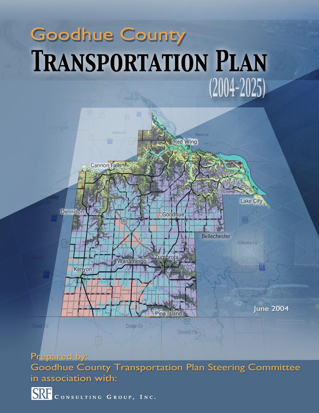
6 Apple Valley Rosemount Coates Hastings GOODHUE COUNTY TRANSPORTATION PLAN Lakeville Farmington Dakota County 8 Wisconsin FIGURE Hampton Miesville Red Wing Northfield Cannon Falls Lake City Trunk Highways CSAHs & County Roads Rice County 5 9 Dennison Goodhue Bellechester US Highways State Highways Faribault Nerstrand 44 4 Kenyon Wanamingo Zumbrota Pine Island 2 Zumbro Falls Mazeppa Wabasha County Millville 2 43 County State Aid Highways County Roads Plainview Miles Steele County Owatonna West Concord Dodge County Oronoco Olmsted County Elgin
7 GOAL 2: EFFICIENT MOVEMENT Strive to ensure that the transportation network promotes the efficient movement of people and goods by: Maintaining county roadway infrastructure. Providing roadways to serve new development areas and planning future urban routes with affected governments. Constructing improved county highway linkages to major state highway improvements. Reviewing the current functional classification system and proposing a new 2025 framework. Encouraging consistency between roadway jurisdiction, designation and functional classification. GOAL 3: MULTIMODAL Promote transportation mode choice as part of the county transportation system by: Preparing a countywide recreation trail system map that is coordinated with cities in the county. Utilizing the trail system plan to incorporate bicycle and pedestrian improvements into the appropriate county road upgrades. Establishing county connections to regional trails. Expanding major private employers existing commuter transit programs for employees living in Goodhue County. Encouraging Mn/DOT to construct park-and-ride lots, as part of the US 52 reconstruction program, to promote ridesharing. Assuring good connectivity of agricultural product movement to the Port of Red Wing for rail and barge intermodal transfers. Evaluating the potential benefit of and, if feasible, supporting extension of the proposed Red Rock Commuter Rail System from Hastings to Red Wing. GOAL 4: LAND USE/DEVELOPMENT Recognize the linkage between Goodhue County s desired growth and its transportation system to ensure that decisions regarding transportation are fully integrated with locally approved land use planning and development policies by: Identifying and preserving potential transportation corridors by utilizing such tools as official mapping, footprinting and new subdivision requirements. Managing access along state and county arterial roadways, in accordance with local and state spacing guidelines. Identifying growth areas within the county and evaluating the impacts of proposed land use on the transportation system. 3
8 Utilizing smart growth techniques to balance mobility and access, to promote economic development with system preservation and to support agricultural preservation with urbanization policies. Allowing the Goodhue County Public Works Department to provide input on land use, zoning and subdivision proposals during the development review process. GOAL 5: COORDINATION BETWEEN JURISDICTIONS Build cooperation and coordination among state and local jurisdictions by: Encouraging Mn/DOT to efficiently implement IRC improvement plans which are sufficiently coordinated with the county and its jurisdictions, so that local road connections can be planned. Seeking opportunities to coordinate roadway improvement plans with adjacent counties and the adjoining state. Reviewing and proposing logical jurisdictional modifications for discussion among affected governments. Promoting cooperative intergovernmental maintenance activities to increase the efficiency and effectiveness of services. GOAL 6: ECONOMIC DEVELOPMENT Recognize economic development issues when managing the transportation system s resources by: Preparing a system plan for ten-ton roadways. Developing a county trail system that supports economic development. Ensuring that the transportation system serves major economic development generators. GOAL : INVESTMENTS AND USE OF FUNDING Investigate opportunities to secure new funding for transportation needs and maximize the efficiency of current resources by: Preserving, maintaining and managing the existing highway system. Examining the current system designation and seeking changes in state assistance. Preparing an impact fee negotiation procedure with major private developers as part of the permitting process. Securing federal transportation funding for priority multimodal improvements. Encouraging joint-agency and/or public-private partnerships and cost sharing strategies. Updating the county s project priority list for incorporation into the Capital Improvement Plan. Exploring and developing new strategies to balance the realities of construction and maintenance needs with available financial resources. 4
9 .3 PUBLIC PARTICIPATION Public participation and agency coordination were an important element in developing the transportation needs and in building support for the overall Plan. The following approaches were used to accomplish these objectives: A Steering Committee was established to actively guide the development of the Plan. It included representatives of the Goodhue County Public Works Department, the Goodhue County Planning and Zoning Department and the Minnesota Department of Transportation (Mn/DOT). The Steering Committee met throughout the development of the Plan to review technical analyses and provide input on the Plan contents. Eight small-group focus meetings were held with representatives of cities, townships, elected officials, local business interests, agricultural/rural trucking, school districts and emergency responders. Issues and comments received at these meetings were documented and are included in the Transportation Plan. A public information meeting was held to gather input on transportation issues from the public. One meeting each was held with Mn/DOT, the County Park Board, the County Commission; individual sessions were held with local officials from 9 of the 2 townships and the four cities experiencing the largest impacts to discuss the preliminary alternatives report. Two public open-house meetings were held to obtain input from citizens, agencies and communities on the draft Plan s findings and recommendations. These meetings were held in conjunction with public meetings for the County Comprehensive Plan update. One meeting was held with the County Commission (Committee of the Whole) to discuss the final draft Plan and to assure continued coordination with the County Comprehensive Plan and the Transportation Plan. The County Commission held a final meeting to discuss adoption of the final Plan, at which time the Goodhue County Transportation Plan was approved. 5
10 2.0 EXISTING CONDITIONS Land use, population and traffic growth trends, safety and multimodal uses were investigated during the Transportation Plan s development process to help define the county s future growth and transportation needs. 2. Land Use Goodhue County s land use was reviewed to identify major trip generators, economic growth factors and the potential for additional growth and expansion. Goodhue County evolved into an agricultural center because of its abundance of rich farmland and its proximity to the Mississippi River agricultural transshipment points. The county has placed a high value on these rural, agricultural areas by enacting and enforcing strong zoning policies, maintaining agricultural preservation policies and encouraging growth within existing communities. The high value Goodhue County has put on agricultural land is evident in their zoning ordinance. The majority of the county is zoned as agricultural protection to maintain, conserve and enhance agricultural lands that are valuable for crop production, pasture and natural habitat for plant and animal life. The intent of this district is to encourage longterm agricultural uses and preserve prime agricultural farmland by restricting the location and density of non-farm dwellings and other non-farm uses. Additionally, a general agricultural district covers a large portion of Goodhue County. Like the agricultural protection district, the purpose of the agricultural district is to conserve and maintain agricultural investments and prime agricultural farmland. However, the agricultural district allows a slightly higher density of dwellings than the agricultural protection district does. The remainder of the land use in Goodhue County is contained within its cities, or in an urban fringe district surrounding the cities. The establishment of an urban fringe district allows urban expansion in close proximity to existing incorporated urban centers by conserving land for farming and other open space land uses until urban services are extended to the fringe area. Urban development is deferred in these areas until an orderly transition from farm to urban uses is achieved by annexation of areas adjacent to incorporated limits of existing urban centers. Land use density in the county is directly related to the county s transportation needs. Future growth areas were identified during meetings with cities and townships. Significant growth is anticipated in the following areas: City of Cannon Falls Future industrial growth is planned northwest of the existing city limits, while residential growth is anticipated east, west and south of existing city limits. In addition, a future rock quarry will be located north of the existing city limits. 6
11 City of Pine Island Future growth is most likely to the north and east of the existing city limits. A smaller growth area is expected along the western edge of the existing city limits. These areas will mostly be developed for residential use with limited commercial areas along US 52. City of Zumbrota Future growth to the north and east of existing city limits will be mainly residential. Highway commercial and industrial growth is anticipated along US 52, to the west of existing city limits. Future residential growth is likely to the west of the highway commercial district. City of Red Wing Future residential growth will most likely occur within the existing city limits between CSAH (Bench Street) and TH 9, south of US 6. Florence Township Residential growth is occurring, and is anticipated to continue, in this township near Lake City. Growth is most likely south of US POPULATION Traffic growth, and growth in other transportation modes and services, is generally the result of changes in regional population, land use changes and changes in travel patterns. Examining historic population trends for the area is one of the first steps taken to estimate future traffic growth for the region. Projected population changes for the study area were developed by using U.S. Census data, Minnesota State Demographer projections and population estimates from local agencies. Table identifies historic growth trends and future projections. The following observations have been noted about growth trends in the area: Goodhue County s overall population growth since 90 has been moderate. An annual growth rate of approximately.4 percent per year is roughly equivalent to a 2 percent increase in population over 30 years (90 to 2000). The State Demographer projects that the county will continue to grow at approximately.4 percent per year between 2000 and This is roughly the same rate of growth as 90 to This projection appears to be consistent with the rural nature of the county. The population of the county is aging. The growth in elderly population will increase demand for medical, recreational and community services that assist elderly populations. Future growth will continue to be focused in communities such as Red Wing, Zumbrota, Pine Island, Florence Township and Cannon Falls.
12 TABLE HISTORIC POPULATION GROWTH AND PROJECTIONS Historic Population Population Estimates* Annual Growth Rates Government Unit to to 2025 Bellechester Dennison Goodhue Kenyon,55,529,552,66,835 2, Lake City Red Wing 2,834 3,36 5,34 6,6,802 20, Wanamingo 54 84,00,2, Zumbrota,929 2,29 2,32 2,89 3,08 3, Cannon Falls 2,02 2,63 3,232 3,95 4,92 4, Pine Island,640,9 2,25 2,33 2,582 2, Minneola Township Belle Creek Township Vasa Township , Welch Township Cannon Falls Township,023,33,369,236,365, Leon Township ,04, Wanamingo Township Cherry Grove Township Kenyon Township Warsaw Township Florence Township 96,23,96,450,602, Wacouta Township Hay Creek Township , Belvidere Township Featherstone Township , Zumbrota Township Pine Island Township Roscoe Township , Holden Township Stanton Township ,080,93, Goodhue Township Goodhue County 34,804 38,49 40,690 44,2 4,60 5, * Population Estimates were made using a % annual growth rate for all communities. State Demographer estimates were used for Goodhue County. 8
13 2.3 ISSUES IDENTIFICATION One element of the planning process involved identifying and discussing transportation issues, and determining how to address them in the Plan. Issues were identified based on input from county staff, focus-group meetings, public meetings and issues raised by the consultant, as part of the analysis of existing and future conditions. These issues were documented and organized into the following categories: Administrative Safety Jurisdiction System Maintenance Trails Management and Operations Transit Reconstruction/Upgrade These issues were then mapped and are shown in Figure 2. A comprehensive list of all issues identified is presented in Appendix C. 9
14 52 Dakota County 6 8 Single Outlet from Casino GOODHUE COUNTY TRANSPORTATION PLAN Nerstrand MINNESOTA 56 MINNESOTA 60 Add Chevrons Hampton 9 Dennison Kenyon MINNESOTA MINNESOTA 56 Potential 4-lane Access to Metro New Tr ier Potential New Quarry 22 Future Interchange Southbound Grade Issue Potential Off-Road Trail under TH9 Cannon Falls Future Interchange 8 Maintenance Issues 54 Potential Turnback Miesville Wanamingo 9 MINNESOTA MINNESOTA 60 MINNESOTA 9 Need for On-Road Trail 8 Concern over Loss of Access 2 50 Future Interchange Potential Off-Road Trail 4 Potential 0-ton Route 43 3 Snow/Ice Problem Future Interchange 2 Sharp Curve 6 66 Potential On-Road Trail Skewed Intersection Skewed Intersection MINNESOTA 58 Heavy Traffic to 4 Livestock Auction Red Wing 0 Potential New Signal Zumbrota 4 Goodhue 55 Pine Island MINNESOTA 60 Convert to Overpass only 6 42 MINNESOTA 58 Mazeppa Potential 4-Lane Heavy Truck Traffic Poor Turning Radius Congestion Rutting is a Problem on Roadway Bellechester Zumbro Falls Wabasha County 2 35 Offset Intersection 5 28 Add Guard Rails Access Access Access Lake City TH 52 Issues Heavy Commercial Vehicle Usage High Crash Rate High Speeds Skewed Intersections Intersections Not Well Marked Grade Difference in Northbound/Southbound Lanes TH 6 Issues Heavy Weekend and Seasonal Traffic Many Access Points Congestion/Safety Problems at TH 6/TH 63/TH 58 Confluence Millville Transit Issues Hammond Increase Transit Options for County Residents Safety System FIGURE 2 ISSUES Management & Operations Reconstruction/Upgrade Maintenance Trails Transit Jurisdiction LEGEND Growth Area Miles Transportation Plan Goodhue County
15 2.4 EXISTING TRAFFIC Annual average daily traffic volumes (AADTs) on state highways and county routes were collected using historical data provided by Goodhue County and Mn/DOT and traffic counts from individual studies done in the county. Historical volumes for individual segments and their associated growth rates are shown in Appendix A. In general, traffic volumes increase as they approach larger cities in the county, such as Red Wing, Cannon Falls and Zumbrota. For example, volumes on County State Aid Highway (CSAH) just south of the city limits of Red Wing total,650 vehicles per day and increase to 5,200 vehicles per day as the roadway enters the City of Red Wing. 2.5 CONGESTION ANALYSIS Existing average annual daily traffic volumes were reviewed to identify congested areas. By identifying segments with congestion or operational problems, improvement options can be investigated and planned (i.e., roadway improvements, intersection control changes, alternative routes, setback requirements, etc.). In addition, these corridors can be targeted for access controls and other management tools to improve their traffic operations until major improvements are completed. For the purpose of this analysis, threshold volumes were developed for nine different types of roadways, using the Highway Capacity Manual (HCM) and typical traffic characteristics (e.g., percent peak hour, directional split, percent no passing, number of access points, signalized intersections per mile) for the different facility types. Threshold volumes are the volumes at which operational problems may occur (traffic backups, side street delays, slower speeds, etc.). Appendix A- Table lists threshold volumes for four types of urban facilities and five types of rural facilities. These threshold volumes were compared to existing average annual daily traffic volumes for each roadway segment in the county and each segment was categorized as one of the following: Uncongested The existing volume is less than 85 percent of the threshold volume, indicating a low probability of operational problems due to volume of traffic on the facility. Near Congestion The existing volume is between 85 percent and 0 percent of threshold volumes, suggesting a moderate probability of operational problems due to traffic volume on the facility. Congested The existing volume exceeds 0 percent of the threshold volume, indicating a high probability of operational problems due to volume of traffic on the facility. Existing volume to capacity ratios on state and county routes in Goodhue County are presented in Figure 3. Information received during the focus-group meetings, and from Steering Committee members, suggests that congestion is not perceived as a major problem in the region. Analysis of the existing roadway system, and its corresponding daily traffic levels, indicated that US 63, from 0.6 miles north of US 6 to the county line, is the only existing roadway segment congested at this time. This heavily used segment funnels traffic from downtown Red Wing to the bridge over the Mississippi River into Wisconsin.
16 Dakota County 8 GOODHUE COUNTY TRANSPORTATION PLAN FIGURE 3 Hampton New Trier Miesville Red Wing Northfield Cannon Falls Lake City Volume/Capacity Ratio "Near Congested".0 or greater "Congested" Nerstrand 9 Dennison Kenyon Wanamingo Goodhue Zumbrota 9 2 Bellechester Zumbro Falls Wabasha County 2 43 US Highways State Highways County State Aid Highways County Roads Pine Island Mazeppa Hammond Millville Miles Oronoco
17 Five segments were identified as nearing congestion levels: TH 58 from US 52 to 2th Street in Zumbrota CSAH 24 from CSAH 25 to 0. miles north CSAH 24 from 0. miles north to West Park Street CSAH 24 from West Park Street to TH 9 CSAH 62 from south limits of Pine Island to CSAH It should be noted that the methodology described above is a planning-level analysis that uses average daily traffic volumes and is not appropriate for abnormal traffic conditions. For example, traffic conditions that do not fit the average daily traffic criteria (e.g., holiday travel periods, fall agricultural volumes or special events) are likely to produce different levels of congestion. A good example of this is on US 6, between Red Wing and Lake City, during the fall. The rolling bluffs along the river valley draw many tourists into the area to view the changing leaf colors, and during the autumn, weekend traffic may exceed the roadway s capacity. 2.6 SAFETY AND CRASH ANALYSIS Public safety is a high priority for all agencies responsible for improving and maintaining public transportation facilities. To evaluate potential safety problems in the county, a crash analysis was performed using Department of Public Safety (DPS) crash records from Records from the DPS were collected for state trunk highways, county state aid highways and county roads. The crash database was imported into the county Geographic Information System (GIS) format so that the data could be viewed on a map of the study area. Analysis of crash data focused on identifying problems at intersections and on roadway segments. The analysis is described in the following sections Intersection Crash Analysis Using GIS technology and crash data from 998 to 2002 identified intersections with potential problems. Because many intersection-related crashes do not occur directly at the intersection, a buffer was created around the intersections. All crashes within a,500-foot buffer in rural areas, and a 500-foot buffer in municipal areas were considered intersection-related and were included in the tally for each intersection. Each intersection was categorized into one of four groups: intersections with over 25 crashes (more than five crashes per year); intersections with crashes (four to five crashes per year); intersections with 5-9 crashes (three crashes per year); and intersections with less than 5 crashes (three crashes or less per year). The results of the analysis show that intersections had more than 25 crashes during the five-year period. These intersections were defined as high-crash locations in the study. 3
18 High-crash intersections generally reflect areas with higher traffic volumes and/or a high number of access points. Of the high crash locations, nine of them are located on US 52 and five are located on US 6. Each intersection with over 25 crashes during the five-year period between 998 and 2002 was further evaluated in terms of crash type and severity. The results are summarized below, highlighted in Table 2 and shown in Figure 4: US 52 Corridor: Nine of the high-crash locations are located on US 52. This portion of US 52 is a four-lane, rural expressway, mph, with left and right turn-lanes at signalized intersections. Traffic volumes on this segment range from 6,536 to 24,440 vehicles per day. The highest number of crashes (62) occurred at the intersection of US 52 and TH 58 near the City of Zumbrota. To the north, at US 52 and CSAH 9, another 44 crashes were reported; and to the south at US 52 and TH 60, 3 crashes were identified. The high frequency of crashes at these three locations warrants further discussion. The location with the highest crash rates, along US 52, is located at the intersection with TH 58. The majority of crashes at US 52 and TH 58 were right-angle and rearend crashes (29 and 2 percent respectively). Although the majority of crashes at this location resulted in property damage, injuries were reported 3 percent of the time. The second highest crash intersection along US 52 is located at US 52 and CSAH 9. This intersection is characterized by a high percentage (52 percent) of right-angle crashes. As noted in the US 52 Road Safety Audit, the vertical alignment difference between the northbound and southbound lanes is extreme and could be one of the key contributing factors to crashes at this intersection. The prevalence of rightangle crashes likely means that vehicles on CSAH 9 are pulling out onto US 52 into oncoming traffic. Grade differences hinder a vehicle s ability to see oncoming traffic or judge acceptable gaps in traffic. It is important to note that the majority of crashes at the intersection resulted in injury (64 percent), and two crashes resulted in severe injury. This location has been selected as a state demonstration project to evaluate ITS applications for rural uncontrolled intersections that exhibit serious safety hazards. The Rural Intersection Decision Support Study will test the use of electronic sensors and dynamic message boards to alert motorists on CSAH 9 that traffic along US 52 is approaching. The study objective is to warn CSAH 9 traffic, so it does not pull out into oncoming US 52 traffic. The third highest crash intersection along the US 52 and TH 60 corridor has a high percentage of run-off the road crashes (54 percent). Public input suggests that a slight curve along US 52 at the location of the TH 60 interchange may be the cause of some of these crashes. A majority of the crashes resulted in property damage; however, injuries occurred 30 percent of the time and one fatal crash was reported. Approximately 32 percent of all crashes reported on the US 52 corridor in Goodhue County resulted in injuries. Four fatalities and 0 severe injury crashes were reported. The remaining high-crash intersections for the US 52 corridor are presented in Table 2. 4
19 Table 2 Intersection Crashes INTERSECTION INFORMATION CRASH TYPE (PERCENT) CRASH SUMMARY Left-Turn Into Percent Intersection Location Intersection Control Rear End Sideswipe Right- Angle Run off Road Oncoming Traffic Other Total Crashes Injury Crashes TH 9 and CSAH 24 Signal US 52 and TH 58 Interchange US 52 and TH 60 South Interchange US 52 and TH 60 North Interchange US 52 and TH 5 Stop sign US 52 and CSAH 9 Stop sign US 52 and Skunk Hollow Trail Stop sign US 52 and 320th Street/CSAH 24 Signal US 52 and CSAH 24 Signal US 52 and TH 9 Interchange TH 58 and 4th Street Stop sign TH 58 and CSAH 68 Stop sign US 6 and Carol Lane Stop sign US 6 and CSAH Signal US 6 and Cedar Street Stop sign TH 58 and 3rd Street Stop sign US 6 and TH 58 Signal US 6 and US 63 Signal
20 Dakota County 8 GOODHUE COUNTY TRANSPORTATION PLAN Hampton 9 FIGURE 4 New Trier Miesville 3 46 Red Wing Cannon Falls Lake City Crashes within 500 ft of low speed intersection Crashes within 500 ft of high speed intersection Number of Crashes < 5 9 Dennison Goodhue > Bellechester US Highways Nerstrand Kenyon Wanamingo Zumbrota 0 42 Zumbro Falls Wabasha County 2 43 State Highways County State Aid Highways County Roads Pine Island Mazeppa Hammond Millville Miles
21 US 52 Road Safety Audit In response to concerns about safety issues resulting from several fatal and severe crashes along the US 52 corridor, the Department of Public Safety, in conjunction with Mn/DOT, assembled a Road Safety Audit (RSA) to study the expressway section of US 52 between Rochester and Inver Grove Heights, including Goodhue County. Mn/DOT recognized that conversion of US 52 to a freeway would likely occur in stages and not be complete for 20 years or more. Therefore, the RSA team focused on identifying short-term, easily implemented solutions to improve roadway safety that are consistent with the long-range goals for the corridor. The solutions and outcomes of the RSA are located in the Minnesota Department of Transportation Department of Public Safety Road Safety Audit. Goodhue County should refer to these solutions when planning any improvements or upgrades of roadways that intersect with US 52. US 6 Corridor: Five of the high-crash locations are located along the US 6 corridor in the City of Red Wing. This portion of US 6 is a four-lane, urban expressway, mph with left and right turn-lanes at most signalized intersections. Traffic volumes on this portion of US 6 range from 8,2 to 20,904 vehicles per day. The majority of crashes on this corridor were rear-end or right-angle crashes. A high percentage of rear-end crashes occurred at CSAH, Cedar Street, TH 58 and US 63 (46, 6, 33 and 9 percent respectively). Right-angle crashes accounted for 53 percent of the crashes at Carol Lane. Crashes causing injury occurred approximately 3 percent of the time, and four of those crashes caused severe injury. TH 58 corridor: Three of the high-crash locations are located along the TH 58 corridor. Two of these locations are in the City of Zumbrota, and the other intersection is in the City of Red Wing. The portion of TH 58 within Zumbrota is an urban two-lane arterial street with traffic volumes ranging from 6,968 to 8,632 vehicles per day. The majority of crashes at the Zumbrota locations are rear-end and right-angle crashes (46 and 32 percent respectively). Crashes that caused injuries occurred 24 percent of the time, and one severe injury crash was reported. The majority (32 percent) of crashes at the intersection located in Red Wing are right-angle crashes. While most of the crashes resulted in property damage, injuries were reported percent of the time. TH 9 and CSAH 24: This high-crash intersection is located within the City of Cannon Falls. Trunk Highway 9 is an urban two-lane arterial, and traffic volumes range from 4,368 to 6,240. County State Aid Highway 24 is an urban two-lane street with traffic volumes of approximately 8,000 vehicles per day. The majority of crashes at this location are rear-end and right-angle crashes (22 percent each). Another 9 percent of crashes are characterized by left-turns into on-coming traffic. Injury crashes resulted 8 percent of the time, and one severe injury crash was reported.
22 A high percentage of rear-end crashes usually indicates that drivers are forced to make sudden stops. This can be caused by stop-and-go traffic in congested area, areas with many access points, areas along expressways or freeways with traffic signals and areas where drivers have a difficult time anticipating the maneuvers of other vehicles Segment Crash Analysis Although most crashes occur at high-conflict locations such as intersections, it is also important to look at crashes along roadway segments to identify abnormally high-crash segments. While numerous factors (i.e., geometric or cross-section deficiencies, sight distance problems, excessive access, etc.) contribute to crashes, segment analysis identifies potential problems so that further investigations and analysis can be done. In addition, segments can be targeted for safety improvements and investments. In order to identify segments with high crash rates, a comparison was made between average crash rates, by facility type, and the rates for each individual segment in the county (Table 3). Table 3 shows that Goodhue County s crash rates are below or similar to crash rates, per design type, for Mn/DOT District 6. The only exceptions are the urban four-lane roadway, at 30 mph (U-3) and the rural two-lane highways with poor geometrics or site distance issues (R-2) categories. Since only one segment of roadway within Goodhue County is categorized as a U-3, an inaccurate overall crash rate is portrayed for the category. For the R-2 facility type, Goodhue County exhibits almost double the District 6 rate. Nonetheless, for the remaining categories, County rates are similar to District 6 crash rates and slight variations between the two should not be of great concern. TABLE 3 SEGMENT CRASH RATES Type of Facility Goodhue County Non-Junction Crash Rates Comparison Non- Junction Crash Rates (2) U- = Urban 2-lane Local U-2 = Urban 2-lane Arterial U-3 = Urban 4-lane (30 Mph) 0.6. U-4 = Urban 4-lane Expressway R-A = Rural 2-lane Trunk Hwy.9.0 R = Rural 2-lane Local.0. R2 = Rural 2-lane (3) R3 = Rural 4-lane Expressway () (2) (3) Goodhue County rates are based on analysis of Department of Public Safety Data for the Goodhue County area. Averages were developed for different facility types within the county using data. Comparison rates are based on 999 to 200 Mn/DOT District 6 average crash rates. Two-lane rural highways with limited sight distance and poor geometrics. NA = information not available. 8
23 While the ratio of segment crash rates to average crash rates identifies areas with potential safety problems, it does not account for variations caused by short segment lengths and low traffic volumes. The Federal Highway Administration (FHWA) Hazard Elimination Safety (HES) program criteria require that four or more crashes per mile be correctable. For the purposes of this plan, high-crash segments have been identified as segments that have a crash ratio greater than the average crash rate per design type for Goodhue County and have a crash frequency of more than four crashes per mile, per year. Using these criteria, high crash segments have been identified and are shown on Figure 5. When reviewing the high-crash segment map, it is important to remember the following: Short highway segments can result in high crash rates. Segments with low traffic volumes are subject to more variability (a small number of crashes can result in a high crash rate). Different types of highway facilities have different crash rates. For example, the average crash rate for a rural, four-lane highway is.0 crash per million vehicles-miles, while a rural, two-lane, county facility has an average crash rate of.0. 9
24 Dakota County 8 GOODHUE COUNTY TRANSPORTATION PLAN Hampton 9 FIGURE 5 New Trier Miesville 3 46 Red Wing Cannon Falls Lake City High Accident Rate High Accident Rate, Low Frequency Other Study Segments 9 Dennison Goodhue 9 2 US Highways State Highways Bellechester 2 County State Aid Highways Nerstrand Kenyon Wanamingo Zumbrota Zumbro Falls Wabasha County 43 County Roads Pine Island Mazeppa Hammond Millville Miles
25 2.6.3 High Crash Locations on County System As noted in Table 2 and Figure 5, the most serious safety issues, in terms of frequency and rates, are located along US and Trunk Highways in Goodhue County. For the most part, the solutions to these high crash locations will fall under Mn/DOT s jurisdiction. However, some locations on CSAH roads also exhibit safety needs. Table 4 identifies crash locations on the County system that would benefit from investments in safety measures. The 8 segments noted on Table 4 reflect sections of CSAH routes that exhibit at least ten crashes over the five-year analysis period, and that have crash rates that exceed the County s average rate per design type. Appendix A is the source for this data. The table shows that the following seven roadways could benefit most from safety improvements: CSAH 6 CSAH CSAH CSAH 8 CSAH 9 CSAH 24 CSAH 62 TABLE 4 SEGMENT CRASH RATES ON GOODHUE COUNTY ROAD SYSTEM GIS_ID Roadway TERMINI Number of Crashes Crash Rate Goodhue County Average Crash Rate by Design Type 200 CSAH 9.2 miles NE of CSAH 8 to south limits of Red Wing CSAH 2 CSAH 5 to TH CSAH 6 CSAH to 2.6 miles N of CSAH CSAH TH 9 to WELCH CSAH 2.6 MI S to TH CSAH 9 US 52 to.0 miles W of CSAH CSAH Along the east county line from 0.3 miles S of TH 60 to.30 MI S CSAH 4 CSAH 9 to US CSAH 6 TH 58 to west limits of Bellechester CSAH 8 TH 6 to CSAH 9 on west limits of Red Wing-Eggleston CSAH 8 CSAH 9 to Sturgeon Lake Road CSAH 9 TH 6 to CSAH 8 at west limits of Red Wing CSAH 24 CSAH 9 to 4. miles north CSAH 24 North Cannon River to US CSAH 24 New US 52 to old US 52 (Cannonball Frontage) CSAH 24 New US 52 to CSAH CSAH 25 South limits Cannon Falls to CSAH CSAH 62 South Limits Pine Island to CSAH
26 2. MULTIMODAL USES Goodhue County has a variety of modal transportation users and services including trucking, railroads, transit, bicyclists and pedestrians. The existing multimodal uses can be summarized as follows: 2.. Trucking In Goodhue County, the movement of agricultural goods, livestock, and commercial and industrial products are the major sources of truck traffic. Over-the-road trucks transport crops and milk for processing. Other agricultural truck traffic hauls grain and seed from local elevators to Red Wing where it is shipped elsewhere by barge. Other materials and products transported by truck include cement, custom molding and cold storage products. The Livestock Auction Market in Zumbrota draws heavy truck traffic on auction days. The primary truck routes in Goodhue County are US 52, US 6, TH 58, CSAH and CSAH 9. Trunk Highway 52 is an important truck route because it connects Goodhue County to both the Twin Cities metropolitan area and Rochester and because it connects the larger cities of Goodhue County, such as Pine Island, Zumbrota and Cannon Falls. Trunk Highway 58 is an important truck route that provides a north-south connection to Red Wing. Trucks traveling on US 52 use TH 58 to travel to grain and barge terminals in Red Wing. County State Aid Highway is a parallel route to TH 58 that links most of the county to Red Wing. CSAH runs the entire length of the county and provides access from rural elevators and farming communities to processors and barge and river shipping terminals near Red Wing. County State Aid Highway 9 is a key truck route because it provides one of the few eastwest connections from Rice County to Wabasha County. It also provides an alternative route from TH 58 to US Rail Passenger and freight rail service is provided by Amtrak and the Canadian Pacific Railroad in Goodhue County. The operations of these railroads are described in more detail below. Amtrak Amtrak is the nation s largest provider of contract-commuter services for state and regional authorities. The passenger rail line serves more than 500 stations in 46 states. A small, unstaffed Amtrak station is located on Levee Street in Red Wing. Amtrak operates the Empire Builder (one daily train in each direction) that provides passenger service between Chicago and the Seattle/Portland area and utilizes Canadian Pacific trackage through Red Wing. 22
27 Canadian Pacific Railroad The main line of the Canadian Pacific (CP) Railroad runs along the northern edge of Goodhue County between the Mississippi River and US 6. The trackage averages 28 trains per day, with speeds up to 9 mile per hour. Trains on the corridor include high-speed passenger trains (Amtrak), intermodal trains, lowerspeed coal and commodity trains, general freight trains, and local freight trains Transit Goodhue County partners with Wabasha County, through Three Rivers Community Action, Inc., to provide public transit within the county. Three Rivers Community Action, Inc. is a private, non-profit organization that works to address basic human needs of people in the service area. Public transportation is available via dial-a-ride service for individuals in Cannon Falls, Lake City and Frontenanc. The City of Red Wing s public transportation system is called The Ride. The Ride provides two regular bus routes and a flexible dial-a-ride service. The -passenger busses supply economical and convenient transportation to local workers, residents and visitors. A potential source of public transit is an extension to the Red Rock Commuter Rail System. When complete, the Red Rock rail system will provide approximately 30 miles of commuter service from downtown Minneapolis and St. Paul to Hastings on existing (Canadian Pacific) freight railroad tracks. Discussions have taken place about the possible extension of this commuter rail system from Hastings to Red Wing to provide transit opportunities for county residents commuting to and from the Twin Cities metro area and for tourists traveling to Goodhue County. Several park-and-ride lots exist within the county (Cannon Falls, Zumbrota and Pine Island). Currently, these park-and-rides primarily serve employees traveling to and from the Mayo Clinic in Rochester Bicycle/Pedestrian Goodhue County has three existing regional trails within its boundaries, including the Cannon Valley Trail, the Goodhue Pioneer Trail and the Douglas State Trail (Figure 6). The Cannon Valley Trail is a 9. mile-long multi-use trail running through the diverse scenery of the former Chicago Great Western Railroad line and connecting the cities of Cannon Falls, Welch and Red Wing. The Cannon Valley Trail parallels the Cannon River and is open year-round for bicycling, in-line skating, skateboarding, cross-country skiing, hiking and walking. Each year, approximately 00,000 people utilize the Cannon Valley Trail. 23
28 52 Dakota County 6 8 GOODHUE COUNTY TRANSPORTATION PLAN Hampton 9 FIGURE 6 MINNESOTA 56 MINNESOTA New Trier Cannon Falls 25 Miesville 8 MINNESOTA Cannon Valley Trail Red Wing MINNESOTA 58 Levee Park to Barn Bluff Trail Lake City EXISTING TRAILS 9 Dennison Goodhue 2 Nerstrand MINNESOTA 246 Kenyon MINNESOTA MINNESOTA Wanamingo 54 MINNESOTA MINNESOTA Zumbrota MINNESOTA Pine Island 0 MINNESOTA 60 Douglas State Trail 6 42 Bellechester Zumbro Falls Mazeppa Wabasha County Hammond Millville LEGEND Existing Trails Miles Transportation Plan Goodhue County
29 The Douglas State Trail is another regional trail that begins in Goodhue County. The trail is a multi-use state trail developed on the abandoned Chicago Northwestern Railroad grade. It provides two separate treadways, each of which is designed for different recreational activities. One treadway is surfaced with bituminous pavement for bicyclists, hikers and cross-country skiers; the other is a natural surface for horseback riders and snowmobilers. The completed trail begins at Pine Island City Park, travels through the town of Douglas (for which the Trail is named), and terminates in northwest Rochester. The Goodhue Pioneer trail is a legislatively authorized 3-mile state trail which, when completed, will connect Red Wing, Goodhue, Zumbrota, Mazeppa, Bellechester and Pine Island. The four-mile section from Red Wing to Hay Creek has been constructed. It consists of one, crushed limestone treadway for use by bicycles, pedestrians, horseback riders and snowmobilers. The trail may be paved in the future. A connected system of regional trails in Goodhue County is in the planning stages, or has been established. In developing a county-wide trail system, that connects to other regional trails, filling gaps between existing trail systems is critical. As bicycling and trail use becomes more widespread, avid bicyclists are looking for longer (20 to 40 mile) trails. Utilizing the opportunity to create a county-wide trail system that connects to regional trails, will draw tourists and trail users from other regions to the county. Such trail development will increase economic activity in communities located along the trails. As indicated above, the focus of Goodhue County s trail plan should be on providing trail connections in areas that link to regional trails and/or local and regional park facilities. When planning transportation improvements, special consideration should be given to addressing bicycle and pedestrian needs. Numerous traffic operation factors (e.g., traffic volumes, speeds, sight distance, accesses, available space) and funding availability should be considered when determining the types of trail facilities (off-road versus on-road). 25
30 3.0 ANALYSIS OF FUTURE TRANSPORTATION NEEDS 3. TRAFFIC PROJECTIONS Traffic projections for the year 2025 were prepared to identify future capacity or system deficiencies, and to provide traffic information for decision-making by state, county and city staff officials, and for businesses and residents. A variety of data sources and methods were used to derive 2025 projections for highways and county road segments within the county. Sources included regional population growth trends, historic traffic growth trends, and consideration of anticipated highway and county road changes. In addition, traffic volume projections were reviewed from the US 6 Corridor Management Plan and the US 52 Interregional Corridor Study. The first step was to identify population and development trends through a review of census data and discussions with local planning officials. Then, historical average daily traffic volumes and other traffic count sources were gathered from the county. Traffic volume inconsistencies were noted and investigated. Four traffic projection methods were applied to historical volumes: compounded growth rate, linear regression, percent per year and 2.5 percent per year. In general, the four methods for computing traffic growth provided a range of projected volumes; compounded rates were more aggressive, linear regression (slope) was more conservative and the percent and 2.5 percent growth rates per year provided a statistical comparison for the other two methods. Growth projections were adjusted to reflect anticipated development trends and the potential for traffic diversion to new links. Potential development areas were identified through discussions with local officials, and segments were categorized into high-, medium- and low-growth areas traffic projections for individual roadway segments in the county, by jurisdiction, are shown in Appendix A. For the majority of the CSAH and CR segments, the 2025 forecasts are based on the slope projection method, as determined by the Steering Committee. Footnotes on the tables in Appendix A explain deviations from this general rule. Details of the methodology used to develop state highway traffic forecasts are found in Appendix B. Projected traffic volumes reflect a county-wide level of analysis. Traffic volumes on roadways within specific development areas may change, depending on the development densities. For this reason, specific study area forecasts should be completed when developing individual improvement projects. In addition, the county should periodically review land use and development/growth trends and adjust the projections accordingly. 26
31 3.2 FUTURE CONGESTION Forecast data, was used to identify future transportation system operational deficiencies. This information is ordinarily used to plan capacity improvements or to effectively manage the corridor through access controls, right-of-way preservation, setback requirements, and land use and development controls. The analysis followed the same procedure described in the existing conditions congestion analysis, except that 2025 daily traffic projections were compared with daily volume thresholds to establish future volume to capacity (V/C) ratios. Over the next twenty years, thirteen segments are expected to become congested (e.g., V/C ratio over.). These segments are shown in Figure and are listed below: ROUTE FROM TO V/C RATIO US N of US 6 County line.5 TH 58 US 52 2 Street in Zumbrota.3 TH 58 2th Street in Zumbrota 3rd Street in Zumbrota.2 TH 58 Golflinks Drive th Street in Red Wing.2 TH 58 th Street in Red Wing 3th Street in Red Wing.2 CSAH South limits of Red Wing 0. miles north 2.0 CSAH 0. miles north 0.5 north of south limits Red Wing.6 CSAH 24 New US 52 Old US 52.5 CSAH 24 Old US 52 CSAH 25.5 CSAH 24 CSAH miles north 2.0 CSAH miles north of CSAH 25 Park Street 2.0 CSAH 24 Park Street TH CSAH 62 South limits Pine Island CSAH.59 Additionally, Figure presents roadway segments that are expected to be near congestion by 2025 (e.g., V/C) Capacity analysis is a planning-level tool used to identify potential problems based on the facility type and future volume projections. Although a segment may be shown as congested or near congestion, it is only one indication of a potential problem. Some segments can handle volumes higher than the threshold if they have little to no access points and relatively little cross traffic. As long as access remains limited, roadways noted in Figure will likely operate better than the analysis indicates. While planning-level capacity analysis identifies potential problem areas, additional traffic information should be reviewed to confirm operational problems when specific improvements or operational changes are considered. This includes evaluating peak hour volumes, directional splits, and reviewing actual development and growth patterns for the area. 2
32 Dakota County 8 GOODHUE COUNTY TRANSPORTATION PLAN Hampton 9 FIGURE New Trier Miesville 3 46 Red Wing Cannon Falls Lake City V/C Ratio "Near Congested" or greater "Congested" 9 Dennison Goodhue 9 2 US Highways State Highways Bellechester 2 County State Aid Highways Nerstrand Kenyon Wanamingo Zumbrota Zumbro Falls Wabasha County 43 County Roads Pine Island Mazeppa Hammond Millville Miles
33 4.0 ROADWAY SYSTEM PLAN 4. FUNCTIONAL CLASSIFICATION An important element of this Transportation Plan involved using data generated by the planning process to update the current functional classification plan for roadways in Goodhue County. The designated function of a road is defined by its role in serving the flow of trips through the roadway system. A formal process for determining urban and rural functional classification is outlined in FHWA s manual, Highway Functional Classification Concepts, Criteria and Practices, March 989. The concepts and guidelines in this manual were used to develop the updated functional classification plan for Goodhue County. The functional classification process considered the following roadway and system characteristics: The trip length, type and size of traffic generators served, and continuity along the route. The route s ability to serve regional population centers, regional activity centers and major traffic generators. The route s spacing to serve different functions (need to provide access and mobility functions for entire area). The route s ability to provide continuity between or through individual travelsheds. The route s role in providing mobility or land access (number of accesses, access spacing, speed, parking and traffic control). The route s relationship to adjacent land uses (location of growth areas, industrial areas, and neighborhoods). When considering the above factors it is important to understand the underlying characteristics of each functional classification category. The following rural functional classification rules/characteristics were applied to the Goodhue County roadway system to develop potential future functional classification changes: Principal Arterials (e.g., US 52, US 6) Connect major activity centers Have significant continuity on a state-level Serve long, through-type trips Typically high-speed with limited access Serve very large travelsheds (regions) Minor Arterials (e.g., TH 58, TH 9) Connect key activity centers Have significant continuity on county/multi-county area Serve longer- to medium-length trips Typically high-speed with limits on number of access Serve large areas 29
34 Collectors (e.g., CSAH 9) Connect local activity centers and/or connect to higher-order routes Have continuity on local level Serve short to medium length trips Can serve a variety of uses, and can therefore have a variety of speeds Have equal emphasis on access and mobility Route spacing allows service to smaller or localized areas Local Routes (e.g., CR 4 or Township Roads) Connect local neighborhoods, farms, small developments and higher-order streets/routes Have a low degree of continuity Have closely spaced access Provide direct access (no access control) to property Serve limited travelsheds (very few through trips) The U.S. Census Bureau considers municipalities with populations over 5,000 urban areas. Such cities may define an urban functional class roadway system and may obtain federal funds to maintain and construct their roadway system. The 2000 U.S. Census indicates that the City of Red Wing is the only municipality within Goodhue County with a population of more than 5,000. The boundary of the established urban area is shown in Figure. Established urban limits do not directly influence a route s function; however, urban limits trigger changes in functional classification terminology. Major collectors and minor arterials are commonly upgraded by one classification when they enter an urban area. For example, minor arterial routes that carry regional traffic into and out of an urban area become principal arterial routes when they enter urban areas, and major collector routes that feed traffic from the rural area into an urban area become minor arterial routes. Rural and urban areas also differ in their classification of collector streets. For example, in rural areas, collector routes are split into major collectors and minor collectors. Major collector routes are longer and connect smaller rural communities, carry intra-county traffic and connect to arterial routes. Minor collector routes are less important collector routes that connect less developed rural areas with major collector and arterial routes. Within the urban area there is a single classification called urban collectors. These routes feed traffic to the arterial routes and provide access to major traffic generators within the urban area. The existing functional classification system was last updated in 993 and is shown in Figure 8. A future functional classification system was developed using the above guidelines and is shown in Figure 9. Changes to the county functional classification system, based on the rules and characteristics of functional classification, are described below: County Road 59, from the Rice County line to CSAH 2, is recommended to be changed from a minor collector to a local road. This route serves a limited travelshed, has low growth, low volumes and has a gravel surface. CSAH, from CSAH 3 to TH 56, is recommended to be changed from a local road to a minor collector. This route serves short- to medium-length trips, has continuity on a local level and provides connections to higher-order routes. 30
35 Dakota County 8 GOODHUE COUNTY TRANSPORTATION PLAN Hampton 9 FIGURE 8 New Trier Miesville 3 46 Red Wing Cannon Falls Lake City Principal Arterial Minor Arterial Major Collector Minor Collector 9 Dennison Goodhue 9 2 US Highways State Highways Bellechester 2 County State Aid Highways Nerstrand Kenyon Wanamingo Zumbrota 0 42 Zumbro Falls Wabasha County 43 County Roads Pine Island Mazeppa Hammond Millville Miles
36 Dakota County 8 GOODHUE COUNTY TRANSPORTATION PLAN Hampton 9 FIGURE 9 New Trier Miesville 3 46 Red Wing Cannon Falls Lake City Principal Arterial Minor Arterial Major Collector Urban Collector Minor Collector Future Roads 9 Dennison Goodhue 9 2 US Highways State Highways Bellechester 2 County State Aid Highways Nerstrand Kenyon Wanamingo Zumbrota 0 42 Zumbro Falls Wabasha County 43 County Roads Pine Island Mazeppa Hammond Millville Miles
37 80th Avenue, from CSAH to CSAH 0, is recommended to be changed from a local road to a minor collector due to the proposed jurisdictional transfer of this roadway to Goodhue County. Since this road will function as a parallel, backage route to US 52 from Pine Island to Zumbrota, it should be classified as a collector. 95th Avenue, from US 52 to CSAH 0, is recommended to be changed from a local road to minor collector due to the proposed jurisdictional transfer of this roadway to Goodhue County. This route will also function as a north-south parallel route to US 52 from Pine Island to Zumbrota and therefore, should be classified as a collector. CSAH 0, from 60th Avenue to TH 58, is recommended to be changed from a major collector to a minor collector due to the future realignment of CSAH 0 from 60th Avenue east to the US 52/TH 60 interchange. This realignment will cause this section of CSAH 0 to have lower levels of traffic and serve short- to medium-length trips. Future CSAH 0, from 60th Avenue to US 52/TH 60, interchange is recommended to be functionally classified as a major collector. This route will provide direct access to US 52, will have continuity on a local level and will serve short- to medium-length trips. TH 246, from the west Goodhue County line to TH 56, is recommended to be changed from a major collector to a minor collector. This change is due to its close spacing with another state highway (TH 56) and low volumes. County Road 49, from CSAH 4 to the Holden Township line, is recommended to be changed from a minor collector to a local road. This change complies with the proposed jurisdictional transfer of this roadway from Goodhue County to Warsau and Holden Townships. Further, this recommendation is made due to lack of continuity, gravel surface and low volumes on County Road 49. Finally, this section of County Road 49 would function better as a local road because it comes to a dead-end and serves a very limited travelshed. County Road 50, from TH 5 to CSAH, is recommended to be changed from a minor collector to a local road due to low volumes and close spacing with other collector routes. As US 52 is transitioned to a freeway, access to US 52 will be closed, and this will limit the function of this roadway as a collector. Future CSAH, from CSAH 25 to the future interchange at US 52/CSAH 9, is recommended to be functionally classified as a major collector. Realignment of this route will facilitate the efficient movement of people and goods, connect local activity centers and provide connections to higher-order routes. CSAH, from CSAH 25 to US 52, is recommended to be changed from a major collector to a local road due to the realignment of CSAH for the future interchange at CSAH 9/US 52. This section of CSAH is recommended for turnback to the township because closure of access to US 52 will limit its function a collector. 33
38 CSAH, from US 52 to CSAH 9, is recommended to be changed from a major collector to a minor collector due to realignment of CSAH for the future interchange at CSAH 9/US 52. Access to US 52 will be closed on this section of CSAH ; however, it would stay on the county system as a minor collector due to the location of an existing business along this segment. County Road 45, from CSAH 9 to CSAH 2, is recommended to be changed from a minor collector to a local road due to low volumes, location in a low growth area and gravel surface. This roadway is currently functioning as a local road and should be classified as such. County Road 58, between CSAH 8 and TH 9, is recommended to be changed from a minor collector to a local road due to low volumes, limited travelshed, location in a low growth area, spacing and a gravel surface. The future Cannon Falls Perimeter Road is recommended to be functionally classified as a major collector. This route will connect local activity centers and provide connections to higher-order routes. The perimeter road will have continuity on a local level and will serve short- to medium-length trips. CSAH 24, from TH 9 to US 52, is recommended to be changed from a minor collector to a minor arterial. This route carries high volumes of traffic and connects key higherorder routes. County Road 53, from CSAH to the Red Wing City Limits, is recommended to be changed from a local road to a minor collector. This roadway was recently paved and it functions as a collector connecting outlying rural areas and local traffic generators with the City of Red Wing. The future Red Wing Southern Boulevard, from Mill Road to CSAH, is recommended to be functionally classified as a minor arterial. This route will become part of a continuous route in the southern part of the city and will serve longer- to medium-length trips within a large urban area. County Road 53, from the Red Wing City Limits to US 6, is recommended to be changed from a minor collector to an urban collector. Pioneer Road, from CSAH 66 to CSAH 2, is recommended to be changed from a local road to a minor arterial because this section of Pioneer Road would be part of the future southern boulevard in the City of Red Wing and would act as a reliever to US 6. Mill Road, from CR 53 to TH 9, is recommended to be changed from a local urban road to a minor arterial. The route will provide continuity and serve longer- to medium-length trips as the western link to the future Southern Boulevard. CSAH 66, from CSAH to Pioneer Road, is recommended to be changed from a major collector to a minor arterial as part of the future southern boulevard. It will provide continuity, carry higher volumes of traffic and serve a large area. 34
39 CSAH 9, from US 6 to CSAH 8, is recommended to be changed from a local road to a minor collector due to the road s current function. It currently has characteristics of a collector route, including providing connections to higher order routes and serving short- to medium-length trips within a smaller or localized area. Hay Creek Trail, from TH 58 to CSAH 66, is recommended to be changed from a minor collector to a local road, as it has a limited travelshed, low volumes and a gravel surface. CSAH 2, from US 6 to TH 58, is recommended to be changed from a minor collector to a major collector. This change is recommended due to this roadway s role in the future southern boulevard of the City of Red Wing. When the southern boulevard is completed, higher volumes expected on CSAH 2 will justify its upgrade to a major collector. CR 5, from CSAH to TH 9, is recommended to be changed from a minor collector to a local road. This route is surrounded by other collectors, thus its spacing is poor, is in a low growth area and has low volumes. CSAH 9, along the east line of Goodhue County, is recommended to be changed from a local road to a minor collector. This section provides connections to higher-order routes and serves a small or localized area. CSAH 3, from US 6 to CSAH 8, is recommended to be changed from a local road to a minor collector. This roadway provides connections to higher-order routes and serves short- to medium length trips. CSAH 64, from 2nd Street to Broadway, and from Broadway to 3rd Avenue is recommended to be changed from a minor collector to a local street. It is a circuitous route that encompasses a whole city block with the City of Goodhue. The segment remaining on the functional classification system would serve the fire station. CSAH 68, from US 52 to TH 58 in Zumbrota, is recommended to be changed from a local road to a major collector. This roadway is currently functioning like a collector by serving a variety of uses and its continuity on a local level and its spacing allows it to serve smaller or localized areas. Future CSAH 68, from 65th Avenue to US 52, on 445 th Street, is recommended to be functionally classified as a major collector. This route will connect the future alignment of CSAH to US 52. It has continuity on a local level and will serve shortto medium-length trips. Future CSAH, from existing CSAH to TH 60, is recommended to be functionally classified as a major collector. This route provides significant continuity between the future interchange at US 52/CSAH and TH 60. It will serve as an alternative parallel route to US 52 and will carry short- to medium-length trips. 35
40 Future CSAH (500th Street), from 500th Street to the new interchange at US 52 near Pine Island, is recommended to be functionally classified as a major collector. This route will provide access to a higher-order route (US 52) and will provide local continuity. Current CSAH, from 500th Street to US 52, is recommended to be changed from a major collector to a minor collector. This follows the designation change from a CSAH to a county road due to the new alignment of CSAH. Territorial Road, from CSAH 2 to CSAH 5, is recommended to be changed from a local road to a minor collector due to recent rural developments along this route. Upgrading this road to a county road as a minor collector will help minimize additional access along US 6 from these new developments. This route connects higher-order routes and will serve this smaller, more localized area. 5th Avenue, from CSAH 4 to CSAH 24, is recommended to be changed from a local road to a major collector, if the future US 52 improvements close the current CSAH 4 access to US 52 as expected. Upgrading this avenue to a major collector will recognize its future role as the new connection between CSAH 4 and CSAH 24. CSAH 24, from its juncture with new CSAH 4 (old 5th Avenue) to Cannon Falls, is recommended to be changed from a minor collector to a major collector after the US 52 improvements close CSAH 4 access, and the CSAH 4 traffic is directed via 5th Avenue (as noted above). Raising CSAH 24 s classification, contingent on the above factors, will recognize its future role (i.e., carry both CSAH 24 and CSAH 4 traffic south of the city). These proposed functional classification changes can be made at this time while keeping the county within the acceptable functional classification ranges, per AASHTO and Mn/DOT standards. As development increases and/or intensifies, additional local street mileage will increase and other functional classification changes may be needed to maintain relationships between local streets and collector and arterial routes. 4.2 JURISDICTIONAL TRANSFERS The jurisdiction of roads is an important element in the Transportation Plan because it affects a number of critical organizational functions and obligations (regulatory, maintenance, construction and financial). The primary goal of reviewing jurisdiction is to match the roadway s function with the organizational level best suited to handle the route s function. The following process was used to identify jurisdictional transfer candidates: a. An updated functional classification plan was developed for the county. b. Jurisdictional transfer candidates were identified by the Steering Committee and the functional classification study. c. Guidelines were developed for route jurisdiction (Appendix D). d. A jurisdictional system framework was established (Appendix E). 36
41 e. Jurisdictional transfer candidates were grouped by their similarities. The transfer groupings are defined as follows: Group : Group 2: Group 3: Group 4: Transfer candidate is linked with the Comprehensive Land Use Plan goal of protecting rural areas by directing growth to urban areas. Transportation facilities within and around urban areas, and especially in urban growth areas, were included in this grouping. Transfer candidates are located in rural areas and involve only the transferring and receiving jurisdictions. Transfer candidates are located in rural areas and involve more than two jurisdictions. Transfer involves state highways. f. Jurisdictional transfer candidates were reviewed against the jurisdictional framework, and reasons for and against the jurisdictional changes were noted (Table 5). g. Each jurisdictional transfer candidate was given a rating, based on the degree to which the route met transfer guidelines. These rankings and their rationale were discussed by the steering committee. The ratings are defined as follows: Rating : Rating 2: Rating 3: Rating 4: Transfer candidate definitely meets transfer guidelines Transfer candidate substantially meets transfer guidelines Transfer candidate marginally meets transfer guidelines or the transfer candidate is dependent on future growth and development of the area Transfer candidate does not meet transfer guidelines and therefore is not recommended as a future transfer h. Upon review of the factors noted on Table 5, the timeframe for each transfer was proposed. The timeframes were divided into short range ( ), medium-range ( ), and long-range (after 205). Approximately 60 percent of the transfers are proposed for the short-range period in part due to the results of meetings with city and township officials. Based on the potential jurisdictional transfers discussed, a summary of the mileage impacts to each roadway system was developed (Table 6). The recommended transfer candidates are shown in Figure 0. While the Plan recommends a number of potential transfers and provides a transfer timeframe, it is understood that not every candidate will actually be transferred as proposed in the Plan and that some revisions in the Plan may be made in the future, based on changing needs and situations. 3
42 Table 5 Potential Jurisdictional Transfers Location Route From Termini To CR 59 Rice County line CSAH (4.0) Local Route Length Township/ City Net Mileage Gain County State Existing Volume Est Volume Future Functional Classification Rationale For Change This route serves a limited travelshed, has low growth, low volumes and a gravel surface. Rationale Against Change Transfer Grouping This route provides connection with Steele County CSAH 0. 3 Transfer Rating Transfer Timeframe () Medium range - Will require multi-jurisdictional coordination, including Dodge County cooperation Kenyon Twp. CSAH 23 TH 56 60th Avenue.9.9 (.9) Local This route serves a limited travelshed, has low growth, low volumes and a gravel surface. Needs tiling according to twp. officials 3 Short-range: While jurisdictional cooperation will be needed, this is critical CSAH mileage that can be freed-up for higher needs which can generate increased funding if mileage is assigned to more urban area locations TOTAL MILES 5.9 (5.9) Cherry Grove Twp. CSAH 23 60th Avenue CSAH (2.9) Local This route serves a limited travelshed, has low growth, low volumes and a gravel surface. As with all County to Twp turnbacks, local data indicates that overall taxpayer dollars can be saved by Twp assuming maintenance responsibilities due to Twp's lower roadway standards and associated costs Township gains additional mileage on its system 3 Short-range: While jurisdictional cooperation will be needed, this is critical CSAH mileage that can be freed-up for higher needs which can generate increased funding if mileage is assigned to more urban area locations CR 54 CSAH TH (3.5) Local This route serves a limited travelshed, has low growth, low volumes and a gravel surface. Township gains additional mileage on its system 2 Short-range: "Best-fit" as township roadway; has minimal interjurisdictional conflict TOTAL MILES 6.4 (6.4) Roscoe Twp. CR 43 CSAH CSAH (4.) Local Swap for 80th Avenue; Township is agreeable to change 80th Avenue North of Pine Island Creek US (2.2) (2) Minor Collector Swap for CR 43; 80th will provide north/south parallel route to US 52 from Pine Island to Zumbrota. CR 43 is a wide road that should be narrowed when it is turned back, per township request Because 80th is on twp. boundary, not all mileage reverting to the County can be credited to Roscoe Twp; approx. half will go to Pine Island Twp. New CSAH 0 CSAH 0 80th Avenue NEW NEW Major Collector No impact to Township mileage from new alignment Old CSAH 0 mileage will revert to a CR. 2 TOTAL MILES Short-range: General agreement by affected jurisdictions Short-range: General agreement by affected jurisdictions Short-range: Such a nonexistent segment can begin drawing needs for future construction as soon as the mileage is approved. 80th Avenue CSAH North of Pine Island Creek 2.3 (2.3) (3) Minor Collector Swap for CR 43; 80th will provide north-south parallel route to US 52 from Pine Island to Zumbrota. The swap is consistent with local plans Overall, the County will end up with approx..5 miles of additional mileage in the CR 43-80th Ave swap Short-range: general agreement by affected jurisdictions CR 55 CSAH 460th Street (4.0) Local Swap for 95th Avenue; Twp is agreeable and trade will reduce Twp mileage. County needs to fix bridge before turnback to twp. Short-range: general agreement by affected jurisdictions Pine Island Twp. 95th Ave City of Pine Island 460th St. 4. (4.) (4) 4. (4) (3) (3) Minor Collector Swap for CR 55; 95th will provide north/south route to US 52 from Pine Island to Zumbrota. Overall, County will gain approx..5 miles in complete CR 55-95th Ave. swap New CSAH 0 80th Avenue US NEW NEW Major Collector No impact to twp.; mileage from new alignment Old CSAH 0 mileage will revert to CR th Street - (New CSAH ) 95th Avenue CR 55.5 (.5) (5) 690 (5) Minor Collector This is a potential future linkage to 95th Ave. when new US 52 interchange is in place; new CSAH would partially be constructed on twp. road alignment, so current twp. mileage will revert to County Overall, County will gain mileage on its system from CSAH relocation Short-range: general agreement by affected jurisdictions 2 Short-range: Such a non-existent segment can begin drawing needs for future construction as soon as the mileage is approved Short-range: While transfer will not be needed until US 52 construction period is closer, adding mileage will permit the County to draw increased need funds prior to relocation of new CSAH New Road (New CSAH ) US 52 95th Avenue (6) 90 (6) Minor Collector No impact to twp. Old CSAH mileage will revert to CR. 2 same as 500th Street (above) TOTAL MILES (4.5) th Ave 460th St. CSAH (0.8) 0.8 (3) (3) Minor Collector Zumbrota Twp. CR 42 CSAH 4 Wabasha County (2.8) Local Swap for CR 55; 95th will provide north/south route to US 52 from Pine Island to Zumbrota. This route serves a limited travelshed, has low growth, low volumes, a gravel surface and a lack of continuity. Route connects to a gravel twp. road in Wabasha County County gains mileage on its system Short range: General agreement by affected jurisdictions Twp. gains maintenance responsibility 2 Short-range: "Best-fit" as township roadway TOTAL MILES 2.0 (2.0) SRF Consulting Group, Inc. November 2003 H:\Trans\422 Goodhue County\Jurisdiction\Table 4- Potential Juridictional Transfers-0_6_03.xls
43 Table 5 Potential Jurisdictional Transfers Location Route From Termini To Route Length Net Mileage Gain Township/ City County State Existing Volume Est Volume Future Functional Classification Rationale For Change Rationale Against Change Transfer Grouping Transfer Rating Transfer Timeframe () 445th Street (new CSAH 68) 65th Avenue US (0.6) 0.6 NEW NEW Major Collector This is a planned, future alignment that will serve the future interchange at CSAH County gains mileage on its system 3 Short-range: Adding mileage early to Co. system will permit it to draw increased need funds sooner; however, actual improvement implementation depends on city growth/development and US 52 improvement staging Minneola Twp. 65th Avenue (new CSAH ) TH 60 Sherwood Trail.9 (.9).9 NEW NEW Major Collector This is a planned future alignment to be added to the County system County gains mileage on its system 3 same as 445th Street (above) New Sherwood Trail CSAH 65th Avenue () NEW NEW Local This is a potential future frontage road alignment, expected to be built by Mn/DOT to preserve access after US 52 improvements Twp. gains maintenance responsibility on new segment 3 Long-range: Depends on Mn/DOT US 52 construction schedule New CSAH US 52 65th Avenue 0.6 (0.3) (8) 0.6 (9) 30 (3) 660 (3) Major Collector This is a planned future alignment to be added to the County system Small increase in mileage on County system 3 same as 445th Street (above) TOTAL MILES (2.3) 3. Wanamingo Twp. CR 44 Holden Twp. Line CSAH (2.4) 5 80 Local This route serves a limited travelshed, has low growth, low volumes and a gravel surface. Township gains mileage on its system 3 Medium-range: Will require multi-jurisdiction coordination with Holden and Warsaw Twps. TOTAL MILES 2.4 (2.4) Holden Twp. TH 246 Rice County TH (5.0) (0) Minor Collector CR 49 CSAH 4 Township Line (0.4) (0) Minor Collector CR 44 TH 56 CSAH (2.6) Local CR 44 CSAH 4 Holden Twp. Line (0.6) Local This route is short, does not serve major population centers, has poor continuity and therefore, does not function as a state highway; turnback would generate improvements that otherwise will not occur. This route serves a limited travelshed, has low growth, low volumes and a gravel surface. This route serves a limited travelshed, has low growth, low volumes and a gravel surface. This route serves a limited travelshed, has low growth, low volumes and a gravel surface. Mileage and maintenance responsibility would be added to County 4 Small amount of mileage added to twp. system 2 Short-range: Seek turnback funds from Mn/DOT D-6, upgrade, then put on CSAH system to obtain resurfacing needs. Medium-range: Will require multi-jurisdictional coordination, including Wanamingo and Warsaw Townships County needs to improve 2 bridges as part of turnback 2 Short-range: Best fit as a township roadway Adds a small amount of mileage to twp. system 3 Medium-range: Will require multi-jurisdictional coordination including Wanamingo Twp. TOTAL MILES (5.0) Warsaw Twp. CR 49 CSAH 4 Township Line (0.4) (0) Minor Collector CR 5 CSAH 24 CSAH (2.8) 0 90 Local TOTAL MILES 3.2 (3.2) This route serves a limited travelshed, has low growth, low volumes and a gravel surface, probably no improvements needed to facilitate transfer This route serves a limited travelshed, has low growth, low volumes and a gravel surface, probably no improvements needed to facilitate transfer A bridge might need to be replaced, road would be multijurisdictional, and maintenance by which of the 3 twps would have to be determined 2 Medium-range: Will require multi-jurisdictional coordination including Holden and Wanamingo Twps. Twp gains maintenance responsibility 2 Short-range: Best fit, generally agreeable to affected parties Leon Twp. CSAH - new alignment () CSAH 25 CSAH (.) (2) 2.3 (2) NEW NEW Major Collector This is the County's preferred new alignment to connect a street with a future US 52 interchange, County would reduce overall system mileage with this transfer Might have to buy two houses for realignment of CSAH. Mn/DOT needs to address access and circulation when it closes access to US 52 in this area 2 3 Long-range: Implementation depends on US 52 improvement staging CSAH () CSAH 25 US (2.9) (3) Local This would be turned back to the twp. due to the new alignment. Use current CSAH and US 52 at-grade intersection for the site of the future interchange instead of this option 2 3 Same as above TOTAL MILES.8 (0.6) Belle Creek Twp. CR 4 400th St. CSAH (2.0) Local This route serves a limited travelshed, has low growth, low volumes, gravel surface and a lack of continuity. Road needs to be improved before it is turned back (has low areas) 2 Short-range: Best fit as a twp. road; general agreement among affected parties TOTAL MILES 2.0 (2.0) Goodhue Twp. CR 52 CSAH 6 TH (.8) Local This route serves a limited travelshed, has low growth, low volumes and a gravel surface, and bridge was recently improved Township gains maintenance responsibility 2 Short-range: Best fit as a twp. road; general agreement among affected parties TOTAL MILES.8 (.8) City of Goodhue On 2nd Ave. (from 2nd St. to CSAH 64 (2 city blocks) Broadway) and Broadway from (2nd (0.) 800-, ,890 Local Ave. to 3rd Ave) This circuitous route encompasses whole block in City of Goodhue, proposal would retain half of current CSAH mileage that serves the fire station City gains 2 blocks of street maintenance 2 Medium-range: Best fit as a city street, but CSAH improvements were recently made TOTAL MILES 0. (0.) Belvidere Twp. CR th St. Belvidere Twp. Line (3.6) Local This route serves a limited travelshed, has low growth, low volumes and a gravel surface. Township gains maintenance responsibility 3 Medium-range: Will require multi-jurisdictional coordination including Hay Creek Twp. TOTAL MILES 3.6 (3.6) SRF Consulting Group, Inc. November 2003 H:\Trans\422 Goodhue County\Jurisdiction\Table 4- Potential Juridictional Transfers-0_6_03.xls
44 Table 5 Potential Jurisdictional Transfers Location Route From Termini To Route Length Net Mileage Gain Township/ City County State Existing Volume Est Volume Future Functional Classification Rationale For Change Rationale Against Change Transfer Grouping Transfer Rating Transfer Timeframe () Florence Twp. Territorial Road CSAH 2 CSAH 5 5. (5.) (2) Minor Collector Route spacing serves a growth travelshed, has high volumes, continuity and provides connections to higher-order routes. This upgrade will help serve the recent and proposed development in this area, and will deter additional access points along US 6. Twp. is agreeable. Will need to be blacktopped in the future and bridge widening may be necessary. County gains mileage on its system, but can have a greater influence on access and land-use management. 2 Short-range: Impending development in this rural growth area encourages early action TOTAL MILES (5.) 5. Hay Creek Twp. CR 45 Belvidere Twp. Line CSAH (.0) Local CR 45 CSAH 2 CSAH (3.2) 20 0 Local This route serves a limited travelshed, has low growth, low volumes, a gravel surface and past improvements were appreciated by twp. This route serves a limited travelshed, has low growth, low volumes, a gravel surface and past improvements were appreciated by twp. Township gains maintenance responsibility 3 Township gains maintenance responsibility 3 Medium-range: Will require multi-jurisdictional coordination including Belvidere Twp. Short-range: Best fit as a twp. road, and because of recent County improvements there is general agreement on turnback TOTAL MILES 4.2 (4.2) Featherstone Twp. CR 4 Vasa Twp. Line TH (0.3) Local This route serves a limited travelshed, has low growth, low volumes and a gravel surface. Township gains small amount of additional mileage on its system 3 Medium-range: Will require multi-jurisdictional coordination including Vasa Twp. TOTAL MILES 0.3 (0.3) Vasa Twp. CR 58 CSAH 8 TH (2.0) 65 0 Local CR 4 CSAH Vasa Twp. Line (3.3) Local This route serves a limited travelshed, has low growth, low volumes and a gravel surface. This route serves a limited travelshed, has low growth, low volumes and a gravel surface. Twp. gains mileage on its system 2 Short-range: Best fit as a twp. road Twp. gains mileage on its system 3 Medium-range: Will require multi-jurisdictional coordination, including Featherstone Twp. TOTAL MILES 5.3 (5.3) Cannon Falls Twp. Cannon Falls Perimeter Road US 52 TH th Avenue Stanton Twp. Line CSAH (0.8) 0.8 (4) NEW NEW Major Collector (3) (3) Local, unless this transfer occurs CR 40 CSAH End of road.3.3 (.3) Local TOTAL MILES This is a planned new alignment recommended to be added to the County system. Twp. and city support this option. This approach would allow County to control access and manage perimeter road. An upgrade of this roadway could provide continuity for a 3 twp. area when future US 52 improvements close current accesses. This route serves a limited travelshed, has low growth, low volumes, but has a black-top surface. This is a growing area and annexation may occur in the future. Further, it the City population grows to 5,000 people, the City will begin to receive MSA funds, and they could construct this road as a city collector, if area was annexed into the city. 3 County would add a small amount of mileage to its system 3 3 Medium-range: County, City, Twp negotiation on implementation option will require time and growth of City will affect recommendation; however, during the short range, corridor planning should be accomplished and the corridor should be officially mapped to preserve ROW Long-range: Depends on US 52 improvement staging and 2 twps cooperation Ditches need to be repaired before turnback 2 Short-range: Best fit as twp road City of Cannon Falls CSAH 24 TH 9 US 52.2 (.4).4 4,000-8,000 2,000-6,000 Major Collector This route has high ADTs and is in a continually growing area. This segment has higher ADTs than TH 20, and is the missing link in connecting two US highways (US 6 and US 52) via TH 20. MnDOT would find it much easier to add this short link than to try and turn back miles of TH 20 to 2 counties and one city. Route is the old alignment of US 52 Because of continued growth and urban expansion, this route may be impacted by increased access, slower speeds and localized trips. 4 3 Medium-range: Either option, MnDOT accepting CSAH 24 or MnDOT turning back TH 20, will require negotiations and could be linked with decisions regarding TH 5 and TH 246 turnbacks TOTAL MILES 0.0 (.4).4 Stanton Twp. 5th Avenue CSAH 24 Cannon Falls Twp. Line 0.8 (0.8) 0.8 (3) (3) Local, unless this transfer occurs This route would connect CSAH 4 to CSAH 24 and the Twp suggested that it be added as a CR Approaches to CSAH 24 need work 3 3 Long-range: Depends on US 52 improvement staging and 2 twps cooperation TOTAL MILES (0.8) 0.8 Welch Twp. Old CSAH 8 CSAH 8 CSAH (3.3) (3) (3) Local This turnback is the last phase of the CSAH 8 improvement Twp gains mileage on its system Short-range: This route is in the process of being turned back TOTAL MILES 3.3 (3.3) SRF Consulting Group, Inc. November 2003 H:\Trans\422 Goodhue County\Jurisdiction\Table 4- Potential Juridictional Transfers-0_6_03.xls
45 Table 5 Potential Jurisdictional Transfers Location Route From Termini To Route Length Net Mileage Gain Township/ City County State Existing Volume Est Volume Future Functional Classification Rationale For Change Rationale Against Change Transfer Grouping Transfer Rating Transfer Timeframe () Red Wing Southern Boulevard (5) CR 53 CSAH () NEW NEW Minor Arterial This planned new southern boulevard is recommended to be added to the County system. This is supported by City staff As an alternate, the southern boulevard could also be accomplished by the City accepting CSAH 66 and the City constructing the new alignment. 3 Medium-range: Either alternate will require negotiations and growth of City may affect recommendation; however, during the short range, corridor planning should be accomplished and the corridor should be officially mapped to preserve ROW City of Red Wing CR 53 (5) Mill Road US (.6) Pioneer Road (5) CSAH 66 TH 58.5 (.5).5 Mill Road (5) TH 9 CR 53.2 (.2).2,00-,00 () 4,00-6,000 () ,0 Urban Collector (2) (2) Minor Arterial Minor Arterial CR 46 CSAH 8 US (2.8) Local TOTAL MILES. 0.6 This route is designated as a collector, has higher volumes than other city streets, and provides access to local generators. This segment will be part of Red Wing's future southern boulevard and will serve longer to medium-length trips. This segment will be part of Red Wing's future southern boulevard and will serve longer to medium-length trips. This route serves a limited travelshed, has a lack of continuity, low growth, low volumes, a gravel surface, and is located within city boundaries. City would gain mileage on its system 3 Under the alternate proposal, Pioneer Road would remain under City jurisdiction Under the alternate proposal, Mill Road would remain under City jurisdiction 3 3 Mileage and maintenance responsibility would revert to City Short-range Medium-range: Either alternate will require negotiations and growth of City may affect recommendation Medium-range: Either alternate will require negotiations and growth of City may affect recommendation Medium-range: Either alternate will require negotiations and growth of City may affect recommendation TH 5 Dodge County US (2.0) 90-2,50 Multijurisdictional,500-4,90 Major Collector Route does not connect major population centers and has low volumes for a state highway. TH 56, which runs parallel, serves the same purpose. Turnback would generate improvements that otherwise will not occur. Improvements should include upgrade of roadway to 0-ton status, per County Transportation Plan recommendations Mileage and maintenance responsibility would be added to County 4 Short-range: Seek turnback funds from D-6, upgrade, and then put on CSAH to obtain resurfacing needs TOTAL MILES 2.0 (2.0) TOWNSHIP TOTAL CITY TOTAL COUNTY TOTAL (.4) (6) STATE TOTAL (5.6) () Transfer Timeframe Definitions: Short Range: (5 years) Medium Range: ( years) Long-range: 205 (2) Due to incomplete historical volumes, 2025 projections were not generated for some Township and City roads (3) Volumes were unavailable for township and city roads (4) 0. miles is part of the realignment of CSAH (5) Future and existing volumes are for existing CSAH (from the east limit of Pine Island to CR 55), volumes for a new alignment may differ (6) Future and existing volumes are for existing CSAH (from US 52 to the east limit of Pine Island), volumes for a new alignment may differ () Part of the roadway is a realignment of existing Sherwood Trail (8) It is expected that part of this realignment will follow the existing Sherwood Trail (9) Future and existing volumes are for existing CSAH (north of US 52), volumes for a new alignment may differ (0) Due to declining volumes on the roadway, future volumes are based on a growth factor of.5 for THs and.0 for CRs () These transfers will only happen together (2). miles of the realignment would follow existing 00th Avenue (3) Future volume is projected for existing CSAH alignment (4) The exact mileage of this alignment will be determined when the roadway is designed; Goodhue County jurisdiction of the Perimeter Road is reflected; the alternative Cannon Falls jurisdiction would revise these net mileage figures (i.e. the 2. miles would be added to the Township/City column.) (5) These transfers will only happen together (6) Includes County Roads and CSAHs () Reflects Goodhue County jurisdiction of the future Southern Boulevard; the alternative, Red Wing jurisdiction of the Boulevard would reviese these net mileage figures (i.e. new alignment miles and CSAH miles would be added to City mileage, and Mill Road and Pioneer Road mileage would remain as city streets). SRF Consulting Group, Inc. November 2003 H:\Trans\422 Goodhue County\Jurisdiction\Table 4- Potential Juridictional Transfers-0_6_03.xls
46 TABLE 6 JURISDICTIONAL TRANSFERS MILEAGE SUMMARY EXISTING MILEAGE FUTURE MILEAGE NET CHANGE Trunk Highway CSAH () County Road Township Road () Mileage reflects one alternative (County jurisdiction) for the future South Boulevard in Red Wing and the future Perimeter Road in Cannon Falls. The jurisdiction of these new alignments will be subject to future negotiations between the County and the respective City. It is recommended that the final jurisdictional decision be either all CSAH or all MSAs for each future alignment. 42


47 52 Dakota County 6 8 GOODHUE COUNTY TRANSPORTATION PLAN Hampton 50 New Trier Miesville Welch FIGURE 0 MINNESOTA 56 9 Dennison MINNESOTA 9 Stanton Warsaw Cannon Falls Cannon Falls Leon MINNESOTA 9 Vasa 9 5 Belle Creek Red Wing MINNESOTA 58 Featherstone 52 Goodhue 4 Goodhue 66 6 MINNESOTA Hay Creek 45 Belvidere 45 Bellechester Wacouta 2 Florence 5 28 Lake City POTENTIAL JURISDICTIONAL TRANSFERS LEGEND Nerstrand MINNESOTA 246 Kenyon MINNESOTA Holden 3 44 Kenyon 4 MINNESOTA Wanamingo 30 Wanamingo Cherry Grove 54 MINNESOTA MINNESOTA 60 2 Minneola 0 Roscoe Zumbrota Zumbrota 55 4 Pine Island Pine Island 0 MINNESOTA Mazeppa Zumbro Falls Wabasha County Hammond Millville State to County County to State County to City City to County County to Township Township to County New Alignments to County New Alignments to Township Miles Transportation Plan Goodhue County
48 4.3 SYSTEM DESIGNATION The county highway system is divided into two categories, County State Aid Highways (CSAH) and County Roads. The difference in designation relates to the route s function and funding. The CSAH system originated in the mid 950s to provide an integrated network of secondary roads servicing the state s rural transportation needs. Routes qualifying or designated as CSAHs are eligible to receive state funding for maintenance and construction activities, while County Roads are funded with local property tax dollars. Administration of the CSAH system is based on a detailed set of rules administered by the Minnesota Department of Transportation Office of State Aid. These rules outline requirements and responsibilities including designation, maintenance and reconstruction. Reviewing the system designation ensures that demographic and transportation changes in the county have been adequately addressed through system designation changes. Route designation, as outlined in Chapter of the State-Aid Rules Selection Criteria, parallels the functional classification criteria used to designate collector and arterial routes. State-aid criteria are summarized as follows: State-aid routes carry heavier traffic volumes or are functionally classified as collector or arterial routes on the county s functional classification system. State-aid routes connect towns, communities, shipping points and markets within a county or in adjacent counties; provide access to churches, schools, community meeting halls, industrial areas, state institutions and recreational areas; or serve as a principal rural mail route and school bus route. State-aid routes provide an integrated and coordinated highway system, consistent with projected traffic demands. Using the above guidelines, the Goodhue County transportation system was reviewed to identify designation changes, based on functional classification changes, jurisdiction changes, proposed new roadway alignments and major construction projects. Table shows a summary of proposed county state aid mileage changes. 44
49 TABLE SUMMARY OF PROPOSED COUNTY STATE AID MILEAGE CHANGES () Description of CSAH Change Miles of CSAH Impacted Proposed State Highway Turnbacks +.0 Proposed CSAH Transfers to State -.4 Proposed CSAH Transfers to County Road -5. Proposed CSAH Transfers to City -0. Proposed City Transfers to CSAH +2. Proposed CSAH Transfers to Townships -8. New CSAH Segments (2) +2.9 Total Change to State Aid System +6. () The table summarizes the mileage changes for the Goodhue County CSAH system based on functional classification changes and potential jurisdictional transfers identified in the study. (2) Reflects the Goodhue County jurisdiction alternative for two new alignments (Red Wing South Boulevard and Cannon Falls Perimeter Road). The final jurisdiction will be negotiated between the Cities and the County. It is anticipated the final decision will result in each alignment being either all CSAH or all MSAs. The proposed changes will increase state-aid mileage from miles to 340. miles. The proposed system designation changes are described in detail below, and are shown in Figure. Proposed Designation Changes from State Highway to CSAH TH 5 TH 246 TH 5 is a major collector route extending from US 52 to the southern county line. This route has low volumes, for a state highway, and does not connect major population centers. TH 56, which runs parallel, serves the north-south state highway function in this area. TH 246 extends from the western county line to TH 56. This route does not function as a state highway because it is short, does not serve major population centers and has poor continuity. Based on these factors, this route is recommended to be transferred to the county as a CSAH route. Proposed Designation Change from CSAH to State Highway CSAH 24 CSAH 24, from US 52 to TH 9, is recommended to be transferred to the state. This route has high volumes and connects two state highways (US 52 and TH 9). It is recommended that TH 20 be extended to US 52, using the existing alignment of CSAH 24. The extension of TH 20 would facilitate intra-county trips and connect two important state highways, US 52 and US 6. 45
50 52 Dakota County 6 8 GOODHUE COUNTY TRANSPORTATION PLAN Hampton 9 FIGURE 50 New Trier Miesville MINNESOTA 56 MINNESOTA Cannon Falls MINNESOTA Red Wing MINNESOTA Lake City PROPOSED COUNTY STATE AID CHANGES Nerstrand 9 Dennison MINNESOTA 246 Kenyon MINNESOTA MINNESOTA Wanamingo MINNESOTA MINNESOTA Zumbrota MINNESOTA Goodhue 55 Pine Island MINNESOTA Bellechester Zumbro Falls Mazeppa Wabasha County Hammond Millville LEGEND CSAH to Township Road CSAH to County Road State Highway to CSAH CSAH to State Highway City Road to CSAH CSAH to City Road New Alignment to CSAH Miles Transportation Plan Goodhue County
51 Proposed Designation Change from CSAH to County Roads CSAH 0 CSAH CSAH This segment of CSAH 0 extends from 60th Avenue to TH 58. Due to the proposed realignment of CSAH 0 to US 52, it is recommended that the CSAH designation transfer to the new alignment and this segment be changed to a county road. This segment of CSAH extends from US 52 to CSAH 9. Due to the proposed realignment of CSAH, north of US 52 to the future interchange at US 52/ CSAH 9, it was recommended that the CSAH designation follow the new alignment. Therefore, this section of CSAH is recommended to be changed to a county road to accommodate access to an existing business on the route. This segment of CSAH extends from the east limits of the City of Pine Island to the eastern county line. Due to the proposed realignment of CSAH, along 500th Street to the future interchange at US 52, this segment is recommended to be changed to a county road. Proposed Designation Changes from CSAH to City Street CSAH 64 CSAH 64 extends from CSAH 9 to TH 58, and encompasses a city block in the City of Goodhue. It is recommended that two of these blocks (2nd Avenue and Broadway) be transferred to the city as a city street. Proposed Designation Changes from a City Street to CSAH Pioneer Road Mill Road Pioneer Road, from CSAH 66 to CSAH 2, is recommended to be changed from a City of Red Wing street to a CSAH. When this route is incorporated into the future southern boulevard, it will experience heavier volumes of traffic and will serve a larger area and longer- to medium-length trips. Actual jurisdiction and final designation will be determined by future County-City negotiations. Mill Road, from CR 53 to TH 9, is recommended to be transferred from the City of Red Wing to a CSAH. When this route is incorporated into the future southern boulevard, it will experience heavier volumes of traffic and will serve a larger area and longer- to medium-length trips. Actual jurisdiction and final designation will be determined by future County-City negotiations. 4
52 Proposed Designation Change from CSAH to Township CSAH 23 CSAH Old CSAH 8 CSAH 23 extends from TH 56 to CSAH. This route serves a limited travelshed and has low growth, low volumes and a gravel surface. It is recommended that CSAH 23 be transferred to Kenyon and Cherry Grove Townships as a township road. This segment of CSAH extends from CSAH 25 to US 52. Due to the future realignment of CSAH, this route is recommended to be transferred to Leon Township as a township road. Access to US 52 will be closed when the interchange at US 52/CSAH 9 is constructed and the road s function as a county state aid highway will be limited. Old CSAH 8 extends from the north end of the existing CSAH 8 to the south end of CSAH 8. Old CSAH 8 was transferred to Welch Township in November Proposed New CSAH Designations CSAH 0 CSAH Cannon Falls Perimeter Road CSAH 68 CSAH CSAH Red Wing Southern Boulevard This new alignment will connect existing CSAH 0 at 60th Avenue to the interchange with US 52/TH 60 south of the City of Zumbrota. This new alignment will extend from CSAH 25 to the future interchange at US 52/CSAH 9. This new alignment will extend from US 52 to TH 9, around the City of Cannon Falls. Under the Goodhue County jurisdiction option for the Perimeter Road, the new alignment would be on the CSAH system. However, this designation is under discussion and is open for negotiation. This new alignment will extend existing CSAH 68 over US 52 to connect with the realignment of CSAH in the township of Minneola. This new alignment will extend existing CSAH past the future interchange at US 52 to connect to TH 60, west of the City of Zumbrota. This new alignment will extend along 500th Street from the existing CSAH to the future interchange north of the City of Pine Island. This new alignment will extend from County Road 53 to CSAH in the City of Red Wing. Under the Goodhue County jurisdiction option for the Southern Boulevard, the new alignment would be on the CSAH system. However, this designation is under discussion and is open for negotiation. 48
53 4.4 0-TON ROADWAY SYSTEM Another major component of the county s system plan is the development of 0-ton roadway guidelines. Many vehicles that use the transportation system today are larger and heavier than their predecessors. In addition, the increased exporting of products to global markets requires mobility of goods throughout the year (i.e., transporting materials during spring restriction period), not just under ideal conditions. These factors require construction of a transportation system designated to withstand heavier loads. The current spring weight restriction map for the county is shown in Figure. As part of this Plan, 0-ton roadway guidelines were developed to identify transportation surfacing and resurfacing needs, and to develop a consistent system of rural farm-to-market routes throughout the county. The 0-ton roadway guidelines developed for Goodhue County are as follows: Roadway is designated as major collector or higher Roadway provides connections to major grain elevators, agricultural business centers or freight terminals Roadway has higher levels of traffic Roadway is paved Roadway is coordinated with adjacent county s 0-ton route system At present, the County has a program to upgrade its seven-ton roads to a nine-ton standard. The effect of upgrading the county s transportation system to reflect the 0-ton roadway guidelines noted above was assessed using the county s GIS system. This was done by comparing the existing weight restrictions, roadway functional classification, and roadway traffic volumes to the proposed 0-ton roadway guidelines. Upgrade mileages and estimated costs were calculated and are shown in Table 8. The future 0-ton roadway system, as determined by using these guidelines, is shown in Figure 2. It should be noted that several roads (2.63 miles within the county) are built to 0-ton standard but have not been designated as 0-ton routes. Figure 2 shows these roadways as upgraded regardless of whether they meet the 0-ton criteria outlined above. TABLE 8 0-TON ROADWAY GUIDELINE IMPACTS CURRENT SPRING WEIGHT UPGRADE FROM UPGRADE TO MILES AFFECTED COST PER MILE ESTIMATED COST 9-ton 9-ton 0-ton $60,000 $,52,000 -ton 9-ton $90,000 $2,0,500 -ton 9-ton 0-ton $60,000 $,40,000 The cost for each inch of bituminous is $30,000 per mile; upgrading a roadway from - to 9- tons requires 3-inch of bituminous, and upgrading from 9- to 0- ton requires 2-inch of bituminous. Therefore, upgrading roadways from -to 9-ton costs $90,000 per mile, and upgrading from 9- to 0-ton costs $60,000 per mile. 2 Goodhue County is in the process of upgrading its -ton roads to 9-ton roads 49
54 Another important item to note is that sections of, or the entirety of, a few state highways within the county are not built to 0-ton standards. These roadways are as follows: TH 9, from US 52 to the west Goodhue County line TH 60, from TH 56 to.0 mile west of Wanamingo TH 5, from.0 mile south of TH 60 to the south Goodhue County line To produce a uniform system of 0-ton roadways within the county, Goodhue County should encourage Mn/DOT to upgrade these state highways to 0-ton standards. 50
55 Dakota County 8 GOODHUE COUNTY TRANSPORTATION PLAN Hampton 9 FIGURE 2 New Trier Miesville 3 46 Red Wing Cannon Falls Lake City 0-Ton Roadways 9-Ton Roadways -Ton Roadways 6-Ton Roadways 9 Dennison Goodhue US Highways State Highways County State Aid Highways Bellechester 43 County Roads Nerstrand Kenyon Wanamingo Zumbrota 0 42 Zumbro Falls Wabasha County Pine Island Mazeppa Hammond Millville Miles
56 Dakota County 8 GOODHUE COUNTY TRANSPORTATION PLAN Hampton 9 FIGURE 3 New Trier Miesville 3 46 Red Wing 9 Dennison Cannon Falls 25 future alignment Goodhue Bellechester Lake City 2 43 Existing 0-Ton Highways Future 0-Ton Trunk Highways Future 0-Ton CSAHs Built to 0-Ton But Not Designated US Highways State Highways County State Aid Highways County Roads Nerstrand Kenyon Wanamingo Zumbrota 0 42 Zumbro Falls Wabasha County Pine Island Mazeppa Hammond Millville Miles
57 4.5 TRAIL SYSTEM PLAN In addition to its roadway system, Minnesota has approximately 225 miles of longdistance, off-road bicycle trails. In Minnesota, pedestrians and bicyclists make up a limited percent of transportation trips; roughly 0.4 percent of all trips are taken on bicycle and 3.3 percent of trips are taken by pedestrians. According to the 2000 Census, approximately 2 percent of Goodhue County residents bike to work, while approximately 3 percent walk to work. Most of the past effort in developing the county s trail system focused on identifying and constructing off-road trail facilities; the construction of on-road bicycle facilities was not emphasized. A fully functional trail system will utilize different types of facilities to provide bicycle accommodation for all types of users. To determine the appropriate highway design treatment to accommodate bicyclists, several factors associated with the specific route must be assessed: What types of bicyclists are the route most likely to serve? What type of facility will best serve each type of user? User Types Off-road trails may be used for recreation and leisure, while on-road facilities may be used for commuting and utilitarian trips. Further, trails connecting residential areas to schools may be used by children, while on-road facilities may be used by more experienced riders. Bicycle and pedestrian networks should be safe for all types of users and should include facilities which accommodate different trip lengths and purposes. A basic system for classifying types of users, outlined by the Bicycle Federation of America, is as follows: Type A Advanced Bicyclists: Experienced riders who are comfortable traveling in most traffic conditions. These persons, in general, prefer to travel at maximum speed with minimum delay, and travel on streets rather than mixed-use trails. These riders desire direct access to school, work, shopping and other destinations, and are best served by providing adequate width for bicycle travel on all roadways. Type B Basic Bicyclists: Persons who are casual or new adult and teen riders. These riders prefer safe and comfortable access to recreational or leisure-related destinations. Type B bicyclists are most comfortable where there is well-defined separation of bicycles and motor vehicles. They can be accommodated on a network of designated bicycle facilities and on low-volume neighborhood streets. Type C Children: Young riders (preteen), whose bicycle use is generally monitored by parents. They can be accommodated on the same facilities as Type B bicyclists. A strong emphasis should be made on providing safe connections between residential areas and key destinations such as schools and recreational areas. 53

58 On-Road Facilities Once user types have been identified, bicycle facilities can be selected to facilitate the movement of these users to their preferred destinations. Four basic types of on-road facilities that are used to accommodate bicyclists include: Shared lane: Shared motor vehicle/bicycle use of a 2-foot standard -width travel lane (usually on a low volume city street). Wide outside lane: A 4-foot outside travel lane, wider than a standard width travel lane, which accommodates both bicyclists and vehicles (usually on a higher volume city street). Bike lane: A portion of the roadway designated by striping, signing, and/or marking pavement for preferential or exclusive use of bicycles (usually along urban streets). Bike lanes should be at least 5 feet wide. Shoulder: A paved portion of the roadway, to the right of the edge strip, wide enough to accommodate bicyclists (usually along rural routes). Paved shoulders should be at least 6 feet wide. Shoulder width should increase as speeds, traffic volumes and the numbers of heavy commercial vehicles increase. The AASHTO Guide for the Development of Bicycle Facilities notes that, in rural areas, adding or improving paved shoulders often can be the best way to accommodate bicyclists. Several Goodhue County roadways are appropriate candidates for bicycle use. Widening the shoulders of existing low volume, rural highways, and signing these roadways as bicycle routes may be an effective method for filling gaps in the county s emerging recreational trail system. (See Figure 4) FIGURE 4 WIDE SHOULDER FOR BICYCLE USE 54
Open House. Highway212. Meetings. Corridor Access Management, Safety & Phasing Plan. 5:30 to 6:30 p.m. - Southwest Corridor Transportation Coalition
 Welcome Meetings 5:30 to 6:30 p.m. - Southwest Corridor Transportation Coalition 6:30 to 8:00 p.m. - Open House Why is Highway 212 Project Important? Important Arterial Route Local Support Highway 212
Metropolitan Freeway System 2013 Congestion Report
 Metropolitan Freeway System 2013 Congestion Report Metro District Office of Operations and Maintenance Regional Transportation Management Center May 2014 Table of Contents PURPOSE AND NEED... 1 INTRODUCTION...
2016 Congestion Report
 2016 Congestion Report Metropolitan Freeway System May 2017 2016 Congestion Report 1 Table of Contents Purpose and Need...3 Introduction...3 Methodology...4 2016 Results...5 Explanation of Percentage Miles
Subarea Study. Manning Avenue (CSAH 15) Corridor Management and Safety Improvement Project. Final Version 1. Washington County.
 Corridor Management and Safety Improvement Project. Final Version 1. Washington County.") Subarea Study Manning Avenue (CSAH 15) Corridor Management and Safety Improvement Project Final Version 1 Washington County June 12, 214 SRF No. 138141 Table of Contents Introduction... 1 Forecast Methodology
Subarea Study Manning Avenue (CSAH 15) Corridor Management and Safety Improvement Project Final Version 1 Washington County June 12, 214 SRF No. 138141 Table of Contents Introduction... 1 Forecast Methodology
Executive Summary. Treasure Valley High Capacity Transit Study Priority Corridor Phase 1 Alternatives Analysis October 13, 2009.
 Treasure Valley High Capacity Transit Study Priority Corridor Phase 1 Alternatives Analysis October 13, 2009 Background As the Treasure Valley continues to grow, high-quality transportation connections
EXCEPTION TO STANDARDS REPORT
 EXCEPTION TO STANDARDS REPORT PROJECT DESCRIPTION AND NEED The project is located in Section 6, Township 23 North, Range 9 East and Section 31 Township 24 North, Range 9 East, in the Town of Stockton,
US 81 Bypass of Chickasha Environmental Assessment Public Meeting
 US 81 Bypass of Chickasha Environmental Assessment Public Meeting March 14, 2013 Introductions ODOT FHWA SAIC Meeting Purpose Present need for bypass Provide responses to 10/04/11 public meeting comments
Parking Management Element
 Parking Management Element The State Transportation Planning Rule, adopted in 1991, requires that the Metropolitan Planning Organization (MPO) area implement, through its member jurisdictions, a parking
STH 60 Northern Reliever Route Feasibility Study Report
 #233087 v3 STH 60 Northern Reliever Route Feasibility Study Report Washington County Public Works Committee Meeting September 28, 2016 1 STH 60 Northern Reliever Route Feasibility Study Hartford Area Development
Recommended Transportation. Capital Improvement Program
 Recommended 2018-2022 Transportation Capital Improvement Program 1 Overview 2017 Review 2018-2022 Considerations 2018-2022 Recommended CIP 2 Limited Resources are Directed to the Highest Priority Number
CEDAR AVENUE TRANSITWAY Implementation Plan Update
 CEDAR AVENUE TRANSITWAY Implementation Plan Update EECUTIVE SUMMARY DECEMBER 2015 Executive Summary In 2013, the Twin Cities metropolitan area s first bus rapid transit (BRT) line, the METRO Red Line,
Sales and Use Transportation Tax Implementation Plan
 Sales and Use Transportation Tax Implementation Plan Transportation is more than just a way of getting from here to there. Reliable, safe transportation is necessary for commerce, economic development,
Highway 18 BNSF Railroad Overpass Feasibility Study Craighead County. Executive Summary
 Highway 18 BNSF Railroad Overpass Feasibility Study Craighead County Executive Summary October 2014 Highway 18 BNSF Railroad Overpass Feasibility Study Craighead County Executive Summary October 2014 Prepared
Rocky Mount. Transportation Plan. Transportation Planning Division. Virginia Department of Transportation
 2020 Transportation Plan Developed by the Transportation Planning Division of the Virginia Department of Transportation in cooperation with the U.S. Department of Transportation, Federal Highway Administration
BROWARD BOULEVARD CORRIDOR TRANSIT STUDY
 BROWARD BOULEVARD CORRIDOR TRANSIT STUDY FM # 42802411201 EXECUTIVE SUMMARY July 2012 GOBROWARD Broward Boulevard Corridor Transit Study FM # 42802411201 Executive Summary Prepared For: Ms. Khalilah Ffrench,
Energy Technical Memorandum
 Southeast Extension Project Lincoln Station to RidgeGate Parkway Prepared for: Federal Transit Administration Prepared by: Denver Regional Transportation District May 2014 Table of Contents Page No. Chapter
Corridor Sketch Summary
 Corridor Sketch Summary SR 241: I-82 Jct (Sunnyside) to SR 24 Jct Corridor Highway No. 241 Mileposts: 7.53 to 25.21 Length: 17.65 miles Corridor Description The seventeen and one-half mile corridor begins
Appendix C. Parking Strategies
 Appendix C. Parking Strategies Bremerton Parking Study Introduction & Project Scope Community concerns regarding parking impacts in Downtown Bremerton and the surrounding residential areas have existed
Transportation Demand Management Element
 Transportation Demand Management Element Over the years, our reliance on the private automobile as our primary mode of transportation has grown substantially. Our dependence on the automobile is evidenced
Car Sharing at a. with great results.
 Car Sharing at a Denver tweaks its parking system with great results. By Robert Ferrin L aunched earlier this year, Denver s car sharing program is a fee-based service that provides a shared vehicle fleet
Metropolitan Freeway System 2007 Congestion Report
 Metropolitan Freeway System 2007 Congestion Report Minnesota Department of Transportation Office of Traffic, Safety and Operations Freeway Operations Section Regional Transportation Management Center March
5. OPPORTUNITIES AND NEXT STEPS
 5. OPPORTUNITIES AND NEXT STEPS When the METRO Green Line LRT begins operating in mid-2014, a strong emphasis will be placed on providing frequent connecting bus service with Green Line trains. Bus hours
Table of Contents INTRODUCTION... 3 PROJECT STUDY AREA Figure 1 Vicinity Map Study Area... 4 EXISTING CONDITIONS... 5 TRAFFIC OPERATIONS...
 Crosshaven Drive Corridor Study City of Vestavia Hills, Alabama Table of Contents INTRODUCTION... 3 PROJECT STUDY AREA... 3 Figure 1 Vicinity Map Study Area... 4 EXISTING CONDITIONS... 5 TRAFFIC OPERATIONS...
EUGENE-SPRINGFIELD, OREGON EAST WEST PILOT BRT LANE TRANSIT DISTRICT
 EUGENE-SPRINGFIELD, OREGON EAST WEST PILOT BRT LANE TRANSIT DISTRICT (BRIEF) Table of Contents EUGENE-SPRINGFIELD, OREGON (USA)... 1 COUNTY CONTEXT AND SYSTEM DESCRIPTION... 1 SYSTEM OVERVIEW... 1 PLANNING
RTID Travel Demand Modeling: Assumptions and Method of Analysis
 RTID Travel Demand Modeling: Assumptions and Method of Analysis Overall Model and Scenario Assumptions The Puget Sound Regional Council s (PSRC) regional travel demand model was used to forecast travel
Maryland Gets to Work
 I-695/Leeds Avenue Interchange Reconstruction Baltimore County Reconstruction of the I-695/Leeds Avenue interchange including replacing the I-695 Inner Loop bridges over Benson Avenue, Amtrak s Northeast
Letter EL652 City of Mercer Island. Page 1. No comments n/a
 Letter EL652 City of Mercer Island Page 1 No comments n/a Page 2 Response to comment EL652 1 Section 4.5.3 of the Final EIS presents the range of potential impacts of the project. This project also lists
I-820 (East) Project Description. Fort Worth District. Reconstruct Southern I-820/SH 121 Interchange
 Project Description. Fort Worth District. Reconstruct Southern I-820/SH 121 Interchange") I-820 (East) Project Description Fort Worth District Reconstruct Southern I-820/SH 121 Interchange I-820 from approximately 2,000 feet north of Pipeline Road/Glenview Drive to approximately 3,200 feet
I-820 (East) Project Description Fort Worth District Reconstruct Southern I-820/SH 121 Interchange I-820 from approximately 2,000 feet north of Pipeline Road/Glenview Drive to approximately 3,200 feet
The major roadways in the study area are State Route 166 and State Route 33, which are shown on Figure 1-1 and described below:
 3.5 TRAFFIC AND CIRCULATION 3.5.1 Existing Conditions 3.5.1.1 Street Network DRAFT ENVIRONMENTAL IMPACT REPORT The major roadways in the study area are State Route 166 and State Route 33, which are shown
Executive Summary EXECUTIVE SUMMARY Parking Issues Trenton Downtown Parking Policy and Sidewalk Design Standards E.S. Page 1 Final Report 2008
 EXECUTIVE SUMMARY A walkable environment that accommodates market demand while minimizing the negative impacts of growth is an important element in promoting the City s downtown revitalization. There are
Harlem Avenue between 63 rd and 65 th
 Harlem Avenue between 63 rd and 65 th Public Meeting #2 March 13, 2018 Summit Park District Welcome to the second Public Meeting for the preliminary engineering and environmental studies of Illinois 43
The Eastern Connector Study November, 2007 planning for the future
 The Eastern Connector Study November, 2007 planning for the future In late 2006, Albemarle County and the City of Charlottesville jointly initiated the Eastern Connector Corridor Study. The Project Team
MPO Staff Report Technical Advisory Committee: July 12, 2017
 MPO Staff Report Technical Advisory Committee: July 12, 2017 RECOMMENDED ACTION: 2 nd TAC Meeting with Kimley-Horn/WSB in Updating the Street/Highway Element of 2045 Metropolitan Transportation Plan. Matter
Table Existing Traffic Conditions for Arterial Segments along Construction Access Route. Daily
 5.8 TRAFFIC, ACCESS, AND CIRCULATION This section describes existing traffic conditions in the project area; summarizes applicable regulations; and analyzes the potential traffic, access, and circulation
ANDERSON PROPERTY SITE ANALYSIS
 ANDERSON PROPERTY SITE ANALYSIS Introduction The Montgomery County Department of Transportation (MCDOT) initiated a feasibility study in the fall of 2012 to evaluate the need for transit service expansion
Downtown Lee s Summit Parking Study
 Downtown Lee s Summit Parking Study As part of the Downtown Lee s Summit Master Plan, a downtown parking and traffic study was completed by TranSystems Corporation in November 2003. The parking analysis
TRAFFIC IMPACT STUDY. USD #497 Warehouse and Bus Site
 TRAFFIC IMPACT STUDY for USD #497 Warehouse and Bus Site Prepared by: Jason Hoskinson, PE, PTOE BG Project No. 16-12L July 8, 216 145 Wakarusa Drive Lawrence, Kansas 6649 T: 785.749.4474 F: 785.749.734
EXECUTIVE SUMMARY. Introduction
 EXECUTIVE SUMMARY Introduction The purpose of this study is to ensure that the Village, in cooperation and coordination with the Downtown Management Corporation (DMC), is using best practices as they plan
CITY OF LONDON STRATEGIC MULTI-YEAR BUDGET ADDITIONAL INVESTMENTS BUSINESS CASE # 6
 2016 2019 CITY OF LONDON STRATEGIC MULTI-YEAR BUDGET ADDITIONAL INVESTMENTS BUSINESS CASE # 6 STRATEGIC AREA OF FOCUS: SUB-PRIORITY: STRATEGY: INITIATIVE: INITIATIVE LEAD(S): BUILDING A SUSTAINABLE CITY
King County Metro. Columbia Street Transit Priority Improvements Alternative Analysis. Downtown Southend Transit Study. May 2014.
 King County Metro Columbia Street Transit Priority Improvements Alternative Analysis Downtown Southend Transit Study May 2014 Parametrix Table of Contents Introduction... 1 Methodology... 1 Study Area...
FREQUENTLY ASKED QUESTIONS
 FREQUENTLY ASKED QUESTIONS 2018 What is the More MARTA Atlanta program? The More MARTA Atlanta program is a collaborative partnership between MARTA and the City of Atlanta to develop and implement a program
METRO Orange Line BRT American Boulevard Station Options
 METRO Orange Line BRT American Boulevard Station Options Bloomington City Council Work Session November 18, 2013 Christina Morrison BRT/Small Starts Project Office Coordinating Planning and Design AMERICAN
Alpine Highway to North County Boulevard Connector Study
 Alpine Highway to North County Boulevard Connector Study prepared by Avenue Consultants March 16, 2017 North County Boulevard Connector Study March 16, 2017 Table of Contents 1 Summary of Findings... 1
FREQUENTLY ASKED QUESTIONS
 THE PROJECT Last updated on 2/19/16 FREQUENTLY ASKED QUESTIONS What s happening on Highway 169? The Minnesota Department of Transportation (MnDOT) is planning to rebuild and repair the infrastructure on
APPENDIX C1 TRAFFIC ANALYSIS DESIGN YEAR TRAFFIC ANALYSIS
 APPENDIX C1 TRAFFIC ANALYSIS DESIGN YEAR TRAFFIC ANALYSIS DESIGN YEAR TRAFFIC ANALYSIS February 2018 Highway & Bridge Project PIN 6754.12 Route 13 Connector Road Chemung County February 2018 Appendix
Executive Summary. Draft Environmental Impact Statement/Environmental Impact Report ES-1
 Executive Summary Introduction The Eastside Transit Corridor Phase 2 Project is a vital public transit infrastructure investment that would provide a transit connection to the existing Metro Gold Line
Alberta Infrastructure HIGHWAY GEOMETRIC DESIGN GUIDE AUGUST 1999
 &+$37(5Ã)Ã Alberta Infrastructure HIGHWAY GEOMETRIC DESIGN GUIDE AUGUST 1999 &+$37(5) 52$'6,'()$&,/,7,(6 7$%/(2)&217(176 Section Subject Page Number Page Date F.1 VEHICLE INSPECTION STATIONS... F-3 April
Green Line Long-Term Investments
 Enhancements Short-term improvements to keep Austin moving. Investments Long-term projects to support our future. Mobility Hubs MetroRapid MetroRail MetroExpress Connectors Circulators Project Connect
Charlotte-Mecklenburg Region Rapid Transit and Land-Use Integration
 Charlotte-Mecklenburg Region Rapid Transit and Land-Use Integration Legislative Committee on Urban Growth and Infrastructure Carolyn Flowers CEO Charlotte Area Transit System March 23, 2010 Charlotte Region
PORTS-TO-PLAINS. Corridor Planning. Ports-to-Plains Stakeholder Meeting
 PORTS-TO-PLAINS Corridor Planning Stakeholder Workshop - Agenda 1 Purpose of Stakeholder Workshops 3 2 Rural Transportation System Overview 4 3 Ports-to-Plains 8 4 5 6 7 I-27 Expansion Key Considerations
FREQUENTLY ASKED QUESTIONS
 THE PROJECT Last updated on 9/8/16 FREQUENTLY ASKED QUESTIONS What s happening on Highway 169? The Minnesota Department of Transportation (MnDOT) is planning to rebuild and repair the infrastructure on
Contents. Executive Summary...1 Introduction...2 Operating Plan...4 System Connectivity...5
 Contents Executive Summary...1 Introduction...2 Operating Plan...4 System Connectivity...5 Project Benefits...6 Economic Growth...7 Infrastructure Improvements...9 Quality of Life... 11 Next Steps... 12
Bi-County Transitway/ Bethesda Station Access Demand Analysis
 Bi-County Transitway/ Bethesda Station Access Demand Analysis Prepared for: Washington Metropolitan Area Transit Authority Office of Planning and Project Development May 2005 Prepared by: in conjunction
Operating & Maintenance Cost Results Report
 Operating & Maintenance Cost Results Report Prepared for: Hennepin County Regional Railroad Authority Prepared by: Connetics Transportation Group Under Contract To: Kimley-Horn and Associates FINAL June
Traffic Impact Analysis West Street Garden Plots Improvements and DuPage River Park Garden Plots Development Naperville, Illinois
 Traffic Impact Analysis West Street Garden Plots Improvements and DuPage River Park Garden Plots Development Naperville, Illinois Submitted by April 9, 2009 Introduction Kenig, Lindgren, O Hara, Aboona,
Highway 23 New London Access & Safety Assessment. Public Open House #2 October 3, :00 to 7:00 PM
 Public Open House #2 October 3, 2017 5:00 to 7:00 PM Highway 9 OVERVIEW OF ASSESSMENT Assessment Limits Highway 23 from County Road 40 to North Shore Dr Purpose: Identify opportunities to reduce serious
Purpose and Need Report
 Purpose and Need Report State Highway (SH) 29 From Southwestern Boulevard to SH 95 Williamson County, Texas (CSJ: 0337-02-045) Prepared by Blanton & Associates, Inc. Date: November, 2015 The environmental
2 EXISTING ROUTE STRUCTURE AND SERVICE LEVELS
 2 EXISTING ROUTE STRUCTURE AND SERVICE LEVELS In the Study Area, as in most of the Metro Transit network, there are two distinct route structures. The base service structure operates all day and the peak
March 2, 2017 Integrating Transportation Planning, Project Development, and Project Programming
 COORDINATION WITH VDOT DISTRICTS TO DELIVER IMPLEMENTABLE IMPROVEMENT PROJECTS March 2, 2017 Integrating Transportation Planning, Project Development, and Project Programming PRESENTATION OUTLINE What
Committee Report. Transportation Committee. Business Item No
 Committee Report Business Item No. 2015-280 Transportation Committee For the Metropolitan Council meeting of December 9, 2015 Subject: METRO Blue Line Extension (Bottineau Light Rail Transit) Revised Scope
Parks and Transportation System Development Charge Methodology
 City of Sandy Parks and Transportation System Development Charge Methodology March, 2016 Background In order to implement a City Council goal the City of Sandy engaged FCS Group in January of 2015 to update
INTERSECTION CONTROL EVALUATION
 INTERSECTION CONTROL EVALUATION Trunk Highway 22 and CSAH 21 (E Hill Street/Shanaska Creek Road) Kasota, Le Sueur County, Minnesota November 2018 Trunk Highway 22 and Le Sueur CSAH 21 (E Hill Street/Shanaska
TRAVEL DEMAND FORECASTS
 Jiangxi Ji an Sustainable Urban Transport Project (RRP PRC 45022) TRAVEL DEMAND FORECASTS A. Introduction 1. The purpose of the travel demand forecasts is to assess the impact of the project components
Green Line LRT: Beltline Segment Update April 19, 2017
 Green Line LRT: Beltline Segment Update April 19, 2017 Quick Facts On April 11, 2017, City Council approved Administration s recommendation for the Green Line to be underground in the Beltline from 2 Street
Kenosha-Racine-Milwaukee (KRM)
") Kenosha-Racine-Milwaukee (KRM) Commuter Rail #147925 November 6, 2009 1 Guidance of KRM Commuter Rail Studies Intergovernmental Partnership Technical Steering Committee Temporary and Limited Authority
Kenosha-Racine-Milwaukee (KRM) Commuter Rail #147925 November 6, 2009 1 Guidance of KRM Commuter Rail Studies Intergovernmental Partnership Technical Steering Committee Temporary and Limited Authority
GTA West Corridor Planning and EA Study Stage 1
 GTA West Corridor Planning and EA Study Stage 1 Draft Development Strategy Presentation to Peel Goods Movement Task Force April 8 2011 Study Areas 2 Unique Approach Unprecedented two-stage EA process:
CHAPTER 9: VEHICULAR ACCESS CONTROL Introduction and Goals Administration Standards
 9.00 Introduction and Goals 9.01 Administration 9.02 Standards 9.1 9.00 INTRODUCTION AND GOALS City streets serve two purposes that are often in conflict moving traffic and accessing property. The higher
Making Mobility Better, Together
 Making Mobility Better, Together Austin Transportation Department Gordon Derr, P.E., for Robert J. Spillar, P.E Director, Austin Transportation Department 1 AUSTIN TRANSPORTATION DEPARTMENT Our Mission
Mississauga Bus Rapid Transit Preliminary Design Project
 Mississauga Bus Rapid Transit Preliminary Design Project PUBLIC INFORMATION CENTRE OCTOBER 2008 WELCOME The Mississauga Bus Rapid Transit (BRT) Project Thank you for attending this Public Information Centre.
Develop ground transportation improvements to make the Airport a multi-modal regional
 Project Overview TRANSPORTATION IMPROVEMENTS WHAT ARE THE PROJECT GOALS? Transportation transportation hub. Develop ground transportation improvements to make the Airport a multi-modal regional Land Use
Citizens Committee for Facilities
 Citizens Committee for Facilities AGENDA Thursday, December 11, 2014 City Council Chambers 305 3 rd Avenue East -Twin Falls, Idaho 11:30 A.M. AGENDA ITEMS Purpose By 1. Discussion and possible action on
Major Widening/New Roadway
 Revised Evaluation s Major Widening/New Roadway This page provides a summary of any revisions made to the draft scores presented at the October th Attributable Funds Committee meeting. The information
Population Trends. US 12 Corridor Performance
 Corridor Context The corridor runs over 81 miles from Willmar to the Twins Cities metropolitan area. It connects the Twin Cities and the cities of Montrose, Howard Lake, Cokato, Dassel, Litchfield, Atwater,
The Case for. Business. investment. in Public Transportation
 The Case for Business investment in Public Transportation Introduction Public transportation is an enterprise with expenditure of $55 billion in the United States. There has been a steady growth trend
Rapid Transit and Land-Use Integration a Reality
 City of Charlotte Rapid Transit and Land-Use Integration a Reality Transportation Oversight Committee Carolyn Flowers CEO Charlotte Area Transit System April 29, 2010 Charlotte Region Statistics Mecklenburg
Slow Down! Why speed is important in realizing your Vision Zero goals and how to achieve the speeds you need
 Slow Down! Why speed is important in realizing your Vision Zero goals and how to achieve the speeds you need Lake McTighe, METRO Joel McCarroll, ODOT Jenna Marmon, ODOT Matt Ferris-Smith, PBOT Oregon Active
residents of data near walking. related to bicycling and Safety According available. available. 2.2 Land adopted by
 2. Assessment of Current Conditions and Needs In order to prepare a plan to reach the vision desired by the residents of Texarkana, it is first necessary to ascertain the current situation. Since there
LAWRENCE TRANSIT CENTER LOCATION ANALYSIS 9 TH STREET & ROCKLEDGE ROAD / 21 ST STREET & IOWA STREET LAWRENCE, KANSAS
 LAWRENCE TRANSIT CENTER LOCATION ANALYSIS 9 TH STREET & ROCKLEDGE ROAD / 21 ST STREET & IOWA STREET LAWRENCE, KANSAS TRAFFIC IMPACT STUDY FEBRUARY 214 OA Project No. 213-542 TABLE OF CONTENTS 1. INTRODUCTION...
Denver Car Share Program 2017 Program Summary
 Denver Car Share Program 2017 Program Summary Prepared for: Prepared by: Project Manager: Malinda Reese, PE Apex Design Reference No. P170271, Task Order #3 January 2018 Table of Contents 1. Introduction...
Introduction and Background Study Purpose
 Introduction and Background The Brent Spence Bridge on I-71/75 across the Ohio River is arguably the single most important piece of transportation infrastructure the Ohio-Kentucky-Indiana (OKI) region.
Introduction. Assumptions. Jeff Holstein, P.E., City of Brooklyn Park Steve Wilson, Principal Tim Babich, Associate Krista Anderson, Engineer
 SRF No. 10482 To: From: Jeff Holstein, P.E., City of Brooklyn Park Steve Wilson, Principal Tim Babich, Associate Krista Anderson, Engineer Date: May 16, 2018 Subject: City of Brooklyn Park Year 2040 Forecasts
Interstate Operations Study: Fargo-Moorhead Metropolitan Area Simulation Output
 NDSU Dept #2880 PO Box 6050 Fargo, ND 58108-6050 Tel 701-231-8058 Fax 701-231-6265 www.ugpti.org www.atacenter.org Interstate Operations Study: Fargo-Moorhead Metropolitan Area 2015 Simulation Output Technical
WELLS COUNTY TRANSPORTATION PLAN
 WELLS COUNTY TRANSPORTATION PLAN 2010 NORTHEASTERN INDIANA REGIONAL COORDINATION COUNCIL INTRODUCTION The Northeastern Indiana Regional Coordinating Council has conducted the transportation planning activities
Transportation: On the Road to Cleaner Air Did you know?
 Opposite and above State transportation officials are urging commuters to use mass transit, carpool, ride a bike, or to telecommute, in a campaign to help communities get cleaner air. Cities are also turning
CITY OF ANN ARBOR, MICHIGAN 301 E. Huron St., P.O. Box 8647 Ann Arbor, Michigan
 Date: Wednesday, June 18, 2014 Location: Ann Arbor District Library Attendees: 14 citizen attendees Ann Arbor Station Environmental Review Citizen Working Group Meeting Notes Meeting #3 The third meeting
FINAL. Sound Transit Long-Range Plan Update. Issue Paper S.1: Tacoma Link Integration with Central Link. Prepared for: Sound Transit
 Sound Transit Long-Range Plan Update Issue Paper S.1: Tacoma Link Integration with Central Link Prepared for: Sound Transit Prepared by: Quade & Douglas, Inc. FINAL March 2005 Foreword This issue paper
Traffic Engineering Study
 Traffic Engineering Study Bellaire Boulevard Prepared For: International Management District Technical Services, Inc. Texas Registered Engineering Firm F-3580 November 2009 Executive Summary has been requested
The Jack A. Markell Trail Delaware s Bicycle Highway New England Bike- Walk Summit
 The Jack A. Markell Trail Delaware s Bicycle Highway 2018 New England Bike- Walk Summit The Jack A. Markell Trail Sometimes a very difficult project, including significant investment and perseverance,
IV. ENVIRONMENTAL IMPACT ANALYSIS K.2. PARKING
 IV. ENVIRONMENTAL IMPACT ANALYSIS K.2. PARKING ENVIRONMENTAL SETTING The following analysis summarizes the findings and conclusions of the Traffic Analysis (Traffic Study), prepared by The Mobility Group,
6/6/2018. June 7, Item #1 CITIZENS PARTICIPATION
 June 7, 2018 Item #1 CITIZENS PARTICIPATION 1 Item #2 APPROVAL OF MINUTES Item #3 TRAC GOALS, FRAMEWORK & AGENDA REVIEW 2 COMMITTEE GOALS Learn about Southern Nevada s mobility challenges, new developments
The Engineering Department recommends Council receive this report for information.
 CORPORATE REPORT NO: R161 COUNCIL DATE: July 23, 2018 REGULAR COUNCIL TO: Mayor & Council DATE: July 19, 2018 FROM: General Manager, Engineering FILE: 8740-01 SUBJECT: Surrey Long-Range Rapid Transit Vision
RE: Comments on Proposed Mitigation Plan for the Volkswagen Environmental Mitigation Trust
 May 24, 2018 Oklahoma Department of Environmental Quality Air Quality Division P.O. Box 1677 Oklahoma City, OK 73101-1677 RE: Comments on Proposed Mitigation Plan for the Volkswagen Environmental Mitigation
Transportation accomplishments
 1 1 Welcome Transportation accomplishments Federal Funding State Funding Challenges Future Projects 2 Transportation Project: The NDDOT had a record construction season in 2011. Completed $595.6 million
Office of Transportation Bureau of Traffic Management Downtown Parking Meter District Rate Report
 Office of Transportation Bureau of Traffic Management 1997 Downtown Parking Meter District Rate Report Introduction The City operates approximately 5,600 parking meters in the core area of downtown. 1
Public Meeting. City of Chicago Department of Transportation & Department of Housing and Economic Development
 Public Meeting City of Chicago Department of Transportation & Department of Housing and Economic Development Funded by Regional Transportation Authority September 12, 2011 In partnership with Presentation
APPENDIX E. Traffic Analysis Report
 APPENDIX E Traffic Analysis Report THIS PAGE INTENTIONALLY BLANK EAGLE RIVER TRAFFIC MITIGATION PHASE I OLD GLENN HIGHWAY/EAGLE RIVER ROAD INTERSECTION IMPROVEMENTS TRAFFIC ANALYSIS Eagle River, Alaska
Scope of Services January 26, Project Development and Conceptual Engineering for City of Lake Forest Amtrak Station
 203 North LaSalle Street, Suite 2100 Chicago, IL 60601 (312) 558-1345 Fax: (312) 346-9603 E-Mail: cquandel@quandelconsultants.com www.quandel.com Scope of Services January 26, 2010 Project Development
San Rafael Civic Center Station Area Plan May 2012 DRAFT FOR PUBLIC REVIEW
 CHAPTER 4. PARKING Parking has been identified as a key concern among neighbors and employers in the area, both in terms of increased demand from potential new development and from SMART passengers that
Mountainland Association of Governments SPRINGVILLE-SPANISH FORK AREA TRANSPORTATION STUDY APRIL 2012
 Mountainland Association of Governments SPRINGVILLE-SPANISH FORK AREA TRANSPORTATION STUDY APRIL 2012 PLANNING FOR OUR FUTURE Planners with the Mountainland Association of Governments (MAG) have evaluated
Green Line LRT: Beltline Recommendation Frequently Asked Questions
 Green Line LRT: Beltline Recommendation Frequently Asked Questions June 2017 Quick Facts Administration has evaluated several alignment options that would connect the Green Line in the Beltline to Victoria