MUNICIPAL CLASS EA PROCESS 1
|
|
|
- Charles Ethan Hutchinson
- 5 years ago
- Views:
Transcription
1 PHASE 1 PROBLEM OR OPPORTUNITY PHASE 2 PHASE 3 PHASE 4 PHASE 5 ALTERNATIVE SOLUTIONS ALTERNATIVE DESIGN CONCEPTS FOR PREFERRED SOLUTION ENVIRONMENTAL STUDY REPORT IMPLEMENTATION 1. Identify problem or opportunity 1. Identify alternative solution to problem or opportunity Approved may proceed 1. Identify alternative design concepts for preferred solution 1. Complete environmental study report (ESR) 1. Complete contract drawings & tender documents 2. Discretionary public consultation to review problem or opportunity Determine applicability of master plan approach Select Schedule 2. Inventory natural, social & economic environment 3. Identify impact of alternative solutions on the environment & mitigating measures 4. Evaluate alternative solutions: identify recommended solutions Order* granted, proceed with individual EA or abandon project Schedule A / A+ If no order*, may proceed Opportunity for order* request to Minister within 30 days of notification 2. Detail inventory of natural, social & economic environment 3. Identify impact of alternative designs on environment & mitigating measures 4. Evaluate alternative designs: identify recommended design 5. Consult review agencies & previously interested & directly affected public 2. Environmental study report (ESR) placed on public record Notice of completion to review agencies & public Copy of notice of completion to MOE-EA branch 3. Opportunity to request Minister within 30 days of notification to request an order* Optional formal mediation 2. Proceed to construction & operation 3. Monitor for environmental provisions & commitments WE ARE HERE 5. Consult review agencies & public re: problem or opportunity & alternative solutions 6. Select preferred solution Review & confirm choice of schedule Notice of completion to review agencies & public Schedule B Schedule C Individual EA 6. Select preferred design Review environmental significance & choice of schedule 7. Preliminary finalization of preferred design Discretionary public consultation to review preferred design Order* granted, proceed as per Minister s direction or abandon project Matter referred to mediation Order* denied with or without Minister s conditions * Indicates possible events Indicates mandatory events Indicates probable events Mandatory public contact points Decision points on choice of schedule Optional Part II order MUNICIPAL CLASS EA PROCESS 1


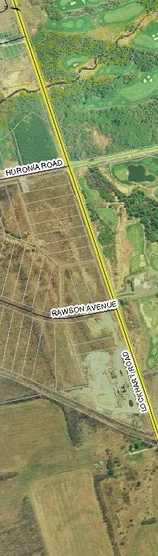
2 Yonge St NORTH Little Ave Huronia Rd Webb St Herrell St Big Bay Pt Rd Truman Rd Ellis Dr Mapleview Dr Huronia Rd Saunders Rd Lockhart Rd source: maps.simcoe.ca STUDY LIMITS 2 STUDY AREA source: Microsoft Virtual Earth


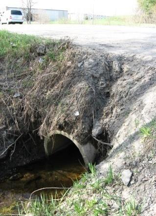
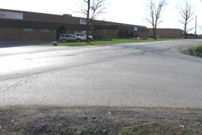

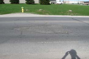

3 Huronia Road at Yonge Street intersection Huronia Road at Yonge Street intersection Huronia Road between Yonge Street & Little Avenue Huronia Road between Yonge Street & Little Avenue Huronia Road at Little Avenue intersection Huronia Road between Little Avenue & Webb Street Huronia Road between Little Avenue & Webb Street Huronia Road at Webb Street intersection Huronia Road between Webb Street & Herrell Avenue Huronia Road at Herrell Avenue intersection Huronia Road between Herrell Avenue & Truman Road Huronia Road at Truman Road intersection Huronia Road between Truman Road & Big Bay Point Road Huronia Road between Herrell Avenue & Truman Road Huronia Road between Herrell Avenue & Truman Road Huronia Road at Big Bay Point Road intersection Huronia Road between Big Bay Point Road and Ellis Drive Huronia Road between Big Bay Point Road and Ellis Drive EXISTING CONDITIONS - YONGE STREET TO ELLIS DRIVE 3


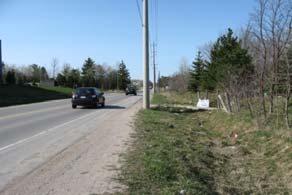
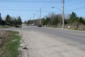
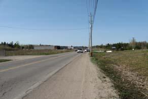

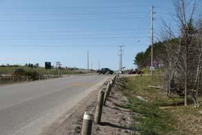
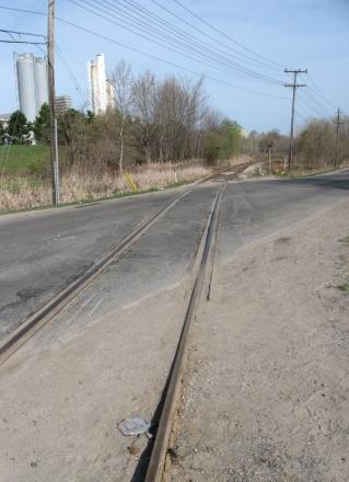
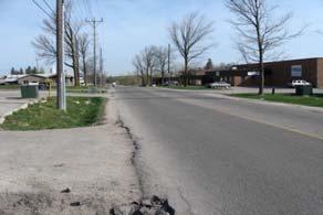
4 Huronia Road at Ellis Drive intersection Huronia Road between Ellis Drive & Loon Avenue Huronia Road between Ellis Drive & Loon Avenue Huronia Road at Loon Avenue intersection Huronia Road between Loon Avenue & Mapleview Drive Huronia Road between Loon Avenue & Mapleview Drive Huronia Road between Loon Avenue & Mapleview Drive Huronia Road at Mapleview Drive intersection Huronia Road at Mapleview Drive intersection Huronia Road between Mapleview Drive & Saunders Road Huronia Road at Saunders Road intersection Huronia Road between Saunders Road & Lockhart Road Huronia Road between Saunders Road & Lockhart Road Huronia Road between Mapleview Drive & Saunders Road Huronia Road between Mapleview Drive & Saunders Road Huronia Road between Saunders Road & Lockhart Road Huronia Road at Lockhart Road intersection Huronia Road at Lockhart Road intersection EXISTING CONDITIONS - ELLIS DRIVE TO LOCKHART ROAD 4
5 NORTH Yonge St 1 Little Ave 2 1. YONGE STREET 5. TRUMAN ROAD 9. MAPLEVIEW DRIVE 3 Webb St 4 Herrell St 5 Truman Rd 6 Big Bay Point 7 2. LITTLE AVENUE 6. BIG BAY POINT ROAD 10. SAUNDERS ROAD Ellis Dr 8 Loon Ave 9 Mapleview 565m 0m 2m 420m m 310m 765m 525m 820m Saunders Rd WEBB STREET 7. ELLIS DRIVE 11. LOCKHART ROAD right turn lane through lane left turn lane shared through-right lane shared through-left lane Lockhart Rd 11 shared left-through-right shared left-right lane STUDY AREA 4. HERRELL STREET 8. LOON AVENUE LEGEND stop sign traffic signal source: Microsoft Virtual Earth EXISTING INTERSECTION CONFIGURATIONS & CONTROLS 5
6 NORTH YONGE STREET 8. LOON AVENUE LITTLE AVENUE MAPLEVIEW DRIVE HERRELL STREET 11. LOCKHART ROAD right turn through move left turn PM peak hour volume stop sign traffic signal STUDY AREA 6. BIG BAY POINT ROAD LEGEND source: Microsoft Virtual Earth source: Huronia Road Traffic Impact Study, June TRAFFIC VOLUMES 6


7 NORTH completed trail Yonge Street Little Avenue Huronia Road Big Bay Point Road Mapleview Drive East Huronia Road Lockhart Road source: City of Barrie Recreation Map source: Trans Canada Trail ( TRAIL SYSTEM 7
8 NORTH YONGE STREET 8. LOON AVENUE LITTLE AVENUE MAPLEVIEW DRIVE HERRELL STREET 11. LOCKHART ROAD right turn through move left turn PM peak hour volume stop sign traffic signal STUDY AREA 6. BIG BAY POINT ROAD LEGEND source: Microsoft Virtual Earth source: Huronia Road Traffic Impact Study, June TRAFFIC VOLUMES 8
9 NORTH YONGE STREET 8. LOON AVENUE LITTLE AVENUE MAPLEVIEW DRIVE HERRELL STREET 11. LOCKHART ROAD right turn through move left turn PM peak hour volume stop sign traffic signal STUDY AREA 6. BIG BAY POINT ROAD LEGEND source: Microsoft Virtual Earth 2026 TRAFFIC VOLUMES - LOW GROWTH 9
10 NORTH YONGE STREET 8. LOON AVENUE LITTLE AVENUE MAPLEVIEW DRIVE HERRELL STREET 11. LOCKHART ROAD right turn through move left turn PM peak hour volume stop sign traffic signal STUDY AREA 6. BIG BAY POINT ROAD LEGEND source: Microsoft Virtual Earth 2026 TRAFFIC VOLUMES - HIGH GROWTH 10


11 NORTH NORTH CITY CITY CITY OF OF OF BARRIE BARRIE BARRIE TOWN TOWN TOWN OF OF OF INNISFIL INNISFIL INNISFIL CITY CITY CITY OF OF OF BARRIE BARRIE BARRIE TOWN TOWN TOWN OF OF OF INNISFIL INNISFIL INNISFIL CITY CITY CITY OF OF OF BARRIE BARRIE BARRIE TOWN TOWN TOWN OF OF OF INNISFIL INNISFIL INNISFIL STUDY AREA ROUTE A STUDY AREA ROUTE B source: Microsoft Virtual Earth source: Microsoft Virtual Earth ALTERNATIVE 3 - CONSIDER ALTERNATIVE TRAVEL ROUTES 11 CITY CITY CITY OF OF OF BARRIE BARRIE BARRIE TOWN TOWN TOWN OF OF OF INNISFIL INNISFIL INNISFIL
12 existing conditions proposed right-of-way proposed sidewalk proposed curb and travel lanes ALTERNATIVE 4 - RECONSTRUCT HURONIA ROAD + INTERSECTION IMPROVEMENTS 12a
13 existing conditions proposed right-of-way proposed sidewalk proposed curb and travel lanes ALTERNATIVE 4 - RECONSTRUCT HURONIA ROAD + INTERSECTION IMPROVEMENTS 12b
14 existing conditions proposed right-of-way proposed sidewalk proposed curb and travel lanes ALTERNATIVE 5 - RECONSTRUCT & WIDEN HURONIA ROAD TO 3 LANES 13a
15 existing conditions proposed right-of-way proposed sidewalk proposed curb and travel lanes ALTERNATIVE 5 - RECONSTRUCT & WIDEN HURONIA ROAD TO 3 LANES 13b
16 existing conditions proposed right-of-way proposed sidewalk proposed curb and travel lanes ALTERNATIVE 6 - RECONSTRUCT & WIDEN HURONIA ROAD TO 4 LANES 14a
17 existing conditions proposed right-of-way proposed sidewalk proposed curb and travel lanes ALTERNATIVE 6 - RECONSTRUCT & WIDEN HURONIA ROAD TO 4 LANES 14b
18 existing conditions proposed right-of-way proposed sidewalk proposed curb and travel lanes ALTERNATIVE 7 - RECONSTRUCT & WIDEN HURONIA ROAD TO 5 LANES 15a
19 existing conditions proposed right-of-way proposed sidewalk proposed curb and travel lanes ALTERNATIVE 7 - RECONSTRUCT & WIDEN HURONIA ROAD TO 5 LANES 15b


20 NORTH Streams, Rivers Residential Agricultural Commercial Industrial Open Space Environment Protection Lakes Provincial Highway County Road Local Road Treed Hedgerow Plantation Greenbelt Assessment Parcels Crown Land Municipal Border Separated City ANSI Earth Science Provincial ANSI Earth Science Regional ANSI Life Science Provincial ANSI Life Science Regional Local Classified Wetland Provincial Classified Wetland Greenland source: maps.simcoe.ca AREA LAND USE & DEVELOPMENT 16


21 NORTH CITY OF BARRIE TOWN OF INNISFIL source: maps.simcoe.ca Environmentally Sensitive Area ENVIRONMENTALLY SENSITIVE AREAS 17
22 NORTH YONGE STREET 8. LOON AVENUE LITTLE AVENUE MAPLEVIEW DRIVE HERRELL STREET 11. LOCKHART ROAD right turn through move left turn PM peak hour volume stop sign traffic signal STUDY AREA 6. BIG BAY POINT ROAD LEGEND source: Microsoft Virtual Earth 2026 TRAFFIC VOLUMES - REVISED 18
23 NORTH Yonge St 1 Little Ave 2 1. YONGE STREET 5. TRUMAN ROAD 9. MAPLEVIEW DRIVE 3 Webb St 4 Herrell St 5 Truman Rd 6 Big Bay Point 7 2. LITTLE AVENUE 10. SAUNDERS ROAD Ellis Dr 8 Loon Ave 9 Mapleview 565m 0m 2m 420m m 310m 765m 525m 820m Saunders Rd WEBB STREET 7. ELLIS DRIVE 11. LOCKHART ROAD right turn lane through lane left turn lane shared through-right lane shared through-left lane Lockhart Rd 11 shared left-through-right shared left-right lane STUDY AREA 4. HERRELL STREET 8. LOON AVENUE LEGEND stop sign traffic signal source: Microsoft Virtual Earth PREFERRED INTERSECTION CONFIGURATIONS & CONTROLS 19
Environmental Assessment Derry Road and Argentia Road Intersection
 Air and Noise Study Environmental Assessment Derry Road and Argentia Road Intersection Project 11-4295 City of Mississauga, Region of Peel October 17, 2014 1 Region of Peel Environmental Assessment for
City of Pacific Grove
 Regional Study Utilizing Caltrans Intersection Evaluation Section 7: City of Pacific Grove s: FIRST STREET AT CENTRAL AVENUE Transportation Agency for Monterey County Prepared by Transportation Agency
Public Information Centre
 Junction Street Wastewater Pumping Station & Forcemain Schedule B Municipal Class Environmental Assessment Study Public Information Centre June 28, 2017. 6:00 to 8:00 pm. The Burlington Performing Arts
2.0 Development Driveways. Movin Out June 2017
 Movin Out June 2017 1.0 Introduction The proposed Movin Out development is a mixed use development in the northeast quadrant of the intersection of West Broadway and Fayette Avenue in the City of Madison.
HIGHWAY 28 FUNCTIONAL DESIGN
 HIGHWAY 28 FUNCTIONAL DESIGN PUBLIC OPEN HOUSE #1 WEDNESDAY, MARCH 12, 2014 Stantec Presenters: Brad Vander Heyden, Project Engineer Neal Cormack, Project Manager Dave Parker, Project Engineer Beth Thola,
I-820 (East) Project Description. Fort Worth District. Reconstruct Southern I-820/SH 121 Interchange
 Project Description. Fort Worth District. Reconstruct Southern I-820/SH 121 Interchange") I-820 (East) Project Description Fort Worth District Reconstruct Southern I-820/SH 121 Interchange I-820 from approximately 2,000 feet north of Pipeline Road/Glenview Drive to approximately 3,200 feet
I-820 (East) Project Description Fort Worth District Reconstruct Southern I-820/SH 121 Interchange I-820 from approximately 2,000 feet north of Pipeline Road/Glenview Drive to approximately 3,200 feet
We Want Your Input! Review the design alternatives and tell us what s important to you in the design of these areas of the approved BRT Network:
 We Want Your Input! Review the design alternatives and tell us what s important to you in the design of these areas of the approved BRT Network: Richmond North of Oxford Street Richmond Row Dundas Street
TORONTO TRANSIT COMMISSION REPORT NO.
 Form Revised: February 2005 TORONTO TRANSIT COMMISSION REPORT NO. MEETING DATE: May 28, 2009 SUBJECT: DON MILLS STATION ACTION ITEM RECOMMENDATIONS It is recommended that the Commission: 1. Endorse the
GTA West Corridor Planning and EA Study Stage 1
 GTA West Corridor Planning and EA Study Stage 1 Draft Development Strategy Presentation to Peel Goods Movement Task Force April 8 2011 Study Areas 2 Unique Approach Unprecedented two-stage EA process:
New McNicoll Bus Garage Public Open House
 New McNicoll Bus Garage Public Open House Kennedy Public School 1 The Need for a New Bus Garage Riders Increased ridership means Buses Need for new buses Garage And a new buses facility Problems Garages
STH 60 Northern Reliever Route Feasibility Study Report
 #233087 v3 STH 60 Northern Reliever Route Feasibility Study Report Washington County Public Works Committee Meeting September 28, 2016 1 STH 60 Northern Reliever Route Feasibility Study Hartford Area Development
Welcome. Green Line in Your Community
 Welcome Green Line in Your Community Today's session will provide you with information about Administration's recommendation for connecting the Green Line in the Beltline to Victoria Park and Inglewood/Ramsay
2 MAJOR MACKENZIE DRIVE WEST JOG ELIMINATION AT HUNTINGTON ROAD CITY OF VAUGHAN
 2 MAJOR MACKENZIE DRIVE WEST JOG ELIMINATION AT HUNTINGTON ROAD CITY OF VAUGHAN The Transportation Services Committee recommends the adoption of the recommendations contained in the following report dated
Public Information Workshop
 Public Information Workshop Charlotte County-Punta Gorda MPO - Meeting Rooms A and B March 29, 2018 Welcome to the Public Information Workshop for Harborview Road Project Development and Environment (PD&E)
Mississauga Bus Rapid Transit Preliminary Design Project
 Mississauga Bus Rapid Transit Preliminary Design Project PUBLIC INFORMATION CENTRE OCTOBER 2008 WELCOME The Mississauga Bus Rapid Transit (BRT) Project Thank you for attending this Public Information Centre.
Pedestrians, Cars, Buses and Trains? Considerations for Rapid Transit Service at Western University
 Pedestrians, Cars, Buses and Trains? Considerations for Rapid Transit Service at Western University Shift: The City of London s Rapid Transit Proposal Shift: The City of London s Rapid Transit Proposal
Waco Rapid Transit Corridor (RTC) Feasibility Study
 Feasibility Study") Waco Rapid Transit Corridor (RTC) Feasibility Study Chris Evilia, Director of Waco Metropolitan Planning Organization Allen Hunter, General Manager Waco Transit System Jimi Mitchell, Project Manager AECOM
Waco Rapid Transit Corridor (RTC) Feasibility Study Chris Evilia, Director of Waco Metropolitan Planning Organization Allen Hunter, General Manager Waco Transit System Jimi Mitchell, Project Manager AECOM
Access Management Standards
 Access Management Standards This section replaces Access Control Standards on Page number 300-4 of the Engineering Standards passed February 11, 2002 and is an abridged version of the Access Management
Traffic Impact Analysis West Street Garden Plots Improvements and DuPage River Park Garden Plots Development Naperville, Illinois
 Traffic Impact Analysis West Street Garden Plots Improvements and DuPage River Park Garden Plots Development Naperville, Illinois Submitted by April 9, 2009 Introduction Kenig, Lindgren, O Hara, Aboona,
ANDERSON PROPERTY SITE ANALYSIS
 ANDERSON PROPERTY SITE ANALYSIS Introduction The Montgomery County Department of Transportation (MCDOT) initiated a feasibility study in the fall of 2012 to evaluate the need for transit service expansion
Subarea Study. Manning Avenue (CSAH 15) Corridor Management and Safety Improvement Project. Final Version 1. Washington County.
 Corridor Management and Safety Improvement Project. Final Version 1. Washington County.") Subarea Study Manning Avenue (CSAH 15) Corridor Management and Safety Improvement Project Final Version 1 Washington County June 12, 214 SRF No. 138141 Table of Contents Introduction... 1 Forecast Methodology
Subarea Study Manning Avenue (CSAH 15) Corridor Management and Safety Improvement Project Final Version 1 Washington County June 12, 214 SRF No. 138141 Table of Contents Introduction... 1 Forecast Methodology
Develop ground transportation improvements to make the Airport a multi-modal regional
 Project Overview TRANSPORTATION IMPROVEMENTS WHAT ARE THE PROJECT GOALS? Transportation transportation hub. Develop ground transportation improvements to make the Airport a multi-modal regional Land Use
BINGHAMTON METROPOLITAN TRANSPORTATION STUDY
 BINGHAMTON METROPOLITAN TRANSPORTATION STUDY ANNUAL LISTING OF FEDERAL AID PROJECT OBLIGATIONS FEDERAL FISCAL YEAR Federal regulations require an annual listing of transportation projects, including investments
Rapid Transit Implementation Working Group #4 February 9, 2017
 Rapid Transit Implementation Working Group #4 February 9, 2017 Agenda 1. Business Case Update 2. Rapid Transit Master Plan Overview 3. Corridor Concepts 4. Public Consultation Event 5. Schedule Outlook
EGLINTON CROSSTOWN LIGHT RAIL TRANSIT (LRT)
") WELCOME TO OUR PUBLIC OPEN HOUSE EGLINTON CROSSTOWN LIGHT RAIL TRANSIT (LRT) Preliminary Planning for a Transit Project Assessment Open House Martin Grove Road to Pearson International Airport September
WELCOME TO OUR PUBLIC OPEN HOUSE EGLINTON CROSSTOWN LIGHT RAIL TRANSIT (LRT) Preliminary Planning for a Transit Project Assessment Open House Martin Grove Road to Pearson International Airport September
WOLVERINE TO BHP JANSEN NEW TRANSMISSION LINE PROJECT FALL 2017
 WOLVERINE TO BHP JANSEN NEW TRANSMISSION LINE PROJECT FALL 2017 TODAY WE LL TALK ABOUT Our challenges and how we re meeting them Why we re building this project Our planning process and considerations
Letter EL652 City of Mercer Island. Page 1. No comments n/a
 Letter EL652 City of Mercer Island Page 1 No comments n/a Page 2 Response to comment EL652 1 Section 4.5.3 of the Final EIS presents the range of potential impacts of the project. This project also lists
CITY OF TORRANCE PUBLIC WORKS DEPARTMENT ENGINEERING DIVISION INFRASTRUCTURE UPDATE
 CITY OF TORRANCE PUBLIC WORKS DEPARTMENT ENGINEERING DIVISION INFRASTRUCTURE UPDATE TUESDAY, DECEMBER 5, 2017 1 DISCUSSION TOPICS Update of Infrastructure Action Plan (IAP) o Sidewalk and Roadway projects
THE WAY WE MOVE LRT FOR EVERYONE
 THE WAY WE MOVE LRT FOR EVERYONE 2 LRT for Everyone LRT FOR EVERYONE Light rail is about more than transit; it s about transforming Edmonton. As the city grows, so do its transportation needs. LRT is an
PUBLIC INFRASTRUCTURE PROJECTS
 PUBLIC INFRASTRUCTURE PROJECTS FM 664 / OVILLA ROAD WIDENING & IMPROVEMENTS FM 664 / OVILLA ROAD CONNECTS US 287 WITH I-45 (SOURCE: TEXAS DEPARTMENT OF TRANSPORTATION. 2016 FM 664 / OVILLA ROAD WIDENING
Railyard Alternatives & I-280 Boulevard Feasibility Study 1 RAILYARD ALTERNATIVES & I-280 BOULEVARD (RAB) FEASIBILITY STUDY
 FEASIBILITY STUDY") Railyard Alternatives & I-280 Boulevard Feasibility Study 1 RAILYARD ALTERNATIVES & I-280 BOULEVARD (RAB) FEASIBILITY STUDY RAB Citizen Working Group Meeting, August 1 st 2016 CITIZEN WORKING GROUP (CWG)
Railyard Alternatives & I-280 Boulevard Feasibility Study 1 RAILYARD ALTERNATIVES & I-280 BOULEVARD (RAB) FEASIBILITY STUDY RAB Citizen Working Group Meeting, August 1 st 2016 CITIZEN WORKING GROUP (CWG)
Parks and Transportation System Development Charge Methodology
 City of Sandy Parks and Transportation System Development Charge Methodology March, 2016 Background In order to implement a City Council goal the City of Sandy engaged FCS Group in January of 2015 to update
Wentzville Parkway South Phase 2 & 2A
 Wentzville Parkway South Phase 2 & 2A Sponsor Wentzville Project No. RB18-000034 Project Type New Road TOTAL FUNDING Phase 2 Total County Sponsor Federal $10,000,000 $8,000,000 $2,000,000 $0 Phase 2A Total
Transportation. Background. Transportation Planning Goals. Level of Service Analysis 5-1
 Transportation portion of the city s stormwater utility, and state road and fuel taxes. Background The transportation needs of the City of Lacey and its planning areas are met by a growing multimodal network
US 81 Bypass of Chickasha Environmental Assessment Public Meeting
 US 81 Bypass of Chickasha Environmental Assessment Public Meeting March 14, 2013 Introductions ODOT FHWA SAIC Meeting Purpose Present need for bypass Provide responses to 10/04/11 public meeting comments
LACEY CITY COUNCIL MEETING July 09, 2015
 LACEY CITY COUNCIL MEETING July 09, 2015 SUBJECT: 2016-2021 Six-Year Transportation Improvement Plan and Mitigation List RECOMMENDATION: Adopt Resolution approving the proposed 2016-2021 Six- Year Transportation
WELCOME. New Septage Waste Haulage Receiving Station Municipal Class Environmental Assessment (Class EA)
") WELCOME New Septage Waste Haulage Receiving Station Municipal Class Environmental Assessment (Class EA) Public Information Centre (PIC) No. 1 Thursday November 9 th, 2017 6:00pm-8:00pm Please SIGN IN to
WELCOME New Septage Waste Haulage Receiving Station Municipal Class Environmental Assessment (Class EA) Public Information Centre (PIC) No. 1 Thursday November 9 th, 2017 6:00pm-8:00pm Please SIGN IN to
Harlem Avenue between 63 rd and 65 th
 Harlem Avenue between 63 rd and 65 th Public Meeting #2 March 13, 2018 Summit Park District Welcome to the second Public Meeting for the preliminary engineering and environmental studies of Illinois 43
TORONTO TRANSIT COMMISSION REPORT NO.
 Form Revised: February 2005 TORONTO TRANSIT COMMISSION REPORT NO. MEETING DATE: October 24, 2012 SUBJECT: DOWNTOWN RAPID TRANSIT EXPANSION STUDY (DRTES) PHASE 1 STRATEGIC PLAN ACTION ITEM RECOMMENDATIONS
Vanier Parkway and Presland Road Residential Development Transportation Impact Study
 Vanier Parkway and Presland Road Residential Development Transportation Impact Study Final Report (Revised) March 2011 Submitted to: Groupe Lépine Ottawa Project No. 09-1613 Submitted by: Groupe Lépine
Attachment 5 Eglinton West LRT Planning and Technical Update
 Eglinton West LRT Planning and Technical Update 1. Introduction In July 2016, City Council approved an Eglinton West LRT with between 8 and 12 stops between Mount Dennis and Renforth Gateway, and up to
City of Marina. Regional Roundabout Study Utilizing Caltrans Intersection Control Evaluation Section 4: Transportation Agency for Monterey County
 Regional Roundabout Study Utilizing Caltrans Intersection Control Evaluation Section 4: City of Marina Study Intersections: RESERVATION ROAD AT BEACH ROAD RESERVATION ROAD AT DEFOREST ROAD CARDOZA AVENUE
Agenda. Utility Undergrounding Strategies & Laguna Canyon Road Master Plan
 Utility Undergrounding Strategies & Laguna Canyon Road Master Plan January 17, 2017 City Council Meeting 2 Agenda Progress since March 2016 Status of undergrounding and road widening between El Toro Rd.
Highway 23 New London Access & Safety Assessment. Public Open House #2 October 3, :00 to 7:00 PM
 Public Open House #2 October 3, 2017 5:00 to 7:00 PM Highway 9 OVERVIEW OF ASSESSMENT Assessment Limits Highway 23 from County Road 40 to North Shore Dr Purpose: Identify opportunities to reduce serious
Attachment F: Transport assessment report on implications if Capell Avenue never formed
 Attachment F: Transport assessment report on implications if never formed CCL Ref: 14447-181118-williams.docx 18 November 2018 Tim Williams Williams and Co Limited By e-mail only: tim@williamsandco.nz
EXECUTIVE SUMMARY. The following is an outline of the traffic analysis performed by Hales Engineering for the traffic conditions of this project.
 EXECUTIVE SUMMARY This study addresses the traffic impacts associated with the proposed Shopko redevelopment located in Sugarhouse, Utah. The Shopko redevelopment project is located between 1300 East and
Executive Summary. Draft Environmental Impact Statement/Environmental Impact Report ES-1
 Executive Summary Introduction The Eastside Transit Corridor Phase 2 Project is a vital public transit infrastructure investment that would provide a transit connection to the existing Metro Gold Line
Mercer Island Center for the Arts Parking Management Plan
 Parking Stalls Mercer Island Center for the Arts Parking Management Plan June 15, 2016 This Parking Management Plan (P) covers all tenants at the Mercer Island Center for the Arts (MICA) campus, including
METRO Orange Line BRT American Boulevard Station Options
 METRO Orange Line BRT American Boulevard Station Options Bloomington City Council Work Session November 18, 2013 Christina Morrison BRT/Small Starts Project Office Coordinating Planning and Design AMERICAN
Town of Londonderry, New Hampshire NH Route 28 Western Segment Traffic Impact Fee Methodology
 Town of Londonderry, New Hampshire NH Route 28 Western Segment Traffic Impact Fee Methodology Prepared by the Londonderry Community Development Department Planning & Economic Development Division Based
HDR Engineering. HART North / South. Tampa Bay Applications Group Meeting May 14, 2009
 HDR Engineering HART North / South BRT Corridor PD&E Tampa Bay Applications Group Meeting May 14, 2009 1 Agenda Update on Project Development and Environment (PD&E) Study Project Overview System Branding
East Turnaround. Access to Ayreswood Avenue would be restricted to right-in/rightout movements under the proposed Rapid Transit plan.
 East Turnaround Options at Fanshawe College Ayreswood Access Access to Ayreswood Avenue would be restricted to right-in/rightout movements under the proposed Rapid Transit plan. To mitigate the impacts
TRAFFIC IMPACT STUDY VICDOM BROCK ROAD PIT EXPANSION
 TRAFFIC IMPACT STUDY VICDOM BROCK ROAD PIT EXPANSION TOWNSHIP OF UXBRIDGE P/N 05-1993 June 2011 Revised -August 2011 Prepared by: Skelton, Brumwell & Associates Inc. 93 Bell Farm Road, Suite 107 Barrie,
Lacey Gateway Residential Phase 1
 Lacey Gateway Residential Phase Transportation Impact Study April 23, 203 Prepared for: Gateway 850 LLC 5 Lake Bellevue Drive Suite 02 Bellevue, WA 98005 Prepared by: TENW Transportation Engineering West
CITY OF PORT TOWNSEND, WASHINGTON CAPITAL IMPROVEMENT PLAN
 Page 1 of 3 CITY OF PORT TOWNSEND, WASHINGTON CAPITAL IMPROVEMENT PLAN The six-year Capital Improvement Plan (CIP) includes capital projects for 2017 2022. This plan includes capital projects that add
Scarborough Transit Planning
 Scarborough Transit Planning April 23, 2016 Transportation Planning Section City Planning Division Overview 1. Developing Toronto s Transit Network Plan 2. Scarborough Transit Planning 1. Minutes of last
Parking Management Element
 Parking Management Element The State Transportation Planning Rule, adopted in 1991, requires that the Metropolitan Planning Organization (MPO) area implement, through its member jurisdictions, a parking
Right-of-Way Obstruction Permit Fee Structure Minneapolis Department of Public Works May 10, 2001
 Right-of-Way Obstruction Permit Fee Structure Minneapolis Department of Public Works May 10, 2001 Revised April 5, 2005 Revised January 27, 2006 Prepared by: Steve Collin, Engineer 2.5 Revised by Douglas
Garrett Hill Master Plan
 Garrett Hill Master Plan Visioning Workshop February 13, 2007 Campbell Thomas & Company Agenda Welcome Existing conditions summary Critical issues Visioning exercise Summary & next steps Critical Assets
SOUTHERN GATEWAY. Transportation and Trinity River Project Committee 11 May 2015
 SOUTHERN GATEWAY Transportation and Trinity River Project Committee 11 May 2015 Southern Gateway Project History Began in 2001 as a Major Investment Study [ MIS ], Schematic, and Environmental Assessment
Municipal District of Taber Synchronized With The Alberta Township System
 Municipal District of Taber Synchronized With The Alberta Township System The Alberta Township System The Alberta Township System is another Name for the Dominion Land Survey System that was developed
Decision D ATCO Electric Ltd. Decommissioning of Transmission Line 6L82
 Decision 21447-D01-2016 August 23, 2016 Decision 21447-D01-2016 Proceeding 21447 Application 21447-A001 August 23, 2016 Published by the: Fifth Avenue Place, Fourth Floor, 425 First Street S.W. Calgary,
Transportation Infrastructure Investment Program moving
 moving CALGARY What is TIIP? Ten Year Transportation Capital Program Last approved by Council in 2005 Defines: Major infrastructure projects Lifecycle programs What is TIIP? Represents current planned
TRAFFIC IMPACT ANALYSIS
 TRAFFIC IMPACT ANALYSIS Emerald Isle Commercial Development Prepared by SEPI Engineering & Construction Prepared for Ark Consulting Group, PLLC March 2016 I. Executive Summary A. Site Location The Emerald
BROWARD BOULEVARD CORRIDOR TRANSIT STUDY
 BROWARD BOULEVARD CORRIDOR TRANSIT STUDY FM # 42802411201 EXECUTIVE SUMMARY July 2012 GOBROWARD Broward Boulevard Corridor Transit Study FM # 42802411201 Executive Summary Prepared For: Ms. Khalilah Ffrench,
Welcome. Public Open House Schedule. Super 8 West Kelowna 1655 Westgate Rd, West Kelowna. West Kelowna. Wednesday, March 2, :00 p.m. 8:00 p.m.
 Welcome Thank you for attending this Community Engagement on improvements to the Boucherie Road and Westlake Road intersections on Highway 97 in the Central Okanagan. Public Open House Schedule Location
COPPER RUN PRELIMINARY PLANS FOR LITTLE CREEK HUNDRED, KENT COUNTY DELAWARE COPPER RUN GENERAL NOTES. DATA COLUMN PyA FgA SITE.
 PRELIMINARY PLANS FOR LITTLE CREEK HUNDRED, KENT COUNTY DELAWARE DATA COLUMN PyA FgA GENERAL NOTES N SITE N FaA N LOCATION MAP SCALE: 1"=000' SITE SOILS MAP SCALE: 1"=00' TRIP GENERATION - FORK BRANCH
5. OPPORTUNITIES AND NEXT STEPS
 5. OPPORTUNITIES AND NEXT STEPS When the METRO Green Line LRT begins operating in mid-2014, a strong emphasis will be placed on providing frequent connecting bus service with Green Line trains. Bus hours
West Broadway Reconstruction/LRT Design. March 19, 2015
 West Broadway Reconstruction/LRT Design March 19, 2015 1 Meeting Agenda 6:05 6:30 PM Brief presentation What we heard Project overview 6:30 8:00 PM Visit Six Topic Areas Road and LRT design elements Pedestrian
TRAFFIC IMPACT STUDY. USD #497 Warehouse and Bus Site
 TRAFFIC IMPACT STUDY for USD #497 Warehouse and Bus Site Prepared by: Jason Hoskinson, PE, PTOE BG Project No. 16-12L July 8, 216 145 Wakarusa Drive Lawrence, Kansas 6649 T: 785.749.4474 F: 785.749.734
Table of Contents INTRODUCTION... 3 PROJECT STUDY AREA Figure 1 Vicinity Map Study Area... 4 EXISTING CONDITIONS... 5 TRAFFIC OPERATIONS...
 Crosshaven Drive Corridor Study City of Vestavia Hills, Alabama Table of Contents INTRODUCTION... 3 PROJECT STUDY AREA... 3 Figure 1 Vicinity Map Study Area... 4 EXISTING CONDITIONS... 5 TRAFFIC OPERATIONS...
STRATEGIC PRIORITIES AND POLICY COMMITTEE MAY 5, 2016
 STRATEGIC PRIORITIES AND POLICY COMMITTEE MAY 5, 2016 Shift Rapid Transit Initiative Largest infrastructure project in the city s history. Rapid Transit initiative will transform London s public transit
CITY COUNCIL STUDY SESSION UPDATE ON SMART. January 19, 2017 CITY OF SAN RAFAEL
 CITY COUNCIL STUDY SESSION UPDATE ON SMART January 19, 2017 CITY OF SAN RAFAEL SONOMA MARIN AREA RAIL TRANSIT UPDATE OUTLINE BACKGROUND INITIAL OPERATION SYSTEM (IOS1) CIVIC CENTER AREA LARKSPUR EXTENSION
Citizens Committee for Facilities
 Citizens Committee for Facilities AGENDA Thursday, December 11, 2014 City Council Chambers 305 3 rd Avenue East -Twin Falls, Idaho 11:30 A.M. AGENDA ITEMS Purpose By 1. Discussion and possible action on
US 50/SOUTH SHORE COMMUNITY REVITALIZATION PROJECT
 US 50/SOUTH SHORE COMMUNITY REVITALIZATION PROJECT April 25, 2012 Tahoe Transportation District (TTD) Tahoe Transportation District (TTD) established 1980 as Bi-State Agency TTD Goals Implement Transportation
Ex.-Applicants-Stevenson-22
 Mississippi River WAB AS HA W INONA City of Alma WABA SHA 61 Alma Lizzy Pauls Pond City of Buffalo BU FFALO Belvidere Village of Cochrane Lincoln Fountain City Bay 88 Bensel Pond Milton 35 Waumandee Waumandee
1. INTRODUCTION 2. PROJECT DESCRIPTION CUBES SELF-STORAGE MILL CREEK TRIP GENERATION COMPARISON
 CUBES SELF-STORAGE MILL CREEK TRIP GENERATION COMPARISON 1. INTRODUCTION This report summarizes traffic impacts of the proposed CUBES Self-Storage Mill Creek project in comparison to the traffic currently
Kendall Drive Premium Transit PD&E Study Project Kick-Off Meeting SR 94/Kendall Drive/SW 88 Street Project Development and Environment (PD&E) Study
 Study") Florida Department of Transportation District Six Kendall Drive Premium Transit PD&E Study Project Kick-Off Meeting SR 94/Kendall Drive/SW 88 Street Project Development and Environment (PD&E) Study What
Florida Department of Transportation District Six Kendall Drive Premium Transit PD&E Study Project Kick-Off Meeting SR 94/Kendall Drive/SW 88 Street Project Development and Environment (PD&E) Study What
Dixie Transportation Planning Office
 A project must be given a yes rating on items 1 & 2 in order to be prioritized. Sponsor: St. George City Project: Pioneer Parkway Type: Road Widening and Reconstruction Rev. 9/17/2010 Dixie Transportation
Summary of Current Corridor Alternatives. January 4, 2012
 Summary of Current Corridor Alternatives January 4, 2012 INITIAL CORRIDORS FOR ANALYSIS (grouped by corridor families ) P-1 P-2 P-3 P-4 T-5 T-6 T-7 Pleasant Hill Road Family Tennessee Avenue Family M-8
appendix 4: Parking Management Study, Phase II
 appendix 4: Parking Management Study, Phase II A4-1 A4-2 Eastlake Parking Management Study Final Phase 2 Report Future Parking Demand & Supply January 6, 2017 Submitted by Denver Corp Center III 7900 E.
Business Advisory Committee. July 7, 2015
 Business Advisory Committee July 7, 2015 1 Today s Topics Outreach Update TI #1 and 2: Target Field Station Connection to I-94: Recommendation 85 th Station Configuration 93 rd Station Configuration DEIS
Project Description: Georgia Department of Transportation Public Information Open House Handout PI#(s): , County: Muscogee
: , County: Muscogee") Why We Are Here: GDOT s Transportation Improvement Act (TIA) Office, the City of Columbus, and the project delivery team are here this evening to display and answer questions concerning the proposed roadway
Why We Are Here: GDOT s Transportation Improvement Act (TIA) Office, the City of Columbus, and the project delivery team are here this evening to display and answer questions concerning the proposed roadway
Creditview Road Schedule C Class Environmental Assessment Traffic Operations Analysis Final Report
 Capability City of Mississauga Creditview Road Schedule C Class Environmental Assessment Traffic Operations Analysis Final Report Prepared by: AECOM 5080 Commerce Boulevard 905 238 0007 tel Mississauga,
PROJECT BACKGROUND 3
 AGENDA 1. Welcome & Introductions 2. Project Background 3. Project Approach & Schedule 4. Draft Long List of Options 5. Evaluation Process 6. Next Steps 2 PROJECT BACKGROUND 3 OUR RAPID TRANSIT NETWORK
Highway 18 BNSF Railroad Overpass Feasibility Study Craighead County. Executive Summary
 Highway 18 BNSF Railroad Overpass Feasibility Study Craighead County Executive Summary October 2014 Highway 18 BNSF Railroad Overpass Feasibility Study Craighead County Executive Summary October 2014 Prepared
Rocky Mount. Transportation Plan. Transportation Planning Division. Virginia Department of Transportation
 2020 Transportation Plan Developed by the Transportation Planning Division of the Virginia Department of Transportation in cooperation with the U.S. Department of Transportation, Federal Highway Administration
4 Circulation & Transportation
 4.1 Mobility Network The mobility network at the new St. Paul s hospital and health campus is comprised of an interconnected system of sidewalks, cycle paths, transit routes and roadways. Figure 4-1: Indicative
IV. REVISIONS TO THE DRAFT IS/MND
 IV. REVISIONS TO THE DRAFT IS/MND 1. REVISIONS TO THE DRAFT IS/MND This section presents corrections and clarifications that have been made to the text of the Draft IS/MND. These changes include revisions
Draft Results and Open House
 Waco Rapid Transit Corridor (RTC) Feasibility Study Draft Results and Open House Chris Evilia, Director of Waco Metropolitan Planning Organization Allen Hunter, General Manager Waco Transit System Jimi
DIXIE TIP CONCEPT REPORT APPLICATION FY 2015 (Due November 6, 2013) PROJECT INFORMATION
 PROJECT INFORMATION") DIXIE TIP CONCEPT REPORT APPLICATION FY 2015 (Due November 6, 2013) PROJECT INFORMATION 1) TITLE: Old Hwy 91 (Swiss Village, Santa Clara to 200 East, Ivins) 2) DESCRIPTION: This joint Ivins/Santa Clara
DIXIE TIP CONCEPT REPORT APPLICATION FY 2015 (Due November 6, 2013) PROJECT INFORMATION 1) TITLE: Old Hwy 91 (Swiss Village, Santa Clara to 200 East, Ivins) 2) DESCRIPTION: This joint Ivins/Santa Clara
Street Lighting Policy. Revision
 Street Lighting Policy Revision 5-2017 Grand Chute Street Lighting Policy - 1 - May 2, 2017 Intent: The intent of this policy is to outline the Town of Grand Chute s standards for the installation and
Alberta Aerotropolis Overview Booklet Prepared for the Leduc Partnership (City of Leduc & Leduc County)
") Alberta Aerotropolis Overview Booklet Prepared for the Leduc Partnership (City of Leduc & Leduc County) by MXD Development Strategists / Stantec June 2015 WHAT IS AN AEROTROPOLIS? An Aerotropolis is a
Alberta Aerotropolis Overview Booklet Prepared for the Leduc Partnership (City of Leduc & Leduc County) by MXD Development Strategists / Stantec June 2015 WHAT IS AN AEROTROPOLIS? An Aerotropolis is a
Capital Metro Downtown Multimodal Station
 Capital Metro Downtown Multimodal Station Stakeholder Briefing December 11, 2015 Agenda 1 2 3 4 5 Project Summary Downtown Station Concept Evaluation 4 th Street Traffic Analysis 5 th Street Traffic Analysis
Midtown Corridor Alternatives Analysis Key Issues Memo
 Midtown Corridor Alternatives Analysis Key Issues Memo 1/4/2013 Prepared by the SRF Consulting Group Team for Table of Contents Introduction... 1 1. Markets... 1 External Markets... 1 Intra-Corridor Travel...
ST. CROIX RIVER CROSSING PROJECT 2004 SUPPLEMENTAL ENVIRONMENTAL IMPACT STATEMENT TECHNICAL MEMORANDUM SUPPLEMENT FOR THE PREFERRED ALTERNATIVE:
 ST. CROIX RIVER CROSSING PROJECT 2004 SUPPLEMENTAL ENVIRONMENTAL IMPACT STATEMENT TECHNICAL MEMORANDUM SUPPLEMENT FOR THE PREFERRED ALTERNATIVE: TRAVEL DEMAND FORECASTS May 12, 2005 Prepared for Minnesota
Post Opening Project Evaluation. M6 Toll
 M6 Toll Five Post Years Opening After Study: Project Summary Evaluation Report Post Opening Project Evaluation M6 Toll Five Years After Study Summary Report October 2009 Document History JOB NUMBER: 5081587/905
Green Line LRT: Beltline Recommendation Frequently Asked Questions
 Green Line LRT: Beltline Recommendation Frequently Asked Questions June 2017 Quick Facts Administration has evaluated several alignment options that would connect the Green Line in the Beltline to Victoria
Brigham City 1200 West Box Elder Creek Bridge - Widening Project Type Reconstruction
 Brigham City 1200 West Box Elder Creek Bridge - Widening Project Type Reconstruction 550 North to 650 North $ 1,750,000 $ 1,582,113 To widen an existing bridge on 1200 West over Box Elder Creek that will
Community Advisory Committee. October 5, 2015
 Community Advisory Committee October 5, 2015 1 Today s Topics Hennepin County Community Works Update Project Ridership Estimates Technical Issue #4:Golden Valley Rd and Plymouth Ave Stations Technical