PEDESTRIAN TO TRANSIT ACCESSIBILITY PRIORITIZATION
|
|
|
- Osborn Douglas
- 5 years ago
- Views:
Transcription


1 Technical Assistance: Transportation/Land Use Connections (TLC) Program PEDESTRIAN TRANSIT IBILITY FINAL REPORT MAY 2010 Prepared for: Prince George s County, Maryland & Metropolitan Washington Council of Governments
2
3 KFH GROUP, INC. Technical Assistance TLC Program Pedestrian to Transit Accessibility Prioritization Final Report June, 2010 Prepared for the: Metropolitan Washington Council of Governments 4920 Elm Street, Suite 350 Bethesda, MD (301) FAX (301)
4
5 TABLE OF CONTENTS Page Section 1 - Introduction Background Purpose Section 2 Local and National Practices Introduction Local Practices National Practices Summary Section 3 Methodology Introduction Prioritization Criteria Summary Section 4 Prioritization Introduction Bus Stop Prioritization Summary Appendix A: Bus Stop Prioritization Field Definitions Appendix B: Tier 1 Bus Stops In Prince George s County Appendix C: Tier 2 Bus Stops in Prince George s County Appendix D: Tier 3 Bus Stops in Prince George s County
6
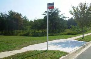
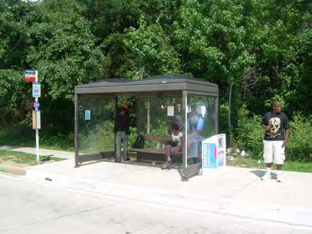
7 Final Report Section 1 Introduction BACKGROUND Over the past six years, there has been much effort in improving safety and accessibility of bus stops in the region. KFH Group has been a part of those efforts through inventory and assessment of bus stops in the region, including the 4,000 bus stop locations in Prince George s County. With limited public resources, one of the major challenges in implementing a bus stop improvement program is deciding what and where to focus those limited resources. Therefore being able to leverage existing data sources to prioritize bus stop locations where safety and accessibility improvements will have the greatest impacts is important. In 2007, a report prepared for the Washington Metropolitan Transit Authority (WMATA) identified the following accessibility challenges at bus stops: 24% of stops have no presence of a sidewalk 5% of stops have sidewalks that are obstructed 2% of stops have sidewalks that end short of the stop 74% of stops do not have an Americans with Disabilities Act (ADA) landing pad 8% of stops have sidewalks that do not connect to an existing ADA landing pad 81% of stops are missing at least one curb ramp connection These accessibility challenges were identified through an inventory and assessment of all bus stops in Prince George s County that was conducted in Technical Assistance TCL Program Pedestrian to Transit Accessibility Prioritization 1-1
8 Final Report PURPOSE The primary purpose of this project was to assist the County in identifying gaps in accessibility to active bus stops and to prioritize bus stop locations on which to focus limited resources to improve access and safety. This report is organized in four sections. The next section of this report provides a description of other bus stop improvement prioritization efforts in the Washington D.C. metropolitan region. In addition, national practices on prioritizing bus stop improvements are also documented in this section. The third section of the report outlines the methodology and criteria used for the prioritization of bus stop locations for improvements in Prince George s County. The fourth section of this report consists of the prioritization of bus stops for improvements based on the methodology described in Section 3. Maps and tables are used to illustrate the prioritization and bus stop locations. Technical Assistance TCL Program Pedestrian to Transit Accessibility Prioritization 1-2
9 Final Report Section 2 Local and National Practices INTRODUCTION This section of the report documents the review of local and national practices on the prioritization of bus stop improvements, and proposed criteria for prioritization of bus stop improvements. For the local review, the research team contacted each of the other jurisdictions in the Metro area to document what method is used in determining which bus stop locations to improve. Relevant national practices were reviewed through an online search of literature on prioritization of bus stops for safety and accessibility improvements. LOCAL PRACTICES City of Alexandria Alexandria maintains a bus stop inventory, based on the 2007 WMATA regional inventory, with supplemental and updated information based on more recent field work. There is currently very limited funding to make improvements to bus stops, though efforts are underway to request grant funding. However, the City works with developers and sidewalk improvement projects to include bus stop improvements within other projects whenever possible. Bus stop accessibility improvements are for the most part planned on an individual basis, unless there is a larger corridor improvement project underway. Whenever an individual bus stop improvement need surfaces, the City considers the following. If the bus stop is contained within a planned project or development, the City will wait and address the bus stop improvement need within the larger project. If not, and funds are available for making the improvement, the next criterion is ridership. In general, a minimum of 25 boardings per day are required for the improvement to be considered for funding. Technical Assistance TLC Program Pedestrian to Transit Accessibility Prioritization 2-1
10 Final Report There is also a sidewalk improvement program underway to install sidewalks in parts of Alexandria where there are currently no sidewalks (predominantly in the western part of the City), as part of the implementation of the June 2008 Pedestrian & Bicycle Mobility Plan. This plan recommended 148 bus stop improvements which will result in greater access to transit. Proximity to transit was a factor in prioritizing all pedestrian and bicycle improvements in the plan, with recommendations for facilities within 1/16 mile of a bus stop, 1/8 mile of a future transit corridor, or ½ mile of a Metrorail stop. The plan notes that a list of the top 50 bus routes with the highest bus ridership was identified and recommendations in the vicinity of these routes were automatically changed to short-term priorities. The plan recommends a total of $12,333,352 in Access to Transit improvements, including $4,080,367 in short-term improvements, $1,944,613 in medium-term, and $6,308,372 in long-term improvements. The recommended improvements include connecting sidewalks, pads, benches, shelters, and lighting. Ridership data (DASH and Metro bus boarding by stop) were used to select high-use bus stops for shelter and bench installations. The detailed scoring and prioritization methodology is explained in the Pedestrian & Bicycle Mobility Plan. In brief, the criteria included: Existing conditions: Potential to improve conditions for pedestrians and bicyclists where there are missing facilities, facilities that are in poor condition, or barriers to walking and bicycling (e.g., pedestrian deficiencies or low bicycle level of service grades identified through existing data and field inventories). In particular, detailed scores were developed for conditions indicative of: o Pedestrian Walking Along the Roadway Deficiency o Pedestrian and Bicycle Crossing Deficiency Existing and future demand: Potential for pedestrian and bicycle activity at a location based on objective land use and socioeconomic characteristics. o Proximity to Trip Attractors o Population and Employment Density and Automobile Ownership Reported crashes: Potential to improve conditions in locations with high numbers of reported crashes. Bus Ridership. Public input: Potential to address problems that were mentioned frequently by citizens in survey responses and s and at stakeholder meetings and public meetings. Technical Assistance TLC Program Pedestrian to Transit Accessibility Prioritization 2-2
11 Final Report Arlington County Arlington County in most cases uses the scoring method detailed in Chapter 3 of the 2002 Arlington County Bus Stop Evaluation Program Final Report. In this study, 100 bus stops were identified as highest priority for improvements (including installation of shelters and other comfort amenities), based on the following criteria: Ridership, up to 25 points based on total boardings and disembarking: 0-9 passengers per day: 0 points passengers per day: 5 points passengers per day: 10 points passengers per day: 15 points passengers per day: 20 points 50+ passengers per day: 25 points Surrounding trip generators: Twenty-five points for stops adjacent to any of the following: large apartment buildings or complexes, colleges, universities, technical schools, government centers, hospitals, major clinics, major shopping, department stores or major discount stores, or park and ride lots. Ten points for stops adjacent to any of the following: small apartment buildings, human service agencies, neighborhood shopping center (with grocery or drug stores), office buildings or major employment, high schools, senior centers, or town homes. Five points for stops adjacent to any of the following: churches, day cares, libraries, nursing homes/assisted living, recreation centers, or middle schools. Zero points for all other stops. Safety: Bus stops just before a crosswalk: 5 points Stopped bus straddles a crosswalk: 5 points Bus stop is just after a curve in the road: 2 points Bus stop is just over the crest of a hill: 2 points Technical Assistance TLC Program Pedestrian to Transit Accessibility Prioritization 2-3
12 Final Report No lighting at bus stop: 4 points Waiting passengers are hidden from view of approaching bus: 4 points There are no traffic controls at the nearest intersection: 1 point Other safety concerns: 2 points Accessibility Landing area is not at least 5 x8 : 5 points Landing area surface is uneven: 5 points Shelter is not accessible: 5 points Problems with adjacent sidewalk: 5 points Problems with access between bus and landing area: 5 points Each bus stop could be scored up to a total of 100 points (25 points for each of the above four categories), and the top 100 stops were identified based on highest scores. However, some stops were manually removed from the top 100 list because they received the highest scores for ridership and trip generators, but do not need to be improved upon, as they already were equipped with shelters. District of Columbia KFH Group did not receive a response from the District of Columbia at the time of this report. The District of Columbia currently has a shelter improvement program that is replacing older WMATA shelters with new Clear Channel shelters. Select stops with no passenger shelters are also getting new Clear Channel shelters. City of Fairfax The City of Fairfax has not established formal criteria for prioritizing bus stop/sidewalk connection improvements. In 2005, the City hired a consultant to do an inventory and needs assessment. Based on the recommendations of this study, the City has made recommended accessibility improvements at all stops for which there wasn t already a development underway or pending, or plans for road construction in which alignment might change. In most cases, these projects involved advancing a few feet of sidewalks. Ridership is a criterion for determining shelter location, but not sidewalk connections. Technical Assistance TLC Program Pedestrian to Transit Accessibility Prioritization 2-4
13 Final Report Fairfax County In 2005, the final report of the Fairfax County Bus Stop Inventory and Safety Study was completed. One of the outcomes of this study was the development of a prioritized list of bus stop improvements. A total of 3,941 bus stops were inventoried and assessed, and each stop was placed in one of the following categories: A Fully Accessible Stops. These stops meet all Americans with Disabilities Act (ADA) requirements. B1 Need improvement, but no action recommended at this time. Although not fully ADA compliant, these stops are comfortable and have only minor deficiencies. B2 Minor improvements needed. Stops in this category may have no waiting area other than the sidewalk/trail; or no paved access. C Needs Improvement. Missing essential elements for accessibility, and generally located on busier roadways. D Difficult Access. Access exposes users to traffic and waiting areas are uncomfortable. Next, the 655 stops found to be in categories C and D were scored and prioritized based on the following criteria: 1. Safety and Accessibility a. Pedestrian access b. Waiting safety c. Bus access 2. Cost to improve 3. Estimated ridership 4. Additional benefits from improvements (for example, secondary benefits to other pedestrians) Technical Assistance TLC Program Pedestrian to Transit Accessibility Prioritization 2-5
14 Final Report For each criterion, each stop was scored between 1 and 5. The scores were then weighted, according to the following table excerpted from the final report. Evaluation Criteria Prioritization Criteria and Weights Typical Considerations Weight Safety Sidewalk, ramps, pedestrian signals, lighting, and Pedestrian any obstacles to access Waiting safety Pad, shelter, obstacles, and proximity to roadway Bus access Lane width, sight distance, pull out area Estimated and Potential Current use, nearby generators and potential based Ridership on land use with fully accessible stops Cost Construction cost Secondary Benefit Non transit pedestrian safety or removal of vehicular or pedestrian obstacles The final report indicates that the weights were determined using the Hierarchal Analytic Process, also known as pair-wise comparison method. The weighted scores were then used to determine stop priority, and those 344 stops with an overall weighted score of 3.0 or above were considered high priority stops. The set of high priority stops was further subdivided into three groups (with Priority 1 the highest priority - having scores of 4.0 to 4.4, Priority 2 having scores with 3.5 to 3.9, and Priority 3 having scores of 3.0 to 3.4). Following the prioritization of individual stops, the study report recommended balancing efficiency in construction mobilization with high priority needs in planning improvement projects. The report noted that the most effective process is to focus on both priority and construction efficiency considerations. With this need for balance in mind, the following recommendations were made: Construction mobilization on small projects is a very large cost item. Materials should be procured and crews assembled to perform substantial work. Work on multiple stops in the same area as part of a contract item improves efficiency for the contractor. Work on identical items as part of the same contract also improves efficiency for the contractor. For example, sidewalk improvements, guardrail, and pad construction can be done in a repetitive and efficient manner. Technical Assistance TLC Program Pedestrian to Transit Accessibility Prioritization 2-6
15 Final Report Some stops should be improved, despite not being in close proximity to other bus stops needing improvement. It may also be cost-effective to target other minor improvements not included in the priority stop list. Among recommendations for construction preparation, the report also indicates Finalize Improvements for Priority Corridor. Using more detailed survey, confirm or modify improvements recommended by this Study. Thus, Fairfax County also appears to be factoring in corridor prioritization, though this is not a formal criterion in the scoring process described. City of Falls Church Falls Church does not currently have a formal method for determining which bus stops have priority for installing improvements. In 2010, the City will be developing a pedestrian and bicycle master plan that will be looking at access to transit and will help the city prioritize these type of improvements. Montgomery County Montgomery County completed a Bus Stop Facility Inventory and Assessment study in The study inventoried over 5,000 bus stops and provided a detailed, systemwide evaluation of each stop. The report categorized bus stop improvement needs into three categories: High Risk Stops, Moderate Risk Stops, and Low Risk Stops. High risk stops are bus stop locations where there were limited/obstructed sight lines for transit passengers and approaching vehicles, no safe area to wait for the bus, no safe pedestrian connection, or hazardous pedestrian crossing. Moderate risk stops were those where only the shoulder provided access to the stop, the stop was obstructed, there were missing or insufficient curb-ramps, or no connection between an existing ADA landing pad or sidewalk. Low risk stops are bus stop locations where there were no ADA landing pad, damaged passenger amenities, damaged pole and sign, or outdated/missing operator information. Following the study, the County Council approved $11,000,000 to make all the necessary bus stop improvements in the County. With the bus stop improvements fully funded, there wasn t the question of what to improve but rather how to efficiently and effectively make all the necessary improvements. Since 2005, Montgomery County has been improving the bus stops based on the recommended improvements. The County s approach to the bus stop improvements is to prioritize locations based on the following criteria: Local knowledge Ridership Customer complaints Technical Assistance TLC Program Pedestrian to Transit Accessibility Prioritization 2-7
16 Final Report Public requests Pedestrian collision data High incident zones Input from local stakeholders Potential coordination with roadway and sidewalk improvements In addition to the criteria listed above, County staff also ensures that the locations of improvements are evenly distributed throughout the service area. NATIONAL PRACTICES Valley Regional Transit (VRT), Boise, Idaho Appendix A provides the Bus Stop Prioritization Field Definitions used by VRT. While there was not a narrative explanation on the prioritization process, Appendix A presents clues as to what the prioritization criteria might be, such as: Sidewalk conditions ADA compliance of pedestrian ramps Existing bus stop pad Pedestrian Safety Concerns 1 thru 3 ranking system (visual observation from photo log to determine pedestrian safety concerns) Curb, gutter, and sidewalk no visual safety concerns No sidewalk but sufficient refuge area, or existing sidewalk behind planter, or existing partial sidewalk, or uneven sidewalk No sidewalk and limited refuge area Wheelchair Mobility (based on visual observation from photo log ) Sufficient Right-of-Way ( Visual Only : GIS Right-of-Way data against an aerial image ) Sufficiency of Existing Illumination ( Visual observation of photo log to determine the existing illumination condition ) Technical Assistance TLC Program Pedestrian to Transit Accessibility Prioritization 2-8
17 Final Report COMPASS Disability Rank Review of information provided by COMPASS to determine whether the bus stop was within a higher percentage disabled population area. Percentages provided by COMPASS. 1. Highest Priority 20% - 50% brackets 2. Secondary Priority 10% - 20% brackets 3. Lowest Priority 0% - 10% brackets COMPASS Elderly Rank Review of information provided by COMPASS to determine whether the bus stop was within a higher percentage elderly population area. Percentages provided by COMPASS. 1. Highest Priority 12% - 22% 2. Secondary Priority 7% - 12% 3. Lowest Priority 0% - 7% COMPASS Walkability Rank Review of information provided by COMPASS to determine general walkability ranking adjacent to the existing bus stop. Level of Service data provided by COMPASS. 1. A+ thru B Level of Service 2. B- thru C Level of Service 3. C- thru D- Level of Service Ridership, including: On Count & Off Counts at each stop Ratio of On Count & Off Counts divided by the count total to develop a ratio of persons boarding per counts taken, resulting in On & Off / Count (Rank) 1 through 3 ranking system: 1. Ridership Ratio from to 9.24 (n/a = no data provided by VRT count analysis also included as 1) Highest Priority 2. Ridership Ratio from to Secondary Priority 3. Ridership Ratio from 0.00 to Lowest Priority (Note: COMPASS is not defined in the online file.) The presence of a sidewalk, a disconnect to the pad, and/or the need for a sidewalk extension/addition were also factors. The formula for scoring the level of need was not indicated in the two documents found online. However, the Bus Stop Prioritization Field Definitions include the following Tier Ranks: Tier 0 No Improvements Needed: Locations that are currently fully compliant with the criteria developed for identifying improvements. Technical Assistance TLC Program Pedestrian to Transit Accessibility Prioritization 2-9
18 Final Report Tier 1 Highest Priority for Proposed Improvements: Locations that are the best candidates for bus stop site improvements due to existing condition. Tier 2 Medium Priority for Proposed Improvements: Locations where sites did not meet the criteria for the Tier 1 group, but no Red Flag issues were identified. Improvements are needed at these sites and construction appears feasible. These sites should be improved if funding remains after the Tier 1 sites have been improved. Further investigation and/or additional analysis could help better prioritize these sites. Tier 3 Lowest Priority for Proposed Improvements Red Flag Sites: No improvements recommended at this time. Locations that require substantial facility improvements and/or cannot be improved due to the existing stop location conditions. Many of these sites have insufficient right-of-way for the recommended improvements. Further, they include VRT Analysis Rank, described as supplemental information provided by VRT and used in developing aggregate improvement recommendations for each stop location. The VRT rank focused on whether the sidewalk was attached to the curb. Finally, the document indicates that priorities were determined by a combination of Tiers and VRT rank. Seven priority levels were developed: Priority 1: Highest Priority Improvement Sidewalk Not Attached Priority 2: Secondary Priority Improvement Sidewalk Not Attached Priority 3: Highest Priority Improvement Sidewalk Attached Priority 4: Secondary Priority Improvement Sidewalk Attached Priority 5: Highest Priority Improvement Meandering / No Sidewalk Priority 6: Secondary Priority Improvement Meandering / No Sidewalk Priority 7: Lowest Priority Improvement Varying Sidewalk Condition Thus, it appears from this list that the three priority tiers (highest, secondary, and lowest) are subdivided by sidewalk attachment conditions (Sidewalk Not Attached, Sidewalk Attached, Meandering / No Sidewalk, and Varying Sidewalk Condition). Technical Assistance TLC Program Pedestrian to Transit Accessibility Prioritization 2-10
19 Final Report St. Louis Metro, Missouri According to St. Louis (Missouri) Metro s 2007 annual report, the agency initiated a major effort in FY 2007 to improve the accessibility of its bus stops. The effort included an evaluation of over 9,000 bus stops and identification of those stops most in need of improvement. The report also indicates that Metro launched an education and coordination campaign designed to encourage the improvement of bus stops and sidewalks throughout the St. Louis region, including an informational workshop to promote bus stop accessibility and share information on bus stop location and accessibility with local governments, private firms, Missouri Department of Transportation, the City of St. Louis, and St. Louis County. The agency s 2008 annual report indicated that Metro constructed 65 new accessible stops, with a second phase of improvements set to begin in early The report also states that Metro also continues to engage communities in the effort to ensure commuters with limited mobility or who use wheeled mobility devices have safe access to bus stops. The Missouri Department of Transportation, St. Louis County, and various municipalities are now working with Metro to create more accessible transit and pedestrian environments. A May 2007 slide presentation indicated that a quantitative score for each candidate stop is calculated based on stop-specific attributes: Average daily boardings (converted to interval 1-5) Employment density (1-5) Residential density (1-5) Transfer potential (binary) Proximity to MetroLink (binary) Passenger amenities: bench, shelter, lighting, garbage receptacle (binary) The total score was the sum of: Riders Residential density Employment density Rail proximity x 3 Bench x 0.5 Shelter x 0.5 Lighting x 0.75 Transfer x 2 Technical Assistance TLC Program Pedestrian to Transit Accessibility Prioritization 2-11
20 Final Report A May 2008 construction bid solicitation procured construction of landing pads and curb cuts described as Phase 1 Bus Stop ADA Enhancement Project. A March 2009 document indicated that, as part of key upcoming projects in the next 12 months, Metro has initiated a bus stop upgrade project aimed at increasing the percentage of accessible bus stops by 5% in FY Four hundred and seven additional bus stops are now accessible due to this project. Metropolitan Transit, Minneapolis, Minnesota Metropolitan Transit s January 2009 Bicycle and Pedestrian Connections to Transit Infrastructure Study final report provided detailed information about the prioritization of bus stop improvements in the Minneapolis-St. Paul area. The report indicates that bus stops were ranked for prioritization based on their need for improvements to facilitate access for both bicyclists and pedestrians. Improvement needs were grouped into three major categories: legal access (i.e., per ADA), safety (including pedestrian and bicycle safety), and facilities (i.e., comfort and convenience amenities) and each bus stop were scored based on variables within each group of needs: Legal Access: ADA Accessible (max. 3 points) ADA Pad for Wheelchair (max. 4 points) Safety: Crash History - Bicycle (max. 3 points) Crash History - Pedestrian (max. 3 points) Safety Crosswalk Access (max. 3 points) Lighting (max. 3 points) Level of Service (max. 2 points) Sidewalk Access (max. 2 points) Bike Lane Access (max. 2 points) Right-of-Way Buffer (max. 2 points) Facilities: Shelter (max. 1 point) Bench (max. 1 point) Bus Schedule (max. 1 point) Trash (max. 1 point) Bike Locker (max. 1 point) Technical Assistance TLC Program Pedestrian to Transit Accessibility Prioritization 2-12
21 Final Report This scoring reflects a hierarchical pyramid of descend importance on needs, with Legal Access as the agency s top priority and convenience amenities as the lowest for the purposes of this project. The maximum number of points for each variable is applied where stops have a high need for improvement, with 0 points if no need identified. Detailed instructions on how the point values for each variable was determined are found in the report beginning on page 6. These scores were then weighted according to a system of tier rankings for each route serving the stop. The route tier rankings were based on the frequency of service, bicycle and pedestrian count data, and the number of recorded pedestrian and bicycle crashes in the area. TriMet, Portland, Oregon TriMet s 2009 Transit Investment Plan (TIP) indicates that in FY 2010, TriMet will begin to analyze and prioritize pedestrian infrastructure needs, building on an existing inventory of sidewalks. Prioritization will be based on providing better access to transit and encouraging local walking trips. The study will take a macro-level look at pedestrian needs and will identify specific projects. However, only rough descriptions and cost estimates will be provided. The study will not provide detailed specifications for projects. The 2009 TIP also indicated that in FY 2008, TriMet provided an inventory of high-use bus stops for jurisdictions to use in planning pedestrian investments funded through the Metropolitan Transportation Improvement Program (MTIP) as well as private development. MTIP bus stop improvement objectives include prioritizing investments on the basis of ridership, destination type, and land use per TriMet s Bus Stop Level rating program. Hillsborough Area Regional Transit (HART) HART of Florida published its bus stop improvement program in the 2008 Bus Stop & Facility Accessibility Study report. HART s bus stop improvement responsibilities were first grouped into three implementation groups. First, quick fix bus stop improvements were ascertained by defining identified issues that could be quickly and easily addressed by HART staff at relatively low cost. Second, bus stops were identified that could possibly be improved in conjunction with planned transportation projects. Third, a five-year phased implementation plan was created to help guide HART in addressing the more significant improvements at the remaining bus stops. Quick fix improvements included: replacement or modification of the bus stop sign to address compliance issues; relocation of a HART bench because it poses an obstruction; and/or relocation of a leaning rail because it poses an obstruction. Technical Assistance TLC Program Pedestrian to Transit Accessibility Prioritization 2-13
22 Final Report Bus stop improvements that could be completed in conjunction with other planned transportation projects, such as roadway widening or bicycle and pedestrian improvements being implemented by other jurisdictions or organizations, are considered to be a priority that can be timed with the planned project. The remaining improvements were prioritized for implementation through a twostep process. 1. The accessibility, safety/security, and operational efficiency conditions of each bus stop were rated. a. Conditions were rated as either high, medium, or low (those in greatest need) High Either the stop has no deficiencies or very few less-critical deficiencies. Medium Either the stop has very few critical deficiencies or a greater number of less-critical deficiencies. Low Either the stop has many critical deficiencies, a combination of critical and less-critical deficiencies, or all of its elements are deficient to some degree. 2. Improvements were assessed for potential benefit to be derived by reviewing bus stop activity and trip generator activity factors (i.e., community facilities). Finally, a GIS analysis of the distribution of the recommended improvements was conducted to ensure nondiscrimination per Title VI. SUMMARY Table 2-1 summarizes the examples found through an online literature search of various prioritization criteria and procedures. Technical Assistance TLC Program Pedestrian to Transit Accessibility Prioritization 2-14
23 Table 2-1: Prioritization Criteria for Bus Stop and Pedestrian Connection Improvements in Other Areas Accessibility Conditions Safety Conditions Ridership Pedestrian Counts Bicycle Counts Customer Recommendations Employment Density Population Density Elderly Population Disabled Population Intermodal Connectivity / Transfer Potential Existing Amenities Potential to Include in Another Project Destination Type / Land Use Ease of Improvement Title VI Equitable Distribution Construction Efficiency / Cost Jurisdiction City of Alexandria, Virginia Arlington County, Virginia District of Columbia City of Fairfax, n.a. n.a. n.a. n.a. n.a. n.a. n.a. n.a. n.a. n.a. n.a. n.a. n.a. n.a. n.a. n.a. n.a. Virginia Fairfax County, Virginia City of Falls Church, n.a. n.a. n.a. n.a. n.a. n.a. n.a. n.a. n.a. n.a. n.a. n.a. n.a. n.a. n.a. n.a. n.a. Virginia Montgomery County, Maryland St. Louis Metro, Missouri Valley Transit, Boise, Idaho Metropolitan Transit, Minneapolis, Minnesota Per route Per route Per route TriMet, Portland, Oregon HART, Hillsborough Florida 2-15
24
25 Final Report Section 3 Methodology INTRODUCTION In an attempt to improve the bus stops throughout Prince George s County, KFH Group produced a categorization of criteria and relative measurements that identify and prioritize essential improvements. The prioritization that is a result of this methodology aspires to address concerns of safety, connectivity, and accessibility, surrounding the County s bus stops through the additional incorporation of factors associated with potential usage and existing land use. By employing specific measurements within the four criteria of safety, usage, accessibility and land use, KFH Group was able to produce a ranking of bus stops in need of improvements; subdivided into time frames of importance. The following categories outline these criteria by detailing the performed measurements and the datasets and scoring schemes utilized within them. CRITERIA Criterion I: Safety Identifying bus stops that exist in potentially dangerous locations is a critical component to this prioritization process. A bus stop that is established in an area where pedestrian safety is jeopardized has an inordinate negative impact on public health and will subsequently cause consequences regarding the impression of the transit service throughout the community, and performance of the specific bus stop. As such, safety was provided with a weight higher than any of the other three criterions. To score the safety criterion, KFH Group obtained a dataset from the Traffic Safety Division within the Department of Public Works & Transportation, which detailed all pedestrian and automobile accidents in Prince George s County from January 1, 2002 through December 31, The first filter applied to this dataset was to eliminate those accidents where either the driver or pedestrian were impaired by Technical Assistance TCL Program Pedestrian to Transit Accessibility Prioritization 3-1
26 Final Report alcohol or drug consumption per the police officer s incident report, while the second filter eliminated those reports where the intersection fields were either missing or illegible. After filtering the dataset to remove these two qualifiers, a dataset of 2,534 accidents remained. This dataset was further treated with a process that mapped the remaining locations based upon a produced spatial reference determined by the cross streets listed in the police report. Once this spatial determination was completed, a dataset of 1,622 pedestrian-vehicular accidents was finalized. The lone measurement for the safety criterion carried a maximum score of 40 points and was determined through a combination of the number of incidents and the propinquity of an accident site to a bus stop. A bus stop that was within a buffer of 165- feet (1/32 nd of a mile) to an accident site with five or more incidents was given a score of 40 points. Whereas, a bus stop that was within a buffer of 165-feet to an accident site with two to four incidents was given a score of 30 points. A bus stop that was within a buffer of 165-feet to an accident site with one incident was given a score of 20 points Those bus stops outside of a 165-foot radius to a pedestrian-vehicular accident were not given any points in this measurement. Criterion II: Usage Determining the amount of potential riders boarding at a particular bus stop is an important element to consider when deciding whether to improve one bus stop over another. Intuitively, a bus stop that produces a higher ridership figure has more pedestrians utilizing the stop, and consequently any inadequacies found near the stop will impact a greater number of individuals. This logic leads to the conclusion that bus stops used by a greater population should be improved before those stops with a lower demand. The usage criterion was created to calculate this potential of supply for the transit service and weighted with the second-highest point total. The obvious manner in which to measure this criterion would be to examine ridership figures for each bus stop in the county. Unfortunately, this dataset was not readily available at the time of this study. Therefore, two separate measurements, based upon compiled datasets provided by the 2000 United States Census, were utilized in lieu of this circumstance. The first performance measurement was a five-tier classification of overall population density estimates for Year 2007 at the block group level. For this measurement, bus stops were provided with the persons per square mile figure that was associated with their particular block group. The bus stops were then categorized by Jenk s natural breaks into five separate rankings (Very Low, Low, Moderate, High, and Very High) that signified the population density of the associated block group. For instance, a bus stop located in the block group with the highest population density was categorized as being Very High. The awarded point totals were designated by a factor of three with the mentioned bus stop receiving a score of 15 Technical Assistance TCL Program Pedestrian to Transit Accessibility Prioritization 3-2
27 Final Report points for being Very High. A bus stop being categorized as High was awarded a score of 12 points, a bus stop denoted as having a Moderate surrounding population density was designated nine points, and so on. The second performance measurement sought to quantify and score the density of potential users of a bus stop by examining the characteristics that reflect core riders of public transit systems. In an effort to compose this measurement, the density totals for core riders in the Year 2000 (persons with disabilities, persons living below povertylevel, persons over the age of 60, and households without a vehicle) within each block group were accumulated. Each block group received a density figure based upon the summation of these four factors that was ranked in ascending order. The block groups were then categorized similarly to the overall population density measurement by Jenk s natural breaks, and with the block group with the highest density of core riders receiving a classification of Very High. The five-tier allocation of scores completed for the first performance measurement was replicated in scoring this measurement of core riders. Criterion III: Accessibility An obvious presumption behind an acceptable bus stop environment is that the stop can be properly accessed by the pedestrian traversing the immediate street surroundings. Accessibility in this context means the availability or convenience to which an individual may approach and enter the bus stop environment. The prominence behind this concept is why it has been isolated as a criterion and apportioned 20 points. Undoubtedly, a variety of measurements that may adequately quantify accessibility exist, but for the intention of this methodology four measurements were utilized, each of which drew from the database of Prince George s County bus stops. The first measurement represented the presence of a sidewalk connection between the bus stop and the nearest intersection. A complete and passable sidewalk is necessary for any bus stop with an accessible nature. This measure was classified into three categories detailing its presence or whether there were any obstructions to the pathway. Zero points were granted to a bus stop that has the presence of an unobstructed sidewalk, four points were presented to a stop that has the presence of an obstructed sidewalk, and eight points were awarded to a stop in which no sidewalk was present. The second measurement investigated the existence of a landing pad that is compliant with the Americans with Disabilities Act Accessibility Guidelines for Buildings and Facilities (ADAAG). According to this document, bus stop pads must have a firm, stable surface with a minimum clear length of 96 inches and a minimum clear width of 60 inches. Like the previous measure, the landing pad measure was Technical Assistance TCL Program Pedestrian to Transit Accessibility Prioritization 3-3
28 Final Report classified into three categories, which detailed its presence and whether or not the pad is in accordance to ADAAG provisions. Zero points were granted to a bus stop that has the existence of an unobstructed eight-foot by five-foot landing pad, three points were presented to a stop that has the existence of an obstructed eight-foot by five-foot landing pad, and six were awarded to a stop without a landing pad. The third measurement looked into the number of designated crosswalks that were missing from the intersection nearest to a particular bus stop. For this particular study, a crosswalk was considered an accessibility criterion rather than a safety criterion; because of the limitations a pedestrian may face in crossing a road without an assigned right-of-way and the idea that crosswalks are one component within a fully functioning street infrastructure. In this measure, there were three classifications that a bus stop may be characterized based upon the amount of missing crosswalks at the nearest intersection. Zero points were granted to a bus stop in which no crosswalks were missing from the nearest intersection, one point was presented to a stop in which one or two crosswalks were missing, and two points were awarded to a stop in which three or four crosswalks were missing. As a note, some bus stops had fewer than four crossings, such as mid-block bus stops or stops at T-intersections, and possessed nonapplicable crossings that were not considered to be missing. The final measurement for the accessibility criterion gauged the number of curb ramps that were missing from the intersection nearest to a certain bus stop. Curb ramps are noted in the ADAAG as accessible elements to an exterior route and are therefore employed in this study as a measurement for the accessibility criterion. The determination and scoring of this dimension was completed in the same manner as the measurement for missing crosswalks. Zero points were granted to a bus stop in which no curb ramps were missing from the nearest intersection, one point was presented to a stop in which one or two curb ramps were missing, and two points were awarded to a stop in which three or four curb ramps were missing. Similarly, those stops with fewer than four crossings were not penalized for this characteristic. Criterion IV: Land Use Issues concerning public transit are synonymous with matters of the built environment and the overall transportation-land use connection. The origin or destination of a transit trip is integrated with a land use function, which must be accounted for when determining improvements to transit services. A bus stop is more often than not positioned in a strategic setting that allows the transit service to most effectively and efficiently serve these trip generators. Under this acknowledgement, a prioritization must look into the demand-side of the potential bus trip that in this case is represented by the land use criterion. The land use criterion was created to calculate Technical Assistance TCL Program Pedestrian to Transit Accessibility Prioritization 3-4
29 Final Report this potential for demand of the service and weighted with a maximum total of 10 points. The first measurement of the land use criterion discovered the proximity of a medical center to a bus stop. The presumption behind this measure is that services provided by a medical center carry a high societal obligation and that public health should be offered in an unproblematic manner. Bus stops that are within a reasonable proximity to medical centers should be a priority due to this responsibility and the demand for service that is generated by these facilities. For this measurement, a bus stop within a half-mile buffer from a medical center was given a score of two points, while a bus stop outside of this half-mile proximity was granted zero points. The second measurement of the land use criterion looked into the proximity of public and private educational institutions throughout the county that provide instruction at or above the level of high school. An argument detailing a public good is also made in this circumstance, as well as the concept that the population needing this land use has a greater reliance on public transit. This measurement was calculated in the same approach used to assess hospital proximity, where a bus stop within a halfmile buffer from a school was given a score of two points, while a bus stop outside of this half-mile propinquity was granted zero points. The third measurement of the land use criterion gauged whether a bus stop was located within a Priority Funding Area (PFA), as defined by the Maryland Department of Planning and in accordance with the 1997 PFA Act. The intent of these areas is to help concentrate development within existing communities and places where local governments want State investment to support future growth. In the spirit of this act, bus stops in need of improvements that are located within these designated areas should be made a priority over stops located outside of PFAs. For this land use measurement, bus stops located within a PFA were given a marginal value of two points, while those stops outside of a PFA were not awarded any points. As an aside, it should be noted that only 87 bus stops, or 2.3% of the County s stops, are located outside of a PFA. The fourth measurement of the land use criterion investigated whether a bus stop was located within an activity center or activity corridor outlined by the Prince George s County Approved General Plan that was completed by the Maryland- National Capital Park and Planning Commission in October Similar to PFAs, these areas are explicitly targeted growth zones where expansion and redevelopment can capitalize on existing infrastructure, in which the benefits to the County outweigh the potential costs. For this measurement, a bus stop located within a determined center or corridor was given a value of two points, while those stops outside of a designated center or corridor were not awarded any points. Technical Assistance TCL Program Pedestrian to Transit Accessibility Prioritization 3-5
30 Final Report The final measurement of the land use criterion captures the economic activity, in terms of aggregate total of employees, within the geography surrounding the bus stop. The employment data was provided by the United States Census Bureau s Longitudinal Employer-Household Dynamics (LEHD) dataset, which accumulates federal and state administrative data on employers and employees from censuses, surveys, and administrative records. One caveat with this dataset is that it fails to account for federal civilian employees, uniformed military personnel, self-employed workers, and informally employed workers. In an effort to award points based upon this final measure, each Census tract was given an employment density figure. The Census tracts were then categorized into three unique classes (Low, Moderate, and High) through Jenk s natural breaks. Each bus stop was given the label that corresponded with the employment classification of the surrounding Census tract. The awarded point totals were assigned in accordance to these three classes, with a bus stop in a Census tract with a High employment density receiving a score of 2 points, a bus stop being categorized as Moderate being awarded a score of 1 point, and a bus stop denoted as having a Low surrounding employment density being designated with zero points. SUMMARY These four separate criterions were presented with different weights that were objectively assigned to each overarching characteristic based upon communication with planning officials at Prince George s County and interpretations of regional and national efforts undertaken during the literature review process. A visual graphic representing this hierarchy of criteria, with the assigned weights, and the related measures, with scores, is depicted in Figure 3-1. These scores were summed, ranked, and assigned to Tier 1 (short-term), Tier 2 (medium-term), and Tier 3 (long-term) time frames. Tier 1 Locations that could potentially have safety implications for passengers who are at the stop, accessing the stop, and/or leaving from the bus stop environment. These locations should be a priority for immediate attention and review. Tier 2 Locations that possess accessibility concerns. The bus stop could be seamlessly connected by a sidewalk, but may still have safety implications due to the built environment, traffic pattern, placement of the stop, and/or pedestrian behavior. Tier 3 Locations not identified in either Tier 1 or Tier 2. Technical Assistance TCL Program Pedestrian to Transit Accessibility Prioritization 3-6
31 Figure 3-1: Weighting & Scoring of Bus Stop Prioritization Criteria & Measurements for Prince George s County (40 Points) (30 Points) IBILITY (20 Points) LAND (10 Points) 3-7 Number of Incidents and Proximity of Automobile Pedestrian Accident (40 Points) Five or More Incidents, Inside of 165 Feet (40) Two to Four Incidents, Inside of 165 Feet (30) One Incident, Inside of 165 Feet (20) Zero Incidents, Inside of 165 Feet (0) Classification of Transit Dependent Persons Density (15 Points) Very High (15) High (12) Moderate (9) Low (6) Very Low (3) Classification of Overall Population Density (15 Points) Very High (15) High (12) Moderate (9) Low (6) Very Low (3) Sidewalk Presence (8 Points) No (8) Obstructed (4) Yes (0) Landing Pad Presence (6 Points) No (6) Obstructed (3) Yes (0) Missing Crosswalks (3 Points) 3 or 4 (3) 1 or 2 (1) 0 (0) Proximity to a Hospital (2 Points) Inside of Half Mile Buffer (2) Outside of Half Mile Buffer (0) Proximity to a School (2 Points) Inside of Half Mile Buffer (2) Outside of Half Mile Buffer (0) Proximity to a Priority Funding Area (2 Points) Inside (2) Outside (0) Missing Curb Ramps (3 Points) 3 or 4 (3) 1 or 2 (1) 0 (0) Proximity to an M NCPPC Center or Corridor (2 Points) Inside (2) Outside (0) Classification of Employment Density (2 Points) High (2) Moderate (1) Low (0)
32 Final Report Section 4 Prioritization INTRODUCTION An accumulation of the four criteria outlined in the methodology produced a prioritization score for each Prince George s County bus stop. The 3,728 bus stops were then categorized into three tiers of improvement immediacy based upon the proximity of the bus stop to a pedestrian-vehicular accident and the present accessibility of the bus stop. Once the bus stops were divided into these unique tiers, they were ranked, with the bus stop having the highest prioritization score in a specific tier being recognized as the stop with the greatest need for improvement. In addition to the four criteria utilized in determining the prioritization score, each bus stop has been presented with attributes identifying the number of nearby pedestrianvehicular accident sites, as well as the proximity of a WMATA Metrorail station or traffic signal. The first attribute was measured within the safety criterion, while the latter two attributes simply provide complementary spatial and site information. As previously mentioned, all bus stops in Prince George s County have been separated into unique tiers. The following is a description of the three tiers as well as figures and tables that further illustrate the findings. BUS SP Tier 1: Short-Term Improvements Bus stop locations that have the potential to be a public safety risk, based upon previous conditions, have been classified as stops in Tier 1. The stops in Tier 1 are located within a proximity of 165 feet from the scene of a past vehicular-pedestrian accident. Being such, these bus stops would seem to have increased safety implication to passengers waiting at the stop, accessing the stop, or departing the stop. A graphical Technical Assistance TLC Program Pedestrian to Transit Accessibility Prioritization 4-1


33 Final Report display of these accident sites with the number of instances at a particular location is exhibited in Figure 4-1. Bus stops that are in proximity to a prior accident have been determined to be short-term improvements. These stops have been ranked based upon their prioritization score. Table 4-1 displays the top 40 bus stops within the first tier, while Appendix B details all 555 bus stops within this tier and Figure 4-2 presents the spatial location of the bus stops with short-term improvements. Additional cartographic representations of Tier 1 bus stops with characteristics within the usage and land use criterions have also been developed. Figure 4-3 displays the population density for Census block groups in Prince George s County with an overlay of the 555 bus stops in Tier 1, while Figure 4-4 shows the density of core riders (persons with disabilities, persons living below poverty-level, persons over the age of 60, and households without a vehicle) for Census block groups with the first tier bus stops. In regard to the measure of the land use criterion, Figure 4-5 displays first tier bus stops overlaid upon priority funding areas outlined by the Maryland Department of Planning, as well as the centers and corridors identified in the Prince George s County Approved General Plan, while Figure 4-6 shows first tier bus stops and employment density for Census tracts. Tier 2: Medium-Term Improvements Whereas bus stops with past and present safety concerns are designated as shortterm improvements, those bus stops where accessibility to the bus stop environment is a problem are placed into the Tier 2 category. The bus stops outside of Tier 2 that have a total access score of 15 or greater were allocated as stops with medium-term improvements. The rationale behind this value is that any bus stop with this total access score will have a minimum of three accessibility problems, which are in need of enhancement. Table 4-2 displays the top 40 bus stops in Tier 2 and Appendix C lists all 773 bus Tier 1: Short-Term Improvement Vehicular Damage to Guardrail Tier 2: Medium-Term Improvement Unsafe Accessibility for Pedestrians stops in need of medium-term improvements, whereas Figure 4-7 displays the physical location of these second tier stops. Technical Assistance TLC Program Pedestrian to Transit Accessibility Prioritization 4-2
34 Figure 4-1: Pedestrian-Vehicular Accidents in Prince George's County, H o w a r d Laurel M o n t g o m e r y South Laurel Beltsville Langley Park College Park Greenbelt A n n e A r u n d e l Chillum Hyattsville New CarrolltonSeabrook Bowie Bladensburg D i s t r i c t o f C o l u m b i a Landover Largo Hillcrest Heights Suitland Upper Marlboro Camp Springs Oxon Hill Cheltenham Clinton Fort Washington Brandywine C a l v e r t Legend Pedestrian-Vehicular Accidents Number of Incidents* and Above C h a r l e s *Source: Prince George's County Department of Public Works & Transportation,Traffic Safety Division Miles
35 Table 4-1: Tier 1 Bus Stops in Prince George's County (Top 40) 4-4 PROXIMITY LAND INDIAN HEAD HWY AUDREY LN No Yes UNIVERSITY BLVD 14TH AVE No Yes NEW HAMPSHIRE AVE UNIVERSITY BLVD No Yes UNIVERSITY BLVD GUILFORD RD No Yes RIGGS RD DREXEL ST No Yes DEAL DR MARCY AVE No Yes TH AVE LANGLEY WAY No Yes NEW HAMPSHIRE AVE MERRIMAC DR No Yes NEW HAMPSHIRE AVE LEBANON ST No Yes MERRIMAC DR 15TH AVE No Yes ADDISON RD WALKER MILL RD No Yes ANNAPOLIS RD 62ND AVE No Yes ANNAPOLIS RD 68TH PL X No BALTIMORE AVE CHERRY HILL RD Yes TH AVE LANGLEY WAY No Yes MERRIMAC DR 14TH AVE No Yes MERRIMAC DR 14TH AVE No Yes MARLBORO PK BROOKS DR No Yes ADELPHI RD ERIE ST No No MERRIMAC DR NEW HAMPSHIRE AVE No Yes RIGGS RD KEOKEE ST No Yes SURREY SERVICE DR REGENCY PKWY X No No RIGGS RD JASMINE TERR X No Yes UNIVERSITY BLVD PHELPS RD No No BRANCH AVE CURTIS DR Yes MARLBORO PK LORRING DR No Yes BRIGHTSEAT RD HAMLIN ST No No EAST WEST HWY LEDO TERR X Yes NEW HAMPSHIRE AVE QUEBEC ST No Yes BALTIMORE AVE ERIE ST No No KENILWORTH AVE RITTENHO ST No Yes CIPRIANO RD BRAE BROOKE DR No Yes ANNAPOLIS RD 62ND AVE No Yes AGER RD LANCER DR X No OWENS RD KENNEBEC ST No Yes IVERSON ST SUTLER RD No No RIGGS RD MERRIMAC DR No Yes LANDOVER RD ANNAPOLIS RD (MD 450) No Yes GREENBELT RD CHERRYWOOD LN Yes COLLINGN RD HOLIDAY LN No No
36 Figure 4-2: Tier 1 Bus Stops H o w a r d Laurel M o n t g o m e r y South Laurel Beltsville Langley Park College Park Greenbelt A n n e A r u n d e l Chillum Hyattsville New CarrolltonSeabrook Bowie Bladensburg D i s t r i c t o f C o l u m b i a Landover Largo Hillcrest Heights Suitland Upper Marlboro Camp Springs Oxon Hill Cheltenham Clinton Fort Washington Brandywine C a l v e r t C h a r l e s Legend Tier 1 Bus Stops (Short-Term) Remaining Bus Stops Miles 4-5
37 Figure 4-3: Tier 1 Bus Stops and Population Density H o w a r d Laurel M o n t g o m e r y South Laurel Beltsville Langley Park College Park Greenbelt A n n e A r u n d e l Chillum Hyattsville New CarrolltonSeabrook Bowie Bladensburg D i s t r i c t o f C o l u m b i a Landover Largo Hillcrest Heights Suitland Upper Marlboro Camp Springs Oxon Hill Cheltenham Clinton Fort Washington Brandywine Legend Tier 1 Bus Stops (Short-Term) Prince George's Block Groups Persons per Square Mile (2007)* Very Low Low Moderate High Very High *Source: United States Census Bureau C h a r l e s 4-6 C a l v e r t Miles
38 Figure 4-4: Tier 1 Bus Stops and Population Density of Core Riders H o w a r d Laurel M o n t g o m e r y South Laurel Beltsville Langley Park College Park Greenbelt A n n e A r u n d e l Chillum Hyattsville New CarrolltonSeabrook Bowie Bladensburg D i s t r i c t o f C o l u m b i a Landover Largo Hillcrest Heights Suitland Upper Marlboro Camp Springs Oxon Hill Cheltenham Clinton Fort Washington Brandywine Legend Tier 1 Bus Stops (Short-Term) Prince George's Block Groups Density of Core Riders (2000)* Very Low Low Moderate High Very High *Source: United States Census Bureau C h a r l e s 4-7 C a l v e r t Miles
39 Figure 4-5: Tier 1 Bus Stops with Centers, Corridors, and Priority Funding Areas H o w a r d Laurel M o n t g o m e r y South Laurel Beltsville Langley Park College Park Greenbelt A n n e A r u n d e l Chillum Hyattsville New CarrolltonSeabrook Bowie Bladensburg D i s t r i c t o f C o l u m b i a Landover Largo Hillcrest Heights Suitland Upper Marlboro Camp Springs Oxon Hill Cheltenham Clinton Fort Washington Brandywine C a l v e r t Legend Tier 1 Bus Stops (Short-Term) General Plan Centers General Plan Corridors Priority Funding Areas C h a r l e s Miles 4-8
40 Figure 4-6: Tier 1 Bus Stops and Employment Density H o w a r d Laurel M o n t g o m e r y South Laurel Beltsville Langley Park College Park Greenbelt A n n e A r u n d e l Chillum Hyattsville New CarrolltonSeabrook Bowie Bladensburg D i s t r i c t o f C o l u m b i a Landover Largo Hillcrest Heights Suitland Upper Marlboro Camp Springs Oxon Hill Cheltenham Clinton Fort Washington Brandywine C a l v e r t Legend Tier 1 Bus Stops (Short-Term) Prince George's Tracts Jobs per Square Mile Low Moderate High *Source: United States Census Bureau, Longitudinal Employer-Household Dynamics, C h a r l e s Miles
41 Table 4-2: Tier 2 Bus Stops in Prince George's County (Top 40) 4-10 PROXIMITY LAND SURREY SERVICE DR SURREY SQ APTS No No PARK BERKSHIRE SURREY SQ LANE No No SURREY SQUARE LA PARK BERKSHIRE No Yes NORTHWEST DR LEDO TERR Yes SOUTHVIEW APTS # No SOUTHERN AVE FAIRHILL DR No COOPER LANE PARKWOOD ST No GOOD LUCK RD DOCRS HOSPITAL No No SUITLAND RD SHADYSIDE AVE Yes HIL MAR DR N HILL MAR CIR No No TH PKWY CURTIS DR No SOUTHERN AVE OXON RUN PL No INDIAN HEAD HWY LIVINGSN RD No No SOUTHERN AVE FOREST GLADE LN No FISHER RD DAMIAN DR No No UNIVERSITY BLVD TULANE DR No No EDMONSN RD HAMILN ST No No EDMONSN RD GALLATIN ST No No OWENS RD # No No BERKLEY ST 26TH AVE Yes CURTIS DR HILLCREST PKWY Yes SHADYSIDE RD HOWE AVE No LARCHMONT AVE CLOVIS AVE No VAN DN RD LAUREL OAKS LA No No SOUTHERN AVE 34TH ST No BRINKLEY RD HUNTCREST CONDOS No No BRINKLEY RD HUNTCREST CONDOS No No PENNSYLVANIA AVE CEDAR HILL FUNERAL No No BRANCH AVE MARLOW HEIGHTS SC No PENNSYLVANIA AVE PENN STATION S/C No No LA SALLE RD WOODREEVE RD No HIGH VIEW TERR # No HAYES ST JOHNSON AVE No BRINKLEY RD HUNTLEY SQ DR No No EAST WEST HWY KENTLAND AVE No No LANHAM SEVERN RD 98TH AVE No No LANHAM SEVERN RD 98TH AVE No No LANHAM SEVERN RD 96TH AVE No No GOOD LUCK RD GREENBELT RD No Yes CENTER PARK RDWY MAIN ENT RDWY No No
42 Figure 4-7: Tier 2 Bus Stops H o w a r d Laurel M o n t g o m e r y South Laurel Beltsville Langley Park College Park Greenbelt A n n e A r u n d e l Chillum Hyattsville New CarrolltonSeabrook Bowie Bladensburg D i s t r i c t o f C o l u m b i a Landover Largo Hillcrest Heights Suitland Upper Marlboro Camp Springs Oxon Hill Cheltenham Clinton Fort Washington Brandywine C a l v e r t C h a r l e s Legend Tier 2 Bus Stops (Medium-Term) Remaining Bus Stops Miles 4-11

43 Final Report As with bus stops in Tier 1, further cartographic depictions of Tier 2 bus stops within the usage and land use criterions have been created. Figure 4-8 displays the population density for Census block groups in Prince George s County with an overlay of the Tier 2 bus stops, while Figure 4-9 shows the density of core riders for Census block groups with the medium-improvement bus stops. The land use measurements for PFA, centers, and corridors are shown with all Tier 2 bus stops in Figure 4-10, while Figure 4-11 displays an overlay of employment density with the Tier 2 bus stops. Tier 3: Long-Term Improvements The final tier consists of those bus stops not categorized into either of these first two tiers. Tier 3 bus stops are stops with a comparatively low prioritization score that do not possess significant safety or accessibility concerns. Many of these stops require improvements, but the improvements are not viewed as being as urgent as the stops classified as Tier 1 or Tier 2. Oftentimes, Tier 3 bus stops received a lofty prioritization score, because the stops received high marks in the total usage or land use score. Table 4-3 displays the top 40 bus stops in Tier 3 and Appendix D lists the remaining 2,400 bus stops in Prince George s County, whereas Tier 3: Long-Term Improvement High Potential for Usage and Without a Pedestrian Pad Figure 4-12 displays the physical location of these stops that are viewed as long-term improvements. A map of Tier 3 bus stops with the usage measurement of population density for Census block groups in Prince George s County is depicted in Figure 4-13, while these same bus stops are displayed with block groups stratified into levels representing the population density of core riders in Figure The land use measurements for PFA, centers, and corridors are shown with all Tier 3 bus stops in Figure 4-15, while Figure 4-16 displays an overlay of employment density with the Tier 3 bus stops. SUMMARY The overall three-tiered stratification of Prince George s County bus stops is displayed in Figure The bus stops are divided into separate tiers based upon deficiencies in either the safety or accessibility criterion. Within these tiers, the bus stops are then prioritized based upon the cumulative total of the safety and accessibility categories plus the scores from the usage and land use criteria. Every bus stop in Prince George s County has been presented with a prioritization score; however this score or the stop s assigned tier should not solely dictate the order in which the County conducts Technical Assistance TLC Program Pedestrian to Transit Accessibility Prioritization 4-12
Improving Accessibility of Regional Bus Stops and Pathways
 Customer Service and Operations Committee Board Information Item III-A March 13, 2014 Improving Accessibility of Regional Bus Stops and Pathways Page 3 of 17 Washington Metropolitan Area Transit Authority
BUS STOP DESIGN & PLANNING GUIDE
 BUS STOP DESIGN & PLANNING GUIDE Prepared by the Operations and Planning Departments 2011 PURPOSE OF GUIDE The design of passenger waiting areas plays a significant role in a person s decision of whether
Bus Stop Optimization Study
 Bus Stop Optimization Study Executive Summary February 2015 Prepared by: Passero Associates 242 West Main Street, Suite 100 Rochester, NY 14614 Office: 585 325 1000 Fax: 585 325 1691 In association with:
Update on Bus Stop Enhancements
 Customer Service and Operations Committee Board Information Item III-A February 2, 2012 Update on Bus Stop Enhancements Page 3 of 15 Washington Metropolitan Area Transit Authority Board Action/Information
SPACE COAST AREA TRANSIT BUS STOP ACCESSIBILITY STUDY. Final Report
 SPACE COAST AREA TRANSIT BUS STOP ACCESSIBILITY STUDY Final Report November 28, 2018 (This page intentionally left blank) Space Coast TPO Final Report Bus Stop Accessibility Study TABLE OF CONTENTS Inventory
Waco Rapid Transit Corridor (RTC) Feasibility Study
 Feasibility Study") Waco Rapid Transit Corridor (RTC) Feasibility Study Chris Evilia, Director of Waco Metropolitan Planning Organization Allen Hunter, General Manager Waco Transit System Jimi Mitchell, Project Manager AECOM
Waco Rapid Transit Corridor (RTC) Feasibility Study Chris Evilia, Director of Waco Metropolitan Planning Organization Allen Hunter, General Manager Waco Transit System Jimi Mitchell, Project Manager AECOM
Bi-County Transitway/ Bethesda Station Access Demand Analysis
 Bi-County Transitway/ Bethesda Station Access Demand Analysis Prepared for: Washington Metropolitan Area Transit Authority Office of Planning and Project Development May 2005 Prepared by: in conjunction
CONTENTS I. INTRODUCTION... 2 II. SPEED HUMP INSTALLATION POLICY... 3 III. SPEED HUMP INSTALLATION PROCEDURE... 7 APPENDIX A... 9 APPENDIX B...
 Speed Hump Program CONTENTS I. INTRODUCTION... 2 II. SPEED HUMP INSTALLATION POLICY... 3 1. GENERAL... 3 2. ELIGIBILITY REQUIREMENTS... 3 A. PETITION... 3 B. OPERATIONAL AND GEOMETRIC CHARACTERISTICS OF
Parking Management Element
 Parking Management Element The State Transportation Planning Rule, adopted in 1991, requires that the Metropolitan Planning Organization (MPO) area implement, through its member jurisdictions, a parking
Memorandum. To: The Arlington County Board Date: June 29, 2018 From: Subject:
 OFFICE OF THE COUNTY MANAGER 2100 Clarendon Boulevard, Suite 302, Arlington, VA 22201 TEL 703.228.3120 FAX 703.228.3218 TTY 703.228.4611 www.arlingtonva.us Memorandum To: The Arlington County Board Date:
Utilizing GIS Models in Prioritizing and Selecting Transportation Projects
 Utilizing GIS Models in Prioritizing and Selecting Transportation Projects GIS-T Conference Raleigh, NC April 7, 2016 Tyler Meyer, AICP Tram Truong, GISP Outline Case Studies: 1. MPO project selection
Transportation Demand Management Element
 Transportation Demand Management Element Over the years, our reliance on the private automobile as our primary mode of transportation has grown substantially. Our dependence on the automobile is evidenced
ANDERSON PROPERTY SITE ANALYSIS
 ANDERSON PROPERTY SITE ANALYSIS Introduction The Montgomery County Department of Transportation (MCDOT) initiated a feasibility study in the fall of 2012 to evaluate the need for transit service expansion
Washington Metropolitan Area Transit Authority Board Action/Information Summary
 Washington Metropolitan Area Transit Authority Board Action/Information Summary Action Information MEAD Number: Resolution: Yes No TITLE: LRT and Streetcar Interoperability Study PURPOSE: To brief the
2. ELIGIBILITY REQUIREMENTS
 Speed Hump Policy 1. GENERAL The purpose of this policy is to provide guidelines for the application of speed humps. A "speed hump" is a gradual rise and fall of pavement surface across the width of the
APPENDIX B TRAINING MANUAL
 APPENDIX B TRAINING MANUAL BUS STOP ADA ASSESSMENT STUDY Assessment Procedures and Practices Training and Guidance Manual OVERVIEW Space Coast Area Transit wishes to improve the accessibility, safety,
Project Status Update January 2017
 Project Status Update January 2017 1 What is the Purple Line? A new 16 mile east-west light rail line Operates mostly on the surface with 21 stations Connects New Carrollton in Prince George s County and
6/6/2018. June 7, Item #1 CITIZENS PARTICIPATION
 June 7, 2018 Item #1 CITIZENS PARTICIPATION 1 Item #2 APPROVAL OF MINUTES Item #3 TRAC GOALS, FRAMEWORK & AGENDA REVIEW 2 COMMITTEE GOALS Learn about Southern Nevada s mobility challenges, new developments
Table of Contents INTRODUCTION... 3 PROJECT STUDY AREA Figure 1 Vicinity Map Study Area... 4 EXISTING CONDITIONS... 5 TRAFFIC OPERATIONS...
 Crosshaven Drive Corridor Study City of Vestavia Hills, Alabama Table of Contents INTRODUCTION... 3 PROJECT STUDY AREA... 3 Figure 1 Vicinity Map Study Area... 4 EXISTING CONDITIONS... 5 TRAFFIC OPERATIONS...
ACTION TRANSMITTAL No
 Transportation Advisory Board of the Metropolitan Council of the Twin Cities DATE: January 4, 2016 TO: ACTION TRANSMITTAL No. 2016-19 TAC Funding and Programming Committee PREPARED BY: Joe Barbeau, Senior
residents of data near walking. related to bicycling and Safety According available. available. 2.2 Land adopted by
 2. Assessment of Current Conditions and Needs In order to prepare a plan to reach the vision desired by the residents of Texarkana, it is first necessary to ascertain the current situation. Since there
CITY OF ANN ARBOR, MICHIGAN 301 E. Huron St., P.O. Box 8647 Ann Arbor, Michigan
 Date: Wednesday, June 18, 2014 Location: Ann Arbor District Library Attendees: 14 citizen attendees Ann Arbor Station Environmental Review Citizen Working Group Meeting Notes Meeting #3 The third meeting
Service Quality: Higher Ridership: Very Affordable: Image:
 Over the past decade, much attention has been placed on the development of Bus Rapid Transit (BRT) systems. These systems provide rail-like service, but with buses, and are typically less expensive to
City of Pacific Grove
 Regional Study Utilizing Caltrans Intersection Evaluation Section 7: City of Pacific Grove s: FIRST STREET AT CENTRAL AVENUE Transportation Agency for Monterey County Prepared by Transportation Agency
Washington Metropolitan Area Transit Authority
 Executive Summary: Metrobus Network Evaluation and Future Fleet Needs Presented to: Washington Metropolitan Area Transit Authority Submitted by: In Association with P 2 D Joint Venture Introduction Metrobus
PUBLIC TRANSPORTATION
 PUBLIC TRANSPORTATION PROJECT TITLE U-MED DISTRICT MULTI-MODAL IMPROVEMENTS- PHASE II Transit Vehicles and Upgrades MUNICIPALITY OF ANCHORAGE Capital Improvement Program PROJECT LIST BY DEPARTMENT Public
Green Line Long-Term Investments
 Enhancements Short-term improvements to keep Austin moving. Investments Long-term projects to support our future. Mobility Hubs MetroRapid MetroRail MetroExpress Connectors Circulators Project Connect
Citizens Committee for Facilities
 Citizens Committee for Facilities AGENDA Thursday, December 11, 2014 City Council Chambers 305 3 rd Avenue East -Twin Falls, Idaho 11:30 A.M. AGENDA ITEMS Purpose By 1. Discussion and possible action on
TRAFFIC CALMING PROGRAM
 TRAFFIC CALMING PROGRAM PROGRAM BASICS Mount Pleasant Transportation Department 100 Ann Edwards Lane Mt. Pleasant, SC 29465 Tel: 843-856-3080 www.tompsc.com The Town of Mount Pleasant has adopted a traffic
Background. Request for Decision. Pedestrian Lighting Standards for Road Right-of-ways. Recommendation. Presented: Monday, Mar 17, 2014
 Presented To: Operations Committee Request for Decision Pedestrian Lighting Standards for Road Right-of-ways Presented: Monday, Mar 17, 2014 Report Date Thursday, Mar 06, 2014 Type: Presentations Recommendation
CORE AREA SPECIFIC PLAN
 only four (A, B, D, and F) extend past Eighth Street to the north, and only Richards Boulevard leaves the Core Area to the south. This street pattern, compounded by the fact that Richards Boulevard is
UTA Transportation Equity Study and Staff Analysis. Board Workshop January 6, 2018
 UTA Transportation Equity Study and Staff Analysis Board Workshop January 6, 2018 1 Executive Summary UTA ranks DART 6 th out of top 20 Transit Agencies in the country for ridership. UTA Study confirms
EUGENE-SPRINGFIELD, OREGON EAST WEST PILOT BRT LANE TRANSIT DISTRICT
 EUGENE-SPRINGFIELD, OREGON EAST WEST PILOT BRT LANE TRANSIT DISTRICT (BRIEF) Table of Contents EUGENE-SPRINGFIELD, OREGON (USA)... 1 COUNTY CONTEXT AND SYSTEM DESCRIPTION... 1 SYSTEM OVERVIEW... 1 PLANNING
Transportation Statistical Data Development Report BAY COUNTY 2035 LONG RANGE TRANSPORTATION PLAN
 Transportation Statistical Data Development Report BAY COUNTY 2035 LONG RANGE TRANSPORTATION PLAN Prepared for Bay County Transportation Planning Organization and The Florida Department of Transportation,
CEDAR AVENUE TRANSITWAY Implementation Plan Update
 CEDAR AVENUE TRANSITWAY Implementation Plan Update EECUTIVE SUMMARY DECEMBER 2015 Executive Summary In 2013, the Twin Cities metropolitan area s first bus rapid transit (BRT) line, the METRO Red Line,
Denver Car Share Program 2017 Program Summary
 Denver Car Share Program 2017 Program Summary Prepared for: Prepared by: Project Manager: Malinda Reese, PE Apex Design Reference No. P170271, Task Order #3 January 2018 Table of Contents 1. Introduction...
Purpose: General Provisions:
 10-19-1 Purpose: The purpose of off-street parking requirements is to promote traffic/pedestrian safety and efficiency and to minimize hard surfaced areas to reduce storm water run-off and visual impacts
SPEED HUMP POLICY and PROCEDURES for RESIDENTIAL AREAS
 SPEED HUMP POLICY and PROCEDURES for RESIDENTIAL AREAS City of Panama City, Florida Public Works Department 9 Harrison Avenue Panama City, Florida 32401 Phone: (850) 872-3015 Effective 1/22/08 Table of
Alpine Highway to North County Boulevard Connector Study
 Alpine Highway to North County Boulevard Connector Study prepared by Avenue Consultants March 16, 2017 North County Boulevard Connector Study March 16, 2017 Table of Contents 1 Summary of Findings... 1
February 2017 FTA COMPLIANCE REVIEW MAPLE GROVE TRANSIT PROGRAM EVALUATION AND AUDIT
 February 2017 FTA COMPLIANCE REVIEW MAPLE GROVE TRANSIT PROGRAM EVALUATION AND AUDIT Americans with Disability Act (ADA) Findings 1) Finding: Maple Grove Transit had poor compliance in announcing streets
Energy Technical Memorandum
 Southeast Extension Project Lincoln Station to RidgeGate Parkway Prepared for: Federal Transit Administration Prepared by: Denver Regional Transportation District May 2014 Table of Contents Page No. Chapter
POLICIES FOR THE INSTALLATION OF SPEED HUMPS (Amended May 23, 2011)
") (Amended May 23, 2011) 1. Speed humps are an appropriate mechanism for reducing speeds on certain streets in Pasadena when properly installed under the right circumstances. 2. Speed humps can be considered
(Amended May 23, 2011) 1. Speed humps are an appropriate mechanism for reducing speeds on certain streets in Pasadena when properly installed under the right circumstances. 2. Speed humps can be considered
SPEED CUSHION POLICY AND INSTALLATION PROCEDURES FOR RESIDENTIAL STREETS
 SPEED CUSHION POLICY AND INSTALLATION PROCEDURES FOR RESIDENTIAL STREETS CITY OF GRAND PRAIRIE TRANSPORTATION SERVICES DEPARTMENT SPEED CUSHION INSTALLATION POLICY A. GENERAL Speed cushions are an effective
5. OPPORTUNITIES AND NEXT STEPS
 5. OPPORTUNITIES AND NEXT STEPS When the METRO Green Line LRT begins operating in mid-2014, a strong emphasis will be placed on providing frequent connecting bus service with Green Line trains. Bus hours
CAPITAL FUND 9510 STREET & SIDEWALK IMPROVEMENTS FIVE-YEAR CAPITAL IMPROVEMENT PROGRAM FISCAL YEARS
 9510 STREET & SIDEWALK IMPROVEMENTS FIVE-YEAR CAPITAL IMPROVEMENT PROGRAM FISCAL YEARS 2019-2023 9510 STREET & SIDEWALK IMPROVEMENTS - 01 STREET AND SIDEWALK MAINTENANCE PROGRAM $1,250,000 $0 $1,250,000
Downtown Transit Connector. Making Transit Work for Rhode Island
 Downtown Transit Connector Making Transit Work for Rhode Island 3.17.17 Project Evolution Transit 2020 (Stakeholders identify need for better transit) Providence Core Connector Study (Streetcar project
SUPPORTING TOD IN METRO CHICAGO
 www.rtachicago.org SUPPORTING TOD IN METRO CHICAGO Tuesdays at APA November 18, 2014 OVERVIEW OF RTA 2 11/18/2014 Tuesdays at APA: Supporting TOD in Metro Chicago RTA Region 8.5 million people 3,700 square
LEED v4 Building Design and Construction Quiz #3 LT
 LEED v4 Building Design and Construction Quiz #3 LT 1. How are walking and bicycling distance measured? A. Straight-line radius from a main building entrance B. Straight-line radius from any building entrance
Tulsa Transportation Management Area. Urbanized Area Surface Transportation Program
 Tulsa Transportation Management Area Urbanized Area Surface Transportation Program FFY 2022 Application Information Sponsor Location Description STP Request Other Funds Broken Arrow Elm Place: Kenosha
MOBILITY AND ACCESSIBILITY IN OUR COMMUNITY
 MOBILITY AND ACCESSIBILITY IN OUR COMMUNITY MOBILITY AND ACCESSIBILITY BACKGROUND Mobility and Accessibility Working Committee Broad representation Transit, Transportation, Planning and Development, Facility
US 29 Bus Rapid Transit Planning Board Briefing. February 16, 2017
 US 29 Bus Rapid Transit Planning Board Briefing February 16, 2017 Project Goals Improve the quality of transit service Improve mobility opportunities and choices Enhance quality of life Support master
Dixie Transportation Planning Office
 A project must be given a yes rating on items 1 & 2 in order to be prioritized. Sponsor: St. George City Project: Pioneer Parkway Type: Road Widening and Reconstruction Rev. 9/17/2010 Dixie Transportation
Appendix C. Parking Strategies
 Appendix C. Parking Strategies Bremerton Parking Study Introduction & Project Scope Community concerns regarding parking impacts in Downtown Bremerton and the surrounding residential areas have existed
Breakout Session. The Mobility Challenges of Our Growing & Sprawling Upstate
 Breakout Session The Mobility Challenges of Our Growing & Sprawling Upstate The Mobility Challenges of Our Growing & Sprawling Upstate Why is our suburban and sprawling development pattern a challenge
a. A written request for speed humps must be submitted by residents living along the applicable street(s) to the Public Works Department.
 to the Public Works Department.") WASHOE COUNTY POLICY FOR INSTALLATION OF SPEED HUMPS BACKGROUND The quality of life in residential neighborhoods can be significantly affected by the traffic issues of speeding and high vehicle volumes.
WASHOE COUNTY POLICY FOR INSTALLATION OF SPEED HUMPS BACKGROUND The quality of life in residential neighborhoods can be significantly affected by the traffic issues of speeding and high vehicle volumes.
TORONTO TRANSIT COMMISSION REPORT NO.
 Revised: March/13 TORONTO TRANSIT COMMISSION REPORT NO. MEETING DATE: March 26, 2014 SUBJECT: COMMUNITY BUS SERVICES ACTION ITEM RECOMMENDATION It is recommended that the Board not approve any routing
US 81 Bypass of Chickasha Environmental Assessment Public Meeting
 US 81 Bypass of Chickasha Environmental Assessment Public Meeting March 14, 2013 Introductions ODOT FHWA SAIC Meeting Purpose Present need for bypass Provide responses to 10/04/11 public meeting comments
TABLE OF CONTENTS EXECUTIVE SUMMARY...1 INTRODUCTION...3 PROJECTED FUTURE GROWTH...3 ROADWAY IMPROVEMENT PROJECTS...4 POTENTIAL FUNDING SOURCES...
 Transportation Impact Fee Study September 2014 TABLE OF CONTENTS EXECUTIVE SUMMARY...1 INTRODUCTION...3 PROJECTED FUTURE GROWTH...3 ROADWAY IMPROVEMENT PROJECTS......4 POTENTIAL FUNDING SOURCES...7 PROPOSED
ADA Became Law In 1990
 ADA Became Law In 1990 Many conflicts between State & Federal guidelines exist. Always default to the more stringent requirements. California Access Codes have come closer but still not equal to the Federal
Highway 18 BNSF Railroad Overpass Feasibility Study Craighead County. Executive Summary
 Highway 18 BNSF Railroad Overpass Feasibility Study Craighead County Executive Summary October 2014 Highway 18 BNSF Railroad Overpass Feasibility Study Craighead County Executive Summary October 2014 Prepared
Access Management Standards
 Access Management Standards This section replaces Access Control Standards on Page number 300-4 of the Engineering Standards passed February 11, 2002 and is an abridged version of the Access Management
CITY OF MINNEAPOLIS GREEN FLEET POLICY
 CITY OF MINNEAPOLIS GREEN FLEET POLICY TABLE OF CONTENTS I. Introduction Purpose & Objectives Oversight: The Green Fleet Team II. Establishing a Baseline for Inventory III. Implementation Strategies Optimize
Collect and analyze data on motorcycle crashes, injuries, and fatalities;
 November 2006 Highway Safety Program Guideline No. 3 Motorcycle Safety Each State, in cooperation with its political subdivisions and tribal governments and other parties as appropriate, should develop
4 COSTS AND OPERATIONS
 4 COSTS AND OPERATIONS 4.1 INTRODUCTION This chapter summarizes the estimated capital and operations and maintenance (O&M) costs for the Modal and High-Speed Train (HST) Alternatives evaluated in this
Getting Parking Right in Emerging Mixed Use Environments
 Getting Parking Right in Emerging Mixed Use Environments Shana R. Johnson, AICP Senior Transportation Planner Foursquare ITP Makeover Montgomery 2 May 9, 2014 1 Parking today White Flint Mall Photo Source:
DRAFT Evaluation Scores. Transit
 DRAFT Evaluation s The criteria for evaluating applications for new funding commitments are used to measure how well they advance the six goals identified for the MTP. Through transportation: Reduce per
Attachment 5 Eglinton West LRT Planning and Technical Update
 Eglinton West LRT Planning and Technical Update 1. Introduction In July 2016, City Council approved an Eglinton West LRT with between 8 and 12 stops between Mount Dennis and Renforth Gateway, and up to
Valley Metro Overview. ITE/IMSA Spring Conference March 6, 2014
 Valley Metro Overview ITE/IMSA Spring Conference March 6, 2014 Valley Metro Who Are We? Operate Regional Transit Services Valley Metro and Phoenix are region s primary service providers Light Rail and
CITY OF ANN ARBOR, MICHIGAN 301 E. Huron St., P.O. Box 8647 Ann Arbor, Michigan
 Date: Wednesday, June 24, 2014 Location: Ann Arbor District Library Attendees: 40 citizen attendees Ann Arbor Station Environmental Review Public Meeting Meeting Notes Meeting #2 The second public meeting
Electric Vehicle Infrastructure Location Tool and Visualization Map. July 17, 2018
 Electric Vehicle Infrastructure Location Tool and Visualization Map Version 2.0 Analysis Summary July 17, 2018 Contents Electric Vehicle Fast Charging Infrastructure Planning Tools Overview & Analysis
Metropolitan Freeway System 2013 Congestion Report
 Metropolitan Freeway System 2013 Congestion Report Metro District Office of Operations and Maintenance Regional Transportation Management Center May 2014 Table of Contents PURPOSE AND NEED... 1 INTRODUCTION...
August 2, 2010 Public Meeting
 Public Meeting LYMMO Expansion Alternatives Analysis Study Purpose of study is to provide a fresh look at potential LYMMO expansion, following Federal Transit Administration (FTA) Alternatives Analysis
TRAVEL DEMAND FORECASTS
 Jiangxi Ji an Sustainable Urban Transport Project (RRP PRC 45022) TRAVEL DEMAND FORECASTS A. Introduction 1. The purpose of the travel demand forecasts is to assess the impact of the project components
King County Metro. Sustainably and equitably achieving a zero-emission fleet
 King County Metro Sustainably and equitably achieving a zero-emission fleet Agenda Background Purpose Service area Fleet size Climate goals Process Stakeholder engagement Analyses Service Equity Final
March 2, 2017 Integrating Transportation Planning, Project Development, and Project Programming
 COORDINATION WITH VDOT DISTRICTS TO DELIVER IMPLEMENTABLE IMPROVEMENT PROJECTS March 2, 2017 Integrating Transportation Planning, Project Development, and Project Programming PRESENTATION OUTLINE What
Paid Parking at Park & Ride Lots: Framing the Issues. Capital Programs Committee May 2014
 Paid Parking at Park & Ride Lots: Framing the Issues Capital Programs Committee May 2014 Outline Current Status Industry Review DART Case Study Issues Alternatives Mechanics 2 Current Status: All Lots
The Value of Travel-Time: Estimates of the Hourly Value of Time for Vehicles in Oregon 2007
 The Value of Travel-Time: Estimates of the Hourly Value of Time for Vehicles in Oregon 2007 Oregon Department of Transportation Long Range Planning Unit June 2008 For questions contact: Denise Whitney
Report by Planning, Development & Real Estate Committee (B) Washington Metropolitan Area Transit Authority Board Action/Information Summary
 Washington Metropolitan Area Transit Authority Board Action/Information Summary") Report by Planning, Development & Real Estate Committee (B) 06-26-08 Washington Metropolitan Area Transit Authority Board Action/Information Summary Action Information MEAD Number: 100027 Resolution: Yes
Report by Planning, Development & Real Estate Committee (B) 06-26-08 Washington Metropolitan Area Transit Authority Board Action/Information Summary Action Information MEAD Number: 100027 Resolution: Yes
April 2010 April 2010 Presented by Alan Eirls
 April 2010 April 2010 Presented by Alan Eirls A Partnership Between the Coeur d Alene Tribe, the State of Idaho, the KMPO, and Kootenai County. Current System The Citylink system began on the Coeur d Alene
JCP&L Verbatim Response to Middletown Township s Questions
 JCP&L Verbatim Response to Middletown Township s Questions Township officials sent 13 questions about the proposed Monmouth County Reliability Project to JCP&L on June 10 th. JCP&L provided direct responses
STRATEGIC PRIORITIES AND POLICY COMMITTEE MAY 5, 2016
 STRATEGIC PRIORITIES AND POLICY COMMITTEE MAY 5, 2016 Shift Rapid Transit Initiative Largest infrastructure project in the city s history. Rapid Transit initiative will transform London s public transit
Central City Line Locally Preferred Alternative (LPA) Amendment Public Hearing. July 24, 2014
 Amendment Public Hearing. July 24, 2014") Central City Line Locally Preferred Alternative (LPA) Amendment Public Hearing July 24, 2014 Project Description The Central City Line is a High Performance Transit project that will extend from Browne
Central City Line Locally Preferred Alternative (LPA) Amendment Public Hearing July 24, 2014 Project Description The Central City Line is a High Performance Transit project that will extend from Browne
Capital Needs Assessment Riders Advisory Council July2, 2008
 Capital Needs Assessment 2011-2020 Riders Advisory Council July2, 2008 1 Outline I. Capital Improvement Plan History II. Capital Improvement Plan Update III. Capital Needs Assessment State of Good Repair
Travel Forecasting Methodology
 Travel Forecasting Methodology Introduction This technical memorandum documents the travel demand forecasting methodology used for the SH7 BRT Study. This memorandum includes discussion of the following:
CHAPTER 9: VEHICULAR ACCESS CONTROL Introduction and Goals Administration Standards
 9.00 Introduction and Goals 9.01 Administration 9.02 Standards 9.1 9.00 INTRODUCTION AND GOALS City streets serve two purposes that are often in conflict moving traffic and accessing property. The higher
Attachment D Environmental Justice and Outreach
 Attachment D Environmental Justice and Outreach ATTACHMENT D Environmental Justice and Outreach Indicate whether the project will have disproportionately high and adverse impacts on minority or low income
Green Line LRT: Beltline Segment Update April 19, 2017
 Green Line LRT: Beltline Segment Update April 19, 2017 Quick Facts On April 11, 2017, City Council approved Administration s recommendation for the Green Line to be underground in the Beltline from 2 Street
Which fuels do you use? 96% 34% 8% 5% 5% 1% 0.5% 2014 EQUIPMENT SURVEY
 2014 EQUIPMENT SURVEY Diesel Still Dominates SBF s Equipment Survey finds that 96% of operations run some or all of their buses on diesel, while propane is the mostly widely used alternative fuel. Our
Mercer Island Center for the Arts Parking Management Plan
 Parking Stalls Mercer Island Center for the Arts Parking Management Plan June 15, 2016 This Parking Management Plan (P) covers all tenants at the Mercer Island Center for the Arts (MICA) campus, including
CITY OF OAKLAND INTRODUCTION
 CITY OF OAKLAND CITY HALL ONE FRANK OGAWA PLAZA 3RD FLOOR OAKLAND CA 94612 City Administrator s ADA Programs Division (510) 238-4754 TDD: (510) 238-2007 : January 4, To: Mayor s Commission on Persons with
APPENDIX VMT Evaluation
 APPENDIX 2.7-2 VMT Evaluation MEMORANDUM To: From: Mr. Jonathan Frankel New Urban West, Incorporated Chris Mendiara LLG, Engineers Date: May 19, 2017 LLG Ref: 3-16-2614 Subject: Villages VMT Evaluation
TRANSPORTATION PLANNING PERFORMANCE MEASUREMENT USING GIS
 TRANSPORTATION PLANNING PERFORMANCE MEASUREMENT USING GIS TYLER MEYER, AICP 2015 AMPO Conference Clark County, NV October 2015 Overview Transportation Alternatives Program (TAP) overview MPO TAP Scoring
ARLINGTON COUNTY, VIRGINIA. County Board Agenda Item Meeting of February 24, 2018
 ARLINGTON COUNTY, VIRGINIA County Board Agenda Item Meeting of February 24, 2018 DATE: February 20, 2018 SUBJECT: Request to authorize advertisement of a public hearing to consider an amendment to Section
Draft Results and Open House
 Waco Rapid Transit Corridor (RTC) Feasibility Study Draft Results and Open House Chris Evilia, Director of Waco Metropolitan Planning Organization Allen Hunter, General Manager Waco Transit System Jimi
A Guide to the medium General Service. BC Hydro Last Updated: February 24, 2012
 A Guide to the medium General Service Conservation Rate BC Hydro Last Updated: February 24, 2012 Executive summary The way Medium General Service (MGS) accounts pay for electricity is changing. MGS is
Draft Results and Recommendations
 Waco Rapid Transit Corridor (RTC) Feasibility Study Draft Results and Recommendations Chris Evilia, Director of Waco Metropolitan Planning Organization Allen Hunter, General Manager Waco Transit System
Proposed FY2015 Budget and Fare Increase
 Washington Metropolitan Area Transit Authority Proposed FY2015 Budget and Fare Increase Riders Advisory Council January 8, 2014 1 Washington Metropolitan Area Transit Authority What will riders see from
traversing them. Speed dips may be installed in lieu of speed humps where the 85 th percentile speed on a street is at least 36 mph.
 County of San Mateo Department of Public Works Residential Speed Control Device Program PURPOSE The purpose of the Residential Speed Control Devices 1 Program is to provide a consistent, fair and cost-effective
Revised Evaluation Scores. System Preservation
 Revised Evaluation s System Preservation This page provides a summary of any revisions made to the draft scores presented at the October th Attributable Funds mmittee meeting. The information below highlights
TRAFFIC DEPARTMENT 404 EAST WASHINGTON BROWNSVILLE, TEXAS City of Brownsville Speed Hump Installation Policy
 A. GENERAL Speed humps are an effective and appropriate device for safely reducing vehicle speeds on certain types of streets when installed accordance with the provisions of this policy. In order for