Report Addendum. Terry Keller, SDDOT. Noise Study Technical Report I-29 from Tea Interchange to Skunk Creek Sioux Falls, South Dakota
|
|
|
- Augusta Gallagher
- 5 years ago
- Views:
Transcription
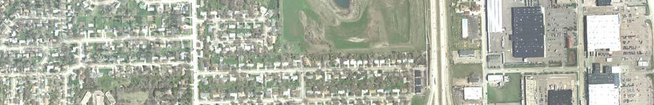
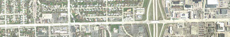
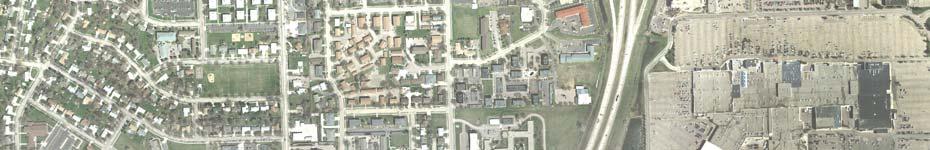
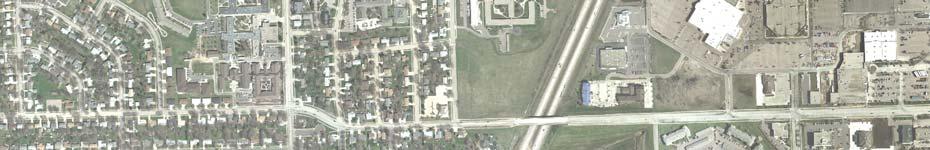
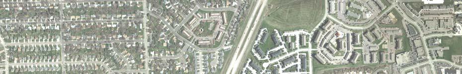
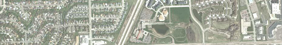
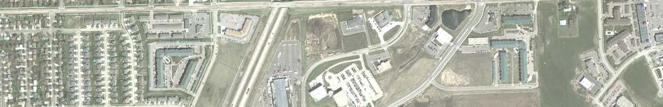
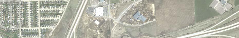
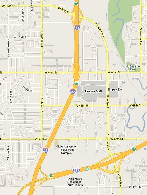
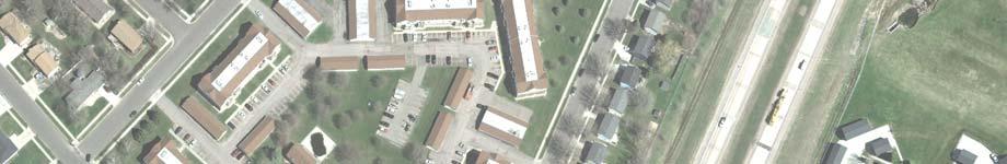
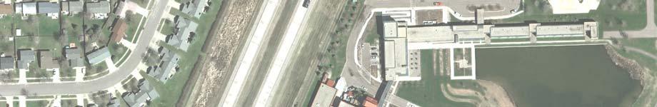
1 Report Addendum To: Terry Keller, SDDOT From: HDR Project: Noise Study Technical Report I-29 from Tea Interchange to Skunk Creek Sioux Falls, South Dakota cc: file Date: May 28, 2010; rev July 16, July 30, 2010 Job No: Re: I-29 Analysis Update BACKGROUND In November 2005, HDR conducted a noise study on the section of I-29 from the Tea Interchange to Skunk Creek in Sioux Falls, South Dakota. The study included two public meetings and a final Noise Study Technical Report 1. Proposed construction of auxiliary lanes on I-29 precipitated the analysis. At the request of Federal Highway Administration (FHWA), the noise analysis is being revised with 2008 traffic volumes and year 2035 traffic projections from the City of Sioux Falls updated Travel Demand Forecast Model. Noise wall costs are also being updated in the analysis. This memo serves as an update/addendum to the 2005 study. Figure 1 shows a site map of the noise study area. 1 Noise Study Technical Report, I-29 from Tea Interchange to Skunk Creek, HDR, 11/16/2005 SDDOT NOISE ABATEMENT POLICY The SDDOT Noise Analysis and Abatement Policy (Policy), upon which this analysis is based, is intended to supplement FHWA traffic noise analysis and abatement regulations and guidance. The Policy provides procedures for noise studies and noise abatement measures to help protect the public health and welfare, to supply noise abatement criteria and to establish requirements for traffic noise information to be given to those officials who have planning and zoning authority in the Project area. The Policy contains noise abatement criteria (NAC) that are based on the Leq(h) which is used to analyze traffic noise levels and identify noise impacts. The Leq(h) is defined as the equivalent steady-state sound level that, in a stated period of time, contains the same acoustic energy as the time-varying sound level during the same period. Therefore, for the purposes of this analysis, Leq can be considered the average sound level and Leq(h) can be considered the average sound level occurring over a one-hour period. It is representative of the overall (average) traffic generated noise level expressed on an hourly basis.
2
3 Land uses are assigned to an activity category based on the type of activities occurring in each respective land use (i.e. picnic areas, churches, commercial land and undeveloped land). Activity categories are then ordered based on their sensitivity to traffic noise levels. NAC are assigned to each activity category. These NAC represent the maximum traffic noise levels that allow uninterrupted land use within each activity category. Table 1 lists the five land use categories included in the SDDOT NAC and the Leq(h) associated with each activity category. Traffic noise impacts are identified relative to the NAC and the Policy. The federal (23 Code of Federal Regulations (CFR) 772) and SDDOT definition of a traffic noise impact contains three criteria of which only one has to be met. Traffic noise impacts are defined as impacts that occur when the predicted traffic noise levels: approach or equal the noise abatement criteria given on Table 1; or, exceed the noise abatement criteria given on Table 1; or, substantially exceed the existing noise levels. Table 1 Noise Abatement Criteria A B Activity Category 57-dBA (Exterior) 67-dBA (Exterior) L eq (h) Description of Activity Category Lands on which serenity and quiet are of extraordinary significance and serve an important public need and where the preservation of those qualities is essential if the area is to continue to serve its intended purpose. Picnic areas, recreation areas, playgrounds, active sports areas, parks, residences, motels, hotels, schools, churches, libraries and hospitals. C 72-dBA (Exterior) Developed lands, properties or activities not included in Categories A or B above. D No Limit Undeveloped Lands E 52-dBA (Interior) SOURCE: Federal-Aid Highway Program Manual 7-7-3, "Procedures for Abatement of Highway Traffic Noise and Construction Noise", dated August Residences, motels, hotels, public meeting rooms, schools, churches, libraries, hospitals and auditoriums. Page 3 I-29 Noise Analysis Update July 30, 2010
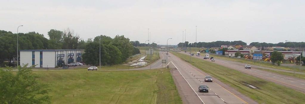
4 The Policy states that a noise level of 66-dBA approaches the NAC (for category B), a noise level greater than 67-dBA exceeds the NAC (for category B) and a 15-dBA increase in existing noise levels is a substantial increase. Therefore, approaches the NAC is defined as within one decibel of the NAC. METH0DOLOGY The FHWA model TNM v2.5 was used to assess 2008 and predicted year 2035 traffic volumes for future Build traffic noise levels. The Basic model inputs were: Preliminary project concept and geometry taken from the initial analysis Traffic volumes for I-29 and area cross streets in the Study area updated from the original analysis from Traffic volumes for I-29 and area cross streets in the Study area updated from the original analysis from 2025 Operational speeds for I-29 of 60 miles per hour (mph) were based on drive-through observations. Operational speeds for area cross streets were based on the City s traffic model. Once traffic counts were updated, HDR modeled various barrier lengths and heights within TNM to determine the effectiveness of the barriers against SDDOT s noise barrier cost/feasibility guidelines. The TNM model assists in determination of the optimum wall configuration to achieve a minimum 7 dba of noise attenuation at a majority of impacted receptors per SDDOT policy. Receptors which achieve a 5 dba or greater attenuation as a result of the barrier are included within the cost/benefit/reasonableness calculation. TRAFFIC VOLUMES The traffic volumes used were the Peak Hourly Volume (PHV) traffic in the PM condition. This was determined to be the time period with the highest noise levels from the 24-hour monitoring conducted in The traffic volumes on this Project were obtained from the following sources: I-29 peak hour volumes - City of Sioux Falls Office of Traffic Engineering/Transportation Planning I-29 vehicle classifications Vehicle counts conducted by HDR on June 22, st Street interchange ramp volumes and vehicle mix - City of Sioux Falls Office of Traffic Engineering/Transportation Planning. 41 st Street, 49 th Street, and 57 th Street peak hour volumes and vehicle mix - City of Sioux Falls Office of Traffic Engineering/Transportation Planning. Figures 2, 2a, 3, and 3a show the traffic data used in the noise model. Page 4 I-29 Noise Analysis Update July 30, 2010
5
6
7
8
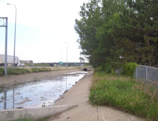
 and a west-side residential area north of 57 th Street; a Southeast, which was located along the east I-29")
9 BARRIER LOCATIONS AND OPTIONS s analyzed were similar to that of the 2005 study with the exception of barrier cost. The barriers included a Southwest which was located along the west I-29 Right-of-way (ROW) and a west-side residential area north of 57 th Street; a Southeast, which was located along the east I-29 ROW and an east-side apartment complex north of 57 th Street; and a North, located along the west I-29 ROW and north of 41 st St. and east of a residential area. In the 2005 analysis, SDDOT estimated the noise wall cost at $57.50 per square foot for colored, textured, pre-cast concrete walls. For this analysis, four less expensive barrier types were examined: 1. Sound Fighter, a manufacturer of noise barriers for transportation and industry located in Shreveport, LA, was one option examined. The Sound Fighter barrier is a weatherized metal panel which has perforations on the side facing traffic with each panel filled with absorptive material. Noise from traffic is not only reduced due to the barrier itself, reflections are also mitigated due to the absorptive nature of the panel. A representation of the Sound Fighter panel is contained within Figure 1 below: Figure 1, Sound Fighter Panels along a Roadside Source: The anticipated build price of the Sound Fighter panel was determined to be $ The second barrier type examined was cast in place concrete wall. The anticipated build cost was determined to be $30.00 per square foot. Page 9 I-29 Noise Analysis Update July 30, 2010

10 3. A third noise barrier type examined was a recycled PVC/vinyl wall called Tuf- Noise Wall System manufactured by Harder, Luckey & Hargrave, Inc. (HLH, Inc.). Features of this wall type include: Graffiti resistant Designed for wind loads up to 110 mph Fire retardant Maintenance free 40 year design life Can be multi-colored for aesthetic purposes Estimated cost is approximately $30 per square foot Source: Page 10 I-29 Noise Analysis Update July 30, 2010


11 4. A fourth noise barrier examined was a pre-cast wall panel system manufactured by AFTEC. Features of this product include durability, strength, pleasing aesthetics, etc. A verbal quote of $34.75 was supplied to SDDOT by the manufacturer. Source: Within the updated modeling, a build cost of $30.00 per square foot was used for all analysis due to the similarity in costs of the various barriers. A discussion of each barrier, its respective location, and the cost analysis per benefited receptor follows. It should be noted that this analysis used year 2035 predicted traffic volumes while the 2005 analysis used year 2025 predicted traffic volumes. The higher year 2035 traffic volumes resulted in higher predicted noise levels and a corresponding higher number of impacted receptors. Because of the higher predicted noise levels, the noise wall heights in this analysis were increased from the 2005 analysis to optimize the number of shielded and benefitted receptors in relationship to the wall cost. Page 11 I-29 Noise Analysis Update July 30, 2010
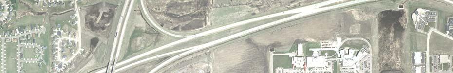
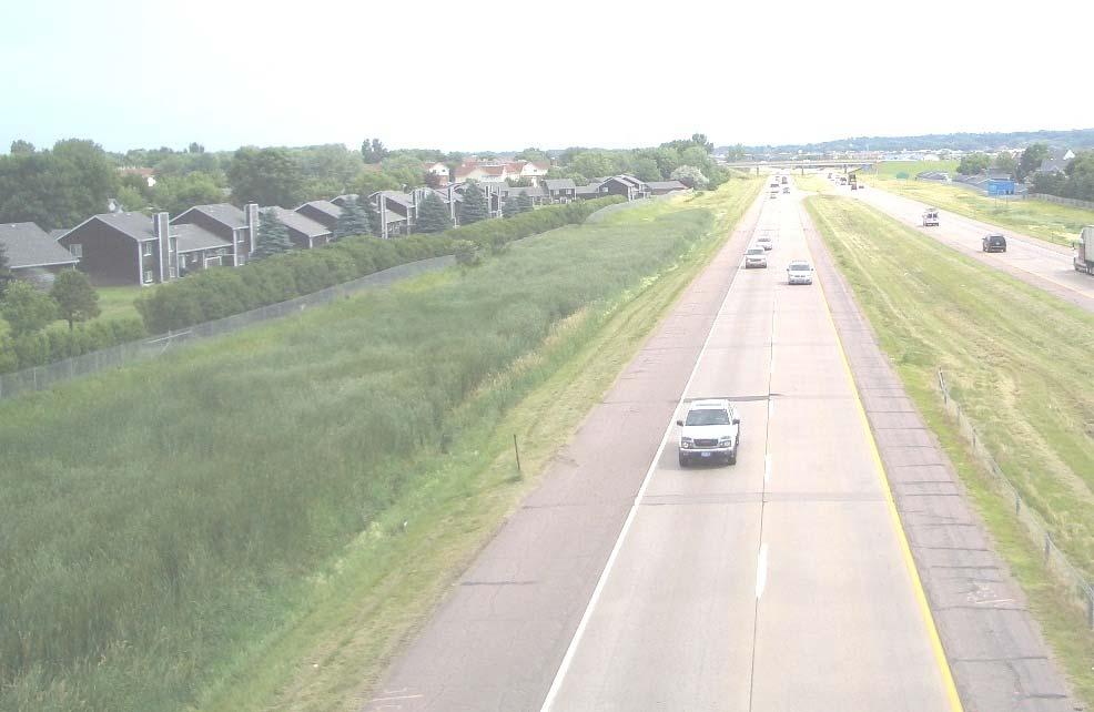
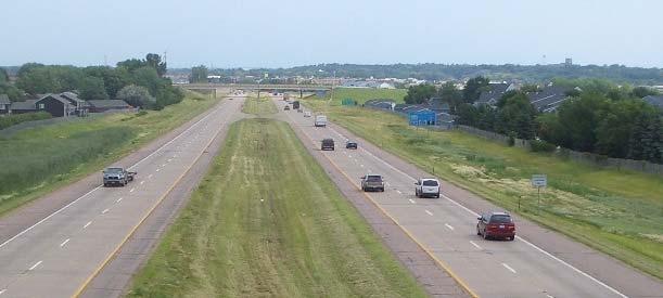
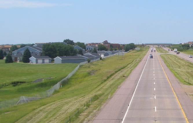
12 BARRIER ANALYSIS RESULTS Southwest The southwest noise barrier is located along the west highway ROW between I-29 and the westside residential area between 57 th Street and 49 th Street. The optimized barrier is 2,701-feet in length with an average height of feet as shown in Figure 4. The barrier length and height were optimized to provide 7 dba of noise reduction at the maximum number of receptors per SDDOT guidelines. Table 2 summarizes the noise barrier modeled for this area, Figure 4 illustrates receptor and barrier locations, and Appendix A presents the predicted noise levels at each receptor with and without a noise barrier. Given the calculated cost of the barrier ($888,540) and the number of benefited receptors (69), this barrier is considered cost reasonable based on SDDOT guidelines (less than $15,000 per benefited receptor). Table 2 Southwest Noise Attenuation and Cost Results Length (ft) Average Height (ft) Area (sq ft) Cost (@ $30/sq ft) Total Number of Benefited Receptors 1 Southwest 2, ,618 $888, Benefitted receptor: Noise barrier provides at least 5 dba of noise level reduction. Cost Reasonability $12,877/benefitted receptor Wall is costreasonable Page 12 I-29 Noise Analysis Update July 30, 2010

13
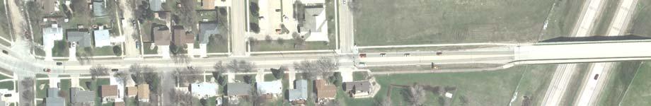
14 Southeast The southeast noise barrier is located along the east highway ROW between I-29 and the eastside residential area between 57 th Street and 49 th Street at the Carrington House apartment complex. The optimized barrier is 1,074-feet in length with an average height of feet as shown in Figure 5. The barrier length and height were optimized to provide 7 dba of noise reduction at the maximum number of receptors per SDDOT guidelines. Table 3 summarizes the noise barrier modeled for this area, Figure 5 illustrates receptor and barrier locations, and Appendix B presents the predicted noise levels at each receptor with and without a noise barrier. Given the calculated cost of the barrier ($447,000) and the number of benefited receptors (59), this barrier is considered cost reasonable based on SDDOT guidelines (less than $15,000 per benefited receptor). Table 3 Southwest Noise Attenuation and Cost Results Length (ft) Average Height (ft) Area (sq ft) Cost (@ $30/sq ft) Total Number of Benefited Receptors 1 Southeast 1, ,900 $447, Benefitted receptor: Noise barrier provides at least 5 dba of noise level reduction. Cost Reasonability $7,576/benefitted receptor Wall is costreasonable Page 14 I-29 Noise Analysis Update July 30, 2010
15
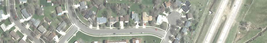
16 North The north noise barrier is located along the west highway ROW north of 41 st Street. A series of apartment complexes and single-family homes are in this area. The apartment complexes are three stories tall. Only the first and second stories were considered in this analysis. The optimized barrier is 606 feet in length with an average height of feet as shown in Figure 6. The barrier length and height were optimized to provide 7 dba of noise reduction at the maximum number of receptors per SDDOT guidelines. Table 4 summarizes the noise barrier modeled for this area, Figure 4 illustrates receptor and barrier locations, and Appendix C presents the predicted noise levels at each receptor with and without a noise barrier. Given the calculated cost of the barrier ($301,980) and the number of benefited receptors (22), this barrier is considered cost reasonable based on SDDOT guidelines (less than $15,000 per benefited receptor). Table 4 Southwest Noise Attenuation and Cost Results Length (ft) Average Height (ft) Area (sq ft) Cost (@ $30/sq ft) Total Number of Benefited Receptors 1 North ,066 $301, Benefitted receptor: Noise barrier provides at least 5 dba of noise level reduction. Cost Reasonability $13,726/benefitted receptor Wall is costreasonable Page 16 I-29 Noise Analysis Update July 30, 2010
17
18 CONCLUSIONS HDR modeled 3 separate barrier locations for the I-29 expansion. The noise models were based on the noise analysis performed in 2005 with the exception of: Modified car and truck volumes which were updated to reflect current year volumes (2008) and Design Year (2035). An updated noise wall cost of $30.00 per square foot was used at the direction of SDDOT. height was optimized in relationship to the number of benefitted receptors and wall costs. All three barrier locations were calculated to be cost reasonable based upon SDDOT s reasonableness factor of a build to benefit cost of less than $15,000 per benefited receptor. PUBLIC INVOLVEMENT Public involvement for the 2005 noise study included one public meeting before the study began and a second public meeting at the conclusion of the study. One public meeting is proposed for the noise study update. All residents considered as noise receptors will be invited to attend. Apartment building owners will also be invited. For the barriers determined to be cost reasonable by the analysis, residents will be provided with ballots to determine their preferences. Tabulation of the returned ballots will be weighted based on the proximity of the resident to the barrier location. The final decision on the wall installation will be based on a combination of the cost reasonability and the outcome of the voting. Page 18 I-29 Noise Analysis Update July 30, 2010
19 APPENDIX A SOUTHWEST BARRIER ANALYSIS RESULTS Page 19 I-29 Noise Analysis Update July 30, 2010
20 July 16, 2010, rev. 7/30/10 I 29 Noise Analysis Update I 229 to 26th Street TNM 2.5 RUN: I 29 Noise Analysis Build Year 2035 BARRIER: Southwest (West side of I 29 from 57th Street to 49th Street) ATMOSPHERICS: 75 deg F, 55% RH Average pavement type used in analysis PM Peak hour noise levels Without With Increase Impacted Benefitted Yr 2008 Yr 2035 Yr 2008 (66 dba) Yr 2035 Noise (min. 5 dba Receiver Dwelling Leq Leq to Yr 2035 yes=1 Leq Reduction reduction) Name Units dba dba dba no=0 dba dba yes=1, no=0 P O N M L K J I BBB AAA SS xx yy zz XX ZZ YY II HH GG JJ NN MM LL KK OO PP QQ RR FF EE DD CC BB A B C D E F by HDR page 1 of 3
21 July 16, 2010, rev. 7/30/10 I 29 Noise Analysis Update I 229 to 26th Street TNM 2.5 RUN: I 29 Noise Analysis Build Year 2035 BARRIER: Southwest (West side of I 29 from 57th Street to 49th Street) ATMOSPHERICS: 75 deg F, 55% RH Average pavement type used in analysis PM Peak hour noise levels Without With Increase Impacted Benefitted Yr 2008 Yr 2035 Yr 2008 (66 dba) Yr 2035 Noise (min. 5 dba Receiver Dwelling Leq Leq to Yr 2035 yes=1 Leq Reduction reduction) Name Units dba dba dba no=0 dba dba yes=1, no=0 G H Q R S T WW VV U V W X Y UU AA a b c d TT Z e f g h i j k l m n o p q r s t u v w by HDR page 2 of 3
22 July 16, 2010, rev. 7/30/10 I 29 Noise Analysis Update I 229 to 26th Street TNM 2.5 RUN: I 29 Noise Analysis Build Year 2035 BARRIER: Southwest (West side of I 29 from 57th Street to 49th Street) ATMOSPHERICS: 75 deg F, 55% RH Average pavement type used in analysis PM Peak hour noise levels Without With Increase Impacted Benefitted Yr 2008 Yr 2035 Yr 2008 (66 dba) Yr 2035 Noise (min. 5 dba Receiver Dwelling Leq Leq to Yr 2035 yes=1 Leq Reduction reduction) Name Units dba dba dba no=0 dba dba yes=1, no=0 x y z aa bb cc dd ee ff gg hh ii jj kk ll mm nn oo pp qq rr ss tt uu vv ww Totals Averages Optimized Length: 2,701 feet Optimized Average Height: feet Optimized Area: 29,618 sq. ft. Unit Cost: $30 per sq. ft. Total Cost: $888,540 Benefitted Receptors: 69 Cost Reasonability: $12,877 per benefitted receptor (Cost Reasonability = Total Cost/receptors with 5 dba or greater noise reduction) by HDR page 3 of 3
23 APPENDIX B SOUTHEAST BARRIER ANALYSIS RESULTS Page 21 I-29 Noise Analysis Update July 16, 2010
24 July 16, 2010, rev. 7/30/10 I 29 Noise Analysis Update I 229 to 26th Street by HDR TNM 2.5 RUN: I 29 Noise Analysis Build Year 2035 BARRIER: Southeast (East side of I 29 from 57th Street to 49th Street) ATMOSPHERICS: 75 deg F, 55% RH Average pavement type used in analysis PM Peak hour noise levels Without With Increase Impacted Benefitted Yr 2008 Yr 2035 Yr 2008 (66 dba) Yr 2035 Noise (min. 5 dba Receiver Dwelling Leq Leq to Yr 2035 yes=1 Leq Reduction reduction) Name Units dba dba dba no=0 dba dba yes=1, no= page 1 of 2
25 July 16, 2010, rev. 7/30/10 I 29 Noise Analysis Update I 229 to 26th Street by HDR TNM 2.5 RUN: I 29 Noise Analysis Build Year 2035 BARRIER: Southeast (East side of I 29 from 57th Street to 49th Street) ATMOSPHERICS: 75 deg F, 55% RH Average pavement type used in analysis PM Peak hour noise levels Without With Increase Impacted Benefitted Yr 2008 Yr 2035 Yr 2008 (66 dba) Yr 2035 Noise (min. 5 dba Receiver Dwelling Leq Leq to Yr 2035 yes=1 Leq Reduction reduction) Name Units dba dba dba no=0 dba dba yes=1, no= Totals Averages Note: Receptors 31 to 34 are not included in the above list because they represent a different land use. Optimized Length: 1,074 feet Optimized Average Height: feet Optimized Area: 14,900 sq. ft. Unit Cost: $30 per sq. ft. Total Cost: $447,000 Benefitted Receptors: 59 Cost Reasonability: $7,576 per benefitted receptor (Cost Reasonability = Total Cost/receptors with 5 dba or greater noise reduction) page 2 of 2
26 APPENDIX C NORTH BARRIER ANALYSIS RESULTS Page 23 I-29 Noise Analysis Update July 16, 2010
27 July 16, 2010, rev. 7/30/10 I 29 Noise Analysis Update I 229 to 26th Street by HDR TNM 2.5 RUN: I 29 Noise Analysis Build Year 2035 BARRIER: North (West side of I 29 north of 41st Street) ATMOSPHERICS: 75 deg F, 55% RH Average pavement type used in analysis PM Peak hour noise levels Without With Increase Impacted Benefitted Yr 2008 Yr 2035 Yr 2008 (66 dba) Yr 2035 Noise (min. 5 dba Receiver Dwelling Leq Leq to Yr 2035 yes=1 Leq Reduction reduction) Name Units dba dba dba no=0 dba dba yes=1, no= Totals Averages Note: Third level receptors were not considered in this analysis. Optimized Length: 606 feet Optimized Average Height: feet Optimized Area: 10,066 sq. ft. Unit Cost: $30 per sq. ft. Total Cost: $301,980 Benefitted Receptors: 22 Cost Reasonability: $13,726 per benefitted receptor (Cost Reasonability = Total Cost/receptors with 5 dba or greater noise reduction) page 1 of 1
Lower River Floodplain Restoration and Levee/Towne Road Re-Alignment Noise Analysis
 Lower River Floodplain Restoration and Levee/Towne Road Re-Alignment Noise Analysis This project is not anticipated to create additional noise beyond the current background levels. Although Towne Road
Red Wing US 63 Bridge and Approach Roadways
 Traffic Noise Analysis Report Red Wing US 63 Bridge and Approach Roadways TH 63 over the Mississippi River Red Wing, MN MN State Project Number: 2515-21 WI Project ID Number: 7210-00-06 June 2015 Red Wing
NOISE ANALYSIS TECHNICAL REPORT. Route 58 Martin Luther King Freeway. Portsmouth Virginia
 NOISE ANALYSIS TECHNICAL REPORT Route 58 Martin Luther King Freeway Portsmouth Virginia May 2008 Prepared for: Virginia Department of Transportation NOISE ANALYSIS TECHNICAL REPORT Route 58 Martin Luther
Final Noise Study Report
 Final Noise Study Report Interstate 630 Widening Noise Analysis From East of Baptist Medical Center To East of University Avenue FAP No. 9991 Job No. CA0608 Pulaski County, Arkansas Submitted to: Prepared
Illinois Route 60/83 Widening and Reconstruction IL Route 176 to IL Route 60 P Traffic Noise Analysis Technical Report FINAL
 Illinois Route 60/83 Widening and Reconstruction IL Route 176 to IL Route 60 P-91-084-97 Traffic Noise Analysis Technical Report FINAL August 2017 Prepared for Prepared by IL Route 60/83 IL 176 to IL 60
Project Location. I-80 Toll Plaza at I-480/I-80 Interchange, Lorain County, Ohio
 Geoffrey Pratt - Bowlby & Associates, Inc. William Bowlby - Bowlby & Associates, Inc. Kim Burton - Burton Planning Services, LLC Elvin Pinckney - Burton Planning Services, LLC Noel Alcala - Ohio Department
Mississauga Bus Rapid Transit Preliminary Design Project
 Mississauga Bus Rapid Transit Preliminary Design Project PUBLIC INFORMATION CENTRE OCTOBER 2008 WELCOME The Mississauga Bus Rapid Transit (BRT) Project Thank you for attending this Public Information Centre.
DULLES AIRPORT ACCESS/TOLL ROAD CONNECTOR ROUTE 267, FROM ROUTE 123 TO I-66 NOISE ABATEMENT DESIGN STUDY. Noise Analysis Technical Report
 DULLES AIRPORT ACCESS/TOLL ROAD CONNECTOR ROUTE 267, FROM ROUTE 123 TO I-66 NOISE ABATEMENT DESIGN STUDY Noise Analysis Technical Report VDOT Project No. 0267-029-919, C501, P101 UPC 98232 HMMH Report
SAN FRANCISCO MUNICIPAL TRANSPORTATION AGENCY BOARD OF DIRECTORS. RESOLUTION No
 SAN FRANCISCO MUNICIPAL TRANSPORTATION AGENCY BOARD OF DIRECTORS RESOLUTION No. 16-036 WHEREAS, The San Francisco Municipal Transportation Agency has received a request, or identified a need for traffic
Access Management Standards
 Access Management Standards This section replaces Access Control Standards on Page number 300-4 of the Engineering Standards passed February 11, 2002 and is an abridged version of the Access Management
PROPOSED HELICOPTER LANDING PAD 85 MILL ROAD LARA
 PROPOSED HELICOPTER LANDING PAD 85 MILL ROAD LARA Assessment of Helicopter Noise A report Prepared on behalf of: JamCo Constructions Pty Ltd PO Box 631 Yarraville Victoria 3013 Ref: 11573-3jg March 2015
Appendix I Noise Background and Modeling Data
 SERRANO II RESIDENTIAL PROJECT REVISED INITIAL STUDY/MITIGATED NEGATIVE DECLARATION CITY OF CLAREMONT Appendix Appendix I Noise Background and Modeling Data March 2015 SERRANO II RESIDENTIAL PROJECT REVISED
Managing Projects Teaching materials to accompany:
 Managing Projects Teaching materials to accompany: Product Design and Development Chapter 14 Karl T. Ulrich and Steven D. Eppinger 2nd Edition, Irwin McGraw-Hill, 2000. Product Development Process Planning
Turnpike Mitigation Program Application
 Ohio Department of Transportation - Ohio Turnpike Infrastructure Commission Turnpike Mitigation Program Application The application has been improved to enable project sponsors to save the application
TIMBERVINE TRANSPORTATION IMPACT STUDY FORT COLLINS, COLORADO JANUARY Prepared for:
 TIMBERVINE TRANSPORTATION IMPACT STUDY FORT COLLINS, COLORADO JANUARY 2014 Prepared for: Hartford Companies 1218 W. Ash Street Suite A Windsor, Co 80550 Prepared by: DELICH ASSOCIATES 2272 Glen Haven Drive
2005 City of Santa Paula Potable Water System Master Plan Amendment
 2005 City of Santa Paula Potable Water System Master Plan Amendment City of Santa Paula Project Engineer Randy Toedter, PE Brian Yanez June, 2012 970 Ventura Street Santa Paula, CA 93060 PURPOSE OF THE
Silverado Village Project
 Environmental Noise Assessment Silverado Village Project Elk Grove, California BAC Job # 2011-053 Prepared For: Vintara Holdings, LLC Attn: Mr. Paul Eblen 140 Diamond Creek Place Roseville, CA 95747 Prepared
DEVELOPMENT AGREEMENT APPLICATION MULTI-UNIT RESIDENTIAL DEVELOPMENT FOURTH STREET NEAR BEDFORD HIGHWAY SUBMITTED BY: LYDON LYNCH ARCHITECTS
 DEVELOPMENT AGREEMENT APPLICATION MULTI-UNIT RESIDENTIAL DEVELOPMENT FOURTH STREET NEAR BEDFORD HIGHWAY NOVEMBER 30, 2017 SUBMITTED BY: LYDON LYNCH ARCHITECTS TABLE OF CONTENTS LETTER OF INTRODUCTION PROJECT
FREQUENTLY ASKED QUESTIONS
 THE PROJECT Last updated on 2/19/16 FREQUENTLY ASKED QUESTIONS What s happening on Highway 169? The Minnesota Department of Transportation (MnDOT) is planning to rebuild and repair the infrastructure on
Environmental Assessment Derry Road and Argentia Road Intersection
 Air and Noise Study Environmental Assessment Derry Road and Argentia Road Intersection Project 11-4295 City of Mississauga, Region of Peel October 17, 2014 1 Region of Peel Environmental Assessment for
2.0 Development Driveways. Movin Out June 2017
 Movin Out June 2017 1.0 Introduction The proposed Movin Out development is a mixed use development in the northeast quadrant of the intersection of West Broadway and Fayette Avenue in the City of Madison.
Definitions of Acoustical Terms
 Appendix E Noise Definitions of Acoustical Terms Sound Measurements Decibel (db) A Weighted Decibel (dba) Maximum Sound Level (Lmax) Minimum Sound Level (Lmin) Equivalent Sound Level (Leq) Percentile
TABLE OF CONTENTS EXECUTIVE SUMMARY...1 INTRODUCTION...3 PROJECTED FUTURE GROWTH...3 ROADWAY IMPROVEMENT PROJECTS...4 POTENTIAL FUNDING SOURCES...
 Transportation Impact Fee Study September 2014 TABLE OF CONTENTS EXECUTIVE SUMMARY...1 INTRODUCTION...3 PROJECTED FUTURE GROWTH...3 ROADWAY IMPROVEMENT PROJECTS......4 POTENTIAL FUNDING SOURCES...7 PROPOSED
FREQUENTLY ASKED QUESTIONS
 THE PROJECT Last updated on 9/8/16 FREQUENTLY ASKED QUESTIONS What s happening on Highway 169? The Minnesota Department of Transportation (MnDOT) is planning to rebuild and repair the infrastructure on
Construction Noise Memorandum
 Construction Noise Memorandum To: Ms. Paula Daneluk Date: June 13, 2013 Development Impact 9370 Studio Court, Suite 160 Elk Grove, CA 95758 From: Paul Bollard Bollard Acoustical Consultants, Inc. 3551
STH 60 Northern Reliever Route Feasibility Study Report
 #233087 v3 STH 60 Northern Reliever Route Feasibility Study Report Washington County Public Works Committee Meeting September 28, 2016 1 STH 60 Northern Reliever Route Feasibility Study Hartford Area Development
EXECUTIVE SUMMARY. The following is an outline of the traffic analysis performed by Hales Engineering for the traffic conditions of this project.
 EXECUTIVE SUMMARY This study addresses the traffic impacts associated with the proposed Shopko redevelopment located in Sugarhouse, Utah. The Shopko redevelopment project is located between 1300 East and
West Hills Shopping Centre Lowe s Expansion Traffic Impact Study
 West Hills Shopping Centre Lowe s Expansion Traffic Impact Study Prepared for: Armel Corporation January 2015 Paradigm Transportation Solutions Ltd. 22 King Street South, Suite 300 Waterloo ON N2J 1N8
Turnpike Mitigation Program Application
 Ohio Department of Transportation & Ohio Turnpike and Infrastructure Commission Turnpike Mitigation Program Application Please note the following eligibility criteria: 1) Projects must be sponsored by
1.1 Purpose of This Environmental Impact Report EIR Process Use of This Report Report Organization...
 Table of Contents SUMMARY PAGE S.1 Project Location and Project Characteristics... S-1 S.2 Project Objectives... S-9 S.3 Project Approvals... S-11 S.4 Impacts and Mitigation Measures... S-12 S.5 Alternatives...
APPENDIX D NOISE IMPACT ASSESSMENT
 APPENDIX D NOISE IMPACT ASSESSMENT AURORA ACOUSTICAL CONSULTANTS Inc. 745 Warren Drive East Aurora, New York 14052 716-655-2200 info@auroraacoustical.com NOISE IMPACT ASSESSMENT OF NIGHTTIME PARKING LOT
Traffic Impact Statement (TIS)
") Traffic Impact Statement (TIS) Vincentian PUDA Collier County, FL 10/18/2013 Prepared for: Global Properties of Naples Prepared by: Trebilcock Consulting Solutions, PA 2614 Tamiami Trail N, Suite 615 1205
Traffic Impact Statement (TIS) Vincentian PUDA Collier County, FL 10/18/2013 Prepared for: Global Properties of Naples Prepared by: Trebilcock Consulting Solutions, PA 2614 Tamiami Trail N, Suite 615 1205
Highway 18 BNSF Railroad Overpass Feasibility Study Craighead County. Executive Summary
 Highway 18 BNSF Railroad Overpass Feasibility Study Craighead County Executive Summary October 2014 Highway 18 BNSF Railroad Overpass Feasibility Study Craighead County Executive Summary October 2014 Prepared
Transportation & Traffic Engineering
 Transportation & Traffic Engineering 1) Project Description This report presents a summary of findings for a Traffic Impact Analysis (TIA) performed by A+ Engineering, Inc. for the Hill Country Family
POLICY FOR THE ESTABLISHMENT AND POSTING OF SPEED LIMITS ON COUNTY AND TOWNSHIP HIGHWAYS WITHIN MCHENRY COUNTY, ILLINOIS
 POLICY FOR THE ESTABLISHMENT AND POSTING OF SPEED LIMITS ON COUNTY AND TOWNSHIP HIGHWAYS WITHIN MCHENRY COUNTY, ILLINOIS MCHENRY COUNTY DIVISION OF TRANSPORTATION 16111 NELSON ROAD WOODSTOCK, IL 60098
Open House. Highway212. Meetings. Corridor Access Management, Safety & Phasing Plan. 5:30 to 6:30 p.m. - Southwest Corridor Transportation Coalition
 Welcome Meetings 5:30 to 6:30 p.m. - Southwest Corridor Transportation Coalition 6:30 to 8:00 p.m. - Open House Why is Highway 212 Project Important? Important Arterial Route Local Support Highway 212
THE CORNERSTONE APARTMENTS TRAFFIC IMPACT STUDY R&M PROJECT NO
 THE CORNERSTONE APARTMENTS SITUATED AT N/E/C OF STAUDERMAN AVENUE AND FOREST AVENUE VILLAGE OF LYNBROOK NASSAU COUNTY, NEW YORK TRAFFIC IMPACT STUDY R&M PROJECT NO. 2018-089 September 2018 50 Elm Street,
Appendix J Traffic Impact Study
 MRI May 2012 Appendix J Traffic Impact Study Level 2 Traffic Assessment Limited Impact Review Appendix J [This page was left blank intentionally.] www.sgm-inc.com Figure 1. Site Driveway and Trail Crossing
ANDERSON PROPERTY SITE ANALYSIS
 ANDERSON PROPERTY SITE ANALYSIS Introduction The Montgomery County Department of Transportation (MCDOT) initiated a feasibility study in the fall of 2012 to evaluate the need for transit service expansion
6.16 OFF-STREET PARKING AND LOADING REQUIREMENTS
 6.16 OFF-STREET PARKING AND LOADING REQUIREMENTS 6.16.1 Off-Street Parking Off-street parking and loading spaces shall be required for all land uses as set forth in this section. A. Minimum Parking Space
Lincoln 40 Residential
 Lincoln 40 Residential City of Davis, California March 15, 2017 jcb Project # 2016-180 Prepared for: Attn: Nick Pappani 1501 Sports Drive Sacramento, CA 95834 Prepared by: j.c. brennan & associates, Inc.
1. INTRODUCTION 2. PROJECT DESCRIPTION CUBES SELF-STORAGE MILL CREEK TRIP GENERATION COMPARISON
 CUBES SELF-STORAGE MILL CREEK TRIP GENERATION COMPARISON 1. INTRODUCTION This report summarizes traffic impacts of the proposed CUBES Self-Storage Mill Creek project in comparison to the traffic currently
July 17, In Reply Refer To: HSSD/B-176A
 July 17, 2008 1200 New Jersey Avenue, SE. Washington, DC 20590 In Reply Refer To: HSSD/B-176A Mr. John Addy Hill & Smith Springvale Business and Industrial Park Bliston, Wolverhampton, West Midlands, UK,
Note: The October 2007 version of this report has been updated in this December 2008 report to present costs in year 2007 dollars.
 Sound Transit Phase 2 South Corridor LRT Design Report: SR 99 and I-5 Alignment Scenarios (S 200 th Street to Tacoma Dome Station) Tacoma Link Extension to West Tacoma Prepared for: Sound Transit Prepared
IH 35 FEASIBILITY STUDY
 IH 35 FEASIBILITY STUDY COOKE COUNTY, TEXAS February 1, 2007 Prepared by: Carter & Burgess, Inc. For: The Wichita Falls District of the Texas Department of Transportation INDEX I. INTRODUCTION. 3 II. PURPOSE
BRAKE WINCHES B1200B B1200G B2500 B2500G B3500 B1500 B1500G B1500
 BRAKE WINCHES B1500 B1200B B1200G B1500 B1500G B2500 B2500G B3500 B1200B, B1200G B1500, B1500G B2500, B2500G B3500 X 6 650 lb/295 kg 1 1200 lb/545 kg 6 728 lb/330 kg 1 1500 lb/680 kg 3 1554 lb/705 kg 1
Table of Contents INTRODUCTION... 3 PROJECT STUDY AREA Figure 1 Vicinity Map Study Area... 4 EXISTING CONDITIONS... 5 TRAFFIC OPERATIONS...
 Crosshaven Drive Corridor Study City of Vestavia Hills, Alabama Table of Contents INTRODUCTION... 3 PROJECT STUDY AREA... 3 Figure 1 Vicinity Map Study Area... 4 EXISTING CONDITIONS... 5 TRAFFIC OPERATIONS...
Noise and Vibration Analysis Technical Report (Final)
") Noise and Vibration Analysis Technical Report (Final) for the Denver West Corridor Light Rail Transit Project Final Design Assessment Prepared by: KM Chng Environmental Inc. June 25, 2007 (Rev. 5a) TABLE
Noise and Vibration Analysis Technical Report (Final) for the Denver West Corridor Light Rail Transit Project Final Design Assessment Prepared by: KM Chng Environmental Inc. June 25, 2007 (Rev. 5a) TABLE
OPERATIONS NOISE STUDY FOR A PROPOSED AUTOMATIC CAR WASH IN THE SHERMAN OAKS DISTRICT OF LOS ANGELES
 OPERATIONS NOISE STUDY FOR A PROPOSED AUTOMATIC CAR WASH IN THE SHERMAN OAKS DISTRICT OF LOS ANGELES October 12, 2017 PREPARED FOR: Ms. Chantly Banayan 4822 Van Nuys Blvd. Sherman Oaks, CA 91403 PREPARED
Reduction of vehicle noise at lower speeds due to a porous open-graded asphalt pavement
 Reduction of vehicle noise at lower speeds due to a porous open-graded asphalt pavement Paul Donavan 1 1 Illingworth & Rodkin, Inc., USA ABSTRACT Vehicle noise measurements were made on an arterial roadway
December Wilmington School & Residence Sound Attenuation Program. Report #3: Noise Contour Development Methodology Report
 December 2013 Wilmington School & Residence Sound Attenuation Program Report #3: Noise Contour Development Methodology Report Wilmington School & Residence Sound Attenuation Program Report #3: Noise
King Soopers #116 Thornton, Colorado
 Traffic Impact Study King Soopers #116 Thornton, Colorado Prepared for: Galloway & Company, Inc. T R A F F I C I M P A C T S T U D Y King Soopers #116 Thornton, Colorado Prepared for Galloway & Company
Attachment E3 Vibration Technical Memorandum
 Attachment E3 Technical Memorandum 77 South Bedford Street Burlington, MA 01803 T 781.229.0707 F 781.229.7939 E jross@hmmh.com W www.hmmh.com TECHNICAL MEMORANDUM To: Alisa Swank, CH2M HILL Jodi Ketelsen,
Noise. Noise Fundamentals. Noise Descriptors. City of Redlands - Redlands Crossing Center
 3.11-3.11.1 - Introduction This section describes the existing noise setting and potential noise related effects from implementation on the site and its surrounding area. Section 15125 of the State CEQA
Applicable California Vehicle Code Sections, 2015 Edition
 Applicable California Vehicle Code Sections, 2015 Edition Speed limits in California are governed by the California Vehicle Code (CVC), Sections 22348 through 22413; also, pertinent sections are found
Traffic Impact Study Proposed Residential Development (Watson Parkway North - Starwood Drive Node, City of Guelph)
") Traffic Impact Study Proposed Residential Development (Watson Parkway North - Starwood Drive Node, City of Guelph) Prepared By: 332 Lorne Avenue East Stratford ON N5A 6S4 Prepared for: Paul Kemper, President
Traffic Impact Study Proposed Residential Development (Watson Parkway North - Starwood Drive Node, City of Guelph) Prepared By: 332 Lorne Avenue East Stratford ON N5A 6S4 Prepared for: Paul Kemper, President
Field Installation of the Joystick Conversion Kit (DUAL CONTROL){1408, 5057, 5059, 5264, 5705}
{1408, 5057, 5059, 5264, 5705}") Media Search - REHS1805 - Field Installation of the 233-5720 Joystick Conversion K Page 1 of 54 Special Instruction Field Installation of the 233-5720 Joystick Conversion Kit (DUAL CONTROL){1408, 5057,
Media Search - REHS1805 - Field Installation of the 233-5720 Joystick Conversion K Page 1 of 54 Special Instruction Field Installation of the 233-5720 Joystick Conversion Kit (DUAL CONTROL){1408, 5057,
Per Revised Concept Plan Residential Condo/Townhouse. Proposed Land Use per TIS
 January 2, 2018 Mr. Paul DeBotton Marple Associates, L.P. 1604 Walnut Street, 4 th Floor Philadelphia, PA 19103 RE: Langford Run Road Traffic Analysis Proposed Mid County Shopping Center Marple Township,
MINERVA PARK SITE TRAFFIC IMPACT STUDY M/I HOMES. September 2, 2015
 5500 New Albany Road Columbus, Ohio 43054 Phone: 614.775.4500 Fax: 614.775.4800 Toll Free: 1-888-775-EMHT emht.com 2015-1008 MINERVA PARK SITE TRAFFIC IMPACT STUDY M/I HOMES September 2, 2015 Engineers
Measurement of Tire/Pavement Noise
 Measurement of Tire/Pavement Noise 34 Hot Mix Asphalt Technology JANUARY/FEBRUARY 2005 Sound caused by transportation systems is the number one noise complaint. Figure 1 Wayside measurements Research in
Transportation Statistical Data Development Report BAY COUNTY 2035 LONG RANGE TRANSPORTATION PLAN
 Transportation Statistical Data Development Report BAY COUNTY 2035 LONG RANGE TRANSPORTATION PLAN Prepared for Bay County Transportation Planning Organization and The Florida Department of Transportation,
STAFF REPORT. To: Planning Commission Meeting date: April 12, 2017 Item: UN Prepared by: Robert Eastman
 # 5 ) UN-15-17 LA SIERRA AUTO SALES SPECIAL USE PERMIT VEHICLE SALES PUBLIC HEARING STAFF REPORT To: Planning Commission Meeting date: April 12, 2017 Item: UN-15-17 Prepared by: Robert Eastman GENERAL
Downtown Lee s Summit Parking Study
 Downtown Lee s Summit Parking Study As part of the Downtown Lee s Summit Master Plan, a downtown parking and traffic study was completed by TranSystems Corporation in November 2003. The parking analysis
CITY OF ANN ARBOR, MICHIGAN 301 E. Huron St., P.O. Box 8647 Ann Arbor, Michigan
 Date: Wednesday, June 24, 2014 Location: Ann Arbor District Library Attendees: 40 citizen attendees Ann Arbor Station Environmental Review Public Meeting Meeting Notes Meeting #2 The second public meeting
NOISE ASSESSMENT TECHNICAL REPORT for the Duke Perris Boulevard Warehouse Project Perris, California
 NOISE ASSESSMENT TECHNICAL REPORT for the Duke Perris Boulevard Warehouse Project Perris, California Prepared for: Albert A. Webb Associates 3788 McCray Street Riverside, CA 92506 Prepared by: 605 Third
TOYOTA SIENNA TRAILER WIRE HARNESS Preparation
 Preparation Part Number: PT791-08150 (non-se) PT791-08102 (SE only) Kit Contents Item # Quantity Reqd. Description 1 1 Trailer Module Harness 2 1 4-Flat Harness 3 1 Battery Power Wire Harness 4 1 Mounting
April 7, Mr. Blake Shutler Compass Homes Development LLC Summit Homes Construction, LLC PO Box 6539 Dillon, CO 80435
 Compass Homes Development LLC Summit Homes Construction, LLC PO Box 6539 Dillon, CO 80435 Re: Trip Generation Comparison West Hills Townhomes Keystone, Colorado FHU Reference No. 116388-01 Dear Mr. Shutler:
Four Shaft Linear Thrusters
 Four Shaft Linear Thrusters FOUR SHAFT THRUSTERS Three Models with bores from 2 to 4 Twice the load capacity of comparable two shaft units Reduced deflection and bearing play Compact, light weight robust
Volume 1 Traffic Impact Analysis Turtle Creek Boulevard Dallas, Texas. Kimley-Horn and Associates, Inc. Dallas, Texas.
 Volume 1 Traffic Impact Analysis 2727 Dallas, Texas June 18, 2018 Kimley-Horn and Associates, Inc. Dallas, Texas Project #064523000 Registered Firm F-928 Traffic Impact Analysis 2727 Dallas, Texas Prepared
Parking and Loading. Page 1 of 7
 Parking and Loading 21.03.020 Off-street parking and loading. A. Purpose. The purpose of this section is to ensure that sufficient off-street parking and loading areas are provided and properly designed
Sound Transit East Link: Bus/LRT System Integration Study
 Sound Transit East Link: Bus/LRT System Integration Study Prepared For: Sound Transit King County Metro Mercer Island WSDOT Prepared By: CH2M HILL July, 2014 1 SOUND TRANSIT EAST LINK: BUS/LRT SYSTEMES
Appendix D. Noise Calculations
 Appendix D Noise Calculations Summary of Boating Activity Changes Associated with each Alternative Peak Day Boating Trips Structure Existing With Alt increase with alt 2 increase with alt 3 increase with
Alpine Highway to North County Boulevard Connector Study
 Alpine Highway to North County Boulevard Connector Study prepared by Avenue Consultants March 16, 2017 North County Boulevard Connector Study March 16, 2017 Table of Contents 1 Summary of Findings... 1
IV. ENVIRONMENTAL IMPACT ANALYSIS K.2. PARKING
 IV. ENVIRONMENTAL IMPACT ANALYSIS K.2. PARKING ENVIRONMENTAL SETTING The following analysis summarizes the findings and conclusions of the Traffic Analysis (Traffic Study), prepared by The Mobility Group,
Table Existing Traffic Conditions for Arterial Segments along Construction Access Route. Daily
 5.8 TRAFFIC, ACCESS, AND CIRCULATION This section describes existing traffic conditions in the project area; summarizes applicable regulations; and analyzes the potential traffic, access, and circulation
STAFF REPORT # CHANGE OF ZONING
 STAFF REPORT #17-2000-0007 CHANGE OF ZONING PLANNING COMMISSION MEETING DATE: November 16, 2017 (Applicant Provided Materials / Traffic Study = Blue) 1. APPLICATION: A public hearing for an application
Re: Amend Sections and File No ZA Marcus Lotson, Development Services Planner
 Page 1 To: From: The Planning Commission MPC Staff Date: April 5, 2016 Subject: Re: Amend Sections 8-3082 and 8-3090 Marcus Lotson, Development Services Planner Issue: Proposed amendments to the zoning
PEC FLY OWNER'S MANUAL SERIAL NO.'S. through. Parts Manual. Maintenance Manual Follows page REVISED: Nov. 07,1998.
 TM TM 15,22 16,23 157,159A 28 PEC FLY OWNER'S MANUAL 17,24 30 REVISED: Nov. 07,1998 29 SERIAL NO.'S through 33 33 Contents Parts Manual 1 2 3 4 5 6 7 8 9 FRAME & PAD ASSEMBLY WORKBOX TO FRAME ASSEMBLY
I-820 (East) Project Description. Fort Worth District. Reconstruct Southern I-820/SH 121 Interchange
 Project Description. Fort Worth District. Reconstruct Southern I-820/SH 121 Interchange") I-820 (East) Project Description Fort Worth District Reconstruct Southern I-820/SH 121 Interchange I-820 from approximately 2,000 feet north of Pipeline Road/Glenview Drive to approximately 3,200 feet
I-820 (East) Project Description Fort Worth District Reconstruct Southern I-820/SH 121 Interchange I-820 from approximately 2,000 feet north of Pipeline Road/Glenview Drive to approximately 3,200 feet
Energy Technical Memorandum
 Southeast Extension Project Lincoln Station to RidgeGate Parkway Prepared for: Federal Transit Administration Prepared by: Denver Regional Transportation District May 2014 Table of Contents Page No. Chapter
Appendix J. Noise Impact Assessment Report
 Appendix J Noise Impact Assessment Report Appendix J Sheridan Park Drive Extension Municipal Class Environmental Assessment Noise Impact Assessment Report City of Mississauga R.J. Burnside & Associates
FLAMBOROUGH QUARRY HAUL ROUTE STUDY HAUL ROUTE VIBRATION REPORT. itrans Consulting Inc 100 York Boulevard Richmond Hill, Ontario L4B 1J8
 FINAL REPORT FLAMBOROUGH QUARRY HAUL ROUTE STUDY HAUL ROUTE VIBRATION REPORT Project Number: #W08-5107A August 28, 2008 SUBMITTED TO: Tara Erwin itrans Consulting Inc 100 York Boulevard Richmond Hill,
REVISED NOISE ASSESSMENT TECHNICAL REPORT for the Duke Patterson Avenue Warehouse Project Perris, California
 REVISED NOISE ASSESSMENT TECHNICAL REPORT for the Duke Patterson Avenue Warehouse Project Perris, California Prepared for: Albert A. Webb Associates 3788 McCray Street Riverside, CA 92506 Prepared by:
Appendix 5. Haymeadow Interim Traffic Analysis
 Appendix 5 Haymeadow Interim Traffic Analysis 20 MEMORANDUM To: From: Rick Pylman Gary Brooks Bill Fox Date: September 15, 2016 Project: Subject: Haymeadow Evaluation of interim access configuration Currently
LAWRENCE TRANSIT CENTER LOCATION ANALYSIS 9 TH STREET & ROCKLEDGE ROAD / 21 ST STREET & IOWA STREET LAWRENCE, KANSAS
 LAWRENCE TRANSIT CENTER LOCATION ANALYSIS 9 TH STREET & ROCKLEDGE ROAD / 21 ST STREET & IOWA STREET LAWRENCE, KANSAS TRAFFIC IMPACT STUDY FEBRUARY 214 OA Project No. 213-542 TABLE OF CONTENTS 1. INTRODUCTION...
TECHNICAL SUPPORT MANUAL Fan Coils FSM4X6000AT
 Fan Coils FSM4X60 DANGER, WARNING, CAUTION, and NOTE The signal words DANGER, WARNING, CAU- TION, and NOTE are used to identify levels of hazard seriousness. The signal word DANGER is only used on product
I-190/Silver Street Study
 I-190/Silver Street Study Interchange Modification Justification Report December, 2011 Interchange Modification Justification Report I-190/Silver Street Interchange Rapid City, South Dakota December 2011
Escondido Marriott Hotel and Mixed-Use Condominium Project TRAFFIC IMPACT ANALYSIS REPORT
 Escondido Marriott Hotel and Mixed-Use Condominium Project TRAFFIC IMPACT ANALYSIS REPORT Prepared for Phelps Program Management 420 Sixth Avenue, Greeley, CO 80632 Prepared by 5050 Avenida Encinas, Suite
THE COUNTY BOARD OF SUPERVISORS OF THE COUNTY OF DOUGLAS DOES ORDAIN AS FOLLOWS:
 5.04 ALL-TERRAIN VEHICLE ROUTES AND OPERATION THE COUNTY BOARD OF SUPERVISORS OF THE COUNTY OF DOUGLAS DOES ORDAIN AS FOLLOWS: SECTION I. INTENT Following due consideration of the recreational and economic
CONCEPTUAL UTILITY REPORT FOR THE CANYONS PHASE 1 CITY OF CASTLE PINES, CO
 CONCEPTUAL UTILITY REPORT FOR THE CANYONS PHASE 1 CITY OF CASTLE PINES, CO PREPARED FOR: SHEA HOMES 9380 STATION ST., SUITE 600 LONE TREE, CO 80124 PHONE: 303-791-8180 CONTACT: RYAN MCDERMED PREPARED BY:
The major roadways in the study area are State Route 166 and State Route 33, which are shown on Figure 1-1 and described below:
 3.5 TRAFFIC AND CIRCULATION 3.5.1 Existing Conditions 3.5.1.1 Street Network DRAFT ENVIRONMENTAL IMPACT REPORT The major roadways in the study area are State Route 166 and State Route 33, which are shown
Table 4.10 SELECTED STATE ADMINISTRATIVE OFFICIALS: METHODS OF SELECTION (Key and footnotes listed at end of chart.)
") Table 4.10 SELECTED STATE ADMINISTRATIVE OFFICIALS: METHODS OF SELECTION (Key and footnotes listed at end of chart.) State or other Lieutenant Secretary Attorney Adjutant jurisdiction Governor governor
Table 4.10 SELECTED STATE ADMINISTRATIVE OFFICIALS: METHODS OF SELECTION (Key and footnotes listed at end of chart.) State or other Lieutenant Secretary Attorney Adjutant jurisdiction Governor governor
Parks and Transportation System Development Charge Methodology
 City of Sandy Parks and Transportation System Development Charge Methodology March, 2016 Background In order to implement a City Council goal the City of Sandy engaged FCS Group in January of 2015 to update
Mystic to Woburn Line Project. Town of Winchester Board of Selectmen Lincoln School Auditorium February 11, 2016
 Mystic to Woburn Line Project Town of Winchester Board of Selectmen Lincoln School Auditorium February 11, 2016 Tonight s Agenda Electric Transmission vs. Distribution Projects Need Benefits of the Project
The Boston South Station HSIPR Expansion Project Cost-Benefit Analysis. High Speed Intercity Passenger Rail Technical Appendix
 The Boston South Station HSIPR Expansion Project Cost-Benefit Analysis High Speed Intercity Passenger Rail Technical Appendix Prepared by HDR August 5, 2010 The Boston South Station HSIPR Expansion Project
PRONE LEG CURL OWNER'S MANUAL
 TM TM 97 105 19 1 1 73 PRONE LEG CURL OWNER'S MANUAL REVISED: May 15,1998 119 51 SERIAL NO.'S through Contents Parts Manual 1 3 4 5 6 7 8 SEAT FRAME ASSEMBLY WORKBOX & CROSSMEMBER ASSEMBLY MOVEMENT ARM
MAP OR PHOTO. Public Meeting & Open House July 23, Project Roadway Limits From: FM 1957 To: FM 471. Counties Bexar & Medina
 Public Meeting & Open House July 23, 2013 Project Roadway Limits From: FM 1957 To: FM 471 MAP OR PHOTO Counties Bexar & Medina 1 I. Project History II. III. IV. Project Overview Project Alternatives Response
Traffic Engineering Study
 Traffic Engineering Study Bellaire Boulevard Prepared For: International Management District Technical Services, Inc. Texas Registered Engineering Firm F-3580 November 2009 Executive Summary has been requested
To: File From: Adrian Soo, P. Eng. Markham, ON File: Date: August 18, 2015
 Memo To: From: Adrian Soo, P. Eng. Markham, ON : 165620021 Date: Reference: E.C. Row Expressway, Dominion Boulevard Interchange, Dougall Avenue Interchange, and Howard 1. Review of Interchange Geometry
CHARACTERIZATION AND DEVELOPMENT OF TRUCK LOAD SPECTRA FOR CURRENT AND FUTURE PAVEMENT DESIGN PRACTICES IN LOUISIANA
 CHARACTERIZATION AND DEVELOPMENT OF TRUCK LOAD SPECTRA FOR CURRENT AND FUTURE PAVEMENT DESIGN PRACTICES IN LOUISIANA LSU Research Team Sherif Ishak Hak-Chul Shin Bharath K Sridhar OUTLINE BACKGROUND AND