Fresno County. Sustainable Communities Strategy (SCS) Public Workshop
|
|
|
- Georgina Warren
- 5 years ago
- Views:
Transcription


")
1 Fresno County Sustainable Communities Strategy (SCS) Public Workshop

2 Project Background Senate Bill 375 Regional Transportation Plan (RTP) Greenhouse gas emission reduction through integrated transportation & land use planning


3 What s a SCS? a forecasted development pattern for the region, which, when integrated with the transportation network, and other transportation measures and policies, will reduce the greenhouse gas emissions from light trucks and cars, to achieve, if feasible, the greenhouse gas emission reduction targets approved by the Air Resource Board Senate Bill 375

4 Growth Projection Planning horizon year: 2040 Population: 1,373,679 Housing: 435,375 Employment: 468,464
5 SCS Process
6 Traditional Approach The Present The Future

7 Scenario Approach Plausible stories about the future
8 Develop a Range of Scenarios A B C D


9 Instant Polling! - Getting Familiar with the Keypads There are no right or wrong answers! You will have a short time to review each question... Go with your gut reaction!
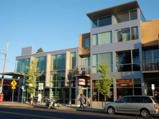
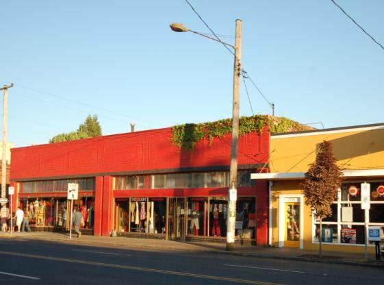
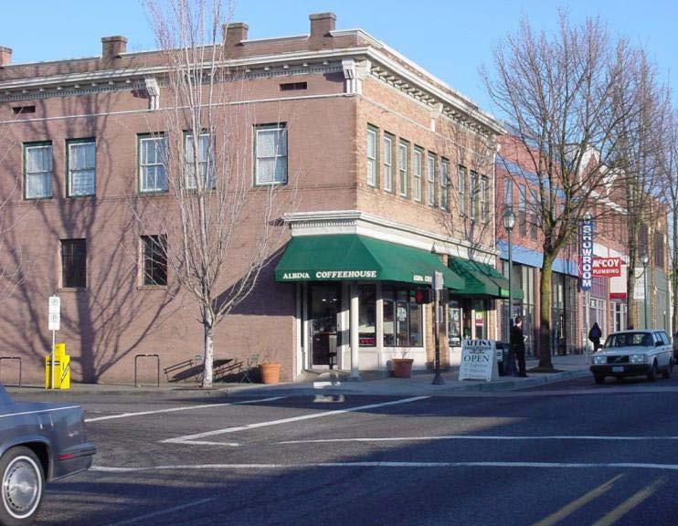
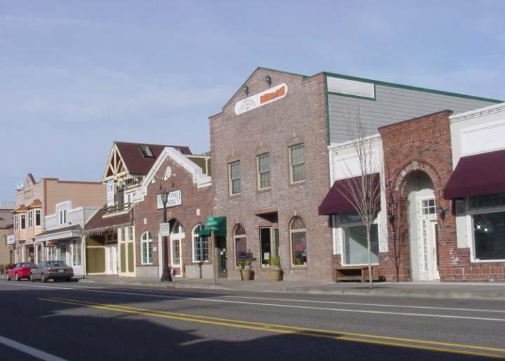
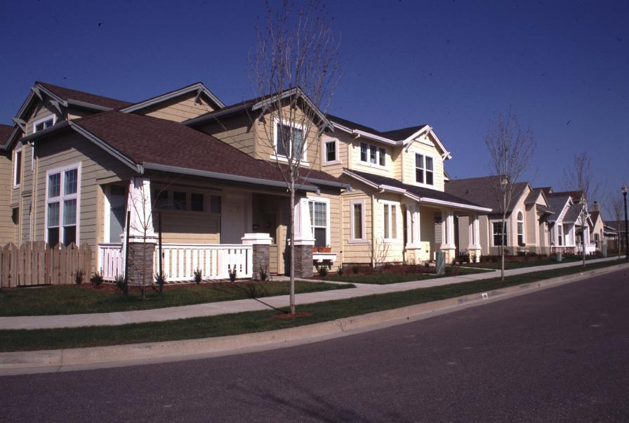
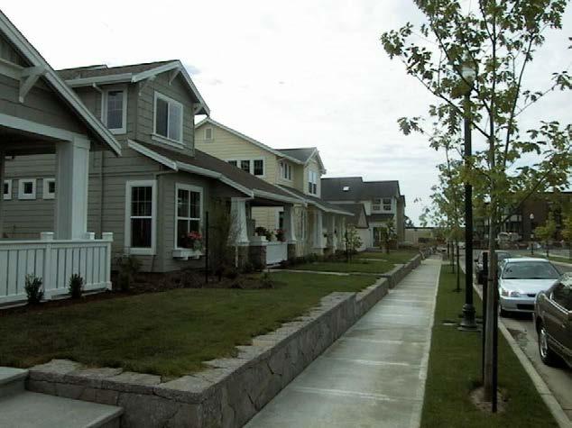
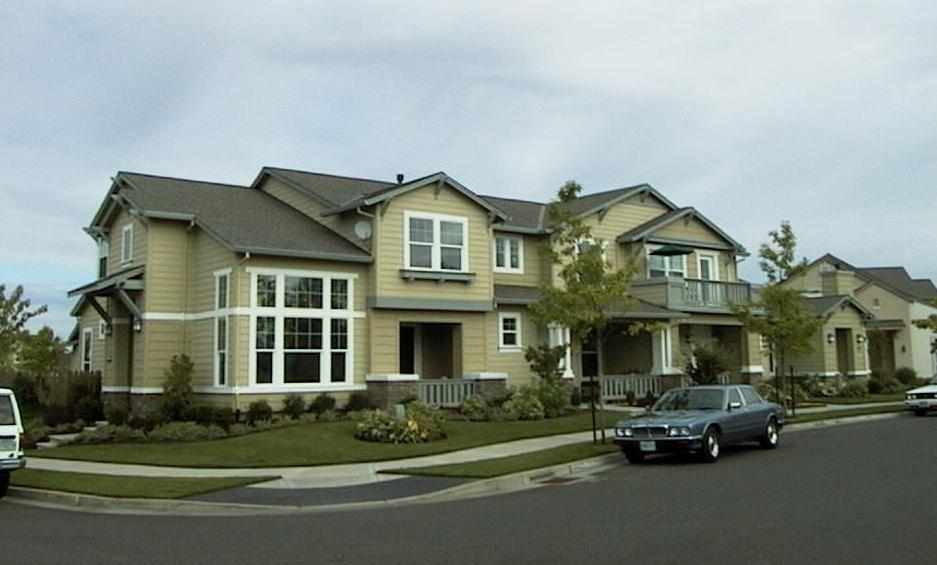
10 Let s try it...
11 Instant Polling! - Getting Familiar with the Keypads 1. Under 18 6% How old are you? 17% % % or older 4%
12 5% 6% 11% Where do you live? 1. Fresno/Clovis Metropolitan Area 78% 2. In one of the incorporated cities east of Highway In one of the incorporate cities west of Highway In an unincorporated rural communities

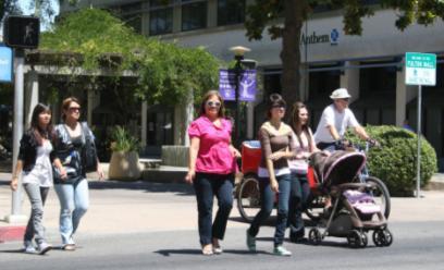
13 How do you get around?
14 When shopping or running errands I like to 1. Park within sight of each destination 19% 2. Park once and walk between shops 21% 60% 3. Walk, bike or bus to my destinations

15 What makes people walk? Walkable Distances

16 What makes people walk? Practical Destinations

17 What makes people walk? Pleasant and Interesting Environment, a Human Scale


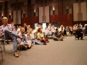
18 Walkable Neighborhoods In most conventional suburban development, streets separate uses, discouraging walking and forcing even local trips onto arterial roads. Walkable neighborhoods have streets that connect uses, with arterials reserved for through traffic.
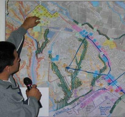
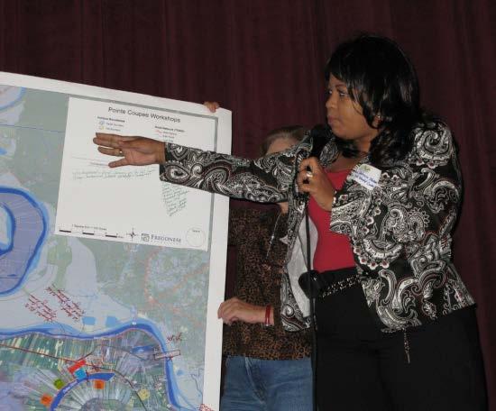
19 Have you ridden on transit in the past six months? 1. Yes 2. No 33% 67%
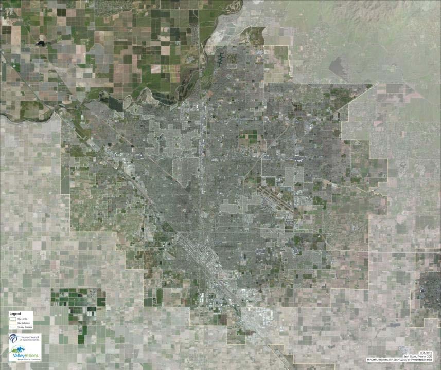
20 If you answered yes to the last question, why did you ride transit? 1. It is convenient 2. It is cheap 15% 23% 3. It is my only option 62%
21 If you didn t ride transit, why? 1. It is too slow 9% 24% 32% 34% 2. Doesn t serve my destinations 3. Not a pleasant experience 4. There is no stop or station close to my home
22 What do you think is the highest priority for transportation spending? 1. Building new and widening existing streets 7% 12% 16% 2. Improve/Increase bus service 21% 3. Build more sidewalks, bikes lanes and trails 44% 4. Improve transportation for the disabled and elderly 5. None of the above
23 What is the most important issue to you in the SCS process? 1. Offering different transportation choices 7% 12% 24% 2. Improve air quality 26% 31% 3. Provide increased housing choices 4. Conserve valuable farmland 5. None of the above
24 We have plenty of room in the region so we shouldn t worry about cities spreading out as they grow. 1% 1. Strongly agree 12% 2. Agree 7% 3. Neutral 7% 4. Disagree 11% 5. Strongly Disagree 6. Don t know 62%
25 I am willing to have more people live in my neighborhood so that less open space outside existing city boundaries will have to be developed. 1. Strongly agree 3% 2. Agree 3. Neutral 7% 11% 14% 4. Disagree 21% 5. Strongly disagree 6. Don t know 43%

26 Purpose of the Workshop Bottom-up process Input collection Public outreach

27 Interactive Mapping Exercises Groups of 8 to 10 will work together
28 Fresno/Clovis Workshop Map
29 Aerial
30 Major Roads and Highways
31 Land Use

32 West County Map

33 East County Map


34 Workshop Game Pieces Employment Types Mixed-Use Types Residential Types

35 Chip Menus are on your Table

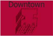
36 Downtown Downtown: 60 acres 66 Households~ 11 hh / ac 6,300 Jobs ~ 105 jobs / ac
37


38 Business Park 2,640 feet Business Park: 160 Acres 0 Households ~ 0 hh / ac 5,440 Jobs ~ 34 jobs / ac


39 Strip Commercial 5,280 feet Strip Commercial: 160 Acres 0 Households ~ 0 hh / ac 2,080 Jobs ~ 13 jobs / ac


40 Activity Center 2,640 feet Activity Center: 160 Acres 0 Households ~ 0 hh / ac 3,040 Jobs ~ 19 jobs / ac


41 Industrial 2,640 feet Industrial: 160 Acres 0 Households ~ 0 hh / ac 1,440 Jobs ~ 9 jobs / ac


42 Mixed Use Corridor 5,280 feet Urban Corridor: 160 Acres 2,240 Households~14 hh / ac 6,080 Jobs ~ 38 jobs / ac
43
44 Is this building appropriate for the Fresno region of the future? 1. Yes 2. No 9% 3. Maybe 9% 81%
45 Is housing in mixed use buildings a good fit for Fresno County? 3% 1. Yes, throughout the area 9% 7% 22% 59% 2. Yes, only in Fresno and Clovis 3. Yes, only in commercial centers and along transit corridors 4. No, it is not compatible 5. I don t know


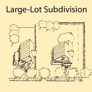
46 Neighborhood Center 2,640 feet Neighborhood Center: 160 Acres 2,080 Households~ 13 hh / ac 3,040 Jobs ~ 38 jobs / ac
47


48 Main Street 5,280 feet Main Street: 160 Acres 983 Households ~ 9 hh / ac 973 Jobs ~ 9 jobs / ac
49


50 Compact Neighborhood 2,640 feet Compact Neighborhood: 160 Acres 1,280 Households ~ 8 hh / ac 0 Jobs~ 0 jobs / ac
51

52 Is this housing style appropriate for the region of the future? 1. Yes 2. No 13% 3. Maybe 71% 16%


53 Residential Subdivision 2,640 feet Residential Subdivision: 160 Acres 800 Households~ 5 hh / ac 0 Jobs~ 0 jobs / ac


54 Large-Lot Subdivision 2,640 feet Large-Lot Subdivision: 160 Acres 230 Households~ 2 hh / ac 0 Jobs~ 0 jobs / ac
55 The Chipsets The chip sets are the physical area covered by forecasted construction Trends Continue 156 Chips Complete Neighborhoods 102 Chips There are 2 packets

56 The Chipsets Trends Continue 156 Chips
57 Chipset: Trends Job growth continues primarily outside of downtown Housing is predominantly single-family in residential subdivisions Development is primarily single-use and autooriented

58 Trends: 156 Chips


59 Existing Trends in Development Big-box retail Large parking lots oriented to major highways

60 Existing Trends in Development Housing separated from shopping and jobs
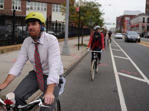
61 The Chipsets Complete Neighborhoods 102 Chips
62 Chipset: Complete Neighborhoods New jobs and housing are directed downtown and along main streets Focus on neighborhood revitalization, transit, and infill Housing includes a wide mix of apartments, condominiums, townhomes and compact single family homes.
63 Complete Neighborhoods: 102 Chips
64 Chipsets Compared Percent Walkable Chips 70% 60% 50% 40% 30% 20% 10% 0% Walkable Chips Trends Continue Complete Neighborhoods
65 Chipsets Compared Acres of Land Consumed 30,000 25,000 20,000 15,000 10,000 5, ,860 Trends 16,120 Complete Neighborhoods

66 The Workshop Exercise Participants build their own growth scenarios PROCESS: 1. Decide where NOT to grow 2. Choose a starter chip set 3. Arrange chips on map 4. Trade chips 5. Draw in roads and transit needed 6. Present map to group

67 Get Familiar with the Materials Workshop Map Markers Chipset Envelopes


68 Decide where NOT to grow Designate desired: Open space, green corridors and conservation areas Historic districts and other significant areas


69 Draw transportation infrastructure Bicycle & Pedestrian Networks Transit Roadways & Highways Especially in areas you expect to have new jobs or housing! New bike paths New bus route New roads

70 The Workshop Exercise Choose a Starter Set and Place Chips on Map

71 What if the chip is too big? Feel free to cut the chip in half, or in quarters

72 Experiment with Chip Arrangements Cut out chips and begin placing them in strategic locations but don t stick them down yet!

73 Name Your Map and Choose a Presenter
74

75 What happens after the Workshops?


76 Each table s plan is analyzed and recorded


77 Then we use the maps to build scenarios Your Input Concepts and Analysis Growth Scenarios


78 The scenarios are evaluated for performance Transportation Analysis Roadway Impact Ridership Owner Renter Vision , , , ,000 48% 52% 150, ,000 Vision ,000 - SF Det SF Att MF SF Det SF Att MF 48% 52% Year 2000 Vision 2030 Market Constraints Development Program Commercial Demand Housing Needs Sustainability Urban Design Land Use Scenario Development
79 How can you follow up? Scenarios will be released in February, 2013 Public workshops in March/April, 2013 Policy Board adoption in April/May, 2013 www. Fresnocog.org
80 Fresno COG Staff Contacts RTP : Barbara Steck SCS : Kristine Cai bjsteck@fresnocog.org kcai@fresnocog.org Outreach: Brenda Veenendaal brendav@fresnocog.org
Jeff s House. Downtown Charlottesville. PEC Office
 Jeff s House Downtown Charlottesville PEC Office Year 2000 US Census Data Employed persons over 16 Percentage of Employed Persons Locality Avg Commute (in minutes) Drove Public Transit Walk/Bike Other
ConnectGreaterWashington: Can the Region Grow Differently?
 Washington Metropolitan Area Transit Authority ConnectGreaterWashington: Can the Region Grow Differently? Transportation Planning Board (TPB) Travel Forecasting Subcommittee July 17, 2015 1 Alternatives
Kendall Drive Premium Transit PD&E Study Project Kick-Off Meeting SR 94/Kendall Drive/SW 88 Street Project Development and Environment (PD&E) Study
 Study") Florida Department of Transportation District Six Kendall Drive Premium Transit PD&E Study Project Kick-Off Meeting SR 94/Kendall Drive/SW 88 Street Project Development and Environment (PD&E) Study What
Florida Department of Transportation District Six Kendall Drive Premium Transit PD&E Study Project Kick-Off Meeting SR 94/Kendall Drive/SW 88 Street Project Development and Environment (PD&E) Study What
Public Workshop Results
 Public Workshop Results Our family moved here (El Dorado Hills) from Stockton so we could be closer to things. Now we bike as a family to school and even walked to the park for this event. And to soccer
Breakout Session. The Mobility Challenges of Our Growing & Sprawling Upstate
 Breakout Session The Mobility Challenges of Our Growing & Sprawling Upstate The Mobility Challenges of Our Growing & Sprawling Upstate Why is our suburban and sprawling development pattern a challenge
Executive Summary. Draft Environmental Impact Statement/Environmental Impact Report ES-1
 Executive Summary Introduction The Eastside Transit Corridor Phase 2 Project is a vital public transit infrastructure investment that would provide a transit connection to the existing Metro Gold Line
APPLICATION OF A PARCEL-BASED SUSTAINABILITY TOOL TO ANALYZE GHG EMISSIONS
 APPLICATION OF A PARCEL-BASED SUSTAINABILITY TOOL TO ANALYZE GHG EMISSIONS Jung Seo, Hsi-Hwa Hu, Frank Wen, Simon Choi, Cheol-Ho Lee Research & Analysis Southern California Association of Governments 2012
MPO Transit Study. Transit Concept for 2050 November 5, Transit Technologies
 Hillsborough County MPO Transit Study Transit Concept for 2050 November 5, 2007 Transit Technologies 1 Technologies Considered Bus Light Rail Commuter Rail Bus Standard or articulated high-capacity vehicles
Garrett Hill Master Plan
 Garrett Hill Master Plan Visioning Workshop February 13, 2007 Campbell Thomas & Company Agenda Welcome Existing conditions summary Critical issues Visioning exercise Summary & next steps Critical Assets
Parking Management Strategies
 Parking Management Strategies Policy Program Potential Effectiveness (percent reduction in demand) Comments Parking Pricing Unbundling and Cash-Out Options Reduced Parking Requirements Transit/TOD Supportive
PROJECT SCHEDULE. Plan for Implementation. Explore and Analyze. Refine Ideas. Identify Common Ideas SPRING 2016 SUMMER 2016 FALL 2016
 VISION WORKSHOP MAY 25 th 2016 A COLLABORATION PROJECT SCHEDULE Explore and Analyze Identify Common Ideas Refine Ideas Plan for Implementation SPRING 2016 SUMMER 2016 FALL 2016 TODAY S AGENDA Explore and
2.4 TRANSIT VISION 2040 FROM VISION TO ACTION. Support the revitalization of urban cores STRATEGIC DIRECTION
 TRANSIT VISION 2040 FROM VISION TO ACTION TRANSIT VISION 2040 defines a future in which public transit maximizes its contribution to quality of life with benefits that support a vibrant and equitable society,
APPENDIX VMT Evaluation
 APPENDIX 2.7-2 VMT Evaluation MEMORANDUM To: From: Mr. Jonathan Frankel New Urban West, Incorporated Chris Mendiara LLG, Engineers Date: May 19, 2017 LLG Ref: 3-16-2614 Subject: Villages VMT Evaluation
US 81 Bypass of Chickasha Environmental Assessment Public Meeting
 US 81 Bypass of Chickasha Environmental Assessment Public Meeting March 14, 2013 Introductions ODOT FHWA SAIC Meeting Purpose Present need for bypass Provide responses to 10/04/11 public meeting comments
Equitable transit-oriented development: Tools + Tactics
 Equitable transit-oriented development: Tools + Tactics Yonah Freemark February 18, 2016 Metropolitan Planning Council Chicagoland s growth over time 1950 Population density Fewer than 2,000 ppl/sq. mi.
QUALITY OF LIFE EXECUTIVE SUMMARY REPORT I O N S TAT I O N
 QUALITY OF LIFE EXECUTIVE SUMMARY REPORT UN I O N S TAT I O N T R AV E L by TR A I N Published September 2017 2015 PROGRESS MAP This document reports FasTracks progress through 2015 BACKGROUND RTD The
BIRMINGHAM CONNECTED Anne Shaw Tuesday 20 January 2015
 BIRMINGHAM CONNECTED Anne Shaw Tuesday 20 January 2015 www.birmingham.gov.uk/connected Birmingham Connected Setting the context challenges in Birmingham The need for action The EU the SUMP process Strategy
EUGENE-SPRINGFIELD, OREGON EAST WEST PILOT BRT LANE TRANSIT DISTRICT
 EUGENE-SPRINGFIELD, OREGON EAST WEST PILOT BRT LANE TRANSIT DISTRICT (BRIEF) Table of Contents EUGENE-SPRINGFIELD, OREGON (USA)... 1 COUNTY CONTEXT AND SYSTEM DESCRIPTION... 1 SYSTEM OVERVIEW... 1 PLANNING
2030 Multimodal Transportation Study
 2030 Multimodal Transportation Study City of Jacksonville Planning and Development Department Prepared by Ghyabi & Associates April 29,2010 Introduction Presentation Components 1. Study Basis 2. Study
Green Line Long-Term Investments
 Enhancements Short-term improvements to keep Austin moving. Investments Long-term projects to support our future. Mobility Hubs MetroRapid MetroRail MetroExpress Connectors Circulators Project Connect
Executive Summary. Treasure Valley High Capacity Transit Study Priority Corridor Phase 1 Alternatives Analysis October 13, 2009.
 Treasure Valley High Capacity Transit Study Priority Corridor Phase 1 Alternatives Analysis October 13, 2009 Background As the Treasure Valley continues to grow, high-quality transportation connections
Comments_Negative_A. Neg_ScenA
 ?? A loss of 39.2 acres of farmland A lot of roads to repair. (At lease in the Reedley area) Active all ready, not really need improving Active transportation Affects our agricultural economy Air Quality
The City of Toronto s Transportation Strategy July 2007
 The City of Toronto s Transportation Strategy July 2007 Presentation Outline Transportation Statistics Transportation Building Blocks Toronto s Official Plan Transportation and City Building Vision Projects
Hillsborough County MPO Transit Study. Transit Concept for 2050 October 17, 2007
 Hillsborough County MPO Transit Study Transit Concept for 2050 October 17, 2007 Transit Technologies Technologies Considered Bus Light Rail Commuter Rail Bus Standard or articulated high-capacity vehicles
Don Elliott, FAICP Clarion Associates, Denver, CO Pace Land Use Law Conference, White Plains December 2017
 Driverless Cars & Their Implications for Zoning Don Elliott, FAICP Clarion Associates, Denver, CO Pace Land Use Law Conference, White Plains December 2017 A. IT S NOT ONE THING 0. Human Drivers by themselves
King County Metro. Sustainably and equitably achieving a zero-emission fleet
 King County Metro Sustainably and equitably achieving a zero-emission fleet Agenda Background Purpose Service area Fleet size Climate goals Process Stakeholder engagement Analyses Service Equity Final
Leveraging Land Use Changes through Transportation Funding
 Leveraging Land Use Changes through Transportation Funding Railvolution 2005 September 10, 2005 James Corless Senior Planner What is the MTC region? 9 7 101 26 San Francisco Bay Area counties Million people;
SUSTAINABILITY CODE AMENDMENTS ELECTRICAL VEHICLE INFRASTRUCTURE AND BICYCLE PARKING DRAFT
 SUSTAINABILITY CODE AMENDMENTS ELECTRICAL VEHICLE INFRASTRUCTURE AND BICYCLE PARKING DRAFT Planning Commission January 8, 2014 Electric Vehicle Parking Purpose: To ensure infrastructure readiness for electric
Puget Sound Transportation Panel Factors in Daily Travel Choices September 1991
 Puget Sound Transportation Panel Factors in Daily Travel Choices September 1991 My current work/school status is: 1 Work, 35 hours/week or more 2 Work, fewer than 35 hours/week 3 Student, full-time Continue
Findings from the Limassol SUMP study
 5 th European Conference on Sustainable Urban Mobility Plans 14-15 May 2018 Nicosia, Cyprus Findings from the Limassol SUMP study Apostolos Bizakis Deputy PM General Information The largest city in the
Chapter 7: Travel Demand Analysis. Chapter 8. Plan Scenarios. LaSalle Community Center. Image Credit: Town of LaSalle
 Chapter 7: Travel Demand Analysis Chapter 8 Plan Scenarios LaSalle Community Center. Image Credit: Town of LaSalle 164 Chapter 8: Plan Scenarios Moving Ahead for Progress in the 21 st Century Act (MAP
Major Widening/New Roadway
 Revised Evaluation s Major Widening/New Roadway This page provides a summary of any revisions made to the draft scores presented at the October th Attributable Funds Committee meeting. The information
2.0 Development Driveways. Movin Out June 2017
 Movin Out June 2017 1.0 Introduction The proposed Movin Out development is a mixed use development in the northeast quadrant of the intersection of West Broadway and Fayette Avenue in the City of Madison.
West Broadway Transit Study. Community Advisory Committee September 17, 2015
 West Broadway Transit Study Community Advisory Committee September 17, 2015 Introductions Community Engagement Summer Outreach Fall Outreach Technical Analysis Process Update Alternatives Review Economic
Public Meeting. March 21, 2013 Mimosa Elementary School
 Public Meeting March 21, 2013 Mimosa Elementary School Today s Meeting Purpose 2 Where We Are The Process What We ve Heard and Findings Transit Technologies Station Types Break-out Session Where We Are
Transitioning to Integrated Sustainable Multi-mobility. A Model Climate Action Strategy
 Transitioning to Integrated Sustainable Multi-mobility A Model Climate Action Strategy 8 03 2009 Timothy Papandreou Assistant Deputy Director Planning & Development SFMTA-Municipal Transportation Agency
Metro Transit Update. Christina Morrison, Senior Planner Metro Transit BRT/Small Starts Project Office. John Dillery, Senior Transit Planner
 Metro Transit Update Christina Morrison, Senior Planner Metro Transit BRT/Small Starts Project Office John Dillery, Senior Transit Planner Metro Transit Service Development May 16, 2013 1 Transit Planning
Parking Management Element
 Parking Management Element The State Transportation Planning Rule, adopted in 1991, requires that the Metropolitan Planning Organization (MPO) area implement, through its member jurisdictions, a parking
Charlotte-Mecklenburg Region Rapid Transit and Land-Use Integration
 Charlotte-Mecklenburg Region Rapid Transit and Land-Use Integration Legislative Committee on Urban Growth and Infrastructure Carolyn Flowers CEO Charlotte Area Transit System March 23, 2010 Charlotte Region
Transportation Sustainability Program
 Transportation Sustainability Program Photo: Sergio Ruiz San Francisco 2016 Roads and public transit nearing capacity Increase in cycling and walking despite less than ideal conditions 2 San Francisco
Metra Milwaukee District West Line Transit-Friendly Development Plan
 Metra Milwaukee District West Line Transit-Friendly Development Plan Community Input Workshop April 6, 2011 Overview of Presentation Workshop Goals Study Context Existing Conditions Market Overview Employment
Town of Londonderry, New Hampshire NH Route 28 Western Segment Traffic Impact Fee Methodology
 Town of Londonderry, New Hampshire NH Route 28 Western Segment Traffic Impact Fee Methodology Prepared by the Londonderry Community Development Department Planning & Economic Development Division Based
residents of data near walking. related to bicycling and Safety According available. available. 2.2 Land adopted by
 2. Assessment of Current Conditions and Needs In order to prepare a plan to reach the vision desired by the residents of Texarkana, it is first necessary to ascertain the current situation. Since there
FREQUENTLY ASKED QUESTIONS
 FREQUENTLY ASKED QUESTIONS 2018 What is the More MARTA Atlanta program? The More MARTA Atlanta program is a collaborative partnership between MARTA and the City of Atlanta to develop and implement a program
DOWNTOWN CONCORD SPECIFIC PLAN
 Timeline 21-month process Tasks 1-3; Basis for the preparation of the plan (Jan. through March) Tasks 4-5; Development and Evaluation of Alternatives. Selection of Preferred Alternative. Preparation of
Appendix A. Community Workshop Results PUBLIC REVIEW DRAFT
 Appendix A Community Workshop Results This Page Left Blank Intentionally Comprehensive Planning Community Workshop Summary July 30, 2012 The City of Becker invited the Community to participate in a Comprehensive
Transit in Bay Area Blueprint
 Rail~Volution 2010 Click to edit Master title style Transit in Bay Area Blueprint October 21, 2010 0 Bottom Line State-of-Good Repair essential for reliable transit service large funding shortfalls BART
11 October 12, 2011 Public Hearing APPLICANT:
 11 October 12, 2011 Public Hearing APPLICANT: CARING TRANSITIONS PROPERTY OWNER: HARDEE REALTY CORPORATION REQUEST: Conditional Use Permit (motor vehicle rental) STAFF PLANNER: Leslie Bonilla ADDRESS /
CITY OF ANN ARBOR, MICHIGAN 301 E. Huron St., P.O. Box 8647 Ann Arbor, Michigan
 Date: Wednesday, June 24, 2014 Location: Ann Arbor District Library Attendees: 40 citizen attendees Ann Arbor Station Environmental Review Public Meeting Meeting Notes Meeting #2 The second public meeting
Westside Issues Major generators: employment centers, retail, residential, recreational, UCLA, LAX Rising jobs-housing imbalance Transportation improv
 Westside Issues Major generators: employment centers, retail, residential, recreational, UCLA, LAX Rising jobs-housing imbalance Transportation improvements have not kept pace Spreading peak periods Severe
Energy Technical Memorandum
 Southeast Extension Project Lincoln Station to RidgeGate Parkway Prepared for: Federal Transit Administration Prepared by: Denver Regional Transportation District May 2014 Table of Contents Page No. Chapter
Mobility 2045 Plan Workshop
 Mobility 2045 Plan Workshop Regional Transportation Council October 12, 2017 Agenda Mobility Planning Mobility 2045 Innovative Funding and Strategic Partnerships Public Outreach Efforts Next Steps 2 Mobility
SUPPORTING TOD IN METRO CHICAGO
 www.rtachicago.org SUPPORTING TOD IN METRO CHICAGO Tuesdays at APA November 18, 2014 OVERVIEW OF RTA 2 11/18/2014 Tuesdays at APA: Supporting TOD in Metro Chicago RTA Region 8.5 million people 3,700 square
1 Downtown LRT Connector: Draft Concept
 Downtown LRT Connector: Draft Concept Plan November 2010 We re moving forward. Get involved. On June 21, 2010, City Council approved a street-level downtown LRT route, including a connector for the future
UTA Transportation Equity Study and Staff Analysis. Board Workshop January 6, 2018
 UTA Transportation Equity Study and Staff Analysis Board Workshop January 6, 2018 1 Executive Summary UTA ranks DART 6 th out of top 20 Transit Agencies in the country for ridership. UTA Study confirms
Incentives for Green Fleets
 Incentives for Green Fleets 2012 Green Vehicle Funding Workshop East Bay Clean Cities Coalition Karen Schkolnick Air Quality Programs Manager Bay Area Air Quality Management District Overview Introduction
San Francisco Transportation Plan Update
 San Francisco Transportation Plan Update SPUR August 1, 2011 www.sfcta.org/movesmartsf twitter.com/sanfranciscota www.facebook.com/movesmartsf How does the RTP relate to the SFTP? Regional Transportation
Transportation Demand Management Element
 Transportation Demand Management Element Over the years, our reliance on the private automobile as our primary mode of transportation has grown substantially. Our dependence on the automobile is evidenced
CTA Blue Line Study Area
 CTA Blue Line Study Area HISTORY OF THE CTA BLUE LINE / I-290 SYSTEM Blue Line / I-290 infrastructure is 55 years old First integrated transit / highway facility in the U.S. PROJECT STUDY AREA EXISTING
Restoration of Historic Streetcar Services in Downtown Los Angeles
 Restoration of Historic Streetcar Services in Downtown Los Angeles Early Scoping Meeting for Alternatives Analysis (AA) May 17, 2011 Introduction Key players Local lead agency: Metro Federal lead agency:
PROJECT BACKGROUND 3
 AGENDA 1. Welcome & Introductions 2. Project Background 3. Project Approach & Schedule 4. Draft Long List of Options 5. Evaluation Process 6. Next Steps 2 PROJECT BACKGROUND 3 OUR RAPID TRANSIT NETWORK
DOWNTOWN CONCORD SPECIFIC PLAN
 Timeline Next Milestones Alternatives Analysis Draft Report to MTC - July 30 Draft Specific Plan Outline July 31 First Draft Specific Plan Report September 15 Schedule and Agendas July 22 nd DSC #5 Evaluation
Charlotte Area Transit System: Moving Forward John Lewis CATS Chief Executive Officer
 Charlotte Area Transit System: Moving Forward John Lewis CATS Chief Executive Officer House Select Committee March 2018 1 Charlotte Long-Term Growth Management Strategy Centers, Corridors and Wedges Five
Rocky Mount. Transportation Plan. Transportation Planning Division. Virginia Department of Transportation
 2020 Transportation Plan Developed by the Transportation Planning Division of the Virginia Department of Transportation in cooperation with the U.S. Department of Transportation, Federal Highway Administration
The Engineering Department recommends Council receive this report for information.
 CORPORATE REPORT NO: R161 COUNCIL DATE: July 23, 2018 REGULAR COUNCIL TO: Mayor & Council DATE: July 19, 2018 FROM: General Manager, Engineering FILE: 8740-01 SUBJECT: Surrey Long-Range Rapid Transit Vision
WESTSIDE SUBWAY EXTENSION. Final Smart Growth Evaluation Report
 Final Smart Growth Evaluation Report August 2010 Table of Contents Table of Contents 1.0 INTRODUCTION... 1-1 1.1 4Ds... 1-2 1.2 Direct Ridership Model (DRM)... 1-2 2.0 4DS... 2-1 2.1 Inputs... 2-1 2.2
CITY OF ANN ARBOR, MICHIGAN 301 E. Huron St., P.O. Box 8647 Ann Arbor, Michigan
 Date: Wednesday, June 18, 2014 Location: Ann Arbor District Library Attendees: 14 citizen attendees Ann Arbor Station Environmental Review Citizen Working Group Meeting Notes Meeting #3 The third meeting
Streetcar and Light Rail Design Differences. February 2015
 Streetcar and Light Rail Design Differences February 2015 How Are Streetcar and Light Rail Different? The design differences between streetcar and light rail are tied to the distinctions in the markets
METRO Orange Line BRT American Boulevard Station Options
 METRO Orange Line BRT American Boulevard Station Options Bloomington City Council Work Session November 18, 2013 Christina Morrison BRT/Small Starts Project Office Coordinating Planning and Design AMERICAN
Bi-County Transitway/ Bethesda Station Access Demand Analysis
 Bi-County Transitway/ Bethesda Station Access Demand Analysis Prepared for: Washington Metropolitan Area Transit Authority Office of Planning and Project Development May 2005 Prepared by: in conjunction
Whither the Dashing Commuter?
 Whither the Dashing Commuter? The MTA in a Changing Region William Wheeler Director of Special Project Development and Planning Travel in the New York Region has changed from the days of the 9 to 5 commute
This letter provides SPUR s comments on the Draft Supplemental Environmental Impact Statement/ Subsequent Environmental Impact Report.
 Tom Fitzwater, Environmental Planning Manager VTA Environmental Programs & Resources Management 3331 North First Street, Building B-2 San Jose, CA 95134 March 6, 2017 Submitted Electronically Re: VTA s
Transportation 2040: Plan Performance. Transportation Policy Board September 14, 2017
 Transportation 2040: Plan Performance Transportation Policy Board September 14, 2017 Today Background Plan Performance Today s Meeting Background Board and Committee Direction 2016-2017 Transportation
Public Information Workshop
 Public Information Workshop Charlotte County-Punta Gorda MPO - Meeting Rooms A and B March 29, 2018 Welcome to the Public Information Workshop for Harborview Road Project Development and Environment (PD&E)
Climate Change. November 29, 2018 Growth Management Policy Board
 Climate Change November 29, 2018 Growth Management Policy Board VISION 2050 and Climate Change 1. Climate Background Paper: Background information Regional inventory Emission reduction efforts Potential
Streetcar and Light Rail Design Differences. March 2015
 Streetcar and Light Rail Design Differences March 2015 How Are Streetcar and Light Rail Different? The design differences between streetcar and light rail are tied to the distinctions in the markets served
TRAVEL DEMAND FORECASTS
 Jiangxi Ji an Sustainable Urban Transport Project (RRP PRC 45022) TRAVEL DEMAND FORECASTS A. Introduction 1. The purpose of the travel demand forecasts is to assess the impact of the project components
Sustainability SFMTA Path to Platinum
 Sustainability SFMTA Path to Platinum Ed Reiskin San Francisco Municipal Transportation Agency, Director of Transportation San Francisco, CA Timothy Papandreou Deputy Director Strategic Planning & Policy
V03. APTA Multimodal Operations Planning Workshop August Green Line LRT
 V03 APTA Multimodal Operations Planning Workshop August 2016 Green Line LRT 2 Presentation Outline Past Present Future 3 16/03/2016 RouteAhead Update 4 4 16/03/2016 RouteAhead Update 5 5 16/03/2016 6 6
Utilizing GIS Models in Prioritizing and Selecting Transportation Projects
 Utilizing GIS Models in Prioritizing and Selecting Transportation Projects GIS-T Conference Raleigh, NC April 7, 2016 Tyler Meyer, AICP Tram Truong, GISP Outline Case Studies: 1. MPO project selection
Rapid Transit and Land-Use Integration a Reality
 City of Charlotte Rapid Transit and Land-Use Integration a Reality Transportation Oversight Committee Carolyn Flowers CEO Charlotte Area Transit System April 29, 2010 Charlotte Region Statistics Mecklenburg
Speaker Information Tweet about this presentation #TransitGIS
 Making the Case for Transit: the Transit Competitiveness Index Title William E. Walter, GISP Speaker Information Tweet about this presentation #TransitGIS Understanding Conditions in Each Travel Market
SUMMARY OF COMMENTS AT PUBLIC OPEN HOUSES SCOPING OF ALTERNATIVES GATEWAY CORRIDOR ALTERNATIVES ANALYSIS
 SUMMARY OF COMMENTS AT PUBLIC OPEN HOUSES SCOPING OF ALTERNATIVES GATEWAY CORRIDOR ALTERNATIVES ANALYSIS A second series of four public open houses was held for the Gateway Corridor Alternatives Analysis
TIMBERVINE TRANSPORTATION IMPACT STUDY FORT COLLINS, COLORADO JANUARY Prepared for:
 TIMBERVINE TRANSPORTATION IMPACT STUDY FORT COLLINS, COLORADO JANUARY 2014 Prepared for: Hartford Companies 1218 W. Ash Street Suite A Windsor, Co 80550 Prepared by: DELICH ASSOCIATES 2272 Glen Haven Drive
STRATEGIC PRIORITIES AND POLICY COMMITTEE MAY 5, 2016
 STRATEGIC PRIORITIES AND POLICY COMMITTEE MAY 5, 2016 Shift Rapid Transit Initiative Largest infrastructure project in the city s history. Rapid Transit initiative will transform London s public transit
Travel Demand Modeling at NCTCOG
 Travel Demand Modeling at NCTCOG Arash Mirzaei North Central Texas Council Of Governments for Southern Methodist University The ASCE Student Chapter October 24, 2005 Contents NCTCOG DFW Regional Model
Results from the North American E-bike Owner Survey
 Results from the North American E-bike Owner Survey TRB Emerging Vehicles for Low Speed Transportation Subcommittee January 2018 John MacArthur Research Associate Portland State University UNITED STATES
When Do We Talk About the Future?
 When Do We Talk About the Future? How to Lead an Agency Through the Transportation Revolution Month Day, 2014 UC Davis March, 4, 2016 WHO WE ARE The Contra Costa Transportation Authority (CCTA) is a public
BROWARD BOULEVARD CORRIDOR TRANSIT STUDY
 BROWARD BOULEVARD CORRIDOR TRANSIT STUDY FM # 42802411201 EXECUTIVE SUMMARY July 2012 GOBROWARD Broward Boulevard Corridor Transit Study FM # 42802411201 Executive Summary Prepared For: Ms. Khalilah Ffrench,
LEED v4 Building Design and Construction Quiz #3 LT
 LEED v4 Building Design and Construction Quiz #3 LT 1. How are walking and bicycling distance measured? A. Straight-line radius from a main building entrance B. Straight-line radius from any building entrance
Making Mobility Better, Together
 Making Mobility Better, Together Austin Transportation Department Gordon Derr, P.E., for Robert J. Spillar, P.E Director, Austin Transportation Department 1 AUSTIN TRANSPORTATION DEPARTMENT Our Mission
Hennepin County Transit Oriented Development Program. The Ellipse, St. Louis Park, 2009
 Hennepin County Transit Oriented Development Program The Ellipse, St. Louis Park, 2009 What is Transit Oriented Development (TOD)? Development within walking distance of transit Typically ¼ to ½ mile 10
Metro Reimagined. Project Overview October 2017
 Metro Reimagined Project Overview October 2017 Reimagining Metro Transit Continuing our Commitment to: Provide mobility based on existing and future needs Value the role of personal mobility in the quality
Community Advisory Committee. October 5, 2015
 Community Advisory Committee October 5, 2015 1 Today s Topics Hennepin County Community Works Update Project Ridership Estimates Technical Issue #4:Golden Valley Rd and Plymouth Ave Stations Technical
East Link Extension. September 16, Bel-Red Conclusion to Final Design Open House Public Involvement Summary
 East Link Extension September 16, 2014 Bel-Red Conclusion to Final Design Open House Public Involvement Summary Table of contents 1 Background 2 Overview 2 Notification 3 Open House Overview 4 Comment
Halifax Commuter Rail Feasibility Study
 Halifax Commuter Rail Feasibility Study Open House Halifax Regional Municipality February 26, 2015 Study Team The team is led by CPCS: A global management consulting firm (formerly the consulting arm of
Electric Vehicle Programs & Services. October 26, 2017
 1 Electric Vehicle Programs & Services October 26, 2017 2 Outline Electric vehicle (EV) market update MGE Programs, Services and Outreach Public charging Home charging Multi-family charging Madison Gas
This Evening s Agenda. Open House 7:00 7:30 Presentation 7:30 8:00 Community Feedback8:00 9:00 Adjourn
 This Evening s Agenda Open House 7:00 7:30 Presentation 7:30 8:00 Community Feedback8:00 9:00 Adjourn Preliminary Station Footprint Potential Mid-Peninsula High Speed Train Station Palo Alto Dominic Spaethling,
TABLE OF CONTENTS EXECUTIVE SUMMARY...1 INTRODUCTION...3 PROJECTED FUTURE GROWTH...3 ROADWAY IMPROVEMENT PROJECTS...4 POTENTIAL FUNDING SOURCES...
 Transportation Impact Fee Study September 2014 TABLE OF CONTENTS EXECUTIVE SUMMARY...1 INTRODUCTION...3 PROJECTED FUTURE GROWTH...3 ROADWAY IMPROVEMENT PROJECTS......4 POTENTIAL FUNDING SOURCES...7 PROPOSED
Navigating in Different Rivers
 Navigating in Different Rivers Suburban TOD Julie Jones, Planning Manager, City of Fridley Julie Farnham, Senior Planner, City of Bloomington Kersten Elverum, Director of Planning & Development, City of