Transportation 2030 Total (projected 15 year total) BETTER ROADS
|
|
|
- Russell Hubbard
- 6 years ago
- Views:
Transcription
1
2 2 TRANSPORTATION 2030 EXECUTIVE SUMMARY WHAT IS TRANSPORTATION 2030? In November 2013, Mayor Ed Lee accepted the Transportation Task Force recommendations to pursue new resources for San Francisco s transportation system and more effectively plan for growth and change. The Task Force analyzed the City s transportation conditions, and reviewed the projects in previous transportation and community plans that have not been funded. The Task Force analyzed the funding needed to maintain and enhance our system, estimated at $10.1 billion over the next 15 years. The City has identified $3.8 billion in reasonable foreseeable funding, leaving a $6.3 billion funding gap. The Task Force recommended three funding sources to generate $3 billion over the next 15 years to support San Francisco s transportation needs: 1. Two $500 million General Obligation Bonds 2. A local increase to California s vehicle license fee (VLF) for vehicles registered in San Francisco. The VLF would increase from 0.65% of a vehicle s value to 2%. 3. A half-cent sales tax increase from 8.75% to 9.25% The Task Force proposals, if approved and fully funded, would be a historic increase in transportation investment that would almost double current funding levels. The Transportation 2030 November 2014 Measure are: 1. A $500 million general obligation bond (GO Bond) to address urgent repairs and upgrades to the city s transportation infrastructure without raising property tax rates. 2. A local increase to California s vehicle license fee (VLF) that if passed, will increase San Francisco General Fund revenues. The City could use the new revenues generated by a proposed VLF to support transportation projects in San Francisco. For vehicles registered in San Francisco, the VLF would increase from 0.65% of a vehicle s value to 2%. 3. A City and County of San Francisco Advisory Measure, expressing that the people of San Francisco wish to spend General Fund revenue supported by an increase to the Vehicle License Fee on transportation infrastructure projects. Summary of Programs and Estimated Funding Through 2030 Program GO Bond Possible New General Fund Allocation Transportation 2030 Total (projected 15 year total) BETTER ROADS Repave deteriorating neighborhood roads and potholes $42 million/year ($625 million) $625 million IMPROVED TRANSIT Provide faster and more reliable transit $230 million $230 million Replace and upgrade old buses and trains to increase service and reduce crowding Improve safety and accessibility at transit stops Fix obsolete Muni facilities to create productive working conditions and improve vehicle maintenance Invest in the development of critical capital projects along key transit corridors SAFER STREETS Improve pedestrian safety through focused engineering efforts at high-injury locations Install modern traffic signals to improve safety and mobility Build Complete Streets that enable safe, convenient and comfortable travel for all users, including safer, well-defined bikeways TOTALS $30 million $70 million $28 million $68 million $22 million $52 million $500 million $10.3 million/year ($154 million) $2.8 million/year ($42 million) $1 million/year ($15 million) $4.4 million/year ($66 million) $2.5 million/year ($37 million) $3 million/year ($45 million) $5 million/year ($72 million) $73.1 million/year ($1,056 million) $154 million $72 million $85 million $94 million $105 million $67 million $124 million $1,556 million EXECUTIVE SUMMARY

3 TRANSPORTATION HOW DOES TRANSPORTATION 2030 IMPROVE SAN FRANCISCO? The goals of Transportation 2030 are to provide Better Roads, Improved Transit, and Safer Streets for residents, workers, and visitors to San Francisco. Collectively, the initiatives provide funding to fix urgent infrastructure issues and provide an ongoing source of funding to maintain these assets in the years to come. The money from Transportation 2030, if passed, could fund repaving roads and eliminating potholes, increasing Muni reliability, reducing Muni travel times, and improving safety for people walking and cycling. The outcome of these investments will be increased transit reliability and significantly improved safety for all people getting around the city. The benefits of Transportation 2030 will be felt throughout every neighborhood in San Francisco. WHERE WILL THE MONEY COME FROM? The money for these proposed programs will come from two separate sources: a GO bond measure and a restored local vehicle license fee. Because of the importance of fiscal stewardship, the city has adopted strict constraints in its Capital Plan on the use of long-term debt financing in order to avoid placing an increased burden of property tax on future generations. For this reason, voter-approved GO bonds like those in Transportation 2030 are only proposed as the city retires existing debt and the city s property tax base grows. Last year, bonds were repaid and the city s property tax base grew, creating an opportunity to issue the Transportation 2030 GO bond measure without any increase to property tax rates. The second funding source, the local vehicle license fee (VLF), will, if passed, increase the existing fee collected by the California Department of Motor Vehicles (DMV) by 1.35%, to a total of 2%. Currently, there is an existing VLF of 0.65% which goes directly to the State of California through the Department of Motor Vehicles (DMV). The proposed 1.35% fee increase will also be collected by the DMV, and, with the exception of the state fees, all funds collected from this local VLF would go to the City and County of San Francisco General Fund. In addition to the VLF, a proposed Advisory measure, if passed, could be used to allocate funding in an equivalent amount for transportation-related projects proposed in the Transportation 2030 Program Descriptions. The VLF amount a car owner will pay is calculated based on the value of the vehicle when purchased, decreasing with each renewal of registration for the first 11 years, at which point the fee remains the same for as long as the vehicle is registered. HOW CAN WE BE SURE THE MONEY IS SPENT WISELY? The city s Capital Plan places an emphasis on accountability and transparency for each of the funding sources it recommends. The progress made in the implementation of each of the Transportation 2030 programs outlined in this report will be reported regularly through: An independent citizen oversight committee to ensure that the funds are allocated as outlined in the city s Capital Plan. This committee will be open to the public, sponsor audits, and provide a safety net to ensure the funds are spent in accordance with the express will of the voters. A dedicated web page that will list project schedules, scopes and budgets. Because some programs will be funded by both the proposed GO Bond and the general fund allocation resulting from the VLF, these reporting mechanisms will be employed for Transportation 2030 as a whole. EXECUTIVE SUMMARY
4 4 TRANSPORTATION 2030 TABLE OF CONTENTS INTRODUCTION... 6 TRANSPORTATION 2030 PROGRAM DESCRIPTIONS... 9 Better Roads... 9 Improved Transit Safer Streets CREDITS/NOTES GENERAL OBLIGATION BOND REPORT INTRODUCTION PROGRAM DESCRIPTIONS Improved Transit Safer Streets YEAR CAPITAL PLAN ACCOUNTABILITY PROJECT PRIORITIZATION CREDITS/NOTES GENERAL FUND ALLOCATION REPORT INTRODUCTION PROGRAM DESCRIPTIONS Better Roads Improved Transit Safer Streets YEAR CAPITAL PLAN ACCOUNTABILITY PROJECT PRIORITIZATION CREDITS/NOTES TRANSPORTATION 2030» CONTENTS

5 TRANSPORTATION TRANSPORTATION 2030
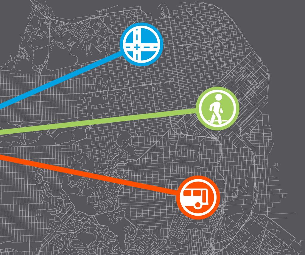
6 6 TRANSPORTATION 2030 INTRODUCTION Transportation 2030 is a $1.5 billion funding package to improve road conditions, transit service, and street safety in San Francisco. Transportation 2030 proposes two measures recommended by the Task Force for the November 2014 ballot. The November 2014 Measures are: 1. A $500 million general obligation bond (GO Bond) to address urgent repairs and upgrades to the city s transportation infrastructure without raising property tax rates. 2. A local increase to California s vehicle license fee (VLF) that if passed, will increase San Francisco General Fund revenues. The City could use the new revenues generated by a proposed VLF to support transportation projects in San Francisco. For vehicles registered in San Francisco, the VLF would increase from 0.65% of a vehicle s value to 2%. 3. A City and County of San Francisco Advisory Measure, expressing that the people of San Francisco wish to spend General Fund revenue supported by an increase to the Vehicle License Fee on transportation infrastructure projects. Making these investments now will improve safety and help people get around San Francisco more easily in the near-term, and position the city to maintain its assets and improve Muni service delivery for the next 15 years. MAKING CRITICAL UPGRADES TO THE TRANSPORTATION SYSTEM The population of San Francisco is projected to grow by about 20 percent by This increased population will compound the stress on the city s roads and existing transit system, a system which can be slow, inefficient, and in disrepair. The city has developed a set of programs that will improve the condition of the roads, the reliability and travel time of public transit, and the safety of all who travel through the city s neighborhood streets every day. The goal of Transportation 2030 is to provide Better Roads, Improved Transit, and Safer Streets for residents, workers, and visitors to San Francisco. These investments will produce increased transit reliability and significantly improved safety for all people getting around the city, if the November 2014 measures pass. The benefits of Transportation 2030 will be felt throughout every neighborhood in San Francisco. Measure 1: General Obligation Bond $500 million bond measure to address urgent repairs and upgrades to the city s transportation infrastructure Measure 2: Vehicle License Fee A local vehicle license fee of 1.35% of the vehicle s value that would go to the city s General Fund San Francisco General Fund Measure 3: Advisory Measure Expressing that SF should spend General Fund revenue supported by an increase to the Vehicle License Fee on transportation infrastructure projects. Funding to make critical safety and infrastructure upgrades to streets and improve Muni service Transportation 2030 Roads + Transit + Safety The following table summarizes the most urgent and effective street and transit investments the city can fund in the next 15 years with Transportation Expenditure Plan Goals 1. Better Roads: Repave deteriorating neighborhood roads and potholes 2. Improved Transit: Improve Muni speed and reliability 3. Safer Streets: Create safer streets and sidewalks for people who walk, drive, bike and take public transportation TRANSPORTATION 2030» INTRODUCTION
7 TRANSPORTATION Program Description Refer to the to General Obligation Bond Report and the General Fund Allocation Report for more information on the budget and schedule for each of the programs. GO Bond Posible New General Fund Allocation 2014 Transportation Measures Total BETTER ROADS Repave deteriorating neighborhood roads and potholes Repave deteriorating roads and potholes on more than 500 additional neighborhood blocks throughout the city each year Improve pedestrian access from roadway to sidewalk by constructing more than 1,000 curb ramps annually Use taxpayer dollars in a responsible and cost-effective way, spending public dollars on maintenance now to prevent costly emergency repairs in the future $625 million ($42 million annually) $625 million IMPROVED TRANSIT Provide faster and more reliable transit Improve travel time by 20% on Muni Rapid Network routes that serve 280, miles of transit priority investment, potentially saving customers up to one hour per week in travel time Reduce overcrowding and improve service quality Contribute towards San Francisco s share of Caltrain capital improvements to improve reliability $230 million $230 million Replace and upgrade outof-date buses and trains to increase service and reduce crowding Replace old buses and trains to improve service and reduce crowding for passengers Repair buses and trains in a timely manner to save money, decrease maintenance-related service delays, and improve on-time performance $154 million ($10.3 million annually) $154 million Improve safety and accessibility at transit stops Improve safety and accessibility at transit stations and stops by investing in lighting, wayfinding, and infrastructure improvements Replace and add more BART/Muni elevators and escalators to increase accessibility for all users $30 million $42 million ($2.8 million annually) $72 million Fix obsolete Muni facilities to create productive working conditions and improve vehicle maintenance Overhaul maintenance bays to accommodate new buses and trains Upgrade and redesign facilities to improve bus storage capacity Improve vehicle maintenance resources to ensure buses and trains stay in service $70 million $15 million ($1 million annually) $85 million Invest in development of critical capital projects along key transit corridors Plan, design and engineer strategic, large-scale transportation projects of citywide benefit, such as Bus Rapid Transit, Caltrain extension, and other key capital projects $28 million $66 million ($4.4 million annually) $94 million SAFER STREETS Improve pedestrian safety through focused engineering efforts at high-injury locations Prioritize pedestrian safety projects and programs at locations with the most severe pedestrian injuries and fatalities Invest in quick and cost-effective measures as well as comprehensive, permanent infrastructure $68 million $37 million ($2.5 million annually) $105 million Install modern traffic signals to improve safety and mobility Leverage more frequent traffic signal replacement to ensure modern, reliable signals for all people traveling on city streets Install Pedestrian Countdown Signals to improve safety for those walking $22 million $45 million ($3 million annually) $67 million Build Complete Streets that enable safe, convenient and comfortable travel for all users and provide safer, welldefined bikeways Build Complete Streets with all users in mind, including those walking, riding a bike, taking transit and people with disabilities; coordinate Complete Streets projects with paving projects to maximize efficiency Build up to 30 miles of bicycle network upgrades and 35 miles of bicycle network expansion, creating a safer, more well-defined bicycle network to reduce conflict and improve safety for all users $52 million $72 million ($5 million annually) $124 million TOTAL $500 million $1,056 million $1,556 million INTRODUCTION «TRANSPORTATION 2030


8 8 TRANSPORTATION 2030 BETTER ROADS IMPROVED TRANSIT SAFER STREETS TRANSPORTATION 2030» PROGRAM DESCRIPTIONS
9 TRANSPORTATION PROGRAM DESCRIPTIONS BETTER ROADS Repave deteriorating neighborhood roads and potholes Providing smooth and pothole-free streets is essential to moving people safely throughout the city. Well-maintained roads help keep buses running smoothly and reduce costs to vehicle owners whose cars can be damaged by the poor condition of streets. Road maintenance is like preventative medicine; it improves overall health in the long term and is cheaper to care for over the course of a road s life. More frequent maintenance can extend the life of a road and reduce costs by percent. The city s goal is to maintain streets and roadways in good condition, which is equivalent to a Pavement Condition Index (PCI) of at least 70. Transportation 2030 proposes establishing a steady, permanent funding source for the city s street repaving program to achieve this goal. The city is responsible for maintaining more than 940 miles of streets and roadways. Thanks to recent, significant investments in streets, primarily from the 2011 Road Repaving and Street Safety general obligation bond, San Francisco is improving the average condition of streets for the first time in decades, increasing the average Pavement Condition Index score from 63 to 66. SAN FRANCISCO S PAVEMENT CONDITION INDEX To track the condition of the pavement, the city uses a management system that establishes a rating for each city block using a visual survey performed by certified engineers. Each segment is evaluated based on a variety of criteria that informs the Pavement Condition Index (PCI) score for each city block. This scoring system uses a scale of 0 the worst score to 100 a freshly paved street. The table below summarizes the current condition of the city s streets, required pavement treatment, and the cost for the associated PCI range. % of SF Streets 22% 29% 27% 18% 4% PCI Score excellent good at-risk poor 0 24 very poor Treatment Average Cost/ Block No improvement needed $0 Pavement preservation specialized sealing treatments to extend life of street $21,600 Repave - grind off and replace the top two inches of asphalt $120,000 Resurface with base repair - grind off and replace the top two inches of asphalt and repair the concrete base Reconstruction - reconstruct the street including concrete base and top layer of asphalt $165,000 $520,000 We must continue to invest in our roads or their condition will decline, road repair costs will escalate quickly, recent improvements to street conditions will disappear, and the backlog of streets needing reconstruction will grow. It can be 50 times more expensive to reconstruct a street that is in poor condition than to preserve a street that is in good condition. Investing in road repair now is the most cost-effective way to give us better roads. WHAT DOES TRANSPORTATION 2030 MEAN FOR YOU? Smoother rides in the car, on the bus, and on a bicycle Reduced long term cost to maintain roads in good condition, which means taxpayer savings Savings on your annual vehicle maintenance costs Improved pedestrian access from roadway to sidewalk by constructing new curb ramps BETTER ROADS «PROGRAM DESCRIPTIONS «TRANSPORTATION 2030

10 10 TRANSPORTATION 2030 Pavement Conditions and Projected Impact of New Funding, AVERAGE PAVEMENT CONDITION INDEX (PCI) Projected PCI with Dedicated New Revenue Projected PCI without Dedicated New Revenue Historical PCI Transportation 2030 will invest $42 million annually in street repaving, putting us on track to improve the PCI to 70 by If this new funding is not added to city s existing funding sources, the PCI will fall to 59 by CURRENT FUNDING SOURCES San Francisco faces many challenges and uncertainties in securing a sustainable, dedicated funding source for street repaving. The projected allocation over the next ten years for road repaving and maintenance averages about $24 million per year. That is less than 40% of the funding needed to get and maintain a good PCI score of 70. Street Resurfacing Anticipated Funding Sources 2% FEDERAL OTHER LOCAL 63% 10% 25% STATE GENERAL FUND It can be 50 times more expensive to reconstruct a street that is in poor condition than to preserve a street that is in good condition. Investing in road repair now is the most cost-effective way to give us better roads. TRANSPORTATION 2030» PROGRAM DESCRIPTIONS» BETTER ROADS


11 TRANSPORTATION Transportation 2030 Program Description: Street Resurfacing The city s roadway system is complex and streets deteriorate over time. Three major factors can accelerate deterioration: Heavy wear and tear In San Francisco, streets and roads have an average useful life of 14 to 21 years. Because a street s lifecycle depends on how heavily the street is used - particularly by heavy buses and trucks - a street with heavy traffic can deteriorate seven years sooner than a street that carries lighter traffic. Excavation Underneath our streets, there is a vast network of underground utility lines, pipes and cables. Each time one of these utility lines or services needs repair or replacement, utility companies must cut a trench in the pavement, leaving a vulnerable spot in the street. These vulnerable spots in the street can reduce the road s life span. Deferred work Without adequate funding in place, needed repaving is often deferred. This increases the rate of street degradation, including potholes, and greatly increases the cost of repairing that street in the future. Life Cycle of the Road Maintenance PAVEMENT CONDITION INDEX (PCI) NO MAINTENANCE Total cost = $1,000,000 per block Average PCI = 57 MAINTENANCE Total cost = $348,000 per block average PCI = 84 Preservation Repave Reconstruct YEARS IN THE LIFE CYCLE OF THE ROAD The figure above illustrates potential cost savings that can be realized through the proper maintenance cycle that preserves and extends the life of a street. If the appropriate treatment is applied in a timely manner, a street with a PCI of 100 can be maintained over the course of two life cycles for an average cost of $348,000 per block and yield a good average PCI score of 84. If this maintenance cycle is not followed and a street is allowed to reach a point where reconstruction is required, the cost of repair more than triples to $1,040,000 and results in an at-risk average PCI score of 57. The proposed funding from Transportation 2030 would enable the city to address approximately 500 additional street segments annually, an increase from the 300 segments that will be addressed with existing revenue. BETTER ROADS «PROGRAM DESCRIPTIONS «TRANSPORTATION 2030

12 12 TRANSPORTATION 2030 CRITERIA FOR PROJECT SELECTION AND PROJECT COORDINATION Street resurfacing improvements will be equitably distributed among neighborhoods and commercial districts throughout the city using six criteria. Repairs will be implemented along contiguous blocks to ensure cost efficiency, and the city will develop a yearly priority list of candidate streets cross referenced with the Five-Year Excavation Plan. This Five-Year Plan is a schedule of anticipated street excavations coordinated through monthly meetings with city agencies and private utilities to present projects, discuss conflicts, and coordinate joint opportunities. This coordination improves the planning process, minimizes disruption to the neighborhood and public transit, and protects newly repaved roadways from being cut into for routine maintenance of the utilities. The street resurfacing program prioritizes projects based on the following criteria: PCI Score - The city s pavement management system generates a list of streets that have PCI scores below 84. Those streets are then categorized as either requiring preservation treatments (PCI 70-84), or requiring resurfacing or reconstruction (PCI 69 and below). Project Readiness and Coordination with Utility Companies and City Agencies - Project readiness is primarily dependent on coordination with other agencies. To maximize use of funds, priority will be given to projects that have utility clearances, which means there will be no planned work underneath that street for at least the next five years. Those projects that are jointly coordinated with other agencies must synchronize with the planned paving project schedule to facilitate use of the funds. Multi-modal Routes - Project lists will be divided and categorized by the mode of traffic the road carries, taking into account Muni and bicycle routes. Streets with high volumes of transit and bicycle traffic receive priority for consideration, and the city will collaborate with other agencies and community organizations to determine how routes within the bicycle network are selected and prioritized. Equitable Distribution Across the City - Geographic equity is monitored to ensure that projects are distributed to all parts of the city. Public Input - When the city receives complaints from the public on street condition, paving engineers investigate, evaluate, and make recommendations. If the street is found to be in need of resurfacing, meets requirements for a paving candidate, and is verified against the Five-Year Plan, priority for resurfacing is considered. Functional Classification - Grouping streets by function helps to understand the nature of how a street is used, as arterials can carry heavy bicycle, car, and transit traffic, while local streets carry low volume residential traffic. DELIVERING RESULTS In 2011, San Francisco voters passed the Road Repaving and Street Safety bond to make a three-year investment to improve the quality and safety of city roads. That funding has enabled the city to: Resurfaced a record-high 854 blocks in 2013, touching one out of every five city blocks during the three-year program. Improve the city s PCI score from 63 to 66 for the first time in over a decade. Start work on two dozen key streetscape, bicycling, and walking improvement projects all over the city, plus another 50 smaller safety projects. Upgrade or replace more than 1,500 curb ramps to improve accessibility. TRANSPORTATION 2030» PROGRAM DESCRIPTIONS» BETTER ROADS It is critical to continue the momentum of recent improvements to perhaps the most important, most heavily-used elements of the city s infrastructure: our streets and roadways. For the first time in a decade, there have been improvements in the condition of our streets. Transportation 2030 would provide an ongoing funding source for repaving and would build on the processes already in place to provide smoother traveling and better roads.
13 TRANSPORTATION IMPROVED TRANSIT Provide faster and more reliable transit The Municipal Railway (Muni) currently provides more than 700,000 trips on an average weekday and is a critical resource for customers, residents, and visitors who depend on transit to go to work, to school, to the grocery store, for recreation, and to visit family and friends. All San Francisco residents live within a quartermile of a Muni route and transit service is provided 24 hours a day. Muni s availability and low fare options, among the lowest of peer transit agencies, make public transit in San Francisco available to all and integral to meeting the city s accessibility, affordability, equity, and environmental goals. Since the 1980s, Muni routes and service schedules have remained largely unchanged, even as residential and employment patterns have shifted. This has created the need to examine transit routing, frequency of service, and the design of transit infrastructure in order for Muni to meet the current needs of its riders. In addition to Muni, regional transit providers such as Caltrain are experiencing growing ridership that impacts the transportation system. In order to create a public transit system that meets the city s needs, Muni must make critical capital infrastructure investments. Today, Muni service suffers because of aging vehicles, narrow and congested streets, and obsolete maintenance facilities. Operating aging vehicles and repairing them in 1900s-era facilities has resulted in poor service reliability and increased maintenance costs. Older vehicles break down more often, and the outdated maintenance facilities mean that repairing those vehicles takes longer. Addressing traffic congestion is also crucial to improving Muni transit service. Congested roads caused by traffic, double parking, and potholes slow Muni s travel times, making Muni less reliable, more crowded, and more costly to operate. Roadway improvements, such as transit only lanes, transit signal priority, and boarding areas that allow buses to board quickly, directly counteract congestion impacts to Muni. These kinds of improvements make Muni more reliable and reduce travel time for Muni riders. Ongoing maintenance of Muni s overhead wire systems and rail lines, along with fleet and facilities upgrades, also improve Muni reliability and reduce emergency repair costs. Improving safety and accessibility at Muni stations and stops ensures that all riders are well-served. These investments complement service changes identified by examining Muni s route structure, collectively producing a system that is faster, more reliable, and less crowded. This holistic approach to improving the transit system also includes potential upgrades to Caltrain s infrastructure that will improve reliability. MUNI BY-THE-NUMBERS Over 3 million hours of transit service annually Over 700,000 weekday boardings Approximately 3,500 transit stops 1,055 service vehicles in the fleet 75 transit lines 217 miles of overhead wire systems Lowest fares among peer transit agencies 1 WHAT DOES TRANSPORTATION 2030 MEAN FOR YOU? 20% faster Muni service on the most heavily utilized lines Fewer Muni delays at intersections and corridors through 40 miles of transit investments Replace out-of-date buses and trains to improve service and reduce crowding for passengers IMPROVED TRANSIT «PROGRAM DESCRIPTIONS «TRANSPORTATION 2030

14 14 TRANSPORTATION 2030 CURRENT FUNDING The major sources of funding for Muni s day-to-day operations come from the City and County of San Francisco s General Fund, passenger fares, parking revenues, and various fees and fines. The SFMTA also receives a portion of the state sales tax on diesel fuel to support its operations. The SFMTA also receives grants for major investments in vehicles, equipment, and infrastructure from federal, state, and local funding sources. Local funding from San Francisco s Proposition K Sales Tax is available for transit, paratransit, streets and traffic safety, and transportation systems management. However, these grants are not dedicated funding for the SFMTA, and their consistent continued support is uncertain. In addition to the uncertainty of capital funding, the need for capital funding far surpasses the availability of these grants, and the SFMTA is looking for new ways to fund the capital improvements that are essential to supporting current and future transportation needs. Transportation 2030 Program Description: Muni Forward - Rapid Network Improvements Developed through the extensive Transit Effectiveness Project planning effort which included several years of data collection, intensive assessment, and public outreach efforts, the Rapid Network Improvement projects will restructure transit service on Muni s high ridership lines to improve efficiency and connectivity. This program consists of targeted engineering improvements designed to minimize transit service delays at key intersections and along the Rapid Network, the busiest transit corridors in the city. Street design engineering tools that reduce travel time, ensure safer transit operations, and improve accessibility on the busiest transit routes include: lane modifications, traffic signal and stop sign changes, transit stop changes, parking and turn restrictions, and pedestrian improvements. The Rapid Network Improvements will make Muni approximately 20% faster and significantly more reliable on its most heavily used corridors, meaning that a daily customer could save over an hour of their week with these improvements. CRITERIA FOR PROJECT SELECTION In an effort to improve service efficiency and effectiveness, respond to changing travel patterns, and meet standards set in the City Charter, the SFMTA and the San Francisco Office of the Controller launched a comprehensive detailed analysis of existing travel patterns and a review of service options. As part of the assessment, SFMTA developed detailed proposals for the busiest corridors. The prioritization of the Muni Forward Rapid Network Improvements involved consideration of a variety of factors, including: How the project would benefit transit riders (e.g. time saved per customer). Benefits to low income and minority neighborhoods. Pedestrian and transit safety issues. The SFMTA also considered coordination opportunities and constraints with ongoing projects in order to be cost effective and efficient in implementation, including: Opportunities to integrate with related planning studies through the San Francisco Planning Department and San Francisco County Transportation Authority. Opportunities to integrate with construction efforts and the Department of Public Works Five-Year Paving Plan. Equitable geographic distribution of improvements to the street and transit routes. Because these proposals often affected the travel lanes and public space of the city s busiest corridors, more than one alternative was typically proposed at the most contentious locations, each balancing different stakeholder needs and interests. The precise components of the capital improvements that will be implemented under the Muni Forward Program will be decided by the SFMTA Board of Directors. They will consider the details of the project proposals, the results of the environmental impact analysis, and the community s needs and concerns in their decision. Below are a few examples of transit lines that will benefit from the Rapid Network Improvements. All of the proposals described below will assist customers with all-door boarding, provide space for transit shelters and other customer amenities, improve safety of people walking by making the crossing distance shorter, and make people crossing the street more visible to people driving. N JUDAH The N Judah carries more than 40,000 daily customers on an average weekday and is often delayed by long passenger boarding and alighting times, a high number of stop signs along the route, and areas of closely spaced transit stops. The Rapid Network Improvements for this route consist of: Replacing stop sign-controlled intersections with traffic signals Relocating transit stops across an intersection to take advantage of transit signal improvements»» Extending the sidewalks and boarding islands at transit stops to provide safe and more efficient passenger boarding TRANSPORTATION 2030» PROGRAM DESCRIPTIONS» IMPROVED TRANSIT


15 TRANSPORTATION FULTON The 5 Fulton route carries about 19,000 daily customers on an average weekday. This bus route is often delayed by closely spaced bus stops, traffic congestion and frequent stop signs along the route. In order to reduce transit travel times and improve reliability within its proposed Rapid Network, the SFMTA proposes the following improvements to this route: Extending the sidewalks at transit stops Replacing stop sign-controlled intersections with traffic signals Widening the travel lanes Increasing bus stop spacing Adding right-turn lanes Adding peak-period parking restrictions In addition to the transit-related improvements for this corridor, the Rapid Network Improvement program recommends adding safety improvements for people walking, such as sidewalk extensions at intersection corners or refuge islands mid-crossing. 8X BAYSHORE EXPRESS The 8X Bayshore Express route carries more than 23,000 daily customers on an average weekday. The primary causes of delay to this route include long passenger boarding and alighting times, general traffic congestion in certain locations, a high number of stop signs along the route, and areas of closely spaced transit stops. In order to reduce transit travel times and improve reliability within its proposed Rapid Network, the SFMTA proposes the following measures: Extending the sidewalks at transit stops to provide safe and efficient passenger boarding Replacing stop sign-controlled intersections with traffic signals Establishing one mile of transit-only lanes Increasing bus stop spacing Adding right-turn lanes 14 MISSION The 14 Mission local bus service is complemented by the 14L and the 14X routes. Together, these lines carry more than 46,000 total customers on an average weekday. The main causes of delay to the 14 Mission include long passenger boarding and alighting times, friction between parking and loading vehicles, double-parked vehicles, getting stuck behind right turning cars, narrow lanes, and areas of closely spaced transit stops. In order to reduce transit travel times and improve reliability within its proposed Rapid Network, the SFMTA proposes a reconfiguration of Mission Street. This redesign of the street will reduce delay by providing wider lanes for buses to travel and, in some proposals, give the Muni buses exclusive use of a travel lane. The proposed reconfiguration of Mission Street may include many of the following improvements: Extending the sidewalks and adding boarding islands at transit stops to provide safe and efficient passenger boarding Allowing buses their own green-light phase at intersections Adding right-turn lanes Converting side-running transit-only lanes to center-running transit-only lanes Increasing bus stop spacing Extending the hours of existing left-turn restrictions The Rapid Network Improvements will make Muni approximately 20% faster and significantly more reliable on its most heavily used corridors, meaning a daily customer could save over an hour of their week with these improvements. IMPROVED TRANSIT «PROGRAM DESCRIPTIONS «TRANSPORTATION 2030
16 16 TRANSPORTATION 2030 Transportation 2030 Program Description: Caltrain Upgrades Caltrain operates commuter rail passenger service throughout the Peninsula Corridor, from San Francisco through San Mateo and Santa Clara Counties to Gilroy. The northern terminal is at 4th and King Streets in San Francisco where there are local connections to Muni bus and rail services. Year after year, Caltrain has seen a significant growth in ridership and has increased service where possible. However, system capacity has now reached a point at which large service increases are not feasible without significant upgrades to Caltrain s signal systems, rail infrastructure, and vehicles. CRITERIA FOR PROJECT SELECTION This program would involve San Francisco s share of improvements to Caltrain s infrastructure from San Francisco to Tamien Station in San Jose, including the busiest segments of the rail line. The projects funded by the program will focus on the infrastructure investments that will improve reliability along the corridor. Replace and upgrade out-of-date buses and trains to increase service and reduce crowding As Muni buses and trains approach the end of their useful service life, they fail more frequently and have greater maintenance needs that result in less dependable transit service. By establishing ongoing mid-life rehabilitation of the Muni buses and trains, Muni can maintain its vehicles in good repair, improve their cleanliness, and ensure that an appropriate number of vehicles are in good working order. While Muni provides one of the most cost-effective and green transportation alternatives to carbon emitting private cars, the system s buses and trains are among the oldest of its peer transit agencies. 3 The age of the vehicles, the hilly San Francisco terrain, high ridership, and long delays in service mean increased wear and tear on the vehicles and more frequent breakdowns. This in turn causes frequent delays, overcrowded vehicles, and the diversion of operating resources to emergency repair. At the middle of the vehicle s lifetime, manufacturers recommend replacing and rehabilitating the major components of the vehicle, like engines and power systems, as well as updating the doors and steps. Keeping Muni s fleet of buses and trains in good repair through consistent vehicle replacement and rehabilitation will ensure that the transit system is safe and reliable and will keep vehicles in service on the road instead of being in the shop. WHAT DOES TRANSPORTATION 2030 MEAN FOR YOU? More dependable transit service and a more comfortable ride Fewer maintenance-related Muni delays and improved on-time performance by repairing buses and trains more regularly Reduced commute time for average daily customers THE MUNI CUSTOMER 2 52% rated Muni service as good or excellent 66% ride Muni 5 days a week or more Customers range from affluent to very poor, but the majority of customers are low income 25% reported living in households making less than $15,000 annually Over 60% live in households making less than the City s Area Median Income ($71,000 for family of 4) 58% self-identify as a minority 42% use Muni to get to work TRANSPORTATION 2030» PROGRAM DESCRIPTIONS» IMPROVED TRANSIT


17 TRANSPORTATION In addition to developing ongoing maintenance programs, Muni s fleet needs to grow to ensure uninterrupted service, alleviate overcrowding, and enable the transit system to carry more passengers as the city grows. The SFMTA could reduce crowding on popular Muni bus routes and rail lines if more buses and train cars were available, but currently there are not enough 60-foot articulated buses and too few train cars to serve these routes. Further, not all vehicles have cameras and communication devices that provide enhanced safety and communications with customers. New vehicles, in combination with the proposed mid-life rehabilitation program funded through Transportation 2030, will result in a modern vehicle fleet that Muni and its customers can count on to provide reliable and comfortable service. CURRENT FUNDING Historically, the available federal and local funding sources for replacing vehicles when they reach the end of their useful life have been sufficient to meet Muni s needs. However, funding is not available to invest in the manufacturer-recommended mid-life and component overhauls needed to keep the vehicles in good running order. Similarly, there are not enough funds available to expand the number of transit vehicles in the fleet above the number currently in service today or purchase more high capacity train cars and 60-foot articulated buses. As a result, Muni needs additional local funding sources for the necessary vehicle rehabilitation and fleet expansion that is critical to meeting service frequency and reliability goals. Transportation 2030 Program Description: Muni Forward - New Vehicles This funding will allow Muni to upsize vehicles by replacing 40- foot vehicles with 60-foot vehicles, increasing the capacity of the bus by approximately 50%, and adding vehicle enhancements such as improved customer amenities and on-board cameras on the new vehicles to improve the safety and security of Muni passengers. As Nearly one third of Muni vehicles are past their useful life, making them prone to frequent service breakdowns. a result, Muni will be able to serve more customers on its most popular and crowded routes without adding additional buses to the route. Increasing reliability and capacity on transit routes are not the only benefits to buying new vehicles. Replacing and upgrading the vehicle fleet will also improve the city s air quality and public health by using cleaner fuels more efficiently. Upgrades will also improve accessibility through new, improved vehicles that are low-floor and have ramps and other customer service accommodations. NEW VEHICLE SPECIFICATIONS Fuel-efficient hybrid buses to reduce emissions Quieter buses to reduce noise pollution on neighborhood streets Low-floor buses to make getting on and off easy State-of-the-art cameras to increase passenger security while on the bus IMPROVED TRANSIT «PROGRAM DESCRIPTIONS «TRANSPORTATION 2030


18 18 TRANSPORTATION 2030 CRITERIA FOR PROJECT SELECTION New vehicles are equitably distributed on routes throughout the city, serving all of San Francisco s neighborhoods and benefiting all Muni riders. Replacement of existing vehicles is done when they reach their functional life span, and those with the worst maintenance records are replaced first. Transportation 2030 Program Description: Muni Forward - Vehicle Rehabilitation Due to years of constrained budgets, SFMTA deferred the fleet rehabilitation program in order to have enough money to fund scheduled daily transit service. As a result, most Muni vehicles have not received mid-life rehabilitations or replacement, which has led to reduced service reliability and frequent, expensive emergency repairs. The need for overhauls of Muni buses is especially critical due to the high number of passengers using the system, the hilly terrain, and the vehicle s frequent use for more than 20 hours a day. The proposed mid-life rehabilitation program goes far beyond standard maintenance and cleaning of the vehicles. This program would completely overhaul the mechanical components of the vehicles, as well as repaint and refinish the interior and exterior of the vehicles. This investment in the vehicle fleet will improve the customer experience on buses and trains, provide greater service reliability through reduced breakdowns, and increase Muni service through greater vehicle availability. CRITERIA FOR PROJECT SELECTION Selection of vehicles for rehabilitation will be based on the age of the vehicle, the intensity of service, and the maintenance service record. Upsizing vehicles by replacing 40-foot buses with 60-foot buses increases the capacity of the bus by approximately 50%. TRANSPORTATION 2030» PROGRAM DESCRIPTIONS» IMPROVED TRANSIT

19 TRANSPORTATION Improve safety and accessibility at transit stops People living in, working in, and visiting San Francisco may have limited mobility or other disabilities that can impede access to transit. The construction of new elevators, escalators, and boarding islands will improve the safety and accessibility of transit stations and stops and allow for level boarding for people with mobility impairments. These improvements benefit a broad spectrum of people, including seniors, families traveling with small children in strollers, and people who may be temporarily disabled as they recover from an injury. Currently, one in five Americans experiences some kind of disability, and as our life expectancy grows, so do the chances that we will need this type of accommodation during our lives. Along Market Street, Muni and BART maintain elevators to access the underground transit stations both at the Muni-only stations (Forest Hill, Castro, Church and Van Ness) and at the shared Muni/ BART stations (Civic Center, Powell, Montgomery and Embarcadero). With the exception of the Powell station that has an additional street elevator, each of the shared stations is served by only one street elevator and one elevator from concourse to platform. The elevators at the Metro stations are over 40 years old, have exceeded their useful lives, and are subject to frequent mechanical breakdowns. Apart from elevator enclosure upgrades to the street elevators at the shared stations that were completed in 2010, there have been no significant upgrades to Metro elevators since their installation. When one elevator breaks down, the station it serves becomes inaccessible to many people with disabilities, creating a barrier to light rail transit access. In addition to concerns about lack of access due to elevator breakdowns, passengers who rely on the elevators have expressed concerns about their safety when using the platform elevators at Powell and Montgomery Stations. At these stations, the platform elevators are located in isolated areas at the end of long passageways, far from the boarding areas, making users vulnerable to harassment or assault. The surface Muni Light Rail System is accessible at key stops that are located at transfer points, major destinations, and transit route terminals. Accessibility for people with disabilities at those stops is provided with ramps and platforms to facilitate access to the transit vehicle. After Congress passed the Americans with Disabilities Act (ADA) in 1990, Muni conducted a study to identify the most suitable locations for accessible light rail stops. The study identified 23 locations where new accessible stops should be constructed, or where existing accessible platforms should be upgraded for ADA compliance. Construction or modification of these stops was completed in the 1990s, with two more added since. CURRENT FUNDING Minimal funding for accessibility improvements is available from local sources and competitive grants. WHAT DOES TRANSPORTATION 2030 MEAN FOR YOU? Improved navigation at transit stations and stops Increased accessibility and comfort when using BART/Muni IMPROVED TRANSIT «PROGRAM DESCRIPTIONS «TRANSPORTATION 2030

20 20 TRANSPORTATION 2030 Transportation 2030 Program Description: Muni Forward - Accessible Rail Stops Accessible Muni Rail Stops provide access to transit for people with limited mobility where it did not exist, making it possible for these individuals to use transit independently and gain access to employment and cultural centers in other parts of the city. This initiative will identify locations where it is feasible to construct new accessible light rail stops and fill the large gaps between existing accessible stops on the surface light rail network. The construction of these new accessible stops is part of the Muni Forward program to improve reliability and enhance customer amenities. CRITERIA FOR PROJECT SELECTION The SFMTA will choose locations for accessible stops based on the following criteria: number of passenger boardings, distance between existing accessible stops, whether the stop is a major transfer point, and whether the stop is a major activity center. Transportation 2030 Program Description: Muni Forward - New Elevators and Escalators This program will modernize the existing station elevators, providing new cabs, glass-paneled doors, door operators, hydraulics, control systems and security cameras. The project will improve the reliability of the elevators, helping to ensure that passengers with disabilities have safe, consistent and reliable access to the Muni Metro system. It will also involve construction of additional street and platform elevators to provide redundancy in case one goes out of service, thus ensuring consistent access for people with disabilities who require an elevator for station access. The new elevators will be ADA compliant. CRITERIA FOR PROJECT SELECTION Locations for rehabilitation and construction of new escalators and elevators are based on the age of the device, the intensity of its use, and the density of nearby, common destinations. Fix obsolete Muni facilities to create productive working conditions and improve vehicle maintenance SFMTA has 26 facilities that are used to provide support services and maintain, clean, store, and operate transit, maintenance, and enforcement vehicles. After over 100 years in operation, many of SFMTA s transit facilities require significant renovation to bring them up to modern standards of construction and seismic safety. Additionally, outdated layouts and structures have led to serious constraints in the SFMTA s capacity for maintenance work, access to necessary parts and materials, and reliable service delivery. As SFMTA enters its second century, it is confronting significant facility challenges: Aging and obsolete facilities are hindering operations, with certain facilities requiring complete reconstruction. Key SFMTA facilities could suffer catastrophic damage in an earthquake, potentially rendering major portions of the system unusable; the economic recovery of the city would require a fully functional transit system. Facilities are operating over capacity and will not be able to accommodate anticipated growth of the 60-foot bus fleet. In 2013, the SFMTA s Real Estate and Facilities Vision established a plan and process to rehabilitate and reconfigure SFMTA s existing facilities to optimize operations and accommodate future operating and fleet needs. CURRENT FUNDING Currently, the SFMTA funds minor facility maintenance projects through Muni operating funds and revenue bonds.4 Because funding for facilities is not consistently available from federal, state, and local capital funding sources, the SFMTA had to defer large-scale facilities projects for years. This has resulted in a network of facilities that no longer adequately support the needs of today s fleet. WHAT DOES TRANSPORTATION 2030 MEAN FOR YOU? Better maintained vehicles with fewer emergency repairs Storage for new, high-capacity 60-foot buses TRANSPORTATION 2030» PROGRAM DESCRIPTIONS» IMPROVED TRANSIT


21 TRANSPORTATION Transportation 2030 Program Description: Upgrade Muni Facilities The SFMTA Real Estate and Facilities Vision has mapped out a sequence of projects that will allow the SFMTA to upgrade and expand the Muni facilities to meet their needs without any significant interruption to the day-to-day transit operations and maintenance. This program will fund the initial design and construction projects that are necessary for initial implementation of the Real Estate and Facilities Vision. These projects may include reconfiguration of maintenance materials and parts storage, upgraded and expanded washing and fueling stations, and structural modifications. EXAMPLE IMPROVEMENT PROJECTS Reconfiguration of maintenance materials and parts storage: Install new ventilation systems, doors, elevators, and security systems to secure facilities; reconfigure materials to use space more efficiently. Upgraded and expanded washing and fueling stations: In order to wash and maintain the larger vehicles, some facilities may be expanded to allow for the new vehicles to travel easily through the maintenance areas. The installation of upgraded equipment and machinery will also improve the working environment by providing more effective and modernized equipment that reduces water consumption and efficiently utilizes necessary cleaning chemicals. Structural modifications: This work may require raising the structural ceiling beams of some facilities to accommodate vehicles when lifted for maintenance. Additional structural improvements will widen the buildings and vehicle storage areas to accommodate the larger buses traveling through the space. CRITERIA FOR PROJECT SELECTION Facility upgrade projects will be selected based on the recommended implementation sequencing in the Real Estate and Facilities Vision. Solutions have been prioritized based on the following criteria: Improvements needed to provide essential service Minimizing negative impacts to Muni service while renovating maintenance facilities Accommodating the maintenance and storage needs of the current buses and trains Increasing safety and security for personnel Coordination with ongoing projects and the scheduled expansion of the fleet Potential funding availability for reconfiguration and renovation The schedule to upgrade Muni facilities will be developed by prioritizing projects that will build momentum and set the stage for coordinated implementation over the ensuing years. The SFMTA s Potrero Division is one of the agency s oldest. As vehicles and maintenance standards have changed, the facilities have become increasingly dated and dilapidated. IMPROVED TRANSIT «PROGRAM DESCRIPTIONS «TRANSPORTATION 2030

22 22 TRANSPORTATION 2030 Invest in development of critical capital projects along key transit corridors As the city continues to grow, congestion threatens the entire transportation system by delaying Muni and making it difficult for everyone to get where they are going on the city s most trafficked routes. Major corridors such as 19th Avenue, Geary Boulevard, Lombard Street, Market Street and The Embarcadero are major centers of economic activity, though in many cases, the transportation infrastructure on them has remained the same for decades. Changing travel patterns, increased car traffic, and growing demand for trips by public transit, walking and bicycling, require evaluation and redesign of these critical streets. The proposed Major Transit Corridor Improvement Program will address issues that lead to congestion for transit on the major streets so that they can serve as the anchor of the transit system. This program includes improvements for people bicycling and walking, like corner bulbouts, pedestrian countdown signals, lighting, sidewalk widening, dedicated signals, bollards, and curb modifications in order to define space for all users along these key corridors. CURRENT FUNDING In order to fund projects of all sizes that improve transit reliability and access to stations and stops, the SFMTA relies on competitive state and federal grants and revenues from the city s sales tax. Local investment is often needed to develop major corridor upgrade projects, as the federal and state funding sources typically only pay for final design and construction. Investing local funds like those from Transportation 2030 in the preliminary planning and design of these projects demonstrates the city s commitment to the project and makes it more competitive when applying for grants. WHAT DOES TRANSPORTATION 2030 MEAN FOR YOU? Ensures San Francisco plans transit corridors to accommodate current demand and expected growth Funding for improvements to major transit corridors TRANSPORTATION 2030» PROGRAM DESCRIPTIONS» IMPROVED TRANSIT

23 TRANSPORTATION Transportation 2030 Program Description: Corridor Improvement Program The proposed Major Transit Corridor Improvement Program upgrades the streets that anchor the transit system to increase transit speed and reliability and to ensure that people can safely and efficiently move around the city. In order to have a flexible, integrated, and high performance transit system, San Francisco needs to continue to design and build street corridors with all users in mind to make transit and private vehicles flow smoothly and ensure the safety of people walking and riding bicycles. The focus of this program is to fund corridor-wide projects that encourage street interconnectivity to create a comprehensive, integrated, efficient and connected network for all modes. This program would also enable a wide array of safety and accessibility improvements at Muni stations and stops that provide a better and safer experience on transit, particularly for seniors and people with limited mobility. CRITERIA FOR PROJECT SELECTION Projects to be considered for this category will be screened against the following criteria: The Corridor s Role in the Network: Projects in this category are expected to focus on corridors that serve a key role in the transportation system, with high levels of travel demand and significant impacts on the network s overall quality. Community Planning and Support: Projects that derive from community planning efforts and which have significant community support will be prioritized. Social and Geographic Equity: Projects will be screened to ensure that they collectively address social and geographic inequities, including those related to transit access and reliability, safety, air quality, and crime. Safety: Projects which directly improve safety for all transportation system users will be prioritized. Strategic Plan Alignment: Projects will be prioritized according to their effectiveness in meeting strategic transportation system goals, including improving: on-time performance; the comfort, attractiveness and cleanliness of transit; accessibility for those with limited mobility; and travel times for those walking, bicycling, carpooling, and taking transit or taxis. Environmental and Quality of Life Impacts: Projects will be considered for their ability to improve the environment and quality of life in San Francisco through efficient transit operations and maintenance, reduction of pollution and greenhouse gas emissions, and unnecessary water and energy consumption. The specific corridors considered for the program will be decided by the SFMTA Board of Directors, who will consider the details of the project proposals, the results of the environmental impact analysis, and the community s needs and opinions. Major Transit Corridor Improvement Programs upgrade streets that anchor the transit system. IMPROVED TRANSIT «PROGRAM DESCRIPTIONS «TRANSPORTATION 2030
24 24 TRANSPORTATION 2030 SAFER STREETS Improve pedestrian safety through focused engineering efforts at high-injury locations Each year in San Francisco, approximately 100 people are severely injured or killed and 800 are injured in traffic collisions. People walking are some of the most vulnerable road users in San Francisco, account for half of all traffic fatalities in the city, and are concentrated in specific areas. Only 6% of San Francisco s streets account for 60% of severe and fatal injuries for people walking, with seniors and children being the most vulnerable. In 2010, then Mayor Gavin Newsom issued Executive Directive 10-03, which calls on the city to reduce fatal and serious injuries to people walking by 25 percent by 2016 and 50 percent by The Pedestrian Safety Task Force was formed in response, led by SFMTA and the San Francisco Department of Public Health (SFDPH). The Task Force is comprised of key city agencies including the Planning Department, the County Transportation Authority (SFCTA), Department of Public Works (SFDPW), the Police Department and the District Attorney s Office, as well as community stakeholders including Walk San Francisco, members of the Pedestrian Safety Advisory Committee, and the Senior Action Network. WHAT DOES TRANSPORTATION 2030 MEAN FOR YOU? Increased safety while walking throughout San Francisco Improved access for seniors and people with limited mobility Family-friendly walking routes and safer routes to schools Lower citywide costs related to injuries, currently estimated at $15 million annually The Pedestrian Safety Task Force developed the Pedestrian Strategy which examined current conditions and proposed recommendations for near- and long-term actions and funding sources to improve safety and walkability. They found that 70 miles, or six percent, of the city s streets account for 55 percent of the total injuries and 60 percent of the severe and fatal injuries that occurred in The most common causes of these injury collisions were vehicle speed, failure to yield, and left turning vehicles. The Task Force collaborated with an existing group of city agency staff and community stakeholders called WalkFirst, and employed their data driven process to prioritize the capital improvements needed over the next five years to make the city a safer place to walk. WalkFirst reviewed existing city crash data, documented findings, analyzed risk factors that cause collisions, and studied which countermeasures are most cost effective at improving safety conditions for people walking. City staff then used existing data to prioritize where to make targeted safety improvements, address neighborhood injury inequities, and improve walking conditions for seniors and people with limited mobility. WalkFirst and the Pedestrian Safety Task Force have continued beyond initial planning and analysis and have developed a toolbox of proven measures that can be leveraged to reduce serious injuries and fatalities through focused investment at the high-priority locations. CURRENT FUNDING Current project funding does not adequately provide the necessary resources to construct the capital projects recommended by WalkFirst and the Pedestrian Strategy. The SFMTA receives limited funding from the Proposition K sales tax and SFMTA Revenue bonds which will only cover a small portion of the total need of all three phases of WalkFirst. CAUSES OF INJURY TO PEOPLE WALKING IN SAN FRANCISCO Each year in San Francisco approximately 100 people are severely injured or killed, and 800 are injured. Injuries and deaths of people walking are concentrated in specific areas. Only 6% of San Francisco s streets account for 60% of severe and fatal injuries to people while walking. Vehicle speeds kill. Higher vehicle traffic speeds increase the likelihood of fatalities for people walking: 10% at 25 mph, and 50% at 40 mph. Left turns disproportionately contribute to injuries. 27% of vehicles were turning left when hitting a person walking, 10% were turning right, 35% were traveling through, and the rest were backing up, entering traffic, etc. Seniors and children are the most vulnerable. People over 64-years-old are five times more likely to sustain fatal injuries in a collision. Medical costs of healing the injuries of people hit while walking are approximately $15 million a year. 76% of costs are paid by public funds or the patient directly. TRANSPORTATION 2030» PROGRAM DESCRIPTIONS» SAFER STREETS

25 TRANSPORTATION Transportation 2030 Program Description: Improvements to the Walking Environment This program will use the WalkFirst toolbox of treatments to construct capital improvements on San Francisco s neighborhood streets to create a safer, more welcoming environment for walking. Capital projects will be designed and built to most effectively address the specific issues present at each intersection or corridor in San Francisco. Examples of projects that you may see in your neighborhood include: refuge islands, speed tables, or corner curb bulb-outs. CRITERIA FOR PROJECT SELECTION The investment and improvement in the walking environment will address the most critical needs of the city first. To prioritize the WalkFirst network, each intersection received a score based upon: Number of severe and fatal injuries to people walking over a five-year period Number of injuries to older adults (over 65) Number of injuries to children (under 17) A social equity metric related to the Metropolitan Transportation Commission s Communities of Concern The following map reflects the city s ongoing efforts to match investment to locations with the greatest need based on the level of activity and collision history. San Francisco s Safety Streets High Injury Corridors are streets where high numbers of pedestrian injuries occur. Some intersections do not fit into corridors but may have specific challenges that warrant special attention. WalkFirst will identify patterns of collisions and effective strategies to reduce pedestrian injury. (Source: SFDPH) EXAMPLE IMPROVEMENT PROJECTS Refuge islands are protected areas where people may safely pause or wait while crossing a street. These projects generally cost $28,000 to construct and take 1-2 years to plan, design, legislate, and build. A speed table is a raised area in the roadway, extending to either the curb or the edge of the parking area. Raised crosswalks are speed tables outfitted with crosswalk markings and signs, providing people walking with a level street crossing. These projects generally cost $36,000 to construct and take 1-2 years to plan, design, legislate, and build. A corner curb bulb-out, or sidewalk extension, extends the sidewalk into the roadway, often occupying the parking lane. Bulb-outs narrow the roadway and provide additional space for walking at key locations. These projects generally cost $110,000 to construct for bulbs at one corner and take 1-2 years to plan, design, legislate, and build. SAFER STREETS «PROGRAM DESCRIPTIONS «TRANSPORTATION 2030

26 26 TRANSPORTATION 2030 Muni Forward and WalkFirst Synergies The significant community engagement and data analysis done through the WalkFirst and Muni Forward - Rapid Network Improvements planning efforts have resulted in the identification of priority locations in need of capital investment. As shown in the map, several of these priority corridors overlap, and the city is committed to coordinating the design and construction efforts of these programs in order to create a better transportation system for all users. Install modern traffic signals to improve safety and mobility In order to more effectively manage traffic congestion in the city and improve the overall reliability of the transit system, the city must replace obsolete and deteriorating traffic signal infrastructure. Traffic signals are made up of three major components, with varying useful lives a signal controller, underground conduit infrastructure, and the actual signal and mast arm. The entire signal has a useful asset life of 21 years, after which the signals are severely deteriorated and technologically obsolete. This project will not only maintain and replace existing signals, it will also allow for the installation of new technology to the traffic signal system. These smart tools enable real-time traffic management to minimize congestion and improve mobility for people driving. Upgraded signals also enable transit signal priority on streets that have Muni service. Additionally, when traffic signals are upgraded, the SFMTA is able to install or upgrade pedestrian countdown and audible signals at intersections at the same time, improving safety for all users in a very cost effective manner. CURRENT FUNDING Current funding to upgrade traffic signals has resulted in an average replacement every 95 years, far exceeding the target of every 21 years. Ongoing funding for traffic signals identified in the Proposition K Sales Tax program is roughly $3 million per year. One-time funding from the SFMTA Revenue Bond is helping to make a small dent in the backlog of signal upgrades, but even with those sources combined, the need far surpasses the available funding. WHAT DOES TRANSPORTATION 2030 MEAN FOR YOU? Improved safety when crossing the street Faster Muni service Reduced congestion and increased ease of driving throughout the city TRANSPORTATION 2030» PROGRAM DESCRIPTIONS» SAFER STREETS

 and Audible Pedestrian Signals (APS) along with the upgraded signals will dramatically improve safety for people crossing streets in San")
27 TRANSPORTATION Transportation 2030 Program Description: Traffic Signal Improvements The city has an ongoing program to replace and upgrade the most deteriorated or obsolete signal hardware for over 1,100 signalized intersections, including the controllers and foundations, vehicle and pedestrian signal lights, poles, conduit, pull boxes, wiring and loop detectors. The goal of this program is to update the traffic signals and operations to improve visibility of the signals and the overall safety and efficiency of the roadway. The installation of Pedestrian Countdown Signals (PCS) and Audible Pedestrian Signals (APS) along with the upgraded signals will dramatically improve safety for people crossing streets in San Francisco. Pedestrian Countdown Signals have shown to be effective in reducing the percentage of people remaining in the crosswalk at the beginning of the conflicting vehicle green light, reducing the potential for collisions. The countdown feature of the PCS is helpful for people to discern whether there is enough time left in a signal cycle to cross the intersection safely. In addition to reducing traffic congestion and increasing safety and visibility of the traffic signals, this program will also benefit the visually impaired. Blind and visually impaired people usually have difficulty taking advantage of the traffic and countdown signals. The APS chirps to notify the visually impaired and blind that the APS signal is present at an intersection. The specific APS chirps are activated on both ends of the crosswalk to guide the visuallyimpaired person through the specific angle in the intersection. This is especially important in San Francisco where many intersections are angled, multi-leg, and difficult to cross. Upgraded Pedestrian Countdown Signals will dramatically improve safety for people crossing streets in San Francisco. CRITERIA FOR PROJECT SELECTION Funds for traffic signal improvements will be distributed based on established criteria that include the following: Replace Obsolete and Deteriorating Infrastructure - A primary goal of the program is to improve the city s obsolete traffic signals and the overall effectiveness of the transportation system. Priority will be given to corridors with obsolete and deteriorating infrastructure. Priority Transit Network - By replacing, upgrading and retiming traffic signals on transit corridors, cars, buses, and trains can flow through intersections, reducing delays and congestion at traffic signals and speeding up travel time overall. High Traffic Volumes - Signal infrastructure upgrades benefit corridors that carry a high amount of traffic involving different types of transportation. Traffic flow in these high volume corridors is the most susceptible to slow downs due to traffic incidents, breakdowns or emergencies. Emergency Routes - Priority will also be given to streets and roadways that are part of the Emergency Priority Routes network. These are routes designed to facilitate the movement of emergency response personnel and resources in the event of a major emergency, such as an earthquake or other major disaster. Joint Projects - Coordinating project planning, design, and construction with utilities, the state, and other local agencies helps to reduce overall project costs, makes better use of project resources, and minimizes disruption of traffic. To the extent possible, improvements requiring roadway excavations (e.g., interconnect conduits) will be jointly coordinated to minimize excessive street excavations and disruptions. SAFER STREETS «PROGRAM DESCRIPTIONS «TRANSPORTATION 2030


28 28 TRANSPORTATION 2030 Build Complete Streets that enable safe, convenient and comfortable travel for all users and provide safer, well-defined bikeways Streets make up approximately 25 percent of San Francisco s public land area, more space than the city s public parks. While road improvements to the driving surface are important to cars and transit, complementary improvements enhance the environment of those who get around on foot or bicycle. San Francisco s Better Streets Plan calls for streets to be updated to incorporate the needs of people with disabilities, walking and bicycling as well as transit and car traffic. Many improvements in the Better Streets Plan are relatively inexpensive, and it is most cost-effective to make these improvements in conjunction with already scheduled work, such as street repaving. However, without a dedicated funding source to make such improvements, opportunities to coordinate enhancements with planned work are often lost due to insufficient funds. The passage of the 2011 Road Repaving and Street Safety Bond was an opportunity for the city to make a commitment of funds to implement the Complete Street projects called for in the Better Streets Plan. City agencies worked together with neighborhoods to identify opportunities to make improvements, such as restriping bicycle lanes, re-opening closed crosswalks, adding underground conduit for Pedestrian Countdown Signals, and low-cost streetscape beautification projects as part of repaving projects. These coordinated projects minimize disturbances to neighborhoods and save taxpayer dollars by avoiding the need for a second construction contract to add walking or bicycle enhancements. In addition to making coordinated enhancements to the streetscape to improve the walking environment, the city can use the same opportunities to implement new and refresh existing bicycle facilities. Creating space for people on bicycles will grow in importance as the population of San Francisco grows and increases in density. Traffic congestion will grow unless the city is thoughtful and efficient about use of the limited public right-of-way. Currently, 3.5 percent of all trips are made by bicycle on a fragmented bicycle network. As more people use bicycles to get around the city, it is important that the streets of San Francisco are safe and accessible for everyone. Additionally, as use of the system grows, the bicycle network will need to be expanded, and bicycle parking spaces will need to be added. WHAT DOES TRANSPORTATION 2030 MEAN FOR YOU? Complete Streets for walking, bicycling, transit and safe driving Well-defined bikeways and travel lanes that improve safety for all COMPLETE STREET PROJECTS Complete Street projects in San Francisco are largely implemented with one-time funding sources, such as federal grants or bonds. Local funding plays a key role in delivering such projects by matching grants or funding portions of work the grant does not cover. Two examples of Complete Street projects on Jefferson Street and Leland Avenue, pictured above, have made walking and biking commercial corridors safer and more enjoyable. TRANSPORTATION 2030» PROGRAM DESCRIPTIONS» SAFER STREETS


29 TRANSPORTATION In order to guide the enhancement of the bicycle network in San Francisco, the SFMTA completed the draft Bicycle Strategy in This strategy analyzed the level of comfort of the existing bicycle network and the potential demand for new infrastructure. It also set the direction and policy targets to make bicycling a part of everyday life in San Francisco. The agency then employed a data driven process coupled with community engagement to identify future citywide bicycle projects. By balancing the needs of all users and making streets safe, convenient, and comfortable, the city can help create a vibrant livable space for the residents, workers and visitors to San Francisco. CURRENT FUNDING Due to a lack of dedicated funding sources, funding Complete Streets projects typically relies on coordination with adjacent projects. In recent years, however, this has started to change and there have been one-time commitments for this type of work under the 2011 Streets Bond and through the city s General Fund. Additionally, the SFMTA and Public Works, in collaboration with the San Francisco County Transportation Authority (SFCTA), have included a small amount of dedicated funding in each Expenditure Plan category of the draft Proposition K (Sales Tax revenue) 5- Year Prioritization Program. While these projects are inexpensive, these recent investments amount to only a fraction of the total need. Transportation 2030 Program Description: Better Streets Plan Implementation If new revenue is secured for road resurfacing, more than 800 city blocks will be repaved each year. Department of Public Works and Mayor s Office on Disability also construct approximately 400 corner curb ramps at priority locations across the city each year. Each of these construction projects presents an opportunity to improve the streetscape. If the conditions warrant it, the cost-effective Complete Streets elements could be added to the project to ensure that the finished project maximizes the benefits to all users. In addition, these funds will be used strategically on larger corridor projects when additional local funding is necessary to deliver the project elements preferred by the community. The Better Streets Plan Implementation Program leverages existing and ongoing investments to improve the travel experience for people walking and cycling in the city. These improvements include curb bulbs, raised crosswalks, tighter corner radii (which slow down turning vehicles), and installing and extending median islands. This program also includes installing basic infrastructure to decrease the cost of future projects, such as underground signal conduit for future pedestrian countdown signals. This program will provide improvements in the public right-of-way that align with current and future user needs including increased safety from injuries and crime, enhanced accessible path of travel, and improved access to transit. Examples of projects in your neighborhood include enhancing crosswalk markings, opening closed crosswalks, improving the sidewalks and corners of intersections, and painted bicycle buffer zones. EXAMPLE IMPROVEMENT PROJECTS Enhancing crosswalk markings and opening closed crosswalks increases visibility and makes street crossings shorter and more convenient for people walking. Approximate Cost: $4,500 per intersection Planning and Design Time: 2 months, construction timeline coordinated with paving schedule Improving the sidewalks and corners of intersections makes people walking and crossing the street more visible to vehicles, slows turning vehicles, and shortens the crossing distance at intersections. Approximate Cost: $100,000 per corner Planning and Design Time: 2 months, construction timeline coordinated with paving schedule Painted bicycle buffer zones utilize space on wider streets to provide a separation of existing bicycle facilities from traffic. Approximate Cost: $3,000 per block Planning and Design Time: 2 months, construction timeline coordinated with paving schedule SAFER STREETS «PROGRAM DESCRIPTIONS «TRANSPORTATION 2030

. Project locations will also be evaluated on: Project Readiness: Evaluated based on the project s level of design and legislative clearance.")


30 30 TRANSPORTATION 2030 CRITERIA FOR PROJECT SELECTION Fully implementing the Better Streets Plan at all locations with planned work would require more funding than is currently available. To maximize the benefit of investments, locations for improvements will be prioritized. Safety is the first priority. After safety considerations, a list of locations for possible Better Streets Plan Implementation projects will be developed based on planned repaving and the curb ramp work associated with the American with Disabilities Act (ADA). Project locations will also be evaluated on: Project Readiness: Evaluated based on the project s level of design and legislative clearance. Economic Growth for Neighborhoods: Evaluated based on the project s ability to improve neighborhood-serving retail, including facilitating goods movement and delivery. Future Growth: Evaluated based on the project s proximity to expected increased density of jobs and housing. Geographic Equity: Evaluated on an equitable distribution of resources to all areas of the city. Transportation 2030 Program Description: Bicycle Network Many existing bicycle routes will be upgraded to increase the safety, comfort and accessibility of bicycling as a mode of transportation. Specific routes have been identified for upgrades as part of a datadriven process outlined in the SFMTA Bicycle Strategy and described in further detail in the following section. These improvements will make bicycling in the city easier and can make it more attractive than traveling by car or on crowded transit vehicles. As the popularity of bicycling grows, so does the need to establish clear rights-of-way for people bicycling to improve safety and make the roads easy to navigate for all users. Upgrades of the bicycle network will be performed citywide and will engage the community to determine design network improvements that best serve their neighborhood. Examples of neighborhood projects include separated bikeways, spot improvements, and bicycle parking. EXAMPLE IMPROVEMENT PROJECTS Separated bikeways: Create dedicated paths for people biking that improve safety for all street users Spot Improvements: Improve pinch points in the bicycle network to improve safety and connectivity Bicycle Parking: Provide safe and secure places to leave bicycles near residences, workplaces, commercial areas, parks and other destinations TRANSPORTATION 2030» PROGRAM DESCRIPTIONS» SAFER STREETS
31 TRANSPORTATION CRITERIA FOR PROJECT SELECTION As part of the recent Bicycle Strategy, the SFMTA measured the level of traffic stress along every street in the bicycle network. Level of Traffic stress describes the level of comfort and safety that a person can expect to experience while traveling on a bike. Factors such as the speed and volume of adjacent traffic, the level of traffic control at intersections, and the number of lanes on the street all influence the level of traffic stress. The overall prioritization also drew on the analysis of the following data: Network comfort factors like: proximity to rail, high speeds, wide roadways, freeway, Muni Rapid Network Routes, bicycle crashes, and type of bicycle lane or path Citywide demand analysis factors like proximity to: local and regional transit options, bicycle sharing stations, schools, commercial districts, large development; and current level of bicycle commuting, employee density, and car ownership Once this measurement was complete, the SFMTA worked with a variety of stakeholders to identify the core network for improvement and set the goals for traffic stress on each street to make sure that the broadest spectrum of riders would feel safe traveling by bicycle. Based on community workshop input and demand analysis, the SFMTA will prioritize funding for projects according to the following breakdown: 45% highest demand, 30% high demand, 20% medium demand, 5% lowest demand. This funding will include bicycle route upgrades and expansion opportunities identified by the public and decided on by the SFMTA Board of Directors. CREDITS/NOTES 1 City and County of San Francisco, Office of the Controller. City Services Benchmarking: Public Transportation. March 13, Data from on-board survey of ~22,000 Muni customers administered in City and County of San Francisco, Office of the Controller. City Services Benchmarking: Public Transportation. March 13, The SFMTA issues revenue bonds which are paid back from future operating funds. 5 Compared to a 2008 baseline figure 6 Source: Pedestrian Safety Guide and Countermeasure Selection System (PEDSAFE). Photo credits: Page 16: photo by Caltrain All other images by the San Francisco Municipal Transportation Agency. SAFER STREETS «PROGRAM DESCRIPTIONS «TRANSPORTATION 2030

32 32 TRANSPORTATION 2030 GENERAL OBLIGATION BOND REPORT GENERAL OBLIGATION BOND REPORT
33 TRANSPORTATION INTRODUCTION To better serve the people of San Francisco, transit needs to be faster, more reliable, and better aligned with current customer needs. At the same time, the city needs to invest in its streets to create a safer, more enjoyable environment. This $500 million general obligation bond (GO Bond), if passed, will address the urgent need to improve the streets and safety for all users and fund Muni infrastructure upgrades for more efficient and reliable operations. A significant capital investment in the transit system made possible by this GO Bond will improve service through physical changes to transit corridors, improve safety and accessibility of the Muni system, and jumpstart the long-term renovation program of Muni s maintenance and storage facilities. This improved Muni, in turn, will promote social equity, environmental sustainability, affordability, and access to the city s housing, jobs, and recreation. These funds will also create Safer Streets by improving the walking and bicycling environment in the city to reduce collisions, improve safety at intersections, and increase the comfort and accessibility of the bicycle network. Summary of Projects and Funding Description Refer to the Project Descriptions starting on page 35 for more information on the budget and schedule for each of the programs. IMPROVED TRANSIT Provide faster and more reliable transit Improve travel time by 20% on Muni Rapid Network routes that serve 280, miles of transit priority investment, potentially saving customers up to one hour per week in travel time Reduce overcrowding and improve service quality Contribute towards San Francisco s share of Caltrain capital improvements to improve reliability Improve safety and accessibility at transit stops Improve safety and accessibility at transit stations and stops by investing in lighting, wayfinding, and infrastructure improvements Replace and add more BART/Muni elevators and escalators to increase accessibility for all users Fix obsolete Muni facilities to create productive working conditions and improve vehicle maintenance Overhaul maintenance bays to accommodate new buses and trains Upgrade and redesign facilities to improve bus storage capacity Improve vehicle maintenance resources to ensure buses and trains stay in service Invest in development of critical capital projects along key transit corridors Plan, design and engineer strategic, large-scale transportation projects of citywide benefit, such as Bus Rapid Transit, Caltrain extension, and other key capital projects GO Bond $230 million $30 million $70 million $28 million SAFER STREETS Improve pedestrian safety through focused engineering efforts at high-injury locations Prioritize pedestrian safety projects and programs at locations with the most severe pedestrian injuries and fatalities Invest in quick and cost-effective measures as well as comprehensive, permanent infrastructure Install modern traffic lights to improve safety and mobility Leverage more frequent traffic signal replacement to ensure modern, reliable signals for all people traveling on city streets Install Pedestrian Countdown Signals to improve safety for those walking Build Complete Streets that enable safe, convenient and comfortable travel for all users and provide safer, well-defined bikeways Build Complete Streets with all users in mind, including those walking, riding a bike, taking transit and people with disabilities; coordinate Complete Streets projects with paving projects to maximize efficiency Build up to 30 miles of bicycle network upgrades and 35 miles of bicycle network expansion, creating a safer, more well-defined bicycle network to reduce conflict and improve safety for all users $68 million $22 million $52 million Totals $500 million INTRODUCTION «GENERAL OBLIGATION BOND REPORT


34 34 TRANSPORTATION 2030 IMPROVED TRANSIT SAFER STREETS GENERAL OBLIGATION BOND REPORT» PROGRAM DESCRIPTIONS
 currently provides more than 700,000 trips on an average weekday and is a critical resource for customers,")
35 TRANSPORTATION PROGRAM DESCRIPTIONS The following is a description of the programs and projects that would be funded through this bond measure. IMPROVED TRANSIT Provide Faster and more reliable transit The Municipal Railway (Muni) currently provides more than 700,000 trips on an average weekday and is a critical resource for customers, residents, and visitors who depend on transit to go to work, to school, to the grocery store, for recreation, and to visit family and friends. All San Francisco residents live within a quartermile of a Muni route and transit service is provided 24 hours a day. Muni s availability and low fare options, among the lowest of peer transit agencies, make public transit in San Francisco available to all and integral to meeting the city s accessibility, affordability, equity, and environmental goals. Since the 1980s, Muni routes and service schedules have remained largely unchanged, even as residential and employment patterns have shifted. This has created the need to examine transit routing, frequency of service, and the design of transit infrastructure in order for Muni to meet the current needs of its riders. In addition to Muni, regional transit providers such as Caltrain are experiencing growing ridership that impacts the transportation system. MUNI FORWARD RAPID NETWORK IMPROVEMENTS Muni Forward s Rapid Network Improvements will make Muni approximately 20% faster and significantly more reliable on its heaviest used corridors. Engineering improvements that are designed to reduce travel time and ensure safer transit operations include: adding transit bulbs/boarding islands and accessible platforms; transit stop changes including relocating, adding, or eliminating stops; the addition of turn lanes, turn restrictions, and transit-only lanes; and the removal of stop signs and installation of traffic signals or other traffic calming measures at intersections. These targeted improvements together result in reduced time spent traveling on Muni by reducing delays caused at intersections and from congestion along corridors. BUDGET AND SCHEDULE Program Schedule Budget Muni Forward Rapid Network Improvements (Phase 1): Upgrade 7-9 Muni Route Segments Design: Currently underway Construction: Ranges from $2 million to $20+ million per project Muni Forward Rapid Network Improvements (Phase 2): Upgrade 6-8 Muni Route Segments Design: Construction Ranges from $2 million to $20+ million per project IMPROVED TRANSIT «PROGRAM DESCRIPTIONS «GENERAL OBLIGATION BOND REPORT


36 36 TRANSPORTATION 2030 Improve safety and accessibility at transit stops People living, working, and visiting San Francisco may have limited mobility or other disabilities that can impede access to transit. The construction of infrastructure like new escalators and boarding islands will improve the safety and accessibility of transit stations and stops and allow for level boarding for people with mobility impairments. This program will improve the reliability of the BART/Muni escalators, helping to ensure that passengers have safe, consistent and reliable access to the underground transit system. BUDGET AND SCHEDULE Program Schedule Budget CALTRAIN UPGRADES This program will fund San Francisco s share of needed improvements to Caltrain s infrastructure from San Francisco to San Jose. This investment will improve reliability. Upgrade BART/Muni subway street-level escalators Design: Spring Fall 2015 Construction: Winter 2015 Spring 2016 $30 million BUDGET AND SCHEDULE Program Schedule Budget Caltrain Upgrades Design: Winter 2015 Construction: $39 million GENERAL OBLIGATION BOND REPORT» PROGRAM DESCRIPTIONS» IMPROVED TRANSIT


37 TRANSPORTATION Fix obsolete Muni facilities to create productive working conditions and improve vehicle maintenance The SFMTA has 26 facilities that are used to maintain, clean, store and operate transit maintenance and enforcement vehicles. After more than 100 years in operation, many of SFMTA s transit facilities require significant renovation to bring them up to modern standards of construction and seismic safety. Additionally, outdated layouts and structures have led to serious constraints in the SFMTA s capacity for maintenance work, access to necessary parts and materials, and reliable service delivery. In 2013, the SFMTA s Real Estate and Facilities Vision established a plan and process to rehabilitate and reconfigure SFMTA s existing facilities to optimize operations and accommodate future operating and fleet needs. This program would fund facilities project like: Reconfiguration of maintenance materials and parts storage Upgraded and expanded washing and fueling stations Structural modifications to accommodate larger vehicles lifted for maintenance BUDGET AND SCHEDULE Program Schedule Budget Site reconfiguration and renovation Major construction Design and Construction: Design and Construction: $8 million $62 million IMPROVED TRANSIT «PROGRAM DESCRIPTIONS «GENERAL OBLIGATION BOND REPORT

38 38 TRANSPORTATION 2030 This program will fund corridorwide projects that encourage street interconnectivity to create a comprehensive, integrated, efficient, and connected network for all modes. Invest in development of critical capital projects along key transit corridors As the city continues to grow, congestion threatens the entire transportation system by delaying Muni and making it difficult for everyone to get where they are going on the city s most trafficked routes. Major corridors such as 19th Avenue, Geary Boulevard, Lombard Street, Market Street and The Embarcadero are major centers of economic activity, though in many cases, the transportation infrastructure on these routes has remained the same for decades. Changing travel patterns, increased car traffic, and growing demand for trips by public transit, walking and bicycling, requires evaluation and redesign of these critical streets. The proposed Major Transit Corridor Improvement Program will address issues that lead to congestion for transit on the major streets so that they can serve as the anchor of the transit system. BUDGET AND SCHEDULE Program Schedule Budget Designing and engineering emerging and strategic transportation projects Various, depends on project selected and scale of project $28 million GENERAL OBLIGATION BOND REPORT» PROGRAM DESCRIPTIONS» IMPROVED TRANSIT
39 TRANSPORTATION SAFER STREETS Improve pedestrian safety through focused engineering efforts at high-injury locations Each year in San Francisco, approximately 100 people are severely injured or killed and 800 are injured in traffic collisions. People walking are some of the most vulnerable road users in San Francisco, account for half of all traffic fatalities in the city, and are concentrated in specific areas. Only 6% of San Francisco s streets account for 60% of severe and fatal injuries for people walking, with seniors and children being the most vulnerable. The Pedestrian Safety Task Force developed the Pedestrian Strategy which examined current conditions and proposed recommendations for near- and long-term actions and funding sources to improve safety and walkability. They found that 70 miles, or six percent of the city s streets, account for 55 percent of the total injuries and 60 percent of the severe and fatal injuries that occurred in The most common causes of these injury collisions were vehicle speed, failure to yield, and left turning vehicles. The Task Force collaborated with an existing group of city agency staff and community stakeholders called WalkFirst. This group used a data-driven process to develop a toolbox of treatments that address the common causes of collisions. This program will use the toolbox to construct capital improvements on San Francisco s neighborhood streets to create a safer, more welcoming environment for walking. Capital projects will be designed and built to most effectively address the specific issues present at each intersection or corridor in San Francisco. Examples of projects that you may see in your neighborhood include refuge islands, speed tables, and corner curb bulb-outs. BUDGET AND SCHEDULE Current project funding does not adequately provide the necessary resources to construct all of the recommended capital projects from the WalkFirst initiative. SFMTA receives limited funding from the Proposition K sales tax and SFMTA Revenue bonds that will only construct a small portion of the total need of all three phases of WalkFirst. Therefore, this investment will address the most critical needs of the city first. Program Schedule Budget Walk First Capital Improvement Program Design and Construction on an ongoing basis: $50 million EXAMPLE IMPROVEMENT PROJECTS Refuge islands are protected areas where people may safely pause or wait while crossing a street. These projects generally cost $28,000 to construct and take 1-2 years to plan, design, legislate, and build. A speed table is a raised area in the roadway, extending to either the curb or the edge of the parking area. Raised crosswalks are speed tables outfitted with crosswalk markings and signs, providing people walking with a level street crossing. These projects generally cost $36,000 to construct and take 1-2 years to plan, design, legislate, and build. A corner curb bulb-out, or sidewalk extension, extends the sidewalk into the roadway, often occupying the parking lane. Bulb-outs narrow the roadway and provide additional space for walking at key locations. These projects generally cost $110,000 to construct for bulbs at one corner and take 1-2 years to plan, design, legislate, and build. SAFER STREETS «PROGRAM DESCRIPTIONS «GENERAL OBLIGATION BOND REPORT

 and audible pedestrian signals (APS) in conjunction with the upgraded traffic signals will dramatically improve safety for people walking in San")
40 40 TRANSPORTATION 2030 Install modern traffic signals to improve safety and mobility In order to more effectively manage traffic congestion in the city and improve the overall reliability of the transit system, the city must replace obsolete and deteriorating traffic signal infrastructure. The goal of this program is to update the traffic signals and operations to improve visibility of the signals and the overall safety and efficiency of the roadway. The installation of pedestrian countdown signals (PCS) and audible pedestrian signals (APS) in conjunction with the upgraded traffic signals will dramatically improve safety for people walking in San Francisco. This is especially important in San Francisco, as many crossings are difficult to navigate due to angled, multi-leg intersections or unique crossing phases. BUDGET AND SCHEDULE Program Schedule Budget Replacement of traffic signals & installation of pedestrian countdown signals Variable based on the project scale and coordination opportunities $22 million GENERAL OBLIGATION BOND REPORT» PROGRAM DESCRIPTIONS» SAFER STREETS

41 TRANSPORTATION Build Complete Streets that enable safe, convenient and comfortable travel for all users and provide safer, well-defined bikeways Streets make up approximately 25 percent of San Francisco s public land area, more space than the city s public parks. While road improvements to the driving surface are important to people who drive and take the bus, complementary improvements enhance the environment for people who get around on foot or bicycle. These improvements include curb bulbs, raised crosswalks, and improved sidewalks at intersection corners, median islands, separated bikeways, and bicycle parking. This program also includes installing basic infrastructure to decrease the cost of future projects, such as underground signal conduit to be utilized for the future pedestrian countdown signals, and would provide safety improvements for people bicycling. This work builds on the 2011 Road Repaving and Street Safety Bond in which the city made a commitment of funds to implement the complete street projects called for in the Better Streets Plan. These projects transform neighborhood commercial corridors through the implementation of low-cost improvements at priority locations, in conjunction with planned construction projects. City agencies worked together to identify opportunities to make improvements like restriping bicycle lanes, reopening closed crosswalks, and adding underground conduit for pedestrian countdown signals as part of repaving projects. This program would build on the established coordination efforts to start the design and construction of these elements immediately. These projects transform neighborhood commercial corridors through the implementation of low-cost improvements at priority locations. BUDGET AND SCHEDULE Program Schedule Budget Bicycle Network Projects Complete Street Projects Design: 8 12 months Construction: 9-18 months Projects and locations are assessed on an annual cycle in conjunction with paving projects; each project takes 6-12 months on average to design and build. $40 million $12 million SAFER STREETS «PROGRAM DESCRIPTIONS «GENERAL OBLIGATION BOND REPORT
42 42 TRANSPORTATION YEAR CAPITAL PLAN A FISCALLY RESPONSIBLE SOLUTION TO THE CITY S CRITICAL CAPITAL NEEDS The city has invested significant general fund dollars into the repair and rehabilitation of our capital assets over the years. However, the city cannot rely on annual general funds alone to address these critical needs. The Transportation 2030 funding package for improving roads, transit, and safety is the most recent product of the city s formal commitment to long-term, strategic, and fiscally responsible capital planning. Adopted through legislation by the Mayor and Board of Supervisors in 2005, the Capital Planning Committee was created to guide and prioritize capital needs citywide. The Ten-Year Capital Plan is developed by the Capital Planning Committee and adopted annually by the Board of Supervisors prior to adoption of the annual city budget. The capital plan prioritizes critical capital projects that impact public safety and well-being, places a strong emphasis on accountability and transparency, and demonstrates the highest levels of fiscal restraint and responsibility. Where general funds are not adequate to pay the costs of major capital improvements, the capital plan recommends using one of two sources of long-term debt financing: general obligation bonds backed by property taxes upon approval by voters, and general fund debt programs backed by the city s general fund upon approval by the Board of Supervisors and the Mayor. Both sources are appropriate means of funding capital improvements, as they spread the cost of these facilities over their long useful lives and across the generations of San Franciscans that will reap their benefits. Despite a large backlog of capital infrastructure needs, the capital plan has adopted strict financial constraints on the use of longterm debt financing to avoid placing an increased burden on future generations. Voter-approved bonds proposed by the capital plan are only proposed as the city retires existing debt from prior bonds. As we pay off our obligations for other facilities such as hospitals and seismic retrofits, and as the city s property tax base grows, the city can initiate new capital projects without increasing property tax rates. For more information on the city s capital plan, please visit onesanfrancisco.org. ACCOUNTABILITY The proposed General Obligation (GO) Bond in Transportaton 2030 includes a rigorous set of public oversight and accountability measures that apply to each of the funding programs. These measures are in addition to California state law bond requirements. They can be summarized under three basic principles of commitment to cost accuracy, public involvement and transparent selection criteria and rules. There will be regular public reporting of the GO Bond expenditures through a dedicated website updated quarterly. There also will be periodic reviews before the San Francisco Municipal Transportation Agency Board, Capital Planning Committee and Board of Supervisors as part of the 10-Year Capital Plan and capital budget processes. City Agencies will report annually to the San Francisco County Transportation Authority Plans & Programs Committee on program status and efficacy. The spending of GO bond revenue will be overseen by the Citizens General Obligation Bond Oversight Committee (GOBOC). This independent, nine-member committee is appointed by the Mayor, the Board of Supervisors, the Controller, and the Civil Grand Jury. One-tenth of one percent (0.1%) of the bond funds would pay for the committee s audit and oversight functions. Per the Administrative Code (Section 5.30 to 5.36), the GOBOC Committee reviews, audits and reports on the expenditure of bond proceeds to assure the expenditures are in accordance with the will of the voters. This committee will submit audits and reports to the Board of Supervisors and the Mayor s Office. Also per the Administrative Code (Section 2.70 to 2.74), 60 days prior to the issuance of any portion of the bond authority, City Agencies must submit a bond accountability report to the Clerk of the Board of Supervisors, the City Controller, the Treasurer, the Director of Public Finance and the Board of Supervisors Budget Analyst describing the current status and description of each proposed project and whether it conforms to the express will of the voters. Additionally, there are transparent selection criteria as part of Transportation 2030, including objective means of prioritizing projects through the use of program specific criteria that are identified in pages and clear rules for funding, scope, or prioritization changes based on the same criteria, should changes be necessary. The General Obligation Bond that is part of the Transportation 2030 package will not raise property tax rates beyond their fiscal year 2006 levels. GENERAL OBLIGATION BOND REPORT» 10-YEAR CAPITAL PLAN/PROJECT PRIORITIZATION

43 TRANSPORTATION CITIZENS GENERAL OBLIGATION BOND OVERSIGHT COMMITTEE On March 5th, 2002 the San Francisco voters adopted Proposition F, the Citizen Oversight of Bond Expenditures Initiative. The Ordinance established a committee of nine members for the purpose of informing the public concerning the expenditure of general bond proceeds through active review and the publishing of regular reports. The ordinance required that the nine members meet certain minimum qualifications and be appointed as follows: three members by the Mayor, three members by the Board of Supervisors, two members by the Controller and one member by the Civil Grand Jury. Each member serves for a term of two years and may be re-appointed for a second two-year term. PROJECT PRIORITIZATION HOW WILL THE CITY DECIDE WHICH PROJECTS TO DO FIRST? The programs included in the Transportation 2030 package build off of many years of work with community stakeholders to develop plans and strategies to improve the health of the transportation system and the wellbeing of the people who use it. In many cases, these plans already identify project prioritization criteria, such as those developed as part of the WalkFirst initiative. The Transportation 2030 package also funds core maintenance projects, such as traffic signal replacement and rail track replacement, for which prioritization criteria are based on operational considerations such as age and degree of use. In deciding which projects to implement first, the Transportation 2030 program will consider three key factors: Program-specific Prioritization Criteria. As described in this report, each program will rely on existing prioritization criteria uniquely relevant to the specific program and often developed with significant stakeholder input. These criteria weigh such factors as the project s impact in addressing the problem (e.g. safety, reliability, accessibility, connectivity), operational urgency, and number of people benefiting from the project. Equity Analysis. Each program considers geographic and social equity goals as a factor in prioritizing projects. In addition, the overall Transportation 2030 package is considered for its collective impact in addressing social inequities and achieving geographic fairness. Funding Source Eligibility. If approved by voters, the revenue realized through the Transportation 2030 package will be considered in coordination with other existing revenue sources, to ensure that the full set of projects and needs are delivered. Some sources of funding can only be allocated to fixed capital assets, or specific types of modal improvements (those for paving, bicycles, pedestrians, and traffic calming, among other programs). Not all revenue can be used for all purposes and needs; the city will continually evaluate the most effective way to deliver program projects taking into consideration funding restrictions. The city will also evaluate programs and projects as they are designed and delivered to ensure effectiveness. This information will be considered annually and program modifications will be made as appropriate, based on this additional data. CREDITS/NOTES Page 36: photo by Caltrain All other images by the San Francisco Municipal Transportation Agency. CREDITS NOTES/ACCOUNTABILITY «GENERAL OBLIGATION BOND REPORT

44 44 TRANSPORTATION 2030 GENERAL FUND ALLOCATION REPORT GENERAL FUND ALLOCATION REPORT
45 TRANSPORTATION INTRODUCTION The creation of a local Vehicle License Fee (VLF) would establish a new source of revenue for the city that could provide a long-term, consistent source of funding for transportation projects. A local increase to California s vehicle license fee (VLF) that if passed, will increase San Francisco General Fund revenues. The City could use the new revenues generated by a proposed VLF to support transportation projects in San Francisco. Chronic, long-term underinvestment in San Francisco s roads and the transit system has led to higher operating costs. The cost of repair and replacement of these assets is more costly than maintaining them. By using a possible new general fund allocation, transportation will get a dedicated source of funding to maintain the system for years to come. Summary of Projects and Funding Description Refer to the Project Descriptions starting on page 47 for more information on the budget and schedule for each of the programs. BETTER ROADS Repave deteriorating neighborhood roads and potholes Repave deteriorating roads and potholes on more than 500 additional neighborhood blocks throughout the city each year Improve pedestrian access from the roadway to sidewalk by constructing more than 1,000 curb ramps annually Use taxpayer dollars in a responsible and cost-effective way, spending public dollars on maintenance now to prevent costly emergency repairs in the future IMPROVED TRANSIT Replace and upgrade out-of-date buses and trains to improve service and reduce crowding Replace old buses and trains to improve service and reduce crowding for passengers Repair buses and trains in a timely manner to save money, decrease maintenance-related service delays, and improve on-time performance Improve safety and accessibility at transit stops Improve safety and accessibility at transit stations and stops by investing in lighting, wayfinding, and infrastructure improvements Replace and add more BART/Muni elevators and escalators to increase accessibility for all users Fix obsolete Muni facilities to create productive working conditions and improve vehicle maintenance Overhaul maintenance bays to accommodate new buses and trains Upgrade and redesign facilities to improve bus storage capacity Improve vehicle maintenance resources to ensure buses and trains stay in service Invest in development of critical capital projects along key transit corridors Plan, design and engineer strategic, large-scale transportation projects of citywide benefit, such as Bus Rapid Transit, Caltrain extension, and other key capital projects SAFER STREETS Improve pedestrian safety through focused engineering efforts at high-injury locations Prioritize pedestrian safety projects and programs at locations with the most severe pedestrian injuries and fatalities Invest in quick and cost-effective measures as well as comprehensive, permanent infrastructure Install modern traffic lights to improve safety and mobility Leverage more frequent traffic signal replacement to ensure modern, reliable signals for all people traveling on city streets Install Pedestrian Countdown Signals to improve safety for those walking Build Complete Streets that enable safe, convenient and comfortable travel for all users and provide safer, well-defined bikeways Build Complete Streets with all users in mind, including those walking, riding a bike, taking transit and people with disabilities; coordinate Complete Streets projects with paving projects to maximize efficiency Build up to 30 miles of bicycle network upgrades and 35 miles of bicycle network expansion, creating a safer, more welldefined bicycle network to reduce conflict and improve safety for all users Totals Possible New New General Fund Allocation $625 million ($42 million annually) $154 million ($10.3 million annually) $42 million ($2.8 million annually) $15 million ($1 million annually) $66 million ($4.4 million annually) $37 million ($2.5 million annually) $45 million ($3 million annually) $72 million ($5 million annually) $1,056 million INTRODUCTION «GENERAL FUND ALLOCATION REPORT


46 46 TRANSPORTATION 2030 BETTER ROADS IMPROVED TRANSIT SAFER STREETS GENERAL FUND ALLOCATION REPORT» PROGRAM DESCRIPTIONS


47 TRANSPORTATION PROGRAM DESCRIPTIONS The following is the summary of programs that would be funded by a consistent allocation from the city s General Fund resulting from the vehicle license fee dedicated to transportation-related projects. BETTER ROADS Repave deteriorating neighborhood roads and potholes Providing smooth and pothole-free streets is essential to moving people safely throughout the city. In addition, well-maintained roads help keep buses running smoothly and reduce costs to vehicle owners whose cars can be damaged by the poor condition of streets. The city is responsible for maintaining more than 940 miles of streets and roadways. Thanks to recent, significant investments in streets primarily from the 2011 Road Repaving and Street Safety general obligation bond, San Francisco has begun to improve the average condition of streets for the first time in decades, increasing the Pavement Condition Index score from 63 to 66. It is the city s goal to raise our streets to a score of 70. Based on the condition of the street, roadway resurfacing work may include a variety of treatment options, from less expensive surface preservation to a complete rebuild of the street and substructure. Street resurfacing improvements will be equitably distributed among neighborhoods and commercial districts, with resurfacing done along adjoining blocks to ensure cost efficiency. The city will develop a yearly priority list of candidates cross referenced with the Five-Year Excavation Plan to ensure coordination with other city agencies to reduce construction time and inconvenience. If the city does not continue to invest in our roads, San Francisco s PCI score will decline, road repair costs will escalate quickly, recent improvements to street conditions will disappear, and the backlog of streets needing reconstruction will grow exponentially. The cost to reconstruct a street segment that is in poor condition versus making pavement preservation treatments to a segment that is in good condition can be 50 times more expensive. Investing in road repair now is the most cost-effective way to give us better roads. BUDGET AND SCHEDULE Program Schedule Budget Street resurfacing 500 blocks per year $42 million annually BETTER ROADS «PROGRAM DESCRIPTIONS «GENERAL FUND ALLOCATION REPORT


48 48 TRANSPORTATION 2030 IMPROVED TRANSIT Replace and upgrade out-of-date buses and trains to increase service and reduce crowding As Muni buses and trains approach the end of their useful service life, they fail more frequently and have greater maintenance needs that result in less dependable transit service. By establishing an ongoing mid-life rehabilitation of the Muni buses and trains, Muni can maintain its vehicles in good repair, improve their cleanliness, and ensure that an appropriate number of vehicles are in good working order. Keeping Muni s fleet of buses and trains in good repair through consistent vehicle replacement and rehabilitation will ensure that the transit system is safe and reliable. In addition to developing ongoing maintenance programs, Muni s fleet needs to grow to ensure uninterrupted service, alleviate overcrowding, and enable the transit system to carry more passengers as the city grows. The SFMTA could reduce crowding on popular Muni bus routes and rail lines if more buses and train cars were available, but currently there are not enough 60-foot articulated buses and there are too few train cars to serve these routes. New vehicles, in combination with the recent bus and train car purchases and the proposed mid-life rehabilitation program funded through Transportation 2030, will result in a modern vehicle fleet that Muni and its customers can count on to provide reliable and comfortable service. BUDGET AND SCHEDULE Program Project Duration Budget Estimate Vehicle Rehabilitation New Vehicles Over 15 years Replacement and expansion based on Muni scheduling and ridership needs $3 million per year; starting in FY2019 $1 - $5 million per vehicle depending on the size and type of vehicle GENERAL FUND ALLOCATION REPORT» PROGRAM DESCRIPTIONS» IMPROVED TRANSIT

49 TRANSPORTATION Improve safety and accessibility at transit stops People living, working, and visiting San Francisco may have limited mobility or other disabilities that can impede access to transit. The construction of new elevators, escalators, and boarding islands will improve the safety and accessibility of transit stations and stops and allow for easy boarding of Muni buses and trains. These improvements benefit a broad spectrum of people, including families traveling with small children in strollers and people who may be temporarily disabled as they recover from an injury. NEW ELEVATORS AND MUNI/BART ENTRANCES ON MARKET STREET The elevators at the Metro stations are over 40 years old, have exceeded their useful lives, and are subject to frequent mechanical breakdowns. This program will modernize the existing station elevators, providing new cabs, glass-paneled doors, door operators, hydraulics, control systems and security cameras. The project will improve the reliability of the elevators, helping to ensure that passengers with disabilities have safe, consistent and reliable access to the Muni Metro system. It will also construct additional street and platform elevators to provide redundancy in case one goes out of service, thus ensuring consistent access for people with disabilities who require an elevator for station access. The new elevators will be ADA compliant. BUDGET AND SCHEDULE Program Upgrade BART/Muni Metro elevators and escalators New BART/Muni Metro Elevators Project Duration Design and Construction: 9 months Design and Construction: 12 months Budget Estimate $1 million per project $2 million per project NEW ACCESSIBLE MUNI STOPS The surface Muni Light Rail System is accessible at key stops that are located at transfer points, major destinations, and transit route terminals. The construction of new boarding islands will improve the safety and accessibility of rail stops and allow for level boarding for people with mobility impairments. These improvements benefit a broad spectrum of people, including families traveling with small children in strollers and people who may be temporarily disabled as they recover from an injury. Despite the citywide benefit of accessible stops, only 42% of surface rail stops are accessible. This program will identify locations where it is feasible to construct new accessible light rail stops and fill the large gaps between existing accessible stops on the surface light rail network. BUDGET AND SCHEDULE Program Accessible surface light rail and Muni Metro stops Project Duration Design and Construction: 12 months Budget Estimate $1.5 million per project One in five Americans experiences some kind of disability, and as our life expectancy grows, so do the chances that at some point we will need this type of accommodation during our lives. IMPROVED TRANSIT «PROGRAM DESCRIPTIONS «GENERAL FUND ALLOCATION REPORT


50 50 TRANSPORTATION 2030 Fix obsolete Muni facilities to create productive working conditions and improve vehicle maintenance The SFMTA has 26 facilities that are used to maintain, clean, store and operate transit maintenance and enforcement vehicles. After over 100 years in operation, many of SFMTA s transit facilities require significant renovation to bring them up to modern standards of construction and seismic safety. Additionally, outdated layouts and structures have led to serious constraints in the SFMTA s capacity for maintenance work, access to necessary parts and materials, and reliable service delivery. In 2013, the SFMTA s Real Estate and Facilities Vision established a plan and process to rehabilitate and reconfigure SFMTA s existing facilities to optimize operations and accommodate future operating and fleet needs. This program would fund facilities project like: Reconfiguration of maintenance materials and parts storage Upgraded and expanded washing and fueling stations Structural modifications to accommodate larger vehicles lifted for maintenance BUDGET AND SCHEDULE Program Schedule Budget Targeted facility safety improvements Design and Construction: $1 million annually GENERAL FUND ALLOCATION REPORT» PROGRAM DESCRIPTIONS» IMPROVED TRANSIT

51 TRANSPORTATION Invest in development of critical capital projects along key transit corridors As the city continues to grow, congestion threatens the entire transportation system by delaying Muni and making it difficult for everyone to get where they are going on the city s most trafficked routes. Major corridors such as 19th Avenue, Geary Boulevard, Lombard Street, Market Street and The Embarcadero are major centers of economic activity, though in many cases, the transportation infrastructure on these routes has remained the same for decades. Changing travel patterns, increased car traffic, and growing demand for trips by public transit, walking and bicycling, requires evaluation and redesign of these critical streets. The proposed Major Transit Corridor Improvement Program will address issues that lead to congestion for transit on the major streets so that they can serve as the anchor of the transit system. This program will fund corridorwide projects that encourage street interconnectivity to create a comprehensive, integrated, efficient, and connected network for all modes. BUDGET AND SCHEDULE Program Planning and constructing emerging and strategic transportation projects Project Duration Design and construction on a rolling basis Budget Estimate $66 million over 15 years IMPROVED TRANSIT «PROGRAM DESCRIPTIONS «GENERAL FUND ALLOCATION REPORT


52 52 TRANSPORTATION 2030 SAFER STREETS Improve pedestrian safety through focused engineering efforts at high-injury locations Each year in San Francisco, approximately 100 people are severely injured or killed and 800 are injured in traffic collisions. People walking are some of the most vulnerable road users in San Francisco, accounting for half of all traffic fatalities in the city and are concentrated in specific areas. Only 6% of San Francisco s streets account for 60% of severe and fatal injuries for people walking, with seniors and children being the most vulnerable. The Pedestrian Safety Task Force developed the Pedestrian Strategy which examined current conditions and proposed recommendations for near- and long-term actions and funding sources to improve safety and walkability. They found that 70 miles, or six percent of the city s streets, account for 55 percent of the total injuries and 60 percent of the severe and fatal injuries that occurred in The most common explanations of these injury collisions were vehicle speed, failure to yield, and left turning vehicles. The Task Force collaborated with an existing group of city agency staff and community stakeholders called WalkFirst. This group used a data-driven process to develop a toolbox of treatments that address the common causes of collisions. This program will use the toolbox to construct capital improvements on San Francisco s neighborhood streets to create a safer, more welcoming environment for walking. Capital projects will be designed and built to most effectively address the specific issues present at each intersection or corridor in San Francisco. Examples of projects that you may see in your neighborhood include refuge islands, speed tables, and corner curb bulb-outs. EXAMPLE IMPROVEMENT PROJECTS Refuge islands are protected areas where people may safely pause or wait while crossing a street. These projects generally cost $28,000 to construct and take 1-2 years to plan, design, legislate, and build. A speed table is a raised area in the roadway, extending to either the curb or the edge of the parking area. Raised crosswalks are speed tables outfitted with crosswalk markings and signs, providing people walking with a level street crossing. These projects generally cost $36,000 to construct and take 1-2 years to plan, design, legislate, and build. A corner curb bulb-out, or sidewalk extension, extends the sidewalk into the roadway, often occupying the parking lane. Bulb-outs narrow the roadway and provide additional space for walking at key locations. These projects generally cost $110,000 to construct for bulbs at one corner and take 1-2 years to plan, design, legislate, and build. BUDGET AND SCHEDULE Program Schedule Budget Walk First Capital Improvement Program Design and Construction on an ongoing basis: $2.5 million annually GENERAL FUND ALLOCATION REPORT» PROGRAM DESCRIPTIONS» SAFER STREETS

 and audible pedestrian signals (APS) in conjunction with the upgraded traffic signals will dramatically improve safety for people walking in San")
53 TRANSPORTATION Install modern traffic signals to improve safety and mobility In order to more effectively manage traffic congestion in the city and improve the overall reliability of the transit system, the city must replace obsolete and deteriorating traffic signal infrastructure. The goal of this program is to update the traffic signals and operations to improve visibility of the signals and the overall safety and efficiency of the roadway. The installation of pedestrian countdown signals (PCS) and audible pedestrian signals (APS) in conjunction with the upgraded traffic signals will dramatically improve safety for people walking in San Francisco. This is especially important in San Francisco, as many crossings are difficult to navigate due to angled, multi-leg intersections or to unique crossing phases. BUDGET AND SCHEDULE Program Schedule Budget Replacement of Traffic signals Approximately 8-12 signals will be designed and upgraded annually $3 million annually SAFER STREETS «PROGRAM DESCRIPTIONS «GENERAL FUND ALLOCATION REPORT

54 54 TRANSPORTATION 2030 Build Complete Streets that enable safe, convenient and comfortable travel for all users and provide safer, well-defined bikeways Streets make up approximately 25 percent of San Francisco s public land area, more space than the city s public parks. While road improvements to the driving surface are important to cars and transit, complementary improvements enhance the environment of those who get around on foot or bicycle. These improvements include curb bulbs, raised crosswalks, and improved sidewalks at intersection corners, median islands, separated bikeways, and bicycle parking. This program also includes installing basic infrastructure to decrease the cost of future projects, such as underground signal conduit to be utilized for the future pedestrian countdown signals, and would provide safety improvements for people bicycling. BUDGET AND SCHEDULE Program Schedule Budget Bicycle Network Projects Design: 8 12 months Construction: 9-18 months $4 million annually Safety, Accessibility, Bicycling, Walking projects coordinated with paving Projects and locations are assessed on an annual cycle in conjunction with paving projects; each project takes 6-12 months on average to design and build. $800,000 annually San Francisco s Better Streets Plan call for streets to be updated to incorporate the needs of people with disabilities, walking and bicycling, as well as transit and car traffic. GENERAL FUND ALLOCATION REPORT» PROGRAM DESCRIPTIONS» SAFER STREETS
55 TRANSPORTATION YEAR CAPITAL PLAN A FISCALLY RESPONSIBLE SOLUTION TO THE CITY S CRITICAL CAPITAL NEEDS Transportation 2030 is the most recent product of the city s formal commitment to long-term, strategic, and fiscally responsible capital planning. Adopted through legislation by the mayor and Board of Supervisors in 2005, the Capital Planning Committee was created to guide and prioritize capital needs citywide. The Ten-Year Capital Plan is developed by the Capital Planning Committee and adopted bi-annually by the Board of Supervisors prior to adoption of the annual city budget. The capital plan prioritizes critical capital projects that impact public safety and well-being, places a strong emphasis on accountability and transparency, and demonstrates the highest levels of fiscal restraint and responsibility. The local vehicle license fee recommended by Transportation 2030 is consistent with the city s capital plan, will further aid in its implementation, and will be appropriated annually by the Board of Supervisors through the capital plan process. For more information on the city s capital plan, please visit onesanfrancisco.org. ACCOUNTABILITY The Transportation 2030 General Fund Program includes a comprehensive set of public oversight and accountability measures that apply to each of the funding programs. They can be summarized under three basic principles of commitment to cost accuracy, public involvement and transparent selection criteria and rules. Through public meetings, the Capital Planning Committee (CPC) annually reviews and approves the Capital Plan, Capital Budget, SAN FRANCISCO CAPITAL PLANNING COMMITTEE The Capital Planning Committee (CPC) makes recommendations to the Mayor and Board of Supervisors on all of the City s capital expenditures. The CPC is chaired by the City Administrator and includes the President of the Board of Supervisors, the Mayor s Finance Director, the Controller, the City Planning Director, the Director of Public Works, the Airport Director, the Executive Director of the Municipal Transportation Agency, the General Manager of the Public Utilities Commission, the General Manager of the Recreation and Parks Department, and the Executive Director of the Port of San Francisco. and issuances of long-term debt. The Transportation 2030 General Fund Program dollars will be subject to CPC oversight and quarterly reporting requirements. There will be regular public reporting of General Fund expenditures through a dedicated website updated quarterly. There also will be periodic reviews before the San Francisco Municipal Transportation Agency Board (SFMTA Board), CPC and Board of Supervisors as part of the 10-year capital plan and capital budget processes. City Agencies will report annually to the San Francisco County Transportation Authority Plans & Programs Committee on program status and efficacy. In addition, the existing SFMTA Bond Oversight Committee (BOC) will transition to the SFMTA Oversight Committee, which will review, audit, and report on SFMTA Transportation 2030 General Fund expenditures and host public hearings to assure the expenditures are in accordance with the will of the voters. This committee will submit audits and reports to the SFMTA Board annually in January. SFMTA BOND OVERSIGHT COMMITTEE The Board of Directors of the SFMTA created the Bond Oversight Committee (BOC) on December 6, 2011 to provide public oversight regarding the expenditure of bond proceeds for projects funded by the SFMTA s revenue bonds and other forms of indebtedness to ensure that bond proceeds are being spent for authorized purposes in accordance with law. Its purpose is to ensure accountability and transparency for SFMTA debt financed projects, and to ensure that prudent internal controls and practices are established and implemented by the SFMTA. The BOC also informs the SFMTA Board of Directors and the public on status of the projects funded by debt. Effective with adoption of the Transportation 2030 program, the Bond Oversight Committee will additionally provide oversight of SFMTA Transportation 2030 General Fund expenditures. The BOC consists of seven members as follows: (1) three members recommended by the SFMTA Board Chairman and approved by the SFMTA Board of Directors; (2) two members of the Citizens Advisory Council; (3) one member appointed by the Director of Transportation; and (4) one member appointed by the Controller. Additionally, there are transparent selection criteria as part of Transportation 2030, including objective means of prioritizing projects through the use of program specific criteria that are identified in pages and clear rules for funding, scope, or prioritization changes based on the same criteria, should changes be necessary. 10-YEAR CAPITAL PLAN/PROJECT PRIORITIZATION «GENERAL FUND ALLOCATION REPORT

56 56 TRANSPORTATION 2030 PROJECT PRIORITIZATION HOW WILL THE CITY DECIDE WHICH PROJECTS TO DO FIRST? The programs included in the Transportation 2030 package build off of many years of work with community stakeholders to develop plans and strategies to improve the health of the transportation system and the wellbeing of the people who use it. In many cases, these plans already identify project prioritization criteria, such as those developed as part of the WalkFirst initiative. The Transportation 2030 package also funds core maintenance projects, such as traffic signal replacement and rail track replacement, for which prioritization criteria are based on operational considerations such as age and degree of use. In deciding which projects to implement first, the Transportation 2030 program will consider three key factors: Program-specific Prioritization Criteria. As described in this report, each program will rely on existing prioritization criteria uniquely relevant to the specific program and often developed with significant stakeholder input. These criteria weigh such factors as the project s impact in addressing the problem (e.g. safety, reliability, accessibility, connectivity), operational urgency, and number of people benefiting from the project. Equity Analysis. Each program considers geographic and social equity goals as a factor in prioritizing projects. In addition, the overall Transportation 2030 package is considered for its collective impact in addressing social inequities and achieving geographic fairness. Funding Source Eligibility. If approved by voters, the revenue realized through the Transportation 2030 package will be considered in coordination with other existing revenue sources to ensure that the full set of projects and needs are delivered. Some sources of funding can only be allocated to fixed capital assets, or specific types of modal improvements (those for paving, bicycles, pedestrians, and traffic calming, among other programs). Not all revenue can be used for all purposes and needs; the city will continually evaluate the most effective way to deliver program projects taking into consideration funding restrictions. The city will also evaluate programs and projects as they are designed and delivered to ensure effectiveness. This information will be considered annually and program modifications will be made as appropriate, based on this additional data. GENERAL FUND ALLOCATION REPORT» PROJECT PRIORITIZATION

57 TRANSPORTATION 2030 City and County of San Francisco Report prepared by the San Francisco Municipal Transporation Agency.
Balancing the Transportation Needs of a Growing City
 Balancing the Transportation Needs of a Growing City FY 2019 and FY 2020 Capital Budget SFMTA Board Meeting Ed Reiskin, Director of Transportation April 3, 2018 1 FY 2019-23 Capital Improvement Program
FREQUENTLY ASKED QUESTIONS
 FREQUENTLY ASKED QUESTIONS 2018 What is the More MARTA Atlanta program? The More MARTA Atlanta program is a collaborative partnership between MARTA and the City of Atlanta to develop and implement a program
Sustainability SFMTA Path to Platinum
 Sustainability SFMTA Path to Platinum Ed Reiskin San Francisco Municipal Transportation Agency, Director of Transportation San Francisco, CA Timothy Papandreou Deputy Director Strategic Planning & Policy
Proposed FY Capital Improvement Program (CIP) March 5, 2018 Capital Planning Committee 1
 March 5, 2018 Capital Planning Committee 1") Proposed FY 2019-2023 Capital Improvement Program (CIP) March 5, 2018 Capital Planning Committee 1 The Capital Improvement Program is: A fiscally constrained, 5-year program of capital projects An implementation
Proposed FY 2019-2023 Capital Improvement Program (CIP) March 5, 2018 Capital Planning Committee 1 The Capital Improvement Program is: A fiscally constrained, 5-year program of capital projects An implementation
US 29 Bus Rapid Transit Planning Board Briefing. February 16, 2017
 US 29 Bus Rapid Transit Planning Board Briefing February 16, 2017 Project Goals Improve the quality of transit service Improve mobility opportunities and choices Enhance quality of life Support master
Funding Scenario Descriptions & Performance
 Funding Scenario Descriptions & Performance These scenarios were developed based on direction set by the Task Force at previous meetings. They represent approaches for funding to further Task Force discussion
Transportation Sustainability Program
 Transportation Sustainability Program Photo: Sergio Ruiz San Francisco is a popular place to work, live and visit, straining the existing transportation network Roads and transit vehicles nearing capacity
Metropolitan Council Budget Overview SFY
 Metropolitan Council Budget Overview SFY 2016-2017 H T t ti C itt House Transportation Committee February 4, 2015 Transit connects us to the places that matter Transportation Needs Grow as the Region Grows
Sales and Use Transportation Tax Implementation Plan
 Sales and Use Transportation Tax Implementation Plan Transportation is more than just a way of getting from here to there. Reliable, safe transportation is necessary for commerce, economic development,
REPORT CARD FOR CALIFORNIA S INFRASTRUCTURE WHAT YOU SHOULD KNOW ABOUT CALIFORNIA S TRANSIT FACILITIES
 TRANSIT GRADE: C- WHAT YOU SHOULD KNOW ABOUT TRANSIT FACILITIES California needs robust, flexible and reliable transit systems to reduce peak congestion on our highways, provide options for citizens who
San Francisco Transportation Plan
 San Francisco Transportation Plan Overview and Findings to Date November 13, 2012 www.sfcta.org/movesmartsf twitter.com/sanfranciscota www.facebook.com/movesmartsf Purpose of the SFTP San Francisco s long-range
CAPITAL FUND 9510 STREET & SIDEWALK IMPROVEMENTS FIVE-YEAR CAPITAL IMPROVEMENT PROGRAM FISCAL YEARS
 9510 STREET & SIDEWALK IMPROVEMENTS FIVE-YEAR CAPITAL IMPROVEMENT PROGRAM FISCAL YEARS 2019-2023 9510 STREET & SIDEWALK IMPROVEMENTS - 01 STREET AND SIDEWALK MAINTENANCE PROGRAM $1,250,000 $0 $1,250,000
Strategic Plan Performance Metrics & Targets
 San Francisco Municipal Transportation Agency Strategic Plan Performance Metrics & Targets Fiscal Year 2019 Fiscal Year 2020 April 3, 2018 SAFETY Goal 1: Create a safer transportation experience for everyone.
Redefining Mobility Ready or not: Autonomous and connected vehicle planning and policy, now and in the future
 Redefining Mobility Ready or not: Autonomous and connected vehicle planning and policy, now and in the future Randy Iwasaki November 30, 2017 WHO WE ARE The Contra Costa Transportation Authority (CCTA)
Treasure Island Mobility Management Program
 Treasure Island Mobility Management Program Preliminary Toll Policy Recommendations For Buildout Year (2030) Draft TIDA CAB June 2, 2015 About the Treasure Island Mobility Management Program 2003 2008
5. OPPORTUNITIES AND NEXT STEPS
 5. OPPORTUNITIES AND NEXT STEPS When the METRO Green Line LRT begins operating in mid-2014, a strong emphasis will be placed on providing frequent connecting bus service with Green Line trains. Bus hours
Appendix C. Parking Strategies
 Appendix C. Parking Strategies Bremerton Parking Study Introduction & Project Scope Community concerns regarding parking impacts in Downtown Bremerton and the surrounding residential areas have existed
Policy Note. Vanpools in the Puget Sound Region The case for expanding vanpool programs to move the most people for the least cost.
 Policy Note Vanpools in the Puget Sound Region The case for expanding vanpool programs to move the most people for the least cost Recommendations 1. Saturate vanpool market before expanding other intercity
Treasure Island Toll Policy, Affordability and Transit Pass Programs. TIMMA Board Meeting December 11, 2018
 Treasure Island Toll Policy, Affordability and Transit Pass Programs TIMMA Board Meeting December 11, 2018 Avoiding Island Gridlock 2 Island Mobility Goals Incentivize transit, walking, and biking Discourage
An Asset Management Plan for Transit And Access Transit Fleet
 Header Title ATTACHMENT 1 Building Better Transit: An Asset Management Plan for Transit And Access Transit Fleet 2 June 2016 Transit & Access Transit Fleet INTRODUCTION The Saskatoon Transit fleet is currently
Executive Summary October 2013
 Executive Summary October 2013 Table of Contents Introduction... 1 Rider Transit and Regional Connectivity... 1 Plan Overview... 2 Network Overview... 2 Outreach... 3 Rider Performance... 4 Findings...
Van Ness Transit Corridor Improvement Project. Engineering, Maintenance and Safety Committee March 25, 2015
 Van Ness Transit Corridor Improvement Project Engineering, Maintenance and Safety Committee March 25, 2015 Project Need 16,000 daily passenger boardings within the project corridor Average bus speed 8
Help shape your community investment in Wake Transit. Fiscal Year 2019 Draft Work Plan Summary
 Help shape your community investment in Wake Transit Fiscal Year 2019 Draft Work Plan Summary Wake County, growth and transit The Triangle is one of the fastest-growing regions in the nation. Wake County
Office of Transportation Bureau of Traffic Management Downtown Parking Meter District Rate Report
 Office of Transportation Bureau of Traffic Management 1997 Downtown Parking Meter District Rate Report Introduction The City operates approximately 5,600 parking meters in the core area of downtown. 1
The City of Toronto s Transportation Strategy July 2007
 The City of Toronto s Transportation Strategy July 2007 Presentation Outline Transportation Statistics Transportation Building Blocks Toronto s Official Plan Transportation and City Building Vision Projects
Presentation A Blue Slides 1-5.
 Presentation A Blue Slides 1-5. 1 Presentation A Blue Slides 1-5. 2 Presentation A Blue Slides 1-5. 3 Presentation A Blue Slides 1-5. 4 Presentation A Blue Slides 1-5. 5 Transit Service right. service
The Case for. Business. investment. in Public Transportation
 The Case for Business investment in Public Transportation Introduction Public transportation is an enterprise with expenditure of $55 billion in the United States. There has been a steady growth trend
Rail alignment and benefits (rab) study
 study") Rail alignment and benefits (rab) study previously known as railyard alternatives & i-280 boulevard study June 5, 2018 CONNECTING CALIFORNIA 4,300 lane miles + 115 Airport gates would be needed to create
Rail alignment and benefits (rab) study previously known as railyard alternatives & i-280 boulevard study June 5, 2018 CONNECTING CALIFORNIA 4,300 lane miles + 115 Airport gates would be needed to create
A Transit Plan for the Future. Draft Network Plan
 A Transit Plan for the Future Draft Network Plan Project Overview and Status Completed Market Analysis and Service Evaluation. Developed Plan Framework and Guiding Principles. Developed a draft Five Year
Executive Summary. Draft Environmental Impact Statement/Environmental Impact Report ES-1
 Executive Summary Introduction The Eastside Transit Corridor Phase 2 Project is a vital public transit infrastructure investment that would provide a transit connection to the existing Metro Gold Line
San Francisco Transportation Plan Update
 San Francisco Transportation Plan Update SPUR August 1, 2011 www.sfcta.org/movesmartsf twitter.com/sanfranciscota www.facebook.com/movesmartsf How does the RTP relate to the SFTP? Regional Transportation
Tempe Streetcar. March 2, 2016
 Tempe Streetcar March 2, 2016 Tempe Profile 40 sq. miles, highest density in state University Town, center of region Imposed growth boundaries (density increase) Mixed use growth/intensifying land use
MARTA s blueprint for the future. COFFEE AND CONVERSATION Kyle Keahey, More MARTA Atlanta Dec. 5, 2018
 MARTA s blueprint for the future COFFEE AND CONVERSATION Kyle Keahey, More MARTA Atlanta Dec. 5, 2018 TODAY S AGENDA About MARTA Economic development/local impact More MARTA Atlanta program Program summary/timeline
COMMUNITY REPORT FISCAL YEAR We are making progress, are you on board? GOLD COAST TRANSIT DISTRICT
 FISCAL YEAR 178 GOLD COAST TRANSIT DISTRICT COMMUNITY REPORT We are making progress, are you on board? OJAI OXNARD PORT HUENEME VENTURA COUNTY OF VENTURA GENERAL MANAGER S MESSAGE STEVEN P. BROWN DEAR
Kenosha-Racine-Milwaukee (KRM)
") Kenosha-Racine-Milwaukee (KRM) Commuter Rail #147925 November 6, 2009 1 Guidance of KRM Commuter Rail Studies Intergovernmental Partnership Technical Steering Committee Temporary and Limited Authority
Kenosha-Racine-Milwaukee (KRM) Commuter Rail #147925 November 6, 2009 1 Guidance of KRM Commuter Rail Studies Intergovernmental Partnership Technical Steering Committee Temporary and Limited Authority
Car Sharing at a. with great results.
 Car Sharing at a Denver tweaks its parking system with great results. By Robert Ferrin L aunched earlier this year, Denver s car sharing program is a fee-based service that provides a shared vehicle fleet
Chapter 7. Transportation Capital Improvement Projects. Chapter 7
 Chapter 7 Transportation Capital Improvement Projects Chapter 7 81 Chapter 7 Transportation Capital Improvement Projects Local Transportation Sales Tax Programs For over three decades, Santa Clara County
Connected Vehicle and Autonomous Vehicle (CV/AV) Mobility and Technology
 Mobility and Technology") Connected Vehicle and Autonomous Vehicle (CV/AV) Mobility and Technology Randy Iwasaki Executive Director Contra Costa Transportation Authority May13, 2016 WHO WE ARE The Contra Costa Transportation Authority
Connected Vehicle and Autonomous Vehicle (CV/AV) Mobility and Technology Randy Iwasaki Executive Director Contra Costa Transportation Authority May13, 2016 WHO WE ARE The Contra Costa Transportation Authority
Capital Needs Assessment Riders Advisory Council July2, 2008
 Capital Needs Assessment 2011-2020 Riders Advisory Council July2, 2008 1 Outline I. Capital Improvement Plan History II. Capital Improvement Plan Update III. Capital Needs Assessment State of Good Repair
Service Quality: Higher Ridership: Very Affordable: Image:
 Over the past decade, much attention has been placed on the development of Bus Rapid Transit (BRT) systems. These systems provide rail-like service, but with buses, and are typically less expensive to
CEDAR AVENUE TRANSITWAY Implementation Plan Update
 CEDAR AVENUE TRANSITWAY Implementation Plan Update EECUTIVE SUMMARY DECEMBER 2015 Executive Summary In 2013, the Twin Cities metropolitan area s first bus rapid transit (BRT) line, the METRO Red Line,
2014 Transportation and Road Improvement Bond STATUS REPORT
 2014 STATUS REPORT January 22, 2015 1 2014 STATUS REPORT Table of Contents 1.0 Executive Summary 2.0 Program Summary and Proposed Projects Improved Transit Muni Forward Rapid Network Improvements Caltrain
Transportation Demand Management Element
 Transportation Demand Management Element Over the years, our reliance on the private automobile as our primary mode of transportation has grown substantially. Our dependence on the automobile is evidenced
SAN FRANCISCO MUNICIPAL TRANSPORTATION AGENCY
 THIS PRINT COVERS CALENDAR ITEM NO. : 10.3 DIVISION: Sustainable Streets BRIEF DESCRIPTION: SAN FRANCISCO MUNICIPAL TRANSPORTATION AGENCY Authorizing the Department of Public Works (DPW) to award DPW Contract
EUGENE-SPRINGFIELD, OREGON EAST WEST PILOT BRT LANE TRANSIT DISTRICT
 EUGENE-SPRINGFIELD, OREGON EAST WEST PILOT BRT LANE TRANSIT DISTRICT (BRIEF) Table of Contents EUGENE-SPRINGFIELD, OREGON (USA)... 1 COUNTY CONTEXT AND SYSTEM DESCRIPTION... 1 SYSTEM OVERVIEW... 1 PLANNING
TRANSIT FEASIBILITY STUDY Town of Bradford West Gwillimbury
 TRANSIT FEASIBILITY STUDY Town of Bradford West Gwillimbury Open House Presentation January 19, 2012 Study Objectives Quantify the need for transit service in BWG Determine transit service priorities based
Rail alignment and benefits (rab) study
 study") Rail alignment and benefits (rab) study previously known as railyard alternatives & i-280 boulevard study May 22, 2018 CONNECTING CALIFORNIA 4,300 lane miles + 115 Airport gates would be needed to create
Rail alignment and benefits (rab) study previously known as railyard alternatives & i-280 boulevard study May 22, 2018 CONNECTING CALIFORNIA 4,300 lane miles + 115 Airport gates would be needed to create
PUBLIC TRANSPORTATION
 PUBLIC TRANSPORTATION PROJECT TITLE U-MED DISTRICT MULTI-MODAL IMPROVEMENTS- PHASE II Transit Vehicles and Upgrades MUNICIPALITY OF ANCHORAGE Capital Improvement Program PROJECT LIST BY DEPARTMENT Public
Preliminary Definition of Alternatives. 3.0 Preliminary Definition of Alternatives
 3.0 What preliminary alternatives are being evaluated? The alternatives for the East San Fernando Valley Transit Corridor project that were considered for screening include the No Build Alternative, Transportation
San Francisco Mobility, Access & Pricing Study
 San Francisco Mobility, Access & Pricing Study SAN FRANCISCO COUNTY TRANSPORTATION AUTHORITY Summer Workshops 2010 Downtown Growth Projections + 24,000 hsg units + 107,000 jobs +184,000 auto trips +88,000
Bus The Case for the Bus
 Bus 2020 The Case for the Bus Bus 2020 The Case for the Bus Introduction by Claire Haigh I am sure we are all pleased that the economy is on the mend. The challenge now is to make sure people, young and
Strategic Plan
 2005-2015 Strategic Plan SUMMARY OF THE REVISED PLAN IN 2011 A decade focused on developing mass transit in the Outaouais A updated vision of mass transit in the region The STO is embracing the future
King County Metro. Sustainably and equitably achieving a zero-emission fleet
 King County Metro Sustainably and equitably achieving a zero-emission fleet Agenda Background Purpose Service area Fleet size Climate goals Process Stakeholder engagement Analyses Service Equity Final
The Future of Transportation on the Caltrain Corridor
 The Future of Transportation on the Caltrain Corridor 11.30.16 1 2 Today What is happening Vision Recommendations What is costs How to pay for it 3 The Caltrain Corridor is home to the world s innovation
6/6/2018. June 7, Item #1 CITIZENS PARTICIPATION
 June 7, 2018 Item #1 CITIZENS PARTICIPATION 1 Item #2 APPROVAL OF MINUTES Item #3 TRAC GOALS, FRAMEWORK & AGENDA REVIEW 2 COMMITTEE GOALS Learn about Southern Nevada s mobility challenges, new developments
Downtown Transit Connector. Making Transit Work for Rhode Island
 Downtown Transit Connector Making Transit Work for Rhode Island 3.17.17 Project Evolution Transit 2020 (Stakeholders identify need for better transit) Providence Core Connector Study (Streetcar project
Kendall Drive Premium Transit PD&E Study Project Kick-Off Meeting SR 94/Kendall Drive/SW 88 Street Project Development and Environment (PD&E) Study
 Study") Florida Department of Transportation District Six Kendall Drive Premium Transit PD&E Study Project Kick-Off Meeting SR 94/Kendall Drive/SW 88 Street Project Development and Environment (PD&E) Study What
Florida Department of Transportation District Six Kendall Drive Premium Transit PD&E Study Project Kick-Off Meeting SR 94/Kendall Drive/SW 88 Street Project Development and Environment (PD&E) Study What
Working for Broward. Working for Coral Springs. September, 2016
 Working for Broward. Working for Coral Springs. September, 2016 Outline What is the Surtax? Why a Surtax? Why Now? Infrastructure Projects Transportation Projects Oversight Committee Ballot Questions What
2011 Saskatoon Transit Services Annual Report
 2011 Annual Report Saskatoon Transit provides a high quality of service for all citizens in our community, and is undertaking initiatives focused on building its ridership. Saskatoon, like most North American
Vanpooling and Transit Agencies. Module 3: Benefits to Incorporating Vanpools. into a Transit Agency s Services
 Vanpooling and Transit Agencies Module 3: Benefits to Incorporating Vanpools into a Transit Agency s Services A common theme we heard among the reasons why the transit agencies described in Module 2 began
METRO Orange Line BRT American Boulevard Station Options
 METRO Orange Line BRT American Boulevard Station Options Bloomington City Council Work Session November 18, 2013 Christina Morrison BRT/Small Starts Project Office Coordinating Planning and Design AMERICAN
DRAFT Evaluation Scores. Transit
 DRAFT Evaluation s The criteria for evaluating applications for new funding commitments are used to measure how well they advance the six goals identified for the MTP. Through transportation: Reduce per
Midtown Corridor Alternatives Analysis. Policy Advisory Committee Meeting February 12, 2014
 Midtown Corridor Alternatives Analysis Policy Advisory Committee Meeting February 12, 2014 Today s Agenda Introductions Outreach efforts and survey results Other updates since last meeting Evaluation results
Art Griffith, Capital Projects Manager, ,
 Part 1 Base Information 1. Project Title Broadway & Highlands Ranch Pkwy. Intersection Capacity and Safety Improvement Project 2. Project Start/End points or Geographic Area Provide a map with submittal,
East Bay Bus Rapid Transit Project. Downtown Oakland to San Leandro International Blvd to East 14 th St
 East Bay Bus Rapid Transit Project 1 AC Transit at a Glance EAST BAY AREA S LARGEST PUBLIC TRANSIT PROVIDER RIDERSHIP Daily (weekday) 178,851* Annual 54,987,132 Paratransit (daily) 1,994 ** * Includes
Washington State Road Usage Charge Assessment
 Washington State Road Usage Charge Assessment Jeff Doyle Director of Public/Private Partnerships; and State Project Director Road User Charge Assessment August 15, 2013 Tallahassee, Florida Similarities
UTA Transportation Equity Study and Staff Analysis. Board Workshop January 6, 2018
 UTA Transportation Equity Study and Staff Analysis Board Workshop January 6, 2018 1 Executive Summary UTA ranks DART 6 th out of top 20 Transit Agencies in the country for ridership. UTA Study confirms
UCLA Lake Arrowhead Conference. October 18, 2010
 BART Click to Capacity edit Master Overview title style for UCLA Lake Arrowhead Conference October 18, 2010 0 BART Basics 360,000 daily riders 104 miles 43 stations 1.3 billion annual passenger miles 1
SAN FRANCISCO MUNICIPAL TRANSPORTATION AGENCY
 THIS PRINT COVERS CALENDAR ITEM NO. : 10.4 DIVISION: Sustainable Streets BRIEF DESCRIPTION: SAN FRANCISCO MUNICIPAL TRANSPORTATION AGENCY Authorizing the Department of Public Works (DPW) to award DPW Contract
Metro Transit Update. Christina Morrison, Senior Planner Metro Transit BRT/Small Starts Project Office. John Dillery, Senior Transit Planner
 Metro Transit Update Christina Morrison, Senior Planner Metro Transit BRT/Small Starts Project Office John Dillery, Senior Transit Planner Metro Transit Service Development May 16, 2013 1 Transit Planning
ROCHESTER, MINNESOTA
 ROCHESTER, MINNESOTA Rochester Public Works TRANSIT AND PARKING DIVISION Transit and Parking Manager Tony Knauer tknauer@rochestermn.gov SERVICE ATTITUDE CONSISTENCY - TEAMWORK ROCHESTER TRANSIT & PARKING
PEACHTREE CORRIDOR PARTNERSHIP. Current Status & Next Steps
 PEACHTREE CORRIDOR PARTNERSHIP Current Status & Next Steps PEACHTREE CORRIDOR PARTNERSHIP Why Peachtree? Why Now? I. THE CONTEXT High Level View of Phasing Discussion Potential Ridership Segment 3 Ease
Transit in Bay Area Blueprint
 Rail~Volution 2010 Click to edit Master title style Transit in Bay Area Blueprint October 21, 2010 0 Bottom Line State-of-Good Repair essential for reliable transit service large funding shortfalls BART
Electric Multiple Unit Procurement Update
 Electric Multiple Unit Procurement Update Public Meetings September 2014 Caltrain Today 2 1 Key Facts Diesel commuter rail system SF to SJ area 77 mile corridor, 32 stations 92 trains / weekday Ridership:
When Do We Talk About the Future?
 When Do We Talk About the Future? How to Lead an Agency Through the Transportation Revolution Month Day, 2014 UC Davis March, 4, 2016 WHO WE ARE The Contra Costa Transportation Authority (CCTA) is a public
Rapid Transit and Land-Use Integration a Reality
 City of Charlotte Rapid Transit and Land-Use Integration a Reality Transportation Oversight Committee Carolyn Flowers CEO Charlotte Area Transit System April 29, 2010 Charlotte Region Statistics Mecklenburg
Final Administrative Decision
 Final Administrative Decision Date: August 30, 2018 By: David Martin, Director of Planning and Community Development Subject: Shared Mobility Device Pilot Program Operator Selection and Device Allocation
Valley Metro Overview. ITE/IMSA Spring Conference March 6, 2014
 Valley Metro Overview ITE/IMSA Spring Conference March 6, 2014 Valley Metro Who Are We? Operate Regional Transit Services Valley Metro and Phoenix are region s primary service providers Light Rail and
Improving Accessibility of Regional Bus Stops and Pathways
 Customer Service and Operations Committee Board Information Item III-A March 13, 2014 Improving Accessibility of Regional Bus Stops and Pathways Page 3 of 17 Washington Metropolitan Area Transit Authority
Caltrain Modernization EMU Procurement
 Caltrain Modernization EMU Procurement Boarding Height CAC Meeting May 20, 2015 Context 2 1 Riders (Boardings) Average Weekday Ridership Since 2004 143% increase 60,000 55,000 50,000 45,000 40,000 35,000
2.4 TRANSIT VISION 2040 FROM VISION TO ACTION. Support the revitalization of urban cores STRATEGIC DIRECTION
 TRANSIT VISION 2040 FROM VISION TO ACTION TRANSIT VISION 2040 defines a future in which public transit maximizes its contribution to quality of life with benefits that support a vibrant and equitable society,
Revised Evaluation Scores. System Preservation
 Revised Evaluation s System Preservation This page provides a summary of any revisions made to the draft scores presented at the October th Attributable Funds mmittee meeting. The information below highlights
Independence Institute Denver West Parkway, Suite 185 Golden, Colorado i2i.org/cad.aspx BRT = BTR
 Independence Institute 14142 Denver West Parkway, Suite 185 Golden, Colorado 80401 303-279-6536 i2i.org/cad.aspx BRT = BTR Bus-Rapid Transit Is Better Than Rail: The Smart Alternative to Light Rail Joseph
EMERGING REQUIREMENTS
 Page of 0 EMERGING REQUIREMENTS EXTERNALLY INITIATED PLANT RELOCATIONS THESL distributes electricity to residential, commercial, and industrial customers via overhead and underground infrastructure. This
Point A Point B Point C Point D. Fulton County Board of Commissioners and Mayors Meeting December 14, 2017
 Fulton County Board of Commissioners and Mayors Meeting December 14, 2017 Master Plan Overview Phase 1 Community Vision and Existing Transit Conditions Phase 2 Scenario Development Phase 3 Transit Master
Transportation Sustainability Program
 Transportation Sustainability Program Photo: Sergio Ruiz San Francisco 2016 Roads and public transit nearing capacity Increase in cycling and walking despite less than ideal conditions 2 San Francisco
UCLA Lake Arrowhead Conference. October 18, 2010
 BART Click to Capacity edit Master Overview title style for UCLA Lake Arrowhead Conference October 18, 2010 0 BART Basics 360,000 daily riders 104 miles 43 stations 1.3 billion annual passenger miles 1
UCLA Lake Arrowhead Conference. October 18, 2010
 BART Click to Capacity edit Master Overview title style for UCLA Lake Arrowhead Conference October 18, 2010 0 BART Basics 360,000 daily riders 104 miles 43 stations 1.3 billion annual passenger miles 1
METRO TRANSIT a n n ua l re p o r t. madison, wisconsin // mymetrobus.com
 METRO TRANSIT 2016 a n n ua l re p o r t madison, wisconsin // mymetrobus.com metro transit In 2016, Metro Transit took steps to address capacity issues both on and off the road. Off the road, Metro began
Needs and Community Characteristics
 Needs and Community Characteristics Anticipate Population and Job Growth in the City Strongest density of population and jobs in Ann Arbor are within the Study Area Population expected to grow 8.4% by
MEDIA RELEASE. June 16, 2008 For Immediate Release
 MEDIA RELEASE June 16, 2008 For Immediate Release Recommendations to Keep Trolleys Released Alternative Proposal for Trolleys Ensures City s Sustainability The Edmonton Trolley Coalition, a non-profit
BUS STOP DESIGN & PLANNING GUIDE
 BUS STOP DESIGN & PLANNING GUIDE Prepared by the Operations and Planning Departments 2011 PURPOSE OF GUIDE The design of passenger waiting areas plays a significant role in a person s decision of whether
7000 Series Railcar Program Overview
 Finance, Administration and Oversight Committee Information Item IV-B November 6, 2008 7000 Series Railcar Program Overview Washington Metropolitan Area Transit Authority Board Action/Information Summary
SERVICE DESIGN GUIDELINES
 VTA TRANSIT SUSTAINABILITY POLICY: APPENDIX A SERVICE DESIGN GUIDELINES Adopted February 2007 COMMUNITYBUS LOCALBUS EXPRESSBUS BUSRAPIDTRANSIT LIGHTRAILTRANSIT STATIONAREAS S A N T A C L A R A Valley Transportation
IMPROVEMENT CONCEPTS
 IMPROVEMENT CONCEPTS for the South Novato Transit Hub Study Prepared by: January 11, 2010 DKS Associates With Wilbur Smith Associates IMPROVEMENT CONCEPTS Chapter 1: Introduction 1. INTRODUCTION The strategic
Central City Line Locally Preferred Alternative (LPA) Amendment Public Hearing. July 24, 2014
 Amendment Public Hearing. July 24, 2014") Central City Line Locally Preferred Alternative (LPA) Amendment Public Hearing July 24, 2014 Project Description The Central City Line is a High Performance Transit project that will extend from Browne
Central City Line Locally Preferred Alternative (LPA) Amendment Public Hearing July 24, 2014 Project Description The Central City Line is a High Performance Transit project that will extend from Browne
Denver Car Share Program 2017 Program Summary
 Denver Car Share Program 2017 Program Summary Prepared for: Prepared by: Project Manager: Malinda Reese, PE Apex Design Reference No. P170271, Task Order #3 January 2018 Table of Contents 1. Introduction...
Draft Marrickville Car Share Policy 2014
 Draft Marrickville Car Share Policy 2014 1. Background 1.1. Marrickville Council has supported car sharing in the LGA since 2007 as part of a holistic approach to encouraging more sustainable modes of
WASHINGTON STATE ROAD USAGE CHARGE ASSESSMENT
 1 WASHINGTON STATE ROAD USAGE CHARGE ASSESSMENT Anthony L. Buckley Director, Office of Innovative Partnerships Washington State Department of Transportation Overview: Washington State Infrastructure 2
Exhibit A Sound Transit Board Resolution R Selecting the bicycle, pedestrian, and parking access improvements to be built for the Puyallup
 Exhibit A Sound Transit Board Resolution R2016-07 Selecting the bicycle, pedestrian, and parking access improvements to be built for the Puyallup Access Improvement Project. RESOLUTION NO. R2016-07 Selecting