DRAFT Travel Demand Methodology & Forecast
|
|
|
- Junior Baldwin
- 5 years ago
- Views:
Transcription


1 DRAFT Travel Demand Methodology & Forecast February 2016 Revision 4 Southwest LRT Project Technical Report
2 This page intentionally blank.
3 Contents 1. Introduction Methodology Model Overview Traffic Analysis Zones Socioeconomic Data Trip Generation and Distribution Highway Networks Transit Networks Travel Times Mode Choice Highway Assignment Transit Assignment Model Validation Travel Times Park and Ride Validation Transit Route Validation No Build Alternative Build Alternative (SWLRT Project) Concept Bus Plan SWLRT Service Plan and Run Times LRT Stations and Park and Ride Facilities Park and Ride Catchment Areas Model Results Specific to the FEIS i
4 List of Figures Figure 1 1: SWLRT Corridor Study Area... 2 Figure 2 1: Year 2040 Traffic Analysis Zones with SWLRT Districts... 5 Figure 2 2: Year 2040 Model Highway Network Figure 2 3: Model Mode Choice Structure Figure 3 1 : Highways and Arterials Checked for Highway Travel Time Validation Figure 3 2: Year 2010 Observed vs Modeled Highway Travel Times Figure 3 3: Year 2010 Observed vs Modeled Arterial Travel Times Figure 3 4: Corridor Transit Routes Checked for Transit Travel Time Validation Figure 3 5: Initial Year 2010 Peak and Off Peak Observed vs Modeled Transit Travel Times Figure 3 6: Revised Year 2010 Peak and Off Peak Observed vs Modeled Transit Travel Times Figure 3 7: Regional Park and Rides Checked for Validation Figure 4 1: Major Transit Projects in the 2040 No Build Alternative Figure 5 1: SWLRT 2040 Service Plan Figure 5 2: SWLRT Alignment and Station Locations Figure 5 3: DEIS and Final Park and Ride Catchment Areas ii
5 List of Tables Table 2 1: Year 2010 Socioeconomic Data by District... 6 Table 2 2: Year 2040 Socioeconomic Data by District Table 2 3: Socioeconomic Data Growth from 2010 to Table 2 4: Year 2010 Person Trips by Time Period Table 2 5: Year 2040 Person Trips by Time Period Table 2 6: Model Transit Network Modes, Companies, and Service Types Table 2 7: Peak Transit Speeds by Area Type and Assignment Group Table 2 8: Off Peak Transit Speeds by Area Type and Assignment Group Table 2 9: Peak Transit Alternative Specific Constants Relative to Local Bus Table 2 10 Off Peak Transit Alternative Specific Constants Relative to Local Bus Table 3 1: Year 2010 Observed vs. Modeled Highway Travel Times Table 3 2: Year 2010 Observed vs. Modeled Arterial Travel Times Table 3 3: Year 2010 Observed vs. Modeled Volumes for Regional Park and Rides Table 3 4: Year 2010 Observed vs. Modeled Ridership for Regional Transit Routes Table 3 5: Year 2010 Observed vs. Modeled Transit Ridership by Mode Table 4 1: Summary of 2040 No Build and SWLRT Concept Bus Plans Metro Transit Table 4 2: Summary of 2040 No Build and SWLRT Concept Bus Plans SouthWest Transit Table 5 1: SWLRT Service Plan Table 5 2: SWLRT Station to Station Run Times Table 5 3: SWLRT Park and Ride Facilities Table 6 1: Transit and Auto Average Weekday PM Peak Hour Travel Times to and from Select Locations Table 6 2: Measures of Transit Reliability in the Southwest SWLRT Corridor (2040) Table 6 3: Average Weekday Corridor Transit Service Characteristics Table 6 4: Light Rail and Bus Network Operating Characteristics of the No Build and LPA (2040).47 Table 6 5: Average Weekday Light Rail and Commuter Rail Boardings (2040) Table 6 6: Average Weekday Total Systemwide and LPA Corridor Transit Trips (2040) Table 6 7: Average Weekday Work and Nonwork Corridor Transit Trips and Transit Mode Share to Downtown (2040) Table 6 8: Average Weekday Station Usage (Ons and Offs) by Mode of Access and Egress (2040) Table 6 9: Average Weekday Station Ridership by Station, including YR 2020 Opening Day, YR 2040, and YR 2040 Reverse Commute, New Transit Trips, and Transit Dependent iii
6 This page intentionally blank. iv
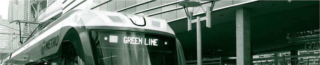
7 1. Introduction This document summarizes the results of the forecasting effort for the Southwest Light Rail Transit (SWLRT) Project. These forecasts have been prepared to support the Project s Final Environmental Impact Statement (FEIS), and use the Metropolitan Council (Met Council) Regional Travel Demand Model. This report includes details of the following tasks: Travel demand model methodology Travel demand model validation SWLRT alternatives and ridership estimates The SWLRT Project is a southwestern extension of the METRO Green Line (formerly Central Corridor LRT or CCLRT). The METRO Green Line is an 11 mile LRT line between downtown Minneapolis and Downtown Saint Paul. It has 23 stations, including five shared stations in downtown Minneapolis with the METRO Blue Line (formerly Hiawatha LRT). It began revenue service in June The SWLRT Project is 14.5 miles in length and runs from Target Field in Downtown Minneapolis to SouthWest Station in Eden Prairie. The estimated one way travel time is 31.9 minutes. The Project consists of 16 new stations between Downtown Minneapolis and Eden Prairie: Royalston, Van White, Penn, 21st Street, West Lake, Beltline, Wooddale, Louisiana, Blake, Hopkins, Shady Oak, Opus, City West, Golden Triangle, Eden Prairie Town Center, and SouthWest Station. Figure 1 1 shows the project corridor along with the final project station locations and alignment. 1


8 Figure 1 1: SWLRT Corridor Study Area 2
9 2. Methodology The ridership forecasts for the SWLRT Line are based on the Met Council Regional Travel Demand Model. This version is generally consistent with current Federal Transit Administration (FTA) guidance related to transit New Starts forecasting. The model has been used to forecast ridership for the SWLRT Project as well as the Bottineau and Central Corridor Projects Model Overview The Met Council Regional Travel Demand Model uses regional socioeconomic and transportation network characteristics to generate estimates for trips between different locations in the study area, the mode share of these trips, and the route that these trips take between the locations on the highway and transit networks. The results of the model include trips by mode and facility including detailed transit route information for individual routes or stations to obtain ridership. The process is done for all origin and destination locations in the region to generate regional trip estimates. In order to manage this process, locations are aggregated into Traffic Analysis Zones (TAZs) which are the fundamental geographic unit of analysis for the process. The model is a form of the conventional four step model used for transportation analysis throughout the United States. The four steps of the model include: Trip generation. This step estimates the number of trips produced in and attracted to each TAZ based on zonal socioeconomic variables such as population, households, and employment. The trip generation step estimates the amount of travel beginning and ending in each production (home) and attraction (non home) TAZ for Home Based Work, Home Based University, Home Based Shopping, Home Based School, Home Based WR, Home Based Other, Non Home Based Work, and Non Home Based Other trips. Trip generation rates are based on procedures developed by the Met Council. Trip distribution. A computerized network representation of the highway system is used to estimate the time and cost associated with travel between each pair of zones and these estimates are combined with trip generation results to develop a matrix (known as a trip table ) of travel between each production and each attraction zone in the region. Both the zone to zone travel times (known as skims ) and the trip tables are organized as very large matrices that have one row for each production zone and one column for each attraction zone. Each cell in these matrices contains an estimate of the time or number of trips beginning at a given production zone and ending at a given attraction zone. Each skim table or trip table contains over 1 million values representing each combination of production and attraction zone. 3
10 Mode Choice. Following trip distribution, the skim matrices for each mode of travel (drive alone, HOV, and various transit options) are used to characterize the quality of each transportation option and to estimate the market share that each mode would attract. This step is known as Mode Choice. In addition to generating trip tables for each mode of travel, this step generates estimates of the number of linked trips (i.e., from origin to destination, independent of transfers) attracted to each mode. Assignment. Finally, network processing software is used to determine the best path or routing that each highway and transit trip will use to travel between the trip origin and destination. This step is known as Assignment and ridership results such as boardings by station or route are determined from the results of this element of the model. The remainder of this section describes each aspect of the modeling approach in more detail Traffic Analysis Zones The system of zones utilized in the Met Council Regional Travel Demand Model is designed to characterize the travel patterns occurring to, from, and within the seven county region that makes up the Metropolitan Council s jurisdiction. Within the model, all travel is represented beginning at the trip production end (e.g., home) and ending at the trip attraction end (e.g., workplace). This requires a large geographic system that includes the key travel markets to, from, and within Hennepin, Ramsey, Anoka, Washington, Dakota, Scott, and Carver counties. The zone system has 1,742 zones in 2010 and 1,632 zones in A depiction of the zone system is shown in Figure 2 1 as grey boundary lines. The SWLRT district system is shown by the different colored zones. The region is divided into 19 districts for analysis. Four districts enclose the rail line itself, four districts compose the main park and ride capture area for the line, four districts contain the CBD and surrounding areas where transfers are likely to be high, and the rest of the region is divided into seven districts, primarily along county lines. 4

11 Figure 2 1: Year 2040 Traffic Analysis Zones with SWLRT Districts 5
12 2.3. Socioeconomic Data Data on existing and projected socioeconomic characteristics are major inputs to the travel demand model for trip generation. The socioeconomic data include population, employment, and household information that are aggregated by TAZ. Base year (2010) data and preliminary forecast year (2040) projections were obtained from the Met Council using the December 2014 series of forecasts that cover the period ending in the Year The specific data used include population, number of households, retail employment, and total employment. Table 2 1 and Table 2 2 show 2010 and 2040 population, households, and employment summarized to the district level of detail. Table 2 3 shows the percent change from 2010 to 2040 for each demographic data set. The Minneapolis CBD is expected to lead the region in growth in population (162) while PNR South Other and SWW Saint Louis Park West are expected to lead the region in retail and non retail employment growth (129 percent and 66 percent, respectively). The rest of the districts all see some level of growth with PNR South East and Minneapolis North seeing the least growth. Table 2 1: Year 2010 Socioeconomic Data by District 1 Districts Population Households Retail Employment Non-Retail Employment CBD 21,035 13,009 10, ,680 SWE Minneapolis/Saint Louis Park East 84,405 42,703 8,273 25,025 SWW Saint Louis Park West 21,045 9,593 2,614 10,831 SWW Hopkins/Minnetonka 17,945 8,795 1,716 26,178 SWW Eden Prairie 15,919 7,161 7,500 35,001 PNR North 70,453 30,401 10,983 36,916 PNR South East 127,677 56,721 16,298 63,226 PNR South Other 102,754 36,668 6,444 31,863 PNR West 136,016 49,695 5,376 35,235 Minneapolis North 88,435 33,375 3,862 40,680 Minneapolis NE 72,071 29,180 5,859 58,134 Minneapolis SE 82,322 31,238 4,836 39,392 Richfield 113,626 47,680 18,635 80,390 Hennepin 384, ,693 32, ,631 Anoka County 330, ,227 25,057 81,538 Ramsey County 508, ,691 47, ,299 Washington County 238,126 87,855 18,695 53,149 Dakota County 398, ,060 35, ,806 Scott 35,065 11,996 1,709 6,200 Total 2,849,546 1,117, ,625 1,277,174 1 Source: Metropolitan Council, 2040 population and employment forecasts, December
13 Table 2 2: Year 2040 Socioeconomic Data by District 1 Districts Population Households Retail Employment Non-Retail Employment CBD 55,170 24,280 18, ,400 SWE Minneapolis/Saint Louis Park East 105,890 53,910 10,670 28,980 SWW Saint Louis Park West 25,870 11,550 2,500 17,960 SWW Hopkins/Minnetonka 23,430 10,980 2,070 34,040 SWW Eden Prairie 36,030 14,910 10,270 51,840 PNR North 82,510 35,970 15,160 46,530 PNR South East 136,950 62,770 17,320 84,680 PNR South Other 154,090 59,310 14,750 45,140 PNR West 205,430 81,620 9,850 54,430 Minneapolis North 90,190 36,490 4,410 49,940 Minneapolis NE 94,680 35,770 6,250 70,630 Minneapolis SE 91,200 38,520 8,290 46,710 Richfield 130,310 56,450 26,540 92,240 Hennepin 499, ,990 47, ,650 Anoka County 426, ,180 36, ,910 Ramsey County 597, ,630 63, ,890 Washington County 337, ,010 27,990 79,240 Dakota County 524, ,660 57, ,630 Scott 58,440 23,010 3,370 8,850 Total 3,676,260 1,510, ,490 1,718,690 7
14 Table 2 3: Socioeconomic Data Growth from 2010 to Districts Population Households Retail Employment Non-Retail Employment CBD 162% 87% 82% 31% SWE Minneapolis/Saint Louis Park East 25% 26% 29% 16% SWW Saint Louis Park West 23% 20% -4% 66% SWW Hopkins/Minnetonka 31% 25% 21% 30% SWW Eden Prairie 126% 108% 37% 48% PNR North 17% 18% 38% 26% PNR South East 7% 11% 6% 34% PNR South Other 50% 62% 129% 42% PNR West 51% 64% 83% 54% Minneapolis North 2% 9% 14% 23% Minneapolis NE 31% 23% 7% 21% Minneapolis SE 11% 23% 71% 19% Richfield 15% 18% 42% 15% Hennepin 30% 37% 44% 53% Anoka County 29% 41% 47% 42% Ramsey County 18% 23% 35% 29% Washington County 42% 54% 50% 49% Dakota County 32% 39% 62% 40% Scott 67% 92% 97% 43% Total 29% 35% 45% 35% 2.4. Trip Generation and Distribution In the trip generation step, the model processes the socioeconomic data and creates trips that are produced and attracted by each TAZ. The Met Council Travel Demand Model stratifies trips by trip purpose, time of day, and auto ownership of the household of the trip being generated. These stratifications include: Home Based Work: (Peak and Off Peak for 0, 1, 2, 3+ Car Households) Home Based Work Related: (Peak and Off Peak for 0, 1, 2, 3+ Car Households) Home Based School: (Peak and Off Peak for 0, 1, 2, 3+ Car Households) Home Based Shopping: (Peak and Off Peak for 0, 1, 2, 3+ Car Households) Home Based Other: (Peak and Off Peak for 0, 1, 2, 3+ Car Households) Home Based University: (Peak and Off Peak with no auto ownership stratification) Non Home Based Work: (Peak and Off Peak with no auto ownership stratification) Non Home Based Other: (Peak and Off Peak with no auto ownership stratification) Tables 2 4 and 2 5 show the total person trips generated in each stratification for 2010 and 2040, respectively. 8
15 Trip tables contain information on the number of trips that are attracted to and produced in each zone to zone interchange in the modeling area. These tables take the form of large matrices where each row contains the total trips produced in the TAZ and each column contains the total trips attracted to the TAZ. Each individual cell contains the number of trips traveling from the production TAZ to the attraction TAZ. Detailed trip tables showing travel in district to district format are presented in the appendix Highway Networks Highway networks for 2010 and 2040 are based on the Met Council highway networks. Minor coding was performed to box code around highway nodes near rail stations in order to estimate walk, drive, and transfer access to stations. The highway network contains details including distance, area type, assignment group, and number of lanes. The network contains major highways, arterials, and collectors in the region. Figure 2 2 is a view of the highway network from the Cube GIS view. 9
16 Table 2 4: Year 2010 Person Trips by Time Period Purpose 2010 Build - Peak Person Trips 2010 Build Off-Peak Person Trips 0 car 1 car 2 car 3+ car Total 0 car 1 car 2 car 3+ car Total HBW 43, , , ,388 1,271,426 15,711 95, , , ,708 HBO 51, , , ,642 1,421,870 76, , , ,804 1,851,863 HBSCH 40, , , ,560 1,543,195 34,628 41, ,573 54, ,854 HBSHOP 32, , , , ,771 42, , , ,866 1,370,676 HBWR 5,268 28,426 79,192 57, ,255 2,645 22,253 45,304 33, ,823 HBU , ,305 NHBW , ,792 NHBO , ,197,688 Total 173,760 1,061,731 2,608,924 1,315,102 6,693, , ,007 2,054, ,695 6,119,709 Table 2 5: Year 2040 Person Trips by Time Period 1 Purpose 2040 Build - Peak Person Trips 2040 Build Off-Peak Person Trips 0 car 1 car 2 car 3+ car Total 0 car 1 car 2 car 3+ car Total HBW 86, , , ,703 1,744,476 31, , , , ,309 HBO 92, , , ,188 1,795, , ,733 1,163, ,712 2,341,510 HBSCH 74, , , ,520 1,823,936 62,811 55, ,162 57, ,310 HBSHOP 57, , , , ,033 75, , , ,197 1,768,063 HBWR 9,654 39, ,815 65, ,081 4,848 30,986 58,246 38, ,190 HBU , ,331 NHBW , ,543 NHBO , ,553,367 Total 320,780 1,498,217 3,283,473 1,454,231 8,510, ,771 1,269,896 2,595,198 1,067,517 7,857,623 10


17 Figure 2 2: Year 2040 Model Highway Network 11
18 2.6. Transit Networks The 2010 and 2040 transit networks were provided by the Met Council. The data for the transit network includes paths along the highway network, peak and off peak frequencies, route names, stops, and owner. The transit network contains all routes in the twin cities region. Metro Transit is the primary transit provider for the region, with other bus operators ( opt outs ) also providing service. This includes SouthWest Transit, an opt out provider within portions of the SWLRT corridor. The coded transit modes include Local Bus, Local Limited Bus, Express Bus, LRT, and CRT. Table 2 6 shows the mode numbers, companies that operate them, and the service types of those modes. Table 2 6: Model Transit Network Modes, Companies, and Service Types Mode Companies Service Type 5 University of Minnesota, Metro Transit Local Bus 6 SouthWest Transit, Minnesota Valley, Plymouth, Scott County Transit, Local Limited Bus Prior Lake, Maple Grove, Metro Transit 7 SouthWest Transit, Minnesota Valley, Plymouth, Prior Lake, Maple Express Bus Grove, Metro Transit 8 Metro Transit LRT 9 Metro Transit CRT Initial transit access was provided by the Met Council and includes walk and drive links from zone centroids to highway nodes that have corresponding transit stops. Park and Ride access to transit use drive links (Mode 2) while Walk and Kiss and Ride access to transit use walk links (Mode 1). Access links can be added or removed manually to adjust coverage areas for specific stops. Access link details include TAZ where trips are produced or attracted, node in highway network where a transit route stops, access mode type, and distance, speed, and travel time between zone and stop Travel Times There are four key travel time generated by the model in order to perform mode choice and run network assignments: Peak Highway, Off Peak Highway, Peak Transit and Off Peak Transit. Peak and Off Peak Highway Travel Times Highway travel times are found during the feedback process of the model. Based on iterative highway assignments, highway times in the peak and off peak are adjusted to help the model converge. (See Table 2 7.) Peak and Off Peak Transit Travel Times The model uses a lookup table based on area type and assignment group of links in the highway network for transit speeds. The speeds on the links are applied to the routes that use them to find travel times on these links. The initial model used a single lookup table for both peak and off peak periods. As an update, a peak table and an off peak table were added to match 2010 schedule times for bus routes. Transit times in the peak period were decreased on freeways and arterials to reflect congestion while times were increased in the off peak period on some arterials. (See Table 2 8.) 12
19 Area Type Table 2 7: Peak Transit Speeds by Area Type and Assignment Group Assignment Group , Area Type Table 2 8: Off Peak Transit Speeds by Area Type and Assignment Group Assignment Group , Mode Choice The heart of the ridership forecasting process is the mode choice model. This process is designed to subdivide the person trip tables from the trip distribution model into separate trip tables for each travel mode. The share attracted to each mode is based on the travel characteristics of competing highway and transit services, socio economic characteristics of the production and attraction TAZs, and parameters that define the relative importance of each factor. The proportion of trips selecting each mode is estimated using a logit function that relates the probability of selecting a mode to the relative utility of that mode compared to that of all other modes. The form of this function is as follows: Where: Pg,i is the probability of a traveler from group g choosing mode i; xg,i are the attributes of mode i that describe its attractiveness to group g; and Ug,m(xg,m) is the utility (or attractiveness) of mode m for travelers in group g. The Met Council model is based on the nested logit form of this function, which allows for submodal trade offs to be more sensitive to service measures than higher level choices of the main 13


20 modes. Separate models have been developed for each time period (peak and off peak) and for each modeled purpose. Figure 2 3 depicts the choice set for this model, showing a top tier of auto vs. non motorized, or transit. The second tier subdivided auto into single occupancy vehicle and shared ride trips and transit into walk access, park and ride access, and kiss and ride access. The third tier subdivides shared ride into 2 person shared ride or 3 person shared ride trips along with if HOV lanes or non HOV lanes are to be used. The fourth tier subdivides all auto modes into toll vs. non toll users, non motorized trips into walk or bike access, and the transit access trips into the transit modes. Figure 2 3: Model Mode Choice Structure U g,m ( x g,m )= a m +b m LOS m +c g,m SE g +d m TRIP The relative attractiveness (or utility ) of each travel mode takes the following form: Where: LOS m is a variable set describing levels of service by mode m; SE g is a variable set describing the socioeconomic characteristics of group g; TRIP is a variable set describing the characteristics of the trip; b m is vector of coefficients describing the importance of each LOS m variable; c g,m is vector of coefficients describing the importance of each SE g characteristic of group g with respect to mode m d m is vector of coefficients describing the importance of each TRIP characteristic of with respect to mode m, and a m is a constant specific to mode m. 14
21 Tables 2 9 and 2 10 show the alternative specific constants in terms of equivalent minutes saved as compared to local bus by the same access mode for peak and off peak periods. Equivalent Minutes Table 2 9: Peak Transit Alternative Specific Constants Relative to Local Bus HBW_PK HBU_PK HBWR_P K HBSH_PK HBO_PK HBSCH_PK NHBW_PK NHBO_PK Walk to Express Alternative Specific Constant (7.50) (20.00) (40.00) 0.00 (40.00) 0.00 (40.26) (20.00) PNR to Express Alternative Specific Constant (10.00) (10.00) 0.00 (10.00) KNR to Express Alternative Specific Constant (2.50) Walk to LRT Alternative Specific Constant PNR to LRT Alternative Specific Constant KNR to LRT Alternative Specific Constant Walk to CRT Alternative Specific Constant (10.00) 6.00 PNR to CRT Alternative Specific Constant KNR to CRT Alternative Specific Constant Table 2 10 Off Peak Transit Alternative Specific Constants Relative to Local Bus Equivalent Minutes HBW_OP HBU_OP HBWR_O P HBSH_OP HBO_OP HBSCH_OP NHBW_OP NHBO_OP Walk to Express Alternative Specific Constant (25.00) (7.50) (10.00) (10.00) (7.56) (20.00) PNR to Express Alternative Specific Constant (12.50) KNR to Express Alternative Specific Constant (20.00) Walk to LRT Alternative Specific Constant PNR to LRT Alternative Specific Constant KNR to LRT Alternative Specific Constant Walk to CRT Alternative Specific Constant (10.00) PNR to CRT Alternative Specific Constant (7.53) KNR to CRT Alternative Specific Constant (15.00)
22 2.9. Highway Assignment After the mode choice portion of the model is completed and all trips are segmented by mode, highway and transit assignments are run in order to route trips on specific paths between zone pairs. For highway assignment, Drive Alone, Shared Ride, and Trucks modes have their trips factored by hour in the peak and off peak periods. The highway networks are then loaded with trip volumes. Based on the ratio of trip volumes to roadway capacity for each time period along with the free flow speed on each highway link, a congested speed is calculated for them. As part of the iterative process of the model, these congested speeds are input back into the model in order to generate new times between zone pairs and all of the steps repeat. Once the model has run through several iterations (approximately 4), trip tables are fairly convergent in not changing due to the congestion on the highway network. At this point, the trip tables are set and additional model runs that change the transit network but not the highway network are performed for alternative analysis for the project Transit Assignment Mode Choice and Transit Assignment are run in tandem for most alternatives to be analyzed using the model. Using consistent trip tables from a full iteration run of the model allows for analysis of what any specific transit change be it a headway change, stop change, or different routes being included or excluded. While mode choice generates skims for the transit network by finding the fastest weighted path between zonal pairs, transit assignment separates those paths into individual routes and transfers between them and finds the total volume of trips on each route. Mode choice separates the various highway and transit modes out, with each transit mode being able to use one or more transit type in their paths, for example, light rail trips can use any routes in the transit network as long as a portion of the trip uses light rail while local bus trips can only use local bus routes. Transit assignment creates database files that segment each zone to zone trip by the network link they use and which route on that link they use by time period and mode choice (i.e. walk to local bus trips or park and ride to commuter rail trips.) After each transit mode choice is assigned, the total number trips on each segment of each route is accessible and the total route volumes are calculated. 16


23 3. Model Validation In order to validate the model, three main aspects were checked: Travel times, park and ride ridership, and regional transit ridership. Observed 2010 data were compared to modeled 2010 data based on 2010 socioeconomic inputs and transit network for the region Travel Times Both highway and transit travel times were checked in the validation process to ensure that skimming data reflected actual travel times. Observed peak and off peak highway measurements were obtained from TomTom travel time data provided by the Met Council and compared to model highway travel times for selected segments. Transit travel times were taken from 2010 route schedules for end to end run times. Highway Travel Times In order to validate the highway skims in the study area, TomTom GPS data were used to validate the modeled travel times along several highways and major arterials. Figure 3 1 shows the selected highways and arterials. Figure 3 1 : Highways and Arterials Checked for Highway Travel Time Validation 17
24 For highway segments, average speed travel times were taken for the midday period, while 85 th percentile speeds were taken for the AM peak period to reflect congested conditions from TomTom data. As Table 3 1 and Figure 3 2 show, the model matches observed data reasonable well for both the peak and off peak periods (peak represented by AM peak times and off peak represented by midday times.) Table 3 1: Year 2010 Observed vs. Modeled Highway Travel Times Freeway Direction From Street To Street Observed AM Model AM Diff. AM Observed MD Model MD Diff. MD I 494 NB US 212 I SB I 394 US I 35 W NB I 494 I SB I 94 I I 494 EB US 212 I 35 W WB I 35 W US I 394 EB I 494 I WB I 94 I I 94 EB I 35 W I 35 E WB I 35 E I 35 W US 169 NB I 494 I SB I 394 I MN 62 EB I 494 I 35 W WB I 35 W I MN 100 NB I 494 I SB I 394 I Figure 3 2: Year 2010 Observed vs Modeled Highway Travel Times Modeled Speed (mph) Model MD Model AM Linear (Series3) Observed (Tom Tom) Speed (mph) 18
25 For arterials, the average speeds were used for both peak and off peak observed data for segment travel times. Table 3 2 and Figure 3 3 show travel time comparisons between observed and model. The model has slightly faster speeds than the observed data; however, these values appeared reasonable and did not require recalibration of the model. Table 3 2: Year 2010 Observed vs. Modeled Arterial Travel Times Observed Modeled Difference Observed Modeled Difference Arterial From Street To Street From > To From > To From > To To > From To > From To > From AM MD AM MD AM MD AM MD AM MD AM MD MN 7 I 494 Minnetonka Blvd Excelsior Blvd I 494 W Lake St Minnetonka Blvd I 494 MN Vernon Ave & W 50th St MN 62 I 35 W Shady Oak Dr MN 62 Minnetonka Blvd France Ave S I 494 MN
26 Figure 3 3: Year 2010 Observed vs Modeled Arterial Travel Times Modeled Speed (mph) Model AM (To From) Model MD (To From) Model AM( From To) Model MD (From To) Observed (Tom Tom) Speed (mph) Overall, the model highway times seemed accurate in representing observed data collected from Tom Tom, and no further adjustments were made to highway travel times. Transit Travel Times Transit travel times were checked to aid in validating transit ridership for the base year. Routes in the SWLRT corridor were selected to compare modeled and observed travel times for peak and offpeak periods. Observed travel times were taken from the 2010 transit schedules provided by Metro Transit and SouthWest Transit. Modeled travel times were taken from model output files that provide peak and off peak runtimes for each transit route. Figure 3 4 shows the selected routes used to validate transit travel times. 20

27 Figure 3 4: Corridor Transit Routes Checked for Transit Travel Time Validation Before making any calibrations to transit travel times, transit schedules were compared to the modeled times for each transit route which used a single speed lookup for both the peak and off peak periods. Figure 3 5 shows route times plotted based on time period; it demonstrates that travel times match moderately well with R2 values of 0.68 in the peak period and 0.81 in the off peak period. In order to calibrate the model transit times to more accurately match the schedule times, the peak and off peak periods were split such that they used different speed lookup tables. (See Section 2.7.) Figure 3 6 shows the revised modeled vs. scheduled runtimes for the selected routes by time period, and demonstrates that these are more accurately reflected by the R2 values of 0.92 for the peak and 0.97 for the off peak period. 21
28 Figure 3 5: Initial Year 2010 Peak and Off Peak Observed vs Modeled Transit Travel Times Peak Travel Time Off Peak Travel Time Modeled (min) Peak Modeled (min) Off Peak Observed (min) Observed (min) 150 Figure 3 6: Revised Year 2010 Peak and Off Peak Observed vs Modeled Transit Travel Times Peak Travel Time Off Peak Travel Time Modeled (min) Peak Modeled (min) Off Peak Observed (min) Observed (min) Park and Ride Validation Another important aspect of the validation effort is to represent the model s prediction of drive access to park and rides accurately. Park and rides in the SouthWest Transit service area that lies within the SWLRT corridor as well as around the Hiawatha LRT were selected to verify the accuracy of the model compared to observed data. Observed park and ride usage was provided by the Met Council for regional park and rides along with origins of those vehicles parked at the parkand rides in Figure 3 7 shows the selected park and rides used for validation. 22

29 Figure 3 7: Regional Park and Rides Checked for Validation From the Met Council model, park and ride space utilization was taken to be one half of park andride trips multiplied by 0.9. The one half accounts for both an outbound and inbound trip as trip tables are in Production/Attraction format; the 0.9 accounts for a rule of thumb 10 percent daily turnover of parking spaces. In order to validate the accuracy of the bus park and rides in the region, the weighted travel time for drive access was lowered from 2.2 times the drive access time to 1.5 times the drive access time. Table 3 3 presents the results of the park and ride model validation. 23
30 Park-and-Ride Table 3 3: Year 2010 Observed vs. Modeled Volumes for Regional Park and Rides Survey Counts 2 Model Volume (Before) % Difference (Before) Model Volume % Difference Near Study Area Knox Ave at Best Buy % % Southwest Transit Station % 915 0% East Creek Station % % Louisiana Ave Transit Center % % CR 73 & I-394 South % 498 4% Southwest Village % % Southdale Transit Center % 68 14% Total 2,375 1,399-41% 2,336-2% Outside Study Area Eagan Transit Station % 300-4% Blackhawk % 238-9% Burnsville Transit Station 1, % 1,141-3% Total 1, % 1,678-4% METRO Blue Line Lake Street/ Midtown Station % 175 4% Fort Snelling Station 987 1,097 11% 981-1% 28 th Avenue Station 677 1,164 72% 650-4% Total 1,832 2,625 43% 1,805-1% TOTAL 5,957 4,215-29% 5,819-2% 3.3. Transit Route Validation The Project would affect a number of existing transit routes in the study area. To track the current ridership on these routes in order to forecast potential growth, 2010 Metro Transit surveyed route data were compared with the model route level ridership. An initial list of routes in the corridor was compiled along with the other rail service in the region. Both the Metro Transit and SouthWest Transit services were validated by checking route headways and runtimes in the peak and off peak periods. Headway adjustments so that modeled values tracked scheduled headways improved the accuracy of the model, along with validated transit travel times. Table 3 4 shows observed vs. original and validated ridership for regional transit routes. 2 Source: 2010 expanded license plate survey. 24
31 Table 3 4: Year 2010 Observed vs. Modeled Ridership for Regional Transit Routes 3 Route On-Board Survey 2010 Model 2010 (Before) %Diff (Before) Model 2010 %Diff Peak Off-Peak Total Peak Off-Peak Total Peak Off-Peak Total Peak Off-Peak Total Peak Off-Peak Total METRO Blue Line 15,455 13,872 29,327 13,148 12,716 25,864-15% -8% -12% 12,436 13,079 25,515-20% -6% -13% Northstar Rail 1, , % - -80% % - -79% , , % - -40% 1, ,394 6% - 10% % - -34% % - -11% , % -32% 29% , % 3% 106% % - -60% % - -57% % - 3% % - 35% % - -54% % - -60% % -100% -24% % -100% -3% % - -68% % - -46% ,070 3,260 6,330 4,363 3,574 7,937 42% 10% 25% 4,404 3,612 8,016 43% 11% 27% 6 4,499 4,264 8,763 3,864 4,410 8,274-14% 3% -6% 4,094 4,497 8,591-9% 5% -2% 12 1, ,160 2,697 1,618 4,315 90% 117% 100% 2,818 1,697 4,515 99% 128% 109% 17 3,131 2,750 5,881 2,224 2,979 5,203-29% 8% -12% 2,356 3,004 5,360-25% 9% -9% 18 4,059 6,332 10,391 3,234 4,509 7,743-20% -29% -25% 3,420 4,718 8,138-16% -25% -22% , % -6% -36% % -9% -38% , % , % % - -70% % - -77% % - -66% % - -29% % - 9% % - 80% ,050 1, ,601 2,364-53% 125% 809 1,652 2,461-57% 134% ,413 1, ,822 33% 24% 29% 1, ,974 43% 36% 40% % - -29% % - -70% % - -11% % - -12% Total 39,884 34,413 74,297 36,490 33,940 70,430-9% -1% -5% 37,944 35,153 73,097-5% 2% -2% 3 SouthWest Transit routes in grey, Metro Transit routes in white. Draft February
32 This page intentionally blank. Draft February
33 In addition to examining individual transit routes, the entire transit network was also compared with the 2010 on board survey. The changes to the transit run times and headways had a minor impact on region wide boardings. Table 3 5 displays the 2010 observed vs modeled transit ridership by mode. Table 3 5: Year 2010 Observed vs. Modeled Transit Ridership by Mode Mode Type 2010 Transit On-Board Survey 2010 Model (Before) 2010 Model Peak Off-Peak Total Peak Off-Peak Total Peak Off-Peak Total 5 Local 81,189 95, ,249 82,213 95, ,412 83,282 98, ,304 6 Local Limited 7,591 7,208 14,799 20,846 16,247 37,093 20,881 16,763 37,644 7 Express 40,125 6,697 46,823 28,575 5,500 34,075 30,230 6,442 36,672 Subtotal (6,7) 47,716 13,905 61,622 49,421 21,747 71,168 51,111 23,205 74,316 8 LRT 12,286 14,519 26,805 13,148 12,716 25,864 12,436 13,079 25,515 9 CRT 1, , Total 143, , , , , , , , ,554 27
34 No Build Alternative The 2040 No Build alternative as defined in support of the FEIS is summarised herein, and developed with the Metropolitan Council, Metro Transit Service Development, and SouthWest Transit. Detailed service plan assumptions are provided under separate cover. In summary, the 2040 service plan for the No Build Alternative includes the following features: 4 Existing Transitways: METRO Blue (Hiawatha LRT), Green (Central Corridor LRT), Red (Cedar BRT) Lines; and North Star Commuter Rail Future Major Transit Projects: METRO Blue Extension (Bottineau LRT), Orange (I 35W BRT), Gold (Gateway BRT), and Red (extension to 181 st Street) Lines Arterial BRT Lines: A (Snelling Avenue), C (Penn Avenue, and Chicago Emerson/Fremont. Figure 4 1 illustrates the major transit infrastructure and services included in the 2040 No Build service plan. Table 4 1 summarizes the operational features of the 2040 No Build and Build service plan for Metro Transit. Table 4 2 summarizes the operational features of the 2040 No Build and Build service plan for SouthWest Transit. 4 Reference: 2040 Transportation Policy Plan, Metropolitan Council, January

35 Figure 4 1: Major Transit Projects in the 2040 No Build Alternative 29
36 This page intentionally blank. 30
37 Table 4 1: Summary of 2040 No Build and SWLRT Concept Bus Plans Metro Transit 2040 No Build Alternative 2040 Build Alternative Route 5 Route Description Reduced Frequency to 30 minutes with implementation of Fremont/Chicago ABRT. Eliminate Route 5F with introduction of route 26 6 No change from Existing 9 No change from Existing All trips operate to downtown Mpls. Increase frequency to 15 peak, 20 off peak. Extend a uniform service span to 5:00 to 1:00 Service west of West Lake station will be on par with the rest of the route. Reduced service to Beltline Boulevard but Weekday and Saturday service is extended south slightly to Excelsior Boulevard for connections with Route 12 Reduce frequency to 30 minutes all day with implementation of Penn Avenue ABRT 21 No change from Existing Weekday Saturday Sunday Route Description Weekday Saturday Sunday Span Peak Off Peak Span Day Span Day Span Peak Off Peak Span Day Span Day All Day All Day 30 All Day 30 No change from No Build All Day All Day 30 All Day 30 Royalston 4:30 1:00 5:30 12:30 5:00 1:00 5:00 2: :30 1:00 5:30 12:30 5:00 1:00 5:30 2: :00 12:00 7:00 11: 00 p.m. 5:00 1:00 5:30 2: Increase in weekday peak service form Uptown Transit Station to downtown to cover changes in Route 12 (freq. not specified) Service to 9h Branch discontinued, with various segments picked up by proposed Route 601 Eliminated and replaced by new Route No change from No Build 4:30 1:00 5:30 12: :30 1:00 5:30 12: :00 12:00 7:00 11: 00 p.m. SW LRT Stations Served 15 n/a 30 Royalston n/a n/a n/a n/a n/a n/a n/a n/a 5:00 2: All Day All Day 30 All Day 30 No change from No Build All Day All Day 30 All Day 30 Royalston 4:00 2:00 15 Jun 15 Jun 4:00 2:00 15 Jun 4:00 2:00 20 Aug Extension to West Lake Street Station with 20 min. freq. Mon Sun. Service span 7:00 12:00 4:00 2:00 15 Jun 15 Jun 5:30 2:00 4:00 2: Jun 5:30 2:00 4:00 2: Aug West Lake Street, Blake West Lake Street DRAFT August
38 2040 No Build Alternative 2040 Build Alternative Route Route Description 22 No change from Existing 25 No change from Existing 26 New North Minneapolis circulator; operates onedirection (clockwise) with 30 min frequency during all time periods Weekday Saturday Sunday Route Description Weekday Saturday Sunday Span Peak Off Peak Span Day Span Day Span Peak Off Peak Span Day Span Day 4:30 12:30 5:00 7:00 p.m. 6:00 11:00 p.m :30 12:30 8:00 6:00 p.m. 6:00 11:00 p.m. 20 5:00 12:30 30 No change from No Build 90 n/a n/a No change from No Build 30 6:00 11:00 p.m. 30 No change from No Build 4:30 12:30 5:00 7:00 p.m. 6:00 11:00 p.m :30 12:30 8:00 6:00 p.m. 6:00 11:00 p.m. 20 5:00 12:30 SW LRT Stations Served 30 Royalston 90 n/a n/a n/a 30 6:00 11:00 p.m. 30 Penn, Van White 601 Not in No Build Network n/a n/a n/a n/a n/a n/a n/a New Replaces the 9H branch as a crosstown servicing West Lake Station to the Louisiana Transit Center 4:30 1: :00 1: :00 1:00 30 West Lake Street 602 Not in No Build Network n/a n/a n/a n/a n/a n/a n/a New crosstown between West Lake Station and the Southdale Transit Center 4:30 1: :00 1: :00 1:00 30 West Lake Street 604 Add weekend service with 30 min. daily frequency. Extend service span from 6:00 12:00 6:00 12: :00 12: :00 12:00 30 Extend service to Belt Line Station and end service at Louisiana Transit Center 6:00 12: :00 12: :00 12:00 30 Belt Line, Louisiana 605 Not in No Build Network n/a n/a n/a n/a n/a n/a n/a New route picking up parts of 615 and servicing Hopkins station to Beltline Station. 30 min. freq. Mon Sun. 6:00 12:00 6:00 12: :00 12: :00 12:00 30 Louisiana, Blake, Hopkins. 612 Not in No Build Network n/a n/a n/a n/a n/a n/a n/a New Replaces Route 12, from Hopkins to West Lake Station. Mon Sat 15 min. freq. Sun 30 min. freq. 5:00 1:00 daily 5:00 1: :00 1: :00 1:00 30 Hopkins, Blake, West Lake 614 No change from Existing 6:00 12: :00 4:00 p.m. 60 n/a n/a Operate the east segment of Route 670 from Vine Hill Road to Hopkins Station. 30 min. peak/60 min. off peak. Mon Sun. 6:00 12:00 6:00 12: :00 12: :00 12:00 60 Hopkins DRAFT August
39 2040 No Build Alternative 2040 Build Alternative Route Route Description Weekday Saturday Sunday Weekday Saturday Sunday Route Description Span Peak Off Peak Span Day Span Day Span Peak Off Peak Span Day Span Day SW LRT Stations Served 615 No change from Existing 6:00 12: :00 12: :00 12:00 30 Takes over part of Route 12 south of Downtown Hopkins to Opus Station. Route is extended to Carlson Parkway on north end. Add weekend service from Ridgedale to Opus. 30 min. freq. Mon Sun. 6:00 12:00 6:00 12: :00 12: :00 12:00 30 Hopkins, Opus 616 Not in No Build Network n/a n/a n/a n/a n/a n/a n/a New route operating between Opus Station and Minnetonka Corporate Center. Peak only at 30 min. freq. Peak Periods Only 30 n/a n/a n/a n/a n/a Opus 620 New crosstown route operates between Southwest and Hopkins. Mon Sat freq at 30 min. with 60 min. eve freq. Service span from 6:00 12:00 No Sunday service 6:00 12: :00 12:00 30 n/a n/a Route eliminated in Build network. n/a n/a n/a n/a n/a n/a n/a n/a 664 No change from Existing Peak 15 trips n/a n/a n/a n/a n/a No change from No Build Peak 15 trips n/a n/a n/a n/a n/a Opus 667 No change from Existing Peak 20 trips n/a n/a n/a n/a n/a No change from No Build Peak 20 trips n/a n/a n/a n/a n/a n/a 668 No change from Existing Peak 9 trips n/a n/a n/a n/a n/a Route eliminated in Build network. n/a n/a n/a n/a n/a n/a n/a n/a 670 No change from Existing Peak 6 trips n/a n/a n/a n/a n/a Route eliminated in Build network. n/a n/a n/a n/a n/a n/a n/a n/a 671 No change from Existing Peak 6 trips n/a n/a n/a n/a n/a No change from No Build Peak 6 trips n/a n/a n/a n/a n/a n/a 755 No change from Existing Peak 25 trips n/a n/a n/a n/a n/a No change from No Build Peak 25 trips n/a n/a n/a n/a n/a n/a A Line Snelling C Line Penn Chicago/ Fremont ABRT New ABRT Route in Regional Network New ABRT Route in Regional Network New ABRT Route in Regional Network All Day All Day 10 All Day 10 No change from No Build All Day All Day 10 All Day 10 n/a All Day All Day 10 All Day 10 No change from No Build All Day All Day 10 All Day 10 n/a All Day All Day 10 All Day 10 No change from No Build All Day All Day 10 All Day 10 n/a DRAFT August
40 Route Route Description Span Table 4 2: Summary of 2040 No Build and SWLRT Concept Bus Plans SouthWest Transit 2040 No Build Alternative 2040 Build Alternative Weekday Saturday Sunday Weekday Saturday Sunday Route Description Off Off Peak Span Day Span Day Span Peak Span Day Span Day Peak Peak 630N Not in No Build Network n/a n/a n/a n/a n/a n/a n/a New Local route 630S Not in No Build Network n/a n/a n/a n/a n/a n/a n/a New Local route 631 Not in No Build Network n/a n/a n/a n/a n/a n/a n/a New Local route 632 Not in No Build Network n/a n/a n/a n/a n/a n/a n/a New Local route 6:00 7:00 p.m. 6:00 7:00 p.m. 6:00 10:00 p.m. 6:00 10:00 p.m n/a n/a n/a n/a n/a n/a n/a n/a Not in No Build Network n/a n/a n/a n/a n/a n/a n/a New Local route Peak Not in No Build Network n/a n/a n/a n/a n/a n/a n/a New Local route Peak A Not in No Build Network n/a n/a n/a n/a n/a n/a n/a New Local route Peak B Not in No Build Network n/a n/a n/a n/a n/a n/a n/a New Local route Peak Add service 12 trips EB AM / 15 trips WB PM Add service 4 trips EB AM / 4 trips WB PM Add service 5 min. in peak Add service 3 trip EB AM; 3 trip WB PM No change from existing 4 trips EB AM / 4 trips WB PM Add service 15 min Peak; 30 min Midday Add service 10 min AM & PM Peak No change from existing 6 trips EB AM / 5 trips WB PM Add service 30 Peak; 15 Off Peak No change from existing 11 trips EB AM / 11 trips WB PM Peak Varies n/a n/a n/a n/a n/a Peak Varies n/a n/a n/a n/a n/a Peak Varies n/a n/a n/a n/a n/a Peak Varies n/a n/a n/a n/a n/a Peak Varies n/a n/a n/a n/a n/a 7:00 6:00 p.m. 6:00 am 9:00 pm Varies n/a n/a n/a n/a n/a Varies n/a n/a n/a n/a n/a Peak Varies n/a n/a n/a n/a n/a 6:00 am 10:30 pm Varies n/a n/a n/a n/a n/a Peak Varies n/a n/a n/a n/a n/a Same as No Build 12 trips EB AM / 15 trips WB PM Same as No Build 4 trips EB AM / 4 trips WB PM Same as No Build 5 min. in peak Same as No Build 3 trip EB AM; 3 trip WB PM Same as No Build 4 trips EB AM / 4 trips WB PM Same as No Build 15 min Peak; 30 min Midday Same as No Build 10 min AM & PM Peak Same as No Build 6 trips EB AM / 5 trips WB PM Same as No Build 30 Peak; 15 Off Peak Same as No Build 11 trips EB AM / 11 trips WB PM 8:30 10:10 p.m. 8:30 10:10 p.m. 8:30 10:10 p.m. 8:30 10:10 p.m. 8:30 10:10 p.m. 8:30 10:10 p.m. 30 n/a n/a 30 n/a n/a 30 n/a n/a 30 n/a n/a 30 n/a n/a 30 n/a n/a SW LRT Stations Served Golden Triangle Golden Triangle Southwest Station Southwest Station Southwest Station Southwest Station Southwest Station Southwest Station Peak Varies n/a n/a n/a n/a n/a n/a Peak Varies n/a n/a n/a n/a n/a n/a Peak Varies n/a n/a n/a n/a n/a Peak Varies n/a n/a n/a n/a n/a Southwest Station Southwest Station Peak Varies n/a n/a n/a n/a n/a n/a 7:00 6:00 p.m. Varies n/a n/a n/a n/a n/a 6:00 am 9:00 pm Varies n/a n/a n/a n/a n/a Southwest Station Southwest Station Peak Varies n/a n/a n/a n/a n/a n/a 6:00 am 10:30 pm Varies n/a n/a n/a n/a n/a Southwest Station Peak Varies n/a n/a n/a n/a n/a n/a DRAFT August
41 Build Alternative (SWLRT Project) This section summarizes the assumptions for the SWLRT Project that are included in the 2040 Build Alternative Concept Bus Plan A number of changes to the No Build bus network in order to incorporate the Green Line LRT Extension. Similar to the 2040 No Build service plan, the 2040 concept bus plan has been developed in collaboration with the Metropolitan Council, Metro Transit and SouthWest Transit. (Details are provided under separate cover.) See Figure 5 1 and Table 4 1 for a summary of the 2040 SWLRT service plan assumptions SWLRT Service Plan and Run Times Tables 5 1 and 5 2 summarize the SWLRT frequencies and station to station run times. Table 5 1: SWLRT Service Plan Time Distance Headway From To (min.) (mi.) Day Early AM Mid PM Eve Late Owl M Blue Line Th Mall of The Fri America Interchange Sat Sun TOTALS Green M Line Th n/a Union SouthWest Fri n/a Depot Sat n/a Sun n/a TOTALS Green M Line Th n/a n/a n/a n/a n/a n/a 60 Union The Fri n/a n/a n/a n/a n/a n/a 60 Depot Interchange Sat n/a n/a n/a n/a n/a n/a 60 Sun n/a n/a n/a n/a n/a n/a 60 TOTALS SYSTEM TOTALS CHANGE FROM NO BUILD DRAFT August
42 Table 5 2: SWLRT Station to Station Run Times Runtime From Station To Station (minutes) Eden Prairie Town SouthWest Center 2.08 Eden Prairie Town Center Golden Triangle 3.65 Golden Triangle City West 2.27 City West Opus 1.37 Opus Shady Oak 2.98 Shady Oak Hopkins 1.4 Hopkins Blake 2.08 Blake Louisiana 2.1 Louisiana Wooddale 1.47 Wooddale Beltline 1.67 Beltline West Lake 1.58 West Lake 21st Street st Street Penn 1.5 Penn Van White 1.62 Van White Royalston 2.33 Royalston Interchange 1.73 SouthWest Interchange 31.9 The SWLRT service plan modeled herein has an estimated 31.9 minutes runtime between the Interchange Station and SouthWest Station. DRAFT August
43 Figure 5 1: SWLRT 2040 Service Plan Note: Graphic is not up to date, Mitchell Station and Routes 8, should be removed, Route 26 should be added. DRAFT August


44 5.3. LRT Stations and Park and Ride Facilities Figure 5 2 presents the locations of the LRT station and park and ride facilities associated with the SWLRT Project. The Project includes 16 stations, 9 of which have park and ride facilities. Table 5 3 lists the stations with park and ride facilities and number of spaces at each location. Figure 5 2: SWLRT Alignment and Station Locations 38
45 Table 5 3: SWLRT Park and Ride Facilities Location Number of Spaces 5 SouthWest Station 450 Golden Triangle 200 City West 160 Opus 80 Shady Oak 700 Hopkins 190 Blake 89 Louisiana 350 Beltline 268 Total 2, Park and Ride Catchment Areas Initial park and ride catchment areas came from the previous model used for the DEIS. In order to reflect real world catchment areas, a park and ride model was used to generate parking space estimates for stations with park and rides based on the park and ride survey. This model s generated catchment areas were reconciled with the DEIS park and ride catchment areas in order to limit the park and ride demands to the parking space capacities at each station. Figure 5 3 shows the original DEIS park and ride catchment areas along with the final catchment area used for all stations in the Project. 5 Number of parking spaces in


46 Figure 5 3: DEIS and Final Park and Ride Catchment Areas 40
Transitways. Chapter 4
 4 Transitways Figure 4-1: Hiawatha LRT Train at the Lake Street/Midtown Station The 23 Transportation Policy Plan identifies a network of transitway corridors to be implemented by 23. Transitways recommended
Background Information for MPRB Community Advisory Committee for 2010 Southwest Light Rail Transit Project DEIS Comment Letter Section 2
 Background Information for MPRB Community Advisory Committee for 2010 Southwest Light Rail Transit Project DEIS Comment Letter Section 2 1 2. SW LRT Corridor Overview Source: http://www.southwesttransitway.org/home.html
CEDAR AVENUE TRANSITWAY Implementation Plan Update
 CEDAR AVENUE TRANSITWAY Implementation Plan Update EECUTIVE SUMMARY DECEMBER 2015 Executive Summary In 2013, the Twin Cities metropolitan area s first bus rapid transit (BRT) line, the METRO Red Line,
Transit Modeling Update District One Implementation & Status Report. Purpose and Need
 Transit Modeling Update District One Implementation & Status Report presented to MTF Transit & Rail Committee presented by Dan Macmurphy, Traf-O-Data Corp. June 17, 2013 Purpose and Need Developed by FDOT
Community Advisory Committee. October 5, 2015
 Community Advisory Committee October 5, 2015 1 Today s Topics Hennepin County Community Works Update Project Ridership Estimates Technical Issue #4:Golden Valley Rd and Plymouth Ave Stations Technical
TRAVEL DEMAND FORECASTS
 Jiangxi Ji an Sustainable Urban Transport Project (RRP PRC 45022) TRAVEL DEMAND FORECASTS A. Introduction 1. The purpose of the travel demand forecasts is to assess the impact of the project components
Bi-County Transitway/ Bethesda Station Access Demand Analysis
 Bi-County Transitway/ Bethesda Station Access Demand Analysis Prepared for: Washington Metropolitan Area Transit Authority Office of Planning and Project Development May 2005 Prepared by: in conjunction
Operating & Maintenance Cost Results Report
 Operating & Maintenance Cost Results Report Prepared for: Hennepin County Regional Railroad Authority Prepared by: Connetics Transportation Group Under Contract To: Kimley-Horn and Associates FINAL June
Trunk Highway 13 Corridor Study Update Existing and No-Build Conditions Technical Memo #2B: Traffic Forecasts and Operations Analysis SEH No.
 TECHNICAL MEMORANDUM TO: FROM: Molly McCartney MnDOT Project Manager Haifeng Xiao, PE Tom Sohrweide, PE, PTOE DATE: November 27, 2012 RE: Trunk Highway 13 Corridor Study Update Existing and No-Build Conditions
2 EXISTING ROUTE STRUCTURE AND SERVICE LEVELS
 2 EXISTING ROUTE STRUCTURE AND SERVICE LEVELS In the Study Area, as in most of the Metro Transit network, there are two distinct route structures. The base service structure operates all day and the peak
5. OPPORTUNITIES AND NEXT STEPS
 5. OPPORTUNITIES AND NEXT STEPS When the METRO Green Line LRT begins operating in mid-2014, a strong emphasis will be placed on providing frequent connecting bus service with Green Line trains. Bus hours
Travel Demand Modeling at NCTCOG
 Travel Demand Modeling at NCTCOG Arash Mirzaei North Central Texas Council Of Governments for Southern Methodist University The ASCE Student Chapter October 24, 2005 Contents NCTCOG DFW Regional Model
Appendix F Model Development Report
 Appendix F Model Development Report This page intentionally left blank. Westside Mobility Plan Model Development Report December 2015 WESTSIDE MOBILITY PLAN MODEL DEVELOPMENT REPORT December 2015 Originally
Interstate Operations Study: Fargo-Moorhead Metropolitan Area Simulation Output
 NDSU Dept #2880 PO Box 6050 Fargo, ND 58108-6050 Tel 701-231-8058 Fax 701-231-6265 www.ugpti.org www.atacenter.org Interstate Operations Study: Fargo-Moorhead Metropolitan Area 2015 Simulation Output Technical
Travel Forecasting Methodology
 Travel Forecasting Methodology Introduction This technical memorandum documents the travel demand forecasting methodology used for the SH7 BRT Study. This memorandum includes discussion of the following:
TEXAS CITY PARK & RIDE RIDERSHIP ANALYSIS
 TEXAS CITY PARK & RIDE RIDERSHIP ANALYSIS This document reviews the methodologies and tools used to calculate the projected ridership and parking space needs from the proposed Texas City Park & Ride to
Subarea Study. Manning Avenue (CSAH 15) Corridor Management and Safety Improvement Project. Final Version 1. Washington County.
 Corridor Management and Safety Improvement Project. Final Version 1. Washington County.") Subarea Study Manning Avenue (CSAH 15) Corridor Management and Safety Improvement Project Final Version 1 Washington County June 12, 214 SRF No. 138141 Table of Contents Introduction... 1 Forecast Methodology
Subarea Study Manning Avenue (CSAH 15) Corridor Management and Safety Improvement Project Final Version 1 Washington County June 12, 214 SRF No. 138141 Table of Contents Introduction... 1 Forecast Methodology
Mountain Area Transportation Study Model Methodology and Assumptions Final
 Model Methodology and Assumptions Final February 19, 2017 Submitted to: 17J17-1768.17 Prepared by Iteris, Inc. Innovating Through Informatics TABLE OF CONTENTS 1.0 OVERVIEW... 1 1.1 Project Objective and
Alpine Highway to North County Boulevard Connector Study
 Alpine Highway to North County Boulevard Connector Study prepared by Avenue Consultants March 16, 2017 North County Boulevard Connector Study March 16, 2017 Table of Contents 1 Summary of Findings... 1
Extending TRACKS. Preliminary design plan review underway. Public comment and approval process in May & June. Municipal Consent Process
 Extending TRACKS Issue 5 Spring 2014 Preliminary design plan review underway Public comment and approval process in May & June Residents and businesses along the Southwest LRT (METRO Green Line Extension)
DEVELOPMENT OF RIDERSHIP FORECASTS FOR THE SAN BERNARDINO INFRASTRUCTURE IMPROVEMENT STUDY
 APPENDIX 1 DEVELOPMENT OF RIDERSHIP FORECASTS FOR THE SAN BERNARDINO INFRASTRUCTURE IMPROVEMENT STUDY INTRODUCTION: This Appendix presents a general description of the analysis method used in forecasting
Highway Transitway Corridor Study
 Highway Transitway Corridor Study Technical Memorandum 3: Corridor Concepts and Evaluation Prepared for: Metropolitan Council May 2014 SRF No. 7994 Table of Contents Introduction... 1 Concept Development...
HALTON REGION SUB-MODEL
 WORKING DRAFT GTA P.M. PEAK MODEL Version 2.0 And HALTON REGION SUB-MODEL Documentation & Users' Guide Prepared by Peter Dalton July 2001 Contents 1.0 P.M. Peak Period Model for the GTA... 4 Table 1 -
6.0 TRANSPORTATION EFFECTS
 Chapter 6 6.0 TRANSPORTATION EFFECTS This chapter describes the anticipated transportation impacts of the No Build, the Enhanced Bus Alternative, and the Build Alternatives described in Chapter 2. Evaluation
Sales and Use Transportation Tax Implementation Plan
 Sales and Use Transportation Tax Implementation Plan Transportation is more than just a way of getting from here to there. Reliable, safe transportation is necessary for commerce, economic development,
BROWARD BOULEVARD CORRIDOR TRANSIT STUDY
 BROWARD BOULEVARD CORRIDOR TRANSIT STUDY FM # 42802411201 EXECUTIVE SUMMARY July 2012 GOBROWARD Broward Boulevard Corridor Transit Study FM # 42802411201 Executive Summary Prepared For: Ms. Khalilah Ffrench,
Travel Time Savings Memorandum
 04-05-2018 TABLE OF CONTENTS 1 Background 3 Methodology 3 Inputs and Calculation 3 Assumptions 4 Light Rail Transit (LRT) Travel Times 5 Auto Travel Times 5 Bus Travel Times 6 Findings 7 Generalized Cost
Current Corridor Characteristics. MN 62 Corridor Performance
 Corridor Context The corridor runs 12 miles between I-494 and MN 55 south of Minneapolis. The corridor serves as an important East-West connection for the Metro area. A portion of the corridor has been
Extending TRACKS. Peer reviews, advanced design next for Southwest LRT
 Extending TRACKS Issue 7 Fall 2014 Peer reviews, advanced design next for Southwest LRT A new chapter is beginning for the planned METRO Green Line Extension (Southwest Light Rail Transit Project), following
Metropolitan Council Budget Overview SFY
 Metropolitan Council Budget Overview SFY 2016-2017 H T t ti C itt House Transportation Committee February 4, 2015 Transit connects us to the places that matter Transportation Needs Grow as the Region Grows
C LINE: LONG-TERM GLENWOOD REALIGNMENT STUDY
 C LINE: LONG-TERM GLENWOOD REALIGNMENT STUDY Comments on this study and the long-term Glenwood realignment recommendation can be submitted to brtprojects@metrotransit.org. Comments can be submitted through
MILLERSVILLE PARK TRAFFIC IMPACT ANALYSIS ANNE ARUNDEL COUNTY, MARYLAND
 MILLERSVILLE PARK TRAFFIC IMPACT ANALYSIS ANNE ARUNDEL COUNTY, MARYLAND Prepared for: Department of Public Works Anne Arundel County Prepared by: URS Corporation 4 North Park Drive, Suite 3 Hunt Valley,
Appendix G Traffic Study Methodology
 REVISED DRAFT ENVIRONMENTAL IMPACT REPORT/ Appendix G Traffic Forecasting Model Methodology In addition to the existing/baseline condition (year 2005), a level of service (LOS) analysis was conducted for
Madison BRT Transit Corridor Study Proposed BRT Operations Plans
 Madison BRT Transit Corridor Study Proposed BRT Operations Plans This paper presents a description of the proposed BRT operations plan for use in the Madison BRT Transit Corridor Study. The objective is
RTID Travel Demand Modeling: Assumptions and Method of Analysis
 RTID Travel Demand Modeling: Assumptions and Method of Analysis Overall Model and Scenario Assumptions The Puget Sound Regional Council s (PSRC) regional travel demand model was used to forecast travel
David Leard, Edward Potthoff, Andrew de Garmo and Kevin Welch
 Technical Memorandum Technical Memorandum Date: Monday, June 22, 2015 Project: To: From: Subject: Albuquerque Rapid Transit Study David Leard, Edward Potthoff, Andrew de Garmo and Kevin Welch Vijay Mahal,
Chapter 7: Travel Demand Analysis. Chapter 8. Plan Scenarios. LaSalle Community Center. Image Credit: Town of LaSalle
 Chapter 7: Travel Demand Analysis Chapter 8 Plan Scenarios LaSalle Community Center. Image Credit: Town of LaSalle 164 Chapter 8: Plan Scenarios Moving Ahead for Progress in the 21 st Century Act (MAP
I-35W & Lake Street Station
 I-35W & Lake Street Station 2017 CMAQ Funding Proposal April 16, 2014 Charles Carlson Metro Transit BRT/Small Starts Project Office www.metrotransit.org/orangeline Addressing Corridor Challenges 7+ Hours/day
Metro Transit Update. Christina Morrison, Senior Planner Metro Transit BRT/Small Starts Project Office. John Dillery, Senior Transit Planner
 Metro Transit Update Christina Morrison, Senior Planner Metro Transit BRT/Small Starts Project Office John Dillery, Senior Transit Planner Metro Transit Service Development May 16, 2013 1 Transit Planning
Transportation Committee Revised Project Scope and Cost Estimate. November 23, 2015
 Transportation Committee Revised Project Scope and Cost Estimate November 23, 2015 1 Today s Topics Revised Project Scope Revised Cost Estimate Municipal Approval Action 2 3 Revised Project Scope Project
4.0 TIER 2 ALTERNATIVES
 4.0 TIER 2 ALTERNATIVES The Tier 2 Alternatives represent the highest performing Tier 1 Alternatives. The purpose of the Tier 2 Screening was to identify the LPA utilizing a more robust list of evaluation
Business Advisory Committee. November 3, 2015
 Business Advisory Committee November 3, 2015 1 Today s Topics DEIS Cost Estimate 2 Assumptions Revised Cost Estimate Revised Project Scope Cost Estimate Overview Position Statement Discussion Municipal
Appendix B: Travel Demand Forecasts July 2017
 Appendix B: Travel Demand Forecasts July 2017 Table of Contents 1 Introduction... 2 2 Model Review and Updates... 2 2.1 Overview of Smart Moves Model ( City of London Model )... 2 2.1.1 Network and Zone
Snelling Bus Rapid Transit. May 13, 2013 Technical Advisory Committee Meeting #1
 Snelling Bus Rapid Transit May 13, 2013 Technical Advisory Committee Meeting #1 1 Today s meeting TAC Introductions Project Overview Arterial BRT Concept Background Snelling Corridor Plan, Funding & Schedule
Business Advisory Committee. July 7, 2015
 Business Advisory Committee July 7, 2015 1 Today s Topics Outreach Update TI #1 and 2: Target Field Station Connection to I-94: Recommendation 85 th Station Configuration 93 rd Station Configuration DEIS
Project Title: Using Truck GPS Data for Freight Performance Analysis in the Twin Cities Metro Area Prepared by: Chen-Fu Liao (PI) Task Due: 9/30/2013
 Task Due: 9/30/2013") MnDOT Contract No. 998 Work Order No.47 213 Project Title: Using Truck GPS Data for Freight Performance Analysis in the Twin Cities Metro Area Prepared by: Chen-Fu Liao (PI) Task Due: 9/3/213 TASK #4:
MnDOT Contract No. 998 Work Order No.47 213 Project Title: Using Truck GPS Data for Freight Performance Analysis in the Twin Cities Metro Area Prepared by: Chen-Fu Liao (PI) Task Due: 9/3/213 TASK #4:
GTA A.M. PEAK MODEL. Documentation & Users' Guide. Version 4.0. Prepared by. Peter Dalton
 GTA A.M. PEAK MODEL Version 4.0 Documentation & Users' Guide Prepared by Peter Dalton August 19, 2003 Contents 1.0 Introduction... 1 1.1 Summary Description... 2 Figure 1 - Flow Diagram... 2 Table 1 -
Mobile Area Transportation Study Urban Area and Planning Boundary
 Mobile Origin- Destination Study Mobile Origin- Destination Study Trip Distribution Calibration WHY? Some background on Mobile Long Range Transportation Plan Crash course in travel demand forecasting HOW?
EASTSIDE PHASE 2 - PART 1 GREENWOOD AVE. STATION LOCATION PLAN PNR + TOD TOD BY OTHERS WASHINGTON BLVD. STATION FACILITIES + TOD
 PARKING STRUCTURE 120 x 180 FOOTPRINT 2 STORY STRUCTURE 200 CARS PNR + TOD OO DA VE. TOD BY OTHERS EE NW A2 06 270 GR x 23 WA S HIN PL AT F OR M GT ON BL VD. STATION FACILITIES + TOD S. SCHWARZKOPF S.
6/6/2018. June 7, Item #1 CITIZENS PARTICIPATION
 June 7, 2018 Item #1 CITIZENS PARTICIPATION 1 Item #2 APPROVAL OF MINUTES Item #3 TRAC GOALS, FRAMEWORK & AGENDA REVIEW 2 COMMITTEE GOALS Learn about Southern Nevada s mobility challenges, new developments
V03. APTA Multimodal Operations Planning Workshop August Green Line LRT
 V03 APTA Multimodal Operations Planning Workshop August 2016 Green Line LRT 2 Presentation Outline Past Present Future 3 16/03/2016 RouteAhead Update 4 4 16/03/2016 RouteAhead Update 5 5 16/03/2016 6 6
RTSP Phase II Update
 Washington Metropolitan Area Transit Authority RTSP Phase II Update Presentation to the Technical Advisory Group July 18, 2013 Meeting 1 Presentation Outline RTSP Integration with Momentum RTSP Process
BERKELEY DOWNTOWN AREA PLAN PROGRAM ENVIRONMENTAL IMPACT REPORT TRAFFIC IMPACT ANALYSIS
 BERKELEY DOWNTOWN AREA PLAN PROGRAM ENVIRONMENTAL IMPACT REPORT TRAFFIC IMPACT ANALYSIS Prepared for: City of Berkeley Prepared by: REVISED JANUARY 9, 2009 Berkeley Downtown Area Plan Program EIR Traffic
3.1 Introduction Transportation Elements and Study Area Meeting the Need for the Project
 Chapter 3 Transportation Environment and Consequences 3. Introduction This chapter summarizes the characteristics of the transportation system in the East Link Project vicinity and discusses potential
Committee Report. Transportation Committee. Business Item No
 Committee Report Business Item No. 2015-280 Transportation Committee For the Metropolitan Council meeting of December 9, 2015 Subject: METRO Blue Line Extension (Bottineau Light Rail Transit) Revised Scope
Measuring Accessibility. Andrew Owen Director, Accessibility Observatory May 17, 2017
 Measuring Accessibility Andrew Owen Director, Accessibility Observatory May 17, 2017 1. Overview 2. Methodology 3. Reporting Accessibility 4. Policy Implications 1. Overview What is Accessibility? Accessibility
Interstate Operations Study: Fargo-Moorhead Metropolitan Area Simulation Results
 NDSU Dept #2880 PO Box 6050 Fargo, ND 58108-6050 Tel 701-231-8058 Fax 701-231-6265 www.ugpti.org www.atacenter.org Interstate Operations Study: Fargo-Moorhead Metropolitan Area 2025 Simulation Results
West Broadway Reconstruction/LRT Design. March 19, 2015
 West Broadway Reconstruction/LRT Design March 19, 2015 1 Meeting Agenda 6:05 6:30 PM Brief presentation What we heard Project overview 6:30 8:00 PM Visit Six Topic Areas Road and LRT design elements Pedestrian
Valley Metro Overview. ITE/IMSA Spring Conference March 6, 2014
 Valley Metro Overview ITE/IMSA Spring Conference March 6, 2014 Valley Metro Who Are We? Operate Regional Transit Services Valley Metro and Phoenix are region s primary service providers Light Rail and
What is ELToD and Why Use it? Toll Choice Key Concepts. ELToD Applications. SW 10 th Street. ELToD Future Enhancements
 June 16, 2017 What is ELToD and Why Use it? Toll Choice Key Concepts ELToD Applications SW 10 th Street ELToD Future Enhancements 2 ELToD (Express Lanes Time of Day) Model is a traffic assignment model
Open House. Highway212. Meetings. Corridor Access Management, Safety & Phasing Plan. 5:30 to 6:30 p.m. - Southwest Corridor Transportation Coalition
 Welcome Meetings 5:30 to 6:30 p.m. - Southwest Corridor Transportation Coalition 6:30 to 8:00 p.m. - Open House Why is Highway 212 Project Important? Important Arterial Route Local Support Highway 212
METRO Orange Line BRT American Boulevard Station Options
 METRO Orange Line BRT American Boulevard Station Options Bloomington City Council Work Session November 18, 2013 Christina Morrison BRT/Small Starts Project Office Coordinating Planning and Design AMERICAN
Traffic and Toll Revenue Estimates
 The results of WSA s assessment of traffic and toll revenue characteristics of the proposed LBJ (MLs) are presented in this chapter. As discussed in Chapter 1, Alternatives 2 and 6 were selected as the
CENTRAL BROWARD EAST-WEST TRANSIT STUDY MODELING METHODOLOGY TECHNICAL MEMORANDUM
 CENTRAL BROWARD EAST-WEST TRANSIT STUDY MODELING METHODOLOGY TECHNICAL MEMORANDUM December 2012 Table of Contents Table of Contents 1.0 Introduction... 1 2.0 Alternatives... 2 2.1 No Build Alternative...
Citizens Committee for Facilities
 Citizens Committee for Facilities AGENDA Thursday, December 11, 2014 City Council Chambers 305 3 rd Avenue East -Twin Falls, Idaho 11:30 A.M. AGENDA ITEMS Purpose By 1. Discussion and possible action on
Midtown Corridor Alternatives Analysis. Policy Advisory Committee Meeting February 12, 2014
 Midtown Corridor Alternatives Analysis Policy Advisory Committee Meeting February 12, 2014 Today s Agenda Introductions Outreach efforts and survey results Other updates since last meeting Evaluation results
Introduction. Assumptions. Jeff Holstein, P.E., City of Brooklyn Park Steve Wilson, Principal Tim Babich, Associate Krista Anderson, Engineer
 SRF No. 10482 To: From: Jeff Holstein, P.E., City of Brooklyn Park Steve Wilson, Principal Tim Babich, Associate Krista Anderson, Engineer Date: May 16, 2018 Subject: City of Brooklyn Park Year 2040 Forecasts
West Broadway Transit Study. Minnesota APA Conference Charles Carlson, Metro Transit Adele Hall, SRF Consulting September 24, 2015
 West Broadway Transit Study Minnesota APA Conference Charles Carlson, Metro Transit Adele Hall, SRF Consulting September 24, 2015 Study Context: Blue Line Planning 2 Study Context: Arterial BRT Study completed
Metropolitan Freeway System 2013 Congestion Report
 Metropolitan Freeway System 2013 Congestion Report Metro District Office of Operations and Maintenance Regional Transportation Management Center May 2014 Table of Contents PURPOSE AND NEED... 1 INTRODUCTION...
SouthWest Transit s Microtransit Service 2018 APTA State Public Transportation Partnerships Conference Wednesday, August 15 th
 SouthWest Transit s Microtransit Service 2018 APTA State Public Transportation Partnerships Conference Wednesday, August 15 th Who We Are Public Transportation serving southwestern suburbs of Minneapolis:
Project Title: Using Truck GPS Data for Freight Performance Analysis in the Twin Cities Metro Area Prepared by: Chen-Fu Liao (PI) Task Due: 7/31/2013
 Task Due: 7/31/2013") Project Title: Using Truck GPS Data for Freight Performance Analysis in the Twin Cities Metro Area Prepared by: Chen-Fu Liao (PI) Task Due: 7/31/2013 TASK #3 PROCESS TRUCK GPS DATA AND DERIVE PERFORMANCE
Project Title: Using Truck GPS Data for Freight Performance Analysis in the Twin Cities Metro Area Prepared by: Chen-Fu Liao (PI) Task Due: 7/31/2013 TASK #3 PROCESS TRUCK GPS DATA AND DERIVE PERFORMANCE
I-394 Corridor Performance
 Population Trends Corridor Context The corridor runs from edge of Hennepin County to downtown Minneapolis and serves the cities of Delano, Independence, Medina, and Wayzata. City Population 2000 2010 2,088
Eastside Transit Corridor Phase 2 Draft Environmental Impact Statement/ Environmental Impact Report APPENDIX II
 Eastside Transit Corridor Phase 2 Draft Environmental Impact Statement/ Environmental Impact Report APPENDIX II TRAVEL DEMAND MODELING TECHNICAL MEMORANDUM State Clearinghouse Number: 2010011062 Travel
Transit Operations Plans Report
 Transit Operations Plans Report Prepared for: Hennepin County Regional Railroad Authority Prepared by: Connetics Transportation Group Under Contract To: Kimley-Horn and Associates TABLE OF CONTENTS 1.0
Parks and Transportation System Development Charge Methodology
 City of Sandy Parks and Transportation System Development Charge Methodology March, 2016 Background In order to implement a City Council goal the City of Sandy engaged FCS Group in January of 2015 to update
Letter EL652 City of Mercer Island. Page 1. No comments n/a
 Letter EL652 City of Mercer Island Page 1 No comments n/a Page 2 Response to comment EL652 1 Section 4.5.3 of the Final EIS presents the range of potential impacts of the project. This project also lists
Background Information about the Metrobus 29 Lines Study
 Background Information about the Metrobus 29 Lines Study Questions Overview of Existing Service Q. Why is the study being conducted? A. The 29 Lines provide an important connection between Annandale and
Appendix E: Transportation Modeling
 Appendix E: Transportation Modeling TransAction Technical Report (This page intentionally left blank) INTRODUCTION E-3 (This page intentionally left blank) TransAction Draft Technical Report 10/11/17 Transportation
I-20 EAST TRANSIT INITIATIVE Tier 1 and Tier 2 Alternatives Screening Report EXECUTIVE SUMMARY
 EXECUTIVE SUMMARY The purpose of this report is to document the results of the Tier 1 and Tier 2 Screening of alternatives for the I-20 East Transit Initiative. The two-tier screening process presented
Missouri Seat Belt Usage Survey for 2017
 Missouri Seat Belt Usage Survey for 2017 Conducted for the Highway Safety & Traffic Division of the Missouri Department of Transportation by The Missouri Safety Center University of Central Missouri Final
Draft Results and Open House
 Waco Rapid Transit Corridor (RTC) Feasibility Study Draft Results and Open House Chris Evilia, Director of Waco Metropolitan Planning Organization Allen Hunter, General Manager Waco Transit System Jimi
ACTION TRANSMITTAL
 Transportation Advisory Board of the Metropolitan Council of the Twin Cities DATE: February 12, 2014 TO: FROM: PREPARED BY: SUBJECT: REQUESTED ACTION: RECOMMENDED MOTION: ACTION TRANSMITTAL 2014-14 Transportation
Green Line Long-Term Investments
 Enhancements Short-term improvements to keep Austin moving. Investments Long-term projects to support our future. Mobility Hubs MetroRapid MetroRail MetroExpress Connectors Circulators Project Connect
MPO Staff Report Technical Advisory Committee: July 12, 2017
 MPO Staff Report Technical Advisory Committee: July 12, 2017 RECOMMENDED ACTION: 2 nd TAC Meeting with Kimley-Horn/WSB in Updating the Street/Highway Element of 2045 Metropolitan Transportation Plan. Matter
Waco Rapid Transit Corridor (RTC) Feasibility Study
 Feasibility Study") Waco Rapid Transit Corridor (RTC) Feasibility Study Chris Evilia, Director of Waco Metropolitan Planning Organization Allen Hunter, General Manager Waco Transit System Jimi Mitchell, Project Manager AECOM
Waco Rapid Transit Corridor (RTC) Feasibility Study Chris Evilia, Director of Waco Metropolitan Planning Organization Allen Hunter, General Manager Waco Transit System Jimi Mitchell, Project Manager AECOM
Executive Summary. Draft Environmental Impact Statement/Environmental Impact Report ES-1
 Executive Summary Introduction The Eastside Transit Corridor Phase 2 Project is a vital public transit infrastructure investment that would provide a transit connection to the existing Metro Gold Line
Expansion Projects Description
 Expansion Projects Description The Turnpike expansion program was authorized by the Florida Legislature in 1990 to meet the State s backlog of needed highway facilities. The Legislature set environmental
EAST-WEST BUS RAPID TRANSIT Service Plan and Operations and Maintenance (O&M) Cost Memo
 Cost Memo") EAST-WEST BUS RAPID TRANSIT Service Plan and Operations and Maintenance (O&M) Cost Memo This memo documents the proposed service plan, operating statistics, and O&M cost for the East-West BRT and background
EAST-WEST BUS RAPID TRANSIT Service Plan and Operations and Maintenance (O&M) Cost Memo This memo documents the proposed service plan, operating statistics, and O&M cost for the East-West BRT and background
CTfastrak Expansion. Stakeholder Meeting #4 Manchester Town Hall June 3, 2016
 CTfastrak Expansion Stakeholder Meeting #4 Manchester Town Hall June 3, 2016 Today s Agenda Phase I Update 2016 Service Plan Implementation Schedule & Cost Update Phase II Services Timeline Market Analysis
Click to edit Master title style
 Nelson/Nygaard Consulting Associates SERVICE IMPROVEMENT STRATEGIES September 22, 2015 1 PROJECT OVERVIEW & WORK TO DATE 1. Extensive stakeholder involvement Throughout 2. System and market assessment
TRANSPORTATION STUDY FOR THE 8899 BEVERLY BOULEVARD PROJECT
 DRAFT TRANSPORTATION STUDY FOR THE 8899 BEVERLY BOULEVARD PROJECT WEST HOLLYWOOD, CALIFORNIA NOVEMBER 2013 PREPARED FOR BEVERLY BOULEVARD ASSOCIATION PREPARED BY DRAFT TRANSPORTATION STUDY FOR THE 8899
Alternatives Analysis Findings Report
 6.0 This chapter presents estimates of the potential capital, operations and maintenance costs associated with the alternatives carried forward for detailed evaluation. The methodology used to develop
METRO Light Rail Update
 American Society of Highway Engineers METRO Light Rail Update Brian Buchanan Director, Design and Construction October 13, 2009 1 High Capacity Transit System 2 20-Mile Light Rail Line 3 Operations Operations
Knoxville Area Transit (KAT) Transit Development Plan Downtown Transit Plan
 Transit Development Plan Downtown Transit Plan") Knoxville Area Transit (KAT) Transit Development Plan Submitted to: Knoxville Area Transit and Knoxville Knox County Metropolitan Planning Commission Submitted by: Connetics Transportation Group Under
Knoxville Area Transit (KAT) Transit Development Plan Submitted to: Knoxville Area Transit and Knoxville Knox County Metropolitan Planning Commission Submitted by: Connetics Transportation Group Under
To Infill or Not to Infill?
 To Infill or Not to Infill? Mark Fuhrmann Program Director, Rail New Starts Metropolitan Council/Metro Transit MarySue Abel Deputy Project Director, METRO Blue Line Extension Metropolitan Council/Metro
Appendix 3 CUUATS Transportation Model Report
 Appendix 3 CUUATS Transportation Model Report TRANSPORTATION MODEL LONG RANGE TRANSPORTATION PLAN 2025 Champaign-Urbana Urbanized Area Transportation Study (CUUATS) TABLE OF CONTENTS I. INTRODUCTION...1
Development of the Idaho Statewide Travel Demand Model Trip Matrices Using Cell Phone OD Data and Origin Destination Matrix Estimation
 Portland State University PDXScholar TREC Friday Seminar Series Transportation Research and Education Center (TREC) 10-24-2016 Development of the Idaho Statewide Travel Demand Model Trip Matrices Using
Chapter 2. Description of the Regional Transit System
 Chapter 2. Description of the Regional Transit System Characteristics of the Transit System There are currently five modes of public transit service in the Twin Cities area: commuter rail service, light-rail
METRONext. Vision & Moving Forward Plans. Board Workshop. December 11, DRAFT For Preliminary Discussion Only
 METRONext Vision & Moving Forward Plans Board Workshop December 11, 2018 Disclaimer This presentation is being provided solely for discussion purposes by the Board of Directors of the Metropolitan Transit
TRAFFIC IMPACT STUDY DERRY GREEN CORPORATE BUSINESS PARK MILTON SECONDARY PLAN MODIFICATION
 TRAFFIC IMPACT STUDY DERRY GREEN CORPORATE BUSINESS PARK MILTON SECONDARY PLAN MODIFICATION TRAFFIC IMPACT STUDY DERRY GREEN CORPORATE BUSINESS PARK MILTON SECONDARY PLAN MODIFICATION DECEMBER 24 UPDATED