EVALUATION RESULT OF THE ALERT-2 RURAL INTERSECTION CONFLICT WARNING SYSTEM
|
|
|
- Marylou Payne
- 6 years ago
- Views:
Transcription
1 EVALUATION RESULT OF THE ALERT-2 RURAL INTERSECTION CONFLICT WARNING SYSTEM Taek M. Kwon, Ph.D University of Minnesota Duluth Victor Lund (St. Louis County), Robert Ege, Alan Rindels (MnDOT)
2 Outline Introduction System description Evaluation results Conclusion
3 Intersection Safety Performance in Minnesota For the ten years period ( ), 43% of all intersection crashes occurred at unsignalized intersections. 65% of fatal and serious injury crashes occurred at unsignalized intersections. Rural Two-Way Stop Control intersections accounted for 76% of these crashes.
4 Other Factors Static intersection warning signs appear to be ineffective Sight restrictions increase risk of crash (vertical and horizontal curves) Limited local funding for major intersection improvements (i.e. realignment, grade corrections) Difficult to justify major improvement projects, due to low traffic volumes
5 System Goals Low cost, low maintenance, dynamic interaction warning system based upon presence of traffic Effect a reduction in speed for vehicles on the major approach when approaching the intersection System warns driver on the major approach of a vehicle stopped or entering the intersection from the minor approach Reduce the probability of a conflict at the intersection between a turning vehicle from the minor approach and a vehicle on the major approach System warns driver on minor approach of an approaching vehicle on the major approach
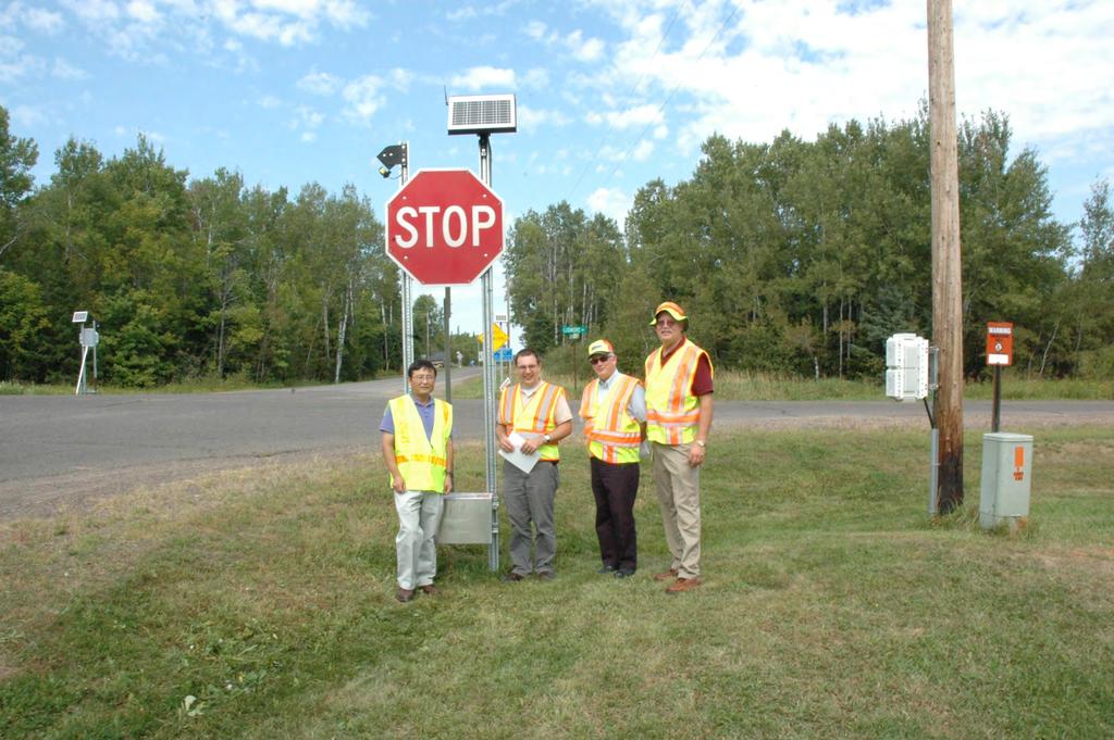
6 System Design Approach System will utilize existing off-the-shelf technologies Can be assembled by traffic/sign technicians Wireless communications between components; no hardwire connections ; no conduits Nonintrusive vehicle detection (e.g. radar) Utilize alternative energy source (solar and/or wind) Utilize LED blinker signs
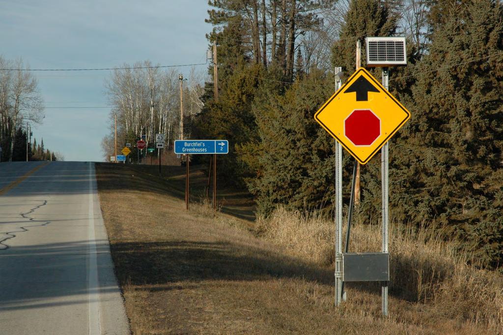
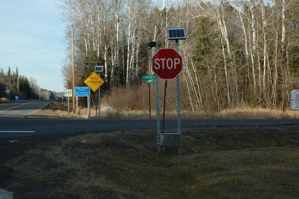
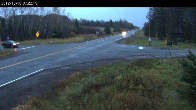
7 Lismore/Lakewood Rd Intersection

8 Looking west on Lismore Rd. approaching Lakewood Rd.

9 Looking south on Lakewood Rd. approaching Lismore Rd.
10
11
12
13 Data Collection Two network video cameras (PoE) and one server Event data logger (records signal changes) Mail-in survey within a two mile radius of the study intersection
14 Battery Power Signs with a Radar Detector ALERT-1 ALERT-2 Average Daily Power Demand 26Wh 36Wh Battery Capacity 106Wh 2,688Wh Days of Storage Without Charge 7 days 25 days Solar Panel 20W 20W Signs without a Radar Detector ALERT-1 ALERT-2 Average Daily Power Demand 8Wh 7.8Wh Battery Capacity 67Wh 1248Wh Days of Storage Without Charge 7 days 45 days Solar Panel 14W 20W
15 Average Speed on the Major Road After Installation of the ALERT-2 System No-Conflict Conflict Peak Time mph 47.7 mph Off Peak Time mph mph Weekday mph mph Weekend mph mph September mph mph October mph mph November mph mph December mph mph January mph mph February mph mph March mph 48.1 mph April mph mph May mph mph June mph mph Average Speed Decrease: 3.89 mph or 0.93 sec extra time
16 Roll-Through Percentage of Before and After Installation of ALERT-2 Before Installation Percent of Rollthroughs After Installation Percent of Rollthroughs Right-turn % 9.93 % Through % 2.89 % Left-turn 8.63 % 5.18 % All turns combined % %
17 Roll-Through Percentage of Conflict and no-conflict Case After Installation of ALERT-2 Percent of Roll- Throughs Under no- Conflict Percent of Roll- Throughs Under Conflict Right-turn 8.7 % 0.76 % Through 2.78 % 0.19 % Left-turn 4.74 % 0.21 % All turns combined % 1.16 %
18 Mail-in Survey on Residents Living in Two Mile Radius Statement Strongly Agree Agree Total Positive Disagree Strongly Disagree Total Negative The warning system is easy to understand. The warning system improved the safety of the intersection. The vehicle activated Blinker STOP signs obtain my attention. The warning system could be used at other intersections. 55% 39% 94% 5% 1% 6% 56% 36% 92% 1% 7% 8% 70% 28% 98% 1% 1% 2% 53% 38% 91% 5% 4% 9%

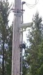
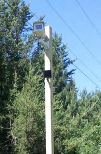
19 Video Data Collection Lismore Road Intersection
20 Another System In Minnesota Rural Intersection Conflict Warning System (RICWC) Uses AC power and loop detectors Uses a traditional traffic controller to control warning signals Uses single lens flashing beacon $100,000 per system Suited for urban intersections
21 Conclusions Reduced vehicle speeds on the main approach by average 3.89mph Increased wait time on the minor approaches by about 4 seconds Nearly zero roll-throughs on conflict cases 92% of survey responses agree or strongly agree that the system improved safety
22 Future Studies Drivers are still treating LED blinking warning signs as traffic signals (cause of roll-throughs) Design challenges for battery charge when sunny areas are unavailable in the intersection Redesign of control circuits for plug-and-play, not requiring any programming
23 Questions?
Overview. Prioritization of Safety Strategies Development of the Minnesota Sinusoidal Rumble Strip Implementation and Public Relations Considerations
 Victor Lund, PE, Traffic Engineer St. Louis County, Minnesota October 11, 2018 Overview Prioritization of Safety Strategies Development of the Minnesota Sinusoidal Rumble Strip Implementation and Public
Investigation of the Impact the I-94 ATM System has on the Safety of the I-94 Commons High Crash Area
 Investigation of the Impact the I-94 ATM System has on the Safety of the I-94 Commons High Crash Area John Hourdos and Stephen Zitzow Minnesota Traffic Observatory Overview Project Objectives I- 94 High
Evaluation of Major Street Speeds for Minnesota Intersection Collision Warning Systems
 Evaluation of Major Street Speeds for Minnesota Intersection Collision Warning Systems Shauna Hallmark, Principal Investigator Center for Transportation Research and Education Iowa State University June
Solar/Wind Hybrid Renewable Power Generators for Minnesota Rural Transportation Applications
 Solar/Wind Hybrid Renewable Power Generators for Minnesota Rural Transportation Applications Taek Kwon and Ryan Weidemann University of Minnesota-Duluth Ray Starr, Kevin Schmidt and Roger Sowder Minnesota
Act 229 Evaluation Report
 R22-1 W21-19 W21-20 Act 229 Evaluation Report Prepared for Prepared by Table of Contents 1. Documentation Page 3 2. Executive Summary 4 2.1. Purpose 4 2.2. Evaluation Results 4 3. Background 4 4. Approach
Slow Down! Why speed is important in realizing your Vision Zero goals and how to achieve the speeds you need
 Slow Down! Why speed is important in realizing your Vision Zero goals and how to achieve the speeds you need Lake McTighe, METRO Joel McCarroll, ODOT Jenna Marmon, ODOT Matt Ferris-Smith, PBOT Oregon Active
US 81 Bypass of Chickasha Environmental Assessment Public Meeting
 US 81 Bypass of Chickasha Environmental Assessment Public Meeting March 14, 2013 Introductions ODOT FHWA SAIC Meeting Purpose Present need for bypass Provide responses to 10/04/11 public meeting comments
Memorandum. To: Sue Polka, City Engineer, City of Arden Hills. From: Sean Delmore, PE, PTOE. Date: June 21, 2017
 Memorandum engineering planning environmental construction 701 Xenia Avenue South Suite 300 Minneapolis, MN 55416 Tel: 763-541-4800 Fax: 763-541-1700 To: Sue Polka, City Engineer, City of Arden Hills From:
New Generation of Curve Warning Devices. Steven D. Hoernig, P.E. Traffic Operations Engineer MoDOT SE District
 New Generation of Curve Warning Devices Steven D. Hoernig, P.E. Traffic Operations Engineer MoDOT SE District History: Caution Series Signs: 1927 (44 Pages) History: Curve Warning Signs (Class: Slow Type
Solar/Wind Hybrid Renewable Power Generator for Powering Rural Dynamic Message Sign
 Solar/Wind Hybrid Renewable Power Generator for Powering Rural Dynamic Message Sign Taek Kwon (Prof.) and Ryan Weidemann (GRA) University of Minnesota-Duluth Ray Starr, Kevin Schmidt and Roger Sowder Minnesota
The effects of intersection collision warning systems on gap selection and stopping characteristics
 Graduate Theses and Dissertations Graduate College 2015 The effects of intersection collision warning systems on gap selection and stopping characteristics Mitchell Lee Holtzman Iowa State University Follow
Open House. Highway212. Meetings. Corridor Access Management, Safety & Phasing Plan. 5:30 to 6:30 p.m. - Southwest Corridor Transportation Coalition
 Welcome Meetings 5:30 to 6:30 p.m. - Southwest Corridor Transportation Coalition 6:30 to 8:00 p.m. - Open House Why is Highway 212 Project Important? Important Arterial Route Local Support Highway 212
Speed Evaluation Saw Mill Drive
 Speed Evaluation Saw Mill Drive Prepared for: Mount Laurel Township Burlington County, New Jersey Prepared by: Dana Litwornia Litwornia & Associates, Inc. Transportation, Traffic & Environmental Engineering
WIM #37 was operational for the entire month of September Volume was computed using all monthly data.
 SEPTEMBER 2016 WIM Site Location WIM #37 is located on I-94 near Otsego in Wright county. The WIM is located only on the westbound (WB) side of I-94, meaning that all data mentioned in this report pertains
Vehicle Activated Signs: An emerging treatment at high risk rural intersections
 Vehicle Activated Signs: An emerging treatment at high risk rural intersections a, C.L., Bui b, B., & Jurewicz a, C. a ARRB Group, Vermont South, Vic, b VicRoads, Kew, Vic Abstract Vehicle Activated Signs
COUNTY ROAD SPEED LIMITS. Policy 817 i
 Table of Contents COUNTY ROAD SPEED LIMITS Policy 817.1 PURPOSE... 1.2 APPLICABILITY... 1.3 DEFINITIONS... 1.4 STATE ENABLING LEGISLATION... 2.5 SPEED LIMITS ON COUNTY ROADS (CCC 11.04)... 2.6 ESTABLISHING
Crane Inspection Log. Mailing Address: P.O. Box Tulsa, OK Phone: (918) Fax: (918)
 Fax: (918)") 999978000 Crane Inspection Log Mailing Address: P.O. Box 581510 Tulsa, OK 74158-1510 Physical Address: 4707 North Mingo Road Tulsa, OK 74117-5904 Phone: (918) 836-0463 Fax: (918) 834-5979 www.autocrane.com
999978000 Crane Inspection Log Mailing Address: P.O. Box 581510 Tulsa, OK 74158-1510 Physical Address: 4707 North Mingo Road Tulsa, OK 74117-5904 Phone: (918) 836-0463 Fax: (918) 834-5979 www.autocrane.com
US 30 Wrong-Way Detection APWA September 11, 2014 RESEARCH AND TECHNOLOGY BUREAU
 US 30 Wrong-Way Detection APWA September 11, 2014 RESEARCH AND 1 Project Location Boone Nevada Ames 25 miles 2 Situation/Background 110+/- (911 calls) Wrong Way Drivers (WWD) in the last 5 ½ years. many
Pedestrians Road Safety
 Pedestrians Road Safety Overview Over the period 1996-2009, 5,323 people have been killed on Irish road. Out of this 22% (1162) were pedestrians. Additional 3863 pedestrians were seriously injured in the
Michigan State Police (MSP) Post 21 - Metro North
 Post 21 - Metro North") June 2018 Revised 8/3/2018 2017 Reporting Criteria Please pay particular attention to the wording when interpreting the three levels of data gathered for this report. Crash The Crash Level analyzes data
June 2018 Revised 8/3/2018 2017 Reporting Criteria Please pay particular attention to the wording when interpreting the three levels of data gathered for this report. Crash The Crash Level analyzes data
Michigan State Police (MSP) Post 21 - Metro North
 Post 21 - Metro North") October 2017 2016 Reporting Criteria Please pay particular attention to the wording when interpreting the three levels of data gathered for this report. Crash The Crash Level analyzes data related to crash
October 2017 2016 Reporting Criteria Please pay particular attention to the wording when interpreting the three levels of data gathered for this report. Crash The Crash Level analyzes data related to crash
Traffic Safety Network Huron Valley
 June 2018 Revised 8/3/2018 2017 Reporting Criteria Please pay particular attention to the wording when interpreting the three levels of data gathered for this report. Crash The Crash Level analyzes data
No. CONSUMER PRICE INDICES. Information bulletin. Moscow 2019
 No. January 209 CONSUMER PRICE INDICES Information bulletin Moscow 209 No. (87) January 209 Consumer prices by group of goods and services (per cent change month-on-month) Table Inflation Core inflation
Gary Modi, PE(Stolen from Tim Peiples)
") Crash Avoidance System Rural ITS Application for Intersections with Restricted Sight Gary Modi, PE(Stolen from Tim Peiples) Chief, Safety Management (717) 783-1190.gmodi@state.pa.us Crash Avoidance System
Crash Avoidance System Rural ITS Application for Intersections with Restricted Sight Gary Modi, PE(Stolen from Tim Peiples) Chief, Safety Management (717) 783-1190.gmodi@state.pa.us Crash Avoidance System
Implementation of Automatic Flagger Assistance Devices (AFADs) for Minnesota Department of Transportation Flagger Operations
 for Minnesota Department of Transportation Flagger Operations") Implementation of Automatic Flagger Assistance Devices (AFADs) for Minnesota Department of Transportation Flagger Operations Edward F. Terhaar, Principal Investigator Wenck Associates, Inc. December 2014
Implementation of Automatic Flagger Assistance Devices (AFADs) for Minnesota Department of Transportation Flagger Operations Edward F. Terhaar, Principal Investigator Wenck Associates, Inc. December 2014
Traffic Impact Analysis West Street Garden Plots Improvements and DuPage River Park Garden Plots Development Naperville, Illinois
 Traffic Impact Analysis West Street Garden Plots Improvements and DuPage River Park Garden Plots Development Naperville, Illinois Submitted by April 9, 2009 Introduction Kenig, Lindgren, O Hara, Aboona,
PET(S) FIRST & LAST NAME: January 2019
 FIRST & LAST NAME: January 2019") January 2019 1 2 3 4 5 New Year's Day 6 7 8 9 10 11 12 13 14 15 16 17 18 19 20 21 22 23 24 25 26 27 28 29 30 31 SPECIAL TE We will not have Doggie available during these dates: *3/29-4/7, 4/19-4/21, 5/24-5/27,
January 2019 1 2 3 4 5 New Year's Day 6 7 8 9 10 11 12 13 14 15 16 17 18 19 20 21 22 23 24 25 26 27 28 29 30 31 SPECIAL TE We will not have Doggie available during these dates: *3/29-4/7, 4/19-4/21, 5/24-5/27,
Horizontal Alignment
 Session 8 Jim Rosenow, PE, Mn/DOT March 5-7, 2010 Horizontal Alignment The shortest distance between two points is: A straight line The circumference of a circle passing through both points and the center
Off-Road Vehicle Recreation Report
 Wyoming Comprehensive Off-Road Vehicle Recreation Report Summary of Key Findings 2012 Report by University of Wyoming, Department of Agricultural and Applied Economics The University of Wyoming Department
ROAD USER BEHAVIOUR SURVEYS
 ROAD USER BEHAVIOUR SURVEYS Photo courtesy of NZTA 154 MOTOR VEHICLE CRASHES IN NEW ZEALAND 2012 ROAD USER BEHAVIOUR SURVEYS 155 CONTENTS TABLES Table 1 Safety belt wearing rates for front seat adults
INFRASTRUCTURE SYSTEMS FOR INTERSECTION COLLISION AVOIDANCE
 INFRASTRUCTURE SYSTEMS FOR INTERSECTION COLLISION AVOIDANCE Robert A. Ferlis Office of Operations Research and Development Federal Highway Administration McLean, Virginia USA E-mail: robert.ferlis@fhwa.dot.gov
LOADING AND UNLOADING SURVEY NATIONAL SCHOOL BUS. Kansas leads the world in the success of each student.
 NATIONAL SCHOOL BUS LOADING AND UNLOADING SURVEY Kansas leads the world in the success of each student. January 2018 The Kansas State Department of Education School Bus Safety Unit wishes to thank the
MPO Staff Report Technical Advisory Committee: July 12, 2017
 MPO Staff Report Technical Advisory Committee: July 12, 2017 RECOMMENDED ACTION: 2 nd TAC Meeting with Kimley-Horn/WSB in Updating the Street/Highway Element of 2045 Metropolitan Transportation Plan. Matter
Highway 23 New London Access & Safety Assessment. Public Open House #2 October 3, :00 to 7:00 PM
 Public Open House #2 October 3, 2017 5:00 to 7:00 PM Highway 9 OVERVIEW OF ASSESSMENT Assessment Limits Highway 23 from County Road 40 to North Shore Dr Purpose: Identify opportunities to reduce serious
Inventory Levels - All Prices. Inventory Levels - By Price Range
 Inventory Levels - All Prices Idaho Falls Bonneville Total 3-Mar-17 152 108 260 2-Mar-18 109 78 187-28% Inventory Levels - By Price Range 3-Mar-17 2-Mar-18 0-100,000 41 6 100,001-125,000 19 8 125,001-150,000
2014 Community Report Portales
 4 Portales Produced for the New Mexico Department of Transportation, Traffic Safety Division, Traffic Records Bureau, Under Contract 58 by the University of New Mexico, Geospatial and Population Studies,
2014 Community Report Luna County
 4 Luna County Produced for the New Mexico Department of Transportation, Traffic Safety Division, Traffic Records Bureau, Under Contract 58 by the University of New Mexico, Geospatial and Population Studies,
Inventory Levels - All Prices. Inventory Levels - By Price Range
 Inventory Levels - All Prices Idaho Falls Bonneville Total 7-Apr-17 154 111 265 6-Apr-18 113 91 204-23% Inventory Levels - By Price Range 7-Apr-17 6-Apr-18 0-100,000 36 10 100,001-125,000 13 9 125,001-150,000
2016 Car Tech Impact Study. January 2016
 2016 Car Tech Impact Study January 2016 Objectives & Methodology Objectives Identify vehicle technologies that are currently being used and that are must haves for future vehicle purchases Determine how
Monthly Market Detail - June 2018 Single Family Homes Miami-Dade County
 ly Market Detail - June 218 Summary Statistics June 218 June 217 Paid in Cash 1,335 1,346 -.8% 286 33-5.6% $355, $335, 6.% Average Sale Price Dollar Volume $598,494 $57,82 18.% $799. Million $682.5 Million
Monthly Market Detail - June 2018 Townhouses and Condos Miami-Dade County
 ly Market Detail - June 218 Summary Statistics June 218 June 217 Paid in Cash 1,257 1,323-5.% 657 682-3.7% $24, $235, 2.1% Average Sale Price Dollar Volume $439,546 $384,319 14.4% $552.5 Million $58.5
Summary Statistics. Closed Sales. Paid in Cash. Median Sale Price. Average Sale Price. Dollar Volume. Median Percent of Original List Price Received
 ly Market Detail - May 218 Summary Statistics May 218 May 217 Paid in Cash 1,667 1,647 1.2% 888 943-5.8% $168, $159, 5.7% Average Sale Price Dollar Volume $231,288 $21,944 9.6% $385.6 Million $347.4 Million
2016 Community Report New Mexico
 216 Produced for the Department of Transportation, Traffic Safety Division, Traffic Records Bureau, Under Contract 581 by the University of, Geospatial and Population Studies, Traffic Research Unit Distributed
2014 Community Report Las Vegas
 4 Las Vegas Produced for the New Mexico Department of Transportation, Traffic Safety Division, Traffic Records Bureau, Under Contract 58 by the University of New Mexico, Geospatial and Population Studies,
2014 Community Report Truth or Consequences
 4 Truth or Consequences Produced for the New Mexico Department of Transportation, Traffic Safety Division, Traffic Records Bureau, Under Contract 58 by the University of New Mexico, Geospatial and Population
2014 Community Report Tularosa
 4 Tularosa Produced for the New Mexico Department of Transportation, Traffic Safety Division, Traffic Records Bureau, Under Contract 8 by the University of New Mexico, Geospatial and Population Studies,
2016 Congestion Report
 2016 Congestion Report Metropolitan Freeway System May 2017 2016 Congestion Report 1 Table of Contents Purpose and Need...3 Introduction...3 Methodology...4 2016 Results...5 Explanation of Percentage Miles
MONTHLY NEW RESIDENTIAL CONSTRUCTION, NOVEMBER 2017
 FOR RELEASE AT 8:30 AM EST, TUESDAY, DECEMBER 19, MONTHLY NEW RESIDENTIAL CONSTRUCTION, NOVEMBER Release Number: CB17-206 December 19, - The U.S. Census Bureau and the U.S. Department of Housing and Urban
EXCEPTION TO STANDARDS REPORT
 EXCEPTION TO STANDARDS REPORT PROJECT DESCRIPTION AND NEED The project is located in Section 6, Township 23 North, Range 9 East and Section 31 Township 24 North, Range 9 East, in the Town of Stockton,
Washtenaw County Traffic Crash Data & Year Trends. Reporting Criteria
 June 2018 Revised 8/3/2018 2017 Reporting Criteria Please pay particular attention to the wording when interpreting the three levels of data gathered for this report. Crash The Crash Level analyzes data
2014 Community Report Aztec
 Aztec Produced for the New Mexico Department of Transportation, Traffic Safety Division, Traffic Records Bureau, Under Contract 58 by the University of New Mexico, Geospatial and Population Studies, Traffic
ROADWAY INJURY EXPERIENCE FOR PERSONS WHO HAD BEEN DRINKING AND/OR USING DRUGS
 ROADWAY INJURY EXPERIENCE FOR PERSONS WHO HAD BEEN DRINKING AND/OR USING DRUGS Vehicle Severity Total Crashes involving drinking, not drugs Crashes involving drugs, not drinking Crashes involving drinking
Washtenaw County Traffic Crash Data & Year Trends. Reporting Criteria
 June 2017 Revised 10/3/17 2016 Reporting Criteria Please pay particular attention to the wording when interpreting the three levels of data gathered for this report. Crash The Crash Level analyzes data
County State Aid Highway 32 (Cliff Road) and Dodd Road Intersection Study
 and Dodd Road Intersection Study") County State Aid Highway 32 (Cliff Road) and Dodd Road Intersection Study City of Eagan, Dakota County, Minnesota Date: March 2012 Project No. 14957.000 444 Cedar Street, Suite 1500 Saint Paul, MN 55101
County State Aid Highway 32 (Cliff Road) and Dodd Road Intersection Study City of Eagan, Dakota County, Minnesota Date: March 2012 Project No. 14957.000 444 Cedar Street, Suite 1500 Saint Paul, MN 55101
Percentage of crashes with driving too fast for the conditions cited as a contributing factor ( ) 0% 5% 10% 15% 20% 25% 30% 35% Percentage
 0% 5% 10% 15% 20% 25% 30% 35% Percentage") Speeding CRASH FACTSHEET November 2013 CRASH STATISTICS FOR THE YEAR ENDED 31 DECEMBER 2012 Prepared by the Ministry of Transport In this fact sheet speeding is defined as driving too fast for the conditions.
Speeding CRASH FACTSHEET November 2013 CRASH STATISTICS FOR THE YEAR ENDED 31 DECEMBER 2012 Prepared by the Ministry of Transport In this fact sheet speeding is defined as driving too fast for the conditions.
2014 Community Report Los Lunas
 4 Los Lunas Produced for the New Mexico Department of Transportation, Traffic Safety Division, Traffic Records Bureau, Under Contract 58 by the University of New Mexico, Geospatial and Population Studies,
Michigan State Police (MSP) Traffic Safety Network Traverse Bay Area
 Traffic Safety Network Traverse Bay Area") June 2016 Revised 2/15/2017 2015 Reporting Criteria Please pay particular attention to the wording when interpreting the three levels of data gathered for this report. Crash The Crash Level analyzes data
June 2016 Revised 2/15/2017 2015 Reporting Criteria Please pay particular attention to the wording when interpreting the three levels of data gathered for this report. Crash The Crash Level analyzes data
RTCSNV CRASH ANALYSIS REPORT
 2011-2015 RTCSNV CRASH ANALYSIS REPORT TABLE OF CONTENTS Summary... 3 Crash Types... 4 Time and Day of Crashes... 7 Crash Factors... 9 Fatalities... 10 Driver s Behavior... 11 Crash Locations... 15 Non-Motorized
Inventory Levels - All Prices. Inventory Levels - By Price Range
 Inventory Levels - All Prices Idaho Falls Bonneville Total 3-Nov-17 198 128 326 2-Nov-18 155 134 289-11% Inventory Levels - By Price Range 3-Nov-17 2-Nov-18 0-100,000 17 11 100,001-125,000 15 9 125,001-150,000
INTERSECTION CONTROL EVALUATION
 INTERSECTION CONTROL EVALUATION Trunk Highway 22 and CSAH 21 (E Hill Street/Shanaska Creek Road) Kasota, Le Sueur County, Minnesota November 2018 Trunk Highway 22 and Le Sueur CSAH 21 (E Hill Street/Shanaska
Introduction and Background Study Purpose
 Introduction and Background The Brent Spence Bridge on I-71/75 across the Ohio River is arguably the single most important piece of transportation infrastructure the Ohio-Kentucky-Indiana (OKI) region.
Median Barriers in North Carolina -- Long Term Evaluation. Safety Evaluation Group Traffic Safety Systems Management Section
 Median Barriers in North Carolina -- Long Term Evaluation Safety Evaluation Group Traffic Safety Systems Management Section Background In 1998 North Carolina began a three pronged approach to prevent and
Appendix B CTA Transit Data Supporting Documentation
 RED ED-PURPLE BYPASS PROJECT ENVIRONMENTAL ASSESSMENT AND SECTION 4(F) EVALUATION Appendix B CTA Transit Data Supporting Documentation 4( Memorandum Date: May 14, 2015 Subject: Chicago Transit Authority
Background. Speed Prediction in Work Zones Using the SHRP 2 Naturalistic Driving Study Data
 Speed Prediction in Work Zones Using the SHRP 2 Naturalistic Driving Study Data Minnesota Towards Zero Deaths Conference October 2017 Shauna Hallmark, Amrita Goswamy, Omar Smadi, Sue Chrysler Background
CAR 10-1 TRAFFIC CALMING CAR 10-1 OPR: Engineering 06/06
 CAR 10-1 TRAFFIC CALMING CAR 10-1 OPR: Engineering 06/06 Purpose Section I Policy II I. Purpose The purpose of this Ordinance is to outline the City s response to the traffic complaints arising as a result
MONTHLY NEW RESIDENTIAL SALES, APRIL 2017
 FOR RELEASE AT 10:00 AM EDT, TUESDAY, MAY 23, MONTHLY NEW RESIDENTIAL SALES, APRIL Release Number: CB17-80 May 23, - The U.S. Census Bureau and the U.S. Department of Housing and Urban Development jointly
MONTHLY NEW RESIDENTIAL CONSTRUCTION, FEBRUARY 2017
 FOR RELEASE AT 8:30 AM EDT, THURSDAY, MARCH 16, MONTHLY NEW RESIDENTIAL CONSTRUCTION, FEBRUARY Release Number: CB17-38 March 16, - The U.S. Census Bureau and the U.S. Department of Housing and Urban Development
IMPROVING CITIES THROUGH PUBLIC-PRIVATE PARTNERSHIPS. Toronto Forum For Global Cities December 2008
 IMPROVING CITIES THROUGH PUBLIC-PRIVATE PARTNERSHIPS Toronto Forum For Global Cities December 2008 TORONTO S CHALLENGE GTA suffers from traffic congestion The average Torontonian spends seven hours a week
HEAVY VEHICLE DRIVERS INVOLVED IN ROAD CRASHES IN SOUTH AUSTRALIA
 FACT SHEET HEAVY VEHICLE DRIVERS INVOLVED IN ROAD CRASHES IN SOUTH AUSTRALIA OVERVIEW Heavy vehicles 1 travel more than 1.3 billion kilometres per year in South Australia. represent 8% of the kilometres
MONTHLY NEW RESIDENTIAL CONSTRUCTION, APRIL 2017
 FOR RELEASE AT 8:30 AM EDT, TUESDAY, MAY 16, MONTHLY NEW RESIDENTIAL CONSTRUCTION, APRIL Release Number: CB17-75 May 16, - The U.S. Census Bureau and the U.S. Department of Housing and Urban Development
MONTHLY NEW RESIDENTIAL CONSTRUCTION, JULY 2017
 FOR RELEASE AT 8:30 AM EDT, WEDNESDAY, AUGUST 16, MONTHLY NEW RESIDENTIAL CONSTRUCTION, JULY Release Number: CB17-133 August 16, - The U.S. Census Bureau and the U.S. Department of Housing and Urban Development
Development of a Moving Automatic Flagger Assistance Device (AFAD) for Moving Work Zone Operations
 for Moving Work Zone Operations") Development of a Moving Automatic Flagger Assistance Device (AFAD) for Moving Work Zone Operations Edward F. Terhaar, Principal Investigator Wenck Associates, Inc. March 2017 Research Project Final Report
Development of a Moving Automatic Flagger Assistance Device (AFAD) for Moving Work Zone Operations Edward F. Terhaar, Principal Investigator Wenck Associates, Inc. March 2017 Research Project Final Report
Who has trouble reporting prior day events?
 Vol. 10, Issue 1, 2017 Who has trouble reporting prior day events? Tim Triplett 1, Rob Santos 2, Brian Tefft 3 Survey Practice 10.29115/SP-2017-0003 Jan 01, 2017 Tags: missing data, recall data, measurement
Pedestrians Road Safety
 Pedestrians Road Safety Overview According to the World Health Organization, the World Bank, the FIA Foundation for the Automobile and Society and the Global Road Safety Partnership collaborative report
SafeLight Lafayette SafeSpeed Lafayette A Bottom Up Approach
 SafeLight Lafayette SafeSpeed Lafayette A Bottom Up Approach Background Active Consideration Since 1998 Electronic Enforcement Study Funded With Safety Funds /La DOTD ($80,000) Dr Sun, ULL, was Principal
Safety Evaluation of Restricted Crossing U-Turn (RCUT or J-Turn) Projects in Louisiana
 Projects in Louisiana") Safety Evaluation of Restricted Crossing U-Turn (RCUT or J-Turn) Projects in Louisiana Xiaoduan Sun University of Louisiana at Lafayette 2018 Louisiana Transportation Engineering Conference Outline Project
Safety Evaluation of Restricted Crossing U-Turn (RCUT or J-Turn) Projects in Louisiana Xiaoduan Sun University of Louisiana at Lafayette 2018 Louisiana Transportation Engineering Conference Outline Project
A9 Data Monitoring and Analysis Report. March Content. 1. Executive Summary and Key Findings. 2. Overview. 3. Purpose
 A9 Data Monitoring and Analysis Report March 2018 Content 1. Executive Summary and Key Findings 2. Overview 3. Purpose 4. Baseline Data Sources and Methodology 5. Casualty Analysis 6. Vehicle Speed Data
Michigan. Traffic. Profile
 June 2014 Revised 5/11/15 Michigan 2013 Traffic Crash Profile Reporting Criteria Please pay particular attention to the wording when interpreting the three levels of data gathered for this report. Crash
Metropolitan Freeway System 2013 Congestion Report
 Metropolitan Freeway System 2013 Congestion Report Metro District Office of Operations and Maintenance Regional Transportation Management Center May 2014 Table of Contents PURPOSE AND NEED... 1 INTRODUCTION...
EXPERIENCE IN A COMPANY-WIDE LONG DISTANCE CARPOOL PROGRAM IN SOUTH KOREA
 EXPERIENCE IN A COMPANY-WIDE LONG DISTANCE CARPOOL PROGRAM IN SOUTH KOREA JB s Social Club Presented at TRB 94th Annual Meeting on Jan 12, 2015 Louis Berger Kyeongsu Kim Land & Housing Institute (LHI)
Stop Sign Gap Assistance At Rural Expressway Intersections
 Stop Sign Gap Assistance At Rural Expressway Intersections Minnesota Department of Transportation University of Minnesota Outline What is Stop Sign Gap Assistance? Part of Multi-State Effort Crash Data
Intersection Safety Technologies Guidebook
 Intersection Safety Technologies Guidebook Intersection Conflict Warning Systems & LED STOP Signs May 2016 2016RIC10 This report represents the results of research conducted by the authors and does not
Freight Performance Measures Using Truck GPS Data and the Application of National Performance Measure Research Data Set (NPMRDS)
") Freight Performance Measures Using Truck GPS Data and the Application of National Performance Measure Research Data Set (NPMRDS) Chen-Fu Liao Department of Civil, Environmental, and Geo- Engineering University
Freight Performance Measures Using Truck GPS Data and the Application of National Performance Measure Research Data Set (NPMRDS) Chen-Fu Liao Department of Civil, Environmental, and Geo- Engineering University
2015 Community Report White Rock
 5 White Rock Produced for the New Mexico Department of Transportation, Traffic Safety Division, Traffic Records Bureau, Under Contract 58 by the University of New Mexico, Geospatial and Population Studies,
Table of Contents INTRODUCTION... 3 PROJECT STUDY AREA Figure 1 Vicinity Map Study Area... 4 EXISTING CONDITIONS... 5 TRAFFIC OPERATIONS...
 Crosshaven Drive Corridor Study City of Vestavia Hills, Alabama Table of Contents INTRODUCTION... 3 PROJECT STUDY AREA... 3 Figure 1 Vicinity Map Study Area... 4 EXISTING CONDITIONS... 5 TRAFFIC OPERATIONS...
ANDERSON PROPERTY SITE ANALYSIS
 ANDERSON PROPERTY SITE ANALYSIS Introduction The Montgomery County Department of Transportation (MCDOT) initiated a feasibility study in the fall of 2012 to evaluate the need for transit service expansion
U.S. Census Bureau News Joint Release U.S. Department of Housing and Urban Development
 Raemeka Mayo or Stephen Cooper Economic Indicators Division (301) 763-5160 FOR IMMEDIATE RELEASE TUESDAY, MAY 17, 2016 AT 8:30 A.M. EDT NEW RESIDENTIAL CONSTRUCTION IN APRIL 2016 The U.S. Census Bureau
Overview of FMCSA s Proposed Hours of Service Rules For Truck Drivers. Rob Abbott Vice President of Safety Policy American Trucking Associations
 Overview of FMCSA s Proposed Hours of Service Rules For Truck Drivers Rob Abbott Vice President of Safety Policy American Trucking Associations Background 2003 Final Rule 2003 Legal Challenge 2005 New
2016 Community Report Los Alamos County
 6 Los Alamos County Produced for the New Mexico Department of Transportation, Traffic Safety Division, Traffic Records Bureau, Under Contract 58 by the University of New Mexico, Geospatial and Population
2016 Community Report Portales
 6 Portales Produced for the New Mexico Department of Transportation, Traffic Safety Division, Traffic Records Bureau, Under Contract 58 by the University of New Mexico, Geospatial and Population Studies,
2015 Community Report Grants
 5 Grants Produced for the New Mexico Department of Transportation, Traffic Safety Division, Traffic Records Bureau, Under Contract 58 by the University of New Mexico, Geospatial and Population Studies,
Hybrid Solar Panel Fuel Cell Power Plant
 Hybrid Solar Panel Fuel Cell Power Plant Antoni Dmowski, Piotr Biczel, Bartłomiej Kras Warsaw University of Technology, Institute of Electrical Power Engineering, Poland, 00-662 Warsaw, ul. Koszykowa 75;
Collision Analysis Safety Tables
 Crash Severity Geography of Geography of Time and Date of Crash Conditions Features Features.. Queries Selected: Town(Hartford), Date(Year:All or //05 to 9/7/06), Severity(All), Route Class(Interstate),
Understanding and Identifying Crashes on Curves for Safety Improvement Potential in Illinois
 Understanding and Identifying Crashes on Curves for Safety Improvement Potential in Illinois Priscilla Tobias, P.E. Mouyid Islam, Ph.D. Kim Kolody, P.E. Optional Agenda Image Title Background Workflow
2016 Community Report Torrance County
 6 Torrance County Produced for the New Mexico Department of Transportation, Traffic Safety Division, Traffic Records Bureau, Under Contract 58 by the University of New Mexico, Geospatial and Population
2015 Community Report Torrance County
 5 Torrance County Produced for the New Mexico Department of Transportation, Traffic Safety Division, Traffic Records Bureau, Under Contract 58 by the University of New Mexico, Geospatial and Population
M E M O R A N D U M. Fargo Planning (Derrick LaPoint) & Interstate Parking (Andy Renfrew)
 & Interstate Parking (Andy Renfrew)") PLANNING AND DEVELOPMENT 200 3 rd Street North Fargo, North Dakota M E M O R A N D U M INTERSTATE PARKING 502 NP Avenue North Fargo, North Dakota TO: FROM: Parking Commission Members Fargo Planning (Derrick
PLANNING AND DEVELOPMENT 200 3 rd Street North Fargo, North Dakota M E M O R A N D U M INTERSTATE PARKING 502 NP Avenue North Fargo, North Dakota TO: FROM: Parking Commission Members Fargo Planning (Derrick
2016 Community Report De Baca County
 6 De Baca County Produced for the New Mexico Department of Transportation, Traffic Safety Division, Traffic Records Bureau, Under Contract 58 by the University of New Mexico, Geospatial and Population
2015 Community Report Las Vegas
 5 Las Vegas Produced for the New Mexico Department of Transportation, Traffic Safety Division, Traffic Records Bureau, Under Contract 58 by the University of New Mexico, Geospatial and Population Studies,
Van Buren County Traffic Crash Data & Year Trends. Reporting Criteria
 May 2015 Revised 3/16/2016 2014 Reporting Criteria Please pay particular attention to the wording when interpreting the three levels of data gathered for this report. Crash The Crash Level analyzes data