Chicago to St. Louis 220 mph High Speed Rail Alternative Corridor Study. Volume 1 Infrastructure & Cost. Revised October 8, 2009.
|
|
|
- Lester Wright
- 6 years ago
- Views:
Transcription
1 Chicago to St. Louis 220 mph High Speed Rail Alternative Corridor Study Volume 1 Infrastructure & Cost Revised October 8, 2009 Prepared by: 222 S. Riverside Plaza, Suite 2320 Chicago, IL P: F: In association with: Prepared for:
2 TABLE OF CONTENTS 1.0 Executive Summary Project Initiation and Need Key Findings Design Criteria Task 1: Evaluation of Corridors Background Approach Alternatives Review Western Routing Eastern Routing Regulatory Environment Signals Track FRA Vehicle Compliance Implications for the Chicago-St. Louis route Task 2: Analysis and Recommendations Geographically Segmented Approach Descriptions of Rural Area Concepts Using the Existing Railroad Corridor Using the Interstate Highways Corridors Developing New Corridors Descriptions of Urban Area Concepts Chicago Kankakee Champaign Decatur Springfield St. Louis/Metro East Task 3: Proposed Running Times Simulation Model Purpose Key Finding Model Components
3 5.4 Key Model Assumptions Conceptual Level Cost Estimate Assumptions Primary Cost Elements End to End Costs Rural Farmland Template Costs Small Villages Template Costs Urban Elements Counted
4 1.0 Executive Summary 1.1 Project Initiation and Need In March 2009 TranSystems was retained by The Midwest High Speed Rail Association (MHSRA) to conduct a limited alternative corridor feasibility study for a high speed passenger rail route from Chicago to St. Louis via Kankakee, Champaign, Decatur, and Springfield. In August 2009 MHSRA authorized enhancing the project corridor study area by extending it to Chicago s O Hare International Airport This volume consists of the following elements: 1. A comparison of reasonable alternative alignments to the existing Union Pacific corridor between Chicago and St. Louis via Joliet and Springfield and a fatal flaw analysis of the proposed corridor via Champaign and Decatur. 2. An evaluation of the proposed alignment via Champaign and Decatur examining the suitability of the existing railroad rights-of-way to support a 220 mph maximum speed high speed rail operation using an approximately two hour schedule between Chicago and St. Louis. 3. Development of expected train running times using a railroad operations simulator for the proposed corridor with expected running times for each of the intermediate segments. 4. Development of a conceptual level cost estimate for infrastructure improvements between O Hare and St. Louis to allow for approximately two hour service between downtown Chicago and St. Louis. 5. A phasing plan showing the running time and capital costs for each logical segment. Additional tasks also authorized In August include: 6. A sketch planning exercise to develop a ridership estimate sufficient to complete an initial calculation of project benefits and train fleet requirements needed to meet the estimated demand. 7. An economic benefits analysis that shows the economic impact of the proposed project. 8. An environmental benefits analysis that describes the general impacts of the proposed project on the environment along the corridor. These reports are contained in Volume
5 1.2 Key Findings This study generated the following key findings: 1. No other suitable railroad corridor exists between Chicago and St. Louis other than the existing corridor via Joliet and Springfield and the proposed corridor via Champaign and Decatur. The proposed corridor does not contain any fatal flaws that would eliminate its use as a high speed rail passenger line based on bifurcating the existing railroad rights-of-way. Any railroad property acquisition would of course be subject to negotiation and, if successful, expected payment of compensation to the owning carrier. 2. The proposed corridor via Champaign and Decatur has the alignment and grade to support 220 mph operating speed, with the addition of complete grade separation and fencing of the right-of-way. Between Springfield and St. Louis a route using a combination of existing rail lines which do not currently have passenger service could be used instead of the existing Amtrak route (via the Union Pacific Railroad). The existing Amtrak route is constrained by numerous horizontal curves which limit maximum speeds to approximately mph. Additionally, the alternate corridor would provide for a shorter travel distance and a new and more centrally located station stop on the Illinois side of the Mississippi River. 3. Simulation runs show that express trains using the proposed corridor, stopping only at Champaign and Springfield, could operate between downtown Chicago and downtown St. Louis in 1 hour 52 minutes while operating at least once an hour in each direction. Trains stopping at McCormick Place, Kankakee, Champaign, Decatur, Springfield, and Metro East could complete the run in 2 hours 4 minutes. 4. The infrastructure for the high speed rail passenger line between Chicago O Hare and St. Louis could be built for a cost of $12.6 Billion in 2012 dollars. This estimate includes the track, bridges, signals, electrification, grade separations, fencing and other civil work, as well design and construction management fees, and a contingency allowance. It does not include rolling stock, maintenance facilities, stations, or other program costs. 5. Table 1 on page 5 shows the potential phasing of a high speed rail line from Chicago to St. Louis. Segments, costs, and running times are shown. If the phasing occurs over an extended period of time, the cost estimate would need to be adjusted for the expected construction costs during the proposed year of construction
6 SEGMENT APPROXIMATE SEGMENT COST (in Millions) APPROXIMATE CUMULATIVE COST (in Millions) APPROXIMATE SEGMENT TRAVEL TIME (Min.) APPROXIMATE CUMULATIVE TRAVEL TIME FROM UNION STATION (Hrs.:Min.) EXPRESS RUN APPROXIMATE SEGMENT TRAVEL TIME (Min.) EXPRESS RUN APPROXIMATE CUMULATIVE TRAVEL TIME FROM UNION STATION (Hrs.:Min.) O'Hare Airport to Chicago Union Station $ 1,013 $ 1, Chicago Union Station to McCormick Place $ 119 $ 1, :03 McCormick Place to Kankakee $ 2,808 $ 3, : :43 Kankakee to Champaign $ 2,818 $ 6, :50 Champaign to Decatur $ 1,741 $ 8, :05 Decatur to Springfield $ 1,358 $ 9, : :15 Springfield to Metro East $ 1,861 $ 11, :50 Metro East to Downtown St. Louis $ 904 $ 12, : :52 Table 1: Costs and Travel Times for High Speed Rail from Chicago to St. Louis - 5 -
7 6. Table 2 below indicates approximately what percentages of the total build-out capital cost, from Chicago to Downtown St. Louis, would be spent in which category of construction. Midwest High Speed Rail Study Chicago (O'Hare) to St. Louis (Downtown) (220 mph) Rail/Roadway Construction Cost Breakout UNIT TOTAL ITEM DESCRIPTION COST COST Railroad Construction $ 7,990,769, % Trackwork $ 1,902,185,017 Electrification $ 1,265,620,140 Signaling $ 353,750,800 Bridges $ 690,787,900 Flyovers $ 799,876,213 Property & ROW $ 305,402,040 Allocated Engineering, Final Design, PM, CM (12%) $ 601,466,408 Allocated Contingency (35%) $ 2,071,680,981 Roadway Construction $ 4,618,009, % Rural Grade Separations (Type I & II) $ 231,046,920 Urban Grade Separations (Trench & Embankment) $ 2,641,558,485 Bridge, Roadway (Includes Sub Structure) $ 6,888,000 At-Grade Crossing Protection $ - Utilities & Environmental $ 174,745,935 Allocated Engineering, Final Design, PM, CM (12%) $ 366,508,721 Allocated Contingency (35%) $ 1,197,261,821 TOTAL PRELIMINARY COSTS $ 12,609,000, % Table 2: Rail/Roadway Construction Cost Breakout - 6 -
8 2.0 Design Criteria The following assumptions were identified in order to provide conceptual level costs within the limited time frame: 1. Technology and Operations: It was assumed that service traveling at a maximum of 220 mph, would employ non-fra compliant trains. European and Asian High Speed trainsets are built to UIC (worldwide) standards and do not meet the current Federal Railroad Administration requirements designed to mitigate impacts from crashes with North American freight railroad equipment. In order to operate above 150 mph, UIC compliant equipment must be used with an FRA non-compliant waiver. In the past, these waivers have required a completely grade separated, independent system. Although tilting equipment would enable trains to accomplish sharper curves at higher speeds, they were not assumed in this study because there are so few curves on the recommended corridors. Rolling stock has not been analyzed in this infrastructure study and has not been included in the capital cost estimate. 2. Grade Separations: Elimination of any highway or railroad crossings of the proposed high speed rail corridor are required due to the proposed use of non-fra compliant vehicles (such as those planned for the California High Speed Rail system and the previously planned Florida High Speed Rail system). See further discussion of this issue section 3.6 Regulatory Environment. On the existing railroad corridors in rural areas there are typically grade crossings with a county road each mile. When the Interstate Highways were constructed, which parallel the railroad corridors, the typical practice was to provide a crossing for every other county road. In this study the same concept has been applied to the railroad corridor, with a bridge indicated for construction over the railroad (both the existing freight railroad and the two proposed high speed passenger tracks) approximately every two miles (Figure 1), with the intermediate public and private crossings assumed to be closed. Using the Federal Railroad Administration (FRA) database of railroad crossings, each was reviewed using aerial photography and GIS maps. Priority was given to keeping the roads that have the bridges over nearby Interstate Highways open and to avoid situations where the only access to local residences would be removed. In this study s conceptual cost estimate a limited number of access roadways were included as grade separated access to such isolated housing, and while the final outcome may find that relocation of farm houses may prove less expensive it was deemed reasonable to maintain this placeholder for these expenses. In many rural locations there is a highway located closely parallel to the railroad. To allow room for the ramps down from the overpass it will be necessary to shift the highway somewhat at these points. In the rural villages there is generally not enough space to construct a highway overpass without severe impacts. It will be necessary for the high speed rail alignment to be raised or lowered to eliminate crossings. The elevation of the tracks through villages (including the freight railroad mainline) onto a retained embankment is the type of scenario that has been included in the conceptual construction cost estimate in this study. Further study should review in greater detail the - 7 -
9 impacts that the grade separation would generate through these rural villages. A few potential positive impacts would include the following: Elimination of freight railroad mainline crossings along with attendant traffic delays and potential for collisions with highway vehicles and pedestrians Reduction in noise from train horn blowing for grade crossings 3. Right-of-Way: Throughout this study it has been assumed that at least 50 feet of existing freight railroad right-of-way (ROW) for the recommended corridor would be available for acquisition and construction of high speed rail passenger tracks. It is also assumed that these existing freight railroad operators would require adequate clearance between their own freight tracks and passenger tracks to meet FRA Roadway Worker Protection requirements for uninterrupted adjacent track operation, although complete bifurcation of the right-of-way would eliminate many issues regarding operation on a joint corridor. Allowance for the purchase of ROW has been included in the conceptual cost estimate and further explanation for the unit price assigned to this entity is provided in Section 6.0. No verification of the availability or purchase terms for the railroad corridors identified has been undertaken as part of this study
10 Figure 1 Typical Rural Railroad Bridge Crossing DRAFT - 9 -
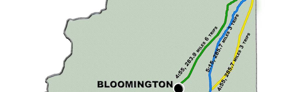
11 3.0 Task 1: Evaluation of Corridors 3.1 Background This study began with a goal of developing a conceptual plan for a passenger rail route that could provide service between Chicago and St. Louis with a travel time of approximately two hours while serving the key population centers in the corridor between those points. This plan would use the latest technology now operating in regular service worldwide, with electricallypowered trains operating at 220 mph on a double track alignment. This is the approach that the California High Speed Rail Authority is using to implement its high speed rail program. Its first route is currently scheduled to open in about 2021 and will provide frequent service over a new 432 mile dedicated route between Los Angeles and San Francisco in 2 hours 40 minutes. Identification of key high speed rail corridors is important now since significant funding for high speed rail systems is available for the first time in the United States. The Federal government included $8 billion for high speed rail in the American Recovery and Reinvestment Act (ARRA) and it appears that significant funding for high speed rail projects will be an ongoing feature of annual appropriations in the future. Amtrak currently operates passenger train service over the Chicago-Champaign portion of the recommended high speed rail route. The Illini and Saluki trains provide twice daily service over CN tracks between Chicago and Carbondale and the City of New Orleans operates overnight service to/from New Orleans. These trains stop at several smaller stations between Chicago and Champaign not included for the proposed high speed rail service, as well as serving several Downstate stations. While the focus of this study is on high speed service with limited stops, several options exist for maintaining train service for these other points. These might involve the operation of additional local service on the high speed tracks at slower speeds, providing local service, or continued operation on the existing CN tracks. 3.2 Approach The study began by identifying the major population centers in the corridor. To evaluate the potential environmental issues the team analyzed existing and past, railroad and interstate highway alignments. A key advantage that Illinois has compared to California and most of the ten other countries which operate high speed passenger trains (now generally defined worldwide as 300 km/h (186 mph) or greater), is that Illinois railroad alignments, are extremely straight and level, ideal conditions for implementing fast operation at reasonable cost. As part of the analysis, TranSystems reviewed the rail service operated in the 1930 s when Chicago was the worldwide center of high speed rail operations. There were three railroads which competed for the Chicago-St. Louis traffic. TranSystems reviewed timetables from 1937 to determine the running times during that period, as shown in Table 3 and on Figure 2. Since then, all three of the railroads operating in 1937 have been absorbed as part of larger railroads. Amtrak s Chicago-St. Louis service operates on the old Chicago and Alton route that, several mergers later, is now mostly owned by the Union Pacific
12 Historical Route (1937) Miles Through trips Fastest Time Chicago & Alton :55 Wabash :15 Illinois Central :55 Comparison Miles Through trips Fastest Time Amtrak in :20 Final EIS Chicago-St. Louis HSR Project (Jan. 2003) Current Study, 220 mph Express Service via Champaign/Decatur/Springfield : Hourly 1:52 Table 3: Chicago St. Louis Passenger Train Service


13 Figure 2: 1937 Chicago-St. Louis Passenger Train Service
14 3.3 Alternatives Review The two Chicago to St. Louis corridors reviewed for 220 mph service in this report are the current one via Bloomington/Normal and Springfield (Western Routing) and one via Champaign/Urbana-Decatur-Springfield (Eastern Routing). Each routing has its own advantages and disadvantages. The analysis looked at both physical suitability and potential ridership when reviewing both corridors. 3.4 Western Routing The current Amtrak routing from Chicago to St. Louis travels through the Bloomington/Normal area to Springfield. South of Springfield the service travels southwest passing through Alton and into St. Louis. This route is programmed for upgrading to a maximum speed of 110 mph in current plans and an Environmental Impact Statement (EIS) has been completed for the upgrading. Train service with a maximum speed of 110 mph has been defined as Emerging HSR in the US DOT HSR strategic plan. The Western Routing takes the most direct alignment from Chicago to Springfield. It serves Illinois State University and comes within only 40 miles of Peoria. Upgrading the segment from downtown Chicago to Joliet to 220 mph service from 110 mph will face a significant hurdle which will necessitate construction of complex and expensive infrastructure. Currently this corridor is constrained with commuter rail, freight railroads, Interstate 55 and two waterways. Space is not available for the addition of the proposed two added high speed tracks. Construction of a right-of-way wide enough for high speed rail would require relocation of many of these elements which will significantly increase potential costs. South of Springfield, the Western Routing has speed-limiting curves through a hilly area south of Carlinville and the routing through Alton is circuitous. 3.5 Eastern Routing The Eastern Routing would service Champaign/Urbana and Decatur departing Chicago on the current CN (former IC) corridor. The Champaign/Urbana metro area, where the University of Illinois at Urbana-Champaign is located, has evolved to become the largest population concentration in the corridor. Decatur is home to Archer Daniels Midland, a key agribusiness firm in Illinois. High speed rail on this routing would also connect St. Louis, Springfield, Decatur, and Champaign to the planned Chicago area 3 rd airport in Peotone. Since planning for the airport is in the early stages, 220 mph service in this corridor could serve the airport terminal directly and provide a world class multimodal connection. This service could also provide express service from the airport to Downtown Chicago and on to O Hare. South of Springfield this routing provides the opportunity for the construction of a very accessible, centrally located Metro East area station. A site is proposed near the northwest side of Edwardsville, IL at a point where the route intersects a major freeway. The Eastern Routing has the advantages of requiring substantially less construction to provide a faster entry into Chicago. Several portions of the CN alignment have hosted more tracks than are currently in place. The CN plans to move most of its freight operations, and of them at the northern end, providing the opportunity to create the proposed two dedicated passenger-only tracks. The proposed Eastern route would be only 23 miles longer than the Western route via Bloomington (only 6 minutes at 220 mph)

15 Figure 3: Routing Reviewed and Populations of Potential Stops
16 3.6 Regulatory Environment Railroad safety regulation, which is under the jurisdiction of the Federal Railroad Administration (FRA), has a significant impact on high speed rail system design Signals Traditional wayside railroad signals provide the train engineer (driver) with information concerning the occupancy of the track ahead and the safe speeds that they may attain. That system relies on the engineer to observe and obey the instructions that they convey. Over the years, there have been many serious accidents that have resulted from human error when engineers failed to properly respond to restrictive signals. Newer cab signal systems, where the same information is displayed inside the operating cab and can directly control the train eliminate this problem but have been expensive to install on a mostly freight railroad environment. Rapid transit systems, such as the New York subway, had such cab signal systems from their beginnings in the 1890s. Railroads started to deploy Automatic Train Stop (ATS) along with cab signals starting in the 1930s, in conjunction with the widespread deployment of higher speed streamlined passenger trains. The Interstate Commerce Commission (ICC), then responsible for all types of railroad regulation, required each of the railroads to install one of these systems on at least one division. In 1951 the ICC required that one of these systems be in place for operation at 80 mph or more. The regulations also required railroads to request permission to remove any signal systems then in place. By that time the railroads had already generally lost interest in significant investments in passenger service. Thus the de facto passenger train speed limit in the U.S. became 79 mph, except in the Northeast Corridor and a few other routes equipped with ICC mandated cab signals. The Illinois Central s Chicago-Centralia route had a 100 mph speed limit until The second main track was removed a few years later. Amtrak has been using an advanced cab signal system in the Northeast Corridor for operation up to 150 mph. In the 1990s several railroads resumed experiments with Positive Train Control (PTC), using new concepts from computer-based systems. One system that failed to meet its objectives was tested on Amtrak s Chicago-St. Louis route and another system is now successfully in service in Michigan on the Chicago-Detroit route. In the aftermath of a head on collision between a commuter train and a freight train in California in November 2008, which killed 25 people, the Federal Government required the installation of PTC on all routes carrying passengers or hazardous materials by Although still awaiting final FRA regulations, the major railroads have already agreed on standards that will allow for interoperability between PTC systems operated by the various railroads. It is still being developed at this time what extensions to the new PTC standards may be required to accommodate high speed operation Track A number of years ago the FRA issued standards for classifications of track specifying design and maintenance standards for track to allow operation at various speeds. The table s upper limit is 200 mph, for Class 9 track, slightly lower than the 220 mph top speed assumed in this study. There is a major body of worldwide experience to serve as guidance for establishing U.S. standards for this extension. California is expected to take the lead on this issue
17 3.6.3 FRA Vehicle Compliance One of the key differences between UIC (worldwide) railroad standards and the United States is the FRA requirement for a railroad passenger car to withstand 800,000 pounds of force without permanent deflection. This is significantly higher than what is required elsewhere in the world and is a response to the greater weight of U.S. locomotives and railcars. This is also related to the lack of a signal system that ensures that trains cannot collide under any foreseeable circumstances, such as what PTC provides. By contrast, the focus in Europe for many years has been on preventing collisions using some form of cab signals and automatic train control. As a result, U.S. FRA compliant passenger cars are substantially heavier than those used overseas, using more energy for propulsion. The FRA only grants waivers from this requirement for very limited purposes. The California high speed rail system is planned to be a totally selfcontained system, essentially without track connections to the national system which will allow them to use non FRA compliant trains Implications for the Chicago-St. Louis route To obtain 2 hour running time to St. Louis, use of the latest designed high speed rail trains will require non FRA compliant train sets using a full PTC system. These trains meet all worldwide standards but do not meet the heavy crash mitigation requirements for interoperation on the general railroad network of the United States. Instead the concept would be to use a completely separated system such as those planned for California and Florida. This does increase the terminal costs at the Chicago and St. Louis ends since a separated route must be used to access the close-in terminals. From a safety perspective, the PTC based European or Asian systems have a much higher safety record than traditional passenger railroad operations in the United States. Use of the new high speed rail corridor by conventional passenger trains is possible if the FRA accepts the separating capability of the PTC system as being functionally equivalent to the existing 800,000 lb. buff strength requirement. This modification will be necessary to operate a portion of the California High Speed Rail system so the issue may be resolved prior to Illinois system going into operation
18 4.0 Task 2: Analysis and Recommendations 4.1 Geographically Segmented Approach The investment in high speed rail can be completed using a segmented approach, in which each new segment builds upon an earlier completed segment. The eventual goal, as part of providing a two hour trip time from Chicago to St. Louis, is to create dedicated tracks only used by high speed trains from end to end with station stops in all of the urban areas: Chicago, Kankakee, Champaign, Decatur, Springfield, Metro East and St. Louis. This end to end corridor could be completed by linking any number of contiguous geographical segments together in various timelines as deemed appropriate. It has been assumed in this study that once all segments are completed from Chicago to St. Louis, that trains would operate with hourly frequency. Thus, it has been assumed that dedicated double track would be required in all segments. This would provide sufficient capacity for increasing the number of trains to accommodate growth and to provide additional local service, or services to other destinations beyond those considered in this study. 4.2 Descriptions of Rural Area Concepts Three conceptual alternatives for routing the new high speed rail service through the rural areas, between major cities where stops are planned, were considered: Using the Existing Railroad Corridor The railroad alignments between the cities in the corridor are extremely straight, minimizing the need to reduce speed due to curvature. Using the existing transportation corridor alignment would minimize many environmental issues. On most of the segments that are under study the railroad-owned right-of-way (ROW) is 100 feet wide. Thus, overall, in most areas there would be enough width for the high speed rail agency to purchase half of the right-of-way to add two high speed rail tracks. However, there are three complications with this solution: The existing tracks tend to be in the center of the ROW. It is important to maintain 25 foot separation between a high speed track and any other track (high speed or otherwise) for safety purposes; this spacing is required if track maintenance is to be performed without requiring the speed of trains on adjacent track(s) to be restricted. Figure 4 below shows proposed typical utilization of existing ROW for HSR tracks. Planning was conducted with the goal of eliminating most at-grade highway crossings for their freight operations, as well. While there are some site-specific conditions where these solutions do not apply, there are some general approaches that have been followed in this study

19 Figure 4 Proposed Typical Utilization of Existing ROW for High Speed Rail Villages developed over time along the tracks. While they vary in size, they are typically located about 5 miles apart, they have more than one roadway grade crossing and many have one or more sidetracks to serve grain elevators, or other freight customers. Providing grade separations will be beneficial to the communities, but form a significant portion of the costs of the project. In most areas a highway closely parallels the railroad. In the countryside, county roads regularly cross the railroad every mile. It is assumed that, in general, crossings of the railroad would be provided about 2 miles apart; thus alternate county road crossings and all private crossings would be closed. Grade separations would be provided to replace the remaining crossings and provide access to private property where needed. The best design for these crossings is to construct an overpass over the high speed rail tracks (it would also go over the freight tracks). The slope from such an overpass is several hundred feet long, which would require the highway to be bowed out where they meet the county road overpasses as seen in Figure 1. These alterations (bowing out the highway) are estimated to cost an average of about $400,000 each, depending on the size of the highway and local conditions Using the Interstate Highways Corridors I-57 between Chicago and Champaign and I-72 between Champaign and Decatur have extensive curvature, much too sharp for the high speed rail trains to maintain speed
20 4.2.3 Developing New Corridors While at first this would seem to be a difficult approach, upon closer examination it appears that this would be an attractive option worth further review in the future. The advantages are that: ROW would not need to be purchased from the railroad; its operation in these areas would be unaffected. Construction would be across open farm land; the villages would be unaffected. Construction of the grade separations would be greatly simplified because there would be few instances where grade separations would need to be constructed where closely parallel the alignment. An option would be to relocate the freight railroad mainline tracks to share the new high speed passenger alignment, mitigating the impact of their operations through grade crossings as well. Track to service to serve local shippers could be retained. A more detailed review of this alternative is necessary and is not included in this study. Such an analysis would be aimed at answering questions regarding the environmental review processes that would apply to a new alignment; the review s associated typical timeframe, and the relative ROW costs. Experience elsewhere in the few cases of new passenger railroad construction in recent time varies considerably, but it is possible that well over $2 billion could be saved compared to the use of existing railroad corridors. 4.3 Descriptions of Urban Area Concepts The high speed rail corridor evaluated in Section 3 above travels through six urban areas including the Chicago metropolitan area, Kankakee, Champaign, Decatur, Springfield and the St. Louis/Metro East metropolitan area. Each of these urban areas was evaluated for high speed rail corridors individually and is described below Chicago O Hare: Trains would originate and terminate at the planned O Hare Western Terminal. This facility would provide direct access to air carriers, Metra commuter rail service, CTA Blue Line and the planned Airport Express rapid transit service. The station is an integral component of the City of Chicago s Department of Aviation plan for O Hare. Preliminary design work is now underway. In the event of a delay in constructing this facility, the exisitng Metra O Hare Transfer station on the east side of the airport could be used temporarily. This would require extension of the ATS (People Mover) to serve this facility. Between O Hare and Union Station: It is proposed that the route essentially follow the aligment of Metra s Milwaukee West route. There is space for the track addition along essentially all of this route, although more standard urban track centers would need to be used. While most of the route was grade-separated in the early 1900s, there are 24 public roadway grade crossings. A mixture of closings and new grade separations has been assumed. It is anticipated that this effort would be conducted jointly with Metra, allowing most of its route to become grade-sepated as well. Grade separations would also be built between the high speed rail alignment and five mainline railroad crossings and one industrial spur
21 Union Station: Union Station is the existing hub of Amtrak s intercity and long distance services and is a major Metra commuter rail terminal. The stub end tracks on the south side of Union Station (used by the existing Amtrak trains to St. Louis amoung others) are fully utilized during the peak periods, restricting development of new services to arival/departure times that may not be ideal for the market.. Insertion of any additional trains into this congested facility will require changes in the operating procedures to ensure that arriving trains are quickly emptied and returned to the yards, which will increase operating costs. It has been assumed that initial hourly service through to O Hare can be operated on the one existing through track. The current plan for increasing the capacity of Union Station, being advanced by the City of Chicago, is construction of the proposed West Loop Transportation Center (WLTC). This four level facility connected to Union Station will allow high speed trains and other local transit to pass through Union Station and continue north to O Hare and Milwaukee. The through tracks at the WLTC will substantially increase the number of trains that can be handled at Union Station and could provide for an exclusive high speed rail platform. Access: Two options for the segment leaving downtown Chicago have been evaluated for this study: Option 1: Via the Lakefront Route Under this option a new station would be constructed at McCormick Place, adding a second station to serve downtown Chicago. The connection from Union Station to McCormick Place would be via the St. Charles Airline railroad tracks. Today trains use the St. Charles Airline connection to the Lakefront railroad alignment need to back in and out of Union Station and cross the Metra Rock Island District tracks at grade near Clark and 16 th Streets. However, future HSR train service would utilize a ramp that would be constructed connecting Union Station s existing tracks and the proposed below grade future West Loop Transportation Center (WLTC) with the St. Charles Airline Chicago River bridge. A grade separation with the Metra Rock Island District tracks would also be constructed. This option assumes that CN will discontinue freight operations on the St. Charles Airline, which would leave passenger rail operations as the only user of that corridor. McCormick Place Station: A station at McCormick Place has been assumed as part of this routing alternative to serve this important destination, as well as to provide more direct access to the eastern portion of downtown. The concept of establishing light rail or modern streetcar service to provide convenient distribution within the downtown area from McCormick Place has been studied by the City of Chicago and by the Midwest High Speed Rail Association. Option 2: Via Grand Crossing Under this option trains would proceed southbound out of the south side of Union Station and possibly in the future they would proceed southbound up and out of the WLTC. At 21 st Street, trains would encounter the south branch of the Chicago River. The existing two track bridge at this location can be a bottleneck because it must be raised for most river traffic because it has low clearance above the Chicago River and it has also had reliability issues over the years. To provide reliable HSR service via this routing it would be necessary to construct either a new fixed bridge at an elevation high enough to avoid the need to raise the bridge, with a connection to the WLTC, or extend the WLTC tunnels south of the River before climbing up. If a new fixed bridge were needed at a
22 higher elevation, the CTA s Orange Line elevated structure would need to be adjusted accordingly. From 21 st Street to Grand Crossing, this segment currently has substantial congestion due to freight and commuter train interference and, in particular, the need to cross Metra s Rock Island District commuter trains at grade at Englewood (63rd Street). A flyover for Metra trains has been planned here as part of the CREATE initiative and is expected to enter preliminary engineering shortly. Amtrak has been working for some time to create a two track passenger-only alignment in this segment. Again, this effort may be facilitated by the anticipated reduction in the scale of CN s freight operation in the City of Chicago. Grand Crossing itself is a connection from the NS to the CN mainline, in the vicinity of 74th Street. It was also planned as a CREATE project for CN. It now, apparently, will become virtually a passenger-only link. Under this proposal that track will be dedicated to FRA compliant passenger trains but under some scenarios could be shared with non- FRA compliant high speed trains. The conceptual cost estimate produced for this study focuses on Option 1: Via the Lakefront. Future studies could also evaluate Option 2 s routing, costs, and its structural needs. Within the Chicago metropolitan area south of Grand Crossing, both Options 1 and 2 share the same alignment and are described below: Between Grand Crossing-Markham Yard: It is anticipated that only local CN freight operations will remain in this segment. It is expected that it will be possible to obtain two of the CN s former freight/passenger tracks for high speed rail use. Between Markham Yard and University Park (end of Metra service): There will continue to be major freight operation in this segment. The additional high speed rail tracks would be positioned between the Metra commuter tracks and the CN freight tracks Kankakee In Kankakee trains would pass into a trench completely grade separated from all roadway and rail crossings. The only location where high speed trains would climb out of the trench would be to cross above the Kankakee River. It is assumed that HSR operation would provide a station stop in Kankakee Champaign HSR service will approach Champaign from Chicago on the north side using existing CN ROW. The service would be fully grade separated from all road and rail crossings. The station would be located at the current multimodal station with convenient walking-distance access to much of the commercial heart of downtown Champaign and a short distance from the University of Illinois campus and downtown Urbana. Service to Decatur will require leaving town south on the CN alignment. The assumption has been that the natural route would follow the CN and transition to an alignment following the NS at Tolono. A concept level horizontal curve has been generated in electronic software which has been designed to support maximum speed service of 220 mph
23 4.3.4 Decatur Approaching Decatur from the east presents a challenge as the Norfolk Southern has a very large yard and shop facilities on this east side of the city. The NS (ex-wabash) Chicago-St. Louis and Fort Wayne-Kansas City main lines run jointly for 21 miles east of here and extensive block swapping and other switching takes place here. Decatur is the headquarters of Archer Daniels Midland (ADM) and it has major facilities here along with Firestone and Caterpillar, requiring a large amount of rail freight service. There are also significant NS car and locomotive maintenance facilities. Going through the yards at 220 mph would have required running on structure for miles. A less expensive alternative that enables high speed trains to maintain 220 mph operation for a longer distance may be able to adopt an alignment that: Curves to due west from southwest and away from the existing NS freight track near the villages of Cerro Gordo/La Place. Continues due west as it crosses Lake Decatur. Curves from due west to southwest and joins the CN ROW. Travels southwest, then once in downtown Decatur travels south and then makes a turn to due west onto the NS ROW. As non-express high speed trains would be scheduled for a stop in downtown Decatur these curves would have minimal impact to operations and schedule efficiency as trains would begin their deceleration from 220 mph just outside of downtown Decatur for the station stop regardless of the presence of these curves Springfield Coming in from the east side of Springfield the HSR trains would require some reduction of the existing curvature near the Sangamon River. HSR trains would continue in along the NS ROW, curving to the south and paralleling along 10 th St. A future HSR station could be located near St. John s Hospital along 10 th St. Although marginally further away from the State Capitol building than the existing Amtrak station site, this site would still be in downtown and would be within walking distance to most of Springfield s commercial core. Passenger trains on the western route could be diverted to share the same station. Trains would then proceed south from downtown on the NS making a connection into the UP ROW and continue southward. An alternative means of serving downtown Springfield could reinstate tracks in the disused Illinois Central Gulf (C&A) route between the NS and the UP. This would allow HSR trains to share the existing station, closer to the State Capitol building, but would require additional capital investment and some residential relocation. Relocation of freight operations off either alignment recommended for passenger service may be desirable due to the frequency of passenger trains St. Louis/Metro East HSR trains would continue south from Springfield passing through rural farmland with only a few small villages along the way. A few curves would require reduction, but for the most part the UP and NS ROW s are fairly straight and are ideal for parallel high speed service. Near Staunton, IL the HSR corridor would curve from due south to southwest and would run along the NS (ex- Wabash) line and would curve again to follow the UP (ex-new York Central) ROW south of Worden, IL. A flyover would possibly be needed to pass over Lenox Junction (in Mitchell, IL) as the HSR train continues along the freight ROW. The HSR line would then continue on to the new St. Louis Gateway Multimodal Transportation Center in downtown St. Louis, allowing direct connection to numerous means of transportation for access throughout St. Louis
24 It has not been determined whether capacity can be provided on an existing bridge across the Mississippi River or whether a new bridge will need to be constructed. The situation is complicated by the fact that under current regulations non-fra compliant HSR trains cannot be mixed with conventional passenger or freight trains. There are now a total of four railroad tracks (on three bridges) across the Mississippi River at St. Louis. The MacArthur Bridge over the Mississippi River, which carries Amtrak service now, has a disused upper deck. There is the possibility that this upper deck could be removed and converted into an upper track level exclusively for non-fra compliant trains. Review of this upper deck could be included in any future analysis. No line item has been included in the conceptual cost estimate to include a new Mississippi River bridge
 is to provide high level analysis of the conceptual layout of the proposed High Speed Rail line to run from Chicago to")
25 5.0 Task 3: Proposed Running Times Simulation Model 5.1 Purpose The purpose of the Midwest High Speed Rail Feasibility Model (MHSRFM) is to provide high level analysis of the conceptual layout of the proposed High Speed Rail line to run from Chicago to St. Louis. The MHSRFM will provide data on average trip time, as well as other capacityrelated statistics such as maximum number of trips each train can run. This data was used to further refine the proposed route. Modeling runs were completed for maximum speed operation of 220 mph from Chicago to St. Louis including all intermediate stops. 5.2 Key Finding Simulated running times with all stops sum to a total approximate travel time of: 2 hours 4 minutes (Chicago to St. Louis) and 1 hour 52 minutes with trains stopping only at Champaign and Springfield. 5.3 Model Components The MHSRFM is composed of 3 major components: The TranSystems Transportation Modeling Studio Anylogic Simulation Model Excel based model inputs and outputs A description of each of these components and their utility follows. 1. The TranSystems Transportation Modeling Studio (TMS) The Transportation Modeling Studio is customized for each individual case and has been configured for the Midwest High Speed Rail study. It provides the user a centralized location to run the model, access model inputs and outputs, as well as save scenarios for future analysis. The Modeling Studio is an interface that enables TranSystems to assemble, analyze, and process modeling data and syntheses output in the most efficient and accurate arrangement. Figure 6 below shows the opening console interface for the TMS. Figure 6: The MHSRFM Modeling Studio Interface

26 2. Anylogic simulation model The simulation model enables the TranSystems modeling team to visualize the location of trains as they are running in the system. This visualization is an important component of data verification and analysis. Figure 7 below shows a screen capture of the simulation model running trains from Chicago south through Kankakee and on to Champaign. Figure 7: A Screen Capture of the Simulation Model 3. Excel based model inputs and outputs The model inputs are created by the user via an Excel workbook. The configuration includes inputs such as the number of trains to run, the departing time of each train, the stops each train makes, and the duration of each stop. After the model completes, output reports are generated via the Transportation Modeling Studio. These reports contain pertinent information regarding the number of trips each train made, the trip time, and the production of a string graph to assist in both conceptualizing the approximate locations and exact quantity of sidings needed in a single track operation. Figure 8 below shows model inputs

27 Figure 8: Model Input 5.4 Key Model Assumptions Assumptions have been important in the generation of this study s simulation and generation of running time output. Those key modeling assumptions are listed and described below. 1. Approximate acceleration and deceleration profiles for a High Speed Train were generated utilizing RailSim output data. Brief descriptions of this modeled trainset are as follows, however it should be noted that rolling stock that may run on the future HSR tracks could be selected from a broad range of suppliers and equipment types such as push-pull or multiple units (MU s). a. Maximum speed 220 mph, non-fra compliant b. 2 Power Units (one front, one rear) Talgo 350 (AVE Class 102) c. 8 Passenger coaches Talgo 350 (AVE Class 102) 2. Although the Talgo 350 train has the capability to tilt, it was not taken into consideration in the modeling process. 3. Speed changes required for vertical geometries of the track were considered to be deminimis and therefore were not modeled. Speed restrictions due to horizontal curves were established and were tabulated, entered and adhered to in the modeling process. 4. Trains run according to the predefined schedule created by the modeling user with no variation. 5. The trains do not experience any delays due to mechanical defects, operating conditions, or similar items often incorporated into the final timetables. 6. Trains wait 60 minutes before starting another trip. 7. All trains leave from Chicago and travel to points south: From Chicago (CUS) to the St. Louis Gateway Intermodal Transportation Center. 8. Trains always arrive at stations regardless if another train is currently stopped there on another platform (the model assumes capacity for all arrivals)
28 6.1 Assumptions 6.0 Conceptual Level Cost Estimate All conceptual level cost estimates are provided in 2012 dollars. Conceptual level cost estimates are derived from specific template infrastructure solutions applied across the corridor. This method provides for a more accurate cost estimate than a strictly unit cost estimate would provide. Where specific template solutions are not available, a site specific solution was estimated. Since this is a conceptual level estimate, a 35% contingency budget has been included as an allowance for additional work unforeseen at this time. Table 4 below shows the conceptual cost estimate broken down by infrastructure elements including the full corridor from Chicago to downtown St. Louis. Additional tables broken down by segments are included in the appendix showing these same infrastructure line items, and even more tables are included in the appendix to show other scenarios estimated but not advanced to final production for this study. 6.2 Primary Cost Elements End to End Costs Certain line items in the cost estimate (available in the Appendix) were applied in a segment end to end condition such as total mileage of track or overhead catenary (electrification). Segments were broken down by geographical region including the six urban areas: Chicago Metro area, Kankakee, Champaign, Decatur, Springfield, and St. Louis/Metro East with each rural area between those urban areas considered a segment. For this study, it has been assumed that right of way (ROW) would be acquired at a rate of $500,000 per mile; this was based upon an approximate average across the state of Illinois including both urban and rural areas originally quantified in cost per unit acre Rural Farmland Template Costs In rural farmland one of the primary cost elements includes grade separation of county roads with either a Type I or Type II grade separation required. Type I includes the partial realignment of a highway paralleling the railroad ROW, while Type II does not Small Villages Template Costs All villages along the entire alignment would require grade separation of the passenger tracks. Villages pose a significant challenge due to their typical possession of one or two at-grade roadway crossings, small industries (with spur tracks from the existing freight mainlines) and due to the occasional appearance of perpendicular mainline railroad tracks. It was decided that the most logical way to pass through these villages at the maximum velocity of 220 mph would be to elevate both the existing freight railroad tracks and the proposed HSR tracks onto a partially retained earthen embankment. Industry sidings would remain at grade in these small villages and would extended outside the village limits to match into the freight tracks at their at grade condition. The extension of these freight sidings has been included in the conceptual cost estimate Urban Elements Counted 220 mph service would utilize non-fra compliant vehicles and would therefore allow for no grade crossings from Chicago to St. Louis. Therefore all existing grade crossings were considered closed or were counted as grade separations with their associated costs being included in the conceptual cost estimate
Development of 220 mph High Speed Rail Service for Illinois. Mark C. Walbrun, PE TranSystems Corporation
 Development of 220 mph High Speed Rail Service for Illinois Mark C. Walbrun, PE TranSystems Corporation 1 Study Purpose Worldwide Use of High Speed Rail Technology Japan, France, Italy, Germany, Spain,
Update of the Midwest Regional Rail Initiative. Tim Hoeffner Michigan Department of Transportation Director, Office of Rail Lansing, MI
 Update of the Midwest Regional Rail Initiative Tim Hoeffner Michigan Department of Transportation Director, Office of Rail Lansing, MI Key Presentation Take-Aways Status of Midwest Regional Rail Initiative
4 COSTS AND OPERATIONS
 4 COSTS AND OPERATIONS 4.1 INTRODUCTION This chapter summarizes the estimated capital and operations and maintenance (O&M) costs for the Modal and High-Speed Train (HST) Alternatives evaluated in this
Chicago to St. Louis High-Speed Rail. IDOT District 8 Crossings. July 29, 2015
 Chicago to St. Louis High-Speed Rail IDOT District 8 Crossings July 29, 2015 1 History: Chicago-St. Louis Corridor» IDOT has actively developed the Chicago to St. Louis corridor since the mid 1980 s» In
FINAL. Sound Transit Long-Range Plan Update. Issue Paper S.1: Tacoma Link Integration with Central Link. Prepared for: Sound Transit
 Sound Transit Long-Range Plan Update Issue Paper S.1: Tacoma Link Integration with Central Link Prepared for: Sound Transit Prepared by: Quade & Douglas, Inc. FINAL March 2005 Foreword This issue paper
Chapter 4 : THEME 2. Transportation
 Chapter 4 : THEME 2 Strengthen connections to keep the Central Area easy to reach and get around 55 Figure 4.2.1 Promote region-wide transit investments. Metra commuter rail provides service to the east,
Scope of Services January 26, Project Development and Conceptual Engineering for City of Lake Forest Amtrak Station
 203 North LaSalle Street, Suite 2100 Chicago, IL 60601 (312) 558-1345 Fax: (312) 346-9603 E-Mail: cquandel@quandelconsultants.com www.quandel.com Scope of Services January 26, 2010 Project Development
Validation Study. Proposed Railroad Grade Separation Algonquin Road at the Union Pacific Milwaukee Railroad. May 15, 2008.
 Validation Study Proposed Railroad Grade Separation Algonquin Road at the Union Pacific Milwaukee Railroad May 15, 2008 Prepared for: City of Des Plaines Des Plaines Civic Center 1420 Miner Street Des
DRAFT Subject to modifications
 TREASURE COAST REGIONAL PLANNING COUNCIL M E M O R A N D U M DRAFT To: Council Members AGENDA ITEM 7A From: Date: Subject: Staff September 17, 2010 Council Meeting High Speed Rail Update Introduction The
CROSSING RAIL PROJECT (P4) RAIL
 RAIL") GRAND CROSSING RAIL PROJECT (P4) Community Advisory Group October 10, 2012 1:30 pm Grand Crossing Park Field House 7655 S. Ingleside Avenue, Chicago GRAND CROSSING RAIL PROJECT (P4) Community Advisory
GRAND CROSSING RAIL PROJECT (P4) Community Advisory Group October 10, 2012 1:30 pm Grand Crossing Park Field House 7655 S. Ingleside Avenue, Chicago GRAND CROSSING RAIL PROJECT (P4) Community Advisory
TORONTO TRANSIT COMMISSION REPORT NO.
 Form Revised: February 2005 TORONTO TRANSIT COMMISSION REPORT NO. MEETING DATE: October 24, 2012 SUBJECT: DOWNTOWN RAPID TRANSIT EXPANSION STUDY (DRTES) PHASE 1 STRATEGIC PLAN ACTION ITEM RECOMMENDATIONS
Executive Summary. Draft Environmental Impact Statement/Environmental Impact Report ES-1
 Executive Summary Introduction The Eastside Transit Corridor Phase 2 Project is a vital public transit infrastructure investment that would provide a transit connection to the existing Metro Gold Line
NEW HAVEN HARTFORD SPRINGFIELD RAIL PROGRAM
 NEW HAVEN HARTFORD SPRINGFIELD RAIL PROGRAM Hartford Rail Alternatives Analysis www.nhhsrail.com What Is This Study About? The Connecticut Department of Transportation (CTDOT) conducted an Alternatives
Georgia Department of Transportation 2006 Fact Sheet Lovejoy to Atlanta Rail Line visit the website at
 Overview Georgia Department of Transportation 2006 Fact Sheet Lovejoy to Atlanta Rail Line visit the website at www.garail.com Commuter rail service between Lovejoy and Atlanta is ready for implementation:
4.0 TIER 2 ALTERNATIVES
 4.0 TIER 2 ALTERNATIVES The Tier 2 Alternatives represent the highest performing Tier 1 Alternatives. The purpose of the Tier 2 Screening was to identify the LPA utilizing a more robust list of evaluation
APPENDIX I: [FIXED-GUIDEWAY TRANSIT FEASIBILITY]
![APPENDIX I: [FIXED-GUIDEWAY TRANSIT FEASIBILITY]](/thumbs/83/87090921.jpg "APPENDIX I: [FIXED-GUIDEWAY TRANSIT FEASIBILITY]") APPENDIX I: [FIXED-GUIDEWAY TRANSIT FEASIBILITY] Jackson/Teton Integrated Transportation Plan 2015 Appendix I. Fixed-Guideway Transit Feasibility Jackson/Teton County Integrated Transportation Plan v2
APPENDIX I: [FIXED-GUIDEWAY TRANSIT FEASIBILITY] Jackson/Teton Integrated Transportation Plan 2015 Appendix I. Fixed-Guideway Transit Feasibility Jackson/Teton County Integrated Transportation Plan v2
High-Speed Intercity Passenger Rail
 September 13, 2011 LTRC Seminar Series: Congestion Management Baton Rouge New Orleans High-Speed Intercity Passenger Rail AGENDA LTRC Seminar Series: Congestion Management Baton Rouge, Louisiana Project
STH 60 Northern Reliever Route Feasibility Study Report
 #233087 v3 STH 60 Northern Reliever Route Feasibility Study Report Washington County Public Works Committee Meeting September 28, 2016 1 STH 60 Northern Reliever Route Feasibility Study Hartford Area Development
Chicago Milwaukee Intercity Passenger Rail Corridor
 Chicago Milwaukee Intercity Passenger Rail Corridor Past, Present, and Future Arun Rao, Passenger Rail Manager Wisconsin Department of Transportation Elliot Ramos, Passenger Rail Engineer Illinois Department
An Overview of High Speed Rail. David Randall Peterman Congressional Research Service
 An Overview of High Speed Rail David Randall Peterman Congressional Research Service 1 Defining High Speed Rail in the U.S. What is High Speed Rail? Allusions to world-class European and Asian systems
Comprehensive Regional Goods Movement Plan and Implementation Strategy Goods Movement in the 2012 RTP/SCS
 Comprehensive Regional Goods Movement Plan and Implementation Strategy Goods Movement in the 2012 RTP/SCS Annie Nam Southern California Association of Governments September 24, 2012 The Goods Movement
Green Line LRT: Beltline Segment Update April 19, 2017
 Green Line LRT: Beltline Segment Update April 19, 2017 Quick Facts On April 11, 2017, City Council approved Administration s recommendation for the Green Line to be underground in the Beltline from 2 Street
CITY OF LONDON STRATEGIC MULTI-YEAR BUDGET ADDITIONAL INVESTMENTS BUSINESS CASE # 6
 2016 2019 CITY OF LONDON STRATEGIC MULTI-YEAR BUDGET ADDITIONAL INVESTMENTS BUSINESS CASE # 6 STRATEGIC AREA OF FOCUS: SUB-PRIORITY: STRATEGY: INITIATIVE: INITIATIVE LEAD(S): BUILDING A SUSTAINABLE CITY
Needs and Community Characteristics
 Needs and Community Characteristics Anticipate Population and Job Growth in the City Strongest density of population and jobs in Ann Arbor are within the Study Area Population expected to grow 8.4% by
Green Line LRT: Beltline Recommendation Frequently Asked Questions
 Green Line LRT: Beltline Recommendation Frequently Asked Questions June 2017 Quick Facts Administration has evaluated several alignment options that would connect the Green Line in the Beltline to Victoria
U.S. System Summary: ARIZONA/SOUTHWEST
 U.S. System Summary: ARIZONA/SOUTHWEST Arizona/Southwest High-Speed Rail System (Source: Texas A&M Transportation Institute) The Arizona/Southwest high-speed rail system described in this summary groups
Proposal for September 2006 Start of Commuter Rail from Lovejoy on the Macon Line to Atlanta
 Proposal for September 2006 Start of Commuter Rail from Lovejoy on the Macon Line to Atlanta Overview Commuter rail service between Lovejoy and Atlanta is ready for implementation: $87.08 Million is in
CITY OF ANN ARBOR, MICHIGAN 301 E. Huron St., P.O. Box 8647 Ann Arbor, Michigan
 Date: Wednesday, June 24, 2014 Location: Ann Arbor District Library Attendees: 40 citizen attendees Ann Arbor Station Environmental Review Public Meeting Meeting Notes Meeting #2 The second public meeting
Bi-County Transitway/ Bethesda Station Access Demand Analysis
 Bi-County Transitway/ Bethesda Station Access Demand Analysis Prepared for: Washington Metropolitan Area Transit Authority Office of Planning and Project Development May 2005 Prepared by: in conjunction
EUGENE-SPRINGFIELD, OREGON EAST WEST PILOT BRT LANE TRANSIT DISTRICT
 EUGENE-SPRINGFIELD, OREGON EAST WEST PILOT BRT LANE TRANSIT DISTRICT (BRIEF) Table of Contents EUGENE-SPRINGFIELD, OREGON (USA)... 1 COUNTY CONTEXT AND SYSTEM DESCRIPTION... 1 SYSTEM OVERVIEW... 1 PLANNING
Charlotte Gateway Station A State & City Partnership June 24, 2015
 Charlotte Gateway Station A State & City Partnership June 24, 2015 Paul C. Worley, Director NCDOT Rail Division John M. Muth, Interim CEO City of Charlotte/CATS NCDOT Rail Improvements Currently under
The Eastern Connector Study November, 2007 planning for the future
 The Eastern Connector Study November, 2007 planning for the future In late 2006, Albemarle County and the City of Charlottesville jointly initiated the Eastern Connector Corridor Study. The Project Team
Chicago St. Louis High-Speed Rail. Braidwood Construction Public Meeting. August 7, 2014
 Chicago St. Louis High-Speed Rail Braidwood Construction Public Meeting August 7, 2014 1 Chicago-St. Louis Corridor Goals and Benefits» Reduction in travel time by about an hour» Enhanced reliability»
Ohio Passenger Rail Development. Northwest Ohio Passenger Rail Association
 Ohio Passenger Rail Development Northwest Ohio Passenger Rail Association Ohio Rail Development Commission June 11, 2010 Ohio Strategy Establish the Market Grow the Market Capture the Value of the Market
Welcome. Green Line in Your Community
 Welcome Green Line in Your Community Today's session will provide you with information about Administration's recommendation for connecting the Green Line in the Beltline to Victoria Park and Inglewood/Ramsay
Program. presented by: September 22, 2010
 Minnesota s s High Speed Passenger Rail Program presented by: Minnesota Department of Transportation September 22, 2010 Presentation Overview State Rail Plan National High Speed Rail Initiatives Passenger
Executive Summary. Treasure Valley High Capacity Transit Study Priority Corridor Phase 1 Alternatives Analysis October 13, 2009.
 Treasure Valley High Capacity Transit Study Priority Corridor Phase 1 Alternatives Analysis October 13, 2009 Background As the Treasure Valley continues to grow, high-quality transportation connections
UNION STATION MASTER PLAN STUDY
 UNION STATION MASTER PLAN STUDY The Chicago Department of Transportation has begun a comprehensive study of issues related to Chicago s Union Station, the Union Station Master Plan. Opened in 1925, Union
ANDERSON PROPERTY SITE ANALYSIS
 ANDERSON PROPERTY SITE ANALYSIS Introduction The Montgomery County Department of Transportation (MCDOT) initiated a feasibility study in the fall of 2012 to evaluate the need for transit service expansion
BROWARD BOULEVARD CORRIDOR TRANSIT STUDY
 BROWARD BOULEVARD CORRIDOR TRANSIT STUDY FM # 42802411201 EXECUTIVE SUMMARY July 2012 GOBROWARD Broward Boulevard Corridor Transit Study FM # 42802411201 Executive Summary Prepared For: Ms. Khalilah Ffrench,
Alternatives Analysis Findings Report
 6.0 This chapter presents estimates of the potential capital, operations and maintenance costs associated with the alternatives carried forward for detailed evaluation. The methodology used to develop
Public Meeting. City of Chicago Department of Transportation & Department of Housing and Economic Development
 Public Meeting City of Chicago Department of Transportation & Department of Housing and Economic Development Funded by Regional Transportation Authority September 12, 2011 In partnership with Presentation
Proposed Program of Interrelated Projects
 DALLAS AREA RAPID TRANSIT Proposed Program of Interrelated Projects Federal Transit Administration Capital Investment Program Summer 204 INTRODUCTION The current federal transportation bill, Moving Ahead
Develop ground transportation improvements to make the Airport a multi-modal regional
 Project Overview TRANSPORTATION IMPROVEMENTS WHAT ARE THE PROJECT GOALS? Transportation transportation hub. Develop ground transportation improvements to make the Airport a multi-modal regional Land Use
6/6/2018. June 7, Item #1 CITIZENS PARTICIPATION
 June 7, 2018 Item #1 CITIZENS PARTICIPATION 1 Item #2 APPROVAL OF MINUTES Item #3 TRAC GOALS, FRAMEWORK & AGENDA REVIEW 2 COMMITTEE GOALS Learn about Southern Nevada s mobility challenges, new developments
Location Concept Plan Amendment Recommendation Approved 2011 Concept Plan
 Valley Line West LRT Concept Plan Recommended Amendments Lewis Farms LRT Terminus Site Location Concept Plan Amendment Recommendation Approved 2011 Concept Plan Lewis Farms LRT terminus site, 87 Avenue/West
Kenosha-Racine-Milwaukee (KRM)
") Kenosha-Racine-Milwaukee (KRM) Commuter Rail #147925 November 6, 2009 1 Guidance of KRM Commuter Rail Studies Intergovernmental Partnership Technical Steering Committee Temporary and Limited Authority
Kenosha-Racine-Milwaukee (KRM) Commuter Rail #147925 November 6, 2009 1 Guidance of KRM Commuter Rail Studies Intergovernmental Partnership Technical Steering Committee Temporary and Limited Authority
CITY OF ANN ARBOR, MICHIGAN 301 E. Huron St., P.O. Box 8647 Ann Arbor, Michigan
 Date: Wednesday, June 18, 2014 Location: Ann Arbor District Library Attendees: 14 citizen attendees Ann Arbor Station Environmental Review Citizen Working Group Meeting Notes Meeting #3 The third meeting
Appendix B CTA Transit Data Supporting Documentation
 RED ED-PURPLE BYPASS PROJECT ENVIRONMENTAL ASSESSMENT AND SECTION 4(F) EVALUATION Appendix B CTA Transit Data Supporting Documentation 4( Memorandum Date: May 14, 2015 Subject: Chicago Transit Authority
Letter EL652 City of Mercer Island. Page 1. No comments n/a
 Letter EL652 City of Mercer Island Page 1 No comments n/a Page 2 Response to comment EL652 1 Section 4.5.3 of the Final EIS presents the range of potential impacts of the project. This project also lists
Service Quality: Higher Ridership: Very Affordable: Image:
 Over the past decade, much attention has been placed on the development of Bus Rapid Transit (BRT) systems. These systems provide rail-like service, but with buses, and are typically less expensive to
Harlem Avenue between 63 rd and 65 th
 Harlem Avenue between 63 rd and 65 th Public Meeting #2 March 13, 2018 Summit Park District Welcome to the second Public Meeting for the preliminary engineering and environmental studies of Illinois 43
Metropolitan Freeway System 2013 Congestion Report
 Metropolitan Freeway System 2013 Congestion Report Metro District Office of Operations and Maintenance Regional Transportation Management Center May 2014 Table of Contents PURPOSE AND NEED... 1 INTRODUCTION...
RTID Travel Demand Modeling: Assumptions and Method of Analysis
 RTID Travel Demand Modeling: Assumptions and Method of Analysis Overall Model and Scenario Assumptions The Puget Sound Regional Council s (PSRC) regional travel demand model was used to forecast travel
Central City Line Locally Preferred Alternative (LPA) Amendment Public Hearing. July 24, 2014
 Amendment Public Hearing. July 24, 2014") Central City Line Locally Preferred Alternative (LPA) Amendment Public Hearing July 24, 2014 Project Description The Central City Line is a High Performance Transit project that will extend from Browne
Central City Line Locally Preferred Alternative (LPA) Amendment Public Hearing July 24, 2014 Project Description The Central City Line is a High Performance Transit project that will extend from Browne
Kendall Drive Premium Transit PD&E Study Project Kick-Off Meeting SR 94/Kendall Drive/SW 88 Street Project Development and Environment (PD&E) Study
 Study") Florida Department of Transportation District Six Kendall Drive Premium Transit PD&E Study Project Kick-Off Meeting SR 94/Kendall Drive/SW 88 Street Project Development and Environment (PD&E) Study What
Florida Department of Transportation District Six Kendall Drive Premium Transit PD&E Study Project Kick-Off Meeting SR 94/Kendall Drive/SW 88 Street Project Development and Environment (PD&E) Study What
The Screening and Selection of Regionally Significant Projects
 The Screening and Selection of Regionally Significant Projects UTC 2018 Seminar Series March 15, 2018 Claire Bozic Martin Menninger ON TO 2050 CMAP is the Region s MPO, seven county region Land use and
Madison BRT Transit Corridor Study Proposed BRT Operations Plans
 Madison BRT Transit Corridor Study Proposed BRT Operations Plans This paper presents a description of the proposed BRT operations plan for use in the Madison BRT Transit Corridor Study. The objective is
2016 Congestion Report
 2016 Congestion Report Metropolitan Freeway System May 2017 2016 Congestion Report 1 Table of Contents Purpose and Need...3 Introduction...3 Methodology...4 2016 Results...5 Explanation of Percentage Miles
FREQUENTLY ASKED QUESTIONS
 FREQUENTLY ASKED QUESTIONS 2018 What is the More MARTA Atlanta program? The More MARTA Atlanta program is a collaborative partnership between MARTA and the City of Atlanta to develop and implement a program
Introduction and Background Study Purpose
 Introduction and Background The Brent Spence Bridge on I-71/75 across the Ohio River is arguably the single most important piece of transportation infrastructure the Ohio-Kentucky-Indiana (OKI) region.
The Northeast Corridor Master Plan Amtrak s Next Generation High-Speed Rail and Northeastern Maryland
 The Northeast Corridor Master Plan Amtrak s Next Generation High-Speed Rail and Northeastern Maryland Chesapeake Science & Security Corridor Regional Rail Committee Meeting October 20, 2010 Drew Galloway
Travel Time Savings Memorandum
 04-05-2018 TABLE OF CONTENTS 1 Background 3 Methodology 3 Inputs and Calculation 3 Assumptions 4 Light Rail Transit (LRT) Travel Times 5 Auto Travel Times 5 Bus Travel Times 6 Findings 7 Generalized Cost
US 81 Bypass of Chickasha Environmental Assessment Public Meeting
 US 81 Bypass of Chickasha Environmental Assessment Public Meeting March 14, 2013 Introductions ODOT FHWA SAIC Meeting Purpose Present need for bypass Provide responses to 10/04/11 public meeting comments
Click to edit Master title style
 Nelson/Nygaard Consulting Associates SERVICE IMPROVEMENT STRATEGIES September 22, 2015 1 PROJECT OVERVIEW & WORK TO DATE 1. Extensive stakeholder involvement Throughout 2. System and market assessment
Leadership NC. November 8, 2018
 v Leadership NC November 8, 2018 Planning for our region s growth The Triangle is one of the fastestgrowing regions in the nation. More than 2 million people are already part of the equation, and the
New Buck O Neil (U. S. 169) Crossing Benefit-Cost Analysis. Kansas City, Missouri
 Crossing Benefit-Cost Analysis. Kansas City, Missouri") New Buck O Neil (U. S. 169) Crossing Benefit-Cost Analysis Kansas City, Missouri New Buck O Neil (U. S. 169) Crossing Benefit-Cost Analysis prepared for Kansas City, Missouri prepared by Burns & McDonnell
New Buck O Neil (U. S. 169) Crossing Benefit-Cost Analysis Kansas City, Missouri New Buck O Neil (U. S. 169) Crossing Benefit-Cost Analysis prepared for Kansas City, Missouri prepared by Burns & McDonnell
Restoration of Historic Streetcar Services in Downtown Los Angeles
 Restoration of Historic Streetcar Services in Downtown Los Angeles Alternatives Analysis Community Update Meeting August 2, 2011 Introduction Key players Local lead agency: Metro Federal lead agency: Federal
The Preferred Alternative: a Vision for Growth on the Northeast Corridor
 A Long-Term Vision is Needed The Preferred Alternative: a Vision for Growth on the Northeast Corridor The Federal Railroad Administration (FRA) has released the Tier 1 Final Environmental Impact Statement
Green Line Long-Term Investments
 Enhancements Short-term improvements to keep Austin moving. Investments Long-term projects to support our future. Mobility Hubs MetroRapid MetroRail MetroExpress Connectors Circulators Project Connect
The major roadways in the study area are State Route 166 and State Route 33, which are shown on Figure 1-1 and described below:
 3.5 TRAFFIC AND CIRCULATION 3.5.1 Existing Conditions 3.5.1.1 Street Network DRAFT ENVIRONMENTAL IMPACT REPORT The major roadways in the study area are State Route 166 and State Route 33, which are shown
T-THIRD PHASE 3 CONCEPT STUDY C: DETAILED DESCRIPTIONS OF CONCEPT ALIGNMENTS D: CONSTRUCTABILITY ANALYSIS AND COST ESTIMATES (HNTB CONSULTANTS)
") A: 2014 SFMTA TRANSIT SERVICE INFORMATION B: SFMTA TRAFFIC COUNT DATA C: DETAILED DESCRIPTIONS OF CONCEPT ALIGNMENTS D: CONSTRUCTABILITY ANALYSIS AND COST ESTIMATES (HNTB CONSULTANTS) E: LAND USE AND VALUE
A: 2014 SFMTA TRANSIT SERVICE INFORMATION B: SFMTA TRAFFIC COUNT DATA C: DETAILED DESCRIPTIONS OF CONCEPT ALIGNMENTS D: CONSTRUCTABILITY ANALYSIS AND COST ESTIMATES (HNTB CONSULTANTS) E: LAND USE AND VALUE
I-20 EAST TRANSIT INITIATIVE Tier 1 and Tier 2 Alternatives Screening Report EXECUTIVE SUMMARY
 EXECUTIVE SUMMARY The purpose of this report is to document the results of the Tier 1 and Tier 2 Screening of alternatives for the I-20 East Transit Initiative. The two-tier screening process presented
PEACHTREE CORRIDOR PARTNERSHIP. Current Status & Next Steps
 PEACHTREE CORRIDOR PARTNERSHIP Current Status & Next Steps PEACHTREE CORRIDOR PARTNERSHIP Why Peachtree? Why Now? I. THE CONTEXT High Level View of Phasing Discussion Potential Ridership Segment 3 Ease
Highway 18 BNSF Railroad Overpass Feasibility Study Craighead County. Executive Summary
 Highway 18 BNSF Railroad Overpass Feasibility Study Craighead County Executive Summary October 2014 Highway 18 BNSF Railroad Overpass Feasibility Study Craighead County Executive Summary October 2014 Prepared
Purpose and Need Report
 Purpose and Need Report State Highway (SH) 29 From Southwestern Boulevard to SH 95 Williamson County, Texas (CSJ: 0337-02-045) Prepared by Blanton & Associates, Inc. Date: November, 2015 The environmental
Note: The October 2007 version of this report has been updated in this December 2008 report to present costs in year 2007 dollars.
 Sound Transit Phase 2 South Corridor LRT Design Report: SR 99 and I-5 Alignment Scenarios (S 200 th Street to Tacoma Dome Station) Tacoma Link Extension to West Tacoma Prepared for: Sound Transit Prepared
I-820 (East) Project Description. Fort Worth District. Reconstruct Southern I-820/SH 121 Interchange
 Project Description. Fort Worth District. Reconstruct Southern I-820/SH 121 Interchange") I-820 (East) Project Description Fort Worth District Reconstruct Southern I-820/SH 121 Interchange I-820 from approximately 2,000 feet north of Pipeline Road/Glenview Drive to approximately 3,200 feet
I-820 (East) Project Description Fort Worth District Reconstruct Southern I-820/SH 121 Interchange I-820 from approximately 2,000 feet north of Pipeline Road/Glenview Drive to approximately 3,200 feet
Energy Technical Memorandum
 Southeast Extension Project Lincoln Station to RidgeGate Parkway Prepared for: Federal Transit Administration Prepared by: Denver Regional Transportation District May 2014 Table of Contents Page No. Chapter
Design of the High Speed Rail System in California. Orange County to Los Angeles Segment
 Andrew W. Sokol 1 Design of the High Speed Rail System in California Orange County to Los Angeles Segment Andrew W. Sokol, P.E. STV Incorporated 2009 AREMA Conference and Exposition Chicago, Illinois (total
appendix 4: Parking Management Study, Phase II
 appendix 4: Parking Management Study, Phase II A4-1 A4-2 Eastlake Parking Management Study Final Phase 2 Report Future Parking Demand & Supply January 6, 2017 Submitted by Denver Corp Center III 7900 E.
Table of Contents INTRODUCTION... 3 PROJECT STUDY AREA Figure 1 Vicinity Map Study Area... 4 EXISTING CONDITIONS... 5 TRAFFIC OPERATIONS...
 Crosshaven Drive Corridor Study City of Vestavia Hills, Alabama Table of Contents INTRODUCTION... 3 PROJECT STUDY AREA... 3 Figure 1 Vicinity Map Study Area... 4 EXISTING CONDITIONS... 5 TRAFFIC OPERATIONS...
I-405 Corridor Master Plan
 Southern California Association of Governments I-405 Corridor Master Plan Presentation to Streets and Freeways Subcommittee October 13, 2015 1 Presentation Overview Expectations and Approach Corridor Performance
DART Priorities Overview
 City of Dallas Transportation and Trinity River Project Committee DART Priorities Overview Gary C. Thomas President/Executive Director August 10, 2015 City of Dallas Transportation & Trinity River Committee
Memorandum of Understanding
 Memorum of Understing Between The City of Lake Forest, Metra, Amtrak, Illinois Department of Transportation, Wisconsin Department of Transportation to Collaborate in Improving Passenger Motorist Safety
AMTRAK ENVISIONS WORLD CLASS HIGH-SPEED RAIL Washington to Boston in about three hours at up to 220 mph (354 kph)
") FOR IMMEDIATE RELEASE September 28, 2010 ATK-10-130a Contact: Media Relations 202 906.3860 AMTRAK ENVISIONS WORLD CLASS HIGH-SPEED RAIL Washington to Boston in about three hours at up to 220 mph (354 kph)
FOR IMMEDIATE RELEASE September 28, 2010 ATK-10-130a Contact: Media Relations 202 906.3860 AMTRAK ENVISIONS WORLD CLASS HIGH-SPEED RAIL Washington to Boston in about three hours at up to 220 mph (354 kph)
Table Existing Traffic Conditions for Arterial Segments along Construction Access Route. Daily
 5.8 TRAFFIC, ACCESS, AND CIRCULATION This section describes existing traffic conditions in the project area; summarizes applicable regulations; and analyzes the potential traffic, access, and circulation
I-10 West AA/EIS Pre-Screening and Tier 1 Analysis Results. Public Meeting. Wulf Grote, Director Project Development Rick Pilgrim, Project Manager
 I-10 West AA/EIS Pre-Screening and Tier 1 Analysis Results Public Meeting Wulf Grote, Director Project Development Rick Pilgrim, Project Manager March 4 & 5, 2008 Today s Agenda Overview of Alternatives
Waco Rapid Transit Corridor (RTC) Feasibility Study
 Feasibility Study") Waco Rapid Transit Corridor (RTC) Feasibility Study Chris Evilia, Director of Waco Metropolitan Planning Organization Allen Hunter, General Manager Waco Transit System Jimi Mitchell, Project Manager AECOM
Waco Rapid Transit Corridor (RTC) Feasibility Study Chris Evilia, Director of Waco Metropolitan Planning Organization Allen Hunter, General Manager Waco Transit System Jimi Mitchell, Project Manager AECOM
EXECUTIVE SUMMARY. The following is an outline of the traffic analysis performed by Hales Engineering for the traffic conditions of this project.
 EXECUTIVE SUMMARY This study addresses the traffic impacts associated with the proposed Shopko redevelopment located in Sugarhouse, Utah. The Shopko redevelopment project is located between 1300 East and
4.1 Land Use. SECTION CONTENTS Land Use Transit Transportation Technology
 4 FUTURE CHANGES IN THE CORRIDOR Over the next 30 years, Santa Clara County will grow by roughly 637,000 residents and 303,500 jobs increases of 31 percent and 43 percent, respectively. 1 Changes in land
TXDOT PLANNING CONFERENCE. Quincy D. Allen, P.E. Houston District Engineer June 16, 2016
 TXDOT PLANNING CONFERENCE Quincy D. Allen, P.E. Houston District Engineer June 16, 2016 Welcome to Houston Show video...http://youtu.be/knchpl8sdfu Population Growth in Texas Texas added 1.3 million people
Update on Community or Heritage Rail Project (Project Manager Services) The Engineering Department recommends that Council:
 The Engineering Department recommends that Council:") Corporate NO: R279 Report COUNCIL DATE: DECEMBER 18, 2006 REGULAR COUNCIL TO: Mayor & Council DATE: December 15, 2006 FROM: General Manager, Engineering FILE: 8710-20 (Heritage) SUBJECT: Update on Community
Corporate NO: R279 Report COUNCIL DATE: DECEMBER 18, 2006 REGULAR COUNCIL TO: Mayor & Council DATE: December 15, 2006 FROM: General Manager, Engineering FILE: 8710-20 (Heritage) SUBJECT: Update on Community
PAPER FOR AREMA 2006 ANNUAL CONFERENCE LOS ANGELES UNION STATION RUN-THROUGH TRACKS UNION STATION TERMINAL IMPROVEMENTS. Paul Mak, PE, SE HDR Inc
 PAPER FOR AREMA 2006 ANNUAL CONFERENCE LOS ANGELES UNION STATION RUN-THROUGH TRACKS UNION STATION TERMINAL IMPROVEMENTS Paul Mak, PE, SE HDR Inc 801 S. Grand Ave. Suite 500, Los Angeles, CA 90017. Tel
CrossRail Chicago. CrossRail Chicago, a modern vision for transportation in our region. 1:00 1:00. Union Station 0:30 1:00
 To Madison To Milwaukee 1:00 Rockford Belvidere Gurnee Travel Time from Union 1:00 Winnebago Boone 20 McHenry Lake Deerfield Ogle DeKalb Kane 47 Elgin Hoffman Estates Schaumburg DuPage Arlington Heights
STRATEGIC PRIORITIES AND POLICY COMMITTEE MAY 5, 2016
 STRATEGIC PRIORITIES AND POLICY COMMITTEE MAY 5, 2016 Shift Rapid Transit Initiative Largest infrastructure project in the city s history. Rapid Transit initiative will transform London s public transit
HRTPO Strategic Campaign. Passenger Rail. Agenda Item #11. Presentation To. May 19, Presentation By
 Presentation To HRTPO Board Meeting Agenda Item #11 HRTPO Strategic Campaign and Vision Plan for Passenger Rail Presentation By May 19, 2010 Transportation Economics & Management Systems, Inc. Study Timeline
Mountainland Association of Governments SPRINGVILLE-SPANISH FORK AREA TRANSPORTATION STUDY APRIL 2012
 Mountainland Association of Governments SPRINGVILLE-SPANISH FORK AREA TRANSPORTATION STUDY APRIL 2012 PLANNING FOR OUR FUTURE Planners with the Mountainland Association of Governments (MAG) have evaluated
5. OPPORTUNITIES AND NEXT STEPS
 5. OPPORTUNITIES AND NEXT STEPS When the METRO Green Line LRT begins operating in mid-2014, a strong emphasis will be placed on providing frequent connecting bus service with Green Line trains. Bus hours
Passenger Rail Solar Electrification: A Primer. Oregon Department of Transportation Rail Division. June 2009
 Passenger Rail Solar Electrification: A Primer Oregon Department of Transportation Rail Division June 2009 Betsy Imholt ODOT Rail Division 503.986.4077 phone betsy.imholt@odot.state.or.us Executive Summary