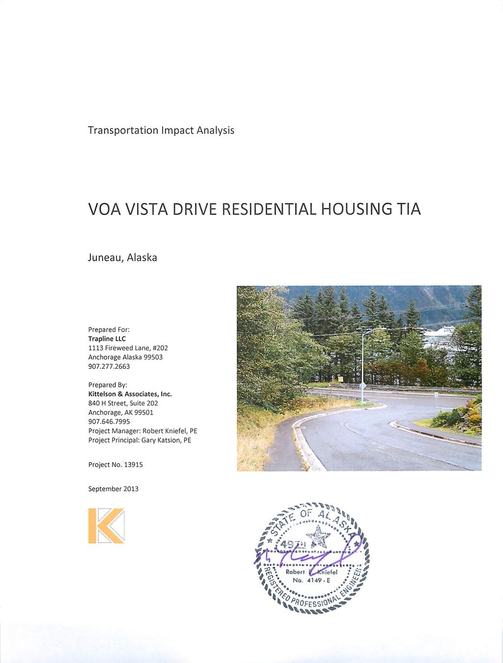
VOA Vista Drive Residential housing Development TIA Project #13915 TABLE OF CONTENTS
|
|
|
- Jared Richard
- 5 years ago
- Views:
Transcription
1
2 VOA Vista Drive Residential housing Development TIA Project #13915 TABLE OF CONTENTS Executive Summary... 2 Project Background... 2 Conditions... 2 Findings... 3 Recommendations... 4 Introduction... 6 Scope of this Report... 6 Project Background... 6 Existing Conditions Site Conditions and Adjacent Land Uses Transportation Facilities Transportation Impact Analysis Traffic Growth Project Traffic Estimation Future Traffic Volumes with the Proposed Development Level-of-Service Analysis Pedestrian and Bicycles Findings and Recommendations Findings Recommendations References ii Kittelson & Associates, Inc.
3 VOA Vista Drive Residential housing Development TIA Project #13915 LIST OF FIGURES Figure 1. Vicinity Map... 8 Figure 2. Proposed Development Plan... 9 Figure 3. Existing Lane Configurations and Traffic Control Devices Figure 4. September 2013 Existing Traffic Conditions, Weekday AM and PM Peak Hours Figure 5. Douglas Highway ADT, near Lawson Creek iii Kittelson & Associates, Inc.
4 VOA Vista Drive Residential housing Development TIA Project #13915 LIST OF TABLES Table 1. Douglas Highway/Vista Drive Current and Projected Level of Service... 4 Table 2. Existing Transportation Facilities and Roadways in the Study Area Table 3. Transit ridership at Forest Edge Road bus stop Table 4. Douglas Highway/Vista Drive Existing Level of Service Table 5. Douglas Highway/Vista Drive Crash History Table 6. Background Traffic ADT Analysis (base + growth, no construction) Table 7. VOA Vista Residential Condominium Development: Trip Generation Rates Table 8. VOA Vista Residential Condominium Development: Peak Hour Trips Table 9. Background Traffic Volumes 2013, 2015, 2016, 2036 (base + growth, no constructions) Table 10. Phase 1 Volumes for 2015, 2016, 2036 (40 Units) Table 11. Phase 2 Volumes for 2015, 2016, 2036 (75 Units) Table 12. Douglas Highway/Vista Drive Level of Service iv Kittelson & Associates, Inc.
5 VOA Vista Drive Residential housing Development TIA Project #13915 APPENDICES Appendix 1 Traffic Count Data Appendix 2 Methods and Criteria Appendix 3 Level-of-Service Worksheets v Kittelson & Associates, Inc.
6 VOA Vista Drive Residential housing Development TIA Project #13915 This page left intentionally blank vi Kittelson & Associates, Inc.
7 Section 1 Executive Summary

8 VOA Vista Drive Residential housing Development TIA Project #13915 EXECUTIVE SUMMARY The Volunteers of America (VOA) are proposing to develop 75 condominium style residential units in Juneau, Alaska. The project is located along Vista Drive west of Douglas Highway on Douglas Island. The purpose of this Traffic Impact Analysis (TIA) is to provide information about the transportation impacts of the residential project. The analysis was completed in accordance with Alaska Department of Transportation and Public Facilities (DOTPF) and City and Borough of Juneau (CBJ) TIA requirements. PROJECT BACKGROUND The proposed residential development by VOA will provide condominium style housing units with a goal of having 60% of the units be occupied by low income qualifiers. This development is being planned for an area previously designed for additional residential units adjacent to the existing 30 units of the Crest at Lawson Creek project. Project development has been planned over two phases: the first phase would include approximately 40 units with occupancy anticipated during 2015, and the second phase would add approximately 35 condominium units and begin occupancy in CONDITIONS Douglas Highway is controlled by the DOTPF and is classified as a Major Collector. Douglas Highway has two 12-foot paved lanes with 8- foot shoulders, curb/gutter, street lighting, and a paved 5-foot pedestrian trail behind the curb along the east side. The highway is nearly straight in the area of Vista Drive with a roadway slope of less than 2%. Capital Transit provides half-hour bus service along Douglas Highway seven days a week. Douglas Drive has a daily traffic volume of between 6,000 to 7,000 trips per day, which appears to be slowly decreasing over the last 12 years. The AM peak hour (7:15 AM to 8:15 AM) count on Douglas Highway was 612 vehicles, and the PM peak hour (5:00 PM to 6:00 PM) vehicle count was 647 vehicles. The AM peak hour included seven bikes/pedestrians with the PM peak hour showing four bikes/pedestrians. The bikes used the shoulder area with the pedestrians using the paved pedestrian trail. Vista Drive is a Local Street maintained by CBJ. Vista Drive is a 26-foot wide paved two lane local residential street. The roadway proceeds west and south from Douglas Highway and currently terminates in the parking area for the Crest at Lawson Creek Condominiums. The plan for Vista Drive 2 Kittelson & Associates, Inc.

9 VOA Vista Drive Residential housing Development TIA Project #13915 includes two connections to two adjacent properties for future development that could result in additional access points for this area. It has a 10 to 13%+ grade and allows limited parking on the east side as it approaches the parking area. The street includes five foot sidewalks along both sides, street lighting, side ditch drainage and curb and gutter improvements. The AM peak hour count on Vista Drive was eight vehicles (six exiting and two entering), and the PM count was 18 vehicles (seven exiting and 11 entering). The sight distance for vehicles entering Douglas Highway from Vista Drive meets standards in both directions, but right-of-way (ROW) brush along the west side of Douglas Drive south of Vista Drive is encroaching on that sight distance. There has been one crash associated with this intersection in the most recent five year period that crash data is available (2006 to 2010). For an intersection with an entering volume of 6,500 ADT, that relates to a crash rate of 0.08 crashes per 1,000,000 entering vehicles. The DOTPF Highway Safety Improvement Program (HSIP) shows an average crash rate of 0.48 for a stop controlled three-way intersection. The Douglas Highway /Vista Drive intersection is well below the average crash level. FINDINGS Using the Institute of Transportation Engineers (ITE) Trip Generation factors, this proposed development is estimated to generate 33 new trips in the AM peak hour and 39 new trips in the PM peak hour. Based upon the current peak hour traffic counts, about 90% of the current trips have an origin or destination north of Vista Drive with about 10% focused on Douglas Highway to the south. The future traffic demands were developed by adding the projected trip generated volumes to the projected background trip volumes. The background volumes were developed by applying the DOTPF supplied growth rate of 0.5% per year to the background traffic. This resulted in intersection turning movement counts for the project years of 2015, 2016, and Using the adopted Highway Capacity Manual procedures, the current and projected Levels of Service (LOS) were determined for all intersection conditions. The results are shown in Table 1. 3 Kittelson & Associates, Inc.
10 VOA Vista Drive Residential housing Development TIA Project #13915 Table 1. Douglas Highway/Vista Drive Current and Projected Level of Service Douglas Highway Vista Drive Year Condition Peak Hour Level of Service Level of Service Delay 2013 Current No Construction AM A B 12.8 PM A B units total units Total 2036 No construction units total AM A B 13.3 PM A B 11.4 AM A B 14.0 PM A B 11.5 AM A B 13.7 PM A B 11.9 AM A B 14.8 PM A B 11.9 The analysis shows Douglas Highway operating at LOS A for the current year 2013, 2015-planned 40- unit occupancy, 2016-additonal 35-unit occupancy, and the 2036 project plan year. The analysis also shows Vista Drive operating at LOS B at its stop sign controlled intersection with Douglas Highway in its current condition and in the 2015, 2016, and 2036 years even with the growth from this planned residential development. In general, when both the development peak hour traffic and the projected growth of Douglas Highway is added to the current Douglas Highway traffic, it only results in a +5.5% total change. This results in little change in the intersection LOS and in the delay to the Vista Drive vehicles. RECOMMENDATIONS The project will have minor traffic impacts on the Douglas Highway and Vista Drive intersection. The current and future intersection volumes do not meet any of the Manual on Uniform Traffic Control Devices (MUTCD) criteria for signalization or other traffic control device installation. Due to the low volumes from Vista Drive onto Douglas Highway, there was no need to widen to provide separated turn pockets; therefore, no improvements were identified. The extension of Vista Drive to the new development from the existing parking area will need proper signage to reduce traffic circulation confusion. The maintenance of Vista Drive has been mentioned as a concern during the winter months. This concern needs to be forwarded to the CBJ Street Maintenance for consideration. The Douglas Highway maintenance crew should see that the brush along the west side of the Douglas Highway ROW south of Vista Drive is eliminated so as to improve sign distance for vehicles entering Douglas Highway from Vista Drive. Additional details of the study methodology, findings, and recommendations are provided in the sections below. 4 Kittelson & Associates, Inc.
11 Section 2 Introduction
12 VOA Vista Drive Residential housing Development TIA Project #13915 INTRODUCTION SCOPE OF THIS REPORT This analysis determines the transportation-related impacts associated with the proposed VOA Vista Drive Residential development. The format for this report follows the DOTPF TIA checklist and the Juneau Zoning Code Section TIA requirements. The data collected and analysis included in the TIA are based upon information gathered from the DOTPF records and a site visit performed on September 18 and 19, Pre-TIA meetings were held with David Epstein, DOTPF Regional Traffic and Safety Engineer; Marie Heidemann, DOTPF SE Region Planner; and Beth McKibben, CBJ Senior Planner. As a result of those meetings, the following items were proposed for the TIA study: 1. The main study intersection is Vista Drive and Douglas Highway. 2. No roadway or development projects are planned for the near term within the study area. 3. The Safe Routes to School project has recommended to add a sidewalk on the school-side of Douglas Highway, from Lawson Creek (or Vista Drive) to Gastineau Elementary School (approx. 2,000-3,000 feet). Currently there is no funding for the design or construction of this project. 4. Analyze current year (2013) existing land-use and transportation system conditions during the weekday AM and PM peak conditions. 5. Use trip generation rates based upon the ITE Trip Generation Manual, 9 th Edition. 6. Forecast year 2015 background and Phase One 40-unit development traffic conditions during the AM and PM peak periods. 7. Forecast year 2016 Phase One plus Phase Two 75-unit development traffic conditions during the AM and PM peak periods. 8. Forecast year 2036 background traffic conditions (no development) during the AM and PM peak periods. 9. Forecast year 2036 background and Phase One plus Phase Two 75-unit development traffic conditions during the AM and PM peak periods. 10. The study review must address vehicle, pedestrian, and bicycle transportation and safety impacts. PROJECT BACKGROUND The Juneau Volunteers of America is proposing to develop approximately 75 condominium residential units in Juneau, Alaska. The development will occur along Vista Drive west of its intersection with Douglas Highway. Figure 1 illustrates the site vicinity. The subject property covers approximately 6 acres and was originally approved for expansion of the Crest at Lawson Creek Condominiums. The property is zoned D-18. This residential district is intended to accommodate primarily multifamily development at a density of 18 dwelling units per acre. This is a high density multifamily zoning district intended to accommodate midrise-type development. The construction of the 40-unit Phase One residential development is scheduled to start in 2014 with occupancy in The construction of the 6 Kittelson & Associates, Inc.
13 VOA Vista Drive Residential housing Development TIA Project # units of Phase Two 35 could begin as early as 2015 with occupancy in Figure 2 illustrates the proposed development plan. At completion, the 75-unit complex will have a density of approximately 13 units per acre. 7 Kittelson & Associates, Inc.
14

15 VOA Vista Drive Residential housing Development TIA Project #13915 Figure 2. Proposed Development Plan Douglas Highway 9 Kittelson & Associates, Inc.
16 Section 3 Existing Conditions
17 VOA Vista Drive Residential housing Development TIA Project #13915 EXISTING CONDITIONS The existing conditions analysis identifies the site conditions and current operational and geometric characteristics of the roadways within the study area. These conditions will be compared with future conditions later in this report. Kittelson & Associates, Inc. (KAI) staff visited and inventoried the proposed VOA Vista Drive development site and surrounding study area in September At that time, KAI collected information regarding site conditions, adjacent land uses, existing traffic operations, and transportation facilities in the study area. SITE CONDITIONS AND ADJACENT LAND USES The proposed site is currently vacant and is zoned D-18 for multi-family residential use. The surrounding land uses are also residential and zoned D-18 multi-family use. The 6-acre site of the proposed development was originally planned to be a later phase of the existing 30-unit Crest at Lawson Creek condominium project also located on Vista Drive. TRANSPORTATION FACILITIES Table 2. Existing Transportation Facilities and Roadways in the Study Area Roadway Functional Classification1 Number of Lanes Douglas Highway (DOTPF) Major Collector 2 Lanes 40 Vista Drive (CBJ) Local Street 2 Lanes None posted 1 Per DOTPF 2 Mph represents miles per hour Posted Speed (mph) Sidewalks Bicycle Lanes 5 Asphalt East side 8 shoulder on both sides No On-Street Parking 5 Asphalt Both sides No Limited Roadway Facilities Douglas Highway Douglas Highway in the vicinity of Vista Drive is a two-lane facility with 12-foot lanes and 8-foot shoulders used by bicycles that is owned by the DOTPF. No parking is allowed on Douglas Highway near this intersection. Parking is allowed farther north of the intersection on the east side of the roadway. Douglas Highway near Vista Drive has a total of three street lights, which include two continuous roadway lights on Douglas Highway and one intersection light installed for Vista Drive. 11 Kittelson & Associates, Inc.


18 VOA Vista Drive Residential housing Development TIA Project #13915 Vista Drive This CBJ-maintained roadway is a 26-foot wide two-lane facility with curb and gutter and sidewalks. The asphalt sidewalks are 5- feet wide and placed directly behind the curb. There are street lights along Vista Drive. The section of Vista Drive above the first condominium driveway allows parking on the east side except between November 1 and April 1. Pedestrian and Bicycle Facilities The bicycle lanes along Douglas Highway were observed to have two cyclists during the AM and four cyclists during the PM peak hour counts. The sidewalk along the east side of Douglas Highway had five pedestrians during the AM peak hour and two pedestrians during the PM peak hour. The only pedestrian usage of the Vista Drive sidewalk during the count period was a student emerging from a school bus at Vista Drive and Douglas Highway at approximately 4:25 PM and walking to the Crest at Lawson Creek development. Conversation with the Gastineau Community School staff noted they plan to bus any students from the Vista Drive area to the school since no sidewalk connection exists on the west side of Douglas Highway between Vista Drive and the school. The Safe Routes to School (SRTS) plan for Gastineau School shows the need to construct a sidewalk along the west side of Douglas Highway connecting to Lawson Creek/Vista Drive, but no design or project construction is funded/scheduled at this time. According to the school staff, at this time there is no school bus service to Vista Drive since there are no children from Vista Drive using Gastineau School. Transit Facilities Local transit service is provided by the City and Borough of Juneau Capital Transit. The system provides seven day per week service (Monday through Saturday 7 AM to 11:30 PM and Sunday 9 AM to 6:30 PM) on a half hour schedule. The nearest transit stop/pullouts along Douglas Highway are located at Douglas Highway and Forest Edge Road approximately 120 feet from the north Vista Drive sidewalk. Table 3 shows transit ridership information provided by Capital Transit and taken from a survey completed in April The figures are for passengers using the nearest bus stops at Forest Edge Road. 12 Kittelson & Associates, Inc.
19 VOA Vista Drive Residential housing Development TIA Project #13915 Table 3. Transit ridership at Forest Edge Road bus stop Inbound towards Juneau Outbound towards Douglas Passenger Activity On Off On Off Total for survey day Traffic Volumes and Peak Hour Operations During the September site visit, manual peak hour turning-movement counts were collected for analysis. The counts used in this analysis were from the evening of Wednesday, September 18, 2013 (3:30 to 6:00 PM) and Thursday, September 19, 2013 during the morning (6:00 to 8:45 AM). The intersection morning and evening peak hours were found to occur between 7:15 AM and 8:15 AM and 5:00 PM and 6:00 PM, respectively. Figure 4 provides a summary of the turning-movement counts. Appendix A contains the AM and PM traffic count worksheets used in this study. 13 Kittelson & Associates, Inc.
20
21
22 VOA Vista Drive Residential housing Development TIA Project #13915 The daily traffic volume pattern on Douglas Drive south of Lawson Creek has been declining in volume as shown in Figure 5. For purposes of this analysis, DOTPF staff recommended we use a future growth rate of 0.5% annual growth per year. This results in a net 11% growth between the current year 2013 and 2036 the project plan year. Figure 5. Douglas Highway ADT, near Lawson Creek 8,000 Douglas Highway ADT South of Lawson Creek source: DOTPF 7,000 6,000 Vehicle Volume 5,000 4,000 3,000 2,000 1, Year 16 Kittelson & Associates, Inc.
23 VOA Vista Drive Residential housing Development TIA Project #13915 Existing Levels of Service All LOS analyses described in this report were performed in accordance with the procedures stated in the 2000 Highway Capacity Manual (Reference 6). A description of level of service and the criteria by which they are determined is presented in Appendix B. Appendix B also indicates how LOS is measured. Intersection LOS is analogous to the letter grades in a school report card. Motorists using an intersection that operates at LOS A experience very little delay, while those using an intersection that operates at LOS F will experience intolerably long delays. The CBJ TIA guidelines note the minimum acceptable LOS for this project is LOS D. All intersection LOS evaluations used the peak 15-minute flow rate during the weekday AM and PM peak hours. Using the peak 15-minute flow rate ensures that this analysis is based on a reasonable worst-case scenario. For this reason, the analysis reflects conditions that are only likely to occur for 15 minutes out of each average peak hour. The transportation system will likely operate under conditions better than those described in this report during all other time periods. Table 4 summarizes the LOS analysis for the existing study intersection under current weekday AM and PM peak hour traffic conditions. The Douglas Highway/Vista Drive intersection operates at a LOS A/B during the weekday AM and PM peak hours. Table 4. Douglas Highway/Vista Drive Existing Level of Service Douglas Highway Vista Drive Year Condition Peak Hour Level of Service Level of Service Delay 2013 Current AM A B 12.8 PM A B 11.4 Traffic Crashes The crash history at the study intersection was reviewed to identify potential safety issues. DOTPF provided crash records from the study intersection for the most recent available five-year period, from January 1, 2006, through December 31, There was one vehicle crash in the study area during this period. It involved a single northbound vehicle turning left into Vista Drive from Douglas Highway. Table 5. Douglas Highway/Vista Drive Crash History Crash Type Crash Severity Year Angle Turning Rear End Overturn Backed Into Side Swipe Fence PDO* Injury Total * PDO = Property Damage Only 17 Kittelson & Associates, Inc.
24 VOA Vista Drive Residential housing Development TIA Project #13915 Intersection Sight Distance Figure of the DOTPF Pre-Construction Manual shows a minimum required intersection sight distance of 305 feet for the main roadway with a speed limit of 40 miles per hour (mph). The Douglas/Vista intersection sight distances were field measured with the north view exceeding 600 feet and the south view approaching 400 feet. Therefore, the Douglas Highway/Vista Drive intersection sight distance meets the design standards. The stop bar on Vista Drive is set back 15 feet from the near edge of the bike lane. During the field observation a majority of the vehicles on Vista Drive used the stop bar to stop and then pulled closer to Douglas Drive before entering it. It appears they creep out since the brush in the ROW area along the west side of Douglas Highway south of Vista Drive has grown to partially impede sight distance for the vehicles pulling out of Vista Drive making a left turn. 18 Kittelson & Associates, Inc.
25 VOA Vista Drive Residential housing Development TIA Project #13915 Section 4 Transportation Impact Analysis 19 Kittelson & Associates, Inc.
26 VOA Vista Drive Residential housing Development TIA Project #13915 TRANSPORTATION IMPACT ANALYSIS The transportation impact analysis identifies how the study area s transportation system will operate in the year the proposed development phases are expected to be fully built, years 2015 and 2016, and in the future project planning year Following is the basis for the traffic growth, the impacts of adding the development traffic and the intersection LOS analysis. TRAFFIC GROWTH The future traffic conditions during the weekday AM and PM peak hours were examined by developing the background traffic volumes (no development) including projected growth and then adding the development estimated traffic. The background weekday AM and PM peak hour traffic conditions were developed by applying the DOTPF recommended 0.5-percent annual growth rate to the existing traffic volumes to account for regional growth in the site vicinity for years 2013, 2015, 2016, and Table 6 represents this information. 20 Kittelson & Associates, Inc.
27 VOA Vista Drive Residential housing Development TIA Project #13915 Table 6. Background Traffic ADT Analysis (base + growth, no construction) AM Peak Hour Direction Volume based upon growth Movement 100.0% 101.0% 101.5% 111.0% 2013 Current Project Year Douglas/Northbound Douglas/Southbound Vista/Eastbound Volume based upon growth Through Left Through Right Left Right PM Peak Hour 100.0% 101.0% 101.5% 111.0% Direction Movement 2013 Current Project Year Douglas/Northbound Douglas/Southbound Vista/Eastbound Through Left Through Right Left Right Kittelson & Associates, Inc.
28 VOA Vista Drive Residential housing Development TIA Project #13915 PROJECT TRAFFIC ESTIMATION The total traffic generated by the proposed development was estimated using ITE Trip Generation Manual, 9 th Edition. Category 230 shows trip rates for Residential Condominium townhouses. The full build-out of 75 units would generate 33 vehicle trips in the AM peak hour. These trips were estimated using 0.44 trips per unit for the proposed 75 units. Similarly, the full build-out 75 units would generate 39 vehicle trips in the PM peak hour. These trips were estimated using 0.52 trips per unit for 75 units. With some of the development focusing on low income housing, this trip rate is probably higher than what will be seen at full development as a portion of the residents will probably use other modes of travel including walking, bicycling, and busing on the Capital Transit system. As a conservative approach to this analysis, the trips were all assumed to be by vehicle. Table 7. VOA Vista Residential Condominium Development: Trip Generation Rates Time Period Vehicle Trips per Unit per Time Period # of Units Total Trips per Time Period Weekday AM Peak Hour of Douglas Highway PM Peak Hour of Douglas Highway Source: ITE Trip Generation, 9th Edition, Use Code 230 Residential Condominium Townhouse The site trip distribution pattern was derived after viewing the existing traffic patterns. In general, it assumes approximately 90% of the traffic exiting from Vista Drive to Douglas Highway would turn left toward downtown Juneau, with approximately 10% turning right going to downtown Douglas. Similarly, for traffic generated by the development returning to the site, it was assumed 90% would come from the downtown Juneau direction and 10% from downtown Douglas. Table 8. VOA Vista Residential Condominium Development: Peak Hour Trips Vista Drive AM Peak Hour Trips Units Peak Hour Trips Vista Drive Left Turns Vista Drive Right Turns 90% 10% Phase Phase TOTAL Units Vista Drive PM Peak Hour Trips Peak Hour Trips Douglas Southbound Right Turn Douglas Northbound Left Turn 90% 10% Phase Phase TOTAL Kittelson & Associates, Inc.
29 VOA Vista Drive Residential housing Development TIA Project #13915 FUTURE TRAFFIC VOLUMES WITH THE PROPOSED DEVELOPMENT The estimate of the future traffic volumes is the result of adding the background traffic volumes to the proposed development traffic volumes. For purposes of this analysis we developed future traffic volumes for the following conditions: 1. Background: This condition represents the background traffic starting with the base year 2013 and showing the background for 2015, 2016, and Table 9 shows these volumes. Table 9. Background Traffic Volumes 2013, 2015, 2016, 2036 (base + growth, no constructions) AM Peak Hour Growth Projection 100.0% 101.0% 101.5% 111.0% Direction Movement 2013 Current Project Year Douglas/Northbound Douglas/Southbound Vista/Eastbound Through Left Through Right Left Right PM Peak Hour Direction Douglas/Northbound Douglas/Southbound Vista/Eastbound Growth Projection 100.0% 101.0% 101.5% 111.0% Movement 2013 Current Project Year Through Left Through Right Left Right Kittelson & Associates, Inc.
30 VOA Vista Drive Residential housing Development TIA Project # Phase One 40-Unit Occupancy: This condition represents the traffic volumes comprised of the background volumes and the impacts of the Phase One 40 Occupancy. This is shown in Table 10. Table 10. Phase 1 Volumes for 2015, 2016, 2036 (40 Units) AM Peak Hour Volume based upon growth 100.0% 101.0% 101.0% 111.0% Direction Movement 2013 Current 2015 Background 2015 Phase 1 Occupancy 2035 Project Year Douglas/Northbound Douglas/Southbound Vista/Eastbound Through Left Through Right Left Right PM Peak Hour Volume based upon growth 100.0% 101.0% 101.0% 111.0% Direction Movement 2013 Current 2015 Background 2015 Phase 1 Occupancy 2035 Project Year Douglas/Northbound Douglas/Southbound Vista/Eastbound Through Left Through Right Left Right Kittelson & Associates, Inc.
31 VOA Vista Drive Residential housing Development TIA Project # Full Occupancy: This condition represents the traffic volumes comprised of the background volumes and the impacts of the completion of the Phase One and Phase Two efforts for a total of 75 units. This is shown in Table 11. Table 11. Phase 2 Volumes for 2015, 2016, 2036 (75 Units) AM Peak Hour Volume based upon growth 100.0% 101.0% 101.5% 111.0% Direction Movement 2013 Current 2015 Background 2016 Phase 2 Occupancy 2035 Project Year Douglas/Northbound Douglas/Southbound Vista/Eastbound Through Left Through Right Left Right PM Peak Hour Volume based upon growth 100.0% 101.0% 101.5% 111.0% Direction Movement 2013 Current 2015 Background 2016 Phase 2 Occupancy 2035 Project Year Douglas/Northbound Douglas/Southbound Vista/Eastbound Through Left Through Right Left Right LEVEL-OF-SERVICE ANALYSIS All intersection level-of-service evaluations used the peak 15-minute flow rate during the weekday AM and PM peak hours. Using the peak 15-minute flow rate ensures that this analysis is based on a reasonable worst-case scenario. For this reason, the analysis reflects conditions that are only likely to occur for 15 minutes out of each average peak hour. The transportation system will likely operate under conditions better than those described in this report during all other time periods. The weekday AM and PM peak-hour turning-movement volumes shown in Tables 9, 10, and 11 were used to conduct an operational analysis for the Douglas Highway and Vista Drive study intersection for the various conditions. Table 12 shows that for all conditions of Background Traffic or Background plus growth traffic, the study intersection achieves an acceptable level of service (A/B), achieving the TIA guidelines requiring better than the LOS designation of D. 25 Kittelson & Associates, Inc.
32 VOA Vista Drive Residential housing Development TIA Project #13915 Table 12. Douglas Highway/Vista Drive Level of Service Douglas Highway Vista Drive Year Condition Peak Hour Level of Service Level of Service Delay 2013 Current No Construction units total units Total 2036 No construction units total AM A B 12.8 PM A B 11.4 AM A B 13.3 PM A B 11.4 AM A B 14.0 PM A B 11.5 AM A B 13.7 PM A B 11.9 AM A B 14.8 PM A B 11.9 PEDESTRIAN AND BICYCLES The current and future Vista Drive pedestrian and bicycle users can access the bike lanes or pedestrian walkways along Douglas Highway. For pedestrian access from Vista Drive, they must cross Douglas Highway to reach the pedestrian walkway along its eastern side. This is very similar to the numerous other residential developments along the west side of Douglas Highway where pedestrians cross over to the developed pathway on the east side of the road. The bicycle users can also gain access to the Douglas Highway bike lanes from Vista Drive. Those bicyclists wishing to use the eastern bike lane would cross Douglas Highway like the numerous other cyclists originating from residential developments on the west side of Douglas Highway. The DOTPF has warrants and standards that deal with the installation of pedestrian crossing treatments based upon the site conditions, speeds, and the volume of pedestrians making the crossing. DOTPF is responsible for monitoring the roadways and determining what, if any, pedestrian crossing treatments are needed. For analysis purposes, it assumed that 15% of the new units would have a pedestrian/bicyclist during the peak hour, resulting in 11 pedestrians/bicyclists. This number falls below the DOTPF standards for pedestrian crossing treatments. As previously noted, the school staff stated students from this area will be bused to school when students begin to live in this area. 26 Kittelson & Associates, Inc.
33 VOA Vista Drive Residential housing Development TIA Project #13915 Section 5 Findings and Recommendations 27 Kittelson & Associates, Inc.
34 VOA Vista Drive Residential housing Development TIA Project #13915 FINDINGS AND RECOMMENDATIONS FINDINGS The results of the traffic impact analysis indicate that the proposed VOA Vista Residential Condominium Development can be constructed while maintaining acceptable levels of service and safety. The proposed LOS for the project planning year of 2036 will still maintain the current LOS A on Douglas Highway and LOS B on Vista Drive. The project will have minor traffic impacts on the Douglas Highway and Vista Drive intersection. The current and future intersection volumes do not meet any of the MUTCD criteria for signalization or widening and therefore no improvements were identified. RECOMMENDATIONS Due to the low volumes from Vista Drive onto Douglas Highway, there is no need to widen to provide separated turn pockets; therefore, no improvements were identified. The extension of Vista Drive to the new development from the existing parking area will need proper signage to reduce traffic circulation confusion. The maintenance of Vista Drive has been mentioned as a concern during the winter months. This concern needs to be forwarded to the CBJ Street Maintenance for consideration. The Douglas Highway maintenance crew should insure the brush along the west side of the Douglas Highway ROW south of Vista Drive is eliminated so as to improve sight distance for vehicles entering Douglas Highway from Vista Drive. 28 Kittelson & Associates, Inc.
35 Section 6 References
36 VOA Vista Drive Residential housing Development TIA Project #13915 REFERENCES 1. Transportation Research Board. Highway Capacity Manual Institute of Transportation Engineers. 9th Edition, Trip Generation Manual U.S. Department of Transportation Federal Highway Administration. Manual on Uniform Traffic Control Devices (MUTCD) Kittelson & Associates, Inc.
37 Appendix 1 Traffic Count Data
38 VOA Vista Drive Residential housing Development TIA Project # AM Counts Existing Douglas/Vista Drive Traffic Counts Douglas Highway Vista Drive Time Starting Northbound Southbound Eastbound TOTAL VEHICLES Through Left Through Right Left Right Vehicles Peds Bikes Vehicles Peds Bikes Vehicles Peds Bikes Vehicles Peds Bikes Douglas Vista TOTAL Peak Hour 6: : : : : : : : : : : Peak Hour TOTAL AM peak hour from 7:15 AM to 8:15 AM = 612 vehicles (606 on Douglas Highway and 6 on Vista Drive) PM Counts Douglas/Vista Drive Traffic Counts Douglas Highway Vista Drive Time Starting Northbound Southbound Eastbound TOTAL VEHICLES Through Left Through Right Left Right Vehicles Peds Bikes Vehicles Peds Bikes Vehicles Peds Bikes Vehicles Peds Bikes Douglas Vista TOTAL Peak Hour 3: : : : : : : : : Peak Hour Total :26 PM School bus southbound dropped one student who walked up Vista Drive PM peak hour from 5:00 PM to 6:00 PM = 647 vehicles (640 on Douglas Highway and 7 on Vista Drive) Kittelson & Associates, Inc.
39 Appendix 2 Methods and Criteria
40 VOA Vista Drive Residential housing Development TIA Project #13915 APPENDIX 2 LEVEL-OF-SERVICE CONCEPT Level of service (LOS) is a concept developed to quantify the degree of comfort (including such elements as travel time, number of stops, total amount of stopped delay, and impediments caused by other vehicles) afforded to drivers as they travel through an intersection or roadway segment. Six grades are used to denote the various level of service from A to F. UNSIGNALIZED INTERSECTIONS Unsignalized intersections include two-way stop-controlled (TWSC) and all-way stop-controlled (AWSC) intersections. The 2000 Highway Capacity Manual (HCM) provides models for estimating control delay at both TWSC and AWSC intersections. A qualitative description of the various service levels associated with an unsignalized intersection is presented in Table B1. A quantitative definition of level of service for unsignalized intersections is presented in Table B2. Using this definition, Level of Service E is generally considered to represent the minimum acceptable design standard. Table B1 Level-of-Service Criteria for Unsignalized Intersections Level of Service A B C D E F Nearly all drivers find freedom of operation. Very seldom is there more than one vehicle in queue. Some drivers begin to consider the delay an inconvenience. Occasionally there is more than one vehicle in queue. Many times there is more than one vehicle in queue. Most drivers feel restricted, but not objectionably so. Often there is more than one vehicle in queue. Drivers feel quite restricted. Average Delay per Vehicle to Minor Street Represents a condition in which the demand is near or equal to the probable maximum number of vehicles that can be accommodated by the movement. There is almost always more than one vehicle in queue. Drivers find the delays approaching intolerable levels. Forced flow. Represents an intersection failure condition that is caused by geometric and/or operational constraints external to the intersection. Table B2 Level-of-Service Criteria for Unsignalized Intersections Level of Service A <10.0 B >10.0 and 15.0 C >15.0 and 25.0 D >25.0 and 35.0 E >35.0 and 50.0 F >50.0 Average Control Delay per Vehicle (Seconds) Kittelson & Associates, Inc.
41 VOA Vista Drive Residential housing Development TIA Project #13915 It should be noted that the level-of-service criteria for unsignalized intersections are somewhat different than the criteria used for signalized intersections. The primary reason for this difference is that drivers expect different levels of performance from different kinds of transportation facilities. The expectation is that a signalized intersection is designed to carry higher traffic volumes than an unsignalized intersection. Additionally, there are a number of driver behavior considerations that combine to make delays at signalized intersections less galling than at unsignalized intersections. For example, drivers at signalized intersections are able to relax during the red interval, while drivers on the minor street approaches to TWSC intersections must remain attentive to the task of identifying acceptable gaps and vehicle conflicts. Also, there is often much more variability in the amount of delay experienced by individual drivers at unsignalized intersections than signalized intersections. For these reasons, it is considered that the control delay threshold for any given level of service is less for an unsignalized intersection than for a signalized intersection. While overall intersection level of service is calculated for AWSC intersections, level of service is only calculated for the minor approaches and the major street left turn movements at TWSC intersections. No delay is assumed to the major street through movements. For TWSC intersections, the overall intersection level of service remains undefined: level of service is only calculated for each minor street lane. In the performance evaluation of TWSC intersections, it is important to consider other measures of effectiveness (MOEs) in addition to delay, such as v/c ratios for individual movements, average queue lengths, and 95th-percentile queue lengths. By focusing on a single MOE for the worst movement only, such as delay for the minor-street left turn, users may make inappropriate traffic control decisions. The potential for making such inappropriate decisions is likely to be particularly pronounced when the HCM level-of-service thresholds are adopted as legal standards, as is the case in many public agencies. Kittelson & Associates, Inc.
42 Appendix 3 Level-of-Service Worksheets
43 Two-Way Stop Control file:///c:/users/jboudart/appdata/local/temp/u2k4ae8.tmp Page 1 of 1 9/24/2013 General Information Analyst JXB Agency/Co. Kittelson & Associates, Inc. Date Performed 9/24/2013 Analysis Time Period AM Peak Hour TWO-WAY STOP CONTROL SUMMARY Site Information Intersection Douglas Hwy/Vista Dr Jurisdiction Analysis Year 2013 Project Description East/West Street: Vista Dr North/South Street: Douglas Hwy Intersection Orientation: North-South Study Period (hrs): 0.25 Vehicle Volumes and Adjustments Major Street Northbound Southbound Movement L T R L T R Volume (veh/h) Peak-Hour Factor, PHF Hourly Flow Rate, HFR (veh/h) Percent Heavy Vehicles Median Type Undivided RT Channelized 0 0 Lanes Configuration LT TR Upstream Signal 0 0 Minor Street Eastbound Westbound Movement L T R L T R Volume (veh/h) Peak-Hour Factor, PHF Hourly Flow Rate, HFR (veh/h) Percent Heavy Vehicles Percent Grade (%) -7 0 Flared Approach N N Storage 0 0 RT Channelized 0 0 Lanes Configuration LTR Delay, Queue Length, and Level of Service Approach Northbound Southbound Westbound Eastbound Movement Lane Configuration LT LTR v (veh/h) 1 9 C (m) (veh/h) v/c % queue length Control Delay (s/veh) LOS A B Approach Delay (s/veh) Approach LOS B Copyright 2010 University of Florida, All Rights Reserved HCS+ TM Version 5.6 Generated: 9/24/2013 2:53 PM
44 Two-Way Stop Control file:///c:/users/jboudart/appdata/local/temp/u2kda4e.tmp Page 1 of 1 9/24/2013 General Information Analyst JXB Agency/Co. Kittelson & Associates, Inc. Date Performed 9/24/2013 Analysis Time Period PM Peak Hour TWO-WAY STOP CONTROL SUMMARY Site Information Intersection Douglas Hwy/Vista Dr Jurisdiction Analysis Year 2013 Project Description East/West Street: Vista Dr North/South Street: Douglas Hwy Intersection Orientation: North-South Study Period (hrs): 0.25 Vehicle Volumes and Adjustments Major Street Northbound Southbound Movement L T R L T R Volume (veh/h) Peak-Hour Factor, PHF Hourly Flow Rate, HFR (veh/h) Percent Heavy Vehicles Median Type Undivided RT Channelized 0 0 Lanes Configuration LT TR Upstream Signal 0 0 Minor Street Eastbound Westbound Movement L T R L T R Volume (veh/h) Peak-Hour Factor, PHF Hourly Flow Rate, HFR (veh/h) Percent Heavy Vehicles Percent Grade (%) -7 0 Flared Approach N N Storage 0 0 RT Channelized 0 0 Lanes Configuration LTR Delay, Queue Length, and Level of Service Approach Northbound Southbound Westbound Eastbound Movement Lane Configuration LT LTR v (veh/h) 3 7 C (m) (veh/h) v/c % queue length Control Delay (s/veh) LOS A B Approach Delay (s/veh) Approach LOS B Copyright 2010 University of Florida, All Rights Reserved HCS+ TM Version 5.6 Generated: 9/24/2013 2:53 PM
45 Two-Way Stop Control file:///c:/users/jboudart/appdata/local/temp/u2kf28.tmp Page 1 of 1 9/24/2013 General Information Analyst JXB Agency/Co. Kittelson & Associates, Inc. Date Performed 9/24/2013 Analysis Time Period AM Peak Hour TWO-WAY STOP CONTROL SUMMARY Site Information Intersection Jurisdiction Analysis Year Project Description East/West Street: Vista Dr North/South Street: Douglas Hwy Intersection Orientation: North-South Study Period (hrs): 0.25 Douglas Hwy/Vista Dr 2015, 40 Units Vehicle Volumes and Adjustments Major Street Northbound Southbound Movement L T R L T R Volume (veh/h) Peak-Hour Factor, PHF Hourly Flow Rate, HFR (veh/h) Percent Heavy Vehicles Median Type Undivided RT Channelized 0 0 Lanes Configuration LT TR Upstream Signal 0 0 Minor Street Eastbound Westbound Movement L T R L T R Volume (veh/h) Peak-Hour Factor, PHF Hourly Flow Rate, HFR (veh/h) Percent Heavy Vehicles Percent Grade (%) -7 0 Flared Approach N N Storage 0 0 RT Channelized 0 0 Lanes Configuration LTR Delay, Queue Length, and Level of Service Approach Northbound Southbound Westbound Eastbound Movement Lane Configuration LT LTR v (veh/h) 1 35 C (m) (veh/h) v/c % queue length Control Delay (s/veh) LOS A B Approach Delay (s/veh) Approach LOS B Copyright 2010 University of Florida, All Rights Reserved HCS+ TM Version 5.6 Generated: 9/24/2013 2:54 PM
46 Two-Way Stop Control file:///c:/users/jboudart/appdata/local/temp/u2kf4c3.tmp Page 1 of 1 9/24/2013 General Information Analyst JXB Agency/Co. Kittelson & Associates, Inc. Date Performed 9/24/2013 Analysis Time Period PM Peak Hour TWO-WAY STOP CONTROL SUMMARY Site Information Intersection Jurisdiction Analysis Year Project Description East/West Street: Vista Dr North/South Street: Douglas Hwy Intersection Orientation: North-South Study Period (hrs): 0.25 Douglas Hwy/Vista Dr 2015, 40 Units Vehicle Volumes and Adjustments Major Street Northbound Southbound Movement L T R L T R Volume (veh/h) Peak-Hour Factor, PHF Hourly Flow Rate, HFR (veh/h) Percent Heavy Vehicles Median Type Undivided RT Channelized 0 0 Lanes Configuration LT TR Upstream Signal 0 0 Minor Street Eastbound Westbound Movement L T R L T R Volume (veh/h) Peak-Hour Factor, PHF Hourly Flow Rate, HFR (veh/h) Percent Heavy Vehicles Percent Grade (%) -7 0 Flared Approach N N Storage 0 0 RT Channelized 0 0 Lanes Configuration LTR Delay, Queue Length, and Level of Service Approach Northbound Southbound Westbound Eastbound Movement Lane Configuration LT LTR v (veh/h) 3 7 C (m) (veh/h) v/c % queue length Control Delay (s/veh) LOS A B Approach Delay (s/veh) Approach LOS B Copyright 2010 University of Florida, All Rights Reserved HCS+ TM Version 5.6 Generated: 9/24/2013 3:24 PM
47 Two-Way Stop Control file:///c:/users/jboudart/appdata/local/temp/u2k1e29.tmp Page 1 of 1 9/24/2013 General Information Analyst JXB Agency/Co. Kittelson & Associates, Inc. Date Performed 9/24/2013 Analysis Time Period AM Peak Hour TWO-WAY STOP CONTROL SUMMARY Site Information Intersection Douglas Hwy/Vista Dr Jurisdiction Analysis Year 2016, Phase 2 Project Description East/West Street: Vista Dr North/South Street: Douglas Hwy Intersection Orientation: North-South Study Period (hrs): 0.25 Vehicle Volumes and Adjustments Major Street Northbound Southbound Movement L T R L T R Volume (veh/h) Peak-Hour Factor, PHF Hourly Flow Rate, HFR (veh/h) Percent Heavy Vehicles Median Type Undivided RT Channelized 0 0 Lanes Configuration LT TR Upstream Signal 0 0 Minor Street Eastbound Westbound Movement L T R L T R Volume (veh/h) Peak-Hour Factor, PHF Hourly Flow Rate, HFR (veh/h) Percent Heavy Vehicles Percent Grade (%) -7 0 Flared Approach N N Storage 0 0 RT Channelized 0 0 Lanes Configuration LTR Delay, Queue Length, and Level of Service Approach Northbound Southbound Westbound Eastbound Movement Lane Configuration LT LTR v (veh/h) 1 57 C (m) (veh/h) v/c % queue length Control Delay (s/veh) LOS A B Approach Delay (s/veh) Approach LOS B Copyright 2010 University of Florida, All Rights Reserved HCS+ TM Version 5.6 Generated: 9/24/2013 2:56 PM
48 Two-Way Stop Control file:///c:/users/jboudart/appdata/local/temp/u2k8097.tmp Page 1 of 1 9/24/2013 General Information Analyst JXB Agency/Co. Kittelson & Associates, Inc. Date Performed 9/24/2013 Analysis Time Period PM Peak Hour TWO-WAY STOP CONTROL SUMMARY Site Information Intersection Douglas Hwy/Vista Dr Jurisdiction Analysis Year 2016, Phase 2 Project Description East/West Street: Vista Dr North/South Street: Douglas Hwy Intersection Orientation: North-South Study Period (hrs): 0.25 Vehicle Volumes and Adjustments Major Street Northbound Southbound Movement L T R L T R Volume (veh/h) Peak-Hour Factor, PHF Hourly Flow Rate, HFR (veh/h) Percent Heavy Vehicles Median Type Undivided RT Channelized 0 0 Lanes Configuration LT TR Upstream Signal 0 0 Minor Street Eastbound Westbound Movement L T R L T R Volume (veh/h) Peak-Hour Factor, PHF Hourly Flow Rate, HFR (veh/h) Percent Heavy Vehicles Percent Grade (%) -7 0 Flared Approach N N Storage 0 0 RT Channelized 0 0 Lanes Configuration LTR Delay, Queue Length, and Level of Service Approach Northbound Southbound Westbound Eastbound Movement Lane Configuration LT LTR v (veh/h) 7 8 C (m) (veh/h) v/c % queue length Control Delay (s/veh) LOS A B Approach Delay (s/veh) Approach LOS B Copyright 2010 University of Florida, All Rights Reserved HCS+ TM Version 5.6 Generated: 9/24/2013 2:59 PM
49 Two-Way Stop Control file:///c:/users/jboudart/appdata/local/temp/u2kd9dd.tmp Page 1 of 1 9/24/2013 General Information Analyst JXB Agency/Co. Kittelson & Associates, Inc. Date Performed 9/24/2013 Analysis Time Period AM Peak Hour TWO-WAY STOP CONTROL SUMMARY Site Information Intersection Jurisdiction Analysis Year Douglas Hwy/Vista Dr 2035, Background Conditions Project Description East/West Street: Vista Dr North/South Street: Douglas Hwy Intersection Orientation: North-South Study Period (hrs): 0.25 Vehicle Volumes and Adjustments Major Street Northbound Southbound Movement L T R L T R Volume (veh/h) Peak-Hour Factor, PHF Hourly Flow Rate, HFR (veh/h) Percent Heavy Vehicles Median Type Undivided RT Channelized 0 0 Lanes Configuration LT TR Upstream Signal 0 0 Minor Street Eastbound Westbound Movement L T R L T R Volume (veh/h) Peak-Hour Factor, PHF Hourly Flow Rate, HFR (veh/h) Percent Heavy Vehicles Percent Grade (%) -7 0 Flared Approach N N Storage 0 0 RT Channelized 0 0 Lanes Configuration LTR Delay, Queue Length, and Level of Service Approach Northbound Southbound Westbound Eastbound Movement Lane Configuration LT LTR v (veh/h) 1 11 C (m) (veh/h) v/c % queue length Control Delay (s/veh) LOS A B Approach Delay (s/veh) Approach LOS B Copyright 2010 University of Florida, All Rights Reserved HCS+ TM Version 5.6 Generated: 9/24/2013 3:11 PM
50 Two-Way Stop Control file:///c:/users/jboudart/appdata/local/temp/u2k8044.tmp Page 1 of 1 9/24/2013 General Information Analyst JXB Agency/Co. Kittelson & Associates, Inc. Date Performed 9/24/2013 Analysis Time Period PM Peak Hour TWO-WAY STOP CONTROL SUMMARY Site Information Intersection Jurisdiction Analysis Year Douglas Hwy/Vista Dr 2035, Background Conditions Project Description East/West Street: Vista Dr North/South Street: Douglas Hwy Intersection Orientation: North-South Study Period (hrs): 0.25 Vehicle Volumes and Adjustments Major Street Northbound Southbound Movement L T R L T R Volume (veh/h) Peak-Hour Factor, PHF Hourly Flow Rate, HFR (veh/h) Percent Heavy Vehicles Median Type Undivided RT Channelized 0 0 Lanes Configuration LT TR Upstream Signal 0 0 Minor Street Eastbound Westbound Movement L T R L T R Volume (veh/h) Peak-Hour Factor, PHF Hourly Flow Rate, HFR (veh/h) Percent Heavy Vehicles Percent Grade (%) -7 0 Flared Approach N N Storage 0 0 RT Channelized 0 0 Lanes Configuration LTR Delay, Queue Length, and Level of Service Approach Northbound Southbound Westbound Eastbound Movement Lane Configuration LT LTR v (veh/h) 3 8 C (m) (veh/h) v/c % queue length Control Delay (s/veh) LOS A B Approach Delay (s/veh) Approach LOS B Copyright 2010 University of Florida, All Rights Reserved HCS+ TM Version 5.6 Generated: 9/24/2013 3:07 PM
51 Two-Way Stop Control file:///c:/users/jboudart/appdata/local/temp/u2k55fe.tmp Page 1 of 1 9/24/2013 General Information Analyst JXB Agency/Co. Kittelson & Associates, Inc. Date Performed 9/24/2013 Analysis Time Period AM Peak Hour TWO-WAY STOP CONTROL SUMMARY Site Information Intersection Jurisdiction Analysis Year Douglas Hwy/Vista Dr 2035, Total Traffic Conditions Project Description East/West Street: Vista Dr North/South Street: Douglas Hwy Intersection Orientation: North-South Study Period (hrs): 0.25 Vehicle Volumes and Adjustments Major Street Northbound Southbound Movement L T R L T R Volume (veh/h) Peak-Hour Factor, PHF Hourly Flow Rate, HFR (veh/h) Percent Heavy Vehicles Median Type Undivided RT Channelized 0 0 Lanes Configuration LT TR Upstream Signal 0 0 Minor Street Eastbound Westbound Movement L T R L T R Volume (veh/h) Peak-Hour Factor, PHF Hourly Flow Rate, HFR (veh/h) Percent Heavy Vehicles Percent Grade (%) -7 0 Flared Approach N N Storage 0 0 RT Channelized 0 0 Lanes Configuration LTR Delay, Queue Length, and Level of Service Approach Northbound Southbound Westbound Eastbound Movement Lane Configuration LT LTR v (veh/h) 1 57 C (m) (veh/h) v/c % queue length Control Delay (s/veh) LOS A B Approach Delay (s/veh) Approach LOS B Copyright 2010 University of Florida, All Rights Reserved HCS+ TM Version 5.6 Generated: 9/24/2013 3:09 PM
52 Two-Way Stop Control file:///c:/users/jboudart/appdata/local/temp/u2k8044.tmp Page 1 of 1 9/24/2013 General Information Analyst JXB Agency/Co. Kittelson & Associates, Inc. Date Performed 9/24/2013 Analysis Time Period PM Peak Hour TWO-WAY STOP CONTROL SUMMARY Site Information Intersection Jurisdiction Analysis Year Douglas Hwy/Vista Dr 2035, Total Traffic Conditions Project Description East/West Street: Vista Dr North/South Street: Douglas Hwy Intersection Orientation: North-South Study Period (hrs): 0.25 Vehicle Volumes and Adjustments Major Street Northbound Southbound Movement L T R L T R Volume (veh/h) Peak-Hour Factor, PHF Hourly Flow Rate, HFR (veh/h) Percent Heavy Vehicles Median Type Undivided RT Channelized 0 0 Lanes Configuration LT TR Upstream Signal 0 0 Minor Street Eastbound Westbound Movement L T R L T R Volume (veh/h) Peak-Hour Factor, PHF Hourly Flow Rate, HFR (veh/h) Percent Heavy Vehicles Percent Grade (%) -7 0 Flared Approach N N Storage 0 0 RT Channelized 0 0 Lanes Configuration LTR Delay, Queue Length, and Level of Service Approach Northbound Southbound Westbound Eastbound Movement Lane Configuration LT LTR v (veh/h) 7 9 C (m) (veh/h) v/c % queue length Control Delay (s/veh) LOS A B Approach Delay (s/veh) Approach LOS B Copyright 2010 University of Florida, All Rights Reserved HCS+ TM Version 5.6 Generated: 9/24/2013 3:10 PM
53
54
55
56
57
58
59
60
61
62
63
64
65
66
67
68
69
70
71
72
73
74
75
76
77
78
79
80
81
82
LAWRENCE TRANSIT CENTER LOCATION ANALYSIS 9 TH STREET & ROCKLEDGE ROAD / 21 ST STREET & IOWA STREET LAWRENCE, KANSAS
 LAWRENCE TRANSIT CENTER LOCATION ANALYSIS 9 TH STREET & ROCKLEDGE ROAD / 21 ST STREET & IOWA STREET LAWRENCE, KANSAS TRAFFIC IMPACT STUDY FEBRUARY 214 OA Project No. 213-542 TABLE OF CONTENTS 1. INTRODUCTION...
TRAFFIC DATA. Existing Derousse Ave./River Rd. AM LOS Analysis Existing Derousse Ave./River Rd. PM LOS Analysis
 Appendix E NJ TRANSIT Pennsauken Junction Transit Center and Park & Ride RiverLINE and Atlantic City Line Pennsauken Township, Camden County, New Jersey TRAFFIC DATA Background Traffic Information for
Shirk Road at State Route 198 Interchange Analysis Tulare County, California
 Shirk Road at State Route 198 Interchange Analysis Tulare County, California DRAFT REPORT Prepared By Tulare County Association of Governments (TCAG) April 2013 Table of Contents Introduction:... 3 Project
BARRHAVEN FELLOWSHIP CRC 3058 JOCKVALE ROAD OTTAWA, ONTARIO TRANSPORTATION BRIEF. Prepared for:
 BARRHAVEN FELLOWSHIP CRC 3058 JOCKVALE ROAD OTTAWA, ONTARIO TRANSPORTATION BRIEF Prepared for: Barrhaven Fellowship CRC 3058 Jockvale Road Ottawa, ON K2J 2W7 December 7, 2016 116-649 Report_1.doc D. J.
RICHMOND OAKS HEALTH CENTRE 6265 PERTH STREET OTTAWA, ONTARIO TRANSPORTATION BRIEF. Prepared for: Guycoki (Eastern) Limited.
 Limited.") RICHMOND OAKS HEALTH CENTRE 6265 PERTH STREET OTTAWA, ONTARIO TRANSPORTATION BRIEF Prepared for: Guycoki (Eastern) Limited June 16, 2016 116-638 Brief_1.doc D. J. Halpenny & Associates Ltd. Consulting
RICHMOND OAKS HEALTH CENTRE 6265 PERTH STREET OTTAWA, ONTARIO TRANSPORTATION BRIEF Prepared for: Guycoki (Eastern) Limited June 16, 2016 116-638 Brief_1.doc D. J. Halpenny & Associates Ltd. Consulting
DEVELOPMENT PROPERTY 1627 MAXIME STREET CITY OF OTTAWA TRANSPORTATION OVERVIEW. Prepared for: Subhas Bhargava. July 9, Overview_1.
 DEVELOPMENT PROPERTY 1627 MAXIME STREET CITY OF OTTAWA TRANSPORTATION OVERVIEW Prepared for: Subhas Bhargava July 9, 2015 115-620 Overview_1.doc D. J. Halpenny & Associates Ltd. Consulting Transportation
Traffic Engineering Study
 Traffic Engineering Study Bellaire Boulevard Prepared For: International Management District Technical Services, Inc. Texas Registered Engineering Firm F-3580 November 2009 Executive Summary has been requested
TIMBERVINE TRANSPORTATION IMPACT STUDY FORT COLLINS, COLORADO JANUARY Prepared for:
 TIMBERVINE TRANSPORTATION IMPACT STUDY FORT COLLINS, COLORADO JANUARY 2014 Prepared for: Hartford Companies 1218 W. Ash Street Suite A Windsor, Co 80550 Prepared by: DELICH ASSOCIATES 2272 Glen Haven Drive
King Soopers #116 Thornton, Colorado
 Traffic Impact Study King Soopers #116 Thornton, Colorado Prepared for: Galloway & Company, Inc. T R A F F I C I M P A C T S T U D Y King Soopers #116 Thornton, Colorado Prepared for Galloway & Company
EXECUTIVE SUMMARY. The following is an outline of the traffic analysis performed by Hales Engineering for the traffic conditions of this project.
 EXECUTIVE SUMMARY This study addresses the traffic impacts associated with the proposed Shopko redevelopment located in Sugarhouse, Utah. The Shopko redevelopment project is located between 1300 East and
TRAFFIC IMPACT ANALYSIS
 TRAFFIC IMPACT ANALYSIS Emerald Isle Commercial Development Prepared by SEPI Engineering & Construction Prepared for Ark Consulting Group, PLLC March 2016 I. Executive Summary A. Site Location The Emerald
MERIVALE PRIORITY SQUARE 2852 MERIVALE ROAD CITY OF OTTAWA TRANSPORTATION BRIEF. Prepared for: ONT Inc. 25 Winding Way Nepean, Ontario K2C 3H1
 MERIVALE PRIORITY SQUARE 2852 MERIVALE ROAD CITY OF OTTAWA TRANSPORTATION BRIEF Prepared for: 2190986ONT Inc. 25 Winding Way Nepean, Ontario K2C 3H1 October 6, 2010 110-502 Report_1.doc D. J. Halpenny
APPENDIX B Traffic Analysis
 APPENDIX B Traffic Analysis Rim of the World Unified School District Reconfiguration Prepared for: Rim of the World School District 27315 North Bay Road, Blue Jay, CA 92317 Prepared by: 400 Oceangate,
L1TILE BEARS DAY CARE TRANSPORTATION IMPACT STUDY FORT COLLINS, COLORADO MAY Prepared for:
 L1TILE BEARS DAY CARE TRANSPORTATION IMPACT STUDY FORT COLLINS, COLORADO MAY 2012 Prepared for: Hillside Construction, Inc. 216 Hemlock Street, Suite B Fort Collins, CO 80534 Prepared by: DELICH ASSOCIATES
Traffic Impact Analysis. Alliance Cole Avenue Residential Site Dallas, Texas. Kimley-Horn and Associates, Inc. Dallas, Texas.
 Traffic Impact Analysis Alliance Cole Avenue Residential Site Dallas, Texas February 15, 2018 Kimley-Horn and Associates, Inc. Dallas, Texas Project #064524900 Registered Firm F-928 Traffic Impact Analysis
Traffic Impact Analysis West Street Garden Plots Improvements and DuPage River Park Garden Plots Development Naperville, Illinois
 Traffic Impact Analysis West Street Garden Plots Improvements and DuPage River Park Garden Plots Development Naperville, Illinois Submitted by April 9, 2009 Introduction Kenig, Lindgren, O Hara, Aboona,
December 5, Red Bank Planning Board Municipal Building 90 Monmouth Street Red Bank, NJ 07701
 Dynamic Traffic, LLC www.dynamic-traffic.com 1904 Main Street Lake Como, NJ 07719 T. 732.681.0760 December 5, 2016 Red Bank Planning Board Municipal Building 90 Monmouth Street Red Bank, NJ 07701 Re: Traffic
One Harbor Point Residential
 Residential Gig Harbor, WA Transportation Impact Analysis January 23, 2017 Prepared for: Neil Walter Company PO Box 2181 Tacoma, WA 98401 Prepared by: TENW Transportation Engineering NorthWest 11400 SE
MEMO VIA . Ms. Amy Roth DPS Director, City of Three Rivers. To:
 MEMO To: Ms. Amy Roth DPS Director, City of Three Rivers VIA EMAIL From: Michael J. Labadie, PE Julie M. Kroll, PE, PTOE Brandon Hayes, PE, P.Eng. Fleis & VandenBrink Date: January 5, 2017 Re: Proposed
Table of Contents INTRODUCTION... 3 PROJECT STUDY AREA Figure 1 Vicinity Map Study Area... 4 EXISTING CONDITIONS... 5 TRAFFIC OPERATIONS...
 Crosshaven Drive Corridor Study City of Vestavia Hills, Alabama Table of Contents INTRODUCTION... 3 PROJECT STUDY AREA... 3 Figure 1 Vicinity Map Study Area... 4 EXISTING CONDITIONS... 5 TRAFFIC OPERATIONS...
Bennett Pit. Traffic Impact Study. J&T Consulting, Inc. Weld County, Colorado. March 3, 2017
 Bennett Pit Traffic Impact Study J&T Consulting, Inc. Weld County, Colorado March 3, 217 Prepared By: Sustainable Traffic Solutions, Inc. http://www.sustainabletrafficsolutions.com/ Joseph L. Henderson,
Traffic Impact Study Speedway Gas Station Redevelopment
 Traffic Impact Study Speedway Gas Station Redevelopment Warrenville, Illinois Prepared For: Prepared By: April 11, 2018 Table of Contents 1. Introduction... 1 2. Existing Conditions... 4 Site Location...
King County Metro. Columbia Street Transit Priority Improvements Alternative Analysis. Downtown Southend Transit Study. May 2014.
 King County Metro Columbia Street Transit Priority Improvements Alternative Analysis Downtown Southend Transit Study May 2014 Parametrix Table of Contents Introduction... 1 Methodology... 1 Study Area...
Proposed location of Camp Parkway Commerce Center. Vicinity map of Camp Parkway Commerce Center Southampton County, VA
 Proposed location of Camp Parkway Commerce Center Vicinity map of Camp Parkway Commerce Center Southampton County, VA Camp Parkway Commerce Center is a proposed distribution and industrial center to be
INDUSTRIAL DEVELOPMENT
 INDUSTRIAL DEVELOPMENT Traffic Impact Study Plainfield, Illinois August 2018 Prepared for: Seefried Industrial Properties, Inc. TABLE OF CONTENTS Executive Summary 2 Introduction 3 Existing Conditions
Clean Harbors Canada, Inc.
 Clean Harbors Canada, Inc. Proposed Lambton Landfill Expansion Environmental Assessment Terms of Reference Transportation Assessment St. Clair Township, Ontario September 2009 itrans Consulting Inc. 260
TALMONT TOWNHOMES MADISON KENNETH SPA TRAFFIC IMPACT STUDY. Sacramento, CA. Prepared For: MBK Homes. Prepared By:
 TALMONT TOWNHOMES MADISON KENNETH SPA TRAFFIC IMPACT STUDY Sacramento, CA Prepared For: MBK Homes Prepared By: KD Anderson & Associates 3853 Taylor Road, Suite G Loomis, California 95650 (916) 660-1555
MILLERSVILLE PARK TRAFFIC IMPACT ANALYSIS ANNE ARUNDEL COUNTY, MARYLAND
 MILLERSVILLE PARK TRAFFIC IMPACT ANALYSIS ANNE ARUNDEL COUNTY, MARYLAND Prepared for: Department of Public Works Anne Arundel County Prepared by: URS Corporation 4 North Park Drive, Suite 3 Hunt Valley,
APPENDIX E. Traffic Analysis Report
 APPENDIX E Traffic Analysis Report THIS PAGE INTENTIONALLY BLANK EAGLE RIVER TRAFFIC MITIGATION PHASE I OLD GLENN HIGHWAY/EAGLE RIVER ROAD INTERSECTION IMPROVEMENTS TRAFFIC ANALYSIS Eagle River, Alaska
Date: February 7, 2017 John Doyle, Z-Best Products Robert Del Rio. T.E. Z-Best Traffic Operations and Site Access Analysis
 Memorandum Date: February 7, 07 To: From: Subject: John Doyle, Z-Best Products Robert Del Rio. T.E. Z-Best Traffic Operations and Site Access Analysis Introduction Hexagon Transportation Consultants, Inc.
TRAFFIC SIGNAL DESIGN REPORT KING OF PRUSSIA ROAD & RAIDER ROAD RADNOR TOWNSHIP PENNSYLVANIA
 TRAFFIC SIGNAL DESIGN REPORT KING OF PRUSSIA ROAD & RAIDER ROAD RADNOR TOWNSHIP PENNSYLVANIA PREPARED FOR: UNIVERSITY OF PENNSYLVANIA HEALTH SYSTEM 34 CIVIC CENTER BOULEVARD PHILADELPHIA, PA 1987 (61)
Appendix Q Traffic Study
 Appendices Appendix Q Traffic Study Crummer Site Subdivision Draft EIR City of Malibu Appendices This page intentionally left blank. The Planning Center April 2013 TRAFFIC IMPACT ANALYSIS Photo z here
Traffic Impact Analysis Update
 Willow Bend Traffic Impact Analysis Update TABLE OF CONTENTS Page I. INTRODUCTION -------------------------------------------------------------------------------------------- 1 II. EXISTING CONDITIONS
Section 5.0 Traffic Information
 Section 5.0 Traffic Information 10.0 TRANSPORTATION MDM Transportation Consultants, Inc. (MDM) has prepared an evaluation of transportation impacts for the proposed evaluation for the expansion of the
TRAFFIC IMPACT ANALYSIS RIZZO CONFERENCE CENTER EXPANSION FINAL REPORT
 TRAFFIC IMPACT ANALYSIS RIZZO CONFERENCE CENTER EXPANSION Chapel Hill, North Carolina FINAL REPORT Prepared for: The Town of Chapel Hill, NC Prepared by: Architects-Engineers-Planners, Inc. December 2010
Volume 1 Traffic Impact Analysis Turtle Creek Boulevard Dallas, Texas. Kimley-Horn and Associates, Inc. Dallas, Texas.
 Volume 1 Traffic Impact Analysis 2727 Dallas, Texas June 18, 2018 Kimley-Horn and Associates, Inc. Dallas, Texas Project #064523000 Registered Firm F-928 Traffic Impact Analysis 2727 Dallas, Texas Prepared
Transportation & Traffic Engineering
 Transportation & Traffic Engineering 1) Project Description This report presents a summary of findings for a Traffic Impact Analysis (TIA) performed by A+ Engineering, Inc. for the Hill Country Family
APPENDIX C1 TRAFFIC ANALYSIS DESIGN YEAR TRAFFIC ANALYSIS
 APPENDIX C1 TRAFFIC ANALYSIS DESIGN YEAR TRAFFIC ANALYSIS DESIGN YEAR TRAFFIC ANALYSIS February 2018 Highway & Bridge Project PIN 6754.12 Route 13 Connector Road Chemung County February 2018 Appendix
LCPS Valley Service Center
 Traffic Impact Study LCPS Valley Service Center Loudoun County, Virginia November 4, 2015 Prepared For: Loudoun County Public Schools 21000 Education Court Ashburn, VA 20148 Prepared by: 1140 Connecticut
Lacey Gateway Residential Phase 1
 Lacey Gateway Residential Phase Transportation Impact Study April 23, 203 Prepared for: Gateway 850 LLC 5 Lake Bellevue Drive Suite 02 Bellevue, WA 98005 Prepared by: TENW Transportation Engineering West
Alpine Highway to North County Boulevard Connector Study
 Alpine Highway to North County Boulevard Connector Study prepared by Avenue Consultants March 16, 2017 North County Boulevard Connector Study March 16, 2017 Table of Contents 1 Summary of Findings... 1
MINERVA PARK SITE TRAFFIC IMPACT STUDY M/I HOMES. September 2, 2015
 5500 New Albany Road Columbus, Ohio 43054 Phone: 614.775.4500 Fax: 614.775.4800 Toll Free: 1-888-775-EMHT emht.com 2015-1008 MINERVA PARK SITE TRAFFIC IMPACT STUDY M/I HOMES September 2, 2015 Engineers
2.0 Development Driveways. Movin Out June 2017
 Movin Out June 2017 1.0 Introduction The proposed Movin Out development is a mixed use development in the northeast quadrant of the intersection of West Broadway and Fayette Avenue in the City of Madison.
Table of Contents. Traffic Impact Analysis Capital One Building at Schilling Place
 Traffic Impact Analysis Capital One Building at Schilling Place Table of Contents Executive Summary... 1 1. Introduction... 4 2. Project Description... 4 3. Background Information... 4 4. Study Scope...
D & B COMMERCIAL TRAFFIC IMPACT ANALYSIS
 D & B COMMERCIAL TRAFFIC IMPACT ANALYSIS TABLE OF CONTENTS I. Introduction...3 II. Project Description...3 III. Existing Conditions...3 IV. Future Traffic Conditions...8 V. Conclusions and Mitigation...14
West Hills Shopping Centre Lowe s Expansion Traffic Impact Study
 West Hills Shopping Centre Lowe s Expansion Traffic Impact Study Prepared for: Armel Corporation January 2015 Paradigm Transportation Solutions Ltd. 22 King Street South, Suite 300 Waterloo ON N2J 1N8
Oakbrook Village Plaza City of Laguna Hills
 Oakbrook Village Plaza City of Laguna Hills Traffic Impact Analysis Prepared by: HDR Engineering 3230 El Camino Real, Suite 200 Irvine, CA 92602 October 2012 Revision 3 D-1 Oakbrook Village Plaza Laguna
TRAFFIC PARKING ANALYSIS
 TRAFFIC PARKING ANALYSIS NAPA FLEA MARKET COUNTY OF NAPA Prepared for: Tom Harding Napa-Vallejo Flea Market 33 Kelly Road American Canyon, CA 9453 Prepared by: 166 Olympic Boulevard, Suite 21 Walnut Creek,
CHAPTER 9: VEHICULAR ACCESS CONTROL Introduction and Goals Administration Standards
 9.00 Introduction and Goals 9.01 Administration 9.02 Standards 9.1 9.00 INTRODUCTION AND GOALS City streets serve two purposes that are often in conflict moving traffic and accessing property. The higher
TRANSPORTATION TECHNICAL REPORT
 TRANSPORTATION TECHNICAL REPORT for Sunrise Elementary School Replacement PREPARED FOR: Puyallup School District PREPARED BY: 6544 NE 61 st Street, Seattle, WA 98115 ph: (26) 523-3939 fx: (26) 523-4949
ZINFANDEL LANE / SILVERADO TRAIL INTERSECTION TRAFFIC ANALYSIS
 ZINFANDEL LANE / SILVERADO TRAIL INTERSECTION TRAFFIC ANALYSIS UPDATED TRAFFIC STUDY FOR THE PROPOSED RAYMOND VINEYARDS WINERY USE PERMIT MODIFICATION #P11-00156 AUGUST 5, 2014 PREPARED BY: OMNI-MEANS,
County State Aid Highway 32 (Cliff Road) and Dodd Road Intersection Study
 and Dodd Road Intersection Study") County State Aid Highway 32 (Cliff Road) and Dodd Road Intersection Study City of Eagan, Dakota County, Minnesota Date: March 2012 Project No. 14957.000 444 Cedar Street, Suite 1500 Saint Paul, MN 55101
County State Aid Highway 32 (Cliff Road) and Dodd Road Intersection Study City of Eagan, Dakota County, Minnesota Date: March 2012 Project No. 14957.000 444 Cedar Street, Suite 1500 Saint Paul, MN 55101
TECHNICAL MEMORANDUM. Part A: Introduction
 TECHNICAL MEMORANDUM To: David J. Decker Decker Properties, Inc. 5950 Seminole Centre Ct. Suite 200 Madison, Wisconsin 53711 608-663-1218 Fax: 608-663-1226 www.klengineering.com From: Mike Scarmon, P.E.,
TRAFFIC IMPACT STUDY DERRY GREEN CORPORATE BUSINESS PARK MILTON SECONDARY PLAN MODIFICATION
 TRAFFIC IMPACT STUDY DERRY GREEN CORPORATE BUSINESS PARK MILTON SECONDARY PLAN MODIFICATION TRAFFIC IMPACT STUDY DERRY GREEN CORPORATE BUSINESS PARK MILTON SECONDARY PLAN MODIFICATION DECEMBER 24 UPDATED
TRAFFIC IMPACT ANALYSIS SHORTBREAD LOFTS 2009 MODIFICATION Chapel Hill, North Carolina
 TRAFFIC IMPACT ANALYSIS SHORTBREAD LOFTS 2009 MODIFICATION Chapel Hill, North Carolina Prepared for: The Town of Chapel Hill, NC Prepared by: Architects-Engineers-Planners, Inc. November 2009 Traffic Impact
1. INTRODUCTION 2. PROJECT DESCRIPTION CUBES SELF-STORAGE MILL CREEK TRIP GENERATION COMPARISON
 CUBES SELF-STORAGE MILL CREEK TRIP GENERATION COMPARISON 1. INTRODUCTION This report summarizes traffic impacts of the proposed CUBES Self-Storage Mill Creek project in comparison to the traffic currently
Appendix J Traffic Impact Study
 MRI May 2012 Appendix J Traffic Impact Study Level 2 Traffic Assessment Limited Impact Review Appendix J [This page was left blank intentionally.] www.sgm-inc.com Figure 1. Site Driveway and Trail Crossing
Traffic Impact Analysis 5742 BEACH BOULEVARD MIXED USE PROJECT
 Traffic Impact Analysis 5742 BEACH BOULEVARD MIXED USE PROJECT CITY OF BUENA PARK Prepared by Project No. 14139 000 April 17 th, 2015 DKS Associates Jeffrey Heald, P.E. Rohit Itadkar, T.E. 2677 North Main
Existing Traffic Conditions
 May 14, 2014 Ms. Lorraine Weiss City of San Mateo 330 West 20 th Avenue San Mateo, CA 94403 Subject: Traffic Operational Study for the Proposed Tilton Avenue Residential Development in San Mateo, California
TRAFFIC IMPACT ANALYSIS WESTMINSTER SEMINARY. Escondido, California June 25, LLG Ref Transportation Engineer II
 TRAFFIC IMPACT ANALYSIS WESTMINSTER SEMINARY Escondido, California June 25, 2015 LLG Ref. 3-15-2420 Prepared by: Pedram Massoudi Transportation Engineer II Under the Supervision of: John Boarman, P.E.
BROWARD BOULEVARD CORRIDOR TRANSIT STUDY
 BROWARD BOULEVARD CORRIDOR TRANSIT STUDY FM # 42802411201 EXECUTIVE SUMMARY July 2012 GOBROWARD Broward Boulevard Corridor Transit Study FM # 42802411201 Executive Summary Prepared For: Ms. Khalilah Ffrench,
886 March Road McDonald's Transportation Study
 McDonald's Restaurants of Canada Limited March 2013 886 March Road McDonald's Transportation Study Submitted by: HDR Corporation 100 York Boulevard, Suite 300 Richmond Hill, ON L4B 1J8 (905) 882-4100 www.hdrinc.com
Traffic Impact Study Morgan Road Commerce Park Pasco County, Florida
 Traffic Impact Study Morgan Road Commerce Park Pasco County, Florida Summary Report June 2008 Prepared by: 12909 N 56 th Street # 201 Tampa, FL 33617 Ph: (813) 988-3180 Fax: (813) 343-6854 Morgan Road
Roundabout Feasibility Study SR 44 at Grand Avenue TABLE OF CONTENTS
 Roundabout Feasibility Study SR 44 at Grand Avenue TABLE OF CONTENTS Introduction and Executive Summary... 1 Existing Conditions... 3 Intersection Volume Conditions... 5 Intersection Operations... 9 Safety
INTERSECTION ANALYSIS PARK AVENUE AND BRADDOCK ROAD (FROSTBURG, MD) FOR LENHART TRAFFIC CONSULTING, INC.
 FOR LENHART TRAFFIC CONSULTING, INC.") INTERSECTION ANALYSIS FOR PARK AVENUE AND BRADDOCK ROAD (FROSTBURG, MD) Prepared for: City of Frostburg, Maryland & Allegany County Commissioners Prepared by: LENHART TRAFFIC CONSULTING, INC. TRAFFIC ENGINEERING
INTERSECTION ANALYSIS FOR PARK AVENUE AND BRADDOCK ROAD (FROSTBURG, MD) Prepared for: City of Frostburg, Maryland & Allegany County Commissioners Prepared by: LENHART TRAFFIC CONSULTING, INC. TRAFFIC ENGINEERING
4131 Chain Bridge Road
 Traffic Impact Study 4131 Chain Bridge Road City of Fairfax, VA 05/04/16 May 4, 2016 Prepared for: Paradigm 1415 North Taft Street Suite 100 Arlington, VA 22201 This report is printed on environmentally
GASOLINE SERVICE STATION 1618, 1622 ROGER STEVENS DRIVE OTTAWA, ONTARIO TRANSPORTATION IMPACT ASSESSMENT. Prepared for:
 GASOLINE SERVICE STATION 1618, 1622 ROGER STEVENS DRIVE OTTAWA, ONTARIO TRANSPORTATION IMPACT ASSESSMENT Prepared for: Invecta Development (Ottawa) Corporation 758 Shanks Height Milton, ON L9T 7P7 May
IMPROVEMENT CONCEPTS
 IMPROVEMENT CONCEPTS for the South Novato Transit Hub Study Prepared by: January 11, 2010 DKS Associates With Wilbur Smith Associates IMPROVEMENT CONCEPTS Chapter 1: Introduction 1. INTRODUCTION The strategic
THE CORNERSTONE APARTMENTS TRAFFIC IMPACT STUDY R&M PROJECT NO
 THE CORNERSTONE APARTMENTS SITUATED AT N/E/C OF STAUDERMAN AVENUE AND FOREST AVENUE VILLAGE OF LYNBROOK NASSAU COUNTY, NEW YORK TRAFFIC IMPACT STUDY R&M PROJECT NO. 2018-089 September 2018 50 Elm Street,
Trip Generation Study: Provo Assisted Living Facility Land Use Code: 254
 Trip Generation Study: Provo Assisted Living Facility Land Use Code: 254 Introduction The Brigham Young University Institute of Transportation Engineers (BYU ITE) student chapter completed a trip generation
King Street & Wyman Road Transportation Impact Study & Transportation Demand Management. Paradigm Transportation Solutions Limited
 King Street & Wyman Road Transportation Impact Study & Transportation Demand Management Paradigm Transportation Solutions Limited April 28 Project Summary Project Number 822 April 28 Client RISE Commercial
105 Toronto Street South, Markdale Transportation Impact Study. Paradigm Transportation Solutions Limited
 105 Toronto Street South, Markdale Transportation Impact Study Paradigm Transportation Solutions Limited December 2016 Project Summary Project Number 162060 December 2016 Client Zelinka Priamo Ltd 318
Traffic Impact Statement (TIS)
") Traffic Impact Statement (TIS) Vincentian PUDA Collier County, FL 10/18/2013 Prepared for: Global Properties of Naples Prepared by: Trebilcock Consulting Solutions, PA 2614 Tamiami Trail N, Suite 615 1205
Traffic Impact Statement (TIS) Vincentian PUDA Collier County, FL 10/18/2013 Prepared for: Global Properties of Naples Prepared by: Trebilcock Consulting Solutions, PA 2614 Tamiami Trail N, Suite 615 1205
Parks and Transportation System Development Charge Methodology
 City of Sandy Parks and Transportation System Development Charge Methodology March, 2016 Background In order to implement a City Council goal the City of Sandy engaged FCS Group in January of 2015 to update
INTERCHANGE OPERTIONS STUDY Interstate 77 / Wallings Road Interchange
 INTERCHANGE OPERTIONS STUDY Interstate 77 / Wallings Road Interchange City of Broadview Heights, Cuyahoga County, Ohio Prepared For: City of Broadview Heights Department of Engineering 9543 Broadview Road
County State Aid Highway 30 (Diffley Road) and Dodd Road Intersection Study
 and Dodd Road Intersection Study") County State Aid Highway 30 (Diffley Road) and Dodd Road Intersection Study City of Eagan, Dakota County, Minnesota Date: March 2012 Project No. 14957.000 444 Cedar Street, Suite 1500 Saint Paul, MN 55101
County State Aid Highway 30 (Diffley Road) and Dodd Road Intersection Study City of Eagan, Dakota County, Minnesota Date: March 2012 Project No. 14957.000 444 Cedar Street, Suite 1500 Saint Paul, MN 55101
Table Existing Traffic Conditions for Arterial Segments along Construction Access Route. Daily
 5.8 TRAFFIC, ACCESS, AND CIRCULATION This section describes existing traffic conditions in the project area; summarizes applicable regulations; and analyzes the potential traffic, access, and circulation
Vanier Parkway and Presland Road Residential Development Transportation Impact Study
 Vanier Parkway and Presland Road Residential Development Transportation Impact Study Final Report (Revised) March 2011 Submitted to: Groupe Lépine Ottawa Project No. 09-1613 Submitted by: Groupe Lépine
TRANSPORTATION STUDY FOR THE 8899 BEVERLY BOULEVARD PROJECT
 DRAFT TRANSPORTATION STUDY FOR THE 8899 BEVERLY BOULEVARD PROJECT WEST HOLLYWOOD, CALIFORNIA NOVEMBER 2013 PREPARED FOR BEVERLY BOULEVARD ASSOCIATION PREPARED BY DRAFT TRANSPORTATION STUDY FOR THE 8899
STAFF REPORT # CHANGE OF ZONING
 STAFF REPORT #17-2000-0007 CHANGE OF ZONING PLANNING COMMISSION MEETING DATE: November 16, 2017 (Applicant Provided Materials / Traffic Study = Blue) 1. APPLICATION: A public hearing for an application
Lakeside Terrace Development
 Lakeside Terrace Development City of Barrie, County of Simcoe Traffic Brief for: Type of Document: Final Report Project Number: JDE 1617 Date Submitted: April 29 th, 216 4/29/16 John Northcote, P.Eng.
RTE. 1 at RTE. 637 & RTE. 639
 INTERSECTION SAFETY STUDY Prepared for: Virginia Department of Transportation Central Region Operations Traffic Engineering (UPC #81378, TO 12-092) DAVENPORT Project Number: 13-368 / /2014 RTE. 1 at RTE.
830 Main Street Halifax Regional Municipality
 830 Main Street Halifax Regional Municipality Traffic Impact Statement Final Report Prepared by: GRIFFIN transportation group inc. 30 Bonny View Drive Fall River, NS B2T 1R2 www.griffininc.ca Prepared
TRAFFIC IMPACT STUDY. USD #497 Warehouse and Bus Site
 TRAFFIC IMPACT STUDY for USD #497 Warehouse and Bus Site Prepared by: Jason Hoskinson, PE, PTOE BG Project No. 16-12L July 8, 216 145 Wakarusa Drive Lawrence, Kansas 6649 T: 785.749.4474 F: 785.749.734
NEWCASTLE MIDDLE SCHOOL Traffic Impact Analysis
 Gibson Traffic Consultants 2802 Wetmore Avenue Suite 220 Everett, WA 98201 425.339.8266 NEWCASTLE MIDDLE SCHOOL Traffic Impact Analysis Prepared for: Renton School District Jurisdiction: City of Newcastle
Escondido Marriott Hotel and Mixed-Use Condominium Project TRAFFIC IMPACT ANALYSIS REPORT
 Escondido Marriott Hotel and Mixed-Use Condominium Project TRAFFIC IMPACT ANALYSIS REPORT Prepared for Phelps Program Management 420 Sixth Avenue, Greeley, CO 80632 Prepared by 5050 Avenida Encinas, Suite
Appendix C-5: Proposed Refinements Rail Operations and Maintenance Facility (ROMF) Traffic Impact Analysis. Durham-Orange Light Rail Transit Project
 Traffic Impact Analysis. Durham-Orange Light Rail Transit Project") Appendix C-5: Proposed Refinements Rail Operations and Maintenance Facility (ROMF) Traffic Impact Analysis Durham-Orange Light Rail Transit Project July 25, 218 ROMF Transportation Impact Analysis Version
Appendix C-5: Proposed Refinements Rail Operations and Maintenance Facility (ROMF) Traffic Impact Analysis Durham-Orange Light Rail Transit Project July 25, 218 ROMF Transportation Impact Analysis Version
Appendix C. Traffic Study
 Appendix C Traffic Study TABLE OF CONTENTS SECTION Executive Summary PAGE 1.0 Introduction... 1 1.1 Scope of Work... 1 1.2 Study Area... 2 2.0 Project Description... 3 2.1 Site Access... 4 2.2 Pedestrian
Craig Scheffler, P.E., PTOE HNTB North Carolina, P.C. HNTB Project File: Subject
 TECHNICAL MEMORANDUM To Kumar Neppalli Traffic Engineering Manager Town of Chapel Hill From Craig Scheffler, P.E., PTOE HNTB North Carolina, P.C. Cc HNTB Project File: 38435 Subject Obey Creek TIS 2022
TRAFFIC IMPACT STUDY FOR ST. JOSEPH'S ELEMENTARY SCHOOL ADDITION
 CATHOLIC DISTRICT SCHOOL BOARD OF EASTERN ONTARIO P.O. 61992 TRAFFIC IMPACT STUDY FOR ST. JOSEPH'S ELEMENTARY SCHOOL ADDITION SEPTEMBER 5, 218 TRAFFIC IMPACT STUDY FOR ST. JOSEPH'S ELEMENTARY SCHOOL ADDITION
April 7, Mr. Blake Shutler Compass Homes Development LLC Summit Homes Construction, LLC PO Box 6539 Dillon, CO 80435
 Compass Homes Development LLC Summit Homes Construction, LLC PO Box 6539 Dillon, CO 80435 Re: Trip Generation Comparison West Hills Townhomes Keystone, Colorado FHU Reference No. 116388-01 Dear Mr. Shutler:
Proposed CVS/pharmacy
 Traffic Impact and Access Study Proposed CVS/pharmacy West Main Street (Route 1) at Hull Street Clinton, Connecticut PREPARED FOR Arista Development LLC 520 Providence Highway, Suite 9 Norwood, Massachusetts
Appendix H TRAFFIC IMPACT ANALYSIS
 Appendix H TRAFFIC IMPACT ANALYSIS Teichert Boca Quarry Expansion Traffic Impact Analysis Prepared for Teichert Aggregates Prepared by TRANSPORTATION CONSULTANTS, INC. LSC Transportation Consultants, Inc.
TRAFFIC IMPACT ANALYSIS. for MILTON SQUARE
 TRAFFIC IMPACT ANALYSIS for MILTON SQUARE US Route 7 Milton, Vermont March 5, 2008 LAMOUREUX & DICKINSON 14 Morse Drive Essex Junction, Vermont 05452 (802) 878-4450 Traffic Impact Assessment EXECUTIVE
MEMORANDUM. Figure 1. Roundabout Interchange under Alternative D
 MEMORANDUM Date: To: Liz Diamond, Dokken Engineering From: Subject: Dave Stanek, Fehr & Peers Western Placerville Interchanges 2045 Analysis RS08-2639 Fehr & Peers has completed a transportation analysis
Re: Addendum No. 4 Transportation Overview 146 Mountshannon Drive Ottawa, Ontario
 April 18 th, 2017 Mr. Kevin Yemm Vice President, Land Development Richraft Group of Companies 2280 St. Laurent Boulevard, Suite 201 Ottawa, Ontario (Tel: 613.739.7111 / e-mail: keviny@richcraft.com) Re:
City of Janesville Rock County, Wisconsin September 25, 2017
 Rotamer Road Multi-Family Residential Development Traffic Impact Analysis City of Janesville Rock County, Wisconsin September 25, 2017 TRAFFIC IMPACT STUDY FOR: MULTI-FAMILY RESIDETIAL DEVELOPMET ROTAMER
Traffic Feasibility Study
 Traffic Feasibility Study Town Center South Robbinsville Township, Mercer County, New Jersey December 19, 2017 Prepared For Robbinsville Township Department of Community Development 2298 Route 33 Robbinsville,
Traffic Analysis for Bon Air Bridge Mitigation Magnolia Storm Water Quality Project
 Memo To: Paul DiDonato, ATI Architects and Engineers From: David Parisi, PE and Ashley Tam, EIT Date: February 23, 216 Subject: Traffic Analysis for Bon Air Bridge Mitigation Magnolia Storm Water Quality
INTERSECTION CONTROL EVALUATION
 INTERSECTION CONTROL EVALUATION Trunk Highway 22 and CSAH 21 (E Hill Street/Shanaska Creek Road) Kasota, Le Sueur County, Minnesota November 2018 Trunk Highway 22 and Le Sueur CSAH 21 (E Hill Street/Shanaska