LEMON FLATS SECOND ACCESS
|
|
|
- Deirdre Fitzgerald
- 5 years ago
- Views:
Transcription

1 LEMON FLATS SECOND ACCESS RECONNAISSANCE STUDY SEPTEMBER 2007
2 APPENDIX A Synchro Analysis Worksheets
3 HCM Signalized Intersection Capacity Analysis Background 3: Anka Street & Lemon Flats Second Access Movement EBL EBT EBR WBL WBT WBR NBL NBT NBR SBL SBT SBR Lane Configurations Volume (vph) Ideal Flow (vphpl) Total Lost time (s) Lane Util. Factor Frt Flt Protected Satd. Flow (prot) Flt Permitted Satd. Flow (perm) Peak-hour factor, PHF Adj. Flow (vph) RTOR Reduction (vph) Lane Group Flow (vph) Turn Type pm+pt pm+pt Perm custom custom Protected Phases Permitted Phases Actuated Green, G (s) Effective Green, g (s) Actuated g/c Ratio Clearance Time (s) Vehicle Extension (s) Lane Grp Cap (vph) v/s Ratio Prot c c0.28 v/s Ratio Perm c v/c Ratio Uniform Delay, d Progression Factor Incremental Delay, d Delay (s) Level of Service B B B C B C B Approach Delay (s) Approach LOS B C B B Intersection Summary HCM Average Control Delay 17.6 HCM Level of Service B HCM Volume to Capacity ratio 0.56 Actuated Cycle Length (s) 71.1 Sum of lost time (s) 12.0 Intersection Capacity Utilization 56.7% ICU Level of Service B Analysis Period (min) 15 c Critical Lane Group DOWL, LLC Synchro 7 - Report SKN/SLM Page 1 Appendix A - Page 1
4 HCM Unsignalized Intersection Capacity Analysis Background 19: Davis St & Glacier Hwy Lemon Flats Second Access Movement WBL WBR NBL NBR SEL SER Lane Configurations Volume (veh/h) Sign Control Stop Free Free Grade 0% 0% 0% Peak Hour Factor Hourly flow rate (vph) Pedestrians Lane Width (ft) Walking Speed (ft/s) Percent Blockage Right turn flare (veh) 6 Median type None None Median storage veh) Upstream signal (ft) px, platoon unblocked vc, conflicting volume vc1, stage 1 conf vol vc2, stage 2 conf vol vcu, unblocked vol tc, single (s) tc, 2 stage (s) tf (s) p0 queue free % cm capacity (veh/h) Direction, Lane # WB 1 NB 1 SE 1 SE 2 Volume Total Volume Left Volume Right csh Volume to Capacity Queue Length 95th (ft) Control Delay (s) Lane LOS C A Approach Delay (s) Approach LOS C Intersection Summary Average Delay 2.9 Intersection Capacity Utilization 53.2% ICU Level of Service A Analysis Period (min) 15 DOWL, LLC Synchro 7 - Report SKN/SLM Page 1 Appendix A - Page 2
5 HCM Unsignalized Intersection Capacity Analysis Background 4: Commercial Drive & Anka Street Lemon Flats Second Access Movement WBL WBR NBT NBR SBL SBT Lane Configurations Volume (veh/h) Sign Control Stop Free Free Grade 0% 0% 0% Peak Hour Factor Hourly flow rate (vph) Pedestrians Lane Width (ft) Walking Speed (ft/s) Percent Blockage Right turn flare (veh) Median type None None Median storage veh) Upstream signal (ft) 680 px, platoon unblocked vc, conflicting volume vc1, stage 1 conf vol vc2, stage 2 conf vol vcu, unblocked vol tc, single (s) tc, 2 stage (s) tf (s) p0 queue free % cm capacity (veh/h) Direction, Lane # WB 1 NB 1 SB 1 Volume Total Volume Left Volume Right csh Volume to Capacity Queue Length 95th (ft) Control Delay (s) Lane LOS C A Approach Delay (s) Approach LOS C Intersection Summary Average Delay 9.0 Intersection Capacity Utilization 54.6% ICU Level of Service A Analysis Period (min) 15 DOWL, LLC Synchro 7 - Report SKN/SLM Page 1 Appendix A - Page 3
6 HCM Signalized Intersection Capacity Analysis Background 3: Glacier Hwy & Anka Street Lemon Flats Second Access Movement EBL EBT EBR WBL WBT WBR NBL NBT NBR SBL SBT SBR Lane Configurations Volume (vph) Ideal Flow (vphpl) Total Lost time (s) Lane Util. Factor Frt Flt Protected Satd. Flow (prot) Flt Permitted Satd. Flow (perm) Peak-hour factor, PHF Growth Factor (vph) 125% 125% 125% 125% 125% 125% 125% 125% 125% 125% 125% 125% Adj. Flow (vph) RTOR Reduction (vph) Lane Group Flow (vph) Turn Type pm+pt pm+pt Perm custom custom Protected Phases Permitted Phases Actuated Green, G (s) Effective Green, g (s) Actuated g/c Ratio Clearance Time (s) Vehicle Extension (s) Lane Grp Cap (vph) v/s Ratio Prot c c0.37 v/s Ratio Perm c v/c Ratio Uniform Delay, d Progression Factor Incremental Delay, d Delay (s) Level of Service B B B C B C C Approach Delay (s) Approach LOS B C B C Intersection Summary HCM Average Control Delay 22.1 HCM Level of Service C HCM Volume to Capacity ratio 0.73 Actuated Cycle Length (s) 78.5 Sum of lost time (s) 12.0 Intersection Capacity Utilization 67.5% ICU Level of Service C Analysis Period (min) 15 c Critical Lane Group DOWL, LLC Synchro 7 - Report SKN/SLM Page 1 Appendix A - Page 4
7 HCM Unsignalized Intersection Capacity Analysis Background 19: Davis Ave & Glacier Hwy Lemon Flats Second Access Movement WBL WBR NBL NBR SEL SER Lane Configurations Volume (veh/h) Sign Control Stop Free Free Grade 0% 0% 0% Peak Hour Factor Hourly flow rate (vph) Pedestrians Lane Width (ft) Walking Speed (ft/s) Percent Blockage Right turn flare (veh) 6 Median type None None Median storage veh) Upstream signal (ft) px, platoon unblocked vc, conflicting volume vc1, stage 1 conf vol vc2, stage 2 conf vol vcu, unblocked vol tc, single (s) tc, 2 stage (s) tf (s) p0 queue free % cm capacity (veh/h) Direction, Lane # WB 1 NB 1 SE 1 SE 2 Volume Total Volume Left Volume Right csh Volume to Capacity Queue Length 95th (ft) Control Delay (s) Lane LOS E B Approach Delay (s) Approach LOS E Intersection Summary Average Delay 5.7 Intersection Capacity Utilization 63.6% ICU Level of Service B Analysis Period (min) 15 DOWL, LLC Synchro 7 - Report SKN/SLM Page 1 Appendix A - Page 5
8 HCM Unsignalized Intersection Capacity Analysis Background 4: Commercial Drive & Anka Street Lemon Flats Second Access Movement WBL WBR NBT NBR SBL SBT Lane Configurations Volume (veh/h) Sign Control Stop Free Free Grade 0% 0% 0% Peak Hour Factor Hourly flow rate (vph) Pedestrians Lane Width (ft) Walking Speed (ft/s) Percent Blockage Right turn flare (veh) Median type None None Median storage veh) Upstream signal (ft) 680 px, platoon unblocked vc, conflicting volume vc1, stage 1 conf vol vc2, stage 2 conf vol vcu, unblocked vol tc, single (s) tc, 2 stage (s) tf (s) p0 queue free % cm capacity (veh/h) Direction, Lane # WB 1 NB 1 SB 1 Volume Total Volume Left Volume Right csh Volume to Capacity Queue Length 95th (ft) Control Delay (s) Lane LOS E A Approach Delay (s) Approach LOS E Intersection Summary Average Delay 18.5 Intersection Capacity Utilization 66.0% ICU Level of Service C Analysis Period (min) 15 DOWL, LLC Synchro 7 - Report SKN/SLM Page 1 Appendix A - Page 6
9 HCM Signalized Intersection Capacity Analysis Alternative : Glacier Hwy & Anka St Lemon Flats Second Access Movement EBL EBT EBR WBL WBT WBR NBL NBT NBR SBL SBT SBR Lane Configurations Volume (vph) Ideal Flow (vphpl) Total Lost time (s) Lane Util. Factor Frpb, ped/bikes Flpb, ped/bikes Frt Flt Protected Satd. Flow (prot) Flt Permitted Satd. Flow (perm) Peak-hour factor, PHF Growth Factor (vph) 125% 125% 125% 125% 125% 125% 125% 125% 125% 125% 125% 125% Adj. Flow (vph) RTOR Reduction (vph) Lane Group Flow (vph) Confl. Peds. (#/hr) 3 Turn Type pm+pt pm+pt Perm Perm Perm Protected Phases Permitted Phases Actuated Green, G (s) Effective Green, g (s) Actuated g/c Ratio Clearance Time (s) Vehicle Extension (s) Lane Grp Cap (vph) v/s Ratio Prot c c v/s Ratio Perm c v/c Ratio Uniform Delay, d Progression Factor Incremental Delay, d Delay (s) Level of Service B A A C C C C C Approach Delay (s) Approach LOS B C C C Intersection Summary HCM Average Control Delay 22.6 HCM Level of Service C HCM Volume to Capacity ratio 0.76 Actuated Cycle Length (s) 79.4 Sum of lost time (s) 12.0 Intersection Capacity Utilization 73.9% ICU Level of Service D Analysis Period (min) 15 c Critical Lane Group DOWL, LLC Synchro 7 - Report SKN/SLM Page 1 Appendix A - Page 7
10 HCM Unsignalized Intersection Capacity Analysis Alternative : Glacier Hwy & Concrete Way Lemon Flats Second Access Movement EBL EBT WBT WBR SWL SWR Lane Configurations Volume (veh/h) Sign Control Free Free Stop Grade 0% 0% 0% Peak Hour Factor Hourly flow rate (vph) Pedestrians Lane Width (ft) Walking Speed (ft/s) Percent Blockage Right turn flare (veh) Median type TWLTL TWLTL Median storage veh) 2 2 Upstream signal (ft) 1033 px, platoon unblocked vc, conflicting volume vc1, stage 1 conf vol 812 vc2, stage 2 conf vol 1004 vcu, unblocked vol tc, single (s) tc, 2 stage (s) 5.5 tf (s) p0 queue free % cm capacity (veh/h) Direction, Lane # EB 1 EB 2 WB 1 SW 1 Volume Total Volume Left Volume Right csh Volume to Capacity Queue Length 95th (ft) Control Delay (s) Lane LOS B D Approach Delay (s) Approach LOS D Intersection Summary Average Delay 3.9 Intersection Capacity Utilization 68.2% ICU Level of Service C Analysis Period (min) 15 DOWL, LLC Synchro 7 - Report SKN/SLM Page 1 Appendix A - Page 8
11 HCM Unsignalized Intersection Capacity Analysis Alternative : Davis St & Glacier Hwy Lemon Flats Second Access Movement WBL WBR SEL SET NWT NWR Lane Configurations Volume (veh/h) Sign Control Stop Yield Free Grade 0% 0% 0% Peak Hour Factor Hourly flow rate (vph) Pedestrians Lane Width (ft) Walking Speed (ft/s) Percent Blockage Right turn flare (veh) Median type TWLTL Median storage veh) 2 Upstream signal (ft) 605 px, platoon unblocked vc, conflicting volume vc1, stage 1 conf vol vc2, stage 2 conf vol vcu, unblocked vol tc, single (s) tc, 2 stage (s) tf (s) p0 queue free % cm capacity (veh/h) Direction, Lane # WB 1 WB 2 SE 1 SE 2 NW 1 Volume Total Volume Left Volume Right csh Volume to Capacity Err Queue Length 95th (ft) Err Control Delay (s) Err Lane LOS F F F B A Approach Delay (s) Err Approach LOS F F Intersection Summary Average Delay Err Intersection Capacity Utilization 66.1% ICU Level of Service C Analysis Period (min) 15 DOWL, LLC Synchro 7 - Report SKN/SLM Page 1 Appendix A - Page 9
12 HCM Signalized Intersection Capacity Analysis Alternative : Glacier Hwy & Anka St Lemon Flats Second Access Movement EBL EBT EBR WBL WBT WBR NBL NBT NBR SBL SBT SBR Lane Configurations Volume (vph) Ideal Flow (vphpl) Total Lost time (s) Lane Util. Factor Frt Flt Protected Satd. Flow (prot) Flt Permitted Satd. Flow (perm) Peak-hour factor, PHF Growth Factor (vph) 125% 125% 125% 125% 125% 125% 125% 125% 125% 125% 125% 125% Adj. Flow (vph) RTOR Reduction (vph) Lane Group Flow (vph) Turn Type pm+pt pm+pt Perm Perm Perm Protected Phases Permitted Phases Actuated Green, G (s) Effective Green, g (s) Actuated g/c Ratio Clearance Time (s) Vehicle Extension (s) Lane Grp Cap (vph) v/s Ratio Prot c0.04 c v/s Ratio Perm c0.17 v/c Ratio Uniform Delay, d Progression Factor Incremental Delay, d Delay (s) Level of Service B C B C B B B C Approach Delay (s) Approach LOS C C B B Intersection Summary HCM Average Control Delay 22.7 HCM Level of Service C HCM Volume to Capacity ratio 0.65 Actuated Cycle Length (s) 76.2 Sum of lost time (s) 12.0 Intersection Capacity Utilization 68.4% ICU Level of Service C Analysis Period (min) 15 c Critical Lane Group DOWL, LLC Synchro 7 - Report SKN/SLM Page 1 Appendix A - Page 10
13 HCM Signalized Intersection Capacity Analysis Alternative : Short St & Glacier Hwy Lemon Flats Second Access Movement EBL EBT EBR WBL WBT WBR NBL NBT NBR SBL SBT SBR Lane Configurations Volume (vph) Ideal Flow (vphpl) Total Lost time (s) Lane Util. Factor Frt Flt Protected Satd. Flow (prot) Flt Permitted Satd. Flow (perm) Peak-hour factor, PHF Growth Factor (vph) 125% 125% 125% 125% 125% 125% 125% 125% 125% 125% 125% 125% Adj. Flow (vph) RTOR Reduction (vph) Lane Group Flow (vph) Turn Type pm+pt pm+pt pm+pt pm+pt Protected Phases Permitted Phases Actuated Green, G (s) Effective Green, g (s) Actuated g/c Ratio Clearance Time (s) Vehicle Extension (s) Lane Grp Cap (vph) v/s Ratio Prot c c0.47 c v/s Ratio Perm 0.01 c v/c Ratio Uniform Delay, d Progression Factor Incremental Delay, d Delay (s) Level of Service C C C C A C B B Approach Delay (s) Approach LOS C C C B Intersection Summary HCM Average Control Delay 19.1 HCM Level of Service B HCM Volume to Capacity ratio 0.84 Actuated Cycle Length (s) 63.5 Sum of lost time (s) 16.0 Intersection Capacity Utilization 73.2% ICU Level of Service D Analysis Period (min) 15 c Critical Lane Group DOWL, LLC Synchro 7 - Report SKN/SLM Page 1 Appendix A - Page 11
14 HCM Signalized Intersection Capacity Analysis Alternative : Glacier Hwy & Anka St Lemon Flats Second Access Movement EBL EBT EBR WBL WBT WBR NBL NBT NBR SBL SBT SBR Lane Configurations Volume (vph) Ideal Flow (vphpl) Total Lost time (s) Lane Util. Factor Frt Flt Protected Satd. Flow (prot) Flt Permitted Satd. Flow (perm) Peak-hour factor, PHF Growth Factor (vph) 125% 125% 125% 125% 125% 125% 125% 125% 125% 125% 125% 125% Adj. Flow (vph) RTOR Reduction (vph) Lane Group Flow (vph) Turn Type pm+pt pm+pt Perm Perm Perm Protected Phases Permitted Phases Actuated Green, G (s) Effective Green, g (s) Actuated g/c Ratio Clearance Time (s) Vehicle Extension (s) Lane Grp Cap (vph) v/s Ratio Prot c c v/s Ratio Perm c0.15 v/c Ratio Uniform Delay, d Progression Factor Incremental Delay, d Delay (s) Level of Service B B B C B B C C Approach Delay (s) Approach LOS B C B C Intersection Summary HCM Average Control Delay 22.1 HCM Level of Service C HCM Volume to Capacity ratio 0.66 Actuated Cycle Length (s) 79.1 Sum of lost time (s) 12.0 Intersection Capacity Utilization 68.4% ICU Level of Service C Analysis Period (min) 15 c Critical Lane Group DOWL, LLC Synchro 7 - Report SKN/SLM Page 1 Appendix A - Page 12
15 HCM Unsignalized Intersection Capacity Analysis Alternative : Borrow Street Extension & Glacier Hwy Lemon Flats Second Access Movement EBL EBT EBR WBL WBT WBR NBL NBT NBR SBL SBT SBR Lane Configurations Volume (veh/h) Sign Control Stop Stop Free Free Grade 0% 0% 0% 0% Peak Hour Factor Hourly flow rate (vph) Pedestrians Lane Width (ft) Walking Speed (ft/s) Percent Blockage Right turn flare (veh) Median type None TWLTL Median storage veh) 2 Upstream signal (ft) px, platoon unblocked vc, conflicting volume vc1, stage 1 conf vol vc2, stage 2 conf vol vcu, unblocked vol tc, single (s) tc, 2 stage (s) tf (s) p0 queue free % cm capacity (veh/h) Direction, Lane # EB 1 EB 2 WB 1 WB 2 NB 1 NB 2 SB 1 SB 2 Volume Total Volume Left Volume Right csh Volume to Capacity Queue Length 95th (ft) Control Delay (s) Lane LOS C C D B A B Approach Delay (s) Approach LOS C C Intersection Summary Average Delay 3.1 Intersection Capacity Utilization 66.8% ICU Level of Service C Analysis Period (min) 15 DOWL, LLC Synchro 7 - Report SKN/SLM Page 1 Appendix A - Page 13
16 HCM Signalized Intersection Capacity Analysis Alternative : Glacier Hwy & Anka St Lemon Flats Second Access Movement EBL EBT EBR WBL WBT WBR NBL NBT NBR SBL SBT SBR Lane Configurations Volume (vph) Ideal Flow (vphpl) Total Lost time (s) Lane Util. Factor Frt Flt Protected Satd. Flow (prot) Flt Permitted Satd. Flow (perm) Peak-hour factor, PHF Growth Factor (vph) 125% 125% 125% 125% 125% 125% 125% 125% 125% 125% 125% 125% Adj. Flow (vph) RTOR Reduction (vph) Lane Group Flow (vph) Turn Type pm+pt pm+pt Perm Perm Perm Protected Phases Permitted Phases Actuated Green, G (s) Effective Green, g (s) Actuated g/c Ratio Clearance Time (s) Vehicle Extension (s) Lane Grp Cap (vph) v/s Ratio Prot c v/s Ratio Perm c c v/c Ratio Uniform Delay, d Progression Factor Incremental Delay, d Delay (s) Level of Service D A B D C C D C Approach Delay (s) Approach LOS C D C D Intersection Summary HCM Average Control Delay 35.1 HCM Level of Service D HCM Volume to Capacity ratio 0.89 Actuated Cycle Length (s) 83.2 Sum of lost time (s) 8.0 Intersection Capacity Utilization 86.6% ICU Level of Service E Analysis Period (min) 15 c Critical Lane Group DOWL, LLC Synchro 7 - Report SKN/SLM Page 1 Appendix A - Page 14
17 HCM Unsignalized Intersection Capacity Analysis Alternative : Commercial Drive & Anka St Lemon Flats Second Access Movement WBL WBR NBT NBR SBL SBT Lane Configurations Volume (veh/h) Sign Control Stop Free Free Grade 0% 0% 0% Peak Hour Factor Hourly flow rate (vph) Pedestrians Lane Width (ft) Walking Speed (ft/s) Percent Blockage Right turn flare (veh) 3 Median type None None Median storage veh) Upstream signal (ft) 680 px, platoon unblocked vc, conflicting volume vc1, stage 1 conf vol vc2, stage 2 conf vol vcu, unblocked vol tc, single (s) tc, 2 stage (s) tf (s) p0 queue free % cm capacity (veh/h) Direction, Lane # WB 1 NB 1 SB 1 Volume Total Volume Left Volume Right csh Volume to Capacity Queue Length 95th (ft) Control Delay (s) Lane LOS D A Approach Delay (s) Approach LOS D Intersection Summary Average Delay 12.5 Intersection Capacity Utilization 60.5% ICU Level of Service B Analysis Period (min) 15 DOWL, LLC Synchro 7 - Report SKN/SLM Page 1 Appendix A - Page 15
18 HCM Unsignalized Intersection Capacity Analysis Alternative : Anka St & Lemon Creek Bridge Lemon Flats Second Access Movement EBL EBT WBT WBR SBL SBR Lane Configurations Volume (veh/h) Sign Control Free Free Stop Grade 0% 0% 0% Peak Hour Factor Hourly flow rate (vph) Pedestrians Lane Width (ft) Walking Speed (ft/s) Percent Blockage Right turn flare (veh) Median type None None Median storage veh) Upstream signal (ft) 1300 px, platoon unblocked vc, conflicting volume vc1, stage 1 conf vol vc2, stage 2 conf vol vcu, unblocked vol tc, single (s) tc, 2 stage (s) tf (s) p0 queue free % cm capacity (veh/h) Direction, Lane # EB 1 EB 2 WB 1 WB 2 SB 1 Volume Total Volume Left Volume Right csh Volume to Capacity Queue Length 95th (ft) Control Delay (s) Lane LOS A A Approach Delay (s) Approach LOS A Intersection Summary Average Delay 4.8 Intersection Capacity Utilization 26.3% ICU Level of Service A Analysis Period (min) 15 DOWL, LLC Synchro 7 - Report SKN/SLM Page 1 Appendix A - Page 16
19 HCM Unsignalized Intersection Capacity Analysis Alternative : Davis St & Glacier Hwy Lemon Flats Second Access Movement EBL EBT EBR WBL WBT WBR NBL NBT NBR SBL SBT SBR Lane Configurations Volume (veh/h) Sign Control Stop Stop Free Free Grade 0% 0% 0% 0% Peak Hour Factor Hourly flow rate (vph) Pedestrians Lane Width (ft) Walking Speed (ft/s) Percent Blockage Right turn flare (veh) 6 Median type TWLTL TWLTL Median storage veh) 2 2 Upstream signal (ft) px, platoon unblocked vc, conflicting volume vc1, stage 1 conf vol vc2, stage 2 conf vol vcu, unblocked vol tc, single (s) tc, 2 stage (s) tf (s) p0 queue free % cm capacity (veh/h) Direction, Lane # EB 1 WB 1 NB 1 NB 2 SB 1 SB 2 Volume Total Volume Left Volume Right csh Volume to Capacity Queue Length 95th (ft) Control Delay (s) Lane LOS A C B Approach Delay (s) Approach LOS A C Intersection Summary Average Delay 3.3 Intersection Capacity Utilization 63.3% ICU Level of Service B Analysis Period (min) 15 DOWL, LLC Synchro 7 - Report SKN/SLM Page 1 Appendix A - Page 17
20 HCM Unsignalized Intersection Capacity Analysis Alternative : Davis St & Lemon Creek Bridge Lemon Flats Second Access Movement EBL EBR NBL NBT SBT SBR Lane Configurations Sign Control Stop Stop Stop Volume (vph) Peak Hour Factor Hourly flow rate (vph) Direction, Lane # EB 1 NB 1 SB 1 Volume Total (vph) Volume Left (vph) Volume Right (vph) Hadj (s) Departure Headway (s) Degree Utilization, x Capacity (veh/h) Control Delay (s) Approach Delay (s) Approach LOS B A A Intersection Summary Delay 9.6 HCM Level of Service A Intersection Capacity Utilization 34.8% ICU Level of Service A Analysis Period (min) 15 DOWL, LLC Synchro 7 - Report SKN/SLM Page 1 Appendix A - Page 18
21 HCM Signalized Intersection Capacity Analysis Alternative : Glacier HIghway & Anka Street Lemon Flats Second Access Movement EBL EBT EBR WBL WBT WBR NBL NBT NBR SBL SBT SBR Lane Configurations Volume (vph) Ideal Flow (vphpl) Total Lost time (s) Lane Util. Factor Frt Flt Protected Satd. Flow (prot) Flt Permitted Satd. Flow (perm) Peak-hour factor, PHF Growth Factor (vph) 125% 125% 125% 125% 125% 125% 125% 125% 125% 125% 125% 125% Adj. Flow (vph) RTOR Reduction (vph) Lane Group Flow (vph) Turn Type pm+pt pm+pt Perm custom custom Protected Phases Permitted Phases Actuated Green, G (s) Effective Green, g (s) Actuated g/c Ratio Clearance Time (s) Vehicle Extension (s) Lane Grp Cap (vph) v/s Ratio Prot c c0.37 v/s Ratio Perm c v/c Ratio Uniform Delay, d Progression Factor Incremental Delay, d Delay (s) Level of Service B B B C B C B Approach Delay (s) Approach LOS B C B C Intersection Summary HCM Average Control Delay 20.8 HCM Level of Service C HCM Volume to Capacity ratio 0.69 Actuated Cycle Length (s) 75.6 Sum of lost time (s) 12.0 Intersection Capacity Utilization 63.5% ICU Level of Service B Analysis Period (min) 15 c Critical Lane Group DOWL, LLC Synchro 7 - Report SKN/SLM Page 1 Appendix A - Page 19
22 HCM Unsignalized Intersection Capacity Analysis Alternative : Commercial Drive & Anka Street Lemon Flats Second Access Movement WBL WBR NBT NBR SBL SBT Lane Configurations Volume (veh/h) Sign Control Stop Free Free Grade 0% 0% 0% Peak Hour Factor Hourly flow rate (vph) Pedestrians Lane Width (ft) Walking Speed (ft/s) Percent Blockage Right turn flare (veh) Median type None None Median storage veh) Upstream signal (ft) 680 px, platoon unblocked vc, conflicting volume vc1, stage 1 conf vol vc2, stage 2 conf vol vcu, unblocked vol tc, single (s) tc, 2 stage (s) tf (s) p0 queue free % cm capacity (veh/h) Direction, Lane # WB 1 NB 1 SB 1 Volume Total Volume Left Volume Right csh Volume to Capacity Queue Length 95th (ft) Control Delay (s) Lane LOS C A Approach Delay (s) Approach LOS C Intersection Summary Average Delay 8.9 Intersection Capacity Utilization 55.5% ICU Level of Service B Analysis Period (min) 15 DOWL, LLC Synchro 7 - Report SKN/SLM Page 1 Appendix A - Page 20
23 HCM Unsignalized Intersection Capacity Analysis Alternative : Davis Ave & Glacier HIghway Lemon Flats Second Access Movement WBL WBR NBL NBR SEL SER Lane Configurations Volume (veh/h) Sign Control Stop Free Free Grade 0% 0% 0% Peak Hour Factor Hourly flow rate (vph) Pedestrians Lane Width (ft) Walking Speed (ft/s) Percent Blockage Right turn flare (veh) 6 Median type None None Median storage veh) Upstream signal (ft) px, platoon unblocked vc, conflicting volume vc1, stage 1 conf vol vc2, stage 2 conf vol vcu, unblocked vol tc, single (s) tc, 2 stage (s) tf (s) p0 queue free % cm capacity (veh/h) Direction, Lane # WB 1 NB 1 SE 1 SE 2 Volume Total Volume Left Volume Right csh Volume to Capacity Queue Length 95th (ft) Control Delay (s) Lane LOS D A Approach Delay (s) Approach LOS D Intersection Summary Average Delay 4.3 Intersection Capacity Utilization 57.2% ICU Level of Service B Analysis Period (min) 15 DOWL, LLC Synchro 7 - Report SKN/SLM Page 1 Appendix A - Page 21
24 APPENDIX B Scoping Summary Report
25 SCOPING SUMMARY REPORT LEMON FLATS SECOND ACCESS Prepared for: City and Borough of Juneau 155 S. Seward Street Juneau, Alaska Prepared by: DOWL Engineers 4041 B Street Anchorage, Alaska (907) W.O. D59662 July 2007 B - 1
26 Scoping Summary Report Lemon Flats Second Access Juneau, Alaska W.O. D59662 TABLE OF CONTENTS Page 1.0 INTRODUCTION General Project Team Scoping Method Mailing List for Potentially Affected Interests Project Flyer Advertisements Project Website Project Address Project Comment Form PUBLIC SCOPING Public Scoping Meeting Public Works and Facilities Commission Planning Commission Presentation Wetland Review Board Documentation of Public Comments AGENCY SCOPING Agency Scoping Meeting SUMMARY...15 FIGURES Figure 1: Project Location Map and Options...2 Figure 2: Mailing List Distribution Area...5 APPENDICES Appendix A...Scoping Method Appendix B...Public Scoping Presentations Appendix C...Written Public Comments Appendix D...Agency Scoping Appendix E...Agency Written Comments B - 2 Page i
27 Scoping Summary Report Lemon Flats Second Access Juneau, Alaska W.O. D59662 LIST OF ACRONYMS ACWA...American Clean Water Association AEL&P... Alaska Electric Light and Power CBJ... City and Borough of Juneau DEC...State of Alaska Department of Environmental Conservation DOT&PF...State of Alaska Department of Transportation and Public Facilities DOWL... DOWL Engineers FWS...Fish and Wildlife Service JFD... Juneau Fire Department JPD...Juneau Police Department JWP... Juneau Watershed Partnership LFCD...Lemon Flats Commercial District USCG...United States Coast Guard B - 3 Page ii
28 Scoping Summary Report Lemon Flats Second Access Juneau, Alaska W.O. D INTRODUCTION 1.1 General The Lemon Flats Commercial District (LFCD) is one of the fastest developing areas in Juneau. The single access into the LFCD is the Anka Street/Glacier Highway intersection. This existing access is congested during peak periods and combines heavy commercial traffic with pedestrian, residential, and light commercial traffic that also access this area. The objective of the Lemon Flats Second Access project is to complete the planning and design efforts for a second access into the LFCD that will resolve the safety and congestion concerns associated with the existing access (Figure 1). Improvements to this intersection have recently been constructed to resolve traffic impacts associated with ongoing development in LFCD. Additional development is anticipated and the State of Alaska Department of Transportation and Public Facilities (DOT&PF) has requested the LFCD be studied to develop a plan for the entire area rather than to piecemeal the traffic mitigation on a project-by-project basis. This study is the City and Borough of Juneau (CBJ) s response to that request. The project is planned to occur in three phases. Phase I is a planning and scoping process that will identify access alternatives and will culminate in a Reconnaissance Report that evaluates the identified alternatives. If funding is identified, Phase II would include a preliminary design and environmental documentation. Phase III would be final design. B - 4 Page 1

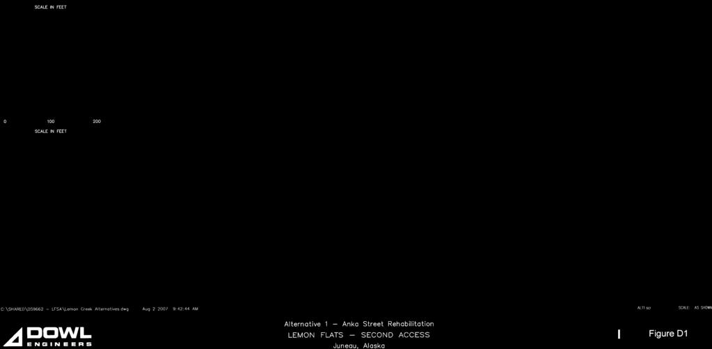
29 Scoping Summary Report Lemon Flats Second Access Juneau, Alaska W.O. D59662 Figure 1: Project Location Map and Options B - 5 Page 2
30 Scoping Summary Report Lemon Flats Second Access Juneau, Alaska W.O. D Project Team Phase I Project Personnel The project team for this project is listed below. CBJ Rorie Watts, P.E., Deputy Engineering Director Michele Elfers, Project Manager Toner-Nordling and Associates Pete Hildre, P.E., Project/Contract Manager DOWL Engineers (DOWL) Steven K Noble, P.E., Project Engineer Stephanie Mormilo, E.I.T. Jennifer Payne, Public Involvement Lead 1.3 Scoping Method The following scoping methods were included in the Public Involvement Plan and used to inform the public and local, state, and federal resource agencies about the project, its objectives, and the environmental design process: Public Scoping Meeting Agency Scoping Meeting CBJ Public Works and Facilities Commission Meeting CBJ Planning Commission Meeting B - 6 Page 3
31 Scoping Summary Report Lemon Flats Second Access Juneau, Alaska W.O. D59662 CBJ Wetland Review Board Meeting Project Information on the CBJ Website Project Address Advertisements Flyers PowerPoint Presentations and Informational Maps Mailing List for Potentially Affected Interests A mailing list has been developed for this project. The mailing list includes all property owners and residents within the project study area (Figure 2). Additionally, persons who, through the course of advertisements and scoping, expressed an interest in this project were also added to the list. Agencies/officials of local, state, and federal resource agencies, area utility representatives, and officials who have expressed an interest in the project are also included in the mailing distribution list. In addition to the mailing lists, an distribution list was created (Appendix A) Project Flyer A project flyer (Appendix A) was created by CBJ to announce the public meetings and sent to the addressees on the project mailing lists. The flyers contained graphics and text explaining the project status, informing the public of meetings, and asking for public feedback on the proposed solutions Advertisements Advertisements for the scoping meeting ran in the Juneau Empire on May 11 and May 21, 2007 (Appendix A). B - 7 Page 4

32 Scoping Summary Report Lemon Flats Second Access Juneau, Alaska W.O. D Project Website A project-specific link to CBJ s website was developed and will be maintained for the duration of the project. The link is located at The website provides a source for current project information, including meeting announcements, project details, maps, and project documents. A copy of the project website is attached in Appendix A Project Address A project-specific contact address of secondaccess@dowl.com was established to collect public comments and questions. Figure 2: Mailing List Distribution Area B - 8 Page 5
33 Scoping Summary Report Lemon Flats Second Access Juneau, Alaska W.O. D Project Comment Form A project comment form (Appendix A) was developed and distributed at the public scoping meeting to solicit public comments. The form includes information about the project and a place to add comments. 2.0 PUBLIC SCOPING 2.1 Public Scoping Meeting A Public Scoping meeting was held on May 21, 2007, at Dzantiki Heeni School in Juneau. Community members signed in and met with the project staff for one-on-one discussions in an open-house format. After the open house, Steve Noble (DOWL) gave a PowerPoint presentation about the project. At the conclusion of the presentation, the floor was opened for public questions and concerns. A copy of the presentation, meeting minutes, and sign-in sheet are included in Appendix B. 2.2 Public Works and Facilities Commission A CBJ Public Works and Facilities Commission meeting was held on Monday, May 21, Steve Noble (DOWL) gave a PowerPoint Presentation about the project and took comments from the Commission. A copy of the presentation and meeting minutes are included in Appendix B. 2.3 Planning Commission Presentation A CBJ Planning Commission meeting was held on Tuesday, May 22, Steve Noble (DOWL) gave a PowerPoint presentation about the project and took comments from the Commission. A copy of the presentation and meeting minutes are included in Appendix B. 2.4 Wetland Review Board A CBJ Wetland Review Board meeting was held on Thursday, June 7, Michele Elfers (CBJ) gave a PowerPoint presentation about the project and took comments from the Board. A copy of the presentation and meeting minutes are included in Appendix B. B - 9 Page 6
34 Scoping Summary Report Lemon Flats Second Access Juneau, Alaska W.O. D59662 Meeting summary: The board voted to support Options 1, 2, and 5 over Options 3, 3a, 4a, and 4b because these alternatives meet the purpose and need without impacting wetlands and Vanderbilt Creek. 2.5 Documentation of Public Comments All written comments received as of June 18, 2007 (the conclusion of the scoping period), are listed in Appendix C. A paraphrased list of public comments is listed below, and comments in their entirety are included in Appendix C. General Project Comments - CBJ has already made up its mind that it wants to go through the watershed. - CBJ should not take property through eminent domain. - The route should meet CBJ arterial road standards. - The Comprehensive Plan, Juneau Wetland Management Plan, and the Parks and Recreation Plan should be considered. - Seeking a second access is unneeded as traffic counts are well within acceptable traffic load limits. - There should not be more traffic lights on Glacier Highway. - Split traffic between Commercial Boulevard and Anka Street with no more lights. Alignment Comments - Option 1: Anka Street Rehab + This should not be the preferred route, even though it may be the cheapest and least destructive. B - 10 Page 7
35 Scoping Summary Report Lemon Flats Second Access Juneau, Alaska W.O. D This is the least expensive route. + This is the least environmentally damaging option. + This route should be preferred because when traffic was directed away from this route in the past, an area business was hurt. - Option 2: Concrete Way + This is a good option as it requires less money and work by the CBJ. + This seems to have the least negative impacts to businesses. + This would create a second access route. + This is a less environmentally damaging option. + This option would need a street light and to be widened. - Option 3: New Bench Road + This would be the longest, most expensive, and environmentally damaging option. + This would negatively affect the Lemon Creek Trail, Quigley Homestead, and wildlife corridor. + This would require removing a big chunk of Blackerby Ridge. + Would be an abuse of CBJ authority. + If CBJ were interested in more than a haul route, they would take this option off the table. + A road here will negatively affect the watershed and subsequently the salmon in Vanderbilt Creek. B - 11 Page 8
36 Scoping Summary Report Lemon Flats Second Access Juneau, Alaska W.O. D This option would go through four active slide areas. + Vanderbilt Creek is already an impaired water body. + A road would create more sedimentation, pollution, and potential water flow problems that would further degrade Vanderbilt Creek as a salmon rearing stream. + This would negatively affect businesses by routing potential customers away from businesses. + This route negatively affects wetlands. + There needs to be more monitoring of Vanderbilt Creek in terms of water quality and the presence of fish. + This would create a safety problem for residents if trucks were to travel in the area. + The Lemon Creek Trail is a Forest Service Trail that has been in existence in this location since Options 3 or 3A would obliterate the entire length of the lower Lemon Creek Trail that runs parallel to Vanderbilt Creek. + This is the best route because there is not an intersection on a curve and is straight along Glacier Highway that makes for safe turning movements. + This route is a good long-term option, is the most truly independent route for future development, and is on firm ground. + The best route is from Short Street up to Charles Way, as it will minimize traffic impacts on area businesses and will not affect residential properties directly. + This route should connect to the northern Lemon Flats. B - 12 Page 9
37 Scoping Summary Report Lemon Flats Second Access Juneau, Alaska W.O. D There should be an established truck route from Home Depot to Glacier Highway and Mapco. - Option 4: Borrow Street Extension + This will go through a residential property. - Option 5: Davis/Anka Bridge + This might exacerbate traffic problems on Anka Street. + This option drives commercial traffic to a residential area. + Davis Avenue is already too well used with no signal at the Glacier Highway intersection. + This would give felons in the halfway house on Anka Street easy access to the residential area. + This area is already too dangerous for bicycles. + This option would provide a pedestrian route. - Option 6: Northern Lemon Creek Bridge + This option is for the materials site, not a second access. + We would like to see this option connected to the bench road. 3.0 AGENCY SCOPING 3.1 Agency Scoping Meeting The agency scoping meeting was held on Tuesday, May 22, 2007, in Juneau, Alaska. An invitation that provided background information on the project was sent to the agencies inviting them to comment on the project and participate in the scoping meeting. The letter, B - 13 Page 10
38 Scoping Summary Report Lemon Flats Second Access Juneau, Alaska W.O. D59662 invitation list, and a copy of the presentation, meeting minutes, and attendance list are included in Appendix D. Those in attendance were: Carolyn Morehouse, DOT&PF Fred Thorstenson, DOT&PF Eric Eriksen, Alaska Electric Light and Power (AEL&P) Rich Etheridge, CBJ Neil Barten, Alaska Department of Fish and Game Dennis Townsend, Alaska Communication Systems Mike Scott, CBJ, Traffic Jerry Nankervis, Juneau Police Department (JPD) Davis Hawes, DOT&PF Heather Marlow, CBJ, Planning Michele Elfers, CBJ Steve Noble, DOWL Stephanie Mormilo, DOWL Jennifer Payne, DOWL Comments at the meeting included: Look at taking out the Anka Street signal and placing one at Concrete Way. There is an active falconer near the trail site right under Option 3a. B - 14 Page 11
39 Scoping Summary Report Lemon Flats Second Access Juneau, Alaska W.O. D59662 Home Depot is already building a small section of Option 3. It would be attractive to build it for those accessing the business. Option 3 would probably drive people from the Sunny Point and Fred Meyer Glacier Highway access point onto the Western Auto access point. Options 3 and 3a are more attractive to the Juneau Fire Department (JFD) because they would give access to residential areas. Currently JFD has to use four-by-four vehicles to access these areas. The Charles and Commercial Boulevard would give JFD a second entrance into the area which would be helpful for response times if the other road is blocked. The start of a curve is a bad place for access. Option 4 has the most wetland impact. Option 5 would bring traffic to a residential area. Option 5 may add more traffic to Anka Street. A pedestrian bridge at Option 5 may make sense. The Comprehensive Plan shows a road going behind Switzer Creek. CBJ is going to develop those lands someday and needs access. The truck route this project is proposing does not match with the Comprehensive Plan for the Switzer Creek access route. Capital Transit should be included in the planning discussion. The team should wait until Home Depot opens to see if the projected traffic numbers come true before there is a plan to build something. Has the project team considered eliminating the intersection at Anka Street and servicing it as a frontage road? B - 15 Page 12
40 Scoping Summary Report Lemon Flats Second Access Juneau, Alaska W.O. D59662 Agency Written Comments: Various agencies provided written comments to the project team (Appendix E). The following is a summary of the comments: Alaska Electric Light & Power (AEL&P) AEL&P is currently coordinating with the CBJ about providing service to a new impound yard beyond the Lemon Creek Correctional Center. AEL&P is in the process of extending its electrical system across the temporary bridge installation that crosses Lemon Creek. A permanent crossing at Option 6 (northern crossing of Lemon Creek) will allow AEL&P to best serve both the residential side and industrial side of Lemon Creek. AEL&P also supports Option 6 (northern crossing of Lemon Creek) being connected to Option 3 (bench road). State of Alaska Department of Environmental Conservation (DEC) Lemon Creek has a total maximum daily load for sediment and turbidity. As a result, best management practices from construction site activities would need to be implemented to ensure that the project does not contribute to existing sediment and turbidity levels. Vanderbilt Creek is also listed as an impaired water body for sediment, turbidity, and residues. The Juneau Watershed Partnership (JWP) is currently working with an American Clean Water Association (ACWA) grant to develop monitoring strategies for both Lemon and Vanderbilt Creeks, and it is likely that ACWA funding will be available for the sampling of Vanderbilt Creek in Fiscal Year Juneau Police Department (JPD) The best route is from the Short Street intersection with Glacier Highway up along Option 3 (bench) and connecting to Option 3a onto Charles Way. B - 16 Page 13
41 Scoping Summary Report Lemon Flats Second Access Juneau, Alaska W.O. D There is a straightaway along Glacier Highway that makes for safe turning, whereas the Concrete Way option is more dangerous because it is on a curve and close to Davis Avenue. 2. This route will minimize traffic impacts on existing businesses. 3. This route will not directly affect any residential properties. JPD does not think Option 5 (Davis Avenue) is a good option because there are many people that live in this area and there is already a lot of traffic. JPD does not like the Option 4a (Borrow Street) because there are private property owners who will be affected. CBJ Municipal Sewer Utilities There are no existing sewer lines in the area of Options 3, 3a, or 4a. Currently, there are some properties in this area that currently have no sewer service. Juneau Watershed Partnership (JWP) The JWP favors Option 2 as it has the least impact to Lemon and Vanderbilt Creeks. It recommends further evaluation of the purpose and need for a bench road and, if it is justified, the Partnership suggests Option 3a be considered for further review. If any option other than 1 or 2 is to be considered, more information on fish habitat and wetlands should be gathered and studied to allow maximum protection of these assets. Juneau Fire Department (JFD) The JFD fully supports the project and favors Options 3 to 3a. United States Coast Guard (USCG) The USCG expressed concerns about the project negatively affecting their property at 4845 Glacier Highway. B - 17 Page 14
42 Scoping Summary Report Lemon Flats Second Access Juneau, Alaska W.O. D59662 Fish and Wildlife Service (FWS) The FWS supports the further evaluation of Options 1 and 2. The FWS asserted that Options 3 and 4 will have impacts on Vanderbilt Creek, its tributaries, and wetlands to some degree; with Option 4b having the least impact and Options 3, 3a, and 4a having higher impacts. The FWS would like the project team to further evaluate: A total survey of the area. Work with state and federal biologists to determine upstream extent of fish habitat in the watershed. Evaluate how the perennial backslope drainage from the Home Depot site and the existing tributary streams will be accommodated by any potential road crossing. Create an overlay map with associated impact analysis matrix. 4.0 SUMMARY The above public and agency comments provide valuable insight into the issues to be resolved during the project and investigated for the Reconnaissance Report. Comments received after the end of the scoping period June 18, 2007 will also be reviewed by the team and included in the Reconnaissance Report. B - 18 Page 15
43 APPENDIX C Public Involvement Plan
44 LEMON FLATS SECOND ACCESS PUBLIC INVOLVEMENT PLAN-PHASE I Overview The Lemon Flats Commercial Districts (LFCD) is one of the fastest developing areas in Juneau, Alaska. The single access into the LFCD is the Anka Street/Glacier Highway intersection. This existing access will not meet the projected traffic demand over the next 20 years and does not enable heavier commercial traffic to be separated from the pedestrian and light commercial traffic that also access this area. Project objective: complete the planning and design efforts for a second access into the LFCD that will resolve the safety and congestion concerns associated with the existing access. The objective is planned to occur in three phases. Phase I is a planning and scoping period that will identify access alternatives and will culminate in a Reconnaissance Report that evaluates the identified alternatives. After funding is identified, Phase II will be a preliminary design and environmental phase. The third phase is final design. Purpose of the Public Involvement Plan This public involvement and scoping plan provides a framework for soliciting public and resource agency input on the Lemon Flats Second Access project. The project team members are committed to keeping the public informed, having no lapses in coordination, maintaining a brisk project pace, being ready to respond to pertinent comments and questions in a timely manner, and using state-of-the-art tools and approaches. This public involvement plan will be continually updated and revised as needed during the project. Numerous groups and individuals may be interested in how the project will be designed and constructed. The objective of the public involvement program is to work directly with the interested public through Phase I (Reconnaissance Report) so that their issues and concerns are consistently understood and considered. C - 1 Page 1
45 Public Participation Goals Guidelines for a successful public involvement process include the following: The City and Borough of Juneau (CBJ) and DOWL Engineers (DOWL) will keep the public informed, listen to and acknowledge concerns, and provide feedback on how public input has influenced project decisions. Various means will be used to keep the public informed. Attention will be paid to the best ways to reach and listen to all groups. Information will be shared openly and directly to help people become familiar with the issues and the process. The project team and participants will take time to try to understand different points of view and to resolve issues that arise along the way. Milestones in the process will be clearly defined and acknowledged. Efforts will be made up front to clarify the goals and expectations for public input into the project. The roles of the technical team and the public will be clearly explained. Aspects of the project that are technical in nature will be clearly identified as such. The public will be encouraged to provide input and collaborate with the team on appropriate design issues. Potentially Affected Interests The public involvement process for the project will include the following groups. General Public The general public mailing list includes all property owners and residents within the project study area (Figure 1). During the project, members of the public living outside the area that comment on the project or attend public meetings will be added to the mailing list. Additionally, the following agencies/representatives will be included in the general project mailing list: C - 2 Page 2
46 Federal Government Environmental Protection Agency (EPA) United States Fish and Wildlife Service (USFWS) United States Army Corps of Engineers (USACE) State of Alaska State of Alaska Department of Transportation and Public Facilities (DOT&PF) State of Alaska Department of Environmental Conservation (DEC) State of Alaska Department of Natural Resources (DNR): Office of Habitat Management and Permitting Office of Project Management and Permitting Office of History and Archaeology Alaska Department of Fish and Game (ADF&G) Alaska Senator Kim Elton Alaska Representative Beth Kerttula Alaska Representative Andrea Doll City and Borough of Juneau Mayor Bruce Botelho Assembly Member Robert Bob Doll Assembly Member Johan Dybdahl Assembly Member Jeff Bush Assembly Member Merrill Sanford Assembly Member David G. Stone Assembly Member Randy Wanamaker Assembly Member Jonathan Anderson Assembly Member Sara Chambers C - 3 Page 3
47 Other Interested Parties Capital Transit Local Utility Companies AEL&P (electric) ACS (phone) GCI (phone and cable) CBJ Public Works (water) CBJ Wastewater Utilities (sewer) CBJ Street Department Comprehensive Mailing List An expanded mailing list will be developed that incorporates the above potentially affected interests and additional listings of groups or individuals that have been asked to be included in all project mailings. Phase I Project Personnel Key personnel from the project team that will be involved in the public and agency involvement portion of the project include: City and Borough of Juneau Rorie Watts, P.E., Deputy Engineering Director Michele Elfers, Project Manager Toner-Nordling and Associates Pete Hildre, P.E., Project/Contract Manager DOWL s Project Team Steve Noble, P.E., PTOE - Phase 1 Task Leader Jennifer Payne - Public Involvement Lead C - 4 Page 4
48 Public Involvement Opportunities Numerous methods of reaching the public for input and involvement will be employed on this project. Public Scoping Meetings A public Scoping meeting will be on May 21, 2007, at Dzantiki Heeni School in Juneau, 6:30 p.m. to 9 p.m. The public meeting will be advertised twice in the Juneau Empire; once on May 7, 2007, and again on May 21, A flyer announcing the meeting will be sent to the project mailing list. Public Works and Facilities Commission Monday, May 21, 2007 Noon 1 p.m. PW&FC Public Works and Facilities Committee: Bob Doll, Chair; Merrill Sanford, Deputy Mayor; Jonathan Anderson, Assembly Member; David Stone, Assembly Member. Planning Commission Presentation Tuesday, May 22, 2007, 7 p.m. to 11 p.m. Planning Commission: Dan Bruce, Chair; Maria Gladziszewski, Clerk; Marshal Kendziorek, Vice Chair; Dan Miller, Frank Rue, Michael Satre, Linda Snow, Nancy Waterman, Vice Clerk, Dennis Watson. Agency Meeting Tuesday, May 22, 2007, 10 a.m. to 11:30 a.m. Contact Address A project-specific contact address of secondaccess@dowl.com has been established to collect public comments and questions. It will be checked each business day. Project Website A project-specific link to CBJ s website will be developed and maintained for the duration of the project. The link will be located at C - 5 Page 5
49 The website will provide a source for current project information including meeting announcements, project details, maps, and project documents. Project Flyers A project flyer will be created by CBJ to announce the public meetings and sent to the established mailing list. The flyers will contain graphics and text explaining the project status, informing the public of meetings, and asking for public feedback on the proposed solutions. C - 6 Page 6
50 APPENDIX D Alternative Plan and Profiles

51 Appendix D -1
52 Appendix D -2
53 Appendix D -3

54 Appendix D -4
55 Appendix D -5
56 Appendix D -6
57 Appendix D -7
58 Appendix D -8
59 Appendix D -9
60 Appendix D -10
61 Appendix D -11
62 Appendix D -12
63 APPENDIX E Lemon Flats Commercial District Extract from Comprehensive Plan


64 Appendix E -1
65 APPENDIX F Level of Service Definitions
66 Lemon Flats Second Access Reconnaissance Study Juneau, Alaska W.O. D59662 Level of Service (LOS) is a qualitative measure that describes the operating conditions within an intersection or roadway section, and the perception of those conditions by the facility s users. The factors used to measure the level of service provided by any given facility, might include any or all of the following: User comfort Convenience Travel time Maneuverability Interruptions in traffic Speed Cost Number of stops Fuel Consumption Every type of facility (intersections, freeway segment, arterial, or pedestrian) has different operating parameters that are used to determine its level of service. For intersections, the primary operating parameter is average control delay per vehicle defined in units of seconds per vehicle. There are six levels of service defined for each facility type. Each level has a letter identification from A to F with LOS A representing the best operating conditions and LOS F the worst. SIGNALIZED INTERSECTIONS The delay experienced by motorists in a signalized intersection is effected by a number of factors related to geometrics, traffic, control, and incidents. The total delay is defined as the difference between the actual travel time and travel time that would result from ideal conditions. An ideal signalized intersection has 12-foot (3.6 meter) lane widths, level grade, no curb parking, only passenger cars in the traffic stream, no turning movements, green signal available all the time, and is located outside the central business district. For signalized intersections, only the portion of total delay associated with control is measured. This delay is referred to as control delay and includes the following: initial deceleration delay, queue move-up time, stopped delay, and final acceleration delay. Table 1 summarizes the 2000 Highway Capacity Manual s description of the six LOSs for a signalized intersection. Appendix F - Page 1
67 Lemon Flats Second Access Reconnaissance Study Juneau, Alaska W.O. D59662 Table 1: Level of Service Criteria for Signalized Intersections LOS Average Delay per Vehicle A B C D E F Very low control delay, 10 or less seconds per vehicle; progression is very favorable; most vehicles arrive during the green cycle; most vehicles do not stop. Short cycle lengths may also contribute to low delay. Control delay greater than 10 and up to 20 seconds per vehicle; progression is good and/or cycle lengths are short. More vehicles stop than for LOS A, causing higher levels of average delay. Control delay greater than 20 and up to 25 seconds per vehicle; progression is fair and/or cycle lengths are longer. Individual cycle failures may begin to appear at this level. The number of vehicles stopping is significant, though many vehicles still pass through without stopping. Control delay greater than 35 and up to 55 seconds per vehicle; progression is unfavorable, cycle lengths are long, or has a high flow rate to capacity ratio. Many vehicles stop, and the proportion of vehicles not stopping diminishes. Individual cycle failures are obvious. Control delay greater than 55 and up to 80 seconds per vehicle; progression is poor, cycle lengths are long, and has a high flow rate to capacity ratio. Individual cycle failures are frequent occurrences. Control delay greater than 80 seconds per vehicle; progression is very poor, cycle lengths are long. Many individual cycle failures. Arrival flow rates exceed the capacity of the intersection. This level is considered unacceptable to most drivers. UNSIGNALIZED INTERSECTIONS The two types of unsignalized intersections include two-way stop-controlled (TWSC) and all-way stop-controlled (AWSC) intersections. The LOS for a TWSC intersection is defined by control delay for each minor approach and major street left-turn movement rather than the overall intersection. The LOS for an AWSC intersection is defined by control delay for the intersection as a while. The delay range for unsignalized intersections are different from those for signalized intersections primarily due to driver expectation. The expectation is that signalized intersections are designed to carry higher volumes of traffic and therefore higher levels of delay are acceptable. Table 2 summarizes the 2000 Highway Capacity Manual s description of the six LOSs for an unsignalized intersection. Appendix F - Page 2
68 Lemon Flats Second Access Reconnaissance Study Juneau, Alaska W.O. D59662 Table 2: Level of Service Criteria for Unsignalized Intersections LOS Average Delay per Vehicle A Very low control delay, 10 or less seconds per vehicle. All drivers find freedom of operation. Very rarely more than one vehicle in queue. B Control delay great than 10 and up to 15 seconds per vehicle. Some drivers begin to consider the delay troublesome. Seldom is there more than one vehicle in queue. C D E F Control delay greater than 15 and up to 25 seconds per vehicle. Most drivers feel restricted, but tolerably so. Often there is more than one vehicle in queue. Control delay is greater than 25 and up to 35 seconds per vehicle. Drivers feel restricted. Most often, there is more than one vehicle in queue. Control delay greater than 35 and up to 50 seconds per vehicle. Drivers find delays approaching intolerable levels. There is frequently more than one vehicle is queue. This level denotes a state in which the demand is close or equal to the probable maximum number of vehicles that can be accommodated by the movement. Control delay in excess of 50 seconds per vehicle. Very constrained flow. Represents an intersection failure situation that is caused by geometry and/or operational constraints external to the intersection. SUMMARY The average control delay for signalized and unsignalized intersections is summarized in Table 3. Table 3: Summary of Average Control Delay per Vehicle (in seconds) for Signalized and Unsignalized Intersections LOS Unsignalized Intersections Signalized Intersections A B > 10 and 15 > 10 and 20 C > 15 and 25 > 20 and 35 D > 25 and 35 > 35 and 55 E > 35 and 50 > 55 and 80 F > 50 > 80 Appendix F - Page 3


69
HCM Unsignalized Intersection Capacity Analysis 6: Brian Street & LC 111 5/26/2009
 6: Brian Street & LC 111 5/26/2009 Movement EBL EBR NBL NBT SBT SBR Volume (veh/h) 116 20 8 405 137 56 Sign Control Stop Free Free Grade 0% 0% 0% Peak Hour Factor 0.81 0.81 0.67 0.67 0.89 0.89 Hourly flow
886 March Road McDonald's Transportation Study
 McDonald's Restaurants of Canada Limited March 2013 886 March Road McDonald's Transportation Study Submitted by: HDR Corporation 100 York Boulevard, Suite 300 Richmond Hill, ON L4B 1J8 (905) 882-4100 www.hdrinc.com
Village of Richmond Transportation Brief
 Village of Richmond Transportation Brief GENIVAR Project Number 111-18482-00 June 21 st, 2011 www.genivar.com GENIVAR 15 Fitzgerald Road, Suite 100 Ottawa, Ontario, CANADA K2H 9G1 Telephone: 613-829-2800
MEMORANDUM. Date: November 4, Cheryl Burrell, Pebble Beach Company. Rob Rees, P.E. Inclusionary Housing Transportation Analysis WC
 MEMORANDUM Date: November 4, 2013 To: From: Subject: Cheryl Burrell, Pebble Beach Company Rob Rees, P.E. Inclusionary Housing Transportation Analysis As requested, Fehr & Peers is providing clarification
Sugarland Crossing Gwinnett County, Georgia
 Sugarland Crossing Gwinnett County, Georgia S IGNAL W ARRANT A NALYSIS For the Intersection of: Sugarloaf Parkway / Richards Middle School Driveway / Sugarland Crossing Main Site Driveway Prepared for:
TECHNICAL MEMORANDUM Upper Broadway Road Diet Summary of Findings
 TECHNICAL MEMORANDUM Summary of Findings Date: June 17, 2014 Project #: 17121.15 To: Si Lau, P.E.; City of Oakland, CA From: Erin Ferguson, P.E.; Aaron Elias, P.E.; Daphne Dethier; and Mark Bowman, P.E.;
APPENDIX G. Traffic Data
 APPENDIX G Traffic Data HCM Signalized Intersection Capacity Analysis 2: Duanesburg Road & I-88 Ramps 10/7/2004 Movement EBL EBT EBR WBL WBT WBR NBL NBT NBR SBL SBT SBR Lane Configurations Ideal Flow (vphpl)
APPENDICES. APPENDIX D Synchro Level of Service Output Sheets
 APPENDICES APPENDIX D Synchro Level of Service Output Sheets Lanes, Volumes, Timings NO BUILD 2016 PM 8: 10th St & Thain Rd 10/05/2016 Lane Group NBL NBT NBR SBL SBT SBR SEL SET SER NWL NWT NWR
(A) Project Manager, Infrastructure Approvals
 Project Manager, Infrastructure Approvals") February 14th, 2014 BY E-MAIL: wally.dubyk@ottawa.ca City of Ottawa Planning and Growth Management Branch 110 Laurier Ave. W., 4 th Floor, Ottawa, Ontario K1P 1J1 Attention: Wally Dubyk, C.E.T (A) Project
February 14th, 2014 BY E-MAIL: wally.dubyk@ottawa.ca City of Ottawa Planning and Growth Management Branch 110 Laurier Ave. W., 4 th Floor, Ottawa, Ontario K1P 1J1 Attention: Wally Dubyk, C.E.T (A) Project
ZINFANDEL LANE / SILVERADO TRAIL INTERSECTION TRAFFIC ANALYSIS
 ZINFANDEL LANE / SILVERADO TRAIL INTERSECTION TRAFFIC ANALYSIS UPDATED TRAFFIC STUDY FOR THE PROPOSED RAYMOND VINEYARDS WINERY USE PERMIT MODIFICATION #P11-00156 AUGUST 5, 2014 PREPARED BY: OMNI-MEANS,
 Traffic Analysis For Approved Uses within the St. Lucie West DRI Aldi Port St. Lucie, FL Prepared for: Bohler Engineering, LLC 1000 Corporate Drive Suite 250 Fort Lauderdale, FL 33334 Prepared by: 10795
L1TILE BEARS DAY CARE TRANSPORTATION IMPACT STUDY FORT COLLINS, COLORADO MAY Prepared for:
 L1TILE BEARS DAY CARE TRANSPORTATION IMPACT STUDY FORT COLLINS, COLORADO MAY 2012 Prepared for: Hillside Construction, Inc. 216 Hemlock Street, Suite B Fort Collins, CO 80534 Prepared by: DELICH ASSOCIATES
Barrhaven Honda Dealership. Dealership Drive, Ottawa, ON. Transportation Brief
 Barrhaven Honda Dealership Dealership Drive, Ottawa, ON Transportation Brief Prepared By: NOVATECH Suite 200, 240 Michael Cowpland Drive Ottawa, Ontario K2M 1P6 September, 2015 File: 115136 Ref: R-2015-152
RESPONSE TO TRAFFIC IMPACT STUDY COMMENTS
 RESPONSE TO TRAFFIC IMPACT STUDY COMMENTS Proposed Gas Station 40 Arthur Street (Highway 26), Town of the Blue Mountains (Thornbury), County of Grey, Ontario AUGUST 2013 August 27, 2013 MR. REG RUSSWURM
Traffic Impact Study Proposed Commercial Development Ballwin, Missouri. Technical Memorandum for Traffic Impact Study
 Traffic Impact Study Proposed Commercial Development Ballwin, Missouri Technical Memorandum for Traffic Impact Study Crawford, Bunte, Brammeier May 1, 2009 MEMORANDUM Date: April 24, 2009 To: From: Subject:
Weaver Road Senior Housing Traffic Impact Analysis
 Gibson Traffic Consultants, Inc. 2813 Rockefeller Avenue Suite B Everett, WA 9821 425.339.8266 Weaver Road Senior Housing Traffic Impact Analysis Jurisdiction: City of Snohomish January 218 GTC #17-37
MURRIETA APARTMENTS TRAFFIC IMPACT ANALYSIS CITY OF MURRIETA, CALIFORNIA
 MURRIETA APARTMENTS TRAFFIC IMPACT ANALYSIS CITY OF MURRIETA, CALIFORNIA SEPTEMBER 20, 2012 Prepared for: Golden Eagle Multi-Family Properties, LLC 6201 Oak Canyon Rd., Suite 250 Irvine, CA 92618 Prepared
Provide an overview of the development proposal including projected site traffic volumes;
 December 19, 2013 File: 163600935 Attention: Troy Elliott Carl Elliott Limited 15-1831 Robertson Road PO Box 11117 Nepean, Ontario K1H 7T8 Dear Mr. Elliott, Reference: 2235 and 2265 Robertson Road Transportation
LOST LAKE CORRIDOR REVIEW
 LOST LAKE CORRIDOR REVIEW Prepared for: Prepared by: Broadview Developments Inc. c/o Westbrook Consulting Watt Consulting Group Our File: 2064.B01 Date: October 31, 2016 TABLE OF CONTENTS 1.0 INTRODUCTION...
KUM & GO 6400 WESTOWN PARKWAY WEST DES MOINES, IOWA 50266
 KUM & GO #300 PECOS STREET & 88 TH AVENUE THORNTON, COLORADO TRAFFIC IMPACT STUDY REVISION 1 PREPARED FOR KUM & GO 6400 WESTOWN PARKWAY WEST DES MOINES, IOWA 50266 JANUARY 23, 2014 OA PROJECT NO. 013-1721
TRAFFIC IMPACT STUDY DERRY GREEN CORPORATE BUSINESS PARK MILTON SECONDARY PLAN MODIFICATION
 TRAFFIC IMPACT STUDY DERRY GREEN CORPORATE BUSINESS PARK MILTON SECONDARY PLAN MODIFICATION TRAFFIC IMPACT STUDY DERRY GREEN CORPORATE BUSINESS PARK MILTON SECONDARY PLAN MODIFICATION DECEMBER 2014 UPDATED
Traffic Impact Study Hudson Street Parking Garage MC Project No.: A Table of Contents
 Traffic Impact Study Hudson Street Parking Garage MC Project No.: 15001714A Table of Contents Table of Contents I. INTRODUCTION... 1 II. EXISTING CONDITIONS... 4 III. 2015 EXISTING TRAFFIC CONDITIONS...
Sweetwater Landing Traffic Impact Analysis
 Gibson Traffic Consultants, Inc. 8 Rockefeller Avenue Suite B Everett, WA 98 45.9.8 Sweetwater Landing Traffic Impact Analysis Jurisdiction: City of Snohomish February 8 GTC #7-87 Sweetwater Landing Traffic
LATSON INTERCHANGE DEVELOPMENT TRAFFIC STUDIES. Genoa Township, Livingston County, MI
 LATSON INTERCHANGE DEVELOPMENT TRAFFIC STUDIES Genoa Township, Livingston County, MI DRAFT TRAFFIC STUDY FOR I-96 AT LATSON RD INTERCHANGE Livingston County CS 47065 JN 101622C Submitted to: Michigan Department
Ref. No Task 3. April 28, Mr. Cesar Saleh, P. Eng. VP Planning and Design W.M. Fares Group th
 Ref. No. 151-00564 Task 3 April 28, 2015 Mr. Cesar Saleh, P. Eng. VP Planning and Design W.M. Fares Group th 3480 Joseph Howe Drive, 5 Floor HALIFAX NS B3L 4H7 Sent via Email to ceasr.saleh@wmfares.com
Zachary Bugg, PhD, Diego Arguea, PE, and Phill Worth University of Oregon North Campus Conditional Use Permit Application Transportation Assessment
 MEMORANDUM Date: June 22, 2018 Project #: 21562 To: Colin McArthur, AICP From: Project: Subject: Zachary Bugg, PhD, Diego Arguea, PE, and Phill Worth University of Oregon North Campus Conditional Use Permit
MEMO. McCORMICK RANKIN CORPORATION. File FROM: Keyur Shah DATE: February 1, 2010 COPIES: OUR FILE: SUBJECT: TO:
 McCORMICK RANKIN CORPORATION 2655 North Sheridan Way Mississauga, Ontario, L5K 2P8 Tel: (905)823-8500 Fax: (905) 823-8503 E-mail: mrc@mrc.ca Website: www.mrc.ca MEMO TO: File FROM: Keyur Shah DATE: February
ARVADA TRIANGLE REDEVELOPMENT TRAFFIC IMPACT ANALYSIS
 ARVADA TRIANGLE REDEVELOPMENT TRAFFIC IMPACT ANALYSIS Prepared for: Arvada Urban Renewal Authority 5601 Olde Wadsworth Boulevard, Suite 210 Arvada, Colorado 80002 (720) 898-7062 Prepared by: Felsburg Holt
Interstate 80 Corridor Study
 Interstate 80 Corridor Study Final Technical Memorandum 5: Traffic Volumes, Accident Locations and Operational Deficiencies West Verdi (SR 425) Interchange to West McCarran Boulevard (SR 651) and East
Table 1 - Land Use Comparisons - Proposed King s Wharf Development. Retail (SF) Office (SF) 354 6,000 10, Land Uses 1
 Office (SF) 354 6,000 10, Land Uses 1") Ref. No. 171-6694 Phase 2 November 23, 217 Mr. David Quilichini, Vice President Fares & Co. Developments Inc. 31 Place Keelson Sales Centre DARTMOUTH NS B2Y C1 Sent Via Email to David@faresinc.com RE:
Ref. No. 171-6694 Phase 2 November 23, 217 Mr. David Quilichini, Vice President Fares & Co. Developments Inc. 31 Place Keelson Sales Centre DARTMOUTH NS B2Y C1 Sent Via Email to David@faresinc.com RE:
TRAFFIC AND TRANSPORTATION TECHNICAL MEMORANDUM
 TRAFFIC AND TRANSPORTATION TECHNICAL MEMORANDUM for ENVIRONMENTAL ASSESSMENT US 460 Bypass Interchange and Southgate Drive Relocation State Project No.: 0460-150-204, P101, R201, C501, B601; UPC 99425
JRL consulting. March Hartland Developments Limited 1993 Hammonds Plains Road Hammonds Plains, NS B4B 1P3
 March 2015 Prepared for Hartland Developments Limited 1993 Hammonds Plains Road Hammonds Plains, NS B4B 1P3 JRL consulting JRL consulting TABLE OF CONTENTS 1 INTRODUCTION... 2 1.1 BACKGROUND... 2 2 EXISTING
10 th Street Residences Development Traffic Impact Analysis
 Gibson Traffic Consultants, Inc. 2813 Rockefeller Avenue Suite B Everett, WA 98201 425.339.8266 10 th Street Residences Development Traffic Impact Analysis Jurisdiction: City of Snohomish September 2018
Lakeside Terrace Development
 Lakeside Terrace Development City of Barrie, County of Simcoe Traffic Brief for: Type of Document: Final Report Project Number: JDE 1617 Date Submitted: April 29 th, 216 4/29/16 John Northcote, P.Eng.
Addendum to Traffic Impact Analysis for Port Marigny Site Mandeville, LA
 Addendum to Traffic Impact Analysis for Port Marigny Site Mandeville, LA (St. Tammany Parish Mandeville, LA) Prepared For The Pittman Companies Michael N Pittman, MD 328 East Boston St Covington, LA 70433
April Salvation Army Barrhaven Church 102 Bill Leathem Drive Transportation Brief
 April 26 Salvation Army Barrhaven Church 2 Bill Leathem Drive Transportation Brief Salvation Army Barrhaven Church 2 Bill Leathem Drive Transportation Brief prepared for: The Salvation Army 2 Overlea Blvd.
Appendix B: Traffic Reports
 Appendix B: Traffic Reports 407 TRANSITWAY - KENNEDY ROAD TO BROCK ROAD MINISTRY OF TRANSPORTATION - CENTRAL REGION Report Markham Road Station Traffic Study Prepared for Ministry of Transportation, Ontario
MMM Group Limited. Communities. Transportation. Buildings. Infrastructure
 MMM Group Limited Traffic Study CASA MIA Community Care Facility Vancouver, BC Communities Transportation Buildings Infrastructure February 2013 5011001-033 STANDARD LIMITATIONS This report was prepared
Proposed Office Building Traffic Impact Study Chicago Avenue Evanston, Illinois
 Proposed Office Building Traffic Impact Study 1714-1720 Chicago Avenue Evanston, Illinois Prepared For: HOLABIRD & ROOT, LLC Prepared by: Eriksson Engineering Associates, Ltd. 145 Commerce Drive, Ste A,
Traffic Impact Study. Eastern Springs. A Proposed Development in Manorville, NY. April Haas Group Inc Transportation Planners and Engineers
 Traffic Impact Study For Eastern Springs A Proposed Development in Manorville, NY April 2018 Haas Group Inc Transportation Planners and Engineers Table of Contents 1) Executive Summary... 2 2) Study Purpose...
Bennett Pit. Traffic Impact Study. J&T Consulting, Inc. Weld County, Colorado. March 3, 2017
 Bennett Pit Traffic Impact Study J&T Consulting, Inc. Weld County, Colorado March 3, 217 Prepared By: Sustainable Traffic Solutions, Inc. http://www.sustainabletrafficsolutions.com/ Joseph L. Henderson,
STANDARD LIMITATIONS
 STANDARD LIMITATIONS This report was prepared by MMM Group (MMM) for the account of Spire Construction Inc. (the Client). The disclosure of any information contained in this report is the sole responsibility
C. iv) Analysis/Results
 Analysis/Results") The Pettengill Road project is located outside the borders of the model in an external zone. As a result, inserting all Pettengill Road trip generation assumptions into the NRPC model and running a new
The Pettengill Road project is located outside the borders of the model in an external zone. As a result, inserting all Pettengill Road trip generation assumptions into the NRPC model and running a new
Traffic Impact Analysis Farmington Center Village
 Traffic Impact Analysis Farmington Center Village Route 4 (Farmington Avenue) Farmington, Connecticut Prepared for: The Town of Farmington, CT Prepared By: BL Companies Meriden, Connecticut December 2016
MEMORANDUM November 19, 2012
 COUNCIL OF GOVERNMENTS CENTRAL NAUGATUCK VALLEY 60 NORTH MAIN ST 3RD Floor WATERBURY, CT 06702-1403 (203)757-0535 Web Site: www.cogcnv.org E-Mail: cogcnv@cogcnv.org November 19, 2012 MEMORANDUM 111912
One Harbor Point Residential
 Residential Gig Harbor, WA Transportation Impact Analysis January 23, 2017 Prepared for: Neil Walter Company PO Box 2181 Tacoma, WA 98401 Prepared by: TENW Transportation Engineering NorthWest 11400 SE
Final Technical Report US 17 Corridor Study Update (Market Street Road Diet)
") Market Street Road Diet Wilmington, NC 2016 Final Technical Report US 17 Corridor Study Update (Market Street Road Diet) Wilmington, NC Parsons Brinckerhoff January 2016 FINAL TECHNICAL REPORT US 17 Corridor
Market Street Road Diet Wilmington, NC 2016 Final Technical Report US 17 Corridor Study Update (Market Street Road Diet) Wilmington, NC Parsons Brinckerhoff January 2016 FINAL TECHNICAL REPORT US 17 Corridor
Minto Mahogany Stage 2
 Minto Mahogany Stage 2 Transportation Impact Study prepared for: Minto Developments Inc 200-180 Kent Street Ottawa, ON K1P 0B6 prepared by: 1223 Michael Street Suite 100 Ottawa, ON K1J 7T2 June 27, 2017
CastleGlenn Consultants Inc.
 CastleGlenn Consultants Inc. Engineers, Project Managers & Planners March 11 th, 2013 Domenic Idone, P. Eng Planning Manager R.W. Tomlinson Ltd. 5597 Power Road Ottawa, Ontario K1G 3N4 Dear Mr. Idone:
Traffic Impact Study Morgan Road Commerce Park Pasco County, Florida
 Traffic Impact Study Morgan Road Commerce Park Pasco County, Florida Summary Report June 2008 Prepared by: 12909 N 56 th Street # 201 Tampa, FL 33617 Ph: (813) 988-3180 Fax: (813) 343-6854 Morgan Road
700 Hunt Club Road. Transportation Impact Study - Addendum #1. Submitted by:
 700 Hunt Club Road Transportation Impact Study - Addendum #1 Submitted by: 14 June 2013 1223 Michael Street, Suite 100, Ottawa, ON K1J 7T2 Tel: 613.738.4160 Fax: 613.739.7105 www.delcan.com 14 June 2013
Rockingham Ridge Plaza Commercial Development Halifax Regional Municipality
 Rockingham Ridge Plaza Commercial Development Halifax Regional Municipality Traffic Impact Study Final Draft Report Prepared by: GRIFFIN transportation group inc. 30 Bonny View Drive Fall River, NS B2T
Paisley & Whitelaw - Paisley Park OPA / ZBA for Mixed Density Residential Use
 Paisley & Whitelaw - Paisley Park OPA / ZBA for Mixed Density Residential Use Transportation Impact Study City of Guelph Prepared for: Armel Corporation August 2018 Table of Contents 1 Introduction...
Wellings Communities Holding Inc and Extendicare (Canada) Inc Hazeldean Road. Transportation Impact Study. Ottawa, Ontario. Project ID
 Inc Hazeldean Road. Transportation Impact Study. Ottawa, Ontario. Project ID") Wellings Communities Holding Inc and Extendicare (Canada) Inc. 5731 Hazeldean Road Transportation Impact Study Ottawa, Ontario Project ID 160401195 Prepared by: Stantec Consulting Ltd. March 2016 WELLINGS
Wellings Communities Holding Inc and Extendicare (Canada) Inc. 5731 Hazeldean Road Transportation Impact Study Ottawa, Ontario Project ID 160401195 Prepared by: Stantec Consulting Ltd. March 2016 WELLINGS
Critical Movement* Delay (sec/veh) Critical Movement* LOS 8 a.m. 9 a.m. B 25.2 C. 3 p.m. 4 p.m. B 17.3 B
 Critical Movement* LOS 8 a.m. 9 a.m. B 25.2 C. 3 p.m. 4 p.m. B 17.3 B") Memorandum DATE: AUGUST 1, 2013 TO: PAUL TILTON, P.E., SANDWICH DPW DIRECTOR/TOWN ENGINEER FROM: LEV MALAKHOFF, SR. TRANSPORTATION ENGINEER RE: ROUTE 130/QUAKER MEETINGHOUSE ROAD INTERSECTION Paul: Per
Memorandum DATE: AUGUST 1, 2013 TO: PAUL TILTON, P.E., SANDWICH DPW DIRECTOR/TOWN ENGINEER FROM: LEV MALAKHOFF, SR. TRANSPORTATION ENGINEER RE: ROUTE 130/QUAKER MEETINGHOUSE ROAD INTERSECTION Paul: Per
TRANSPORTATION ANALYSIS. Wawa US 441 and Morningside Drive. Prepared for: Brightwork Real Estate, Inc.
 TRANSPORTATION ANALYSIS Wawa US 441 and Morningside Drive Prepared for: Brightwork Real Estate, Inc. TABLE OF CONTENTS Introduction... 1 Project Description... 1 Estimated Daily Project Traffic... 3 Estimated
City of Fairfax, Virginia City Council Work Session
 City of Fairfax, Virginia City Council Work Session Agenda Item # City Council Meeting 8g 9/29/2015 TO: FROM: SUBJECT: ISSUE(S): SUMMARY: Honorable Mayor and Members of City Council Robert Sisson, City
Wellington Street West
 Transportation Brief prepared for: 185 Davenport Road Suite 300 Toronto, ON M5R 1J1 prepared by: 1223 Michael Street Suite 100 Ottawa, ON K1J 7T2 November 5, 2013 TO3131TOH Transportation Brief November
TECHNICAL MEMORANDUM
 TECHNICAL MEMORANDUM TO: Merrimack Valley Metropolitan Planning Organization FROM: James Terlizzi, P.E., Transportation Planning Engineer DATE: March 6, 2017 SUBJECT: Further analysis of the recommendations
June 21, Mr. Jeff Mark The Landhuis Company 212 North Wahsatch Avenue, Suite 301. Colorado Springs, CO 80903
 LSC TRANSPORTATION CONSULTANTS, INC. 545 East Pikes Peak Avenue, Suite 210 Colorado Springs, CO 80903 (719) 633-2868 FAX (719) 633-5430 E-mail: lsc@lsctrans.com Website: http://www.lsctrans.com June 21,
267 O Connor Street Residential Development
 M a y 2014 267 O Connor Street Residential Development Transportation Brief Google 2014 Bing 2014 Prepared for: MASTERCRAFT STARWOOD Prepared by: Study 267 O'Connor Type Street May 2014 Study Residential
1140 Wellington Street West Transportation Brief
 1140 Wellington Street West Transportation Brief October 2013 Study 1140 Wellington Type Street West October 2013 Study Transportation Name Brief February 2011 TB Check List TIS / TB/ CTS Check List prepared
Intersection LOS Delay (Sec) LOS Delay (Sec.) US 3/ Hawthorne Drive N B 16.1 B 17.5
 LOS Delay (Sec.) US 3/ Hawthorne Drive N B 16.1 B 17.5") Intersection No- LOS Delay (Sec) LOS Delay (Sec.) US 3/ Hawthorne Drive N B 16.1 B 17.5 Ü Intersection No- LOS Delay (Sec) LOS Delay (Sec.) US 3/ Hawthorne Drive S C 32.6 D 43.0 Intersection No- LOS Delay
Intersection No- LOS Delay (Sec) LOS Delay (Sec.) US 3/ Hawthorne Drive N B 16.1 B 17.5 Ü Intersection No- LOS Delay (Sec) LOS Delay (Sec.) US 3/ Hawthorne Drive S C 32.6 D 43.0 Intersection No- LOS Delay
JOHNSON RANCH RAPID CITY, SOUTH DAKOTA TRAFFIC IMPACT ANALYSIS
 JOHNSON RANCH RAPID CITY, SOUTH DAKOTA TRAFFIC IMPACT ANALYSIS Prepared for: KTM Design Solutions 528 Kansas City Street, Suite 1 Rapid City, SD 57701 Prepared by: Felsburg Holt & Ullevig 6300 South Syracuse
Date: December 20, Project #:
 To: Craig Rottenberg Long s Jewelers 60A South Avenue Burlington, MA 01803 From: Patrick Dunford, P.E. Senior Project Manager Date: December 20, 2018 Project #: 14416.00 Re: Burlington Mall Proposed Long
Appendix A City of Sammamish Town Center Sub-Area Plan FEIS September 2007
 Appendix A City of Sammamish Town Center Sub-Area Plan FEIS September 2007 5309 Shilshole Avenue NW Suite 200 Seattle, WA 98107 206.789.9658 phone 206.789.9684 fax www.adolfson.com Memorandum date March
Traffic Impact Analysis Update
 Willow Bend Traffic Impact Analysis Update TABLE OF CONTENTS Page I. INTRODUCTION -------------------------------------------------------------------------------------------- 1 II. EXISTING CONDITIONS
Appendix E: Emission Reduction Calculations
 Derr Road and Home Road Conversion Feasibility Study Springfield, OH Appendix E: Emission Reduction Calculations Derr Road and Home Road Conversion Feasibility Study Springfield, OH Emission Reduction
BUCKLEY ANNEX REDEVELOPMENT PLAN TRANSPORTATION ANALYSIS ADDENDUM
 BUCKLEY ANNEX REDEVELOPMENT PLAN TRANSPORTATION ANALYSIS ADDENDUM Prepared for: City and County of Denver Prepared by: Contact: Brian Bern, P.E., PTOE 303.572.0200 On Behalf of: Lowry Redevelopment Authority
INTERSECTION ANALYSIS PARK AVENUE AND BRADDOCK ROAD (FROSTBURG, MD) FOR LENHART TRAFFIC CONSULTING, INC.
 FOR LENHART TRAFFIC CONSULTING, INC.") INTERSECTION ANALYSIS FOR PARK AVENUE AND BRADDOCK ROAD (FROSTBURG, MD) Prepared for: City of Frostburg, Maryland & Allegany County Commissioners Prepared by: LENHART TRAFFIC CONSULTING, INC. TRAFFIC ENGINEERING
INTERSECTION ANALYSIS FOR PARK AVENUE AND BRADDOCK ROAD (FROSTBURG, MD) Prepared for: City of Frostburg, Maryland & Allegany County Commissioners Prepared by: LENHART TRAFFIC CONSULTING, INC. TRAFFIC ENGINEERING
Aldridge Transportation Consultants, LLC Advanced Transportation Planning and Traffic Engineering
 Aldridge Transportation Consultants, LLC Advanced Transportation Planning and Traffic Engineering John M.W. Aldridge, PE, PTOE, AICP 1082 Chimney Rock Road Colorado Registered Professional Engineer Highlands
Salvini Consulting Inc. 459 Deer Ridge Drive Kitchener, ON N2P 0A November 8, 2017 Revised December 20, 2017
 Salvini Consulting Inc. 459 Deer Ridge Drive Kitchener, ON N2P 0A7 519-591-0426 November 8, 2017 Revised December 20, 2017 Laurie Wills, PEng Deputy Director of Public Works Town of Cobourg 740 Division
Dartmouth, NS B3B 1X7 Tel: WSP. Canada Inc.
 Traffic Impact Study: Proposed Residential Development Herring Cove Road Halifax, NS Presented to: FH Construction Ltd. 1 Spectacle Lake Drive Dartmouth, NS B3B 1X7 Tel: 902 835 9955 Fax: 902 835 1645
MEMORANDUM BOSTON REGION METROPOLITAN PLANNING ORGANIZATION. DATE March 1, 2012
 BOSTON REGION METROPOLITAN PLANNING ORGANIZATION State Transportation Building Ten Park Plaza, Suite 2150 Boston, MA 02116-3968 Tel. (617) 973-7100 Fax (617) 973-8855 TTY (617) 973-7089 www.bostonmpo.org
Winnetka Avenue Bike Lanes Traffic Impact Analysis
 Winnetka Avenue Bike Lanes Traffic Impact Analysis January 4, 2019 Prepared by City of Los Angeles Department of Transportation Active Transportation Division Winnetka Ave Bike Lanes Traffic Impact Analysis
SR 104/Paradise Bay-Shine Road Intersection Safety Improvements Intersection Control Evaluation
 SR 104/Paradise Bay-Shine Road Intersection Safety Improvements Intersection Control Evaluation Background and Project Needs SR 104 is functionally classified as a rural-principal arterial. It is a limited
Re: Cyrville Road Car Dealership
 1223 Michael Street, Suite 100, Ottawa, ON K1J 7T2 Tel: 613.738.4160 Fax: 613.739.7105 www.delcan.com February 25, 2013 OUR REF: TO3098TOE Mark Motors of Ottawa 611 Montreal Road Ottawa, ON K1K 0T8 Attention:
APPENDIX B Public Scoping Presentations
 APPENDIX B Public Scoping Presentations Public Scoping (May 21, 2007)...1 Meeting Minutes (May 21, 2007)...12 Sign-in Sheets...19 Public Works and Facilities (May 21, 2007)...23 Meeting Minutes...34 Planning
Re: Addendum No. 4 Transportation Overview 146 Mountshannon Drive Ottawa, Ontario
 April 18 th, 2017 Mr. Kevin Yemm Vice President, Land Development Richraft Group of Companies 2280 St. Laurent Boulevard, Suite 201 Ottawa, Ontario (Tel: 613.739.7111 / e-mail: keviny@richcraft.com) Re:
Appendix I: The Project Traffic Impact Study report by TJKM Transportation Consultants
 Appendix I: The Project Traffic Impact Study report by TJKM Transportation Consultants TJKM Transportation Consultants Draft Report Traffic Impact Study for the Residential Development at 4659 Proctor
APPENDIX A. OC Transpo System Map & Route Information
 APPENDIX A OC Transpo System Map & Route Information OC Transpo System Map 1040 Somerset Street, Ottawa = Subject Site Route / Circuit 2 CENTRE RIDEAU CENTRE Wellington Albert Slater Elgin Bank Somerset
MERIVALE PRIORITY SQUARE 2852 MERIVALE ROAD CITY OF OTTAWA TRANSPORTATION BRIEF. Prepared for: ONT Inc. 25 Winding Way Nepean, Ontario K2C 3H1
 MERIVALE PRIORITY SQUARE 2852 MERIVALE ROAD CITY OF OTTAWA TRANSPORTATION BRIEF Prepared for: 2190986ONT Inc. 25 Winding Way Nepean, Ontario K2C 3H1 October 6, 2010 110-502 Report_1.doc D. J. Halpenny
Appendix F. Capacity Analysis Worksheets No Build
 Appendix F Capacity Analysis Worksheets No Build 88 9: Rte 35 & Rte 58 WB Off & Rte 58 WB On 7/5/2014 Movement NBL2 NBL NBR SEL SER NEL NET NER SWL SWT SWR Volume (veh/h) 95 0 10 0 0 10 188 0 0 225 38
1012 & 1024 McGarry Terrace
 December 217 112 & 124 McGarry Terrace Transportation Impact Study 112 & 124 McGarry Terrace Transportation Impact Study prepared for: Lépine Corporation 32 March Road Kanata, ON K2K 2E3 prepared by: 1223
Parking/Traffic Assessment Study
 Brock Road Industrial Mall 985 Brock Road South City of Pickering Parking/Traffic Assessment Study Prepared by: Tranplan Associates, Toronto Toronto 416-670-2005 Sudbury 705-522-0272 Peterborough 705-874-3638
Re: Residential Development - Ogilvie/Cummings Transportation Overview
 1223 Michael Street, Suite 100, Ottawa, ON K1J 7T2 Tel: 613.738.4160 Fax: 613.739.7105 www.delcan.com March 28, 2012 OUR REF: TO3088TOY Barry J. Hobin & Architects 63 Pamilla Street Ottawa, ON K1S 3K7
Appendix H: Construction Impacts H-2 Transportation
 Appendix H: Construction Impacts H-2 Transportation \ AECOM 71 W. 23 rd Street New York, NY 10010 www.aecom.com 212 366 6200 tel 212 366 6214 fax Memorandum To CC Subject Robert Conway Donald Tone Construction
APPENDIX A LEVEL OF SERVICE CONCEPTS, ANALYSIS METHODOLOGIES,STANDARDS OF SIGNIFICANCE
 APPENDIX A LEVEL OF SERVICE CONCEPTS, ANALYSIS METHODOLOGIES,STANDARDS OF SIGNIFICANCE Roadway Segment Level of Service Definitions LOS V/C Congestion/Delay Traffic Description (Used for surface streets,
Aldridge Transportation Consultants, LLC Advanced Transportation Planning and Traffic Engineering
 Aldridge Transportation Consultants, LLC Advanced Transportation Planning and Traffic Engineering John M.W. Aldridge, PE, PTOE, AICP 1082 Chimney Rock Road Colorado Registered Professional Engineer Highlands
APPENDICES. No Cumulative Impact Project Alternative Traffic Analysis Memorandum (May 2016)
") APPENDICES Appendix T No Cumulative Impact Project Alternative Traffic Analysis Memorandum (May 2016) 661 Bear Valley Parkway EIR March 2017 APPENDICES This page intentionally left blank 661 Bear Valley
APPENDICES Appendix T No Cumulative Impact Project Alternative Traffic Analysis Memorandum (May 2016) 661 Bear Valley Parkway EIR March 2017 APPENDICES This page intentionally left blank 661 Bear Valley
Proposed Pit Development
 July 5, 2017 via email: sam@greenwoodconst.ca CCTA File 114239 Sam Greenwood Greenwood Aggregates 205467 County Road 109 Amaranth, ON L9W 0V1 Re: Proposed Violet Hill Gravel Pit, Town of Mono Traffic Review
INTERCHANGE OPERTIONS STUDY Interstate 77 / Wallings Road Interchange
 INTERCHANGE OPERTIONS STUDY Interstate 77 / Wallings Road Interchange City of Broadview Heights, Cuyahoga County, Ohio Prepared For: City of Broadview Heights Department of Engineering 9543 Broadview Road
Ingraham High School Parking and Traffic Analysis
 Parking and Traffic Analysis Seattle, WA Prepared for: URS Corporation 1501 4th Avenue, Suite 1400 Seattle, WA 98101-1616 Mirai Transportation Planning & Engineering 11410 NE 122nd Way, Suite 320 Kirkland,
Ryan Coyne, PE City Engineer City of Rye 1051 Boston Post Road Rye, NY Boston Post Road Realignment and Roundabout Design Report
 March 6, 2015 Ryan Coyne, PE City Engineer City of Rye 1051 Boston Post Road Rye, NY 10580 RE: JMC Project 14108 Boston Post Road Roundabout Boston Post Road and Parsons Street City of Rye, NY Dear Ryan:
D & B COMMERCIAL TRAFFIC IMPACT ANALYSIS
 D & B COMMERCIAL TRAFFIC IMPACT ANALYSIS TABLE OF CONTENTS I. Introduction...3 II. Project Description...3 III. Existing Conditions...3 IV. Future Traffic Conditions...8 V. Conclusions and Mitigation...14
1 st Street Intersection Study
 TRAFFIC ENGINEERING ASSISTANCE PROGRAM 1 st Street Intersection Study Prepared for: City of Independence In Cooperation With: Iowa Department of Transportation & Iowa Department of Public Safety Governor
Alpine Highway to North County Boulevard Connector Study
 Alpine Highway to North County Boulevard Connector Study prepared by Avenue Consultants March 16, 2017 North County Boulevard Connector Study March 16, 2017 Table of Contents 1 Summary of Findings... 1
TRAFFIC IMPACT ANALYSIS FOR. RESIDENCE INN PROJECT Davis, CA. Prepared For: JACKSON PROPERTIES 155 Cadillac Drive, Suite 100 Sacramento, CA 95825
 TRAFFIC IMPACT ANALYSIS FOR RESIDENCE INN PROJECT Davis, CA Prepared For: JACKSON PROPERTIES 155 Cadillac Drive, Suite 100 Sacramento, CA 95825 Prepared By: KD Anderson & Associates, Inc. 3853 Taylor Road,
Oakbrook Village Plaza City of Laguna Hills
 Oakbrook Village Plaza City of Laguna Hills Traffic Impact Analysis Prepared by: HDR Engineering 3230 El Camino Real, Suite 200 Irvine, CA 92602 October 2012 Revision 3 D-1 Oakbrook Village Plaza Laguna
TRAFFIC DATA. Existing Derousse Ave./River Rd. AM LOS Analysis Existing Derousse Ave./River Rd. PM LOS Analysis
 Appendix E NJ TRANSIT Pennsauken Junction Transit Center and Park & Ride RiverLINE and Atlantic City Line Pennsauken Township, Camden County, New Jersey TRAFFIC DATA Background Traffic Information for