Interstate 80 Corridor Study
|
|
|
- Delilah Walton
- 5 years ago
- Views:
Transcription
1

 Interchange to West McCarran")
 to Wadsworth-Pyramid (SR 427)")

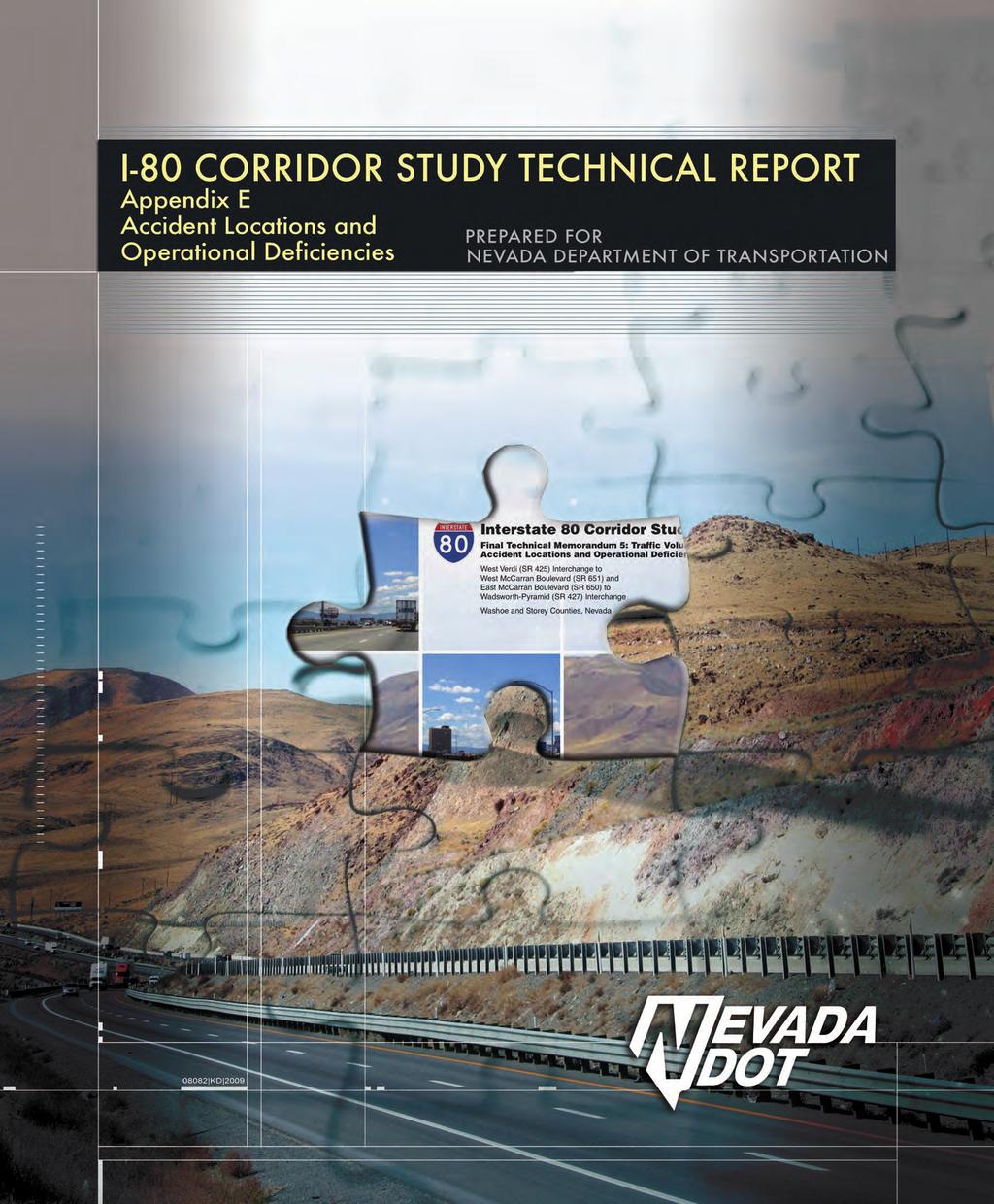
2 Interstate 80 Corridor Study Final Technical Memorandum 5: Traffic Volumes, Accident Locations and Operational Deficiencies West Verdi (SR 425) Interchange to West McCarran Boulevard (SR 651) and East McCarran Boulevard (SR 650) to Wadsworth-Pyramid (SR 427) Interchange Washoe and Storey Counties, Nevada June 2009 TM Prepared for: Nevada Department of Transportation and PBS&J
3 Final Technical Memorandum 5: Traffic Volumes, Accident Locations and Operational Deficiencies To: I-80 Corridor Study Team From: Bryan Gant, PE Venu Parimi, PE Project: I-80 Corridor Study CC: Project File Date: July 09, 2008 Job No: Introduction The I-80 Corridor Study area encompasses I-80 west from the California stateline to the West McCarran Boulevard (SR 651) Interchange in the City of Reno, and I-80 east from the East McCarran Boulevard (SR650) Interchange in the City of Sparks to east of the Wadsworth- Pyramid (SR 427) Interchange near the City of Fernley. The intention of the study is to provide decision makers within the I-80 Corridor an action plan that will define future transportation needs along the corridor. The study is intended to provide participating agencies with a range of workable and cost effective transportation alternatives that address current and future needs along the corridor. These alternatives will be assessed for socioeconomic, community, environmental, and monetary impacts of implementing a range of needed projects addressing existing and projected transportation problems. 2. Document Purpose The information presented in this memorandum involved collection, assembly, review, compilation, and verification of available data. More specifically, this memo reviews and analyzes high crash locations when compared to similar facility types, peak hour traffic volumes, and traffic operational conditions in the form of turning movements. Available physical and operational data along the corridor was obtained from the following local and/or state agencies: California Department of Transportation (Caltrans) City of Reno City of Sparks Nevada Department of Transportation (NDOT) Regional Transportation Commission of Washoe County (RTC) Storey County Washoe County Jacobs Final Technical Memorandum No Bermuda Road Las Vegas, NV Phone Fax Page 1 of 20

4 3. Safety Analysis The collection and analysis of crash data is fundamental to the development of measures that improve overall traffic safety. Historical data is useful in determining why crashes occur, helping to identify crash prone locations, determining which countermeasures should be implemented, and assisting in the evaluation of countermeasure effectiveness. A measure that relates the number of crashes to traffic volume usually provides a better indication of problem locations. A traffic safety and accident analysis of three years of data (January 1, 2004 through December 31, 2006) was conducted for the east and west segments of I-80. The crash reports prepared by the law enforcement officers at the scene of a crash were used as the basis for preparing the data. Each crash is recorded as an entry in a collision database that includes information such as time, date, location, type of crash, severity, and contributing factor. In the three year study period a total of 1,791 crashes were reported. While thirteen of the total crashes were fatal, there were 458 injury crashes and 1,319 property damage only (PDO) crashes. Figure 1 presents a summary of crashes by crash severity throughout the entire study area. Figure 1. Study Area Summary of Crashes It is important to note that some of the crash records in the database are incomplete. While some of them have a missing location field, others didn t have information pertaining to the contributing factor of a crash. Incomplete crash records were not considered for the crash rate analysis. Jacobs Final Technical Memorandum No Bermuda Road Las Vegas, NV Phone Fax Page 2 of 20
5 Crash records were sorted by milepost to identify high accident locations within the study area. Figure 2 illustrates fatal, injury and PDO crashes by mile marker along the I-80 study corridor. 100% 80% 60% 40% Urbanized Area 20% 0% Mile Marker Fatal Crashes Injury Crashes Property Damage Only (PDO) Crashes Figure 2. I-80 Corridor Crashes by Severity 3.1 Crash Rates Crash rates are measured in crashes per million vehicles entering the study freeway segment. Crash rates determine the magnitude of the crash problem at a particular location based on both the total number of incidents and the traffic volume entering that study segment. They are calculated using the following equation: Crash Rate = Cr = A 1,000,000 N AADT 365 where, A = no. of reported crashes N = no. of years (3) AADT = average annual daily traffic The annual average daily traffic (AADT) data at the following count stations, obtained from NDOT s Traffic Information Access (TRINA) system was used for the crash rate calculations: Traffic Count Station , located on I-80, 1 mile east of the Nevada/California stateline Jacobs Final Technical Memorandum No Bermuda Road Las Vegas, NV Phone Fax Page 3 of 20
6 Traffic Count Station , located on I-80, between West Verdi Interchange and the Verdi Interchange Traffic Count Station , located on I-80, between Garson Interchange and the East Verdi Interchange Traffic Count Station , located on I-80, between East Verdi Interchange and the Mogul Interchange Traffic Count Station , located on I-80, 0.1 miles east of the Westbound off-ramp of the Mogul Interchange Traffic Count Station , located on I-80, between West 4 th Street Interchange and the Robb Drive Interchange Traffic Count Station , located on I-80, 0.5 miles west of the West McCarran Boulevard Interchange Traffic Count Station , located on I-80, 0.5 miles east of Pyramid Highway Interchange Traffic Count Station , located on I-80, at Sparks Boulevard Interchange Traffic Count Station , located on I-80, 0.1 miles west of the Vista Boulevard Interchange Traffic Count Station , located on I-80, 0.9 miles east of Vista Interchange Traffic Count Station , located on I-80, 0.2 miles east of the Lockwood Interchange Traffic Count Station , located on I-80, 0.5 miles east of the Mustang Interchange Traffic Count Station , located on I-80, 0.2 miles east of the Patrick Interchange Traffic Count Station , located on I-80, 1.1 miles east of Tracy Clark Interchange Traffic Count Station , located on I-80, between Thisbe-Derby Dam Interchange and the Orchard Interchange Traffic Count Station , located on I-80, between Orchard Interchange and the Painted Rock Interchange Traffic Count Station , located on I-80, 0.9 miles east of Vista Interchange AADT values from the year 2006 were used for the eastern and western segments of I-80 respectively. Figure 3 shows the crash rates by mile marker along the I-80 corridor. Jacobs Final Technical Memorandum No Bermuda Road Las Vegas, NV Phone Fax Page 4 of 20
7 Number of Crashes per MVMT Urbanized Area Mile Marker Figure 3. Crash Rates by Mile Marker along the I-80 Study Corridor 4. High Crash Locations - NDOT 5% Report Section 148(c)(1)(D) of Title 23 U.S.C. requires States to annually submit a report to the FHWA that describes not less than 5 percent of locations exhibiting the most severe safety needs. Because Nevada has significant urban population centers in Las Vegas and Reno-Sparks-Carson City and large rural areas, with very different safety needs, NDOT produced both urban and rural 5 percent lists of High Crash Locations (HCL). Figures 4 and 5 illustrate NDOT s study area for identifying HCL on rural highways. Jacobs Final Technical Memorandum No Bermuda Road Las Vegas, NV Phone Fax Page 5 of 20
8 Figure 4. Study Area Summary of Crashes Jacobs Final Technical Memorandum No Bermuda Road Las Vegas, NV Phone Fax Page 6 of 20
9 Figure 5. Study Area Summary of Crashes NDOT used crash data in the development of this report. The urban analysis utilized the most recent HCL data list using crash data. This data was filtered so that only fatal and injury crash data was used at locations within urban boundaries. The high crash location that was identified within this corridor study area is the section of I-80 that lies between the easterly urban limits of the Reno-Sparks area and Fernley (MP 20.5 to 44.7). Tables 1 and 2 summarize findings from NDOT s 5% report. Jacobs Final Technical Memorandum No Bermuda Road Las Vegas, NV Phone Fax Page 7 of 20
10 Table 1. Top 5% Rural Segments Weighted by Crash Density Map ID County Route 1 Clark SR 159 (MP 1.4 to 14.1) 2 Douglas US 50 (MP 7.0 to 12.2) 3 Clark SR 160 (MP 12.2 to 43.2) 4 Washoe SR 431 (MP 3.6 to 17.8) 5 Clark IR 15N (MP 0.0 to 25.5) 6 Clark IR 15N (MP 58.4 to 64.1) 7 Douglas SR 88 (MP 0.0 to 7.1) 8 Carson City US 50 (MP 0.0 to 6.0) 9 Washoe IR 80E (MP 20.5 to 44.7) 10 Douglas US 395N (MP 24.4 to 30.2) Length (Miles) Total Crashes Fatal Crashes Injury Crashes Weighted Crash Rate Table 2. Top 5% Rural Segments Comparison to Overall Network Totals Length (Miles) Total Crashes Fatal Crashes Injury Crashes Weighted Crash Rate Analyzed Rural Routes 6,164 9, , Top 10 segments 137 1, Top 10 segments % of Analyzed Rural Routes 2% 19% 24% 19% - Jacobs Final Technical Memorandum No Bermuda Road Las Vegas, NV Phone Fax Page 8 of 20
11 5. Identification of High Crash Locations along the Corridor Crash Severity Methodology was used to identify and priority rank HCLs on I-80 along the limits of this corridor study. Crash Severity Methodology takes the severity of crashes into consideration. A weighting factor is applied to crashes based on their severity to calculate weighted crash count (WCC) for each location. Crash severities are often classified by National Safety Council (NSC) within the following categories: Fatal crashes one or more deaths A-type injury crashes incapacitating B-type injury crashes non-incapacitating C-type injury crashes probable injury PDO crashes property damage only (no injury) NDOT considers crashes involving only fatalities, type A injuries (the most severe type), and type B injuries to identify the statewide HCLs in their 5% report. NDOT calculates the WCC for rural areas as follows: (# of fatal crashes *4) + (# of type A injury crashes *2) + (# of type B injury crashes) = WCC In this study, type C injury and PDO crashes were also taken into consideration in identifying HCLs. NDOT s 5% Report does not include weight factors for type C injury and PDO crashes. For the purposes of this study, type C injury crashes were weighted as half of type B, and PDO crashes were weighted as half of type C injury crashes. Based on these assumptions, fatal crashes are weighted 16 times more than PDO crashes. The three types of injury crashes were combined into one injury category and were given a weighting factor of 4. Average weight of the three injury types are higher than 4, however it was decided to use a lower value due to the fact that majority of the injury crashes are type-c. The weighted crash count, therefore, is calculated as follows: (# of fatal crashes *16) + (# of injury crashes *4) + (# of PDO crashes) = WCC A weighted crash rate (WCR) for each mile marker based on weighted crash counts were then calculated as follows. Figure 6 shows the results graphically. WeightedCr ash Rate = WCR where, WCC = weighted crash count N = no. of years (3) AADT = average annual daily traffic WCC 1,000,000 = N AADT 365 The locations along the corridor is priority ranked based on the calculated weighted crash rates. Table 1 shows this ranking along with weighted crash counts and the number of crashes by severity. Jacobs Final Technical Memorandum No Bermuda Road Las Vegas, NV Phone Fax Page 9 of 20
12 Weighted crash rate of 2.0 was selected as the cutoff point for priority locations. In other words, those locations that exceeded a WCR of 2.0 were identified as HCLs. Based on this criterion; the top 16 locations in Table 3 are the HCLs along the corridor Weighted Crash Rate Urbanized Area Mile Marker Figure 6. Weighted Crash Rates by Mile Marker along the I-80 Study Corridor Following are observations and recommendations based on the results of the priority ranking analysis: All locations except for mile markers 0, 6, 7 and 9 fall in the high priority list for the west section of the corridor. A roadway safety audit (RSA) is recommended for the entire west section of the corridor (i.e. from California Stateline to West McCarran Boulevard interchange in the City of Reno) Based on the results shown in Table 3, the section from East McCarran Boulevard in City of Sparks to mile marker 26 (just west of Patrick Interchange) is the section where majority of the HCLs are. A road safety audit is recommended from East McCarran Boulevard to Patrick Interchange for the east section of the study corridor. A separate engineering study is recommended that will conduct a detailed analysis of each HCL listed in this Technical Memorandum to identify probable causes of the crashes and identify possible countermeasures to reduce both crashes and limit their severity. This study should develop statistical summaries of the crash data by various characteristics such as contributing factors, environmental conditions, time of day etc. Results of the RSAs should be part of this study. Jacobs Final Technical Memorandum No Bermuda Road Las Vegas, NV Phone Fax Page 10 of 20
13 Table 3. Identification of High Crash Locations Mile Marker Fatal Crashes Number of Crashes (2004 to 2006) Injury Crashes PDO Crashes Weighted Crash Count (WCC) Weighted Crash Rate (WCR) Prirotiy Rank Source: Jacobs, 2009 Jacobs Final Technical Memorandum No Bermuda Road Las Vegas, NV Phone Fax Page 11 of 20
14 6. Travel Time Runs Travel time runs were conducted using the floating car method, in which the driver of a survey vehicle floats with the traffic by attempting to safely pass as many vehicles that have passed the test vehicle. Travel time runs were conducted during the morning and afternoon peak periods on all roadway segments on September 24, 2007 and September 25, Five runs were made in each direction during each peak period, for a total of ten runs per peak period. During the travel time runs, the Haicom BT GPS equipment recorded position and time at one-second intervals into a Dell Personal Digital Assistant (PDA) using Bluetooth technology. The data is saved through a customized travel speed program developed by Carter & Burgess, Inc. The driver of the test vehicle drove at the speed limit if no other cars were present. While the first four travel time runs were made floating with the general traffic, the fifth and final run in each direction was made trailing a heavy vehicle to collect speed and travel time data for trucks. The mapped roadway network was used to process the travel time runs. I-80 segments in both directions were created between the beginning and ending points and the mapped roadway network was used to calculate travel time. The travel time information and associated congestion indices were formatted into tables and graphs in ArcMap. ArcMap is GIS software that allows the reader a quick, easy-to-understand graphical reference. ArcMap reads the study data files, stored in geodatabases, and presents the information graphically. ArcMap allows the user to group and summarize data for specific purposes. The 1-second data points are color coded according to the criteria for free-flow, stable, and congested conditions. These 1-second points can be used to determine at what point along a segment a traveler experiences delays or congestion. The data in the figures and tables in this report provide information for AM and PM travel time runs. When congestion occurs during only one time period, the user can study the detailed information to determine the cause of the delay. Due to free flow conditions in the rural sections of I-80 study area, there was not much of a difference in speeds between the runs floating with general traffic and the runs made trailing heavy vehicles. Figures 7 and 8 illustrate this for vehicles traveling east, in the west corridor during the AM peak hour. Figures 9 to 15 illustrate the speeds of all vehicles for the remaining seven scenarios. Jacobs Final Technical Memorandum No Bermuda Road Las Vegas, NV Phone Fax Page 12 of 20
15 Speed (miles per hour) Verdi On Ramp Boomtown Off Ramp Boomtown On Ramp East Verdi On Ramp Mogul Off Ramp Mogul On Ramp W 4th St Off Ramp Robb Dr Off Ramp Robb Dr On Ramp Figure 7. I-80 West Corridor - All Vehicles Eastbound Speeds (AM Peak Hour) Speed (miles per hour) Verdi On Ramp Boomtown Off Ramp Boomtown On Ramp East Verdi On Ramp Mogul Off Ramp Mogul On Ramp W 4th St Off Ramp Robb Dr Off Ramp Robb Dr On Ramp Figure 8. I-80 West Corridor - Trucks Only Eastbound Speeds (AM Peak Hour) Jacobs Final Technical Memorandum No Bermuda Road Las Vegas, NV Phone Fax Page 13 of 20
16 Speed (miles per hour) McCarran East On Ramp Sparks Off Ramp Sparks On Ramp Vista Off Ramp Vista On Ramp Lockwood Off Ramp Lockwood On Ramp Mustang Off Ramp Mustang On Ramp Patrick Off Ramp Patrick On Ramp Tracy-Clark Off Ramp Tracy-Clark On Ramp Derby Dam Off Ramp Derby Dam On Ramp Orchard Off Ramp Orchard On Ramp Painted Rock Off Ramp Painted Rock On Ramp Wadsworth Off Ramp Figure 9. I-80 East Corridor - Eastbound Average Speeds (AM Peak Hour) Speed (miles per hour) McCarran West On Ramp Robb Dr Off Ramp Robb Dr On Ramp W 4th St On Ramp Mogul Off Ramp Mogul On Ramp East Verdi Off Ramp Boomtown Off Ramp Boomtown On Ramp Verdi Off Ramp East Verdi Off Ramp Figure 10. I-80 West Corridor - Westbound Average Speeds (AM Peak Hour) Jacobs Final Technical Memorandum No Bermuda Road Las Vegas, NV Phone Fax Page 14 of 20
17 Speed (miles per hour) Wadsworth On Ramp Painted Rock Off Ramp Painted Rock On Ramp Orchard Off Ramp Orchard On Ramp Derby Dam Off Ramp Derby Dam On Ramp Tracy-Clark Off Ramp Tracy-Clark On Ramp Patrick Off Ramp Patrick On Ramp Mustang Off Ramp Mustang On Ramp Lockwood Off Ramp Lockwood On Ramp Vista Off Ramp Vista On Ramp Sparks Off Ramp Sparks On Ramp Figure 11. I-80 East Corridor - Westbound Speeds (AM Peak Hour) Speed (miles per hour) Verdi On Ramp Boomtown Off Ramp Boomtown On Ramp East Verdi On Ramp Mogul Off Ramp Mogul On Ramp W 4th St Off Ramp Robb Dr Off Ramp Robb Dr On Ramp Figure 12. I-80 West Corridor - Eastbound Speeds (PM Peak Hour) Jacobs Final Technical Memorandum No Bermuda Road Las Vegas, NV Phone Fax Page 15 of 20
18 Speed (miles per hour) McCarran East On Ramp Sparks Off Ramp Sparks On Ramp Vista Off Ramp Vista On Ramp Lockwood Off Ramp Lockwood On Ramp Mustang Off Ramp Mustang On Ramp Patrick Off Ramp Patrick On Ramp Tracy-Clark Off Ramp Tracy-Clark On Ramp Derby Dam Off Ramp Derby Dam On Ramp Orchard Off Ramp Orchard On Ramp Painted Rock Off Ramp Painted Rock On Ramp Wadsworth Off Ramp Figure 13. I-80 East Corridor - Eastbound Speeds (PM Peak Hour) Speed (miles per hour) McCarran West On Ramp Robb Dr Off Ramp Robb Dr On Ramp W 4th St On Ramp Mogul Off Ramp Mogul On Ramp East Verdi Off Ramp Boomtown Off Ramp Boomtown On Ramp Verdi Off Ramp East Verdi Off Ramp Figure 14. I-80 West Corridor - Westbound Speeds (PM Peak Hour) Jacobs Final Technical Memorandum No Bermuda Road Las Vegas, NV Phone Fax Page 16 of 20
19 Speed (miles per hour) Wadsworth On Ramp Painted Rock Off Ramp Painted Rock On Ramp Orchard Off Ramp Orchard On Ramp Derby Dam Off Ramp Derby Dam On Ramp Tracy-Clark Off Ramp Tracy-Clark On Ramp Patrick Off Ramp Patrick On Ramp Mustang Off Ramp Mustang On Ramp Lockwood Off Ramp Lockwood On Ramp Vista Off Ramp Vista On Ramp Sparks Off Ramp Sparks On Ramp Figure 15. I-80 East Corridor - Westbound Speeds (PM Peak Hour) Jacobs Final Technical Memorandum No Bermuda Road Las Vegas, NV Phone Fax Page 17 of 20
20 7. Existing Traffic Operational Analysis Year 2007 AM and PM peak hour turning movement volumes at the study intersections were provided in Technical Memorandum 1 along with the lane geometry information. Using these data, an operational analysis was conducted to assess the existing levels of service at the study intersections. The analysis was conducted using methodologies outlined in the Highway Capacity Manual (HCM), 2000 edition published by Transportation Research Board. Trafficware s Synchro 7.0 software was used. Synchro can calculate LOS according to HCM procedures. Table 4 shows the intersection level of service criteria defined by HCM. To determine intersection LOS for the study intersections, control delay for each intersection was extracted from Synchro output and compared to the criteria shown in Table 4. Level of service of D or better were considered as satisfactory/acceptable. Table 4. Level of Service Criteria for Intersections Control Delay per Vehicle (in seconds) LOS Signalized Intersections Unsignalized Intersections A B >10-20 >10-15 C >20-35 >15-25 D >35-55 >25-35 E >55-80 >35-50 F >80 >50 Source: Highway Capacity Manual 2000, Transportation Research Board The existing conditions capacity analyses results for the AM and PM peak hours for the study intersections are summarized in Table 5. For signalized intersections, the analyses used the cycle lengths provided by City of Reno and City of Sparks; and reported in Technical Memorandum 1. Peak hour factors of 0.88 and 0.92 as recommended in HCM were used for rural and urban intersections respectively. Within the limits of this corridor, the unsignalized intersections are generally located in rural areas; while the signalized intersections are located in urban cities of Reno and Sparks. Analysis worksheets are provided in the Appendix A. Following are few observations and recommendations from the analysis results: All of the unsignalized study intersections operate satisfactorily (C or better) during both AM and PM peak hours. Intersection of McCarran Boulevard West with I-80 WB Ramps (Intersection # 13) operates at unacceptable level of service (LOS E) during PM peak hour. Providing an additional northbound left turn lane would improve the operations at this location. Intersection of Vista Boulevard with I-80 EB Ramps operates at unacceptable level of service (LOS F) during PM peak hour. This is due to heavy eastbound left turn movement from the eastbound off-ramp. Provision of an additional eastbound left turn lane at this approach would increase the LOS to acceptable levels. Jacobs Final Technical Memorandum No Bermuda Road Las Vegas, NV Phone Fax Page 18 of 20
21 Rest of the signalized intersections operate at acceptable levels of service (D or better) during both AM and PM peak hours. Table 5. Existing Traffic Operational Analysis Results Intersection Number and Name AM Peak Hour Control Delay LOS (sec/veh) PM Peak Hour Control Delay LOS (sec/veh) 1. I-80 WB Off-Ramp and Gold Ranch Road at Exit 2 - West Verdi Interchange TWSC 10.2 B 11.0 B 2. I-80 EB Ramps and Gold Ranch Road at Exit 2 - West Verdi Interchange TWSC 0.8 A 0.5 A 3. I-80 WB Off-Ramp and S Verdi Road at Exit 3 - Verdi Interchange TWSC 8.5 A 8.6 A 4. I-80 EB On-Ramp and Crystal Park Road at NO CONTROL Exit 3 - Verdi Interchange 5.8 A 5.3 A 5A. I-80 WB Ramps and Frontage Road at Exit 4 - Boomtown/Garson Interchange TWSC 12.4 B 13.3 B 5B. Garson Road and Frontage Road at Exit 4- Boomtown/Garson Interchange TWSC 10.6 B 13.2 B 6. I-80 EB Ramps and Garson Road at Exit 4 - Boomtown/Garson Interchange TWSC 11.9 B 24.5 C 7. I-80 WB Off-Ramp / EB On-Ramp and Old Highway 40 at Exit 5 - East Verdi Interchange NO CONTROL 0.0 A 0.0 A 8. I-80 WB Ramps and West 4 th Street at Exit 7 - Mogul Interchange 9. I-80 EB Ramps and Mogul Road at Exit 7 - Mogul Interchange 10. I-80 WB On-Ramp and West 4 th Street at Exit 8 - West 4th Interchange 11. I-80 EB Off-Ramp and West 4 th Street at Exit 8 - West 4th Interchange 12. I-80 WB Ramps and Robb Dr at Exit 9- Robb Interchange 13. I-80 WB Ramps and McCarran Boulevard West at Exit 10 - McCarran West Interchange 14. I-80 EB Ramps and McCarran Boulevard West at Exit 10 - McCarran West Interchange 15. I-80 WB Ramps and McCarran Boulevard East at Exit 19 - McCarran East Interchange 16. I-80 EB Ramps and McCarran Boulevard East at Exit 19 - McCarran East Interchange 17. I-80 WB Ramps and Sparks Boulevard at Exit 20 - Sparks Interchange 18. I-80 EB Ramps and Sparks Boulevard at Exit 20 - Sparks Interchange 19. I-80 WB Ramps and Vista Boulevard at Exit 21 - Vista Interchange 20. I-80 EB Ramps and Vista Boulevard at Exit 21 - Vista Interchange 21. I-80 WB Ramps and Canyon Road at Exit 22 - Lockwood Interchange 22. I-80 EB Ramps and Canyon Road at Exit 22 - Lockwood Interchange 23A. I-80 WB Off-Ramp and Canyon Park at Exit 23 - Mustang Interchange 23B. I-80 WB On Ramp and Canyon Park Road at Exit 23 - Mustang Interchange Control TWSC 8.7 A 9.7 A TWSC 11.6 B 9.1 A TWSC 9.2 A 9.7 A TWSC 9.1 A 9.5 A TWSC 10.4 B 23.6 C SIGNAL 24.3 C 71.9 E SIGNAL 13.2 B 30.8 C SIGNAL 20.7 C 40.2 D SIGNAL 30.6 C 31.8 C SIGNAL 21.8 C 30.3 C SIGNAL 23.3 C 40.1 D SIGNAL 20.4 C 41.9 D SIGNAL 29.8 C F NO CONTROL 6.8 A 6.7 A TWSC 9.4 A 9.3 A TWSC 8.8 A 8.6 A NO CONTROL 7.5 A 7.3 A Jacobs Final Technical Memorandum No Bermuda Road Las Vegas, NV Phone Fax Page 19 of 20
22 Table 5 Continued. Existing Traffic Operational Analysis Results AM Peak Hour PM Peak Hour Intersection Number and Name Control Control Delay (sec/veh) LOS Control Delay (sec/veh) 24A. I-80 EB On Ramp and Mustang Road at Exit 23 - Mustang Interchange YIELD 4.3 A 4.4 A 24B. I-80 EB Off-Ramp and Mustang Road at Exit 23 - Mustang Interchange AWSC 8.1 A 7.7 A 25. I-80 WB Ramps and NV Highway 655 at Exit 28 - Patrick Interchange NO CONTROL 0.0 A 0.0 A 26. I-80 EB Ramps and Waltham Way at Exit 28 - Patrick Interchange NO CONTROL 0.0 A 0.0 A 27. I-80 WB Ramps and Clark Station Road at NO CONTROL Exit 32 - Tracy / Clark Interchange 0.0 A 0.0 A 28A. I-80 EB On Ramp and Wunotoo Road at Exit 32 - Tracy / Clark Interchange TWSC 9.7 A 10.5 B 28B. I-80 EB Off Ramp and Wunotoo Road at Exit 32 - Tracy / Clark Interchange TWSC 13.1 B 11.7 B 29. I-80 WB Ramps and Derby Dam Road at Exit 36 - Thisbe / Derby Dam Interchange TWSC 8.8 A 8.9 A 30A. I-80 EB Off Ramp and Derby Dam Road at Exit 36 - Thisbe / Derby Dam Interchange TWSC 8.5 A 8.5 A 30B. I-80 EB On Ramp and Derby Dam Road at Exit 36 - Thisbe / Derby Dam Interchange YIELD 7.1 A 7.1 A 31. I-80 WB Ramps and Raodside Rest Road at Exit 38 - Orchard Interchange TWSC 8.8 A 8.8 A 32. I-80 EB Ramps and Roadside Rest Road at Exit 38 - Orchard Interchange TWSC 8.8 A 8.7 A 33. I-80 WB Ramps and Canal Road at Exit 40 - Painted Rock Interchange TWSC 8.8 A 8.7 A 34. I-80 EB Ramps and Canal Road at Exit 40 - Painted Rock Interchange TWSC 8.7 A 8.8 A 35. I-80 WB Ramps and Main Street at Exit 43 - Wadsworth Pyramid Lake Interchange TWSC 8.6 A 8.9 A 36. I-80 EB Ramps and Main Street at Exit 43 - Wadsworth Pyramid Lake Interchange AWSC 7.3 A 7.6 A Note: For signalized intersections, LOS shown is for the overall intersection. For unsignalized intersections, LOS shown is for the approach with the worst delay. TWSC = Two Way Stop Control, AWSC = All Way Stop Control Source: Jacobs, June 2009 LOS Jacobs Final Technical Memorandum No Bermuda Road Las Vegas, NV Phone Fax Page 20 of 20


23 APPENDIXA
24 HCM Signalized Intersection Capacity Analysis 13: I-80 WB On Ramp & McCarran Blvd West Movement EBL EBT EBR WBL WBT WBR NBL NBT NBR SBL SBT SBR Volume (vph) Ideal Flow (vphpl) Total Lost time (s) Lane Util. Factor Frt Flt Protected Satd. Flow (prot) Flt Permitted Satd. Flow (perm) Peak-hour factor, PHF Adj. Flow (vph) RTOR Reduction (vph) Lane Group Flow (vph) Turn Type Perm Perm Prot Protected Phases Permitted Phases 8 8 Actuated Green, G (s) Effective Green, g (s) Actuated g/c Ratio Clearance Time (s) Vehicle Extension (s) Lane Grp Cap (vph) v/s Ratio Prot c c0.42 v/s Ratio Perm c0.12 v/c Ratio Uniform Delay, d Progression Factor Incremental Delay, d Delay (s) Level of Service D D D D A B Approach Delay (s) Approach LOS A D B B HCM Average Control Delay 24.3 HCM Level of Service C HCM Volume to Capacity ratio 0.69 Actuated Cycle Length (s) Sum of lost time (s) 12.0 Intersection Capacity Utilization 64.1% ICU Level of Service C c Critical Lane Group I-80 Corridor Study 6/17/2009 Existing AM Peak Hour Synchro 7 - Report
25 HCM Signalized Intersection Capacity Analysis 14: I-80 EB Off Ramp & McCarran Blvd West Movement EBL EBT EBR WBL WBT WBR NBL NBT NBR SBL SBT SBR Volume (vph) Ideal Flow (vphpl) Total Lost time (s) Lane Util. Factor Frt Flt Protected Satd. Flow (prot) Flt Permitted Satd. Flow (perm) Peak-hour factor, PHF Adj. Flow (vph) RTOR Reduction (vph) Lane Group Flow (vph) Turn Type Perm Free Perm Prot Protected Phases Permitted Phases 4 Free 2 Actuated Green, G (s) Effective Green, g (s) Actuated g/c Ratio Clearance Time (s) Vehicle Extension (s) Lane Grp Cap (vph) v/s Ratio Prot 0.19 c0.14 c0.32 v/s Ratio Perm 0.03 c v/c Ratio Uniform Delay, d Progression Factor Incremental Delay, d Delay (s) Level of Service D A B B D A Approach Delay (s) Approach LOS A A B B HCM Average Control Delay 13.2 HCM Level of Service B HCM Volume to Capacity ratio 0.41 Actuated Cycle Length (s) Sum of lost time (s) 4.0 Intersection Capacity Utilization 64.1% ICU Level of Service C c Critical Lane Group I-80 Corridor Study 6/17/2009 Existing AM Peak Hour Synchro 7 - Report
26 HCM Signalized Intersection Capacity Analysis 15: Victorian Ave & McCarran Blvd East Movement EBL EBT EBR WBL WBT WBR NBL NBT NBR SBL SBT SBR Volume (vph) Ideal Flow (vphpl) Total Lost time (s) Lane Util. Factor Frt Flt Protected Satd. Flow (prot) Flt Permitted Satd. Flow (perm) Peak-hour factor, PHF Adj. Flow (vph) RTOR Reduction (vph) Lane Group Flow (vph) Turn Type custom custom Split Perm Prot Protected Phases Permitted Phases Actuated Green, G (s) Effective Green, g (s) Actuated g/c Ratio Clearance Time (s) Vehicle Extension (s) Lane Grp Cap (vph) v/s Ratio Prot c0.06 c c0.38 v/s Ratio Perm c v/c Ratio dl Uniform Delay, d Progression Factor Incremental Delay, d Delay (s) Level of Service E E E E E A B Approach Delay (s) Approach LOS E E B B HCM Average Control Delay 20.7 HCM Level of Service C HCM Volume to Capacity ratio 0.57 Actuated Cycle Length (s) Sum of lost time (s) 16.0 Intersection Capacity Utilization 60.9% ICU Level of Service B dl Defacto Left Lane. Recode with 1 though lane as a left lane. c Critical Lane Group I-80 Corridor Study 6/17/2009 Existing AM Peak Hour Synchro 7 - Report
27 HCM Signalized Intersection Capacity Analysis 16: I-80 EB Off Ramp & McCarran Blvd East Movement EBL EBT EBR WBL WBT WBR NBL NBT NBR SBL SBT SBR Volume (vph) Ideal Flow (vphpl) Total Lost time (s) Lane Util. Factor Frt Flt Protected Satd. Flow (prot) Flt Permitted Satd. Flow (perm) Peak-hour factor, PHF Adj. Flow (vph) RTOR Reduction (vph) Lane Group Flow (vph) Turn Type Perm Perm Prot Protected Phases Permitted Phases 4 4 Actuated Green, G (s) Effective Green, g (s) Actuated g/c Ratio Clearance Time (s) Vehicle Extension (s) Lane Grp Cap (vph) v/s Ratio Prot c0.44 v/s Ratio Perm c0.31 v/c Ratio Uniform Delay, d Progression Factor Incremental Delay, d Delay (s) Level of Service C C E C E C Approach Delay (s) Approach LOS D A C C HCM Average Control Delay 30.6 HCM Level of Service C HCM Volume to Capacity ratio 0.80 Actuated Cycle Length (s) Sum of lost time (s) 8.0 Intersection Capacity Utilization 75.4% ICU Level of Service D c Critical Lane Group I-80 Corridor Study 6/17/2009 Existing AM Peak Hour Synchro 7 - Report
28 HCM Signalized Intersection Capacity Analysis 17: I-80 WB On Ramp & Sparks Blvd Movement EBL EBT EBR WBL WBT WBR NBL NBT NBR SBL SBT SBR Volume (vph) Ideal Flow (vphpl) Total Lost time (s) Lane Util. Factor Frt Flt Protected Satd. Flow (prot) Flt Permitted Satd. Flow (perm) Peak-hour factor, PHF Adj. Flow (vph) RTOR Reduction (vph) Lane Group Flow (vph) Turn Type Perm Perm Prot Protected Phases Permitted Phases 8 8 Actuated Green, G (s) Effective Green, g (s) Actuated g/c Ratio Clearance Time (s) Vehicle Extension (s) Lane Grp Cap (vph) v/s Ratio Prot c c0.47 v/s Ratio Perm v/c Ratio dr Uniform Delay, d Progression Factor Incremental Delay, d Delay (s) Level of Service C C E A C Approach Delay (s) Approach LOS A C B C HCM Average Control Delay 21.8 HCM Level of Service C HCM Volume to Capacity ratio 0.64 Actuated Cycle Length (s) Sum of lost time (s) 12.0 Intersection Capacity Utilization 66.8% ICU Level of Service C dr Defacto Right Lane. Recode with 1 though lane as a right lane. c Critical Lane Group I-80 Corridor Study 6/17/2009 Existing AM Peak Hour Synchro 7 - Report
29 HCM Signalized Intersection Capacity Analysis 18: I-80 EB Off Ramp & Sparks Blvd Movement EBL EBT EBR WBL WBT WBR NBL NBT NBR SBL SBT SBR Volume (vph) Ideal Flow (vphpl) Total Lost time (s) Lane Util. Factor Frt Flt Protected Satd. Flow (prot) Flt Permitted Satd. Flow (perm) Peak-hour factor, PHF Adj. Flow (vph) RTOR Reduction (vph) Lane Group Flow (vph) Turn Type Perm Prot Protected Phases Permitted Phases 4 Actuated Green, G (s) Effective Green, g (s) Actuated g/c Ratio Clearance Time (s) Vehicle Extension (s) Lane Grp Cap (vph) v/s Ratio Prot 0.07 c0.03 c0.21 v/s Ratio Perm c v/c Ratio Uniform Delay, d Progression Factor Incremental Delay, d Delay (s) Level of Service E D B D A Approach Delay (s) Approach LOS D A B A HCM Average Control Delay 23.3 HCM Level of Service C HCM Volume to Capacity ratio 0.46 Actuated Cycle Length (s) Sum of lost time (s) 12.0 Intersection Capacity Utilization 66.8% ICU Level of Service C c Critical Lane Group I-80 Corridor Study 6/17/2009 Existing AM Peak Hour Synchro 7 - Report
30 HCM Signalized Intersection Capacity Analysis 19: I-80 WB On Ramp & Vista Blvd Movement EBL EBT EBR WBL WBT WBR NBL NBT NBR SBL SBT SBR Volume (vph) Ideal Flow (vphpl) Total Lost time (s) Lane Util. Factor Frt Flt Protected Satd. Flow (prot) Flt Permitted Satd. Flow (perm) Peak-hour factor, PHF Adj. Flow (vph) RTOR Reduction (vph) Lane Group Flow (vph) Turn Type Perm Prot Protected Phases Permitted Phases 8 Actuated Green, G (s) Effective Green, g (s) Actuated g/c Ratio Clearance Time (s) Vehicle Extension (s) Lane Grp Cap (vph) v/s Ratio Prot c c0.50 v/s Ratio Perm 0.14 v/c Ratio Uniform Delay, d Progression Factor Incremental Delay, d Delay (s) Level of Service E E A B Approach Delay (s) Approach LOS A E A B HCM Average Control Delay 20.4 HCM Level of Service C HCM Volume to Capacity ratio 0.78 Actuated Cycle Length (s) Sum of lost time (s) 12.0 Intersection Capacity Utilization 79.5% ICU Level of Service D c Critical Lane Group I-80 Corridor Study 6/17/2009 Existing AM Peak Hour Synchro 7 - Report
31 HCM Signalized Intersection Capacity Analysis 20: I-80 EB Off Ramp & Vista Blvd Movement EBL EBT EBR WBL WBT WBR NBL NBT NBR SBL SBT SBR Volume (vph) Ideal Flow (vphpl) Total Lost time (s) Lane Util. Factor Frt Flt Protected Satd. Flow (prot) Flt Permitted Satd. Flow (perm) Peak-hour factor, PHF Adj. Flow (vph) RTOR Reduction (vph) Lane Group Flow (vph) Turn Type Perm Perm Prot Protected Phases Permitted Phases 4 4 Actuated Green, G (s) Effective Green, g (s) Actuated g/c Ratio Clearance Time (s) Vehicle Extension (s) Lane Grp Cap (vph) v/s Ratio Prot 0.10 c0.09 c0.22 v/s Ratio Perm v/c Ratio Uniform Delay, d Progression Factor Incremental Delay, d Delay (s) Level of Service D B D D B Approach Delay (s) Approach LOS C A D C HCM Average Control Delay 29.8 HCM Level of Service C HCM Volume to Capacity ratio 0.66 Actuated Cycle Length (s) Sum of lost time (s) 12.0 Intersection Capacity Utilization 79.5% ICU Level of Service D c Critical Lane Group I-80 Corridor Study 6/17/2009 Existing AM Peak Hour Synchro 7 - Report
32 1: I-80 WB Off Ramp & Gold Ranch Rd Movement EBL EBT EBR WBL WBT WBR NBL NBT NBR SBL SBT SBR Volume (veh/h) Sign Control Free Free Stop Stop Grade 0% 0% 0% 0% Peak Hour Factor Hourly flow rate (vph) Median type None None vc, conflicting volume vcu, unblocked vol tc, single (s) tf (s) p0 queue free % cm capacity (veh/h) Direction, Lane # WB 1 WB 2 NB 1 SB 1 Volume Total Volume Left Volume Right csh Volume to Capacity Queue Length 95th (ft) Control Delay (s) Lane LOS A B A Approach Delay (s) Approach LOS B A Average Delay 4.5 Intersection Capacity Utilization 17.1% ICU Level of Service A I-80 Corridor Study 6/17/2009 Existing AM Peak Hour Synchro 7 - Report
33 2: I-80 EB On Ramp & Gold Ranch Rd Movement EBL EBR NBL NBT SBT SBR Volume (veh/h) Sign Control Stop Free Free Grade 0% 0% 0% Peak Hour Factor Hourly flow rate (vph) Median type None None vc, conflicting volume vcu, unblocked vol tc, single (s) tf (s) p0 queue free % cm capacity (veh/h) Direction, Lane # NB 1 SB 1 Volume Total Volume Left 5 0 Volume Right 0 61 csh Volume to Capacity Queue Length 95th (ft) 0 0 Control Delay (s) Lane LOS A Approach Delay (s) Approach LOS Average Delay 0.3 Intersection Capacity Utilization 8.5% ICU Level of Service A I-80 Corridor Study 6/17/2009 Existing AM Peak Hour Synchro 7 - Report
34 3: I-80 WB Off Ramp & S. Verdi Rd Movement WBL WBR NBT NBR SBL SBT Volume (veh/h) Sign Control Stop Free Free Grade 0% 0% 0% Peak Hour Factor Hourly flow rate (vph) Median type None None vc, conflicting volume vcu, unblocked vol tc, single (s) tf (s) p0 queue free % cm capacity (veh/h) Direction, Lane # WB 1 WB 2 NB 1 SB 1 Volume Total Volume Left Volume Right csh Volume to Capacity Queue Length 95th (ft) Control Delay (s) Lane LOS A A Approach Delay (s) Approach LOS A Average Delay 2.2 Intersection Capacity Utilization 13.3% ICU Level of Service A I-80 Corridor Study 6/17/2009 Existing AM Peak Hour Synchro 7 - Report
35 4: I-80 EB On Ramp & Crystal Park Rd Movement WBL WBR NBT NBR SBL SBT Volume (veh/h) Sign Control Stop Free Free Grade 0% 0% 0% Peak Hour Factor Hourly flow rate (vph) Median type None None vc, conflicting volume vcu, unblocked vol tc, single (s) tf (s) p0 queue free % cm capacity (veh/h) Direction, Lane # NB 1 SB 1 Volume Total 8 33 Volume Left 0 26 Volume Right 7 0 csh Volume to Capacity Queue Length 95th (ft) 0 1 Control Delay (s) Lane LOS A Approach Delay (s) Approach LOS Average Delay 4.7 Intersection Capacity Utilization 11.6% ICU Level of Service A I-80 Corridor Study 6/17/2009 Existing AM Peak Hour Synchro 7 - Report
36 5: Frontage Rd & Cabela Dr Movement EBL EBT EBR WBL WBT WBR NBL NBT NBR SBL SBT SBR Volume (veh/h) Sign Control Stop Stop Free Free Grade 0% 0% 0% 0% Peak Hour Factor Hourly flow rate (vph) Median type None None vc, conflicting volume vcu, unblocked vol tc, single (s) tf (s) p0 queue free % cm capacity (veh/h) Direction, Lane # EB 1 EB 2 EB 3 WB 1 WB 2 NB 1 NB 2 SB 1 Volume Total Volume Left Volume Right csh Volume to Capacity Queue Length 95th (ft) Control Delay (s) Lane LOS B B A B B A A Approach Delay (s) Approach LOS B B Average Delay 1.7 Intersection Capacity Utilization 34.5% ICU Level of Service A I-80 Corridor Study 6/17/2009 Existing AM Peak Hour Synchro 7 - Report
37 6: I-80 EB Off Ramp & Garson Rd Movement EBL EBT EBR WBL WBT WBR NBL NBT NBR SBL SBT SBR Volume (veh/h) Sign Control Stop Stop Free Free Grade 0% 0% 0% 0% Peak Hour Factor Hourly flow rate (vph) Median type None None vc, conflicting volume vcu, unblocked vol tc, single (s) tf (s) p0 queue free % cm capacity (veh/h) Direction, Lane # EB 1 NB 1 SB 1 Volume Total Volume Left Volume Right csh Volume to Capacity Queue Length 95th (ft) Control Delay (s) Lane LOS B A Approach Delay (s) Approach LOS B Average Delay 8.4 Intersection Capacity Utilization 27.1% ICU Level of Service A I-80 Corridor Study 6/17/2009 Existing AM Peak Hour Synchro 7 - Report
HCM Unsignalized Intersection Capacity Analysis 6: Brian Street & LC 111 5/26/2009
 6: Brian Street & LC 111 5/26/2009 Movement EBL EBR NBL NBT SBT SBR Volume (veh/h) 116 20 8 405 137 56 Sign Control Stop Free Free Grade 0% 0% 0% Peak Hour Factor 0.81 0.81 0.67 0.67 0.89 0.89 Hourly flow
Sugarland Crossing Gwinnett County, Georgia
 Sugarland Crossing Gwinnett County, Georgia S IGNAL W ARRANT A NALYSIS For the Intersection of: Sugarloaf Parkway / Richards Middle School Driveway / Sugarland Crossing Main Site Driveway Prepared for:
TRAFFIC AND TRANSPORTATION TECHNICAL MEMORANDUM
 TRAFFIC AND TRANSPORTATION TECHNICAL MEMORANDUM for ENVIRONMENTAL ASSESSMENT US 460 Bypass Interchange and Southgate Drive Relocation State Project No.: 0460-150-204, P101, R201, C501, B601; UPC 99425
886 March Road McDonald's Transportation Study
 McDonald's Restaurants of Canada Limited March 2013 886 March Road McDonald's Transportation Study Submitted by: HDR Corporation 100 York Boulevard, Suite 300 Richmond Hill, ON L4B 1J8 (905) 882-4100 www.hdrinc.com
 Traffic Analysis For Approved Uses within the St. Lucie West DRI Aldi Port St. Lucie, FL Prepared for: Bohler Engineering, LLC 1000 Corporate Drive Suite 250 Fort Lauderdale, FL 33334 Prepared by: 10795
Village of Richmond Transportation Brief
 Village of Richmond Transportation Brief GENIVAR Project Number 111-18482-00 June 21 st, 2011 www.genivar.com GENIVAR 15 Fitzgerald Road, Suite 100 Ottawa, Ontario, CANADA K2H 9G1 Telephone: 613-829-2800
APPENDIX G. Traffic Data
 APPENDIX G Traffic Data HCM Signalized Intersection Capacity Analysis 2: Duanesburg Road & I-88 Ramps 10/7/2004 Movement EBL EBT EBR WBL WBT WBR NBL NBT NBR SBL SBT SBR Lane Configurations Ideal Flow (vphpl)
MEMORANDUM. Date: November 4, Cheryl Burrell, Pebble Beach Company. Rob Rees, P.E. Inclusionary Housing Transportation Analysis WC
 MEMORANDUM Date: November 4, 2013 To: From: Subject: Cheryl Burrell, Pebble Beach Company Rob Rees, P.E. Inclusionary Housing Transportation Analysis As requested, Fehr & Peers is providing clarification
TECHNICAL MEMORANDUM Upper Broadway Road Diet Summary of Findings
 TECHNICAL MEMORANDUM Summary of Findings Date: June 17, 2014 Project #: 17121.15 To: Si Lau, P.E.; City of Oakland, CA From: Erin Ferguson, P.E.; Aaron Elias, P.E.; Daphne Dethier; and Mark Bowman, P.E.;
ZINFANDEL LANE / SILVERADO TRAIL INTERSECTION TRAFFIC ANALYSIS
 ZINFANDEL LANE / SILVERADO TRAIL INTERSECTION TRAFFIC ANALYSIS UPDATED TRAFFIC STUDY FOR THE PROPOSED RAYMOND VINEYARDS WINERY USE PERMIT MODIFICATION #P11-00156 AUGUST 5, 2014 PREPARED BY: OMNI-MEANS,
Provide an overview of the development proposal including projected site traffic volumes;
 December 19, 2013 File: 163600935 Attention: Troy Elliott Carl Elliott Limited 15-1831 Robertson Road PO Box 11117 Nepean, Ontario K1H 7T8 Dear Mr. Elliott, Reference: 2235 and 2265 Robertson Road Transportation
L1TILE BEARS DAY CARE TRANSPORTATION IMPACT STUDY FORT COLLINS, COLORADO MAY Prepared for:
 L1TILE BEARS DAY CARE TRANSPORTATION IMPACT STUDY FORT COLLINS, COLORADO MAY 2012 Prepared for: Hillside Construction, Inc. 216 Hemlock Street, Suite B Fort Collins, CO 80534 Prepared by: DELICH ASSOCIATES
MEMO. McCORMICK RANKIN CORPORATION. File FROM: Keyur Shah DATE: February 1, 2010 COPIES: OUR FILE: SUBJECT: TO:
 McCORMICK RANKIN CORPORATION 2655 North Sheridan Way Mississauga, Ontario, L5K 2P8 Tel: (905)823-8500 Fax: (905) 823-8503 E-mail: mrc@mrc.ca Website: www.mrc.ca MEMO TO: File FROM: Keyur Shah DATE: February
Weaver Road Senior Housing Traffic Impact Analysis
 Gibson Traffic Consultants, Inc. 2813 Rockefeller Avenue Suite B Everett, WA 9821 425.339.8266 Weaver Road Senior Housing Traffic Impact Analysis Jurisdiction: City of Snohomish January 218 GTC #17-37
MURRIETA APARTMENTS TRAFFIC IMPACT ANALYSIS CITY OF MURRIETA, CALIFORNIA
 MURRIETA APARTMENTS TRAFFIC IMPACT ANALYSIS CITY OF MURRIETA, CALIFORNIA SEPTEMBER 20, 2012 Prepared for: Golden Eagle Multi-Family Properties, LLC 6201 Oak Canyon Rd., Suite 250 Irvine, CA 92618 Prepared
KUM & GO 6400 WESTOWN PARKWAY WEST DES MOINES, IOWA 50266
 KUM & GO #300 PECOS STREET & 88 TH AVENUE THORNTON, COLORADO TRAFFIC IMPACT STUDY REVISION 1 PREPARED FOR KUM & GO 6400 WESTOWN PARKWAY WEST DES MOINES, IOWA 50266 JANUARY 23, 2014 OA PROJECT NO. 013-1721
Bennett Pit. Traffic Impact Study. J&T Consulting, Inc. Weld County, Colorado. March 3, 2017
 Bennett Pit Traffic Impact Study J&T Consulting, Inc. Weld County, Colorado March 3, 217 Prepared By: Sustainable Traffic Solutions, Inc. http://www.sustainabletrafficsolutions.com/ Joseph L. Henderson,
Table 1 - Land Use Comparisons - Proposed King s Wharf Development. Retail (SF) Office (SF) 354 6,000 10, Land Uses 1
 Office (SF) 354 6,000 10, Land Uses 1") Ref. No. 171-6694 Phase 2 November 23, 217 Mr. David Quilichini, Vice President Fares & Co. Developments Inc. 31 Place Keelson Sales Centre DARTMOUTH NS B2Y C1 Sent Via Email to David@faresinc.com RE:
Ref. No. 171-6694 Phase 2 November 23, 217 Mr. David Quilichini, Vice President Fares & Co. Developments Inc. 31 Place Keelson Sales Centre DARTMOUTH NS B2Y C1 Sent Via Email to David@faresinc.com RE:
LATSON INTERCHANGE DEVELOPMENT TRAFFIC STUDIES. Genoa Township, Livingston County, MI
 LATSON INTERCHANGE DEVELOPMENT TRAFFIC STUDIES Genoa Township, Livingston County, MI DRAFT TRAFFIC STUDY FOR I-96 AT LATSON RD INTERCHANGE Livingston County CS 47065 JN 101622C Submitted to: Michigan Department
Barrhaven Honda Dealership. Dealership Drive, Ottawa, ON. Transportation Brief
 Barrhaven Honda Dealership Dealership Drive, Ottawa, ON Transportation Brief Prepared By: NOVATECH Suite 200, 240 Michael Cowpland Drive Ottawa, Ontario K2M 1P6 September, 2015 File: 115136 Ref: R-2015-152
Ref. No Task 3. April 28, Mr. Cesar Saleh, P. Eng. VP Planning and Design W.M. Fares Group th
 Ref. No. 151-00564 Task 3 April 28, 2015 Mr. Cesar Saleh, P. Eng. VP Planning and Design W.M. Fares Group th 3480 Joseph Howe Drive, 5 Floor HALIFAX NS B3L 4H7 Sent via Email to ceasr.saleh@wmfares.com
Appendix B: Traffic Reports
 Appendix B: Traffic Reports 407 TRANSITWAY - KENNEDY ROAD TO BROCK ROAD MINISTRY OF TRANSPORTATION - CENTRAL REGION Report Markham Road Station Traffic Study Prepared for Ministry of Transportation, Ontario
ARVADA TRIANGLE REDEVELOPMENT TRAFFIC IMPACT ANALYSIS
 ARVADA TRIANGLE REDEVELOPMENT TRAFFIC IMPACT ANALYSIS Prepared for: Arvada Urban Renewal Authority 5601 Olde Wadsworth Boulevard, Suite 210 Arvada, Colorado 80002 (720) 898-7062 Prepared by: Felsburg Holt
APPENDICES. APPENDIX D Synchro Level of Service Output Sheets
 APPENDICES APPENDIX D Synchro Level of Service Output Sheets Lanes, Volumes, Timings NO BUILD 2016 PM 8: 10th St & Thain Rd 10/05/2016 Lane Group NBL NBT NBR SBL SBT SBR SEL SET SER NWL NWT NWR
TRAFFIC IMPACT STUDY DERRY GREEN CORPORATE BUSINESS PARK MILTON SECONDARY PLAN MODIFICATION
 TRAFFIC IMPACT STUDY DERRY GREEN CORPORATE BUSINESS PARK MILTON SECONDARY PLAN MODIFICATION TRAFFIC IMPACT STUDY DERRY GREEN CORPORATE BUSINESS PARK MILTON SECONDARY PLAN MODIFICATION DECEMBER 2014 UPDATED
LOST LAKE CORRIDOR REVIEW
 LOST LAKE CORRIDOR REVIEW Prepared for: Prepared by: Broadview Developments Inc. c/o Westbrook Consulting Watt Consulting Group Our File: 2064.B01 Date: October 31, 2016 TABLE OF CONTENTS 1.0 INTRODUCTION...
(A) Project Manager, Infrastructure Approvals
 Project Manager, Infrastructure Approvals") February 14th, 2014 BY E-MAIL: wally.dubyk@ottawa.ca City of Ottawa Planning and Growth Management Branch 110 Laurier Ave. W., 4 th Floor, Ottawa, Ontario K1P 1J1 Attention: Wally Dubyk, C.E.T (A) Project
February 14th, 2014 BY E-MAIL: wally.dubyk@ottawa.ca City of Ottawa Planning and Growth Management Branch 110 Laurier Ave. W., 4 th Floor, Ottawa, Ontario K1P 1J1 Attention: Wally Dubyk, C.E.T (A) Project
One Harbor Point Residential
 Residential Gig Harbor, WA Transportation Impact Analysis January 23, 2017 Prepared for: Neil Walter Company PO Box 2181 Tacoma, WA 98401 Prepared by: TENW Transportation Engineering NorthWest 11400 SE
LEMON FLATS SECOND ACCESS
 LEMON FLATS SECOND ACCESS RECONNAISSANCE STUDY SEPTEMBER 2007 APPENDIX A Synchro Analysis Worksheets HCM Signalized Intersection Capacity Analysis 2005 - Background 3: Anka Street & Lemon Flats Second
Traffic Impact Study Proposed Commercial Development Ballwin, Missouri. Technical Memorandum for Traffic Impact Study
 Traffic Impact Study Proposed Commercial Development Ballwin, Missouri Technical Memorandum for Traffic Impact Study Crawford, Bunte, Brammeier May 1, 2009 MEMORANDUM Date: April 24, 2009 To: From: Subject:
Traffic Impact Study Hudson Street Parking Garage MC Project No.: A Table of Contents
 Traffic Impact Study Hudson Street Parking Garage MC Project No.: 15001714A Table of Contents Table of Contents I. INTRODUCTION... 1 II. EXISTING CONDITIONS... 4 III. 2015 EXISTING TRAFFIC CONDITIONS...
RESPONSE TO TRAFFIC IMPACT STUDY COMMENTS
 RESPONSE TO TRAFFIC IMPACT STUDY COMMENTS Proposed Gas Station 40 Arthur Street (Highway 26), Town of the Blue Mountains (Thornbury), County of Grey, Ontario AUGUST 2013 August 27, 2013 MR. REG RUSSWURM
INTERCHANGE OPERTIONS STUDY Interstate 77 / Wallings Road Interchange
 INTERCHANGE OPERTIONS STUDY Interstate 77 / Wallings Road Interchange City of Broadview Heights, Cuyahoga County, Ohio Prepared For: City of Broadview Heights Department of Engineering 9543 Broadview Road
MEMORANDUM November 19, 2012
 COUNCIL OF GOVERNMENTS CENTRAL NAUGATUCK VALLEY 60 NORTH MAIN ST 3RD Floor WATERBURY, CT 06702-1403 (203)757-0535 Web Site: www.cogcnv.org E-Mail: cogcnv@cogcnv.org November 19, 2012 MEMORANDUM 111912
Freeway Weaving and Ramp Junction Analysis
 TEXAS TECH UNIVERSITY Freeway Weaving and Ramp Junction Analysis Along IH 27 at Plainview, TX Hao Xu, Jared A. Squyres, Wesley Kumfer, and Hongchao Liu 7/15/2011 Table of Contents Project Description...
Alpine Highway to North County Boulevard Connector Study
 Alpine Highway to North County Boulevard Connector Study prepared by Avenue Consultants March 16, 2017 North County Boulevard Connector Study March 16, 2017 Table of Contents 1 Summary of Findings... 1
10 th Street Residences Development Traffic Impact Analysis
 Gibson Traffic Consultants, Inc. 2813 Rockefeller Avenue Suite B Everett, WA 98201 425.339.8266 10 th Street Residences Development Traffic Impact Analysis Jurisdiction: City of Snohomish September 2018
Final Technical Report US 17 Corridor Study Update (Market Street Road Diet)
") Market Street Road Diet Wilmington, NC 2016 Final Technical Report US 17 Corridor Study Update (Market Street Road Diet) Wilmington, NC Parsons Brinckerhoff January 2016 FINAL TECHNICAL REPORT US 17 Corridor
Market Street Road Diet Wilmington, NC 2016 Final Technical Report US 17 Corridor Study Update (Market Street Road Diet) Wilmington, NC Parsons Brinckerhoff January 2016 FINAL TECHNICAL REPORT US 17 Corridor
June 21, Mr. Jeff Mark The Landhuis Company 212 North Wahsatch Avenue, Suite 301. Colorado Springs, CO 80903
 LSC TRANSPORTATION CONSULTANTS, INC. 545 East Pikes Peak Avenue, Suite 210 Colorado Springs, CO 80903 (719) 633-2868 FAX (719) 633-5430 E-mail: lsc@lsctrans.com Website: http://www.lsctrans.com June 21,
April Salvation Army Barrhaven Church 102 Bill Leathem Drive Transportation Brief
 April 26 Salvation Army Barrhaven Church 2 Bill Leathem Drive Transportation Brief Salvation Army Barrhaven Church 2 Bill Leathem Drive Transportation Brief prepared for: The Salvation Army 2 Overlea Blvd.
JRL consulting. March Hartland Developments Limited 1993 Hammonds Plains Road Hammonds Plains, NS B4B 1P3
 March 2015 Prepared for Hartland Developments Limited 1993 Hammonds Plains Road Hammonds Plains, NS B4B 1P3 JRL consulting JRL consulting TABLE OF CONTENTS 1 INTRODUCTION... 2 1.1 BACKGROUND... 2 2 EXISTING
Sweetwater Landing Traffic Impact Analysis
 Gibson Traffic Consultants, Inc. 8 Rockefeller Avenue Suite B Everett, WA 98 45.9.8 Sweetwater Landing Traffic Impact Analysis Jurisdiction: City of Snohomish February 8 GTC #7-87 Sweetwater Landing Traffic
Date: December 20, Project #:
 To: Craig Rottenberg Long s Jewelers 60A South Avenue Burlington, MA 01803 From: Patrick Dunford, P.E. Senior Project Manager Date: December 20, 2018 Project #: 14416.00 Re: Burlington Mall Proposed Long
Traffic Impact Study Morgan Road Commerce Park Pasco County, Florida
 Traffic Impact Study Morgan Road Commerce Park Pasco County, Florida Summary Report June 2008 Prepared by: 12909 N 56 th Street # 201 Tampa, FL 33617 Ph: (813) 988-3180 Fax: (813) 343-6854 Morgan Road
Proposed Office Building Traffic Impact Study Chicago Avenue Evanston, Illinois
 Proposed Office Building Traffic Impact Study 1714-1720 Chicago Avenue Evanston, Illinois Prepared For: HOLABIRD & ROOT, LLC Prepared by: Eriksson Engineering Associates, Ltd. 145 Commerce Drive, Ste A,
Addendum to Traffic Impact Analysis for Port Marigny Site Mandeville, LA
 Addendum to Traffic Impact Analysis for Port Marigny Site Mandeville, LA (St. Tammany Parish Mandeville, LA) Prepared For The Pittman Companies Michael N Pittman, MD 328 East Boston St Covington, LA 70433
Zachary Bugg, PhD, Diego Arguea, PE, and Phill Worth University of Oregon North Campus Conditional Use Permit Application Transportation Assessment
 MEMORANDUM Date: June 22, 2018 Project #: 21562 To: Colin McArthur, AICP From: Project: Subject: Zachary Bugg, PhD, Diego Arguea, PE, and Phill Worth University of Oregon North Campus Conditional Use Permit
Traffic Impact Analysis Farmington Center Village
 Traffic Impact Analysis Farmington Center Village Route 4 (Farmington Avenue) Farmington, Connecticut Prepared for: The Town of Farmington, CT Prepared By: BL Companies Meriden, Connecticut December 2016
MEMO. McCORMICK RANKIN CORPORATION. File Mark VanderSluis, Keyur Shah DATE: October 26, 2009 COPIES: OUR FILE: TO: FROM: Jack Thompson
 McCORMICK RANKIN CORPORATION 2655 North Sheridan Way Mississauga, Ontario, L5K 2P8 Tel: (95)823-85 Fax: (95) 823-853 E-mail: mrc@mrc.ca Website: www.mrc.ca MEMO TO: FROM: File Mark VanderSluis, Keyur Shah
Appendix H: Construction Impacts H-2 Transportation
 Appendix H: Construction Impacts H-2 Transportation \ AECOM 71 W. 23 rd Street New York, NY 10010 www.aecom.com 212 366 6200 tel 212 366 6214 fax Memorandum To CC Subject Robert Conway Donald Tone Construction
Critical Movement* Delay (sec/veh) Critical Movement* LOS 8 a.m. 9 a.m. B 25.2 C. 3 p.m. 4 p.m. B 17.3 B
 Critical Movement* LOS 8 a.m. 9 a.m. B 25.2 C. 3 p.m. 4 p.m. B 17.3 B") Memorandum DATE: AUGUST 1, 2013 TO: PAUL TILTON, P.E., SANDWICH DPW DIRECTOR/TOWN ENGINEER FROM: LEV MALAKHOFF, SR. TRANSPORTATION ENGINEER RE: ROUTE 130/QUAKER MEETINGHOUSE ROAD INTERSECTION Paul: Per
Memorandum DATE: AUGUST 1, 2013 TO: PAUL TILTON, P.E., SANDWICH DPW DIRECTOR/TOWN ENGINEER FROM: LEV MALAKHOFF, SR. TRANSPORTATION ENGINEER RE: ROUTE 130/QUAKER MEETINGHOUSE ROAD INTERSECTION Paul: Per
Traffic Impact Study. Eastern Springs. A Proposed Development in Manorville, NY. April Haas Group Inc Transportation Planners and Engineers
 Traffic Impact Study For Eastern Springs A Proposed Development in Manorville, NY April 2018 Haas Group Inc Transportation Planners and Engineers Table of Contents 1) Executive Summary... 2 2) Study Purpose...
C. iv) Analysis/Results
 Analysis/Results") The Pettengill Road project is located outside the borders of the model in an external zone. As a result, inserting all Pettengill Road trip generation assumptions into the NRPC model and running a new
The Pettengill Road project is located outside the borders of the model in an external zone. As a result, inserting all Pettengill Road trip generation assumptions into the NRPC model and running a new
Proposed Pit Development
 July 5, 2017 via email: sam@greenwoodconst.ca CCTA File 114239 Sam Greenwood Greenwood Aggregates 205467 County Road 109 Amaranth, ON L9W 0V1 Re: Proposed Violet Hill Gravel Pit, Town of Mono Traffic Review
SR 104/Paradise Bay-Shine Road Intersection Safety Improvements Intersection Control Evaluation
 SR 104/Paradise Bay-Shine Road Intersection Safety Improvements Intersection Control Evaluation Background and Project Needs SR 104 is functionally classified as a rural-principal arterial. It is a limited
Rockingham Ridge Plaza Commercial Development Halifax Regional Municipality
 Rockingham Ridge Plaza Commercial Development Halifax Regional Municipality Traffic Impact Study Final Draft Report Prepared by: GRIFFIN transportation group inc. 30 Bonny View Drive Fall River, NS B2T
Traffic Impact Analysis Update
 Willow Bend Traffic Impact Analysis Update TABLE OF CONTENTS Page I. INTRODUCTION -------------------------------------------------------------------------------------------- 1 II. EXISTING CONDITIONS
Lakeside Terrace Development
 Lakeside Terrace Development City of Barrie, County of Simcoe Traffic Brief for: Type of Document: Final Report Project Number: JDE 1617 Date Submitted: April 29 th, 216 4/29/16 John Northcote, P.Eng.
Appendix I: The Project Traffic Impact Study report by TJKM Transportation Consultants
 Appendix I: The Project Traffic Impact Study report by TJKM Transportation Consultants TJKM Transportation Consultants Draft Report Traffic Impact Study for the Residential Development at 4659 Proctor
CENTRAL VIRGINIA LONG RANGE TRANSPORTATION PLAN. Appendix F
 Data Collection Traffic turning movement data were obtained from the Virginia Department of Transportation (VDOT) Southwestern Region Lynchburg District Traffic Engineering Section. However, 12-hour traffic
STANDARD LIMITATIONS
 STANDARD LIMITATIONS This report was prepared by MMM Group (MMM) for the account of Spire Construction Inc. (the Client). The disclosure of any information contained in this report is the sole responsibility
TECHNICAL MEMORANDUM
 TECHNICAL MEMORANDUM TO: Merrimack Valley Metropolitan Planning Organization FROM: James Terlizzi, P.E., Transportation Planning Engineer DATE: March 6, 2017 SUBJECT: Further analysis of the recommendations
Oakbrook Village Plaza City of Laguna Hills
 Oakbrook Village Plaza City of Laguna Hills Traffic Impact Analysis Prepared by: HDR Engineering 3230 El Camino Real, Suite 200 Irvine, CA 92602 October 2012 Revision 3 D-1 Oakbrook Village Plaza Laguna
CastleGlenn Consultants Inc.
 CastleGlenn Consultants Inc. Engineers, Project Managers & Planners March 11 th, 2013 Domenic Idone, P. Eng Planning Manager R.W. Tomlinson Ltd. 5597 Power Road Ottawa, Ontario K1G 3N4 Dear Mr. Idone:
Appendix A City of Sammamish Town Center Sub-Area Plan FEIS September 2007
 Appendix A City of Sammamish Town Center Sub-Area Plan FEIS September 2007 5309 Shilshole Avenue NW Suite 200 Seattle, WA 98107 206.789.9658 phone 206.789.9684 fax www.adolfson.com Memorandum date March
APPENDICES. No Cumulative Impact Project Alternative Traffic Analysis Memorandum (May 2016)
") APPENDICES Appendix T No Cumulative Impact Project Alternative Traffic Analysis Memorandum (May 2016) 661 Bear Valley Parkway EIR March 2017 APPENDICES This page intentionally left blank 661 Bear Valley
APPENDICES Appendix T No Cumulative Impact Project Alternative Traffic Analysis Memorandum (May 2016) 661 Bear Valley Parkway EIR March 2017 APPENDICES This page intentionally left blank 661 Bear Valley
Shirk Road at State Route 198 Interchange Analysis Tulare County, California
 Shirk Road at State Route 198 Interchange Analysis Tulare County, California DRAFT REPORT Prepared By Tulare County Association of Governments (TCAG) April 2013 Table of Contents Introduction:... 3 Project
LAWRENCE TRANSIT CENTER LOCATION ANALYSIS 9 TH STREET & ROCKLEDGE ROAD / 21 ST STREET & IOWA STREET LAWRENCE, KANSAS
 LAWRENCE TRANSIT CENTER LOCATION ANALYSIS 9 TH STREET & ROCKLEDGE ROAD / 21 ST STREET & IOWA STREET LAWRENCE, KANSAS TRAFFIC IMPACT STUDY FEBRUARY 214 OA Project No. 213-542 TABLE OF CONTENTS 1. INTRODUCTION...
Aldridge Transportation Consultants, LLC Advanced Transportation Planning and Traffic Engineering
 Aldridge Transportation Consultants, LLC Advanced Transportation Planning and Traffic Engineering John M.W. Aldridge, PE, PTOE, AICP 1082 Chimney Rock Road Colorado Registered Professional Engineer Highlands
Parking/Traffic Assessment Study
 Brock Road Industrial Mall 985 Brock Road South City of Pickering Parking/Traffic Assessment Study Prepared by: Tranplan Associates, Toronto Toronto 416-670-2005 Sudbury 705-522-0272 Peterborough 705-874-3638
MMM Group Limited. Communities. Transportation. Buildings. Infrastructure
 MMM Group Limited Traffic Study CASA MIA Community Care Facility Vancouver, BC Communities Transportation Buildings Infrastructure February 2013 5011001-033 STANDARD LIMITATIONS This report was prepared
APPENDIX A LEVEL OF SERVICE CONCEPTS, ANALYSIS METHODOLOGIES,STANDARDS OF SIGNIFICANCE
 APPENDIX A LEVEL OF SERVICE CONCEPTS, ANALYSIS METHODOLOGIES,STANDARDS OF SIGNIFICANCE Roadway Segment Level of Service Definitions LOS V/C Congestion/Delay Traffic Description (Used for surface streets,
MEMORANDUM BOSTON REGION METROPOLITAN PLANNING ORGANIZATION. DATE March 1, 2012
 BOSTON REGION METROPOLITAN PLANNING ORGANIZATION State Transportation Building Ten Park Plaza, Suite 2150 Boston, MA 02116-3968 Tel. (617) 973-7100 Fax (617) 973-8855 TTY (617) 973-7089 www.bostonmpo.org
City of Fairfax, Virginia City Council Work Session
 City of Fairfax, Virginia City Council Work Session Agenda Item # City Council Meeting 8g 9/29/2015 TO: FROM: SUBJECT: ISSUE(S): SUMMARY: Honorable Mayor and Members of City Council Robert Sisson, City
Wellington Street West
 Transportation Brief prepared for: 185 Davenport Road Suite 300 Toronto, ON M5R 1J1 prepared by: 1223 Michael Street Suite 100 Ottawa, ON K1J 7T2 November 5, 2013 TO3131TOH Transportation Brief November
V. DEVELOPMENT OF CONCEPTS
 Martin Luther King, Jr. Drive Extension FINAL Feasibility Study Page 9 V. DEVELOPMENT OF CONCEPTS Throughout the study process several alternative alignments were developed and eliminated. Initial discussion
Intersection LOS Delay (Sec) LOS Delay (Sec.) US 3/ Hawthorne Drive N B 16.1 B 17.5
 LOS Delay (Sec.) US 3/ Hawthorne Drive N B 16.1 B 17.5") Intersection No- LOS Delay (Sec) LOS Delay (Sec.) US 3/ Hawthorne Drive N B 16.1 B 17.5 Ü Intersection No- LOS Delay (Sec) LOS Delay (Sec.) US 3/ Hawthorne Drive S C 32.6 D 43.0 Intersection No- LOS Delay
Intersection No- LOS Delay (Sec) LOS Delay (Sec.) US 3/ Hawthorne Drive N B 16.1 B 17.5 Ü Intersection No- LOS Delay (Sec) LOS Delay (Sec.) US 3/ Hawthorne Drive S C 32.6 D 43.0 Intersection No- LOS Delay
Paisley & Whitelaw - Paisley Park OPA / ZBA for Mixed Density Residential Use
 Paisley & Whitelaw - Paisley Park OPA / ZBA for Mixed Density Residential Use Transportation Impact Study City of Guelph Prepared for: Armel Corporation August 2018 Table of Contents 1 Introduction...
APPENDIX C1 TRAFFIC ANALYSIS DESIGN YEAR TRAFFIC ANALYSIS
 APPENDIX C1 TRAFFIC ANALYSIS DESIGN YEAR TRAFFIC ANALYSIS DESIGN YEAR TRAFFIC ANALYSIS February 2018 Highway & Bridge Project PIN 6754.12 Route 13 Connector Road Chemung County February 2018 Appendix
Salvini Consulting Inc. 459 Deer Ridge Drive Kitchener, ON N2P 0A November 8, 2017 Revised December 20, 2017
 Salvini Consulting Inc. 459 Deer Ridge Drive Kitchener, ON N2P 0A7 519-591-0426 November 8, 2017 Revised December 20, 2017 Laurie Wills, PEng Deputy Director of Public Works Town of Cobourg 740 Division
Wellings Communities Holding Inc and Extendicare (Canada) Inc Hazeldean Road. Transportation Impact Study. Ottawa, Ontario. Project ID
 Inc Hazeldean Road. Transportation Impact Study. Ottawa, Ontario. Project ID") Wellings Communities Holding Inc and Extendicare (Canada) Inc. 5731 Hazeldean Road Transportation Impact Study Ottawa, Ontario Project ID 160401195 Prepared by: Stantec Consulting Ltd. March 2016 WELLINGS
Wellings Communities Holding Inc and Extendicare (Canada) Inc. 5731 Hazeldean Road Transportation Impact Study Ottawa, Ontario Project ID 160401195 Prepared by: Stantec Consulting Ltd. March 2016 WELLINGS
Downtown One Way Street Conversion Technical Feasibility Report
 Downtown One Way Street Conversion Technical Feasibility Report As part of the City s Transportation Master Plan, this report reviews the technical feasibility of the proposed conversion of the current
County State Aid Highway 30 (Diffley Road) and Dodd Road Intersection Study
 and Dodd Road Intersection Study") County State Aid Highway 30 (Diffley Road) and Dodd Road Intersection Study City of Eagan, Dakota County, Minnesota Date: March 2012 Project No. 14957.000 444 Cedar Street, Suite 1500 Saint Paul, MN 55101
County State Aid Highway 30 (Diffley Road) and Dodd Road Intersection Study City of Eagan, Dakota County, Minnesota Date: March 2012 Project No. 14957.000 444 Cedar Street, Suite 1500 Saint Paul, MN 55101
Winnetka Avenue Bike Lanes Traffic Impact Analysis
 Winnetka Avenue Bike Lanes Traffic Impact Analysis January 4, 2019 Prepared by City of Los Angeles Department of Transportation Active Transportation Division Winnetka Ave Bike Lanes Traffic Impact Analysis
Re: Cyrville Road Car Dealership
 1223 Michael Street, Suite 100, Ottawa, ON K1J 7T2 Tel: 613.738.4160 Fax: 613.739.7105 www.delcan.com February 25, 2013 OUR REF: TO3098TOE Mark Motors of Ottawa 611 Montreal Road Ottawa, ON K1K 0T8 Attention:
TRANSPORTATION ANALYSIS. Wawa US 441 and Morningside Drive. Prepared for: Brightwork Real Estate, Inc.
 TRANSPORTATION ANALYSIS Wawa US 441 and Morningside Drive Prepared for: Brightwork Real Estate, Inc. TABLE OF CONTENTS Introduction... 1 Project Description... 1 Estimated Daily Project Traffic... 3 Estimated
Minto Mahogany Stage 2
 Minto Mahogany Stage 2 Transportation Impact Study prepared for: Minto Developments Inc 200-180 Kent Street Ottawa, ON K1P 0B6 prepared by: 1223 Michael Street Suite 100 Ottawa, ON K1J 7T2 June 27, 2017
To: File From: Adrian Soo, P. Eng. Markham, ON File: Date: August 18, 2015
 Memo To: From: Adrian Soo, P. Eng. Markham, ON : 165620021 Date: Reference: E.C. Row Expressway, Dominion Boulevard Interchange, Dougall Avenue Interchange, and Howard 1. Review of Interchange Geometry
JOHNSON RANCH RAPID CITY, SOUTH DAKOTA TRAFFIC IMPACT ANALYSIS
 JOHNSON RANCH RAPID CITY, SOUTH DAKOTA TRAFFIC IMPACT ANALYSIS Prepared for: KTM Design Solutions 528 Kansas City Street, Suite 1 Rapid City, SD 57701 Prepared by: Felsburg Holt & Ullevig 6300 South Syracuse
MEMO VIA . Ms. Amy Roth DPS Director, City of Three Rivers. To:
 MEMO To: Ms. Amy Roth DPS Director, City of Three Rivers VIA EMAIL From: Michael J. Labadie, PE Julie M. Kroll, PE, PTOE Brandon Hayes, PE, P.Eng. Fleis & VandenBrink Date: January 5, 2017 Re: Proposed
267 O Connor Street Residential Development
 M a y 2014 267 O Connor Street Residential Development Transportation Brief Google 2014 Bing 2014 Prepared for: MASTERCRAFT STARWOOD Prepared by: Study 267 O'Connor Type Street May 2014 Study Residential
INTERSECTION ANALYSIS PARK AVENUE AND BRADDOCK ROAD (FROSTBURG, MD) FOR LENHART TRAFFIC CONSULTING, INC.
 FOR LENHART TRAFFIC CONSULTING, INC.") INTERSECTION ANALYSIS FOR PARK AVENUE AND BRADDOCK ROAD (FROSTBURG, MD) Prepared for: City of Frostburg, Maryland & Allegany County Commissioners Prepared by: LENHART TRAFFIC CONSULTING, INC. TRAFFIC ENGINEERING
INTERSECTION ANALYSIS FOR PARK AVENUE AND BRADDOCK ROAD (FROSTBURG, MD) Prepared for: City of Frostburg, Maryland & Allegany County Commissioners Prepared by: LENHART TRAFFIC CONSULTING, INC. TRAFFIC ENGINEERING
BUCKLEY ANNEX REDEVELOPMENT PLAN TRANSPORTATION ANALYSIS ADDENDUM
 BUCKLEY ANNEX REDEVELOPMENT PLAN TRANSPORTATION ANALYSIS ADDENDUM Prepared for: City and County of Denver Prepared by: Contact: Brian Bern, P.E., PTOE 303.572.0200 On Behalf of: Lowry Redevelopment Authority
Re: Residential Development - Ogilvie/Cummings Transportation Overview
 1223 Michael Street, Suite 100, Ottawa, ON K1J 7T2 Tel: 613.738.4160 Fax: 613.739.7105 www.delcan.com March 28, 2012 OUR REF: TO3088TOY Barry J. Hobin & Architects 63 Pamilla Street Ottawa, ON K1S 3K7
Traffic Engineering Study
 Traffic Engineering Study Bellaire Boulevard Prepared For: International Management District Technical Services, Inc. Texas Registered Engineering Firm F-3580 November 2009 Executive Summary has been requested
PROJECT: Wilkinson Road Corridor Improvement Traffic Management Planning Project SUBJECT: Traffic Analysis
 TECHNICAL MEMORANDUM DATE: September 10, 2014 PROJECT 5861.03 NO: PROJECT: Wilkinson Road Corridor Improvement Traffic Management Planning Project SUBJECT: Traffic Analysis TO: Steve Holroyd - District
TRAFFIC IMPACT ANALYSIS FOR. RESIDENCE INN PROJECT Davis, CA. Prepared For: JACKSON PROPERTIES 155 Cadillac Drive, Suite 100 Sacramento, CA 95825
 TRAFFIC IMPACT ANALYSIS FOR RESIDENCE INN PROJECT Davis, CA Prepared For: JACKSON PROPERTIES 155 Cadillac Drive, Suite 100 Sacramento, CA 95825 Prepared By: KD Anderson & Associates, Inc. 3853 Taylor Road,
MERIVALE PRIORITY SQUARE 2852 MERIVALE ROAD CITY OF OTTAWA TRANSPORTATION BRIEF. Prepared for: ONT Inc. 25 Winding Way Nepean, Ontario K2C 3H1
 MERIVALE PRIORITY SQUARE 2852 MERIVALE ROAD CITY OF OTTAWA TRANSPORTATION BRIEF Prepared for: 2190986ONT Inc. 25 Winding Way Nepean, Ontario K2C 3H1 October 6, 2010 110-502 Report_1.doc D. J. Halpenny
RTE. 1 at RTE. 637 & RTE. 639
 INTERSECTION SAFETY STUDY Prepared for: Virginia Department of Transportation Central Region Operations Traffic Engineering (UPC #81378, TO 12-092) DAVENPORT Project Number: 13-368 / /2014 RTE. 1 at RTE.
830 Main Street Halifax Regional Municipality
 830 Main Street Halifax Regional Municipality Traffic Impact Statement Final Report Prepared by: GRIFFIN transportation group inc. 30 Bonny View Drive Fall River, NS B2T 1R2 www.griffininc.ca Prepared