Basic Project Information
|
|
|
- Dale Merritt
- 5 years ago
- Views:
Transcription
1 FY PROJECT DESCRIPTION FORM (9F) Submitting Agency: Arlington County Basic Project Information Project Title: Glebe Road Corridor Intelligent Transportation Systems (9F) Project Type (check one): Roadway (X) Transit ( ) VA State Route Number (if applicable) and NVTA Corridor Number (1-8): Route 120, NVTA Corridor 9 1. Project Description: The Intelligent Transportation System (ITS) and Adaptive Traffic Control System program are adaptive responsive traffic control system(s) that help monitor real time traffic conditions, including volume, speeds, delays and queues. The system automatically optimizes the traffic signal timings depending upon the real time traffic situations. The system also helps monitor and adjust the operation of traffic signals during emergency situations and facilitates the smooth operation of evacuation routes. The system reduces the delay timings and facilitates safe crossing of pedestrians at the intersections. Overall it helps reduce greenhouse gas emissions and improve safety on the County roadways including pedestrian and bicycle traffic. The system includes hardware and software for real time traffic data collection, Forward Looking Infra Red (FLIR) traffic detection, 3D pedestrian and bike detection for safe crossings, interactive audible ADA accessible pedestrian crossings, CCTVs for traffic monitoring and operation, backup power supply information systems, queue detections, dynamic message signs for real time travel information and amber alerts, emergency and transit vehicle operations. The application of ITS and adaptive responsive traffic signal systems become is due to newly installed County Fiber (backbone) based communication system. 2. Requested NVTA Funds: $2 million 3. Phase(s) of Project Covered by Requested NVTA Funds: Design and construction 4. Total Cost to Complete Project: $2 million 5. Project Milestone -Study Phase: Start of Study - Complete 6. Project Milestone -Preliminary Engineering (30% Design): Start of PE July Project Milestones -Final Design: Start of Final Design - January Glebe Road Corridor Intelligent Transportation Systems (9F)
2 8. Project Milestones -Right-of-Way: ROW acquisitions completed - N/A 9. Project Milestone Construction: Start of Construction - June Project Milestone Mass Transit Vehicle Acquisition: Start of Construction N/A 11. Is Project in Transaction 2040: Yes (X) No ( ) 12. Project in 2010 CLRP: N/A 13. Project Leverages other Funding: (please state amount) Local (X) State ( ) Federal ( ) Other: 2 Glebe Road Corridor Intelligent Transportation Systems (9F)
3 Stated Benefits What Regional benefit(s) does this project offer? o Reduction in travel time Minimum 13% reductions in travel time is expected o Saving in fuel consumption Average annual fuel savings per signal 8,395 gallons o Average annual savings per signal at $30K o Corresponding savings in pollutant emissions o Improved transit operation will result in decreased traffic volume on Glebe Road o Reduced congestion resulting in safety benefits o Improved pedestrian / bike safety and operation o Improved reliability of the system o Improved emergency operation of the system o Facilitate emergency evacuations o Greatly facilitate the operation of traffic on connected corridors; Route 123, 29, 50, 244 and Route 1 o Incident management improved response time How does the project reduce congestion? The system will be fully adaptive and responsive to real time traffic situations. The system will reduce the wastage of green band and will assign green times based on actual demand patterns in the field. In order to reduce congestion the adaptive system will be capable of automatically implementing following traffic signal timing strategies: o Yield time o Dynamic max o Coord adaptive split o Virtual split How does project increase capacity? (Mass Transit Projects only ) N/A How does project improve auto and pedestrian safety? o Safety is improved by reduction in congestion and travel times, by improving the level of service o By providing transit priority and queue jumps at selected locations o By providing advance travel information to the pedestrian through VMS o By providing emergency preemption system, thus improving incident managements and response time o By providing automatic pedestrian and bike detection systems throughout corridor o ADA accessibility and pedestrian safety is also improved by providing audible interactive countdown type of pedestrian crossing systems o Improving reliability of the system o CCTVs help identify incident for a better response 3 Glebe Road Corridor Intelligent Transportation Systems (9F)

4 List internet links below to any additional information in support of this project: 4 Glebe Road Corridor Intelligent Transportation Systems (9F)
5 Submitting Agency: Arlington County Basic Project Information Project Title: Columbia Pike Multimodal Street Improvements (9G) Project Type (check one): Roadway (X) Transit ( ) VA State Route Number (if applicable) and NVTA Corridor Number (1-8): Route 244, NVTA Corridor (Other) 1. Project Description: The realignment includes shifting the roadway south of its existing location, eliminating the s-curves, and enhancing pedestrian facilities to improve safety and increase capacity. The multimodal improvements will increase the efficiency of person movements and safety along Columbia Pike, which currently carries the most bus transit trips in the Commonwealth. This phase of the project is for design and construction of Columbia Pike between South Orme Street, through South Joyce Street, and to the easternmost interchange with Washington Boulevard. The proposed realignment will increase person throughput and provide better access to and evacuation capacity from the Pentagon and vicinity. The other major capacity improvement pertains to a modification to the easternmost interchange of Columbia Pike with Washington Boulevard. This portion of the project is currently undergoing an Interchange Modification Study, which will result in a preferred design. 2. Requested NVTA Funds: $10 million 3. Phase(s) of Project Covered by Requested NVTA Funds: Design and Construction 4. Total Cost to Complete Project: $10 million to complete the phase described above. The total cost of all phases of the Columbia Pike Multimodal project is $82.5 million 5. Project Milestone -Study Phase: Complete FY PROJECT DESCRIPTION FORM (9G) 6. Project Milestone -Preliminary Engineering (30% Design):Start of PE September Project Milestones -Final Design: Start of Final Design September Project Milestones -Right-of-Way: ROW acquisitions completed January Columbia Pike Multimodal Street Improvements 9G
6 9. Project Milestone Construction: Start of Construction April Project Milestone Mass Transit Vehicle Acquisition: Start of Construction (month/year) 11. Is Project in Transaction 2040: Yes ( ) No (X) 12. Project in 2010 CLRP: CLRP ID# 2315, Columbia Pike Multi-Modal Corridor Improvements 13. Project Leverages other Funding: (please state amount) Local (X) State ( ) Federal ( ) Other: 2 Columbia Pike Multimodal Street Improvements 9G
7 Stated Benefits What Regional benefit(s) does this project offer? This the Columbia Pike corridor serves as a vital link between Skyline in Fairfax County to the Pentagon and Pentagon City/Crystal City development centers in Arlington County. The multimodal improvements will provide more high-quality mobility for all users, transforming the main thoroughfare into a complete street that balances and improves all modes of travel and will support future high-quality, high-frequency transit service. As of 2011, over 1 million square feet of mixeduse development has been completed along Columbia Pike in four projects, with another 400,000 square feet approved. Columbia Pike s form-based code provides the potential for an additional nine to ten million square feet of development. The street improvements constructed through the Columbia Pike Multimodal Project are necessary to accommodate existing and proposed growth in the corridor. The full reconstruction of the Columbia Pike corridor will benefit travel by all modes between the Fairfax County line and Pentagon City. Columbia Pike carries between 20,000 and 30,000 vehicles and 16,000 transit passengers per day. To provide regional and state perspective, all PRTC OmniRide bus routes combined serve 13,400 riders per day and all Richmond metropolitan area bus routes have a combined ridership of 35,200 per day. By 2040, it is projected that the demand for transit on Columbia Pike will be over 50,000 boardings per day, most of whom will access transit service as pedestrians. Existing pedestrian access between properties lining Columbia Pike and transit stops is poor, which is holding back growth in transit ridership and leading to additional automobile traffic congestion, as residents who would ride transit are forced to shift to car. This reconstruction will improve traffic and transit operations and support increasing the transit carrying capacity to almost 30,000 per weekday, improving pedestrian connections, supporting future enhanced bus transit service, and taking cars off the road. This phase of the project, from South Orme Street to South Joyce Street, will also improve access to and speed evacuation from the Pentagon and Arlington National Cemetery in the case of an emergency. How does the project reduce congestion? Columbia Pike is a critical connection in the I-395 corridor. Due to high congestion on I-395, the person throughput capacity on Columbia Pike provides a viable alternative for vehicles and transit riders accessing the Pentagon vicinity. The realignment of the segment included in this phase and the addition of left-turn lanes and better pedestrian and bicycle accommodations corridor-wide will provide a more streamlined corridor, improving travel for all users and allowing Columbia Pike to serve as a more effective release valve for traffic on I-395. How does project increase capacity? (Mass Transit Projects only ) 3 Columbia Pike Multimodal Street Improvements 9G


8 How does project improve auto and pedestrian safety? The project will construct improved and wider pedestrian facilities to increase access and safety. The elimination of two ramps at the easternmost interchange with Washington Boulevard will reduce the number of conflict points and weaving movements, improving safety for all modes. List internet links below to any additional information in support of this project: 4 Columbia Pike Multimodal Street Improvements 9G
9 FY PROJECT DESCRIPTION FORM (9H) Submitting Agency: Fairfax County Project Title: Braddock Road HOV Widening 9H Project Type (check one): Roadway ( X ) Transit ( ) Basic Project Information VA State Route Number (if applicable) and NVTA Corridor Number (1-8): Route 620 / Other Major Improvements (Outside Corridor) 1. Project Description: Widen Braddock Road from 6 general purpose (GP) lanes to 6 GP lanes with 1-HOV/HOT/Transit lane in each direction from Burke Lake Road to I-495. Funding is for preliminary design (PE) and environmental study (ES). 2. Requested NVTA Funds: $10,000,000 for PE/Design and ES. 3. Phase(s) of Project Covered by Requested NVTA Funds: Design and Environmental Study 4. Total Cost to Complete Project: $63,000, Project Milestone -Study Phase: Start of Study - November Project Milestone -Preliminary Engineering (30% Design): Start of PE - TBD 7. Project Milestones -Final Design: Start of Final Design - TBD 8. Project Milestones -Right-of-Way: ROW acquisitions completed -TBD 9. Project Milestone Construction: Start of Construction - TBD 10. Project Milestone Mass Transit Vehicle Acquisition: Start of Construction - N/A 11. Is Project in Transaction 2040: Yes ( X ) No ( ) 12. Project in 2010 CLRP: No 1 Braddock Road HOV Widening 9H
10 13. Project Leverages other Funding: (please state amount) Local ( X) State ( ) Federal ( ) Other: 2 Braddock Road HOV Widening 9H
.")
11 Stated Benefits What Regional benefit(s) does this project offer? This project will provide additional HOV/HOT/Transit priority lanes on a congested corridor that provides a direct connection to the I-495 Capital Beltway (Corridor 7 - I-495 Beltway). The Beltway offers vehicular and transit connections to the entire Washington DC metropolitan region. How does the project reduce congestion? By providing HOV/Transit lanes, the project will reduce the number of single-occupant vehicles on regional roadways in addition to providing additional lane capacity. How does project increase capacity? (Mass Transit Projects only ) N/A How does project improve auto and pedestrian safety? The project will reduce congestion and promote carpooling and transit use. The project will include multimodal facilities for non-motorized travel. All of these options will increase vehicular and pedestrian safety by reducing the incidence of vehicular conflicts. List internet links below to any additional information in support of this project: This project is included in the Fairfax County Comprehensive Transportation Plan: 3 Braddock Road HOV Widening 9H
12 FY PROJECT DESCRIPTION FORM (9I) Submitting Agency: City of Alexandria Basic Project Information Project Title: Real-Time Adaptive Control and Data Management (9I) Project Type (check one): Roadway (X ) Transit ( ) VA State Route Number (if applicable) and NVTA Corridor Number (1-8): Route Project Description: The Real-Time Adaptive Control and Data Management project will integrate adaptive traffic signal control with cellular tracking data to provide real-time traffic management and data warehousing, or Transportation Data Integration. Data management resources will provide comprehensive input for transportation planning efforts. The completed project will provide daily management of the transportation system and during special events and emergencies. Project will be in NVTA Corridors 7 and Requested NVTA Funds: $500,000 for FY15-FY16 NVTA 70% funds are being requested for the Real-Time Adaptive Control and Data Management study. 3. Phase(s) of Project Covered by Requested NVTA Funds: This covers the project study phase only. 4. Total Cost to Complete Project: $16,500, Project Milestone -Study Phase: Start study in December Project Milestone -Preliminary Engineering (30% Design): N/A 7. Project Milestones -Final Design: N/A 8. Project Milestones -Right-of-Way: No Right-of-way is required for this project 9. Project Milestone Construction: N/A 10. Project Milestone Mass Transit Vehicle Acquisition: N/A 11. Is Project in Transaction 2040: Yes ( X ) No ( ) 1 Real-Time Adaptive Control and Data Management 9I
13 12. Project in 2010 CLRP: N/A 13. Project Leverages other Funding: (please state amount) Local ( ) State ( ) Federal ( ) Other: 2 Real-Time Adaptive Control and Data Management 9I
14 Stated Benefits What Regional benefit(s) does this project offer? This project benefits the region by reducing traffic congestion and delays as well as providing transportation planning data to better prioritize and design future projects. How does the project reduce congestion? This project reduces congestion by continuously optimizing traffic signal operation in real-time to ensure that the transportation network functions at peak performance. This project also provides a valuable planning tool for future congestion mitigation projects. How does project increase capacity? (Mass Transit Projects only ) How does project improve auto and pedestrian safety? Not available at this time, will review results from the study List internet links below to any additional information in support of this project: None at this time 3 Real-Time Adaptive Control and Data Management 9I
15 FY PROJECT DESCRIPTION FORM (9J) Submitting Agency: City of Alexandria Project Title: West End Transitway (9J) Project Type (check one): Roadway ( ) Transit ( X ) Basic Project Information VA State Route Number (if applicable) and NVTA Corridor Number (1-8): 9 - Other 1. Project Description: The West End Transitway (WET) will provide frequent, reliable transit service connecting major activities in the City of Alexandria to the region. The WET will connect to two metro stations (Van Dorn, Pentagon), major employment centers (Pentagon, Mark Center), and major transit nodes (Landmark Mall, Southern Towers, and Shirlington Transit Center). The WET will support ongoing and additional redevelopment activity along the corridor and will improve the built environment to serve all users (pedestrians, bicyclists, transit riders, and drivers). This project will be the second Transitway constructed in Alexandria. Long term plans include a third Transitway along the Duke Street corridor that will connect with the WET and provide high capacity east-west transit service within the City. Project is within NVTA Corridor 8 and will run along S Van Dorn Street and N Beauregard Street within the City of Alexandria (which run parallel to I-395) prior to entering Arlington County and connecting to the Shirlington Transit Center and the Pentagon. 2. Requested NVTA Funds: $2.4M Total 3. Phase(s) of Project Covered by Requested NVTA Funds: Design and Construction 4. Total Cost to Complete Project: Approximately $129M 5. Project Milestone -Study Phase: Start of Study: January Project Milestone -Preliminary Engineering (30% Design): Start of PE: June Project Milestones -Final Design: Start of Final Design: June Project Milestones -Right-of-Way: ROW acquisitions completed: June West End Transitway 9J
16 9. Project Milestone Construction: September Project Milestone Mass Transit Vehicle Acquisition: September Is Project in Transaction 2040: Yes ( X ) No ( ) 12. Project in 2010 CLRP: CLRP Project Leverages other Funding: (please state amount) Local ( ) State ( ) Federal ( X ) up to 50% Other: Private Capital Contributions - $27.2M 2 West End Transitway 9J
17 Stated Benefits What Regional benefit(s) does this project offer? Frequent, reliable transit service between two Metro stations (Van Dorn and Pentagon); connections to major, regional employment centers (Pentagon and Mark Center), connects major transit and activity centers (Van Dorn Metro, Landmark Mall, Mark Center Transit Center, Southern Towers, Shirlington Transit Center, and Pentagon Transit Center), potential for service extensions into Fairfax County and Arlington. How does the project reduce congestion? Dedicated lanes on key segments of the corridor remove buses from general purpose lanes and improve vehicular operations. Provides an alternative travel mode in the I-395 corridor by providing frequent and high-capacity transit service which can attract discretionary travelers. How does project increase capacity? (Mass Transit Projects only ) High frequency service will increase the total amount of transit service available across the corridor, provide a one seat ride along the entire corridor, and supplement existing local service. How does project improve auto and pedestrian safety? Pedestrian safety will be improved by redesigning the entire corridor into a more urban style and will include improved crosswalks, pedestrian countdown signals, wider sidewalks / multi-use paths (where possible), and remove suburban-style slip lanes (where possible). Auto safety will be improved by improving overall operations for all users along the corridor, removing buses from general purposes along the most congested portions of the corridor, and by improving traffic signal operations. List internet links below to any additional information in support of this project: o City of Alexandria FY15 CIP: %20Transportation%20-%20High%20Capacity%20Transit%20Corridors%20- %20Approved.pdf o West End Transitway Project Website: 3 West End Transitway 9J
18 FY PROJECT DESCRIPTION FORM (9K) Submitting Agency: Fairfax County Basic Project Information Project Title: Connector Bus Service Expansion Capital Purchase 22 Buses (9K) Project Type (check one): Roadway ( ) Transit (X) VA State Route Number (if applicable) and NVTA Corridor Number (1-8): Multiple Corridors, including Corridors 5, 6, 7, and 8 1. Project Description: The County is planning to start two (2) new bus routes and improve service on nine (9) additional routes. New and improved service as part of this project would operate within the I-66 Corridor and locations in southern Fairfax County, including service between the Vienna Metrorail Station and Centerville, and in the Huntington and Springfield areas. The $11 million requested would cover the purchase of the 19 buses needed for peak service, plus 3 additional buses for use as spares to cover down time for bus servicing and repairs, 2. Requested NVTA Funds: $6,000, Phase(s) of Project Covered by Requested NVTA Funds: All phases of procurement for capital bus purchases. 4. Total Cost to Complete Project: $11,000, Project Milestone -Study Phase: Start of Study - This purchase would support those service enhancements mentioned in the project description above, and recommended in the County Transit Development Plan. 6. Project Milestone -Preliminary Engineering (30% Design): Start of PE - N/A 7. Project Milestones -Final Design: Start of Final Design - N/A 8. Project Milestones -Right-of-Way: ROW acquisitions completed - N/A 9. Project Milestone Construction: Start of Construction - N/A 10. Project Milestone Mass Transit Vehicle Acquisition: Start of Construction - Procurement and delivery anticipated in FY Connector Bus Service Expansion Capital Purchase 9K
19 11. Is Project in Transaction 2040: Yes (X) No ( ) 12. Project in 2010 CLRP: N/A 13. Project Leverages other Funding: (please state amount) Local ( ) State ( ) Federal ( ) Other: 2 Connector Bus Service Expansion Capital Purchase 9K
20 Stated Benefits What Regional benefit(s) does this project offer? Expands the Connector bus fleet; implements new routes serving two (2) major employment centers (Tysons, Fort Belvoir), provides connections to and from neighboring jurisdictions; increases capacity of Fairfax Connector bus system; contributes to congestion mitigation. How does the project reduce congestion? By expanding transit system capacity, reduces single-occupant vehicle travel on regional roadways. How does project increase capacity? (Mass Transit Projects only ) Increases number of buses in the Fairfax Connector system, which allows the addition of new bus routes on regional corridors, and increased service levels on existing regional routes. How does project improve auto and pedestrian safety? By expanding the transit system capacity, reduces single-occupant vehicle travel on regional roadways, which increases both vehicular and pedestrian safety. List internet links below to any additional information in support of this project: Included in the Fairfax County Transit Development Plan, 3 Connector Bus Service Expansion Capital Purchase 9K


21 4 Connector Bus Service Expansion Capital Purchase 9K

22 5 Connector Bus Service Expansion Capital Purchase 9K
23 FY PROJECT DESCRIPTION FORM (9L) Submitting Agency: City of Fairfax Basic Project Information Project Title: CUE 35-foot transit buses (larger size) 9L Project Type (check one): Roadway ( ) Transit ( X ) VA State Route Number (if applicable) and NVTA Corridor Number (1-8): 9- OTHER Citywide 1. Project Description: This project will replace six of the City s CUE transit buses with larger buses that can hold additional passengers. The existing CUE buses are 30 feet long and can hold 29 seated passengers and 45 standing passengers. The new buses will be 35 feet long and will hold 31 seated passengers and 51 standing. The purchase of these six new buses will provide the City with additional capacity for 12 seated passengers and 36 standing passengers. The City s recently completed CUE/Mason Transit Study projects an increase in CUE ridership based on population and housing forecasts. There are approximately 880,000 passenger trips on the CUE bus system each year. The City partners with George Mason University to provide efficient and low-cost transit service between the City of Fairfax, George Mason University and the Vienna Metrorail station. 2. Requested NVTA Funds: $3,000, Phase(s) of Project Covered by Requested NVTA Funds: Vehicle Acquisition 4. Total Cost to Complete Project: $3,000, Project Milestone -Study Phase: Start of Study N/A 6. Project Milestone -Preliminary Engineering (30% Design): Start of PE (month/year) 7. Project Milestones -Final Design: Start of Final Design (month / year) 8. Project Milestones -Right-of-Way: ROW acquisitions completed (month/year) 9. Project Milestone Construction: Start of Construction (month/year) 10. Project Milestone Mass Transit Vehicle Acquisition: Start of Construction (month/year) August 2015 delivery 1 CUE 35-foot transit buses (larger size) 9L
24 11. Is Project in Transaction 2040: Yes ( ) No ( X ) 12. Project in 2010 CLRP: Yes 13. Project Leverages other Funding: (please state amount) Local ( ) State ( ) Federal (..) Other: 2 CUE 35-foot transit buses (larger size) 9L
25 Stated Benefits What Regional benefit(s) does this project offer? The City of Fairfax CUE bus system was developed to relieve traffic congestion in the area and provide transit services with the City and between George Mason University and the Vienna Metrorail station. Ridership on the CUE system averaged approximately 880,000 trips per year over the past five years. Ridership on the CUE is forecasted to grow in future years. By increasing the capacity of the buses by 12 seated and 36 standing passengers, CUE will be able to carry additional passengers and remove single occupancy vehicles from the roadway. How does the project reduce congestion? By increasing the capacity of the City s fleet of buses by replacing existing buses with larger buses, CUE will be able to carry additional passengers and remove single occupancy vehicles from the roadway. How does project increase capacity? (Mass Transit Projects only ) This project proposes to replace six of the City s 12 buses with larger buses that can hold additional passengers. The City will replace six 30 foot buses that seat 29 passengers (45 standing) with 35 foot buses that can seat 31 passengers (51 standing). By increasing the capacity of the buses, CUE will be able to carry 12 additional seated and 36 standing passengers. How does project improve auto and pedestrian safety? Adding capacity to the City s buses will remove single occupancy vehicles from the City s roadways thereby reducing congestion on the roadways and improving safety for both drivers and pedestrians. List internet links below to any additional information in support of this project: Transit details for the City of Fairfax are included in the base transit network for the CLRP. For instance, the details for Fairfax City CUE are shown in the network development documentation associated with the 2010 CLRP on page 52 (Mode 6) 3 CUE 35-foot transit buses (larger size) 9L
")
26 4 CUE 35-foot transit buses (larger size) 9L
27 FY PROJECT DESCRIPTION FORM (9M) Submitting Agency: Fairfax County Project Title: West Ox Bus Garage Phase II 9M Project Type (check one): Roadway ( ) Transit (X) Basic Project Information VA State Route Number (if applicable) and NVTA Corridor Number (1-8): Multiple Corridors 1. Project Description: This project expands capacity of the West Ox bus facility and allows for additional, increased Fairfax Connector bus service. This funding would allow the project to proceed with construction of nine (9) maintenance bays, and expansion of facilities for bus drivers and security. 2. Requested NVTA Funds: $20,000, Phase(s) of Project Covered by Requested NVTA Funds: Construction 4. Total Cost to Complete Project: $20,000, Project Milestone -Study Phase: Start of Study - November Project Milestone -Preliminary Engineering (30% Design): Start of PE - December Project Milestones -Final Design: Start of Final Design - June Project Milestones -Right-of-Way: ROW acquisitions completed - No land acquisition necessary 9. Project Milestone Construction: Start of Construction - August Project Milestone Mass Transit Vehicle Acquisition: Start of Construction - FY Is Project in Transaction 2040: Yes (X), Supports Connector Bus Service Expansion, which is in TransAction 2040 No ( ) 12. Project in 2010 CLRP: No 1 West Ox Bus Garage Phase II 9M
28 13. Project Leverages other Funding: (please state amount) Local (X) See note below State ( ) Federal ( ) Other: Project design is fully funded at approximately $3.5 million using commercial and industrial tax revenues. NVTA regional revenues would be used to fund all construction costs. 2 West Ox Bus Garage Phase II 9M
29 Stated Benefits What Regional benefit(s) does this project offer? By expanding capacity of the West Ox bus facility, additional maintenance capabilities for support of the increased transit service will be provided. The Fairfax Connector bus service not only provides transit options across Fairfax County, but also provides connections to other transit facilities in the region, including rail and air. How does the project reduce congestion? By expanding maintenance capacity for the facility, this project improves the mass transit system and encourages its use. The increase in mass transit ridership would result in a reduction of vehicular traffic and hence reduction in traffic congestion. How does project increase capacity? (Mass Transit Projects only ) By expanding the maintenance facility, Fairfax Connector will be able to support increased bus service and expanded route coverage. How does project improve auto and pedestrian safety? By expanding transit system capacity, vehicular traffic will be reduced. As a result, vehicular and pedestrian safety will be improved. List internet links below to any additional information in support of this project: Included in the Fairfax County Transit Development Plan: Transit Development Plan - Fairfax County, Virginia Transaction 2040 and the CLRP include bus service expansion, which will require additional capacity expansion at the West Ox Bus Garage. 3 West Ox Bus Garage Phase II 9M


30 4 West Ox Bus Garage Phase II 9M
31 FY PROJECT DESCRIPTION FORM (9N) Basic Project Information Submitting Agency: Washington Metropolitan Area Transit Authority (Metro) Project Title: Bus Infrastructure Improvements for FY15 and FY16 (9N) Project Type (check one): Roadway ( ) Transit (X) VA State Route Number (if applicable) and NVTA Corridor Number (1-8): 9 - Multiple Candidate investment corridors in northern Virginia include: PCN Corridors: o Richmond Highway Line (REX) o Columbia Pike Lines (16A,B,D,J & 16G,H & MetroExtra 16X,Y) o Leesburg Pike Lines (28A & MetroExtra 28X) o Duke Street/Little River Turnpike Line (29K,N) Other non-pcn high ridership corridors: o Wilson Blvd Line (1A,B,E,F,Z) o Washington Blvd.-Dunn Loring Line (2A) o Hunting Towers-Pentagon/Ballston Lines (10A,B,E) o Lincolnia-North Fairlington Line (7A,E,F,Y) o McLean-Crystal City Line (23A,C) These multi-jurisdictional corridors represent the most heavily traveled, non-rail transit corridors in northern Virginia and are served by Metrobus as well local and suburban bus service. 1. Project Description: This project will allow for the implementation of infrastructure improvements to enhance bus service throughout northern Virginia, especially at Metro-owned stops and stations. These investments will work to complete many of the infrastructure elements included in Metro s Priority Corridor Network (PCN) in Virginia and address deficiencies identified through Metro s bus service evaluation process. The proposed corridors encompass northern Virginia s most heavily traveled bus routes, for which bus stop and bus running-way improvements and investments will yield great benefits. Desired infrastructure improvements per year include: Bus stop and accessibility improvements; Passenger information systems; and ITS improvements including transit signal priority. 1 Bus Infrastructure Improvements for FY15 and FY16 (9N)
32 2. Requested NVTA Funds: FY15: $5 million; FY16: $5 million 3. Phase(s) of Project Covered by Requested NVTA Funds: Complete the acquisition and installation of supporting bus infrastructure projects for each year. 4. Total Cost to Complete Project: $66,400,000. Completing the Metrobus Priority Corridor Network (PCN) is expected to cost $600 million across all elements of the plan and all jurisdictions, including Maryland and the District of Columbia. 5. Project Milestone -Study Phase: N/A 6. Project Milestone -Preliminary Engineering (30% Design): N/A 7. Project Milestones -Final Design: N/A 8. Project Milestones -Right-of-Way: N/A 9. Project Milestone Construction: FY Project Milestone Mass Transit Vehicle Acquisition: N/A 11. Is Project in Transaction 2040: Yes ( X ) No ( ) 12. Project in 2010 CLRP: N/A 13. Project Leverages other Funding: (please state amount) Local ( ) State ( ) Federal ( ) Other: None 2 Bus Infrastructure Improvements for FY15 and FY16 (9N)
33 Stated Benefits What Regional benefit(s) does this project offer? Metro s PCN network covers 750,000 households with 1.8 million residents and 1.6 million jobs. It has 246 line miles of service and capacity to serve an additional 10 million riders per year. Investment in PCN corridors as well as other high ridership corridors will provide benefits to the most riders in the shortest timeframe. It will provide an improved bus experience for new and existing riders by improving frequency, reliability, and quality of bus service. Faster, more comfortable and more convenient service combined with integrated communication and fare payment systems will help build transit markets within these corridors and support local development goals. Infrastructure investments will also support bus service provided by local jurisdictions and help to lay the groundwork for future high-capacity transit visions of local jurisdictions including the West End Transitway and Duke Street bus rapid transit (BRT). How does the project reduce congestion? Overall, full implementation of the PCN is estimated to reduce traffic congestion in the four designated Virginia corridors by about one percent. (See page 16 of PCN Evaluation final report, for which a link is specified below.) Additional benefits include reduced auto emissions that result from reduced Vehicle Miles Traveled (VMT) and lower auto-infrastructure costs in terms of fewer autos and parking spaces. Improved access to stops, better information, service reliability, and travel speeds in any of the proposed corridors will help attract more riders to transit so that fewer commuters will travel by auto, especially during peak periods. This will result in lower traffic volumes (or reduced rate of traffic growth) and less traffic congestion. How does project increase capacity? (Mass Transit Projects only ) Increasing the travel speed of buses and improving their overall flow on a route will result in greater throughput of buses. Additionally, improving access to stops and ensuring that riders are able to physically connect safely and directly with bus service will provide greater incentive for choice riders to use the bus system and improve the overall experience of bus riders. How does project improve auto and pedestrian safety? Increased transit mode share because of the improved speeds will reduce auto travel and VMT. As a general rule, reduced VMT results in fewer crashes so as to provide improved safety. Providing needed physical connections from buses to adjacent sidewalks and intersections will improve safety 3 Bus Infrastructure Improvements for FY15 and FY16 (9N)
 for pedestrians using mobility devices such as wheelchairs, as well as for the general public by making it easier to get on and off buses at improved stops.")
34 How does project improve auto and pedestrian safety? (Cont.) for pedestrians using mobility devices such as wheelchairs, as well as for the general public by making it easier to get on and off buses at improved stops. List internet links below to any additional information in support of this project: Metro s strategic plan can be found at: Metro s website for bus corridors studies can be found at: The evaluation of Metro s Priority Corridor Network, by VHB for TPB and Metro, can be found at: 4 Bus Infrastructure Improvements for FY15 and FY16 (9N)
Basic Project Information
 FY 2015-16 PROJECT DESCRIPTION FORM (7B) Submitting Agency: Fairfax County Basic Project Information Project Title: South Van Dorn Street and Franconia Road Interchange 7B Project Type (check one): Roadway
FY 2018 I-66 Commuter Choice Program Presentation to the Northern Virginia Transportation Commission May 3,
 FY 2018 I-66 Commuter Choice Program Presentation to the Northern Virginia Transportation Commission May 3, 2018 www.novatransit.o rg 703-524-3322 Presentation Overview I-66 Commuter Choice Program Overview
ITEM 9 Information October 19, Briefing on the Performance Analysis of the Draft 2016 CLRP Amendment
 ITEM 9 Information October 19, 2016 Briefing on the Performance Analysis of the Draft 2016 CLRP Amendment Staff Recommendation: Issues: Background: Receive briefing None The board will be briefed on a
Background Information about the Metrobus 29 Lines Study
 Background Information about the Metrobus 29 Lines Study Questions Overview of Existing Service Q. Why is the study being conducted? A. The 29 Lines provide an important connection between Annandale and
Reston Transportation Strategy July 9, 2018
 Reston Transportation Strategy July 9, 2018 Background: On February 11, 2014, the Board of Supervisors adopted the Reston Phase I Comprehensive Plan Amendment for the core areas of Reston between Sunset
CLRP. Performance Analysis of The Draft 2014 CLRP. Long-Range Transportation Plan For the National Capital Region
 NATIONAL CAPITAL REGION TRANSPORTATION PLANNING BOARD Item 12 CLRP Financially Constrained Long-Range Transportation Plan For the National Capital Region 2014 Performance Analysis of The Draft 2014 CLRP
CEDAR AVENUE TRANSITWAY Implementation Plan Update
 CEDAR AVENUE TRANSITWAY Implementation Plan Update EECUTIVE SUMMARY DECEMBER 2015 Executive Summary In 2013, the Twin Cities metropolitan area s first bus rapid transit (BRT) line, the METRO Red Line,
METRO Orange Line BRT American Boulevard Station Options
 METRO Orange Line BRT American Boulevard Station Options Bloomington City Council Work Session November 18, 2013 Christina Morrison BRT/Small Starts Project Office Coordinating Planning and Design AMERICAN
NVTA SIX YEAR PLAN PROJECTS BY MODE
 NVTA SIX YEAR PLAN PROJECTS BY MODE FINAL Rebuild the King Street Metro Parking Lot and Bus Loading Area This project will reconfigure the existing Metrorail station parking lot, maximize bus bay capacity
Maryland Gets to Work
 I-695/Leeds Avenue Interchange Reconstruction Baltimore County Reconstruction of the I-695/Leeds Avenue interchange including replacing the I-695 Inner Loop bridges over Benson Avenue, Amtrak s Northeast
Sales and Use Transportation Tax Implementation Plan
 Sales and Use Transportation Tax Implementation Plan Transportation is more than just a way of getting from here to there. Reliable, safe transportation is necessary for commerce, economic development,
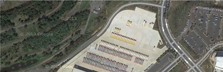
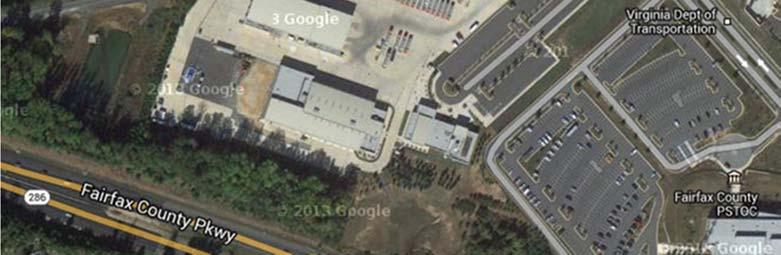
JOINT FACILITIES ADVISORY COMMISSION. ART and APS Bus Parking Informational Session July 27, :30 pm
 ART and APS Bus Parking Informational Session July 27, 2017 7 8:30 pm 2 Agenda Introductions & overview APS Bus Parking APS Bus Facts APS Bus Operations ART Bus Parking Story of ART and its role in County
Metropolitan Council Budget Overview SFY
 Metropolitan Council Budget Overview SFY 2016-2017 H T t ti C itt House Transportation Committee February 4, 2015 Transit connects us to the places that matter Transportation Needs Grow as the Region Grows
STH 60 Northern Reliever Route Feasibility Study Report
 #233087 v3 STH 60 Northern Reliever Route Feasibility Study Report Washington County Public Works Committee Meeting September 28, 2016 1 STH 60 Northern Reliever Route Feasibility Study Hartford Area Development
EUGENE-SPRINGFIELD, OREGON EAST WEST PILOT BRT LANE TRANSIT DISTRICT
 EUGENE-SPRINGFIELD, OREGON EAST WEST PILOT BRT LANE TRANSIT DISTRICT (BRIEF) Table of Contents EUGENE-SPRINGFIELD, OREGON (USA)... 1 COUNTY CONTEXT AND SYSTEM DESCRIPTION... 1 SYSTEM OVERVIEW... 1 PLANNING
I-820 (East) Project Description. Fort Worth District. Reconstruct Southern I-820/SH 121 Interchange
 Project Description. Fort Worth District. Reconstruct Southern I-820/SH 121 Interchange") I-820 (East) Project Description Fort Worth District Reconstruct Southern I-820/SH 121 Interchange I-820 from approximately 2,000 feet north of Pipeline Road/Glenview Drive to approximately 3,200 feet
I-820 (East) Project Description Fort Worth District Reconstruct Southern I-820/SH 121 Interchange I-820 from approximately 2,000 feet north of Pipeline Road/Glenview Drive to approximately 3,200 feet
Bi-County Transitway/ Bethesda Station Access Demand Analysis
 Bi-County Transitway/ Bethesda Station Access Demand Analysis Prepared for: Washington Metropolitan Area Transit Authority Office of Planning and Project Development May 2005 Prepared by: in conjunction
Washington Metropolitan Area Transit Authority
 Executive Summary: Metrobus Network Evaluation and Future Fleet Needs Presented to: Washington Metropolitan Area Transit Authority Submitted by: In Association with P 2 D Joint Venture Introduction Metrobus
STRATEGIC PRIORITIES AND POLICY COMMITTEE MAY 5, 2016
 STRATEGIC PRIORITIES AND POLICY COMMITTEE MAY 5, 2016 Shift Rapid Transit Initiative Largest infrastructure project in the city s history. Rapid Transit initiative will transform London s public transit
Executive Summary. Draft Environmental Impact Statement/Environmental Impact Report ES-1
 Executive Summary Introduction The Eastside Transit Corridor Phase 2 Project is a vital public transit infrastructure investment that would provide a transit connection to the existing Metro Gold Line
Update on Transportation Activities in Fairfax County
 Update on Transportation Activities in Fairfax County Transportation Roundtable Dulles Area Transportation Association June 13, 2018 Tom Biesiadny, Director Fairfax County Continuing Project Implementation
5. OPPORTUNITIES AND NEXT STEPS
 5. OPPORTUNITIES AND NEXT STEPS When the METRO Green Line LRT begins operating in mid-2014, a strong emphasis will be placed on providing frequent connecting bus service with Green Line trains. Bus hours
Kendall Drive Premium Transit PD&E Study Project Kick-Off Meeting SR 94/Kendall Drive/SW 88 Street Project Development and Environment (PD&E) Study
 Study") Florida Department of Transportation District Six Kendall Drive Premium Transit PD&E Study Project Kick-Off Meeting SR 94/Kendall Drive/SW 88 Street Project Development and Environment (PD&E) Study What
Florida Department of Transportation District Six Kendall Drive Premium Transit PD&E Study Project Kick-Off Meeting SR 94/Kendall Drive/SW 88 Street Project Development and Environment (PD&E) Study What
Appendix B. Tier 2 Final Environmental Assessment I-66 Transit/TDM Technical Report
 Tier 2 Final Environmental Assessment I-66 Transit/TDM Technical Report Appendix B Bus Bay, Maintenance, and Storage Capacity Analysis Technical Memorandum FINAL MAY 2016 INTRODUCTION This technical memorandum
CITY OF LONDON STRATEGIC MULTI-YEAR BUDGET ADDITIONAL INVESTMENTS BUSINESS CASE # 6
 2016 2019 CITY OF LONDON STRATEGIC MULTI-YEAR BUDGET ADDITIONAL INVESTMENTS BUSINESS CASE # 6 STRATEGIC AREA OF FOCUS: SUB-PRIORITY: STRATEGY: INITIATIVE: INITIATIVE LEAD(S): BUILDING A SUSTAINABLE CITY
Transportation. Background. Transportation Planning Goals. Level of Service Analysis 5-1
 Transportation portion of the city s stormwater utility, and state road and fuel taxes. Background The transportation needs of the City of Lacey and its planning areas are met by a growing multimodal network
Proposed FY2015 Budget and Fare Increase
 Washington Metropolitan Area Transit Authority Proposed FY2015 Budget and Fare Increase Riders Advisory Council January 8, 2014 1 Washington Metropolitan Area Transit Authority What will riders see from
Draft Results and Recommendations
 Waco Rapid Transit Corridor (RTC) Feasibility Study Draft Results and Recommendations Chris Evilia, Director of Waco Metropolitan Planning Organization Allen Hunter, General Manager Waco Transit System
1.0 Detailed Definition of Alternatives
 1.0 Detailed Definition of Alternatives 1.1 Introduction This chapter provides supplemental information on the four alternatives, including both physical and operational characteristics (e.g. service plans)
Comprehensive Regional Goods Movement Plan and Implementation Strategy Goods Movement in the 2012 RTP/SCS
 Comprehensive Regional Goods Movement Plan and Implementation Strategy Goods Movement in the 2012 RTP/SCS Annie Nam Southern California Association of Governments September 24, 2012 The Goods Movement
Waco Rapid Transit Corridor (RTC) Feasibility Study
 Feasibility Study") Waco Rapid Transit Corridor (RTC) Feasibility Study Chris Evilia, Director of Waco Metropolitan Planning Organization Allen Hunter, General Manager Waco Transit System Jimi Mitchell, Project Manager AECOM
Waco Rapid Transit Corridor (RTC) Feasibility Study Chris Evilia, Director of Waco Metropolitan Planning Organization Allen Hunter, General Manager Waco Transit System Jimi Mitchell, Project Manager AECOM
Leadership NC. November 8, 2018
 v Leadership NC November 8, 2018 Planning for our region s growth The Triangle is one of the fastestgrowing regions in the nation. More than 2 million people are already part of the equation, and the
Capital Needs Assessment Riders Advisory Council July2, 2008
 Capital Needs Assessment 2011-2020 Riders Advisory Council July2, 2008 1 Outline I. Capital Improvement Plan History II. Capital Improvement Plan Update III. Capital Needs Assessment State of Good Repair
BROWARD BOULEVARD CORRIDOR TRANSIT STUDY
 BROWARD BOULEVARD CORRIDOR TRANSIT STUDY FM # 42802411201 EXECUTIVE SUMMARY July 2012 GOBROWARD Broward Boulevard Corridor Transit Study FM # 42802411201 Executive Summary Prepared For: Ms. Khalilah Ffrench,
Energy Technical Memorandum
 Southeast Extension Project Lincoln Station to RidgeGate Parkway Prepared for: Federal Transit Administration Prepared by: Denver Regional Transportation District May 2014 Table of Contents Page No. Chapter
RTSP Phase II Update
 Washington Metropolitan Area Transit Authority RTSP Phase II Update Presentation to the Technical Advisory Group July 18, 2013 Meeting 1 Presentation Outline RTSP Integration with Momentum RTSP Process
Transit Access to the National Harbor
 Transit Access to the National Harbor December 2014 Table of Contents Executive Summary... 3 Introduction and Project Purpose... 6 Methodology.. 9 Definition of Alternatives..... 9 Similar Project Implementation
A Transit Plan for the Future. Draft Network Plan
 A Transit Plan for the Future Draft Network Plan Project Overview and Status Completed Market Analysis and Service Evaluation. Developed Plan Framework and Guiding Principles. Developed a draft Five Year
ConnectGreaterWashington: Can the Region Grow Differently?
 Washington Metropolitan Area Transit Authority ConnectGreaterWashington: Can the Region Grow Differently? Transportation Planning Board (TPB) Travel Forecasting Subcommittee July 17, 2015 1 Alternatives
6/6/2018. June 7, Item #1 CITIZENS PARTICIPATION
 June 7, 2018 Item #1 CITIZENS PARTICIPATION 1 Item #2 APPROVAL OF MINUTES Item #3 TRAC GOALS, FRAMEWORK & AGENDA REVIEW 2 COMMITTEE GOALS Learn about Southern Nevada s mobility challenges, new developments
IH 45 (GULF FWY) IH 10 (Katy Fwy) to IH 610 S (South Loop) 2010 Rank: Rank: 12
 IH 10 (Katy Fwy) to IH 610 S (South Loop) 2010 Rank: Rank: 12") Mobility Investment Priorities Project Houston IH 45 IH 45 (GULF FWY) IH 10 (Katy Fwy) to IH 610 S (South Loop) Current Conditions From IH 10 to IH 610 south, IH 45 is a 6- to 9-lane facility with three
Mobility Investment Priorities Project Houston IH 45 IH 45 (GULF FWY) IH 10 (Katy Fwy) to IH 610 S (South Loop) Current Conditions From IH 10 to IH 610 south, IH 45 is a 6- to 9-lane facility with three
Draft Results and Open House
 Waco Rapid Transit Corridor (RTC) Feasibility Study Draft Results and Open House Chris Evilia, Director of Waco Metropolitan Planning Organization Allen Hunter, General Manager Waco Transit System Jimi
Janice Fortunato Senior Director Business Partnerships
 Janice Fortunato Senior Director Business Partnerships What are Megaprojects? They are large-scale projects distinguished by cost, complexity and the potential impact on the community. Collectively, these
Needs and Community Characteristics
 Needs and Community Characteristics Anticipate Population and Job Growth in the City Strongest density of population and jobs in Ann Arbor are within the Study Area Population expected to grow 8.4% by
Executive Summary. Treasure Valley High Capacity Transit Study Priority Corridor Phase 1 Alternatives Analysis October 13, 2009.
 Treasure Valley High Capacity Transit Study Priority Corridor Phase 1 Alternatives Analysis October 13, 2009 Background As the Treasure Valley continues to grow, high-quality transportation connections
Metro Transit Update. Christina Morrison, Senior Planner Metro Transit BRT/Small Starts Project Office. John Dillery, Senior Transit Planner
 Metro Transit Update Christina Morrison, Senior Planner Metro Transit BRT/Small Starts Project Office John Dillery, Senior Transit Planner Metro Transit Service Development May 16, 2013 1 Transit Planning
US 59 (SOUTHWEST FWY) IH 610 (West Loop) to SH 288 (South Fwy)
 IH 610 (West Loop) to SH 288 (South Fwy)") Mobility Investment Priorities Project Houston US 59 US 59 (SOUTHWEST FWY) IH 610 (West Loop) to SH 288 (South Fwy) Current Conditions From IH 610 West to SH 288, US 59 operates with four or five lanes
Mobility Investment Priorities Project Houston US 59 US 59 (SOUTHWEST FWY) IH 610 (West Loop) to SH 288 (South Fwy) Current Conditions From IH 610 West to SH 288, US 59 operates with four or five lanes
Kenosha-Racine-Milwaukee (KRM)
") Kenosha-Racine-Milwaukee (KRM) Commuter Rail #147925 November 6, 2009 1 Guidance of KRM Commuter Rail Studies Intergovernmental Partnership Technical Steering Committee Temporary and Limited Authority
Kenosha-Racine-Milwaukee (KRM) Commuter Rail #147925 November 6, 2009 1 Guidance of KRM Commuter Rail Studies Intergovernmental Partnership Technical Steering Committee Temporary and Limited Authority
Report by Planning, Development & Real Estate Committee (B) Washington Metropolitan Area Transit Authority Board Action/Information Summary
 Washington Metropolitan Area Transit Authority Board Action/Information Summary") Report by Planning, Development & Real Estate Committee (B) 06-26-08 Washington Metropolitan Area Transit Authority Board Action/Information Summary Action Information MEAD Number: 100027 Resolution: Yes
Report by Planning, Development & Real Estate Committee (B) 06-26-08 Washington Metropolitan Area Transit Authority Board Action/Information Summary Action Information MEAD Number: 100027 Resolution: Yes
Transportation Demand Management Element
 Transportation Demand Management Element Over the years, our reliance on the private automobile as our primary mode of transportation has grown substantially. Our dependence on the automobile is evidenced
Leesburg Dulles Greenway BRT Feasibility
 Leesburg Dulles Greenway BRT Feasibility May 28, 2008 Introduction Increase the use of public transit service by local residents, employees, and visitors alike to help reduce motor vehicle use and traffic
MWAA FY /16/2008 NORTHERN VIRGINIA TRANSPORTATION IMPROVEMENT PROGRAM CAPITAL COSTS (in $1,000) Source Source Total Fed/St/Loc.
 Source Source Total Fed/St/Loc.") Capital VIRGINIA MWAA Title: Dulles Corridor Metrorail Project - Phase 1 53,584 c East Falls Church Metrorail Station Wiehle Avenue Fairfax County, 75,174 c 636,182 c 849,625 c 695,240 c 415,559 c 214,064
Capital VIRGINIA MWAA Title: Dulles Corridor Metrorail Project - Phase 1 53,584 c East Falls Church Metrorail Station Wiehle Avenue Fairfax County, 75,174 c 636,182 c 849,625 c 695,240 c 415,559 c 214,064
Service Quality: Higher Ridership: Very Affordable: Image:
 Over the past decade, much attention has been placed on the development of Bus Rapid Transit (BRT) systems. These systems provide rail-like service, but with buses, and are typically less expensive to
The City of Toronto s Transportation Strategy July 2007
 The City of Toronto s Transportation Strategy July 2007 Presentation Outline Transportation Statistics Transportation Building Blocks Toronto s Official Plan Transportation and City Building Vision Projects
HDR Engineering. HART North / South. Tampa Bay Applications Group Meeting May 14, 2009
 HDR Engineering HART North / South BRT Corridor PD&E Tampa Bay Applications Group Meeting May 14, 2009 1 Agenda Update on Project Development and Environment (PD&E) Study Project Overview System Branding
US 29 Bus Rapid Transit Planning Board Briefing. February 16, 2017
 US 29 Bus Rapid Transit Planning Board Briefing February 16, 2017 Project Goals Improve the quality of transit service Improve mobility opportunities and choices Enhance quality of life Support master
FREQUENTLY ASKED QUESTIONS
 FREQUENTLY ASKED QUESTIONS 2018 What is the More MARTA Atlanta program? The More MARTA Atlanta program is a collaborative partnership between MARTA and the City of Atlanta to develop and implement a program
Master Transportation Plan. Transit Element
 Transit Element March, 2009 1 Table of Contents I. Introduction...1 II. Summary...2 III. Policies, Implementation Actions and Performance Measures.4 IV. The Primary and Secondary Transit Networks....13
Unified Corridor Investment Study DRAFT Step 2 Scenario Analysis Report
 Unified Corridor Investment Study DRAFT Step 2 Scenario Analysis Report REVISIONS 1. Table 39: New Public Investments for Operation and Maintenance Costs 2. Appendix A-10: Passenger Rail Service - Operations
Chapter 7: Travel Demand Analysis. Chapter 8. Plan Scenarios. LaSalle Community Center. Image Credit: Town of LaSalle
 Chapter 7: Travel Demand Analysis Chapter 8 Plan Scenarios LaSalle Community Center. Image Credit: Town of LaSalle 164 Chapter 8: Plan Scenarios Moving Ahead for Progress in the 21 st Century Act (MAP
Help shape your community investment in Wake Transit. Fiscal Year 2019 Draft Work Plan Summary
 Help shape your community investment in Wake Transit Fiscal Year 2019 Draft Work Plan Summary Wake County, growth and transit The Triangle is one of the fastest-growing regions in the nation. Wake County
West Broadway Reconstruction/LRT Design. March 19, 2015
 West Broadway Reconstruction/LRT Design March 19, 2015 1 Meeting Agenda 6:05 6:30 PM Brief presentation What we heard Project overview 6:30 8:00 PM Visit Six Topic Areas Road and LRT design elements Pedestrian
Downtown Transit Connector. Making Transit Work for Rhode Island
 Downtown Transit Connector Making Transit Work for Rhode Island 3.17.17 Project Evolution Transit 2020 (Stakeholders identify need for better transit) Providence Core Connector Study (Streetcar project
TRANSPORTATION EFFECTS
 6 TRANSPORTATION EFFECTS This chapter describes the long-term and construction effects of the No Build Alternative, the Wiehle Avenue, and the full LPA on the local and regional transportation network.
Dixie Transportation Planning Office
 A project must be given a yes rating on items 1 & 2 in order to be prioritized. Sponsor: St. George City Project: Pioneer Parkway Type: Road Widening and Reconstruction Rev. 9/17/2010 Dixie Transportation
2030 Multimodal Transportation Study
 2030 Multimodal Transportation Study City of Jacksonville Planning and Development Department Prepared by Ghyabi & Associates April 29,2010 Introduction Presentation Components 1. Study Basis 2. Study
QUALITY OF LIFE EXECUTIVE SUMMARY REPORT I O N S TAT I O N
 QUALITY OF LIFE EXECUTIVE SUMMARY REPORT UN I O N S TAT I O N T R AV E L by TR A I N Published September 2017 2015 PROGRESS MAP This document reports FasTracks progress through 2015 BACKGROUND RTD The
May 23, 2011 APTA Bus & Paratransit Conference. Metro ExpressLanes
 May 23, 2011 APTA Bus & Paratransit Conference Metro ExpressLanes Program Overview > Conversion of HOV lanes to HOT lanes on I-10 and I-110 > Multi-modal Integrated Corridor Emphasis > 1 of 6 Nationwide
Valley Metro Overview. ITE/IMSA Spring Conference March 6, 2014
 Valley Metro Overview ITE/IMSA Spring Conference March 6, 2014 Valley Metro Who Are We? Operate Regional Transit Services Valley Metro and Phoenix are region s primary service providers Light Rail and
REPORT CARD FOR CALIFORNIA S INFRASTRUCTURE WHAT YOU SHOULD KNOW ABOUT CALIFORNIA S TRANSIT FACILITIES
 TRANSIT GRADE: C- WHAT YOU SHOULD KNOW ABOUT TRANSIT FACILITIES California needs robust, flexible and reliable transit systems to reduce peak congestion on our highways, provide options for citizens who
GLEBE 672 TRAFFIC IMPACT ANALYSIS ARLINGTON COUNTY, VIRGINIA. Section 1 INTRODUCTION 1
 GLEBE 672 TRAFFIC IMPACT ANALYSIS ARLINGTON COUNTY, VIRGINIA TABLE OF CONTENTS Page Section 1 INTRODUCTION 1 Section 2 BACKGROUND INFORMATION 6 Public Road Network... 6 Non Auto Facilities and Services...
THE WAY WE MOVE LRT FOR EVERYONE
 THE WAY WE MOVE LRT FOR EVERYONE 2 LRT for Everyone LRT FOR EVERYONE Light rail is about more than transit; it s about transforming Edmonton. As the city grows, so do its transportation needs. LRT is an
Point A Point B Point C Point D. Fulton County Board of Commissioners and Mayors Meeting December 14, 2017
 Fulton County Board of Commissioners and Mayors Meeting December 14, 2017 Master Plan Overview Phase 1 Community Vision and Existing Transit Conditions Phase 2 Scenario Development Phase 3 Transit Master
Metropolitan Freeway System 2013 Congestion Report
 Metropolitan Freeway System 2013 Congestion Report Metro District Office of Operations and Maintenance Regional Transportation Management Center May 2014 Table of Contents PURPOSE AND NEED... 1 INTRODUCTION...
SOUTHERN GATEWAY. Transportation and Trinity River Project Committee 11 May 2015
 SOUTHERN GATEWAY Transportation and Trinity River Project Committee 11 May 2015 Southern Gateway Project History Began in 2001 as a Major Investment Study [ MIS ], Schematic, and Environmental Assessment
US 81 Bypass of Chickasha Environmental Assessment Public Meeting
 US 81 Bypass of Chickasha Environmental Assessment Public Meeting March 14, 2013 Introductions ODOT FHWA SAIC Meeting Purpose Present need for bypass Provide responses to 10/04/11 public meeting comments
Customer Services, Operations, and Safety Committee Board Information Item III-E May 13, 2010 Bus Fleet Plan
 Customer Services, Operations, and Safety Committee Board Information Item III-E May 13, 2010 Bus Fleet Plan Page 72 of 96 Washington Metropolitan Area Transit Authority Board Action/Information Summary
Parking Management Element
 Parking Management Element The State Transportation Planning Rule, adopted in 1991, requires that the Metropolitan Planning Organization (MPO) area implement, through its member jurisdictions, a parking
Improving Accessibility of Regional Bus Stops and Pathways
 Customer Service and Operations Committee Board Information Item III-A March 13, 2014 Improving Accessibility of Regional Bus Stops and Pathways Page 3 of 17 Washington Metropolitan Area Transit Authority
V03. APTA Multimodal Operations Planning Workshop August Green Line LRT
 V03 APTA Multimodal Operations Planning Workshop August 2016 Green Line LRT 2 Presentation Outline Past Present Future 3 16/03/2016 RouteAhead Update 4 4 16/03/2016 RouteAhead Update 5 5 16/03/2016 6 6
2016 Congestion Report
 2016 Congestion Report Metropolitan Freeway System May 2017 2016 Congestion Report 1 Table of Contents Purpose and Need...3 Introduction...3 Methodology...4 2016 Results...5 Explanation of Percentage Miles
2.1 TRANSIT VISION 2040 FROM VISION TO ACTION. Expand regional rapid transit networks STRATEGIC DIRECTION
 TRANSIT VISION 2040 FROM VISION TO ACTION TRANSIT VISION 2040 defines a future in which public transit maximizes its contribution to quality of life with benefits that support a vibrant and equitable society,
King County Metro. Columbia Street Transit Priority Improvements Alternative Analysis. Downtown Southend Transit Study. May 2014.
 King County Metro Columbia Street Transit Priority Improvements Alternative Analysis Downtown Southend Transit Study May 2014 Parametrix Table of Contents Introduction... 1 Methodology... 1 Study Area...
Balancing the Transportation Needs of a Growing City
 Balancing the Transportation Needs of a Growing City FY 2019 and FY 2020 Capital Budget SFMTA Board Meeting Ed Reiskin, Director of Transportation April 3, 2018 1 FY 2019-23 Capital Improvement Program
Sustainability SFMTA Path to Platinum
 Sustainability SFMTA Path to Platinum Ed Reiskin San Francisco Municipal Transportation Agency, Director of Transportation San Francisco, CA Timothy Papandreou Deputy Director Strategic Planning & Policy
Redefining Mobility Ready or not: Autonomous and connected vehicle planning and policy, now and in the future
 Redefining Mobility Ready or not: Autonomous and connected vehicle planning and policy, now and in the future Randy Iwasaki November 30, 2017 WHO WE ARE The Contra Costa Transportation Authority (CCTA)
Independence Institute Denver West Parkway, Suite 185 Golden, Colorado i2i.org/cad.aspx BRT = BTR
 Independence Institute 14142 Denver West Parkway, Suite 185 Golden, Colorado 80401 303-279-6536 i2i.org/cad.aspx BRT = BTR Bus-Rapid Transit Is Better Than Rail: The Smart Alternative to Light Rail Joseph
Executive Summary. I-95 Transit/TDM Study
 Executive Summary I-95 Transit/TDM Study (Page Left Intentionally Blank) Contents 1 Existing Conditions 1-1 1.1 Previous Studies 1-1 1.2 Transit Service 1-1 1.2.1 Park and Ride Lots 1-3 1.2.2 Ridership
IMPROVEMENT CONCEPTS
 IMPROVEMENT CONCEPTS for the South Novato Transit Hub Study Prepared by: January 11, 2010 DKS Associates With Wilbur Smith Associates IMPROVEMENT CONCEPTS Chapter 1: Introduction 1. INTRODUCTION The strategic
SERVICE DESIGN GUIDELINES
 VTA TRANSIT SUSTAINABILITY POLICY: APPENDIX A SERVICE DESIGN GUIDELINES Adopted February 2007 COMMUNITYBUS LOCALBUS EXPRESSBUS BUSRAPIDTRANSIT LIGHTRAILTRANSIT STATIONAREAS S A N T A C L A R A Valley Transportation
Art Griffith, Capital Projects Manager, ,
 Part 1 Base Information 1. Project Title Broadway & Highlands Ranch Pkwy. Intersection Capacity and Safety Improvement Project 2. Project Start/End points or Geographic Area Provide a map with submittal,
Northeast Corridor Alternatives Analysis. Public Involvement Round 2 Input on Alternatives for Further Study
 Northeast Corridor Alternatives Analysis Public Involvement Round 2 Input on Alternatives for Further Study Feb. 7-9, 2012 Agenda Review project background Progress summary Recommended alternatives for
2.4 TRANSIT VISION 2040 FROM VISION TO ACTION. Support the revitalization of urban cores STRATEGIC DIRECTION
 TRANSIT VISION 2040 FROM VISION TO ACTION TRANSIT VISION 2040 defines a future in which public transit maximizes its contribution to quality of life with benefits that support a vibrant and equitable society,
Pacific Electric Right-of-Way / West Santa Ana Branch Corridor Alternatives Analysis
 Pacific Electric Right-of-Way / West Santa Ana Branch Corridor Alternatives Analysis Transit Coalition September 26, 2012 2 Study Area Pacific Electric Rightof-Way/West Santa Ana Branch (PEROW/ WSAB) extends
Connected Vehicle and Autonomous Vehicle (CV/AV) Mobility and Technology
 Mobility and Technology") Connected Vehicle and Autonomous Vehicle (CV/AV) Mobility and Technology Randy Iwasaki Executive Director Contra Costa Transportation Authority May13, 2016 WHO WE ARE The Contra Costa Transportation Authority
Connected Vehicle and Autonomous Vehicle (CV/AV) Mobility and Technology Randy Iwasaki Executive Director Contra Costa Transportation Authority May13, 2016 WHO WE ARE The Contra Costa Transportation Authority
Rapid Transit and Land-Use Integration a Reality
 City of Charlotte Rapid Transit and Land-Use Integration a Reality Transportation Oversight Committee Carolyn Flowers CEO Charlotte Area Transit System April 29, 2010 Charlotte Region Statistics Mecklenburg
Develop ground transportation improvements to make the Airport a multi-modal regional
 Project Overview TRANSPORTATION IMPROVEMENTS WHAT ARE THE PROJECT GOALS? Transportation transportation hub. Develop ground transportation improvements to make the Airport a multi-modal regional Land Use
Update on Bus Stop Enhancements
 Customer Service and Operations Committee Board Information Item III-A February 2, 2012 Update on Bus Stop Enhancements Page 3 of 15 Washington Metropolitan Area Transit Authority Board Action/Information
Strategic Plan
 2005-2015 Strategic Plan SUMMARY OF THE REVISED PLAN IN 2011 A decade focused on developing mass transit in the Outaouais A updated vision of mass transit in the region The STO is embracing the future
Public Meeting. City of Chicago Department of Transportation & Department of Housing and Economic Development
 Public Meeting City of Chicago Department of Transportation & Department of Housing and Economic Development Funded by Regional Transportation Authority September 12, 2011 In partnership with Presentation