CENTRAL MESA HIGH C CENTRAL MESA HIGH CAPACIT CIT Y TRANSIT C TRANSIT CORRIDOR ORRIDOR
|
|
|
- Jewel Wilson
- 6 years ago
- Views:
Transcription


1 CENTRAL MESA HIGH CAPACITY TRANSIT CORRIDOR study SCOPING BROCHURE
.")
2 INTRODUCTION Study Description, Project Background METRO and the City of Mesa are conducting a 24-month study to analyze potential high capacity transit corridors in the downtown Mesa area and east to Power Road. The study follows a process to qualify for federal funding and is referred to as an Alternatives Analysis (AA). Upon completion of the AA, the appropriate environmental documentation will be completed according to the National Environmental Policy Act (NEPA) and Federal Transit Administration (FTA) guidance. The AA is the first stage of the transit planning process required by the FTA in accordance with recently enacted federal transportation legislation. During the course of these studies, METRO and the City of Mesa will examine several potential transit technologies and alignments that could be built in the study area. The AA study is conducted concurrent with a public involvement program that is structured to obtain community feedback, share project details, and ascertain community desires regarding potential high capacity transit service Downtown Mesa improvements. This will help METRO and the City to identify the route and transit technology that will provide the best transportation choices for Mesa and East Valley residents. The Central Mesa Corridor Study is funded by the Proposition 400 half-cent transportation sales tax extension approved by Maricopa County voters in 2004, and is contained in the adopted RTP as a component of the 57 miles of light rail / high capacity transit (HCT) network to be implemented by 2026 (Figure 1). The 20- mile light rail starter line now under construction runs through Phoenix, Tempe and Mesa, where it will terminate at a station located at Sycamore and Main Streets. This starter line will open for passenger service in December Other high capacity or light rail corridors are planned to be implemented as follows: Northwest Phase I opens in 2012; Phase II opens in 2017; Tempe South opens in 2015; Central Mesa opens in 2015; Glendale opens 2017; I-10 West opens 2019; and Northeast opens in The Central Mesa High Capacity Transit study area, shown on (Figure 2), is bounded by Dobson Road on the west, Power Road on the east, University Drive on the north, and the U.S. 60 Freeway on the south. The City of Mesa, which spans approximately 132 square miles, is the third largest city in Arizona. Mesa s estimated population of 455,100 is expected to increase by approximately 25% by The current MAG travel demand model shows an approximate 30% increase in person trips between 2004 and 2030 for Maricopa County, and an approximate 40% increase in work trips for the same period. Growth in the City of Mesa has caused substantial increases in traffic congestion on the existing roadway network, and has generated the need for new public transportation service.


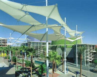
3 Mesa Arts Center Even with implementation of the projects included in the MAG Regional Transportation Plan, level of service (LOS) in 2030 on both the area freeways and arterials is expected to deteriorate substantially because of increased travel demand, resulting in a significant increase in delay. According to preliminary reviews of future travel trends, daily freeway congestion in the Mesa study corridor is expected to exceed congestion levels in other areas, such as the Downtown Phoenix area, Sky Harbor Airport vicinity and the Tempe rail corridor. In 2030, daily congestion is expected on 93% of lane miles on roadways in the Mesa project corridor, a growth of 66% over current levels. EVIT Areas in Mesa located west of the immediate project corridor are expected to generate highest growth in vehicular travel. In southwest and southeast Mesa, vehicular travel trends are projected to be at the highest levels by 2030, in comparison to other areas of the County, east of the project study area. Consistent with this anticipated trend, traffic congestion is expected to be most severe on south Mesa roadways, and on freeways that serve the Mesa corridor in general (U.S. Hwy 60 Superstition Freeway). The potential for the high capacity transit improvement to address this heightened travel demand by connecting the project corridor with the end-of-line station at Sycamore will be examined during the AA, and particularly in the development of the Purpose and Need Statement for the project. In addition, several attractions of regional significance are being planned throughout the City. These attractions will provide significant employment, commercial, entertainment and retail resources, and are expected to generate even greater demand for travel and access, both within the City limits and between the City and regionally significant areas west and northwest of the City, such as the City of Tempe, the Phoenix Central Business District (CBD)/Washington Corridor, and the Spectrum Mall vicinity. Downtown Mesa
4 PURPOSE OF STUDY Identify a transit alternative that increases efficient access to employment opportunities throughout the Central Phoenix/ East Valley region for City of Mesa residents. Identify a transit alternative that provides improved travel times in a congested environment over local bus. Identify a transit improvement alternative, with a recommended alignment and technology, to connect the western and central segments of the City of Mesa with the Central Phoenix/East Valley Light Rail System currently under construction; Identify a widely-supported transit improvement alternative that would facilitate continued growth and development of a comprehensive and inter-connected regional transit network that is multi-modal, that offers a range of effective mobility choices for current and future transit riders, and that attracts new transit riders onto the growing regional system. Identify a transit alternative that supports economic development, and ensures enhanced connectivity among existing and planned regional and local activity centers and attractions. THE SCOPING PROCESS What is it, Why do it? Scoping is a study process designed to inform the public, interested groups and participating agencies about the proposed project, potential alternatives under consideration, and issues for public and agency review and input. The main goal is to encourage the active participation of the community and public agencies early in the decision-making process. It provides the public an opportunity to communicate issues and concerns to help develop alternatives before considerable resources have been expended. The scoping process defines the alternative routes and alignments that will be examined in the study, identifies potential impacts that could arise from the implementation of each alternative under consideration, and establishes the goals and objectives that will guide the evaluation of project alternatives. Key issues are identified, and the technical analyses that will address issues are defined. Citizens, agencies and community organizations are encouraged to comment early in the process so that they can provide input in setting the direction of the study, including the definition of project goals and objectives, issues, and impacts to be studied. All reasonable alternatives and potentially significant project impacts are identified and examined early in the process. Public scoping meetings to accept comments on the scope of the study will be held on the following dates: Thursday, Aug. 23, 2007, at 6:00 p.m. Mesa City Plaza, Training Room E. Main Street, Mesa, AZ Thursday, Aug. 30, 2007, at 6:00 p.m. Jefferson Elementary School, Recreation Center 120 S. Jefferson Avenue, Mesa, AZ 85208
5 The buildings used for the scoping meetings are accessible to persons with disabilities. Any individual who requires special assistance, such as a sign language interpreter, to participate in a scoping meeting should contact Jodi Sorrell, City of Mesa, 600 SE Sixth Street, Mesa, AZ (Telephone ) at least 48 hours in advance of a meeting in order for METRO and the City of Mesa to make the necessary arrangements. In addition, a scoping meeting will be held for governmental agencies as shown: Tuesday, Aug. 21, 2007 at 10:00 a.m. METRO 101 North 1st Ave., Suite 1300 Phoenix, AZ Written and ed comments on the scope of study, including the alternatives to be considered, and the impacts to be assessed, should be sent to Valley Metro Rail, Inc. (METRO) on or before Sept. 13, 2007, addressed to: Additional opportunities for community involvement will be provided throughout the study process as discussed in the Public Involvement section of this document. This scoping information booklet has been developed to provide information about the scoping process itself, the background information leading to the need for the study, the project development process, the initial alternatives being considered, the environmental impact and financial analysis processes, and opportunities for public involvement. METRO and the City of Mesa welcome your participation to help identify important issues and to bring fresh ideas and suggestions to our attention. We encourage you to review the information contained in this booklet; it provides the background information that will help you formulate your comments on the study. Mr. Marc Soronson METRO 101 North 1st Avenue, Suite 1300, Phoenix, AZ centralmesa@metrolightrail.org Ph: (602) 254-RAIL Fax: (602) Scoping Meeting Format The purpose and need for the project, as well as the initial set of alternatives proposed for study, will be presented at these meetings. The scoping meetings will be held in an openhouse format, and representatives will be available to discuss the project throughout the time periods given. Oral and written comments may be given at the scoping meetings, and a court reporter will be available to record all comments.
6 FIGURE 1: REGIONAL TRANSPORTATION PLAN TRANSIT CORRIDORS LEGEND Beardsley Rd Bell Rd Thunderbird Rd Peoria Ave Northern Ave Bethany Home Rd Indian School Rd McDowell Rd Buckeye Rd Broadway Rd Baseline Rd 101 Peoria Glendale Phoenix Phoenix Paradise Valley Scottsdale 2015 Tempe 101 Chaparral Rd Thomas Rd Initial 20-mile Light Rail Alignment (Scheduled to open Dec. 2008) Northwest Extension Phase 1 (Scheduled to open 2012) Future High Capacity / Light Rail Corridors for Further Study Central Mesa Corridor Note: Dates indicate calendar year openings Mesa McKellips Rd University Dr Southern Ave Guadalupe Rd Gilbert Warner Rd South Chandler Mountain Freeway Santan Freeway Chandler Blvd Germann Rd 99th Ave 83rd Ave 67th Ave 51st Ave 35th Ave 19th Ave Central Ave 24th St 40th St 56th St Rural Rd Price Rd Alma School Rd McQueen Rd Gilbert Rd Val Vista Dr FIGURE 2: CENTRAL MESA CORRIDOR STUDY AREA University Dr Main St Union Pacific Railroad Broadway Rd Pueblo Ave/8th St Tempe canal EVIT CITY HALL LEGEND Light rail starter line / Station Central Mesa study area High capacity / LRT corridor* Planned BRT routes* AA BRT alternatives Freeway Express *Regional Transportation Plan - RTP Southern Ave 60 SUPERSTITION SPRINGS CENTER Dobson Rd Sycamore Alma School Rd Extension Rd Country Club Dr Center St Mesa Dr Stapley Dr Gilbert Rd Lindsay Rd Val Vista Dr Greenfield Rd Higley Rd Recker Rd Power Rd
7 PROJECT DEVELOPMENT PROCESS The AA/EIS will be prepared in accordance with NEPA and its implementing regulations issued by the Council on Environmental Quality (40 CFR Parts ) and with the FTA/ Federal Highway Administration regulations Environmental Impact and Related Procedures (23 CFR Part 771). In accordance with 23 CFR (a) and , FTA will comply with all Federal environmental laws, regulations, and executive orders applicable to the proposed project during the environmental review process to the maximum extent practicable. These requirements include, but are not limited to, the environmental and public hearing provisions of Federal transit laws (49 U.S.C. 5301(e), 5323(b), and 5324), the project-level air quality conformity regulation of the U.S. Environmental Protection Agency (EPA) (40 CFR part 93), the Section 404(b)(1) guidelines of EPA (40 CFR part 230), the regulation implementing Section 106 of the National Historic Preservation Act (36 CFR part 800), the regulation implementing Section 7 of the Endangered Species Act (50 CFR part 402), Section 4(f) of the Department of Transportation Act (23 CFR ), and Executive Orders on environmental justice, on floodplain management and on wetlands. Alternatives under Consideration Central Phoenix/East Valley Light Rail LPA The 2002 Final EIS for the Central Phoenix/ East Valley Light Rail Transit Project (the LRT Starter Line that is currently under construction and scheduled to open in December 2008) identified four LRT alignment options that were outside the Build Alternative project studied in that Final EIS. These options extended from the eastern terminus of the LRT Starter Line and continued into the Mesa Town Center. All options used either Main Street, 1st Avenue, 1st Street, or some combination thereof. Recent growth in the vicinity of Mesa Drive has narrowed opportunities for adequate parkand-ride facilities in that area; therefore, it is suggested that park-and-ride facilities be located further east near Horne where a parkand-ride facility could be provided. BRT Alternative The City of Mesa recently conducted a study to evaluate new and improved bus rapid transit (BRT) in the study area. The study recommended a phased BRT project that would initially connect the eastern terminus of the LRT Starter Line to Superstition Springs Mall via Main Street and Power Road, a total of 13 miles. Phase 1 of the BRT project is scheduled to coincide with the opening of the LRT Starter Line in Future operating and service characteristics for the BRT project are subject to change pending the results of the AA/EIS and public and agency input. Other Alternatives At a minimum, the alternatives to be considered include the following: No-Build implements a modified existing and committed road and transit improvements as defined by the Regional Transportation Plan and coordinated with the City of Mesa. The No-Build includes the Mesa BRT project on Main Street scheduled for operation in December Transportation System Management (TSM) includes reasonable cost-effective transit service improvements short of a major capital investment in fixed guideway. The TSM implements all of the projects in the No-Build Alternative.
8 Bus Rapid Transit (BRT) - includes projects defined in the No-Build Alternative and programmed bus service expansion. BRT options under consideration extend at-grade from the LRT Starter Line to Superstition Springs Mall and include: BRT via Main Street and Power Road BRT via Main Street, Mesa Drive, and Southern Avenue BRT via Main Street, Gilbert Road, and Southern Avenue) BRT in the Mesa Town Center include: - Main Street through downtown Mesa - Main Street to 1st Street/1st Avenue Loop in downtown Mesa - Main Street to 1st Street double fixed guideway in downtown Mesa Light Rail Transit - includes projects included in the No-Build Alternative, the highway element of the TSM alternative and consideration of a LRT extension from the CP/EV end-of-line station at Sycamore to the Mesa Town Center at Horne Avenue. LRT alignment sub-options in the Mesa Town Center include (Figure 3): Main Street through downtown Mesa; Main Street to 1st Street diversion in downtown Mesa; Main Street to 1st Avenue diversion in downtown Mesa; Main Street to a 1st Street/1st Avenue couplet in downtown Mesa; and A supporting bus component would include BRT service connecting the LRT terminus at approximately Horne and would extend to Superstition Springs Mall. FIGURE 3: HCT ALTERNATIVES BASE MAP LEGEND 2nd St HCT A HCT B HCT C HCT D 1st St Main St 1st Ave 2nd Ave Sycamore Alma School Rd Extension Rd Country Club Dr Center St Mesa Dr Horne
 is a type of limited-stop service developed in the 1990s that relies on technology to help provide")


9 TRANSIT TECHNOLOGIES Transit technologies under consideration are Bus Rapid Transit and Light Rail Transit operating in exclusive guideway. Rapid Transit METRO Light Rail Orange Line in Los Angeles, California Bus Rapid Transit (BRT) is a type of limited-stop service developed in the 1990s that relies on technology to help provide speedier service and travel times. BRT can operate on exclusive transit corridors, high-occupancy-vehicle lanes, expressways, or in mixed traffic on city streets. A BRT line combines intelligent transportation systems technology, priority for transit, rapid and convenient fare collection, and integration with land use policy in order to substantially upgrade bus system performance. These are described in more detail below. The Orange Line in California is one example of BRT service. The following features characterize BRT technology: Exclusive Busway or HOV/Limited Access Roadway Busways are special roadways designed for the exclusive use of buses; HOV lanes improve service for long-distance commuters. BRT on arterial streets may include lanes reserved for buses and street enhancements that result in increased bus speed and improved service. Traffic Signal Priority Traffic signals are designed to give preference to buses. As the bus travels along its route, electronic sensors provide indications to alert the traffic signal control box, triggering the signalization program to shorten or eliminate intersection wait times for buses. Valley Metro in Phoenix, AZ Opportunities for community interaction and input will occur at important milestones throughout the study process. Within the initial phase of the Central Mesa Corridor Study, opportunities will be provided at the following milestones:
10 Boarding and Fare Collection Improvements Rapid fare collection through prepaid or electronic passes and low-floor/wide-door boarding results in time savings. Level Boarding and Precision Docking may be a feature of BRT; this would more closely emulate LRT and Street Car operations Limited Stops Increasing distances between stations or shelters increases speeds. Improved Stations and Shelters Bus terminals and unique stations or shelters differentiate BRT service from standard bus service. Intelligent Transportation Systems (ITS) Technologies Advanced technology can maintain more consistent distances between buses and inform passengers when the next bus is arriving. Modern Streamlined Vehicles The attractiveness of the technology is improved over that of standard buses to offer a variety of seating options, easier boarding, smoother rides, and greater appeal to the riding public. Light Rail Transit (LRT) Light Rail Transit (LRT) is a steel-wheeled transit system of single cars or multi-car trains (up to three vehicle consists on the CP/EV system), with articulated vehicles that allow greater turning flexibility. A distinctive feature of LRT is that vehicles draw power from an electrified over- head wire, which allows LRT to be integrated with mixed vehicle traffic and pedestrians. With overhead power collection and the availability of articulated LRT vehicles, LRT can operate in mixed traffic on tracks embedded in the street, on at-grade rights-of-way with street and pedestrian crossings, and on exclusive rights-ofway. LRT Stations typically are between 0.5 and 1 mile apart. LRT top speeds range from 50 to 65 mph, with average speeds, including station stops, ranging between 15 and 30 mph. The vehicles carry on average 250 passengers, maximum. LRT usually operates in a semi-exclusive right-of-way and is usually designed with some degree of traffic separation in urban areas. Key characteristics of LRT include: LRT vehicles can operate as a single car or multi-unit train and, after heavy rail, has the highest passenger carrying capacity of all of the modes. Vehicles can operate at maximum operating speed. This feature is not significant in the urban environment but is a benefit in traversing longer, unencumbered distances. Steel wheels on welded steel rails provide a smooth ride with a vehicle performance that offers gradual acceleration and deceleration. The METRO Central Phoenix/East Valley LRT Project, the Portland MAX, and Dallas Area Rapid Transit (DART) are examples of LRT systems. The METRO Central Phoenix/East Valley LRT Project, the Portland MAX, and Dallas Area Rapid Transit (DART) are examples of LRT systems. PROJECT MILESTONES Public Meetings/Workshops: Sept. - Oct Public Meetings: Feb. - March 2008 DEIS Preparation: Aug May 2009 Scoping: Aug Public Meetings/Open House: June 2008 Adoption of the Locally Preferred Alternative (LPA): July - Aug. 2008

11 OPPORTUNITIES FOR PUBLIC INVOLVEMENT METRO will conduct a concurrent Public Involvement Program during the Alternatives Analysis study. A draft Public Involvement Plan, which includes a Project Coordination Plan and a list of participating agencies, was developed in concert with METRO and City of Mesa staff to guide the public involvement process. A project database of stakeholders, property owners in the study area, elected officials, community groups and organizations, Technical Advisory Committee members, along with a schedule of initial stakeholder meetings have been developed, and are under review by METRO, City of Mesa, Maricopa Association of Governments (MAG) and the Regional Public Transportation Authority (RPTA). The project database and the Public Involvement Plan will be refined to incorporate public input. Notice of scheduled project meetings will be mailed to property and business owners in the project area, and posted to the project website (address listed below). A Project Fact Sheet has been distributed throughout the community, and may be viewed on the project s website listed below. Project information will also be provided through a project telephone hotline. Alternatively, interested residents may provide contact information to receive additional project updates or with questions. PROJECT HOTLINE RAIL WEBSITE MetroLightRail.org/centralmesa MetroLightRail.org Info@MetroLightRail.org To receive this information in alternative formats call (602) / TTY (602) Para recibir esta información en formatos alternativos favor de llamar al /TTY
ALTERNATIVES ANALYSIS/ ENVIRONMENTAL IMPACT STATEMENT SCOPING BROCHURE
 I-10 WEST ALTERNATIVES ANALYSIS/ ENVIRONMENTAL IMPACT STATEMENT SCOPING BROCHURE INTRODUCTION Cricket Pavilion Study Description, Project Background The Federal Transit Administration (FTA) and METRO are
I-10 West AA/EIS Pre-Screening and Tier 1 Analysis Results. Public Meeting. Wulf Grote, Director Project Development Rick Pilgrim, Project Manager
 I-10 West AA/EIS Pre-Screening and Tier 1 Analysis Results Public Meeting Wulf Grote, Director Project Development Rick Pilgrim, Project Manager March 4 & 5, 2008 Today s Agenda Overview of Alternatives
LOS ANGELES COUNTY METROPOLITAN TRANSPORTATION AUTHORITY (LACMTA) AND FEDERAL TRANSIT ADMINISTRATION (FTA)
 AND FEDERAL TRANSIT ADMINISTRATION (FTA)") LOS ANGELES COUNTY METROPOLITAN TRANSPORTATION AUTHORITY (LACMTA) AND FEDERAL TRANSIT ADMINISTRATION (FTA) NOTICE OF PREPARATION (NOP)/NOTICE OF INTENT (NOI) OF AN ENVIRONMENTAL IMPACT STATEMENT (EIS)/ENVIRONMENTAL
LOS ANGELES COUNTY METROPOLITAN TRANSPORTATION AUTHORITY (LACMTA) AND FEDERAL TRANSIT ADMINISTRATION (FTA) NOTICE OF PREPARATION (NOP)/NOTICE OF INTENT (NOI) OF AN ENVIRONMENTAL IMPACT STATEMENT (EIS)/ENVIRONMENTAL
Executive Summary. Draft Environmental Impact Statement/Environmental Impact Report ES-1
 Executive Summary Introduction The Eastside Transit Corridor Phase 2 Project is a vital public transit infrastructure investment that would provide a transit connection to the existing Metro Gold Line
Pacific Electric Right-of-Way / West Santa Ana Branch Corridor Alternatives Analysis
 Pacific Electric Right-of-Way / West Santa Ana Branch Corridor Alternatives Analysis Transit Coalition September 26, 2012 2 Study Area Pacific Electric Rightof-Way/West Santa Ana Branch (PEROW/ WSAB) extends
Kendall Drive Premium Transit PD&E Study Project Kick-Off Meeting SR 94/Kendall Drive/SW 88 Street Project Development and Environment (PD&E) Study
 Study") Florida Department of Transportation District Six Kendall Drive Premium Transit PD&E Study Project Kick-Off Meeting SR 94/Kendall Drive/SW 88 Street Project Development and Environment (PD&E) Study What
Florida Department of Transportation District Six Kendall Drive Premium Transit PD&E Study Project Kick-Off Meeting SR 94/Kendall Drive/SW 88 Street Project Development and Environment (PD&E) Study What
Executive Summary. Treasure Valley High Capacity Transit Study Priority Corridor Phase 1 Alternatives Analysis October 13, 2009.
 Treasure Valley High Capacity Transit Study Priority Corridor Phase 1 Alternatives Analysis October 13, 2009 Background As the Treasure Valley continues to grow, high-quality transportation connections
Restoration of Historic Streetcar Services in Downtown Los Angeles
 Restoration of Historic Streetcar Services in Downtown Los Angeles Alternatives Analysis Community Update Meeting August 2, 2011 Introduction Key players Local lead agency: Metro Federal lead agency: Federal
DRAFT METROCENTER CORRIDOR STUDY
 DRAFT METROCENTER CORRIDOR STUDY TIER 2 EVALUATION OF ALTERNATIVES JUNE 20, 2005 TABLE OF CONTENTS SECTION PAGE 1.0 INTRODUCTION... 1 1.1 Overview... 1 1.2 Project Description... 1 2.0 EVALUATION PROCESS...
RECOMMENDED ALTERNATIVE REPORT
 DRAFT METROCENTER CORRIDOR STUDY RECOMMENDED ALTERNATIVE REPORT JULY 12, 2005 TABLE OF CONTENTS SECTION PAGE 1.0 INTRODUCTION... 1 2.0 TIER 1 ALTERNATIVES EVALUATION... 1 3.0 TIER 2 ALTERNATIVES EVALUATION...
Restoration of Historic Streetcar Services in Downtown Los Angeles
 Restoration of Historic Streetcar Services in Downtown Los Angeles Early Scoping Meeting for Alternatives Analysis (AA) May 17, 2011 Introduction Key players Local lead agency: Metro Federal lead agency:
5. OPPORTUNITIES AND NEXT STEPS
 5. OPPORTUNITIES AND NEXT STEPS When the METRO Green Line LRT begins operating in mid-2014, a strong emphasis will be placed on providing frequent connecting bus service with Green Line trains. Bus hours
Project Scoping Report Appendix B Project Web Site. APPENDIX B Project Web Site
 Project Scoping Report Appendix B Project Web Site APPENDIX B Project Web Site WESTSIDE EXTENSION TRANSIT CORRIDOR STUDY February 4, 2008 News and Info of 1 http://metro.net/projects_programs/westside/news_info.htm#topofpage
SCOPING SUMMARY REPORT
 DRAFT METROCENTER CORRIDOR STUDY SCOPING SUMMARY REPORT February 12, 2004 TABLE OF CONTENTS SECTION PAGE 1.0 INTRODUCTION...1 1.1 Overview...1 1.2 Purpose...1 1.3 Process...2 2.0 PROJECT BACKGROUND...2
Valley Metro Overview. ITE/IMSA Spring Conference March 6, 2014
 Valley Metro Overview ITE/IMSA Spring Conference March 6, 2014 Valley Metro Who Are We? Operate Regional Transit Services Valley Metro and Phoenix are region s primary service providers Light Rail and
6/6/2018. June 7, Item #1 CITIZENS PARTICIPATION
 June 7, 2018 Item #1 CITIZENS PARTICIPATION 1 Item #2 APPROVAL OF MINUTES Item #3 TRAC GOALS, FRAMEWORK & AGENDA REVIEW 2 COMMITTEE GOALS Learn about Southern Nevada s mobility challenges, new developments
East San Fernando Valley Transit Corridor. TAC Briefing December 4, 2013
 East San Fernando Valley Transit Corridor TAC Briefing December 4, 2013 Overview Measure R Project Long Range Transportation Plan Reserves $170.1 Million 2018 Revenue Operations Date Coordination with
Waco Rapid Transit Corridor (RTC) Feasibility Study
 Feasibility Study") Waco Rapid Transit Corridor (RTC) Feasibility Study Chris Evilia, Director of Waco Metropolitan Planning Organization Allen Hunter, General Manager Waco Transit System Jimi Mitchell, Project Manager AECOM
Waco Rapid Transit Corridor (RTC) Feasibility Study Chris Evilia, Director of Waco Metropolitan Planning Organization Allen Hunter, General Manager Waco Transit System Jimi Mitchell, Project Manager AECOM
Crenshaw-Prairie Transit Corridor Study Public Meetings
 Crenshaw-Prairie Transit Corridor Study Public Meetings Darby Park: Wednesday, February 20, 2008 6:30 8:00 PM US Bank Community Room: Thursday, February 21, 2008 6:30 8:00 PM Nate Holden Performing Arts
Leadership NC. November 8, 2018
 v Leadership NC November 8, 2018 Planning for our region s growth The Triangle is one of the fastestgrowing regions in the nation. More than 2 million people are already part of the equation, and the
Draft Results and Open House
 Waco Rapid Transit Corridor (RTC) Feasibility Study Draft Results and Open House Chris Evilia, Director of Waco Metropolitan Planning Organization Allen Hunter, General Manager Waco Transit System Jimi
EUGENE-SPRINGFIELD, OREGON EAST WEST PILOT BRT LANE TRANSIT DISTRICT
 EUGENE-SPRINGFIELD, OREGON EAST WEST PILOT BRT LANE TRANSIT DISTRICT (BRIEF) Table of Contents EUGENE-SPRINGFIELD, OREGON (USA)... 1 COUNTY CONTEXT AND SYSTEM DESCRIPTION... 1 SYSTEM OVERVIEW... 1 PLANNING
Harlem Avenue between 63 rd and 65 th
 Harlem Avenue between 63 rd and 65 th Public Meeting #2 March 13, 2018 Summit Park District Welcome to the second Public Meeting for the preliminary engineering and environmental studies of Illinois 43
Draft Results and Recommendations
 Waco Rapid Transit Corridor (RTC) Feasibility Study Draft Results and Recommendations Chris Evilia, Director of Waco Metropolitan Planning Organization Allen Hunter, General Manager Waco Transit System
Project Scoping Open House Welcome
 Scoping Meeting Project Scoping Open House Welcome Alternatives Analysis (AA) and Draft Environmental Impact Statement/Draft Environmental Impact Report (DEIS/DEIR) Project Purpose Purpose of the Project
Public Meeting. City of Chicago Department of Transportation & Department of Housing and Economic Development
 Public Meeting City of Chicago Department of Transportation & Department of Housing and Economic Development Funded by Regional Transportation Authority September 12, 2011 In partnership with Presentation
Valley Metro: Past, Present and Future. September 11, 2014
 Valley Metro: Past, Present and Future September 11, 2014 Valley Metro Who are We? Two Boards of Directors Regional Public Transportation Authority Fund and operate regional transit services Valley Metro
KANSAS CITY STREETCAR
 KANSAS CITY STREETCAR KAREN CLAWSON MID-AMERICA REGIONAL COUNCIL KANSAS CITY STREETCAR Regional Context Alternatives Analysis Kansas City Streetcar Project KANSAS CITY REGION KANSAS CITY REGION KANSAS
Charlotte-Mecklenburg Region Rapid Transit and Land-Use Integration
 Charlotte-Mecklenburg Region Rapid Transit and Land-Use Integration Legislative Committee on Urban Growth and Infrastructure Carolyn Flowers CEO Charlotte Area Transit System March 23, 2010 Charlotte Region
East San Fernando Valley Transit Corridor. Information Session, October 10, 2017
 East San Fernando Valley Transit Corridor Information Session, October 10, 2017 1 Welcome and Meeting Purpose Introductions Metro Transit Corridors Planning Metro Real Estate Metro Community Relations
Energy Technical Memorandum
 Southeast Extension Project Lincoln Station to RidgeGate Parkway Prepared for: Federal Transit Administration Prepared by: Denver Regional Transportation District May 2014 Table of Contents Page No. Chapter
FREQUENTLY ASKED QUESTIONS
 FREQUENTLY ASKED QUESTIONS 2018 What is the More MARTA Atlanta program? The More MARTA Atlanta program is a collaborative partnership between MARTA and the City of Atlanta to develop and implement a program
Help shape your community investment in Wake Transit. Fiscal Year 2019 Draft Work Plan Summary
 Help shape your community investment in Wake Transit Fiscal Year 2019 Draft Work Plan Summary Wake County, growth and transit The Triangle is one of the fastest-growing regions in the nation. Wake County
4.0 TIER 2 ALTERNATIVES
 4.0 TIER 2 ALTERNATIVES The Tier 2 Alternatives represent the highest performing Tier 1 Alternatives. The purpose of the Tier 2 Screening was to identify the LPA utilizing a more robust list of evaluation
Community Advisory Committee. October 5, 2015
 Community Advisory Committee October 5, 2015 1 Today s Topics Hennepin County Community Works Update Project Ridership Estimates Technical Issue #4:Golden Valley Rd and Plymouth Ave Stations Technical
Feasibility Study. Community Meeting March, North-South Commuter Rail Feasibility Study
 Feasibility Study Community Meeting March, 2017 1 Agenda 1. Welcome / Introductions 2. Background / Meeting Purpose 3. Progress to Date Options Evaluated Capital/Operating Costs Ridership 4. Financial
WAKE TRANSIT PLAN Summer 2018
 WAKE TRANSIT PLAN Summer 2018 Planning for growth WAKE COUNTY s population already exceeds ONE MILLION and grows by more than 60 people a day. That s 23,000 people a year or basically another Morrisville.
Click to edit Master title style
 Nelson/Nygaard Consulting Associates SERVICE IMPROVEMENT STRATEGIES September 22, 2015 1 PROJECT OVERVIEW & WORK TO DATE 1. Extensive stakeholder involvement Throughout 2. System and market assessment
METRO Light Rail Update
 American Society of Highway Engineers METRO Light Rail Update Brian Buchanan Director, Design and Construction October 13, 2009 1 High Capacity Transit System 2 20-Mile Light Rail Line 3 Operations Operations
Proposed Program of Interrelated Projects
 DALLAS AREA RAPID TRANSIT Proposed Program of Interrelated Projects Federal Transit Administration Capital Investment Program Summer 204 INTRODUCTION The current federal transportation bill, Moving Ahead
PRIME SITE AT PRESTIGIOUS SCOTTSDALE RD INTERSECTION
 CITRUS RD. Southeast Corner of Loop 101 & Scottsdale Road - Scottsdale, Arizona ESTRELLA FWY. 303 REEMS RD. SUN CITY WEST THUNDERBIRD RD. OLIVE AVE. GLENDALE AVE. LITCHFIELD RD. DYSART RD. BROADWAY RD.
FasTracks News. RTD s Eagle P3 Transit Project Nears Halfway Mark to Opening Day EP3 will add three commuter rail lines to metro area in 2016
 July 29, 2013 Welcome to Inside RTD FasTracks a monthly e- update to keep you informed about the progress of the Regional Transportation District's FasTracks program. FasTracks News RTD s Eagle P3 Transit
West Broadway Reconstruction/LRT Design. March 19, 2015
 West Broadway Reconstruction/LRT Design March 19, 2015 1 Meeting Agenda 6:05 6:30 PM Brief presentation What we heard Project overview 6:30 8:00 PM Visit Six Topic Areas Road and LRT design elements Pedestrian
EAST LINK PROJECT. Environmental Scoping Information Report. Seattle to Bellevue to Redmond. September 2006
 SCOPING EAST LINK PROJECT Environmental Scoping Information Report Seattle to Bellevue to Redmond September 2006 CENTRAL PUGET SOUND REGIONAL TRANSIT AUTHORITY TABLE OF CONTENTS Introduction... 2 What
The Engineering Department recommends Council receive this report for information.
 CORPORATE REPORT NO: R161 COUNCIL DATE: July 23, 2018 REGULAR COUNCIL TO: Mayor & Council DATE: July 19, 2018 FROM: General Manager, Engineering FILE: 8740-01 SUBJECT: Surrey Long-Range Rapid Transit Vision
Preliminary Definition of Alternatives. 3.0 Preliminary Definition of Alternatives
 3.0 What preliminary alternatives are being evaluated? The alternatives for the East San Fernando Valley Transit Corridor project that were considered for screening include the No Build Alternative, Transportation
Office of Transportation Bureau of Traffic Management Downtown Parking Meter District Rate Report
 Office of Transportation Bureau of Traffic Management 1997 Downtown Parking Meter District Rate Report Introduction The City operates approximately 5,600 parking meters in the core area of downtown. 1
Develop ground transportation improvements to make the Airport a multi-modal regional
 Project Overview TRANSPORTATION IMPROVEMENTS WHAT ARE THE PROJECT GOALS? Transportation transportation hub. Develop ground transportation improvements to make the Airport a multi-modal regional Land Use
FINAL. Sound Transit Long-Range Plan Update. Issue Paper S.1: Tacoma Link Integration with Central Link. Prepared for: Sound Transit
 Sound Transit Long-Range Plan Update Issue Paper S.1: Tacoma Link Integration with Central Link Prepared for: Sound Transit Prepared by: Quade & Douglas, Inc. FINAL March 2005 Foreword This issue paper
Bi-County Transitway/ Bethesda Station Access Demand Analysis
 Bi-County Transitway/ Bethesda Station Access Demand Analysis Prepared for: Washington Metropolitan Area Transit Authority Office of Planning and Project Development May 2005 Prepared by: in conjunction
Needs and Community Characteristics
 Needs and Community Characteristics Anticipate Population and Job Growth in the City Strongest density of population and jobs in Ann Arbor are within the Study Area Population expected to grow 8.4% by
Rapid Transit and Land-Use Integration a Reality
 City of Charlotte Rapid Transit and Land-Use Integration a Reality Transportation Oversight Committee Carolyn Flowers CEO Charlotte Area Transit System April 29, 2010 Charlotte Region Statistics Mecklenburg
10/4/2016. October 6, Item #1 CITIZENS PARTICIPATION
 October 6, 2016 Item #1 CITIZENS PARTICIPATION 1 Item #2 APPROVAL OF MINUTES Item #3 WELCOME 2 Item #4 TRAC ROADWAY RECOMMENDATIONS UPDATE Item #4 Completed Jurisdiction Presentations Boulder City August
US 29 Bus Rapid Transit Planning Board Briefing. February 16, 2017
 US 29 Bus Rapid Transit Planning Board Briefing February 16, 2017 Project Goals Improve the quality of transit service Improve mobility opportunities and choices Enhance quality of life Support master
CMAQ DETAILED PROJECT LISTING REPORT ( FY 2000 )
") Fiscal Year = 'By Fiscal Year' and Status Selection Criteria = 'All' and State = '' 1/10/2003 $35,636,011 $35,129,118 99 $910,000 Demand Management Trip Reduction Program Demand Management Project - New
Fiscal Year = 'By Fiscal Year' and Status Selection Criteria = 'All' and State = '' 1/10/2003 $35,636,011 $35,129,118 99 $910,000 Demand Management Trip Reduction Program Demand Management Project - New
STRATEGIC PRIORITIES AND POLICY COMMITTEE MAY 5, 2016
 STRATEGIC PRIORITIES AND POLICY COMMITTEE MAY 5, 2016 Shift Rapid Transit Initiative Largest infrastructure project in the city s history. Rapid Transit initiative will transform London s public transit
Public Information Workshop
 Public Information Workshop Charlotte County-Punta Gorda MPO - Meeting Rooms A and B March 29, 2018 Welcome to the Public Information Workshop for Harborview Road Project Development and Environment (PD&E)
Michigan Avenue Corridor Study. Joint Policy / Technical Committee Meeting Wednesday, June 8, 2016
 Michigan Avenue Corridor Study Joint Policy / Technical Committee Meeting Wednesday, June 8, 2016 Agenda 1. Welcome and Introductions 2. Project Update 3. Recap from May 11 Joint Committee Meetings 4.
6/11/2018. June 7, Item #1 CITIZENS PARTICIPATION
 June 7, 2018 Item #1 CITIZENS PARTICIPATION 1 Item #2 APPROVAL OF MINUTES Item #3 TRAC GOALS, FRAMEWORK & AGENDA REVIEW 2 COMMITTEE GOALS Learn about Southern Nevada s mobility challenges, new developments
BROWARD BOULEVARD CORRIDOR TRANSIT STUDY
 BROWARD BOULEVARD CORRIDOR TRANSIT STUDY FM # 42802411201 EXECUTIVE SUMMARY July 2012 GOBROWARD Broward Boulevard Corridor Transit Study FM # 42802411201 Executive Summary Prepared For: Ms. Khalilah Ffrench,
Public Meeting. June 15, :30 7:30 p.m.
 Public Meeting June 15, 2017 5:30 7:30 p.m. Welcome 2015 Naval Station Norfolk Transit Extension Study 2015 Naval Station Norfolk Transit Extension Study 2017 Norfolk Westside Transit Study HRT and the
West Santa Ana Branch Transit Corridor. Informational Briefing Gateway Cities Service Council April 13, 2017
 West Santa Ana Branch Transit Corridor Informational Briefing Gateway Cities Service Council April 13, 2017 Project Study Area 98 square miles 20 individual cities plus unincorporated LA County 1.2 million
I-20 EAST TRANSIT INITIATIVE Tier 1 and Tier 2 Alternatives Screening Report EXECUTIVE SUMMARY
 EXECUTIVE SUMMARY The purpose of this report is to document the results of the Tier 1 and Tier 2 Screening of alternatives for the I-20 East Transit Initiative. The two-tier screening process presented
West Broadway Transit Study. Community Advisory Committee September 17, 2015
 West Broadway Transit Study Community Advisory Committee September 17, 2015 Introductions Community Engagement Summer Outreach Fall Outreach Technical Analysis Process Update Alternatives Review Economic
What is the Connector?
 What is the Connector? The Connector is a plan for a high-capacity transit system from northeast to south Ann Arbor, connecting major destinations including downtown, commercial, and residential areas,
VAN NESS AVENUE BUS RAPID TRANSIT
 VAN NESS AVENUE BUS RAPID TRANSIT Commission of the Environment Policy Committee May 22, 2014 Peter Gabancho Project Manager III Capital Programs & Construction SFMTA 1 Conceptual Visual Simulation Center-Running
Multnomah County Commission December 15, 2016
 Powell-Division Transit and Development Project Multnomah County Commission December 15, 2016 POWELL-DIVISION TRANSIT AND DEVELOPMENT PROJECT A partnership of Metro, TriMet, the cities of Portland and
The range of alternatives has been reviewed with the RTAC Subgroup and the preliminary analysis is proceeding on the following HCT alternatives:
 Attachment 2 Boise Treasure Valley Phase 1 Alternatives Analysis August 14, 2009 Introduction The Treasure Valley High Capacity Transit Priority Corridor Phase 1 Alternatives Analysis is being prepared
Regional Transit Extension Studies. Hampton Roads Transportation Planning Organization Passenger Rail Task Force Meeting December 17, 2013
 Regional Transit Extension Studies Hampton Roads Transportation Planning Organization Passenger Rail Task Force Meeting December 17, 2013 Topics Virginia Beach Transit Extension Study (VBTES) Naval Station
Mississauga Bus Rapid Transit Preliminary Design Project
 Mississauga Bus Rapid Transit Preliminary Design Project PUBLIC INFORMATION CENTRE OCTOBER 2008 WELCOME The Mississauga Bus Rapid Transit (BRT) Project Thank you for attending this Public Information Centre.
REPORT CARD FOR CALIFORNIA S INFRASTRUCTURE WHAT YOU SHOULD KNOW ABOUT CALIFORNIA S TRANSIT FACILITIES
 TRANSIT GRADE: C- WHAT YOU SHOULD KNOW ABOUT TRANSIT FACILITIES California needs robust, flexible and reliable transit systems to reduce peak congestion on our highways, provide options for citizens who
North Shore Alternatives Analysis. May 2012
 North Shore Alternatives Analysis May 2012 Agenda Study Process and Progress to Date Short List Alternatives Screening Traffic Analysis Conceptual Engineering Ridership Forecasts Refinement of Service
I-26 Fixed Guideway Alternatives Analysis
 I-26 Fixed Guideway Alternatives Analysis Public Meetings: North Charleston, January 25, 2016 Charleston: January 26, 2016 Summerville: January 28, 2016 Agenda I. Project Update II. III. IV. Screen Two
Naval Station Norfolk Transit Extension Study. October 2014
 Naval Station Norfolk Transit Extension Study October 2014 1 Employment by Transportation Analysis Zone (TAZ) Naval Station Legend Norfolk is Hampton Roads Region s largest employer C or with better PM
Northeast Corridor Alternatives Analysis. Public Involvement Round 2 Input on Alternatives for Further Study
 Northeast Corridor Alternatives Analysis Public Involvement Round 2 Input on Alternatives for Further Study Feb. 7-9, 2012 Agenda Review project background Progress summary Recommended alternatives for
STH 60 Northern Reliever Route Feasibility Study Report
 #233087 v3 STH 60 Northern Reliever Route Feasibility Study Report Washington County Public Works Committee Meeting September 28, 2016 1 STH 60 Northern Reliever Route Feasibility Study Hartford Area Development
Background Information about the Metrobus 29 Lines Study
 Background Information about the Metrobus 29 Lines Study Questions Overview of Existing Service Q. Why is the study being conducted? A. The 29 Lines provide an important connection between Annandale and
Community Open Houses November 29 December 7, 2017
 Community Open Houses November 29 December 7, 2017 1 Community Open House Agenda 6:00 PM Open House 6:30-7:30 PM Presentation and Q&A 7:30-8:00 PM Open House Resumes after the presentation and Q&A Thank
Welcome. Please Sign In
 Welcome South Bay Bus Rapid Transit (BRT) Draft Environmental Impact Report (DEIR) Public Meeting Please Sign In Please comment in any of the following manners: 1. Submit a comment form 2. Provide verbal
Recommended Vision for the Downtown Rapid Transit Network
 Recommended Vision for the Downtown Rapid Transit Network April 2008 Presentation Overview Context Transit options Assessment of options Recommended network Building the network 2 1 Rapid Our Vision Reliable
Downtown Transit Connector. Making Transit Work for Rhode Island
 Downtown Transit Connector Making Transit Work for Rhode Island 3.17.17 Project Evolution Transit 2020 (Stakeholders identify need for better transit) Providence Core Connector Study (Streetcar project
Midtown Corridor Alternatives Analysis Key Issues Memo
 Midtown Corridor Alternatives Analysis Key Issues Memo 1/4/2013 Prepared by the SRF Consulting Group Team for Table of Contents Introduction... 1 1. Markets... 1 External Markets... 1 Intra-Corridor Travel...
CITY OF LONDON STRATEGIC MULTI-YEAR BUDGET ADDITIONAL INVESTMENTS BUSINESS CASE # 6
 2016 2019 CITY OF LONDON STRATEGIC MULTI-YEAR BUDGET ADDITIONAL INVESTMENTS BUSINESS CASE # 6 STRATEGIC AREA OF FOCUS: SUB-PRIORITY: STRATEGY: INITIATIVE: INITIATIVE LEAD(S): BUILDING A SUSTAINABLE CITY
I-820 (East) Project Description. Fort Worth District. Reconstruct Southern I-820/SH 121 Interchange
 Project Description. Fort Worth District. Reconstruct Southern I-820/SH 121 Interchange") I-820 (East) Project Description Fort Worth District Reconstruct Southern I-820/SH 121 Interchange I-820 from approximately 2,000 feet north of Pipeline Road/Glenview Drive to approximately 3,200 feet
I-820 (East) Project Description Fort Worth District Reconstruct Southern I-820/SH 121 Interchange I-820 from approximately 2,000 feet north of Pipeline Road/Glenview Drive to approximately 3,200 feet
Metropolitan Council Budget Overview SFY
 Metropolitan Council Budget Overview SFY 2016-2017 H T t ti C itt House Transportation Committee February 4, 2015 Transit connects us to the places that matter Transportation Needs Grow as the Region Grows
Kendall Drive Premium Transit PD&E Study
 Florida Department of Transportation District Six Kendall Drive Premium Transit PD&E Study Project Kick-Off Meeting SR 94/Kendall Drive/SW 88 Street Project Development and Environment (PD&E) Study From
Jihong Cao, PE, Parsons Brinckerhoff Arnab Gupta, PE, Parsons Brinckerhoff Jay Yenerich, PE, Valley Metro
 Jihong Cao, PE, Parsons Brinckerhoff Arnab Gupta, PE, Parsons Brinckerhoff Jay Yenerich, PE, Valley Metro Outline Background Predictive Priority Algorithm Simulation Analysis Measure of Effectives (MOE)
Tempe Streetcar. March 2, 2016
 Tempe Streetcar March 2, 2016 Tempe Profile 40 sq. miles, highest density in state University Town, center of region Imposed growth boundaries (density increase) Mixed use growth/intensifying land use
Chapter 9 Recommended Locally Preferred Alternative and Alternatives for Evaluation in Draft SEIS/SEIR
 Chapter 9 Recommended Locally Preferred Alternative and Alternatives for Evaluation in Draft SEIS/SEIR 9.0 RECOMMENDED LOCALLY PREFERRED ALTERNATIVE AND ALTERNATIVES FOR EVALUATION IN DRAFT SEIS/SEIR
Highway 18 BNSF Railroad Overpass Feasibility Study Craighead County. Executive Summary
 Highway 18 BNSF Railroad Overpass Feasibility Study Craighead County Executive Summary October 2014 Highway 18 BNSF Railroad Overpass Feasibility Study Craighead County Executive Summary October 2014 Prepared
METRO Orange Line BRT American Boulevard Station Options
 METRO Orange Line BRT American Boulevard Station Options Bloomington City Council Work Session November 18, 2013 Christina Morrison BRT/Small Starts Project Office Coordinating Planning and Design AMERICAN
EGLINTON CROSSTOWN LIGHT RAIL TRANSIT (LRT)
") WELCOME TO OUR PUBLIC OPEN HOUSE EGLINTON CROSSTOWN LIGHT RAIL TRANSIT (LRT) Preliminary Planning for a Transit Project Assessment Open House Martin Grove Road to Pearson International Airport September
WELCOME TO OUR PUBLIC OPEN HOUSE EGLINTON CROSSTOWN LIGHT RAIL TRANSIT (LRT) Preliminary Planning for a Transit Project Assessment Open House Martin Grove Road to Pearson International Airport September
Rocky Mount. Transportation Plan. Transportation Planning Division. Virginia Department of Transportation
 2020 Transportation Plan Developed by the Transportation Planning Division of the Virginia Department of Transportation in cooperation with the U.S. Department of Transportation, Federal Highway Administration
Service Quality: Higher Ridership: Very Affordable: Image:
 Over the past decade, much attention has been placed on the development of Bus Rapid Transit (BRT) systems. These systems provide rail-like service, but with buses, and are typically less expensive to
Operating & Maintenance Cost Results Report
 Operating & Maintenance Cost Results Report Prepared for: Hennepin County Regional Railroad Authority Prepared by: Connetics Transportation Group Under Contract To: Kimley-Horn and Associates FINAL June
Successful Revenue Generators for Pavement Management and Pavement Preservation
 Successful Revenue Generators for Pavement Management and Pavement Preservation Presented By: Lenny Hulme Transportation Department Director City of Mesa Matt Manthey Pavement Management Supervisor City
What IS BRT, Really? Not BRT and RNY
 What IS BRT, Really? 2007 Winter TexITE Meeting Presented by Jeff Arndt, TTI Not BRT and RNY 1 What is Bus Rapid Transit? A flexible, rubber-tired from of rapid transit that combines stations, vehicles,
US 81 Bypass of Chickasha Environmental Assessment Public Meeting
 US 81 Bypass of Chickasha Environmental Assessment Public Meeting March 14, 2013 Introductions ODOT FHWA SAIC Meeting Purpose Present need for bypass Provide responses to 10/04/11 public meeting comments
Clifton Corridor Transit Initiative. Briefing to Medlock Area Neighborhood Association (MANA) February 15, 2016
 February 15, 2016") Clifton Corridor Transit Initiative Briefing to Medlock Area Neighborhood Association (MANA) February 15, 2016 Neighborhood Concerns and Requests Provide a general overview and background of the project
Clifton Corridor Transit Initiative Briefing to Medlock Area Neighborhood Association (MANA) February 15, 2016 Neighborhood Concerns and Requests Provide a general overview and background of the project
Letter EL652 City of Mercer Island. Page 1. No comments n/a
 Letter EL652 City of Mercer Island Page 1 No comments n/a Page 2 Response to comment EL652 1 Section 4.5.3 of the Final EIS presents the range of potential impacts of the project. This project also lists