June Prepared by: Prepared for:
|
|
|
- Jeffry Horton
- 6 years ago
- Views:
Transcription


1 Prepared for: Prepared by: Port of Tacoma Washington State Department of Transportation Freight Mobility Strategic Investment Board City of Fife City of Tacoma Marine View Ventures (an entity of the Puyallup Tribe of Indians) Pierce County SSA Marine th Avenue Suite 4120 Seattle, WA Teamed With:
2 TABLE OF CONTENTS Executive Summary... 1 Existing and Future Conditions Analysis... 1 Improvement Concepts... 2 Recommended Projects Introduction... 5 Overview... 5 Purpose & Need... 5 Goals & Objectives... 5 Stakeholder Outreach... 5 Operational Context... 6 Study Area Existing Conditions... 8 Opportunities & Constraints... 8 Roadway Operations... 8 Freight Conditions Safety Conditions Non Motorized Conditions Future Conditions Travel Forecasts SR Extension and Other Baseline Projects Traffic Operations Alternatives Development & Analysis Evaluation Criteria Findings & Recommendations Recommendations Performance Summary Transportation Analysis Cost Estimates Funding Sources Project Sequencing Sequencing Rationale i
3 APPENDICES Appendix A: Stakeholder Outreach Appendix B: Background Information Appendix C: Existing Conditions Technical Memorandum Appendix D: Existing Traffic, Transportation & Collision Data Appendix E: Methods & Assumptions for Transportation Analysis Technical Memorandum Appendix F: Travel Forecasts & Analysis Appendix G: Evaluation Results Appendix H: Conceptual Engineering & Cost Estimates Appendix I: Sequencing of Projects and 2020 Evaluation Appendix J: Miscellaneous Note: Due to the large size, appendices are available on a CD. ii
4 LIST OF FIGURES Figure 1. Study Area and Analysis Locations... 7 Figure 2. Average Daily Traffic Volumes Figure 3. Existing Roadway Operations Figure 4. Existing Truck Routes Figure 5. Existing Rail Facilities & Grade Crossings Figure 6. Baseline Network Assumptions Figure 7. Household Growth ( ) Figure 8. Employment Growth ( ) Figure 9. PM Peak Hour Traffic Growth ( ) Figure 10. PM Peak Hour Truck Growth ( ) Figure 11. Level of Service Comparison: Existing and 2030 Baseline Roadway Operations Figure 12. Recommended Projects Tideflats Area Access Figure 13. Recommended Projects Port Access Figure 14. Recommended Projects Industrial Access Figure 15. Recommended Projects Local Access Figure 16. Level of Service Comparison: Existing, 2030 Baseline and Recommended Plan Roadway Operations Figure 17. Project Definition Areas LIST OF TABLES Table 1. Levels of Service Criteria for Signalized and Unsignalized Intersections... 8 Table 2. Baseline Network Assumptions Table 3. First Level Screening Criteria Table 4. Second Level Evaluation Criteria Table 5. User Groups Table 6. Recommended Projects iii

5 EXECUTIVE SUMMARY The Tacoma Tideflats, the heart of the area s industrial activity, also serves a diverse set of stakeholders and transportation modes. This convergence provides a unique opportunity for stakeholders to come together to produce a coordinated plan to help enhance the economic competitiveness of the area and increase mobility and accessibility by reducing traffic congestion. The Tideflats Area Transportation Study (TATS) is the result, providing a recommended package of transportation improvements to better serve truck freight traffic in the area. The study covers the Port of Tacoma, Downtown Tacoma, the City of Fife, as well as portions of unincorporated Pierce County and Puyallup Indian Reservation. The study area contains the region s largest north south highway, Interstate 5, which often is congested, as well as the port area s high percentage of truck and train traffic. The TATS process included significant agency and stakeholder coordination with those listed, as well as terminal operators, trucking companies and others. The study identifies multiple improvement projects that will be necessary to sustain growth over the next 20 years. Past traffic modeling indicates a need for at least Phase 1 of SR from its current end in Puyallup to SR at the Port of Tacoma, or the entire area will be highly congested by 2030 regardless of what other projects are completed. This study builds upon that work to identify additional improvements to alleviate current conditions temporarily, then augment the completed SR for further traffic improvement. EXISTING AND FUTURE CONDITIONS ANALYSIS The study began by evaluating the existing conditions of the transportation network during the afternoon peak period. This evaluation included all modes of transportation, including passenger vehicles, freight trucks, rail, transit, bicycle and pedestrians. It assessed freeway operations during the peak afternoon period and identified key truck routes between the Port and industrial centers. Micro simulation was performed for much of the study area. This detailed analysis provides the basis for the projected operations described in this report as well as the list of Recommended Projects. Additional details may be found in the appendices of this report. Traffic hot spots occur at numerous entry points to the Port, including Portland Avenue, Port of Tacoma Road and 54th Avenue E. During certain points of the day, queues form as trucks wait to enter the Port. In the southern part of the study area, the Meridian Avenue/SR 161 corridor is congested. Southbound I 5 experiences congestion because of a bottleneck between I 705 and SR 16, with queues back to Portland Avenue and onto the I 705 ramps, as well as between 54th Avenue E and Port of Tacoma Road. Acknowledgements 1
6 Following the existing conditions analysis, the project team forecasted traffic growth in 2030 for both passenger cars and freight trucks. The Baseline scenario included only those transportation improvements likely to be implemented by 2030 and/or necessary to prevent severe traffic congestion. These improvements include the Port of Tacoma Road interchange and completing at least Phase 1 of SR. The Baseline assessment showed that future transportation operations will be poor, even with the Port of Tacoma Road Interchange and at least Phase 1 of SR completed, without additional infrastructure investments. The number of intersections in the study operating at unacceptable levels of service increased from six under current conditions to 33 in the Baseline scenario. Although the reconfigured Port of Tacoma Road interchange would operate fairly well, the other main routes to the Port (Portland Avenue, Milwaukee Way and 54th Avenue E) would be severely congested. Operations along Pacific Avenue in downtown Tacoma would also deteriorate substantially. IMPROVEMENT CONCEPTS To lessen expected congestion throughout the study area by 2030, the project team developed improvement concepts, solicited ideas from stakeholders, and consulted various jurisdictions capital and transportation improvement programs. The result was a list of 85 candidate projects in addition to the Baseline projects already assumed to be in place by The project team then conducted a two step evaluation process to determine which projects would provide the most benefit to the TATS area. The first level screened out projects that did not respond directly to the purpose and need of the study or had some other fatal flaw. Roughly one third of the non Baseline concepts were dismissed at this stage of the evaluation. The remaining projects warranted more rigorous analysis using the micro simulation model. The project team tested various combinations of the improvement concepts and presented a preliminary plan to the TATS Advisory Committee. Using the Committee s input, the plan was revised slightly to form the final Recommended Project, consisting of 38 projects. RECOMMENDED PROJECTS It bears repeating that the Baseline projects are considered essential to avoid traffic system failure by The Recommended Projects, in addition to the Baseline projects, would result in much better traffic operations. The number of intersections operating unacceptably would drop by 38 percent. The biggest improvements would occur near the Port with decreased delays along the key Port access corridors of Portland Avenue, Milwaukee Way, Port of Tacoma Road and 54th Avenue East. More moderate improvement would be seen in Downtown Tacoma, Fife and the Meridian Avenue/SR 161 corridor. 2
7 During the afternoon peak period, the overall vehicle hours of delay would decrease 38 percent over conditions with only the Baseline, and the number of highly congested intersections would be reduced from 33 to 10. Overall greenhouse gas emissions would decrease 2 percent. Throughout the screening process, the projects were categorized according to the user group they most benefit: Tideflats area, port, industrial, or local access. Several significant projects under each category are highlighted here; the full list and maps showing each project s location are presented in the report. Tideflats Area Access Extend Canyon Road from Pioneer Way across the Puyallup River to 70th Avenue E. Rebuild I 5 interchange at 54th Avenue E. Complete the Port of Tacoma Road interchange upgrade at I 5. Port Access On Port of Tacoma Road, add a truck lane southbound to I 5 and a truck queuing lane for access to the Port. Construct slip ramps on SR at D Street. At the Milwaukee Way and Marshall Street intersection, add a signal, railroad flashers, and gates with a traffic signal intertie. Extend the A/D rail line east to Taylor Way to remove train blockages of Milwaukee Way and E 11th Street. Industrial Access Build overcrossings of I 5 at Frank Albert Road and 62nd Avenue E between 20th Street E and Pacific Highway E. Upgrade intersections along Portland Avenue between SR and I 5. Implement an arterial Intelligent Transportation System to guide travelers to and from industrial sites and coordinate signals. Widen intersections of 54th Avenue E at Pacific Highway E and 20th Street E. Upgrade 12th Street E between 62nd Avenue E and 34th Avenue E. Upgrade 20th Street E between Port of Tacoma Road and 63rd Avenue E. Local Access Construct a grade separation at the 54th Avenue E Union Pacific railroad crossing to re open the street. Make intersection improvements along Pacific Avenue in downtown Tacoma. Widen 20th Street E to three lanes between 70th Avenue E and Freeman Road. 3
8 Cost Estimate The cost of the improvements included in the list of Recommended Projects is $ million, as shown in the breakdown by user group at right. This does not include any baseline projects, which are essential to achieve the LOS benefits of the Recommended Projects. Baseline projects, (not including additional HOV capacity on I 5 or the SR extension) total $ million. Funding for some baseline projects has already been secured. In total, $196 million has been committed to baseline projects, leaving a need of $ million. Cost Estimates by User Group Tideflats Area Access: $ M Port Access: $5 10M Industrial Access: $ M Local Access: $35 45M 4
9 1. INTRODUCTION The Tideflats Area Transportation Study (TATS) examines the multimodal transportation network within an area including the Port of Tacoma, Downtown Tacoma, the City of Fife, Puyallup Tribal Lands and Pierce County. Complex transportation needs are present within the area due to the diversity of uses. OVERVIEW Tideflats area, improve the traffic circulation, and reduce congestion. This plan should coordinate between all involved jurisdictions and entities to support existing improvement programs. GOALS & OBJECTIVES The goals and objectives for this project are: Identify future transportation needs for the growth of freight related truck traffic to and from the Tideflats area Tideflats Area Transportation Study The study began by gathering input from stakeholders. Traffic and other data were collected and analyzed to assess the existing conditions. Future travel demand was projected for not only personal vehicles, but also the trucks which comprise a substantial amount of Tideflats area traffic. Micro simulation of the roadway network was used to analyze existing and future conditions. This detailed analysis provides the basis for the expected future operations described in this report. Finally, improvement options were evaluated to determine which projects are most likely to alleviate the transportation problems within the study area. Again, micro simulation was used to assess the benefit of proposed improvements. The culmination of this process is a set of improvement concepts called the Recommended Projects. PURPOSE & NEED The purpose of the study is to create a comprehensive plan that will enhance the economic benefits of the Increase mobility and accessibility by reducing traffic congestion Promote regional economic competitiveness Develop and execute a coordinated transportation plan STAKEHOLDER OUTREACH A key component of TATS was stakeholder outreach. The project team met individually with stakeholders to ascertain each group s unique needs and opinions. Meetings were conducted with representatives from the Port of Tacoma, City of Tacoma, City of Fife, Washington Department of Transportation, Marine View Ventures (an entity of the Puyallup Tribe), SSA Marine, trucking companies, terminal operators, Union Pacific Railroad, and. Detailed interview summaries are included in Appendix A. Stakeholder interview summaries, Executive Committee meeting minutes and agendas may be found in Appendix A. 5
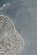
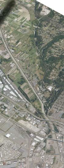
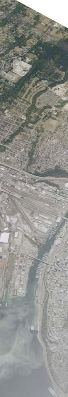
10 In addition to the individual meetings, an Executive Committee was formed. The Committee met periodically throughout the TATS process to review findings of the project team and provide guidance on future steps. The Executive Committee had representatives from the following entities: Washington Department of Transportation Freight Mobility Strategic Investment Board City of Fife City of Tacoma Marine View Ventures (an entity of the Puyallup Tribe) Pierce County Port of Tacoma SSA Marine Appendix A includes Executive Committee meeting minutes and agendas. A larger Advisory Committee included additional stakeholders such as Union Pacific Railroad, Burlington Northern Santa Fe, and Premier Transport. OPERATIONAL CONTEXT The Port of Tacoma covers 2,400 acres and is used for shipping terminal activity as well as warehousing, distributing, and manufacturing. The Port, the seventh largest in North America, handles more than $36 billion in annual trade and is surrounded by Downtown Tacoma to the west, the City of Fife to the south. The high volume and variety of land uses within the area leads to a complex transportation system with competing needs. This study was undertaken to identify existing problems, forecast future travel needs, and set out a clear plan for future improvements. STUDY AREA The study area, shown in Figure 1, includes the Port of Tacoma, Downtown Tacoma, as well as parts of the City of Fife, Puyallup Tribal Lands, and unincorporated Pierce County. Figure 1 also displays the study intersections used for analysis. Background information including previous transportation studies and planned transportation improvements may be found in Appendix B. 6
11 705 20th St E 52nd St E Pacific Hwy S Meridian Ave E Freeman Rd E W Stewart Ave S 356th St 36th St E 161 Marine View Dr Taylor Way E Alexander Ave Lincoln Ave Marshall Ave Port of Tacoma Rd E 11th St 62nd Ave E 54th Ave E E D St Pacific Hwy E Puyallup Ave Industry Dr E 70th Ave E N Levee Rd E E Portland Ave 16 Study Area 99 Pacific Ave River Rd E Pioneer Way E 7 STUDY AREA AND ANALYSIS LOCATIONS Tideflats Area Transportation Study FIGURE 1 Waller Rd E \\FPSE2\Data2\2010Projects\SE _Tideflats Area Transportation Study\Graphics\Draft\GIS\MXD\8x11\studyInts.mxd LEGEND Existing Intersection Future Intersection Micro-Simulation Network N NOT TO SCALE Tracks A/D
12 2. EXISTING CONDITIONS The existing conditions within the study area were assessed to provide a complete picture of current transportation operations, opportunities, and constraints. Truck volumes tend to peak in the early morning when the Port opens; however overall traffic volumes are highest during the PM peak period. Therefore, analysis was completed for the PM peak period when the transportation network is most congested. The Existing Conditions Technical Memorandum, which presents the transportation analysis in detail, may be found in Appendix C. OPPORTUNITIES & CONSTRAINTS The complex nature of the Tideflats area results in a variety of transportation opportunities and constraints that influence the need for improvements. These issues include bottlenecks with heavy congestion, interaction between rail and roads, bridge conditions, baseline projects that are currently underway or are anticipated to be implemented in the immediate term, and plans for roadway extensions, interchange improvements, and transit routes. ROADWAY OPERATIONS Figure 2 displays average daily traffic volumes on roadways within the study area which shows the current distribution of traffic. Intersection operations throughout the study area were analyzed to identify locations that require improvements. Each intersection is assigned a level of service, ranging from A to F, based on the average delay experienced per vehicle. Table 1 displays the criteria for each level of service as well as a brief qualitative description. Level of Service Intersection Operations Figure 3 shows existing traffic hot spots within the study area. The Port of Tacoma Road and 54th Avenue E corridors experience congestion, due in large part to the high truck volumes and close spacing of the intersections. These corridors provide critical access to I 5 as well as destinations to the south. Other problematic operations occur along the Portland Avenue corridor between the SR and I 5 interchanges. The Meridian Avenue/SR 161 corridor between Valley Avenue and River Road experiences congestion. Each Tideflats Area Transportation Study Table 1. Levels of Service Criteria for Signalized and Unsignalized Intersections Delay per Vehicle (seconds) Signalized Intersection Unsignalized Intersection Description A Little or no delay B >10 20 >10 15 Short delays C >20 35 >15 25 Average delays D >35 55 >25 35 Long delays E >55 80 >35 50 Very long delays F >80 >50 Failure extreme congestion Source: Highway Capacity Manual
13 of the five intersections along that stretch of Meridian Avenue show substantial peak hour congestion. Excessive queues tend to form within the Port at the following locations: Westbound E 15th Street and part of East D Street Northbound Port of Tacoma Road between Marshall Avenue and E 11th Street Additional information on the existing conditions analysis may be found in Appendices C and D. Eastbound Lincoln Avenue at APM terminal entrance Northbound Taylor Way at MacMillan Piper entrance in the early morning. Freeway Operations The study area includes several major freeways that serve both local and regional access. A bottleneck on southbound I 5 between I 705 and SR 16 causes congestion along I 5 as well as queues stretching to Portland Avenue and on the ramps to I 705. Another problematic stretch of southbound I 5 occurs between 54th Avenue E and Port of Tacoma Road where high volumes converge from both the on ramp and the mainline. SR currently operates well, and I 705 operates efficiently with the exception of moderate congestion near the 9th Street on ramp. 9
14 Meridian Ave E Pacific Hwy S Freeman Rd E W Stewart Ave S 356th St Marine View Dr Taylor Way E Alexander Ave Lincoln Ave Marshall Ave Port of Tacoma Rd E 11th St 62nd Ave E 54th Ave E Pacific Hwy E Puyallup Ave 20th St E Industry Dr E 70th Ave E N Levee Rd E E Portland Ave Pacific Ave River Rd E Pioneer Way E 52nd St E 36th St E E D St Study Area Waller Rd E 7.9 \\FPSE2\Data2\2010Projects\SE _Tideflats Area Transportation Study\Graphics\Draft\GIS\MXD\8x11\fig02_ADTtubeCounts.mxd LEGEND Average Traffic Volume 0-10,000 10,000-20,000 20,000-30,000 > 30, Traffic Volume (x 1,000) N NOT TO SCALE 161 AVERAGE DAILY TRAFFIC VOLUMES Tideflats Area Transportation Study FIGURE 2 Note: Volumes are for illustrative purposes; some are Average Weekday Daily Traffic and others are Annual Average Daily Traffic.
15 Meridian Ave E Pacific Hwy S Freeman Rd E W Stewart Ave 70th Ave E S 356th St Marine View Dr Taylor Way E Alexander Ave Lincoln Ave Marshall Ave Port of Tacoma Rd E 11th St Study Area 62nd Ave E 54th Ave E! 20th St E Pacific Hwy E Puyallup Ave Industry Dr E N Levee Rd E E Portland Ave Pacific Ave River Rd E Pioneer Way E 52nd St E 99 36th St E E D St EXISTING TRAFFIC "HOT SPOTS" Tideflats Area Transportation Study FIGURE 3 Waller Rd E \\FPSE2\Data2\2010Projects\SE _Tideflats Area Transportation Study\Graphics\Draft\GIS\MXD\8x11\fig03_hotSpots.mxd LEGEND Roadway Congestion Intersection Hot Spots N NOT TO SCALE A-C D E F Exis ng Levels of Service Number of Intersec ons
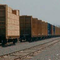
16 FREIGHT CONDITIONS The presence of the Port creates substantial freight activity (both trucks and rail) with unique operations and a key relationship to the economic vitality of the region. Trucks Trucks rely heavily on Portland Avenue, Port of Tacoma Road, and 54th Avenue E to access the shipping terminals within the Port. Much of the truck traffic is traveling between the Port and warehousing and distribution centers located in Kent Valley, Fife/Puyallup/Sumner, Tacoma, Frederickson, Dupont, Lacey/Olympia, and Centralia/Chehalis. Figure 4 summarizes truck routes within the TATS study area. Most of the principal and minor arterials in the study area are approved truck routes, and are heavily used by Port related traffic. Truck traffic into and out of the Port of Tacoma is sustained throughout the day with trucks arriving before the terminals open at 8 AM, causing queues within the Tideflats area, mainly within the Port. Rail Figure 5 displays the rail facilities and grade crossings located within the study area. Burlington Northern Santa Fe (BNSF) and Union Pacific Railroad (UPRR) are the only long haul carriers for shipments originating from the Port of Tacoma, with BNSF carrying the larger share. serves locally by switching containers from cargo ships to local businesses and assembling the long haul trains that are pulled by BNSF and UPRR. Figure 5 also shows the location of the major terminals within the Port. Fourteen of the grade crossings were assessed in terms of level of activity, efficiency of operations, and safety. Crossings that are candidates for grade separation due to the constraints they impose on the transportation network include: 70th Avenue E 54th Avenue E Port of Tacoma Road at Lincoln Avenue Port of Tacoma Road southeast of Lincoln Avenue Port of Tacoma Road crossing to KPAC Milwaukee Way north of Lincoln Avenue E 11th Street east of Milwaukee Way Taylor Way at former Kaiser site SAFETY CONDITIONS Collision data from 2006 to 2008 were analyzed along freeways as well as local corridors to identify locations of concern. Source data are included in Appendix D. 12
17 Freeway Collisions The predominant type of collision on I 5, I 705 and SR were rear end collisions. The majority of collisions on each freeway caused property damage only. Over the three year study period, multiple fatalities have occurred on I 5, one fatality has occurred on SR, and no fatalities have occurred on I 705. Local Corridors and Intersections The highest corridor collision rates within the study area occurred on Pacific Highway E between Milwaukee Way and 54th Avenue E and on 54th Avenue E between 4th Street E and Valley Avenue E. High congestion levels contribute to the safety concerns. The highest intersection collision rates occurred along Portland Avenue and Bay Street in the vicinity of the I 5 interchange. NON MOTORIZED CONDITIONS An inventory of pedestrian and bicycle facilities was completed to identify gaps in the network. Due to the industrial nature of much of the study area, nonmotorized facilities are limited, creating a challenging environment for pedestrians and bicyclists. 13
18 Under construction Marine View Dr S 356th St LEGEND Truck Routes Heavy Haul Corridor Weight restricted E 11th St Lincoln Ave Port of Tacoma Rd Marshall Ave E Alexander Ave Taylor Way Study Area 99 Pacific Hwy S Approved Truck Route Approved Truck Route not exceeding 14,000 GVWR Approved Truck Route not exceeding 26,000 GVWR Truck Class T1-T3 (> 300,000 tons of freight carried per year) Pacific Ave 7 E D St Puyallup Ave E Portland Ave North Levee Road truck restrictions imposed by Fife Council (July 2010). Pacific Hwy E Waller Rd E Industry Dr E N Levee Rd E Pioneer Way E 54th Ave E 52nd St E 62nd Ave E River Rd E 20th St E 70th Ave E Freeman Rd E 161 Meridian Ave E NOT TO SCALE 36th St E Note: City of Puyallup truck routes are illustrative only. N Note: Pierce County does not have adopted truck routes. Marked roads indicate routes with truck class T1-T3. W Stewart Ave \\FPSE2\Data2\2010Projects\SE _Tideflats Area Transportation Study\Graphics\Draft\GIS\MXD\8x11\fig04_Ex_trk_rts.mxd EXISTING TRUCK ROUTES Tideflats Area Transportation Study FIGURE 4
19 ª ª ª ª ª ª ª ª S 356th St Marine View Dr Pacific Hwy S Taylor Way E Alexander Ave Lincoln Ave ª ª ª ª ª ª ª ª Port of Tacoma Rd E 11th St Marshall Ave 62nd Ave E 54th Ave E E D St Meridian Ave E Pacific Hwy E Puyallup Ave Industry Dr E 70th Ave E N Levee Rd E E Portland Ave 16 River Rd E ª 20th St E Pacific Ave Freeman Rd E Pioneer Way E Study Area 52nd St E 99 LEGEND 36th NOT St E TO SCALE 161 Grade Crossing ª Union Pacific R.R. Burlington Northern Santa Fe R.R. Mountain Division APM Terminals Marshall Avenue Auto Facility Blair Terminal EB1 Husky Terminal & Stevedoring Olympic Container Terminal Pierce County Terminal Totem Ocean Trailer Express Terminal Washington United Terminals N Waller Rd E ª Mountain Division W Stewart Ave \\FPSE2\Data2\2010Projects\SE _Tideflats Area Transportation Study\Graphics\Draft\GIS\MXD\8x11\fig07_Ex_Rail.mxd EXISTING RAIL FACILITIES AND GRADE CROSSINGS Tideflats Area Transportation Study FIGURE 5
20 3. FUTURE CONDITIONS Future transportation network conditions were evaluated for a 2030 horizon year. In addition, a 2020 analysis was done to help formulate the sequencing plan for the projects, which is presented later in this report. TRAVEL FORECASTS Traffic volumes were forecast using the Puget Sound Regional Council s (PSRC) regional travel demand model that was modified to include detailed coding of freeway interchanges within the study area. Truck volumes were forecast using an independent method that accounts for the unique characteristics of the Port of Tacoma. Future growth in Port related truck traffic was forecast using terminal acreage projections provided by the Port of Tacoma. These were then converted to annual container throughput using factors for the type of terminal and expected operations. Finally, daily and PM peak hour truck trips were estimated from the throughput and assigned to various routes based on expected future terminal location and the 2006 cordon count for the Port. Truck traffic not related to the Port was forecast using a growth rate based on historic traffic count data and future employment projections for the region. The future year travel demand model incorporates capacity expansion projects that are either currently funded or are considered reasonably likely to be implemented. These Baseline projects are shown in Figure 6 and Table 2. The Baseline scenario assumes that Phase 1 of the SR extension, including tolls, is completed by This is an essential improvement for the region to ensure the long term functionality of the transportation system. Regional and local transportation improvement programs (TIPs), comprehensive plans for a variety of jurisdictions, and other relevant documents were consulted to develop the list of assumed projects. In addition, projects funded by the Sound Transit and WSDOT Gas Tax revenue packages were included. A more detailed discussion of the methods and assumptions used to develop travel forecasts may be found in Appendix E. The resulting traffic volumes are included in Appendix F. Figures 7 and 8 provide an indication of the growth expected in households and employment within the study area between the base year of 2006 and the horizon year of The number of households will grow by 85 percent. The number of jobs will grow by 45 percent This land use growth combined with regional growth will result in major increases in traffic volumes by Figures 9 and 10 show the volumes crossing screenlines set up through the study area. Screenlines were placed throughout the study area to indicate the number of vehicles that cross the line during the PM peak hour. Tideflats Area Transportation Study Additional information on the travel forecasts and analysis of future traffic conditions may be found in Appendices E and F. A screenline is an imaginary line used to measure the traffic flow between two areas. The number of vehicles that cross the screenline on any of the intersecting roadways is counted to provide the overall traffic volume between the areas of interest. 16
21 PM peak hour truck traffic will increase by 120 percent PM peak hour traffic will increase by 35 percent Overall, the highest growth occurs within Fife, the Port, and approaching downtown Tacoma to and from the east. Between 2006 and 2030, nearly 5,000 more vehicles will travel on I 5. As expected, the highest truck volume growth occurs near the Port, with more moderate increases in outlying areas. However, the holistic impact of the other baseline projects should not be underestimated. None of the Study s project functionality will be realized unless the Baseline is completed. The growth expected by 2030 will put a substantial strain on the already congested roadway network. Truck traffic, much of which is related to the Port, is expected to more than double between 2006 and These projections highlight the need for infrastructure investment within the study area. SR EXTENSION AND OTHER BASELINE PROJECTS The baseline projects assumed to be completed by 2030 are presented in Table 2 and shown in Figure 6. Total cost, as well as any committed funding, is also shown. Although SR is grouped with other baseline projects, its importance outweighs that of the smaller improvements. The SR extension is a fundamental system improvement upon which the TATS operational analysis is based. It is not a requirement of this study, but rather a regional requirement to avoid failure of the transportation system. 17
22 Figure 6 ID Tideflats Area Access Projects 15 Table 2. Baseline Network Assumptions Project Description Port of Tacoma Road Interchange Reconstruct interchange between SR and I 5. Reconstruct 34th Avenue E and 12th Street E to a 3 lane roadway. Include southbound truck lane on Port of Tacoma Road. (H14) Funding and Construction Status Partially Funded 16 Canyon Road E from 72nd Street E to Pioneer Way E Widen roadway to provide additional lane(s). (H15) Partially Funded 17 I 5 HOV lanes Extend from SR 18 to SR 16. (H16) Partially Funded and Under Construction 18 SR extension Construct 2 lane freeway between SR and SR 161 (tolls assumed). (H17) Partially Funded Port Access Projects 2 Lincoln Avenue grade separation Construct overpass on Lincoln Avenue between Marc Avenue and Thorne Road. (H2) Completed 3 Lincoln Avenue & Port of Tacoma Road Add traffic signal. (H3) Unfunded 4 Murray Morgan Bridge E 11th Street between A Street and D Street. Rehabilitate bridge. (H4) Partially Funded and Under Construction 5 11th Street Bridge Renovate to accommodate trucks. (H5) Unfunded 6 Lincoln Avenue Bridge Portland Avenue to Marc Avenue. Replace part of the bridge deck, bridge bearings, repair rails and sidewalks, re paint. (H6) Fully Funded and Under Construction 7 Hylebos Bridge Rehabilitate the bridge including a new deck, sidewalk, and guardrails. (H7) Under Construction 9 Extend A/D rail line east across Alexander Avenue to Taylor Way. The Port is planning to increase arrival/departure train lengths from 8,000 feet to 10,000 feet. (H18) Unfunded 1 SR slip ramps at D Street Construct a half diamond interchange at D Street and SR. (W7) Partially Funded Industrial Access Projects 8 Puyallup Avenue Bridge Replace 2 of 5 bridge structures, increasing total lanes to 4. Widen to 6 lanes at approach to Portland Avenue. (H8) Partially Funded 11 70th Avenue E corridor 20th Street East to UPRR. Widen existing two lane arterial to 5 lanes. (H10) Unfunded 12 70th Avenue E 20th Street E to Pacific Highway E. Realign and reconstruct to 4 lane roadway section. (H11) Unfunded 13 20th Street E Port of Tacoma Road to 63rd Avenue E. Reconstruct to a 3 lane roadway. (H12) Unfunded 14 Valley Avenue Widen existing two lane arterial to 4 lanes between 70th Avenue E and Freeman Road E. Add fifth lane east of Freeman Road E and restripe the eastbound right turn lane to through/right turn. (H13) Local Access Projects Unfunded 10 Freeman Road 20th Avenue E to N Levee Road. Reconstruct to 3 lane roadway. (H9) Unfunded Source: Fehr & Peers,
23 Local Area Projects Tacoma S 356th St ai l ail Li nc ol n om Marshall Ave M an de r Ta co m Av e as t u d y R d Pacific Hwy E Murray Morgan Bridge Reconstruct ail 5 E 11th Street Viaduct Rebuild 17. Add HOV Lanes 6 Lincoln Avenue Bridge Rehabilitate 7 Hylebos Bridge Rebuild 8 Puyallup Avenue Bridges Rebuild 9 Extend A/D Rail Line 20th Stt E In U.P. dust R.R ry D. re B.N.S.F. Ave Pacific Ave 15 N Le v ee R 13 de Pi on ee rw ay Ri ve 11 Fife U.P.R.R.RR. d E E 10 Freeman Road - to 3 Lanes 36th StWiden E rr 11 70th Avenue 161 Widen to 5 Lanes 12 70th Avenue - Realign and Widen to 4 Lanes 52nd St E il Waller Rd E 7 a Ra Tacom E Portland 5 99 ar Meridian Ave E 8 Ave Puyallup Lincoln Avenue/Port of Area 6 3 rw ay 9 B.N.S.F. 16 ft ac Ta ylo 70th Ave E 1 3 to Lincoln Avenue Grade Separation 62nd Ave E 705 E D St!!Por 2 Freeman Rd E E th 11 Al ex Av e E St Dr D Street Ramps ys Ta co m ar 1 Pa c Ta co m ar Vi ew ific 7 B.N.S.F. 17. Add HOV Lanes (SR 16) in e 54th Ave E U.P.R.R. Hw M ar U.Pth. Street R.R. N B. Widen to 3 Lanes F..S. th 16. Widen South to 208 St E 18. SR Extension Phase 1 WS tewa rt Av 14 Valley Avenue - Upgrade to 4 Lanes (2011) and Widen East Approach e 15 I-5/Port of Tacoma Road Interchange - Rebuild \\FPSE2\Data2\2010Projects\SE _Tideflats Area Transportation Study\Graphics\Draft\GIS\MXD\8x11\fig01_rdwy_improvements.mxd BASELINE NETWORK ASSUMPTIONS Tideflats Area Transportation Study FIGURE 6
")
24 Meridian Ave E Pacific Hwy S Freeman Rd E W Stewart Ave 70th Ave E S 356th St Marine View Dr 20th St E Taylor Way E Alexander Ave Lincoln Ave Marshall Ave Port of Tacoma Rd E 11th St Study Area 62nd Ave E 54th Ave E Pacific Hwy E Puyallup Ave Industry Dr E N Levee Rd E E Portland Ave Pacific Ave River Rd E Pioneer Way E 52nd St E 36th St E E D St HOUSEHOLD GROWTH ( ) Tideflats Area Transportation Study FIGURE 7 Tacoma Rail Waller Rd E \\FPSE2\Data2\2010Projects\SE _Tideflats Area Transportation Study\Graphics\Draft\GIS\MXD\8x11\fig0x_TAZ_hhGrowth.mxd LEGEND Growth in Number of Households ( ) < ,000 > 1,000 N NOT TO SCALE
25 Meridian Ave E Pacific Hwy S Freeman Rd E W Stewart Ave 70th Ave E S 356th St Marine View Dr Taylor Way E Alexander Ave Lincoln Ave Marshall Ave Port of Tacoma Rd E 11th St Study Area 20th St E 62nd Ave E 54th Ave E Pacific Hwy E Puyallup Ave Industry Dr E N Levee Rd E E Portland Ave Pacific Ave River Rd E Pioneer Way E 52nd St E 36th St E E D St EMPLOYMENT GROWTH ( ) Tideflats Area Transportation Study FIGURE 8 Waller Rd E \\FPSE2\Data2\2010Projects\SE _Tideflats Area Transportation Study\Graphics\Draft\GIS\MXD\8x11\fig0x_TAZ_empGrowth.mxd LEGEND Growth in Number of Employees Full and Part-Time ( ) < ,500 1,500-2,000 > 2,000 N NOT TO SCALE
26 S 356th St LEGEND Screenline * 16 6, % 9,500 E D St E 11th St Puyallup Ave E Portland Ave 4,010 Lincoln Ave +50% 5,970 Port of Tacoma Rd Marshall Ave 7,490 Pacific Hwy E Marine View Dr E Alexander Ave Taylor Way Study Area +30% 9,860 Industry Dr E 54th Ave E +15% 5,810 6,750 62nd Ave E + 45% 99 20th St E Pacific Hwy S 14, % 19,040 Meridian Ave E PM Peak Hour Traffic Growth +35% 19,040 14, N NOT TO SCALE Pacific Ave 7 Rail Waller Rd E N Levee Rd E Pioneer Way E 5,800 52nd St E 8,380 River Rd E 70th Ave E Freeman Rd E +60% 3,070 5, th St E * A screenline is an imaginary line used to measure the traffic flow between two areas. The number of vehicles that cross the screenline on any of the intersecting roadways is counted to provide the overall traffic volume between the areas of interest. W Stewart Ave \\FPSE2\Data2\2010Projects\SE _Tideflats Area Transportation Study\Graphics\Draft\GIS\MXD\8x11\fig0x_PMPh_traff_grwth.mxd PM PEAK HOUR TRAFFIC GROWTH ( ) Tideflats Area Transportation Study FIGURE 9
27 S 356th St LEGEND Screenline * % E D St E 11th St Puyallup Ave % E Portland Ave 360 Lincoln Ave Port of Tacoma Rd Marshall Ave Pacific Hwy E Marine View Dr E Alexander Ave 970 Taylor Way Study Area % 1, % 490 Industry Dr E th Ave E + 120% 1,160 62nd Ave E 99 20th St E + 45% Pacific Hwy S Meridian Ave E PM Peak Hour Truck Growth + 120% 1, N NOT TO SCALE Pacific Ave 7 Rail Waller Rd E N Levee Rd E Pioneer Way E 52nd St E River Rd E 70th Ave E Freeman Rd E th St E * A screenline is an imaginary line used to measure the traffic flow between two areas. The number of vehicles that cross the screenline on any of the intersecting roadways is counted to provide the overall traffic volume between the areas of interest. W Stewart Ave \\FPSE2\Data2\2010Projects\SE _Tideflats Area Transportation Study\Graphics\Draft\GIS\MXD\8x11\fig0x_PMPh_trk_grwth2.mxd PM PEAK HOUR TRUCK GROWTH ( ) Tideflats Area Transportation Study FIGURE 10
28 TRAFFIC OPERATIONS The 2030 Baseline scenario represents traffic operations within the study area if only the reasonably foreseeable transportation projects are implemented. As Figure 11 shows, fewer than half of the study intersections currently operating at LOS A through C would continue to do so in The number of intersections operating at LOS F would increase from six to thirty three. Downtown Tacoma Downtown Tacoma, which currently has good traffic operations, would see half of its study intersections drop to LOS F. Those include Pacific Avenue at S 13th, S 15th, S 21st, and S 24th Streets as well as the I 705 northbound off ramp at S 26th Street. Port of Tacoma Traffic conditions immediately surrounding the Port would deteriorate substantially by Every northsouth arterial accessing the Port will have poor operations at some point along the corridor. Portland Avenue and 54th Avenue E would be extremely congested. Along Portland Avenue, every intersection between the SR and I 5 interchanges would operate at LOS F. The two unsignalized intersections at Milwaukee Way and Pacific Highway E would also drop to LOS F by Intersections along 54th Avenue E from SR to Valley Avenue would operate at LOS F due to heavy growth in industrial traffic and I 5 congestion. The Port of Tacoma Road corridor would fare better than the other regional access roads due to the planned I 5 interchange reconstruction. The plan for the new interchange would construct a couplet between 12th Street E and 20th Street E with Port of Tacoma Road carrying southbound traffic and an extension of 34th Avenue E carrying northbound traffic. Southern Study Area The intersection of Pioneer Way E and Canyon Road E would drop from LOS C to LOS F by The Meridian Avenue/SR 161 corridor will be somewhat improved by the construction of Phase 1 of the SR extension. Several intersections along N Levee Road E and Valley Avenue E would also deteriorate to LOS F. Figure 11. Level of Service Comparison: Existing and 2030 Baseline Roadway Operations 24
29 4. ALTERNATIVES DEVELOPMENT & ANALYSIS The project team developed improvement concepts, solicited ideas from stakeholders, and consulted various jurisdictions capital and transportation improvement programs. This effort resulted in a list of 85 improvement projects in addition to the 2030 Baseline projects. EVALUATION CRITERIA The evaluation of candidate projects was completed in two steps. The first level was a preliminary screening to identify projects that could be dismissed without intensive analysis. The second step was a more rigorous assessment including micro simulation. See Appendix G for the technical memorandum including the full results of this process. First Level Screening Criteria and consistency with existing plans. Each project was scored on a simple three tier basis. Category Transportation System Performance Table 3. First Level Screening Criteria There was no formal threshold needed to pass the screening process. Rather, the ratings were used as a tool for the project team to weigh the costs and benefits, and make a determination as to whether the project warranted further analysis. Criteria Potential to improve traffic hot spots Potential to improve truck operations Safety Potential to improve high collision locations Physical Feasibility Ability to be constructed; environmental feasibility Cost Range of cost Partnerships Support by public and private sectors Consistency with Plans Addressed in local, regional, state plans Source: Fehr & Peers, 2011 The first level screening criteria is shown in Table 3. The purpose of this step was to ensure that the team selected only projects that directly related to the purpose and need of the study. Categories considered include transportation system performance, potential to improve safety, physical feasibility, cost, level of public and private support, Over a third of the non Baseline projects were dismissed during this screening process. Following the initial screening round, a handful of new projects were added to the candidate list. Additional information on the evaluation results may be found in Appendix G. 25
30 Second Level Screening Criteria The second level of evaluation (see Table 4) involved more detailed analysis in terms of traffic operations, cost, and environmental impacts. The candidate projects were incorporated into the micro simulation model to assess the expected benefits, not only of individual projects, but of the overall package of improvements. The project team presented an initial package of improvements to the TATS Advisory Committee. The Committee provided input and suggested revisions to the set of projects. The final improvements, consisting of 38 projects, are called the Recommended Projects. Category Transportation System Performance Table 4. Second Level Evaluation Criteria Criteria Vehicle delay (trucks, general traffic) Travel time Safety Collision prone locations improved Environment Greenhouse gas emissions Cost Effectiveness Cost (capital, operating) Cost effectiveness (annualized cost/delay saved) Partnerships Support by public and private sectors Implementation Ability to be phased Source: Fehr & Peers, 2011 User Groups Throughout the screening and evaluation process, improvement concepts were classified by the user group which would experience the most benefit. Those user groups and the type of travel they represent are summarized in Table 5. The improvement concepts are grouped according to these categories in the next section containing the final recommendations. Table 5. User Groups Category Criteria Tideflats Area Access To/from Port To/from Distribution Centers To/from Industries Port Access Between Port and Local Warehouses Between Port and Consolidators Between Port and Rail (Dray) Industrial Access Connect to Tacoma Industry Connect to Fife Industry Local Access Local traffic circulation Access to residential properties Source: Fehr & Peers,
31 5. FINDINGS & RECOMMENDATIONS The result of this study is a set of Recommended Projects of transportation improvements in the Tideflats area. This section summarizes the recommended improvement package, the expected performance of the transportation system if the recommended package is implemented, and cost estimates of the improvement projects. Conceptual drawings and cost estimates are included in Appendix H. RECOMMENDATIONS The project descriptions and costs of the recommended package of improvements are presented in Table 6. Figures 12 through 15 map the project locations according to the user groups presented in the previous section. 510,000 vehicle miles traveled (VMT), an increase of 15 percent compared to the Baseline network. The increase in VMT is due to the higher volumes able to travel through the roadway network. 8,500 vehicle hours of delay, a decrease of 38 percent compared to the Baseline network. 257 average seconds of delay per vehicle, a decrease of 46 percent compared to the Baseline network. 742,100 pounds of GHG emissions, a decrease of 2 percent compared to the Baseline network. 10 of the 63 study intersections operating at LOS F, a decrease of 70 percent compared to the Baseline network. Tideflats Area Transportation Study Additional information on conceptual engineering and cost estimates may be found in Appendix H. PERFORMANCE SUMMARY The recommended projects were added to the 2030 baseline transportation network to evaluate its impacts. The following list highlights the main findings of that analysis. All statistics reflect performance during a single PM peak period: 92 percent of the PM peak period traffic demand would be served, an increase of 23 percent over that served by the Baseline network. 27
32 ID Tideflats Area Access Projects Table 6. Recommended Projects Project Description Cost (in thousands of 2010 dollars 1 ) O3 I 5 Add variable message signs for access to port. 2,100 R1 70th Avenue E/UPRR Railroad Build railroad grade separation. 25,000 W29 Canyon Road Extension Extend Pioneer Way across Puyallup River to 70th Avenue E. 58,200 W41 I 5 from 54th Avenue E to Port of Tacoma Road Add collector distributor/auxiliary lanes. 7,300 W48 54th Ave Interchange with I 5 Rebuild interchange. 53,400 Port Access Projects I1 SR, Taylor Way & 54th Avenue E Add a right turn lane on northbound 54th Avenue E; double left turn lanes on both directions of SR. 4,800 I16 Milwaukee Way/Marshall Street (East 4th Street) intersection Add signal, RR flashers and gates with a traffic signal intertie. 1,000 O7 Port of Tacoma Road Address truck queuing by making the outside northbound lane a truck queue lane and converting the inside southbound lane to reversible operations. W37 Alexander Avenue/SR intersection Add a free flow right turn lane on the northbound approach. 2,300 Industrial Access Projects I2 54th Avenue E/Pacific Highway E intersection Reconstruct intersection and add turn lanes. Add southbound through lane from 12th Street E to Pacific Highway E. I5 St. Paul Avenue/ E 11th Street intersection Construct signal or roundabout. 2,800 I7 St. Paul Avenue/ Portland Avenue intersection Construct signal. 500 I10 20th Street E/Industry Drive intersection Add signal. 500 I15 Portland Avenue/Puyallup Avenue intersection Widen intersection with additional left turn/through lanes. 5,900 I18 Reconstruct curb returns for trucks at various locations within study area. 500 I19 S 26th Street/I 705 northbound off ramp intersection Add signal. 500 I20 Portland Avenue on and off ramps at SR Add traffic signals and modify channelization I21 54th Avenue E/4th Street Add signal. 500 I22 54th Avenue E/12th Street E intersection Create an eight phase signal operation with protected left turns. 60 I27 54th Avenue E/20th Street E intersection Widen approach legs and rechannelize. See W48 I28 Portland Avenue/25th and 26th Streets Add traffic signals. Coordinate along Portland Avenue corridor. 820 M5 Pavement overlay program Improve pavement conditions throughout study area. 3, See W48 28
33 ID Table 6. Recommended Projects Project Description Cost (in thousands of 2010 dollars 1 ) O1 SR 99 Interconnect signals. 100 W1 Frank Albert Road Overcrossing Build new bridge over I 5 from 20th Street E to Pacific Highway E; new signals at Pacific Highway E and 20th Street E. 24,300 W13 Levee Road Reconstruct Frank Albert Road to Freeman Road. Add signals at two intersections. 31,200 W30 62nd Avenue E overpass Extend 62nd Avenue E over I 5 from Pacific Highway E to 20th Street E; new traffic signals at Pacific Highway E and 20th Street E. 26,300 W54 54th Avenue E Access Management Pacific Highway E to SR. See W48 W55 Arterial ITS Program Signal Coordination; traveler Information to/from industrial sites. 2,000 W56 12th Street E Extend new street from Alexander Avenue E to 34th Avenue E. 18,400 W57 12th Street E Widen to 3 lanes from 62nd Ave E to Alexander Avenue E; extend new street from Alexander Avenue E to 34th Avenue E. See W56 W58 62nd Avenue E Pacific Highway E to 12th Street E Widen to 3 lanes. See W30 W59 Frank Albert Road Pacific Highway E to 12th Street E Widen to 3 lanes. See W1 Local Access Projects I4 East D Street/Puyallup Avenue intersection Change signal phasing. Add left turn pocket to southbound approach. 50 I23 Pacific Avenue/13th Street intersection Restripe the eastbound right turn lane as a shared through/right turn lane. 60 I24 Pacific Avenue/Tacoma Way/26th Street intersection Restripe the eastbound right turn lane as a shared through/right turn lane. 60 P1 Puyallup Avenue Add bike lane from Portland Avenue across Puyallup River. See H8 R2 54th Avenue E at UPRR rail crossing Construct a grade separation structure to re open the street. 35,800 W31 20th Street E Reconstruct from 70th Avenue E to Freeman Road to a 3 lane section. 3,900 1 Some cost estimates were provided by older studies, and are therefore not shown in 2010 dollars. Source: Fehr & Peers, 2011 Total 312,690 29
34 ! mw41!! Meridian Ave E Pacific Hwy S Freeman Rd E W Stewart Ave 70th Ave E S 356th St Marine View Dr 20th St E Taylor Way E Alexander Ave Lincoln Ave Marshall Ave Port of Tacoma Rd E 11th St Study Area 62nd Ave E 54th Ave E Pacific Hwy E Puyallup Ave Industry Dr E N Levee Rd E E Portland Ave Pacific Ave River Rd E Pioneer Way E 52nd St E 36th St E E D St m O3 mw48 7 mw29 99 m R1 RECOMMENDED PROJECTS - TIDEFLATS AREA ACCESS Tideflats Area Transportation Study Waller Rd E \\FPSE2\Data2\2010Projects\SE _Tideflats Area Transportation Study\Graphics\Draft\GIS\MXD\8x11\fig0x_Projects_Regional.mxd LEGEND m A1 Project ID! Intersection Project Roadway Project N NOT TO SCALE 161 FIGURE 12 Tracks A/D
35 ! m W7!!! Meridian Ave E Pacific Hwy S Freeman Rd E W Stewart Ave 70th Ave E S 356th St 20th St E Marine View Dr Taylor Way E Alexander Ave Lincoln Ave Marshall Ave Port of Tacoma Rd E 11th St m I16 m O7 m I1 62nd Ave E 54th Ave E mw37 Study Area Pacific Hwy E Puyallup Ave Industry Dr E N Levee Rd E E Portland Ave Pacific Ave River Rd E Pioneer Way E 52nd St E 99 36th St E E D St RECOMMENDED PROJECTS - PORT ACCESS Tideflats Area Transportation Study Waller Rd E \\FPSE2\Data2\2010Projects\SE _Tideflats Area Transportation Study\Graphics\Draft\GIS\MXD\8x11\fig0x_Projects_Port.mxd LEGEND m A1 Project ID! Intersection Project Roadway Project N NOT TO SCALE 161 FIGURE 13 A/D Tracks
36 !!! m I20!!! m I28! m H12! mw54!!! Meridian Ave E Pacific Hwy S Freeman Rd E W Stewart Ave 70th Ave E S 356th St 20th St E Marine View Dr Taylor Way E Alexander Ave Lincoln Ave Marshall Ave Port of Tacoma Rd E 11th St m I5 m I7 62nd Ave E m I22 m I2 54th Ave E Pacific Hwy E Puyallup Ave Industry Dr E N Levee Rd E E Portland Ave Pacific Ave River Rd E Pioneer Way E 52nd St E 36th St E E D St m I19 m I15 m I10 mw56 m O1 Study Area mw59 mw57 m I21 m W1 m W30 m I27 mw58 99 mw13 7 RECOMMENDED PROJECTS - INDUSTRIAL ACCESS Tideflats Area Transportation Study Waller Rd E \\FPSE2\Data2\2010Projects\SE _Tideflats Area Transportation Study\Graphics\Draft\GIS\MXD\8x11\fig0x_Projects_Industrial.mxd LEGEND m A1 Project ID! Intersection Project Roadway Project N NOT TO SCALE 161 FIGURE 14 Tracks A/D
37 !! m I4!! Meridian Ave E S 356th St Marine View Dr Pacific Hwy S Taylor Way E Alexander Ave Lincoln Ave Marshall Ave Port of Tacoma Rd E 11th St m I23 62nd Ave E 54th Ave E m P1 20th St E W31 m Pacific Hwy E Puyallup Ave Industry Dr E 70th Ave E N Levee Rd E E Portland Ave Pacific Ave Freeman Rd E River Rd E Pioneer Way E 52nd St E 36th St E E D St 16 m I Study Area m R2 99 RECOMMENDED PROJECTS - LOCAL ACCESS Tideflats Area Transportation Study Waller Rd E W Stewart Ave \\FPSE2\Data2\2010Projects\SE _Tideflats Area Transportation Study\Graphics\Draft\GIS\MXD\8x11\fig0x_Projects_Local.mxd LEGEND m A1 Project ID! Intersection Project Roadway Project N NOT TO SCALE 161 FIGURE 15 Tracks A/D

38 TRANSPORTATION ANALYSIS The Recommended Projects would improve the transportation network performance compared with the Baseline scenario. As Figure 16 shows, the Recommended Projects would result in double the number of LOS A through D intersections when compared to the 2030 Baseline scenario. The number of LOS F intersections would drop from 33 LOS F intersections expected in the Baseline condition to 10 under the Recommended Projects. It is important to note that these projected improvements are contingent upon the completion of the Baseline projects. The Recommended Projects alone would not achieve these results. Downtown Tacoma In Downtown Tacoma, operations would improve moderately compared to the 2030 Baseline scenario. However, four intersections would remain at LOS F: Pacific Avenue at S 15th, S 21st, and S 24th Streets and the I 705 northbound off ramp at S 26th Street. Port of Tacoma The Recommended Projects would lead to better conditions near the Port than would be expected under the 2030 Baseline. The Portland Avenue corridor would have only one LOS F intersection between the SR and I 5 interchanges. Although that intersection, at Puyallup Avenue, would be LOS F, the projected delay is still less than was forecast in the Baseline scenario. The two unsignalized intersections at Milwaukee Way and Pacific Highway E would operate at LOS F as was the case under Baseline conditions, but the expected delay would decrease. The conditions on the 54th Avenue E corridor from SR to Valley Avenue E would improve substantially if the Recommended Projects were implemented. With the exception of 54th Avenue E at 12th Street E, all intersections along the corridor would improve from LOS F conditions. The intersection of Marine View Drive and E 11th Street would operate at LOS B rather than LOS F as under the Baseline. All intersections along Port of Tacoma Road would operate at LOS D or better if the Recommended Projects are implemented. Figure 16. Level of Service Comparison: Existing, 2030 Baseline and Recommended Plan Roadway Operations 34
RTID Travel Demand Modeling: Assumptions and Method of Analysis
 RTID Travel Demand Modeling: Assumptions and Method of Analysis Overall Model and Scenario Assumptions The Puget Sound Regional Council s (PSRC) regional travel demand model was used to forecast travel
King County Metro. Columbia Street Transit Priority Improvements Alternative Analysis. Downtown Southend Transit Study. May 2014.
 King County Metro Columbia Street Transit Priority Improvements Alternative Analysis Downtown Southend Transit Study May 2014 Parametrix Table of Contents Introduction... 1 Methodology... 1 Study Area...
EXECUTIVE SUMMARY. The following is an outline of the traffic analysis performed by Hales Engineering for the traffic conditions of this project.
 EXECUTIVE SUMMARY This study addresses the traffic impacts associated with the proposed Shopko redevelopment located in Sugarhouse, Utah. The Shopko redevelopment project is located between 1300 East and
TIMBERVINE TRANSPORTATION IMPACT STUDY FORT COLLINS, COLORADO JANUARY Prepared for:
 TIMBERVINE TRANSPORTATION IMPACT STUDY FORT COLLINS, COLORADO JANUARY 2014 Prepared for: Hartford Companies 1218 W. Ash Street Suite A Windsor, Co 80550 Prepared by: DELICH ASSOCIATES 2272 Glen Haven Drive
LAWRENCE TRANSIT CENTER LOCATION ANALYSIS 9 TH STREET & ROCKLEDGE ROAD / 21 ST STREET & IOWA STREET LAWRENCE, KANSAS
 LAWRENCE TRANSIT CENTER LOCATION ANALYSIS 9 TH STREET & ROCKLEDGE ROAD / 21 ST STREET & IOWA STREET LAWRENCE, KANSAS TRAFFIC IMPACT STUDY FEBRUARY 214 OA Project No. 213-542 TABLE OF CONTENTS 1. INTRODUCTION...
STH 60 Northern Reliever Route Feasibility Study Report
 #233087 v3 STH 60 Northern Reliever Route Feasibility Study Report Washington County Public Works Committee Meeting September 28, 2016 1 STH 60 Northern Reliever Route Feasibility Study Hartford Area Development
The key roadways in the project vicinity are described below. Exhibit displays the existing number of lanes on the study roadways.
 4.2 TRAFFIC AND CIRCULATION This section presents the key assumptions, methods, and results of analysis for the transportation and circulation impacts of the proposed project. This section is based on
Funding Scenario Descriptions & Performance
 Funding Scenario Descriptions & Performance These scenarios were developed based on direction set by the Task Force at previous meetings. They represent approaches for funding to further Task Force discussion
City of Pacific Grove
 Regional Study Utilizing Caltrans Intersection Evaluation Section 7: City of Pacific Grove s: FIRST STREET AT CENTRAL AVENUE Transportation Agency for Monterey County Prepared by Transportation Agency
INDUSTRIAL DEVELOPMENT
 INDUSTRIAL DEVELOPMENT Traffic Impact Study Plainfield, Illinois August 2018 Prepared for: Seefried Industrial Properties, Inc. TABLE OF CONTENTS Executive Summary 2 Introduction 3 Existing Conditions
Date: February 7, 2017 John Doyle, Z-Best Products Robert Del Rio. T.E. Z-Best Traffic Operations and Site Access Analysis
 Memorandum Date: February 7, 07 To: From: Subject: John Doyle, Z-Best Products Robert Del Rio. T.E. Z-Best Traffic Operations and Site Access Analysis Introduction Hexagon Transportation Consultants, Inc.
MEMORANDUM. Figure 1. Roundabout Interchange under Alternative D
 MEMORANDUM Date: To: Liz Diamond, Dokken Engineering From: Subject: Dave Stanek, Fehr & Peers Western Placerville Interchanges 2045 Analysis RS08-2639 Fehr & Peers has completed a transportation analysis
V. DEVELOPMENT OF CONCEPTS
 Martin Luther King, Jr. Drive Extension FINAL Feasibility Study Page 9 V. DEVELOPMENT OF CONCEPTS Throughout the study process several alternative alignments were developed and eliminated. Initial discussion
City of Marina. Regional Roundabout Study Utilizing Caltrans Intersection Control Evaluation Section 4: Transportation Agency for Monterey County
 Regional Roundabout Study Utilizing Caltrans Intersection Control Evaluation Section 4: City of Marina Study Intersections: RESERVATION ROAD AT BEACH ROAD RESERVATION ROAD AT DEFOREST ROAD CARDOZA AVENUE
TRAFFIC IMPACT ANALYSIS
 TRAFFIC IMPACT ANALYSIS Emerald Isle Commercial Development Prepared by SEPI Engineering & Construction Prepared for Ark Consulting Group, PLLC March 2016 I. Executive Summary A. Site Location The Emerald
The Eastern Connector Study November, 2007 planning for the future
 The Eastern Connector Study November, 2007 planning for the future In late 2006, Albemarle County and the City of Charlottesville jointly initiated the Eastern Connector Corridor Study. The Project Team
Attachment F Transportation Technical Memorandum
 Attachment F Transportation Technical Memorandum Sounder Yard and Shops Facility Project Transportation Technical Memorandum March 25, 216 Prepared for: Sound Transit Prepared by: Parsons Brinckerhoff
Sound Transit East Link: Bus/LRT System Integration Study
 Sound Transit East Link: Bus/LRT System Integration Study Prepared For: Sound Transit King County Metro Mercer Island WSDOT Prepared By: CH2M HILL July, 2014 1 SOUND TRANSIT EAST LINK: BUS/LRT SYSTEMES
Table Existing Traffic Conditions for Arterial Segments along Construction Access Route. Daily
 5.8 TRAFFIC, ACCESS, AND CIRCULATION This section describes existing traffic conditions in the project area; summarizes applicable regulations; and analyzes the potential traffic, access, and circulation
Executive Summary. Treasure Valley High Capacity Transit Study Priority Corridor Phase 1 Alternatives Analysis October 13, 2009.
 Treasure Valley High Capacity Transit Study Priority Corridor Phase 1 Alternatives Analysis October 13, 2009 Background As the Treasure Valley continues to grow, high-quality transportation connections
Highway 18 BNSF Railroad Overpass Feasibility Study Craighead County. Executive Summary
 Highway 18 BNSF Railroad Overpass Feasibility Study Craighead County Executive Summary October 2014 Highway 18 BNSF Railroad Overpass Feasibility Study Craighead County Executive Summary October 2014 Prepared
BROWARD BOULEVARD CORRIDOR TRANSIT STUDY
 BROWARD BOULEVARD CORRIDOR TRANSIT STUDY FM # 42802411201 EXECUTIVE SUMMARY July 2012 GOBROWARD Broward Boulevard Corridor Transit Study FM # 42802411201 Executive Summary Prepared For: Ms. Khalilah Ffrench,
Table of Contents INTRODUCTION... 3 PROJECT STUDY AREA Figure 1 Vicinity Map Study Area... 4 EXISTING CONDITIONS... 5 TRAFFIC OPERATIONS...
 Crosshaven Drive Corridor Study City of Vestavia Hills, Alabama Table of Contents INTRODUCTION... 3 PROJECT STUDY AREA... 3 Figure 1 Vicinity Map Study Area... 4 EXISTING CONDITIONS... 5 TRAFFIC OPERATIONS...
Comprehensive Regional Goods Movement Plan and Implementation Strategy Goods Movement in the 2012 RTP/SCS
 Comprehensive Regional Goods Movement Plan and Implementation Strategy Goods Movement in the 2012 RTP/SCS Annie Nam Southern California Association of Governments September 24, 2012 The Goods Movement
Traffic Engineering Study
 Traffic Engineering Study Bellaire Boulevard Prepared For: International Management District Technical Services, Inc. Texas Registered Engineering Firm F-3580 November 2009 Executive Summary has been requested
Transportation. Background. Transportation Planning Goals. Level of Service Analysis 5-1
 Transportation portion of the city s stormwater utility, and state road and fuel taxes. Background The transportation needs of the City of Lacey and its planning areas are met by a growing multimodal network
Harlem Avenue between 63 rd and 65 th
 Harlem Avenue between 63 rd and 65 th Community Advisory Group Meeting #3 December 1, 2017 Bedford Park Public Library 1 Meeting Agenda 1. Welcome/Introductions (3 mins) 2. Project Overview and Re-Cap
Introduction and Background Study Purpose
 Introduction and Background The Brent Spence Bridge on I-71/75 across the Ohio River is arguably the single most important piece of transportation infrastructure the Ohio-Kentucky-Indiana (OKI) region.
King Soopers #116 Thornton, Colorado
 Traffic Impact Study King Soopers #116 Thornton, Colorado Prepared for: Galloway & Company, Inc. T R A F F I C I M P A C T S T U D Y King Soopers #116 Thornton, Colorado Prepared for Galloway & Company
Alpine Highway to North County Boulevard Connector Study
 Alpine Highway to North County Boulevard Connector Study prepared by Avenue Consultants March 16, 2017 North County Boulevard Connector Study March 16, 2017 Table of Contents 1 Summary of Findings... 1
The major roadways in the study area are State Route 166 and State Route 33, which are shown on Figure 1-1 and described below:
 3.5 TRAFFIC AND CIRCULATION 3.5.1 Existing Conditions 3.5.1.1 Street Network DRAFT ENVIRONMENTAL IMPACT REPORT The major roadways in the study area are State Route 166 and State Route 33, which are shown
Waco Rapid Transit Corridor (RTC) Feasibility Study
 Feasibility Study") Waco Rapid Transit Corridor (RTC) Feasibility Study Chris Evilia, Director of Waco Metropolitan Planning Organization Allen Hunter, General Manager Waco Transit System Jimi Mitchell, Project Manager AECOM
Waco Rapid Transit Corridor (RTC) Feasibility Study Chris Evilia, Director of Waco Metropolitan Planning Organization Allen Hunter, General Manager Waco Transit System Jimi Mitchell, Project Manager AECOM
TRAFFIC IMPACT STUDY. USD #497 Warehouse and Bus Site
 TRAFFIC IMPACT STUDY for USD #497 Warehouse and Bus Site Prepared by: Jason Hoskinson, PE, PTOE BG Project No. 16-12L July 8, 216 145 Wakarusa Drive Lawrence, Kansas 6649 T: 785.749.4474 F: 785.749.734
Executive Summary. Draft Environmental Impact Statement/Environmental Impact Report ES-1
 Executive Summary Introduction The Eastside Transit Corridor Phase 2 Project is a vital public transit infrastructure investment that would provide a transit connection to the existing Metro Gold Line
Proposed location of Camp Parkway Commerce Center. Vicinity map of Camp Parkway Commerce Center Southampton County, VA
 Proposed location of Camp Parkway Commerce Center Vicinity map of Camp Parkway Commerce Center Southampton County, VA Camp Parkway Commerce Center is a proposed distribution and industrial center to be
APPENDIX B Traffic Analysis
 APPENDIX B Traffic Analysis Rim of the World Unified School District Reconfiguration Prepared for: Rim of the World School District 27315 North Bay Road, Blue Jay, CA 92317 Prepared by: 400 Oceangate,
Interstate Operations Study: Fargo-Moorhead Metropolitan Area Simulation Output
 NDSU Dept #2880 PO Box 6050 Fargo, ND 58108-6050 Tel 701-231-8058 Fax 701-231-6265 www.ugpti.org www.atacenter.org Interstate Operations Study: Fargo-Moorhead Metropolitan Area 2015 Simulation Output Technical
APPENDIX C1 TRAFFIC ANALYSIS DESIGN YEAR TRAFFIC ANALYSIS
 APPENDIX C1 TRAFFIC ANALYSIS DESIGN YEAR TRAFFIC ANALYSIS DESIGN YEAR TRAFFIC ANALYSIS February 2018 Highway & Bridge Project PIN 6754.12 Route 13 Connector Road Chemung County February 2018 Appendix
Clean Harbors Canada, Inc.
 Clean Harbors Canada, Inc. Proposed Lambton Landfill Expansion Environmental Assessment Terms of Reference Transportation Assessment St. Clair Township, Ontario September 2009 itrans Consulting Inc. 260
3.1 Introduction Transportation Elements and Study Area Meeting the Need for the Project
 Chapter 3 Transportation Environment and Consequences 3. Introduction This chapter summarizes the characteristics of the transportation system in the East Link Project vicinity and discusses potential
Downtown One Way Street Conversion Technical Feasibility Report
 Downtown One Way Street Conversion Technical Feasibility Report As part of the City s Transportation Master Plan, this report reviews the technical feasibility of the proposed conversion of the current
Transportation 2040: Plan Performance. Transportation Policy Board September 14, 2017
 Transportation 2040: Plan Performance Transportation Policy Board September 14, 2017 Today Background Plan Performance Today s Meeting Background Board and Committee Direction 2016-2017 Transportation
Open House. Highway212. Meetings. Corridor Access Management, Safety & Phasing Plan. 5:30 to 6:30 p.m. - Southwest Corridor Transportation Coalition
 Welcome Meetings 5:30 to 6:30 p.m. - Southwest Corridor Transportation Coalition 6:30 to 8:00 p.m. - Open House Why is Highway 212 Project Important? Important Arterial Route Local Support Highway 212
3.0 Transportation Environment and Consequences
 3.0 Transportation Environment and Consequences 3.1 Summary This chapter describes the characteristics of the transportation system in the FWLE vicinity and discusses potential impacts and mitigation measures
Transit City Etobicoke - Finch West LRT
 Delcan Corporation Transit City Etobicoke - Finch West LRT APPENDIX D Microsimulation Traffic Modeling Report March 2010 March 2010 Appendix D CONTENTS 1.0 STUDY CONTEXT... 2 Figure 1 Study Limits... 2
3.0 Future (2040) Transportation
 Transportation") 30 Future () Transportation Conditions Future traffic and structural bridge conditions within the I-84 Hartford Project Area have been analyzed to identify the needs and deficiencies which the Project
30 Future () Transportation Conditions Future traffic and structural bridge conditions within the I-84 Hartford Project Area have been analyzed to identify the needs and deficiencies which the Project
IMPROVEMENT CONCEPTS
 IMPROVEMENT CONCEPTS for the South Novato Transit Hub Study Prepared by: January 11, 2010 DKS Associates With Wilbur Smith Associates IMPROVEMENT CONCEPTS Chapter 1: Introduction 1. INTRODUCTION The strategic
Appendix C-5: Proposed Refinements Rail Operations and Maintenance Facility (ROMF) Traffic Impact Analysis. Durham-Orange Light Rail Transit Project
 Traffic Impact Analysis. Durham-Orange Light Rail Transit Project") Appendix C-5: Proposed Refinements Rail Operations and Maintenance Facility (ROMF) Traffic Impact Analysis Durham-Orange Light Rail Transit Project July 25, 218 ROMF Transportation Impact Analysis Version
Appendix C-5: Proposed Refinements Rail Operations and Maintenance Facility (ROMF) Traffic Impact Analysis Durham-Orange Light Rail Transit Project July 25, 218 ROMF Transportation Impact Analysis Version
Final Interchange Justification Report
 I- / TROSPER ROAD Final Interchange Justification Report Prepared for: Prepared by: I-/Trosper Road Final Interchange Justification Report Prepared for City of Tumwater Israel Rd SW, Olympia, WA 0
Parks and Transportation System Development Charge Methodology
 City of Sandy Parks and Transportation System Development Charge Methodology March, 2016 Background In order to implement a City Council goal the City of Sandy engaged FCS Group in January of 2015 to update
Harlem Avenue between 63 rd and 65 th
 Harlem Avenue between 63 rd and 65 th Public Meeting #2 March 13, 2018 Summit Park District Welcome to the second Public Meeting for the preliminary engineering and environmental studies of Illinois 43
Transportation Technical Report
 Transportation Technical Report Puyallup Station Access Improvements Transportation Technical Report 4 South Jackson Street Seattle, WA 984 2826 February 26 This Page Intentionally Left Blank Puyallup
Craig Scheffler, P.E., PTOE HNTB North Carolina, P.C. HNTB Project File: Subject
 TECHNICAL MEMORANDUM To Kumar Neppalli Traffic Engineering Manager Town of Chapel Hill From Craig Scheffler, P.E., PTOE HNTB North Carolina, P.C. Cc HNTB Project File: 38435 Subject Obey Creek TIS 2022
Note: The October 2007 version of this report has been updated in this December 2008 report to present costs in year 2007 dollars.
 Sound Transit Phase 2 South Corridor LRT Design Report: SR 99 and I-5 Alignment Scenarios (S 200 th Street to Tacoma Dome Station) Tacoma Link Extension to West Tacoma Prepared for: Sound Transit Prepared
Bennett Pit. Traffic Impact Study. J&T Consulting, Inc. Weld County, Colorado. March 3, 2017
 Bennett Pit Traffic Impact Study J&T Consulting, Inc. Weld County, Colorado March 3, 217 Prepared By: Sustainable Traffic Solutions, Inc. http://www.sustainabletrafficsolutions.com/ Joseph L. Henderson,
MOTION NO. M Preferred Alternative for the Puyallup Station Access Improvement Project
 MOTION NO. M2014 64 Preferred Alternative for the Puyallup Station Access Improvement Project MEETING: DATE: TYPE OF ACTION: STAFF CONTACT: Capital Committee Board PROPOSED ACTION 8/14/14 8/28/14 Recommendation
BARRHAVEN FELLOWSHIP CRC 3058 JOCKVALE ROAD OTTAWA, ONTARIO TRANSPORTATION BRIEF. Prepared for:
 BARRHAVEN FELLOWSHIP CRC 3058 JOCKVALE ROAD OTTAWA, ONTARIO TRANSPORTATION BRIEF Prepared for: Barrhaven Fellowship CRC 3058 Jockvale Road Ottawa, ON K2J 2W7 December 7, 2016 116-649 Report_1.doc D. J.
INTERSECTION CONTROL EVALUATION
 INTERSECTION CONTROL EVALUATION Trunk Highway 22 and CSAH 21 (E Hill Street/Shanaska Creek Road) Kasota, Le Sueur County, Minnesota November 2018 Trunk Highway 22 and Le Sueur CSAH 21 (E Hill Street/Shanaska
2.0 Development Driveways. Movin Out June 2017
 Movin Out June 2017 1.0 Introduction The proposed Movin Out development is a mixed use development in the northeast quadrant of the intersection of West Broadway and Fayette Avenue in the City of Madison.
Subarea Study. Manning Avenue (CSAH 15) Corridor Management and Safety Improvement Project. Final Version 1. Washington County.
 Corridor Management and Safety Improvement Project. Final Version 1. Washington County.") Subarea Study Manning Avenue (CSAH 15) Corridor Management and Safety Improvement Project Final Version 1 Washington County June 12, 214 SRF No. 138141 Table of Contents Introduction... 1 Forecast Methodology
Subarea Study Manning Avenue (CSAH 15) Corridor Management and Safety Improvement Project Final Version 1 Washington County June 12, 214 SRF No. 138141 Table of Contents Introduction... 1 Forecast Methodology
Unified Corridor Investment Study DRAFT Step 2 Scenario Analysis Report
 Unified Corridor Investment Study DRAFT Step 2 Scenario Analysis Report REVISIONS 1. Table 39: New Public Investments for Operation and Maintenance Costs 2. Appendix A-10: Passenger Rail Service - Operations
TRAFFIC IMPACT STUDY DERRY GREEN CORPORATE BUSINESS PARK MILTON SECONDARY PLAN MODIFICATION
 TRAFFIC IMPACT STUDY DERRY GREEN CORPORATE BUSINESS PARK MILTON SECONDARY PLAN MODIFICATION TRAFFIC IMPACT STUDY DERRY GREEN CORPORATE BUSINESS PARK MILTON SECONDARY PLAN MODIFICATION DECEMBER 24 UPDATED
Traffic and Toll Revenue Estimates
 The results of WSA s assessment of traffic and toll revenue characteristics of the proposed LBJ (MLs) are presented in this chapter. As discussed in Chapter 1, Alternatives 2 and 6 were selected as the
HIGHWAY 28 FUNCTIONAL DESIGN
 HIGHWAY 28 FUNCTIONAL DESIGN PUBLIC OPEN HOUSE #1 WEDNESDAY, MARCH 12, 2014 Stantec Presenters: Brad Vander Heyden, Project Engineer Neal Cormack, Project Manager Dave Parker, Project Engineer Beth Thola,
I-820 (East) Project Description. Fort Worth District. Reconstruct Southern I-820/SH 121 Interchange
 Project Description. Fort Worth District. Reconstruct Southern I-820/SH 121 Interchange") I-820 (East) Project Description Fort Worth District Reconstruct Southern I-820/SH 121 Interchange I-820 from approximately 2,000 feet north of Pipeline Road/Glenview Drive to approximately 3,200 feet
I-820 (East) Project Description Fort Worth District Reconstruct Southern I-820/SH 121 Interchange I-820 from approximately 2,000 feet north of Pipeline Road/Glenview Drive to approximately 3,200 feet
Bi-County Transitway/ Bethesda Station Access Demand Analysis
 Bi-County Transitway/ Bethesda Station Access Demand Analysis Prepared for: Washington Metropolitan Area Transit Authority Office of Planning and Project Development May 2005 Prepared by: in conjunction
Develop ground transportation improvements to make the Airport a multi-modal regional
 Project Overview TRANSPORTATION IMPROVEMENTS WHAT ARE THE PROJECT GOALS? Transportation transportation hub. Develop ground transportation improvements to make the Airport a multi-modal regional Land Use
Escondido Marriott Hotel and Mixed-Use Condominium Project TRAFFIC IMPACT ANALYSIS REPORT
 Escondido Marriott Hotel and Mixed-Use Condominium Project TRAFFIC IMPACT ANALYSIS REPORT Prepared for Phelps Program Management 420 Sixth Avenue, Greeley, CO 80632 Prepared by 5050 Avenida Encinas, Suite
APPENDIX E. Traffic Analysis Report
 APPENDIX E Traffic Analysis Report THIS PAGE INTENTIONALLY BLANK EAGLE RIVER TRAFFIC MITIGATION PHASE I OLD GLENN HIGHWAY/EAGLE RIVER ROAD INTERSECTION IMPROVEMENTS TRAFFIC ANALYSIS Eagle River, Alaska
Exhibit A Sound Transit Board Resolution R Selecting the bicycle, pedestrian, and parking access improvements to be built for the Puyallup
 Exhibit A Sound Transit Board Resolution R2016-07 Selecting the bicycle, pedestrian, and parking access improvements to be built for the Puyallup Access Improvement Project. RESOLUTION NO. R2016-07 Selecting
To: File From: Adrian Soo, P. Eng. Markham, ON File: Date: August 18, 2015
 Memo To: From: Adrian Soo, P. Eng. Markham, ON : 165620021 Date: Reference: E.C. Row Expressway, Dominion Boulevard Interchange, Dougall Avenue Interchange, and Howard 1. Review of Interchange Geometry
US 81 Bypass of Chickasha Environmental Assessment Public Meeting
 US 81 Bypass of Chickasha Environmental Assessment Public Meeting March 14, 2013 Introductions ODOT FHWA SAIC Meeting Purpose Present need for bypass Provide responses to 10/04/11 public meeting comments
Vanier Parkway and Presland Road Residential Development Transportation Impact Study
 Vanier Parkway and Presland Road Residential Development Transportation Impact Study Final Report (Revised) March 2011 Submitted to: Groupe Lépine Ottawa Project No. 09-1613 Submitted by: Groupe Lépine
Traffic Impact Analysis West Street Garden Plots Improvements and DuPage River Park Garden Plots Development Naperville, Illinois
 Traffic Impact Analysis West Street Garden Plots Improvements and DuPage River Park Garden Plots Development Naperville, Illinois Submitted by April 9, 2009 Introduction Kenig, Lindgren, O Hara, Aboona,
New Buck O Neil (U. S. 169) Crossing Benefit-Cost Analysis. Kansas City, Missouri
 Crossing Benefit-Cost Analysis. Kansas City, Missouri") New Buck O Neil (U. S. 169) Crossing Benefit-Cost Analysis Kansas City, Missouri New Buck O Neil (U. S. 169) Crossing Benefit-Cost Analysis prepared for Kansas City, Missouri prepared by Burns & McDonnell
New Buck O Neil (U. S. 169) Crossing Benefit-Cost Analysis Kansas City, Missouri New Buck O Neil (U. S. 169) Crossing Benefit-Cost Analysis prepared for Kansas City, Missouri prepared by Burns & McDonnell
ANDERSON PROPERTY SITE ANALYSIS
 ANDERSON PROPERTY SITE ANALYSIS Introduction The Montgomery County Department of Transportation (MCDOT) initiated a feasibility study in the fall of 2012 to evaluate the need for transit service expansion
Rocky Mount. Transportation Plan. Transportation Planning Division. Virginia Department of Transportation
 2020 Transportation Plan Developed by the Transportation Planning Division of the Virginia Department of Transportation in cooperation with the U.S. Department of Transportation, Federal Highway Administration
FINAL. Sound Transit Long-Range Plan Update. Issue Paper S.1: Tacoma Link Integration with Central Link. Prepared for: Sound Transit
 Sound Transit Long-Range Plan Update Issue Paper S.1: Tacoma Link Integration with Central Link Prepared for: Sound Transit Prepared by: Quade & Douglas, Inc. FINAL March 2005 Foreword This issue paper
Traffic Impact Analysis. Alliance Cole Avenue Residential Site Dallas, Texas. Kimley-Horn and Associates, Inc. Dallas, Texas.
 Traffic Impact Analysis Alliance Cole Avenue Residential Site Dallas, Texas February 15, 2018 Kimley-Horn and Associates, Inc. Dallas, Texas Project #064524900 Registered Firm F-928 Traffic Impact Analysis
Traffic Impact Study Speedway Gas Station Redevelopment
 Traffic Impact Study Speedway Gas Station Redevelopment Warrenville, Illinois Prepared For: Prepared By: April 11, 2018 Table of Contents 1. Introduction... 1 2. Existing Conditions... 4 Site Location...
TABLE OF CONTENTS SECTION PAGE. Executive Summary... xii
 TABLE OF CONTENTS SECTION PAGE Executive Summary... xii 1.0 Introduction... 1 1.1 Study Area... 2 1.2 Traffic Impact Analysis Scenarios... 4 1.3 Study Area - City of Orange... 4 2.0 Project Description
Table of Contents. Traffic Impact Analysis Capital One Building at Schilling Place
 Traffic Impact Analysis Capital One Building at Schilling Place Table of Contents Executive Summary... 1 1. Introduction... 4 2. Project Description... 4 3. Background Information... 4 4. Study Scope...
GASOLINE SERVICE STATION 1618, 1622 ROGER STEVENS DRIVE OTTAWA, ONTARIO TRANSPORTATION IMPACT ASSESSMENT. Prepared for:
 GASOLINE SERVICE STATION 1618, 1622 ROGER STEVENS DRIVE OTTAWA, ONTARIO TRANSPORTATION IMPACT ASSESSMENT Prepared for: Invecta Development (Ottawa) Corporation 758 Shanks Height Milton, ON L9T 7P7 May
Interstate Operations Study: Fargo-Moorhead Metropolitan Area Simulation Results
 NDSU Dept #2880 PO Box 6050 Fargo, ND 58108-6050 Tel 701-231-8058 Fax 701-231-6265 www.ugpti.org www.atacenter.org Interstate Operations Study: Fargo-Moorhead Metropolitan Area 2025 Simulation Results
Town of Londonderry, New Hampshire NH Route 28 Western Segment Traffic Impact Fee Methodology
 Town of Londonderry, New Hampshire NH Route 28 Western Segment Traffic Impact Fee Methodology Prepared by the Londonderry Community Development Department Planning & Economic Development Division Based
BERKELEY DOWNTOWN AREA PLAN PROGRAM ENVIRONMENTAL IMPACT REPORT TRAFFIC IMPACT ANALYSIS
 BERKELEY DOWNTOWN AREA PLAN PROGRAM ENVIRONMENTAL IMPACT REPORT TRAFFIC IMPACT ANALYSIS Prepared for: City of Berkeley Prepared by: REVISED JANUARY 9, 2009 Berkeley Downtown Area Plan Program EIR Traffic
Proposed Commercial Service at Paine Field Traffic Impact Analysis
 Gibson Traffic Consultants 80 Wetmore Avenue Suite 0 Everett, WA 980.9.86 Prepared for: Federal Aviation Administration July 0 GTC #09-07 TABLE OF CONTENTS. EXECUTIVE SUMMARY.... PROJECT IDENTIFICATION....
West Hills Shopping Centre Lowe s Expansion Traffic Impact Study
 West Hills Shopping Centre Lowe s Expansion Traffic Impact Study Prepared for: Armel Corporation January 2015 Paradigm Transportation Solutions Ltd. 22 King Street South, Suite 300 Waterloo ON N2J 1N8
CEDAR AVENUE TRANSITWAY Implementation Plan Update
 CEDAR AVENUE TRANSITWAY Implementation Plan Update EECUTIVE SUMMARY DECEMBER 2015 Executive Summary In 2013, the Twin Cities metropolitan area s first bus rapid transit (BRT) line, the METRO Red Line,
Dixie Transportation Planning Office
 A project must be given a yes rating on items 1 & 2 in order to be prioritized. Sponsor: St. George City Project: Pioneer Parkway Type: Road Widening and Reconstruction Rev. 9/17/2010 Dixie Transportation
MONTEREY BAY AQUARIUM RESEARCH INSTITUTE (MBARI) MASTER PLAN UPDATE MOSS LANDING, CALIFORNIA
 MASTER PLAN UPDATE MOSS LANDING, CALIFORNIA") MONTEREY BAY AQUARIUM RESEARCH INSTITUTE (MBARI) MASTER PLAN UPDATE MOSS LANDING, CALIFORNIA TRAFFIC IMPACT ANALYSIS Administrative Draft Report Prepared For Monterey Bay Aquarium Research Institute Moss
MONTEREY BAY AQUARIUM RESEARCH INSTITUTE (MBARI) MASTER PLAN UPDATE MOSS LANDING, CALIFORNIA TRAFFIC IMPACT ANALYSIS Administrative Draft Report Prepared For Monterey Bay Aquarium Research Institute Moss
Evaluation of Renton Ramp Meters on I-405
 Evaluation of Renton Ramp Meters on I-405 From the SE 8 th St. Interchange in Bellevue to the SR 167 Interchange in Renton January 2000 By Hien Trinh Edited by Jason Gibbens Northwest Region Traffic Systems
4.0 TIER 2 ALTERNATIVES
 4.0 TIER 2 ALTERNATIVES The Tier 2 Alternatives represent the highest performing Tier 1 Alternatives. The purpose of the Tier 2 Screening was to identify the LPA utilizing a more robust list of evaluation
MINERVA PARK SITE TRAFFIC IMPACT STUDY M/I HOMES. September 2, 2015
 5500 New Albany Road Columbus, Ohio 43054 Phone: 614.775.4500 Fax: 614.775.4800 Toll Free: 1-888-775-EMHT emht.com 2015-1008 MINERVA PARK SITE TRAFFIC IMPACT STUDY M/I HOMES September 2, 2015 Engineers
TALMONT TOWNHOMES MADISON KENNETH SPA TRAFFIC IMPACT STUDY. Sacramento, CA. Prepared For: MBK Homes. Prepared By:
 TALMONT TOWNHOMES MADISON KENNETH SPA TRAFFIC IMPACT STUDY Sacramento, CA Prepared For: MBK Homes Prepared By: KD Anderson & Associates 3853 Taylor Road, Suite G Loomis, California 95650 (916) 660-1555
Traffic Impact Analysis 5742 BEACH BOULEVARD MIXED USE PROJECT
 Traffic Impact Analysis 5742 BEACH BOULEVARD MIXED USE PROJECT CITY OF BUENA PARK Prepared by Project No. 14139 000 April 17 th, 2015 DKS Associates Jeffrey Heald, P.E. Rohit Itadkar, T.E. 2677 North Main
Appendix B Traffic Impact Analysis, Asphalt Plant No. 1 Replacement and Modernization
 Appendix B Traffic Impact Analysis, Asphalt Plant No. 1 Replacement and Modernization REPORT Traffic Impact Analysis, Asphalt Plant No. 1 Replacement and Modernization Prepared for City of Los Angeles
Valley Metro Overview. ITE/IMSA Spring Conference March 6, 2014
 Valley Metro Overview ITE/IMSA Spring Conference March 6, 2014 Valley Metro Who Are We? Operate Regional Transit Services Valley Metro and Phoenix are region s primary service providers Light Rail and
I-405 Corridor Master Plan
 Southern California Association of Governments I-405 Corridor Master Plan Presentation to Streets and Freeways Subcommittee October 13, 2015 1 Presentation Overview Expectations and Approach Corridor Performance
5. OPPORTUNITIES AND NEXT STEPS
 5. OPPORTUNITIES AND NEXT STEPS When the METRO Green Line LRT begins operating in mid-2014, a strong emphasis will be placed on providing frequent connecting bus service with Green Line trains. Bus hours