Bradley Airport. Light Rail Feasibility Study Bradley Development League
|
|
|
- Sharyl Nash
- 6 years ago
- Views:
Transcription


1 Bradley Airport Light Rail Feasibility Study Bradley Development League March 2016
2 Page intentionally left blank
3 Table of Contents Executive Summary... 5 Study Overview... 9 Introduction... 9 Study Goals and Objectives Study Area Background Overview of Previous Studies Long List of Alternatives Vehicle Technology Long List of Alternatives Evaluation Short List of Alternatives Airport Ground Transportation Center Windsor Locks Station Alternative Route 1 the Suffield Spur Alternative Route 2 North Street Alternative Route 3 Elm Street (Route 140) Alternative Route 4 Interstate 91/Route Cost Estimate Capital Cost Summary Maintenance Facilities / Power Distribution Rolling Stock / Schedule Operating Cost from Windsor Locks to Bradley Airport Environmental Analysis Alternatives Evaluation Evaluation Matrix Evaluation Matrix Results Conclusion
4 Appendix A Previous Studies Appendix B Cost Estimates Appendix C Alternate Vehicle Analysis Appendix D Environmental Resources Maps Appendix E Meetings 2
5 Figures Figure 1: Study Area Figure 2: Long List of Alternatives Figure 3: Long List Alternatives: Griffin Alignments Figure 4: Long List Alternatives: Suffield Spur and Windsor Locks Figure 5: Long List Alternatives: I-91 and Route Figure 6: Short List of Alternatives - Alignments Figure 7: Proposed Ground Transportation Center (GTC) Figure 8: Windsor Locks Station Conceptual Design Figure 9: Suffield Spur Alignment Figure 10: Traffic Signal controls the crossing on Ella Grasso Turnpike Figure 11: Northerly and Southerly Alternative Routes Figure 12: Southerly Access (crossing the Schoephoester/Airport Road intersection) Figure 13: Southerly Alignment (highlighted in red) Figure 14: North Street Alignment Figure 15: Route 75 crossing (left) and Schoephoester Rd. crossing (right) Figure 16: Elm Street Alignment Figure 17: Route 75 crossing (left) and Schoephoester Rd. crossing (right) Figure 18: Route 20 Alignment Figure 19: Route 20 alignments onto I Figure 20: Exit from I-91 and crossing Route Figure 21: Typical Maintenance Facilities Figure 22: Zoning Uses Figure 23: Average Score (out of a possible 80) Figure 24: Average Score (out of a possible 180) Figure 25: Average Score (out of a possible 60) Figure 26: Overall Score (out of a possible 320)
6 Tables Table 1: Study Goals and Objectives Table 2: Suffield Spur Alignment Overview Table 3: North Street Alignment Overview Table 4: Elm Street Alignment Overview Table 5: Route 20 Alignment Overview Table 6: Alternative and Guideway Elements Table 7: Summary of Costs Table 8. Tentative Operating Schedule Table 9: Operating Costs for Commuter and Light Rail Systems That Serve Airports Table 10: Operating Costs for Streetcar Systems in the U.S Table 11: Operating Costs for FRA Compliant DMU's Table 12: Annual Operating Cost per Mode Table 13: Water Resource Impact Analysis Table 14: Open Space Impact Analysis Table 15: Endangered Species Impact Analysis Table 16: Summary of Environmental Impacts Table 17: Alternatives Evaluation Matrix
7 Executive Summary March 2016 Bradley Light Rail Feasibility Study
8 Page intentionally left blank
9 Executive Summary This report presents the findings of an analysis of the demand for and feasibility of implementing passenger feeder service to Bradley International Airport (Bradley Airport or BDL), from the New Haven- Hartford-Springfield Line (NHHS), using a fixed-guideway rail connection. In the fall of 2014, the Bradley Development League (League) initiated an alternatives analysis and feasibility study to determine the viability of a rail connection between Bradley Airport and the future Windsor Locks rail station. To guide the process of the study, which was performed by AECOM Technical Services (AECOM), a Steering Committee was established with representatives from the BDL Task Force, local municipalities, regional planning agencies, local transit operators and rail operators. The goal of this committee was to guide the development of the study s goals and objectives, provide input on the evaluation of alternative alignments and review project materials. The goals of this study are as follows: 1. Improve public transportation connectivity and accessibility between Bradley International Airport and the New Haven-Hartford-Springfield rail line 2. Provide cost-effective and efficient land transportation service to and from Bradley International Airport 3. Support sustainable local and regional economic development AECOM developed eight alternatives in the Long List preliminary alignments, each offering a rail connection between the airport and the Windsor Locks train station. These were broad concept routes, and the Steering Committee provided qualitative feedback to help eliminate alignments that were the least reasonable. Through input from the Steering Committee this list was narrowed down to four (Short List) alternatives which were further evaluated based on factors such as environmental impact, capital, operating and maintenance costs, impact on the local economy and compatibility with the NHHS rail line. These four alternatives include alignments located along the Suffield Spur rail line, North Street, Elm Street and Route 20. All of these alignments were evaluated using multiple rail vehicle technologies including streetcars (SC), locomotive haul rail car (LHRC), light rail transit (LRT), and diesel multiple units (DMUs) vehicles (shown in Figure 1). 5
10 A B Figure 1: Short List Alternatives 6
11 Alternative 1: Suffield Spur provides a connection to Bradley Airport utilizing the existing Connecticut Central Suffield Spur off of the Amtrak main line. This alternative could use LHRC or DMU vehicles. Alternative 2: North Street provides a connection to Bradley Airport from Windsor Locks station via North Street and Route 75 using streetcar equipment. Alternative 3: Elm Street provides a connection to Bradley Airport from Windsor Locks station via Elm Street and Route 75 using streetcar equipment. Alternative 4: Route 20 provides a connection to Bradley Airport from Windsor Locks station via Route 159, Interstate 91 and Route 20 using LRT or DMU technology. The first three alternatives which follow Route 75 to the airport entrance offer some flexibility in their alignments to the new Ground Transportation Center which will be constructed as part of Bradley Airport s new Terminal B campus. As seen in Figure 1, these alternatives can follow the northerly alignment (A) along the north edge of the Long Term Lot 3 parking area or the southerly alignment (B) along Schoephoester Road. While the Long List Alternatives were evaluated based on qualitative factors and general feedback from the Steering Committee, the Short List Alternatives were screened through a more extensive process. Factors such as capital and operating costs, shown in Table 1, were considered in the evaluation process. Based on the study s primary goals, an evaluation matrix was created by AECOM and was used by the Steering Committee to evaluate and score each alternative. Table 1: Alternative Capital and Operating Costs Alternative Vehicle Technology Capital Costs (in millions) Annual Operating Costs (in millions) 1A Suffield Spur DMU $12.4 $5.71 1A Suffield Spur LHRC $9.9 $3.84 1B Suffield Spur DMU $12.3 $5.71 1B Suffield Spur LHRC $9.9 $3.84 2A North Street SC $9.9 $1.37 2B North Street SC $10.1 $1.37 3A Elm Street SC $10.4 $1.37 3B Elm Street SC $10.4 $1.37 4A Route 20 DMU $14.3 $5.71 4B Route 20 LRT $14.2 $1.97 The results from the matrix scorings (Figure 2) identified which alternatives best meet the region s needs and could provide the most accessible, cost-efficient and sustainable connection to the airport. Alternative 4: Route 20, which uses LRT vehicles to transport passengers between the airport and train station, scored the highest. However, it should be noted that this alignment has the second highest 7
12 capital cost of all the short list alternatives and would have the most environmental impacts due to construction of the guideway. Overall Score Alternative 4: Route 20 LRT Alternative 4: Route 20 DMU Alternative 3: Elm Street Alternative 2: North Street Alternative 1: Suffield Spur Primary Goal 1 Primary Goal 2 Primary Goal 3 Figure 2: Scorings from Evaluation Matrix Although each alternative was essentially ranked based on their evaluation matrix scores, this study does not identify a preferred alternative. While Alternative 4: Route 20 (LRT) currently meets the region s goals and needs, these may change as Bradley s role and the surrounding environment grows and evolves in the coming years. This strategy was raised by the Steering Committee who discussed the many benefits of each alternative based on different local and regional goals. Deferring the selection of a preferred alternative will provide the Steering Committee greater flexibility in deciding which route alternative best fits their needs in the future. Each of the four short list alternatives has been thoroughly evaluated and this information will aid the Steering Committee in selecting a preferred alternative when the opportunity and funding is available to build a connection. 8
13 Report March 2016 Bradley Light Rail Feasibility Study
14 Page intentionally left blank
15 Study Overview Introduction Bradley Airport serves as a major transportation facility in the State of Connecticut as well as in the surrounding municipalities in the Capitol Region and Knowledge Corridor 1. According to the Capitol Region Council of Governments (CRCOG), the growth in air travel within the Northeast Region, including major airports such as LaGuardia, JFK, Newark and Logan are reaching at or near a market saturation point, making the smaller airport at Bradley a more attractive alternative. In 2014, demolition at Bradley Airport initiated a long-awaited revitalization of Terminal B. Planned improvements for the airport include the construction of a new roadway system, new terminal facility and Ground Transportation Center which includes a consolidated rental car facility and public parking. The first phase of the new terminal facility is slated for construction in 2024 with the full build estimated for 2030 and based on future demand. Once completed, the new terminal will allow the airport to accommodate higher passenger volumes while providing a level of service that will be highly competitive with neighboring international air hubs 2. In light of this expected growth, the Bradley Development League, Inc. (League) has recognized the potential demand and opportunity for enhanced access to the airport. The League was created in 1995 by the four towns that surround Bradley Airport: East Granby, Suffield, Windsor and Windsor Locks. The goal of the organization is to support business opportunities within the four-town region and to enhance the communities and their local economies. Over the years, the League has worked diligently to promote economic growth around the airport through initiatives such as marketing and advertising campaigns, and by facilitating communications with public and private entities for support. These efforts help foster economic and community growth and further expand Bradley Airport s significance within the local and regional economies. In addition to the League s desire for enhanced access to the airport, the development of this study has also been driven by results of several reports (presented later in this report) that recognize the significance of the airport and the importance of increasing access to it. One report published by the Connecticut Department of Transportation (CTDOT) in 2005, The New Haven Hartford Springfield (NHHS) Commuter Rail Implementation Plan, presented a recommendation that a transit connection provide service between the airport and the Windsor Locks train station. Transportation connections to Bradley Airport have historically been described as being limited and inconvenient. In recent years, however, there has been significant investment to provide alternative transit services in Connecticut, which have provided the airport with new opportunities to implement improved flight connections to key destinations and cities in the surrounding area. The New Haven- 1 Knowledge Corridor is a consortium of municipalities between Hartford, CT and Springfield, MA who work together to advance business, tourism, economic opportunities, education and planning within the region. 2 Bradley announced new international flights to Ireland provided by Aer Lingus to go into effect in September
16 Hartford Springfield Commuter Rail (NHHS) line, located roughly 3 miles to the east, will have a strong supporting impact on direct connections to the airport. The NHHS line is scheduled to commence greatly enhanced passenger rail service in The basis of this study focuses on developing an alternative to provide rail access to the airport from the NHHS line. The information presented in this report is organized as follows: Section 1 Study Overview This section provides a background on the project study, an overview of previous studies, and the study s goals and objectives. Section 2 Long List of Alternatives This section presents the preliminary list of route alignments considered to provide a rail connection between the NHHS line and Bradley Airport. The Steering Committee was presented with eight preliminary alternatives for consideration that provided a diverse range of rail connections to the airport. An initial screening by the Committee narrowed the list down to four alternatives for further analysis in this study. Section 3 Short List of Alternatives The four alternatives selected by the Steering Committee for further analysis are presented in this section. Each alternative was examined to determine the route s alignment between the NHHS station and the airport. Section 4 Cost Estimate Conceptual capital and operating cost estimates were prepared for each of the four short list alternatives. Section 5 Environmental Analysis Each of the four Short List Alternatives was evaluated to determine potential environmental impacts. This section presents an overview of identified impacts to resources including water resources, parks and designated open spaces, endangered species and zoning uses. Section 6 Alternatives Evaluation This section provides an overview on how the alternatives were evaluated. The study s goals and objectives were used to guide this process and an evaluation matrix was used to measure the performance of each alternative. 10
17 Study Goals and Objectives The identification of project goals and objectives is an integral part of the evaluation process, as these goals and objectives are used in the primary screening to qualitatively evaluate the alignment alternatives and determine the routes that could best meet the project s goals. In addition, the goals and objectives are the building blocks for developing the performance measures to consider and compare the relative benefits and potential adverse effects of the alignment alternatives. While the primary screening is more qualitative in nature, the secondary screening evaluates the alignment alternatives using both qualitative and quantitative performance measures, including ridership estimates, constructability, refined property requirements, and order-of-magnitude cost estimates, among other performance measures. A preliminary list of study goals was identified by the project team and was presented at the first Steering Committee Meeting on September 26, At this meeting, the Committee accepted the presented goals and discussed appropriate objectives for each goal. Comments were accepted through October 10, 2014 and the final list of goals and objectives are presented in Table 1. The primary goals, which serve as the basis of the study, are to: 1. Improve public transportation connectivity and accessibility between Bradley International Airport and the New Haven-Hartford-Springfield rail line. 2. Provide cost-effective and efficient land transportation service to and from Bradley International Airport. 3. Support sustainable local and regional economic development. Collectively, these goals and objectives seek to implement a cost-effective solution to improve transportation connections to the airport. 11
18 Table 2: Study Goals and Objectives Improve public transportation connectivity and accessibility between Bradley International Airport and the New Haven- Hartford-Springfield rail line Provide a connection between NHHS and BDL with service to Hartford and Springfield Increase transit demand to and from the airport for employees and travelers Coordinate transfers within the transportation system and minimize them when possible Provide cost-effective and efficient transportation service to and from Bradley International Airport Implement service at the most reasonable capital cost Minimize operating and maintenance costs Integrate service within existing transportation system Avoid/Minimize environmental impacts, neighborhood impacts, and property acquisition Support sustainable local and regional economic development Integrate service into existing NHHS station area and TOD plans Minimize impacts to existing businesses and land use Support recruitment of new businesses Study Area Background The four towns surrounding Bradley Airport (East Granby, Windsor, Windsor Locks and Suffield) form a general study area for this report. However, given the regional significance of the airport, this study also recognizes that the alternatives will have an impact beyond these four communities. Bradley Airport In 2015, Bradley Airport reported 5,453,975 visitors. After several years of declining passengers, 2015 experienced a 1.3% growth from visitors reported in It is expected that passenger growth will continue to increase with the new terminal expansion and as Bradley captures displaced passenger growth when neighboring international airports become saturated with no room for growth. 12

19 As of , approximately 7,000 parking spaces are available for visitors and employees on airport property. These spaces provide both short-term and long-term parking options between a garage and several surface lots. In addition to these spaces, private parking facilities near the airport also provide approximately 10,000 spaces for visitors. At its peak, 77% (5,400) of the airport s parking spaces are utilized by visitors and employees. This does not include the privately-owned lots surrounding the airport. The airport s parking garage is the most heavily used by visitors and during peak travel 100% of parking spaces are utilized. Study Area Communities Although the majority of Bradley Airport is situated within Windsor Locks, the airport s runways extend into East Granby and Suffield. As some of the long-list alternatives are aligned through part of Windsor, this town is also included in the study area (Figure 3). Should a rail connection be added to the airport, the four communities that make up the study area would experience direct and indirect impacts. The following information provides a brief overview of the four communities in the study area. Data was collected from the United States Census (2000) and the American Community Survey ( year estimates). This information is intended to provide a general understanding of the four municipalities that surround Bradley Airport. Figure 3: Study Area 3 United States Federal Aviation Administration. Environmental Assessment and Environmental Impact Evaluation. New Terminal B Passenger Facility and Associated Improvements at Bradley International Airport Windsor Locks, Connecticut. June
20 Municipality Population Population Change* Population Density Median Household Income East Granby 5, % 285 $71, % Suffield 15, % 367 $92, % Windsor 29, % 940 $79, % Windsor Locks 12, % 1,333 $66, % *Between 2000 and 2013 Households with zero vehicles East Granby East Granby lies to the west of the airport and is the smallest community in the study area with a population of just over 5,000 residents. Major employers in the town include the Air National Guard, Delta Industries Inc. and Rockbestos-Surprenant Cable. Suffield Suffield lies north of Bradley Airport and borders Massachusetts. Of the four study area communities, Suffield has experienced the largest growth with a 16.1% increase in population between 2000 and Major employers in Suffield include the Corrections Department, Walker Reception Center, Kongsberg Automotive, Suffield House and Robert W Baker Nursery Inc. Windsor Windsor is located just south of Bradley Airport and although it is the largest of all the study area communities, it has experienced the least growth in population since 2000 (3.1% increase). Major employers include Alstom Power Inc., Stanadyne Corp, Envirotest Systems Holdings, Konica Minolta, Super Stop & Shop. Windsor Locks The majority of Bradley Airport s property resides in the town of Windsor Locks. The town has a population of roughly 12,500 and has experienced a population increase of 4.1% since Major employers in Windsor Locks include UTC Aerospace Systems, C & S Wholesale Grocers Inc., Ahlstrom Nonwovens LLC, Health New England and Bombardier Aerospace. Overview of Previous Studies In order to provide a framework for formulating transportation alternatives, the Consultant Team reviewed studies, plans, and planning documents that had been previously prepared by various agencies to identify and address transportation needs within the study area. In all, more than a dozen studies and reports related to improving rail/transit connections to Bradley Airport were reviewed by the team. Detailed summaries of the findings of each report can be found in Appendix A. These studies include: 1. Making it Happen: Opportunities and Strategies for Transit-Oriented Development in the Knowledge Corridor, Windsor Locks: Once and Future,
21 3. Environmental Assessment and Environmental Impact Evaluation for New Terminal B Passenger Facility and Associated Improvements at Bradley International Airport, Capitol Regional Transportation Plan: 2040, New Haven Hartford Springfield Commuter Rail Implementation Plan, The Contribution of Bradley International Airport to Connecticut s Economy, Griffin Busway Feasibility Study, Bradley Area Transportation Study, Griffin Line Major Investment Study, Other studies included TOD and transit related studies completed or ongoing written in the past two years. Making it Happen: Opportunities and Strategies for Transit-Oriented Development in the Knowledge Corridor, 2013 Completed by: Jonathan Rose Companies and the Center for Transit Oriented Development, 2013 With $1.5 billion in transit investment, there are many opportunities for Transit Oriented Development (TOD) in the Hartford and Springfield metropolitan areas. The report concludes that although there has been significant investment in enhanced transit services, TOD success will require strong support from stakeholders. The study also indicates that increased transit service to Bradley Airport would attract and benefit businesses that rely on transit connections for their travel needs. Windsor Locks: Once and Future Completed by: Fuss & O Neill, 2013 This plan focuses on transit oriented development (TOD) as a method to revitalize downtown Windsor Locks and identifies alternatives for implementation through a phased approach. The key component of this study involves the relocation of the existing rail passenger station to the downtown area which would serve as the catalyst for future development. The location of this station is critical to the Bradley LRT Feasibility Study s alternatives because it would serve as the connecting point to Bradley Airport. Environmental Assessment and Environmental Impact Evaluation for New Terminal B Passenger Facility and Associated Improvements at Bradley International Airport Completed by: Federal Aviation Administration and Connecticut Department of Transportation, 2012 Terminal B at Bradley International Airport has been identified as needing renovation to upgrade aged infrastructure, meet building code requirements and provide a level of service to meet the demand of existing and future passenger capacity levels. Based on updated forecast Phase 1 of the Terminal is slated for construction in 2024 with a full build estimated for 2030 and based on future demand. Planned improvements include a new terminal building and concourses, roadway realignments and a new parking garage. Capitol Regional Transportation Plan: 2040 Completed by: Capitol Region Council of Governments,
22 The purpose of this study outlines the anticipated transportation system in the region through the year The plan identifies transit needs, which problems are of the highest priority and thus provides guidance on how the region should spend its capital funds. Bradley Airport is a component of this plan as it is of regional and statewide significance. The plan supports development at the airport for improvements including transit and roadway access and air passenger service. Among its recommendations, the plan identifies the need for a good transit connection to the NHHS line through a shuttle bus service to improve transit access between Bradley Airport and the Windsor Locks rail station. New Haven Hartford Springfield (NHHS) Commuter Rail Implementation Plan Completed by: Wilbur Smith Associates, 2005 This plan examines the feasibility of implementing commuter rail service between New Haven, Hartford and Springfield and providing connections to key destinations such as Bradley International Airport and other transit services to improve mobility along the corridor. Recommendations outlined service operations and infrastructure development to provide start-up service. A bus shuttle was proposed in which the service would operate from the Windsor Locks Station and travel to the airport terminals via South Main Street, I-91 and Route 20. The Contribution of Bradley International Airport to Connecticut s Economy Completed by: Connecticut Department of Economic and Community Development, 2005 The purpose of this report was to examine the airport s contribution to the state s economy by evaluating jobs, gross regional product, and personal income. The report concludes that the airport serves as a critical component to the industries in Connecticut as well as supporting the region s competitiveness in an expanding global marketplace which relies on convenient transit access. Griffin Busway Feasibility Study Completed by: Wilbur Smith Associates, 2004 This report examined the feasibility of implementing bus rapid transit (BRT) service between downtown Hartford (Union Station) and Griffin office center which would provide service to Bradley International Airport. Due to the high cost of implementing BRT and low priority for FTA funding, the report concluded the corridor be preserved as a transit corridor but ultimately the busway proposal would be deferred indefinitely. Recommendations were provided to implement short-term improvements to the existing local bus service to address immediate transit needs. Bradley Area Transportation Study Completed by: URS Corporation, 2002 This report examined land use and existing and future traffic conditions in the airport area to identify any transit deficiencies. Recommendations were provided to address these issues to provide enhanced transit access to the airport and to accommodate for projected growth. As part of this study, improved transit access was explored through the following four connections via bus service: Griffin Busway; New 16
23 Haven-Hartford-Springfield Commuter Rail; Additional Bradley Local Bus Service; and Bus Connection to Hartford and Springfield. Griffin Line Major Investment Study Completed by: Connecticut Center for Economic Development, 1995 This comprehensive study examined the economic impact of a transit way, either light rail transit or a busway, between downtown Hartford and Griffin Center in Bloomfield. Both alternatives would result in positive impacts for the state s economy. Although service to Bradley International Airport was not included in these alternatives, the study concluded that extending service to the airport would further enhance the economic impacts. Implementing a transit way along this corridor could potentially result in negative environmental impacts; however these impacts would vary, depending on the infrastructure design. 17

24 Long List of Alternatives Prior to the development of this study, the League identified four alignment options to provide a new rail connection to the airport. These options include transit guideways along the Griffin line and the Suffield Spur, both of which have existing rail infrastructure, and guideways along Route 20 and through Windsor Locks, both of which do not currently have rail infrastructure. The Project Team developed a list of eight preliminary alternatives, including the four originally identified by the League, to provide a diverse range of options to be considered for rail connection to the airport. Figure 4 depicts the preliminary alignments of these eight alternatives, which were developed from a mode-neutral point of view. The type of mode that is most compatible with each alternative depends on factors such as right of way separation and existing freight utilization. Potential modes considered in this assessment include light rail transit (LRT), bus rapid transit (BRT), and commuter/heavy rail. Griffin Line Extension Alternatives I-91 and Rt. 20 Alternatives Suffield Spur and Windsor Locks Alternatives Figure 4: Long List of Alternatives 18
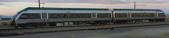
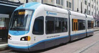
25 Vehicle Technology Multiple technologies exist in the mass transit industry. These range from common diesel locomotive, which have operated for over a century, to highly sophisticated rail systems. In consulting with the Bradley Development League Task Force, the study team identified three categories of rail technology to consider for the alternatives: light rail, streetcars and commuter rail. For detailed descriptions of each technology, please refer to Appendix C. Light Rail Transit Light rail transit can operate as single cars or as short train sets. Typically, LRT runs in exclusive or separated Right of Way with station stops one quarter mile or more apart. It can also operate within streets, but has somewhat limited turning ability. Compared to Streetcar, it has generally higher capacity and can reach speeds up to or exceeding 60 mph. Generally, it requires a minimum of 82 foot turning radius, but some newer LRT systems have the capacity for tighter turning capabilities. In the United States there are seven airports that are serviced by light rail. Streetcar Streetcars often operate as single cars or single articulated vehicles. They generally run in streets with traffic, have moderate capacity and can achieve speeds typically mph. They are capable of handling tight turns (50 foot radius). There are several types of streetcar rolling stock available, including the Modern streetcar; Heritage Cars (primarily historic cars) and new replica cars designed to look like historic ones. In addition, there are hybrid vehicles (Modern) that can run off batteries as well as overhead wire to avoid visual impacts in historic districts. Commuter Rail Commuter rail lines are either electric or diesel propelled railways that extend miles beyond the downtown core into adjacent suburbs with the purpose of transporting passengers from outlining areas into a downtown core. Commuter rail often shares track with freight traffic and therefore must be built to main line rail standards, they do not operate in mixed traffic. Due to the farther distances travelled capacity is often constrained by the number of seats. To increase capacity bi-level cars can be used, they provide up to 1.5 times greater capacity over single level cars. Capacity on a single level vehicle is typically in the range of 90 passengers. Since commuter rail systems are often heavier with lower acceleration values than alternative rail technologies the stations are usually spaced farther apart. Commuter rail lines are typically limited to 79 MPH due to track classification and the lack of automatic train stop and control equipment. Trains are either a locomotive pulling passenger cars or self-powered multiple unit and both can be powered by either electricity or diesel. Multiple units tend to be shorter, quieter, lighter, and travel at quicker speeds than locomotive hauled equipment. In the United States there are six airports serviced by commuter rail. 19
26 Long List of Alternatives Griffin Line Extension 1: Route 187 to Route 20 This alternative provides a connection to Hartford on the route of the existing Griffin Line, with a portion of shared right of way (ROW) with existing freight operations and a portion of shared ROW with vehicular traffic (Figure 5). This route presents engineering challenges due to at-grade crossings and several complex intersections. It also presents operational challenges because of sharing the ROW with an existing freight operation, which will limit the types of vehicles that can be used, or require temporal separation between the uses. The environmental impact of this route would be minimal as it would be constructed within an existing ROW and there would be small land acquisitions. Griffin Line Extension 2: New Corridor to Route 20 via International Drive Similar to the previous alternative, this route would provide a connection to Hartford on the existing Griffin Line, and a new corridor to the Airport (Figure 5). A portion of the route would operate along a shared ROW with rail freight operations, a portion would be on a new separated corridor, and a portion would utilize a shared ROW with vehicular traffic. As noted above, sharing the ROW with freight operations presents an operational challenge. This alternative would also require the construction of a bridge over the Farmington River. There would be substantial environmental impact due in part to required land acquisitions and construction of the new corridor and bridge. Griffin Line Extension 3: Route 187 to Route 20 via Seymour Road and International Drive The third alternative alignment along the Griffin Line considers a connection to Hartford via the Griffin Line and an extension to the airport along Seymour Road and International Drive (Figure 5). This route presents similar operational challenges as noted above. This alternative would intersect Seymour Road and Route 187. Environmental impacts would be minimal, as the route operates in an existing ROW and requires few land acquisitions. 20

27 Figure 5: Long List Alternatives: Griffin Alignments 21
28 Suffield Spur This alternative alignment would provide a connection from the future Windsor Locks rail station via the existing freight railroad (Figure 6). The route would operate on a shared ROW with freight which poses operational challenges. This alignment would require at-grade crossings, and a new junction for service to Springfield. The environmental impact of this alignment is minimal unless the junction to provide rail service towards Springfield is constructed. This alignment presents an opportunity of a one-seat ride directly Between the NHHS rail line and Bradley Airport. Windsor Locks 1a/1b: Elm Street or North Street An alignment through Windsor Locks via Elm Street or North Street would be a connection on a shared ROW (Figure 6). The alternative that operates along Elm Street would provide a connection to the new Windsor Locks station and would face operational challenges as it operates on a shared ROW. Engineering challenges include design challenges associated with providing a rail connection within a narrow ROW. The alignment option following North Street services the new Windsor Locks station and faces the same challenges as the Elm Street alignment in addition to more severe topography challenges. Both of these alignments would result in moderate environmental impacts as it is located through a residential area and would impact the surrounding neighborhoods. Windsor Locks 2: New Corridor This alternative considers an alignment through Windsor Locks on a new separated ROW (Figure 6). A separated ROW would present no operations challenges; however, there are significant engineering challenges associated with the construction. There would also be substantial environment impacts as this route would be constructed on an undisturbed corridor with wetlands. Service on this route would be provided via a shuttle to Windsor Locks or direct rail service to Hartford or Springfield. This alignment also presents an opportunity for a one-seat ride directly between the NHHS rail line and Bradley Airport. 22

29 Figure 6: Long List Alternatives: Suffield Spur and Windsor Locks 23
30 Interstate 91 An alternative connection to the airport from Hartford could be provided in the HOV lane on I-91 or in a separated ROW in the I-91 median (Figure 7). Additional infrastructure requirements include a new guideway along I-91 and Route 20 and structural work at the Route 20 interchange; this construction would create moderate environmental impacts as there would be a large magnitude of construction within the existing ROW. Route 20 A connection to the airport from Windsor Locks or direct service from Hartford or Springfield could be provided (Figure 7). This alignment would operate in a shared ROW with vehicular traffic which could pose operational challenges. A new structure over I-91 and guideway construction along Route 20 would be required. This amount of construction would result in substantial environmental impact, particularly to the wetlands in the area. This alignment presents an opportunity of a one-seat ride directly between the NHHS rail line and Bradley Airport. 24

31 Figure 7: Long List Alternatives: I-91 and Route 20 25
32 Evaluation The eight alternatives described above were presented to the Steering Committee in September The Committee reviewed each alternative to determine the four alternatives that would be further evaluated in this study. Each alternative was evaluated qualitatively for its ability to meet the study s goals and for the likelihood of obstacles that would prevent the alternative from being a cost-effective solution. Alternatives were eliminated by the Committee for a variety of reasons. The group determined that alignments would be eliminated if they: did not serve Springfield would result in a large amount of land acquisition would produce substantial negative environmental impact were not likely to receive political support The following alternatives were eliminated from the long list: 1. Griffin Line Extension 1: Route 187 to Route 20 This alternative was eliminated because it would not service Springfield and points north. 2. Griffin Line Extension 2: New Corridor to Route 20 via International Drive This alternative was eliminated because it would not service Springfield and points north. 3. Griffin Line Extension 3: Route 187 to Route 20 via Seymour Road and International Drive This alternative was eliminated because it would not service Springfield and points north. 4. Interstate 91 This alternative was eliminated because it would require construction of a new corridor which was likely to result in substantial environmental impacts. 5. Windsor Locks 2: New Corridor This alignment was eliminated because it would require a significant number of property takings and could result in potential negative environmental impacts. With the elimination of these alternatives, the following were selected as the four alternatives for further evaluation: 1. Suffield Spur 2. Windsor Locks: North Street 3. Windsor Locks: Elm Street 4. Route 20 Figure 8 depicts the alignments of these four alternatives: 26

33 New Windsor Locks Station Figure 8: Short List of Alternatives - Alignments 27
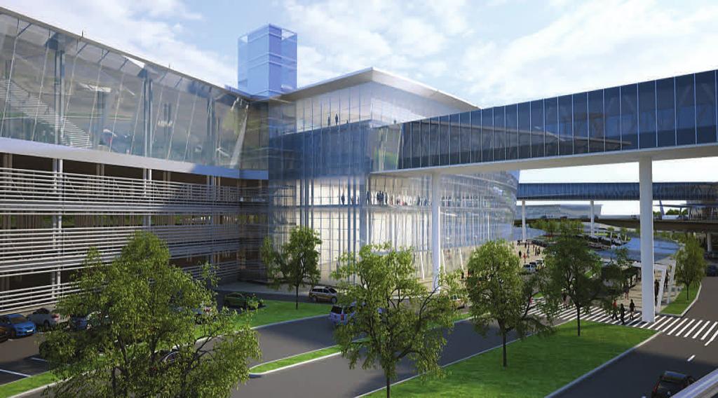
 is to be located on the existing surface parking lot opposite the old main terminal (which is presently")
34 Short List of Alternatives All of the Short List routes would connect the proposed (relocated) Windsor Locks Station to the airport at the proposed Airport Ground Transportation Center. Airport Ground Transportation Center The proposed Airport Ground Transportation Center (GTC) is to be located on the existing surface parking lot opposite the old main terminal (which is presently being demolished) in front of the new Terminal B (Figure 9). The GTC will be separated from the Terminal B building by the Airport terminal access road in a layout that is similar to the parking garage and access road at Terminal A. The alternative layouts for this study all approach the north-east corner of the GTC to provide the closest connecting point to both terminals (A and B). Depending on the final grades and interior uses at the GTC, it may be necessary to alter the location of this stop horizontally or vertically. Figure 9: Proposed Ground Transportation Center (GTC) Windsor Locks Station The Windsor Locks Amtrak station is presently located on the east side of Route 159 south of the I-91 overpass, a distance of approximately 1 mile from Route 140 (Bridge Street). The station provides high level boarding for the single track utilized by Amtrak, and provides parking for approximately 50 vehicles. A new station is proposed to be located immediately north of the historic Windsor Locks Station. This location is approximately ¼ mile north of Route 140 and lies east of Bradley Airport (Figure 8). All four 28
35 alternative routes terminate at the station at this new location. Figure 10 shows a conceptual drawing of the proposed station. Figure 10: Windsor Locks Station Conceptual Design Alternative Route 1 the Suffield Spur This alternative would utilize the existing Connecticut Central Suffield Spur from the Amtrak main line to the airport via the Bradley Spur. It is possible to configure this alternative for diesel locomotive/commuter coach use, or DMU vehicles. It may be possible to use light rail vehicles as well, but issues with operations on this freight line may make this impractical as temporal separation would be required. Assuming that diesel locomotives or FRA compliant DMU s are used, there is some additional track flexibility at the Windsor Locks Station, because these vehicles could access the Hartford mainline track. We believe that the Windsor Locks station would be configured with a separate track for the Bradley Connector, and a two-sided platform to allow a cross platform connection with Hartford line service. 29

36 Figure 11: Suffield Spur Alignment 30

37 This route follows the Suffield Spur as it leaves the Amtrak main line roughly 2,500 feet north of the Windsor Locks Station, and curves to the north-west, servicing several industrial/commercial properties with leading and trailing sidings before crossing Harvey Lane at grade and North Main Street/East Street at grade just north of Harvey Lane. The single track line then passes the MacDougal Correctional Institute and continues north-west to Mather Street. The line diverges from the Suffield Spur and turns toward the airport just before Mather Street, forming a two-track grade crossing at that location. After crossing Suffield Street, the track continues south-westerly, and serves additional industrial customers with sidings as it approaches the Army National Guard base. Just beyond the at-grade crossing with King Spring Road, the track passes through a gated (hand-locked) barrier to enter the base. It passes through the base, which is also served by multiple sidings, to a second hand-locked, gated barrier immediately prior to crossing Route 75 (Ella Grasso Turnpike). The at-grade crossing with Ella Grasso Turnpike is controlled by a traffic signal instead of a railroad crossing signal or gates (Figure 12). Figure 12: Traffic Signal controls the crossing on Ella Grasso Turnpike The track turns to the south as it enters airport development property and runs parallel to Route 75, crossing Light Lane, North Street, Insurance Lane, Citation Lane/Light Lane (on a diagonal), Spring Street, and an unnamed driveway, servicing a siding for an industrial park east of Route 75, and terminating adjacent to the cell-phone parking lot approximately 2,500 feet north of Schoephoester Road. The existing line is maintained strictly for low-speed freight use, and will require significant upgrading for passenger service. All existing crossings (except Route 75) are protected only by static signage, and the Army National Guard property must be entered and exited by manually un-locking and re-locking the gates. The Route 75 crossing is an unusual signalized crossing, using standard vehicular signals instead of crossing signals or gates. The crossing is actuated by a key-by, and it does not appear that track circuits are in place for automatic actuation. 31


38 Two routes have been identified for extending the line to the Ground Transportation Center (GTC); these routes can be seen in Figure 13. Both extend the existing track alignment to the south, basically parallel to Route 75. This will impact the cell phone waiting lot and will require some re-configuration of that lot, or for that use to be shifted to some other location. Figure 13: Northerly and Southerly Alternative Routes The northerly alternative turns westward between the car rental properties and the airport, and continues toward Cargo Road along the north edge of the Long Term Lot 3 parking area. The track would then go overhead on structure to cross Cargo Road and the Airport access drive, passing the garage at an elevation that will not interfere with the pedestrian or vehicular operations in front of Terminal A. The route would terminate at a stub-end platform at the north-east corner of the GTC. The southerly alternative crosses the Schoephoester/Airport Road intersection at an angle (Figure 14), using the traffic signal in conjunction with railroad protection devices to allow the train to pass to the south side of Schoephoester Road. The route then continues between the southerly properties and the street to a point near Airport Entrance intersection. The track would be located overhead on structure to cross the entry road, and merge back to the northerly route, terminating at a stub-end platform at the north-east corner of the GTC. This route has two planned at-grade driveway crossings along Schoephoester Road. However, these crossings and the signalized crossing at Airport Road could be eliminated by placing the track on an elevated structure in this area. Figure 14: Southerly Access (crossing the Schoephoester/Airport Road intersection) Table 3 shows the two alignments along the Suffield Spur and a brief overview of the alignment length, the length of new construction or track renovation, the number of existing and proposed at-grade crossings and the number of existing and proposed traffic signals. 32
39 Table 3: Suffield Spur Alignment Overview Suffield Spur A Suffield Spur B Corridor Length 6.24 miles 6.40 miles New Construction At-grade.78 miles.91 miles Embedded n/a n/a Elevated.57 miles.60 miles Tunnel n/a n/a Track Renovation 4.39 miles 4.39 miles At-grade crossings Existing New 1 2 Traffic Signals Existing 1 2 New 0 0 Alternative Route 2 North Street This alternative would utilize North Street from the Windsor Locks Station to the airport via Route 75. This routing involves in-street operations for most of its length, and would utilize streetcar equipment. The configuration at the Windsor Locks Station would either be a separate track for the Bradley Connector, and a two-sided platform to allow a cross platform connection with Hartford line service, or a separate track without a platform, requiring street level boarding. 33

40 Figure 16: North Street Alignment 34
 to Suffield Street, and then turns to the west onto North Street.")
, where it may take either of the two previously described routes to the GTC (Single")
41 Because of the in-street operation, this route would require double track installation to allow the streetcar to operate with moving vehicular traffic. The route leaves the Windsor Locks station and travels northerly on Main Street (Route 159) to Suffield Street, and then turns to the west onto North Street. It follows North Street all the way to Ella Grasso Turnpike (Route 75), at which point it turns to the south. The route runs in Route 75, crosses the industrial park siding, and proceeds to Schoephoester Road (Figure 17), where it may take either of the two previously described routes to the GTC (Single track), or where is will remain in street operation (dual track) along Schoephoester Road to the GTC. Although crossing gates are not required for in-street operations, traffic signal controls must be modified to permit the safe passage of the streetcars. Modifications to the signal operations are anticipated at four intersections (assuming all in-street running), and a new traffic signal would be needed at the Windsor Locks Train station. Figure 17: Route 75 crossing (left) and Schoephoester Rd. crossing (right) Table 4 shows the two alignments along North Street and a brief overview of the alignment length, the length of new construction or track renovation, the number of existing and proposed at-grade crossings, the number of existing and proposed traffic signals and the number of properties which directly border the proposed alignment. Table 4: North Street Alignment Overview North Street A North Street B Corridor Length 4.36 miles 4.52 miles New Construction At-grade.78 miles.91 miles Embedded 6.01 track miles 6.01 track miles Elevated.57 miles.60 miles Tunnel n/a n/a Track Renovation n/a n/a At-grade crossings Existing
42 New 1 2 Traffic Signals Existing 2 4 New 1 1 Properties Business Industrial Residential Alternative Route 3 Elm Street (Route 140) This alternative would utilize Elm Street from the Windsor Locks Station to the airport via the Route 159. This routing involves in-street operations for most of its length, and would utilize streetcar equipment. It is possible to configure this alternative for light (non-fra compliant) DMU vehicles as well. The configuration at the Windsor Locks Station would either be a separate track for the Bradley Connector, and a two-sided platform to allow a cross platform connection with Hartford line service, or a separate track without a platform, requiring street level boarding. 36

43 Figure 18: Elm Street Alignment 37
, and then turns to the west onto Elm Street.")
, or where is will remain in street operation (double track) along Schoephoester Road to the GTC.")
44 Because of the in-street operation, this route would require double track installation to allow the streetcar to operate with moving vehicular traffic. The route leaves the Windsor Locks station and travels southerly on Main Street (Route 159), and then turns to the west onto Elm Street. It follows Elm Street all the way to Ella Grasso Turnpike (Route 75), at which point it turns to the south and proceeds to Schoephoester Road, where it may take either of the two previously described routes to the GTC (Single track), or where is will remain in street operation (double track) along Schoephoester Road to the GTC. Although crossing gates are not required for in-street operations, traffic signal controls must be modified to permit the safe passage of the streetcars. Modifications to the signal operations are anticipated at eight intersections (assuming all in-street running), and a new signal installation at the Windsor Locks Train station. Figure 19: Route 75 crossing (left) and Schoephoester Rd. crossing (right) Table 5 shows the two alignments along Elm Street and a brief overview of the alignment length, the length of new construction or track renovation, the number of existing and proposed at-grade crossings, the number of existing and proposed traffic signals and the number of properties which directly border the proposed alignment. Table 5: Elm Street Alignment Overview Elm Street A Elm Street B Corridor Length 4.02 miles 4.23 miles New Construction At-grade.62 miles.80 miles Embedded 5.66 track miles 5.66 track miles Elevated.57 miles.60 miles Tunnel n/a n/a Track Renovation n/a n/a At-grade crossings 38
45 Existing 0 0 New 1 2 Traffic Signals Existing 8 10 New 1 1 Properties Business Industrial 5 5 Residential Alternative Route 4 Interstate 91/Route 20 This alternative would utilize Route 159, Interstate 91 and Route 20 from the Windsor Locks Station to the airport. This routing involves in-street operation along the Route 159 portion of the route, and then is on a separated right-of-way to the GTC. It could utilize streetcar, light rail or light DMU equipment. As an alternative, it could use mainline track between the Windsor Locks station and I-91 if FRA compliant DMU equipment or diesel locomotive/coach equipment is utilized. The configuration at the Windsor Locks Station would either be a separate track for the Bradley Connector, and a two-sided platform to allow a cross platform connection with Hartford line service, or a separate track without a platform, requiring street level boarding. If the mainline alternative is chosen, then a third track at the station would be preferable. 39

46 Figure 20: Route 20 Alignment 40
, or alternatively on the main line of the railroad and then turns to the west onto I-91 immediately north")
47 Double track installation would be required only in the Route 159 in-street portion of the operation. The remainder of the route would be single track (reversible) in separated right of way. The route leaves the Windsor Locks station and travels southerly on Main Street (Route 159), or alternatively on the main line of the railroad and then turns to the west onto I-91 immediately north of the SB Entrance ramp. As it maintains its position in the northerly portion of the right of way along I-91, a retaining wall is likely to be necessary to support the track. The track would cross the S. Center Street Exit (exit 41) ramp on structure (or below grade) and continue south along the highway and along the I-91 exit 40 ramp where it will then go up on structure to cross into the median for Route 20. The track would follow the Route 20 median at grade with structures over Old County Rd. and Hamilton Rd. to navigate west toward the airport. The track would follow the Route 20 curvature to the GTC, terminating along the easterly face of the structure, near the north-east corner. This location, again, gives the best access to either Terminal A or Terminal B. Portions of the route using in-street operation would require modifications to the traffic signals to provide proper control and protection of the rail cars. If the heavy rail option is used, Route 159 can either be crossed on a grade-separated structure or at-grade with crossing gates. It is anticipated that an at-grade crossing would be used as there is minimal space for a new track and structure due to the location of the Windsor Locks canal. Figure 21: Route 20 alignments onto I-91 41

48 Figure 22: Exit from I-91 and crossing Route 20 Table 6 shows the two alignments along Route 20 and a brief overview of the alignment length, the length of new construction or track renovation, the number of existing and proposed at-grade crossings, the number of existing and proposed traffic signals and the number of properties which directly border the proposed alignment. Table 6: Route 20 Alignment Overview Route 20 A Route 20 B Corridor Length 6.76 miles 6.82 miles New Construction At-grade 3.48 miles 3.48 miles Embedded n/a 2.16 track miles Elevated 0.69 miles 0.69 miles Tunnel 0.13 miles 0.13 miles Track Renovation n/a n/a At-grade crossings Existing 0 0 New 0 1 Traffic Signals Existing 4 1 New 0 0 Properties 4 Business n/a 16 Industrial n/a 4 Residential n/a 16 4 Properties impacted by this alternative are only for the alignment which uses Light Rail service which would require approximately 2 miles of embedded track. 42
49 Cost Estimate Capital Cost A capital cost estimate was developed for each of the four Short List alternatives in the Bradley Light Rail Feasibility Study based on the specific alignment options. Actual nationwide costs for similar projects were compared to more regionally established costs, including Danbury and Waterbury, Connecticut rail projects as well as Charlotte, North Carolina and Baltimore, Maryland. Costs for this type of construction vary significantly from place to place, and conservative averages were used to formulate unit costs for this project. Costs were inflated to reflect the 2016 design year and a 15% unallocated contingency was also applied to reflect the conceptual level of accuracy appropriate for this stage of the study. Based on FTA Standards, nine major cost categories were identified, as follows: Cost Category 10 Guideway and Track Elements Cost Category 20 Station Stops, Terminals, and Intermodals Cost Category 30 Support Facilities: Yards, Shops, and Administrative Buildings Cost Category 40 Sitework and Special Conditions Cost Category 50 Systems Cost Category 60 Right of way, Land, and Existing Improvements Cost Category 70 Vehicles Cost Category 80 Professional Services Cost Category 90 Unallocated Contingency Cost Category 10 Guideway and Track Elements This section includes the track and guideway elements necessary to complete the route, such as embedded rail, new track and bed, elevated trackway, retaining walls, tunnels, replacing existing track turnouts and crossovers. Excavation and construction related to the track installation are also included in this section. Embedded rail includes the necessary roadway reconstruction and site work for landscaping, roadway access and pedestrian/bicycle accommodations. Retaining wall includes the cost for a single track with a retaining wall that averages 8 feet high. The cost for the tunnel and structure includes the track. Table 7 outlines the alternatives and type of track needed for each. 43
50 Replace existing track Embedded track structure New track and bed Elevated track Alternative 1A X X X Alternative 1B X X X Alternative 2A X X X Alternative 2B X X X Alternative 3A X X X New track w/ retaining wall Tunneled Track Alternative 3B X X X Alternative 4A X X X X Alternative 4B X X X X X Table 7: Alternative and Guideway Elements Segments of track along the New-Haven-Hartford-Springfield (NNHS) line presently installed or already programed to be upgraded are anticipated to be used for sections of Alternative 1A, 1B and 4A. Additional cost for upgrading these sections is not included in this alternative s cost. Alternatives running on roadway embedded track must be single-directional (to operate with the flow of traffic). For consistency, costs associated with these alternatives are per track-mile, applied in each direction. All other track, with the exception of the existing NHHS, will be bi-directional. A passing siding would be required for Alternatives 1 and 4 to accommodate the anticipated schedule. Determination of a specific location would require a detailed site review and operations analysis. However, the cost for the turnouts and an assumed 400 feet of passing track has been included in this estimate. Cost Category 20 Station Stops, Terminals, and Intermodals It is assumed that there will be no intermediate stations and that stops will only be located at the terminals. A separate station at Bradley Airport will not be necessary, as the vehicle will stop at the GTC, and be part of the new Intermodal Station. A new platform, 300 feet long will be constructed at the Windsor Locks station. Cost Category 30 Support Facilities: Yards, Shops, and Administrative Buildings A new maintenance and storage facility will be needed for the DMU, street car and light rail options. If heavy rail is selected then the vehicles will use an existing CTDOT facility for maintenance and storage. A storage facility for DMU, light rail or street car would be appropriate to the size and scale of the proposed operation, including the small number of vehicles being maintained. The facility, which is described in more detail, below, would house typical streetcar maintenance operations, including a wash facility and bays to perform repairs and maintenance. Additional track and turnouts related to the non-paved Right of way is included in this section of the estimate, as well. Cost Category 40 Sitework and Special Conditions In general there may be minor impacts on utilities along the alternative routes, and there will likely be some adjustment to stormwater systems, curb, sidewalk, and streetlights to accommodate the alignments. These costs have been included in category 10 for track elements. 44
51 Cost Category 50 Systems Systems costs include all Traction Power Electrical work, Overhead Catenary System (OCS), and electronics associated with operation of electrically powered systems. A train control and signal system was included for alternatives 1 and 4, if passing sidings are needed. There would be a need for new traffic or significantly upgraded traffic signals at three locations (Schoephoester Rd. and Long Term Lot 4, South Windsor Station, and Rt. 159 and the I-91 South ramp) within the various alignments. It is anticipated that full, gated grade crossings would be required at most private and all public crossings. A typical fenced-in traction power substation can operate approximately one mile of dual track. Each traction power substation is approximately a 30 feet by 10 feet prefabricated aboveground structure that is surrounded by fencing. The trolley wire OCS was priced at a linear foot cost based on dual track support (a single support system for both direction of trolley wire). Existing traffic signals along the route would be replaced or modified, as necessary to provide safe operation and priority clearances. Cost Categories 10 through 50 are a compilation of all direct construction costs. Cost Category 60 Right of way, Land, and Existing Improvements For most of the alignments, there are little to no anticipated land purchase requirements, with most alignments located within local, state or Bradley Airport owned lands. However, the major exception is the US Army training base property which the existing Suffield & Bradley rail subdivision passes through. Negotiation for a permanent easement or purchase of the property would be required if this route is selected. While passing sidings may be required for some of the alignments, it is anticipated that they will be within the existing right of way and no property acquisitions would be necessary. Cost Category 70 Vehicles Alternative 1A and 1B could be operated with either a diesel multiple unit (DMU) or a push-pull locomotive with cab cars. DMUs must be FRA compliant as they would operate along segments of the NHHS line. While neither type of rail equipment is preferred at this time for a Bradley Airport connector, conventional push-pull rail equipment would be easier to implement. Although CTDOT is currently reviewing feasibility of operating DMUs for future passenger rail equipment, no plans are underway for future purchase. FRA compliant DMUs are the most expensive vehicle proposed due to their infancy in the United States and cost approximately $5.4 million per married pair. Modern streetcar vehicles used in comparable cities cost approximately $4 million per car, and light rail vehicles cost $3.5 million per car. Diesel push-pull locomotives average $3.1 million per unit and cab cars are $1.7 million per unit. Further descriptions of vehicle technology can be found in the Alternative Vehicle Analysis of this report. Cost Category 80 Professional Services Continuing project development, engineering and professional services are estimated to be 15% of the construction cost, including preliminary engineering, final design, project management for design and construction, construction administration & management, professional liability and other nonconstruction insurance, legal fees, permits, review fees by other agencies, cities, etc., surveys, testing, investigation, inspection and start up. 45
52 Cost Category 90 Unallocated Contingency An unallocated contingency of 15 percent was added to the overall cost in consideration of the current level of project development. Should the project proceed to a preliminary engineering level, a 40% contingency would likely be required by funding agencies such as the Federal Transit Administration (FTA). Summary Cost estimates for the shortlisted alternatives were computed based on the above listed parameters. The complete breakdown of costs is included in Appendix B and the results are summarized in Table 8, below. Based on these calculations, the total cost to connect the Windsor Locks commuter rail station with Bradley Airport is between $56 and $97 million dollars, or approximately $9.9 to $14.3 million dollars per new mile of track. The least costly alternative is to use the existing spur and access the airport via the current rental car parking lots. The lower cost mode would be either diesel locomotives or DMU. Using diesel locomotives as opposed to DMUs will save $14 million in capital costs. In general the electric powered alternatives (2, 3, and 4B) are more costly than the diesel alternatives. The most expensive alternatives are 4A and 4B. The significantly higher costs on these two alternatives can largely be attributed to the increased need for structure and longer route length. These alternatives, regardless of mode, require a retaining wall along the I-91 segment, a tunnel to go underneath the exit 41 ramp, bridges to cross Old County Rd and Hamilton Rd. plus elevated structure once the alignment leaves Rt. 20 as it approaches the airport. 46
53 Alternative Configuration Mode 1A 1A* 1B 1B* 2A 2B 3A 3B Suffield Spur, single track, through parking lot Suffield Spur, single track, through parking lot Suffield Spur, single track, Schoephoester Rd. Suffield Spur, single track, Schoephoester Rd. North St, In-street directional, through parking lot North St, In-street directional, Schoephoester Rd. Elm St, In-street directional, through parking lot Elm St, In-street directional, Schoephoester Rd. DMU LHRC DMU LHRC 4A Rt 20, DMU DMU 4B RT 20. LRT LRT SC SC SC SC New track miles Total route miles Cost (millions) Cost per new track mile ($ Million per track-mile) $70.7 $ $56.5 $ $72.7 $ $58.5 $ $73.4 $ $75.6 $ $71.4 $ $73.9 $ $81.5 $ $96.8 $14.2 Table 8: Summary of Costs 47


54 Bradley Light Rail Feasibility Study Maintenance Facilities / Power Distribution As noted previously, no new maintenance facilities are required for conventional rail equipment. However, DMU, streetcar and light rail systems require a storage and maintenance facility, or car barn for servicing and storing the vehicle fleet, administering the system operations, and supporting employees. The car barn typically accommodates vehicle storage, cleaning, and maintenance, equipment maintenance, materials storage, operations management and supervision, dispatching, emergency-response communications equipment and supplies, secure parking for nonrevenue vehicles, and employee locker rooms. In addition, due to streetcar systems historic appeal, maintenance activities may be of interest to the general public. Maintenance shops can be sectioned off with glass to provide a controlled environment for active display of the work activity. Although these are separate functional areas, for economy of space, the facilities can be constructed as separate portions of a single structure. Moreover, additional space should ideally be provided to allow for system expansion. However, land can be in short supply, particularly in urban areas. Similarly, financial constraints can restrict initial facility size. Figure 23: Typical Maintenance Facilities The storage and maintenance facility should be located within close proximity to the chosen alignment and outfitted to maintain the DMU/streetcar/light rail fleet, both now and in the future. The reason DMU equipment requires its own facility is primarily due to the type of engines they are typically outfitted with. They are essentially large engines more similar to ones used in buses than in conventional push-pull rail. The facility should be sized for a minimal, but adequate, maintenance regimen and consist of equipment that is typically required for continuous routine maintenance. For example, removing or replacing motors, removing wheels for re-truing offsite, performing routine repairs, and cleaning and washing streetcar vehicles. Based on standard transportation planning of similar transit modes, the footprint for the entire facility is typically 75 feet wide by 150 feet long, to provide space for the total number of vehicles. One track should have a dual structured pit for maintenance repairs to be performed underneath the chassis. This dual structured pit should include a gauge pit, roughly four feet wide between the rails and an open pit, 48 P age
55 Bradley Light Rail Feasibility Study at least twelve feet wide with the streetcar vehicle supported on posts. In addition, the pit track should be long enough to provide walkways for employees to access the pit from both ends with two cars in place. The adjacent tracks could be utilized for internal repairs, cleaning, and washing the cars, as well as covered storage, providing adequate room for safety and car cleaning activity. Rolling Stock / Schedule Table 9 presents a tentative operating schedule for service. This schedule assumes that the layover time on both ends is ten minutes (includes boarding, loading and unloading) and the headway will always be in an increment of 5 minutes. It also assumes there are two vehicles for Alternatives 2 and 3 as the routes can run bi-directionally. Table 9: Tentative Operating Schedule Average Travel Layover Time on Time Each End Cycle Time Alternative 1 8:24 11: Alternative 2 8:54 11: Alternative 3 9:58 10: Alternative 4A 7:30 10: Alternative 4B 9:12 10: Headway This tentative operating schedule was determined based on track configuration and meeting the commuter rail trains from the NHHS line at Windsor Locks Station. On this basis, it was determined that 2 trains would have to be in operation during peak times to accommodate NHHS commuter and Amtrak trains, regardless of the alternative chosen. Alternatives 1 and 4 are single tracked and therefore passing sidings would be needed. Including spare vehicles Alternative 1 would require three DMUs or up to three diesel locomotives and four cab cars. Each locomotive would pull one cab car, and additional coach cars can be added in the future if demand warrants. However, station platforms and passing sidings would need to be reviewed and possibly modified depending on the length of consists. Alternatives 2 and 3 require four vehicles to provide two vehicles in service, one spare vehicle, and one to accommodate repairs and servicing. Operating Cost from Windsor Locks to Bradley Airport Operating cost is driven by the number of revenue hours of service, and can be estimated by applying a unit operating cost per vehicle hour to the level of service proposed based on the mode. The national average operating cost for vehicle revenue hour is: Streetcar - $179 Light rail - $257 DMU - $745 Commuter rail (diesel locomotive) - $ P age
56 (Source: 2013 National Transit Database, Federal Transit Administration) Bradley Light Rail Feasibility Study In the United States there are five airports serviced by diesel locomotive commuter rail, seven by light rail, zero by street car, and one DMU connection which is currently under construction. Table 10 outlines reported operating costs per vehicle revenue hour and mile for commuter rail and light rail systems that connect to airports. Table 11 below denotes reported operating costs per vehicle revenue hour and mile for streetcar operations in cities across the United States. Table 12 outlines reported operating costs per vehicle revenue hour and mile for FRA compliant DMU systems in the United States. 50 P age
57 State Provider Airport served Commuter rail Bradley Light Rail Feasibility Study Cost per hour Cost per mile RI Massachusetts Bay Transportation Authority Providence (PVD) $473 $15.92 CA Metrolink Burbank (BUR) $560 $14.38 CO Regional Transportation District Denver (DEN) Under construction MD Maryland Transit Administration Baltimore (BWI) $826 $21.38 IN Light rail Northern Indiana Commuter Transportation District South Bend (SBN) $377 $10.57 WA King County Metro Seattle (SEA) $136 $11.49 TX Dallas Area Rapid Transit Dallas (DFW) $334 $16.55 MN Metro Transit Minneapolis (MSP) $198 $14.03 OR TriMEt Portland (PDX) $188 $12.87 UT Utah Transit Authority Salt Lake City (SLC) $83 $6.87 MO METRO St. Louis $246 $10.41 MD Maryland Transit Administration Baltimore (BWI) $231 $11.60 State Provider Table 10: Operating Costs for Commuter and Light Rail Systems That Serve Airports. Cost per hour Cost per mile AR Central Arkansas Transit Authority(CATA) $91 $20.49 CA San Francisco Municipal Railway(MUNI) $156 $27.15 FL Hillsborough Area Regional Transit Authority(HART) $114 $21.25 LA New Orleans Regional Transit Authority(NORTA) $165 $27.70 OR City of Portland(PBOT) $228 $37.95 PA Southeastern Pennsylvania Transportation Authority(SEPTA) $171 $19.38 TN Memphis Area Transit Authority(MATA) $105 $14.34 TX McKinney Avenue Transit Authority(MATA) $80 $14.20 WA Central Puget Sound Regional Transit Authority(ST) $431 $55.84 WA King County Department of Transportation - Metro Transit Division(King County Metro) $260 $48.84 WI Kenosha Transit(KT) $125 $17.34 State Provider Table 11: Operating Costs for Streetcar Systems in the U.S. Cost per hour Cost per mile TX Denton County Transportation Authority $508 $18.93 TX Dallas Area Rapid Transit $587 $25.37 OR TriMet $942 $43.41 FL South Florida Regional Transportation Authority $566 $18.34 Table 12: Operating Costs for FRA Compliant DMU's 51 P age
58 Bradley Light Rail Feasibility Study Using the national average operating costs by mode for vehicle revenue hour, the annual operating cost will vary between $1.37 million to $5.71 million depending on the mode (Table 13). The lowest annual operating cost would be for streetcar and the highest for DMU. Operating costs are based on an average of 21 revenue hours per day. Service hours would match that of NHHS (15 hours a day) with increased service during the peak hours. Service is assumed to operate on a year round basis (365 days) between the Windsor Locks commuter rail station and Bradley Airport. Mode Cost per revenue hour Annual cost (millions) DMU $745 $5.71 SC $179 $1.37 LRT $257 $1.97 LHRC $501 $3.84 Table 13: Annual Operating Cost per Mode 52 P age
59 Bradley Light Rail Feasibility Study Environmental Analysis A key component of the alternatives analysis examined each alignment s impact on environmental resources. For the purpose of this report, the study area is defined as 500 feet measured on each side of the proposed alternative s alignment. Within this area, environmental resources were identified including water resources, parks and designated open spaces, endangered species and zoning uses. The study s goals include objectives which seek to minimize any negative impacts to the area. Detailed maps depicting the locations of all identified resources can be viewed in Appendix D. Water Resources Water resources identified within 500 feet of each alternative include wetlands, floodplains and drinking water supply areas. Of the four alternatives, the North Street alignment has the least impact on water resources with only 2.7 acres of wetlands and 5.3 acres of floodplains identified (Table 14). Route 20 falls on the other side of the spectrum and has the most impact on water resources with 27.9 acres of wetlands and 63.5 acres of floodplains. The Town of Windsor Locks recently purchased 32.8 acres from the CT Water Company; however this water will not be part of the drinking water supply. The primary body of water in the study area is the Connecticut River. No aquifer protection areas would be impacted by any of the four short list alternatives. Table 14: Water Resource Impact Analysis Alternative Wetlands Floodplain Drinking Water Supply 1. Suffield Spur 5.9 acres 7.0 acres n/a 2. North Street 2.7 acres 5.3 acres n/a 3. Elm Street 9.1 acres 46.3 acres n/a 4. Route acres 63.5 acres n/a Open Space Although there are designated open space parcels within 500 feet of each alternative, most do not intersect the proposed alignments. The Elm Street alternative has the least potential impact on open space property with only 13.6 acres identified within 500 feet (Table 15). On the other hand, Route 20 has the highest impact on open space with 36.2 acres falling within 500 feet of the proposed alignment. Route 20 is also the only alternative that directly intersects open space property at Olds and Whipple Pond Open Space. Table 15: Open Space Impact Analysis Alternative Open Space Locations 1. Suffield Spur 12.1 acres Veterans of Foreign Wars 2. North Street 13.6 acres North Street School, Pesci Park 53 P age
60 Bradley Light Rail Feasibility Study 3. Elm Street 7.2 acres Denslow Street Park, Windsor Locks Middle School, Town Hall Ball Park 4. Route acres Windsor Locks Middle School, Town Hall Ball Park, Grove Cemetery, Hollowbrook Road/Lighthouse Hill Road Open Space, Belaire Park, Olds and Whipple Pond Open Space Endangered Species To examine the impact of each alternative on endangered species, the Natural Diversity Data Base (NDDB) was used to review state-listed species. Alternative 4, Route 20, poses the highest impact on NDDB areas with acres identified (Table 16). It is important to note that additional coordination with the Connecticut Department of Environmental and Energy Protection (CTDEEP) would be needed to identify the type of species within these identified areas. Additional analysis would also be needed to determine how the area is used as it can serve as a permanent habitat or simply as a migratory path. Route 20 is the only alternative which presents a potential impact to 2.25 acres of critical plant habitats. Table 16: Endangered Species Impact Analysis Alternative NDDB Areas Critical Habitat 1. Suffield Spur acres n/a 2. North Street 92.5 acres n/a 3. Elm Street acres n/a 4. Route acres 2.25 acres (plant habitats) Zoning The type of zoning and land use within the study area varies by municipality. Zoning data was collected from the four towns which surround Bradley Airport. Although there are a variety of zoning types across the region, the primary uses are industrial, commercial, residential and open space (Figure 24). Alternative 1, Suffield Spur, operates on land that is almost exclusively industrial, with a small section of residential zoning. Alternative 2, North Street, and Alternative 3, Elm Street, both of which propose streetcar service, pass through dense residential neighborhoods. Alternative 4, Route 20, proposes an alignment through a mix of industrial, commercial and residential zoning areas. 54 P age

61 Bradley Light Rail Feasibility Study Figure 24: Zoning Uses Environmental Resources Summary Table 17 summarizes the total number of acres where existing environmental resources have been identified within the study area for each of the four short list alternatives. It should be noted that the presence of identified resources only indicates potential impacts. Final impacts will depend on which alternative is selected and the design for implementing the improvements. For example, improvements limited to the existing right of way would have minimal environmental impacts as the land is already 55 P age
62 Bradley Light Rail Feasibility Study developed. Before proceeding with any work within the corridor, it will be necessary to analyze each alternative more thoroughly to determine the specific level of impact the improvements would have. Table 17: Summary of Environmental Impacts 1. Suffield Spur 2. North Street 3. Elm Street 4. Route 20 Wetlands 5.9 acres 2.7 acres 9.1 acres 27.9 acres Flood Zone 7.0 acres 5.3 acres 46.3 acres 63.5 acres Drinking Water n/a n/a n/a n/a Supply Open Space 12.1 acres 13.6 acres 7.2 acres 36.1 acres Critical Habitat n/a n/a n/a 2.3 acres NDDB Areas acres 92.5 acres acres acres TOTAL acres acres acres acres Route Length 6.2 miles 4.4 miles 4.1 miles 6.8 miles Surrounding Zoning Industrial Some Residential; Minimal Commercial Residential Some Industrial and Commercial Residential Some Industrial and Commercial Industrial, Residential, Commercial 56 P age
63 Bradley Light Rail Feasibility Study Alternatives Evaluation Evaluation Matrix While the Long List Alternatives were evaluated based on a general qualitative review, the evaluation of the four Short List Alternatives were evaluated more thoroughly. An Evaluation Matrix (Table 18) was developed to help determine how each of the alternatives meets the goals and objectives of the study. The matrix identifies performance measures for each of the project s goals in order to create a scoring system. The alternatives receive a score for each performance measure ranging from 0 to 20. Higher scores indicate the alternative successfully meets the performance measure and overarching goal. A total score is provided to compare the four alternatives. 57 P age
64 Page intentionally left blank

65 Bradley Light Rail Feasibility Study Table 18: Alternatives Evaluation Matrix 58 P a g e
Executive Summary. Treasure Valley High Capacity Transit Study Priority Corridor Phase 1 Alternatives Analysis October 13, 2009.
 Treasure Valley High Capacity Transit Study Priority Corridor Phase 1 Alternatives Analysis October 13, 2009 Background As the Treasure Valley continues to grow, high-quality transportation connections
Status of Plans March Presented by CAPITOL REGION COUNCIL OF GOVERNMENTS
 Status of Plans March 2011 Presented by CAPITOL REGION COUNCIL OF GOVERNMENTS Transit project update Project rationale The system New Britain Hartford Busway New Haven/Hartford/ Springfield Passenger Rail
NEW HAVEN HARTFORD SPRINGFIELD RAIL PROGRAM
 NEW HAVEN HARTFORD SPRINGFIELD RAIL PROGRAM Hartford Rail Alternatives Analysis www.nhhsrail.com What Is This Study About? The Connecticut Department of Transportation (CTDOT) conducted an Alternatives
4.0 TIER 2 ALTERNATIVES
 4.0 TIER 2 ALTERNATIVES The Tier 2 Alternatives represent the highest performing Tier 1 Alternatives. The purpose of the Tier 2 Screening was to identify the LPA utilizing a more robust list of evaluation
EUGENE-SPRINGFIELD, OREGON EAST WEST PILOT BRT LANE TRANSIT DISTRICT
 EUGENE-SPRINGFIELD, OREGON EAST WEST PILOT BRT LANE TRANSIT DISTRICT (BRIEF) Table of Contents EUGENE-SPRINGFIELD, OREGON (USA)... 1 COUNTY CONTEXT AND SYSTEM DESCRIPTION... 1 SYSTEM OVERVIEW... 1 PLANNING
TORONTO TRANSIT COMMISSION REPORT NO.
 Form Revised: February 2005 TORONTO TRANSIT COMMISSION REPORT NO. MEETING DATE: October 24, 2012 SUBJECT: DOWNTOWN RAPID TRANSIT EXPANSION STUDY (DRTES) PHASE 1 STRATEGIC PLAN ACTION ITEM RECOMMENDATIONS
New Haven Hartford Springfield Rail
 New Haven Hartford Springfield Rail Opportunities for Economic Growth NHHS Rail Conference, October 25, 2011 NHHSrail.com Tom Maziarz, CT DOT, Bureau of Policy & Planning Thomas.Maziarz@ct.gov New Haven
CITY OF LONDON STRATEGIC MULTI-YEAR BUDGET ADDITIONAL INVESTMENTS BUSINESS CASE # 6
 2016 2019 CITY OF LONDON STRATEGIC MULTI-YEAR BUDGET ADDITIONAL INVESTMENTS BUSINESS CASE # 6 STRATEGIC AREA OF FOCUS: SUB-PRIORITY: STRATEGY: INITIATIVE: INITIATIVE LEAD(S): BUILDING A SUSTAINABLE CITY
Executive Summary. Draft Environmental Impact Statement/Environmental Impact Report ES-1
 Executive Summary Introduction The Eastside Transit Corridor Phase 2 Project is a vital public transit infrastructure investment that would provide a transit connection to the existing Metro Gold Line
Bi-County Transitway/ Bethesda Station Access Demand Analysis
 Bi-County Transitway/ Bethesda Station Access Demand Analysis Prepared for: Washington Metropolitan Area Transit Authority Office of Planning and Project Development May 2005 Prepared by: in conjunction
New Haven-Hartford-Springfield Rail Project Gateway to New England. Program Update March 14, 2011 Revised & Updated March 31, 2011
 New Haven-Hartford-Springfield Rail Project Gateway to New England Program Update March 14, 2011 Revised & Updated March 31, 2011 1 New Haven-Hartford-Springfield Rail Corridor Glory Days: 1925-1955 22
The Preferred Alternative: a Vision for Growth on the Northeast Corridor
 A Long-Term Vision is Needed The Preferred Alternative: a Vision for Growth on the Northeast Corridor The Federal Railroad Administration (FRA) has released the Tier 1 Final Environmental Impact Statement
STH 60 Northern Reliever Route Feasibility Study Report
 #233087 v3 STH 60 Northern Reliever Route Feasibility Study Report Washington County Public Works Committee Meeting September 28, 2016 1 STH 60 Northern Reliever Route Feasibility Study Hartford Area Development
STRATEGIC PRIORITIES AND POLICY COMMITTEE MAY 5, 2016
 STRATEGIC PRIORITIES AND POLICY COMMITTEE MAY 5, 2016 Shift Rapid Transit Initiative Largest infrastructure project in the city s history. Rapid Transit initiative will transform London s public transit
Needs and Community Characteristics
 Needs and Community Characteristics Anticipate Population and Job Growth in the City Strongest density of population and jobs in Ann Arbor are within the Study Area Population expected to grow 8.4% by
6/6/2018. June 7, Item #1 CITIZENS PARTICIPATION
 June 7, 2018 Item #1 CITIZENS PARTICIPATION 1 Item #2 APPROVAL OF MINUTES Item #3 TRAC GOALS, FRAMEWORK & AGENDA REVIEW 2 COMMITTEE GOALS Learn about Southern Nevada s mobility challenges, new developments
Kendall Drive Premium Transit PD&E Study Project Kick-Off Meeting SR 94/Kendall Drive/SW 88 Street Project Development and Environment (PD&E) Study
 Study") Florida Department of Transportation District Six Kendall Drive Premium Transit PD&E Study Project Kick-Off Meeting SR 94/Kendall Drive/SW 88 Street Project Development and Environment (PD&E) Study What
Florida Department of Transportation District Six Kendall Drive Premium Transit PD&E Study Project Kick-Off Meeting SR 94/Kendall Drive/SW 88 Street Project Development and Environment (PD&E) Study What
I-20 EAST TRANSIT INITIATIVE Tier 1 and Tier 2 Alternatives Screening Report EXECUTIVE SUMMARY
 EXECUTIVE SUMMARY The purpose of this report is to document the results of the Tier 1 and Tier 2 Screening of alternatives for the I-20 East Transit Initiative. The two-tier screening process presented
Leadership NC. November 8, 2018
 v Leadership NC November 8, 2018 Planning for our region s growth The Triangle is one of the fastestgrowing regions in the nation. More than 2 million people are already part of the equation, and the
Proposed Program of Interrelated Projects
 DALLAS AREA RAPID TRANSIT Proposed Program of Interrelated Projects Federal Transit Administration Capital Investment Program Summer 204 INTRODUCTION The current federal transportation bill, Moving Ahead
Challenges in a Post-Katrina Environment East-West Corridor Project Overview February, 2007
 EAST-WEST CORRIDOR Challenges in a Post-Katrina Environment East-West Corridor Project Overview February, 2007 Presentation Agenda Project Overview / Purpose and Need Highway Component Transit Component
Sales and Use Transportation Tax Implementation Plan
 Sales and Use Transportation Tax Implementation Plan Transportation is more than just a way of getting from here to there. Reliable, safe transportation is necessary for commerce, economic development,
ANDERSON PROPERTY SITE ANALYSIS
 ANDERSON PROPERTY SITE ANALYSIS Introduction The Montgomery County Department of Transportation (MCDOT) initiated a feasibility study in the fall of 2012 to evaluate the need for transit service expansion
Welcome. Green Line in Your Community
 Welcome Green Line in Your Community Today's session will provide you with information about Administration's recommendation for connecting the Green Line in the Beltline to Victoria Park and Inglewood/Ramsay
The Engineering Department recommends Council receive this report for information.
 CORPORATE REPORT NO: R161 COUNCIL DATE: July 23, 2018 REGULAR COUNCIL TO: Mayor & Council DATE: July 19, 2018 FROM: General Manager, Engineering FILE: 8740-01 SUBJECT: Surrey Long-Range Rapid Transit Vision
Green Line Long-Term Investments
 Enhancements Short-term improvements to keep Austin moving. Investments Long-term projects to support our future. Mobility Hubs MetroRapid MetroRail MetroExpress Connectors Circulators Project Connect
Green Line LRT: Beltline Segment Update April 19, 2017
 Green Line LRT: Beltline Segment Update April 19, 2017 Quick Facts On April 11, 2017, City Council approved Administration s recommendation for the Green Line to be underground in the Beltline from 2 Street
Restoration of Historic Streetcar Services in Downtown Los Angeles
 Restoration of Historic Streetcar Services in Downtown Los Angeles Early Scoping Meeting for Alternatives Analysis (AA) May 17, 2011 Introduction Key players Local lead agency: Metro Federal lead agency:
Chapter 4 : THEME 2. Transportation
 Chapter 4 : THEME 2 Strengthen connections to keep the Central Area easy to reach and get around 55 Figure 4.2.1 Promote region-wide transit investments. Metra commuter rail provides service to the east,
Energy Technical Memorandum
 Southeast Extension Project Lincoln Station to RidgeGate Parkway Prepared for: Federal Transit Administration Prepared by: Denver Regional Transportation District May 2014 Table of Contents Page No. Chapter
Restoration of Historic Streetcar Services in Downtown Los Angeles
 Restoration of Historic Streetcar Services in Downtown Los Angeles Alternatives Analysis Community Update Meeting August 2, 2011 Introduction Key players Local lead agency: Metro Federal lead agency: Federal
Waco Rapid Transit Corridor (RTC) Feasibility Study
 Feasibility Study") Waco Rapid Transit Corridor (RTC) Feasibility Study Chris Evilia, Director of Waco Metropolitan Planning Organization Allen Hunter, General Manager Waco Transit System Jimi Mitchell, Project Manager AECOM
Waco Rapid Transit Corridor (RTC) Feasibility Study Chris Evilia, Director of Waco Metropolitan Planning Organization Allen Hunter, General Manager Waco Transit System Jimi Mitchell, Project Manager AECOM
US 81 Bypass of Chickasha Environmental Assessment Public Meeting
 US 81 Bypass of Chickasha Environmental Assessment Public Meeting March 14, 2013 Introductions ODOT FHWA SAIC Meeting Purpose Present need for bypass Provide responses to 10/04/11 public meeting comments
CITY OF ANN ARBOR, MICHIGAN 301 E. Huron St., P.O. Box 8647 Ann Arbor, Michigan
 Date: Wednesday, June 24, 2014 Location: Ann Arbor District Library Attendees: 40 citizen attendees Ann Arbor Station Environmental Review Public Meeting Meeting Notes Meeting #2 The second public meeting
Public Meeting. City of Chicago Department of Transportation & Department of Housing and Economic Development
 Public Meeting City of Chicago Department of Transportation & Department of Housing and Economic Development Funded by Regional Transportation Authority September 12, 2011 In partnership with Presentation
Pacific Electric Right-of-Way / West Santa Ana Branch Corridor Alternatives Analysis
 Pacific Electric Right-of-Way / West Santa Ana Branch Corridor Alternatives Analysis Transit Coalition September 26, 2012 2 Study Area Pacific Electric Rightof-Way/West Santa Ana Branch (PEROW/ WSAB) extends
FINAL. Sound Transit Long-Range Plan Update. Issue Paper S.1: Tacoma Link Integration with Central Link. Prepared for: Sound Transit
 Sound Transit Long-Range Plan Update Issue Paper S.1: Tacoma Link Integration with Central Link Prepared for: Sound Transit Prepared by: Quade & Douglas, Inc. FINAL March 2005 Foreword This issue paper
FREQUENTLY ASKED QUESTIONS
 FREQUENTLY ASKED QUESTIONS 2018 What is the More MARTA Atlanta program? The More MARTA Atlanta program is a collaborative partnership between MARTA and the City of Atlanta to develop and implement a program
Pedestrians, Cars, Buses and Trains? Considerations for Rapid Transit Service at Western University
 Pedestrians, Cars, Buses and Trains? Considerations for Rapid Transit Service at Western University Shift: The City of London s Rapid Transit Proposal Shift: The City of London s Rapid Transit Proposal
Develop ground transportation improvements to make the Airport a multi-modal regional
 Project Overview TRANSPORTATION IMPROVEMENTS WHAT ARE THE PROJECT GOALS? Transportation transportation hub. Develop ground transportation improvements to make the Airport a multi-modal regional Land Use
Green Line LRT: Beltline Recommendation Frequently Asked Questions
 Green Line LRT: Beltline Recommendation Frequently Asked Questions June 2017 Quick Facts Administration has evaluated several alignment options that would connect the Green Line in the Beltline to Victoria
Public Meeting. March 21, 2013 Mimosa Elementary School
 Public Meeting March 21, 2013 Mimosa Elementary School Today s Meeting Purpose 2 Where We Are The Process What We ve Heard and Findings Transit Technologies Station Types Break-out Session Where We Are
PEACHTREE CORRIDOR PARTNERSHIP. Current Status & Next Steps
 PEACHTREE CORRIDOR PARTNERSHIP Current Status & Next Steps PEACHTREE CORRIDOR PARTNERSHIP Why Peachtree? Why Now? I. THE CONTEXT High Level View of Phasing Discussion Potential Ridership Segment 3 Ease
I-26 Fixed Guideway Alternatives Analysis
 I-26 Fixed Guideway Alternatives Analysis Steering & Technical Advisory Committees Joint Meeting January 15, 2016 @ 10:00 AM SC/TAC Meeting Winter 2016 Agenda I. Welcome & Introductions II. III. Project
CEDAR AVENUE TRANSITWAY Implementation Plan Update
 CEDAR AVENUE TRANSITWAY Implementation Plan Update EECUTIVE SUMMARY DECEMBER 2015 Executive Summary In 2013, the Twin Cities metropolitan area s first bus rapid transit (BRT) line, the METRO Red Line,
Central City Line Locally Preferred Alternative (LPA) Amendment Public Hearing. July 24, 2014
 Amendment Public Hearing. July 24, 2014") Central City Line Locally Preferred Alternative (LPA) Amendment Public Hearing July 24, 2014 Project Description The Central City Line is a High Performance Transit project that will extend from Browne
Central City Line Locally Preferred Alternative (LPA) Amendment Public Hearing July 24, 2014 Project Description The Central City Line is a High Performance Transit project that will extend from Browne
Midtown Corridor Alternatives Analysis. Policy Advisory Committee Meeting February 12, 2014
 Midtown Corridor Alternatives Analysis Policy Advisory Committee Meeting February 12, 2014 Today s Agenda Introductions Outreach efforts and survey results Other updates since last meeting Evaluation results
Transit Access Study
 West of Hudson Regional Transit Access Study Open House presentation July 20, 2010 1 Agenda Progress To date Summary of Level 2 Alternatives and Screening Service Plans Bus and Rail Operating and Capital
Preliminary Definition of Alternatives. 3.0 Preliminary Definition of Alternatives
 3.0 What preliminary alternatives are being evaluated? The alternatives for the East San Fernando Valley Transit Corridor project that were considered for screening include the No Build Alternative, Transportation
Office of Transportation Bureau of Traffic Management Downtown Parking Meter District Rate Report
 Office of Transportation Bureau of Traffic Management 1997 Downtown Parking Meter District Rate Report Introduction The City operates approximately 5,600 parking meters in the core area of downtown. 1
Rocky Mountain. Corridor Input Team. Alternatives Overview. TEMS, Inc. / Quandel Consultants, LLC TEMS, Inc. / Quandel Consultants, LLC
 Rocky Mountain Rail Authority (RMRA) Corridor Input Team Meeting #2 Alternatives Overview December 2008 TEMS, Inc. / Quandel Consultants, LLC 0 Agenda Introductions Study Overview Alternatives Overview
US 29 Bus Rapid Transit Planning Board Briefing. February 16, 2017
 US 29 Bus Rapid Transit Planning Board Briefing February 16, 2017 Project Goals Improve the quality of transit service Improve mobility opportunities and choices Enhance quality of life Support master
Converting BRT to LRT in the Nation s Capital Ottawa, Canada. John Manconi City of Ottawa Ottawa, Canada
 Converting BRT to LRT in the Nation s Capital Ottawa, Canada John Manconi City of Ottawa Ottawa, Canada 1 The Challenge *Mackenzie King Bridge Ottawa, AM peak period 2 The Challenge Ottawa s population
Metropolitan Council Budget Overview SFY
 Metropolitan Council Budget Overview SFY 2016-2017 H T t ti C itt House Transportation Committee February 4, 2015 Transit connects us to the places that matter Transportation Needs Grow as the Region Grows
V03. APTA Multimodal Operations Planning Workshop August Green Line LRT
 V03 APTA Multimodal Operations Planning Workshop August 2016 Green Line LRT 2 Presentation Outline Past Present Future 3 16/03/2016 RouteAhead Update 4 4 16/03/2016 RouteAhead Update 5 5 16/03/2016 6 6
1 Downtown LRT Connector: Draft Concept
 Downtown LRT Connector: Draft Concept Plan November 2010 We re moving forward. Get involved. On June 21, 2010, City Council approved a street-level downtown LRT route, including a connector for the future
Comprehensive Regional Goods Movement Plan and Implementation Strategy Goods Movement in the 2012 RTP/SCS
 Comprehensive Regional Goods Movement Plan and Implementation Strategy Goods Movement in the 2012 RTP/SCS Annie Nam Southern California Association of Governments September 24, 2012 The Goods Movement
Attachment 5. High Speed Transit Planning Study REPORT SUMMARY. Prepared by: City of Edmonton Transportation Planning Branch. Stantec Consulting Ltd.
 Attachment 5 High Speed Transit Planning Study Prepared by: City of Edmonton Transportation Planning Branch Stantec Consulting Ltd. Transportation Management & Design, Inc. with Lea Consulting Ltd. [135-35130]
Recommended Vision for the Downtown Rapid Transit Network
 Recommended Vision for the Downtown Rapid Transit Network April 2008 Presentation Overview Context Transit options Assessment of options Recommended network Building the network 2 1 Rapid Our Vision Reliable
Car Sharing at a. with great results.
 Car Sharing at a Denver tweaks its parking system with great results. By Robert Ferrin L aunched earlier this year, Denver s car sharing program is a fee-based service that provides a shared vehicle fleet
Funding Scenario Descriptions & Performance
 Funding Scenario Descriptions & Performance These scenarios were developed based on direction set by the Task Force at previous meetings. They represent approaches for funding to further Task Force discussion
4. Transportation Plan
 The sizes of the most suitable sites are indicated in Table 4.3.6.2. Table 4.3.6.2: Site Sizes and Potential Development Area Potential Development Site Site Size (m 2 ) Area m 2 (3 Floors) D1 29,000 87,000
West LRT. Alignment Update and Costing Report May Calgary Transit Transportation Planning Clifton ND Lea Consultants
 West LRT Alignment Update and Costing Report 2006 May Calgary Transit Transportation Planning Clifton ND Lea Consultants West LRT Update Background The service area for West LRT is generally described
August 2, 2010 Public Meeting
 Public Meeting LYMMO Expansion Alternatives Analysis Study Purpose of study is to provide a fresh look at potential LYMMO expansion, following Federal Transit Administration (FTA) Alternatives Analysis
I-26 Fixed Guideway Alternatives Analysis
 I-26 Fixed Guideway Alternatives Analysis Public Meetings: North Charleston, January 25, 2016 Charleston: January 26, 2016 Summerville: January 28, 2016 Agenda I. Project Update II. III. IV. Screen Two
New Haven-Hartford-Springfield Rail Project Gateway to New England. Public Hearing June
 New Haven-Hartford-Springfield Rail Project Gateway to New England Public Hearing June 2012 1 New Haven-Hartford-Springfield Rail Corridor Glory Days: 1925-1955 22 trains/day in 1947 Bankers Ltd 3-hour
Location Concept Plan Amendment Recommendation Approved 2011 Concept Plan
 Valley Line West LRT Concept Plan Recommended Amendments Lewis Farms LRT Terminus Site Location Concept Plan Amendment Recommendation Approved 2011 Concept Plan Lewis Farms LRT terminus site, 87 Avenue/West
METRO Orange Line BRT American Boulevard Station Options
 METRO Orange Line BRT American Boulevard Station Options Bloomington City Council Work Session November 18, 2013 Christina Morrison BRT/Small Starts Project Office Coordinating Planning and Design AMERICAN
GO Transit s deliverable: the 2020 Service Plan
 GO Transit s deliverable: the 2020 Service Plan GO Transit s 2020 Service Plan describes GO s commitment to customers, existing and new, to provide a dramatically expanded interregional transit option
Submission to Greater Cambridge City Deal
 What Transport for Cambridge? 2 1 Submission to Greater Cambridge City Deal By Professor Marcial Echenique OBE ScD RIBA RTPI and Jonathan Barker Introduction Cambridge Futures was founded in 1997 as a
The Jack A. Markell Trail Delaware s Bicycle Highway New England Bike- Walk Summit
 The Jack A. Markell Trail Delaware s Bicycle Highway 2018 New England Bike- Walk Summit The Jack A. Markell Trail Sometimes a very difficult project, including significant investment and perseverance,
The Northeast Corridor Master Plan Amtrak s Next Generation High-Speed Rail and Northeastern Maryland
 The Northeast Corridor Master Plan Amtrak s Next Generation High-Speed Rail and Northeastern Maryland Chesapeake Science & Security Corridor Regional Rail Committee Meeting October 20, 2010 Drew Galloway
QUALITY OF LIFE EXECUTIVE SUMMARY REPORT I O N S TAT I O N
 QUALITY OF LIFE EXECUTIVE SUMMARY REPORT UN I O N S TAT I O N T R AV E L by TR A I N Published September 2017 2015 PROGRESS MAP This document reports FasTracks progress through 2015 BACKGROUND RTD The
Update on Community or Heritage Rail Project (Project Manager Services) The Engineering Department recommends that Council:
 The Engineering Department recommends that Council:") Corporate NO: R279 Report COUNCIL DATE: DECEMBER 18, 2006 REGULAR COUNCIL TO: Mayor & Council DATE: December 15, 2006 FROM: General Manager, Engineering FILE: 8710-20 (Heritage) SUBJECT: Update on Community
Corporate NO: R279 Report COUNCIL DATE: DECEMBER 18, 2006 REGULAR COUNCIL TO: Mayor & Council DATE: December 15, 2006 FROM: General Manager, Engineering FILE: 8710-20 (Heritage) SUBJECT: Update on Community
THE WAY WE MOVE LRT FOR EVERYONE
 THE WAY WE MOVE LRT FOR EVERYONE 2 LRT for Everyone LRT FOR EVERYONE Light rail is about more than transit; it s about transforming Edmonton. As the city grows, so do its transportation needs. LRT is an
Back ground Founded in 1887, and has expanded rapidly Altitude about 2500 meters above MSL Now among the ten largest cities in Sub Saharan Africa
 Back ground Founded in 1887, and has expanded rapidly Altitude about 2500 meters above MSL Now among the ten largest cities in Sub Saharan Africa Annual growth rate is 3.8% By 2020 population growth would
Maryland Gets to Work
 I-695/Leeds Avenue Interchange Reconstruction Baltimore County Reconstruction of the I-695/Leeds Avenue interchange including replacing the I-695 Inner Loop bridges over Benson Avenue, Amtrak s Northeast
Appendix C. Parking Strategies
 Appendix C. Parking Strategies Bremerton Parking Study Introduction & Project Scope Community concerns regarding parking impacts in Downtown Bremerton and the surrounding residential areas have existed
Parking Management Element
 Parking Management Element The State Transportation Planning Rule, adopted in 1991, requires that the Metropolitan Planning Organization (MPO) area implement, through its member jurisdictions, a parking
West Broadway Transit Study. Community Advisory Committee September 17, 2015
 West Broadway Transit Study Community Advisory Committee September 17, 2015 Introductions Community Engagement Summer Outreach Fall Outreach Technical Analysis Process Update Alternatives Review Economic
Attachment D Environmental Justice and Outreach
 Attachment D Environmental Justice and Outreach ATTACHMENT D Environmental Justice and Outreach Indicate whether the project will have disproportionately high and adverse impacts on minority or low income
Chapter 9 Recommended Locally Preferred Alternative and Alternatives for Evaluation in Draft SEIS/SEIR
 Chapter 9 Recommended Locally Preferred Alternative and Alternatives for Evaluation in Draft SEIS/SEIR 9.0 RECOMMENDED LOCALLY PREFERRED ALTERNATIVE AND ALTERNATIVES FOR EVALUATION IN DRAFT SEIS/SEIR
Public Advisory Committee Meeting #3. February 11, 2014
 Public Advisory Committee Meeting #3 February 11, 2014 Agenda 1. Welcome & Meeting Purpose (5 minutes) a. Where we are in the process b. Purpose of today s meeting 2. Update from P&N Working Group (10
Tier 1 and Tier 2 Alternatives Screening Report
 I - 2 0 E A S T T R A N S I T I N I T I A T I V E Tier 1 and Tier 2 Alternatives Screening Report Prepared for: Metropolitan Atlanta Rapid Transit Authority Prepared by: AECOM/JJG Joint Venture Atlanta,
Mass Transit in Charlotte and San Antonio. Keith T. Parker, AICP
 Mass Transit in Charlotte and San Antonio Keith T. Parker, AICP President/CEO Presentation Overview Charlotte Agency and Customer Profile San Antonio Agency and Customer Profile Attracting New Customers
appendix 4: Parking Management Study, Phase II
 appendix 4: Parking Management Study, Phase II A4-1 A4-2 Eastlake Parking Management Study Final Phase 2 Report Future Parking Demand & Supply January 6, 2017 Submitted by Denver Corp Center III 7900 E.
5. OPPORTUNITIES AND NEXT STEPS
 5. OPPORTUNITIES AND NEXT STEPS When the METRO Green Line LRT begins operating in mid-2014, a strong emphasis will be placed on providing frequent connecting bus service with Green Line trains. Bus hours
Regional Transportation District. Dave Genova Interim General Manager and CEO August 21, 2015
 Regional Transportation District Dave Genova Interim General Manager and CEO August 21, 2015 About RTD Created in 1969 Eight-county service area Service area: 2,340 square miles 2.8 million population
CITY OF ANN ARBOR, MICHIGAN 301 E. Huron St., P.O. Box 8647 Ann Arbor, Michigan
 Date: Wednesday, June 18, 2014 Location: Ann Arbor District Library Attendees: 14 citizen attendees Ann Arbor Station Environmental Review Citizen Working Group Meeting Notes Meeting #3 The third meeting
Northeast Corridor Alternatives Analysis. Public Involvement Round 2 Input on Alternatives for Further Study
 Northeast Corridor Alternatives Analysis Public Involvement Round 2 Input on Alternatives for Further Study Feb. 7-9, 2012 Agenda Review project background Progress summary Recommended alternatives for
BROWARD BOULEVARD CORRIDOR TRANSIT STUDY
 BROWARD BOULEVARD CORRIDOR TRANSIT STUDY FM # 42802411201 EXECUTIVE SUMMARY July 2012 GOBROWARD Broward Boulevard Corridor Transit Study FM # 42802411201 Executive Summary Prepared For: Ms. Khalilah Ffrench,
APPENDIX I: [FIXED-GUIDEWAY TRANSIT FEASIBILITY]
![APPENDIX I: [FIXED-GUIDEWAY TRANSIT FEASIBILITY]](/thumbs/83/87090921.jpg "APPENDIX I: [FIXED-GUIDEWAY TRANSIT FEASIBILITY]") APPENDIX I: [FIXED-GUIDEWAY TRANSIT FEASIBILITY] Jackson/Teton Integrated Transportation Plan 2015 Appendix I. Fixed-Guideway Transit Feasibility Jackson/Teton County Integrated Transportation Plan v2
APPENDIX I: [FIXED-GUIDEWAY TRANSIT FEASIBILITY] Jackson/Teton Integrated Transportation Plan 2015 Appendix I. Fixed-Guideway Transit Feasibility Jackson/Teton County Integrated Transportation Plan v2
San Rafael Transit Center. Update. Golden Gate Bridge, Highway & Transportation District Transportation Committee of the Board of Directors
 Transportation Committee November 17, 2016 Agenda Item No. 5, Update on the San Rafael Transit Center Relocation San Rafael Transit Center Relocation Study Update 11/17/16 Golden Gate Bridge, Highway &
Feasibility Study. Community Meeting March, North-South Commuter Rail Feasibility Study
 Feasibility Study Community Meeting March, 2017 1 Agenda 1. Welcome / Introductions 2. Background / Meeting Purpose 3. Progress to Date Options Evaluated Capital/Operating Costs Ridership 4. Financial
Regional Transit Extension Studies. Hampton Roads Transportation Planning Organization Passenger Rail Task Force Meeting December 17, 2013
 Regional Transit Extension Studies Hampton Roads Transportation Planning Organization Passenger Rail Task Force Meeting December 17, 2013 Topics Virginia Beach Transit Extension Study (VBTES) Naval Station
Policy Note. Vanpools in the Puget Sound Region The case for expanding vanpool programs to move the most people for the least cost.
 Policy Note Vanpools in the Puget Sound Region The case for expanding vanpool programs to move the most people for the least cost Recommendations 1. Saturate vanpool market before expanding other intercity
EMERGING REQUIREMENTS
 Page of 0 EMERGING REQUIREMENTS EXTERNALLY INITIATED PLANT RELOCATIONS THESL distributes electricity to residential, commercial, and industrial customers via overhead and underground infrastructure. This
5 RAPID TRANSIT NETWORK PLAN PRINCIPLES, METROLINX BUSINESS CASE, AND ALTERNATIVE FINANCE AND PROCUREMENT ANALYSIS UPDATE
 5 RAPID TRANSIT NETWORK PLAN PRINCIPLES, METROLINX BUSINESS CASE, AND ALTERNATIVE FINANCE AND PROCUREMENT ANALYSIS UPDATE The Rapid Transit Public/Private Partnership Steering Committee recommends the
Attachment 5 Eglinton West LRT Planning and Technical Update
 Eglinton West LRT Planning and Technical Update 1. Introduction In July 2016, City Council approved an Eglinton West LRT with between 8 and 12 stops between Mount Dennis and Renforth Gateway, and up to
Stakeholders Advisory Working Groups (SAWGs) Traffic and Transit SAWG Meeting #7
 Traffic and Transit SAWG Meeting #7") Presentation Tappan Zee Bridge/I-287 Corridor Environmental Review December 4, 2008 Slide 1 Title Slide Slide 2 This presentation discusses the contents of the Transit Mode Selection Report. Slide 3 The
Presentation Tappan Zee Bridge/I-287 Corridor Environmental Review December 4, 2008 Slide 1 Title Slide Slide 2 This presentation discusses the contents of the Transit Mode Selection Report. Slide 3 The