(A) Project Manager, Infrastructure Approvals
|
|
|
- Bartholomew Sparks
- 5 years ago
- Views:
Transcription
 was submitted to the City in January 2012, in support of Site Plan applications for the above noted property.")
1 February 14th, 2014 BY City of Ottawa Planning and Growth Management Branch 110 Laurier Ave. W., 4 th Floor, Ottawa, Ontario K1P 1J1 Attention: Wally Dubyk, C.E.T (A) Project Manager, Infrastructure Approvals Dear Sir: Reference: Transportation Impact Study Addendum #2 Dow Honda Car Dealership 15 Colonnade Road, Ottawa Our File No. : INTRODUCTION A Transportation Impact Study (TIS) was submitted to the City in January 2012, in support of Site Plan applications for the above noted property. Since the submission of this TIS (and a subsequent Addendum in May 2013 to address City comments), the westernmost portion of the site has been severed and sold to Dow Honda, who intend to develop the site as an auto dealership. Following recent discussions with staff, it has been agreed that an Addendum to the original TIS will be sufficient to fulfil the Site Plan requirements of the Dow Honda development. The purpose of this Addendum is to assess the transportation related-impacts of the proposed development, which will be achieved by checking if the traffic generated by the new car dealership is likely to be less than what had been projected for the restaurant land uses that were originally proposed. Should this prove to be the case, no further quantitative analysis of study area intersections (over and above that which was completed as part of the original TIS) is required. Also, the relevant site-specific issues (parking, access, loading, on-site circulation etc.) will be addressed. 2.0 PROPOSED DEVELOPMENT (ORIGINAL vs. CURRENT) 2.1 Original Development Proposal The parcel of land that is to be developed with the Dow Honda car dealership is broadly comparable to Phase 1A of the development proposal, as outlined in the original TIS. Phase 1A M:\2014\114009\DATA\REPORTS\TRAFFIC\ TIS_ADDENDUM 1.DOC
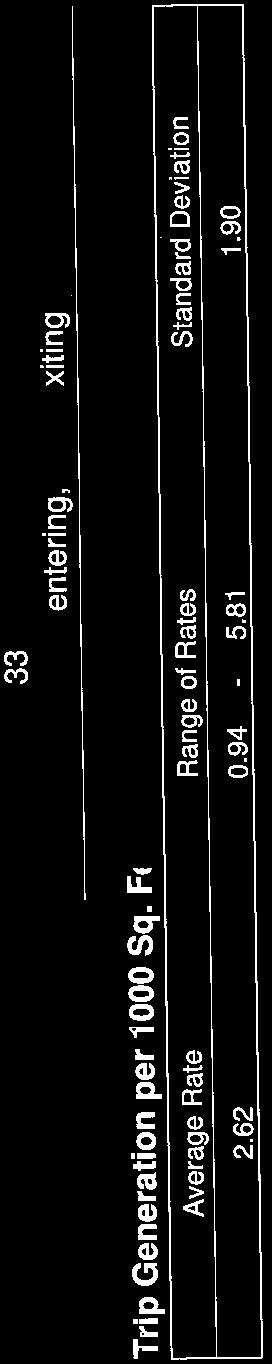
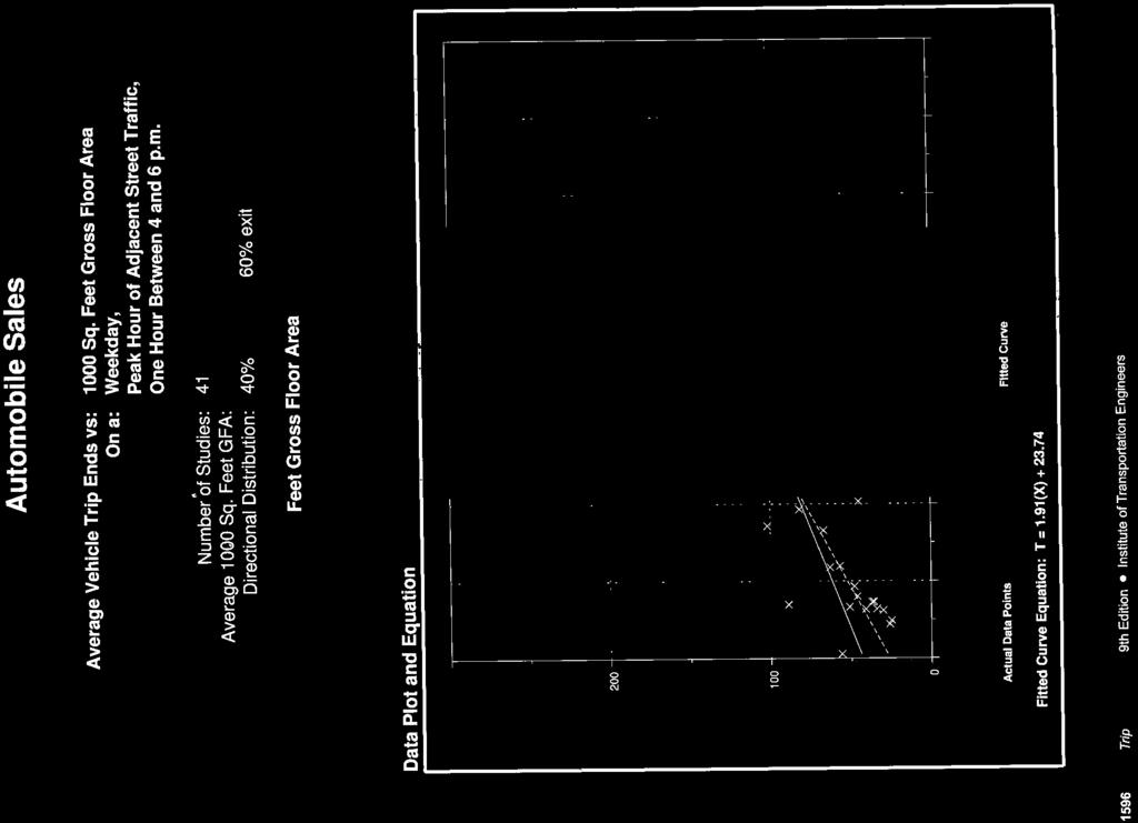
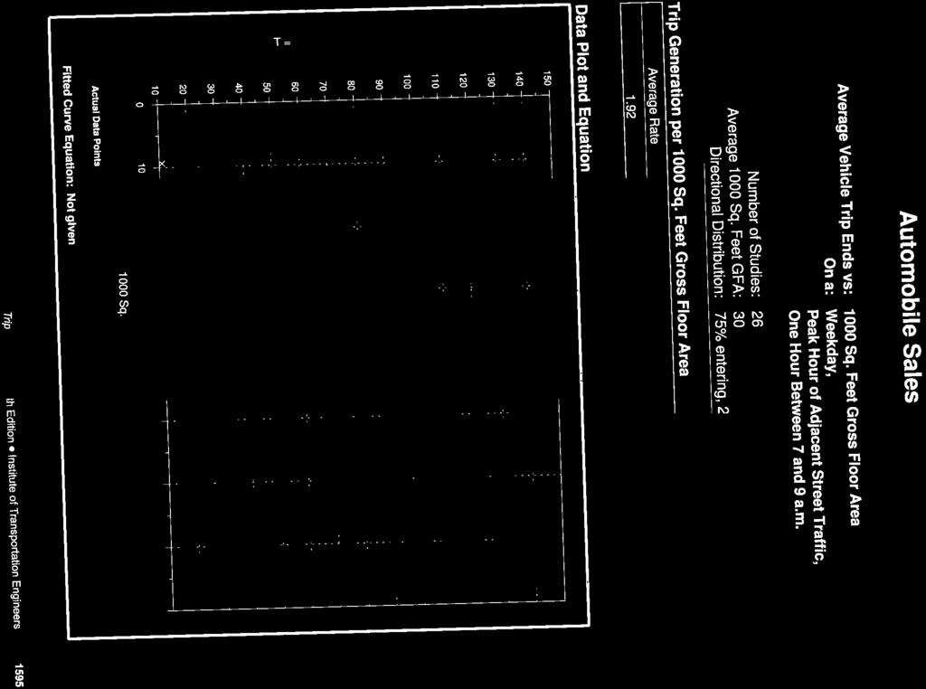
2 of the original development consisted of the following: Building 1 (Restaurant) 4,500ft 2 Building 2 (Restaurant) 7,500ft 2 Building 3 (Restaurant) 6,500ft 2 Building 4 (Restaurant) 15,000ft 2 The total Gross Floor Area of the restaurant land uses originally proposed as part of Phase 1A is 33,500ft Current Development Proposal The development content of the proposed Dow Honda care dealership can be summarized as follows: Main Showroom with a GFA of approximately 8,300ft 2 ; Service/Parts Centre with a GFA of approximately 20,000ft 2 ; Body shop with a GFA of approximately 11,000ft 2 Paved parking lot with 108 spaces; Ancillary Car storage area with capacity for vehicles. In addition, there are future proposals to add a used car showroom (GFA approx. 5,000ft 2 ) and increase the size of the Service Centre (additional GFA approximately 4,500ft 2 ). This TIS Addendum addresses the traffic impacts of the fully-developed site. Pedestrian connections to the main building will be provided from Colonnade Road and Merivale Road. The access configuration proposed as part of the original TIS will be retained for the new site plan. The site plan for the Dow Honda car dealership is presented in this Addendum as Appendix A. 3.0 TRIP GENERATION As noted in the original TIS, site-generated traffic for Phase 1A (restaurants) was estimated using the relevant peak hour vehicle trip rates identified in the Institute of Transportation Engineers (ITE) Trip Generation Manual, 9 th Edition. A similar approach has been taken for the proposed Dow Honda car dealership; the calculations for peak hour trip volumes for each development proposal (original vs. current) are presented in Table 1 below. The relevant trip generation graphs for the Automobile Sales land use (ITE Code 841) have been included in this Addendum as Appendix B. It should be noted that the GFA calculation for the Dow Honda car dealership reflects the future M:\2014\114009\DATA\REPORTS\TRAFFIC\ TIS_ADDENDUM 1.DOC
3 scenario, in which the Service Centre is expanded and the used car showroom is in place, as per the site plan presented in Appendix A. Table 1: Trip Generation of Original/Current Development Proposals Land Use ITE Code GFA (x1000ft 2 ) Trip Rates per 1,000ft 2 GFA AM Peak Hour PM Peak Hour AM Peak Hour Trip Volumes PM Peak Hour Original Development Proposal (Phase 1A) Sit-down Restaurant (4 total) (total) vph 330 vph 198 in, 132 out Current Development Proposal (Dow Honda) Automobile Sales vph 57 in, 19 out 103 vph 41 in, 62 out NET CHANGE IN TRIPS GENERATED +76 vph +57 in, +19 out -227 vph -157 in, -79 out Based on the results presented in Table 1, it is likely that the Dow Honda development will generate more trips that the original restaurant land uses during the weekday AM peak hour, and significantly less trips during the weekday PM peak hour. The peak hour of trip generation for the Dow Honda development is actually expected to occur on a Saturday, as is the case for most car dealerships. Based on the trip rate identified in the Trip Generation Manual for Saturdays, the Dow Honda dealership is expected to generate approximately 160 trips during the peak hour, with an even split between arrivals and departures. This volume is approximately 60% greater than the projected trip volume of the car dealership during the weekday PM peak hour. However, it is also 65% less than the projected trip volume for the originally proposed restaurant land uses during the Saturday peak hour. Based on the foregoing, it is concluded that the proposed Dow Honda dealership will only generate more trips that the originally-proposed restaurant land uses during the weekday AM peak hour. As such, only the weekday AM peak hour traffic scenario will be carried forward for further analysis. M:\2014\114009\DATA\REPORTS\TRAFFIC\ TIS_ADDENDUM 1.DOC
4 4.0 TRIP DISTRIBUTION As noted in Section 2.2 of this Addendum, the access configuration proposed for the original site plan will be retained for the new site plan. For this reason, it is considered reasonable to assume that the distribution of site traffic generated by the Dow Honda development will be broadly similar to the projected distribution of site traffic for the original restaurant land uses. These distribution parameters were derived as part of the original TIS using the following key factors: characteristics and existing operation of the study area road network, the land use and parcel layout of the proposed development, the proposed access/egress configuration on Colonnade Road & Merivale Road, For the purposes of this analysis, it has been conservatively assumed that all trips likely to be generated by the Dow Honda development will be primary (i.e. new) trips on the road network within the study area. This is generally consistent with the nature of the proposed land use. The trip distribution parameters for the Dow Honda development have been carried forward from the original TIS, and can be summarized as follows: 40% to/from the North via Colonnade Road & Merivale Road; 30% to/from the South via Colonnade Road & Merivale Road; 20% to/from the East via Colonnade Road & Colonnade Road North; 10% to/from the West via Colonnade Road & Colonnade Road South; With respect to trip distribution across the proposed access configuration, it has been assumed that all inbound and outbound trips will use the proposed signalized access on Colonnade Road, with the exception of outbound trips to the north, which will use the right-out egress on Merivale Road. The projected weekday AM peak hour site traffic for the Dow Honda development is shown in Figure INTERSECTION ANALYSIS Intersection capacity analysis has been completed using the Synchro 8.0 and SimTraffic 8 software packages, and is based on existing lane configurations and traffic signal timing plans obtained from the Public Works & Services Department. Operating conditions at signalized intersections have been evaluated in terms of the volume to capacity (v/c) ratio and the corresponding Level of Service (LOS) based on City of Ottawa criteria. Operating conditions at unsignalized intersections have been evaluated in terms of delay and LOS based on Highway M:\2014\114009\DATA\REPORTS\TRAFFIC\ TIS_ADDENDUM 1.DOC
5 23 VIEWMOUNT DRIVE 23 6 UNSIGNALIZED RO EGRESS SIGNALIZED ACCESS FUTURE ACCESS FUTURE ACCESS CANADA POST M:\2002\102015\2011&2012\CAD\Phase-01-02\Design\Figures\Traffic\May 2013\Traffic Flow Diagrams Revised May2013.dwg, Fig 1 Site Traffic, Feb 14, :56am, goneill WOODFIELD DRIVE 23 MERIVALE ROAD ROYDON PLACE COLONNADE ROAD 21 (70) 12 (53) xx VPH COLONNADE ROAD SOUTH LEGEND Unsignalized Intersection Signalized Intersection AM Peak Hour DOW HONDA 15 COLONNADE ROAD PROJECTED SITE TRAFFIC FEB FIGURE 1 11
6 Capacity Manual 2000 (HCM) criteria Total Traffic Intersection capacity analysis has been completed for the 2014 total traffic conditions. The total traffic conditions have been determined by adding the projected site traffic volumes (as shown in Figure 1) to the 2014 background traffic volumes that were presented in the original TIS. The 2014 total traffic volumes are presented in this Addendum as Figure 2. For the purposes of the analysis of the 2014 buildout year, it has been assumed that the mitigation measures identified in Section of the original TIS will be implemented, namely: Addition of a second westbound left-turn lane at Merivale Road / Colonnade Road; Increase in length of the southbound left-turn lane at Merivale Road / Colonnade Road from 50m to 155m; The detailed design of the road modifications that incorporate the aforementioned mitigation measures is currently underway. The results of the analysis are summarized in Table 2 for critical movements during the weekday AM hours, and have been directly compared to the projected operating conditions presented in the original TIS (in the same scenario). Detailed reports are included in Appendix C. Table 2: Intersection Analysis 2014 AM Peak Hour, Total Traffic (Original vs. Current) Intersection or Access Original (Restaurant) max. v/c or delay LOS Lane group Current (Dow Honda) max. v/c or delay LOS Lane Group Colonnade N / Colonnade S 0.60 A NBL 0.62 B NBL 0.80 C NBR 0.81 D NBR Merivale / Colonnade 0.70 B SBL 0.74 C WBL Merivale / Viewmount 0.64 B NBT 0.66 B NBT Merivale / Woodfield / Roydon 0.83 D EBL 0.83 D EBL Colonnade / Signalized Access # A EBT 0.37 A EBT Merivale / Unsignalized RO Egress #4 10 sec B WBR 10 sec B WBR M:\2014\114009\DATA\REPORTS\TRAFFIC\ TIS_ADDENDUM 1.DOC
7 VIEWMOUNT DRIVE UNSIGNALIZED RO EGRESS SIGNALIZED ACCESS FUTURE ACCESS FUTURE ACCESS CANADA POST M:\2002\102015\2011&2012\CAD\Phase-01-02\Design\Figures\Traffic\May 2013\Traffic Flow Diagrams Revised May2013.dwg, Fig Total Traffic, Feb 14, :56am, goneill WOODFIELD DRIVE MERIVALE ROAD ROYDON PLACE COLONNADE ROAD xx VPH COLONNADE ROAD SOUTH LEGEND Unsignalized Intersection Signalized Intersection AM Peak Hour DOW HONDA 15 COLONNADE ROAD 2014 TOTAL TRAFFIC FEB FIGURE 2
8 Based on the results presented in Table 2, it is apparent that the change in proposed land use for the subject lands is not expected to have any significant adverse impact on the operation of the study area intersections and accesses. Therefore, it is anticipated that the access configuration presented in the original TIS will be sufficient to accommodate the projected peak hour trip volumes attributable to the Dow Honda development. 6.0 ON-SITE DESIGN This section of the report provides a review of the on-site design in terms of the vehicular access configuration, on-site parking and loading activities. 6.1 Proposed Access Access to the subject site will be provided by a signalized full-movement access on Colonnade Road and a right-out egress on Merivale Road. The need to provide these new connections to the subject lands was confirmed as part of the original TIS, and the location and functional geometry of these intersections has been discussed at great length (and subsequently agreed upon) with City staff. The full-movement access will be located on the north side of Colonnade Road, between the signalized intersections of Merivale Road/Colonnade Road and Colonnade Road N/Colonnade Road S. The approximate centreline spacing between the proposed signalized access and Merivale Road is 215m, measuring from centreline to centreline. This spacing will allow for proper co-ordination between the signal timings during peak hours, which will help to minimize the adverse effects of queue starvation and spillback. The right-out egress will be located on the east side of Merivale Road, approximately 100 metres north of Colonnade Road, measuring from centreline to centreline. This meets the minimum spacing requirement identified in Section 25(l)(ii) of the Private Approach By-law. This egress has been designed such that it can be used effectively by small trucks and cars, but is unsuitable for larger trucks and tractor-trailers. This has been achieved by limiting the clear throat width and maximizing the curvature of the egress, which helps to discourage the left-out movement (there is no median on the adjacent section of Merivale Road). Larger trucks and tractor-trailers will use the new signalized access on Colonnade Road exclusively - more information about on-site loading activities is provided in Section 6.3 of this Addendum. 6.2 On-site Parking Vehicle Parking The site is located in Area C of Schedule 1 of the ZBL, and not within 600 meters of a rapid transit station. Based on the foregoing, minimum parking space rates for the Dow Honda M:\2014\114009\DATA\REPORTS\TRAFFIC\ TIS_ADDENDUM 1.DOC
9 development are identified in Table 3 below: Table 3: Minimum Parking Spaces Required Land Use GFA (m 2 ) or # Bays Minimum Parking Provision Parking Spaces Required (no sharing) Dow Honda Sales/Showroom Dow Honda Service Bays 1,250 2 per 100m per bay 20 Other Areas 1,400 1 per 100m 2 14 TOTAL PARKING SPACES REQUIRED 59 Based on the above table, the ZBL identifies a minimum requirement to provide a total of 59 onsite parking spaces to serve the Dow Honda car dealership. A total of 108 on-site surface parking spaces are shown on the Site Plan, which is almost twice the minimum requirement of the ZBL. However, it should be noted that some of the on-site parking spaces will be used for inventory storage purposes, which means that the number of available parking spaces will be somewhat less than the 108 shown on the Site Plan. All vehicle parking spaces will comply with the dimensions identified in Section 106 of the ZBL Bicycle Parking The minimum number of bicycle parking spaces required for the proposed on-site development is identified in Table 4 below. Table 13: Bicycle Parking Requirements Land Use GFA (m 2 ) Minimum Parking Provision Parking Spaces Required (no sharing) Dow Honda (All buildings) 4,665 1 per 1,500m 2 3 Based on the calculations presented in Table 13, Section 111 of the ZBL identifies a minimum M:\2014\114009\DATA\REPORTS\TRAFFIC\ TIS_ADDENDUM 1.DOC
10 requirement to provide 3 on-site bicycle parking spaces. The specific location of bicycle parking facilities for each phase of the development will be considered at the detailed design stage. In general, the bicycle parking spaces will be located in safe, illuminated and accessible locations, as close as is practicable to the main entrances to the building. 6.3 Loading Activities Loading activities associated with the proposed development will consist almost exclusively of car deliveries on long wheelbase transporter trucks (comparable to a WB-20 design vehicle). These deliveries will take place adjacent to the body shop, at the northeastern corner of the site. The transporter trucks will enter and exit the site using the new signalized access on Colonnade Road, completing a full loop around the body shop after unloading the cars. The truck apron around the back of the body shop is clearly shown the site plan, and the AutoTurn analysis demonstrates that the trucks can complete this movement safely, without having to back up. As noted in Section 6.3.1, some of the on-site parking spaces will be used for the storage of inventory. Based on discussions with the proponent, it is estimated that approximately 70% of the 108 on-site parking spaces will be used for storage of inventory. In addition to the paved parking spaces, a gravel area directly north of the main parking lot will provide additional storage area for cars at times when inventory levels are high. This area will also provide adequate space to move cars around as required, due to purchasing and sales activities. The gravel area will be delineated from the main driveway aisle by a mountable curb. 7.0 SUMMARY AND CONCLUSIONS Based on the results of the foregoing analysis, the main conclusions and recommendations of this report are as follows: Compared to the restaurant land uses that were originally proposed for the subject site, the Dow Honda car dealership is expected to generate more trips in the weekday AM peak hour (as the restaurants would be closed at this time) and significantly less trips during the weekday PM peak hour. The peak hour of generation for the Dow Honda car dealership is likely to occur Saturday, which is consistent with the land use and site's location along a major commercial/retail corridor. However, even on Saturdays, the Dow Honda car dealership is only expected to generate approximately 35% of the trip volume that the originallyproposed restaurants would have. M:\2014\114009\DATA\REPORTS\TRAFFIC\ TIS_ADDENDUM 1.DOC
11 Since the weekday AM peak hour is the only time that the Dow Honda dealership is expected to generate more traffic volume than the restaurant land uses, this was the only scenario carried forward for quantitative analysis. For the purposes of the aforementioned analysis, all trips generated by the Dow Honda dealership are assumed to be primary (i.e. new) auto trips, and the distribution of these primary trips is assumed to be identical to that which had been assumed for the restaurant land uses in the original TIS. These assumptions are consistent with the nature of the proposed development, and its relative location to areas of retail, residence and employment. Under total traffic conditions during the 2014 weekday AM peak hour (as tested in the original TIS), there is no significant adverse impact associated with replacing the restaurant land uses with the Dow Honda dealership. No mitigation measures (other than those already specified in the original TIS) have been identified in this Addendum, as none are required. Although it has not been confirmed through intersection analysis, the ITE-derived trip generation volumes presented in this Addendum strongly suggest that with the Dow Honda dealership in place of the restaurant land uses, the overall traffic impact of the subject lands will be markedly less during the busier weekday PM peak hour. The key aspects of the proposed access configuration (location, type of control, movements allowed etc.) are unchanged from the original TIS. The design of the rightout egress on Merivale Road is intended for small trucks and cars only, and not for larger trucks and tractor-trailers. The City of Ottawa's Zoning By-law identifies a requirement to provide a minimum of 59 on-site parking spaces for the various land uses that make up the Dow Honda dealership. The site plan presented with this Addendum shows a total of 108 on-site parking spaces, satisfying this requirement. Loading activities using large car transporters can be accommodated entirely on-site, without the need for reversing manoeuvres. Car transporters (and any other large delivery trucks) will use the new signalized access on Colonnade Road exclusively. In addition to the paved parking spaces, a gravel area immediately north of the paved parking lot will provide additional space for storage of inventory (i.e. cars). This area will also facilitate the movement of cars around the site, as required by ongoing retail and service activity. We trust that this Addendum adequately address the transportation-related impacts of the latest Site Plan, when read in conjunction with the original TIS. If you have any further comments or questions, please feel free to call. M:\2014\114009\DATA\REPORTS\TRAFFIC\ TIS_ADDENDUM 1.DOC

12
13 APPENDIX A Site Plan - Dow Honda Car Dealership
14 X X X X X X X X X X X X X X X X X X X X X X X X X X X X X X X X MERIVALE ROAD PART A m ACRES X X X X X X X X X X X X X X X X X X X X X X X X PART B m ACRES PART C m ACRES 7500 brian k. clark A R C H I T E C T 141 Catherine Street, Unit 102 Ottawa, Ontario K2P 1C3 TEL (613) FAX bkclarkarchitect@on.aibn.com TP TP 2 COLONNADE ROAD TP TP TP DC 1 SITE PLAN A001 SCALE 1:300 A001
15 APPENDIX B Trip Graphs for Land Use ITE Trip Generation Manual (9th Ed.)
16

17
18 APPENDIX C Intersection Analysis Report - Synchro 8
19 HCM Signalized Intersection Capacity Analysis 1: Colonnade ROad South/Main Access & Colonnade Road/Colonnade Road North 14/02/2014 Movement EBL EBT EBR WBL WBT WBR NBL NBT NBR SBL SBT SBR Lane Configurations Volume (vph) Ideal Flow (vphpl) Lane Width Total Lost time (s) Lane Util. Factor Frpb, ped/bikes Flpb, ped/bikes Frt Flt Protected Satd. Flow (prot) Flt Permitted Satd. Flow (perm) Peak-hour factor, PHF Adj. Flow (vph) RTOR Reduction (vph) Lane Group Flow (vph) Confl. Bikes (#/hr) 1 Heavy Vehicles (%) 2% 4% 4% 3% 3% 2% 2% 2% 2% 2% 2% 2% Turn Type Perm NA Perm Perm NA Perm NA Perm NA Protected Phases Permitted Phases Actuated Green, G (s) Effective Green, g (s) Actuated g/c Ratio Clearance Time (s) Vehicle Extension (s) Lane Grp Cap (vph) v/s Ratio Prot c v/s Ratio Perm c v/c Ratio Uniform Delay, d Progression Factor Incremental Delay, d Delay (s) Level of Service A A A A A D C C C Approach Delay (s) Approach LOS A A D C Intersection Summary HCM 2000 Control Delay 9.7 HCM 2000 Level of Service A HCM 2000 Volume to Capacity ratio 0.35 Actuated Cycle Length (s) 94.3 Sum of lost time (s) 11.0 Intersection Capacity Utilization 61.6% ICU Level of Service B Analysis Period (min) 15 c Critical Lane Group 2014 AM Total 31/01/2014 Dow Honda TIS Addendum, 15 Colonnade Road Synchro 8 Report Graham O'Neill, NECL Page 1
20 HCM Signalized Intersection Capacity Analysis 2: Merivale Road & Colonnade Road 14/02/2014 Movement WBL WBR NBT NBR SBL SBT Lane Configurations Volume (vph) Ideal Flow (vphpl) Total Lost time (s) Lane Util. Factor * Frpb, ped/bikes Flpb, ped/bikes Frt Flt Protected Satd. Flow (prot) Flt Permitted Satd. Flow (perm) Peak-hour factor, PHF Adj. Flow (vph) RTOR Reduction (vph) Lane Group Flow (vph) Confl. Peds. (#/hr) Confl. Bikes (#/hr) 20 Heavy Vehicles (%) 2% 2% 4% 4% 3% 3% Turn Type NA Perm NA Perm pm+pt NA Protected Phases Permitted Phases Actuated Green, G (s) Effective Green, g (s) Actuated g/c Ratio Clearance Time (s) Vehicle Extension (s) Lane Grp Cap (vph) v/s Ratio Prot c c v/s Ratio Perm c0.39 v/c Ratio Uniform Delay, d Progression Factor Incremental Delay, d Delay (s) Level of Service D F C B C A Approach Delay (s) Approach LOS E C A Intersection Summary HCM 2000 Control Delay 21.7 HCM 2000 Level of Service C HCM 2000 Volume to Capacity ratio 0.75 Actuated Cycle Length (s) Sum of lost time (s) 20.1 Intersection Capacity Utilization 85.0% ICU Level of Service E Analysis Period (min) 15 c Critical Lane Group 2014 AM Total 31/01/2014 Dow Honda TIS Addendum, 15 Colonnade Road Synchro 8 Report Graham O'Neill, NECL Page 2
21 HCM Signalized Intersection Capacity Analysis 3: Merivale Road & Viewmount Drive 14/02/2014 Movement EBL EBT EBR WBL WBT WBR NBL NBT NBR SBL SBT SBR Lane Configurations Volume (vph) Ideal Flow (vphpl) Total Lost time (s) Lane Util. Factor Frpb, ped/bikes Flpb, ped/bikes Frt Flt Protected Satd. Flow (prot) Flt Permitted Satd. Flow (perm) Peak-hour factor, PHF Adj. Flow (vph) RTOR Reduction (vph) Lane Group Flow (vph) Confl. Peds. (#/hr) Confl. Bikes (#/hr) Heavy Vehicles (%) 2% 2% 2% 3% 3% 3% 2% 2% 2% 0% 3% 3% Bus Blockages (#/hr) Turn Type Perm NA pm+pt NA pm+pt NA Perm NA Protected Phases Permitted Phases Actuated Green, G (s) Effective Green, g (s) Actuated g/c Ratio Clearance Time (s) Vehicle Extension (s) Lane Grp Cap (vph) v/s Ratio Prot 0.06 c c v/s Ratio Perm 0.04 c v/c Ratio Uniform Delay, d Progression Factor Incremental Delay, d Delay (s) Level of Service D D D C B B B B Approach Delay (s) Approach LOS D D B B Intersection Summary HCM 2000 Control Delay 17.8 HCM 2000 Level of Service B HCM 2000 Volume to Capacity ratio 0.67 Actuated Cycle Length (s) Sum of lost time (s) 24.8 Intersection Capacity Utilization 76.1% ICU Level of Service D Analysis Period (min) 15 c Critical Lane Group 2014 AM Total 31/01/2014 Dow Honda TIS Addendum, 15 Colonnade Road Synchro 8 Report Graham O'Neill, NECL Page 3
22 HCM Signalized Intersection Capacity Analysis 4: Merivale Road & Woodfield Drive/Roydon Place 14/02/2014 Movement EBL EBT EBR WBL WBT WBR NBL NBT NBR SBL SBT SBR Lane Configurations Volume (vph) Ideal Flow (vphpl) Lane Width Total Lost time (s) Lane Util. Factor Frpb, ped/bikes Flpb, ped/bikes Frt Flt Protected Satd. Flow (prot) Flt Permitted Satd. Flow (perm) Peak-hour factor, PHF Adj. Flow (vph) RTOR Reduction (vph) Lane Group Flow (vph) Confl. Peds. (#/hr) Confl. Bikes (#/hr) Heavy Vehicles (%) 2% 2% 2% 5% 5% 5% 0% 2% 0% 0% 2% 0% Bus Blockages (#/hr) Turn Type Perm NA Perm NA Perm pm+pt NA Perm pm+pt NA NA Protected Phases Permitted Phases Actuated Green, G (s) Effective Green, g (s) Actuated g/c Ratio Clearance Time (s) Vehicle Extension (s) Lane Grp Cap (vph) v/s Ratio Prot c0.37 c0.03 c0.26 v/s Ratio Perm c v/c Ratio Uniform Delay, d Progression Factor Incremental Delay, d Delay (s) Level of Service E D D D A B B B B E Approach Delay (s) Approach LOS E D B B Intersection Summary HCM 2000 Control Delay 23.1 HCM 2000 Level of Service C HCM 2000 Volume to Capacity ratio 0.68 Actuated Cycle Length (s) Sum of lost time (s) 19.3 Intersection Capacity Utilization 75.9% ICU Level of Service D Analysis Period (min) 15 c Critical Lane Group 2014 AM Total 31/01/2014 Dow Honda TIS Addendum, 15 Colonnade Road Synchro 8 Report Graham O'Neill, NECL Page 4
23 HCM Signalized Intersection Capacity Analysis 31: Colonnade Road & Signalized Access 14/02/2014 Movement EBL EBT WBT WBR SBL SBR Lane Configurations Volume (vph) Ideal Flow (vphpl) Lane Width Total Lost time (s) Lane Util. Factor Frt Flt Protected Satd. Flow (prot) Flt Permitted Satd. Flow (perm) Peak-hour factor, PHF Adj. Flow (vph) RTOR Reduction (vph) Lane Group Flow (vph) Turn Type pm+pt NA NA Perm NA Perm Protected Phases Permitted Phases Actuated Green, G (s) Effective Green, g (s) Actuated g/c Ratio Clearance Time (s) Vehicle Extension (s) Lane Grp Cap (vph) v/s Ratio Prot 0.01 c c0.01 v/s Ratio Perm v/c Ratio Uniform Delay, d Progression Factor Incremental Delay, d Delay (s) Level of Service A A A A E E Approach Delay (s) Approach LOS A A E Intersection Summary HCM 2000 Control Delay 2.5 HCM 2000 Level of Service A HCM 2000 Volume to Capacity ratio 0.40 Actuated Cycle Length (s) Sum of lost time (s) 16.8 Intersection Capacity Utilization 43.4% ICU Level of Service A Analysis Period (min) 15 c Critical Lane Group 2014 AM Total 31/01/2014 Dow Honda TIS Addendum, 15 Colonnade Road Synchro 8 Report Graham O'Neill, NECL Page 5
24 HCM Unsignalized Intersection Capacity Analysis 33: 8 Colonnade /Unsignalized Access #1 & Colonnade Road 14/02/2014 Movement EBL EBT EBR WBL WBT WBR NBL NBT NBR SBL SBT SBR Lane Configurations Volume (veh/h) Sign Control Free Free Stop Stop Grade 0% 0% 0% 0% Peak Hour Factor Hourly flow rate (vph) Pedestrians Lane Width (m) Walking Speed (m/s) Percent Blockage Right turn flare (veh) Median type TWLTL TWLTL Median storage veh) 2 2 Upstream signal (m) px, platoon unblocked vc, conflicting volume vc1, stage 1 conf vol vc2, stage 2 conf vol vcu, unblocked vol tc, single (s) tc, 2 stage (s) tf (s) p0 queue free % cm capacity (veh/h) Direction, Lane # EB 1 EB 2 WB 1 WB 2 NB 1 SB 1 Volume Total Volume Left Volume Right csh Volume to Capacity Queue Length 95th (m) Control Delay (s) Lane LOS A A C C Approach Delay (s) Approach LOS C C Intersection Summary Average Delay 2.2 Intersection Capacity Utilization 58.6% ICU Level of Service B Analysis Period (min) AM Total 31/01/2014 Dow Honda TIS Addendum, 15 Colonnade Road Synchro 8 Report Graham O'Neill, NECL Page 6
25 HCM Unsignalized Intersection Capacity Analysis 35: 14 Colonnade/Unsignalized Access #2 & Colonnade Road 14/02/2014 Movement EBL EBT EBR WBL WBT WBR NBL NBT NBR SBL SBT SBR Lane Configurations Volume (veh/h) Sign Control Free Free Stop Stop Grade 0% 0% 0% 0% Peak Hour Factor Hourly flow rate (vph) Pedestrians Lane Width (m) Walking Speed (m/s) Percent Blockage Right turn flare (veh) Median type TWLTL None Median storage veh) 2 Upstream signal (m) px, platoon unblocked vc, conflicting volume vc1, stage 1 conf vol vc2, stage 2 conf vol vcu, unblocked vol tc, single (s) tc, 2 stage (s) tf (s) p0 queue free % cm capacity (veh/h) Direction, Lane # EB 1 EB 2 WB 1 WB 2 WB 3 NB 1 SB 1 Volume Total Volume Left Volume Right csh Volume to Capacity Queue Length 95th (m) Control Delay (s) Lane LOS A A C C Approach Delay (s) Approach LOS C C Intersection Summary Average Delay 2.3 Intersection Capacity Utilization 55.4% ICU Level of Service B Analysis Period (min) AM Total 31/01/2014 Dow Honda TIS Addendum, 15 Colonnade Road Synchro 8 Report Graham O'Neill, NECL Page 7
26 HCM Unsignalized Intersection Capacity Analysis 37: Merivale Road & RO Egress (Merivale) 14/02/2014 Movement WBL WBR NBT NBR SBL SBT Lane Configurations Volume (veh/h) Sign Control Stop Free Free Grade 0% 0% 0% Peak Hour Factor Hourly flow rate (vph) Pedestrians Lane Width (m) Walking Speed (m/s) Percent Blockage Right turn flare (veh) Median type None None Median storage veh) Upstream signal (m) px, platoon unblocked vc, conflicting volume vc1, stage 1 conf vol vc2, stage 2 conf vol vcu, unblocked vol tc, single (s) tc, 2 stage (s) tf (s) p0 queue free % cm capacity (veh/h) Direction, Lane # WB 1 NB 1 NB 2 SB 1 SB 2 SB 3 Volume Total Volume Left Volume Right csh Volume to Capacity Queue Length 95th (m) Control Delay (s) Lane LOS A Approach Delay (s) Approach LOS A Intersection Summary Average Delay 0.1 Intersection Capacity Utilization 49.4% ICU Level of Service A Analysis Period (min) AM Total 31/01/2014 Dow Honda TIS Addendum, 15 Colonnade Road Synchro 8 Report Graham O'Neill, NECL Page 8
886 March Road McDonald's Transportation Study
 McDonald's Restaurants of Canada Limited March 2013 886 March Road McDonald's Transportation Study Submitted by: HDR Corporation 100 York Boulevard, Suite 300 Richmond Hill, ON L4B 1J8 (905) 882-4100 www.hdrinc.com
HCM Unsignalized Intersection Capacity Analysis 6: Brian Street & LC 111 5/26/2009
 6: Brian Street & LC 111 5/26/2009 Movement EBL EBR NBL NBT SBT SBR Volume (veh/h) 116 20 8 405 137 56 Sign Control Stop Free Free Grade 0% 0% 0% Peak Hour Factor 0.81 0.81 0.67 0.67 0.89 0.89 Hourly flow
Village of Richmond Transportation Brief
 Village of Richmond Transportation Brief GENIVAR Project Number 111-18482-00 June 21 st, 2011 www.genivar.com GENIVAR 15 Fitzgerald Road, Suite 100 Ottawa, Ontario, CANADA K2H 9G1 Telephone: 613-829-2800
Barrhaven Honda Dealership. Dealership Drive, Ottawa, ON. Transportation Brief
 Barrhaven Honda Dealership Dealership Drive, Ottawa, ON Transportation Brief Prepared By: NOVATECH Suite 200, 240 Michael Cowpland Drive Ottawa, Ontario K2M 1P6 September, 2015 File: 115136 Ref: R-2015-152
RESPONSE TO TRAFFIC IMPACT STUDY COMMENTS
 RESPONSE TO TRAFFIC IMPACT STUDY COMMENTS Proposed Gas Station 40 Arthur Street (Highway 26), Town of the Blue Mountains (Thornbury), County of Grey, Ontario AUGUST 2013 August 27, 2013 MR. REG RUSSWURM
Sugarland Crossing Gwinnett County, Georgia
 Sugarland Crossing Gwinnett County, Georgia S IGNAL W ARRANT A NALYSIS For the Intersection of: Sugarloaf Parkway / Richards Middle School Driveway / Sugarland Crossing Main Site Driveway Prepared for:
ZINFANDEL LANE / SILVERADO TRAIL INTERSECTION TRAFFIC ANALYSIS
 ZINFANDEL LANE / SILVERADO TRAIL INTERSECTION TRAFFIC ANALYSIS UPDATED TRAFFIC STUDY FOR THE PROPOSED RAYMOND VINEYARDS WINERY USE PERMIT MODIFICATION #P11-00156 AUGUST 5, 2014 PREPARED BY: OMNI-MEANS,
Provide an overview of the development proposal including projected site traffic volumes;
 December 19, 2013 File: 163600935 Attention: Troy Elliott Carl Elliott Limited 15-1831 Robertson Road PO Box 11117 Nepean, Ontario K1H 7T8 Dear Mr. Elliott, Reference: 2235 and 2265 Robertson Road Transportation
MEMORANDUM. Date: November 4, Cheryl Burrell, Pebble Beach Company. Rob Rees, P.E. Inclusionary Housing Transportation Analysis WC
 MEMORANDUM Date: November 4, 2013 To: From: Subject: Cheryl Burrell, Pebble Beach Company Rob Rees, P.E. Inclusionary Housing Transportation Analysis As requested, Fehr & Peers is providing clarification
TRAFFIC IMPACT STUDY DERRY GREEN CORPORATE BUSINESS PARK MILTON SECONDARY PLAN MODIFICATION
 TRAFFIC IMPACT STUDY DERRY GREEN CORPORATE BUSINESS PARK MILTON SECONDARY PLAN MODIFICATION TRAFFIC IMPACT STUDY DERRY GREEN CORPORATE BUSINESS PARK MILTON SECONDARY PLAN MODIFICATION DECEMBER 2014 UPDATED
Table 1 - Land Use Comparisons - Proposed King s Wharf Development. Retail (SF) Office (SF) 354 6,000 10, Land Uses 1
 Office (SF) 354 6,000 10, Land Uses 1") Ref. No. 171-6694 Phase 2 November 23, 217 Mr. David Quilichini, Vice President Fares & Co. Developments Inc. 31 Place Keelson Sales Centre DARTMOUTH NS B2Y C1 Sent Via Email to David@faresinc.com RE:
Ref. No. 171-6694 Phase 2 November 23, 217 Mr. David Quilichini, Vice President Fares & Co. Developments Inc. 31 Place Keelson Sales Centre DARTMOUTH NS B2Y C1 Sent Via Email to David@faresinc.com RE:
TECHNICAL MEMORANDUM Upper Broadway Road Diet Summary of Findings
 TECHNICAL MEMORANDUM Summary of Findings Date: June 17, 2014 Project #: 17121.15 To: Si Lau, P.E.; City of Oakland, CA From: Erin Ferguson, P.E.; Aaron Elias, P.E.; Daphne Dethier; and Mark Bowman, P.E.;
 Traffic Analysis For Approved Uses within the St. Lucie West DRI Aldi Port St. Lucie, FL Prepared for: Bohler Engineering, LLC 1000 Corporate Drive Suite 250 Fort Lauderdale, FL 33334 Prepared by: 10795
APPENDIX G. Traffic Data
 APPENDIX G Traffic Data HCM Signalized Intersection Capacity Analysis 2: Duanesburg Road & I-88 Ramps 10/7/2004 Movement EBL EBT EBR WBL WBT WBR NBL NBT NBR SBL SBT SBR Lane Configurations Ideal Flow (vphpl)
April Salvation Army Barrhaven Church 102 Bill Leathem Drive Transportation Brief
 April 26 Salvation Army Barrhaven Church 2 Bill Leathem Drive Transportation Brief Salvation Army Barrhaven Church 2 Bill Leathem Drive Transportation Brief prepared for: The Salvation Army 2 Overlea Blvd.
Weaver Road Senior Housing Traffic Impact Analysis
 Gibson Traffic Consultants, Inc. 2813 Rockefeller Avenue Suite B Everett, WA 9821 425.339.8266 Weaver Road Senior Housing Traffic Impact Analysis Jurisdiction: City of Snohomish January 218 GTC #17-37
L1TILE BEARS DAY CARE TRANSPORTATION IMPACT STUDY FORT COLLINS, COLORADO MAY Prepared for:
 L1TILE BEARS DAY CARE TRANSPORTATION IMPACT STUDY FORT COLLINS, COLORADO MAY 2012 Prepared for: Hillside Construction, Inc. 216 Hemlock Street, Suite B Fort Collins, CO 80534 Prepared by: DELICH ASSOCIATES
APPENDICES. APPENDIX D Synchro Level of Service Output Sheets
 APPENDICES APPENDIX D Synchro Level of Service Output Sheets Lanes, Volumes, Timings NO BUILD 2016 PM 8: 10th St & Thain Rd 10/05/2016 Lane Group NBL NBT NBR SBL SBT SBR SEL SET SER NWL NWT NWR
Traffic Impact Study Proposed Commercial Development Ballwin, Missouri. Technical Memorandum for Traffic Impact Study
 Traffic Impact Study Proposed Commercial Development Ballwin, Missouri Technical Memorandum for Traffic Impact Study Crawford, Bunte, Brammeier May 1, 2009 MEMORANDUM Date: April 24, 2009 To: From: Subject:
MMM Group Limited. Communities. Transportation. Buildings. Infrastructure
 MMM Group Limited Traffic Study CASA MIA Community Care Facility Vancouver, BC Communities Transportation Buildings Infrastructure February 2013 5011001-033 STANDARD LIMITATIONS This report was prepared
Ref. No Task 3. April 28, Mr. Cesar Saleh, P. Eng. VP Planning and Design W.M. Fares Group th
 Ref. No. 151-00564 Task 3 April 28, 2015 Mr. Cesar Saleh, P. Eng. VP Planning and Design W.M. Fares Group th 3480 Joseph Howe Drive, 5 Floor HALIFAX NS B3L 4H7 Sent via Email to ceasr.saleh@wmfares.com
MURRIETA APARTMENTS TRAFFIC IMPACT ANALYSIS CITY OF MURRIETA, CALIFORNIA
 MURRIETA APARTMENTS TRAFFIC IMPACT ANALYSIS CITY OF MURRIETA, CALIFORNIA SEPTEMBER 20, 2012 Prepared for: Golden Eagle Multi-Family Properties, LLC 6201 Oak Canyon Rd., Suite 250 Irvine, CA 92618 Prepared
LATSON INTERCHANGE DEVELOPMENT TRAFFIC STUDIES. Genoa Township, Livingston County, MI
 LATSON INTERCHANGE DEVELOPMENT TRAFFIC STUDIES Genoa Township, Livingston County, MI DRAFT TRAFFIC STUDY FOR I-96 AT LATSON RD INTERCHANGE Livingston County CS 47065 JN 101622C Submitted to: Michigan Department
KUM & GO 6400 WESTOWN PARKWAY WEST DES MOINES, IOWA 50266
 KUM & GO #300 PECOS STREET & 88 TH AVENUE THORNTON, COLORADO TRAFFIC IMPACT STUDY REVISION 1 PREPARED FOR KUM & GO 6400 WESTOWN PARKWAY WEST DES MOINES, IOWA 50266 JANUARY 23, 2014 OA PROJECT NO. 013-1721
Traffic Impact Study Hudson Street Parking Garage MC Project No.: A Table of Contents
 Traffic Impact Study Hudson Street Parking Garage MC Project No.: 15001714A Table of Contents Table of Contents I. INTRODUCTION... 1 II. EXISTING CONDITIONS... 4 III. 2015 EXISTING TRAFFIC CONDITIONS...
JRL consulting. March Hartland Developments Limited 1993 Hammonds Plains Road Hammonds Plains, NS B4B 1P3
 March 2015 Prepared for Hartland Developments Limited 1993 Hammonds Plains Road Hammonds Plains, NS B4B 1P3 JRL consulting JRL consulting TABLE OF CONTENTS 1 INTRODUCTION... 2 1.1 BACKGROUND... 2 2 EXISTING
MEMO. McCORMICK RANKIN CORPORATION. File FROM: Keyur Shah DATE: February 1, 2010 COPIES: OUR FILE: SUBJECT: TO:
 McCORMICK RANKIN CORPORATION 2655 North Sheridan Way Mississauga, Ontario, L5K 2P8 Tel: (905)823-8500 Fax: (905) 823-8503 E-mail: mrc@mrc.ca Website: www.mrc.ca MEMO TO: File FROM: Keyur Shah DATE: February
Lakeside Terrace Development
 Lakeside Terrace Development City of Barrie, County of Simcoe Traffic Brief for: Type of Document: Final Report Project Number: JDE 1617 Date Submitted: April 29 th, 216 4/29/16 John Northcote, P.Eng.
LEMON FLATS SECOND ACCESS
 LEMON FLATS SECOND ACCESS RECONNAISSANCE STUDY SEPTEMBER 2007 APPENDIX A Synchro Analysis Worksheets HCM Signalized Intersection Capacity Analysis 2005 - Background 3: Anka Street & Lemon Flats Second
STANDARD LIMITATIONS
 STANDARD LIMITATIONS This report was prepared by MMM Group (MMM) for the account of Spire Construction Inc. (the Client). The disclosure of any information contained in this report is the sole responsibility
ARVADA TRIANGLE REDEVELOPMENT TRAFFIC IMPACT ANALYSIS
 ARVADA TRIANGLE REDEVELOPMENT TRAFFIC IMPACT ANALYSIS Prepared for: Arvada Urban Renewal Authority 5601 Olde Wadsworth Boulevard, Suite 210 Arvada, Colorado 80002 (720) 898-7062 Prepared by: Felsburg Holt
Rockingham Ridge Plaza Commercial Development Halifax Regional Municipality
 Rockingham Ridge Plaza Commercial Development Halifax Regional Municipality Traffic Impact Study Final Draft Report Prepared by: GRIFFIN transportation group inc. 30 Bonny View Drive Fall River, NS B2T
Re: Cyrville Road Car Dealership
 1223 Michael Street, Suite 100, Ottawa, ON K1J 7T2 Tel: 613.738.4160 Fax: 613.739.7105 www.delcan.com February 25, 2013 OUR REF: TO3098TOE Mark Motors of Ottawa 611 Montreal Road Ottawa, ON K1K 0T8 Attention:
Proposed Office Building Traffic Impact Study Chicago Avenue Evanston, Illinois
 Proposed Office Building Traffic Impact Study 1714-1720 Chicago Avenue Evanston, Illinois Prepared For: HOLABIRD & ROOT, LLC Prepared by: Eriksson Engineering Associates, Ltd. 145 Commerce Drive, Ste A,
Wellington Street West
 Transportation Brief prepared for: 185 Davenport Road Suite 300 Toronto, ON M5R 1J1 prepared by: 1223 Michael Street Suite 100 Ottawa, ON K1J 7T2 November 5, 2013 TO3131TOH Transportation Brief November
LOST LAKE CORRIDOR REVIEW
 LOST LAKE CORRIDOR REVIEW Prepared for: Prepared by: Broadview Developments Inc. c/o Westbrook Consulting Watt Consulting Group Our File: 2064.B01 Date: October 31, 2016 TABLE OF CONTENTS 1.0 INTRODUCTION...
Traffic Impact Analysis Farmington Center Village
 Traffic Impact Analysis Farmington Center Village Route 4 (Farmington Avenue) Farmington, Connecticut Prepared for: The Town of Farmington, CT Prepared By: BL Companies Meriden, Connecticut December 2016
10 th Street Residences Development Traffic Impact Analysis
 Gibson Traffic Consultants, Inc. 2813 Rockefeller Avenue Suite B Everett, WA 98201 425.339.8266 10 th Street Residences Development Traffic Impact Analysis Jurisdiction: City of Snohomish September 2018
Appendix B: Traffic Reports
 Appendix B: Traffic Reports 407 TRANSITWAY - KENNEDY ROAD TO BROCK ROAD MINISTRY OF TRANSPORTATION - CENTRAL REGION Report Markham Road Station Traffic Study Prepared for Ministry of Transportation, Ontario
Zachary Bugg, PhD, Diego Arguea, PE, and Phill Worth University of Oregon North Campus Conditional Use Permit Application Transportation Assessment
 MEMORANDUM Date: June 22, 2018 Project #: 21562 To: Colin McArthur, AICP From: Project: Subject: Zachary Bugg, PhD, Diego Arguea, PE, and Phill Worth University of Oregon North Campus Conditional Use Permit
TRAFFIC AND TRANSPORTATION TECHNICAL MEMORANDUM
 TRAFFIC AND TRANSPORTATION TECHNICAL MEMORANDUM for ENVIRONMENTAL ASSESSMENT US 460 Bypass Interchange and Southgate Drive Relocation State Project No.: 0460-150-204, P101, R201, C501, B601; UPC 99425
267 O Connor Street Residential Development
 M a y 2014 267 O Connor Street Residential Development Transportation Brief Google 2014 Bing 2014 Prepared for: MASTERCRAFT STARWOOD Prepared by: Study 267 O'Connor Type Street May 2014 Study Residential
Sweetwater Landing Traffic Impact Analysis
 Gibson Traffic Consultants, Inc. 8 Rockefeller Avenue Suite B Everett, WA 98 45.9.8 Sweetwater Landing Traffic Impact Analysis Jurisdiction: City of Snohomish February 8 GTC #7-87 Sweetwater Landing Traffic
Re: Residential Development - Ogilvie/Cummings Transportation Overview
 1223 Michael Street, Suite 100, Ottawa, ON K1J 7T2 Tel: 613.738.4160 Fax: 613.739.7105 www.delcan.com March 28, 2012 OUR REF: TO3088TOY Barry J. Hobin & Architects 63 Pamilla Street Ottawa, ON K1S 3K7
Bennett Pit. Traffic Impact Study. J&T Consulting, Inc. Weld County, Colorado. March 3, 2017
 Bennett Pit Traffic Impact Study J&T Consulting, Inc. Weld County, Colorado March 3, 217 Prepared By: Sustainable Traffic Solutions, Inc. http://www.sustainabletrafficsolutions.com/ Joseph L. Henderson,
Addendum to Traffic Impact Analysis for Port Marigny Site Mandeville, LA
 Addendum to Traffic Impact Analysis for Port Marigny Site Mandeville, LA (St. Tammany Parish Mandeville, LA) Prepared For The Pittman Companies Michael N Pittman, MD 328 East Boston St Covington, LA 70433
CastleGlenn Consultants Inc.
 CastleGlenn Consultants Inc. Engineers, Project Managers & Planners March 11 th, 2013 Domenic Idone, P. Eng Planning Manager R.W. Tomlinson Ltd. 5597 Power Road Ottawa, Ontario K1G 3N4 Dear Mr. Idone:
Traffic Impact Study. Eastern Springs. A Proposed Development in Manorville, NY. April Haas Group Inc Transportation Planners and Engineers
 Traffic Impact Study For Eastern Springs A Proposed Development in Manorville, NY April 2018 Haas Group Inc Transportation Planners and Engineers Table of Contents 1) Executive Summary... 2 2) Study Purpose...
Salvini Consulting Inc. 459 Deer Ridge Drive Kitchener, ON N2P 0A November 8, 2017 Revised December 20, 2017
 Salvini Consulting Inc. 459 Deer Ridge Drive Kitchener, ON N2P 0A7 519-591-0426 November 8, 2017 Revised December 20, 2017 Laurie Wills, PEng Deputy Director of Public Works Town of Cobourg 740 Division
700 Hunt Club Road. Transportation Impact Study - Addendum #1. Submitted by:
 700 Hunt Club Road Transportation Impact Study - Addendum #1 Submitted by: 14 June 2013 1223 Michael Street, Suite 100, Ottawa, ON K1J 7T2 Tel: 613.738.4160 Fax: 613.739.7105 www.delcan.com 14 June 2013
Paisley & Whitelaw - Paisley Park OPA / ZBA for Mixed Density Residential Use
 Paisley & Whitelaw - Paisley Park OPA / ZBA for Mixed Density Residential Use Transportation Impact Study City of Guelph Prepared for: Armel Corporation August 2018 Table of Contents 1 Introduction...
1140 Wellington Street West Transportation Brief
 1140 Wellington Street West Transportation Brief October 2013 Study 1140 Wellington Type Street West October 2013 Study Transportation Name Brief February 2011 TB Check List TIS / TB/ CTS Check List prepared
Wellings Communities Holding Inc and Extendicare (Canada) Inc Hazeldean Road. Transportation Impact Study. Ottawa, Ontario. Project ID
 Inc Hazeldean Road. Transportation Impact Study. Ottawa, Ontario. Project ID") Wellings Communities Holding Inc and Extendicare (Canada) Inc. 5731 Hazeldean Road Transportation Impact Study Ottawa, Ontario Project ID 160401195 Prepared by: Stantec Consulting Ltd. March 2016 WELLINGS
Wellings Communities Holding Inc and Extendicare (Canada) Inc. 5731 Hazeldean Road Transportation Impact Study Ottawa, Ontario Project ID 160401195 Prepared by: Stantec Consulting Ltd. March 2016 WELLINGS
One Harbor Point Residential
 Residential Gig Harbor, WA Transportation Impact Analysis January 23, 2017 Prepared for: Neil Walter Company PO Box 2181 Tacoma, WA 98401 Prepared by: TENW Transportation Engineering NorthWest 11400 SE
Date: December 20, Project #:
 To: Craig Rottenberg Long s Jewelers 60A South Avenue Burlington, MA 01803 From: Patrick Dunford, P.E. Senior Project Manager Date: December 20, 2018 Project #: 14416.00 Re: Burlington Mall Proposed Long
MERIVALE PRIORITY SQUARE 2852 MERIVALE ROAD CITY OF OTTAWA TRANSPORTATION BRIEF. Prepared for: ONT Inc. 25 Winding Way Nepean, Ontario K2C 3H1
 MERIVALE PRIORITY SQUARE 2852 MERIVALE ROAD CITY OF OTTAWA TRANSPORTATION BRIEF Prepared for: 2190986ONT Inc. 25 Winding Way Nepean, Ontario K2C 3H1 October 6, 2010 110-502 Report_1.doc D. J. Halpenny
Traffic Impact Study Morgan Road Commerce Park Pasco County, Florida
 Traffic Impact Study Morgan Road Commerce Park Pasco County, Florida Summary Report June 2008 Prepared by: 12909 N 56 th Street # 201 Tampa, FL 33617 Ph: (813) 988-3180 Fax: (813) 343-6854 Morgan Road
Minto Mahogany Stage 2
 Minto Mahogany Stage 2 Transportation Impact Study prepared for: Minto Developments Inc 200-180 Kent Street Ottawa, ON K1P 0B6 prepared by: 1223 Michael Street Suite 100 Ottawa, ON K1J 7T2 June 27, 2017
Interstate 80 Corridor Study
 Interstate 80 Corridor Study Final Technical Memorandum 5: Traffic Volumes, Accident Locations and Operational Deficiencies West Verdi (SR 425) Interchange to West McCarran Boulevard (SR 651) and East
RE: Taggart Retail Site Plan: Kanata West Proposal for Traffic Impact Study: Addendum #2
 1223 Michael Street, Suite 100, Ottawa, Ontario K1J 7T2 Tel: 613.738.4160 Fax: 613.739.7105 www.delcan.com July 9, 2014 OUR REF: TO3073TOK00 BY EMAIL: jparkes@taggart.ca/aturner@taggart.ca Taggart Commercial
Parking/Traffic Assessment Study
 Brock Road Industrial Mall 985 Brock Road South City of Pickering Parking/Traffic Assessment Study Prepared by: Tranplan Associates, Toronto Toronto 416-670-2005 Sudbury 705-522-0272 Peterborough 705-874-3638
C. iv) Analysis/Results
 Analysis/Results") The Pettengill Road project is located outside the borders of the model in an external zone. As a result, inserting all Pettengill Road trip generation assumptions into the NRPC model and running a new
The Pettengill Road project is located outside the borders of the model in an external zone. As a result, inserting all Pettengill Road trip generation assumptions into the NRPC model and running a new
Aldridge Transportation Consultants, LLC Advanced Transportation Planning and Traffic Engineering
 Aldridge Transportation Consultants, LLC Advanced Transportation Planning and Traffic Engineering John M.W. Aldridge, PE, PTOE, AICP 1082 Chimney Rock Road Colorado Registered Professional Engineer Highlands
MEMO. McCORMICK RANKIN CORPORATION. File Mark VanderSluis, Keyur Shah DATE: October 26, 2009 COPIES: OUR FILE: TO: FROM: Jack Thompson
 McCORMICK RANKIN CORPORATION 2655 North Sheridan Way Mississauga, Ontario, L5K 2P8 Tel: (95)823-85 Fax: (95) 823-853 E-mail: mrc@mrc.ca Website: www.mrc.ca MEMO TO: FROM: File Mark VanderSluis, Keyur Shah
D & B COMMERCIAL TRAFFIC IMPACT ANALYSIS
 D & B COMMERCIAL TRAFFIC IMPACT ANALYSIS TABLE OF CONTENTS I. Introduction...3 II. Project Description...3 III. Existing Conditions...3 IV. Future Traffic Conditions...8 V. Conclusions and Mitigation...14
June 21, Mr. Jeff Mark The Landhuis Company 212 North Wahsatch Avenue, Suite 301. Colorado Springs, CO 80903
 LSC TRANSPORTATION CONSULTANTS, INC. 545 East Pikes Peak Avenue, Suite 210 Colorado Springs, CO 80903 (719) 633-2868 FAX (719) 633-5430 E-mail: lsc@lsctrans.com Website: http://www.lsctrans.com June 21,
TRANSPORTATION ANALYSIS. Wawa US 441 and Morningside Drive. Prepared for: Brightwork Real Estate, Inc.
 TRANSPORTATION ANALYSIS Wawa US 441 and Morningside Drive Prepared for: Brightwork Real Estate, Inc. TABLE OF CONTENTS Introduction... 1 Project Description... 1 Estimated Daily Project Traffic... 3 Estimated
BUCKLEY ANNEX REDEVELOPMENT PLAN TRANSPORTATION ANALYSIS ADDENDUM
 BUCKLEY ANNEX REDEVELOPMENT PLAN TRANSPORTATION ANALYSIS ADDENDUM Prepared for: City and County of Denver Prepared by: Contact: Brian Bern, P.E., PTOE 303.572.0200 On Behalf of: Lowry Redevelopment Authority
1012 & 1024 McGarry Terrace
 December 217 112 & 124 McGarry Terrace Transportation Impact Study 112 & 124 McGarry Terrace Transportation Impact Study prepared for: Lépine Corporation 32 March Road Kanata, ON K2K 2E3 prepared by: 1223
DEVELOPMENT PROPERTY 1627 MAXIME STREET CITY OF OTTAWA TRANSPORTATION OVERVIEW. Prepared for: Subhas Bhargava. July 9, Overview_1.
 DEVELOPMENT PROPERTY 1627 MAXIME STREET CITY OF OTTAWA TRANSPORTATION OVERVIEW Prepared for: Subhas Bhargava July 9, 2015 115-620 Overview_1.doc D. J. Halpenny & Associates Ltd. Consulting Transportation
830 Main Street Halifax Regional Municipality
 830 Main Street Halifax Regional Municipality Traffic Impact Statement Final Report Prepared by: GRIFFIN transportation group inc. 30 Bonny View Drive Fall River, NS B2T 1R2 www.griffininc.ca Prepared
Final Technical Report US 17 Corridor Study Update (Market Street Road Diet)
") Market Street Road Diet Wilmington, NC 2016 Final Technical Report US 17 Corridor Study Update (Market Street Road Diet) Wilmington, NC Parsons Brinckerhoff January 2016 FINAL TECHNICAL REPORT US 17 Corridor
Market Street Road Diet Wilmington, NC 2016 Final Technical Report US 17 Corridor Study Update (Market Street Road Diet) Wilmington, NC Parsons Brinckerhoff January 2016 FINAL TECHNICAL REPORT US 17 Corridor
Downtown One Way Street Conversion Technical Feasibility Report
 Downtown One Way Street Conversion Technical Feasibility Report As part of the City s Transportation Master Plan, this report reviews the technical feasibility of the proposed conversion of the current
Oakbrook Village Plaza City of Laguna Hills
 Oakbrook Village Plaza City of Laguna Hills Traffic Impact Analysis Prepared by: HDR Engineering 3230 El Camino Real, Suite 200 Irvine, CA 92602 October 2012 Revision 3 D-1 Oakbrook Village Plaza Laguna
Proposed Pit Development
 July 5, 2017 via email: sam@greenwoodconst.ca CCTA File 114239 Sam Greenwood Greenwood Aggregates 205467 County Road 109 Amaranth, ON L9W 0V1 Re: Proposed Violet Hill Gravel Pit, Town of Mono Traffic Review
RE: 3605 Paul Anka Drive Addendum #2 to the December 2012 Traffic Impact Study
 19 May 2015 BY EMAIL: asaggarwal@gmail.com Manor Park Management 231 Brittany Drive, Suite D Ottawa, ON K1K 0R8 Attention: Mr. Anand Aggarwal RE: 3605 Paul Anka Drive Addendum #2 to the December 2012 Traffic
Mobilia Centre Merivale Road and 530/540 West Hunt Club Road Transportation Overview and Parking Study
 Final Report Mobilia Centre - 1872 Merivale Road and 530/540 West Hunt Club Road Transportation Overview and Parking Study Prepared for CPD Developments by IBI Group August 13, 2014 IBI GROUP FINAL REPORT
Half Moon Bay North Apartment Block Transportation Impact Assessment. Full Report. March 15, Prepared for: Mattamy Homes.
 Half Moon Bay North Apartment Block Transportation Impact Assessment Full Report March 15, 2018 Prepared for: Mattamy Homes Prepared by: Stantec Consulting Ltd. Table of Contents 1.0 SCREENING... 1 1.1
Dartmouth, NS B3B 1X7 Tel: WSP. Canada Inc.
 Traffic Impact Study: Proposed Residential Development Herring Cove Road Halifax, NS Presented to: FH Construction Ltd. 1 Spectacle Lake Drive Dartmouth, NS B3B 1X7 Tel: 902 835 9955 Fax: 902 835 1645
Ingraham High School Parking and Traffic Analysis
 Parking and Traffic Analysis Seattle, WA Prepared for: URS Corporation 1501 4th Avenue, Suite 1400 Seattle, WA 98101-1616 Mirai Transportation Planning & Engineering 11410 NE 122nd Way, Suite 320 Kirkland,
Traffic Impact Analysis Update
 Willow Bend Traffic Impact Analysis Update TABLE OF CONTENTS Page I. INTRODUCTION -------------------------------------------------------------------------------------------- 1 II. EXISTING CONDITIONS
Re: Addendum No. 4 Transportation Overview 146 Mountshannon Drive Ottawa, Ontario
 April 18 th, 2017 Mr. Kevin Yemm Vice President, Land Development Richraft Group of Companies 2280 St. Laurent Boulevard, Suite 201 Ottawa, Ontario (Tel: 613.739.7111 / e-mail: keviny@richcraft.com) Re:
JOHNSON RANCH RAPID CITY, SOUTH DAKOTA TRAFFIC IMPACT ANALYSIS
 JOHNSON RANCH RAPID CITY, SOUTH DAKOTA TRAFFIC IMPACT ANALYSIS Prepared for: KTM Design Solutions 528 Kansas City Street, Suite 1 Rapid City, SD 57701 Prepared by: Felsburg Holt & Ullevig 6300 South Syracuse
CitiGate Retail Development
 CitiGate Retail Development Transportation Impact Study prepared for: Trinity Development Group Inc. Sun Life Financial Centre, East Tower 3250 Bloor Street West, Suite 1000 Toronto, ON M8X 2X9 prepared
Re: Sainte-Geneviève Elementary School (2198 Arch Street) Transportation Overview
 Transportation Overview") 2 March 2015 OUR REF: TO3205TOB00 Conseil des écoles catholiques du Centre-Est (CECCE) 4000 rue Labelle Ottawa, Ontario K1J 1A1 Attention: Maguy Eustache Dear Maguy: Re: Sainte-Geneviève Elementary School
2 March 2015 OUR REF: TO3205TOB00 Conseil des écoles catholiques du Centre-Est (CECCE) 4000 rue Labelle Ottawa, Ontario K1J 1A1 Attention: Maguy Eustache Dear Maguy: Re: Sainte-Geneviève Elementary School
BARRHAVEN FELLOWSHIP CRC 3058 JOCKVALE ROAD OTTAWA, ONTARIO TRANSPORTATION BRIEF. Prepared for:
 BARRHAVEN FELLOWSHIP CRC 3058 JOCKVALE ROAD OTTAWA, ONTARIO TRANSPORTATION BRIEF Prepared for: Barrhaven Fellowship CRC 3058 Jockvale Road Ottawa, ON K2J 2W7 December 7, 2016 116-649 Report_1.doc D. J.
MEMORANDUM November 19, 2012
 COUNCIL OF GOVERNMENTS CENTRAL NAUGATUCK VALLEY 60 NORTH MAIN ST 3RD Floor WATERBURY, CT 06702-1403 (203)757-0535 Web Site: www.cogcnv.org E-Mail: cogcnv@cogcnv.org November 19, 2012 MEMORANDUM 111912
Prepared For: Toronto Transit Commission 1138 Bathurst Street Toronto, Ontario M5R 3H2. Prepared By:
 TRAFFIC IMPACT STUDY FOR THE TTC MCNICOLL BUS GARAGE CITY OF TORONTO Prepared For: Toronto Transit Commission 1138 Bathurst Street Toronto, Ontario M5R 3H2 Prepared By: Canada Inc. 4th Floor, 3 Leek Crescent
City of Fairfax, Virginia City Council Work Session
 City of Fairfax, Virginia City Council Work Session Agenda Item # City Council Meeting 8g 9/29/2015 TO: FROM: SUBJECT: ISSUE(S): SUMMARY: Honorable Mayor and Members of City Council Robert Sisson, City
MEMORANDUM BOSTON REGION METROPOLITAN PLANNING ORGANIZATION. DATE March 1, 2012
 BOSTON REGION METROPOLITAN PLANNING ORGANIZATION State Transportation Building Ten Park Plaza, Suite 2150 Boston, MA 02116-3968 Tel. (617) 973-7100 Fax (617) 973-8855 TTY (617) 973-7089 www.bostonmpo.org
Appendix I: The Project Traffic Impact Study report by TJKM Transportation Consultants
 Appendix I: The Project Traffic Impact Study report by TJKM Transportation Consultants TJKM Transportation Consultants Draft Report Traffic Impact Study for the Residential Development at 4659 Proctor
770 SOMERSET STREET RESIDENTIAL DEVELOPMENT
 Downtown North York by PFHLai / CC-BY-3. September 217 77 SOMERSET STREET RESIDENTIAL DEVELOPMENT Transportation Impact Assessment 77 Somerset Street Residential Development Transportation Impact Assessment
INTERSECTION ANALYSIS PARK AVENUE AND BRADDOCK ROAD (FROSTBURG, MD) FOR LENHART TRAFFIC CONSULTING, INC.
 FOR LENHART TRAFFIC CONSULTING, INC.") INTERSECTION ANALYSIS FOR PARK AVENUE AND BRADDOCK ROAD (FROSTBURG, MD) Prepared for: City of Frostburg, Maryland & Allegany County Commissioners Prepared by: LENHART TRAFFIC CONSULTING, INC. TRAFFIC ENGINEERING
INTERSECTION ANALYSIS FOR PARK AVENUE AND BRADDOCK ROAD (FROSTBURG, MD) Prepared for: City of Frostburg, Maryland & Allegany County Commissioners Prepared by: LENHART TRAFFIC CONSULTING, INC. TRAFFIC ENGINEERING
Aldridge Transportation Consultants, LLC Advanced Transportation Planning and Traffic Engineering
 Aldridge Transportation Consultants, LLC Advanced Transportation Planning and Traffic Engineering John M.W. Aldridge, PE, PTOE, AICP 1082 Chimney Rock Road Colorado Registered Professional Engineer Highlands
County State Aid Highway 30 (Diffley Road) and Dodd Road Intersection Study
 and Dodd Road Intersection Study") County State Aid Highway 30 (Diffley Road) and Dodd Road Intersection Study City of Eagan, Dakota County, Minnesota Date: March 2012 Project No. 14957.000 444 Cedar Street, Suite 1500 Saint Paul, MN 55101
County State Aid Highway 30 (Diffley Road) and Dodd Road Intersection Study City of Eagan, Dakota County, Minnesota Date: March 2012 Project No. 14957.000 444 Cedar Street, Suite 1500 Saint Paul, MN 55101
TECHNICAL MEMORANDUM
 TECHNICAL MEMORANDUM TO: Merrimack Valley Metropolitan Planning Organization FROM: James Terlizzi, P.E., Transportation Planning Engineer DATE: March 6, 2017 SUBJECT: Further analysis of the recommendations
DIVISION STREET PLAT TRAFFIC IMPACT ANALYSIS
 DIVISION STREET PLAT TRAFFIC IMPACT ANALYSIS TABLE OF CONTENTS 1. Introduction...3 2. Project Description...3 3. Existing Conditions...3 4. Forecast Traffic Demand and Analysis...12 5. Conclusions and
Appendix H: Construction Impacts H-2 Transportation
 Appendix H: Construction Impacts H-2 Transportation \ AECOM 71 W. 23 rd Street New York, NY 10010 www.aecom.com 212 366 6200 tel 212 366 6214 fax Memorandum To CC Subject Robert Conway Donald Tone Construction
Appendix A City of Sammamish Town Center Sub-Area Plan FEIS September 2007
 Appendix A City of Sammamish Town Center Sub-Area Plan FEIS September 2007 5309 Shilshole Avenue NW Suite 200 Seattle, WA 98107 206.789.9658 phone 206.789.9684 fax www.adolfson.com Memorandum date March
MEMORANDUM. Saint Edward Ballfields Traffic and Parking Analysis (Updated)
") MEMORANDUM Date: May 26, 2016 To: From: Subject: Debbie Bent and Kris Overleese, City of Kenmore Kendra Breiland and Sarah Keenan, Fehr & Peers Saint Edward Ballfields Traffic and Parking Analysis (Updated)
MEMORANDUM Date: May 26, 2016 To: From: Subject: Debbie Bent and Kris Overleese, City of Kenmore Kendra Breiland and Sarah Keenan, Fehr & Peers Saint Edward Ballfields Traffic and Parking Analysis (Updated)