DOWNTOWN CONCORD SPECIFIC PLAN
|
|
|
- Felicity James
- 5 years ago
- Views:
Transcription

1
2 Timeline Next Milestones Alternatives Analysis Draft Report to MTC - July 30 Draft Specific Plan Outline July 31 First Draft Specific Plan Report September 15 Schedule and Agendas July 22 nd DSC #5 Evaluation of Alternatives August 5 th DSC #6 Preview and discussion of Preferred Plan August 27 th Community Workshop #2 Debut Preferred Plan
3 Developer Panel July 9th Important Takeaways Future downtown development needs MORE rooftops as starting point Placement of High Density Housing near TSP and BART should be initial starting point to create energy along Grant St. Can t push retail; retail follows. Use retail on key streets and nodes; don t require ground level retail Provide incentives on keeping and retaining Existing Class A space Todos Santos Plaza needs higher density around it. Demographic shift occurring; people want to be more urban Improved projects over time will put pressure on Park and Shop/others to redevelop; but need roof tops FIRST. Relevant info. Current DP zoning around TSP allows 30 to 70 foot height Current DMX zoning allows 30 to 200 foot height


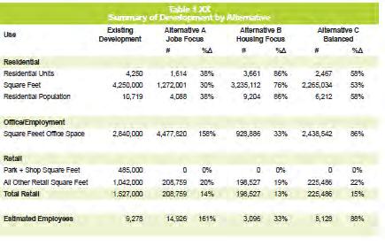
4 EXISTING DEVELOPMENT AREAS Total development in the PDA is estimated based on secondary sources of information. Sources included data from slightly outside of the PDA's boundaries. Estimates shown illustrate the scale of development in the PDA in 2011 rather than absolute amount of development. 2,840,000 33% of total GFA 4,250,000 50% of total GFA RESIDENTIAL SF RETAIL SF OFFICE SF LIVE-WORK SF * 1,500,000 17% of total GFA *assuming average unit size of 1,000sf

5 PROGRAM COMPARISON OPTION A OPTION B OPTION C 306,000 5% 1,272,000 20% 208,800 3% 928,900 20% 306,000 7% 306,000 6% 2,265,000 43% 4,477,800 72% 198,500 4% 3,235,100 69% 2,438,500 47% 225,500 4% * *excluding Phases I-II Renaissance Housing
6 OPTION A: JOBS FOCUS
7 OPTION A: JOBS FOCUS
8 OPTION A: JOBS FOCUS MARKET- RATE HOUSING 4,477,800 72% of total GFA 306,000 5% 1,272,000 20% Residential density 50du/acre 130du/acre (assuming DOWNTOWN average CONCORD 1,000sf SPECIFIC unit) PLAN 208,700 3% TOWNHOMES WORK- LIVE LOFTS RESIDENTIAL SF RETAIL SF OFFICE SF LIVE-WORK SF *excluding Phases I-II Renaissance Housing TOTAL 1,170 units 210 units 240 units 1,620 units 4,100 residents 14,900 employees * GFA FAR Block A OFFICE 488, Block B RETAIL 56, OFFICE 890,988 OFFICE 423,570 Block C OFFICE 135, RETAIL 22,500 Block D OFFICE 538, PARKING STRUCTURE 319,488 Block E RESIDENTIAL 60, Block F RESIDENTIAL 97, Block G RESIDENTIAL 113, Block H RESIDENTIAL 113, Block I RESIDENTIAL 108, Block J RETAIL 50, Block K OFFICE 382, Block L RESIDENTIAL 119, Block M OFFICE 167, Block N RESIDENTIAL 143, Block O RESIDENTIAL 58, Block P MIXED-USE (live-work) 201, Block Q RETAIL 14, Block R RETAIL 22, MIXED-USE (live-work) 28,800 Block S RETAIL 15, OFFICE 88,416 Block T RESIDENTIAL 13, RESIDENTIAL 99,081 RETAIL 12,074 MIXED-USE (live-work) 75,600 Block U RESIDENTIAL 101, RESIDENTIAL 162,364 Block V RESIDENTIAL 99, RESIDENTIAL 22,140 RESIDENTIAL 120,900 RETAIL 11,309 Block W OFFICE 172,
9 OPTION B: HOUSING FOCUS
10 OPTION B: HOUSING FOCUS
11 OPTION B: HOUSING FOCUS 928,900 20% 198,500 4% MARKET- RATE HOUSING 306,000 7% 3,235,100 69% of total GFA TOWNHOMES WORK- LIVE LOFTS Residential density 50du/acre 130du/acre (assuming average 1,000sf unit) TOTAL RESIDENTIAL SF RETAIL SF OFFICE SF LIVE-WORK SF *excluding Phases I-II Renaissance Housing 3,220 units 200 units 240 units 3,660 units 9,200 residents 3,100 employees * GFA FAR Block A RESIDENTIAL 271, Block B RESIDENTIAL 47, RESIDENTIAL 377,715 RETAIL 59,123 Block C RESIDENTIAL 46, RETAIL 12,779 Block D RESIDENTIAL 260, PARKING STRUCTURE 319,488 Block E RESIDENTIAL 60, Block F RESIDENTIAL 97, Block G RESIDENTIAL 113, Block H RESIDENTIAL 113, Block I RESIDENTIAL 108, Block J RETAIL 50, Block K OFFICE 382, Block L RESIDENTIAL 119, Block M RESIDENTIAL 106, Block N RESIDENTIAL 143, Block O RESIDENTIAL 58, Block P MIXED-USE (live-work) 201, Block Q RETAIL 14, Block R RETAIL 22, MIXED-USE (live-work) 28,800 Block S RETAIL 15, RESIDENTIAL 58,122 Block T RESIDENTIAL 13, RESIDENTIAL 99,081 RETAIL 12,074 MIXED-USE (live-work) 75,600 Block U RESIDENTIAL 101, RESIDENTIAL 162,364 Block V RESIDENTIAL 99, RESIDENTIAL 22,140 RESIDENTIAL 120,900 RETAIL 11,309 Block W RESIDENTIAL 153, RESIDENTIAL 0 Block X RETAIL 477, Block Y OFFICE 301, Block Z OFFICE 244,
12 OPTION C: LIVE-WORK BALANCE
13 OPTION C: LIVE-WORK BALANCE
 RESIDENTIAL SF RETAIL SF OFFICE SF LIVE-WORK SF *excluding Phases I-II Renaissance Housing TOTAL 2,050 units 180 units 240 units 2,470 units")
14 OPTION C: LIVE-WORK BALANCE 2,438,500 47% of total GFA MARKET- RATE HOUSING 306,000 6% 225,500 4% 2,265,000 43% of total GFA TOWNHOMES WORK- LIVE LOFTS Residential DOWNTOWN density CONCORD 50du/acre SPECIFIC 130du/acre PLAN (assuming average 1,000sf unit) RESIDENTIAL SF RETAIL SF OFFICE SF LIVE-WORK SF *excluding Phases I-II Renaissance Housing TOTAL 2,050 units 180 units 240 units 2,470 units 6,200 residents 8,100 employees * GFA FAR Block A RESIDENTIAL 271, Block B RESIDENTIAL 18, RESIDENTIAL 155,613 RETAIL 53,482 OFFICE 41,390 OFFICE 428,322 Block C OFFICE 135, RETAIL 22,500 Block D RESIDENTIAL 260, PARKING STRUCTURE 319,488 Block E RESIDENTIAL 60, Block F RESIDENTIAL 97, Block G RESIDENTIAL 113, Block H RESIDENTIAL 113, Block I RESIDENTIAL 108, Block J RETAIL Block K OFFICE 382, Block L RESIDENTIAL 119, Block M RESIDENTIAL 17,513 RESIDENTIAL 106,527 RETAIL 13,523 Block N RESIDENTIAL 143, Block O RESIDENTIAL 58, Block P MIXED-USE (live-work) 201, Block Q RETAIL 14, Block R RETAIL 22, MIXED-USE (live-work) 28,800 Block S RETAIL 15, OFFICE 88,416 Block T RESIDENTIAL 13, RESIDENTIAL 99,081 RETAIL 12,074 MIXED-USE (live-work) 75,600 Block U RESIDENTIAL 101, RESIDENTIAL 162,364 Block V RESIDENTIAL 99, RESIDENTIAL 22,140 RESIDENTIAL 120,900 RETAIL 11,309 Block W OFFICE 172, Block X OFFICE 644, Block Y OFFICE 301, Block Z OFFICE 244, Block A1 RETAIL 9,
15 PROGRAM COMPARISON 6,250,000 SF 4,650,000 SF 5,250,000 SF NEW DEVELOPMENT AREA 8,600,000 SF 8,600,000 SF 8,600,000 SF EXISTING DEVELOPMENT AREA OPT A OPT B OPT C
16 PROGRAM COMPARISON
17 Housing Typologies


18 HOUSING TYPOLOGY: TRANSIT-ORIENTED HOUSING contra costa center transit village 30 du/acre du/acre fruitvale transit village, oakland bergamot transit village, santa monica du/acre macarthur transit village, berkeley 110 du/acre

19 HOUSING TYPOLOGY: MIXED-USE HOUSING 50 du/ac Efficiency/affordable units 25 du/acre


20 HOUSING TYPOLOGY: APARTMENTS du/acre 4 th St, Berkeley du/acre du/acre


21 HOUSING TYPOLOGY: WORK-LIVE LOFTS du/acre


22 HOUSING TYPOLOGY: TOWNHOMES du/acre du/acre
23 Transportation Metrics
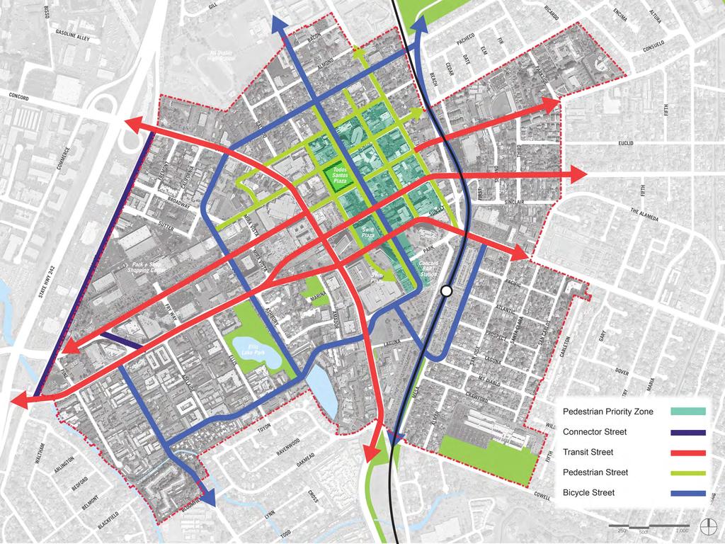
24 STREET TYPOLOGIES
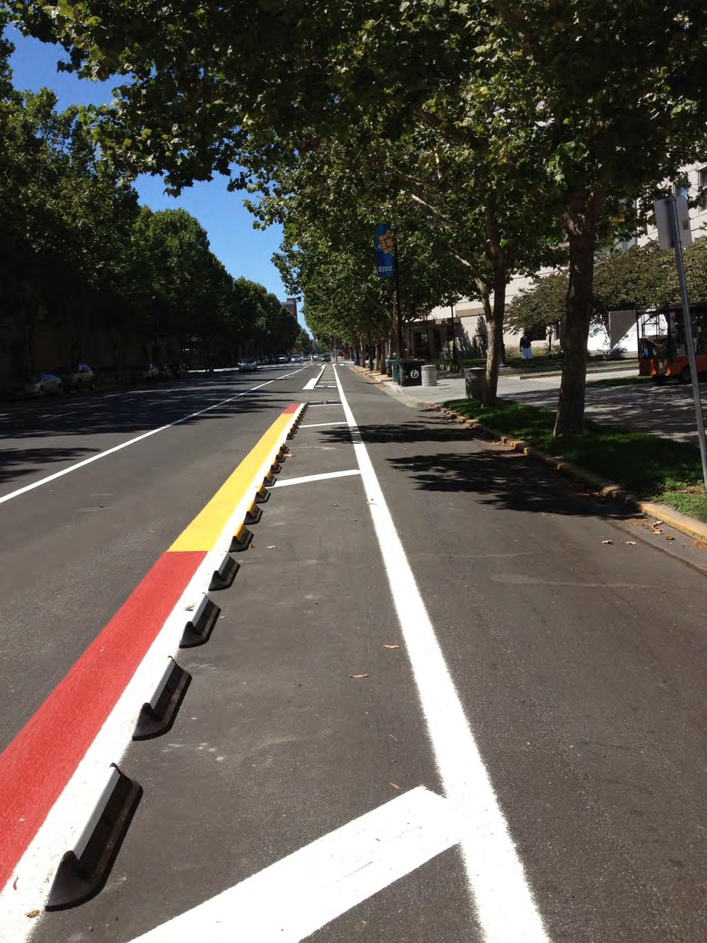
25 STREET TYPOLOGIES Auto Dominant Highway Freeways & approach that serve high volumes of high speed regional motor vehicle traffic. Transbay and express transit buses are also accommodated. Bicycles and pedestrians are prohibited. Transit Street Primary routes for CCCTA, Tri-Delta Transit & downtown shuttle. Signal preemption for transit vehicles, bus stops, bus lanes where appropriate. Accommodate mid-high volumes of through traffic. Pedestrian amenities enhanced around bus stops. Connector Street Accommodates automobiles, bicycles & trucks equally. Mid-high volumes of through traffic within and beyond the city. Local Street Accommodates automobiles, bicycles & trucks equally. Low volumes of local traffic, primarily provide access to property. Through traffic is discouraged. Traffic calming techniques to slow and discourage through automobile and truck traffic. Bicycle Boulevard Routes for bicycles providing continuous access & connections to the bicycle route network. Through motor vehicle traffic discouraged. Traffic calming techniques to slow and discourage through automobile and truck traffic.
26 STREET TYPOLOGIES Major Transit Hub Transfer points where high volume transit lines intersect (BART station). Bicycle Path Class I Bicycle path as defined by Caltrans standards accommodates both bicycles and pedestrians. Motor vehicle traffic is prohibited. Bike Route Class II (bike lanes) or Class III (signed route) bike facilities as defined by Caltrans standards, are overlaid on transit, connector, and local streets. Pedestrian Path These are exclusive walkways for pedestrians. Bicycles and motor vehicles are prohibited. Pedestrian Priority Street Frontage Streets on which high volumes of pedestrian traffic are encouraged. Sidewalks should be wide with ample pedestrian amenities. Building frontages should provide high level of pedestrian interest. Pedestrian crossings should have a high priority at intersections. In some locations, wellprotected mid-block crosswalks may be appropriate. Roadways connecting to the BART station should have pedestrian priority.
27 STREET TYPOLOGIES Modal Priorities in SPA Clayton Road, Concord Road, Concord Boulevard and portions of Willow Pass potential for Transit Street Detroit, Laguna, Oak, Oakland, Grant, Bonifacio, East, Harrison potential for Bicycle Boulevard Market Street potential for Connector Street Downtown core including portion of Willow Pass and Grant Street connecting to BART; Pedestrian priority zone.
28 TRANSPORTATION FACILITIES MATRIX Facility Transit Bicycles Pedestrians Autos Transit Street /1/ Bicycle Boulevard Bicycle Path (class I) Pedestrian Path Connector Street /1/ Local Street /1/ Auto Dominant Road = Dominant = Accommodated = Incidental = Prohibited /1/Bike routes (class II and III) can be overlaid on these street types.
29 TRANSPORTATION METRICS Transportation Metric Gross Daily Trips (includes auto, bike, walk, transit) Existing Option A: Jobs Focus Option B: Housing Focus Option C: Balanced 111,300 44,200 41,900 41,500 Daily BART Trips 10,700 2,600 3,000 2,700 Daily Internal Capture (assumed to be walk/bike) 13% (14,800) 14% (22,200) 16% (23,900) 15% (22,600) Daily External Bike/Walk Trips 8% (7,600) 10% (13,100) 12% (14,900) 11% (13,700) Daily Transit Mode Share 15% (14,100) 14% (18,900) 15% (19,200) 14% (18,800) Daily Vehicle Trips 74,800 26,600 20,500 22,900 AM Peak Hour Trips 6,100 3,300 1,400 2,200 PM Peak Hour Trips 5,700 4,100 1,600 2,700
30 KEY TRANSPORTATION TAKEAWAYS OPTION A Generates the most vehicle trips & fewer trips with origins and destinations in Specific Plan Area; highest impact on intersection and roadway segment operations Least impact to BART as most morning trips would be in the eastbound direction where there is additional capacity OPTION B Generates the least vehicle trips & results in more trips with both origin & destination in Specific Plan Area; the least impact to intersection operations Greater impact on BART, as most morning trips would be in the westbound direction which is already at or approaching capacity for much of peak hour Balances high levels of existing office development with internalization of trips OPTION C Balances the pros/cons of OPTIONS A & B
31 NEXT STEPS Analyze intersection & roadway segment operations with the preferred alternative under the following scenarios: Existing Plus Project Cumulative Plus Project Provide suggestions in the refinement of final Project Alternative to minimize transportation impacts & develop mitigation measures that further the City s goals for this project
32 Evaluation of Alternatives
33 Alternatives Evaluation GROUP EXERCISE Evaluation Process Based upon prioritizing goals for Project Combined with potential weighting of the goals Used symbols in forced ranking of the alternatives Related scoring with each of the symbols Use rankings while multiplying by weighting to achieve each score Totaling scores for each alternative Presenting to the Community Keeping it simple Easy to relate conclusions to scoring Relate key points to public.
34 ALTERNATIVES EVALUATION CRITERIA Concept Alternatives DSC- RANKED ORDER OF IMPORTANCE 1 Increasing job creation 2 CRITERIA Enhancing a strong business climate & expanding the city s economic base A Job focus B Housing focus C Balanced 3 Intensification of uses & densities from current built levels 4 5 Increasing BART ridership & efficiency of multi-modal connections Constructing housing projects for a mix of housing types & income levels 6 Promoting mid- and high-density housing n/a Expand multimodal circulation & alternative transportation methods

35 ALTERNATIVES EVALUATION CRITERIA

36 PROJECT SCHEDULE
37 Next steps Tonight - DSC #5 Evaluation of Alternatives Late July/Early August - Design team develops/refines Preferred Plan August 5 th - DSC #6 Preview and discussion of Preferred Plan August 27 th Community Workshop #2; Presentation of Preferred Plan September 15 th Design team prepares first draft Specific Plan
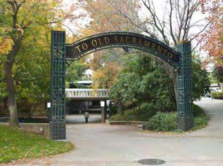
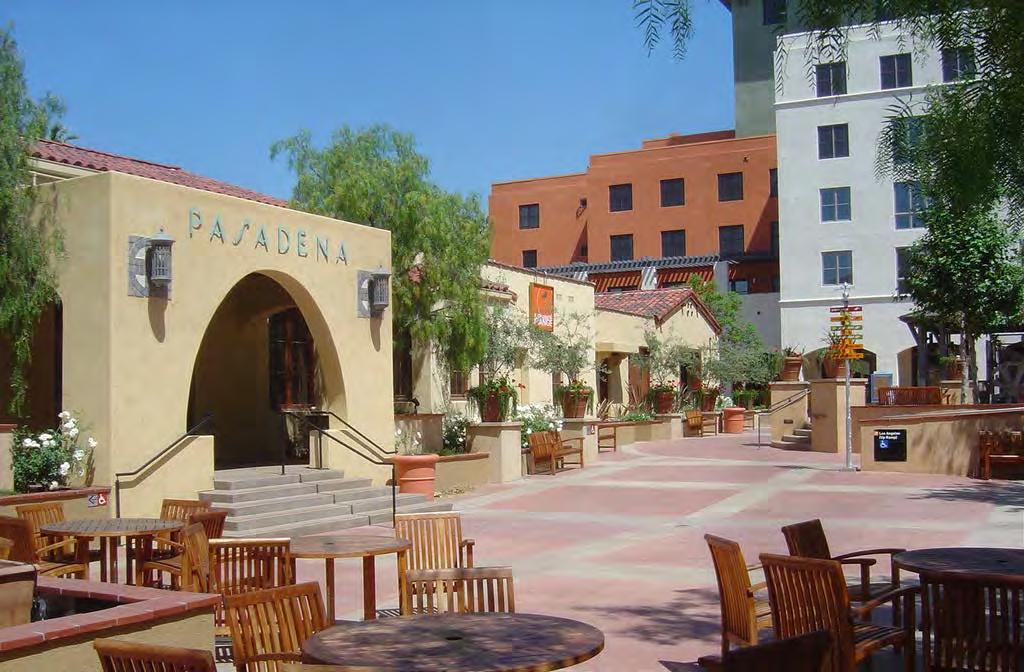
38

39 Previous slides from 7/1

40 GRANT STREET - BART PLAZA: NODES

41 GRANT ST


42 TRAFFIC CALMING medians curb bulb-out marked crossing boulevard


43 ENHANCED STREET CROSSINGS LED crossing paving treatment / 4-way crosswalk paint treatment


44 LIGHTING tree guard lighting lighting combined with signage lighted seating areas solar streetlamps

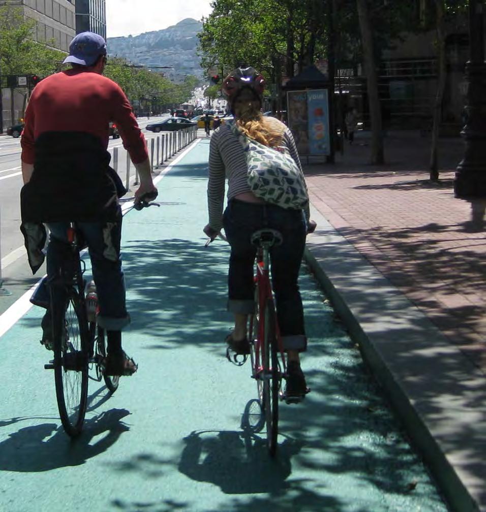
45 SAFE BICYCLE LANES


46 GROUND-FLOOR RETAIL Pasadena Old Town Sacramento transparent retail facade 4 th St, Berkeley Pasadena Old Town

47 GATEWAYS + IDENTITY
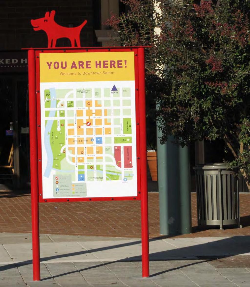
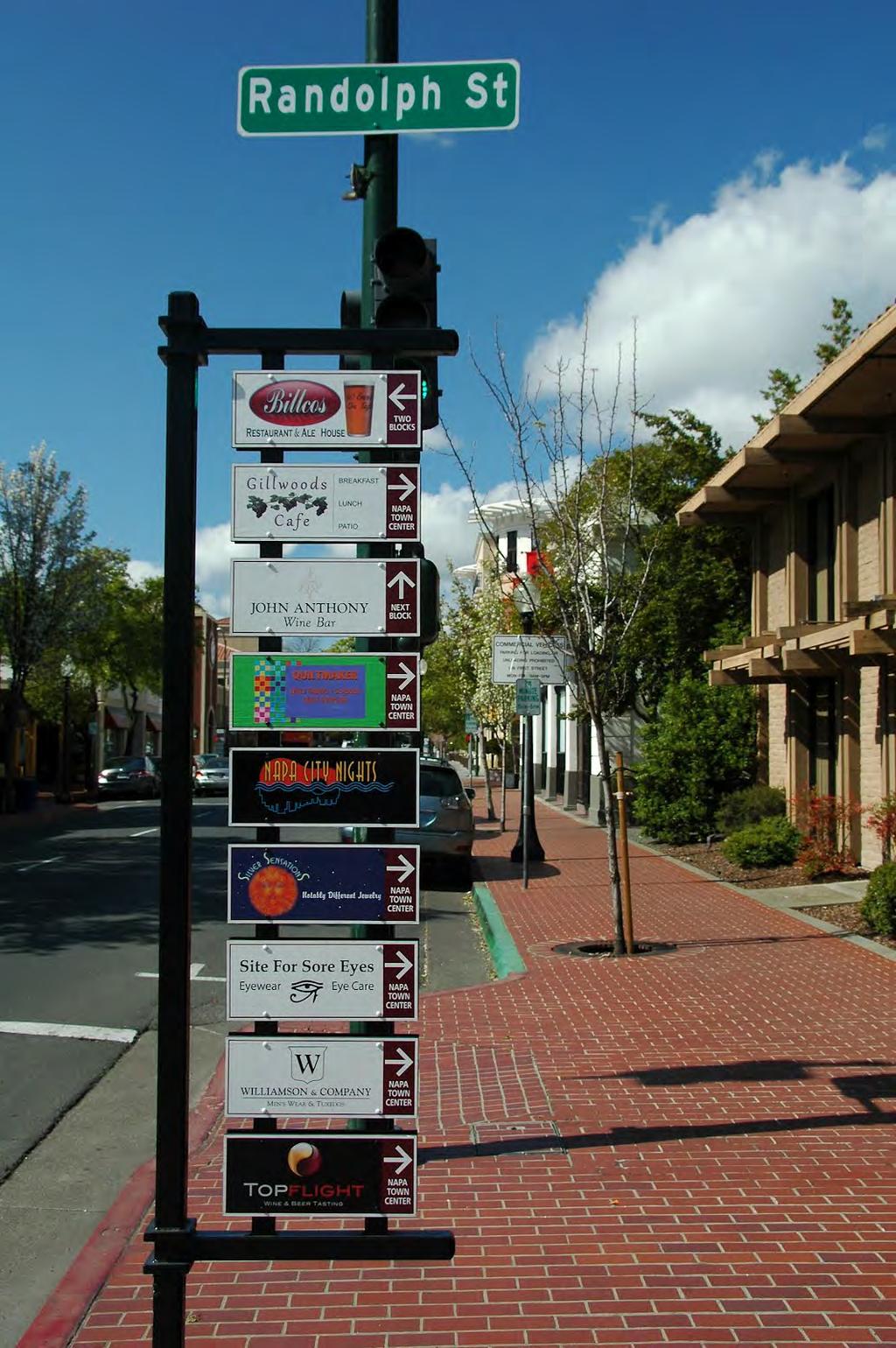
48 WAYFINDING - SIGNAGE

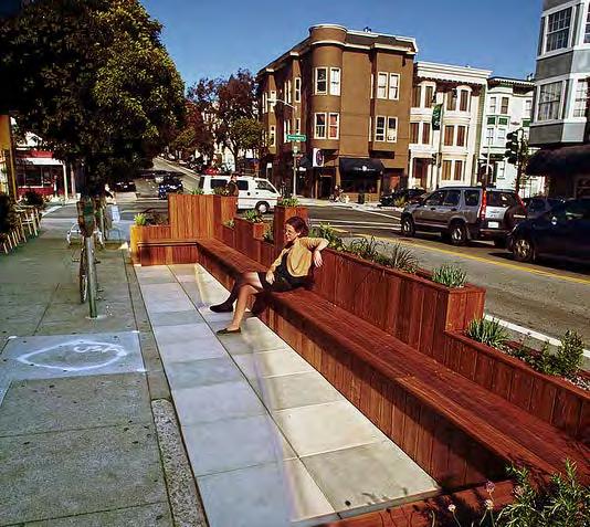
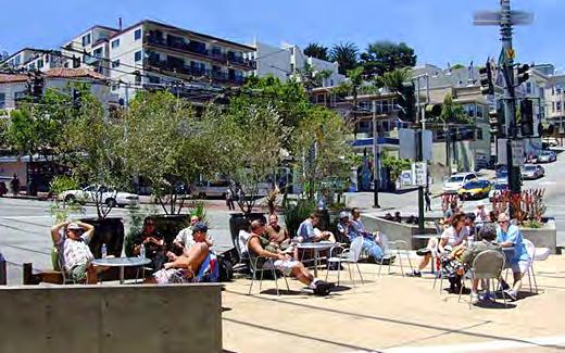
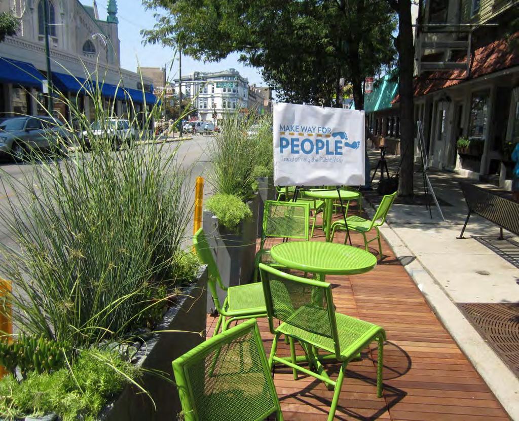
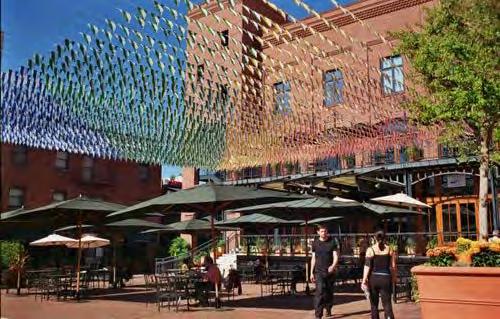
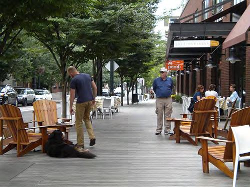
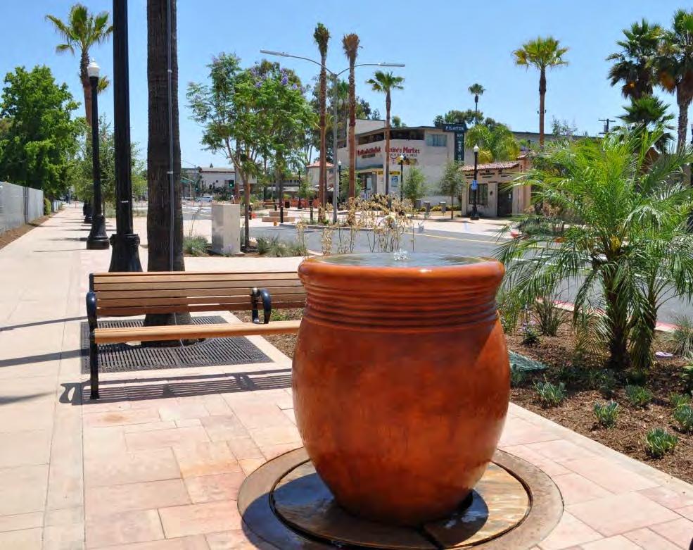
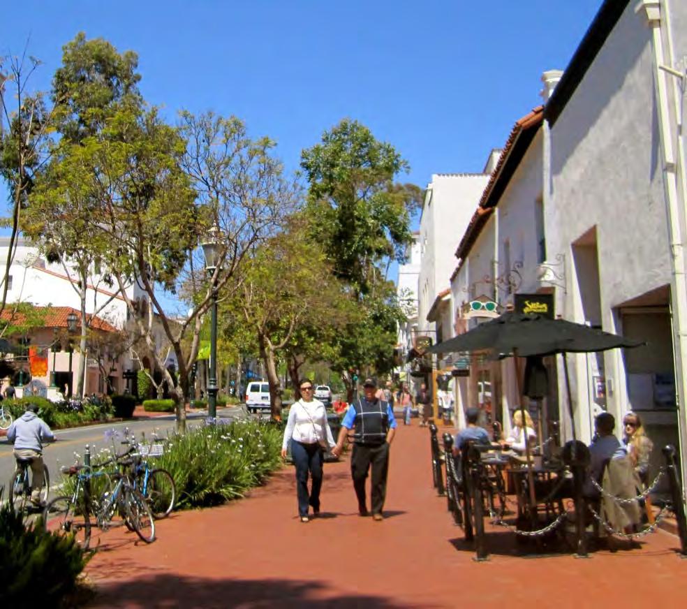
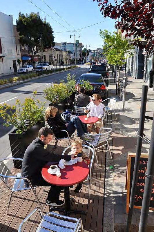
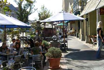
49 OUTDOOR SEATING

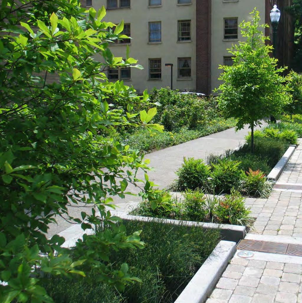

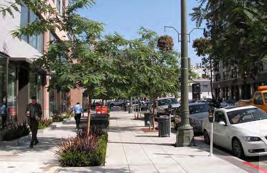
50 TREES + PLANTING

51 PACHECO STREET CLAY ALLEY

52 PACHECO STREET CLAY ALLEY

53 SALVIO STREET, 1930s


54 ALLEYS + PASEOS residential alley mixed-use alley boutique retail alley residential alley

55 PUBLIC PLAZAS

56 WIDE SIDEWALKS

57 OUTDOOR DINING
DOWNTOWN CONCORD SPECIFIC PLAN
 Timeline 21-month process Tasks 1-3; Basis for the preparation of the plan (Jan. through March) Tasks 4-5; Development and Evaluation of Alternatives. Selection of Preferred Alternative. Preparation of
2.0 Development Driveways. Movin Out June 2017
 Movin Out June 2017 1.0 Introduction The proposed Movin Out development is a mixed use development in the northeast quadrant of the intersection of West Broadway and Fayette Avenue in the City of Madison.
BROWARD BOULEVARD CORRIDOR TRANSIT STUDY
 BROWARD BOULEVARD CORRIDOR TRANSIT STUDY FM # 42802411201 EXECUTIVE SUMMARY July 2012 GOBROWARD Broward Boulevard Corridor Transit Study FM # 42802411201 Executive Summary Prepared For: Ms. Khalilah Ffrench,
Troost Corridor Transit Study
 Troost Corridor Transit Study May 23, 2007 Kansas City Area Transportation Authority Agenda Welcome Troost Corridor Planning Study Public participation What is MAX? Survey of Troost Riders Proposed Transit
Garrett Hill Master Plan
 Garrett Hill Master Plan Visioning Workshop February 13, 2007 Campbell Thomas & Company Agenda Welcome Existing conditions summary Critical issues Visioning exercise Summary & next steps Critical Assets
4 Circulation & Transportation
 4.1 Mobility Network The mobility network at the new St. Paul s hospital and health campus is comprised of an interconnected system of sidewalks, cycle paths, transit routes and roadways. Figure 4-1: Indicative
5. OPPORTUNITIES AND NEXT STEPS
 5. OPPORTUNITIES AND NEXT STEPS When the METRO Green Line LRT begins operating in mid-2014, a strong emphasis will be placed on providing frequent connecting bus service with Green Line trains. Bus hours
APPENDIX VMT Evaluation
 APPENDIX 2.7-2 VMT Evaluation MEMORANDUM To: From: Mr. Jonathan Frankel New Urban West, Incorporated Chris Mendiara LLG, Engineers Date: May 19, 2017 LLG Ref: 3-16-2614 Subject: Villages VMT Evaluation
appendix 4: Parking Management Study, Phase II
 appendix 4: Parking Management Study, Phase II A4-1 A4-2 Eastlake Parking Management Study Final Phase 2 Report Future Parking Demand & Supply January 6, 2017 Submitted by Denver Corp Center III 7900 E.
Green Line Long-Term Investments
 Enhancements Short-term improvements to keep Austin moving. Investments Long-term projects to support our future. Mobility Hubs MetroRapid MetroRail MetroExpress Connectors Circulators Project Connect
CORE AREA SPECIFIC PLAN
 only four (A, B, D, and F) extend past Eighth Street to the north, and only Richards Boulevard leaves the Core Area to the south. This street pattern, compounded by the fact that Richards Boulevard is
Agenda. Preliminary Station Footprint High Speed Train Station in the City of Millbrae
 Agenda Preliminary Station Footprint High Speed Train Station in the City of Millbrae Open House 7:00 7:30 Presentation 7:30 8:00 Community Question/Answer 8:00 9:00 Adjourn 2 Preliminary Station Footprint
San Francisco Transportation Plan Update
 San Francisco Transportation Plan Update SPUR August 1, 2011 www.sfcta.org/movesmartsf twitter.com/sanfranciscota www.facebook.com/movesmartsf How does the RTP relate to the SFTP? Regional Transportation
2030 Multimodal Transportation Study
 2030 Multimodal Transportation Study City of Jacksonville Planning and Development Department Prepared by Ghyabi & Associates April 29,2010 Introduction Presentation Components 1. Study Basis 2. Study
CTfastrak Expansion. Stakeholder Meeting #4 Manchester Town Hall June 3, 2016
 CTfastrak Expansion Stakeholder Meeting #4 Manchester Town Hall June 3, 2016 Today s Agenda Phase I Update 2016 Service Plan Implementation Schedule & Cost Update Phase II Services Timeline Market Analysis
Executive Summary. Draft Environmental Impact Statement/Environmental Impact Report ES-1
 Executive Summary Introduction The Eastside Transit Corridor Phase 2 Project is a vital public transit infrastructure investment that would provide a transit connection to the existing Metro Gold Line
Draft Transportation Demand Management Program for the Oak Knoll Project
 Draft Transportation Demand Management Program for the Oak Knoll Project Prepared for: Oak Knoll Venture Acquisition City of Oakland OK14-0026 Table of Contents INTRODUCTION AND PROJECT OVERVIEW... 1 Project
Executive Summary. Treasure Valley High Capacity Transit Study Priority Corridor Phase 1 Alternatives Analysis October 13, 2009.
 Treasure Valley High Capacity Transit Study Priority Corridor Phase 1 Alternatives Analysis October 13, 2009 Background As the Treasure Valley continues to grow, high-quality transportation connections
Downtown Parking/Wayfinding Study. Review of Recommendations to City Council: January 16, 2018
 Downtown Parking/Wayfinding Study Review of Recommendations to City Council: January 16, 2018 Tonight s Focus Objectives & Timeline Recap Study Findings Present Staff Recommendations 2018 Action items
Develop ground transportation improvements to make the Airport a multi-modal regional
 Project Overview TRANSPORTATION IMPROVEMENTS WHAT ARE THE PROJECT GOALS? Transportation transportation hub. Develop ground transportation improvements to make the Airport a multi-modal regional Land Use
METRO Orange Line BRT American Boulevard Station Options
 METRO Orange Line BRT American Boulevard Station Options Bloomington City Council Work Session November 18, 2013 Christina Morrison BRT/Small Starts Project Office Coordinating Planning and Design AMERICAN
IMPROVEMENT CONCEPTS
 IMPROVEMENT CONCEPTS for the South Novato Transit Hub Study Prepared by: January 11, 2010 DKS Associates With Wilbur Smith Associates IMPROVEMENT CONCEPTS Chapter 1: Introduction 1. INTRODUCTION The strategic
Click to edit Master title style
 Nelson/Nygaard Consulting Associates SERVICE IMPROVEMENT STRATEGIES September 22, 2015 1 PROJECT OVERVIEW & WORK TO DATE 1. Extensive stakeholder involvement Throughout 2. System and market assessment
Fresno County. Sustainable Communities Strategy (SCS) Public Workshop
 Public Workshop") Fresno County Sustainable Communities Strategy (SCS) Public Workshop Project Background Senate Bill 375 Regional Transportation Plan (RTP) Greenhouse gas emission reduction through integrated transportation
Fresno County Sustainable Communities Strategy (SCS) Public Workshop Project Background Senate Bill 375 Regional Transportation Plan (RTP) Greenhouse gas emission reduction through integrated transportation
Restoration of Historic Streetcar Services in Downtown Los Angeles
 Restoration of Historic Streetcar Services in Downtown Los Angeles Early Scoping Meeting for Alternatives Analysis (AA) May 17, 2011 Introduction Key players Local lead agency: Metro Federal lead agency:
BERKELEY DOWNTOWN AREA PLAN PROGRAM ENVIRONMENTAL IMPACT REPORT TRAFFIC IMPACT ANALYSIS
 BERKELEY DOWNTOWN AREA PLAN PROGRAM ENVIRONMENTAL IMPACT REPORT TRAFFIC IMPACT ANALYSIS Prepared for: City of Berkeley Prepared by: REVISED JANUARY 9, 2009 Berkeley Downtown Area Plan Program EIR Traffic
IV. ENVIRONMENTAL IMPACT ANALYSIS K.2. PARKING
 IV. ENVIRONMENTAL IMPACT ANALYSIS K.2. PARKING ENVIRONMENTAL SETTING The following analysis summarizes the findings and conclusions of the Traffic Analysis (Traffic Study), prepared by The Mobility Group,
Downtown Transit Connector. Making Transit Work for Rhode Island
 Downtown Transit Connector Making Transit Work for Rhode Island 3.17.17 Project Evolution Transit 2020 (Stakeholders identify need for better transit) Providence Core Connector Study (Streetcar project
Transportation Sustainability Program
 Transportation Sustainability Program Photo: Sergio Ruiz San Francisco 2016 Roads and public transit nearing capacity Increase in cycling and walking despite less than ideal conditions 2 San Francisco
TRANSPORTATION REVIEW
 TRANSPORTATION REVIEW - PROPOSED MIX OF LAND USES IS CONSISTENT WITH THE CITY S UNDER THE GRANVILLE BRIDGE POLICIES THAT AIM TO MEET NEIGHBOURING RESIDENTS SHOPPING NEEDS AND REDUCE RELIANCE ON AUTOMOBILE
Transit and Job Growth: Lessons for SB 375. Jed Kolko Public Policy Institute of California
 Transit and Job Growth: Lessons for SB 375 Jed Kolko Public Policy Institute of California Outline Approaches to reducing VMT The land use transportation connection California s experience with transit-oriented
Capital Metro Downtown Multimodal Station
 Capital Metro Downtown Multimodal Station Stakeholder Briefing December 11, 2015 Agenda 1 2 3 4 5 Project Summary Downtown Station Concept Evaluation 4 th Street Traffic Analysis 5 th Street Traffic Analysis
This Evening s Agenda. Open House 7:00 7:30 Presentation 7:30 8:00 Community Feedback8:00 9:00 Adjourn
 This Evening s Agenda Open House 7:00 7:30 Presentation 7:30 8:00 Community Feedback8:00 9:00 Adjourn Preliminary Station Footprint Potential Mid-Peninsula High Speed Train Station Palo Alto Dominic Spaethling,
West Broadway Transit Study. Community Advisory Committee September 17, 2015
 West Broadway Transit Study Community Advisory Committee September 17, 2015 Introductions Community Engagement Summer Outreach Fall Outreach Technical Analysis Process Update Alternatives Review Economic
Craig Scheffler, P.E., PTOE HNTB North Carolina, P.C. HNTB Project File: Subject
 TECHNICAL MEMORANDUM To Kumar Neppalli Traffic Engineering Manager Town of Chapel Hill From Craig Scheffler, P.E., PTOE HNTB North Carolina, P.C. Cc HNTB Project File: 38435 Subject Obey Creek TIS 2022
The Re:Queen and Sparks Traffic Brief - Addendum #2
 June 11, 2015 Ashcroft Homes 18 Antares Drive Ottawa, ON K2E 1A9 EMAIL: mpham@ashcrofthomes.com Attention: May Pham Development Planner Dear May, Re: The Re:Queen and Sparks Traffic Brief - Addendum #2
Public Meeting. City of Chicago Department of Transportation & Department of Housing and Economic Development
 Public Meeting City of Chicago Department of Transportation & Department of Housing and Economic Development Funded by Regional Transportation Authority September 12, 2011 In partnership with Presentation
PROJECT SCHEDULE. Plan for Implementation. Explore and Analyze. Refine Ideas. Identify Common Ideas SPRING 2016 SUMMER 2016 FALL 2016
 VISION WORKSHOP MAY 25 th 2016 A COLLABORATION PROJECT SCHEDULE Explore and Analyze Identify Common Ideas Refine Ideas Plan for Implementation SPRING 2016 SUMMER 2016 FALL 2016 TODAY S AGENDA Explore and
King County Metro. Columbia Street Transit Priority Improvements Alternative Analysis. Downtown Southend Transit Study. May 2014.
 King County Metro Columbia Street Transit Priority Improvements Alternative Analysis Downtown Southend Transit Study May 2014 Parametrix Table of Contents Introduction... 1 Methodology... 1 Study Area...
Service Quality: Higher Ridership: Very Affordable: Image:
 Over the past decade, much attention has been placed on the development of Bus Rapid Transit (BRT) systems. These systems provide rail-like service, but with buses, and are typically less expensive to
US 29 Bus Rapid Transit Planning Board Briefing. February 16, 2017
 US 29 Bus Rapid Transit Planning Board Briefing February 16, 2017 Project Goals Improve the quality of transit service Improve mobility opportunities and choices Enhance quality of life Support master
IV. ENVIRONMENTAL IMPACT ANALYSIS N. TRANSPORTATION AND TRAFFIC
 IV. ENVIRONMENTAL IMPACT ANALYSIS N. TRANSPORTATION AND TRAFFIC The following section summarizes the information provided in the traffic report entitled Traffic Impact Analysis for a Proposed Residential
CTA Blue Line Study Area
 CTA Blue Line Study Area HISTORY OF THE CTA BLUE LINE / I-290 SYSTEM Blue Line / I-290 infrastructure is 55 years old First integrated transit / highway facility in the U.S. PROJECT STUDY AREA EXISTING
The Engineering Department recommends Council receive this report for information.
 CORPORATE REPORT NO: R161 COUNCIL DATE: July 23, 2018 REGULAR COUNCIL TO: Mayor & Council DATE: July 19, 2018 FROM: General Manager, Engineering FILE: 8740-01 SUBJECT: Surrey Long-Range Rapid Transit Vision
Preliminary Definition of Alternatives. 3.0 Preliminary Definition of Alternatives
 3.0 What preliminary alternatives are being evaluated? The alternatives for the East San Fernando Valley Transit Corridor project that were considered for screening include the No Build Alternative, Transportation
Jeff s House. Downtown Charlottesville. PEC Office
 Jeff s House Downtown Charlottesville PEC Office Year 2000 US Census Data Employed persons over 16 Percentage of Employed Persons Locality Avg Commute (in minutes) Drove Public Transit Walk/Bike Other
Station Evaluation Summary
 Station Evaluation Summary Preferred Site Location 10/1/00 Loop 1 Station Points 70 Key Issues: Potential Master Plan Development suggests a strong economic development potential for the larger property
Planned Development Application 1450 Sherman Avenue Evanston, IL TRAFFIC CIRCULATION IMPACT STUDY
 Planned Development Application 1450 Sherman Avenue Evanston, IL 60201 14 TRAFFIC CIRCULATION IMPACT STUDY Traffic Impact Study 1454 Sherman Mixed-Use Development Evanston, Illinois Prepared for Prepared
Tempe Streetcar. March 2, 2016
 Tempe Streetcar March 2, 2016 Tempe Profile 40 sq. miles, highest density in state University Town, center of region Imposed growth boundaries (density increase) Mixed use growth/intensifying land use
David Martin, Director of Planning and Community Development. Establishment of LAX FlyAway Stop in Santa Monica
 Information Item Date: January 31, 2014 To: From: Subject: Mayor and City Council David Martin, Director of Planning and Community Development Establishment of LAX FlyAway Stop in Santa Monica Introduction
MPO Transit Study. Transit Concept for 2050 November 5, Transit Technologies
 Hillsborough County MPO Transit Study Transit Concept for 2050 November 5, 2007 Transit Technologies 1 Technologies Considered Bus Light Rail Commuter Rail Bus Standard or articulated high-capacity vehicles
Unified Corridor Investment Study DRAFT Step 2 Scenario Analysis Report
 Unified Corridor Investment Study DRAFT Step 2 Scenario Analysis Report REVISIONS 1. Table 39: New Public Investments for Operation and Maintenance Costs 2. Appendix A-10: Passenger Rail Service - Operations
August 26, Main-McVay Transit Study Stakeholder Advisory Committee. John Evans, LTD David Reesor, City of Springfield
 August 26, 2014 TO: FROM: RE: Main-McVay Transit Study Stakeholder Advisory Committee John Evans, LTD David Reesor, City of Springfield Range of Possible Transit Solutions At the July 29, 2014 Stakeholder
City of Pacific Grove
 Regional Study Utilizing Caltrans Intersection Evaluation Section 7: City of Pacific Grove s: FIRST STREET AT CENTRAL AVENUE Transportation Agency for Monterey County Prepared by Transportation Agency
6/6/2018. June 7, Item #1 CITIZENS PARTICIPATION
 June 7, 2018 Item #1 CITIZENS PARTICIPATION 1 Item #2 APPROVAL OF MINUTES Item #3 TRAC GOALS, FRAMEWORK & AGENDA REVIEW 2 COMMITTEE GOALS Learn about Southern Nevada s mobility challenges, new developments
Welcome. The purpose of today s session is to:
 Welcome The purpose of today s session is to: Update you on what we ve heard from the community Share the preferred Rapid Transit network solution Present the draft Rapid Transit Master Plan Representatives
Escondido Marriott Hotel and Mixed-Use Condominium Project TRAFFIC IMPACT ANALYSIS REPORT
 Escondido Marriott Hotel and Mixed-Use Condominium Project TRAFFIC IMPACT ANALYSIS REPORT Prepared for Phelps Program Management 420 Sixth Avenue, Greeley, CO 80632 Prepared by 5050 Avenida Encinas, Suite
FREQUENTLY ASKED QUESTIONS
 FREQUENTLY ASKED QUESTIONS 2018 What is the More MARTA Atlanta program? The More MARTA Atlanta program is a collaborative partnership between MARTA and the City of Atlanta to develop and implement a program
PAWG Meeting #3a Tier 1 Evaluation
 PAWG Meeting #3a Tier 1 Evaluation August 2, 2017 LYNX Central Station Open Area 1 Modes Screening 2 Trunk vs Feeder Trunk Modes High peak capacity Direct routes Feeder Modes Routing may be flexible Serve
LEED v4 Building Design and Construction Quiz #3 LT
 LEED v4 Building Design and Construction Quiz #3 LT 1. How are walking and bicycling distance measured? A. Straight-line radius from a main building entrance B. Straight-line radius from any building entrance
TALMONT TOWNHOMES MADISON KENNETH SPA TRAFFIC IMPACT STUDY. Sacramento, CA. Prepared For: MBK Homes. Prepared By:
 TALMONT TOWNHOMES MADISON KENNETH SPA TRAFFIC IMPACT STUDY Sacramento, CA Prepared For: MBK Homes Prepared By: KD Anderson & Associates 3853 Taylor Road, Suite G Loomis, California 95650 (916) 660-1555
Station Evaluation. Durham-Orange Light Rail Transit Project Spring 2012
 Station Evaluation Durham-Orange Light Rail Transit Project Spring 2012 Key Ingredients for Station Development Platform Designs UNC Hospitals Station The UNC Hospitals Station Option D would be the westerly
Public transit, automobile traffic and loading
 TASK 3.1 Public transit, automobile traffic and loading 1: Timeline Update and Project Approach 2: Transportation Conditions and Challenges 3: Zoning Strategies 4: Next Steps Stuart Street Planning Study
Equitable transit-oriented development: Tools + Tactics
 Equitable transit-oriented development: Tools + Tactics Yonah Freemark February 18, 2016 Metropolitan Planning Council Chicagoland s growth over time 1950 Population density Fewer than 2,000 ppl/sq. mi.
TRAFFIC ENGINEERING ASSESSMENT MOUNT EDEN ROAD, MOUNT EDEN
 12 September 2017 Iain McManus Civitas Planning Consultants PO Box 47020 Ponsonby AUCKLAND 1144 Dear Iain, TRAFFIC ENGINEERING ASSESSMENT 43-45 45 MOUNT EDEN ROAD, MOUNT EDEN As requested, we have prepared
Parking Management Strategies
 Parking Management Strategies Policy Program Potential Effectiveness (percent reduction in demand) Comments Parking Pricing Unbundling and Cash-Out Options Reduced Parking Requirements Transit/TOD Supportive
Appendix C. Parking Strategies
 Appendix C. Parking Strategies Bremerton Parking Study Introduction & Project Scope Community concerns regarding parking impacts in Downtown Bremerton and the surrounding residential areas have existed
San Francisco Mobility, Access & Pricing Study
 San Francisco Mobility, Access & Pricing Study SAN FRANCISCO COUNTY TRANSPORTATION AUTHORITY Summer Workshops 2010 Downtown Growth Projections + 24,000 hsg units + 107,000 jobs +184,000 auto trips +88,000
UTA Transportation Equity Study and Staff Analysis. Board Workshop January 6, 2018
 UTA Transportation Equity Study and Staff Analysis Board Workshop January 6, 2018 1 Executive Summary UTA ranks DART 6 th out of top 20 Transit Agencies in the country for ridership. UTA Study confirms
STH 60 Northern Reliever Route Feasibility Study Report
 #233087 v3 STH 60 Northern Reliever Route Feasibility Study Report Washington County Public Works Committee Meeting September 28, 2016 1 STH 60 Northern Reliever Route Feasibility Study Hartford Area Development
The major roadways in the study area are State Route 166 and State Route 33, which are shown on Figure 1-1 and described below:
 3.5 TRAFFIC AND CIRCULATION 3.5.1 Existing Conditions 3.5.1.1 Street Network DRAFT ENVIRONMENTAL IMPACT REPORT The major roadways in the study area are State Route 166 and State Route 33, which are shown
WELCOME. Transit Options Amherst - Buffalo Public Workshops
 WELCOME Transit Options Amherst - Buffalo Public Workshops Sponsored by Niagara Frontier Transportation Authority Greater Buffalo Niagara Regional Transportation Council Where do you live? Where do you
Diablo Vista Pumping Plant Replacement
 Diablo Vista Pumping Plant Replacement Traffic Study PHA Transportation Consultants 12-05-359 October 2012 Diablo Vista Pumping Plant Replacement Traffic Study For EBMUD October 2012 PHA Transportation
Connected Vehicle and Autonomous Vehicle (CV/AV) Mobility and Technology
 Mobility and Technology") Connected Vehicle and Autonomous Vehicle (CV/AV) Mobility and Technology Randy Iwasaki Executive Director Contra Costa Transportation Authority May13, 2016 WHO WE ARE The Contra Costa Transportation Authority
Connected Vehicle and Autonomous Vehicle (CV/AV) Mobility and Technology Randy Iwasaki Executive Director Contra Costa Transportation Authority May13, 2016 WHO WE ARE The Contra Costa Transportation Authority
Waco Rapid Transit Corridor (RTC) Feasibility Study
 Feasibility Study") Waco Rapid Transit Corridor (RTC) Feasibility Study Chris Evilia, Director of Waco Metropolitan Planning Organization Allen Hunter, General Manager Waco Transit System Jimi Mitchell, Project Manager AECOM
Waco Rapid Transit Corridor (RTC) Feasibility Study Chris Evilia, Director of Waco Metropolitan Planning Organization Allen Hunter, General Manager Waco Transit System Jimi Mitchell, Project Manager AECOM
Central Loop Bus Rapid Transit
 Central Loop Bus Rapid Transit Transportation Goals of the Chicago Central Area ACTION Plan, page 2-6 Central Area Plan Improve Transit in Central Area Improve Pedestrian Environment Manage Traffic Circulation
4.1 Land Use. SECTION CONTENTS Land Use Transit Transportation Technology
 4 FUTURE CHANGES IN THE CORRIDOR Over the next 30 years, Santa Clara County will grow by roughly 637,000 residents and 303,500 jobs increases of 31 percent and 43 percent, respectively. 1 Changes in land
3.15 SAFETY AND SECURITY
 3.15 SAFETY AND SECURITY Introduction This section describes the environmental setting and potential effects of the alternatives analyzed in this EIR with regard to safety and security in the SantaClara-Alum
700 University Avenue Mixed-Use Development. Traffic Impact Analysis
 700 University Avenue Mixed-Use Development Traffic Impact Analysis January 20, 2006 Prepared by 700 UNIVERSITY AVENUE MIXED- USE DEVELOPMENT TRAFFIC IMPACT STUDY Table of Contents 1.0 Executive Summary...
SUPPORTING TOD IN METRO CHICAGO
 www.rtachicago.org SUPPORTING TOD IN METRO CHICAGO Tuesdays at APA November 18, 2014 OVERVIEW OF RTA 2 11/18/2014 Tuesdays at APA: Supporting TOD in Metro Chicago RTA Region 8.5 million people 3,700 square
Address Land Use Approximate GSF
 M E M O R A N D U M To: Kara Brewton, From: Nelson\Nygaard Date: March 26, 2014 Subject: Brookline Place Shared Parking Analysis- Final Memo This memorandum presents a comparative analysis of expected
KANSAS CITY STREETCAR
 KANSAS CITY STREETCAR KAREN CLAWSON MID-AMERICA REGIONAL COUNCIL KANSAS CITY STREETCAR Regional Context Alternatives Analysis Kansas City Streetcar Project KANSAS CITY REGION KANSAS CITY REGION KANSAS
Long Bridge Park. Parking Analysis and Transportation Management Plan. Long Range Planning Committee of the Planning Commission Meeting
 Long Bridge Park Parking Analysis and Transportation Management Plan Long Range Planning Committee of the Planning Commission Meeting Thursday, February 7, 2013 Purpose Achieve consensus on parking and
Railyard Alternatives & I-280 Boulevard Feasibility Study 1 RAILYARD ALTERNATIVES & I-280 BOULEVARD (RAB) FEASIBILITY STUDY
 FEASIBILITY STUDY") Railyard Alternatives & I-280 Boulevard Feasibility Study 1 RAILYARD ALTERNATIVES & I-280 BOULEVARD (RAB) FEASIBILITY STUDY RAB Citizen Working Group Meeting, August 1 st 2016 CITIZEN WORKING GROUP (CWG)
Railyard Alternatives & I-280 Boulevard Feasibility Study 1 RAILYARD ALTERNATIVES & I-280 BOULEVARD (RAB) FEASIBILITY STUDY RAB Citizen Working Group Meeting, August 1 st 2016 CITIZEN WORKING GROUP (CWG)
East Turnaround. Access to Ayreswood Avenue would be restricted to right-in/rightout movements under the proposed Rapid Transit plan.
 East Turnaround Options at Fanshawe College Ayreswood Access Access to Ayreswood Avenue would be restricted to right-in/rightout movements under the proposed Rapid Transit plan. To mitigate the impacts
3.3 TRANSPORTATION, TRAFFIC, CIRCULATION, AND PARKING
 3.3 Transportation, Traffic, Circulation, and Parking January 2013 3.3 TRANSPORTATION, TRAFFIC, CIRCULATION, AND PARKING This section describes the transportation network in the vicinity of the VA Transfer
TRAFFIC IMPACT ANALYSIS FOR. McDONALD S RESTAURANT IN CARMICAEL Sacramento County, CA. Prepared For:
 TRAFFIC IMPACT ANALYSIS FOR McDONALD S RESTAURANT IN CARMICAEL Sacramento County, CA Prepared For: McDonald s USA, LLC Pacific Sierra Region 2999 Oak Road, Suite 900 Walnut Creek, CA 94597 Prepared By:
CITY OF ANN ARBOR, MICHIGAN 301 E. Huron St., P.O. Box 8647 Ann Arbor, Michigan
 Date: Wednesday, June 18, 2014 Location: Ann Arbor District Library Attendees: 14 citizen attendees Ann Arbor Station Environmental Review Citizen Working Group Meeting Notes Meeting #3 The third meeting
Hillsborough County MPO Transit Study. Transit Concept for 2050 October 17, 2007
 Hillsborough County MPO Transit Study Transit Concept for 2050 October 17, 2007 Transit Technologies Technologies Considered Bus Light Rail Commuter Rail Bus Standard or articulated high-capacity vehicles
TRAVEL DEMAND FORECASTS
 Jiangxi Ji an Sustainable Urban Transport Project (RRP PRC 45022) TRAVEL DEMAND FORECASTS A. Introduction 1. The purpose of the travel demand forecasts is to assess the impact of the project components
1 Downtown LRT Connector: Draft Concept
 Downtown LRT Connector: Draft Concept Plan November 2010 We re moving forward. Get involved. On June 21, 2010, City Council approved a street-level downtown LRT route, including a connector for the future
Appendix A. Community Workshop Results PUBLIC REVIEW DRAFT
 Appendix A Community Workshop Results This Page Left Blank Intentionally Comprehensive Planning Community Workshop Summary July 30, 2012 The City of Becker invited the Community to participate in a Comprehensive
Abrams Associates TRIP GENERATION AND PARKING ANALYSIS. City of Berkeley
 TRIP GENERATION AND PARKING ANALYSIS 2556 TELEGRAPH PROJECT City of Berkeley Prepared for: Realtex Group 505 Sansome Street, Suite 400 San Francisco, CA 94111 Prepared by: 1875 Olympic Boulevard, Suite
DRAFT TREASURE ISLAND TRAVEL DEMAND MODELING & ANALYSIS DOCUMENTATION MEMORANDUM
 DRAFT TREASURE ISLAND TRAVEL DEMAND MODELING & ANALYSIS DOCUMENTATION MEMORANDUM PREPARED FOR: PREPARED B Y: JULY 21, 2016 1 Table of Contents Table of Contents... 2 Table of Figures... 3 Table of Tables...
San Rafael Transit Center. Update. Golden Gate Bridge, Highway & Transportation District Transportation Committee of the Board of Directors
 Transportation Committee November 17, 2016 Agenda Item No. 5, Update on the San Rafael Transit Center Relocation San Rafael Transit Center Relocation Study Update 11/17/16 Golden Gate Bridge, Highway &
Table Existing Traffic Conditions for Arterial Segments along Construction Access Route. Daily
 5.8 TRAFFIC, ACCESS, AND CIRCULATION This section describes existing traffic conditions in the project area; summarizes applicable regulations; and analyzes the potential traffic, access, and circulation
Draft Report: West Berkeley Bowl Project
 Draft Report: West Berkeley Bowl Project July 2004 Prepared for: The City of Berkeley 1031-1925 F EHR & PEERS TRANSPORTATION CONSULTANTS 3685 Mt. Diablo Blvd. #301 Lafayette, CA 94549 925-284-3200 Fax:
1. INTRODUCTION 2. PROJECT DESCRIPTION CUBES SELF-STORAGE MILL CREEK TRIP GENERATION COMPARISON
 CUBES SELF-STORAGE MILL CREEK TRIP GENERATION COMPARISON 1. INTRODUCTION This report summarizes traffic impacts of the proposed CUBES Self-Storage Mill Creek project in comparison to the traffic currently
Subarea Study. Manning Avenue (CSAH 15) Corridor Management and Safety Improvement Project. Final Version 1. Washington County.
 Corridor Management and Safety Improvement Project. Final Version 1. Washington County.") Subarea Study Manning Avenue (CSAH 15) Corridor Management and Safety Improvement Project Final Version 1 Washington County June 12, 214 SRF No. 138141 Table of Contents Introduction... 1 Forecast Methodology
Subarea Study Manning Avenue (CSAH 15) Corridor Management and Safety Improvement Project Final Version 1 Washington County June 12, 214 SRF No. 138141 Table of Contents Introduction... 1 Forecast Methodology
V03. APTA Multimodal Operations Planning Workshop August Green Line LRT
 V03 APTA Multimodal Operations Planning Workshop August 2016 Green Line LRT 2 Presentation Outline Past Present Future 3 16/03/2016 RouteAhead Update 4 4 16/03/2016 RouteAhead Update 5 5 16/03/2016 6 6